Expanding Anchoring Away
|
|
|
- Arthur Gilbert
- 5 years ago
- Views:
Transcription
1

2 Expanding Anchoring Away Vessel taxonomy &territorial waters Maritime and admiralty law distinguished The right to navigate Federal navigational servitude as applied CZMA, reverse federalism & Florida law Nav rules & federal preemption Public nav rights, and private submerged lands Anchoring regulation back in the spotlight Regional approaches & future projects
 Stored Vessels Live-aboard Vessels")

3 A Taxonomy of Vessels Vessels Cruising Vessels (vessels in navigation) Stored Vessels Live-aboard Vessels Derelict vessels Floating Structures (non-vessels) Lozman v. City of Riviera Beach, Fla. (Sea Grant Stock Photo) (wtsp.com)


4 Territorial Waters: Law is inherently geospatial International/Fede ral/state/local Florida Boundaries (the ambulatory Atlantic) Benson v. Norweigan Atlantic Cruise Lines Local Boundaries Vary dramatically

5 The Right to Navigate Magna Carta Article 42 Henceforth any person may go out of our realm and return to it, safely and securely, by land and by water Federal Constitution Fundamental right? not likely, but Federal statutes Submerged lands act laizzie faire approach Florida Constitution Public trust doctrine Fishing, swimming & navigation


6 Federal Navigational Servitude Federal reserved right Goodman v. Crystal River, Florida (1987) (Google Maps)

7 Federal Coastal Zone Management Act Reverse Federalism Florida s Coastal Management Program/Plan 24 state statutes DEP and partner agencies Irony - does not include Florida s primary boating laws - Chapter 327 & 328 Thus no state consistency review for federal action (Florida s Coastal Management Program Guide)


8 Federal Regulations and USCG Authority to Regulate Aids to Navigation Regulated Navigation Areas Safety and Security Zones Anchorages Rulemaking Process Inland Navigation Rules (U.S. Coast Guard)


9 Navigation Rules International ( Colregs ) & Inland Minor differences (e.g. anchor lights) Federal Preemption 2009 Obama exec order Inland Navigation Rules U.S. Code C.F.R. Florida incorporation NOAA Chart 11465
 that help to protect the site")
10 Special Anchor Area Consideration There is potential value in identifying special anchorage areas... designation at the federal level suggests an area presumptively preserved for navigation (anchoring) that help to protect the site from incompatible uses NOAA Chart 11472

 Inland Channels")
11 Federal Channels: Maintained and Marked Deep Draft Channels Shallow Draft Channels/Inlets (U.S. Coast Guard Photo) Inland Channels Intracoastal Waterway (Sea Grant Stock Photo)
 survive the transfer of title?")

12 Privately Owned Submerged Lands Does the right to navigate (and anchor) survive the transfer of title? Removing the right to exclude from the bundle of sticks Silver Springs Paradise Co. v. Ray (5 th Cir. 1931) (Google Maps) (Sea Grant Stock Photo)
")
13 Pilot Program Anchoring & Mooring 2009 ~ Legislature Anchoring and Mooring Pilot Program until 2014 Legislature extended the Program until 2017 (marinajacks.com)

14 ~ Legislative Proposal Anchoring and Mooring of Vessels Outside Mooring Fields Proposal included restricting anchoring overnight within 200 ft of developed waterfronts May be revisited in 2016 (Sea Grant Image)

15 The Boater s Approach: Transaction Based Notice to Riparian Property Owners Model: disclosure regarding coastal hazards New disclosure regarding public rights to riparian waters?
 Site, Design, Operational Criteria Mooring Field Management Plan At most")
16 General Permit Mooring Fields (ci.marathon.fl.us) Site, Design, Operational Criteria Mooring Field Management Plan At most 100 vessels Land based accommodations

 Legislative Proposal FWC")
17 Derelict Vessels Classification At-Risk Abandoned Derelict FWC Database (news.wfsu.org) Legislative Proposal FWC Outreach (monroecounty-fl.gov)

18 Regional Waterway Management West Coast Inland Navigation District Finance Channel Maintenance Advance identification of mitigation General Permit WCIND

19 Getting skinny: sea level rise, infrastructure and navigation Bridge Concerns Vertical Clearance Future Permitting Corps/Coast Guard Guidance (U.S. Coast Guard)
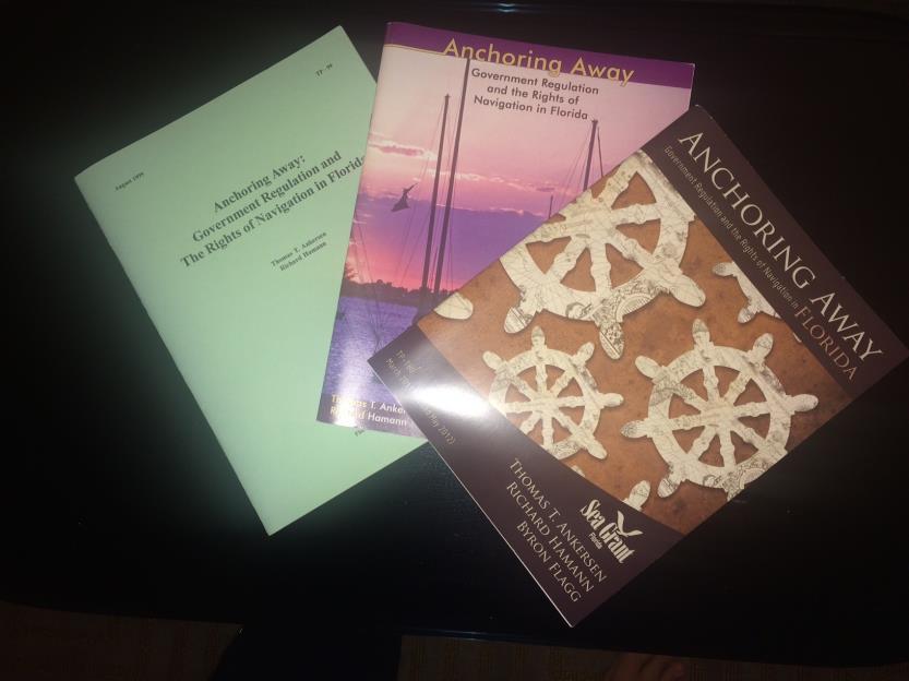
20 Please feel free take take a copy of the new publication! Or find it on line at:
Good Mooring to You! Jensen Beach Mooring Field. Kathy Fitzpatrick, P.E. Coastal Engineer, Martin County
 Good Mooring to You! Kathy Fitzpatrick, P.E. Coastal Engineer, Martin County Penny Cutt Regional Manager, Coastal Systems International Mooring Field Advantages Provide a safe and secure anchorage at a
A Guide for Local Communities that are Considering Creating a Managed Mooring Field
 A Guide for Local Communities that are Considering Creating a Managed Mooring Field Betty Staugler, UF/IFAS Extension, Charlotte County Byron Flagg, The Flagg Firm, P.L. Andy Stevens, Parks and Natural
 Page 1 of 6 Nav-Aid Basics Unlike the roads and highways that we drive on, the waterways we go boating on do not have road signs that tell us our location, the route or distance to a destination, or of
Performance Evaluation
 Performance Evaluation Regulating Vessel Noise on the Florida Intracoastal Waterway Manasota League of Cities November 10, 2016 Presented By: Maggie Mooney-Portale & Regina Kardash 1 Local Governments
Fort Hancock Sailing Center
 Response to the National Parks Service Request for Expressions of Interest to Redevelop Historic Structures at Fort Hancock in the Sandy Hook Unit of Gateway National Recreation Area Fort Hancock Sailing
BookletChart. Intracoastal Waterway Matecumbe to Grassy Key NOAA Chart A reduced-scale NOAA nautical chart for small boaters
 BookletChart Intracoastal Waterway Matecumbe to Grassy Key NOAA Chart 11449 A reduced-scale NOAA nautical chart for small boaters When possible, use the full-size NOAA chart for navigation. Published by
LOCAL NOTICE TO MARINERS
 USCG Notice to Mariners 3/7/18 (View full Notice here) LNM 10/18 Coast Guard District 1: U.S. Department of Homeland Security United States Coast Guard LOCAL NOTICE TO MARINERS COASTAL WATERS FROM EASTPORT,
Enhanced Discussion of Requirements for Commercial Fishing Vessels
 Update on U.S. Commercial Fishing Industry Vessel Requirements Based On Section 604 of the Coast Guard Authorization Act of 2010 (Public Law 111-281) And Section 305 of the Coast Guard and Maritime Transportation
BookletChart. Sand Key to Rebecca Shoal NOAA Chart A reduced-scale NOAA nautical chart for small boaters
 BookletChart Sand Key to Rebecca Shoal NOAA Chart 11439 A reduced-scale NOAA nautical chart for small boaters When possible, use the full-size NOAA chart for navigation. Published by the National Oceanic
3 Navigation Rules Rules General
 115 3 Navigation Rules Rules General Basis for Rules The International Rules were formalized at the Convention for Preventing Collisions at Sea of 1972. These International Rules were ratified in 1977
UBCM Community Excellence Awards 2007 Submission
 UBCM Community Excellence Awards 2007 Submission Formatted: Left: 2.54 cm Category: Partnerships Project: Implementation of False Creek Anchoring Management System 1. A one-paragraph summary of the project/program
ARTICLE III. CERTAIN PUBLIC PLACES* DIVISION 1. GENERALLY DIVISION 2. MUNICIPAL YACHT BASIN DIVISION 3. MANAGED MOORING FIELD
 ARTICLE III. CERTAIN PUBLIC PLACES* *Cross References: Parks and recreation, Ch. 14. Secs. 17-56--17-65. Reserved. DIVISION 1. GENERALLY DIVISION 2. MUNICIPAL YACHT BASIN Sec. 17-66. Mooring. It shall
29 cfr. 33 cfr. 46 US Code (Annotated) 46 cfr CHAPTER II CHAPTER I
 46 cfr CHAPTER II CHAPTER I") 29 cfr Captain Joe's DECK LICENSE PROGRAM G Documentation and Measurement of Vessels H Passenger Vessels 1902 Develop And Enforce Of State Standards I Cargo and Misc. Vessels 1903 Inspections, Citations
29 cfr Captain Joe's DECK LICENSE PROGRAM G Documentation and Measurement of Vessels H Passenger Vessels 1902 Develop And Enforce Of State Standards I Cargo and Misc. Vessels 1903 Inspections, Citations
Norwalk Harbor: The Jewel of Long Island Sound. A Presentation by the Norwalk Harbor Management Commission
 Norwalk Harbor: The Jewel of Long Island Sound A Presentation by the Norwalk Harbor Management Commission 2018 State of the Harbor Meeting December 13, 2018 The City of Norwalk in Southwest Connecticut
Abandoned and Derelict Vessels in the Florida Keys National Marine Sanctuary
 Abandoned and Derelict Vessels in the Florida Keys National Marine Sanctuary Steve Werndli Emergency Response and Enforcement Coordinator Florida Keys National Marine Sanctuary April 18, 2017 Derelict
COAST GUARD ADVISORY NOTICE (CGAN ) To: Distribution Date: September 1, 2017
 To: Distribution Date: September 1, 2017") Commander United States Coast Guard Sector New York 212 Coast Guard Drive Staten Island, NY 10305 Staff Symbol: (spw) Phone: (718) 354-2353 Fax: (718) 354-4190 COAST GUARD ADVISORY NOTICE (CGAN 2017-016)
Commander United States Coast Guard Sector New York 212 Coast Guard Drive Staten Island, NY 10305 Staff Symbol: (spw) Phone: (718) 354-2353 Fax: (718) 354-4190 COAST GUARD ADVISORY NOTICE (CGAN 2017-016)
New Requirements for Commercial Fishing Industry Vessels Section 604 Coast Guard Authorization Act of 2010 (Public Law )
") New Requirements for Commercial Fishing Industry Vessels Section 604 Coast Guard Authorization Act of 2010 (Public Law 111-281) On October 15, 2010, the President signed the law that included provisions
New Requirements for Commercial Fishing Industry Vessels Section 604 Coast Guard Authorization Act of 2010 (Public Law 111-281) On October 15, 2010, the President signed the law that included provisions
2005 ABC. Chapter 3 Part 2. Navigating with ATON's. Revision to D-13 Local Notes. Instructor Notes for Mike Brough. Mike Brough
 2005 ABC Chapter 3 Part 2 Navigating with ATON's Revision to D-13 Local Notes Instructor Notes for Mike Brough Mike Brough June 24 2008 June 24 2008 Slide 1 June 24 2008 New graphics Navigating on Water
Coastal Harbors and Waterways, NC (Shallow Draft Navigation) (O&M)
 (O&M)") Coastal Harbors and Waterways, NC (Shallow Draft Navigation) (O&M) Shallow draft coastal harbors include a subsistence harbor at Silver Lake CONGRESSIONAL DISTRICT: NC 3, 7 DATE: 23 April 2018 1. AUTHORIZATION:
Coastal Harbors and Waterways, NC (Shallow Draft Navigation) (O&M) Shallow draft coastal harbors include a subsistence harbor at Silver Lake CONGRESSIONAL DISTRICT: NC 3, 7 DATE: 23 April 2018 1. AUTHORIZATION:
U.S. Aids To Navigation System Brochure U.S. Coast Guard, Office of Aids to Navigation (202) ,
 ,") AIDS TO NAVIGATION Learning Objectives: As a result of this session the participant should: Understand the principal buoyage systems in the United States. Become aware of the characteristics of the buoy
AIDS TO NAVIGATION Learning Objectives: As a result of this session the participant should: Understand the principal buoyage systems in the United States. Become aware of the characteristics of the buoy
LOCAL NOTICE TO MARINERS
 USCG Notice to Mariners 3/26/15 (View full Notice here) LNM 12/15 Coast Guard District 1 : U.S. Department of Homeland Security United States Coast Guard LOCAL NOTICE TO MARINERS COASTAL WATERS FROM EASTPORT,
Mr. Barry Dragon, March 16, 2015 Commander, Seventh Coast Guard District (dob) Brickell Plaza 909 S.E. 1st Ave. Miami, FL
 Brickell Plaza 909 S.E. 1st Ave. Miami, FL") Mr. Barry Dragon, March 16, 2015 Commander, Seventh Coast Guard District (dob) Brickell Plaza 909 S.E. 1st Ave. Miami, FL 33130-3050 Commander, On behalf of the Florida Council of Yacht Clubs representing
Mr. Barry Dragon, March 16, 2015 Commander, Seventh Coast Guard District (dob) Brickell Plaza 909 S.E. 1st Ave. Miami, FL 33130-3050 Commander, On behalf of the Florida Council of Yacht Clubs representing
Prepared By: Environmental Preservation Committee REVISED: 3/29/05. Please see last section for Summary of Amendments
 SENATE STAFF ANALYSIS AND ECONOMIC IMPACT STATEMENT (This document is based on the provisions contained in the legislation as of the latest date listed below.) BILL: SB 1866 Prepared By: Environmental
City of St. Petersburg. Waterfront Anchoring and Mooring Summit
 City of St. Petersburg Waterfront Anchoring and Mooring Summit Intent: To establish an anchoring management plan which will. Promote environmentally sensitive and responsible anchoring of vessels within
National Standard 10 Advanced Notice of Proposed Rulemaking New England Fishery Management Council
 National Standard 10 Advanced Notice of Proposed Rulemaking New England Fishery Management Council Portland, ME June 21, 2011 Presentation Outline Information on Fishing Safety National Standard 10 and
Safety Zones and Special Local Regulations; Recurring. Marine Events in Captain of the Port Long Island Sound Zone
 This document is scheduled to be published in the Federal Register on 05/19/2015 and available online at http://federalregister.gov/a/2015-12103, and on FDsys.gov 9110-04-P DEPARTMENT OF HOMELAND SECURITY
The LA/LB Harbors handle more than 5,500 commercial vessel arrivals per year (excluding local coastwise and Catalina Island traffic).
.") X. SMALL CRAFT For the purpose of the Los Angeles and Long Beach Harbor Safety Plan, pleasure vessels, commercial fishing vessels and sportfishing boats are designated as small craft. A. BACKGROUND: The
X. SMALL CRAFT For the purpose of the Los Angeles and Long Beach Harbor Safety Plan, pleasure vessels, commercial fishing vessels and sportfishing boats are designated as small craft. A. BACKGROUND: The
Lee County Board Of County Commissioners Agenda Item Summary Blue Sheet No
 1. REOUESTED MOTION: Lee County Board Of County Commissioners Agenda Item Summary Blue Sheet No. 20030985 ACTION REOUESTED: Approve Resolution requesting funding from the West Coast Inland Navigation District
Southeast Volusia Coastal Projects Update
 Southeast Volusia Coastal Projects Update Public Works Department Coastal Division August 15, 2016 2016 Dune Walkover Re-Decking Program Completed Dune Walkovers South End 8 th Ave. New Smyrna Beach* 12
Nautical Chart Challenge
 Discover Your World With NOAA Nautical Chart Challenge For as long as anyone in his family could remember, Francis Beaufort wanted to make scientific observations from the deck of a ship. In 1789 at the
Coastal Harbors and Waterways, NC (Shallow Draft Navigation) (O&M)
 (O&M)") Coastal Harbors and Waterways, NC (Shallow Draft Navigation) (O&M) Shallow draft coastal harbors include a subsistence harbor at Silver Lake CONGRESSIONAL DISTRICT: NC 3 and 7 DATE: 23 February 2015 1.
Coastal Harbors and Waterways, NC (Shallow Draft Navigation) (O&M) Shallow draft coastal harbors include a subsistence harbor at Silver Lake CONGRESSIONAL DISTRICT: NC 3 and 7 DATE: 23 February 2015 1.
UNITED NEW YORK SANDY HOOK PILOTS BENEVOLENT ASSOCIATION AND UNITED NEW JERSEY SANDY HOOK PILOTS BENEVOLENT ASSOCIATION
 UNITED NEW YORK SANDY HOOK PILOTS BENEVOLENT ASSOCIATION AND UNITED NEW JERSEY SANDY HOOK PILOTS BENEVOLENT ASSOCIATION TO: All Shipping Agents and Interested Parties January 19, 2017 SUBJECT: Anchorage
V. HARBOR DEPTHS, CHANNEL DESIGN AND PROPOSED CONSTRUCTION AND DREDGING
 V. HARBOR DEPTHS, CHANNEL DESIGN AND PROPOSED CONSTRUCTION AND DREDGING A. DISCUSSION: For the most part, projects that involve dredging and construction require a comprehensive design and review process
Coastal Harbors and Waterways, NC (Shallow Draft Navigation) (O&M)
 (O&M)") Coastal Harbors and Waterways, NC (Shallow Draft Navigation) (O&M) Shallow draft coastal harbors include a subsistence harbor at Silver Lake CONGRESSIONAL DISTRICT: NC 3 and 7 DATE: 23 February 2015 1.
Coastal Harbors and Waterways, NC (Shallow Draft Navigation) (O&M) Shallow draft coastal harbors include a subsistence harbor at Silver Lake CONGRESSIONAL DISTRICT: NC 3 and 7 DATE: 23 February 2015 1.
Pioneer Array Micro-siting Public Input Process Frequently Asked Questions
 Pioneer Array Micro-siting Public Input Process Frequently Asked Questions The National Science Foundation (NSF) has completed the micro-siting of the moored array of the Ocean Observatories Initiative
World Shipping Council. Bureau of Ocean Energy Management
 Comments of the World Shipping Council Submitted to the Bureau of Ocean Energy Management In the matter of Potential Commercial Leasing for Wind Power on the Outer Continental Shelf (OCS) Offshore New
HARBOR INFRASTRUCTURE INVENTORIES West Harbor, OH
 HARBOR INFRASTRUCTURE INVENTORIES West Harbor, OH Harbor Location: West Harbor is located on the southern shore of Lake Erie in the township of Catawba Island, OH about 50 miles east of Toledo, OH. Authority:
Questions & Answers. Reporting Requirements for Private Boaters For use by CBSA media relations only
 Reporting requirements Questions & Answers Reporting Requirements for Private Boaters For use by CBSA media relations only Q.1. What are the reporting requirements for private boaters entering Canada?
Use of Conservation Moorings as a Component of Eelgrass Restoration in two Massachusetts Harbors
 Use of Conservation Moorings as a Component of Eelgrass Restoration in two Massachusetts Harbors Massachusetts Bays Program Division of Marine Fisheries Jay Baker, Tay Evans, Mass Bays Program MarineFisheries
Redondo Beach Boat Launch Ramp Facility
 Redondo Beach Boat Launch Ramp Facility Feasibility Report for the California Department of Boating and Waterways 2015 Grant Cycle For the City of Redondo Beach Submitted by March 13, 2014 Table of Contents
WHEREAS, the ordinance will not create excessive additional requirements for public facilities and services at public cost.
 ORDINANCE 19-05 AN ORDINANCE OF VALLEY COUNTY, IDAHO, CREATING AN ORDINANCE TO BE ADMINISTERED BY THE VALLEY COUNTY SHERIFF S OFFICE AND TO BE KNOWN AS VALLEY COUNTY WATERWAYS ORDINANCE THAT INCLUDES PAYETTE
Ships 2-Reefs Program Annual Report
 Florida Fish and Wildlife Conservation Commission Ships 2-Reefs Program 2016-17 Annual Report Ships-2-Reefs Program In 2008, the Florida Legislature passed Ships-2-Reefs Program legislation (SB 432), Chapter
JUNEAU SECOND CHANNEL CROSSING WATERWAY USER SURVEY RESULTS
 JUNEAU SECOND CHANNEL CROSSING WATERWAY USER SURVEY RESULTS PREPARED FOR: HDR Alaska, Inc. PREPARED BY: Juneau Anchorage December 2003 TABLE OF CONTENTS Executive Summary...1 Introduction and Methodology...2
Working with your Harbour Authority. Roger Wilson and Mike Pearson. Protecting your Rights, Promoting your Interests
 Working with your Harbour Authority Roger Wilson and Mike Pearson Protecting your Rights, Promoting your Interests 1. MOD Dockyard Ports Are controlled under Orders made pursuant to the Dockyard Ports
Harbor Safety Committee HEAVY WEATHER (WX)
") HEAVY WEATHER (WX) SOC Quick Reference Risk Petroleum transfers Mooring buoys- Operating Policies and Weather Criteria General mooring policies, breakaway prevention Derelict and unattended vessels (abandoned
HEAVY WEATHER (WX) SOC Quick Reference Risk Petroleum transfers Mooring buoys- Operating Policies and Weather Criteria General mooring policies, breakaway prevention Derelict and unattended vessels (abandoned
SUCCESSFUL GEAR RECOVERY Lessons from Puget Sound
 APEC MARINE DEBRIS SEMINAR SUCCESSFUL GEAR RECOVERY Lessons from Puget Sound Jeff June, Project Manager Joe Schmitt & Gary Wood JD Northwest Straits Commission Washington State, U.S. The Northwest Straits
COMMERCIAL & RECREATIONAL FISHING
 COMMERCIAL & RECREATIONAL FISHING Commercial fishing in New England has a long and storied history. Its importance culturally and economically has lasted hundreds of years, becoming a part of many tales
City of Melbourne City Hall 900 E. Strawbridge Avenue, Melbourne, FL (321) Fax (321)
 Fax (321)") City of Melbourne City Hall 900 E. Strawbridge Avenue, Melbourne, FL 32901 (321) 608 7200 Fax (321) 608 7219 SPECIAL WORKSHOP MEETING December 11, 2018 5:30 PM 1. Roll Call 2. Public Comments 3. Discussion
City of Melbourne City Hall 900 E. Strawbridge Avenue, Melbourne, FL 32901 (321) 608 7200 Fax (321) 608 7219 SPECIAL WORKSHOP MEETING December 11, 2018 5:30 PM 1. Roll Call 2. Public Comments 3. Discussion
HELSINKI COMMISSION HELCOM SAFE NAV 4/2014 Group of Experts on Safety of Navigation Fourth Meeting Helsinki, Finland, 4 February 2014
 HELSINKI COMMISSION HELCOM SAFE NAV 4/2014 Group of Experts on Safety of Navigation Fourth Meeting Helsinki, Finland, 4 February 2014 Agenda Item 3 Accidents and ship traffic in the Baltic Sea Document
Anchoring Is Important
 BCC Sailing Classes - Third Theory Anchoring Anchoring Is Important 1 The Anchor is your last resort. Anchoring Keep off a lee shore. Needs to be shaped (type of anchor) to bury in the type of bottom for
California Boater Card FAQ
 California Boater Card FAQ California BOATER CARD Q: What is a California Boater Card? A: The California Boater Card shows that its holder has successfully taken an approved boating safety course and passed
Code of Practise for Deployment and Marking of Fishing Gear
 INTRODUCTION Falmouth Harbour is used for a diverse range of activities including commercial shipping, leisure boating, diving and fishing. The Commissioners aim to accommodate all activities without imposing
Chart Features Maritime maps and Admiralty charts have these features:
 Introduction to Charts A chart or map of the area is an important safety item to carry on board. It allows the Master to obtain knowledge of the area to be travelled, and indicates the navigable channels
68D Broward County Boating Restricted Areas.
 68D-24.008 Broward County Boating Restricted Areas. (1) For the purpose of regulating speed and operation of vessel traffic on and adjacent to the Florida Intracoastal Waterway in Broward County, Florida,
2016 Boating Officer of the Year Boating Educator of the Year
 2016 Boating Officer of the Year Officer Jarrod Molnar was selected as the Florida Boating Officer of the Year. He has worked with the FWC for five years and is assigned to Okaloosa County. In 2015, Officer
World Shipping Council. U.S. Coast Guard. Port Access Route Study: The Atlantic Coast From Maine to Florida
 Comments of the World Shipping Council Submitted to the U.S. Coast Guard In the matter of Port Access Route Study: The Atlantic Coast From Maine to Florida Docket Number: USCG-2011-0351 April 13, 2016
EBA Position Statement AIS Virtual Aids to Navigation
 EBA Position Statement AIS Virtual Aids to Navigation Document date: 17 October 2015 Latest update: 9 December 2015 Executive Summary The European Boating Association 1 (EBA) recognises the value of Automatic
Order Adopting Amendments. Title 58. Recreation Part II. Fish and Boat Commission Chapters 97, 109, 111 and 115 Boating. Preamble
 Order Adopting Amendments COMMONWEALTH OF PENNSYLVANIA PENNSYLVANIA FISH AND BOAT COMMISSION Title 58. Recreation Part II. Fish and Boat Commission Chapters 97, 109, 111 and 115 Boating Preamble The Fish
APPENDIX D REAL ESTATE PLAN
 NAVIGATION IMPROVEMENTS SITKA HARBOR, ALASKA CHANNEL ROCK BREAKWATERS DRAFT DEFICIENCY CORRECTION EVALUATION REPORT APPENDIX D REAL ESTATE PLAN JANUARY 2011 REAL ESTATE PLAN FOR SITKA HARBOR, ALASKA CHANNEL
F4. Coastal Mooring Zone and moorings outside the Coastal Mooring Zone
 F4. Coastal Mooring Zone and moorings outside the Coastal Mooring Zone F4.1. Zone description This section addresses the provisions relating to moorings in the Coastal Mooring Zone and those outside the
June 25, Re: Camping Platform Permitting (NSGLC )
") June 25, 2013 Curtis W. Smith Director of Planning Accomack-Northampton Planning District Commission P.O. Box 417, 23372 Front Street Accomac, VA 23301 Re: Camping Platform Permitting (NSGLC-12-04-03)
June 25, 2013 Curtis W. Smith Director of Planning Accomack-Northampton Planning District Commission P.O. Box 417, 23372 Front Street Accomac, VA 23301 Re: Camping Platform Permitting (NSGLC-12-04-03)
WELCOME TO THE MILLENNIUM RIBBLE LINK
 WELCOME TO THE MILLENNIUM RIBBLE LINK The prestigious 5.8m project to construct the Millennium Ribble Link opened in 2002. This is the first new navigation to be built in England since the Manchester Ship
BookletChart. Chesapeake Bay Tangier Sound, Northern Part NOAA Chart A reduced-scale NOAA nautical chart for small boaters
 BookletChart Chesapeake Bay Tangier Sound, Northern Part NOAA Chart 12231 A reduced-scale NOAA nautical chart for small boaters When possible, use the full-size NOAA chart for navigation. Published by
AMSA A Roadmap Forward & Relevant Alaska Activities. Captain Bob Pawlowski, NOAA (Ret), MNI Legislative Liaison to the Denali Commission
, MNI Legislative Liaison to the Denali Commission") AMSA A Roadmap Forward & Relevant Alaska Activities Captain Bob Pawlowski, NOAA (Ret), MNI Legislative Liaison to the Denali Commission Selected AMSA Key Findings UNCLOS: Fundamental framework IMO: Competent
AMSA A Roadmap Forward & Relevant Alaska Activities Captain Bob Pawlowski, NOAA (Ret), MNI Legislative Liaison to the Denali Commission Selected AMSA Key Findings UNCLOS: Fundamental framework IMO: Competent
Sailing South Seminar October 6, 2016 ICW Slides
 Sailing South Seminar October 6, 2016 ICW Slides The ICW seminar is undergoing updates and changes as Hurricane Matthew approaches the Florida Coast. These slides include screen shots of all of the trouble
Plot the Path. Mary Anne Otten. lesson three
 Plot the Path Mary Anne Otten lesson three Subject/Grade: Grade 2, Math, Social Studies, Science Duration: one class period Materials needed: Per class: Day the Great Lakes Drained Away by Charles Ferguson
THE SYLLABUS FOR WRITTEN EXAMINATION PILOT'S FOURTH CLASS LICENCE (TEES AND HARTLEPOOL) AND
 AND") PD TEESPORT CONSERVANCY DIVISION HARBOUR MASTER'S OFFICE THE SYLLABUS FOR WRITTEN EXAMINATION IN RESPECT OF A PILOT'S FOURTH CLASS LICENCE (TEES AND HARTLEPOOL) AND PILOTAGE EXEMPTION CERTIFICATE (Issued
PD TEESPORT CONSERVANCY DIVISION HARBOUR MASTER'S OFFICE THE SYLLABUS FOR WRITTEN EXAMINATION IN RESPECT OF A PILOT'S FOURTH CLASS LICENCE (TEES AND HARTLEPOOL) AND PILOTAGE EXEMPTION CERTIFICATE (Issued
North Carolina Wildlife Resources Commission Agency Overview. Appropriations Subcommittee on Natural and Economic Resources February 22, 2011
 Agency Overview Appropriations Subcommittee on Natural and Economic Resources February 22, 2011 Agency Background Key Funding Elements Agency Board Economic Impacts Background Agency Purpose derived from
Mississippi Department of Marine Resources. Jimmy Sanders
 Mississippi Department of Marine Resources Jimmy Sanders Fish Aggregating Devices (FADs) Fish aggregating devices (FADs) are floating objects that are designed and strategically placed to attract pelagic
Towing Officers' Assessment Record: Western Rivers
 Towing Officers' Assessment Record: Western Rivers NAME: LICENSE NO.: Task No. Considered Proficient Common Element Task or Duty DE's Initials Date A. Vessel Familiarization A.1. X Locate and demonstrate
August April 18,2008 First Revision
 August 15 2011 Slide 01 April 18,2008 First Revision August 15, 2011 Text converted to Tables for ease of formatting instructor guide. Slide 23 Sound Signals Corrected Danger Signal 5 or More Short Blasts
National Maritime Center
 National Maritime Center Providing Credentials to Mariners (Sample Examination) Page 1 of 8 Choose the best answer to the following Multiple Choice Questions. 1. Which term indicates the rise in height
Plot the Path into the Harbor
 Plot the Path into the Harbor By Mary Anne Otten, Rudyard Area Schools and Joan Chadde, Michigan Technological University Subject/Grade: Grade 3 6, Math, Social Studies, Science Duration: 35 minutes Lesson
SUMMARY: The Coast Guard is establishing a temporary 500 yard safety zone around the
 This document is scheduled to be published in the Federal Register on 06/13/2017 and available online at https://federalregister.gov/d/2017-12163, and on FDsys.gov 9110-04-P DEPARTMENT OF HOMELAND SECURITY
Coastal and marine recreation in New England is ingrained in the region s economic and
 RECREATION Coastal and marine recreation in New England is ingrained in the region s economic and social fabric. Recreation on the ocean and coast includes many of New Englanders most time-honored and
CITY OF COCOA BEACH 2025 COMPREHENSIVE PLAN. Section VIII Mobility Element Goals, Objectives, and Policies
 CITY OF COCOA BEACH 2025 COMPREHENSIVE PLAN Section VIII Mobility Element Goals, Objectives, and Policies Adopted August 6, 2015 by Ordinance No. 1591 VIII MOBILITY ELEMENT Table of Contents Page Number
2 Boating Rules and Regulations... 73
 Contents at a Glance Chapter 1 Boat Design and Construction Chapter 2 Boating Rules and Regulations Chapter 3 Navigation Rules (ColRegs) Chapter 4 Boat Operating and Seamanship Chapter 5 Piloting and Navigation
Texas Department of Transportation s Gulf Intracoastal Waterway Capacity Study. GICA 112 th Annual Seminar July 28, 2017
 Texas Department of Transportation s Gulf Intracoastal Waterway Capacity Study GICA 112 th Annual Seminar July 28, 2017 Study Purpose Determine if current levels of vessel activity on the Texas segment
TOWING OFFICER ASSESSMENT RECORD
 TOWING OFFICER ASSESSMENT RECORD NEAR COASTAL / OCEANS SIGNATED EXAMINER INFORMATION All Designated Examiners (s) signing off successful completion of practical assessments should provide the information
Shellfish Lease Program. February 13, Department of Environmental Quality
 Shellfish Lease Program February 13, 2016 Department of Environmental Quality NC Shellfish Lease History The State of North Carolina has provided for the private use of public trust waters for the production
World Shipping Council. National Oceanographic and Atmospheric Administration
 Comments of the World Shipping Council Submitted to the National Oceanographic and Atmospheric Administration In the matter of Endangered and Threatened Species; Petition for Rulemaking to Establish a
California Boater Card FAQ
 California Boater Card FAQ California BOATER CARD Q: What is a California Boater Card? A: The California Boater Card shows that its holder has successfully taken an approved boating safety course and passed
Florida Department of Environmental Protection
 Florida Department of Environmental Protection Bob Martinez Center 2600 Blair Stone Road Tallahassee, Florida 32399-2400 Rick Scott Governor Jennifer Carroll Lt. Governor Herschel T. Vinyard Jr. Secretary
SECTION II NM 26/10 NAVIGATION PUBLICATIONS ALMANACS CORRECTIONS
 NAVIGATION PUBLICATIONS ALMANACS CORRECTIONS NAUTICAL ALMANAC Ed 2011 NEW EDITION (NGA) 26/10 SAILING DIRECTIONS CORRECTIONS PUB 140 8 Ed 2010 NEW EDITION (NGA) 26/10 COAST PILOT CORRECTIONS COAST PILOT
Another essential characteristic of boat channel geography is the form and spacing of channel
 Another essential characteristic of boat channel geography is the form and spacing of channel segments.some channels are simple, and others are complex. The channel systems include: finger canals or basins;
Flower Garden Banks National Marine Sanctuary Management Plan Revision
 Flower Garden Banks National Marine Sanctuary Management Plan Revision G.P. Schmahl Sanctuary Superintendent Beyond the Horizon May 12, 2011 Flower Garden Banks National Marine Sanctuary Stetson Bank
CDSOA Carolinas Fleet Oriental to Manteo Cruise Loop September 23-October 2
 CDSOA Carolinas Fleet Oriental to Manteo Cruise Loop September 23-October 2 Questions? Contact Cruise Captain Shanna Paxton at cdwanderlust@cox.net or Fleet Captain Lou Ostendorff at 919-676-7437 or ostendorff@bellsouth.net
CHANGING CURRENTS AND BEACH ACCESS
 CHANGING CURRENTS AND BEACH ACCESS The Public Trust Doctrine and Ensuring Universal Beach Access Angela T. Howe. Esq. Legal Director Surfrider Foundation BURNING QUESTIONS! Who owns America s coastlines?!
Visiting Lake Macquarie
 Visiting Lake Macquarie Lake Macquarie is the largest coastal salt water lake in Australia and is a prime boating destination for both small and large vessels. Many sailing regattas and fishing activities
Vessel Traffic in the Salish Sea Mitigating Risk... Captain Joe Raymond Coast Sector Puget Sound
 Vessel Traffic in the Salish Sea Mitigating Risk.... Captain Joe Raymond Coast Sector Puget Sound Overview Prevention Waterways Management Oil Spill Data Mitigating Risks Sector Puget Sound AOR Blan k
HARBOR INFRASTRUCTURE INVENTORIES Fairport Harbor, OH
 HARBOR INFRASTRUCTURE INVENTORIES Fairport Harbor, OH Harbor Location: Fairport Harbor is located at the mouth of the Grand River on the southern shore of Lake Erie in the city of Fairport, OH, approximately
SS&S Chapter 8 Instructor Guide
 SS&S Chapter 8 Instructor Guide The Rules of the Nautical Road The PowerPoints (PPT) slides for this SS&S chapter were copied from the BS&S-13 th Ed PPT because they are identical. Only the chapter numbers
 7 The Guidelines of Measures for preventing Typhoon Disaster ( Objective ) Article1 The objective of this guideline is to establish steps necessary to implement the measures for preventing typhoon
Maritime Rules Part 25: Nautical Charts and Publications
 Maritime Rules Part 25: Nautical Charts and Publications ISBN 978-0-478-44797-2 Published by Maritime New Zealand, PO Box 25620, Wellington 6146, New Zealand Maritime New Zealand Copyright 2015 Part 25:
AGENCY/ORGANIZATION OFFICE/DIVISION SECTION/SUBSECTION ACTIONS (Related to Coral Reefs) Natural Resources Planning and Management Division
 Natural Resources Planning and Management Division") AGENCY/ORGANIZATION OFFICE/DIVISION SECTION/SUBSECTION ACTIONS (Related to Coral Reefs) Broward County Environmental Protection and Growth Department Natural Resources Planning and Division Broward County
AGENCY/ORGANIZATION OFFICE/DIVISION SECTION/SUBSECTION ACTIONS (Related to Coral Reefs) Broward County Environmental Protection and Growth Department Natural Resources Planning and Division Broward County
Marine Debris from Land to Sea: Holistic Characterization, Reduction and Education Efforts in New Hampshire
 Marine Debris from Land to Sea: Holistic Characterization, Reduction and Education Efforts in New Hampshire ABSTRACT Over time, the focus of marine debris research and work has shifted away from simply
FILED 12/04/2017 3:00 PM ARCHIVES DIVISION SECRETARY OF STATE
 OFFICE OF THE SECRETARY OF STATE DENNIS RICHARDSON SECRETARY OF STATE LESLIE CUMMINGS DEPUTY SECRETARY OF STATE PERMANENT ADMINISTRATIVE ORDER OSMB 4-2017 CHAPTER 250 OREGON STATE MARINE BOARD ARCHIVES
Marine Safety Information Bulletin COAST GUARD GUIDANCE FOR DEAD SHIP MOVEMENT IN SECTOR HONOLULU CAPTAIN OF THE PORT ZONE.
 Marine Safety Information Bulletin 16-002 U.S. DEPARTMENT OF HOMELAND SECURITY U. S. Coast Guard Sector Honolulu Sand Island Parkway Honolulu, Hawaii 96819 (808) 842-2600 COAST GUARD GUIDANCE FOR DEAD
Towing Officers' Assessment Record: Great Lakes/Inland
 Towing Officers' Assessment Record: Great Lakes/Inland NAME: LICENSE NO.: Task No. Considered Proficient Common Element Task or Duty DE's Initials Date A. Vessel Familiarization A.1. Locate and demonstrate
Mentoring in the USCG Auxiliary Boat Crew Program Coxswain Mentoring Template
 Notes: 1. When there is no reading assignment specified, the entire chapter contains references to the topic. 2. The study questions in the Qualification Guide should be completed for each task. Boat Crew