Chief-Planning & Readiness USCG Sector Houston-Galveston
|
|
|
- Cornelia Harrell
- 5 years ago
- Views:
Transcription


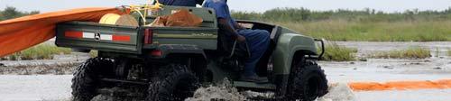
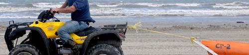
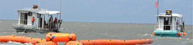
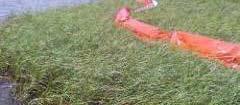
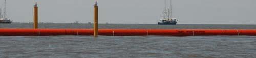
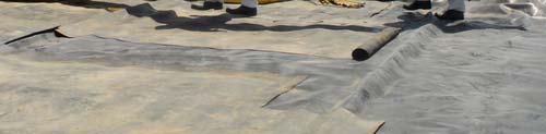
1 Boom Efficacy During the DEEPWATER HORIZON Response LCDR Joseph J. Leonard, Jr. Chief-Planning & Readiness USCG Sector Houston-Galveston June 2011
2 Boom Selection Responder Skill Sets Boom Utilization Site Specific Discussion Overview
3 Boom Selection Type of product to be contained. Operating conditions (wind, wave height, current, tides, etc.). Logistical requirements for deployment and availability of manpower. Compatibility with other types of boom. Local access points for recovery equipment. Anchoring locations ashore and in the water.
4 Boom Selection Buoyancy of the boom. Freeboard height and skirt depth. Visibility in daylight. Ease to transport, assemble, deploy and retrieve. Presence of debris and recovery capabilities.


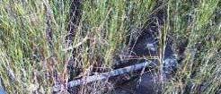
5 Where Boom Doesn t Work On land In bird rookeries Underwater Adrift


6 Responder Skill Sets Strike Team / OSRO Advanced USCG/State/Local Responders Basic-Intermediate VOOs/Volunteers Questionable


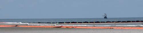
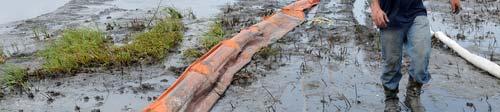
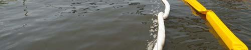
7 Containment t Techniques Exclusion booming Diversion booming Containment booming Sorbent boom Sorbent barriers


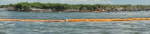
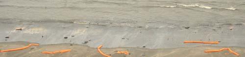
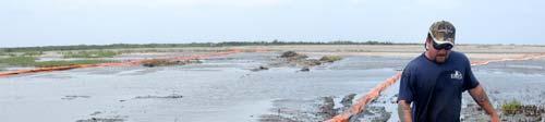
8 Exclusion Booming Used to exclude spilled oil from impacting i environmental or historical sensitive areas, water intakes, and private property. Quantity needed and placement will depend on geography and weather conditions. i


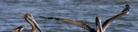


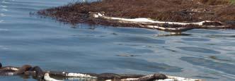
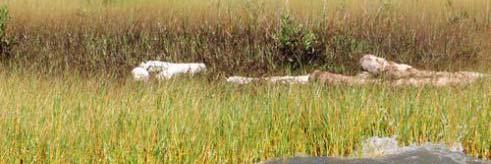
9 Bird Rookeries

10 Diversion i Booming Used to minimize the impact of oil in strategic locations and to direct its flow elsewhere. Most effective when current is <.7 knots and waves are negligible. Quantity needed and placement will depend on geography and weather conditions.
11 Diversion Boom Deployment Chevron Pattern the the boom is angled in a chevron or inverted V-pattern so that all floating oil and debris is deflected to either side of the stream. Cascading Pattern varying lengths of boom are progressively staggered along the watercourse so that the oil is directed to one side of the watercourse.
12
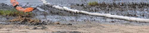
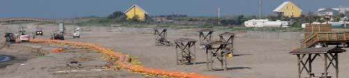
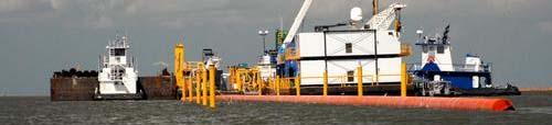
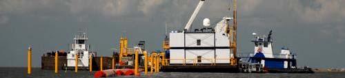
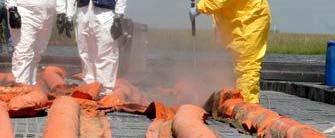
13 Boom Staging

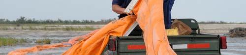
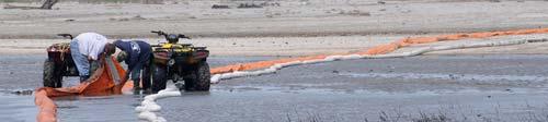
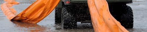


14 Boom Deployment


15 Boom Deployment


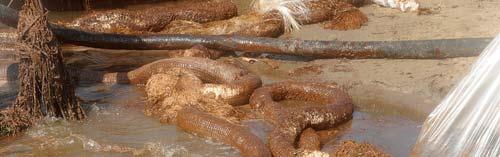
16 Anchors Laying them with boom Lifting boom without them Relocating/recovering them Wishing gy you had nothing to do with them


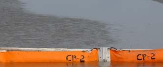
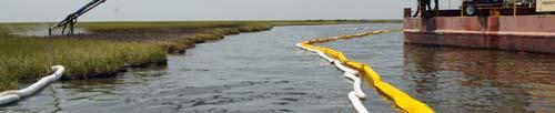
17 Containment t Booming Deployed in a U or V shape to direct flow of oil to recovery resource, such as a skimmer. Quantity needed and placement will depend on geography, weather conditions, and quantity of oil to be recovered.
18 Containment t Booming Often used in combination with skimming resources. When used in sheltered waters, containment booms is often anchored to the bottom. Ensure anchoring systems take into consideration current direction, velocity, and tidal shifts.


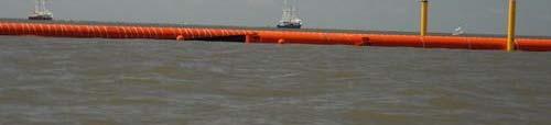
19 Hard Boom
20 Sorbent Booming Boom is composed of sorbent material (primarily adsorbent). Usually deployed ed along shoreline to protect sensitive areas or to keep heavier, emulsified oils from spreading. May be used in concert with conventional boom to better control oil slicks. Primarily used in quiet waters that are not heavily contaminated.
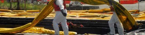
21 Sorbent Barriers Usually constructed of wire mesh, stakes, and loose sorbent materials. Often deployed ed across a waterway a or outfall. Allows water to flow through it but it retains and absorbs b oil on the water s surface. Primarily used in small, low-velocity streams, tidal inlets, and channels.
22


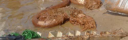

23 Sorbent Boom

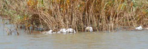
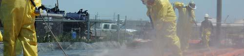
24 Marsh Flushing


25 Fire Booms Used to contain oil in strategic location to facilitate in situ burning. Quantity needed and placement will depend on geography, weather conditions, and quantity of oil to be burned.
26 Improvised Booms Used to control relatively small spills that occur in sheltered waters or as a temporary measure until more suitable boom is available. Examples include: --Inflated fire hose --Telephone poles --Logs --Linked railroad ties --Pipes --Barges --Earthen dams
27 Improvised Booms Uses To divert oil to an area where commercial boom is already deployed. To collect debris and protect the main containment boom. Good in streams or ditches that are too shallow or too narrow for conventional boom. Remember that oil can readily spill over the top or in between sections of improvised boom.


28 Barge Booms


29 Pipe Booms
30

31 Boom Recovery


32 Boom Washing
33
34
35
36
37
38
39

")

40 LCDR Joseph J. Leonard, Jr. (713)
This training is intended to be educational and should not be construed as legal guidance. It is provided as a courtesy to our customers and others
 June 2012 This training is intended to be educational and should not be construed as legal guidance. It is provided as a courtesy to our customers and others who may benefit from the information contained
9. SHORELINE PROTECTION
 9. Shoreline protection is defined as those response activities that take place at or near the shoreline, rather than on open water, to protect the shore zone from becoming oiled or to protect vulnerable
OPRC Level I. Oil containment booms
 OPRC Level I Oil containment booms Aim Be able to distinguish between the various types of Containment Booms Outline General Purpose of Booms Curtain Booms Fence Booms Beach Booms What is boom? Barriers
Use of. Sorbents. for Spill Response OPERATIONAL GUIDE
 Use of Sorbents for Spill Response OPERATIONAL GUIDE Use of Sorbents for Spill Response OPERATIONAL GUIDE This guide was produced with financial support from the Maritime Affairs Directorate, Total and
CHAPTER 4: BEST MANAGEMENT PRACTICES FOR EROSION AND SEDIMENTATION CONTROL
 Figure 4.4m. Type III Floating Turbidity Barrier Source: American Boom and Barrier Corporation and Virginia Department of Transportation (DOT) Standard Sheets 71 4.4.6 Floating Turbidity Barrier Definition
Spill Response on Rivers, Lakes and Sheltered Marine Waters: An Alternative Approach
 693 Spill Response on Rivers, Lakes and Sheltered Marine Waters: An Alternative Approach J.W. (Ian) Lambton Riverspill Response Canada Ltd. Riverspill@telus.net Abstract Prospective spill response recovery/control
Geographic Response Plan Map: SFL-21. Map continued on: SFL-31S XXX. k Curry Hammock. SFL21-05 Grassy Key Beaches. Map continued on: SFL-20
 ! 81 0'0"W Geographic Response Plan Map: SFL-21 Map continued on: SFL-31S 80 52'30"W Arse XXX S A 24 52'30"N j Everglades National Park [] [ 24 52'30"N Florida Bay Flo Nati S 9N-01 oo Banks ock 54! Bamboo
GEM Network; Færoe Islands Coastal Protection Plans. REGION 1. Viðoy. DATE OF SURVEY: October 2000
 REGION 1. Viðoy DATE OF SURVEY: October 2000 General Description of the Area including Tidal Information This region consists of the northern parts of Borðoy, Kalsoy, Kunoy, Svínoy as well as Fugloy. Borðoy
Dry Hydrants. The installation of a non-pressurized pipe system into local water sources provides a ready means of supplying water to fire engines.
 Dry Hydrants What is a Dry Hydrant? A dry hydrant is a non-pressurized pipe system permanently installed in existing lakes, ponds and streams that provides a suction supply of water to a fire department
USE OF BOOMS IN OIL POLLUTION RESPONSE TECHNICAL INFORMATION PAPER
 USE OF BOOMS IN OIL POLLUTION RESPONSE TECHNICAL INFORMATION PAPER 3 Introduction Booms are routinely used to surround and contain oil spilled at sea and to deflect its passage away from sensitive resources
Design and Installation of two Permanent Booms at La Romaine-2 to resist Ice, retain Debris and serve as Safety Booms.
 CGU HS Committee on River Ice Processes and the Environment 18 th Workshop on the Hydraulics of Ice Covered Rivers Quebec City, QC, Canada, August 18-20, 2015 Design and Installation of two Permanent Booms
WCMRC Technical Manual. Waste Management Tactics
 WCMRC Technical Manual Waste Management Tactics this page left intentionally blank 74 P a g e WASTE MANAGEMENT TACTICS PURPOSE OF THE WASTE MANAGEMENT TACTICS This section covers waste management issues
Tidal Inlet Protection Strategies (TIPS) Field Guide API TECHNICAL REPORT JANUARY 2016
 Field Guide API TECHNICAL REPORT JANUARY 2016") Tidal Inlet Protection Strategies (TIPS) Field Guide API TECHNICAL REPORT 1153-2 JANUARY 2016 Special Notes API publications necessarily address problems of a general nature. With respect to particular
Tidal Inlet Protection Strategies (TIPS) Field Guide API TECHNICAL REPORT 1153-2 JANUARY 2016 Special Notes API publications necessarily address problems of a general nature. With respect to particular
Emergency Response Plan Supervisor Version
 Emergency Response Plan Supervisor Version Emergency Response Planning means having the right information, training and equipment to respond safely when an injury or other unexpected event occurs. Minor
Western Canadian Spill Services Ltd. Field Testing Exercise Report
 Western Canadian Spill Services Ltd. Field Testing Exercise Report Wednesday, July 15, 2009 Clearwater River, Rocky Mountain House, AB Background Western Canadian Spill Services Ltd. (WCSS) held a field
National Oil Spill Contingency Plan Chapter 6 Cleanup/Response Options for Different Environments
 National Oil Spill Contingency Plan Chapter 6 Cleanup/Response Options for Different Environments Contents Contents... 2 Overview... 3 Response priorities... 3 Response options... 3 Preferred response
Hazardous Materials First Responder OPERATIONS LEVEL
 ABSORPTION & RETENTION Skill Number HAZO 1 Objective: 5.4.3, 5.4.4 1. The candidate shall be provided with a leaking drum, buckets, pads or pigs, and dry absorbent. 2. Identify the product to the candidate.
Geographic Response Plan Map: EFL-25. Map Continued on Page: EFL-30. EFL25-01 Cape Canaveral Air Force Station Nesting Beach - South
 r. 80 37'30"W Banana River 28 30'0"N!d! White Geographic Response Plan Map: EFL-25 Point Map Continued on Page: EFL-30 80 30'0"W 28 30'0"N! Cactus Point a th)! er erve Map Continued on Page: EFL-26!S(!d
Shoreline Sensitivity Map 6651 Sisimiut
 Airphoto Keymap Legend Contents Phys. Env. & Logistics Map Keymap 66 30' 66 40' 66 50' 67 00' Area 223 209 Area 222 isimiut 221 9 L e c (Holsteinsborg) b439m Gu438 Al436 Kangerluarsuk Tulleq 4 0 222 Area
REGION 2. Eysturoy (north)
") REGION 2. Eysturoy (north) DATE OF SURVEY: October 2000 General Description of the Area including Tidal Information The region consists of the northern part of Eysturoy, within which are the coastal villages
REGION 2. Eysturoy (north) DATE OF SURVEY: October 2000 General Description of the Area including Tidal Information The region consists of the northern part of Eysturoy, within which are the coastal villages
Oil Spill Incident Annex. Introduction [Link to the Oil and Hazardous Materials Incident Annex in the NRP]
![Oil Spill Incident Annex. Introduction [Link to the Oil and Hazardous Materials Incident Annex in the NRP]](/thumbs/89/100738091.jpg "Oil Spill Incident Annex. Introduction [Link to the Oil and Hazardous Materials Incident Annex in the NRP]") Introduction [Link to the Oil and Hazardous Materials Incident Annex in the NRP] Response to oil spills can vary greatly, involving only a few people or thousands. The initial action taken by responders
Introduction [Link to the Oil and Hazardous Materials Incident Annex in the NRP] Response to oil spills can vary greatly, involving only a few people or thousands. The initial action taken by responders
USE OF REELS IN DIVING
 USE OF REELS IN DIVING There have been several different types of reel developed for both commercial and recreational use. This guide is compiled to aid in the use of reels in two distinct techniques,
MILE POINT TRAINING WALL JACKSONVILLE, FL. Geotextile Tube Installation
 MILE POINT TRAINING WALL JACKSONVILLE, FL Geotextile Tube Installation PROJECT DESIGN Remove portion of existing training wall Construct new eastern and western training walls Deepen new flow improvement
Section Decanting Response Tool
 Section 9411 Decanting Response Tool T able of Contents Section Page 9411 Decanting Response Tool... 9411-1 9411.1 Introduction... 9411-1 9411.2 Decanting Policy... 9411-1 9411.2.1 Criteria... 9411-1 9411.2.2
AREA 4 & 5 OIL SPILL CONTINGENCY GROUP EMERGENCY TRAINING EXERCISES
 AREA 4 & 5 OIL SPILL CONTINGENCY GROUP EMERGENCY TRAINING EXERCISES MAINPRIZE REGIONAL PARK (AREA 4 May 17 & 18) MOOSE CREEK REGIONAL PARK (AREA 5 May 24 & 25) 2017 AREA 4 & 5 TRAINING EXERCISES 2017 The
Objectives. Demonstrate proper first responder swiftwater PPE and safety. Demonstrate proper floating throw bag throwing technique.
 Objectives Demonstrate proper first responder swiftwater PPE and safety. Demonstrate proper floating throw bag throwing technique. Demonstrate proper set up of a tension diagonal rescue system. Demonstrate
Section Decanting Response Tool
 Section 9411 Decanting Response Tool T able of Contents Section Page 9411 Decanting Response Tool... 9411-1 9411.1 Introduction... 9411-1 9411.2 Decanting Policy... 9411-1 9411.2.1 Criteria... 9411-1 9411.2.2
Geographic Response Plan Map: SFL-25. Map continued on: SFL-29. Lignumvitae Key. Aquatic Preserve. Lignumvitae Key Botanical.
 ! 25 0'0"N 80 45'0"W Spy Key Geographic Response Plan Map: SFL-25 Panhandle Key Panhandle Key Florida Bay Map continued on: SFL-29 Crab Keys West Key 80 37'30"W 25 0'0"N Crane Keys Crane Keys XXX j Everglades
OIL BOOM FAILURE DUE TO WIND-DRIVEN CURRENT
 OIL BOOM FAILURE DUE TO WIND-DRIVEN CURRENT The death knell for conventional oil booms? Interspill London 2012 Spill Industry Seminar Dag Nilsen R&D Manager TOPICS: - Main failure mechanisms relative to
Oil Spill Incident from Drilling Operation East Java
 OIL SPILL COMBAT EXPERIENCES Oil Spill Incident from Drilling Operation East Java Deployment Vessel Towing Vessel 500 m Oil Spill Location Assist Vessel Oil Spill during drilling operation occurred during
AREA 4 & 5 OIL SPILL CONTINGENCY GROUP EMERGENCY TRAINING EXERCISES 2018
 AREA 4 & 5 OIL SPILL CONTINGENCY GROUP EMERGENCY TRAINING EXERCISES 2018 MAINPRIZE REGIONAL PARK (AREA 4 May 16 & 17) MOOSE CREEK REGIONAL PARK (AREA 5 May 23 & 24) 2018 Page 1 14 AREA 4 & 5 TRAINING EXERCISES
Response Boat & Barge
 Response Boat & Barge Oil Spill Equipment Floating Barriers Incinerators ELASTEC INLANDER BOAT & BARGE Work Horse of the Waterways With the speed of a thoroughbred and the strength of a draft horse, the
Ocean Structures and Material Prof. Dr. Srinivasan Chandrasekaran Department of Ocean Engineering Indian Institute of Technology, Madras
 Ocean Structures and Material Prof. Dr. Srinivasan Chandrasekaran Department of Ocean Engineering Indian Institute of Technology, Madras Module - 2 Lecture - 5 Dredging II In the fifth lecture we discussed
DUAL-VORTEX SEPARATOR. Inspection and Maintenance Guide
 DUAL-VORTEX SEPARATOR Inspection and Maintenance Guide Description The Dual-Vortex Separator (DVS) is a hydrodynamic stormwater treatment device used to remove pollutants from urban runoff. Impervious
Risk Reduction in Offshore Decommissioning Chevron s Success in the Gulf of Mexico
 Risk Reduction in Offshore Decommissioning Chevron s Success in the Gulf of Mexico Lew Dennis Decommissioning Manager Chevron Gulf of Mexico Business Unit 1 Key Messages Focusing on Risk Reduction in Decommissioning
Sheep Bay Unannounced Night Drill. December 10, 2009
 Sheep Bay Unannounced Night Drill December 10, 2009 Tabletop and Equipment Deployment Report Prepared By: Roy Robertson Prince William Sound RCAC Drill/Exercise: Drill/Exercise Type: Contingency Plan:
Geographic Response Plan Map: SFL-19. Map continued on: SFL-19N. Vaca Key. Hawk Channel. Reef Monitoring Site. Florida Keys.
 !!! L18-01 thel Bank en X! 46 e) igeon 24 45'0"N Bethel Bank XXX Map continued on: SFL-18 81 7'30"W 47! # 450 SFL19-04 Boot Inlet SFL19N-02 John Sawyer Bank 100 SFL19-05 Sister Creek - Boot, FL Rachel
Geographic Response Plan Map: VI-7 Inset Map A567 TRUNK AND HAWKSNEST BAYS XXX. St. John. qxxxa551 - V.I. WAPA WATERINTAKE, Acropora Priority Sites
 Geographic Response Plan Map: VI-7 Inset Map Whistling Cay Virgin Islands National Park j St. John qa551 - V.I. WAPA WATERINTAKE, Great Cruz FRANK BAY # St. St. n Jo h s a om Th A554 CHOCOLATE HOLE FISH
AREA 4 & 5 SPILL CO-OPS EMERGENCY TRAINING EXERCISES
 AREA 4 & 5 SPILL CO-OPS EMERGENCY TRAINING EXERCISES MAINPRIZE REGIONAL PARK 2015 (AREA 4 May 13 & 14) MOOSE CREEK REGIONAL PARK (AREA 5 May 20 & 21) P a g e 1 13 AREA 4 & 5 TRAINING EXERCISES 2015 The
Implementation and Effect of Major Oil Recovery System Exercises
 Implementation and Effect of Major Oil Recovery System Exercises by Svein Edward Kjellsen Senior Executive Officer Norwegian Pollution Control Authority Commercial Services Unit Implementation and Effect
GOAL: Collect product flowing over Onalaska spillway to protect downstream resources C&C 250 Y Y. Looking upstream at spillway
 GOAL: Collect product flowing over Onalaska spillway to protect downstream resources BR5 Black n/a Onalaska Spillway Carry- In C&C 250 Y Y Looking upstream at spillway Implementation (Go to Aerial View)
7-1. The following devices will be discussed in this section:
 7-1 7. Booms and baffles 7.1 Introduction As was shown in Section 4, bed-load will be trapped behind a weir, and flotsam will be trapped behind a boom or suspended baffle wall, provided the flow velocities
U.S. Coast Guard Research and Development Center 1082 Shennecossett Road, Groton, CT
 U.S. Coast Guard Research and Development Center 1082 Shennecossett Road, Groton, CT 06340-6096 Report No. CG-D-02-03 Evaluation of New Approaches to the Containment and Recovery of Oil in Fast Water FINAL
XXX. Chisolm Island Creeks. Map Continued on SC-48. Judge Island. SC49-03 Jenkins Creek/Morgan River Intersection XXX. Saint Helena Island
 w River 32 30'0"N ufort County 80 37'30"W 802 Coosaw River 250 450 SC41-05 Geographic Response SC41-03 Plan Map: Coosaw SC-49 River Chisolm Island Chisolm Island s u Map Continued on SC-41 3 (west side)
Computational Analysis of Oil Spill in Shallow Water due to Wave and Tidal Motion Madhu Agrawal Durai Dakshinamoorthy
 Computational Analysis of Oil Spill in Shallow Water due to Wave and Tidal Motion Madhu Agrawal Durai Dakshinamoorthy 1 OUTLINE Overview of Oil Spill & its Impact Technical Challenges for Modeling Review
Operation and Maintenance Manual. First Defense and First Defense High Capacity. Vortex Separator for Stormwater Treatment
 Operation and Maintenance Manual First Defense and First Defense High Capacity Vortex Separator for Stormwater Treatment Page 2 Page 3 Table of Contents I. First Defense by Hydro International 3 First
BOTTOM HINGED FLOOD BARRIER
 BOTTOM HINGED FLOOD BARRIER Installation Instructions/Operation and Maintenance Manual Models: BH-590 Contact Information Table of Contents: Safety Precautions... 2 Product Information... 2 Manual Deployment
APPENDIX 52 INLAND RESPONSE TACTICS MANUAL General Tactics to be applied during initial response to a spill of oil in fresh water
 APPENDIX 52 INLAND RESPONSE TACTICS MANUAL General Tactics to be applied during initial response to a spill of oil in fresh water Thanks to the Region 5 Regional Response Team and Upper River Basin Association
Standard Operating Procedure
 Standard Operating Procedure BOOMS Offshore RO-BOOM / Lamor HD boom Equipment description SOP intended for the use and deployment of Lamor HD 1300 and Desmi Ro-clean 1500 offshore boom. The boom reel holds
TECHNICAL MEMORANDUM 002 EMORANNO. 001
 TECHNICAL MEMORANDUM 002 EMORANNO. 001 To: Jack Synder, P.E. EES Consulting From: Mort McMillen, P.E. Paul Larson, SE Date: October 13, 2010 Project: Cc: Taylor Bowen Subject: Technical Memorandum (TM)
OIL SPILL CONTINGENCY MANUAL
 OIL SPILL CONTINGENCY MANUAL SECTION 4 CONTAINMENT AND RECOVERY CHECKLIST SAFETY 4.1 WATERCOURSES CONTAINMENT & RECOVERY 4.5 ESTABLISHING COMMAND CENTRES 4.2 ICE-COVERED WATERCOURSES CONTAINMENT & RECOVERY
Aquatic Trap Instructions and Information
 Aquatic Trap Instructions and Information Crayfish, Crabs, Shrimp Traps Model 405 Repeating Crayfish Trap featuring trap doors on both ends. Trap doors act as funnels for crayfish to enter. One of the
Barge MM 46 Response Natchez, MS Lower Mississippi River Mile Marker 363
 UNCLASSIFIED Barge MM 46 Response Natchez, MS Lower Mississippi River Mile Marker 363 UNCLASSIFIED RRT Activation: Type of Product & Amount spilled: Cause of Spill: None Catalytic Cracked Clarified Oil
Larvae Overboard on Shell. Dudley Biddlecomb s experiments using larvae from Mike Congrove
 Larvae Overboard on Shell Experiments were conducted in hopes of developing techniques whereby an individual, with a minimum of equipment and labor, can utilize eyed larvae to profitably induce strike
6. OFFSHORE RESPONSE. 6.1 Response Option Decision Process
 6. The prime focus of oil spill countermeasures activities is in prevention and planning. This is achieved through well-designed equipment, good maintenance and operating procedures, sound training techniques,
Hydrographic Surveying Methods, Applications and Uses
 Definition: Hydrographic Surveying Methods, Applications and Uses It is the branch of surveying which deals with any body of still or running water such as a lake, harbor, stream or river. Hydrographic
AREA 4 & 5 OIL SPILL CONTINGENCY GROUP EMERGENCY TRAINING EXERCISES
 AREA 4 & 5 OIL SPILL CONTINGENCY GROUP EMERGENCY TRAINING EXERCISES MAINPRIZE REGIONAL PARK (AREA 4 May 18 & 19) MOOSE CREEK REGIONAL PARK (AREA 5 May 25 & 26) 2016 AREA 4 & 5 TRAINING EXERCISES 2016 The
Shoreline Protection on Sand Beaches Phase 2 Field Guide
 Shoreline Protection on Sand Beaches Phase 2 Field Guide API TECHNICAL REPORT 1150-2 SEPTEMBER 2013 Special Notes API publications necessarily address problems of a general nature. With respect to particular
Des Plaines Fire Department
 Annual Refresher Program Estimating the Potential Harm Identify a resource for determining the size of an endangered area of a hazardous materials incident. Using readily available reference sources, identify
Submerged Oil Recovery Tactics
 2015 Submerged Oil Recovery Tactics USFW AND STATE PARTNERS SHOULD BE CONSULTED PRIOR TO IMPLEMENTING TACTICS TEDWAR02 US-EPA [Company address] Collection by Chain Drag: Manual Version Overview The chain
Float Bridge Protective Devices
 Chapter 9. Floating bridges, particularly those which will remain in place for long periods of time, must be protected against severe weather conditions and enemy destruction. When it is necessary to close
Geographic Response Plan Map: SFL-26. Map continued on: SFL-28. Florida Keys. Wildlife and Environmental. ! k. Area. Plantation Key.
 !!!!!!!!!!!!!!!!!!!!!!!!!!!!!!!! u Cotton Key lamorada f!. ey 4550 SFL26-03 Cotton Key 82! 2750 SFL25-05 Upper Matecumbe Beach ey 25 0'0"N Map continued on: SFL-25 tic Ocean 24 52'30"N 80 37'30"W XXX 1700!
Charlottetown Marine Terminal Pipeline Decommissioning Project Description
 Charlottetown Marine Terminal Pipeline Decommissioning Project Description 69 Marr Road Unit B Rothesay NB, E2E 3J9 Tel (506) 848-1920 Fax (506) 848-1929 Charlottetown Marine Terminal Pipeline Decommissioning
INADVERTENT RETURN PLAN FOR HORIZONTAL DIRECTIONAL DRILLING (HDD)
") INADVERTENT RETURN PLAN FOR HORIZONTAL DIRECTIONAL DRILLING (HDD) FACILITY OPERATOR: NextEra Energy Resources, LLC 700 Universe Boulevard Juno Beach, FL 33408 For Horizontal Directional Drilling Contents
INADVERTENT RETURN PLAN FOR HORIZONTAL DIRECTIONAL DRILLING (HDD) FACILITY OPERATOR: NextEra Energy Resources, LLC 700 Universe Boulevard Juno Beach, FL 33408 For Horizontal Directional Drilling Contents
PERKFILTER. Inspection and Maintenance Guide
 PERKFILTER Inspection and Maintenance Guide PerkFilter Media Filtration System Description The PerkFilter is a stormwater treatment device used to remove pollutants from urban runoff. Impervious surfaces
Low Gradient Velocity Control Short Term Steep Gradient Channel Lining Medium-Long Term Outlet Control Soil Treatment Permanent [1]
![Low Gradient Velocity Control Short Term Steep Gradient Channel Lining Medium-Long Term Outlet Control Soil Treatment Permanent [1]](/thumbs/80/80811988.jpg "Low Gradient Velocity Control Short Term Steep Gradient Channel Lining Medium-Long Term Outlet Control Soil Treatment Permanent [1]") Check Dams DRAINAGE CONTROL TECHNIQUE Low Gradient Velocity Control Short Term Steep Gradient Channel Lining Medium-Long Term Outlet Control Soil Treatment Permanent [1] [1] Though not generally considered
Check Dams DRAINAGE CONTROL TECHNIQUE Low Gradient Velocity Control Short Term Steep Gradient Channel Lining Medium-Long Term Outlet Control Soil Treatment Permanent [1] [1] Though not generally considered
Observations of Near-Bottom Currents with Low-Cost SeaHorse Tilt Current Meters
 DISTRIBUTION STATEMENT A. Approved for public release; distribution is unlimited. Observations of Near-Bottom Currents with Low-Cost SeaHorse Tilt Current Meters Vitalii A. Sheremet, Principal Investigator
Chapter 10 Product Control
 Student Notes Product Control 10-1 Chapter 10 Product Control Lesson Goal After completing this lesson, the student shall be able to describe and perform each of the various spill control tactics. Students
(Revised February,2005) CULVERTS, BRIDGES, AND FORDS
 CULVERTS, BRIDGES, AND FORDS") GUIDE TO STREAM CROSSINGS (Revised February,2005) CULVERTS, BRIDGES, AND FORDS Culverts, bridges, and fords are all methods used to cross-streams. Culverts are the most common stream crossing structure.
GUIDE TO STREAM CROSSINGS (Revised February,2005) CULVERTS, BRIDGES, AND FORDS Culverts, bridges, and fords are all methods used to cross-streams. Culverts are the most common stream crossing structure.
Inland Response Tactics Manual
 Inland Response Tactics Manual General tactics to be applied during initial response to a spill of oil in fresh water Edits for use with Habitat Fact Sheets - July 2013 Prepared for Environmental Protection
Fully Submersible Heavy Lift Vessel
 Fully Submersible Heavy Lift Vessel Arnbjorn Joensen Oil and Gas Authority (OGA) (15th February 2016) CONTENT Leadon structures demobilisation Competitiveness (case studies) Decommissioning options Installation
Description of Underwater Noise Attenuation System Design Unit 2. New NY Bridge Project
 New NY Bridge Project Description of Underwater Noise Attenuation System (NAS) Design Unit 2 Description of Underwater Noise Attenuation System Design Unit 2 for the New NY Bridge Project Revision 1 May
How to install AEA s 10 meter meteorological tower
 How to install AEA s 10 meter meteorological tower Before you start: This guide assumes that you have obtained permission from the land owner, consulted with US Fish & Wildlife Service and obtained approval
APPENDIX D Oil Loading Pipeline - Options
 MAUREEN DECOMMISSIONING PROGRAMME APPENDIX D CONTENTS D.1 Summary of Decommissioning Options Considered 3 D.1.1 D.1.2 D.1.3 Option 1 - Float the Pipeline and Tow it to Shore for Disposal 3 Option 2 Recover
1. Indicate the number of employees and supervisors who will be working on the site. 5-10
 28068 Site Description continued - Describe the natural vegetation --- ground cover, trees, shrubs --- and any proposed changes. Describe the location of any estuarine, riparian, or wetlands and any noticeable
Introduction to Design and Maintenance Considerations for SNOUT Stormwater Quality Systems
 Introduction to Design and Maintenance Considerations for SNOUT Stormwater Quality Systems Background: The SNOUT system from Best Management Products, Inc. (BMP, Inc.) is based on a vented hood that can
Seventeenth Coast Guard District Auxiliary Policy Directive 01-07
 Commander Seventeenth Coast Guard District Director of Auxiliary PO Box 25517 Juneau, AK 99802-5517 Staff Symbol: dpa Phone: 907-463-2252 Fax: 907-463-2256 Email: Robert.C.Gross@uscg.mil Seventeenth Coast
ARGO Incident. Marine Safety Unit Toledo, OH U.S. Coast Guard Sector Detroit, MI Ohio Environmental Protection Agency
 ARGO Incident Marine Safety Unit Toledo, OH U.S. Coast Guard Sector Detroit, MI Ohio Environmental Protection Agency ARGO Background: Built 1911, sunk in 1937 (78 yrs ago), 120ft x 35ft x 12ft with 4 to
NETLAKE guidelines for automated monitoring system development
 Page 2 NETLAKE guidelines for automated monitoring system development Objective 001 Options for buoy design In this factsheet, we describe some of the options that can be used to house an automatic monitoring
Dredging Keeping Our Underwater Highways Open
 Dredging Keeping Our Underwater Highways Open Sedimentation Material that falls to the bottom of a liquid is called sediment. If enough sediment deposits to build a shallow spot on the river or ocean bottom,
Geographic Response Plan Map: EFL-13NW AB 608 AB 5 1 AB 68 ") 770. !Å Heliport [ Historical!Å Site!(RSeagrass! Manatee
 770. !Å Heliport [ Historical!Å Site!(RSeagrass! Manatee") ! 27 30'0"N 80 22'30"W! Geographic Response Plan Map: EFL-13NW [k Indian River - Vero Beach to Ft. Pierce Aquatic Preserve Ft. Pierce State Park [k J a c k I s l a n d 80 18'45"W [\ 27 30'0"N ]^607A ")
! 27 30'0"N 80 22'30"W! Geographic Response Plan Map: EFL-13NW [k Indian River - Vero Beach to Ft. Pierce Aquatic Preserve Ft. Pierce State Park [k J a c k I s l a n d 80 18'45"W [\ 27 30'0"N ]^607A ")
Non-floating Oil Spills: Structure and Outcomes
 Non-floating Oil Spills: Structure and Outcomes Plenary talks (getting everyone on the same page) Case Studies Submerged Oil Overview Biological Effects/Restoration Non-floating Oil Spills: Structure and
B. Corbett, Bobbie, Angus Jackson, L., Tomlinson, Rodger, Hagan, Michael, Schalcher, Thomas, Hughes, Lawrence
 Noosa Main Beach Algae Mitigation Trial Author B. Corbett, Bobbie, Angus Jackson, L., Tomlinson, Rodger, Hagan, Michael, Schalcher, Thomas, Hughes, Lawrence Published 2009 Conference Title Conference Proceedings
ST. LOUIS SECTION PROJECT OF THE YEAR AWARD
 ST. LOUIS SECTION PROJECT OF THE YEAR AWARD Originality and Innovation The St. Louis Harbor Project is located in the Upper Mississippi River between the entrance to the Chain of Rocks Canal at River
Surface Rescue Swimmer School. Primary Rescue Devices and Procedures LT 4.3
 Surface Rescue Swimmer School Primary Rescue Devices and Procedures LT 4.3 2005 1 ENABLING OBJECTIVES Explain the functional operation of the following Rescue Devices per NTTP 3-50.1: 3 Double Rescue Hook
At-sea containment and recovery. Good practice guidelines for incident management and emergency response personnel
 At-sea containment and recovery Good practice guidelines for incident management and emergency response personnel The global oil and gas industry association for environmental and social issues 14th Floor,
Geographic Response Plan Map: SC-41 ACE BASIN NERR. u [b. Big Island. SC47-08 Old Chehaw. River SC Bull River XXX
 32 37'30"N 80 37'30"W Geographic Response Plan Map: SC-41 Map Continued on SC-33W ACE BASIN NERR 80 30'0"W 32 37'30"N!d Old Chehaw Ashepoo Map Continued on SC-40 32 30'0"N y Schooner Channal 80 37'30"W
2012 Susitna River Water Temperature and Meteorological Field Study
 (FERC No. 14241) 2012 Susitna River Water Temperature and Meteorological Field Study Appendix A Prepared for Prepared by URS Corporation Tetra Tech Inc. February 2013 APPENDIX A: PHOTOGRAPHS AND SITE INFORMATION
MESSOLOGI LAGOON AREA (GREECE)
") MESSOLOGI LAGOON AREA (GREECE) 20 Contact: Kyriakos SPYROPOULOS TRITON Consulting Engineers 90 Pratinou Str. 11634 Athens (GREECE) Tel: +32 10 729 57 61 Fax: +32 10 724 33 58 e-mail: kspyropoulos@tritonsa.gr
MESSOLOGI LAGOON AREA (GREECE) 20 Contact: Kyriakos SPYROPOULOS TRITON Consulting Engineers 90 Pratinou Str. 11634 Athens (GREECE) Tel: +32 10 729 57 61 Fax: +32 10 724 33 58 e-mail: kspyropoulos@tritonsa.gr
VACUVENT Valve functions - benefits - flowpath - VG series - Sewage
 01 VG Series air release and vacuum break valves Operation and benefits The topic of sizing and placement is significant and complex the purpose of this document is simply to point out important considerations
In product vessels, LOT is not normally practiced as the recovered oil is usually discharged to shore reception facilities.
 Page: 1 of 7 12.1. COMPLIANCE WITH MARPOL 12.1.1. Retention of Oil on Board Oil tankers are provided with facilities to enable them to control operational pollution by cleaning cargo tanks using re-circulatory
This section applies to all open excavations made in the earth's surface. Excavations are defined to include trenches.
 Appendix H Specific Excavation Requirements This section applies to all open excavations made in the earth's surface. Excavations are defined to include trenches. Surface encumbrances All surface encumbrances
Abandoned and Derelict Vessels in the Florida Keys National Marine Sanctuary
 Abandoned and Derelict Vessels in the Florida Keys National Marine Sanctuary Steve Werndli Emergency Response and Enforcement Coordinator Florida Keys National Marine Sanctuary April 18, 2017 Derelict
DEVELOPMENT OF NATIONAL ABILITY TO RESPOND TO SPILLAGES OF OIL AND OTHER HARMFUL SUBSTANCES
 HELCOM RECOMMENDATION 31/1 (supersedes HELCOM Recommendations 1/7, 4/3 and 11/13) Adopted 4 March 2010 having regard to Article 20, Paragraph 1 b) of the Helsinki Convention DEVELOPMENT OF NATIONAL ABILITY
BC Ministry of Forests. March Fish Stream Crossing Guidebook. Forest Practices Code of British Columbia.
 FRST 557 Lecture 7c Bridges and Culverts: Water Velocity and Discharge Lesson Background and Overview: The previous two lessons presented methods for estimating water volume flow at a particular site and
Fall Protection. 29 CFR Appendix C 29 CFR 1926 Subpart M
 Fall Protection 29 CFR 1910.66 Appendix C 29 CFR 1926 Subpart M Duty to Have Fall Protection Provide fall protection systems which meet the criteria of 1926 and 1910 Make fall protection an integral part
Provisions for Moorings
 Provisions for Moorings Tasman Resource Management Plan Summary Guide No. 11 Current: July 2013 1. Introduction Structures and occupation of the coastal marine area (CMA) are managed to control the location
Fish Passage Culvert Inspection (FPCI) Nicklen Creek Watershed
 Nicklen Creek Watershed") Fish Passage Culvert Inspection (FPCI) Nicklen Creek Watershed FPCI Sites funded by FIA Prepared for: Tolko Industries Ltd., Okanagan Regional Woodlands & British Columbia Timber Sales, Okanagan-Shuswap
Fish Passage Culvert Inspection (FPCI) Nicklen Creek Watershed FPCI Sites funded by FIA Prepared for: Tolko Industries Ltd., Okanagan Regional Woodlands & British Columbia Timber Sales, Okanagan-Shuswap
The topics I will briefly cover, are; Stack Configurations Wellhead Connector Considerations Control Systems Tensioning Systems will be discussed by
 Thank you Greg. 1 The topics I will briefly cover, are; Stack Configurations Wellhead Connector Considerations Control Systems Tensioning Systems will be discussed by Mr. Muhammad Sadiq, however in short,
Geographic Response Plan Map: SC-35 Pleasant Point. Map Continued on SC-36. SC35-05 Church Flats Creek. SC35-01 Mouth of Stono River XXX.
 wood [ 34-01 ogoodoo ek 32 45'0"N Map Continued on SC-34 32 37'30"N 80 15'0"W [y [ 80 15'0"W «165 «165 Meggett SC35-04 Wadmalaw River Wadmalaw River «165 Hollywood Martins Point [ SC35-03 Oyster House