SLOPE STABILITY PRISM MONITORING: A GUIDE FOR PRACTISING MINE SURVEYORS
|
|
|
- Louise Kelley
- 5 years ago
- Views:
Transcription
1 SLOPE STABILITY PRISM MONITORING: A GUIDE FOR PRACTISING MINE SURVEYORS Huw Gareth Thomas A research report submitted to the Faculty of Engineering and the Built Environment, University of the Witwatersrand, Johannesburg, in partial fulfilment of the requirements for the degree of Master of Science in Mining Engineering. Johannesburg, i -
2 Table of Contents CONTENTS DECLARATION QUOTATION ABSTRACT ACKNOWLEDGEMENTS CONTENTS LIST OF FIGURES LIST OF PLATES KEYWORDS AND ABBREVIATIONS Page iii iv v vi vii x x xii - ii -
3 DECLARATION I declare that this research report is my own, unaided work. It is being submitted for the degree of Master of Science in Mining Engineering at the University of the Witwatersrand, Johannesburg. It has not been submitted before for any degree or examination at any other University. Huw Gareth Thomas This 20 th day of April iii -
4 Courage is what it takes to stand up and speak; courage is also what it takes to sit down and listen Winston Churchill - iv -
5 ABSTRACT In designing an open pit mine to optimise an orebody, numerous considerations are made. These include geological, geotechnical, mining method and equipment selection considerations. To achieve the optimisation of an orebody depends on sound mine design principles and adherence to the mining sequence with employee s health and safety being of paramount importance. Mining steeper slope angles for economic gain, mining slope angles steeper than design or ignoring the presence of weak geological structures may seriously increase the likelihood of slope instability leading to slope failure and possible mineral loss (sterilisation), property damage, mine closure, accidents and fatalities. It is not the objective of slope design to eliminate all slope instability, as slope failures can prove desirable to verify design assumptions. Slope failures are desirable as long as they can be predicted and managed and that the risk to personnel, equipment and production is mitigated to a tolerable level. Slope stability monitoring is an important tool in confirming the mine design. Slope stability monitoring in the field of mine surveying has ensured the continuous advancement of state-of-the-art spatial measurement technology and techniques. Today s survey instruments enable the mine surveyor to measure slope movement to a high degree of accuracy and with confidence. It is essential that the slope stability monitoring equipment selected is capable of measuring the degree of movement as determined by the geotechnical engineer. The requirements for a slope stability monitoring system are outlined in this research report with guidelines for establishing and maintaining a slope stability monitoring system. The guidelines have been compiled based on the findings of operational reviews of slope stability monitoring systems. This research report should serve as a reference to mine surveyors involved in slope stability monitoring, focusing primarily on prism monitoring. - v -
6 ACKNOWLEDGMENTS To my parents, for giving me all the opportunities to succeed. To Mike Livingstone-Blevins and Anglo American for allowing me the opportunities to learn, develop and practice my skills. To my supervisor Professor Fred Cawood to whom I am most grateful for guidance and support. To Neil Roman for assistance in editing this research report. To all the numerous friends around the globe that I have made on my travels through the mining world. And finally, to Wendy for being there. - vi -
7 CONTENTS 1 SLOPE STABILITY PRISM MONITORING: A GUIDE FOR PRACTISING MINE SURVEYORS INTRODUCTION The Research Report Title The Aim and the Goal of the Research Report Slope Monitoring and Skills Enhancement The Importance of a Slope Monitoring Guideline The Slope Monitoring Guideline: The Interest of Associated Practitioners The Approach to the Research The Scope and Boundaries of the Research The Objective and Methodology of the Review Process Analysis of the Review Findings for the Guideline Compilation The Literature Review The Evolution of Topics Current Knowledge of the Author WHY MONITOR? LEGISLATION AND THE CODE OF PRACTICE THE RESPONSIBILITIES OF THE GEOTECHNICAL ENGINEER AND THE MINE SURVEYOR Survey Control Network Design and Monitoring Points Monitoring Strategy Time Frames That Influence Equipment Selection Survey Monitoring Equipment Selection Criteria Equipment Selection Automated Total Stations and Software for Prism Monitoring EDM Measurement and Atmospheric Corrections Accuracy of Angular Distance Measurement Equipment Selection Laser Scanners Equipment Selection Slope Stability Radar Effective Processing, Analysis and Presentation of Slope Monitoring Data Mine Survey Personnel and Accountability A Question of Quality Slope Stability Monitoring CONCLUSION 48 2 REVIEW REPORTS FOR SLOPE STABILITY PRISM MONITORING INTRODUCTION THE SLOPE STABILITY MONITORING REVIEW PROCESS STANDARDS, PROCEDURES AND KNOWLEDGE MANAGEMENT The Compilation of Standards and Procedures Knowledge and Understanding of Slope Stability Monitoring Software Dedicated Resources THE SUITABILITY OF SURVEY EQUIPMENT AND SOFTWARE Slope Stability Monitoring Equipment and Software Selection Equipment and Software Utilisation and Maintenance Slope Stability Monitoring Equipment Efficiency THE SUITABILITY OF CONTROL BEACONS, PROTECTIVE HOUSINGS AND SHELTERS Working at Heights Grazing Rays 62 - vii -
8 2.5.3 Monitoring Beacon Redundancy Monitoring Beacon Quality of Construction and Design Monitoring Beacon Location Monitoring Beacon (and Instrumentation) Protection THE SUITABILITY OF MONITORING POINTS Monitoring Points Pole Mounted Monitoring points Face Mounted Monitoring Points Crest Mounted Monitoring Points - Mobile Monitoring Points and Open Pit Coverage THE INTEGRITY OF CONTROL BEACONS: MEASUREMENTS, ACCURACY AND RELIABILITY OF SURVEY RESULTS Accuracy of the Control Network Survey THE RELIABILITY OF ACCURACY ANALYSIS OF SURVEY RESULTS FOR MONITORING POINTS Quantity of Slope Monitoring Data Quality and Confidence of Slope Monitoring Data Equipment Location and Settings and the Influence on Monitoring Results PRESENTATION OF SLOPE MONITORING RESULTS Presentation of Slope Monitoring Results STORAGE AND RETRIEVAL OF SLOPE STABILITY MONITORING DATA Storage and Retrieval of data CONCLUSION 88 3 SLOPE STABILITY MONITORING GUIDELINES FOR PRISM MONITORING INTRODUCTION DEFINITIONS OBJECTIVE LEAD-TIME RESOURCES RESPONSIBILITY AND ACCOUNTABILITY FOR SURVEY SYSTEMS SURVEY TECHNIQUES Monitoring System Automated Monitoring System Manual Monitoring System SURVEY EQUIPMENT AND SOFTWARE Angular and Distance Measurement: Total Station Meteorological Corrections Electronic Distance Measurement (EDM) Slope Monitoring Software Frequency of Monitoring CONTROL BEACONS AND MONITORING POINTS Survey Control Network Design (Prism Monitoring) Design and Construction of Forced Centring Pillar Beacons for the Control Network Monitoring Equipment Protection Monitoring Points BACK-UP OF SLOPE STABILITY MONITORING DATA - ARCHIVE AND RETRIEVAL viii -
9 3.11 SLOPE STABILITY MONITORING OVERSIGHT AND ASSURANCE - THE REVIEW PROCESS SLOPE FAILURE MECHANISMS CONCLUSION CONCLUSION AND RECOMMENDATIONS CONCLUSION RECOMMENDATIONS RECOMMENDATION FOR FURTHER RESEARCH REFERENCES: LITERATURE FIGURES PLATES ix -
10 LIST OF FIGURES Figure 1 - The Potential Impacts of Slope Steepening 17 Figure 2 - The Slope Design Process 26 Figure 3 - Layout of an open pit with transfer and reference beacons showing orientation rays between beacons 29 Figure 4 - The influence of temperature changes on measured slope distances 40 Figure 5 - The effect of ppm correction for temperature and pressure on measured slope distances with ppm applied (yellow) and without ppm applied (purple) 40 Figure 6 - GeoMoS utilisation graph showing utilisation, utilisation targets and actual availability 59 Figure 7 - Typical layout of an open pit operation with monitoring points 73 Figure 8 - Limit Classes 75 Figure 9 - GeoMoS graph showing variance of slope distances (corrected for ppm) between transfer and reference beacons 76 Figure 10 - Trigger Action Response Plan TARP" 80 Figure 11 - Diagram showing a typical forced centring beacon design 103 Figure 12 - Cross-section showing face prism configuration for attachment to highwall 108 LIST OF PLATES Plate 1 - Transfer beacon located on elevated platform to allow for line-of-sight into the open pit 31 Plate 2 - Protective structure for slope monitoring equipment 42 Plate 3 - Laser scanner mounted on survey pillar beacon 43 Plate 4 - Slope stability radar deployed 44 Plate 5 - Erected safety barriers inadequate to prevent injury from falling 61 Plate 6 - Grazing rays 62 Plate 7 - Transfer beacon in protective enclosure; no insulation of the pillar beacon 65 Plate 8 - Transfer beacon with plastic pipe casing to mitigate the effect of the heat of the Sun on the pillar 65 Plate 9 - Plastic outer sleeve of beacon forced up out of concrete base 66 Plate 10 - Slope stability monitoring transfer beacon with protective roof 67 Plate 11 - Slope stability monitoring instrument in protective glass housing 68 Plate 12 - Slope stability monitoring instrumentation in converted shipping container 68 Plate 13 - Slope stability monitoring instrumentation in purpose built protective housing with 360 field of vision 68 Plate 14 - Monitoring prism attached to bench face or highwall 71 Plate 15 - Bench crest type monitoring point with protective shield for the prism 71 - x -
11 Plate 16 - Bench crest type monitoring point prism with steel rod support encased in concrete filled pipe to mitigate the affect of the wind 72 Plate 17 - Mobile type monitoring point with heavy base 72 Plate 18 - Meteorological sensor close to the metal roof of the GeoMoS shelter 83 Plate 19 - Transfer beacon in protective shelter with Stevenson Screen for the meteorological sensor 84 Plate 20 - Stevenson Screen with meteorological sensor for measuring ambient temperature and atmospheric pressure 99 Plate 21 - Pillar type (forced centring) reference beacon for slope stability monitoring 102 Plate 22 - Protective shade canopy for slope stability monitoring instrument and beacon 105 Plate 23 - Protective housing and shelter for slope stability monitoring instrument 105 Plate 24 - Protective housing for slope stability monitoring instrument with Stevenson Screen 106 Plate 25 - Protected crest prism for slope stability monitoring 107 Plate 26 - Crest prism for slope stability monitoring 107 Plate 27 - Mobile slope monitoring point 107 Plate 28 - Protected face prism and target for automated and manual slope stability monitoring 108 Plate 29 - Face prism for slope stability monitoring with protective cover 108 Plate 30 - Planar failure 110 Plate 31 - Rock mass failure 110 Plate 32 - Tension crack 111 Plate 33 - Composite failure (mix of failure mechanisms - rock mass/circular failure) 111 Plate 34 - Composite failure (mix of failure mechanisms - rock mass/circular failure) 111 Plate 35 - Wedge failure 112 Plate 36 - Wedge failure xi -
12 KEYWORDS AND ABBREVIATIONS ATR Automatic Target Recognition; Competent Person a person who has acquired through training, qualification or experience, or a combination of these, the knowledge and skills to carry out a particular task; CAD Computer Aided Design; COP Code of Practice; Diurnal (temperature variation) is a meteorological term that relates to the variation in temperature that occurs from the highs of the day to the cool of night; DVD Digital Video Disc or Digital Versatile Disc; EDM Electromagnetic or Electronic Distance Meter; GPS Global Positioning System; a survey system, which uses satellite signals and time and range technology to determine position; DGPS Differential GPS; a GPS survey method where the differential between GPS determined coordinates of the known point and the actual coordinates of the known point ( base station ) is synchronously applied to coordinates of GPS surveyed points measured by rover receivers; PDOP Position Dilution of Precision, a unit-less figure of merit expressing the relationship between the error in user position and the error in satellite position; MHSA Mine Health and Safety Act, 1996 (Act No.29 of 1996) as amended; Multi-pathing satellite signal received by a GPS receiver other than by the direct route, i.e. by reflection off a surface in proximity to the GPS receiver; Network a set of survey beacons that are inter-linked by survey measurements, which form a network of co-ordinated points from which surveys can be taken; Reference Beacon a survey control beacon within a network, which is used for orientation and check measurement purposes; Transfer Beacon a survey control beacon within a network from which a monitoring point is surveyed; Monitoring Point a point established on the slope (or structure) being monitored, to which regular survey measurements are taken to determine the presence and characteristics of movement; Piling a column of steel or concrete that is driven into the ground to provide support for a structure; ppm parts per million; QM Quality Management; QA Quality Assurance; - xii -
13 QC Quality Control; Theodolite a precision instrument for measuring angles in the horizontal and vertical planes; Total Station an electronic theodolite, which incorporates an EDM; SSR Slope Stability Radar. C Degrees Centigrade - xiii -
14 1 SLOPE STABILITY PRISM MONITORING: A GUIDE FOR PRACTISING MINE SURVEYORS 1.1 INTRODUCTION The topic chosen for this research report is of particular relevance in today s mining environment with the increased focus on safety and the mitigation of risk. With mine related accident and fatality rates being the focus of Government, trade unions and other interested parties, this research report is especially relevant to the South African mining industry. The research report addresses one aspect of risk mitigation in the open pit mining environment; slope stability monitoring utilising prisms. The mining environment, whether underground or on surface is historically one that is associated with being hazardous Reducing accident and fatality rates is of paramount importance in today s mining environment. With this in mind, health and safety legislation has been compiled to protect the mine employee and members of the public who come into contact or are affected by mining. One such hazard that may occur in an open pit mining operation is that of slope failure, which can have devastating consequences. The consequences may include loss of production, damage to or loss of equipment, injury to personnel, closure of the mine and the most devastating, the loss of life. In the United States, statistics indicate that less than 1% of reported accidents are associated with slope stability problems. Accidents resulting from slope failure accounted for approximately 15% of surface mine fatalities in the United States between 1995 and (McHugh, et al: 2004) These statistics indicate the severity of the risk of slope failure in an open pit environment. While safety is the paramount consideration, a driving force for the slope designer is the large economic incentives associated with maximum slope angles commensurate with acceptable economic risk
15 tolerance. Particularly in large open pits, steepening a wall by a few degrees can have a significant impact on the economics of the operation through either increased ore recovery and/or reduced stripping. (Read et al: 2009). Further, to optimise an open pit operation the stripping ratio must be reduced to a level that allows for a profitable return but does not impact on a philosophy that ignores safety risk. (Livingstone-Blevins: 2009) It must be appreciated that the risk of slope failure cannot fully be removed but rather reduced to a tolerable level. To mitigate the risk of possible slope failure would include the monitoring of the rock mass to understand its behaviour. The measurement systems utilised for slope stability monitoring are aimed at understanding rock mass behaviour so that slope failure can be predicted with reasonable confidence. Slope stability monitoring will require the expertise of the mine surveyor to monitor slope stability by means of spatial measurement. Mine survey specific slope monitoring utilises automated Total Stations, strategically placed prisms and suitable processing software. This spatial measurement methodology allows for the advanced warning of slope failure by detecting the movement of the rock mass by tracking the movement of the prism from successive angular and distance measurements. Technology has provided tools to enable the surveyor to measure the movement of slope faces to a high degree of accuracy which in turn enables the geotechnical engineer to predict slope failure with better accuracy. As the open pit develops the collecting and updating of geological and geotechnical data from core logging and face mapping will mean that the mine design will require modifying as knowledge and understanding of the orebody and the surrounding rock mass is gathered. Changing the mine design to have steeper or shallower slope angles will require the continuous collection of geotechnical data and continuous slope stability monitoring to ensure that the risk of slope failure is being addressed diligently
16 To mine safely is the primary core value of a mining company. If there is a safety related incident and depending on the severity of the incident, one can expect reporting of the incident in the local, national or international news media. If the incident is particularly severe, the share price of that company may decline as a result of investors disinvesting with a company that does not have a satisfactory safety record. The resulting reputational damage caused could potentially lead to economic ruin for the company. Therefore, every effort must be made to mitigate safety related incidents. Prism monitoring is one function of slope stability monitoring and every available resource must be afforded to the mine surveyor enabling the delivery of quality spatial information to the geotechnical engineer for the prediction of slope failure and thus mitigating the safety risk. A guideline on how to establish and maintain an efficient and effective prism monitoring system would be a resource that would assist in mitigating safety related incidents caused by slope failure The Research Report Title From the findings of slope stability monitoring reviews it is evident that there is a lack of a sound understanding of the responsibilities of the mine surveyor on many open pit operations. A guideline document is therefore needed where prism monitoring is utilised for risk mitigation of slope failures. The fundamentals of a sound control network design are often not implemented by the mine surveyor. These fundamentals include: Beacon design and construction; Location and geometry of control beacons for line-of-sight and well distributed orientation rays; The surveying of the control beacons in a robust control network
17 Poorly designed and surveyed control networks are common in the findings of slope stability monitoring review reports. Due diligence has to be applied in the design and surveying of a robust survey control network. This will enable the assessment of possible movement within the control network as a result of beacon instability by measuring and quantifying relative movement among the control beacons. If the confidence in the control network is not known the question must be asked what is the confidence in predicting slope failure? Is the measured movement of the monitoring points a result of a poor network design and poor survey results, i.e. are the monitoring points moving or is it survey error? Ownership and accountability of the prism monitoring system by the mine surveyor is therefore of paramount importance. A majority of mining operations that have been reviewed for slope stability prism monitoring tend to have either no or incomplete standards and procedures in place. The survey process of slope stability monitoring is understood by the mine surveyor responsible for slope monitoring. However, being the only person with the knowledge of the survey process it is essential to have an additional mine surveyor with competency in the slope monitoring process to ensure continuity of the programme when the responsible mine surveyor is unavailable. It is advantageous if the mine surveyor also has a basic knowledge in geotechnical engineering to understand better the behaviour of rock masses and their modes of failure. Effective knowledge management and risk mitigation require that standards and procedures are available to guide practice with minimal dependence on the knowledge held by individuals. The absence of specific documented detail and/or current standards and procedures can also negatively impact on monitoring results, due to inconsistent practice. (Livingstone-Blevins: 2005) Experience shows that in some instances there is a dependence on the slope monitoring computer processing software to supply robust survey information without the mine surveyor performing integrity checks of the - 4 -
18 raw survey data. On a mining operation, the mine surveyor is responsible for the integrity and accuracy of all spatial data. Further, the mine surveyor is responsible for the selection, the running and the maintenance of the computer software system utilised for the automating of the slope monitoring measuring sequences and the graphical analysis process. The system must be correctly configured with all the checks, balances, adjustments and redundancies (of measurement) required. From the findings of the reviews, this is not always the case. Simply put, past practice was typically defined by high skill, high planning and high diligence, whereas current practice to some extent is being defined by lower skill, lower planning, and lower diligence. (Livingstone-Blevins: 2009) Further, from the onset it must be emphasised that data processing through sophisticated software cannot correct for poorly designed systems and that survey principles such as work from the whole to the part and checking apply as always. (Cawood: 2007) The need for a guideline to assist the mine surveyor in the compiling of standards and procedures for slope stability monitoring is required. The standards and procedures will ultimately assist the mine surveyor in establishing and maintaining an effective slope monitoring system on an open pit mining operation. Following a systematic design and implementation procedure, to accepted standards, is the desired outcome of any slope monitoring system. A concise set of slope stability monitoring guidelines will assist in achieving this goal. It is equally important for mine survey practitioners that are involved in slope stability monitoring to network and share knowledge with other survey practitioners. The suppliers of survey equipment should be consulted for updates and technological advancements in slope stability monitoring equipment. Attending conferences, seminars, user groups and technical exhibitions and the scanning of technology publications for the latest equipment and software releases will ensure - 5 -
19 that an effective slope monitoring system is selected, commissioned and maintained. Knowledge sharing and the better understanding of slope stability monitoring will ultimately result in more concise and robust guidelines in the future. The guideline document incorporated in this research report should serve as a reference to mine surveyors involved in slope stability monitoring, focusing primarily on prism monitoring. Each set of prism monitoring procedures will be site specific but the general structure of the procedures will be generic The Aim and the Goal of the Research Report The aim of the research report was to investigate and ascertain the level of understanding, knowledge and competency of the mine surveyor with regard to slope stability monitoring, specifically the processes associated with prism monitoring. Chapter one outlines the overall scope of slope stability monitoring with regard to safety, slope design for orebody optimisation, legal requirements and responsibilities and accountability of the mine surveyor and the geotechnical engineer. Chapter two considers the investigations that were carried out by means of reviews of various open pit operations globally, where prism monitoring is performed for slope stability monitoring. The investigation was not a means to assess each individual mine surveyor and to assign a level of competency. The goal of the investigation was to identify areas of leading practice that would be included in a guideline document to assist in the establishing and maintaining of an effective and efficient slope monitoring system. Chapter three details the compilation and contents of the guideline document. The conclusion and recommendations for this research report are included in chapter four. Also in this chapter is the recommendation for further research in the slope stability monitoring field. The proposed - 6 -
20 research would consider the design and construction of pillar beacons to mitigate mining and thermal expansion induced movement. The research would involve the accurate measurement of induced movement of various pillar beacon designs culminating in the selection of a leading practice pillar beacon design Slope Monitoring and Skills Enhancement The topic of this research report is of interest because slope stability monitoring enhances the knowledge and expertise of the mine surveyor because of the many survey techniques and associated skills that are involved. These techniques and skills include: Liaison and interaction with other disciplines, i.e. geotechnical, planning and mining; Reconnaissance and planning of suitable control beacon positions; Designing the layout of the control beacon network for optimal geometry and line-of-sight; Quality assurance of the construction of the control network to ensure verticality of the pillar beacons; Researching and selecting appropriate survey monitoring equipment to meet geotechnical measurement specifications; Providing a system to effectively process, analyse, represent and disseminate measurement results, i.e. computer hardware and software; High order surveys to establish an accurate control network utilising precision instruments, i.e. automated Total Stations and precise levels; Data verification of high order surveys, i.e. calculation checks and the accuracy and integrity thereof; - 7 -
21 Data verification of slope monitoring surveys, i.e. calculation checks and the accuracy and integrity thereof; Contributing to the mitigation of risk. Technological advancements in the field of surveying have meant that the mine surveyor must guard against merely becoming an operator of survey equipment, relying on technology and computer software to deliver survey results. The mine surveyor should not become accustomed to accepting survey results generated by sophisticated instruments and computer software without question. The experience that can be gained from establishing and maintaining a slope monitoring system will broaden the knowledge and enhance the skills of the mine surveyor in precise surveying techniques. The mine surveyor will have a better understanding of survey accuracies required and survey accuracies achieved and will be better equipped for other survey tasks requiring high precision surveys The Importance of a Slope Monitoring Guideline The guideline for slope monitoring has been compiled from many review reports where good and bad practices have been documented. The guideline document will equip the mine surveyor with a tool that will enable the establishment of a slope monitoring system, in a reduced time frame, without having to learn from one s own mistakes. The importance of the guideline has further credence because of its role in risk mitigation with regard to slope failure incidents The Slope Monitoring Guideline: The Interest of Associated Practitioners Other mine disciplines that would be interested in the contents of a slope stability monitoring leading practice guideline would include the technical services manager and the geotechnical engineer. The technical services manager is responsible for the technical services departments on a mine which include the mine survey, - 8 -
22 geotechnical, geology and mine ventilation disciplines. The technical services manager will have an interest where risk mitigation is involved and this will include slope stability monitoring. The request for slope monitoring equipment will ultimately be submitted to the technical services manager from the mine survey department. Knowledge of the requirements of a slope monitoring system will be required by the technical services manager to justify budget allocation for the purchasing of survey equipment and the deployment of dedicated personnel. Slope monitoring survey equipment is costly and the necessary budgets for purchasing equipment must be finalised well in advance of the required date of implementation of the monitoring system. The geotechnical engineer will have input into the requirements of a slope monitoring guideline document for both the mine survey and geotechnical disciplines. The geotechnical input for survey requirements include: Specifying the magnitude and type, i.e. 1, 2 or 3 dimensional, of slope movement to be detected; Advising on the construction of reference and transfer beacons, i.e. foundation specifications, piling etc.; Location and installation of monitoring points; Specifying measurement cycles and frequency; Slope movement limit, e.g. mm per day, and the procedure when the movement limit has been exceeded; this includes resurveys, alarms, communication system, evacuation plans, etc. The input into the guideline by the geotechnical engineer is important in compiling a multi-discipline document The Approach to the Research The approach of the research by means of a review process was to interact with mine surveyors and geotechnical engineers on mining - 9 -
23 operations where slope stability monitoring is performed. The interaction allowed for the collection of information of both good and bad practices culminating in the compilation of a leading practice guideline document to assist practising mine surveyors in establishing and maintaining an effective slope monitoring system. The input of measurement requirements with respect to slope movement by the geotechnical engineer was invaluable; without these requirements the mine surveyor would have no guideline for the slope monitoring task and the accuracies required thereof The Scope and Boundaries of the Research The scope of the research was to investigate current mine survey practice on mining operations with respect to slope stability monitoring, specifically prism monitoring. The research of slope stability monitoring practices was carried out on open pit mining operations on three continents, namely South America, Africa and Australia. South America: El Soldado and Los Bronces Copper Mines in Chile; Mineração Catalão de Goiás Ltda Niobium and Phosphate Mines in Brazil. Africa: Navachab Gold Mine and Skorpion Zinc Mine in Namibia; Geita Gold Mine in Tanzania; Sadiola and Yatela Gold Mines in Mali; Thabazimbi and Sishen Iron Ore Mines in South Africa; Mogalakwena Platinum Mine in South Africa. Australia: Sunrise Dam Gold Mine in Western Australia. Research for the leading practice guideline document was based on the findings of slope stability monitoring reviews. A slope stability monitoring review would be requested by a mining operation to evaluate the system
24 utilised by their survey department. The review would be requested to satisfy the operations commitment to technical governance and the management of risks. The co-operation and assistance shown by the mine survey, mine planning and geotechnical teams at the various operations during the review process was always appreciated; the sharing of knowledge was always forthcoming from all participants The Objective and Methodology of the Review Process The objective of the slope stability monitoring review process with reference to the mine survey discipline is to assess the current practice on a mine with regard to accepted leading practice and to determine whether the slope stability monitoring system is effective in terms of satisfying mandatory regulations. The question that must always be answered is would the slope stability monitoring system pass scrutiny and is the system defensible if there were fatalities or losses as a result of a slope failure? If this question cannot be answered then due diligence with regard to the monitoring system has not been applied. The approach of a review is to question, challenge and identify areas of discomfort, as well as qualitative evaluation of data. The review process critically assesses slope stability monitoring by evaluating the monitoring system focusing on areas that require attention and to recommend remedial action where appropriate as opposed to reporting on satisfactory practice only. The review process for assessing a slope stability monitoring system follows a set agenda and will take between two to three days to complete depending on the size and complexity of the operation. The operation may consist of a single open pit or multiple open pits and the complexity of the operation may be influenced by the geometry of the open pit and topography surrounding the open pit. The methodology of a review is to:
25 Conduct a site visit to examine installation and structure of the control beacon network and monitoring points; Understand the physical structure and constraints of the open pit, dump and infrastructure geometry; Evaluate resources personnel and technical; Evaluation of proficiency in use of systems; Evaluation of atmospheric impact on accuracy; In the evaluation process of the review the following items are investigated: Standards and procedures for slope stability (prism) monitoring and knowledge management thereof, i.e. knowledge and competency of mine survey personnel with regard to the slope stability monitoring system including survey equipment and software; Survey, geotechnical and mine planning responsibilities and accountability; Suitability of survey equipment and software utilised for slope stability (prism) monitoring; Suitability of control (transfer and reference) beacons; Suitability of monitoring points; Survey method, calculation, error propagation and accuracy analysis of control beacons; Integrity and accuracy analysis of survey results for monitoring points pre-slope stability analysis by the geotechnical engineer; Presentation of slope stability monitoring results Analysis of the Review Findings for the Guideline Compilation For a review, basic guidelines for slope stability monitoring are used as the basis of evaluation of survey practice and the implementation of the
26 slope monitoring system. Practical interventions are identified during a review with principal findings and recommendations being those observations that are considered with the highest priority for attention. The remainder of the findings and recommendations are outlined in the review report. The observations of the findings of the numerous reviews undertaken by the author of this research report have been used in compiling the guideline. The guidelines have been compiled by determining leading practice based on the author s technical knowledge and experience The Literature Review The purpose of the literature review was to gauge the depth of understanding of slope stability monitoring. This was done by scanning publications and conference proceedings for articles relating to slope stability monitoring. The literature review references international practices, i.e. the publications were sourced worldwide. Within this research report reference has been made to numerous publications; the references listed on pages 120 to 123 include publications and conference proceedings referred to by the author for reference purposes. The following are synopses of publications and conference proceedings that have not been directly referred to in this research report but have been used for the confirmation of facts and for broadening the knowledge of the author. In Kliche s publication titled Rock Slope Stability, robotic Total Stations and prisms for the monitoring of slope movement is addressed. Case studies that highlight the benefit of prism monitoring for slope stability monitoring and analysis is included in this publication. Professor Watt s paper from 1969 dealing with stability of the slopes at the Big Hole in Kimberley discusses the importance of well designed primary and secondary survey networks for an effective prism
27 monitoring system and emphasises the importance of precision levelling as an indicator for detecting ground movement. The successful utilisation of the ALERT prism monitoring system, developed at the Canadian Centre for Geodetic Engineering at the University of New Brunswick, is discussed by Wilkins et al. The ALERT system is capable of utilising GPS sensors to update the position of robotic Total Stations directly thus mitigating the effect of unstable reference stations where Total Stations are installed for slope stability monitoring. The paper by Bye et al, presented at the Anglo American Group Technical Conference in 2004 addresses the assessment of the effectiveness and value of the risk mitigation strategy employed on open pit mining operations using a risk / consequence system based upon fault tree methodology. In the paper from the 3 rd IAG / 12 th FIG symposium held in Austria in 2006, Chrzanowski et al discuss the ALERT fully automated software system for the collection, processing and the visualisation and analysis of monitoring data. The paper discusses the most significant problems associated with prism monitoring which includes the effects of atmospheric refraction when measuring in an open pit environment. The International Symposium on Stability in Open Pit Mining and Civil Engineering held in Cape Town in 2006 had many presentations of practical and technical content. In Jooste and Cawood s presentation, the various slope monitoring processes are discussed and importantly the topic of competency and responsibility of the mine surveyor is addressed. The paper discusses the processes that are employed for slope stability at the Venetia Diamond Mine in South Africa. Cahill et al discuss the utilisation of the slope stability radar at the Leinster Nickel operations in Western Australia and refer to the
28 monitoring of prisms using the Softrock Solutions suite of slope stability monitoring software. In Little s paper, the utilisation of multiple monitoring techniques for a comprehensive slope monitoring system is discussed. This includes the optimisation of the various techniques for both slope monitoring application and time frame, i.e. lead-time from measurement to analysis. Kayesa s presentation documents a case study dealing with the prediction of slope failure at Letlhakane Diamond Mine in Botswana. Slope failure was initially indicated by tension crack formation with prism monitoring further indicating that slope failure was imminent thus avoiding fatal injury, damage to equipment and the loss of production. Slope stability radar and the monitoring of the roof of the Sishen cave is the topic of McGavigan s paper presented at the Cape Town symposium. GPS and prism monitoring proved impractical during mining hence the decision to deploy slope stability radar due to its continuous ground movement monitoring capability. Risk / consequence analysis in slope design is addressed in Terbrugge s paper. The paper suggests a design process where the mine owner can determine the level of risk that is acceptable by means of fault event tree decision methodology. Once the acceptable risk has been determined, the geotechnical specialist can then design the slopes with the steepest angles that will satisfy the risk criteria. Brown et al presented the paper titled Monitoring of Open Pit Mines Using Combined GNSS Receivers and Robotic Totals Stations at the 2007 International Symposium on Rock Slope Stability in Open Pit Mining in Perth, Australia. This paper illustrates how GPS and robotic Total Stations can be combined to to provide a fully automated and cost effective survey monitoring system for large open pit mines. Test results from a trial carried out in Heerbrugg, Switzerland are discussed in the paper
29 Finally, in Du Toit s article titled Mine Motion Monitoring, the utilisation of Trimble s NetRs receiver was selected for the purpose of detecting sudden ground movement. A trial was carried out at an open pit mine in South Africa. The paper documents both the problems and successes of the trial The Evolution of Topics Prism monitoring utilising automated Total Stations has been utilised in many engineering environments, for example, building and dam wall stability monitoring, and can be considered a mature topic in terms of research and publications. However, open pit slope stability monitoring, with regard to prism monitoring, can be classified as an emerging topic. Automated Total Station and prism monitoring have been used on open pit mining operations since the early 1990 s but a generic set of leading practice guidelines is not generally available across the mine survey discipline. Admittedly, each mining operation is unique from a geotechnical and geological perspective but the processes associated with slope stability monitoring are generic Current Knowledge of the Author Current knowledge of the author is based on experience gained from slope stability monitoring reviews combined with extensive survey knowledge gained over two decades of surveying on surface and underground operations, and many projects requiring the establishment of accurate survey control. In addition, the author has a Graduate Diploma in Engineering (Mining Engineering) from the University of the Witwatersrand, Johannesburg, focusing on the rock engineering discipline. 1.2 WHY MONITOR? Integral to safety is the economic advantage of being able to safely mine steeper slopes, thereby reducing the stripping ratio of waste-toore to be mined. With current metals prices, the need to design and
30 mine steeper slopes is becoming a stay-in-business imperative; the challenge is to do so safely. Getting it wrong can result in multiple fatalities, loss of mining equipment, loss of access (to the pit) and consequent loss of production and revenue. If we do get it wrong, for whatever reason, and depending on the severity of the event, we can expect reporting of the event in the local, national or international news media. If the event is particularly severe, the share price of the company may decline. (Livingstone-Blevins: 2009) Mining companies therefore have a moral, legal and financial obligation to eliminate the potential for accidents. (Mossop: 2009) By steepening the slope angle by two degrees the increase in ore recovery far outweighs the increase in waste stripping which is also offset by the reduction in waste stripping; this is illustrated in figure 1. Figure 1 - The Potential Impacts of Slope Steepening Read and Stacey, 2009 Also from an economical viewpoint, if a slope failure closes the only access into a mine, mine production ceases because no ore can be taken out of the open pit. Prudent design would include an additional access route into the pit to overcome this problem. This would incur additional in-pit construction costs, but the mine would be able to
31 continue production in the event of a slope failure of one of the access ramps. At the design stage it is difficult to predict slope behaviour from the available data and analysis techniques, causing a strong focus on risk management systems in the operating phase. (Mossop: 2009) Risk mitigation and mine safety are integral parts of mining; hence the risk of possible slope failure must be identified and addressed. To mitigate the risk of possible slope failure would be to provide assurance to the mine that the risk is being effectively addressed. Mitigation means to reduce, lessen, or decrease the risk. It must be appreciated that the risk cannot fully be removed but rather reduced to a tolerable level. To mitigate the risk of possible slope failure would include the monitoring of the rock mass to understand its behaviour. The measurement systems utilised for slope stability monitoring are aimed at understanding rock mass behaviour so that slope failure can be predicted with reasonable confidence. As the open pit develops the collecting and updating of geological and geotechnical data from core logging and face mapping will mean that the mine design will require modifying as knowledge and understanding of the orebody and the surrounding rock mass is gathered. Changing the design to have steeper or shallower slope angles is possible but as with the continual collecting of data, so must the continuous exercise of slope stability monitoring be carried out. The design of open pit excavations will endeavour to prevent hazardous and unexpected failures of the rock mass during the operating life of the open pit. (MHSI: 1996) To monitor slope stability, a strategy must be in place, which must list the various aspects of the slope monitoring procedure; these include for example, responsible competent persons, the frequency of slope monitoring and measurement specifications for slope monitoring. The measurement specifications will determine the required accuracy specifications of the survey equipment that is to be used for slope
32 monitoring. The compilation of mining operation specific procedures for slope monitoring will be sought from guidelines outlining leading practice. Independent reviews of slope monitoring systems at mining operations will ensure that leading practice is employed at all times. Where leading practice is not employed, recommendations for remedial action to comply with leading practice are given and follow-up reviews are performed to ensure compliance. Slope failures also occur due to geological factors such as faults, dykes etc. inherent in the orebody and the host rock. Their adverse affects can be amplified by mining activity. Knowledge of when slope failure is likely to happen by predicting the event is the answer to mitigating the risk. This knowledge of slope failure is achieved by monitoring areas of the mine that have a risk of failure and understanding the behaviour of the rock mass. This requires expertise in various disciplines such as mine geotechnical engineering and mine surveying. The configuration of an open pit is such that the design endeavours to optimise the extraction of the orebody. However, design criteria must consider health and safety. The Mine Health and Safety Act, 1996 (Act No.29 of 1996) governs the health and safety of employees and all persons who are not employees but who may be directly affected by the activities at the mine. (MHSA: 1996) Of the accidents that occur in South African mines many are the result of rock falls and slope instability. As a result, the Department of Mineral Resources: Mine Health and Safety Inspectorate have issued the document Guideline for the Compilation of a Mandatory Code of Practice (COP) to Combat Rock Fall and Slope Instability Related Accidents in Surface Mines. The objective of the guideline is to enable the employer at every mine to compile a COP, which, if properly implemented and complied with, would reduce the number of rock fall and slope instability related accidents at surface mines. (MHSA: 1996)
33 Within this guideline document there is reference to slope monitoring which in some instances will require the expertise of the mine surveyor to monitor slope stability by means of spatial measurement. Technology has provided tools to enable the surveyor to measure the movement of slope faces to a high degree of accuracy which in turn enables the geotechnical engineer to predict slope failure with better accuracy. 1.3 LEGISLATION AND THE CODE OF PRACTICE In most countries, mine surveying is regulated by mining legislation; in South Africa a mandatory appointment of a competent person is required. For countries where mine surveying is not regulated, International Labour Organisation discretionary Codes of Practice on mine safety require the appointment of a surveyor. Legislation stipulates that employers must take every precaution practicable to provide a safe working environment. Failure to identify potential hazards and manage the associated risks could result in fines or imprisonment or both. (Read, et al: 2009) Mining in South Africa is regulated by the Mine Health and Safety Act (MHSA), enacted as Act number 29 of The legislation is comprehensive and includes provisions concerning the following: The responsibility of the owner to ensure health and safety through such actions as: creation of a safety and health policy and codes of practice, training, hazard identification, investigation, employment of industrial hygienists, establishment of a system of medical surveillance and record keeping. The rights and responsibilities of employees, including the right to refuse or leave unsafe work areas. (MHSA: 1996)
34 Section 9, chapter 2 of the MHSA, 1996 (Act 29 of 1996) states that an employer must implement a code of practice (COP) on any matter affecting the health and safety of employees. The following points relate to the implementation of the COP: 1. Any employer may prepare and implement a code of practice on any matter affecting the health or safety of employees and other persons who may be directly affected by activities at the mine; 2. An employer must prepare and implement a code of practice on any matter affecting the health or safety of employees and other persons who may be directly affected by activities at the mine if the Chief Inspector of Mines requires it; 3. A code of practice required by the Chief Inspector of Mines must comply with the guidelines issued by the Chief Inspector of Mines; 4. The employer must consult with the health and safety committee on the preparation, implementation or revision of any code of practice; 5. The employer must deliver a copy of every code of practice prepared in terms of subsection (2) to the Chief Inspector of Mines; 6. The Chief Inspector of Mines must review a code of practice of a mine if requested to do so by a registered trade union with members at the mine, or a health and safety committee or a health and safety representative at the mine; 7. At any time, an inspector may instruct an employer to review any code of practice within a specified period if that code of practice; a) does not comply with a guideline of the Chief Inspector of Mines; or b) is inadequate to protect the health or safety of employees. (MHSA, 1996)
35 The preparation and implementation of a COP is aimed at satisfying four principles: 1. Identification and documentation of rock mass related hazards; 2. Development of appropriate strategies to eliminate or reduce the risk caused by these hazards; 3. Allocation of responsibilities/duties for the execution of these strategies; 4. Training of persons to enable them to carry out their duties. (Wits: 2003) The objective of The Guideline for the Compilation of a Mandatory Code of Practice to Combat Rock Fall and Slope Instability Related Accidents in Surface Mines (issued by the Mine Health and Safety Inspectorate) includes the following with respect to slope instability in section 8 of Part C, Aspects to be Addressed in the Mandatory COP ; 8.6 Slope instability In order to prevent persons from being exposed to the risk associated by slope instability, the COP must set out a description covering at least the following: monitoring of both the rock masses and major geological structures in the mine; identification of significant geological discontinuities such as fault shears, slips and intrusions and the existence of wedge structures; and monitoring of potential planar failure, toppling and ravelling. In Annex 1 Surface Mining; 2. Geotechnical Considerations, section 2.5 refers to Pit wall design. It states that, before mining commences, it is necessary to establish an appropriate excavation design geometry on which to base the overall mine plan. It is acknowledged that the [final] pre-mining design may be modified with
36 time, as additional data becomes available during operation; however, it is essential that the [final] pre-mining geotechnical design be adequately attuned to the local ground conditions before mining commences. In this way, the potential for rock mass failures to occur unexpectedly during mining is reduced significantly. (MHSI: 1996) Section 2.7 refers to Monitoring; in the sub-section Monitoring techniques, is listed those commonly used techniques for monitoring; survey techniques include EDM and GPS. Because of their geospatial attributes, laser scanning and slope stability radar are included in this research report. In this section of the document there is the following recommendation; It is strongly recommended that mines adopt a systematic approach to the collection, analysis and interpretation of geotechnical monitoring data as it applies to mine design. This will undoubtedly include survey monitoring techniques as an integral part of the slope monitoring procedure. The document further states that It is also recommended that the mine operator implement more than one of these (monitoring) techniques in every monitoring programme. This will assist in identifying sources of error and provide additional information regarding the mode of failure as well as satisfying the various time frames of slope stability monitoring, e.g. short term, medium term, long term or real-time. In the sub-section titled Selection of an appropriate monitoring method, the following criteria are listed (not as per the full text) and should be considered prior to implementing a monitoring system: The cost per unit of monitoring equipment, e.g. the cost of using a surveyor, already employed at the site for general volumetric definition can be argued to be nil, and the only real cost is survey prisms; Time taken to get the raw data; Required accuracy levels;
37 Robustness mine dust, or vibration, excessive heat, or fly rock may create problems for the instrumentation; Time taken to process raw data; Site access. If berms have been lost or the site is remote from the mine site office, automatic monitoring systems become more viable; Vision. If there is a requirement that monitoring continues through the night, EDM survey or visual monitoring is not practicable; Training or specialist personnel requirements and associated cost; Susceptibility to vandalism or theft. (MHSI: 1996) The first point listed above in Selection of an appropriate monitoring method, states that the only real cost is that of survey prisms. This statement is not necessarily true. The recommendation for slope stability monitoring is that the mine survey slope monitoring team is a dedicated team that assumes no other responsibilities to the everyday running of the open pit operations. Survey equipment and vehicles shall also be a dedicated resource for slope monitoring. This will undoubtedly have an influence on the cost of using a surveyor as a dedicated person as a result of the expense of employing a dedicated mine surveyor(s) and supplying dedicated resources. With regard to Vision, monitoring systems (automated survey systems) that eliminate the human element in slope monitoring allows for continuous 24 hour monitoring. In some cases monitoring at night is preferred as the affects of temperature and pressure on measured distances are reduced. This is particularly the case in areas where the daytime temperatures are excessive. EDM in conjunction with an automated slope monitoring instrument utilising ATR can work during the hours of darkness
38 Further, Chapter 17 of the Mine Health and Safety Act, Act 29 of 1996: Regulations: Mine Health and Safety Regulations Chapter 17 Surveying, Mapping and Mine Plans Safety Precautions states: 17(6) The employer must ensure that - 17(6)(b) where ground movement, as a result of mining operations, poses significant risk, an effective ground movement monitoring system is in place. The regulation is non-prescriptive putting the onus on the employer to implement an effective slope monitoring system. This raises the question what is effective and what are the cost benefit implications? In the event of an enquiry into the failure of a slope, where there may have been losses and/or fatalities, the monitoring system must be defensible; due diligence must be demonstrated. If this is not the case then one may be found liable to a greater or lesser extent for the consequences of the slope failure. (Livingstone-Blevins: 2009) An effective survey monitoring system is one that can be defended by the mine surveyor showing that due diligence was applied during selection and implementation of the system. 1.4 THE RESPONSIBILITIES OF THE GEOTECHNICAL ENGINEER AND THE MINE SURVEYOR The responsibilities of the geotechnical engineer and mine surveyor are often not clearly defined, which gives rise to the question where are the boundaries of responsibility? The responsibilities may be influenced by mining legislation (as in South Africa) or by specialist skills and competencies. The magnitude of the geotechnical engineers input concerning slope stability is far too great to put into detail in this research report but it must be noted that the geotechnical engineers input is critical in reducing the risk of slope failure. To ensure that slope designs are

39 stable and reliable it is necessary that sufficient geotechnical data be collected. Geotechnical logging data required includes: Geological discontinuity data; Intact rock strength data; Joint strength data; Groundwater data. Figure 2 shows the flow diagram of the slope design process and the input of the geotechnical engineer into open pit design. The monitoring aspect of the slope design process is highlighted in red. Figure 2 - The Slope Design Process Read and Stacey, 2009 An important aspect of the geotechnical engineer s responsibility with regard to slope stability monitoring is to specify to the mine surveyor the requirements for the monitoring programme. specifications for the geotechnical engineer to furnish include: The primary
40 Specify the magnitude of movement to be detected, i.e. the required movement to be detected over a distance, e.g. a displacement of 5mm across an open pit that is 1000m wide.; The type of movement, whether in a single direction or 2 or 3 dimensional; The position of control beacons (reference and transfer) with regard to geotechnical/geological influence to mitigate movement of the beacon structures; The foundation specifications (including piling where necessary) of the transfer and reference beacons; The position and installation of monitoring points e.g. crest, toe, grid etc.; The areas of the open pit prone to slope failure. Because the nature of mining is dynamic, the geotechnical engineer will be required to review all of the above survey related requirements at regular intervals and make changes as and when necessary. Any changes must be communicated to the mine surveyor and documented accordingly. The primary responsibilities of the mine surveyor with regard to slope stability monitoring are to: Design a suitable survey control network of transfer and reference beacons that are spatially fixed by means of either conventional survey techniques or utilising GPS or a combination of both; Select the appropriate survey monitoring equipment that would satisfy the movement specifications to be measured, i.e. the required movement to be detected over a given distance, for example, displacement of 5mm across an open pit that is 1000m wide;
41 Select a system that provides effective processing, analysis and presentation of measurement data (accurate and on time); Maintenance of the survey system (equipment and infrastructure); Delegate survey personnel and accountability for monitoring surveys; Design and implementation of a systematic integrity check regime for data collection and processing. Both the geotechnical engineer and the mine surveyor must establish a slope monitoring system that complies with the requirements of the MHSA, i.e. a system that is effective Survey Control Network Design and Monitoring Points The geotechnical engineer responsible for an open pit slope monitoring programme will furnish the mine surveyor with specifications detailing the amount of movement that is to be measured. The geotechnical engineer will also specify the areas of the open pit that are to be monitored; it is preferable that the whole of the open pit can potentially be monitored from a safety perspective for future requirements. With this information, the mine surveyor will be able to select the survey equipment that will satisfy the geotechnical engineer s requirements with regard to the amount of movement that is to be detected and over what distances those measurements are to be made. Prior to slope monitoring commencing the survey control network must be designed and constructed. It is the mine surveyor s responsibility to design a control network that will comply with the specifications given by the geotechnical engineer. When designing the control network the following factors must be taken into consideration: Line-of-sight between transfer and reference control beacons; Line-of-sight between transfer beacons and monitoring points; Stability of ground for transfer control beacons;


42 Stability of ground for reference control beacons; Accessibility of control beacons and monitoring points. Figure 3 shows the layout of an open pit with transfer and reference beacons located outside of the final pit limit. Transfer beacon B is located to optimally monitor the southern side of the open pit and access ramp whilst transfer beacon E monitors the northern side and access ramp. The orientation rays show the angular and distance measurements that would be measured in a least squares adjusted control network. Figure 3 - Layout of an open pit with transfer and reference beacons showing orientation rays between beacons (Thomas: 2010) The orientation rays also indicate the vectors that would be measured in a DGPS static survey. The range capabilities of the DGPS method of survey would allow for additional vectors, e.g. G to J and H to K. When using opto-electrical and opto-mechanical instruments for slope monitoring, line-of-sight between transfer beacons and reference beacons and monitoring points is crucial. Reference beacons should be placed at a distance from the transfer beacon that allows for accurate orientations. The geometry of the reference beacons about a
43 transfer beacon should be such that they are not confined to one angular sector, i.e. good survey practice is to have reference beacons with a 360º field of vision about the transfer beacon. This may not always be possible due to the position of mine infrastructure, stockpiles, waste dumps and safety berms. The initial surveying of the transfer and reference beacons can be done utilising DGPS. When used in the fast-static or static mode with appropriate occupation times and a suitable PDOP, DGPS surveys provide very accurate position solutions for a control network. GPS does not require line-of-sight between the instrument and the measured point. This must be taken into consideration as it is not acceptable to have an accurate control network of beacons that are not intervisible when line-of-sight is required for slope monitoring. For the monitoring exercise itself, GPS is not a viable choice of equipment for the following reasons: Number of GPS receivers required and the high cost involved; Multi-pathing of the GPS signal close to highwalls in the open pit; Availability of continuous power supply to the GPS units; Loss of satellite signal in deep open pits especially with an open pit geometry that does not suit the satellite constellation; Cost of replacing GPS units damaged by blasting activity is excessive. Additional reference and transfer beacons should be constructed for redundancy purposes. There is a possibility that one or a number of reference or transfer beacons may be destroyed or line-of-sight lost due to the placing of obstacles within the line-of-sight, for example, buildings, stockpiles and waste dumps. This inherent problem could be managed by the mine surveyor by considering the long term infrastructure development plan when designing the survey control network. It is important that the mine planner considers the ongoing
44 effectiveness of the monitoring programme when planning the location of proposed buildings and stockpile and waste dump sites with regard to the safety critical slope stability monitoring activity. The transfer beacon must be positioned to ensure line-of-sight to monitoring points but the beacon must be not in a position that is hazardous, i.e. too close to the crest of a highwall or slope. The ground on which the transfer beacon is to be constructed must be competent. Stable, competent ground is usually located away from the crest of the open pit and line-of-sight may be inhibited to the monitoring points located in the open pit. Locating transfer beacons on elevated platforms will address this problem but safety must not be compromised by allowing mine personnel to work at an unsafe height. Plate 1 shows a transfer beacon built on an elevated platform with safety rails to prevent injury from falling. Plate 1 - Transfer beacon located on elevated platform to allow for line-of-sight into the open pit Note: the safety railings installed to prevent injury from falling Both transfer and reference beacons must be constructed on competent ground to ensure no movement of those beacons. A control network that is designed and surveyed to a high degree of accuracy will detect any movement between the transfer and reference beacons
45 when carrying out check orientations and measurements prior to monitoring. The transfer and reference beacons must be constructed to the specifications as recommended by the geotechnical engineer. Where ground conditions are not competent then piling may be a solution to ensure stability of the control beacon. Monitoring is a continuous activity of comparing survey results from one set of measurements to the next. The integrity of the survey results is compromised if movement of control beacons occurs. A new database of monitoring results will have to be established if this is the case. For this reason, every effort must be made to adequately design and construct control beacons. Transfer and reference beacons should be positioned where they are accessible to the mine surveyor for the purpose of instrument set-ups and check levelling. Monitoring points may not always be readily accessible due to their position, e.g. on slope faces. If monitoring requires the precise levelling of monitoring points, then cognisance must be taken of accessibility. The elevations of transfer and reference beacons must be established by precise levelling using a precise level and invar staves and must be checked on a regular basis to confirm that no movement of the beacons has occurred. The levelling of monitoring points by means of trigonometrical heighting with a Total Station is accepted in instances where the monitoring point is inaccessible. For the precise levelling of accessible points trigonometrical heighting may be deemed sub-standard as the accuracy may not meet the requirements as documented in accuracy requirement specifications. All control beacons (transfer and reference) must be forced centring. This allows for the mine surveyor to set-up the Total Station at the
46 same co-ordinate position for each and every survey and gives better confidence when small movements are detected Monitoring Strategy Time Frames That Influence Equipment Selection It is important for each open pit operation to implement a strategy concerning slope stability monitoring. The strategy should specify time frames which will ensure that the correct monitoring equipment and procedures are in place. Typical time frames within a slope stability monitoring strategy are: Long term; Medium term; Short term; Real-time. (Bye: 2003) The long term time frame would involve monitoring that is assessed over a period of a week or a month or more. An example would be that of seismic monitoring which would primarily be utilised for detecting large-scale failures over an extended period of time. The medium term time frame would include conventional survey monitoring utilising prisms. Monitoring is on a 24-hour basis and the time taken to survey all the monitoring points within a monitoring sequence would depend on the number of monitoring points and the extent of the area being monitored. If a one hour sequence of monitoring was configured to measure all the monitoring points once every five hours then each monitoring point would be measured five times in a 24-hour period. The use of laser scanning would also fall into this time frame as one can only assess slope movement by comparing one set of scan data with another. Depending on the size of the area being scanned and
47 the resolution required, the time between scans could vary considerably. The short term category would include daily visual inspections in the open pit particularly where there is mining activity and areas of concern, e.g. poor ground conditions. Real-time monitoring would be slope monitoring that is instantaneous, i.e. immediate realisation and notification of slope instability and movement. Monitoring in the real-time scenario would involve Slope Stability Radar Survey Monitoring Equipment Selection Criteria The choice of survey system to be implemented for slope monitoring can only be made once all the factors influencing selection have been completed. The factors include: Cost and available budget; Instrument accuracy capability to meet specifications; Geometry of the pit in which the equipment is to be used, i.e. with regard to number and type of systems required for optimal monitoring coverage; Geological factors, e.g. the rock type and structure including faulting which influence the time frame at which slope failure may occur; this affects raw data capture and processing; The strengths and weaknesses of each system; Availability and quality of vendor support Equipment Selection Automated Total Stations and Software for Prism Monitoring Total Stations are more widely used for slope stability monitoring but as with GPS, Total Stations have strengths and weaknesses
48 Manual slope monitoring by measuring prisms can take many hours to complete and can become laborious and monotonous due to the continuous reading of angles and distances in any given time period. With a manual system, the likelihood of human errors or blunders being generated is possible; error analysis of the data would incur additional time and delay. The turnaround time from recording the monitoring results and presenting the results could be too excessive for those who require the data timeously, e.g. for the revising of hazard plans or for remedial action to avoid rock mass failure incidents. An automated monitoring survey system using an automated Total Station (robotic) removes the manual repetition factor from the survey process. Through programming, the robotic system is taught the measuring sequence to each of the monitoring points and then continues measuring at pre-set intervals. The human element is removed from the task including the possibility of human error. The turnaround time is also reduced due to the instantaneous calculation of results by computer software once slope monitoring data is captured. An automated Total Station is more versatile because only the instrument requires a power supply as opposed to GPS systems where each receiver and base station requires a continuous power supply. The monitoring points, i.e. prisms, do not require power. At least one manufacturer of survey equipment has also introduced software that can be used for slope stability monitoring and analysis. The Geodetic Monitoring System or GeoMoS 1 is a product of Leica Geosystems 2 of Switzerland and is most commonly used for slope 1 The author has extensive knowledge of the GeoMoS system used for slope stability prism monitoring. The GeoMoS system is utilised on the mining operations where research has been undertaken for this research report. Alternative software for slope stability prism monitoring includes the Trimble 4D Control software and the Quikslope4 software from Softrock Slope Monitoring Systems. 2 Leica Geosystems instrumentation for slope stability prism monitoring is utilised on mining operations globally. An alternative and suitable survey instrument for slope stability prism monitoring is the Trimble S8 Total Station
49 stability monitoring in Southern Africa. Leica GeoMoS is a multipurpose automatic deformation monitoring software that can be used for structural deformation monitoring, landslide and settlement detection and automated surveys. (Leica Geosystems: 2010) Leica GeoMoS software is comprised of two main applications called Monitor and Analyzer. Monitor is the on-line application responsible for the sensor control, collection of data, computation and event management. Analyzer is the off-line application responsible for the analysis, visualisation and post-processing of the data. (Leica Geosystems: 2010) The data and the results generated by GeoMoS can be viewed either numerically or graphically. The survey data and results can be exported into other computer software systems, e.g. text files, CAD files and Excel format that makes GeoMoS a versatile monitoring tool. The number of prisms that can be measured in a single round of observations is in theory unlimited, but there is a limitation on graphical presentation in the software. The maximum number of prism measurements that can be viewed on a single graph is 18; with this number of lines shown on a single graph, slope stability interpretation becomes difficult due to the amount of information presented. The slope monitoring system has numerous sensor connections including: Total Stations the Leica Geosystems range of TPS1100, 1800 and 2003 series, the TCA range and the TM30; Leica Geosystems GPS systems; Meteorological sensors for measuring temperature and pressure. The Total Station selected for slope monitoring will depend on the accuracy required for angular and distance measurements; the
50 distances across the open pit which are to be measured will influence the choice of Total Station for the range and accuracy capability. The GeoMoS system also allows alarm messages via or SMS to be sent to specific recipients if slope movement exceeds the accepted tolerance as specified by the geotechnical engineer. The system also has an automated back-up and archive function. The basic principles of surveying often appear to be ignored when establishing an automated surveying system such as GeoMoS. This is an area of significant risk and concern. In the past, the engineering design of a high-precision monitoring programme, and the skill and equipment required to achieve repeatable precision and accuracy, were the subject of diligent planning and consideration. There now appears to be an absence of diligence emerging, possibly based on the assumption that GeoMoS can replace good surveying practice, which is not the case. (Livingstone-Blevins: 2009) GeoMoS is a computer software tool for automating the monitoring and analysis process, but it must be correctly configured with all the checks, balances, adjustments and redundancies (of measurement) required. Simply put, past practice was typically defined by high skill, high planning and high diligence, whereas current practice to some extent is being defined by lower skill, lower planning, and lower diligence. (Livingstone-Blevins: 2009) To reiterate, From the onset it must be emphasised that data processing through sophisticated software cannot correct for poorly designed systems and that survey principles such as work from the whole to the part and checking apply as always. (Cawood: 2007) The disadvantages of slope stability monitoring using prisms include: Loss of measurement due to dusty conditions in the pit; Loss of measurement due to prisms becoming dirty or dislodged;
51 Prisms in inaccessible positions e.g. centre of slope face, for maintenance purposes; Unable to monitor the area between prisms therefore potential for slope failure without detection. The main disadvantage of measuring distances across an open pit with an EDM is the changing atmospheric conditions within the void of the open pit affecting the measured distances EDM Measurement and Atmospheric Corrections It is critical when using a Total Station for measuring distances to simultaneously measure: Ambient temperature; Barometric (atmospheric) pressure. The density of the atmosphere between the transfer station, the reference station and the monitoring point can affect the velocity of the signal emitted by the EDM. If the atmospheric conditions are not compensated for, then the accuracy of a measured distance can be adversely affected as the atmospheric conditions change. Assuming that the atmospheric settings in the Total Station are kept constant then measured distances will vary as they are not being compensated for when the atmospheric conditions change. The atmospheric settings must change as the atmospheric conditions change. The use of a meteorological sensor overcomes the problem of the continual updating of the atmospheric conditions in the Total Station. The resultant ppm correction being automatically applied to the measured distance will result in accurate distance measurements adjusted for atmospheric conditions being recorded and used for slope stability analysis. The measurements for temperature and pressure should be taken at both ends, i.e. at the Total Station and at the reference station or monitoring point. This may prove to be impractical as the monitoring point may be situated in an inaccessible position and therefore ambient
52 temperature and atmospheric pressure cannot be recorded. The cost of having multiple meteorological sensors would be prohibitive. Due care must be taken when measuring distances across the void of the open pit because of the changes in ambient temperature and atmospheric pressure within the void. This is an inherent problem especially in areas where high temperatures are experienced, for example, in Africa and Australia. A perceived solution to overcome this problem is to monitor at night when the variation in temperature is reduced. However, this does not solve the problem if monitoring is required throughout a 24 hour period. From graphical interpretation of slope monitoring data, it is normally observed that time-like results are similar in magnitude. For example, if the comparison of all 09h00 results is shown graphically, a near straight line will be evident. This is because the temperature and pressure at coincident times of the day are generally the same excepting for varying weather conditions and seasonal changes. It is accepted that a 1º C change in the ambient temperature will cause an approximate change in the measured distance of 1ppm. A 3.5mbar change in atmospheric pressure will have the same effect of 1ppm change in the measured distance. With 1ppm equal to 1mm per kilometre, any changes in temperature or pressure, which are not compensated for, can have a considerable affect on slope monitoring results. A monitoring point may appear to have moved purely because changing atmospheric conditions were not accounted for and the appropriate corrections were not applied. The slope monitoring results shown in Figure 4 indicates a trend for measured slope distances that are influenced by atmospheric conditions. The graph shows that the slope distance measured and corrected for atmospheric conditions (white line) is influenced by the change in temperature (blue line); a cyclical pattern is evident. However, this influence is marginal when compared to results where corrections for atmospheric conditions have not been applied, as

 Figure 5 - The effect of ppm correction for")
53 shown in figure 5. Note in figure 4 the presence of mist where no distance measurements were recorded due to the EDM signal not being able to penetrate the mist. Dusty conditions in the open pit environment can also cause non-measurement of prisms for the same reason. Figure 4 - The influence of temperature changes on measured slope distances (Thomas: 2010) Figure 5 - The effect of ppm correction for temperature and pressure on measured slope distances with ppm applied (yellow) and without ppm applied (purple) (Thomas: 2010)
54 The graph shows that the slope distances (purple line) that are uncorrected for atmospheric conditions have a range of approximately 29mm. The slope distances (yellow line) that have been corrected for atmospheric conditions have a range of approximately 6mm. Applying the ppm correction for atmospheric conditions will have an influence on the graphical results for measured slope distances; the overall trend of movement is similar in both cases but less pronounced for measured distances with ppm corrections applied. It is important that recordings of temperature and pressure measurements are taken at the instrument location and not at a location away from the instrument, for example, at the mine office where it is convenient to take measurements and where the temperature and pressure may be different. It is also important to record temperature and pressure at the time of the measurement to ensure that the correct atmospheric conditions are applied. Temperature and pressure measurements that do not reflect the atmospheric conditions at the instrument and at the time of measurement will result in an error in the ppm factor for atmospheric conditions being applied to measured distances Accuracy of Angular Distance Measurement A Total Station that is used for the slope stability monitoring programme must satisfy the accuracy specifications as stipulated by the geotechnical engineer. If the specification is to measure movement of 5mm per day over an average distance of 1 kilometre then the instrument accuracy must be: Angular measurement of 0.5 (seconds of arc); Distance measurement of 1mm +1ppm in a stable, measured atmosphere. The Leica TCA2003 and TM30 Automatic Total Stations satisfy these specifications

55 Housing the monitoring equipment in a protective structure is advisable to protect it from flying debris (fly rock) especially when the cost of replacing equipment is inhibitive. If the structure is totally encased and the Total Station has to observe prisms through a medium, e.g. glass, cognisance must be taken of the refractive index properties of the glass and the refractive index properties of the air on either side of the glass, which may have differing temperatures. (Rueger et al: 1994). An example of a protective structure for slope monitoring equipment is shown in Plate 2. This structure is well designed and constructed for use in cold climatic conditions at altitude. Plate 2 - Protective structure for slope monitoring equipment Equipment Selection Laser Scanners Laser scanning or LiDAR (LIght Detection and Ranging) is a remotesensing technique that uses a laser light source to probe the characteristics of a surface target. Laser scanning is a technology that determines distance to a surface using laser pulses by measuring the time delay between transmission of a pulse and detection of the reflected signal, i.e. time of flight. In a typical scan, millions of points, i.e. a point cloud, are collected resulting in a highly accurate representation of the surface. Software allows the merging of two sets of point cloud scans, e.g. of a slope face. Real-time colour mapping

56 will highlight areas that do not merge together perfectly showing that there is displacement. Depending on the colour array used to show disparity, the amount of movement can be determined. The amount of displacement will determine what course of action should be taken in line with the geotechnical engineer s recommendation, e.g. pit evacuation. The laser scanner can be set up in the same way as a Total Station, i.e. set up on a known survey point (transfer beacon) with height of instrument being measured and orientations made to other known points (reference beacons), see plate 3 below. The laser scanner is therefore spatially referenced on the survey co-ordinate system. The data captured can be accurately plotted spatially on mine plans. Plate 3 - Laser scanner mounted on survey pillar beacon Laser scanners generally have the capability of scanning 360 in the horizontal field-of-view and 270 in the vertical field of view. The range of the laser scanners vary and care should be taken when selecting the laser scanner that will suit a particular operation; ensure that the range capability of the instrument will satisfy the dimensions of the open pit. The point cloud data generated by the laser scanner must be processed and presented to make it of any use. Using robust

57 algorithms, bespoke software has the ability to process large data sets within a point cloud. Software packages include a number of transformation tools for the generation of three dimensional polygon models, which can be exported to various CAD packages for visualisation purposes. The main benefit of laser scanning is in its ability to measure areas that are difficult to access or are unsafe and to infill areas between prisms Equipment Selection Slope Stability Radar Slope Stability Radar (SSR) is similar in principle to laser scanning and is a mobile unit that has been developed to remotely scan rock slope to continuously monitor the spatial deformation of the face. (Noon: 2003) SSR uses differential radar interferometry and can detect deformation movements of a rough wall with sub-millimetre accuracy, and with high spatial and temporal resolution. (Noon: 2003) Plate 4 - Slope stability radar deployed Unlike conventional survey methods where temperature and pressure is an issue, the effects of atmospheric disturbances on the SSR, caused by local changes in temperature, pressure and humidity are
58 automatically compensated using the radar data for changes in the propagation velocity. (Noon: 2003) Full coverage of the open pit face is achievable without having to place reflectors or sensors on the slope face thus eliminating risk to personnel. A two-dimensional radar displacement image, co-registered with digital photography images are sent from the SSR site to the mine offices via a telemetry link. Using custom-written software, a complete picture of slope displacements over time intervals can be viewed by the geotechnical engineer. A time series of interferograms are combined to make a movie, thereby conveniently displaying the temporal and spatial movement characteristics of the wall surface. The amount of outward or inward movement of each pixel relative to the radar position is indicated by a colour change. The time-history of the movement of any selected points or regions on the slope can also be displayed. Also provided is the ability to set movement thresholds that will trigger alarms at the radar site or mine office. (Noon: 2003) The measurement technique of the SSR is tolerant of vibrations and does not need highly stable footing where conventional survey systems do. This makes it easy for the SSR to be moved about the mine. This attribute makes the SSR an exceptionally good early warning system as it can be conveniently moved and set-up where men and machinery are working. Because of its real-time slope monitoring ability, an alarm will be sounded immediately when displacement of the slope occurs, warning the personnel to evacuate the area. The SSR allows users to effectively monitor slope displacement and evaluate risk, which enables mine management to confidently make decisions regarding health and safety issues and production. SSR, like laser scanning, has the benefit of measuring areas that are difficult to access or are unsafe and to infill areas between prisms
59 The geotechnical engineer is responsible for the deployment of the SSR and usually assumes responsibility for the operation and maintenance of the SSR system Effective Processing, Analysis and Presentation of Slope Monitoring Data Manual slope monitoring surveys can be very time consuming if there is a high volume of monitoring points to be measured. In the event of an imminent slope failure, the time delay in processing the monitoring data could prove a problem. The turn-around time from survey measurement to the presentation of monitoring data is extremely important for ensuring the integrity of the system. Utilising robotic or automated survey systems, laser scanners and slope stability radar with processing and presentation of monitoring data using computer software ensures timeous delivery of accurate and invaluable slope displacement information. It is essential that the slope monitoring database is kept in a secure repository that is backed-up at regular intervals. The database is compiled of successive monitoring surveys where comparisons are made between the present measured data with previously measured data to ascertain the magnitude of any slope movement. This data can be used in determining total slope movement, net slope movement, movement vectors and acceleration Mine Survey Personnel and Accountability To have an effective slope stability monitoring programme it is essential that a strategy is compiled, i.e. a Code of Practice and procedures, and that all aspects of the monitoring strategy are adhered to. Included in the strategy would be the allocation of responsible persons and this will include the mine survey discipline. It is important that a mine surveyor assigned to a slope stability monitoring programme is deemed a competent person with respect to
60 the monitoring system and procedure. The mine surveyor responsible for monitoring must be a dedicated resource to the monitoring programme and not to other additional survey duties. This ensures that the mine surveyor is available at all times for slope monitoring duties. An additional mine surveyor who is also deemed a competent person with slope monitoring must be available to ensure continuity of the slope monitoring programme if the responsible mine surveyor is absent from the mine for any reason. The slope monitoring equipment must be made available at all times to the mine surveyor to ensure the duties and requirements as prescribed in the monitoring procedure are met. It is necessary to carry out reviews of the survey monitoring system on a regular basis with the objective of ensuring the effectiveness of the system and that specifications and requirements are being met. Independent survey consultants should perform reviews. It is essential that the mine surveyor takes ownership of and accountability for the slope monitoring system A Question of Quality Slope Stability Monitoring Quality Management (QM) is an integral part of the surveying process and is not simply a set of adhoc procedures which are applied in order to check if results are OK. (UNSW: 2000) Quality management is concerned with both Quality Assurance (QA) and Quality Control (QC). QA and QC are usually used in the same context but they are in fact separate in definition. QA refers to those sets of practices and procedures that are intended to maximise the chances that the product or service (monitoring surveys) will satisfy the client s (geotechnical engineer/mine management) requirements. (UNSW: 2000) QC refers to those procedures used to verify the level of quality achieved, and if it is inadequate, to detect the source of the problem and remedy it, if possible. (UNSW: 2000)
61 Scatter is an indicator of precision. The wider the scatter of a set of results about the mean, the less reliable they will be compared with results having a smaller scatter. Precision must not be confused with accuracy; the former is a relative grouping with regard to nearness to the truth, whilst the latter denotes absolute nearness to the truth. Precision may be regarded as an index of accuracy only when all sources of error, other than random errors have been eliminated. (Schofield: 2001) With Automatic Target Recognition (ATR) incorporated into automated Total Stations, accuracy is assured. The system ensures that the cross hair of the Total Station aligns accurately with the centre of the prism. Any variance in co-ordinates, i.e. x, y or z, from measurement to measurement (repeatability) will indicate a movement in the target prism assuming that the set-up position has not moved. With regard to laser scanning and slope stability radar, the repeatability may not be exact but precision has been proved to be reliable. QM, in the context of surveying, is concerned with assuring an agreed level of accuracy and reliability of results. This is of importance in surveying and most certainly with slope monitoring and the repeatability of measurements. 1.5 CONCLUSION Slope stability monitoring involves many aspects which have been discussed in this chapter. They include: The reason for monitoring; Legislation associated with slope monitoring; Competency, responsibility and accountability of personnel; Slope monitoring techniques and equipment selection; Survey accuracy of slope monitoring surveys;
62 Effective processing, analysis and presentation of slope monitoring data. To gauge the depth of understanding and compliance of these aspects of slope stability monitoring one has to visit the operations and review their practice. Chapter two discusses the findings and remedial actions of slope stability monitoring reviews that have been carried out on open pit operations. The structure of a review is to conduct a site visit to examine the slope stability monitoring installation, understand the physical structure and constraints of the open pit and evaluate resources and the proficiency of personnel. The findings are those aspects of the slope monitoring process that do not meet leading practice. The remedial action is the solution to rectify the finding to attain leading practice
63 2 REVIEW REPORTS FOR SLOPE STABILITY PRISM MONITORING 2.1 INTRODUCTION The objective of the slope stability monitoring review process with regard to the mine survey discipline is to assess the current practice on a mine based on accepted leading practice. Accepted leading practice is based on experience and knowledge of the person or team performing the review. With regard to the experience and knowledge of the author, this has been gained from numerous slope monitoring reviews combined with extensive survey knowledge gained over two decades of surveying on surface and underground operations and many projects requiring the establishment of accurate survey control networks. Further knowledge in the field of slope monitoring has been achieved through a post-graduate course at the University of the Witwatersrand, Johannesburg. The post-graduate course attended was the Graduate Diploma in Engineering (Mining Engineering) focusing on the rock engineering discipline. Additional knowledge has been obtained through attending international symposia which include: The International Symposium on Rock Slope Stability in Open Pit Mining. Cape Town, South Africa, 2006; 12 th FIG Symposium on Deformation Measurement. Baden, Austria, 2006; The International Symposium on Rock Slope Stability in Open Pit Mining. Perth, Australia, 2007; The International Symposium on Rock Slope Stability in Open Pit Mining. Santiago, Chile, The scanning of technical publications for slope monitoring articles includes:
64 Geomatics World a publication on behalf of the Geomatics Faculty of the Royal Institution of Chartered Surveyors, United Kingdom; PositionIT a publication for surveying based services for Southern Africa. The review of survey related literature, pertaining to slope stability monitoring survey applications, includes the publication by B. Kavanagh - Surveying Principles and Applications. Pearson Education International: Eighth Edition Relevant sections of the publication include: Distance measuring techniques; Electronic angle measurement; Principles of Electronic Distance Measurement (EDM); Prisms; EDM instrument accuracies; Adjustment of the Total Station; Total Station field techniques; Field procedures for Total Stations; Motorised Total Stations; Modern Total Station characteristics. 2.2 THE SLOPE STABILITY MONITORING REVIEW PROCESS A review of an open pit operation will determine whether the slope stability monitoring system is effective in terms of satisfying mandatory regulations. The question that must always be answered when performing a slope monitoring review is would the slope stability monitoring system pass scrutiny and is the system defensible if there were single or multiple fatalities as a result of a slope failure? If this question cannot be answered then due diligence with regard to the
65 slope monitoring system has not been applied. The review process critically reviews slope stability monitoring by evaluating the slope monitoring system focusing on areas that require attention and to recommend remedial action where appropriate as opposed to reporting on satisfactory practice only. The typical areas of focus for a slope stability monitoring review include: Standards and procedures for slope stability (prism) monitoring and knowledge management thereof, i.e. knowledge and competency of mine survey personnel with regard to the slope stability monitoring system including survey equipment and software; Survey, geotechnical and mine planning responsibilities and accountability; Suitability of survey equipment and software utilised for slope stability (prism) monitoring; Suitability of control (transfer and reference) beacons; Suitability of monitoring points; Survey method, calculation, integrity and accuracy analysis of control beacons; Integrity and accuracy analysis of survey results for monitoring points prior to slope stability analysis by the geotechnical engineer; Presentation of slope stability monitoring results. The approach of a slope stability monitoring review is to question, challenge and identify areas of discomfort, as well as the qualitative evaluation of monitoring data of the slope stability monitoring system, to ascertain if leading practice is being employed. It must be noted that analysis of slope monitoring data with regard to the mine survey discipline is limited to survey and not geotechnical issues. The methodology of a review consists of the following:
66 Conduct a site visit to examine the slope stability monitoring installation and structure of the control beacon network and monitoring points; Understand the physical structure and constraints of the open pit, stockpile, dump and infrastructure geometry; Evaluate resources personnel and technical; Evaluate proficiency of personnel in the use of the slope stability monitoring systems and problem solving; Evaluate atmospheric conditions and impact on accuracy. The scope of the review is set out in an executive summary and will include the investigation of measurement practice. The executive summary will also outline the principal findings of the review which constitute the main failings of the monitoring system with remedial action on how that failing can be rectified. The executive summary contains a brief conclusion which includes the probable outcomes of the review findings once the remedial actions of the review team are effectively carried out. A further review is recommended to evaluate the impact of remedial action and to identify further potential for slope stability monitoring system optimisation. The main body of the slope stability monitoring review report provides more in-depth technical detail to the observations and findings of the review team. The slope monitoring review document is distributed to all concerned parties at the mine including the mine manager (or equivalent), the geotechnical engineer, the mine surveyor and to interested parties external to the mine, for example, consultants and selected corporate head office staff. Slope stability monitoring reviews have highlighted areas of low level mine surveying practice, examples include; Poor construction of transfer and reference beacons; Poor design and construction of monitoring points;
67 Meteorological sensors located remotely from the site of monitoring therefore not measuring ambient temperature and atmospheric pressure at the required location of measurement; Monitoring enclosures that are unstable or are constructed as an integral part of the beacon therefore potentially causing movement of the control beacon due to diurnal influence. The following sections have been divided into areas of focus for a slope stability monitoring review. These sections consist of actual examples taken from slope stability monitoring reviews giving findings and remedial action, where applicable. The findings, remedial actions and observations of leading practice have been utilised in the compilation of the guideline document (see chapter three) for slope stability monitoring utilising the measurement of prisms. Declaration: The mining operations that have been reviewed by the author use Leica survey instruments and the Leica GeoMoS slope stability monitoring software. The following findings and remedial actions refer to the Leica suite of products utilised for slope stability prism monitoring. No preference is intended or afforded to any survey instrumentation or software provider. 2.3 STANDARDS, PROCEDURES AND KNOWLEDGE MANAGEMENT A majority of mining operations that are reviewed for slope stability prism monitoring tend to have either no or incomplete standards and procedures. The survey process of slope stability monitoring is well understood by the mine surveyor responsible but they are usually the only person in the mine survey department that has knowledge of the process. This scenario constitutes a risk if the responsible mine surveyor is absent from the mine. Effective knowledge management and risk mitigation require that standards and procedures are available to guide practice with minimal dependence on the knowledge held by individuals. The absence of specific documented detail and/or current
68 standards and procedures can negatively impact on monitoring results, due to inconsistent practice. (Livingstone-Blevins: 2005) The Compilation of Standards and Procedures Finding: An active and comprehensive survey procedure for slope stability monitoring does not exist; at the time of the review the procedure entitled Monitoring Pit Slope Stability Procedure was work in progress. The procedure is not comprehensive, for example, the survey measurement objective as required by the geotechnical engineer for specific rock types, e.g. the instrument accuracy capability required to measure movement of 5mm per day at an average range of 1000m, is not included. Remedial action: Details of geotechnical and measurement objectives and the individual responsibilities of the surveyor and geotechnical engineer must be clearly allocated and understood. These should be incorporated within the procedure document. The procedures should be cross-referenced between the survey and geotechnical engineering departments Knowledge and Understanding of Slope Stability Monitoring Software Finding: A full understanding of the GeoMoS suite of software, i.e. Monitor and Analyzer, appears to be limited. The survey and geotechnical personnel have essentially trained themselves in the dayto-day running of the system. Remedial action: Liaison with the instrumentation and software supplier is essential in ensuring that the latest software and implementation thereof reflect current leading practice. This includes training (including refresher training) in the use of the GeoMoS software especially when software upgrades are acquired. This may require the entering into a service level agreement with the respective supplier. Comprehensive training of mine survey personnel in the effective use, i.e. competency in the use of slope stability monitoring instrumentation and software, is essential for an effective monitoring system. The
69 same applies to geotechnical personnel for the effective use, i.e. competency, of the GeoMoS Analyzer software for analysing and interpreting slope and rock mass behaviour Dedicated Resources Finding: At the mine it was noted that the Chief Mine Surveyor is the dedicated surveyor for slope monitoring. It was reported that only the Chief Mine Surveyor has knowledge of the slope stability monitoring system. The compliment for the mine survey department has a shortfall of one mine surveyor; this puts additional pressure on the department to fulfil all the survey tasks including slope stability monitoring. A tendency to rely on an individual surveyor for slope monitoring is not considered as effective knowledge management. Where only one person has knowledge of the operating procedures for slope stability monitoring, that dependency can potentially put the mine at risk if slope monitoring is not carried out because the responsible mine surveyor is absent from the mine for any reason. Remedial action: Additional personnel must be trained in slope stability monitoring systems to a competent level to ensure continuity if the mine surveyor responsible for slope stability monitoring is absent from the mine. Finding: It was noted that there is no dedicated mine surveyor for slope monitoring. Leading practice for survey related slope monitoring requires that a dedicated mine surveyor perform spatial data collection, taking responsibility for data integrity and accuracy checks, after which the data can then be forwarded to the geotechnical engineer for slope stability analysis and interpretation. At present, no data is verified for integrity or accuracy by a mine surveyor prior to being forwarded to the geotechnical engineer. Remedial action: A competent mine surveyor with must be appointed to the role of slope stability monitoring surveyor for the purpose of analysing all slope stability monitoring data for integrity and accuracy prior to release to the geotechnical engineer. A record of training and
70 competency in slope stability monitoring should be compiled for mine survey personnel. 2.4 THE SUITABILITY OF SURVEY EQUIPMENT AND SOFTWARE The South African Mine Health and Safety Act 29 of 1996: Chapter 17, Surveying, Mapping and Mine Plans, Regulation 17(6) (b) states that; The employer must ensure that - where ground movement, as a result of mining operations, poses significant risk, an effective ground movement monitoring system is in place. Regulation 17(6) (b) is non-prescriptive as it does not prescribe or recommend a slope stability monitoring system that should be used; the onus is on the employer to select and commission an effective system. This raises the question what is effective? It is important for all mine survey practitioners that are involved in slope stability monitoring to share knowledge, communicate with the survey equipment suppliers of slope stability monitoring equipment, attend conferences, seminars and technical exhibitions and scan technology publications for the latest equipment and software specifications to ensure that an effective slope monitoring system is selected and commissioned Slope Stability Monitoring Equipment and Software Selection Finding: The survey department utilises automated and manual survey systems for slope stability monitoring. The automated system utilises the Leica GeoMoS software in conjunction with an automated slope stability monitoring instrument measuring angular and distance data in pre-determined measurement cycles and utilising reference ppm corrections (Reference Distance). The instrumentation used for automated slope monitoring at the mine is the Leica TCA2003 (Automated Total Station). This instrument complies with accepted leading practice for slope stability monitoring;
71 TCA2003 Distance accuracy: (Standard Deviation ISO ) ±1mm +1ppm Angular accuracy: (Standard Deviation ISO ) 0.5 Remedial action: Continuous improvement and upgrading of technology (instrumentation) and software will ensure that an effective slope monitoring system is in place at the mine. It is important that the latest version of slope stability monitoring software is utilised to benefit from advancement in systems and techniques Equipment and Software Utilisation and Maintenance Finding: The survey instruments used for slope stability monitoring run for 24 hours, seven days a week. During the review, it was queried as to the continuous running of the slope stability monitoring system and the potential wear and tear on the equipment. The prescribed schedule for the servicing of instruments on an annual basis may be inadequate. Remedial action: The servicing and calibration of all slope stability monitoring instrumentation at regular intervals is required for an efficient slope stability monitoring system. Due to the continual operation and conditions in which the survey instrumentation operates, it is recommended that the instrument is sent for servicing and calibration at more regular intervals, i.e. at least on a six monthly basis; The instrument should be escorted through the servicing process, i.e. from dispatch to delivery back to the mine. This is to ensure that the duration of time when the instrument is off the mine is kept to a minimum and not compromising the slope stability monitoring function; A condition report detailing the full maintenance and calibration carried out during the instrument service must be requested
72 % from the service provider and kept on record with instrument calibration certificates; A service level agreement should be established with the instrument supplier regarding the servicing of instruments. This will ensure that the survey equipment will have priority status when servicing is required thus reducing the time that the survey equipment is away from the mine. Finding and remedial action: Due to the high utilisation of the slope stability monitoring instruments, it was suggested that the cycle rate of the slope stability monitoring system be reduced, i.e. rather than measure continuously for a targeted 24 hours, rather measure one hour cycles every other hour. This would allow the instrument to rest whilst reducing power requirements and wear and tear on the instruments. A typical slope stability monitoring system availability and utilisation can be seen in the graph in figure 6. The graph shows that the threshold target of 90% for availability and utilisation is being achieved but the achievement of the stretch target set at 95% is erratic. Power failures were the reason for the erratic nature of the stretch target figures for availability and utilisation. LM Geomos Monthly Availability and Utilisation Jan Feb Mar Apr May Jun Jul Aug Sep Oct Nov Dec Month %Availability Utilisation ThreshholdTarget Stretch Target %Availability Utilisation ThreshholdTarget Stretch Target Figure 6 - GeoMoS utilisation graph showing utilisation, utilisation targets and actual availability (Thomas: 2010)
73 2.4.3 Slope Stability Monitoring Equipment Efficiency Finding: There is no efficient and uninterrupted supply of clean power to the slope stability monitoring instruments at the transfer beacons. Remedial action: An uninterrupted, efficient and clean supply of power is required for the effective operation of the slope stability monitoring system at the open pit; consultation with the instrumentation supplier is necessary to obtain an efficient power supply solution. Solar panels are a suitable alternative to a continuous mains electricity supply but the risk of theft of the solar panels must be assessed to ensure that the slope stability monitoring programme is not compromised. Finding: Previous reviews make note of problems concerning the reliability of the radio telemetry link between the automated slope stability monitoring set-up and the survey office. It was reported in this review that there are currently no telemetry problems with the radios that are being used. Remedial action: Slope stability monitoring is a safety critical function and must not be compromised. A sufficient supply of replacement telemetry equipment must be kept at the mine. 2.5 THE SUITABILITY OF CONTROL BEACONS, PROTECTIVE HOUSINGS AND SHELTERS At all mining operations visited for slope monitoring reviews it is evident that transfer and reference beacons are generally well constructed and the protective shelters used for the slope monitoring equipment has shown ingenuity in design and construction. As a rule, transfer beacons tend to be located at the open pit edge for the purpose of line-of-sight observations to the monitoring points within the open pit. This gives rise to further safety implications where mine survey personnel work in close proximity to the open pit edge and the risk of injury from falling is present

74 2.5.1 Working at Heights Finding: Working at heights remains a concern; fall-arrest equipment is not used as this reportedly impairs movement. The risks associated with mine surveyors working without fall-arrest equipment needs to be assessed and addressed. The barrier rails at the survey beacons are now constructed that reach up to waist height. There does remain an open space between the barrier rail and the uprights of the beacon shelters. Plate 5 - Erected safety barriers inadequate to prevent injury from falling Remedial action: To minimise safety risks associated with working at heights, i.e. at the open pit edge, risk assessments and safe work procedures must be compiled and adhered to. Chain barriers must be installed between the beacon shelter uprights to eliminate the risk of falling. Additional chain barriers must be installed closer to the ground to prevent the risk of falling over the open pit edge (crest of the bench) as a result of tripping

75 2.5.2 Grazing Rays Finding: Safety berms built at the edge of highwalls can cause grazing rays if they are constructed to a height that is near to the line-of-sight between transfer and reference beacons or between transfer beacons and monitoring points, as shown in plate 6. Plate 6 - Grazing rays Note that the height of safety berm is close to the line-of-sight between the reference beacon and the transfer beacon potentially causing grazing rays Remedial action: Where safety berms could potentially cause grazing rays the beacon should be constructed on a suitable platform (with safety rails if necessitated) to raise the beacon and prism sufficiently to mitigate the possibility of grazing rays. A safety berm must not be removed or modified in any way that would compromise safety Monitoring Beacon Redundancy Finding: An extensive construction exercise has been implemented by the Chief Mine Surveyor to increase the number of reference and transfer beacons at each open pit. This is an ongoing exercise to ensure redundancy within the slope stability monitoring survey network, i.e. if a beacon is destroyed or damaged due to mine expansion (push-backs), slope monitoring can continue seamlessly utilising the network of remaining beacons. All new beacons are constructed to a high standard
76 and are given a three month curing and settling period before they are used for slope monitoring. Remedial action: Transfer and reference beacons must be forced centring beacons that can be checked for movement by means of conventional survey (distance and angular measurements) or by DGPS. A suitable and practical method that is not onerous should be adopted. Transfer and reference beacons should be checked for possible movement on a regular basis, e.g. quarterly, annually (dependant on monitoring results). It is recommended that a comprehensive DGPS (static) survey be carried out to establish a survey network of all the slope stability monitoring beacons at the mine Monitoring Beacon Quality of Construction and Design Finding: The transfer beacons used for the GeoMoS set-up station have been designed and constructed to a very high standard. This is noted in the draft survey procedure Procedure for Monitoring Pit Slope Stability Using GeoMoS System and states refer to approved drawings and assurance report from structural engineer. However, the beacon pillar and elevated platform have been constructed as a single entity. Any structural movement caused by the heat of the Sun, i.e. diurnal effect related movement, on the platform structure will cause the beacon structure to move. This movement will have an adverse influence on the orientation of the survey instrument and subsequent monitoring measurements and results. Remedial action: The design of a transfer beacon requires that the pillar beacon is independent of the housing and platform structure. The magnitude of potential diurnal influence, i.e. movement, on the platform structure and pillar beacon requires quantifying. To address this issue an investigation is required; the use of tilt-meters should be investigated to quantify potential pillar beacon movement caused by diurnal influence. The immediate portion of concrete flooring of the platform around the pillar beacon should be removed. The pillar beacon will then become an independent structure from the platform and not influenced by diurnal induced movement of the platform structure. This procedure must be
77 carried out in a safe manner, i.e. the overall structure must remain in a safe condition structural engineer must advise. Observation of leading practice: The reference beacons have all been designed and constructed to a high standard. Platforms have been constructed for safe access to the reference beacon pillars and have been erected without contact with the pillar mitigating potential diurnal induced movement. Finding: The design of the transfer beacons does not allow for DGPS surveying; the roof of the beacon protective housing inhibits GPS satellite reception. Remedial action: Survey the reference beacons in a survey network incorporating the transfer beacons using conventional survey methodology, i.e. using angular and distance measurements in a least squares adjusted control network. Alternatively, the design of the protective housing should be re-designed to allow for the roof of the structure to be removed allowing for uninhibited GPS satellite reception. The potential for multi-pathing must be considered. Finding: Transfer and reference beacons have been constructed to a high standard. In instances where beacons are in direct sunlight, the influence of radiant heat from the Sun can cause expansion of one side of the beacon resulting in movement of the beacon. Plate 7 shows a transfer beacon in a protective enclosure with no insulation of the pillar beacon to mitigate movement caused by the influence of radiant heat of the Sun


78 Plate 7 - Transfer beacon in protective enclosure; no insulation of the pillar beacon Remedial action: It is advisable to have the casing of beacons made from thick plastic piping rather than steel due to the reduced expansion properties of plastic from heat. This will lessen the effect of the heat of the Sun on the beacon. Further, it is advisable that beacons have an outer sleeve which allows for a space between the main body of the beacon and the outer sleeve; this gap of cooler air will lessen the affect of the radiant heat of the Sun on the main body of the beacon, see plate 8 below. Plate 8 - Transfer beacon with plastic pipe casing to mitigate the effect of the heat of the Sun on the pillar

79 Finding: The reference beacons have all been designed and constructed by the survey department to their specifications and to an acceptable standard with advice from the geotechnical department for ground conditions and foundations. On inspection of one reference beacon, it appears that the outer plastic piping has been forced up out of the concrete base; no visible cracks indicating movement or structural damage of the beacon are evident. Plate 9 - Plastic outer sleeve of beacon forced up out of concrete base Remedial action: The plastic casing may be swelling and being forced out of the concrete base; the reference beacon must be monitored for possible movement. If movement is detected then the beacon must be condemned and not used for slope stability monitoring Monitoring Beacon Location Finding: In a dynamic mining environment there will be restrictions as to where transfer and reference beacons can be located around the open pit without being disturbed. Mine planning must consider the requirements of an effective monitoring system; this may result in the positioning of safety berms, stockpiling and dumping activity being restricted in certain areas. Lowest dumping cost options may compromise the slope monitoring programme if line-of-sight between transfer and reference beacons is lost. The slope stability monitoring system is a safety critical system and must not be compromised
80 Remedial action: Regular meetings and liaison between the mine planning and mine survey departments is required to discuss mine plan changes, for example, changes in the dump location and design, to ensure that slope stability monitoring is not compromised and mine personnel safety is not jeopardised Monitoring Beacon (and Instrumentation) Protection Finding: The shelter for the instrument transfer station is constructed to a suitable and satisfactory standard, see plate 10. Plate 10 - Slope stability monitoring transfer beacon with protective roof Remedial action: The shelter roof must be extended to ensure that the instrument and transfer beacon are in continual shade and not in direct sunlight thus mitigating the effect of the Sun (diurnal effect) on the instrument and transfer beacon. The following photographs (plates 11 to 13) show a selection of protective housings and shelters for slope stability monitoring instruments and equipment:


81 Plate 11 - Slope stability monitoring instrument in protective glass housing Plate 12 - Slope stability monitoring instrumentation in converted shipping container Plate 13 - Slope stability monitoring instrumentation in purpose built protective housing with 360 field of vision
82 2.6 THE SUITABILITY OF MONITORING POINTS The positioning of all monitoring points whether on bench crests or bench faces is the responsibility of the geotechnical engineer; this will ensure optimal measurement potential for the analysis of slope instability and/or stability. The mine surveyor is not the geotechnical expert and must not make the decision on where to position monitoring points. The mine surveyor may install the monitoring points but under the direction of the geotechnical engineer Monitoring Points Pole Mounted Finding: All monitoring points (pole and face mounted type) have been installed by the geotechnical department to their specifications. The geotechnical department is responsible for the installation of new monitoring points and a sufficient supply of prisms is kept at the mine. Remedial action: It is essential that only genuine manufacturer s prisms are used for reference and monitoring points. Imitation prisms do not perform to the high standard of the genuine manufacturers prisms; it is reported that only genuine prisms are used at the mine. Finding: The design of the pole type monitoring points consists of a prism mounted on a three metre long metal pole, two metres of which is exposed above ground. This configuration may allow for movement of the prism caused by the heat of the Sun, i.e. diurnal influence, on the exposed pole. Remedial action: Insulate the monitoring point pole with a suitable insulation material to mitigate potential movement of the pole due to the effect of the Sun, i.e. diurnal movement. Finding: Pole type monitoring points are installed along the edge of inpit ramps at 50 metre intervals; this is reduced to 25 metre intervals in high risk areas. At the time of the review, ten out of a sample count of 33, i.e. 30%, pole type monitoring points had been disturbed or damaged
83 Remedial action: The slope stability monitoring system is a safety critical system and must not be compromised. Due care and attention is required at all times to mitigate any damage or disturbance to monitoring points and control beacons Monitoring points Face Mounted Finding: The installation of face mounted monitoring points in areas where shotcrete has been applied to the face of the open pit requires attention. As the bench face behind the shotcrete has weathered, the layer of shotcrete has become loose and sloughing has occurred. The weight of the sloughing shotcrete layer resting on the monitoring points may cause them to show movement; this may be interpreted as slope instability when interrogating the slope monitoring data. Remedial action: Face mounted monitoring points must be installed where shotcrete will not cause movement of the monitoring point as a result of sloughing. Finding: The mining operation continues to be the target for theft of monitoring point prisms. In the previous review, it was reported that a remedy to mitigate this problem was to fix a number of the monitoring point prisms high up on the bench faces where access is made far more difficult as opposed to placing the prism on the crests of the benches where the theft of prisms is far easier. At the mine, the prisms are being attached to the bench faces by means of an adhesive. Remedial action: Monitoring prisms that are fixed to bench faces or highwalls should be attached by means of a steel rod, e.g. a length of reinforced steel rod, inserted into a drilled hole and fixed by means of grouting (into the bench face or highwall) with a suitable weather resistant material. Plate 14 shows a photograph of a wall-mounted slope monitoring prism. Note the shade cover to protect the prism from falling rock

84 Plate 14 - Monitoring prism attached to bench face or highwall It is important that the geotechnical engineer specifies the depth of the drill hole for the reinforced steel rod; movement of the monitoring point must indicate the rock mass movement behaviour as required by the geotechnical engineer Monitoring Points Crest Mounted Finding: The bench crest monitoring point is influenced by high winds hitting the protective shield of the prism causing vibration of the prism. This has an influence on the slope stability monitoring results. Plate 15 - Bench crest type monitoring point with protective shield for the prism Remedial action: Encase the steel rod support in a casing filled with concrete to mitigate the affect of the wind on the shield of the monitoring point prism. Result: it was reported by the mine surveyor that this solution did mitigate the influence of the wind, i.e. vibration, on the monitoring point prism
85 Plate 16 - Bench crest type monitoring point prism with steel rod support encased in concrete filled pipe to mitigate the affect of the wind Monitoring Points - Mobile Observation of leading practice: Mobile monitoring points are utilised for slope stability monitoring at the mine, see plate 17. The mobile monitoring points are suitably constructed to mitigate the possibility of movement that maybe caused by adverse weather conditions, for example, high winds. Plate 17 - Mobile type monitoring point with heavy base

86 The mine survey department is notified of the positioning of any newly placed mobile monitoring points for inclusion into the slope stability monitoring sequence Monitoring Points and Open Pit Coverage Finding: In discussion with the geotechnical engineer during the review, it was noted that additional monitoring points are required. Remedial action: The geotechnical engineer must ensure that sufficient monitoring points are installed and measured for the analysis and interpretation of slope stability. The plan in figure 7 shows a typical open pit layout with a full coverage of monitoring points installed for automated slope stability monitoring: Figure 7 - Typical layout of an open pit operation with monitoring points (Thomas: 2010) 2.7 THE INTEGRITY OF CONTROL BEACONS: MEASUREMENTS, ACCURACY AND RELIABILITY OF SURVEY RESULTS This section relates to the survey accuracy of the slope stability monitoring beacons, both transfer and reference, and the survey methods used to fix them spatially. It is noticeable in the responses that follow that few beacon control networks on mining operations have
87 been surveyed in a least squares adjusted control network or in a static, post-processed DGPS network. Insufficient numbers of reference beacons that allow for survey redundancy is normally the case. If beacons are removed for whatever reason, there are no alternative beacons within the network that can be used for orientation and check purposes. Regular check surveys of transfer and reference beacons also tend to be overlooked Accuracy of the Control Network Survey Finding: The reference and transfer beacons are not surveyed in a precise control network derived by a least squares adjustment. As a result of the inaccuracy of the survey, when an alternative transfer beacon is used to observe coincident monitoring points, survey inaccuracy is evident because the network is not robust. The observations for the control network survey are complete; reductions and calculations of the survey data are outstanding, this is a work in progress. Remedial action: A suitable robust least squares adjusted survey control network is required for accurate monitoring surveys; The survey of the reference and transfer beacons should be carried out by means of DGPS static (>60minute occupation time) and conventional survey methods, i.e. distance and angular measurements. Utilising both survey methods allows for the determining of the integrity of the network by accuracy analysis and the subsequent acceptance and sign-off of survey results; Check surveys of the reference beacons are to be carried out on a regular basis or as required, e.g. every six months, determining any monitoring beacon movement; this includes precise levelling of transfer and reference beacons

88 Observation of leading practice: Limit Classes set in the GeoMoS Analyser software must be determined by the geotechnical engineer and updated as and when required. The Limit Classes are the tolerances for the activation of an alarm for measured slope movement. The reliability and accuracy of the control beacon network and resulting monitoring results is important to ensure that false alarms are mitigated. The alarm reaction procedure for registered monitoring point movement at the mine is as follows: 1. Monitoring point prism registers movement above alarm threshold (as determined by the geotechnical engineer re: GeoMoS Analyser Limit Classes ); 2. The monitoring point prism is then re-measured three times in succession to confirm registered movement; 3. Visual inspection of monitoring point is then carried out by geotechnical engineer; 4. Monitoring frequency increased; 5. Slope stability radar deployed if further movement detected decision for deployment of slope stability radar is at the discretion of the geotechnical engineer. An example of Limit Classes used for slope monitoring is shown in figure 8; these Limit Classes are site specific. Figure 8 - Limit Classes (Thomas: 2010)
 from transfer to reference beacons of consecutive measurements.")
89 Observation of leading practice: Transfer and reference beacons are checked for movement during every slope monitoring cycle. This is done by comparing slope distances (corrected for ambient temperature and atmospheric pressure) from transfer to reference beacons of consecutive measurements. If the variance in distance between the transfer beacon and the reference beacons is 5mm then the results are accepted. If the measured distances show a greater variance than the acceptable limit then the beacon (transfer or reference) is tracked for further movement. If further movement of the beacon is observed, the beacon will be condemned and no longer utilised as a transfer or reference beacon. Figure 9 - GeoMoS graph showing variance of slope distances (corrected for ppm) between transfer and reference beacons (Thomas: 2010) Finding: Orienting onto multiple reference beacons during a slope monitoring sequence is the practice at the mine. This practice allows for the checking of the spatial accuracy of the transfer and reference beacons within an accurate survey control network. The accuracy of survey data being used for slope stability monitoring calculations is dependent on a number of survey attributes including the accuracy of the survey network of transfer and reference beacons. Remedial action: A static DGPS static control network survey of all reference beacons and a least squares adjusted control network
90 survey incorporating the transfer beacons must be carried out at regular intervals to check for possible movement of the transfer and reference beacons. Finding: The survey network of reference beacons has been surveyed using post-processing DGPS methodology. On inspection of the survey results during the review, it was evident that the accuracy of the network survey did not meet slope stability monitoring requirements. The accuracy of survey data within the network indicated measured vectors with errors in excess of 50mm. To effectively measure slope stability the accuracy of the survey network must better or be equal to the measurement requirements as stipulated by the geotechnical engineer, for example, the objective of slope stability monitoring is to measure movement of 5mm per day at an average range of 1000 metres. The short occupation times at the reference beacons and the introduction of national trigonometrical beacons into the survey network have resulted in degraded survey results and accuracy. Remedial action: Ensure that the satellite configuration at the time of the DGPS survey is optimised, i.e. optimal PDOP, geometry of satellite constellation, number of satellites and elevation mask; Re-survey the reference beacons with occupation times for the post-processing DGPS survey to satisfy static category type survey, i.e >60 minutes; A multiple receiver set-up scenario will result in duplicate vectors. Experience has proved that redundant vectors should not be deleted from the network adjustment as a more accurate network adjustment solution is obtained using all vectors; Geo-referencing of the slope stability monitoring beacons to the national control survey system can be carried out by linking onto national trigonometrical beacons but vectors measured to national trigonometrical beacons must not be included in the final slope stability monitoring beacon network adjustment;
91 Accept one monitoring reference beacon only as fixed and calculate the DGPS network adjustment of the remaining control beacons; Check surveys of the reference beacons must be carried out on a regular basis or as required, for example, every six months, to determine any possible beacon movement. Observation of leading practice: GeoMoS monitoring at the mine is from a single transfer beacon only. Detection of movement at the transfer beacon is essential if movement of the open pit monitoring points are to be interpreted correctly. Movement of the transfer beacon is checked by orienting onto reference beacons that are known to be fixed and then comparing the spatial data for the detection of movement. Transfer and reference beacons are re-surveyed every six months by precise levelling and within a precise least squares adjusted control network survey to check for movement. All primary beacons are re-surveyed every two years by a survey contractor utilising postprocessing DGPS surveys. It was reported by the mine surveyor that the survey of the primary beacons was within 1 to 2mm in X and Y and was subsequently accepted and signed off by the mine surveyor. All DGPS measurements are linked to the mine benchmark which is accepted as stable. Finding: It was reported during the review that precise levelling of the primary beacons at the mine had not been carried out in ±10 years. Remedial action: A complete precise levelling network incorporating all primary mine beacons including transfer and reference beacons is required. The re-levelling of the beacon network is required on a regular basis, e.g. every six months, or as required for the detection of ground movement
92 Finding: As recommended in the previous review, an EDM calibration baseline has now been established at the mine and has been commissioned. The surveying of the baseline, i.e. the measuring of inter-pillar distances, was carried out using a TCA2003 and a TC1800 Total Station. A post-processing DGPS survey was also carried out to ascertain the inter-pillar distances. EDM distances measured with the Total Stations are reported to differ by 0.2mm; the DGPS distances differ with the EDM distances by between 2.3mm and 10.7mm (error increases at greater distances). The EDM distances have been accepted as correct for the purpose of future EDM calibrations. Remedial action: The EDM calibration baseline should be re-surveyed using DGPS but using longer occupancy times. It was reported by the mine surveyor that the occupation times of the original DGPS survey was 20 minutes (survey carried out during a GPS instrument training session). For further training in post-processing DGPS methodology, extend the occupancy times to 30 minutes (fast static survey) and >60 minutes (static survey which is recommended for high accuracy surveys) and compare inter-pillar results. The results of the static survey should yield better comparisons with the EDM distances. Ensure that the satellite configuration is satisfactory during the time of the DGPS survey, i.e. PDOP, number of available satellites, satellite constellation geometry and elevation mask. 2.8 THE RELIABILITY OF ACCURACY ANALYSIS OF SURVEY RESULTS FOR MONITORING POINTS From experience gained from reviews of mining operations it is evident that survey data is not always analysed for integrity and accuracy prior to being released to the geotechnical engineer for slope stability analysis and interpretation. There is either an excessive amount of data to analyse, there is a lack of knowledge regarding data analysis or the accuracy of the beacon control network survey does not allow for sound quality assurance of the data. remedial actions highlight this problem. The following findings and
93 2.8.1 Quantity of Slope Monitoring Data Finding: The quantity of GeoMoS monitoring data captured in a 24 hour period is excessive and does not allow for qualitative interpretation and professional opinion of measurement data. The proviso for reduced measurement cycles would be continual slope stability radar coverage during rest time of the GeoMoS monitoring system. Remedial action: Reduce frequency of measurement cycles to allow for qualitative interpretation and professional opinion of measurement data; this is only to be done in accordance with the recommendation of a competent geotechnical engineer utilising a trigger action response plan (TARP). Obviously continuous coverage (GeoMoS) would be better. I would suggest that a trigger action response plan (TARP) be formulated that if certain velocities are exceeded then the mine go back to continuous monitoring with all the attendant false alarms that would be generated by atmospherics. Under normal monitoring conditions the timings could be as far as six hours apart. The decision on alert values will be geotechnical domain specific. (P G Carvill, Head: Geotechnical and Rock Engineering, AngloGold Ashanti). An example of a trigger action response plan is shown in figure 10. Rock Mass Soft Brittle Depth < 50 m 50 to 300 m > 300m < 50 m 50 to 300 m > 300m Increase Monitoring Frequency > 5 mm/day 5 to 10 mm/day 5 to 10 mm/ day > 3 mm/day > 3 mm/day > 3 mm/day TARP 1 Continuous Monitoring > 10 mm/day 10 to 50 mm/ day 10 to 50 mm/ day > 8 mm/ day > 8 mm/day > 8 mm/day TARP 2 Evacuate > 30 mm/day > 50 mm/day > 50 mm/ day > 20 mm/ day > 20 mm/ day > 20 mm/ day TARP 3 Figure 10 - Trigger Action Response Plan TARP" (Carvill: 2010)
94 2.8.2 Quality and Confidence of Slope Monitoring Data Finding: There is measurement uncertainty affecting confidence in the slope stability monitoring data. There is high confidence in long-term trend identification but low confidence in short term trend identification. Typically, there is a ±60mm fluctuation noise in transverse graphical representation of monitoring results and a ±40mm fluctuation noise in longitudinal graphical representation of monitoring results. Large spikes are also evident in the data indicating outliers. In instances, there are derived movement vectors that show unlikely movement direction and magnitude. The mine surveyor responsible for slope stability monitoring does not analyse data for survey accuracy. Remedial action: The re-surveying of the transfer and reference beacons in a more rigid and accurate survey control network and the relocation of the meteorological sensor to the open pit, will potentially lead to less noise in the monitoring data. Further analysis of results will be required once these recommendations have been applied; The basic checking of survey accuracy can be performed in the GeoMoS Analyzer software, for example, but not limited to, by interrogating data for slope distance corrected for atmospheric conditions in the Multiple Graphs function. Interrogation of the data for orientation measurements will give an indication of the stability of the transfer and reference beacons. A movement trend will be evident as a result of atmospheric fluctuations; interrogating the data further by comparing coincident time data, for example, all 09h00 measurements, should indicate minimal movement if the beacons are stable. This is further dependent on the accuracy of the temperature and pressure measurements used in calculating the atmospheric correction; Additionally, but not limited to, survey accuracy can be ascertained by interrogation of the survey data being measured and recorded in GeoMoS Monitor under Last Actions, i.e
95 orientation angles, measured distances etc. Knowledge of the slope stability monitoring software is essential for competent use and analysis of measured survey data. Further training in the use of the slope stability monitoring software is required Equipment Location and Settings and the Influence on Monitoring Results Finding: The meteorological sensor used to record temperature and pressure measurements for atmospheric corrections in GeoMoS is situated at the mine offices and not at the location where survey measurements are taken, i.e. at the open pit. Remedial action: Incorrect ambient temperature or atmospheric pressure measurements and subsequent atmospheric corrections will have an effect on the accuracy of monitoring results: Set the ppm correction in the slope stability monitoring instrument (Total Station) to zero to mitigate any possible duplication of ppm corrections being applied to slope stability monitoring calculations; Relocate the meteorological sensor to the open pit next to the slope stability monitoring transfer beacon; A Stevenson Screen (constructed and installed to specification) must be used for the housing of the meteorological sensor. The recommended height above ground level for the Stevenson Screen is between 1.25 metres and 2.0 metres so that the meteorological sensor is not affected by the Earth s low-level radiation. Finding: The meteorological sensor used to record ambient temperature and atmospheric pressure measurements at the transfer beacon shelters are positioned inside the shelters and in close proximity to the metal roof of the shelters, see plate 18. Heat radiating from the metal roof of the hut will have an effect on the temperature recorded by the meteorological sensor as it will not be representative of the ambient temperature outside of the shelter. The Total Station

96 distance measurement is influenced by temperature and pressure; it is essential that the atmospheric correction (ppm) applied to measured distances represents as accurately as possible the actual atmospheric conditions through which the distances are being measured. It was noted in the GeoMoS Monitor printout for Observations, i.e. showing temperature and pressure measurements, that the measured temperature at 10h55 at Hut A was 29.1 C and at Hut B was 34.0 C. This is a 4.9 C temperature difference between the two GeoMoS stations. This would appear to be an excessive difference in temperature for two meteorological sensors in close proximity to each other. The problem could be the positioning of the meteorological sensor in the shelters. Plate 18 - Meteorological sensor close to the metal roof of the GeoMoS shelter Remedial action: A Stevenson Screen should be used for the housing of the meteorological sensor to allow for ambient temperature and atmospheric pressure to be recorded that represents as accurately as possible the actual atmospheric conditions through which distances are being measured in the open pit
97 Plate 19 - Transfer beacon in protective shelter with Stevenson Screen for the meteorological sensor Finding: The meteorological sensor measurements of temperature and pressure are only recorded every thirty minutes according to the GeoMoS Monitor printout of Observations. The time interval between measurements is excessive. In the period between 08h00 and 08h30, the temperature increased from 26.3 C to 30.2 C; a temperature difference of 3.9 C. It is accepted that: 1 C change in temperature is 1 ppm where 1ppm = 1mm per 1 kilometre For the distance measurements taken between 08h00 and 08h30 an error of 3.9ppm would be apparent. Across a distance of 1000m this would equate to an error of ±3.9mm if the atmospheric correction for temperature and pressure is not synchronised, updated and applied to the measured distances. The measurement error maybe misinterpreted as ground movement. Remedial action: Meteorological sensor measurements of ambient temperature and atmospheric pressure should be synchronised to distance measurements. Measurements should be updated more frequently, for example, every one to five minutes, to ensure that the
98 correct representative atmospheric correction is applied to measured distances. Observation of leading practice: The timetable for monitoring frequency at all mining sites is decided upon by the geotechnical engineer. Monitoring from the permanent (automated) installations begin at 23h00 and is repeated at 02h00. The monitoring is performed during the hours of darkness to reduce the atmospheric influence on distance measurements. 2.9 PRESENTATION OF SLOPE MONITORING RESULTS The presentation of slope monitoring results is important for the geotechnical engineer to analyse and interpret the results timeously and with ease. An understanding of the presentation tools within the slope monitoring software, e.g. GeoMoS, is essential. The following findings indicate that there tends to be a lack of knowledge and competency regarding the presentation tools within the slope monitoring software Presentation of Slope Monitoring Results Finding: The use of the graphical presentation tools within the slope stability monitoring software (GeoMoS) at the mine is limited due to a lack of comprehensive training. The GeoMoS software is capable of presenting data in various scenarios, e.g. the slope distance corrected for ppm graph. This graph is used to provide the best indication of slope movement. Remedial action: Competency in the use of the graphical and reporting tools of the GeoMoS software is essential for the system to be utilised to its full potential. The slope stability monitoring software vendor must be contacted and the necessary arrangements made for on or off site training; this may incur a cost to the mine. Any upgrade or release of a new software version of GeoMoS requires that refresher training is
99 undertaken to ensure competency in the functionality of the new software. Finding: The slope stability monitoring software allows for the inserting of event comments on the various graphs, these comments may include rainfall details, blasting and mining activity. This application allows for better interrogation and understanding of results when movement is detected at monitoring points. During the review it was noted that this application is not used, i.e. no knowledge of this application. Remedial action: This application of the slope stability monitoring software is to be used for future interrogation of monitoring data. Training in the full functionality of the slope monitoring software is required as a matter of urgency STORAGE AND RETRIEVAL OF SLOPE STABILITY MONITORING DATA Slope stability monitoring data is invaluable to the geotechnical engineer for the empirical analysis and interpretation of rock mass behaviour. The safe storage and the ability to retrieve slope monitoring data are of paramount importance Storage and Retrieval of data Finding: The GeoMoS data is stored by the geotechnical department on Compact Discs and backed-up on a monthly basis. The data is also reportedly stored on the server and backed-up by the information technology department. The manual slope stability monitoring data is stored on the server and hardcopies are filed with the survey department. Remedial action: Slope stability monitoring data storage and back-up procedures must be included in the standards and procedure documents to ensure efficient knowledge management
100 Observation of leading practice: Slope stability monitoring measurement data is reportedly backed up on a daily basis on a network server; weekly archived data is kept with the security department at the mine. Data retrieval exercises are carried out successfully. Finding: The procedure for the back-up of SSM data as prescribed in GeoMoS Data Back-up is not adhered to. During the review, the data back-up procedure could not be demonstrated. The objective of the procedure states: To ensure all the survey data is captured to prevent loss of data. As the database increases in size, it will become more important to ensure correct and regular back up, which should be managed by the IT (Information Technology) department. When queried, the IT department had no knowledge of any back-up procedure of survey related slope stability monitoring data. Additionally, the procedure states that the GeoMoS Analyzer data is exported to the F: drive; this too could not be demonstrated. The back-up procedure also states that data will be exported on a weekly basis every Monday at 08h00 and that monthly data will be exported to be sure all the data is captured. The weekly basis backup could not be demonstrated and the monthly data was last done in June 2008 (review date: November 2008). The monthly data from September 2007 to February 2008 was saved as data files, i.e..dat files. These files could not be opened at the time of the review. From March 2008 to June 2008, the data was saved as image files of the Longitudinal Displacement graphs. This data format is of no use as the data cannot be further interrogated. A maximum of 18 monitoring points can be displayed at any one time in the Longitudinal Displacement graph, and subsequently saved as an image file. Any additional monitoring point data in a monitoring point group exceeding 18 points is lost. The colour code table defining each monitoring point displayed on the graph has been excluded in the
101 process of saving the image file; the graph could not be used to view and interrogate any one particular monitoring point. Remedial action: Slope stability monitoring data must be backed-up in accordance with the GeoMoS Data Back-up procedure to ensure complete back-up and archiving of monitoring data. All parties must be aware of their responsibilities with regard to monitoring data back-up and archiving. It is important that monitoring data be stored in a manner that allows for efficient retrieval and further use, i.e. for data interrogation CONCLUSION The slope stability monitoring review is very constructive because of the open engagement shown by all parties involved in the review process. This chapter has dealt with the results of the numerous reviews undertaken on many open pit operations. It is evident from the findings of the reviews that there is a requirement for the compilation of a guideline document to assist the mine surveyor in establishing and maintaining an effective slope stability monitoring system. In chapter three, the findings and remedial actions that have been documented in chapter two are utilised in the compilation of a guideline document for slope stability monitoring practitioners
102 3 SLOPE STABILITY MONITORING GUIDELINES FOR PRISM MONITORING 3.1 INTRODUCTION Mine safety and the mitigation of risks are an integral part of mining. Slope failure is identified as a significant safety risk and the purpose of slope stability monitoring is to provide assurance that the risk of slope failure is being effectively addressed. Slope stability monitoring allows for the advanced warning of potential slope failure. The mine surveyor is able to measure movement of slope faces to a high degree of accuracy utilising prism monitoring which enables the geotechnical engineer to predict slope failure. To ensure that slope stability monitoring is effective, these guidelines have been compiled as a reference document for the establishment of new and the maintaining of existing slope monitoring systems. The guidelines for slope stability monitoring include: Slope stability monitoring objectives; Responsibilities and accountability of mine survey, geotechnical and mine planning; Compilation of mine site specific standards and procedures for slope stability monitoring; Survey techniques for slope stability monitoring; Survey equipment and software selection for slope stability monitoring; Slope stability monitoring control beacons and monitoring points; Calculation methods, integrity, accuracy and presentation of results. The choice of survey system to be implemented for slope monitoring can only be made once all the factors influencing selection have been completed, these factors include:
103 Cost and available budget; The required accuracy specification that must be achieved for the slope monitoring project; The most suitable survey equipment to be implemented for the slope monitoring project, which will meet the accuracy specifications of required measurement parameters; Geometry of the pit in which the equipment is to be used, i.e. with regard to the suitability of utilising GPS; Strengths and weaknesses of each system including technical support; The design of the survey network for control beacons to optimise monitoring point observation; The design and construction of control beacons to ensure stability; The timeous reporting of monitoring results. It must be stressed that it is not the objective of slope design to eliminate all slope instability as slope failures can prove desirable to verify slope design assumptions. Slope failures are desirable as long as they can be predicted and managed and that there is no risk to personnel, equipment and production. 3.2 DEFINITIONS For the purpose of the guidelines, the following definitions apply: Reference network: a distribution of survey beacons, inter-linked by survey measurements, forming a geometric network of co-ordinated points from which surveys can be taken; Reference beacon: a survey beacon within a reference network of stable beacons;
104 Transfer beacon: a survey beacon established from the reference network, from which measurements are taken to monitoring points; Monitoring point: a point established on the slope (or structure) being monitored, to which regular survey measurements are taken to determine the presence and characteristics of movement. 3.3 OBJECTIVE The initial consideration for prism monitoring is the magnitude of movement that is to be measured, for example, to measure movement of 5mm per day, at an average range of 1000m; this information is to be furnished by the geotechnical engineer. These measurement requirements will indicate to the mine surveyor the requirements of the Total Station that will meet the range and angular and distance accuracy specifications for slope stability monitoring; see section Angular and Distance Measurement: Total Stations. 3.4 LEAD-TIME Lead-time with regard to the mine survey discipline is the timeous establishment of the survey beacon control network and measurement system(s) to deliver slope stability monitoring information to the geotechnical engineer. An effective slope stability monitoring system should be established as soon as possible during the early stages of mining and maintained throughout the operating life of the open pit. This will allow for a full understanding of the rock mass behaviour throughout the life of the mine. The system may also be required to function beyond the closure of the open pit operation
105 3.5 RESOURCES Dedicated resources should be established for slope monitoring that are independent of other operational deployment. The competent mine surveyor responsible for slope stability monitoring must be assigned only to the slope monitoring programme and not to other additional duties. An additional mine surveyor competent in slope monitoring practice must be available to ensure continuity of the monitoring programme if the responsible mine surveyor is absent from the mine for any period of time. The necessary survey slope monitoring equipment including computer and transport resources must be made available at all times for the mine surveyor to perform the duties and meet the requirements as prescribed in the slope monitoring procedure. 3.6 RESPONSIBILITY AND ACCOUNTABILITY FOR SURVEY SYSTEMS Mine surveyors, geotechnical engineers and mine planners must work jointly on the compilation of the slope stability monitoring procedure document. Details of geotechnical and measurement objectives and the individual responsibilities of the mine surveyor and geotechnical engineer must be clearly allocated and understood; these should be incorporated within the procedures document. The mine survey and geotechnical engineering procedure documents must be crossreferenced. The respective procedures shall include the following (but not necessarily be limited to): The objective of slope stability monitoring, e.g. to measure movement of 5mm per day at an average range of 1000metres; Responsible persons: mine surveyor and geotechnical engineer (to be updated as and when required); Responsibilities of the geotechnical engineer shall include but are not necessarily limited to:
106 Specify magnitude and type, i.e. 1, 2 or 3 dimensional, of movement to be detected; Advise on the position and construction of reference and transfer beacons, i.e. foundation specifications including piling; Location and installation of monitoring points; Specify measurement cycles/frequency; Movement tolerances (rock type dependent) and the procedure when the tolerance limit has been exceeded with regard to slope movement as set in the slope monitoring software, for example, re-survey of monitoring point to confirm movement, alarms, evacuation plans, etc.); Back-up and storage of slope monitoring data; Liaison with the mine surveyor responsible for slope monitoring. Responsibilities of the mine surveyor responsible for survey specific slope monitoring shall include but are not necessarily limited to: Design, performance and maintenance of the survey control network (reference and transfer beacons) to meet the geotechnical specifications taking into consideration future mine expansion, i.e. push-backs, new infrastructure and stockpile and dump locations; The selection, commissioning and performance of the appropriate survey monitoring equipment to meet geotechnical measurement specifications; Provide a system to effectively process, analyse, represent and disseminate measurement results timeously. This will include the effective reporting of anomalous or excessive movement;
107 Details of the survey system, e.g. WGS84, Lo (Cape Datum), local or engineering, elevation datum, corrections, software assumptions and calculation methods and standards; Observation procedures and techniques, i.e. what is measured; how, from where, number of measurements, sequence, software settings, e.g. the utilisation of atmospheric measurements and corrections. This function is to be updated as and when required; Instrument settings for monitoring system; Data verification, calculation checks and limits of allowable error (survey measurement); Care, maintenance, adjustment and calibration of equipment and instruments; Back-up and storage of slope monitoring data; Liaison with the geotechnical engineer and mine planner. It must be noted that the mine surveyor is NOT accountable for: The assessment or interpreting of slope instability and/or stability; Predicting slope failure; Setting alarm trigger levels, i.e. magnitude of ground movement that will trigger an alarm; Frequency rate of survey monitoring, i.e. cycle rate per hour, day, week etc.; Location of monitoring points. Mine survey personnel must sign a register for acknowledgement of the requirements of the approved survey specific slope monitoring procedures as a record of awareness and understanding thereof. This should be performed on a regular basis, i.e. annually, or as required,
108 e.g. after any upgrade or amendment to software, instrumentation or procedures. Mine planning should take cognisance of the requirements of the survey network required for effective slope monitoring. The positioning of beacons and the inter-visibility thereof may influence the positioning of waste dumps, safety berms etc. Lowest dumping cost options may compromise the slope monitoring programme. To mitigate this risk, good communication between the respective departments, i.e. mine planning and mine survey, is essential. 3.7 SURVEY TECHNIQUES Monitoring System These are related to the use of opto-electrical survey instruments used to measure angles, distances and precise height differences. Transfer and reference beacons are to be surveyed in a control network (leastsquares adjusted). GPS (Global Positioning System) can be combined with opto-electrical measurement systems, as external sensors. GPS is not recommended for use on open pit slopes, unless the effect of possible multi-path error of GPS signals can be accurately determined and nullified. Other limitations of utilising GPS on open pit slopes are the expense of multiple receivers to effectively monitor the slope, the expense of replacing blast damaged receivers, a continuous power supply and access to maintain and service the GPS system Automated Monitoring System The system should be capable of providing information to effectively address the risk being managed, i.e. the system should perform within pre-determined accuracy, time, analysis and presentation specifications and include:
109 Computer controlled measurement cycles, measurement, processing and alarm system; Angular, distance or angular and distance measurement using automated survey equipment, mounted on forced centring control beacons; Connection of external measurement sensors, for example: o GPS sensors to measure from reference beacons and/or transfer beacons to transfer beacons; o Geotechnical sensors, e.g. extensometers; o Meteorological sensors (to correct for the influence of atmospheric conditions on distance measurements). Housing of measurement system in a protective structure; Clean and efficient power supply to ensure uninterrupted monitoring; Telemetry system to ensure efficient transfer of slope monitoring data from set-up point to processing unit, e.g. from open pit location to survey office Manual Monitoring System Manual monitoring techniques include: Manually controlled measurement cycles, measurement, processing and alarm system; Angular, distance or angular and distance measurement using manually operated survey equipment, mounted on forced centring control beacons; Measurements from external measurement sensors are manually introduced into processing and analysis; A protective structure for survey equipment is optional; Correction for influence of atmospheric conditions
110 3.8 SURVEY EQUIPMENT AND SOFTWARE Angular and Distance Measurement: Total Station The selection of a suitable survey instrument (Total Station) for prism monitoring will depend on the magnitude of slope movement that is required to be measured across a given distance. Instrument accuracy required to measure movement of 5mm per day, at an average range of 1000m: Angle measurement Distance measurement 0.5 (seconds of arc). 1mm + 1ppm (in a stable, measured atmosphere). Instrument accuracy required to measure movement of 5mm per day, at an average range of 500m: Angle measurement Distance measurement 1.0 (second of arc). 1mm + 2ppm (in a stable, measured atmosphere). Note: Positioning accuracy using automatic target recognition systems is affected by atmospheric conditions and may degrade accuracy. Leica TCA2003 Distance accuracy: ±1mm +1ppm Angular accuracy: 0.5 Leica TM30 Distance accuracy: ±0.6mm +1ppm on prisms Angular accuracy: 0.5 or
111 Due to the continual operation and conditions in which the slope stability monitoring survey instruments operate, instruments must be sent for servicing and calibration at regular intervals or at least on an annual basis. Routine instrument checks, i.e. for horizontal and vertical index should be carried out on a regular basis or as and when required and the results of the instrument checks recorded Meteorological Corrections Electronic Distance Measurement (EDM) The density of the atmosphere through which a distance is being measured, influences the velocity (and computed distance) of the measurement signal. The accuracy to which the atmospheric conditions are measured can significantly influence precise distance measurement. Ideally, the density of the atmosphere should be measured at both ends of the measured line. Additional atmospheric measurements may be required to correct measurements for the effect of temperature inversion. It is recommended that a meteorological sensor used for recording atmospheric measurements, i.e. ambient temperature and atmospheric pressure, is housed in a Stevenson Screen; see plate 20. The recommended height above ground level for the Stevenson Screen is between 1.25 metres and 2.0 metres so that the meteorological sensor is not affected by the Earth s low-level radiation. The measurement of atmospheric conditions, i.e ambient temperature and atmospheric pressure must be recorded at the location where distance measurements are made, i.e. at the transfer beacon

112 Plate 20 - Stevenson Screen with meteorological sensor for measuring ambient temperature and atmospheric pressure Ambient temperature, atmospheric pressure and where applicable, humidity must be measured: Measurements should be taken well above the ground to reflect mid-line conditions; Measurements should be taken at the location of distance measurements; Measurements should be synchronised to distance measurements; 1 C change in temperature is 1 ppm; 3.5 mbar change in pressure is 1ppm; 1 ppm = 1mm/km Slope Monitoring Software A suitable slope monitoring software should be used to effectively record, calculate and represent slope monitoring results, e.g. graphically. Generally, automated slope monitoring systems utilise the Leica GeoMoS software in conjunction with an automated Leica Total Station
113 measuring angular and distance data in pre-determined measurement cycles Frequency of Monitoring Monitoring observations/measurements should be repeated at intervals which provide effective information to manage the risk being addressed. Frequency of measurement cycles are to be specified by the geotechnical engineer, based on the risk, nature and behaviour of the rock mass being monitored. 3.9 CONTROL BEACONS AND MONITORING POINTS Survey Control Network Design (Prism Monitoring) When designing a control network of transfer and reference beacons the following must be considered: Transfer and reference beacons must be positioned to ensure unobstructed line-of-sight between beacons but not located in a position that is hazardous, i.e. too close to a crest/highwall where injury from falling is possible, and to negate the influence of grazing rays. The risk associated with working at heights must be assessed site or company specific rules apply; For accurate monitoring the survey control network must have a minimum grouping of four intervisible forced centring pillar beacons (braced quadrilateral) and spatially fixed by a least squares adjustment or alternate DGPS method measuring all vectors (for redundancy) with suitable occupation times, e.g. static GPS survey >60 minutes; Additional reference and transfer beacons are to be constructed for redundancy purposes, i.e. where beacons are mined out, damaged, unstable or line-of-sight between beacons is lost;
114 Consultation with the mine planning department to ascertain the life of mine open pit limits and the location of new waste and stockpile dumps to the reduce the possibility of compromising the slope stability monitoring programme is required; Future infrastructure construction projects should be taken into consideration for line-of-sight between control beacons and monitoring points. The survey control network design is dependent on specifications of the geotechnical engineer but also dependant on: Line-of-sight between transfer and reference control beacons; Line-of-sight between transfer beacons and monitoring points; Stability of ground for transfer control beacons; Stability of ground for reference control beacons; Accessibility of transfer and reference control beacons and monitoring points. Transfer and reference beacons are to be re-surveyed on a regular basis utilising conventional (angular and distance measurements) within a precise control network (least squares adjusted) or by postprocessing DGPS survey techniques to check for movement. The resurveying of transfer and reference beacons includes precise levelling to check for ground movement in elevation. The basis of accuracy specification: for 1km double run levelling: Standard deviation 0.4mm, using invar staves. The interval between re-surveys must be decided upon at the discretion of the mine surveyor from indicators shown in survey results, i.e. indications of movement. In open pit mining applications, it is often the case that there are no stable sites where control beacons can be located. GPS systems

115 allow reference beacons to be located in stable areas away from the immediate mining area. These reference beacons can be utilised to provide a stable reference network for transfer beacons. The coordinates of the transfer beacon are updated using the GPS system for reliable determination of movement of the monitoring points even if the transfer beacon or immediate reference beacons used for orientation are moving. Formal notification is required of the placement of new monitoring points to ensure that they are included in the slope monitoring survey sequence. This formal notification procedure is to be included in the respective survey and geotechnical procedure documents Design and Construction of Forced Centring Pillar Beacons for the Control Network Forced centring control beacons should be designed for specific site conditions. The advice of civil engineering and geotechnical experts should be sought for beacon design criteria regarding foundation specifications for the ground conditions encountered where control beacons are to be constructed. Plate 21 shows a typical forced centring pillar beacon used for slope stability monitoring. Plate 21 - Pillar type (forced centring) reference beacon for slope stability monitoring

116 Figure 11 shows a typical forced centring pillar beacon design. It must be noted that the design of the pillar beacon foundation is site specific with regard to dimension specifications. Figure 11 - Diagram showing a typical forced centring beacon design The slope stability monitoring system is a safety critical system and must not be compromised. Due care and attention is required at all times to mitigate any damage or disturbance to transfer of reference beacons. Suitable protection is required, e.g. fencing and visible demarcation
117 The concrete mix proportions for the construction of pillar beacons should comply with the following: Material for a two bag batch of concrete, using 26.5mm or 19mm stone: Cement Sand Stone Yield 50 kg bags Litres Wheelbarrows Litres Wheelbarrows m³ Medium strength: 25 MPa High strength: 30 MPa Material for a two bag batch of concrete, using 13.2mm stone: Cement Sand Stone Yield 50 kg bags Litres Wheelbarrows Litres Wheelbarrows m³ Medium strength: 25 MPa High strength: 30 MPa One cubic metre of concrete, using 26.5mm or 19mm stone: Cement Sand Stone 50 kg bags m³ m³ Medium strength: 25 MPa High strength: 30 MPa One cubic metre of concrete, using 13.2mm stone: Cement Sand Stone 50 kg bags m³ m³ Medium strength: 25 MPa High strength: 30 MPa The term cement covers all branded cements, bearing the SABS mark, that comply with SABS EN 197-1/SANS strength class 32.5N and are commonly available from hardware stores and builder s merchants in 50 kg bags. The letter N in a cement strength class designation indicates normal rate of strength gain, and R indicates rapid strength gain, particularly at early ages. Aggregates (sand and stone) for use in concrete should consist of particles of hard material of rounded or roughly cubical shape, with a fairly smooth surface, and should be free from impurities such as earth, clay, roots, salt, etc. Reproduced by kind permission of the Cement and Concrete Institute of South Africa. Note: Concrete should be allowed to cure for a period of at least 28 days


118 3.9.3 Monitoring Equipment Protection Permanent shade canopies must be erected over beacons utilised for slope stability monitoring surveys, to mitigate for error caused by the effect of the heat of the Sun on the survey instrument and pillar beacon. Alternatively, beacon housings should be constructed. Plate 22 - Protective shade canopy for slope stability monitoring instrument and beacon Note: the beacon has an insulating encasement to protect the pillar from direct sunlight thus mitigating diurnal influence. The following photographs show examples of protective housings: Plate 23 - Protective housing and shelter for slope stability monitoring instrument
119 Plate 24 - Protective housing for slope stability monitoring instrument with Stevenson Screen The glass used in protective housings should be secure, i.e. have no movement, and should not be laminated or double glazed. Perspex must not be used Monitoring Points The location of all monitoring points must be determined by the geotechnical engineer. If the monitoring points are to be installed by the mine surveyor then the installation and location specifications furnished by the geotechnical engineer must be adhered to. A sufficient supply of prisms should be kept at the mine for the purpose of replacing damaged prisms or for new installations. It is essential that only genuine manufacturer s prisms are used for reference and monitoring beacons. Imitation prisms do not perform to the high standard of genuine manufacturers prisms. The slope stability monitoring system is a safety critical system and must not be compromised. Due care and attention is required at all times to mitigate any damage or disturbance to monitoring points. Suitable protection must be afforded for the safe-guarding of monitoring points, e.g. secure fencing and demarcation. The following photographs (plates 25 to 29) are examples of monitoring point installations as observed on various mining operations:

120 Plate 25 - Protected crest prism for slope stability monitoring Plate 26 - Crest prism for slope stability monitoring Plate 27 - Mobile slope monitoring point
.")
121 Plate 28 - Protected face prism and target for automated and manual slope stability monitoring Plate 29 - Face prism for slope stability monitoring with protective cover Figure 12 - Cross-section showing face prism configuration for attachment to highwall (Mogalakwena Platinum Mine, RSA)
122 The Hilti Chemical Anchor is recommended for installing and grouting steel rod type monitoring points (as shown in figure 12) into a sidewall (face prism configuration): Recommended grouting material description: HIT RE 500 (Note: Installation requires a dispenser to pump the Chemical Anchor fluid into the drill hole) BACK-UP OF SLOPE STABILITY MONITORING DATA - ARCHIVE AND RETRIEVAL Slope stability monitoring data is invaluable to the geotechnical engineer for the analysis and interpretation of rock mass and slope behaviour from empirical data. The safe storage and the ability to retrieve slope monitoring data are of paramount importance. The data must be backed-up onto a secure server or written to a suitable storage medium, e.g. DVD. All data must be kept in a flame-proof repository. Slope stability monitoring data must be backed-up in accordance with a procedure, e.g. GeoMoS Data Back-up procedure, to ensure comprehensive back-up of all slope monitoring data. The mine survey and geotechnical department must be aware of their responsibilities with regard to slope monitoring data back-up. It is important that slope monitoring data is stored in a manner that allows for efficient retrieval for further use, i.e. data interrogation. The effectiveness of the retrieval system must be tested on a regular basis SLOPE STABILITY MONITORING OVERSIGHT AND ASSURANCE - THE REVIEW PROCESS It is recommended that a review of the effectiveness of the slope monitoring system is carried out by an independent survey consultant on at least a biennial basis. The objective of a review is to ensure that


123 the safety critical function of slope stability monitoring is providing the requisite results, complying with professional leading practice and that the systems in use are providing an effective slope monitoring solution SLOPE FAILURE MECHANISMS The following photographs show a variety of slope failures that occur in open pit operations. Effective slope stability monitoring allows for the analysis of slope stability and the prediction of slope failure. Plate 30 - Planar failure Plate 31 - Rock mass failure

 Plate 34")
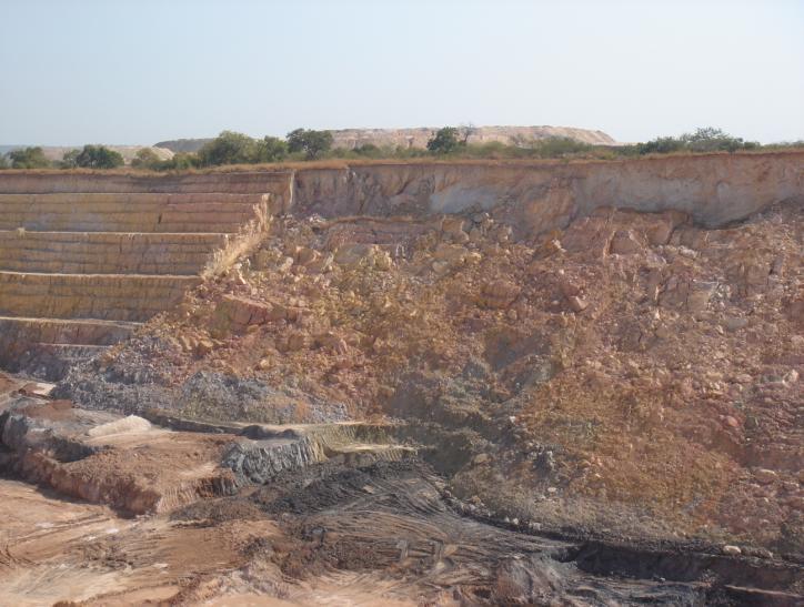
124 Plate 32 - Tension crack Plate 33 - Composite failure (mix of failure mechanisms - rock mass/circular failure) Plate 34 - Composite failure (mix of failure mechanisms - rock mass/circular failure)


125 Plate 35 - Wedge failure Plate 36 - Wedge failure 3.13 CONCLUSION The aim of the guideline document is to assist the mine surveyor in establishing a new or maintaining an effective slope stability monitoring system. It is necessary for independent mine survey consultants to perform regular reviews of the slope monitoring system with the objective of reporting on the effectiveness of the system. The review
UNIVERSITY OF THE WITWATERSRAND SCHOOL OF MINING ENGINEERING, FACULTY OF ENGINEERING AND THE BUILT ENVIRONMENT
 UNIVERSITY OF THE WITWATERSRAND SCHOOL OF MINING ENGINEERING, FACULTY OF ENGINEERING AND THE BUILT ENVIRONMENT Design Principles for a Survey Slope Monitoring System. A research report submitted to the
TRAFF IC CALMING POLICY
 TRAFF IC CALMING POLICY Policy No: 45396 Approved by Council 28 May 2008 C11/05/08 Further amendment by Council 22 June 2011 vide c08/06/11 Contents 1 Problem Statement 1 2 Desired Outcomes 2 3 Strategic
Wade Reynolds 1 Frank Young 1,2 Peter Gibbings 1,2. University of Southern Queensland Toowoomba 4350 AUSTRALIA
 A Comparison of Methods for Mapping Golf Greens Wade Reynolds 1 Frank Young 1,2 Peter Gibbings 1,2 1 Faculty of Engineering and Surveying 2 Australian Centre for Sustainable Catchments University of Southern
Understanding safety life cycles
 Understanding safety life cycles IEC/EN 61508 is the basis for the specification, design, and operation of safety instrumented systems (SIS) Fast Forward: IEC/EN 61508 standards need to be implemented
MINE SAFETY TARGETED ASSESSMENT PROGRAM. Ground or strata failure NSW metalliferous mines. April
 MINE SAFETY TARGETED ASSESSMENT PROGRAM Ground or strata failure NSW metalliferous mines April 2017 www.resourcesandenergy.nsw.gov.au Document control Publication title: Ground or strata failure NSW metalliferous
Purpose. Scope. Process flow OPERATING PROCEDURE 07: HAZARD LOG MANAGEMENT
 SYDNEY TRAINS SAFETY MANAGEMENT SYSTEM OPERATING PROCEDURE 07: HAZARD LOG MANAGEMENT Purpose Scope Process flow This operating procedure supports SMS-07-SP-3067 Manage Safety Change and establishes the
PORTS AUSTRALIA. PRINCIPLES FOR GATHERING AND PROCESSING HYDROGRAPHIC INFORMATION IN AUSTRALIAN PORTS (Version 1.5 November 2012)
") PORTS AUSTRALIA PRINCIPLES FOR GATHERING AND PROCESSING HYDROGRAPHIC INFORMATION IN AUSTRALIAN PORTS (Version 1.5 November 2012) PREFACE These Principles have been prepared by the Hydrographic Surveyors
PORTS AUSTRALIA PRINCIPLES FOR GATHERING AND PROCESSING HYDROGRAPHIC INFORMATION IN AUSTRALIAN PORTS (Version 1.5 November 2012) PREFACE These Principles have been prepared by the Hydrographic Surveyors
Questions & Answers About the Operate within Operate within IROLs Standard
 Index: Introduction to Standard...3 Expansion on Definitions...5 Questions and Answers...9 Who needs to comply with this standard?...9 When does compliance with this standard start?...10 For a System Operator
Geotechnics, Face and Stockpile Operations
 Quarries National Joint Advisory Committee (QNJAC) Geotechnics, Face and Stockpile Operations Information Sheet 4 October 2012 Duties of the Operator This information sheet has been developed by the Quarries
Advanced Test Equipment Rentals ATEC (2832) OMS 600
 OMS 600") Established 1981 Advanced Test Equipment Rentals www.atecorp.com 800-404-ATEC (2832) OMS 600 Continuous partial discharge monitoring system for power generators and electrical motors Condition monitoring
Established 1981 Advanced Test Equipment Rentals www.atecorp.com 800-404-ATEC (2832) OMS 600 Continuous partial discharge monitoring system for power generators and electrical motors Condition monitoring
Review and Assessment of Engineering Factors
 Review and Assessment of Engineering Factors 2013 Learning Objectives After going through this presentation the participants are expected to be familiar with: Engineering factors as follows; Defense in
A study on the relation between safety analysis process and system engineering process of train control system
 A study on the relation between safety analysis process and system engineering process of train control system Abstract - In this paper, the relationship between system engineering lifecycle and safety
THE CANDU 9 DISTRffiUTED CONTROL SYSTEM DESIGN PROCESS
 THE CANDU 9 DISTRffiUTED CONTROL SYSTEM DESIGN PROCESS J.E. HARBER, M.K. KATTAN Atomic Energy of Canada Limited 2251 Speakman Drive, Mississauga, Ont., L5K 1B2 CA9900006 and M.J. MACBETH Institute for
AUSTRALIA ARGENTINA CANADA EGYPT NORTH SEA U.S. CENTRAL U.S. GULF. SEMS HAZARD ANALYSIS TRAINING September 29, 2011
 AUSTRALIA ARGENTINA CANADA EGYPT NORTH SEA U.S. CENTRAL U.S. GULF SEMS HAZARD ANALYSIS TRAINING September 29, 2011 Purpose The purpose of this meeting is to provide guidelines for determination of hazard
The Effect of a Seven Week Exercise Program on Golf Swing Performance and Musculoskeletal Screening Scores
 The Effect of a Seven Week Exercise Program on Golf Swing Performance and Musculoskeletal Screening Scores 2017 Mico Hannes Olivier Bachelor of Sport Science Faculty of Health Sciences and Medicine Bond
The Best Use of Lockout/Tagout and Control Reliable Circuits
 Session No. 565 The Best Use of Lockout/Tagout and Control Reliable Circuits Introduction L. Tyson Ross, P.E., C.S.P. Principal LJB Inc. Dayton, Ohio Anyone involved in the design, installation, operation,
Strategic Plan for Sevens Rugby. September 2006
 Strategic Plan for Sevens Rugby September 2006 Introduction The promotion of Sevens has been instrumental in taking Rugby to new territories and regions. The continued growth of Sevens would help achieve
Best Practice RBI Technology Process by SVT-PP SIMTECH
 Best Practice RBI Technology Process by SVT-PP SIMTECH We define the best practice in RBI as a proactive technology process which is used to formally and reliably optimise the inspection efforts for each
#19 MONITORING AND PREDICTING PEDESTRIAN BEHAVIOR USING TRAFFIC CAMERAS
 #19 MONITORING AND PREDICTING PEDESTRIAN BEHAVIOR USING TRAFFIC CAMERAS Final Research Report Luis E. Navarro-Serment, Ph.D. The Robotics Institute Carnegie Mellon University November 25, 2018. Disclaimer
Advances in Low Voltage Motor Control Center (MCC) Technology Help Reduce Arc-Flash Hazards and Minimize Risks
 Technology Help Reduce Arc-Flash Hazards and Minimize Risks") Advances in Low Voltage Motor Control Center (MCC) Technology Help Reduce Arc-Flash Hazards and Minimize Risks Selecting the right MCC equipment leads to improved plant safety, helping protect people and
Advances in Low Voltage Motor Control Center (MCC) Technology Help Reduce Arc-Flash Hazards and Minimize Risks Selecting the right MCC equipment leads to improved plant safety, helping protect people and
BSR GPTC Z TR GM References and Reporting Page 1 of 8
 Page 1 of 8 PRIMARY: 192.605 SECONDARY: 191.23 PURPOSE: Review guide material added by TR 2009-17 to 5.1(e) and consider restructuring the guide material under 192.605 as discussed further below. ORIGIN/RATIONALE
Safety Assessment of Installing Traffic Signals at High-Speed Expressway Intersections
 Safety Assessment of Installing Traffic Signals at High-Speed Expressway Intersections Todd Knox Center for Transportation Research and Education Iowa State University 2901 South Loop Drive, Suite 3100
NZQA unit standard version 3 Page 1 of 8. Manage the mine ventilation system at an extractive site
 Page 1 of 8 Title Manage the mine ventilation system at an extractive site Level 7 Credits 30 Purpose This unit standard covers the development and management of the operation and maintenance of a mine
Training Fees 3,400 US$ per participant for Public Training includes Materials/Handouts, tea/coffee breaks, refreshments & Buffet Lunch.
 Training Title DISTRIBUTED CONTROL SYSTEMS (DCS) 5 days Training Venue and Dates DISTRIBUTED CONTROL SYSTEMS (DCS) Trainings will be conducted in any of the 5 star hotels. 5 22-26 Oct. 2017 $3400 Dubai,
1.0 PURPOSE 2.0 REFERENCES
 Page 1 1.0 PURPOSE 1.1 This Advisory Circular provides Aerodrome Operators with guidance for the development of corrective action plans to be implemented in order to address findings generated during safety
Article. By: Capt. Himadri Lahiry; Prof. Reza Ziarati
 July 2014 marifuture.org Article Reduction of collisions risks at sea. A study of recent casualties through collisions and endeavour to predict the changes required in the use and application of existing
Minimum standard of competence for electro-technical officers (STCW Reg III/6) Electrical, electronic and control engineering at the operational level
 Electrical, electronic and control engineering at the operational level") Minimum standard of for electro-technical officers (STCW Reg III/6) Function: Electrical, electronic and control engineering at the operational level Monitor the Basic understanding of the Examination
Minimum standard of for electro-technical officers (STCW Reg III/6) Function: Electrical, electronic and control engineering at the operational level Monitor the Basic understanding of the Examination
GD 0043/18 ACTIVE TRAVEL STRATEGY
 GD 0043/18 ACTIVE TRAVEL STRATEGY 2018-2021 May 2018 Minister s Introduction There is strong evidence that regular physical activity reduces the risk of a range of health conditions. The best way to increase
Title: Standard Operating Procedure for Elemental and Organic Carbon (EC and OC) using Non-Dispersive Infrared Detection (NDIR)
 using Non-Dispersive Infrared Detection (NDIR)") Procedure No: SOP-025 Revision No: 1.0 (January 21, 2011) Page No.: 1 of 8 1. INTRODUCTION AND SCOPE To obtain timely data for the purpose of air quality assessment, air quality trend reporting and to
Procedure No: SOP-025 Revision No: 1.0 (January 21, 2011) Page No.: 1 of 8 1. INTRODUCTION AND SCOPE To obtain timely data for the purpose of air quality assessment, air quality trend reporting and to
Every things under control High-Integrity Pressure Protection System (HIPPS)
") Every things under control www.adico.co info@adico.co Table Of Contents 1. Introduction... 2 2. Standards... 3 3. HIPPS vs Emergency Shut Down... 4 4. Safety Requirement Specification... 4 5. Device Integrity
Every things under control www.adico.co info@adico.co Table Of Contents 1. Introduction... 2 2. Standards... 3 3. HIPPS vs Emergency Shut Down... 4 4. Safety Requirement Specification... 4 5. Device Integrity
Report to COUNCIL for decision
 17 152 Title: Section: Prepared by: Olympic Pool Business Case Community & Recreation Andrew White (Community & Recreation Manager) Meeting Date: 18 May 2017 Legal Financial Significance = Medium Report
MANUFACTURING TECHNICAL INSTRUCTIONS - SAFETY FALL HAZARD CONTROL REQUIREMENTS SERIES & NO. SMI - 157
 1 of 6 1.0 PURPOSE To establish minimum requirements and guidelines for controlling hazardous exposure of personnel to falls from working elevations in conformance with Federal and State OSHA rules and
Our Approach to Managing Level Crossing Safety Our Policy
 Our Approach to Managing Level Crossing Safety Our Policy Our policy towards managing level crossing risk is: that we are committed to reducing the risk at level crossings where reasonably practicable
DOCKYARD PORT OF PLYMOUTH HARBOUR SAFETY PLAN. Issue 2 Jun 13
 DOCKYARD PORT OF PLYMOUTH HARBOUR SAFETY PLAN 1 CONTENTS Para Page 1. Introduction 3 2. Safety Management System 3 3 Reduce Risks 4 4. Identification of the Hazards and Risks... 4 5. Conformance with the
[ Fundación PONS ] [ Fundación PONS ] [ Expertise PONS ] Investing in road safety
![[ Fundación PONS ] [ Fundación PONS ] [ Expertise PONS ] Investing in road safety](/thumbs/73/68505603.jpg "[ Fundación PONS ] [ Fundación PONS ] [ Expertise PONS ] Investing in road safety") With more than 60 years experience, PONS is a leading company in the fields of road safety and sustainable transportation planning, providing worldwide support with auditing, consultancy and training services,
With more than 60 years experience, PONS is a leading company in the fields of road safety and sustainable transportation planning, providing worldwide support with auditing, consultancy and training services,
SEMS II: BSEE should focus on eliminating human error
 SEMS II: BSEE should focus on eliminating human error How US companies can prevent accidents on start-ups and shut-downs by using valve interlocks The proposed changes to BSEE s SEMS (Safety and Environmental
Good Morning everyone, I will be talking this morning about the review and restructure of Cruise Whitsundays Safety Management Systems.
 Good Morning everyone, I will be talking this morning about the review and restructure of Cruise Whitsundays Safety Management Systems. 1 This presentation is about the restructure of Cruise Whitsundays
Chapter 2.7 Bylaw sport governance and management
 Chapter 2.7 Bylaw sport governance and management 2010 International Paralympic Committee Adenauerallee 212-214 Tel. +49 228 2097-200 www.paralympic.org 53113 Bonn, Germany Fax +49 228 2097-209 info@paralympic.org
Electrical, electronic and control engineering at the operational level
 STCW Code Table A-III/6 Specification of minimum standard of for electro-technical officers Ref: https://www.edumaritime.net/stcw-code Source: IMO Function: Electrical, electronic and control engineering
Characterizing Ireland s wave energy resource
 Snapshots of Doctoral Research at University College Cork 2011 Characterizing Ireland s wave energy resource Brendan Cahill Hydraulics & Maritime Research Centre, UCC Introduction In theory, the energy
Engineering Safety into the Design
 Engineering safety into the design Peter Scantlebury P.Eng Technical Safety Manager Amec Foster Wheeler, Oil & Gas Canada Abstract Safety by design is Amec Foster Wheeler s systematic approach to engineering
2017 IIHF BID REGULATIONS
 2017 IIHF BID REGULATIONS May 2014 Preface The foregoing IIHF Bid Regulations has been developed by the IIHF strictly for the purpose of improving the selection process for the venues of IIHF top-level
APPLYING VIRTUAL REALITY TO ONTARIO MINE RESCUE OPERATIONS
 APPLYING VIRTUAL REALITY TO ONTARIO MINE RESCUE OPERATIONS Alex Gryska, Manager Mine Rescue Mines and Aggregates Safety and Health Association () 2005 ACKNOWLEDGEMENTS Research relating to this Virtual
The Safety Case. Structure of Safety Cases Safety Argument Notation
 The Safety Case Structure of Safety Cases Safety Argument Notation Budapest University of Technology and Economics Department of Measurement and Information Systems The safety case Definition (core): The
To comply with the OHS Act, the responsible manager must carry out and document the following:
 Owner: Manager Health, Wellbeing and Safety Last Update: 10 January 2018 Contents 1. Purpose... 1 2. Minimum Compliance Requirements... 1 3. Definitions... 2 4. Legislative requirements under the OHS Act
AUSTRIAN RISK ANALYSIS FOR ROAD TUNNELS Development of a new Method for the Risk Assessment of Road Tunnels
 - 204 - ABSTRACT AUSTRIAN RISK ANALYSIS FOR ROAD TUNNELS Development of a new Method for the Risk Assessment of Road Tunnels Kohl B. 1, Botschek K. 1, Hörhan R. 2 1 ILF, 2 BMVIT In Austria, in the past
Pressure Equipment Directive PED 2014/68/EU Commission's Working Group "Pressure"
 I. MISCELLANEOUS Guideline I-01 Guideline related to: Article 4 paragraph 3 What is to be understood by "sound engineering practice"? Sound engineering practice means, without prejudice to Article 5, paragraph
ANGLO AMERICAN S OPEN CUT COAL MINES IN AUSTRALIA. John Hoelle Ismet Canbulat
 A RISK RATING SYSTEM FOR ANGLO AMERICAN S OPEN CUT COAL MINES IN AUSTRALIA John Hoelle Ismet Canbulat ANGLO AMERICAN PLC Anglo American Metallurgical Coal is a wholly owned subsidiary of Anglo American
Engineering: Measurement Technology Pressure/Level (SCQF level 6)
") National Unit Specification: general information CODE F5KT 12 SUMMARY This Unit can be delivered as part of a National Qualification Group Award but can also be taken as a free-standing Unit. This Unit
National Unit Specification: general information CODE F5KT 12 SUMMARY This Unit can be delivered as part of a National Qualification Group Award but can also be taken as a free-standing Unit. This Unit
IMCA DP Station Keeping Bulletin 04/18 November 2018
 DP STATION KEEPING BULLETIN IMCA DP Station Keeping Bulletin 04/18 November 2018 The following event trees have been compiled from recent reports received by IMCA. The originators granted IMCA permission
AC : MEASUREMENT OF HYDROGEN IN HELIUM FLOW
 AC 2010-2145: MEASUREMENT OF HYDROGEN IN HELIUM FLOW Randy Buchanan, University of Southern Mississippi Christopher Winstead, University of Southern Mississippi Anton Netchaev, University of Southern Mississippi
Systems of Accounting for and Control of Nuclear Material
 Systems of Accounting for and Control of Nuclear Material STATES' OBLIGATIONS TO ESTABLISH AN ACCOUNTING AND CONTROL SYSTEM The implementation of safeguards agreements has always involved governmental
International Standard for Athlete Evaluation. September 2016
 International Standard for Athlete Evaluation September 2016 International Paralympic Committee Adenauerallee 212-214 Tel. +49 228 2097-200 www.paralympic.org 53113 Bonn, Germany Fax +49 228 2097-209 info@paralympic.org
Risk Assessment for Stone Quarry Mining is among the most hazardous activities all around the world, being always accompanied with different
 Risk Assessment for Stone Quarry Mining is among the most hazardous activities all around the world, being always accompanied with different incidents, injuries, loss of lives, and property damages. Dimension
Road Safety: African Action Plan for the Global Decade of Action for Road Safety
 The First Ordinary Session of the African Union Specialized Technical Committee on Transport, Intercontinental and Interregional Infrastructures, Energy and Tourism THEME: Financing Infrastructure in Africa
CONTROL OF SUBSTANCES HAZARDOUS TO HEALTH PROCEDURE
 CONTROL OF SUBSTANCES HAZARDOUS TO HEALTH PROCEDURE 1. INTRODUCTION The University uses substances hazardous to health in many of its operations, and accepts that it has a duty of care to reduce exposure
The RCM Analyst - Beyond RCM
 The RCM Analyst - Beyond RCM darylm@strategic-advantages.com About the Author: Daryl Mather was originally trained in RCM in 1991, after which he was involved in the application of the method through a
Reliability engineering is the study of the causes, distribution and prediction of failure.
 Reliability engineering: Reliability is the probability that a system or component will perform without failure for a specified period of time under specified operating conditions. Reliability engineering
ISOLATION ISSUE 2 1 AIM 2 4 REASONS FOR INCLUSION 3 6 PLANT AND EQUIPMENT REQUIREMENTS 3 7 SYSTEM & PROCEDURAL REQUIREMENTS 4 8 PEOPLE REQUIREMENTS 6
 CONTENTS PAGE 1 AIM 2 2 APPLICATION 2 3 DEFINITIONS 2 4 REASONS FOR INCLUSION 3 5 REQUIREMENTS 3 6 PLANT AND EQUIPMENT REQUIREMENTS 3 7 SYSTEM & PROCEDURAL REQUIREMENTS 4 8 PEOPLE REQUIREMENTS 6 APPENDIX
Safe management of industrial steam and hot water boilers A guide for owners, managers and supervisors of boilers, boiler houses and boiler plant
 Health and Safety Executive Safe management of industrial steam and hot water boilers A guide for owners, managers and supervisors of boilers, boiler houses and boiler plant Background Accidents involving
Safety assessments for Aerodromes (Chapter 3 of the PANS-Aerodromes, 1 st ed)
") Safety assessments for Aerodromes (Chapter 3 of the PANS-Aerodromes, 1 st ed) ICAO MID Seminar on Aerodrome Operational Procedures (PANS-Aerodromes) Cairo, November 2017 Avner Shilo, Technical officer
Safety assessments for Aerodromes (Chapter 3 of the PANS-Aerodromes, 1 st ed) ICAO MID Seminar on Aerodrome Operational Procedures (PANS-Aerodromes) Cairo, November 2017 Avner Shilo, Technical officer
CONCLUSIONS AND RECOMMENDATIONS
 CHAPTER 5: CONCLUSIONS AND RECOMMENDATIONS 5.1 General This chapter presents the conclusions and main recommendations flowing from the analysis of level crossing systems and safety performance in several
Remote sensing standards: their current status and significance for offshore projects
 Remote sensing standards: their current status and significance for offshore projects Peter J M Clive Technical Development Consultant SgurrEnergy Ltd 225 Bath Street Glasgow G2 4GZ E: peter.clive@sgurrenergy.com
Drilling Efficiency Utilizing Coriolis Flow Technology
 Session 12: Drilling Efficiency Utilizing Coriolis Flow Technology Clement Cabanayan Emerson Process Management Abstract Continuous, accurate and reliable measurement of drilling fluid volumes and densities
EUSMUNC06 (SQA Unit Code - FG2W 04) Locate and avoid supply apparatus for Utilities Network Construction
 Locate and avoid supply apparatus for Utilities Network Construction") Locate and avoid supply apparatus for Utilities Network Construction Overview This national occupational standard defines the competence involved in locating and avoiding supply apparatus by using appropriate
Locate and avoid supply apparatus for Utilities Network Construction Overview This national occupational standard defines the competence involved in locating and avoiding supply apparatus by using appropriate
Health, Safety and Environment Management System. HSE-PRO-008 HSE Responsibilities Procedure
 Health, Safety and Environment Management System HSE-PRO-008 HSE Responsibilities Procedure 1 Table of Contents 1 Intent... 3 2 Scope... 3 3 Definitions... 3 4 Duty, Obligations and Responsibilities...
Section J. How to develop safety elements for project safety management system. How to develop safety elements for project SMS
 Section J How to develop safety elements for project safety management system 1. Once the project management has developed or adopted a safety policy, it needs to develop safety elements to meet the objectives
How HSE regulates onshore oil and gas
 Health and Safety Executive How HSE regulates onshore oil and gas Paul Bradley (Operations Manager Wells and Mines) Craig Norman (Well Engineering and Operations Inspector) Health & Safety Executive Health
Bus and Transit Lane Review Update
 Board Meeting / 25 February 2013 Agenda Item no.8(i) Bus and Transit Lane Review Update Glossary Auckland Transport New Zealand Transport Agency Transit Two Transit Three (AT) (NZTA) (T2) (T3) Executive
Having an Impact Using Hazard Elimination and Control at Mount Isa s Copper Mine. Brett Cribb Senior Long Term Planning Engineer Mount Isa Operations
 Having an Impact Using Hazard Elimination and Control at Mount Isa s Copper Mine. Brett Cribb Senior Long Term Planning Engineer Mount Isa Operations Abstract Mount Isa Mines has been producing ore from
Exhibit 1 PLANNING COMMISSION AGENDA ITEM
 Exhibit 1 PLANNING COMMISSION AGENDA ITEM Project Name: Grand Junction Circulation Plan Grand Junction Complete Streets Policy Applicant: City of Grand Junction Representative: David Thornton Address:
Distributed Control Systems
 Unit 41: Unit code Distributed Control Systems M/615/1509 Unit level 5 Credit value 15 Introduction With increased complexity and greater emphasis on cost control and environmental issues, the efficient
DESIGN CODE. Enterprise West Harlow London Road North Design Code 21
 DESIGN CODE Enterprise West Essex @ Harlow London Road North Design Code 21 4 MAXIMUM BUILDING HEIGHTS 4.1 Table 4A sets out maximum building height standards for each character area within the LDO boundary.
DETERMINATION OF SAFETY REQUIREMENTS FOR SAFETY- RELATED PROTECTION AND CONTROL SYSTEMS - IEC 61508
 DETERMINATION OF SAFETY REQUIREMENTS FOR SAFETY- RELATED PROTECTION AND CONTROL SYSTEMS - IEC 61508 Simon J Brown Technology Division, Health & Safety Executive, Bootle, Merseyside L20 3QZ, UK Crown Copyright
SAEMA Document No. SDN Original Issue Date: April 2017 Revision Reference: Revision Date: Not later than end of April 2019
 ------------------------------------------------------------------------------------------------------------------------------------- SAEMA Document No. SDN. 14000 Original Issue Date: April 2017 Revision
Memo. Lake Elev. (ft) Target Depth (ft) Azi. ( )
 Target Depth (ft) Azi. ( )") SRK Consulting (Canada) Inc. 2200 1066 West Hastings Street Vancouver, BC V6E 3X2 T: +1.604.681.4196 F: +1.604.687.5532 vancouver@srk.com www.srk.com Memo To: Will Brits, Wentzel Coetzer Client: Cabot
SRK Consulting (Canada) Inc. 2200 1066 West Hastings Street Vancouver, BC V6E 3X2 T: +1.604.681.4196 F: +1.604.687.5532 vancouver@srk.com www.srk.com Memo To: Will Brits, Wentzel Coetzer Client: Cabot
NAVIGATIONAL SAFETY MANAGEMENT SYSTEM MANUAL
 DUCHY OF CORNWALL. ST MARY S HARBOUR AUTHORITY NAVIGATIONAL SAFETY MANAGEMENT SYSTEM MANUAL WORKING DRAFT Page 1 of 25 CONTENTS 1 1. NAVIGATIONAL SAFETY MANAGEMENT SYSTEMS PRINCIPLES 3 2. INTRODUCTION
API MPMS Chapter 17.6 Guidelines for Determining the Fullness of Pipelines between Vessels and Shore Tanks
 API MPMS Chapter 17.6 Guidelines for Determining the Fullness of Pipelines between Vessels and Shore Tanks 1. Scope This document describes procedures for determining or confirming the fill condition of
Investigations into the identification and control of outburst risk in Australian underground coal mines
 Investigations into the identification and control of outburst risk in Australian underground coal mines Dennis J Black 1,2 1. Principal Consultant, PacificMGM, Bulli NSW 2516, Australia 2. Honorary Fellow,
This objective implies that all population groups should find walking appealing, and that it is made easier for them to walk more on a daily basis.
 Walking for life The Norwegian Walking Strategy Guro Berge Norwegian public Roads Administration "Walking for life" is the slogan for the National Walking Strategy that is now being formulated in Norway.
CRICKET HONG KONG 2019 AGM CHAIRMAN S REPORT
 CRICKET HONG KONG 2019 AGM CHAIRMAN S REPORT INTRODUCTION The 2019 AGM is a major milestone in the history of cricket in Hong Kong. The board elected at this AGM will be the first under the new constitution
OPERATIONL RISK ASSESSMENTS
 OPERATIONL RISK ASSESSMENTS Table of Contents SUBJECT Introduction... 3 Formal Risk Assessment Rating... 6 Action Criteria Framework... 7 Summary - Overall Highest To Lowest Risk... 8 DEPARTMENT Operation
BYE-LAWS TO ARTICLE 56 DUTIES OF THE COMMISSIONS AND WORKING GROUPS
 Appendix 6 BYE-LAWS TO ARTICLE 56 DUTIES OF THE COMMISSIONS AND WORKING GROUPS 1. General Duties of the Commissions Each Commission shall: 1. Meet as required when so requested by their Chairs. In principle,
GOVERNMENT OF SASKATCHEWAN SUBMISSION TO THE RAILWAY SAFETY ACT REVIEW PANEL
 GOVERNMENT OF SASKATCHEWAN SUBMISSION TO THE RAILWAY SAFETY ACT REVIEW PANEL Saskatchewan Highways & Transportation May 29, 2007 I Introduction Government of Saskatchewan Submission To the Railway Safety
Aalborg Universitet. Published in: Proceedings of Offshore Wind 2007 Conference & Exhibition. Publication date: 2007
 Aalborg Universitet Design Loads on Platforms on Offshore wind Turbine Foundations with Respect to Vertical Wave Run-up Damsgaard, Mathilde L.; Gravesen, Helge; Andersen, Thomas Lykke Published in: Proceedings
Tools for safety management Effectiveness of risk mitigation measures. Bernhard KOHL
 Tools for safety management Effectiveness of risk mitigation measures Bernhard KOHL Contents Background Tools for risk-based decision making Safety measures Illustration of methodical approach Case studies
CONTRACTOR SAFETY INDUCTION HANDBOOK
 CONTRACTOR SAFETY INDUCTION HANDBOOK As a valued contractor for Total Group we would ask that you read and carefully consider the details included in this document. Total Group carry out work for a number
STATE OF NEW YORK PUBLIC SERVICE COMMISSION. At a session of the Public Service Commission held in the City of Albany on August 20, 2003
 STATE OF NEW YORK PUBLIC SERVICE COMMISSION At a session of the Public Service Commission held in the City of Albany on August 20, 2003 COMMISSIONERS PRESENT: William M. Flynn, Chairman Thomas J. Dunleavy
USING HAZOP TO IDENTIFY AND MINIMISE HUMAN ERRORS IN OPERATING PROCESS PLANT
 USING HAZOP TO IDENTIFY AND MINIMISE HUMAN ERRORS IN OPERATING PROCESS PLANT Chris Lyth, Tracerco, Billingham, Cleveland, UK Ian Bradby, ABB Engineering Services, Billingham Cleveland, UK This joint paper
CITY OF SAINT JOHN TRAFFIC CALMING POLICY
 CITY OF SAINT JOHN TRAFFIC CALMING POLICY VERSION: 1.0 April 10, 2012 Pedestrians, Cyclists and Motorists Sharing Street Spaces CONTENTS INTRODUCTION... 3 POLICY GOAL... 3 POLICY OBJECTIVES... 3 GUIDING
Bringing Pressure Under Control: Harnessing Control Valves for Intelligent Water Networks. A Report on Best Practice from TALIS
 1 Bringing Pressure Under Control: Harnessing Control Valves for Intelligent Water Networks A Report on Best Practice from TALIS 2 Introduction For a generation focused on smart systems and big data, it
CPCS renewal test factsheet
 CPCS renewal test factsheet Introduction to the CPCS renewal test The industry-led CPCS Management Committee has determined that key safety-related knowledge must be checked on each category prior to the
GRUNDFOS industry GRUNDFOS CR MONITOR. Intelligent warning
 GRUNDFOS industry GRUNDFOS CR MONITOR Intelligent warning Look into the future with the CR monitor Tired of having to overhaul your pumps on a regular basis only to find that they are operating flawlessly?
Standards of Practice Personal Protective Equipment
 Document Authority: I. PURPOSE Standards of Practice Personal Protective Equipment Whenever feasible, hazards must be eliminated through engineering, and/or administrative controls, prior to resorting
APPENDIX A1 - Drilling and completion work programme
 APPENDIX A1 - Drilling and completion work programme Information about the well and drilling To the extent possible, the international system of units (SI) should be adhered to, and the drilling programme
ONE SIZE DOESN T FIT ALL RECONCILING OVERLAPPING TRANSPORT NETWORKS IN A CONSTRAINED URBAN ENVIRONMENT
 One Size Doesn t Fit All S Corbett, C Chenery Page 1 ONE SIZE DOESN T FIT ALL RECONCILING OVERLAPPING TRANSPORT NETWORKS IN A CONSTRAINED URBAN ENVIRONMENT Authors/Presenters: Sam Corbett, Principal Transport
Understanding the How, Why, and What of a Safety Integrity Level (SIL)
") Understanding the How, Why, and What of a Safety Integrity Level (SIL) Audio is provided via internet. Please enable your speaker (in all places) and mute your microphone. Understanding the How, Why, and
Understanding the How, Why, and What of a Safety Integrity Level (SIL) Audio is provided via internet. Please enable your speaker (in all places) and mute your microphone. Understanding the How, Why, and
MODEL AERONAUTICAL ASSOCIATION OF AUSTRALIA
 ASSOCIATION OF AUSTRALIA APPROVED: MAAA PRESIDENT Date: 27/10/2017 Table of Contents 1. INTRODUCTION... 1 2. DEFINITIONS... 2 3. POLICY... 2 4. BASIC PROCEDURE... 3 5. EVALUATION OF RISK... 4 6. POSSIBLE
GUIDELINES FOR MOUNTAIN RESCUE TEAMS IN SCOTLAND
 GUIDELINES FOR MOUNTAIN RESCUE TEAMS IN SCOTLAND In response to the ever changing requirements and demands on the voluntary rescue provision, the Mountain Rescue Committee of Scotland has prepared these
RESOLUTION MSC.94(72) (adopted on 22 May 2000) PERFORMANCE STANDARDS FOR NIGHT VISION EQUIPMENT FOR HIGH-SPEED CRAFT (HSC)
 (adopted on 22 May 2000) PERFORMANCE STANDARDS FOR NIGHT VISION EQUIPMENT FOR HIGH-SPEED CRAFT (HSC)") MSC 72/23/Add.1 RESOLUTION MSC.94(72) EQUIPMENT FOR HIGH-SPEED CRAFT (HSC) THE MARITIME SAFETY COMMITTEE, RECALLING Article 28(b) of the Convention on the International Maritime Organization concerning
MSC 72/23/Add.1 RESOLUTION MSC.94(72) EQUIPMENT FOR HIGH-SPEED CRAFT (HSC) THE MARITIME SAFETY COMMITTEE, RECALLING Article 28(b) of the Convention on the International Maritime Organization concerning