Multibeam and Laser: Combined High Resolution. Hydrographic Surveying for Civil Engineering Project Support
|
|
|
- Dortha Parsons
- 6 years ago
- Views:
Transcription


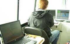
1 Multibeam and Laser: Combined High Resolution Hydrographic Surveying for Civil Engineering Project Support John Dillon-Leetch,Port of London Authority Duncan Mallace, NetSurvey, UK Overview Introduction to MBES capability Engineering Support Surveys : Identifying the Market Project Development Delivery Methods: Acquisition Processing Opportunities and Challenges Conclusions 1


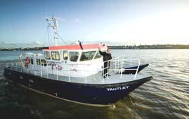
2 Verifier Galloper YANTLET BRENT MBES Equipment 2004: Reson SeaBat 8101: Charting, Navigation Support Surveys London Gateway Dredge Support 2006: Reson SeaBat 8125 : Wreck Surveys, Archeological assessment, Business case Bridge Surveys Engineering Support 2008: - Reson SeaBat 7125 : Mobility, Access, Flexibility, Redundancy of plant Position fixing: : Applanix PosMV 320 Inertial navigation unit providing positional and orientation data. POSPac post processing to RTK Centimetric Accuracy Software: Hypack and Fledermaus. 2


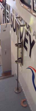
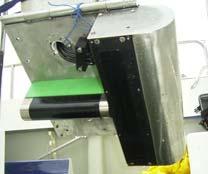
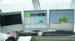
3 MBES Boat Fits Yantlet New MBES Vessel 2008 Transportable by trailer project or chartered work further from base. High Speed (28 knots) Shallow Draft 0.3m SBES, 1.1m MBES Moonpool for deployment. Tilting Head 3

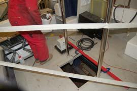
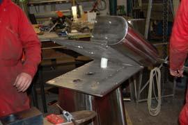
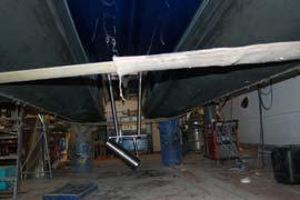
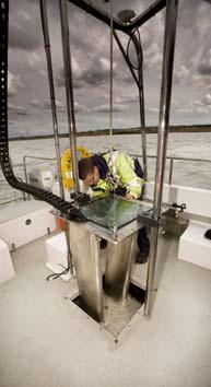
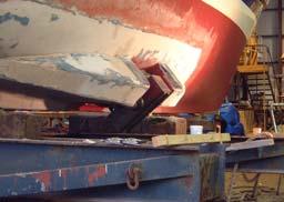
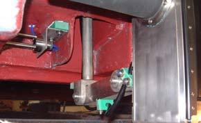
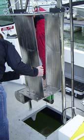
4 Boat Fit: 7125 Moonpool Deployment 4


5 Berth Survey High Resolution. Scour System can measure depths beneath structures & vessels Controlling Depths Slope Stability Speed of survey 5 times faster than SBES resulting in little or no berth downtime Visualisation Capability Structure Monitoring-Scour Damage 5


6 Plan View Showing Undercutting Obstruction Detection XL-XS Standard Port use delivering high accuracy & repeatability. Extending this to vertical Structures involved quantifying achievable accuracies and deliverable results 6


7 Assessing the System Capabilities 8125: Could it do what it said on the tin? Civil Engineering Support Education of Clients Oceanology 2006 Baseline Surveying Structure examination Site Investigation Wall Condition Surveys: Pre/Post Works Free-viewing software methodologies Powerful Project support capability. Value Added particularly to non-surveyors 7


8 Dover: Quay Wall Survey Monitoring Client Specified detection of 1x1m granite blocks. 7000m of breakwater surveyed in two tides. Alternative/ traditional method 30 days diving Experimentation of amalgamation with other data sources. Multibeam data knitted to surface photography Proves system & makes data interpretation easier for non-surveying client. 8


9 Proving the System Canary Wharf: July 2007 Joint Venture with Engineering Diving Company Survey Specs : +/- 3cms in XY and +/- 7cms in Z. Identification of anomalies such as damage, cracks, distortions, abnormalities or other defects of +/-5cms in extent 99% correlation between MBES and Diver survey for all quay walls. Feature Information Feature ID: WWharf_021 Wall: Wood Wharf 5 Easting: mE Northing: mN Chainage: 65m Depth: m Recess: 0.10m Length: 0.20m Notes: Vertical recess in wall 9


10 Fledermaus - Processing Challenges High Resolution Data X-Sections Profile Information Profile ID: WWharf_P02 Wall: Wood Wharf 2 Chainage: 20m Gradient: 88 degs Notes: Wall in good condition. Profile Information Profile ID: WWharf_P05 Wall: Wood Wharf 2 Chainage: 119m Gradient: 92 degs Notes: This wall section is just to the west of the ladder and has severe damage to the top two-thirds with recesses of up to 0.4 m. The wall is also overhanging slightly at this point which might indicate that it is being pushed from behind. 10
 Scanner was a Riegl Z240i which has a 500m range and scanned")


11 Laser Scanning 2008 Riegl Laser mobilised to PLA survey vessel Galloper (Aug 08) Scanner was a Riegl Z240i which has a 500m range and scanned and registered using Riegl Riscan Pro Data was cleaned up in Pointools & Fledermaus Edit to remove stray points and false objects in the scans ( cars, boats, people, and filter data if necessary. Static scanning produces 10-15mm spacing on surfaces where possible. Boat based 5-10cms dependant on boat speed. Assessed PPK and tracking TS positioning control. Static Scanning of Survey Vessel System : Faro Photon2 Phase Based Laser 11


12 Laser Scanning Schematic Laser Data Examples Savoy Pier Scan Imagery Westminster Area Overview 12

13 Engineering Project Support (Hydrodynamic & Civil) MBES and Laser Surveys deliver:- Tangible Results. Powerful Project Support Capability. Safe & Non Intrusive methodology Augment or replace Dive Surveys Additional value added for Lidar augmentation for structural inspection, asset tracking, baseline survey data. Opportunities and Challenges 1000 s miles of inland waterways & crossings requiring surveying Tunnel Surveys? 40 miles of tunnels Prohibitive cost of de-watering Issues: Shallow Water <3m Surface reflections for laser and MBES MBES/Laser Interface data gaps. Can vessel based lasers provide engineering level of data. 13
14 CONCLUSIONS Performing surveys using multibeam technology significantly reduces the time it takes to inspect and survey dock walls. Data is collected at a much higher resolution than is possible using general diver surveys. There are much lower HSE risks associated than with Diver Surveys. Dock wall surveys can be performed at the same time as other dredge or charting survey activities and can form part of an annual inspection. Acquisition and fusion with Laser scaning data increases value added Accuracy, Precision and repeatability reaching structural survey levels 3D visualisation significantly enhances the products produced and aids the analysis and presentation of the data New Developments: Integration of Terrestrial Laser systems? Need to develop specifications for engineering level of surveys for MBES & Lidar surveys Any Questions? 14

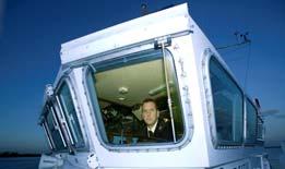

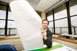
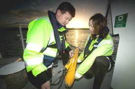
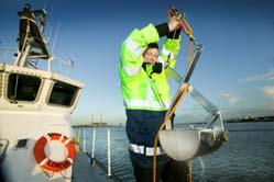

15 At Work 15
Hydrographic Surveying at The Port of London
 Hydrographic Surveying at The Port of London John Dillon-Leetch Port and Terminal Technology 2009 14 th October, Antwerp Overview Introduction Surveying the Thames Navigational Charting High Resolution
Utilizing Vessel Based Mobile LiDAR & Bathymetry Survey Techniques for Survey of Four Southern California Breakwaters
 Utilizing Vessel Based Mobile LiDAR & Bathymetry Survey Techniques for Survey of Four Southern California Breakwaters Western Dredging Association: Pacific Chapter September 2012 Insert: Pipe Location
Certified Professionals in Hydrographic Solutions
 Certified Professionals in Hydrographic Solutions Client Satisfaction is our Deliverable Port of Brisbane Pty Ltd Port Surveys Certified Professionals in Hydrographic Surveying Tel +61 (0) 7 3258 4820
Acoustic Pipeline Inspection Mind The Gap
 Acoustic Pipeline Inspection Mind The Gap Mike Liddell Chief Surveyor, Fugro Survey Limited UUVS @ Oceanology 2012 13 th March 2012 Contents Menu Introduction to Pipeline Inspection The Current Toolkit
THE CHALLENGES OF A LARGE-AREA BATHYMETRIC SURVEY
 THE CHALLENGES OF A LARGE-AREA BATHYMETRIC SURVEY Agenda: - Introduction - Tender - Project Planning - Survey - Processing - Delivery - Conclusion 2 Introduction We know less of the oceans at our feet,
High Definition Laser Scanning (HDS) Underwater Acoustic Imaging and Profiling
 Underwater Acoustic Imaging and Profiling") High Definition Laser Scanning (HDS) Underwater Acoustic Imaging and Profiling Images at Depth: The Use of Acoustic Imaging on Large River Crossings A Case Study AGENDA Background of project Review of
High Definition Laser Scanning (HDS) Underwater Acoustic Imaging and Profiling Images at Depth: The Use of Acoustic Imaging on Large River Crossings A Case Study AGENDA Background of project Review of
An Integrated Marine Gradiometer Array System (MGA)
") An Integrated Marine Gradiometer Array System (MGA) For Detection and Location of Chemical and Conventional UXO/MEC in Shallow to Deep Marine and Freshwater Environments Introduction Tetra Tech EC, Inc.
An Integrated Marine Gradiometer Array System (MGA) For Detection and Location of Chemical and Conventional UXO/MEC in Shallow to Deep Marine and Freshwater Environments Introduction Tetra Tech EC, Inc.
Advantages of Using Combined Bathymetry and Side Scan Data in Survey Processing T.M. Hiller, L.N. Brisson
 Advantages of Using Combined Bathymetry and Side Scan Data in Survey Processing T.M. Hiller, L.N. Brisson EdgeTech, West WareHam MA, USA EdgeTech 6205 Combined Bathymetric and Side Scan Sonar EdgeTech
INSIDE 16. Hydrographic Soundings, Sensors, and Bots. Dual-head Sonar Mapping. 25 A Case for Big Blue Data. Collaboration in the Air & on the Ground
 POSITIONING AND MEASUREMENT, ELEVATED AUGUST 2016 INSIDE: SURVEYING HYDROGRAPHY EDUCATION MAPPING UAS MACHINE CONTROL Hydrographic Soundings, Sensors, and Bots INSIDE 16 25 A Case for Big Blue Data 31
1 st Tidal and Water Level Working Group Meeting DHN, Niteroi, Brazil 31/03/09 02/04/09 Vertical Offshore Reference Framework (VORF) Chris Jones
 Chris Jones") 1 st Tidal and Water Level Working Group Meeting DHN, Niteroi, Brazil 31/03/09 02/04/09 Vertical Offshore Reference Framework (VORF) Chris Jones United Kingdom Hydrographic Office Presentation Structure
1 st Tidal and Water Level Working Group Meeting DHN, Niteroi, Brazil 31/03/09 02/04/09 Vertical Offshore Reference Framework (VORF) Chris Jones United Kingdom Hydrographic Office Presentation Structure
Evaluation of the Klein HydroChart 3500 Interferometric Bathymetry Sonar for NOAA Sea Floor Mapping
 Evaluation of the Klein HydroChart 3500 Interferometric Bathymetry Sonar for NOAA Sea Floor Mapping Yuhui Ai, Straud Armstrong and Dean Fleury L-3 Communications Klein Associates, Inc. 11 Klein Dr. Salem,
Panel Discussion on unmanned Hydrography
 Panel Discussion on unmanned Hydrography Overview Why bother General Types Autonomous Underwater Vehicle (AUV) Remotely Operated Vehicle (ROV) Unmanned Surface Vessels (USV) TerraSond s Experiences AUV
Determination of Survey Boat Heave Motion with the Use of RTS Technique
 Environmental Engineering 10th International Conference Vilnius Gediminas Technical University Lithuania, 27 28 April 2017 http://enviro.vgtu.lt eissn 2029-7092 / eisbn 978-609-476-044-0 Article ID: enviro.2017.229
High Precision Hydrography in Canada, the ST. Lawrence River Channel, HD Bathymetry, Production, Distribution and Updating
 High Precision Hydrography in Canada, the ST. Lawrence River Channel, HD Bathymetry, Production, Distribution and Updating Marc Journault Canada CHS, Louis Maltais Canada CHS, and Richard Sanfaçon Canada
ICES Guidelines for Multibeam Echosounder Data (Compiled September 2006)
") ICES Guidelines for Multibeam Echosounder Data (Compiled September 2006) If you are considering producing a hydrographic survey please read the following information first. Your survey could be used to
ICES Guidelines for Multibeam Echosounder Data (Compiled September 2006) If you are considering producing a hydrographic survey please read the following information first. Your survey could be used to
Click to edit Master title style Advanced Military Layers. and the Historic Environment
 Advanced Military Layers and the Historic Environment Paul Baggaley and Louise Tizzard Wessex Archaeology 1 Click to edit Objectives Master title style to establish the degree of mutual benefit in integrating
Introduction. VORF - Model Development and Principles. The required VORF model transformation accuracies were as follows:
 Introduction In 2006, the United Kingdom Hydrographic Office (UKHO) began testing of the Vertical Offshore Reference Frame (VORF), which had been developed on their behalf by the Department of Geomatic
A PRACTICAL APPROACH TO QUALITY CONTROL AND QUALITY ANALYSIS OF DEPTH DATA
 A PRACTICAL APPROACH TO QUALITY CONTROL AND QUALITY ANALYSIS OF DEPTH DATA ABSTRACT Ulf Olsson, Mats Ericson, Stigbjörn Nilsson, Hans Öiås Hydrographic Office, Swedish Maritime Administration, Sweden Quality
Wade Reynolds 1 Frank Young 1,2 Peter Gibbings 1,2. University of Southern Queensland Toowoomba 4350 AUSTRALIA
 A Comparison of Methods for Mapping Golf Greens Wade Reynolds 1 Frank Young 1,2 Peter Gibbings 1,2 1 Faculty of Engineering and Surveying 2 Australian Centre for Sustainable Catchments University of Southern
Bathymetry Data Collection for Subaqueous Soil Mapping. Maggie Payne 2 nd National Workshop on Subaqueous Soils Rhode Island August 9-12, 2010
 Bathymetry Data Collection for Subaqueous Soil Mapping Maggie Payne 2 nd National Workshop on Subaqueous Soils Rhode Island August 9-12, 2010 Overview of Method Collect tide data Collect bathymetry data
S-44 edition 5 The IHO s New Standard For Hydrographic Surveys Chris Howlett Head of Seabed Data Centre United Kingdom Hydrographic Office
 S-44 edition 5 The IHO s New Standard For Hydrographic Surveys Chris Howlett Head of Seabed Data Centre United Kingdom Hydrographic Office Chairman of IHO Working Group that created S-44 edition 5 S-44
Investigating Acoustic Anomalies in the Water Column. Alistair Robertshaw, Geohazards Specialist, BP Oceanology 2016
 Investigating Acoustic Anomalies in the Water Column Alistair Robertshaw, Geohazards Specialist, BP Oceanology 2016 Overview Water Column Data First Impressions Basic Theory Reflection Geometries Examples
Performance Analysis of the EdgeTech 6205 Swath Bathymetric Sonar
 Performance Analysis of the EdgeTech 6205 Swath Bathymetric Sonar Lisa Nicole Brisson, Lead Bathymetry Product Engineer, EdgeTech, Boca Raton, FL Damon Wolfe, Lead Bathymetry Sales Engineer, EdgeTech,
Monetisation of sustainable business models for Satellite Derived Bathymetry
 Monetisation of sustainable business models for Satellite Derived Bathymetry Who are we? We are a UK & UAE based company specialising in satellite derived seabed & environmental mapping products We aim
Release Performance Notes TN WBMS _R _Release_Presentation.pptx 22 September, 2014
 TN-140079-1.2 WBMS _R2014-06_Release_Presentation.pptx 22 September, 2014 Since the 2013-12 release, NORBIT has made tremendous improvements to both the functionality and performance of the WBMS systems.
An accident at sea, such as an
 Littoral water survey and security Surveying by Claude Cazaoulou, ECA More than 90% of international commercial exchange and 70% of annual world oil consumption are transported by sea. Millions of people
Design and Planning Considerations For a Seabed Survey
 Design and Planning Considerations For a Seabed Survey Vera Quinlan Hydrographer & Data Processor Seabed Survey Overview Survey Platform - What boat do I use? Survey Area / depth of water / objective &
NOAA s Underwater UXO Demonstration Projects Vieques Island, Puerto Rico
 NOAA s Underwater UXO Demonstration Projects Vieques Island, Puerto Rico Vieques Restoration Advisory Board Meeting May 7, 2008 Jason Rolfe NOAA s Office of Response & Restoration NOAA s Underwater UXO
Hydrographic Surveying Methods, Applications and Uses
 Definition: Hydrographic Surveying Methods, Applications and Uses It is the branch of surveying which deals with any body of still or running water such as a lake, harbor, stream or river. Hydrographic
Specifications for Synchronized Sensor Pipe Condition Assessment (AS PROVIDED BY REDZONE ROBOTICS)
") Specifications for Synchronized Sensor Pipe Condition Assessment (AS PROVIDED BY REDZONE ROBOTICS) A. Scope of Work The work covered by these specifications consists of furnishing all materials, labor,
Specifications for Synchronized Sensor Pipe Condition Assessment (AS PROVIDED BY REDZONE ROBOTICS) A. Scope of Work The work covered by these specifications consists of furnishing all materials, labor,
Interferometric Swath Bathymetry for Large Scale Shallow Water Hydrographic Surveys
 Interferometric Swath Bathymetry for Large Scale Shallow Water Hydrographic Surveys Lisa N. Brisson 1, Damon A. Wolfe 1, Matthew Staley P.S.M. 2 1 EdgeTech 4 Little Brook Rd West Wareham, MA 02576 2 USACE
Multi-Purpose Workboats and Vessels. Marine Engineering and Construction. Salvage and Wreck Removal. Marine Consultancy Services
 Multi-Purpose Workboats and Vessels Marine Engineering and Construction Salvage and Wreck Removal Marine Consultancy Services Marine Expertise and Support We are a progressive company with more than 50
Accuracy and Precision of High-Speed Field Measurements of Pavement Surface Rutting and Cracking
 Accuracy and Precision of High-Speed Field Measurements of Pavement Surface Rutting and Cracking Pedro A. Serigos, MSE, MSStat - serigosp@utexas.edu Jorge A. Prozzi, PhD Andre de Fortier Smit, PhD Mike
Processing Lidar Data for Charting Applications Understanding the Trade-Offs and Challenges
 Processing Lidar Data for Charting Applications Understanding the Trade-Offs and Challenges A variety of acoustic and optical technologies are able to be used to survey shallow water areas. Due to the
Mapping the Sea Bottom Using RTK GPS and Lead-Line in Trabzon Harbor
 Mapping the Sea Bottom Using RTK GPS and Lead-Line in Trabzon Harbor Arzu ERENER and Ertan GÖKALP, Turkey Key Words: Real-Time Kinematic GPS, Lead Line, Roll Effect, Hydrographic surveys. SUMMARY The harbor
MARINE SAFETY PLAN
 PORT MARINE SAFETY CODE MARINE SAFETY PLAN 2015-2017 Introduction As required at article 3.20 of the Port Marine Safety Code (PMSC), the Port of London Authority (PLA) publishes its Marine Safety Plan
APPENDIX C DIVING. Section I. General
 APPENDIX C DIVING Section I. General PURPOSE a. Engineer divers support all diving missions in the theater of operations. Engineer support in the communication zone is provided on an area basis; and in
Failure of Wide Bay Pipeline in the Burnett River
 APGA Paper Date: 29 August 2015 Subject: Risk Mitigation for Trench Pipeline Under Shallow River Crossings Prepared by: Derek Boo Manager Planning and Engineering Company: APA Group Background: Beginning
Geospatial Positioning Accuracy Standards Part 5: Standards for Nautical Charting Hydrographic Surveys - Public Review Draft
 Appendix B FGDC Hydrographic Accuracy Standard Geospatial Positioning Accuracy Standards Part 5: Standards for Nautical Charting Hydrographic Surveys - Public Review Draft Subcommittee on Marine and Coastal
Vieques Underwater Demonstration Project
 Vieques Underwater Demonstration Project NOAA Office of Response and Restoration National Ocean Service 2006-2007 2007 University of New Hampshire Joint Hydrographic Center 2006 Science Application International
THE SYLLABUS FOR WRITTEN EXAMINATION PILOT'S FOURTH CLASS LICENCE (TEES AND HARTLEPOOL) AND
 AND") PD TEESPORT CONSERVANCY DIVISION HARBOUR MASTER'S OFFICE THE SYLLABUS FOR WRITTEN EXAMINATION IN RESPECT OF A PILOT'S FOURTH CLASS LICENCE (TEES AND HARTLEPOOL) AND PILOTAGE EXEMPTION CERTIFICATE (Issued
PD TEESPORT CONSERVANCY DIVISION HARBOUR MASTER'S OFFICE THE SYLLABUS FOR WRITTEN EXAMINATION IN RESPECT OF A PILOT'S FOURTH CLASS LICENCE (TEES AND HARTLEPOOL) AND PILOTAGE EXEMPTION CERTIFICATE (Issued
RAMSTM. 360 Riser and Anchor-Chain Integrity Monitoring for FPSOs
 RAMS 360 Riser and Anchor-Chain Integrity Monitoring for FPSOs Introduction to RAMS Tritech s RAMS is a 360 anchor-chain and riser integrity monitoring system for Floating Production Storage and Offloading
Tifft Water Supply Symposium
 Tifft Water Supply Symposium SEPTEMBER 21-22, 2016 BUFFALO, NEW YORK Impossible Journey: Underwater Inspection of Large Diameter Water Transmission Tunnel Kristin Wheaton, PE Jim Clark Bob Clarke, P.Eng,
ENVIRONMENT AGENCY GREAT OUSE AND 100 FT DRAIN QUARTERLY BATHYMETRIC SURVEY DECEMBER 2013 SITE SURVEY REPORT NO. H6787
 ENVIRONMENT AGENCY GREAT OUSE AND 100FT DRAIN QUARTERLY BATHYMETRIC SURVEY DECEMBER 2013 NO. H6787 LONGDIN & BROWNING (SURVEYS) LIMITED CHERRY TREE HOUSE CARMARTHEN ROAD SWANSEA SA1 1HE H6787 1 Measured
Paper for consideration by ENC Working Group. Use of AU6 ENC cells as an option for Bathymetric ENCs (benc)
") Paper for consideration by ENC Working Group Use of AU6 ENC cells as an option for Bathymetric ENCs (benc) Submitted by: Alvaro Sanchez (AHS) Executive Summary: Compilation of high density bathymetric
Paper for consideration by ENC Working Group Use of AU6 ENC cells as an option for Bathymetric ENCs (benc) Submitted by: Alvaro Sanchez (AHS) Executive Summary: Compilation of high density bathymetric
Emerging Subsea Networks
 THE FUTURE OF MARINE SURVEY APPLICATIONS FOR SUBMARINE CABLES Ryan Wopschall (Fugro) Email: rwopschall@fugro.com Fugro Pelagos, Inc. - 3574 Ruffin Road, San Diego, California 92123 USA Abstract: New advances
REVISED SILT CURTAIN DEPLOYMENT PLAN
 Contract No.: HY/2009/11 Central Wanchai Bypass, North Point Reclamation REVISED SILT CURTAIN DEPLOYMENT PLAN Name Prepared by: China Harbour Engineering Co., Ltd. China Road and Bridge Corporation Joint
MULTIBEAM SURVEYS EXTENDED ABOVE THE WATERLINE
 MULTIBEAM SURVEYS EXTENDED ABOVE THE WATERLINE T. J. Mitchell 1, C. A. Miller 2 and T. P. Lee 3 ABSTRACT With the increased need to utilize multibeam bathymetry for volumetric surveys both pre- and post-dredging,
14/10/2013' Bathymetric Survey. egm502 seafloor mapping
 egm502 seafloor mapping lecture 10 single-beam echo-sounders Bathymetric Survey Bathymetry is the measurement of water depths - bathymetry is the underwater equivalent of terrestrial topography. A transect
Best Practice RBI Technology Process by SVT-PP SIMTECH
 Best Practice RBI Technology Process by SVT-PP SIMTECH We define the best practice in RBI as a proactive technology process which is used to formally and reliably optimise the inspection efforts for each
Chapter 2 Civil Works Applications
 Chapter 2 Civil Works Applications 2-1. General Scope Hydrographic surveys are performed to support the Corps' dredging, navigation, and flood control missions. A wide range of hydrographic survey techniques,
Self Propelled Backhoe Dredger. Pat M BV CLASSED I 3/3 COASTAL PC 1400 AQUADIGGER MONTABERT VSS SHD HAMMER
 HUMBER WORK BOATS LTD. Self Propelled Backhoe Dredger Pat M BV CLASSED I 3/3 COASTAL PC 1400 AQUADIGGER MONTABERT VSS SHD HAMMER Self Propelled Backhoe Dredger, PAT-M When you charter the Pat M you charter
V. HARBOR DEPTHS, CHANNEL DESIGN AND PROPOSED CONSTRUCTION AND DREDGING
 V. HARBOR DEPTHS, CHANNEL DESIGN AND PROPOSED CONSTRUCTION AND DREDGING A. DISCUSSION: For the most part, projects that involve dredging and construction require a comprehensive design and review process
Use of Underwater Dry Welding for In Situ Repair to Offshore Structures. Sabine Powell 02/12/2016
 Use of Underwater Dry Welding for In Situ Repair to Offshore Structures Sabine Powell engineering@neptunems.com 02/12/2016 In Situ Welding Steel Structures Suitability of Repair Methods Mobile Offshore
OMS WeldChecker WeldChecker inspection tool Features that can be inspected include: 2007 & 2014 The camera will identify: WELD
 WELD INSPECTION Introducing OMS WeldChecker Pipe Inspection Tools The WeldChecker inspection tool consists of a high resolution camera for visual inspection and a laser sensor to measure features and defects.
AHO s experience on HD bathymetric ENCs
 AHO s experience on HD bathymetric ENCs ENCWG3 Wollongong 16 18 April 2018 Alvaro Sanchez DD Charting Quality Assurance, Standards and Specifications Australian Hydrographic Office Background 2016 As part
Sonar Bathymetry: Waquoit Bay NERR
 Sonar Bathymetry: Waquoit Bay NERR Determining the Functional Shallow Water Limitation for an Arrival Based Sonar Frederick A. Hegg Teledyne Benthos, Inc. 49 Edgerton Drive North Falmouth, MA 02556 fhegg@teledyne.com
OPERATIONS SEAFARER CERTIFICATION GUIDANCE NOTE SA MARITIME QUALIFICATIONS CODE. Deck: Chart Work
 Page 1 of 6 Compiled by Approved by Chief Examiner Syllabus Committee: 26 February 2013 OPERATIONS SEAFARER CERTIFICATION GUIDANCE NOTE SA MARITIME QUALIFICATIONS CODE Deck: Chart Work Page 2 of 6 COLUMN
ABOUT US. Since 2005, we have been providing solutions A PRESENCE RECOGNIZED ON THE MARKET SUITABLE EQUIPMENT FOR EVERY SITUATION!
 ABOUT US Since 2005, we have been providing solutions On any project type in aquatic environment, For many di erent industries, In France and overseas. T an s to our multidisciplinary team, e propose tec
A Government Service to State Owned Enterprise.
 Re-organization of Hydrographic Survey Operations in Finland A Government Service to State Owned Enterprise Kari Pohjola Hydro 2010, Rostock-Warnemuende, Germany, 02-05 November 2010 Re-organization of
Recommended operating guidelines (ROG) for sidescan Sidescan sonar ROG in wrapper.doc English Number of pages: 9 Summary:
 for sidescan Sidescan sonar ROG in wrapper.doc English Number of pages: 9 Summary:") Title: Author(s): Document owner: Recommended operating guidelines (ROG) for sidescan sonar Dave Long (BGS) Dave Long (BGS) Reviewed by: Janine Guinan (MI) 07/09/07 Workgroup: MESH action: 2.1 Version:
Title: Author(s): Document owner: Recommended operating guidelines (ROG) for sidescan sonar Dave Long (BGS) Dave Long (BGS) Reviewed by: Janine Guinan (MI) 07/09/07 Workgroup: MESH action: 2.1 Version:
Small Footprint Topo-Bathymetric LiDAR
 May 8, 2013 Small Footprint Topo-Bathymetric LiDAR PNAMP Remote Sensing Forum Russ Faux, Co-CEO, WSI Amar Nayegandhi, Manager of Elevation Technologies, Dewberry Colin Cooper, Senior Analyst, WSI Watershed
Assisting in the Management of Waterways
 Andrew HOGGARTH, Canada, Gordon JOHNSTON, United Kingdom, Daniel KRUIMEL, Australia Key words: Hydrography, Maritime, Database SUMMARY Maritime Safety Authorities usually a division of the Ministry of
GNSS Technology for the Determination of Real-Time Tidal Information
 GNSS Technology for the Determination of Real-Time Tidal Information Benjamin Kidder C-Nav Positioning Solutions European region Outline of Topics Covered Introduction to Tides Past and Present Methods
NEW BUILD - Wildcat 40 Hydrographic Listing ID:
 Australia - Chile - Indonesia - Great Britain - New Zealand - Panama - Philippines - South Korea - Thailand - USA E: sales@seaboats.net (sales) - E: admin@seaboats.net (accounts) NEW BUILD - Wildcat 40
Preventing Damage to Harbour Facilities and. Ship Handling in Harbours PART 2 INDEX
 Preventing Damage to Harbour Facilities and Ship Handling in Harbours PART 2 INDEX 1 Vessel handling is based on the basic knowledge that a vessel floats in the water and returns to its original position
The Evolution of an Autonomous Unmanned Surface Vessel and Software for Hydrographic Survey
 The Evolution of an Autonomous Unmanned Surface Vessel and Software for Hydrographic Survey Paul Donaldson In 2017, Leidos, Inc. participated in both the Gulf of Mexico Unmanned Systems Operational Demonstration
H ydrog ra p h ic S urve y Using SEABAT
 H ydrog ra p h ic S urve y Using SEABAT Hirokazu Mori, Tadashi Yamamoto and Isao Tedokon, Hydrographic Department, Japan Coast Guard The original was written in 1999, and our hydrographic surveys using
State of the Art Mapping of Portland Harbour - August 2004
 State of the Art Mapping of Portland Harbour - August 2004 In 2003 and 2004, as part of the "Diving with a Purpose" initiative the Nautical Archaeology Society mapped some of the wrecks in and around Portland
ScanFish Katria. Intelligent wide-sweep ROTV for magnetometer surveys
 ScanFish Katria Intelligent wide-sweep ROTV for magnetometer surveys User-friendly control and monitoring software solution The ScanFish Katria comes with the ScanFish III Flight software, which is an
Sparse LBL aided INS for Subsea Positioning
 Sparse LBL aided INS for Subsea Positioning Edward Moller Global Business Manager Construction Survey What is LBL? GPS Network What is LBL? We turn GPS upside down LBL installed in a subsea field development
Products and Services HR3D, AUV3D
 Products and Services HR3D, AUV3D Multi-streamer Short Offset High Resolution 3D Seismic Acquisition Peter Sack Tor Haugland Sound Oceanics, LLC Houston, Texas USA 15 March 2012 Background Petromar V West
AIS data analysis for vessel behavior during strong currents and during encounters in the Botlek area in the Port of Rotterdam
 International Workshop on Next Generation Nautical Traffic Models 2013, Delft, The Netherlands AIS data analysis for vessel behavior during strong currents and during encounters in the Botlek area in the
 ACFM ARRAY PROBE TECHNOLOGY WELD INSPECTION DATA Array probe scan on test piece with longitudinal and transverse cracks. ALTERNATIVE CONTOUR PLOT REDUCING COSTS FOR OPERATORS REMOTELY DEPLOYED ACFM INSPECTION
IFREMER, Department of Underwater Systems, Toulon, France. L u c i e Somaglino, P a t r i c k J a u s s a u d, R o main P i a s co, E w e n Raugel
 F i r s t s e a t r i a l s w i t h E M 2 0 4 0 m u l t i b e a m s o u n d e r i n n o v a t i v e i n t e g r a t i o n o n H y b r i d R O V A r i a n e IFREMER, Department of Underwater Systems, Toulon,
STUDY REPORT W&AR-03 RESERVOIR TEMPERATURE MODEL ATTACHMENT B DON PEDRO RESERVOIR BATHYMETRIC STUDY REPORT
 STUDY REPORT W&AR-03 RESERVOIR TEMPERATURE MODEL ATTACHMENT B DON PEDRO RESERVOIR BATHYMETRIC STUDY REPORT DON PEDRO RESERVOIR BATHYMETRIC STUDY REPORT Prepared for: TURLOCK IRRIGATION DISTRICT MODESTO
LiDAR My favourite tool in the bag 2011 St Kitts & Nevis
 LiDAR My favourite tool in the bag 2011 St Kitts & Nevis Lt Cdr Rupert Forester-Bennett RN (ret d) December 5 th to 11 th 2011 Content Collection of geospatial data reasons Overcoming the White Ribbon
PASSENGER SHIP SAFETY. Preliminary recommendations arising from the Costa Concordia marine casualty investigation. Submitted by Italy SUMMARY
 E MARITIME SAFETY COMMITTEE 92nd session Agenda item 6 18 March 2013 Original: ENGLISH PASSENGER SHIP SAFETY Preliminary recommendations arising from the Costa Concordia marine casualty investigation Submitted
from ocean to cloud PARAMETRIC SUB-BOTTOM PROFILER, A NEW APPROACH FOR AN OLD PROBLEM
 PARAMETRIC SUB-BOTTOM PROFILER, A NEW APPROACH FOR AN OLD PROBLEM Geoff Holland, Alcatel-Lucent Submarine Networks Geoff.holland@alcatel-lucent.com Alcatel-Lucent Submarine Networks Ltd, Christchurch Way,
PROPOSING A NEW PORTABLE DEVICE FOR BRIDGE SCOUR INSPECTION
 PROPOSING A NEW PORTABLE DEVICE FOR BRIDGE SCOUR INSPECTION KISEOK KWAK Senior Researcher, Geotech. Eng. Res. Dept., Korea Institute of Construction Technology, 2311 Daehwa-dong, Ilsan-gu, Koyang City,
Journey of a Sounding: Application of NOAA Soundings and Features to Navigation Products
 Journey of a Sounding: Application of NOAA Soundings and Features to Navigation Products Crescent Moegling, Peter Holmberg NOAA, Pacific Hydrographic Branch Seattle, WA Introduction: From the moment a
SFM mapping of coastal erosion at Point Woronzof. Gennady Gienko, PhD Department of Geomatics, UAA
 SFM mapping of coastal erosion at Point Woronzof Gennady Gienko, PhD Department of Geomatics, UAA ggienko@alaska.edu POINT WORONZOF Point Woronzof bluff 135 ft elevation Point Woronzof bluff Pt. Woronzof
INTERNATIONAL HYDROGRAPHIC SURVEY STANDARDS
 INTERNATIONAL HYDROGRAPHIC SURVEY STANDARDS by Gerald B. MILLS 1 I. Background The International Hydrographic Organization (IHO) traces its origin to the establishment of the International Hydrographic
A real time vessel air gap monitoring system
 Journal of Physics: Conference Series A real time vessel air gap monitoring system To cite this article: D McStay and K Thabeth 2009 J. Phys.: Conf. Ser. 178 012038 View the article online for updates
CALCASIEU SALINITY STRUCTURES. HYDRODYNAMIC MODELING (To Support Design of Salinity Barriers)
") CALCASIEU SALINITY STRUCTURES HYDRODYNAMIC MODELING (To Support Design of Salinity Barriers) Presentation Overview 1 2 3 4 5 Project Overview and CEA Circulation Modeling Vessel Hydrodynamics Modeling
CALCASIEU SALINITY STRUCTURES HYDRODYNAMIC MODELING (To Support Design of Salinity Barriers) Presentation Overview 1 2 3 4 5 Project Overview and CEA Circulation Modeling Vessel Hydrodynamics Modeling
PANAMA CANAL AUTHORITY (PCA) REPORT MACHC S2. 17th MESOAMERICAN AND CARIBBEAN SEA HYDROGRAPHIC COMMISION
 REPORT MACHC S2. 17th MESOAMERICAN AND CARIBBEAN SEA HYDROGRAPHIC COMMISION") PANAMA CANAL AUTHORITY (PCA) REPORT MACHC 17-03.S2 17th MESOAMERICAN AND CARIBBEAN SEA HYDROGRAPHIC COMMISION BELEM, BRAZIL December 12-16, 2016 1. HYDROGRAPHIC OFFICE: Hydrographic Unit- Surveys Section
PANAMA CANAL AUTHORITY (PCA) REPORT MACHC 17-03.S2 17th MESOAMERICAN AND CARIBBEAN SEA HYDROGRAPHIC COMMISION BELEM, BRAZIL December 12-16, 2016 1. HYDROGRAPHIC OFFICE: Hydrographic Unit- Surveys Section
SOP-003 GYRO CALIBRATION AND VERIFICATION PROCEDURE
 Rev No. Issue Description Prepared Reviewed Approved Date 5 Re-issued for use RGM SS RB 17 Aug 15 4 Changes made to procedure AFI JAL JAL 12 Sep 11 3 Re-issued for use RGM RAM MAJ 19 May 11 2 Re-issued
Canadian Hydrographic Service PREFACE
 Canadian Hydrographic Service HYDROGRAPHIC SURVEY MANAGEMENT GUIDELINES PREFACE The advent of satellite positioning, multi-transducer and multibeam echo sounding systems and sophisticated data processing
GPS-based Vertical Control, Unaided by a Shore Station
 GPS-based Vertical Control, Unaided by a Shore Station John Shannon Byrne, SAIC, Newport, R.I. Gail Smith, NAVOCEANO, Stennis Space Center, Miss. Walter Simmons, SAIC, Newport, R.I. Bill Mehaffey, NAVOCEANO,
PACIFIC NORTHWEST TEST OF A HYDROGRAPHIC AIRBORNE LASER SCANNER
 PACIFIC NORTHWEST TEST OF A HYDROGRAPHIC AIRBORNE LASER SCANNER Green LiDAR Workshop June 3 7, 2012 Russell Faux, Principal Watershed Sciences, Inc. 517 SW 2 nd Street, Suite 400 Corvallis, OR 97333 541
LIST OF NOTICES TO MARINERS 2017 PAC 201 JUAN DE FUCA STRAIT AND STRAIT OF GEORGIA, FIRST EDITION, 2012
 1 Chapter 1 After paragraph 154 Insert: 154.1 Pacific Gateway Marina (250-412-5509) is located west of the community wharf. Moorage, gas, diesel, a launching ramp and deep water berths for sailboats are
2600T Series Pressure Transmitters Plugged Impulse Line Detection Diagnostic. Pressure Measurement Engineered solutions for all applications
 Application Description AG/266PILD-EN Rev. C 2600T Series Pressure Transmitters Plugged Impulse Line Detection Diagnostic Pressure Measurement Engineered solutions for all applications Increase plant productivity
EXPERIMENTAL RESULTS OF GUIDED WAVE TRAVEL TIME TOMOGRAPHY
 18 th World Conference on Non destructive Testing, 16-20 April 2012, Durban, South Africa EXPERIMENTAL RESULTS OF GUIDED WAVE TRAVEL TIME TOMOGRAPHY Arno VOLKER 1 and Hendrik VOS 1 TNO, Stieltjesweg 1,
Advanced PMA Capabilities for MCM
 Advanced PMA Capabilities for MCM Shorten the sensor-to-shooter timeline New sensor technology deployed on off-board underwater systems provides navies with improved imagery and data for the purposes of
Plot the Path. Mary Anne Otten. lesson three
 Plot the Path Mary Anne Otten lesson three Subject/Grade: Grade 2, Math, Social Studies, Science Duration: one class period Materials needed: Per class: Day the Great Lakes Drained Away by Charles Ferguson
Vessel Impacts with Floating Piers
 Vessel Impacts with Floating Piers October 2017 PIANC The vulnerability of floating piers By necessity piers are the most exposed structures in the river Public spaces that can host 100+ people Berthing
With a team of highly qualified divers Vision offers a wide range of services including;
 Commercial Diving Services With a team of highly qualified divers Vision offers a wide range of services including; Civils Diving Services Inspections, Construction and maintenance on bridges, piles, quay
Wexford Harbour. Yachting Guide. Navigation
 Wexford Harbour Yachting Guide Navigation This document supersedes all previous editions. Approvals: Yacht Club Committee April, 2015 Wexford Board of Directors April, 2015 # Date Section Revision 1 6.5.2015
NEED FOR SUPPLEMENTAL BATHYMETRIC SURVEY DATA COLLECTION
 305 West Grand Avenue, Suite 300 Montvale, New Jersey 07645 Phone 201.930.9890 Fax 201.930.9805 www.anchorqea.com M EMORANDUM To: Caroline Kwan and Nica Klaber U.S. Environmental Protection Agency Region
Course Instructions. 3 Easy Steps to Complete the Course: 1.) Read the Course PDF Below.
 Read the Course PDF Below.") Course Instructions NOTE: The following pages contain a preview of the final exam. This final exam is identical to the final exam that you will take online after you purchase the course. After you purchase
Course Instructions NOTE: The following pages contain a preview of the final exam. This final exam is identical to the final exam that you will take online after you purchase the course. After you purchase