Wave Transformation, Prediction, and Analysis at Kaumalapau Harbor, Lanai, Hawaii
|
|
|
- Horatio Shannon Knight
- 5 years ago
- Views:
Transcription


1 Wave Transformation, Prediction, and Analysis at Kaumalapau Harbor, Lanai, Hawaii Jessica H. Podoski, P.E. Coastal Engineer, USACE Honolulu District Christopher Goody, P.E. Sea Engineering, Inc. Thomas D. Smith, P.E. Coastal Engineer, USACE Honolulu District 12 th International Workshop on Wave Hindcasting and Forecasting Waikoloa, Hawaii November 3, 2011 US Army Corps of Engineers BUILDING STRONG
Evaluate post construction wave climate incident to breakwater for use in assessing structure stability and evaluating armor unit")
2 Study Motivation Kaumalapau Harbor Breakwater Repair selected for monitoring under the USACE Monitoring of Completed Navigation Projects (MCNP) Program Program Goals: 1) Measure waves at barge pier to determine repaired breakwater s effect on mooring conditions 2)Evaluate post construction wave climate incident to breakwater for use in assessing structure stability and evaluating armor unit movement

3 Study Methodology Wave Data Collection Offshore, Nearshore and Roving Instruments Pacific WIS Hindcasts ( ) Wave Transformation Modeling using WW3, SWAN, and REF/DIF Wave Height Correlation Table Predictive Algorithm and Desktop Program Nearshore Wave Time Series Analysis

4 Summary of Conclusions Incident post construction waves at repaired breakwater have been 10 ft or less so far These waves have not been large enough to affect breakwater armor layer stability Mooring conditions at barge pier are highly dependent on sea/swell direction and period Conditions at barge pier are significantly improved during the post construction conditions observed


5 KAUAI Pacific Ocean OAHU MOLOKAI MAUI PROJECT LOCATION LANAI HAWAII

6 3D Bathymetry Near Kaumalapau Harbor 1000 ft (300m) 600 ft (180m) 200 ft (60m) Multibeam Bathymetry Data Synthesis courtesy of UH/SOEST and Hawaii Mapping Research
 NORTH 20 60 ft depth (6 18m) Barge Pier 7")
7 Harbor Layout 180 Wave Window ft length (67m) NORTH ft depth (6 18m) Barge Pier 7
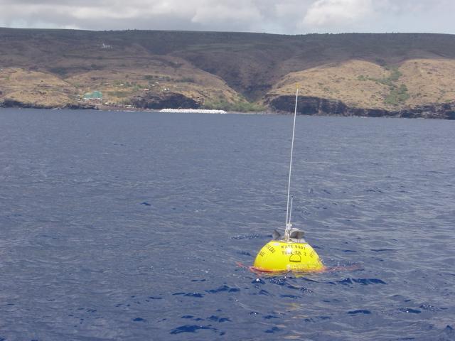

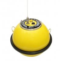
8 Wave Data Collection Datawell Roving Buoy 8

9 Wave Data Collection Offshore CDIP Buoy CDIP Buoy 146 Wave Climate: May 2007 Sept 2011 Kona Storm South Swell WNW WNW Swells Harbor Wave Gages 9
10 December 2007 Kona Storm: Tp = 8.3 s Dir = 224 TN (SW) Wave Data Collection Offshore CDIP Buoy and Harbor Gages January 2008 W NW Swells: Tp = 15.4 s Dir = 298 TN (NW) & 281 (W NW) November 2007 South Swell: Tp = 16.7 s Dir = 190 TN (S SW) Relative Wave Response at the Barge Pier is Highly Dependent on Wave Period and Direction

11 Wave Transformation WIS Hindcast Data 11 WIS Pacific Hindcast available for Stations 113, 114, 115,116 compared to 1 year of buoy data at NDBC WIS Station 116 had best fit overall for Tradewind, South Swell and NW Swell


12 Wave Transformation SWAN Model SWAN Model Validation performed using operational forecast wave model data for boundary input (WW3) no overlap between buoy data and WIS input data 18 Aug October 2007
13 Wave Transformation REF/DIF Model CDIP 146 Buoy REF/DIF used to transform SWAN output into harbor (tradewind cases dropped) Eight observation stations Model validation through comparison of A with 3D physical model data (1998) => negative bias A relationship at observation stations for 119 discrete wave conditions


14 Wave Prediction Surface Plots and KPWAVE Y coordinate Y coordinate = = Wave Wave Period Period Z coordinates Are A Values X coordinate X coordinate = = Wave Wave Direction Direction Time Series Data Sets Were Used to Calculate Amplification Factor for Each Measured Set of Conditions, Yielding a tabulation of x,y,z values (direction, period, A coefficient)


15 Wave Prediction Surface Plots and KPWAVE For Each Reporting Station: A Predictive Surface of Amplification Factor Unique to Deepwater Wave Conditions Predictive Surface for W5 Result: Amplification Factor, A Direction (deg. N) Wave Period (sec) 6 180


16 Wave Prediction Surface Plots and KPWAVE Flagged Area (i.e., here) The Predictive Surface is Filtered to Identify Values That Are Too Far From Real Data Points (Points of Low Confidence)
 for wave periods 15 20 seconds coming from S through SSW(180 215 TN) 0.")
 created at K02, K03, W2, W3, W4, and W5 output wave stations also T p T p 3D")

17 Wave Prediction Surface Plots and KPWAVE Difference between predicted and measured A' at Location K01: (over predicted) for wave periods seconds coming from S through SSW( TN) 0.21 (under predicted) for shorter wave periods (5 10s) coming from the south (190 TN). Predictive Surfaces (based only on model output) created at K02, K03, W2, W3, W4, and W5 output wave stations also T p T p 3D Surface Plot of Amplification Factor at Location K01 (Model Data) D p A X axis = Incident Wave Direction Y axis = Wave Period Color Scale = Amplification Factor, A D p White p A X shows discrete point from lookup table 3D Surface 3D Surface Plot Plot of Amplification of Combined Factor A at Location (Measured/Model K01 (Measured Data) Data)
18 Wave Prediction Surface Plots and KPWAVE KPWAVE a Fortran program that uses predictive algorithms to estimate wave amplification factor based on wave direction and period User can enter parameters manually or use time series input file from the CDIP buoy website (up to 1 year) Creates an output file of the corresponding time series at 7 output locations Flags for Extrapolated values or Out of Bounds

19 Wave Prediction Surface Plots and KPWAVE Comparison of predicted H s from modeling to roving buoy data on 5 Dec 08 at barge pier stations and harbor entrance Positive bias in modeled data One potential erroneous point Sensitivity to Tp and Dp Comparison of Measured vs. Predicted H s for 5 Dec 2008 at Specified Locations Outlier: erroneous measurement? Roving Buoy near K01 Moderate NW Swell Conditions: Ho = ft, Tp = s, Dir = TN
20 Time Series Analysis KPWAVE vs. Gage Data at Barge Pier South Swell South Swell Kona Storm Kona Storm WNW Swells WNW Swells Measured vs. Predicted Wave Height at K01 Good agreement for South Swell and W NW Swell 2 Possible reasons for overprediction during Kona storm and W NW Swell 1 : Kona/WNW wave conditions were not adequately represented in the model runs completed to create the lookup table (requiring extrapolation by KPWAVE) Limited wave gage measurements from K01 that were incorporated into this predictive surface for augmentation did not include these conditions REF/DIF not accurately representing the diffraction occurring in the lee of the breakwater under these conditions further calibration required?
, but significantly improved mooring during typical conditions")
21 Time Series Analysis Predicted Waves along Barge Pier Offshore Event of >6 feet : Kona, South, WNW or Hurricane South Swell Events: T = sec, Dir = TN NW Swell Events: T = sec, Dir = TN K01 K02 K03 Vessels may experience 3 5 ft waves at barge pier during large South and WNW swell events (5% of the time), but significantly improved mooring during typical conditions Difficult to complete a direct pre to post construction wave comparison due to limited data, but general comparisons indicate some improvement during all conditions
 Typical incident waves 1 5 ft,")
, Dec 2007 Kona Storm (10.0 ft) and Jan 2009 W NW (8.")
22 Time Series Analysis Incident Wave at Breakwater Nov 2007 South Swell Dec 2007 Kona Storm Jan 2009 W NW Swell Measured vs. Predicted Wave Height at K01 Time Series of Wave Height at W3 (May 2007 Jan 2011) Typical incident waves 1 5 ft, several occurrences of 6+ feet each year Three largest wave height predictions are from Nov 2007 South Swell (9.6ft), Dec 2007 Kona Storm (10.0 ft) and Jan 2009 W NW (8.2 ft) Waves since construction are much lower than 35 ft design wave height
 Wave response and mooring conditions at barge pier are highly dependent on wave direction and wave period")
23 Conclusions Wave data collected in deep water and in lee of completed breakwater have documented wave climate inside/outside harbor Automated method to determine wave heights within harbor based on permanent CDIP Station and numerical modeling => KPWAVE (also beneficial to harbor users) Wave response and mooring conditions at barge pier are highly dependent on wave direction and wave period Long period waves (15 20s) from WNW and SSW, and Kona storms will still result in wave energy and surge in harbor The breakwater has improved mooring conditions within the harbor thus far, especially during moderate NW swells Nothing close to design wave has been experienced since completion of breakwater (largest recorded deep water Hs = 14 feet) => not large enough to affect breakwater armor layer stability
24 Mahalo USACE MCNP Program Scripps Coastal Data Information Program Demont Hansen (UH Grad and Sea Engineering) University of Hawaii Oceanography Dept.

25 US Army Corps of Engineers Thank You
Kauai Wave Climate. Jessica Podoski, PE USACE Honolulu District
 Kauai Wave Climate Jessica Podoski, PE USACE Honolulu District Kauai Wave Climate Overview Study Regions WIS Hindcast Data & Analysis Wave Transformation NearshoreWave Climate Kauai Study Regions KekahaWave
Wave research at Department of Oceanography, University of Hawai i
 Wave research at Department of Oceanography, University of Hawai i Hawaii wave climate. Directional waverider buoys around Hawaii. Past and present wave-related research projects. Effect of tides on wave
Coastal Wave Energy Dissipation: Observations and Modeling
 Coastal Wave Energy Dissipation: Observations and Modeling Jeffrey L Hanson US Army Corps of Engineers Field Research Facility USACE Field Research Facility Kent K. Hathaway US Army Corps of Engineers
Comparisons of Physical and Numerical Model Wave Predictions with Prototype Data at Morro Bay Harbor Entrance, California
 Comparisons of Physical and Numerical Model Wave Predictions with Prototype Data at Morro Bay Harbor Entrance, California by Robert R. Bottin, Jr. and Edward F. Thompson PURPOSE: This Coastal and Hydraulics
CMS Modeling of the North Coast of Puerto Rico
 CMS Modeling of the North Coast of Puerto Rico PRESENTED BY: Dr. Kelly Rankin Legault, Ph.D., P.E. 1 Dr. Alfredo Torruella, Ph.D. 2 1 USACE Jacksonville District 2 University of Puerto Rico October 2016
Coastal Wave Studies FY13 Summary Report
 DISTRIBUTION STATEMENT A. Approved for public release; distribution is unlimited. Coastal Wave Studies FY13 Summary Report Jeffrey L. Hanson US Army Corps of Engineers, Field Research Facility 1261 Duck
NWEI. Fred.Olsen. Columbia Power
 U.S. Marine Corps Base Hawaii, Kaneohe 30m, 60m, 80m berths in place, grid-connected First device deployed, second Jan 2016, third Sep 2016 HNEI role Funded by DOE, US Navy, ONR, State of Hawaii Acoustic,
Regional Analysis of Extremal Wave Height Variability Oregon Coast, USA. Heidi P. Moritz and Hans R. Moritz
 Regional Analysis of Extremal Wave Height Variability Oregon Coast, USA Heidi P. Moritz and Hans R. Moritz U. S. Army Corps of Engineers, Portland District Portland, Oregon, USA 1. INTRODUCTION This extremal
Coastal Sediment Transport Modeling Ocean Beach & San Francisco Bight, CA
 1 Coastal Sediment Transport Modeling Ocean Beach & San Francisco Bight, CA Honghai Li and Lihwa Lin Engineering Research and Development Center U.S. Army Corps of Engineers Frank Wu, Lisa Andes, and James
US Navy Wave Energy Test Site. Kaneohe, HI
 US Navy Wave Energy Test Site Kaneohe, HI Presented by: Luis A. Vega Ph.D., HNEI, University of Hawaii September 24, 2014 MHK Testing in Hawaii (excluding OTEC) What do you do to support/facilitate testing?
WaMoS II Wave Monitoring System
 WaMoS II Wave Monitoring System - An application of WaMoS II at Duck - Katrin Hessner, K. Reichert, J. Dannenberg OceanWaveS GmbH, Germany Kent Hathaway, Don Resio Engineering Research Development Center
COMPARISON OF CONTEMPORANEOUS WAVE MEASUREMENTS WITH A SAAB WAVERADAR REX AND A DATAWELL DIRECTIONAL WAVERIDER BUOY
 COMPARISON OF CONTEMPORANEOUS WAVE MEASUREMENTS WITH A SAAB WAVERADAR REX AND A DATAWELL DIRECTIONAL WAVERIDER BUOY Scott Noreika, Mark Beardsley, Lulu Lodder, Sarah Brown and David Duncalf rpsmetocean.com
TITLE: The Importance of Model Validation: Two Case Studies. AUTHOR:Julie Thomas. Scripps Institution of Oceanography, La Jolla, CA.
 TITLE: The Importance of Model Validation: Two Case Studies AUTHOR:Julie Thomas Scripps Institution of Oceanography, La Jolla, CA jothomas@ucsd.edu CO-AUTHOR: Corey Olfe Scripps Institution of Oceanography,
Tedious Creek Small Craft Harbor: CGWAVE Model Comparisons Between Existing and Authorized Breakwater Configurations
 Tedious Creek Small Craft Harbor: CGWAVE Model Comparisons Between Existing and Authorized Breakwater Configurations by Michael J. Briggs, Barbara P. Donnell, Zeki Demirbilek, and Robert D. Carver PURPOSE:
Appendix E Cat Island Borrow Area Analysis
 Appendix E Cat Island Borrow Area Analysis ERDC/CHL Letter Report 1 Cat Island Borrow Area Analysis Multiple borrow area configurations were considered for Cat Island restoration. Borrow area CI1 is located
COFFS HARBOUR SEDIMENT MODELLING AND INVESTIGATION
 COFFS HARBOUR SEDIMENT MODELLING AND INVESTIGATION Luke McAvoy Undergraduate Engineer (Civil) Griffith School of Engineering, Griffith University, Gold Coast, Australia Daniel Rodger Senior Engineer Water
Swell and Wave Forecasting
 Lecture 25 Swell and Wave Forecasting Swell and Wave Forecasting Motivation Terminology Wave Formation Wave Decay Wave Refraction Shoaling Rouge Waves 1 2 Motivation In Hawaii, surf is the number one weather-related
APPENDIX A APPENDIX B APPENDIX C APPENDIX D APPENDIX E APPENDIX F APPENDIX G SEDIMENT ANALYSIS APPENDIX A WAVE & SEDIMENT MODELS CRYSTAL BALL ANALYSIS
 APPENDIX A WAVE & SEDIMENT MODELS APPENDIX B SEDIMENT ANALYSIS APPENDIX A WAVE & SEDIMENT MODELS APPENDIX C CRYSTAL BALL ANALYSIS APPENDIX D SBEACH ANALYSIS APPENDIX E GENESIS ANALYSIS APPENDIX F PREFERRED
Prediction of Nearshore Waves and Currents: Model Sensitivity, Confidence and Assimilation
 Prediction of Nearshore Waves and Currents: Model Sensitivity, Confidence and Assimilation H. Tuba Özkan-Haller College of Oceanic and Atmospheric Sciences Oregon State University, 104 Ocean Admin Bldg
Hydrodynamic and hydrological modelling to support the operation and design of sea ports
 Hydrodynamic and hydrological modelling to support the operation and design of sea ports Data needs and examples Martijn de Jong (port/nautical requirements, waves, currents) Sofia Caires (mean and extreme
Wave energy converter effects on wave and sediment circulation
 Wave energy converter effects on wave and sediment circulation Grace Chang and Craig Jones Integral Consulting Inc. cjones@integral-corp.com; gchang@integral-corp.com Jesse Roberts, Kelley Ruehl, and Chris
BILLY BISHOP TORONTO CITY AIRPORT PRELIMINARY RUNWAY DESIGN COASTAL ENGINEERING STUDY
 Bâtiment Infrastructures municipales Transport Industriel Énergie Environnement BILLY BISHOP TORONTO CITY AIRPORT PRELIMINARY RUNWAY DESIGN COASTAL ENGINEERING STUDY N. Guillemette 1, C. Glodowski 1, P.
Model Predictions and Sensitivity Analysis of Nearshore Processes over Complex Bathymetry
 Model Predictions and Sensitivity Analysis of Nearshore Processes over Complex Bathymetry James M. Kaihatu Code 7322 Oceanography Division Naval Research Laboratory Stennis Space Center, MS William C.
Available online at ScienceDirect. Procedia Engineering 116 (2015 )
") Available online at www.sciencedirect.com ScienceDirect Procedia Engineering 116 (2015 ) 320 325 8th International Conference on Asian and Pacific Coasts (APAC 2015) Department of Ocean Engineering, IIT
Available online at www.sciencedirect.com ScienceDirect Procedia Engineering 116 (2015 ) 320 325 8th International Conference on Asian and Pacific Coasts (APAC 2015) Department of Ocean Engineering, IIT
INTRODUCTION TO COASTAL ENGINEERING AND MANAGEMENT
 Advanced Series on Ocean Engineering Volume 16 INTRODUCTION TO COASTAL ENGINEERING AND MANAGEMENT J. William Kamphuis Queen's University, Canada World Scientific Singapore New Jersey London Hong Kong Contents
Modeling Sediment Transport Along the Upper Texas Coast
 Modeling Sediment Transport Along the Upper Texas Coast David B. King Jr. Jeffery P. Waters William R. Curtis Highway 87 roadbed, Jefferson County Galveston District Corps Sabine Pass to San Luis Pass
Coastal and Hydraulics Laboratory
 ERDC/CHL TR-02-20 Coastal and Hydraulics Laboratory Wave Response, Pago Pago Harbor, Island of Tutuila, Territory of American Samoa Edward F. Thompson and Zeki Demirbilek September 2002 Approved for public
Swell and Wave Forecasting
 Lecture 24 Part II Swell and Wave Forecasting 29 Swell and Wave Forecasting Motivation Terminology Wave Formation Wave Decay Wave Refraction Shoaling Rouge Waves 30 Motivation In Hawaii, surf is the number
Exploring the Wind and Wave Climate in the Great Lakes
 Exploring the Wind and Wave Climate in the Great Lakes R.E. Jensen USACE ERDC Coastal and Hydraulics Laboratory 14 th Waves Workshop 8-13 November 2015 Key West, FL Setting / Motivation North America US:
17. High Resolution Application of the Technology Development Index (TDI) in State Waters. South of Block Island
 in State Waters. South of Block Island") 17. High Resolution Application of the Technology Development Index (TDI) in State Waters South of Block Island for the Rhode Island Ocean Special Area Management Plan 2010 by Annette Grilli 1, Malcolm
17. High Resolution Application of the Technology Development Index (TDI) in State Waters South of Block Island for the Rhode Island Ocean Special Area Management Plan 2010 by Annette Grilli 1, Malcolm
Quantifying Wave Measurement Differences in Historical and Present Wave Buoy Systems
 Quantifying Wave Measurement Differences in Historical and Present Wave Buoy Systems R. E. Jensen 1, V. Swail 2, R.H. Bouchard 3, and B. Bradshaw 2 1 Coastal and Hydraulics Laboratory 2 Environment and
Evaluating Extreme Storm Power and Potential Implications to Coastal Infrastructure Damage, Oregon Coast, USA
 Evaluating Extreme Storm Power and Potential Implications to Coastal Infrastructure Damage, Oregon Coast, USA 1.0 INTRODUCTION Heidi P. Moritz, P.E. and Hans R. Moritz, P.E. U. S. Army Corps of Engineers,
Task 16: Impact on Lummi Cultural Properties
 Gateway Pacific Terminal Vessel Traffic and Risk Assessment Study Task 16: Impact on Lummi Cultural Properties Prepared for Pacific International Terminals, Inc. Prepared by The Glosten Associates, Inc.
Tutorial for the. Total Vertical Uncertainty Analysis Tool in NaviModel3
 Tutorial for the Total Vertical Uncertainty Analysis Tool in NaviModel3 May, 2011 1. Introduction The Total Vertical Uncertainty Analysis Tool in NaviModel3 has been designed to facilitate a determination
Nearshore Dredged Material Placement Pilot Study at Noyo Harbor, CA
 1 Nearshore Dredged Material Placement Pilot Study at Noyo Harbor, CA Noyo Cove N 2011 National Conference on Beach Preservation Technology 9-11, February 2011 Lihwa Lin, Honghai Li, Mitchell Brown US
Evaluation of June 9, 2014 Federal Emergency Management Agency Flood Insurance Study for Town of Weymouth, Norfolk, Co, MA
 Evaluation of June 9, 2014 Federal Emergency Management Agency Flood Insurance Study for Town of Weymouth, Norfolk, Co, MA Prepared For: Woodard & Curran 95 Cedar Street, Suite 100 Providence, RI 02903
Appendix D: SWAN Wave Modelling
 Appendix D: SWAN Wave Modelling D.1 Preamble The Eurobodalla Shire Council area is subject to extreme waves originating from offshore storms. When swell waves approach the coast, they are modified by the
Sand Bank Passage. Fiji nearshore wave hindcast ' ' 19 00'
 Sand Bank Passage Fiji nearshore wave hindcast 1 00' 1 00' 1 30' 1 00' 177 00' 177 30' 17 00' 17 30' 17 30' Figure 1. Location maps of the site. The map on the left shows the region. The map on the right
EVALUATION OF A PROPOSED CHANNEL ON CIRCULATION AND MORPHOLOGY CHANGE AT KAWAIHAE HARBOR AND PELEKANE BAY, HAWAII, USA
 EVALUATION OF A PROPOSED CHANNEL ON CIRCULATION AND MORPHOLOGY CHANGE AT KAWAIHAE HARBOR AND PELEKANE BAY, HAWAII, USA Honghai Li 1, Mitchell E. Brown 1, Nicholas C. Kraus 1, Thomas D. Smith 2, and Jessica
Mango Bay_Resort. Fiji nearshore wave hindcast ' ' 19 00'
 Mango Bay_Resort Fiji nearshore wave hindcast 1 00' 1 30' 1 00' 177 00' 177 30' 17 00' 17 30' Figure 1. Location maps of the site. The map on the left shows the region. The map on the right shows the island
Technical Brief - Wave Uprush Analysis 129 South Street, Gananoque
 Technical Brief - Wave Uprush Analysis 129 South Street, Gananoque RIGGS ENGINEERING LTD. 1240 Commissioners Road West Suite 205 London, Ontario N6K 1C7 June 12, 2013 Table of Contents Section Page Table
Characterization of U.S. Wave Energy Converter (WEC) Test Sites: A Catalogue of Met-Ocean Data 2nd Edition
 Test Sites: A Catalogue of Met-Ocean Data 2nd Edition") SANDIA REPORT SAND5-7963 Unlimited Release Printed September 5 Characterization of U.S. Wave Energy Converter (WEC) Test Sites: A Catalogue of Met-Ocean Data nd Edition Ann R. Dallman, Vincent S. Neary
SANDIA REPORT SAND5-7963 Unlimited Release Printed September 5 Characterization of U.S. Wave Energy Converter (WEC) Test Sites: A Catalogue of Met-Ocean Data nd Edition Ann R. Dallman, Vincent S. Neary
An IOOS Operational Wave Observation Plan Supported by NOAA IOOS Program & USACE
 An IOOS Operational Wave Observation Plan Supported by NOAA IOOS Program & USACE R.E. Jensen, W.A. Birkemeier and W. Burnett JCOMM-Workshop on Wave Measurements from Buoys Wave Information to Application
Marine Renewables Industry Association. Marine Renewables Industry: Requirements for Oceanographic Measurements, Data Processing and Modelling
 Marine Renewables Industry Association Marine Renewables Industry: Requirements for Oceanographic Measurements, Data Processing and Modelling October 2009 Table of Contents 1. Introduction... 1 2. Measurements
Avaavaroa passage. Rarotonga nearshore wave hindcast 21 09' 21 12' 21 15' 21 18' ' ' ' '
 Avaavaroa passage Rarotonga nearshore wave hindcast 21 09' 21 ' Fuel Pipeline Avatiu Passage Black Rock Avarua Passage Pue Tupapa Papua Passage Avaavaroa Passage 21 15' Ngatangiia Passage onga Wave Hotspot
Development and Implementation of a Relocatable Coastal and Nearshore Modeling System
 Development and Implementation of a Relocatable Coastal and Nearshore Modeling System James M. Kaihatu Zachry Department of Civil Engineering, Texas A&M University 3136 TAMU College Station, TX 77843-3136
A New Strategy for Harbor Planning and Design
 A New Strategy for Harbor Planning and Design Xiuying Xing, Ph.D Research Associate Sonny Astani Department of Civil and Environmental Engineering University of Southern California Los Angeles, CA 90089-2531
Evaluation of Unstructured WAVEWATCH III for Nearshore Application
 Evaluation of Unstructured WAVEWATCH III for Nearshore Application Jane McKee Smith, Tyler Hesser, Mary Anderson Bryant USACE Research and Development Center, Coastal and Hydraulics Lab Aron Roland BGS
WAVE FORECASTING FOR OFFSHORE WIND FARMS
 9 th International Workshop on Wave Hindcasting and Forecasting, Victoria, B.C. Canada, September 24-29, 2006 WAVE FORECASTING FOR OFFSHORE WIND FARMS Morten Rugbjerg, Ole René Sørensen and Vagner Jacobsen
PHYSICAL AND NUMERICAL MODELLING OF WAVE FIELD IN FRONT OF THE CONTAINER TERMINAL PEAR - PORT OF RIJEKA (ADRIATIC SEA)
") PHYSICAL AND NUMERICAL MODELLING OF WAVE FIELD IN FRONT OF THE CONTAINER TERMINAL PEAR - PORT OF RIJEKA (ADRIATIC SEA) DALIBOR CAREVIĆ (1), GORAN LONČAR (1), VLADIMIR ANDROČEC (1) & MARIN PALADIN (1) 1.
PHYSICAL AND NUMERICAL MODELLING OF WAVE FIELD IN FRONT OF THE CONTAINER TERMINAL PEAR - PORT OF RIJEKA (ADRIATIC SEA) DALIBOR CAREVIĆ (1), GORAN LONČAR (1), VLADIMIR ANDROČEC (1) & MARIN PALADIN (1) 1.
Southern California Beach Processes Study
 Southern California Beach Processes Study Torrey Pines Field Site 5th Quarterly Report 31 May 22 to California Resources Agency and California Department of Boating and Waterways R.T. Guza 1, W.C. O Reilly
Ocean Waves and Surf Forecasting: Wave Climate and Forecasting
 Overview Ocean Waves and Surf Forecasting: Wave Climate and Forecasting Ocean regions Characterizing and describing ocean waves Wave theory, propagation, and dispersion Refraction, shadowing, and bathymetry
Kavala Bay. Fiji nearshore wave hindcast ' ' 19 00'
 Kavala Bay Fiji nearshore wave hindcast 1 00' 19 00' 1 30' 19 00' 1 00' 1 30' 1 00' 1 30' 1 30' Figure 1. Location maps of the site. The map on the left shows the region. The map on the right shows the
Effects of Offshore Forcing in the Nearshore Environment
 Effects of Offshore Forcing in the Nearshore Environment Geno Pawlak Department of Ocean and Resources Engineering University of Hawaii at Manoa 2540 Dole St., Holmes Hall 402 Honolulu, HI 96822 phone:
CALCASIEU SALINITY STRUCTURES. HYDRODYNAMIC MODELING (To Support Design of Salinity Barriers)
") CALCASIEU SALINITY STRUCTURES HYDRODYNAMIC MODELING (To Support Design of Salinity Barriers) Presentation Overview 1 2 3 4 5 Project Overview and CEA Circulation Modeling Vessel Hydrodynamics Modeling
CALCASIEU SALINITY STRUCTURES HYDRODYNAMIC MODELING (To Support Design of Salinity Barriers) Presentation Overview 1 2 3 4 5 Project Overview and CEA Circulation Modeling Vessel Hydrodynamics Modeling
Technical Brief - Wave Uprush Analysis Island Harbour Club, Gananoque, Ontario
 Technical Brief - Wave Uprush Analysis RIGGS ENGINEERING LTD. 1240 Commissioners Road West Suite 205 London, Ontario N6K 1C7 October 31, 2014 Table of Contents Section Page Table of Contents... i List
Figure 1 Example feature overview.
 1. Introduction This case focuses on the northeastern region of Onslow Bay, NC, and includes an initial shoreline, regional contour, wave gauges, inlets, dredging, and beach fills. Most of the features
Technical Note AN EMPIRICAL. METHOD FOR DESIGN OF BREAKWATERS AS SHORE PROTECTION STRUCTURES
 CETN III-23 (Rev 3/95) Coastal Engineering Technical Note AN EMPIRICAL. METHOD FOR DESIGN OF BREAKWATERS AS SHORE PROTECTION STRUCTURES PURPOSE: To present an empirical method that can be used for preliminary
APPENDIX G WEATHER DATA SELECTED EXTRACTS FROM ENVIRONMENTAL DATA FOR BCFS VESSEL REPLACEMENT PROGRAM DRAFT REPORT
 APPENDIX G WEATHER DATA SELECTED EXTRACTS FROM ENVIRONMENTAL DATA FOR BCFS VESSEL REPLACEMENT PROGRAM DRAFT REPORT Prepared for: B.C. Ferries Services Inc. Prepared by: George Roddan, P.Eng. Roddan Engineering
FEMA Region V. Great Lakes Coastal Flood Study. Pilot Study Webinar. Berrien County, Michigan. February 26, 2014
 FEMA Region V Great Lakes Coastal Flood Study Pilot Study Webinar Berrien County, Michigan February 26, 2014 2 Pilot Study Webinar Agenda Great Lakes Coastal Flood Study Background Demonstration Project
Hawaii Regional Sediment Management Program Kauai Workshop Meeting Minutes 20 January 2011
 Hawaii Regional Sediment Management Program Kauai Workshop Meeting Minutes 20 January 2011 I. Purpose A workshop was held on Thursday 20 January 2011 to present the findings of the Hawaii Regional Sediment
Coastal Erosion Impact on Rincón Infrastructure
 Lessons Learned and Best Practices: Resilience of Coastal Infrastructure Coastal Erosion Impact on Rincón Infrastructure Luis D. Aponte, Ph.D. P.E. luisd.aponte@upr.edu Professor University of Puerto Rico
Analysis of Extreme Wave Climates in Rhode Island Waters South of Block Island
 8. Analysis of Extreme Wave Climates in Rhode Island Waters South of Block Island By Annette R. Grilli, Taylor G. Asher, Stephan T. Grilli and Malcolm L. Spaulding Ocean Engineering University of Rhode
Ngatangiia passage. Rarotonga nearshore wave hindcast 21 09' 21 12' 21 15' 21 15' 21 18' ' ' ' '
 Ngatangiia passage Rarotonga nearshore wave hindcast 21 0' 21 ' Fuel Pipeline Avatiu Passage Black Rock Avarua Passage Pue Tupapa Ngatangiia Passage 21 15' Ngatangiia Passage onga Wave Hotspot Rutaki Passage
Sea State Analysis. Topics. Module 7 Sea State Analysis 2/22/2016. CE A676 Coastal Engineering Orson P. Smith, PE, Ph.D.
 Sea State Analysis Module 7 Orson P. Smith, PE, Ph.D. Professor Emeritus Module 7 Sea State Analysis Topics Wave height distribution Wave energy spectra Wind wave generation Directional spectra Hindcasting
Compiled by Uwe Dornbusch. Edited by Cherith Moses
 REPORT ON WAVE AND TIDE MEASUREMENTS Compiled by Uwe Dornbusch. Edited by Cherith Moses 1 Aims...1 2 Summary...1 3 Introduction...1 4 Site selection...1 5 Wave recorder settings...2 6 Results...2 6.1 Water
Physical Modeling of Nearshore Placed Dredged Material Rusty Permenter, Ernie Smith, Michael C. Mohr, Shanon Chader
 Physical Modeling of Nearshore Placed Dredged Material Rusty Permenter, Ernie Smith, Michael C. Mohr, Shanon Chader Research Hydraulic Engineer ERDC-Coastal Hydraulics Laboratory October 25,2012 Study
Dynamic analyses of tankers moored at berth
 Dynamic analyses of tankers moored at berth Marin byggteknikkdagen 18.4.2018 Martin Thuve Hovden Department of Marine Tecnology, Multiconsult Tromsø Department of Marine Tecnology, Tromsø 27 marine & coastal
Analysis of Extreme Wave Climates in Rhode Island Waters South of Block Island
 Analysis of Extreme Wave Climates in Rhode Island Waters South of Block Island By T.G. Asher, A.R. Grilli, S.T. Grilli and M.L. Spaulding Ocean Engineering University of Rhode Island Prepared for Ocean
Wave Transformation Modeling with Bottom Friction Applied to the Southeast Oahu Reefs. Mary A. Cialone and Jane McKee Smith
 Wave Transformation Modeling with Bottom Friction Applied to the Southeast Oahu Reefs Mary A. Cialone and Jane McKee Smith Outline Objective Study Area STWAVE Friction Formulations Model Validation Summary
2016 NC Coastal Local Governments Annual Meeting
 2016 NC Coastal Local Governments Annual Meeting Coastal Flood Study Modeling and Mapping 101 April 21, 2016 Tom Langan, PE, CFM Engineering Supervisor NCEM Floodplain Mapping Program FEMA Coastal Flood
Chapter 4 EM THE COASTAL ENGINEERING MANUAL (Part I) 1 August 2008 (Change 2) Table of Contents. Page. I-4-1. Background...
 1 August 2008 (Change 2) Table of Contents. Page. I-4-1. Background...") Chapter 4 EM 1110-2-1100 THE COASTAL ENGINEERING MANUAL (Part I) 1 August 2008 (Change 2) Table of Contents I-4-1. Background... Page I-4-1 a. Shore Protection Planning and Design, TR 4... I-4-1 b. Shore
Chapter 4 EM 1110-2-1100 THE COASTAL ENGINEERING MANUAL (Part I) 1 August 2008 (Change 2) Table of Contents I-4-1. Background... Page I-4-1 a. Shore Protection Planning and Design, TR 4... I-4-1 b. Shore
Design Criteria Data
 MEMPHIS TN Latitude = 35.35 N WMO No. 723345 Longitude = 89.87 W Elevation = 322 feet Period of Record = 1973 to 1996 Average Pressure = 29.68 inches Hg Design Criteria Data Mean Coincident (Average) Values
Wave Prediction in the Santa Barbara Channel
 Wave Prediction in the Santa Barbara Channel OCS Study MMS 2001-055 Final Technical Summary Final Study Report U.S. Department of the Interior Minerals Management Service Pacific OCS Region Wave Prediction
WIND DATA REPORT. Swan s Island, ME
 WIND DATA REPORT Swan s Island, ME June 1, 2009 August 31, 2009 Prepared for US Department of Energy by Daniel T. Grip Utama Abdulwahid James F. Manwell Anthony F. Ellis September 17, 2009 Report template
Metocean criteria for fatigue assessment. Rafael V. Schiller 5th COPEDI Seminar, Oct 8th 2014.
 Metocean criteria for fatigue assessment Rafael V. Schiller 5th COPEDI Seminar, Oct 8th 2014. Metocean requirements along the lifecycle of a project Metocean criteria for fatigue Analysis techniques and
U.S. Marine Corps Base Hawaii, Kaneohe 30m berth in place (~1km offshore) 60, 80m berths completed in 2015 (~2km offshore) Grid connected
 60, 80m berths completed in 2015 (~2km offshore) Grid connected") U.S. Marine Corps Base Hawaii, Kaneohe 30m berth in place (~1km offshore) 60, 80m berths completed in 2015 (~2km offshore) Grid connected HNEI Research at the US Navy Wave Energy Test Site Patrick Cross
U.S. Marine Corps Base Hawaii, Kaneohe 30m berth in place (~1km offshore) 60, 80m berths completed in 2015 (~2km offshore) Grid connected HNEI Research at the US Navy Wave Energy Test Site Patrick Cross
INVESTIGATION OF WAVE AGITATION INSIDE THE NEW FISHERY PORT (CASE STUDY: NEW MRZOUKA FISHERY PORT, LIBYA)
") INVESTIGATION OF WAVE AGITATION INSIDE THE NEW FISHERY PORT (CASE STUDY: NEW MRZOUKA FISHERY PORT, LIBYA) Abdelazim M. Ali Researcher, The Hydraulics Research Institute, National Water Research Center,
INVESTIGATION OF WAVE AGITATION INSIDE THE NEW FISHERY PORT (CASE STUDY: NEW MRZOUKA FISHERY PORT, LIBYA) Abdelazim M. Ali Researcher, The Hydraulics Research Institute, National Water Research Center,
Wave Resources for Representative Sites Around the Hawaiian Islands
 Wave Resources for Representative Sites Around the Hawaiian Islands Table of Contents Summary Background: Wave Power Conversion Licensing and Permitting Challenges and Barriers Wave Power Resources: Previous
USE OF SEGMENTED OFFSHORE BREAKWATERS FOR BEACH EROSION CONTROL
 .. CETN-III-22 4/84 PURPOSE: USE OF SEGMENTED OFFSHORE BREAKWATERS FOR BEACH EROSION CONTROL To provide information on the functional application of and general design considerations for using offshore
ABSTRACT. KEY WORDS: Navigation safety; numerical modeling; waves; current; sediment transport; channel infilling; morphology change.
 The 25th (2015) International Polar and Engineering Conference Li, H., L. Lin, Z. Demirbilek, T. M. Beck, and H. R. Moritz (2015). Wave-Current Conditions and Navigation Safety at an Inlet Entrance. The
Refined Source Terms in WAVEWATCH III with Wave Breaking and Sea Spray Forecasts
 DISTRIBUTION STATEMENT A. Approved for public release; distribution is unlimited. Refined Source Terms in WAVEWATCH III with Wave Breaking and Sea Spray Forecasts Michael L. Banner School of Mathematics
Hawaii Regional Sediment Management Program Maui Workshop Meeting Minutes 19 January 2011
 Hawaii Regional Sediment Management Program Maui Workshop Meeting Minutes 19 January 2011 I. Purpose A workshop was held on 19 January 2011 to present the findings of the Hawaii Regional Sediment Management
SHORE PROTECTION AND HABITAT CREATION AT SHAMROCK ISLAND, TEXAS ABSTRACT
 SHORE PROTECTION AND HABITAT CREATION AT SHAMROCK ISLAND, TEXAS M. Cameron Perry, P.E., and Daniel J. Heilman, P.E. Coastal Engineer Shiner Moseley & Associates., Inc. 555 N. Carancahua Corpus Christi,
APPENDIX A ENGINEERING DESIGN AND COST ESTIMATE BROWARD COUNTY, FLORIDA SHORE PROTECTION PROJECT GENERAL REEVALUATION REPORT SEGMENT II
 APPENDIX A ENGINEERING DESIGN AND COST ESTIMATE BROWARD COUNTY, FLORIDA SHORE PROTECTION PROJECT GENERAL REEVALUATION REPORT SEGMENT II APPENDIX A ENGINEERING DESIGN AND COST ESTIMATES BROWARD COUNTY,
South Bay Coastal Ocean Observing System California Clean Beaches Initiative
 South Bay Coastal Ocean Observing System California Clean Beaches Initiative Quarterly Report September 2003 to City of Imperial Beach Eric Terrill 1 1 Scripps Institution of Oceanography, University of
Effect of Hydrodynamics on Sediment Transport near a Coastal Inlet
 ICHE 2014, Hamburg - Lehfeldt & Kopmann (eds) - 2014 Bundesanstalt für Wasserbau ISBN 978-3-939230-32-8 Effect of Hydrodynamics on Sediment Transport near a Coastal Inlet H. Li, M. Brown, J. Rosati & Z.
Predicting wave conditions in a coral embayment from offshore directional spectral model input
 Predicting wave conditions in a coral embayment from offshore directional spectral model input Ron Hoeke 1,2 and Curt Storlazzi 3 1 Coral Reef Ecosystem Division (CRED) NOAA Pacific Islands Fisheries Science
Comparison of Predicted and Measured Shoaling at Morro Bay Harbor Entrance, California
 Comparison of Predicted and Measured Shoaling at Morro Bay Harbor Entrance, California by Edward F. Thompson, Inocencio P. DiRamos, and Robert R. Bottin, Jr. PURPOSE: This Coastal and Hydraulics Engineering
APPENDIX G-4 DRAFT BOUSS-2D MODELING REPORT
 APPENDIX G-4 DRAFT BOUSS-2D MODELING REPORT This page intentionally left blank. SOUTHERN PALM BEACH ISLAND COMPREHENSIVE SHORELINE STABILIZATION PROJECT BOUSS2D MODELING REPORT TABLE OF CONTENTS 1.0 INTRODUCTION...
WAVE CLIMATE IN DEEP AND COASTAL WATERS: NUMERICAL MODELS
 WAVE CLIMATE IN DEEP AND COASTAL WATERS: NUMERICAL MODELS BENTOS Servicios y Equipos Marinos Ltda. Avda. Suecia 3005, Ñuñoa, Santiago Telephone: (56 2) 296 373 60 Fax: (56 2) 296 373 77 E-mail: info@bentos.cl
: Hydrodynamic input for 2D Vessel Simulations (HY- 0027)
") Technical Note To : Christian Taylor (PoHDA) From : Rohan Hudson Cc : Ben Gray Date : 1/04/2015 (Final Draft) Subject : Hydrodynamic input for 2D Vessel Simulations (HY- 0027) Introduction This Technical
Technical Note To : Christian Taylor (PoHDA) From : Rohan Hudson Cc : Ben Gray Date : 1/04/2015 (Final Draft) Subject : Hydrodynamic input for 2D Vessel Simulations (HY- 0027) Introduction This Technical
Bob Battalio, PE Chief Engineer, ESA September 8, 2016
 RELATING FUTURE COASTAL CONDITIONS TO EXISTING FEMA FLOOD HAZARD MAPS Technical Methods Manual Bob Battalio, PE Chief Engineer, ESA September 8, 2016 FMA 2016 Sacramento, California DWR-OST-SIO PILOTING
Sensitivity of storm waves in Montevideo (Uruguay) to a hypothetical climate change
 to a hypothetical climate change") Vol. 9: 81-85,1997 1 CLIMATE RESEARCH Clim Res I Published December 29 Sensitivity of storm waves in Montevideo (Uruguay) to a hypothetical climate change Eugenio Lorenzo*, Luis Teixeira Instituto de Mecanica
Vol. 9: 81-85,1997 1 CLIMATE RESEARCH Clim Res I Published December 29 Sensitivity of storm waves in Montevideo (Uruguay) to a hypothetical climate change Eugenio Lorenzo*, Luis Teixeira Instituto de Mecanica
WIND SPEED LENGTH OF TIME WIND BLOWS (Duration) DISTANCE OVER WHICH IT BLOWS (Fetch)
 DISTANCE OVER WHICH IT BLOWS (Fetch)") WAVES Up and down movement of ocean surface Transportation of energy across the water over vast distances If not stopped by anything, waves can travel entire oceans Size and speed depend upon: WIND SPEED
WAVES Up and down movement of ocean surface Transportation of energy across the water over vast distances If not stopped by anything, waves can travel entire oceans Size and speed depend upon: WIND SPEED
COMPARISON OF CONTEMPORANEOUS WAVE MEASUREMENTS WITH A SAAB WAVERADAR REX AND A DATAWELL DIRECTIONAL WAVERIDER BUOY
 31 Bishop Street, Jolimont Western Australia 6014 T +61 8 9387 7955 F +61 8 9387 6686 E info@rpsmetocean.com W rpsmetocean.com & rpsgroup.com.au COMPARISON OF CONTEMPORANEOUS WAVE MEASUREMENTS WITH A SAAB
Coastal and Hydraulics Laboratory
 ERDC/CHL TR-06-3 Monitoring Completed Navigation Projects Program Monitoring of Entrance Channel Navigation Improvements at Pentwater, Michigan, and Design Guidance for Pocket Wave Absorbers Edward F.
Application of OSVW to Determine Wave Generation Areas
 Application of OSVW to Determine Wave Generation Areas Joe Sienkiewicz, NOAA Ocean Prediction Center Greg McFadden, IMSG Special thanks to: Keith Brill, Hydrometeorological Prediction Center Scott Jacobs,
We Make a Difference. New Maps, Now What? Updated Coastal Flood Hazard Information for Southern Georgia
 New Maps, Now What? Updated Coastal Flood Hazard Information for Southern Georgia New Maps, Now What? Risk MAP Project Team FEMA Region IV BakerAECOM, FEMA Mapping Partner GA DNR (CTP) NEFL Duval Flagler
Southwest Washington Littoral Drift Restoration Project: Design, Construction, and Monitoring
 Southwest Washington Littoral Drift Restoration Project: Design, Construction, and Monitoring J Jessica i St Stokke kk USACE Portland District October 28, 2010 WEDA Pacific Meeting Monterey, CA US Army