Follets Island Nearshore Beach Nourishment Project
|
|
|
- Terence Norton
- 5 years ago
- Views:
Transcription


1 Coast & Harbor Engineering A division of Hatch Mott MacDonald Follets Island Nearshore Beach Nourishment Project Arpit Agarwal, P.E. April 1, 2016

*+%")


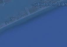
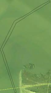
2 Project Site!"#$% &'(% &)*+% )#,'-+%
\"(($ *+,$-.")
3 Shoreline Erosion Rates!"#$%&'($)"(($ -.$45$-6/$0123$!"#$%&'($)"(($ *+,$-./$0123$ 789:$;<6;$
4 Erosion of West Bay Bird Island
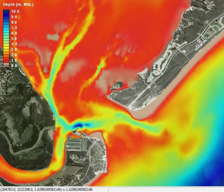
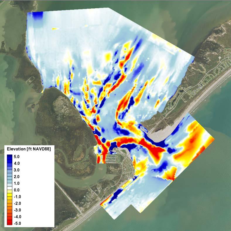
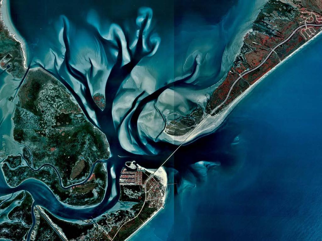
5 Bathymetry ;<6;$ ;<<=$-$;<6>$

6 Flow Control
7 1995
8 Project Need Some of the highest erosion rates in TX due to manmade changes to system Lack of sediment sources! No offshore borrow source available! Upland sources cost prohibitive SLP acts as a sediment sink (approx. 200k cy/yr)
9 Project History SLP Inlet Management Plan performed over 3 phases over the course of 10 years! Phase 1 can we use of material from the SLP flood shoal to restore beaches, dunes and islands?! Phase 2 technical feasibility! Phase 3 environmental feasibility
10 Alternatives Analysis Investigation of potential environmental impacts from proposed dredging alternatives by analyzing:! Hydrodynamics! Salinity! Morphology Investigated 7 different dredge templates! Template selected has least amount of impact


11 Existing 2006 Alt 1 Alt 2 Alt 3 Alt 4 Alt 5 Alt 6 Alt 7

12 Existing 2006 Alt 3 Alt 6 Alt 1 Alt 4 Alt 2 Alt 5 Alt 7


13 Numerical Modeling CMS (USACE)! circulation! waves! sediment transport


14 Numerical Modeling SELFE 3D Salinity Developed numerical model of salinity for Galveston Bay Freshwater inflows, ET from TWDB HF?I$$
15 Salinity Evaluation Almost no change in salinity Trends are consistent for typical, high and low salinity times Typical Salinity
16 Morphology Small changes result from proposed alts Alt 5 (channel) changes less than Alt 6 (wide-area) Areas along Galveston Island experience negligible changes

17 Water Level Comparisons Difference between existing conditions (No Action Alternative 2015) and dredge template very minor More difference between existing conditions and previous bathymetry Range [m] %%%%%%%%%%%%%%%%%%%%%%%%%%%%%%%%%%%6$$$$$$$$$$$$$$$;$$$$$$$$$$$$$$$$$/$$$$$$$$$$$$$$$>$$$$$$$$$$$$$$$$L$$$$$$$$$$$$$$$6<$
18 Velocity Comparisons Difference between existing conditions (No Action Alternative 2015) and dredge template very minor More difference between existing conditions and previous bathymetry <M.>$ <M.<$ <M/>$ <M/<$ <M;>$ <M;<$ <M6>$ <M6<$ <M<>$ <M<<$ 6$ ;$ /$ >$ L$ 6<$
*&+,-+'.$/&0/(#'+$1&+,')/.*/&23+(/&!'##(%&'#(#)*&+,-+'.")
19 Hydrodynamic Patterns Localized flow rates changed by less than 7% Flow rates around West Bay Bird island decreased No change in water surface elevation, velocity, or tide range observed at sensitive habitat locations NG55K$$ $$$$9OO$$!"#$%&'#(#)*&+,-+'.$/&0/(#'+$1&+,')/.*/&23+(/&!'##(%&'#(#)*&+,-+'.$/&0/(#'+$1&-/')/.*/&

20 Project Proposed
21 Nearshore Beach Nourishment Placement of sand as submerged beach nearshore Widening of beach by reduction in erosive wave forces and onshore movement of material Reduced social impact by not interfering with activities on the beach during construction as no construction equipment on beach. Reduced environmental impact doesn t interfere with turtle nesting or piping plover habitat. Reduced permitting efforts

22 Anticipated Construction Methodology Cutterhead dredger (12-16 dia.) Pipeline corridor Est. 2-3 booster pumps necessary Pipeline diffuser plate at placement location No equipment on beach
23 Monitoring 5 year monitoring plan Bathymetry and topography Sensitive Resources! West Bay Bird Island! Emergent vegetation! Seagrass beds! Oyster reefs! Sand flats
24 Project Impacts No seagrass impacts, wetlands or oyster reef impacts would result from project Dredge template located within piping plover habitat Dredging would impact approximately 55.3 acres of unvegetated bottom Nearshore placement of material would impact approximately 43.5 to 58.9 acres of un-vegetated bottom
25 Project Benefits Local sand source for rapidly eroding area! San Luis Pass has net accretion of 200k cy/year Reduced tidal currents along Treasure Island Shoreline! Reduced erosion at Mud Island, Treasure Island, West Bay Bird Island
26 Contributors Casey Connor, P.E.; Hatch Mott MacDonald Josh Carter, P.E., D.CE.; Hatch Mott MacDonald Thomas Durnin; Texas General Land Office Kevin Frenzel, P.G.; Texas General Land Office
27

28
Evaluation of Placement Alternatives for Matagorda Ship Channel Bottleneck Removal
 Evaluation of Placement Alternatives for Matagorda Ship Channel Bottleneck Removal James Rosati III Ashley E. Frey CPT Grays Harbor, WA Wood Wood chips Flour Other CMS Shark River Inlet, NJ US Army Corps
Sediment Management Plan Rehoboth Bay
 Sediment Management Plan Rehoboth Bay STAC Meeting November 16, 2007 Goals of the Study Improve planning for future dredging needs Reduce the dependency on dredging Study Tasks Environmental data Historical
Inlet Management Study for Pass-A-Grille and Bunces Pass, Pinellas County, Florida
 Inlet Management Study for Pass-A-Grille and Bunces Pass, Pinellas County, Florida Final Report Submitted By Ping Wang, Ph.D., Jun Cheng Ph.D., Zachary Westfall, and Mathieu Vallee Coastal Research Laboratory
ST. JOSEPH PENINSULA, GULF COUNTY, FLORIDA Beach Re-Nourishment and Environmental Enhancement Project RECOMMENDATIONS
 ST. JOSEPH PENINSULA, GULF COUNTY, FLORIDA Beach Re-Nourishment and Environmental Enhancement Project RECOMMENDATIONS January 23, 2018 543 Harbor Boulevard, Suite 204 Destin, Florida 32541 850.654.1555
Assateague Island National Seashore North End Restoration Project Timeline
 Assateague Island National Seashore North End Restoration Project Timeline Date Event Some information provided in the Project Introduction document. Detailed events are available in a timeline compiled
Beach Nourishment Impact on Beach Safety and Surfing in the North Reach of Brevard County, Florida
 Beach Nourishment Impact on Beach Safety and Surfing in the North Reach of Brevard County, Florida Prepared by John Hearin, Ph.D. Coastal Engineering Vice Chairman Cocoa Beach Chapter Port Canaveral Patrick
UPPER BEACH REPLENISHMENT PROJECT RELATED
 ASSESSMENT OF SAND VOLUME LOSS at the TOWNSHIP of UPPER BEACH REPLENISHMENT PROJECT RELATED to the LANDFALL OF HURRICANE SANDY - PURSUANT TO NJ-DR 4086 This assessment is in response to Hurricane Sandy
SHORE PROTECTION AND HABITAT CREATION AT SHAMROCK ISLAND, TEXAS ABSTRACT
 SHORE PROTECTION AND HABITAT CREATION AT SHAMROCK ISLAND, TEXAS M. Cameron Perry, P.E., and Daniel J. Heilman, P.E. Coastal Engineer Shiner Moseley & Associates., Inc. 555 N. Carancahua Corpus Christi,
EVALUATION OF BEACH EROSION UP-DRIFT OF TIDAL INLETS IN SOUTHWEST AND CENTRAL FLORIDA, USA. Mohamed A. Dabees 1 and Brett D.
 EVALUATION OF BEACH EROSION UP-DRIFT OF TIDAL INLETS IN SOUTHWEST AND CENTRAL FLORIDA, USA Mohamed A. Dabees 1 and Brett D. Moore 1 The paper discusses the analysis of up-drift beach erosion near selected
ST. LUCIE COUNTY, FLORIDA
 ST. LUCIE COUNTY, FLORIDA COASTAL STORM RISK MANAGEMENT STUDY Draft Feasibility Study & Integrated Environmental Assessment Public Meeting Presented by U.S. Army Corps of Engineers Jacksonville District
Nearshore Dredged Material Placement Pilot Study at Noyo Harbor, CA
 1 Nearshore Dredged Material Placement Pilot Study at Noyo Harbor, CA Noyo Cove N 2011 National Conference on Beach Preservation Technology 9-11, February 2011 Lihwa Lin, Honghai Li, Mitchell Brown US
CMS Modeling of the North Coast of Puerto Rico
 CMS Modeling of the North Coast of Puerto Rico PRESENTED BY: Dr. Kelly Rankin Legault, Ph.D., P.E. 1 Dr. Alfredo Torruella, Ph.D. 2 1 USACE Jacksonville District 2 University of Puerto Rico October 2016
PLAQUEMINES PARISH BARRIER ISLAND RESTORATION & SUSTAINABILITY. MVD/Gulf Coast Regional Dredging Meeting November 5, 2013
 PLAQUEMINES PARISH BARRIER ISLAND RESTORATION & SUSTAINABILITY MVD/Gulf Coast Regional Dredging Meeting November 5, 2013 OVERVIEW 1. Barrier Island Restoration Projects in Plaquemines Parish 2. Plaquemines
Chapter 11. Beach Fill and Soft Engineering Structures
 Chapter 11 Beach Fill and Soft Engineering Structures Solutions to Coastal Erosion Soft Structures Hard Structures Retreat No such thing as low cost coastal protection Beach Nourishment Beach Filling Beach
North Shore of Long Island, Feasibility Study
 North Shore of Long Island, Asharoken New York Asharoken, Feasibility Study Asharoken, NY Public Meeting June 30, 2015 US Army Corps of Engineers US Army Corps of Engineers New York BUILDING STRONG BUILDING
Passage Key Inlet, Florida; CMS Modeling and Borrow Site Impact Analysis
 Passage Key Inlet, Florida; CMS Modeling and Borrow Site Impact Analysis by Kelly R. Legault and Sirisha Rayaprolu PURPOSE: This Coastal and Hydraulics Engineering Technical Note (CHETN) describes the
Navarre Beach & Dune Restoration Project Status Report to be regularly updated June 17, 2016 Report
 Navarre Beach & Dune Restoration Project Status Report to be regularly updated June 17, 2016 Report Work Completed (June 11 to June 17) Weeks Marine Inc. (Contractor): o continued filling Segment 4 including
APPENDIX M DREDGED MATERIAL MANAGEMENT PLAN (DMMP) FINAL INTEGRATED FEASIBILITY REPORT AND ENVIRONMENTAL ASSESSMENT
 FINAL INTEGRATED FEASIBILITY REPORT AND ENVIRONMENTAL ASSESSMENT") APPENDIX M DREDGED MATERIAL MANAGEMENT PLAN (DMMP) Brazos Island Harbor, Texas Channel Improvement Study FINAL INTEGRATED FEASIBILITY REPORT AND ENVIRONMENTAL ASSESSMENT This page is intentionally left
APPENDIX M DREDGED MATERIAL MANAGEMENT PLAN (DMMP) Brazos Island Harbor, Texas Channel Improvement Study FINAL INTEGRATED FEASIBILITY REPORT AND ENVIRONMENTAL ASSESSMENT This page is intentionally left
2018 Beach Preservation Project Information
 QUICK FACTS Beach Renourishment to begin late April 2018 o U.S. Army Corps of Engineers project o Project Area: 8 th St. E. to end of E. Ashley Ave. o Project Length: 2 miles o Cost: $10,900,000 o Funding:
LAB: WHERE S THE BEACH
 Name: LAB: WHERE S THE BEACH Introduction When you build a sandcastle on the beach, you don't expect it to last forever. You spread out your towel to sunbathe, but you know you can't stay in the same spot
Beach Restoration in Okaloosa and Walton Counties. FSBPA Technology Conference Clearwater, FL
 Beach Restoration in Okaloosa and Walton Counties FSBPA Technology Conference Clearwater, FL Presented by: Duncan Greer, E.I. February 5, 2015 PRESENTATION OUTLINE 1. Overview of Project Locations 2. Eglin
Tanya M. Beck. Kelly Legault. Research Physical Scientist Coastal & Hydraulics Lab, ERDC Vicksburg, MS
 Inlet And Adjacent Shoreline Processes at Cascading Time Scales Using the Coastal Modeling System and GenCade Tanya M. Beck Research Physical Scientist Coastal & Hydraulics Lab, ERDC Vicksburg, MS Kelly
Coastal Sediment Transport Modeling Ocean Beach & San Francisco Bight, CA
 1 Coastal Sediment Transport Modeling Ocean Beach & San Francisco Bight, CA Honghai Li and Lihwa Lin Engineering Research and Development Center U.S. Army Corps of Engineers Frank Wu, Lisa Andes, and James
Julebæk Strand. Effect full beach nourishment
 Julebæk Strand Effect full beach nourishment Aim of Study This study is a part of the COADAPT funding and the aim of the study is to analyze the effect of beach nourishment. In order to investigate the
Australian Coastal Councils Conference
 Australian Coastal Councils Conference Kiama March 2019 Where Has My Beach Gone? (and what can I do about it?) Dr Andrew McCowan Water Technology Where Has My Beach Gone? Where Has My Beach Gone? Where
Planning Considerations for Nearshore Placement of Mixed Dredged Sediments
 Planning Considerations for Nearshore Placement of Mixed Dredged Sediments PURPOSE: Dredging planning and management decisions are based on a combination of engineering and economic factors tempered by
Leaning Into Adaptation
 www.marinslr.org Leaning Into Adaptation GFNMS Ocean Summit, May 17, 2016 Jack Liebster, Planning Manager, Marin County Marin County C-SMART Sea Level Rise Adaptation Process Evaluate Science Info. Implement
RE: Hurricane Matthew Beach Damage Assessment and Recommendations [CSE 2416]
![RE: Hurricane Matthew Beach Damage Assessment and Recommendations [CSE 2416]](/thumbs/83/87675702.jpg "RE: Hurricane Matthew Beach Damage Assessment and Recommendations [CSE 2416]") October 25, 2016 Iris Hill Town Administrator Town of Edisto Beach 2414 Murray St Edisto Beach SC 29438 RE: Hurricane Matthew Beach Damage Assessment and Recommendations [CSE 2416] Dear Iris, Hurricane
October 25, 2016 Iris Hill Town Administrator Town of Edisto Beach 2414 Murray St Edisto Beach SC 29438 RE: Hurricane Matthew Beach Damage Assessment and Recommendations [CSE 2416] Dear Iris, Hurricane
LITTLE LAGOON & LITTLE LAGOON PASS: RESEARCH UPDATES & DIRECTIONS
 LITTLE LAGOON & LITTLE LAGOON PASS: RESEARCH UPDATES & DIRECTIONS Bret M. Webb, PhD, PE, DCE Professor Department of Civil, Coastal, and Environmental Engineering October 19, 2017 LLPS Meeting Acknowledgments
PLANNING AND CONSTRUCTION OF SHORE PROTECTION AT SHAMROCK ISLAND, TEXAS: PROJECT UPDATE ABSTRACT
 PLANNING AND CONSTRUCTION OF SHORE PROTECTION AT SHAMROCK ISLAND, TEXAS: PROJECT UPDATE M. Cameron Perry, P.E. and Daniel J. Heilman, P.E. Coastal Engineer HDR Shiner Moseley & Associates., Inc. 555 N.
Warm-up # 7 A day 5/17 - B day 5/18 UPDATE YOUR TABLE OF CONTENTS
 Warm-up # 7 A day 5/17 - B day 5/18 UPDATE YOUR TABLE OF CONTENTS Question: List all examples of surface water on Earth. Answer: Rivers and streams, lakes and reservoirs, (ponds) wetlands, estuaries and
AN OVERVIEW OF RECENT PROJECTS RELATED TO SAND BUDGETS, SOUTHERN CALIFORNIA BEACHES
 AN OVERVIEW OF RECENT PROJECTS RELATED TO SAND BUDGETS, SAND SUPPLY, COASTAL ARMORING, MANAGEMENT, AND VALUING SOUTHERN CALIFORNIA BEACHES Dr. Kiki Patsch California State University Channel Islands Environmental
APPENDIX D W-19 FLUVIAL AND TIDAL HYDRAULIC, SEDIMENTATION, WATER QUALITY AND SEA LEVEL RISE MODELING STUDIES
 APPENDIX D W-19 FLUVIAL AND TIDAL HYDRAULIC, SEDIMENTATION, WATER QUALITY AND SEA LEVEL RISE MODELING STUDIES Final EIR November 2018 Appendices Executive Summary Background: The San Dieguito Lagoon W19
Town of Duck, North Carolina
 Tracking No. 00.00.2010 Erosion Mitigation And Shoreline Management Feasibility Study Town of Duck, North Carolina Coastal Planning & Engineering of North Carolina August 15, 2012 Tom Jarrett Robert Neal
FINAL ENVIRONMENTAL IMPACT STATEMENT ON BROWARD COUNTY SHORE PROTECTION PROJECT SEGMENTS II AND III BROWARD COUNTY, FLORIDA
 FINAL ENVIRONMENTAL IMPACT STATEMENT ON BROWARD COUNTY SHORE PROTECTION PROJECT SEGMENTS II AND III BROWARD COUNTY, FLORIDA 1. PROJECT PURPOSE AND NEED 1.1. PROJECT AUTHORITY. 1.1.1. INITIAL AUTHORIZATION.
Shoreline Studies Program, Department of Physical Sciences, VIMS
 Living Shoreline Training Class 2017 1 Demonstration sites discussed in this talk. 2 A shoreline management plan for the entire creek made conceptual shoreline management recommendations along every stretch
Dauphin Island East End Beach and Barrier Island Restoration Project. Beau Buhring South Coast Engineers
 Dauphin Island East End Beach and Barrier Island Restoration Project Beau Buhring South Coast Engineers Funding Funded with qualified outer continental shelf oil and gas revenues by the Coastal Impact
Shoalwater Bay Shorline Erosion Dredging
 Shoalwater Bay Shorline Erosion Dredging ROSS ISLAND SAND & GRAVEL CO. Saving the Tokeland Penninsula Willapa Bay & Tokeland Penninsula Southwestern Washington Coast Shoalwater Bay Historic View Settlements
Modeling Sediment Transport Along the Upper Texas Coast
 Modeling Sediment Transport Along the Upper Texas Coast David B. King Jr. Jeffery P. Waters William R. Curtis Highway 87 roadbed, Jefferson County Galveston District Corps Sabine Pass to San Luis Pass
Volume and Shoreline Changes along Pinellas County Beaches during Tropical Storm Debby
 Volume and Shoreline Changes along Pinellas County Beaches during Tropical Storm Debby Ping Wang and Tiffany M. Roberts Coastal Research Laboratory University of South Florida July 24, 2012 Introduction
3.3 OCEANOGRAPHY/COASTAL PROCESSES
 3.3 OCEANOGRAPHY/COASTAL PROCESSES Beaches are dynamic and conditions vary based on the onshore/offshore movement of sand both seasonally and annually. Sand also moves alongshore within a generally defined
ATLANTIC COAST OF LONG ISLAND, JONES INLET TO EAST ROCKAWAY INLET, LONG BEACH ISLAND, NY. Contract #2 Construction Scope. April 18th-19th 2018
 ATLANTIC COAST OF LONG ISLAND, JONES INLET TO EAST ROCKAWAY INLET, LONG BEACH ISLAND, NY Contract #2 Construction Scope April 18th-19th 2018 New York District PLAN COMPONENTS Length of Beachfill 35,000
For more information or permission to reprint slides, please contact Donna Milligan at 1
 For more information or permission to reprint slides, please contact Donna Milligan at milligan@vims.edu 1 For more information or permission to reprint slides, please contact Donna Milligan at milligan@vims.edu
Coastal Environments Oceanographic and Engineering Expertise
 Coastal Environments Oceanographic and Engineering Expertise Coastal Environments La Jolla, CA www.coastalenvironments.com 14 May 2004 CE Ref. No. 04-05 EcoSystems Management Associates, Inc. Carlsbad,
ALTERNATIVES FOR COASTAL STORM DAMAGE MITIGATION
 ALTERNATIVES FOR COASTAL STORM DAMAGE MITIGATION Dave Basco Old Dominion University, Norfolk, Virginia, USA National Park Service Photo STRUCTURAL (changes to natural, physical system) hardening (seawalls,
Jimmy s beach preliminary results
 Jimmy s beach preliminary results LP 668979 Jimmy s Beach Restoration Society 1 Outline 1. Long term: GIS analyses. Aerial photos, charts Shoreline analyses Storm data from MHL/DECC 2. Medium term: morphologic
La Quinta Channel Extension Port of Corpus Christi Ingleside, Texas. Mark Coyle
 La Quinta Channel Extension Port of Corpus Christi Ingleside, Texas Mark Coyle Corpus Christi Navigation Channel PCCA La Quinta Expansion Project History Corpus Christi Ship Channel Improvement Projects
Nearshore Sediment Transport What influences the loss of sediment on Beaches? - Waves - Winds - Tidal Currents - River discharge - Runoff
 Tides & Beaches Nearshore Sediment Transport What influences the loss of sediment on Beaches? - Waves - Winds - Tidal Currents - River discharge - Runoff Oceans Ocean Topography Physical Structure of the
Sediment Transport Analysis Village of Asharoken, New York
 Sediment Transport Analysis Village of Asharoken, New York NORTH SHORE OF LONG ISLAND, NEW YORK COMBINED EROSION CONTROL AND STORM DAMAGE PROTECTION FEASIBILITY STUDY FINAL REPORT August 2004 Cell 0 Asharoken
Town of Duck, North Carolina
 Tracking No. 00.00.2010 Erosion Mitigation And Shoreline Management Feasibility Study Town of Duck, North Carolina Coastal Planning & Engineering of North Carolina February 28, 2013 Ken Willson 1 Tracking
STATUS REPORT FOR THE SUBMERGED REEF BALL TM ARTIFICIAL REEF SUBMERGED BREAKWATER BEACH STABILIZATION PROJECT FOR THE GRAND CAYMAN MARRIOTT HOTEL
 August 23 STATUS REPORT FOR THE SUBMERGED REEF BALL TM ARTIFICIAL REEF SUBMERGED BREAKWATER BEACH STABILIZATION PROJECT FOR THE GRAND CAYMAN MARRIOTT HOTEL performed by Lee E. Harris, Ph.D., P.E. Consulting
The 2017 Panama City Beaches Beach Interim Renourishment Project. Answers to Common Questions
 The 2017 Panama City Beaches Beach Interim Renourishment Project The fourth renourishment of the Panama City Beaches will be under construction during March and April 2017, with a planned completion by
4/20/17. #31 - Coastal Erosion. Coastal Erosion - Overview
 Writing Assignment Due Monday by 11:59 pm #31 - Coastal Erosion Beach front property! Great View! Buy now at a great price! See main class web pages for detailed instructions Essays will be submitted in
MOREHEAD CITY HARBOR, NC. Dredged Material Management Plan (DMMP)
") MOREHEAD CITY HARBOR, NC Dredged Material Management Plan (DMMP) Public Meeting/Info Session 15 January 2014 US Army Corps of Engineers Morehead City Harbor DMMP Presentation Topics Morehead City Harbor
MOREHEAD CITY HARBOR, NC Dredged Material Management Plan (DMMP) Public Meeting/Info Session 15 January 2014 US Army Corps of Engineers Morehead City Harbor DMMP Presentation Topics Morehead City Harbor
ALTERNATIVES FOR COASTAL STORM DAMAGE MITIGATION AND FUNCTIONAL DESIGN OF COASTAL STRUCTURES
 The University of the West Indies Organization of American States PROFESSIONAL DEVELOPMENT PROGRAMME: COASTAL INFRASTRUCTURE DESIGN, CONSTRUCTION AND MAINTENANCE A COURSE IN COASTAL DEFENSE SYSTEMS I CHAPTER
SANDBANKS COAST PROTECTION
 SANDBANKS COAST PROTECTION David Robson, Senior Engineer, Coastal & Drainage Team Borough of Poole Leisure Services (T) 01202 265265 (E) d.robson@poole.gov.uk May 2003 SANDBANKS COAST PROTECTION Introduction
Kelly Legault, Ph.D., P.E. USACE SAJ
 Kelly Legault, Ph.D., P.E. USACE SAJ Report Documentation Page Form Approved OMB No. 0704-0188 Public reporting burden for the collection of information is estimated to average 1 hour per response, including
CHAPTER 134 INTRODUCTION
 CHAPTER 134 NEW JETTIES FOR TUNG-KANG FISHING HARBOR, TAIWAN Chi-Fu Su Manager Engineering Department Taiwan Fisheries Consultants, Inc. Taipei, Taiwan INTRODUCTION Tung-Kang Fishing Harbor, which is about
New Jersey Coastal Zone Overview. The New Jersey Beach Profile Network (NJBPN) 3 Dimensional Assessments. Quantifying Shoreline Migration
 3 Dimensional Assessments. Quantifying Shoreline Migration") New Jersey Coastal Zone Overview The New Jersey Beach Profile Network (NJBPN) Objectives Profile Locations Data Collection Analyzing NJBPN Data Examples 3 Dimensional Assessments Methodology Examples Quantifying
New Jersey Coastal Zone Overview The New Jersey Beach Profile Network (NJBPN) Objectives Profile Locations Data Collection Analyzing NJBPN Data Examples 3 Dimensional Assessments Methodology Examples Quantifying
STORM RESPONSE SIMULATION
 APPENDIX V STORM RESPONSE SIMULATION Final Environmental Impact Statement Village of Bald Head Island Shoreline Protection Project Brunswick County, North Carolina Delft3D Storm Response Simulations With
Figure 4, Photo mosaic taken on February 14 about an hour before sunset near low tide.
 The Impact on Great South Bay of the Breach at Old Inlet Charles N. Flagg and Roger Flood School of Marine and Atmospheric Sciences, Stony Brook University Since the last report was issued on January 31
Cat Island Chain Restoration
 Cat Island Chain Restoration 1820s Fox River Military Road Map to Fort Howard 1845 Chart of Green Bay & Fox River Cat Island Chain - 1938 Cat Island Brown County Aerial Photography, 1938 Historic Western
Long Term Success and Future Approach of the Captiva and Sanibel Islands Beach Renourishment Program
 2017 National Conference on Beach Preservation Technology February 8-10, 2017; Stuart, Florida Long Term Success and Future Approach of the Captiva and Sanibel Islands Beach Renourishment Program Thomas
Collaboration: Sea-level Marin Adaptation Response Team (C-SMART)
") Collaboration: Sea-level Marin Adaptation Response Team (C-SMART) Photo Credit : Lighthawk Aerial Community Development Agency 3501 Civic Center Drive, Rm. 308 San Rafael, CA 94903 415 4736269 T www.marinslr.org
Collaboration: Sea-level Marin Adaptation Response Team (C-SMART) Photo Credit : Lighthawk Aerial Community Development Agency 3501 Civic Center Drive, Rm. 308 San Rafael, CA 94903 415 4736269 T www.marinslr.org
CALCASIEU SALINITY STRUCTURES. HYDRODYNAMIC MODELING (To Support Design of Salinity Barriers)
") CALCASIEU SALINITY STRUCTURES HYDRODYNAMIC MODELING (To Support Design of Salinity Barriers) Presentation Overview 1 2 3 4 5 Project Overview and CEA Circulation Modeling Vessel Hydrodynamics Modeling
CALCASIEU SALINITY STRUCTURES HYDRODYNAMIC MODELING (To Support Design of Salinity Barriers) Presentation Overview 1 2 3 4 5 Project Overview and CEA Circulation Modeling Vessel Hydrodynamics Modeling
HURRICANE SANDY LIMITED REEVALUATION REPORT UNION BEACH, NEW JERSEY DRAFT ENGINEERING APPENDIX SUB APPENDIX D SBEACH MODELING
 HURRICANE SANDY LIMITED REEVALUATION REPORT UNION BEACH, NEW JERSEY DRAFT ENGINEERING APPENDIX SUB APPENDIX D SBEACH MODELING Rev. 18 Feb 2015 1 SBEACH Modeling 1.0 Introduction Following the methodology
New Jersey Beach Profile Network Atlantic County Profile Site Locations
 215 RICHARD STOCKTON COLLEGE OF NEW JERSEY New Jersey Beach Profile Network Atlantic County Profile Site Locations COASTAL RESEARCH CENTER Figure 128 There are nine NJBPN survey sites on the Atlantic County
COUPLED MANAGEMENT STRATEGY LAKE CATHIE ESTUARY & COAST
 Lake Cathie Progress Association Inc. ABN 28 251 433 854 P.O. Box 247 Lake Cathie NSW 2445 PHONE/FAX: 02 6584 8211 EMAIL: r3packag@bigpond.com 20 th October 2009 Port Macquarie Hastings Council PO Box
City of Port Aransas Shoreline Analysis and Improvements
 City of Port Aransas Shoreline Analysis and Improvements FINAL Technical Report August 24, 2016 Submitted To: City of Port Aransas Prepared for: City of Port Aransas This document is intended for planning
KEYNOTE PRESENTATION FSBPA olsen
 AMELIA ISAND, FLORIDA BEACH MANAGEMENT PARTNERING AND PERSERVERENCE Erik Olsen, PE associates, inc. KEYNOTE PRESENTATION FSBPA 2009 IN ORDER TO ADDRESS SHORE PROTECTION TODAY LOCAL INTERESTS PARTNER WITH:
OECS Regional Engineering Workshop September 29 October 3, 2014
 B E A C H E S. M A R I N A S. D E S I G N. C O N S T R U C T I O N. OECS Regional Engineering Workshop September 29 October 3, 2014 Coastal Erosion and Sea Defense: Introduction to Coastal Dynamics David
National Shoreline Erosion Control Demonstration Program Overview
 National Shoreline Erosion Control Demonstration Program Overview William R. Curtis 1 (Phone: (601) 634-3040, Fax: (601) 634-3080, CURTISW@wes.army.mil), Joan Pope 1 (Phone: (601) 634-3040, Fax: (601)
US Beach Nourishment Experience:
 Beach Nourishment: Introduction of new sand to the beach by truck or dredge Large beach >1 million cubic yards (100,000 dump truck loads) Funding is a combination of federal, state, local & private Also
To: William Woods, Jenni Austin Job No: CentrePort Harbour Deepening Project - Comments on community queries
 Memo To: William Woods, Jenni Austin From: Richard Reinen-Hamill Date: Subject: cc: 1 Purpose This memo sets out our response to issues raised at and after Seatoun community consultation sessions held
Southwest Washington Littoral Drift Restoration Project: Design, Construction, and Monitoring
 Southwest Washington Littoral Drift Restoration Project: Design, Construction, and Monitoring J Jessica i St Stokke kk USACE Portland District October 28, 2010 WEDA Pacific Meeting Monterey, CA US Army
An Update of Coastal Erosion in Puerto Rico
 Jack Morelock and Maritza Barreto An Update of Coastal Erosion in Puerto Rico Department of Marine Sciences, University of Puerto Rico at Mayagüez and Geography Department, University of Puerto Rico at
Figure79. Location map for the 10 NJBPN profile sites in Atlantic County, NJ 155
 154 Figure79. Location map for the 10 NJBPN profile sites in Atlantic County, NJ 155 ATLANTIC COUNTY SPRING 2009 to FALL 2010 The Atlantic County coastline consists of three barrier islands. Between Little
Beach profile surveys and morphological change, Otago Harbour entrance to Karitane May 2014 to June 2015
 Beach profile surveys and morphological change, Otago Harbour entrance to Karitane May 2014 to June 2015 Prepared for Port Otago Ltd Martin Single September 2015 Shore Processes and Management Ltd Contact
Dare County Nourishment Project Town of Duck
 Dare County Nourishment Project Town of Duck Julien Devisse, P.E. and Ken Willson CB&I / Coastal Planning & Engineering of North Carolina, Inc. February 15, 2017 A World of Solutions Outline Background
A Preliminary Review of Beach Profile and Hardbottom Interactions
 A Preliminary Review of Beach Profile and Hardbottom Interactions Douglas W. Mann, P.E., D.CE. CB&I A World of Solutions Presentation Goal Lead to a better understanding of the challenges regarding the
OYSTER REEF RESTORATION; RESTORING ECOLOGICAL FUNCTION
 OYSTER REEF RESTORATION; RESTORING ECOLOGICAL FUNCTION Paul Jensen, David Buzan, and Ka-Leung Lee; Atkins Mark Dumesnil and Julie Sullivan; The Nature Conservancy Presentation Overview The Nature Conservancy
A REVIEW OF THE CONDITION OF THE MUNICIPAL BEACHES AS A RESULT OF HURRICANE SANDY IN THE BOROUGH OF STONE HARBOR, CAPE MAY COUNTY, NEW JERSEY
 A REVIEW OF THE CONDITION OF THE MUNICIPAL BEACHES AS A RESULT OF HURRICANE SANDY IN THE BOROUGH OF STONE HARBOR, CAPE MAY COUNTY, NEW JERSEY View along the dune scarp from 103 rd Street on October 31,
Oceanside Carlsbad. Solana Beach
 Oceanside Carlsbad Solana Beach BACKGROUND AND PURPOSE OF THE PROGRAM Many beaches in Southern California are actively eroding; A deficit of natural sand delivery to the beaches exists due to flood control
RESILIENCE THROUGH RESTORATION
 RESILIENCE THROUGH RESTORATION RECLAMATION DISTRICT NO. 1601 TWITCHELL ISLAND SAN JOAQUIN RIVER SETBACK LEVEE PROJECT TWITCHELL ISLAND BASICS Nearly 12 miles of levee Storm drainage facilities Protects
Texas passes, longshore transport, hurricanes, beach erosion and sea level
 Texas passes, longshore transport, hurricanes, beach erosion and sea level Richard L. Watson, Ph.D. (361) 749-4152 Field work can be strange! 120,000 years of sea level Years each zone exposed above S/L
Table 4. Volumetric Change Rates Pre-Project and Post-Project for the Town of Duck
 V. VOLUMETRIC CHANGES General Volumetric changes measured over the entire monitoring area for various time periods are provided in Table 4. The volume changes are given in terms of cubic yards/foot of
DELAWARE S VULNERABLE COASTAL AREAS. DELAWARE INLAND BAYS and DELAWARE BAY RECONNAISSANCE STUDY
 DELAWARE S VULNERABLE COASTAL AREAS and the DELAWARE INLAND BAYS and DELAWARE BAY RECONNAISSANCE STUDY Kimberly K. McKenna, PG Delaware Dept. of Natural Resources & Environmental Control Division of Watershed
Sea Level Rise Subcommittee Meeting Subcommittee of Town of Kiawah Island Environmental Committee Town Meeting Hall April 11, 2018.
 Sea Level Rise Subcommittee Meeting Subcommittee of Town of Kiawah Island Environmental Committee Town Meeting Hall April 11, 2018 Persons attending meeting Minutes John Leffler, Subcommittee Chairman
Effect of Hydrodynamics on Sediment Transport near a Coastal Inlet
 ICHE 2014, Hamburg - Lehfeldt & Kopmann (eds) - 2014 Bundesanstalt für Wasserbau ISBN 978-3-939230-32-8 Effect of Hydrodynamics on Sediment Transport near a Coastal Inlet H. Li, M. Brown, J. Rosati & Z.
2014 ANNUAL REPORT - TO THE CITY OF NORTH WILDWOOD ON THE CONDITION OF THE CITY BEACHES
 2014 ANNUAL REPORT - TO THE CITY OF NORTH WILDWOOD ON THE CONDITION OF THE CITY BEACHES View on September 25, 2014 looking northwest into Hereford Inlet. Considerable southerly expansion of the tip of
GENERAL METHODOLOGY FOR INLET RESERVOIR MODEL ANALYSIS OF SAND MANAGEMENT NEAR TIDAL INLETS. Mohamed A. Dabees 1, Nicholas C.
 GENERAL METHODOLOGY FOR INLET RESERVOIR MODEL ANALYSIS OF SAND MANAGEMENT NEAR TIDAL INLETS Mohamed A. Dabees 1, Nicholas C. Kraus 2 1 Humiston& Moore Engineers, 5679 Strand Court, Naples, FL 34109, USA.
City of Del Mar Local Coastal Plan (LCP) Amendment for Sea Level Rise and Coastal Flooding
 Amendment for Sea Level Rise and Coastal Flooding") City of Del Mar Local Coastal Plan (LCP) Amendment for Sea Level Rise and Coastal Flooding 6/22/17 Presentation to Sea Level Rise Stakeholder- Technical Advisory Committee (STAC) Nick Garrity, P.E. Lindsey
City of Del Mar Local Coastal Plan (LCP) Amendment for Sea Level Rise and Coastal Flooding 6/22/17 Presentation to Sea Level Rise Stakeholder- Technical Advisory Committee (STAC) Nick Garrity, P.E. Lindsey
Estuarine Shoreline Stabilization
 Estuarine Shoreline Stabilization Property Owner s Guide to Determining the Most Appropriate Stabilization Method Estuarine shorelines are dynamic features that experience continued erosion. Land is lost
CHAPTER 281 INFLUENCE OF NEARSHORE HARDBOTTOM ON REGIONAL SEDIMENT TRANSPORT
 CHAPTER 281 INFLUENCE OF NEARSHORE HARDBOTTOM ON REGIONAL SEDIMENT TRANSPORT Paul C.-P. Lin, Ph.D., P.E. 1 and R. Harvey Sasso, P.E. 2 ABSTRACT The influence of nearshore hardbottom on longshore and cross-shore
CLAM PASS RESTORATION AND MANAGEMENT PLAN BATHYMETRIC MONITORING REPORT NO. 7 Including Interior Bay Dredge Cuts and Tidal Data
 CLAM PASS RESTORATION AND MANAGEMENT PLAN BATHYMETRIC MONITORING REPORT NO. 7 Including Interior Bay Dredge Cuts and Tidal Data Submitted to: Florida Department of Environmental Protection DEP File No.
Species Conclusions Table
 Conclusions Table Project Name: Chesapeake Landing HOA- Breakwaters (NAO-14-0283) Date: February 25, 2014 /Resource Name Loggerhead sea turtle (Caretta caretta) Conclusion ESA Section 7 / Eagle Act Determination
Low-crested offshore breakwaters: a functional tool for beach management
 Environmental Problems in Coastal Regions VI 237 Low-crested offshore breakwaters: a functional tool for beach management K. Spyropoulos & E. Andrianis TRITON Consulting Engineers, Greece Abstract Beach
Reading Material. Inshore oceanography, Anikouchine and Sternberg The World Ocean, Prentice-Hall
 Reading Material Inshore oceanography, Anikouchine and Sternberg The World Ocean, Prentice-Hall BEACH PROCESSES AND COASTAL ENVIRONMENTS COASTAL FEATURES Cross section Map view Terminology for Coastal
SAND BOTTOM EROSION AND CHANGES OF AN ACTIVE LAYER THICKNESS IN THE SURF ZONE OF THE NORDERNEY ISLAND
 SAND BOTTOM EROSION AND CHANGES OF AN ACTIVE LAYER THICKNESS IN THE SURF ZONE OF THE NORDERNEY ISLAND Kos'yan R. 1, Kunz H. 2, Podymov l. 3 1 Prof.Dr.,The Southern Branch of the P.P.Shirshov Institute
Final Waterways Assets and Resources Survey Master Plan for Dredging and Beach Nourishment
 Final Waterways Assets and Resources Survey Master Plan for Dredging and Beach Nourishment For, Massachusetts Prepared For: Dennis Town Hall P.O. Box 2060 485 Main Street Dennis, MA 02660 Prepared By: