The Noosa River Plan. Noosa Council in collaboration with DPI, DNRM, EPA, QT /MSQ Source Documentation: Noosa River Plan 1997
|
|
|
- Andrea Stanley
- 6 years ago
- Views:
Transcription
1 1
2 2 Project: Project Type: Report Author/s: The Noosa River Plan Noosa River Noosa Council in collaboration with DPI, DNRM, EPA, QT /MSQ Source Documentation: Noosa River Plan 1997 Report: Mapping: Edited and reviewed by: Coordination & Final Documentation: H:\Noosa River\Report Doc\Cabinet Version-Nov 2004.Doc H\:A3NRiverManAreas At various scales prepared by Ian Lewis Mapping prepared by Noosa Council for strategic planning purposes, with original mapping held in Noosa Council s GIS. Accurate representation of boundaries over individual allotments cannot be guaranteed. Various State agencies and Noosa Council Noosa Council Strategic Planning Section ( ) Completion Date: November 2004
3 3 CONTENTS CONTENTS... 3 EXECUTIVE SUMMARY... 4 NOOSA RIVER SYSTEM... 4 COORDINATED MANAGEMENT... 4 STRUCTURE OF THIS PLAN... 5 WHERE THIS PLAN APPLIES... 6 LINKS TO OTHER LOCAL & REGIONAL PLANS & STRATEGIES VISION FOR THE NOOSA RIVER SYSTEM THE VISION FOR THE NOOSA RIVER SYSTEM AT PURPOSE OF THE PLAN DESIRED ENVIRONMENTAL OUTCOMES BED AND BANK HABITAT AND ECOSYSTEM HEALTH WATER QUALITY VISUAL AMENITY AND PUBLIC SAFETY CULTURAL HERITAGE JETTIES, PONTOONS & WHARVES (PUBLIC AND PRIVATE) MOORINGS LIVING ONBOARD WATERCRAFT BOAT RAMPS MARINE SERVICES COMMERCIAL OPERATIONS MOTORISED WATER SPORTS AND TRANSPORTATION MANAGEMENT AREAS LAKE COOTHARABA (INCLUDING LOWER REACHES OF KIN KIN CREEK) DOWNSTREAM OF LAKE COOTHARABA TO TEWANTIN (INCLUDING DOONELLA LAKE) NOOSAVILLE REACH LAKE WEYBA & WEYBA CREEK ACTION PLAN FOR MANAGEMENT AGENCIES BED AND BANK HABITAT AND ECOSYSTEM HEALTH WATER QUALITY VISUAL AMENITY AND PUBLIC SAFETY CULTURAL HERITAGE JETTIES, PONTOONS & WHARVES MOORINGS LIVING ONBOARD WATERCRAFT BOAT RAMPS MARINE SERVICES COMMERCIAL OPERATIONS MOTORISED WATER SPORTS AND TRANSPORTATION SELECTED BIBLIOGRAPHY EXISTING USE PATTERNS MANAGEMENT ISSUES EXISTING MANAGEMENT ARRANGEMENTS FACTORS AFFECTING RIVER USE AND MANAGEMENT APPENDIX B AUDIT OF ACTIONS FROM THE 1997 PLAN APPENDIX C - IMPLEMENTATION INTRODUCTION MANAGEMENT OF TENURE MANAGEMENT OF RIVER & FORESHORE USES CO-ORDINATION OF MANAGEMENT ACTIVITIES ALLOCATION OF MANAGEMENT RESPONSIBILITIES RESOURCING & FUNDING COMMUNITY INVOLVEMENT ESTABLISHMENT TASKFORCE APPENDIX D NOOSA RIVER FISHING CLOSURES JULY MAPS Map 1 Noosa River Plan Area... 6 Map 2 Prohibited Waterskiing Areas Map 3 Noosa River Management Area 1 Map 4 Noosa River Management Area 2 Map 5 Noosa River Management Area 3 Map 6 Noosa River Management Area 4 FIGURES Figure 1.1 Relationship to Other Local and Regional Plans and Strategies Figure 8.1 Mechanisms for Consultation TABLES Table 6.1 Tidal Ranges for Spring Tides Table 6.2 Approximate River Depths Table Peak Flood Levels Table 6.4 Hirecraft on the Noosa River-1996 Table 6.5 Existing Management Arrangements Table 6.6 Recreation Vessel Registrations in South East Queensland Table 6.7 Recreation Vessel Registrations on the Sunshine Coast Table 8.2 Alternative Mechanisms for Management of Water-based Uses for Other than Marine Safety reasons 6. APPENDIX A BACKGROUND INFORMATION PREVIOUS NOOSA RIVER PLAN ECOLOGICAL RESOURCES AND VALUES SCENIC RESOURCES AND VALUES FISHERIES RESOURCES AND VALUES RECREATION AND TOURISM RESOURCES AND VALUES TENURE TIDAL RANGES AND FLOODING INFLUENCE... 39
4 4 EXECUTIVE SUMMARY NOOSA RIVER SYSTEM The Noosa River is the major waterway flowing south from the Great Sandy Region of Queensland. Its source is in the Cooloola Section of the Great Sandy National Park where it is fed by springs draining major sand deposits. The Noosa River is one of the few Queensland rivers which enjoys a continuous year-round freshwater inflow. On its journey to the sea, the river passes through a number of shallow coastal lakes - each is predominantly natural in character and subject to tidal influences. Lakes Cootharaba and Cooroibah are the largest of these. Travelling downstream from Lake Cooroibah, the southern bank of the river becomes increasingly more developed. The townships of Tewantin, Noosaville and Noosa Heads near the river mouth are rapidly developing residential and tourist centres at the northern end of Queensland s Sunshine Coast. As a focal point for recreation and visitor activities, the Noosaville Reach is placed under increasing pressure during peak visitor periods, with numerous motorised and non-motorised vessels competing for limited water. Within this section, the quantity of boat traffic past a given point is the highest in South-east Queensland. Lake Weyba is a shallow tidal lake within an attractive forest setting. Located south of the Noosa River estuary, its tidal connection to the river is through Weyba Creek, a shallow meandering estuarine channel flanked by wetland and seagrass beds. Also connected to the lower reaches of the Noosa River is Doonella Lake- a highly saline, shallow lake fringed by mangroves and Melaleuca woodland, as well as housing on its northern side. Large areas of land adjoining the headwaters of the river are protected in an undisturbed vegetated condition as state forest or national park. This has been a key factor in maintaining the river s outstanding natural attributes including high water quality, diversity of in-stream habitats and high levels of production of fish species. The Noosa River has been awarded an A- rating in 2001 and 2002, with a B+ for estuaries and A- for freshwaters in 2003, based on comparisons with other estuaries in South-east Queensland. However, the ecological, cultural heritage and economic values of the river system are highly sensitive to change and are correspondingly under increasing pressure from population growth, tourism growth, increased boating numbers and human activities in and adjacent to the river. The dilemma facing the Noosa River system is that it is both a relatively un-modified river system with particularly high environmental and scenic values, and a much sought after recreation, tourist and fisheries resource that makes a substantial contribution to the local Noosa economy. The challenge is in balancing the environmental, cultural heritage and visual qualities with the recreational, tourism, and fisheries resources and values within the Noosa River system. This Plan has been prepared to protect and enhance these resources and values and sustainably manage the pressures on them. COORDINATED MANAGEMENT The Noosa River Plan seeks to provide a vision and framework for a coordinated and consistent approach to the planning, development and management of the Noosa River system, including its waterways and tidal lands. It sets out a number of desired environmental outcomes (DEOs) relating to various waterways issues, including bed and bank habitat, water quality, visual amenity, safety and cultural heritage. It also presents DEOs for various river uses and activities, including jetties, moorings, living onboard vessels, boat ramps, commercial operations and motorised water sports. The Plan sets out performance criteria for development and activities in the river system to be used as a basis for assessing applications. In addition, it serves as a decision making tool for management agencies and other key stakeholders, presenting a range of agreed actions for management agencies to fulfil and monitor over time. The Noosa River Plan was first prepared in 1997 through a cooperative process involving all stakeholders, including government agencies, Noosa Council and the community. The 1997 Plan provided a comprehensive review of the existing marine infrastructure and use patterns on and adjacent to the river system. It identified the various ecological, recreational and fisheries values and outlined factors affecting river use and management. The 1997 Plan also contained a number of proposed actions relating to impacts associated with activities and development on the river. This 2003 Plan reviews and updates the actions and background information within the 1997 Plan and has regard to the policies of the State Coastal Management Plan Queensland s Coastal Policy (2001) and other management strategies relating to the river system. This Plan concludes there is a continuing need for co-ordinated management and resources to be applied to the Noosa River system to ensure the values of the river are prevented from seriously deteriorating over time. A coordinated management model is recommended, in conjunction with additional plans and regulations under existing legislation. The absence of a suitable regulatory framework to deliver co-ordinated management of diverse river systems is a serious shortcoming in current legislation.
5 5 Outcomes and recommendations contained within this Plan are Co-ordinated management of the river by all agencies; Specific desired outcomes for river uses and activities to secure long term sustainability; Action plans for management agencies to implement; Monitoring of river uses and activities; and Need for legislative reform. STRUCTURE OF THIS PLAN This Noosa River Plan is presented in four parts, with three supporting appendices. Part 1 - Vision for the Noosa River System This section establishes a vision for the Noosa River system by 2010 and the purpose of the Noosa River Plan. Part 2- Desired Environmental Outcomes From the vision, 11 DEOs are developed for various waterways issues and for uses and activities that relate to the Noosa River system. These DEOs apply to Bed & Bank Habitat and Ecosystem Health Living Onboard Vessels Water Quality Boat Ramps Visual Amenity and Public Safety Marine Services Cultural Heritage Commercial Operations Jetties, Pontoons and Wharves Motorised Water Sports and Transportation Moorings Each DEO has a role in realising the vision. These roles are identified by statements of outcome regarding the important issues to be considered in assessing proposals for development and activities and in planning and managing uses and activities on the river and tidal lands. Part 3 Management Areas The Plan moves from a broadly based vision to DEOs to more detailed provisions and performance criteria. Management areas have been defined for four sections of the river system, which are depicted on Maps 3-6 and include: 1) Lake Cootharabah; 2) Downstream of Lake Cootharabah to Tewantin (including Doonella Lake); 3) Noosaville Reach; and 4) Lake Weyba & Weyba Creek. The boundaries of each management area relate to identified similarities in water activities, landscape and ecological characteristics, land tenure and urban form. These characteristics provide a suitable basis for guiding the type, location and extent of uses and activities within the different sections of the river and tidal lands. For each management area, the Plan describes the mapping context; desired future character and intent; performance criteria for assessing proposals for activities and development; and key actions to be implemented from the Action Plan for Management Agencies in Part 4. The statements of desired future character and intent for each management area serve to set a context for the character of the management areas and define important attributes or values that are to be retaining or enhanced. It also seeks to identify policy intent and direction, such as for controlling certain river uses and development or promoting ongoing bank rehabilitation works. Part 4 - Action Plan for Management Agencies The Action Plan for Management Agencies sets out the agreed actions to be implemented by management agencies. Some actions are specific to a management area whilst others apply to the whole river system. Each action is outcome-oriented and falls under one of the DEOs (in Part 2) and is assigned a regulating/coordinating agency and a level of priority/timeframe. Appendix A - Background Information This part of the Plan summarises the main management issues that emerged from the consultation programme for the 1997 Plan;
6 6 updates the background information and findings of the 1997 Plan, including the physical characteristics and values of the river and the various factors affecting river use and management. Appendix B Audit of Actions from the 1997 Plan This Part comprises the results of an audit of the proposed actions within the 1997 Plan. The audit was carried out to determine the extent to which the 1997 Plan was a success, despite its lack of official status. Appendix C - Implementation This Part proposes an approach for implementing this Plan based on a co-operative management model as there is currently no single piece of legislation that suitably covers the broad facets of river development and activity. WHERE THIS PLAN APPLIES This Plan applies to all parts of the Noosa River system from its northern entrance of Lake Cootharaba downstream to its mouth in Laguna Bay and includes Lake Cooroibah, Doonella Lake and Lake Weyba, Weyba Creek and the lower tidal reaches of Kin Kin Creek, as shown on Map 1. It extends to tidal lands below mean high water mark (MHWM) surrounding these parts of the river system. The Plan does not cover land above MHWM as provisions and controls pertaining to these lands are contained within Noosa Council s planning scheme and other State legislation. Map 1 Noosa River Plan Area Cooloola Shire LAKE COOTHARABA Noosa Shire LAGUNA BAY LAKE COOROIBAH DOONELLA LAKE Maroochy Shire LAKE WEYBA Noosa River Plan Area LINKS TO OTHER LOCAL & REGIONAL PLANS & STRATEGIES This document is related to other strategies and plans which have local and regional contexts. It is important that this document is not viewed on its own, but that other related strategies and plans are acknowledged and taken into account when planning or assessing development and activities on and adjacent the river system. Figure 1 illustrates the overall structure of the document and its links to some of the most relevant local and regional plans and strategies.
7 7 FIGURE 1 LINKS TO OTHER LOCAL & REGIONAL PLANS & STRATEGIES Vision for the Noosa River System Desired Environmental Outcomes Management Areas Action Plan for Management Agencies EPA QT DPI&F NRM NICA Noosa Council State Coastal Management Plan under Coastal Protection and Management Act 1995 Great Sandy Region Management Plan (Queensland Government 1994) Sunshine Coast Waterway Transport Management Plan under Transport Infrastructure Act Fisheries (East Coast Trawl) Management Plan under Fisheries Act Fish Habitat Areas under Fisheries Act SEQ Natural Resources Management Strategy Noosa River Catchment Management Strategy Noosa Planning Scheme under Integrated Planning Act Urban Stormwater Management Strategy
8 8 1. VISION FOR THE NOOSA RIVER SYSTEM 1.1 THE VISION FOR THE NOOSA RIVER SYSTEM AT 2010 The Noosa River system is recognised internationally for the natural, recreational, scenic, cultural and economic values flowing from the river s rich biodiversity and habitat, managed within an effective coordinated framework that strives for sustainability and best practice in nature-based recreation and ecotourism, and valued by government, industry and community which take an active role in protecting and rehabilitating riparian areas and ensuring that development and activities in and on the river system and on tidal lands are sustainable. 1.2 PURPOSE OF THE PLAN The purpose of the Noosa River Plan is to a) establish a co-ordinated framework agreed to by State government and Noosa Council, which encourages a consistent and integrated approach to the planning, development and management of the waterway and tidal lands of the Noosa River system; b) ensure that consistent guidelines are applied to the assessment of applications for development and activities on the river system and tidal lands; c) follow the principles of ESD through assisting in recognising, protecting and enhancing the natural, scenic, recreational and cultural heritage values of the Noosa River system in future planning and decision making in both the short and long term; d) assist in protecting riparian habitats, wetlands and marine plant communities, in a manner which is consistent with their conservation value; e) improve and maintain the water quality of the river system to provide for healthy habitat for marine and bird life and for water-based recreational pursuits; f) give adequate consideration to the visual impact of development and activities in order to protect the aesthetic, recreational and economic values of the river system; g) ensure that the Noosa River system and tidal lands are conserved and promoted as a community asset, with due recognition being given to their value as a recreation and visitor focal point and their role in the local economy; h) consider the cumulative impacts of development on and adjacent to the river system in assessing individual applications; i) promote low impact, nature based recreation activities on the river system that conform with the ecological amenity values of the river and surrounding residents; j) ensure that appropriate facilities are provided for water-based recreational and commercial activities and vessels and which give due regard to environmental and cultural attributes; k) facilitate increased cooperation and sharing of information between State agencies, Council and other interest groups; l) ensure resources for implementing management actions are allocated in a manner which is consistent with real long term management needs; m) ensure that the decision making process provides opportunity for informed participation in strategic issues by the community, industry, indigenous groups and all sectors of government, as appropriate; n) ensure that targeted research continues to be undertaken to better understand the physical and biological processes and use impact relationships; and o) establish timeframes for agreed actions under the Plan.
9 9 2. DESIRED ENVIRONMENTAL OUTCOMES The Desired Environmental Outcomes (DEOs) to deliver the Vision for the Noosa River System (in Part 1) are set out below. Development and activities are to be consistent with these DEOs. 2.1 BED AND BANK HABITAT AND ECOSYSTEM HEALTH a. Aquatic and terrestrial flora and fauna and their habitats, and riparian ecosystems are protected from any potential adverse impacts resulting from development and activities in the river system or on tidal lands. b. Bank erosion and sediment loadings are not increased or accelerated as a result of development or activities in the river system or on tidal lands. c. Dredging of sand from within the river system, only occurs where i. there is a clear demonstrated public benefit; and ii. no feasible and prudent alternatives are available; and iii. it can be demonstrated that the intrinsic values and resources of the river system can be sustainably managed and protected, including water quality, fisheries resources and bed and bank habitats. d. The area of riverfront land held in conservation tenure is preserved, and increased where possible, to afford protection to riparian ecosystems and to maintain or enhance water quality. e. The ecological health and economic and recreational values of fisheries resources are protected through i. the protection of endangered or vulnerable species, nursery grounds and feeding areas; and ii. managing fish stocks at sustainable levels; and iii. the equitable allocation of fisheries resources amongst the recreational, commercial, Indigenous and tourist charter sectors; and iv. reducing and minimising bycatch in fishing operations; and v. avoiding habitat degradation and species loss. 2.2 WATER QUALITY a. The water quality of the Noosa River system is protected to the extent that i. best practice environmental control measures are in place to sustain and improve water quality; and ii. stormwater pollution loads are minimised by ways of intercepting and treating stormwater; and iii. the release of any pollutants into the river system is prevented, including the discharge of waste from vessels; and iv. clearing of bed and bank habitat and riparian lands is controlled to maintain natural filters; and v. measures are in place to ensure that bank erosion and sediment loadings are minimised. b. Sewage collection and treatment facilities are designed and managed to enable appropriate nutrient removal and to minimise adverse impacts on water quality. 2.3 VISUAL AMENITY AND PUBLIC SAFETY a. The visual amenity of the Noosa River system is protected and enhanced by i. ensuring that the special scenic qualities of the river system and vistas to and from the river system are protected; and ii. ensuring vegetation and other natural features and landforms within and along the river system are conserved and protected; and iii. integrating development with the landform and landscape to minimise the contrast between the natural and built environment; and iv. using materials and finishes that are sympathetic to the waterway character; and v. considering the cumulative and incremental effect of structures and activities on and adjacent to the river system; and b. The safety of the river system for all water users is ensured to the extent that development and activities within and adjacent to the river system are appropriately managed and controlled in terms of their immediate and cumulative impacts. c. Development or activities maintain the safety and access rights of the public over public owned foreshore lands.
10 CULTURAL HERITAGE a. The Indigenous, historical, environmental and conservation cultural heritage of the Noosa River system is protected, respected and not harmed by i. providing environmental protection to cultural heritage values to a level that sustains cultural and spiritual obligations; ii. continuing and extending community, indigenous and stakeholder consultation; and iii. all sharing responsibility to protect and respect cultural heritage. 2.5 JETTIES 1, PONTOONS & WHARVES (PUBLIC AND PRIVATE) a. Jetties, pontoons, wharves are designed to avoid cluttering of the Noosa River system and any conflicts with other water and foreshore uses. b. Jetties, pontoons and wharves are constructed for the primary purpose of providing access to vessels and additionally for public recreation purposes in the case of public jetties. c. Large jetties, pontoons and wharves that are capable of serving other uses, such as for private recreational purposes, are not permitted in the Noosa River system. d. Extensions to on-site recreational areas over the Noosa River system are not permitted, unless there is a clear demonstrated public benefit and public support. e. New private jetties, pontoons and wharves on or adjoining public lands in the Noosa River system are not permitted, except in accordance with the State Coastal Management Plan- Queenslands Coastal Policy (State Coastal Plan) (2001). f. New private jetties, pontoons and wharves on or connected to freehold land (used for existing or future residential and tourist purposes) are not permitted in largely undeveloped tidal waterways or undeveloped sections of tidal waterways, in accordance with the State Coastal Plan (2001), unless they are of state economic importance; or i. there are existing private jetties on or connected to neighbouring freehold land and the proposal is infill (located between the neighbouring existing structures); and ii. the new structure does not result in the need for the construction of revetment walls or hardening of the river bank. 2.6 MOORINGS a. Moorings are confined to designated mooring areas that i. avoid adverse impact on fish habitat and other natural values of the river system; and ii. avoid adverse cumulative impact to the visual qualities of the river system; and iii. provide for the safe and suitable mooring of vessels; and iv. do not conflict with safe navigation and users of swimming beaches. b. Sufficient mooring space is provided for the short term mooring of visiting off-shore vessels close to amenities provided by the Noosa Yacht and Rowing Club, and for events sponsored by the Lake Cootharaba Sailing Club. 2.7 LIVING ONBOARD WATERCRAFT a. The use of watercraft for permanent living onboard is restricted within the Noosa River system and recognised as an inappropriate use of the Noosa River with respect to issues of amenity, public health and equity. b. The location and numbers of vessels on the Noosa River used for temporary living onboard does not impact upon the visual amenity and safety of the waterway. c. Waste holding system disposal is effectively monitored and enforced to ensure nil discharge into the Noosa River system. 2.8 BOAT RAMPS a. Public boat ramps are designed and operated to i. provide functional, safe and convenient boat access to the river system under average demand conditions; and ii. ensure no let loss of public access and use of public foreshore lands; and iii. minimise impacts on surrounding local streets and residences. 1 Jetties include floating walkways, piers, boardwalks, above water storage and boat lifting devices.
11 11 b. Boat ramps, public foreshores and adjacent car parks are not used for transactions associated with passenger ferries, water-based recreation and the hiring of watercraft. c. Where boat ramps with no more than 2 lanes in capacity are constructed a natural or artificial beach is provided adjacent to the boat ramp for vessel queuing. d. Where boat launching sites with three or more lanes are constructed, Noosa Council will investigate the need for a dedicated vessel queuing facilities in the form of a pontoon or floating walkway. 2.9 MARINE SERVICES a. Marine services use best practice environmental management by ensuring that such services i. are low key, clean and service oriented; and ii. operate without deleterious impact on immediate, surrounding or downstream environments and environmental processes. b. New marine service operations are designed to i. provide a high level of amenity, including ensuring low ambient noise levels; and ii. avoid causing any adverse increase in congestion and safety risks within the waterway; and iii. prevent any net loss of public access to the foreshore or of public usability of the waterway; and iv. incorporate energy efficiency principles in the design and operation COMMERCIAL OPERATIONS a. Commercial operations use best practice environmental management by ensuring that such uses i. provide for a quality and diverse range of recreation and visitor activities with a nature-based theme; and ii. operate without deleterious impact on immediate, surrounding or downstream environments and environmental processes. b. Commercial development is designed to i. be compatible with the scenic values of the waterway; and ii. provide a high level of amenity, including ensuring low ambient noise levels; and iii. avoid causing any adverse increase in congestion within the waterway; and iv. incorporate energy efficiency principles in the design and operation. c. The loading and unloading of passengers is confined to the commercial lease areas of the respective commercial operation MOTORISED WATER SPORTS AND TRANSPORTATION a. Motorised water sports and transportation are conducted in a manner that i. minimises adverse impact on the natural and cultural values of the river system; ii. considers the amenity and safety of other water users and surrounding land uses, including maintaining low ambient noise levels; and iii. conforms with the low key recreation character of the Noosa River system. b. Hovercraft, airboats, seaplanes, helicopters and other such uses, that generate high noise levels or that are otherwise intrusive, are not permitted to operate within or on the Noosa River system. c. Provision is made for appropriate, efficient and economical public transport to key destinations on the Noosa River. d. Waterway transport links are established on the Noosa River and opportunities for future links are preserved. e. Ferry access to the Noosa North Shore is retained and a bridge across the Noosa River is not constructed.
12 12 3. MANAGEMENT AREAS Any new development and activities, or expansion of existing development or activities, on or in the river system or on tidal lands, are to be assessed on the basis of whether they are consistent with the following desired future character and intent, performance criteria and key actions for the relevant management area. 3.1 LAKE COOTHARABA (INCLUDING LOWER REACHES OF KIN KIN CREEK) Mapping Context This management area applies to the waters and lands of Lake Cootharaba below MHWM, as well as the lower tidal reaches of Kin Kin Creek, as depicted in Map Desired Future Character and Intent Lake Cootharaba is an extensive water body mostly bordered by national park or other public lands and as such the fringing riparian vegetation is predominantly intact. The natural edge of the lake is preserved and is enhanced by a series of small bays between rocky points and includes sandy beaches, mangrove vegetation or Melaleuca/Casuarina forests. The ongoing restoration of foreshore vegetation at the lake s downstream junction with the Noosa River, along Cooloothin Creek, sees improved bank stability and riparian habitat, as well as enhanced scenic amenity. 2 The vegetated shoreline and the lake s overall scale contribute most to the scenic values of Lake Cootharaba, with the surrounding mountains and forested high dunes presenting an attractive backdrop. The presence of visible development at Boreen Point and Elanda Point does not detract from these scenic values, as development is kept unobtrusive and limited in extent along the foreshore. At Boreen Point, the character of development is of a low key, holiday settlement set amongst mature trees, with timber and tin finishes dominating. The lake edge maintains its natural character as buildings and roads are setback from the water s edge and stands of native vegetation are retained along the foreshore. Kin Kin Creek, to the north west of the lake, is a meandering watercourse with essentially pristine bank flora along its lower reaches adjoining the Great Sandy National Park. It is a deep water creek, wide at the entrance to the lake with substantial water flow and influence on the Noosa River. Kinaba Visitors Centre near the junction of Kin Kin Creek and Lake Cootharaba is integrated well amongst the vegetation and is a popular visitors stop for bushwalkers and recreational craft. A footbridge crosses the lower reaches of Kin Kin Creek linking bushwalking trails between Elanda Point and Harry s Hut Road. Lake Cootharaba is used by beam trawler fishermen who benefit from the high water quality and the diverse fisheries habitats within the lake and river system as a whole. Fishing closures operating within this management area ensure the ecological sustainability of fisheries values, as well as increased fish stocks for recreational anglers. Lake Cootharaba is a valued recreation resource used for sailing, paddling, fishing, swimming and low key motorised water sports. Boreen Point is a popular sailing centre and the lake is used frequently for national sailing events plus a host of State and local events. Commercial vessel operators offer low impact, nature-based recreational or visitor experiences to the upper reaches of the Noosa River, within the Great Sandy National Park. Boat access to the lake is via two formal public boat ramps to the north and south of the township Performance Criteria Any development or activity within this management area is to satisfy the following criteria: a. Low impact nature-based recreational or visitor opportunities are provided for which maintain the ecological, scenic and fisheries values and resources of the lake. b. Impacts caused to the environmental values of the following river elements are an improvement to or have no net adverse impact on i. Riverbank and foreshore stability; ii. Sediment loadings; iii. Water quality; iv. Environmental flows; v. In-stream and riparian vegetation; vi. Wetland vegetation communities; vii. Habitat and biodiversity; and viii. Cultural heritage sites and values. c. Pollution discharge and runoff into the river has no net adverse impact. d. The visual quality of vistas across and from the lake are maintained. 2 Refer to Section of Action Plan for Management Agencies
13 13 e. The visual continuity of natural elements along the lake s edge is preserved, including riparian vegetation, bays, points and beaches. f. Development or activities are sited and designed to maintain the visual dominance of the tree canopy and other key natural features along the water s edge. g. Colours of built elements are recessive and match the natural environment as closely as possible. h. The cumulative and incremental effects of structures along the water s edge are considered, particularly at Boreen Point. i. Subject to detailed assessments of need, suitability and impacts, the following additional facilities are considered appropriate at Boreen Point: i. education and interpretive facilities, such as boardwalks; and ii. an additional public boat ramp Key Actions from Part , 4.1.9, , 4.6.2, 4.6.3, 4.6.4, 4.8.4, ,
14 DOWNSTREAM OF LAKE COOTHARABA TO TEWANTIN (INCLUDING DOONELLA LAKE) Mapping Context This management area applies to the waters and lands below MHWM that extend between Lake Cootharaba and Lake Cooroibah and from there down to Tewantin to the mouth of Doonella Lake, including Doonella Lake, as depicted in Map 4. Makepeace and Sheep Islands are included in this section Desired Future Character and Intent This section of the river presents distinct contrasts of character ranging from a natural river corridor in largely conservation tenure in the north, to urban development in the south. The stretch of river between Lake Cootharaba and Lake Cooroibah is relatively narrow with riparian vegetation on the Noosa North Shore side being largely intact due to the land being reserved for conservation purposes. Restoration of vegetation on the inland side, after past clearing of private lands, sees the benefits of improved bank stability and riparian habitat, as well as enhanced scenic amenity. The restriction of boat speeds through this section of the river also sees environmental benefits and a reduction in bank erosion. Lake Cooroibah is considerably smaller than Lake Cootharaba and the forested shoreline and enclosed forests present a scenic setting across the water and extensive reeds. Whilst the lake s north-eastern shores have been development for residential use, as part of Cooroibah settlement, clearing for the most part has been selective with a broad frontal strip left essential intact, thereby screening the housing beyond. Cooroibah and Wooroi Creeks are tidal for much of their length, and support mangrove growth at their lower ends and some part of their length. They have mud banks susceptible to damage and degradation. Both creeks are bound on at least one bank by reserves for conservation purposes, or esplanades bounding national parks. Both these creeks provide opportunities for low impact watercraft use, typically canoes, associated with environmental exploration and interpretation. Cooroibah Creek has an existing jetty and timber ramp which facilitate access to the water without degrading banks. As the river widens from Lake Cooroibah to Doonella Lake, the character of the riverscape progressively changes, with increasing residential development. Houses become visible amongst the trees, however, the natural skyline is maintained as the development is low rise and unobtrusive amongst the vegetated surrounds. On the water s edge are private jetties, boatsheds and boat ramps that are discrete in appearance and scale, using natural materials, where possible, to integrate with the natural environment. Doonella Lake is nearly isolated from the river by the embankments of Doonella Bridge. Whilst urban development is clearly visible from the lake, housing adjoining its northern banks is designed to blend with the surrounding vegetation and appears unimposing from the lake. The southern shore rises to a ridge featuring reasonably mature Eucalypt woodland forest, providing a scenic backdrop that retains an undeveloped character when viewed from the lake. This management area is popular for boating, fishing, camping and other related activities. A popular waterski area is situated upstream from Tewantin. This section is also traversed by houseboats and tour boats heading to Lake Cootharaba and the upper reaches of the Noosa River system. Doonella Lake is reserved for quieter recreation, with limited channels and shallow waters restricting boat access to small craft and paddling. Fishing closers within this section of the river system ensure ecological sustainability of fisheries values, as well as increased fish stocks for recreational anglers. 3 Noosa Harbour marina is a prominent built feature of the Tewantin Reach. It provides for the mooring of largely commercial watercraft, related marine services and ancillary retail and restaurant uses. A passenger ferry service operates from the marina to and from Noosa Heads. Houseboat hire and small boat hire operations also operate at a commercial jetty to the north of the Council Chambers. A vehicular ferry crosses the river at Wooroi Creek from Moorindil Street. This is maintained as the only vehicular crossing point to the Noosa North Shore. A formal boat ramp and commercial jetty are also located at Tewantin between the marina and Council Chambers Performance Criteria Any development or activity within this management area is to satisfy the following criteria: a. Low impact nature-based recreational or visitor opportunities are provided for which maintain the ecological, scenic and fisheries values and resources of the river. b. Development and activities have a direct relationship with the public use and enjoyment of the river. c. Impacts caused to the environmental values of the following river elements are an improvement to or have no net adverse impact on i. Riverbank and foreshore stability; ii. Sediment loadings; iii. Water quality; 3 Appendix D provides a summary of fishing closers within the Noosa River system for recreational and commercial fishing
15 iv. Environmental flows; v. In-stream and riparian vegetation; vi. Wetland vegetation communities; vii. Habitat and biodiversity; and viii. Cultural heritage sites and values. d. Watercraft are operated in a manner that is sensitive to bank erosion and results in nil or minimal boat wash. e. Pollution discharge and runoff into the river has nil adverse impact. f. The natural shoreline features are retained and enhanced to maintain the natural character of the river. g. Development is designed to complement the existing natural features so that the contrast between the built and natural environs is minimised. h. Colours of built elements along natural foreshore areas are recessive and match the natural environment. i. The cumulative and incremental effects of structures along the water s edge are considered in terms of their visual impacts. j. Development and activities are designed and sited to minimise noise and amenity impacts on residential foreshore properties. k. Important vistas from Tewantin across to Noosa North Shore are maintained. l. The safe mooring of watercraft and public access to the water is maintained or improved. m. Water-based uses that conflict with the amenity and safety of existing water users are avoided. n. Development or activities on the river do not endanger or inconvenience watercraft in passage or other low key recreational activities. o. Noosa Harbour marina is operated so as to be available for the mooring of watercraft and related commercial marine services Key Actions for Management Agencies from Part , 4.1.2, 4.1.6, 4.1.9, B, , , 4.6.2, 4.6.3, 4.6.4, ,
16 NOOSAVILLE REACH Mapping Context This management area has been applied to the stretch of river adjacent to Noosaville esplanade, extending south of the entrance to Doonella Lake to the river mouth, as depicted in Map 5. This section includes Goat Island Desired Future Character and Intent This section of the river passes beside the most urbanized area of its catchment and is the most actively used for recreational pursuits. All of the southern banks at Noosaville are affected by human settlement, comprising esplanade, parks, and a portion of private owned foreshore. The informal character of the Gympie Terrace esplanade with its substantial foreshore works, including landscaping, amenities, car parking and drainage works enhance the visual amenity and functionality of the esplanade and swimming area. Jetties and other structures along the river edge are of timber construction and modest scale and thereby present an appropriate response to the recreational and cultural landscape of this section. This contrasts significantly with the natural and undeveloped landscape of the northern banks, with coastal Eucalypt/Melaleuca and mangrove communities touching the water s edge. Small sections of this riverside are occupied by dwelling houses on small lots, some of which have private jetties and/or boat ramps, that seek to blend with the heavily treed surrounds. More common are substantial lots with natural shoreline edges, often with public esplanade fronting the river, providing protection to the dense riparian vegetation. Noosa Inlet is a quieter inlet between the undeveloped spit and the waterfront residential development on the southern banks. Private jetties and pontoons are prevalent on the southern banks and are designed so as not to dominate the waterfront or restrict boat access for other water users. Noosa Inlet is also used by tour boats and ferries accessing Hastings Street at the Sheraton Hotel jetty. The residential canal estate of Noosa Sound has a developed shoreline with rock revetment walls, private boat ramps and small jetties. Whilst residential development is a prominent feature, landscaped garden areas soften the visual appearance of development when viewed from the waterway. Jetties and other structures here are also designed so as not to dominate the water s edge or obstruct other water users. This area is recognised as one of the busiest waterways in Queensland. It is a focal point for recreation and visitor activity. All forms of boating activities are present, including a designated commercial jet ski area located adjacent to the northern bank upstream from Munna Point. Water skiing is reserved for areas north of this management area. Emphasis is placed on low-key passive recreation activities that conform with existing uses on and adjacent the river. Consequently, in addition to its intensive use by boats, this management area is highly used for passive recreation pursuits such as swimming, paddling and sailing, as well as recreation fishing, picnicking and walking along the foreshores. Fishing closers within this section of the river ensure the ecological sustainability of fisheries values, as well as increased fish stocks for recreational anglers. 4 A characteristic of the area is the high number of vessels moored or anchored downstream from the mouth of Doonella Lake. The negative cumulative impacts of these vessels on the visual amenity and functionality of the waterway is controlled by prohibiting any further increase in mooring numbers in this area. Boat access points are provided at Munna Point and along Gympie Terrace. The Noosa River bar and entrance are recognised as a dynamic natural structure. Sandbanks and channels at the entrance are constantly shifting both in location and depth. Their existence and nature form a critical control on upstream river and lake ecology, naturally restricting deeper draught vessels from entering. It is these characteristics that make the Noosa River system a unique shallow marine environment. This is to be protected for the foreseeable future by leaving the Noosa River bar and entrance in a natural state Performance Criteria Any development or activity within this management area is to satisfy the following criteria: a. Development and activities maintain the recreational focus and visitor use of this section of the river and foreshore and enhance opportunities for low-key passive recreation. b. Development is sited so that natural features are protected and the existing natural shoreline is retained. c. Impacts caused to the environmental values of the following river elements are an improvement to or have no net adverse impact on i. Riverbank and foreshore stability; ii. Sediment loadings; iii. Water quality; iv. Environmental flows; v. In-stream and riparian vegetation; vi. Wetland vegetation communities; 4 Appendix D provides a summary of fishing closers within the Noosa River system for recreational and commercial fishing
17 vii. Habitat and biodiversity; and viii. Cultural heritage sites and values. d. Vegetation is integrated with development to minimise the contrast between natural and built elements. e. Development is designed to complement the existing built form and to retain the maritime character of the area. f. Colours of built elements on the Noosa North Shore are recessive and match native vegetation as closely as possible. g. Development and activities are designed and sited to minimise noise and amenity impacts on residential foreshore properties. h. Important vistas across to Noosa North Shore are maintained. i. Foreshore development does not dominate the water s edge or alienate the public from public lands and use of the waterway. j. Water-based uses that conflict with the amenity and safety of existing water users are avoided. k. Development and activities on the river maintain the safety and convenience of watercraft in passage. l. The safe mooring of vessels and public access to the water and foreshore areas is provided for. m. The numbers of moorings, anchored vessels and houseboats do not impact on the visual amenity and functionality of this section of the river Key Actions for Management Agencies from Part , 4.1.9, 4.2.2, 4.2.9, 4.3.5, 4.5.3, 4.6.2, 4.6.3, 4.6.4, 4.7.1, 4.8.2, , , , ,
18 LAKE WEYBA & WEYBA CREEK Mapping Context This management area has been applied to Lake Weyba, Weyba Creek, Keyser Channel and adjoining lands below MHWM, as depicted in Map Desired Future Character and Intent This management area is substantially a natural environment with vegetated foreshores dominated by Melaleuca/Casuarina woodland and sections of mangroves. Lake Weyba has extensive national park areas adjoining the eastern shores and the north-western section. Land fronting the southern and south-western section of the lake is situated in Maroochy Shire and has been allowed to develop for low intensity residential development. Noosa Springs is an extensive urban residential development plus golf course at the northern end of Lake Weyba, which provides for a wide vegetated buffer to the lake and creek. Urban development is also found fronting Weyba Creek at its northern extremity. The retention of a broad frontal strip between these urban developments and the lake and creek system is critical for maintaining water quality, ecosystem health and visual amenity. The character of the lake and creeks in this section is attractive and distinctive, being less accessible and therefore less used than other sections of the Noosa River. The shallowness of the lake and creeks, as well as the vulnerability of its environmental values, limits the ability of medium sized craft to venture onto its waters. In particular, the seagrass beds are easily disturbed by boat traffic. The lake is therefore used by non-motorised shallow-draft boats such as catamarans, kayaks, canoes and tinnies. In addition to the existing fishing closures within and downstream of Lake Weyba 5, the prohibition of commercial fishing tours within this section of the river system ensures the ecological sustainability of fisheries values, as well as increased fish stocks for recreational anglers. 6 This section has limited facilities, with no formal boat accesses to access Weyba Creek or Lake Weyba. The distance to launching areas limits the area s use by boats and for this reason the lack of facilities in this area is desirable from an environmental perspective Performance Criteria Any development or activity within this management area is to satisfy the following criteria: a. Controls on the release of sediment into the waterway are implemented and mitigation measures applied both during and post-construction. b. Impacts caused to the environmental values of the following elements are an improvement or are of minimal detriment: i. Riverbank and foreshore stability; ii. Sediment loadings; iii. Water quality; iv. Environmental flows; v. In-stream and riparian vegetation; vi. Wetland vegetation communities; vii. Habitat and biodiversity; and viii. Cultural heritage sites and values. c. The existing structure and shallow banks of Weyba Creek are maintained. d. Development and activities are sited and designed to maintain the natural and scenic qualities of the waterway and Weyba Lake system. e. Development and activities on and adjacent to Lake Weyba, Weyba Creek and Keyser Channel are restricted to those related to low-key passive recreation pursuits or for purposes of water quality improvement. f. Vegetation is integrated with development to minimise the contrast between natural and built elements. g. Colours of built elements are recessive and match native vegetation as closely as possible Key Actions for Management Agencies from Part , A, 4.8.3, , , Appendix D provides a summary of fishing closers within the Noosa River system for recreational and commercial fishing 6 Refer to Section in Action Plan for Management Agencies
19 19 4. ACTION PLAN FOR MANAGEMENT AGENCIES Action Plan Priorities To achieve the DEOs and performance criteria outlined in Parts 2 and 3, a range of actions are identified for implementation by the various management agencies within given timeframes. The actions comprise both new actions as well as many of the Proposed Actions within the 1997 Plan. Each action is outcome-oriented and is assigned a regulating/coordinating agency. There are two types of actions: those which can be completed and those which are ongoing. The level of priority given to each action has been assigned based on its high, medium and low importance, as follows: High Priority: Year 1; Highly essential for the health and environmental integrity of the river system, or for maintaining or enhancing its economic and recreational values, or for the safe and effective conduct of the activity or development under discussion; Damage or failure will occur if not implemented; Often an essential first step for following steps; and Associated risks of not implementing are unacceptable. Medium Priority: Years 2-3; Essential for the health and wellbeing of the river system, or for maintaining or enhancing its economic and recreational values, or for the effective management of the activity under discussion; Some damage or failure will occur if not implemented; May be an essential first step for following steps; and Associated risks of not implementing are moderately acceptable. Low Priority: Year 3+; Desirable for the health and wellbeing of the river system, or for maintaining or enhancing its economic and recreational values, or for the effective management of the activity under discussion; Limited chance of damage or failure if not implemented; and Limited or no risk to the river system if not implemented. The timeframes are based on the anticipated year of commencement and not necessarily the deadline for the achievement of results. The progress of completion of the actions will be subject to ongoing monitoring, review and evaluation. This will ensure the effective allocation of resources and funding within the budgets of the various management agencies to enable the actions to be achieved. The implementation of the actions are to be consistent with the purpose of the Plan and the relevant DEOs in Part 2 and relevant performance criteria in Part 3. An Audit of the Actions from the 1997 Plan was carried out to determine the extent that actions have been completed, are ongoing, or are yet to be competed. The results of the audit are contained in Appendix B Process for Actions Requiring Statutory Amendment There are a number of actions identified in the Plan which will be subject to statutory amendment. As part of the process of amendment, there is a statutory obligation to undertake a notification process to consult with the public on the proposal. The outcome of this process cannot be pre-empted.
20 20 ACTIONS Regulating or Coordinating Agency Other Agencies Priority & Timeframe 4.1 BED AND BANK HABITAT AND ECOSYSTEM HEALTH Protect and rehabilitate a vegetated riparian strip along either side of the river between Lake Cootharaba and Lake Cooroibah (including the entrance to Cooloothin Creek) by way of the integrated catchment management process. DPI&F EPA Landcare NICA Ongoing Prepare a recreational management plan for the river bank in the vicinity of the John s Landing campground section of the reach, in consultation with the landowners, which addresses: DPI&F QT High control of vehicle use; boat mooring practices; control of recreational activities away from the bank edge; and water access facilities Continue to undertake management works for the prevention and rehabilitation of riverbank erosion. NICA Landcare EPA Ongoing DPI 4.1.4A Provide educational material to boat operators about the effects of boat wash and the provisions of the Marine Safety Regulation regarding boat wash. QT DPI&F NICA Ongoing 4.1.4B Prepare a general code of practice for operating vessels on the Noosa River that includes provisions addressing minimising boat wash. NICA QT Medium Encourage commercial boat operators to prepare and adopt a voluntary code of practice aimed at minimising boat wash in consultation with QT & DPI. QT DPI&F High Undertake appropriate stabilisation works along parts of Hilton Esplanade at Tewantin. EPA Medium Investigate and manage the impacts of water extraction adjacent to the river system under the jurisdiction of the Water Act NR&M DPI&F EPA NICA Ongoing Review appropriateness of dinghies stored and jerry-built jetties on eastern bank of Weyba Creek near Weyba bridge. EPA Medium NR&M
21 21 ACTIONS Regulating or Coordinating Agency Other Agencies Priority & Timeframe Maintain and extend the existing fencing of stock from the rivers edge to prevent the effects of trampling of riparian vegetation A Review speed limits within the Noosa River system, including Weyba Creek, Lake Weyba and Doonella Lake using criteria of safety, noise, erosion and boatwash B With respect to tour vessels and high speed trawlers travelling the river reach between Lake Cooriobah and Lake Cootharaba, investigate a 5 knot speed limit in accordance with Option 2 of the Healthy Waterways and Australian Maritime College report entitled Vessel Wash Impacts on Bank Erosion in consultation with affected operators Examine sustainability of current fisheries practices. (This would include considering the closure of the lakes to amateur fishing during breeding periods). NR&M Medium QT DPI&F High QT DPI&F High DPI&F Ongoing Review commercial fishing within the Noosa River system and tributaries. DPI Medium Continue education campaigns on the impact of litter, including balloons entering the marine environments NICA EPA DPI&F Ongoing 4.2 WATER QUALITY Maintain a high level of compliance monitoring and policing of effluent removal from vessels. (Also refer to below for related action) QT Ongoing Review capacity of floating and shore based pump out facilities to adequately serve the boating community. High Continue the implementation and ongoing monitoring of the strategies and actions in the Noosa River Catchment Management Strategy. NICA All other agencies Ongoing Upgrade all sewerage systems discharging effluent to the Noosa River to a standard that achieves best practice. EPA Low Deleted Implement the actions under the Urban Stormwater Management Strategy EPA Ongoing Investigate and implement wastewater reuse schemes to reduce wastewater loads entering waterways. Low
22 22 ACTIONS Regulating or Coordinating Agency Other Agencies Priority & Timeframe Continue to monitor the water quality of the tidal reaches of the Noosa River and arrange for monitoring of freshwater. EPA (Tidal waters) NICA Ongoing Moreton Bay Waterways and Catchments Partnerships Prepare long term dredge management plan so that necessary permits can be put in place to strategically respond to emerging erosion issues and other foreseeable dredging that may be necessary. EPA DPI&F QT Ongoing Identify environmental values and water quality objectives for the Noosa River estuary for Schedule under the Environmental Protection (Water) Policy EPA All other agencies Medium Ensure that a comprehensive information and education strategy is developed to support the actions in the Noosa River Plan. EPA Medium Investigate water pollution impact of 2- stroke motors and amelioration measures if required. Implementation Co-ordination Group Low In consultation with the boating community, develop and introduce a system for the sealing of holding tanks on a range of larger vessels operating permanently in the Noosa River system, including houseboats, tourist and hire vessels, commercial craft and large pleasure craft. QT Medium (Subject to statutory amendment Refer to Section on Page 19) Investigate quality of waters in the inlet adjacent to Sheep Island caused by occupancy of vessels. Medium 4.3 VISUAL AMENITY AND PUBLIC SAFETY 4.3.1A Identify remnants of old jetties and other marine structures that require removing. NR&M High 4.3.1B Remove remnants of old jetties and other marine structures, with the exception of those identified as being historically significant. NR&M EPA Low (subject to funding) Ensure a prompt response to the removal of rubbish and debris on river banks. Ongoing Enforce requirements that all jetties, pontoons and wharves are to be kept in good repair. Ongoing
23 23 ACTIONS Regulating or Coordinating Agency Other Agencies Priority & Timeframe Remove abandoned vessels within the river system. QT (Marine safety/navigational issues) High NR&M (Other) Low Noosa Council is to improve the visual amenity of stormwater drains, which discharge into the Noosa River system. EPA Low In conjunction with Action and review areas where extensive anchoring of vessels occur to the extent that there is substantial detriment to visual amenity of the waterway and undertake appropriate measures to limit those impacts. Medium 4.4 CULTURAL HERITAGE Identify specific actions for the protection of indigenous and historic cultural heritage of the Noosa River system. NR&M (indigenous values) EPA values) (historic Medium Ensure that historical cultural heritage values are afforded adequate environmental protection within the next planning scheme. High 4.5 JETTIES 7, PONTOONS & WHARVES Develop and maintain a single database of jetties, pontoons and wharves. EPA NR&M Low Develop a code under the applicable regulation that will allow Noosa Shire Council, through the Integrated Planning Act 1997, to assess relevant tidal works. EPA DPI&F High Investigate the feasibility of constructing a public jetty or wharf to meet the needs of pedestrian users in the vicinity of William Street at Noosaville. EPA Low Identify areas of public waterway considered to be unsuitable or inappropriate for the erection of jetties, pontoons and wharves Formalise the current arrangements to allow Council to continue to comment on applications to change existing commercial jetty operations and to have its infrastructure requirements included in any approvals. EPA 8 Low NR&M Medium 4.6 MOORINGS 7 Jetties include floating walkways, piers, boardwalks, above water storage and boat lifting devices. 8 The State Coastal Management Plan 2001 provides direction with regards to restricting the erection of private jetties on or connected to State land and within largely undeveloped parts of the waterway.
24 24 ACTIONS Regulating or Coordinating Agency Other Agencies Priority & Timeframe 4.6.1A Maintain an effective method of control over the location and number of moorings on the river. QT DPI&F High 4.6.1B Investigate alternatives for mooring and securing of vessels. Medium Investigate the designation of mooring areas for specific classes of vessels. QT DPI&F Medium Enforce mooring provisions over areas near Goat Island, Sheep Island, Boreen Point and in Noosa Inlet. QT All other agencies High 4.6.4A Review the potential impact of all existing and future vessels, including future temporarily occupied houseboats, upon the Noosa River. High 4.6.4B Consider a strategy to cap the total number of vessels allowed to moor in the river. QT Medium 4.7 LIVING ONBOARD WATERCRAFT 4.7.1A Allow those persons who were resident within a vessel on the river prior to the State Government s consideration of this Plan to continue to live aboard. QT Medium 4.7.1B Live aboard permits granted after the State Government s consideration of this Plan shall have no rights to permanency and are to be restricted to a period of not more than 2 months. (Subject to statutory amendment Refer to Section on Page 19) 4.7.1C The circumstances of permanent living aboard shall be reviewed in 5 years D Those residents allowed to continue to live aboard under 4.7.1A above, must comply with a code of practice to be endorsed by Council. Such code is to include (but is not restricted to) evidence of compliance with effluent disposal requirements of State government legislation and the Noosa River Plan, including sealing of effluent holding tanks E Council may recover the costs of providing specific services and facilities to residents living aboard watercraft. QT Medium Low Medium Medium
25 25 ACTIONS Regulating or Coordinating Agency Other Agencies Priority & Timeframe Maintain a high level of compliance monitoring and policing of regulations for watercraft used for living onboard and raise the awareness of compliance activities. QT DPI Ongoing (Also refer to above for related action) 4.8 BOAT RAMPS Periodically monitor and assess traffic and parking conditions around public boat ramps to ensure impacts on surrounding local streets are minimised. NR&M Ongoing Keep under review the traffic and parking problems arising from the existing boat ramps in Gympie Terrace and the need for additional safe swimming areas at Noosaville. QT NR&M Ongoing Review and monitor use and impacts arising from use of informal launching points. Take management actions to minimise impacts (including closure if necessary). QT DPI&F NR&M Medium Investigate options for an additional boat ramp at Boreen Point and Noosaville. QT DPI&F High NR&M 4.9 MARINE SERVICES Continue to monitor the performance of marine service facilities, including marine sewerage pump out facilities for watercraft. Ongoing (Also refer to Section 4.2- Water Quality for further Marine Services actions) 4.10 COMMERCIAL OPERATIONS Enforce requirements that commercial operators are not permitted to occupy or otherwise use areas of the foreshore outside their designated lease areas. This includes for the loading and unloading of passengers onto foreshore areas. NR&M Ongoing A Implement statutory controls to prohibit hovercraft and airboats from operating on the river system. QT DPI&F EPA Medium (Subject to statutory amendment Refer to Section on Page 19) B Implement statutory controls to prohibit seaplanes and helicopters from operating on the river system. QT EPA Civil Aviation Medium (Subject to statutory amendment Refer to Section on Page 19) Investigate a statutory means of managing NR&M High
26 26 ACTIONS Regulating or Coordinating Agency Other Agencies Priority & Timeframe fleet sizes for commercial boating operations. (This would not be intended to reduce the existing fleet sizes, but would include criteria that would have to be met for any expansion of fleet sizes or new operations.) Enforce requirements that public foreshores, boat ramps and adjacent car parks are not to be used for transactions associated with the hiring of watercraft, regular use for commercial activity, or the hiring of other forms of water-based recreation equipment without the necessary approvals which would be strictly limited. Ongoing Investigate whether certain parts of the river system should be prohibited from use by certain classes of vessels involving conflicting, inappropriate or unsustainable operations/impacts. DPI QT EPA Medium Council licence existing lawful commercial operators on the river system and foreshores and prevent illegal and unapproved activity, particularly on foreshores and at boat ramps. NR&M Medium 4.11 MOTORISED WATER SPORTS AND TRANSPORTATION Formalise commercial jet ski operations within the current area at Noosaville, subject to ongoing review of its configuration. QT Ongoing A Limit recreational jet skis within the Noosa River system to the river channel from Noosa Waters to the river mouth with a maximum speed of 6 knots to apply to their use. QT EPA Medium (Subject to statutory amendment Refer to Section on Page 19) B Limit commercial jet ski operators to the operation of commercial jet ski tours downstream of the Noosaville boat ramp or the approved operating location to the river mouth at a maximum speed of 6 knots to allow access to the open ocean. (Subject to statutory amendment Refer to Section on Page 19) QT Medium
27 27 ACTIONS Regulating or Coordinating Agency Other Agencies Priority & Timeframe Investigate prohibition of water skiing and wakeboarding in the following areas: downstream from the southern end of Sheep Island; in the vicinity of the Moorindil Street ferry crossing; QT DPI&F EPA Medium between Lake Cootharaba and Lake Cooroibah; within Weyba Creek, Keyser Channel and Weyba Lake; and within Doonella Lake, and other areas where there may be safety implications. Also investigate prohibitions on water skiing during nominated times (i.e. not prior to 8.00am). (Refer to Map 2, pg. 74) Investigate the extension of areas where freestyling, surfing and wave jumping is not permitted under the TISCWMP. QT Medium Closely monitor the management and operation of motorised watercraft to ensure that new regulations resolve issues of noise, safety and amenity on and adjacent to the river. QT DPI&F EPA Ongoing Survey and monitor the trends in the use of the Noosa River system during peak and non-peak times. QT Ongoing Review the current arrangements for the management and operation of passenger ferries and related infrastructure. NR&M QT High
28 28 5. SELECTED BIBLIOGRAPHY Dutton I. (1992), Lower Gorden River Erosion Monitoring: Review. Centre for Coastal Management, Southern Cross University, Technical Report Series 92/1. Environment Science and Services (1983), Noosa River and Environs Interim Policy Plan. Report prepared for Noosa Shire Council. Fraser Island Commission of Inquiry (1991), Reports of the Commission of Inquiry into the Conservation, Management and Use of Fraser Island and the Great Sandy Region, Brisbane. Hyland S. J. (1993), Fisheries Resources of The Sunshine Coast- Cooloola Region. Queensland Fish Management Authority, Brisbane. Noosa Council (2002), Urban Stormwater Management Strategy for Noosa Shire. Prepared by John Wilson and Partners. Noosa Council (1995a), Population Capacity Analysis based on the Planning Scheme. Noosa Council Planning Scheme Review Project. Noosa Council (1995b), Acid Sulphate Soils in the Noosa River Catchment. Noosa Council Planning Scheme Review Project. Noosa Council (1995c), Flooding in the Noosa River Catchment. Noosa Council Planning Scheme Review Project. Noosa Council (1995d), Bed and Bank Habitat of the Noosa River System. Noosa Council Planning Scheme Review Project. Noosa Council (1995e), Vegetation of Noosa Shire. Noosa Council Planning Scheme Review Project. Noosa Council (1995f), Noosa North Shore Development Control Plan. Noosa Council (1995g), Extractive and Clay Mineral Resources of Noosa Shire. Noosa Council Planning Scheme Review Project. Noosa Council (1996), Impact of Water-based Activities on the Water Quality, Habitat and Amenity of the Noosa River System. Noosa Council Planning Scheme Review Project. Noosa Council (2002), Vegetation of Noosa Shire Report. Planning Study for the Noosa Planning Scheme review. Queensland Government (1994), Great Sandy Region Management Plan. Prepared by Fraser Implementation Unit, Dept of Environment, Brisbane. Queensland Government (2001), Noosa River Erosion Investigation. Stage 1 Analysis of Bank Erosion. Prepared by Environmental Protection Agency.
29 29 Queensland Government (2001), State Coastal Management Plan - Queensland s Coastal Policy Prepared by Environmental Protection Agency. Queensland Transport (1997), Maritime Program Project Report, Brisbane. SEQ2001 Regional Planning Advisory Group (1993a), Policy Paper on Rivers and Coastal Management. SEQ2001 Regional Planning Advisory Group (1993b), Policy Paper on Open Space and Recreation. South East Queensland Regional Water Quality Management Strategy (2001), Volume 2 Noosa Maroochy Mooloolah Region. Suzanne Copper and Associates (2001), Noosa State of Environment Report. Noosa Shire Council. WBM Oceanics (2000), Noosa River Scoping Study Report. South East Queensland Regional Water Quality Management Strategy.
30 30 6. APPENDIX A BACKGROUND INFORMATION The purpose of this Part is to provide a summary of background information, which has been used in the preparation of the plan. The information is principally derived from the 1997 Plan and has been updated and expanded in part to reflect legislative changes and to address current management issues. This information is presented under the following headings: Previous Noosa River Plan 1997; Ecological Resources and Values; Scenic Resources and Values; Fisheries Resources and Values; Recreation and Tourism Resources and Values; Cultural Heritage Values; Tenure; Tidal Ranges and Flooding Influence; Existing Use Patterns; Management Issues; Existing Management Arrangements; and Factors Affecting River Use and Management. 6.1 PREVIOUS NOOSA RIVER PLAN Overview The previous Noosa River Plan 1997 was prepared by the consulting practice of Environment Science and Services with assistance from Ian Hill and Associates (civil and structural engineers) and Catherine Brouwer (landscape architect). The study was jointly funded by the then Department of Environment, the Dept of Natural Resources and Noosa Council. Officers from these three agencies and the Queensland Boating and Fisheries patrol formed a Technical Committee to oversee and guide the preparation of the Plan. During the course of the investigations leading to the preparation of the plan, officers from the Department of Transport also joined the Committee. The plan had arisen from concerns within government, industry and the community about the need to achieve better integrated and resourced management of river uses and associated foreshore facilities. The 1997 Plan reviewed the existing marine infrastructure and use patterns on and adjacent to the river and identified the various environmental, recreational and tourism values. It outlined factors affecting river use and management, presented a broad management framework and outlined proposals for implementation. Whilst the plan was endorsed by State Government agencies and Noosa Council, limited action has been undertaken to implement the plan s findings and effectively its was given no official status. Some of the suggested impediments to the plans implementation include: despite the plan being of high quality and comprehensive in content, it was somewhat lengthy and discursive, mixing analysis, opinions and possibilities with elements of clear direction; there was no allocation of timeframes or responsibilities for proposed management actions; there was no champion to drive the plan s implementation; and Consequently, there was no commitment and no performance basis for completion. This current plan seeks to remedy these shortcomings by presenting the plan in a modulated format so that vision, DEOs, performance measures and actions for the river system are at the front of the document and the methods for implementation and supporting background information at the rear. There is a clear distinction between what is clear policy direction upon which to base government decisions, and what is supporting analysis. Each action within the plan is allocated a clear timeframe and a responsible/coordinating agency Audit of Actions from 1997 Plan The 1997 Plan identified a number of Proposed Actions to be implemented. An audit of these actions has been carried out to determine the extent to which the plan has been implemented, despite its lack of official status. The Audit of Actions from the 1997 is contained in Appendix B Consultation on the 1997 Plan Consultation with river users and other interested members of the public was an important part of the preparation of the 1997 Plan. Considerable effort was therefore made to tap into the knowledge and experience of river users; obtain a wide cross-section of views and perceptions from individuals and agencies involved in river use and management; and
31 discuss a wide range of issues affecting river use and management with representatives of key clubs and industry/community organizations; and provide an opportunity for the broader community to express their views and perceptions. The consultative mechanisms employed during the preparation of the plan included: a general call for public submissions; interviews with a cross-section of commercial operators; discussions with representatives from clubs and industry/community organisations; interviews with a cross-section of river and foreshore users; and discussions with representatives from management agencies. The main management issues that emerged from the consultation program are summarised below. Collectively, they provide an overview of community feeling at the time about the way in which management resources should be organised and focused. They are not listed in any particular order of priority. There is a strongly held view that the environmental quality of the Noosa River and lakes system must be protected. There is a strong preference that the existing style and character of foreshore use and development (particularly in the Noosaville area) should be retained but with some tidying up in places. Commercial operators are of the view that they should be given greater security of tenure with opportunities for expansion within reasonable limits. There is a need to rationalise the mooring of boats in the river with designated mooring areas and more formal mooring arrangements. There should be no permanent residency on houseboats or other boats on the river. Bank erosion is a problem - especially between Lake Cootharaba and Lake Cooroibah and along Hilton Esplanade. The existing Council slipway near Gympie Terrace needs to be relocated. The preferred site for location is at the end of Moorindil Street near the existing ferry crossing. (Note: Investigations have been conducted since the 1997 Plan and a formal application refused. The issue is no longer being pursed by Noosa Council.) Congestion and public safety is a problem at peak use times in the Noosaville stretch of the river. Jet skis are perceived to be a problem on the river by many people. The main issue appears to be noise. There are concerns from some boating users that the river is getting shallower due to the movement of sand in from the mouth. However, their is concern expressed that any attempt to provide permanent deep water access through dredging will lead to loss of shallow fish habitats and a requirement for training walls. There is considerable concern about the potential for water quality problems in the river - the most commonly mentioned perceived threats are urban stormwater, rural run-off, discharges from boats and pollution from sewage at Boreen Point. There is a strongly held view that opportunities for public access to the river need to be protected. However, there is also recognition that some future limits may have to be placed on river use if environmental values are to be protected and the quality of user experiences is to be maintained. Some suggestions for acquisition of additional public lands adjacent to the river and lakes have been made. There is a need for more on-the-ground management resources. Several commercial operators on the river have suggested the introduction of a voluntary ranger program. 6.2 ECOLOGICAL RESOURCES AND VALUES Ecological Health The Noosa River system is generally characterised by very high levels of Ecological Health. The system has been studied as part of the South East Queensland Regional Water Quality Management Study (SEQRWQMS) (2001). The scientific investigations that have been undertaken over the past 4 years as part of this process have indicated that the Noosa River System most closely resembles the conceptual model of a pristine riverine waterway in South East Queensland and has been rated as an A- river system for water quality and ecological health. There are only two other major waterways in the South East Queensland region that have been rated as being this healthy. These are Northern Pumicstone Passage and Eastern Moreton Bay. As both of these two systems are highly flushed by oceanic currents they are quite different to the Noosa River system. 31
32 The Noosa River system is therefore a very important reference waterway in the South East Queensland context, and the maintenance of high standards of water quality and ecological health in this waterway have been recognised as very important within the Regional Water Quality Management Strategy. Some of the key characteristics of the Noosa River System include: the presence of an intact bar at the river mouth; minimal channel modifications throughout the system; minimal nutrient pollution from catchment land uses; the absence of any sewage treatment plant discharge into the river system; high levels of native vegetation coverage in the river systems catchment area (much of which is in conservation tenure); good levels of year round freshwater flows through the system; low levels of sediment and toxicant pollution in the river; low levels of intensive urban and agricultural land uses in the catchment area; relatively high levels of intact riparian vegetation throughout the catchment area; presence of extensive seagrass beds, mangrove forests and saltwater marshlands in and adjacent to the river; and the range of fish species found in the river including some species of conservation significance; the waterways are characterised by low total biomass (ie. the total volume of living organisms) but has high biodiversity (ie. the diversity of living things). All things considered, it is difficult to understate the importance of the Noosa River System as an example of an ecologically healthy river system in the South East Queensland Context. The bed habitats of the Noosa River system may be broadly categorised as unvegetated, unconsolidated sediments - silts to sands; unconsolidated sediments vegetated by seagrasses (Zostera capricorni and Halophia ovalis) and macroalgae; and rocky outcrops. The bank habitats of the Noosa River system may be categorised as: supralittoral sands - vegetated by dune communities and bare; mangrove communities; saltmarsh communities; Melaleuca-dominated communities; Eucalypt-dominated communities; rainforest communities; and sedgeland communities. A summary of bed and bank characteristics for different sections of the river within the study area is provided below. This information comes from Noosa Council s report on Bed and Bank Habitat of the Noosa River System (Noosa Council, 1995d). Further information can be found in Council s Vegetation of Noosa Shire Report (Noosa Council, 2002) Lake Cootharabah & Kin Kin Creek Lake Cootharaba is one of the largest natural lakes in Queensland, measuring approximately 10km by 5km. The lake is tidal with brackish water extending to beyond its northern extremity. The banks of the lake support a diversity of native floral communities. In the north, an area known as the Noosa Everglades is characterised by mangrove - Casuarina - sedge dominated floral communities. The sandy sediment of inlets and backwaters along the north-eastern edge of the lake are often totally covered by leaf litter. The algae Euchema sp. and Nitella sp. occur as an extensive mat in sheltered inlets. The extensive, shallow sandy sediments lying across the northern end of the lake show considerable reworking and are essentially devoid of aquatic vegetation. Whilst the eastern bank of the lake is almost continually fringed by a narrow band of sedge and mangrove, the western shore is characterised by a Melaleuca/Casuarina floral community. The lake is very shallow, with even the navigable channel being less than 2m deep for most of its length. Small runabouts leave a trail of resuspended fine sediments as they move across the lake. Extensive past clearing of native vegetation on private land, adjacent to the lake s downstream junction with the Noosa River has left only a narrow fringe of essentially mangrove vegetation along Cooloothin Creek. 32
33 Kin Kin Creek is a shallow, meandering watercourse with numerous deep holes. The bed is comprised of firm silty sand, with softer silts in the deep holes. A covering of leaf litter is a notable feature of the bed and lower banks. The lower reaches of Kin Kin Creek adjoin the Great Sandy National Park and consequently, bank flora is essentially pristine. In the vicinity of the footbridge joining Elanda Point with Harry s Hut Road, the bank vegetation is an open forest, 10-30m high, with rainforest and eucalypt species dominating the canopy. The understorey is composed of ferns, vines and shrubs. Upstream from the Kinaba Visitors Centre, a narrow fringe of mangroves (Avicennia marina and Excoecaria agallocha) dominate the banks. The native hibiscus (Hibiscus tiliaceus), she-oak (Casuarina equisitifolia) and coastal tea tree (Melaleuca quinquenervia) also occur on the bank or immediately landward of the mangroves Between Lakes Cootharaba & Cooroibah Between the lakes, the Noosa River meanders through a range of floral communities. In places a narrow fringe of mature mangroves (often no more than one tree in width) fronts Melaleuca and Casuarina forest. Elsewhere, Melaleuca forest shading an understorey of rush extends to the rivers edge, or mature Eucalypts (including Eucalyptus intermedia and E. tereticornis) dominate a drier floral community. For most of its length in this section, the river s banks show signs of erosion and undercutting. The bank varies from shallow sloping sands to steep gleys. Those sections of the bank supporting mangrove such as Bruguiera gymnorhiza and Avicennia marina appear to be less susceptible to erosion than those sections supporting other flora (such as Eucalypts). The bed of the river here is sand, devoid of aquatic vegetation. Fallen trees, in many areas clearly linked to the bank erosion and undercutting referred to above, contribute to the physical complexity of the habitat. The waters are becoming increasingly brackish (> 10 ppt) and are relatively clear. Depth frequently exceeds 2m Lake Cooroibah The bed and bank flora of Lake Cooroibah differs from that of Lake Cootharaba due to the increased salinity. The sedges, characteristic of Lake Cootharaba are absent from Lake Cooroibah, whilst the majority of Lake Cooroibah s bed supports seagrass. Bank vegetation is characteristically Melaleuca/Casuarina dominated, with the exception of the lake s south western shore, where a dense and relatively wide mangrove fringe is found. Whilst the lake s north-eastern shores have been developed for residential use, clearing for the most part has been selective with a broad frontal strip left essentially intact. With the exception of the navigable channel, Lake Cooroibah is very shallow. Sediments along the channel and around the edges of the lake are silty sands/sands, however much of the central lake is fine silts. In the relatively deeper waters adjacent to the channel, clumps of the seagrass Zostera capricorni occur. The leaves of the Zostera are of the very long and broad morphology, typifying estuarine habitats with restricted tidal range. In the shallower waters of the central lake, another species of seagrass, Halophila ovalis, is prolific Lower Reaches of the River Between Lake Cooroibah and Noosa Sound, the Noosa River, passes through land that in the north and the east is little developed and in the south and west, heavily developed. Along its undeveloped portion, bank floral communities are similar to those of Lake Cooroibah - intermittent narrow mangrove fringe, alternating with dense Melaleuca-dominated woodland. Where development has encroached to the river bank, occasional Casuarina remains. Within the river, dense clumps of Zostera capricorni fringe the banks where flow is reduced (for example the inside of curves) and silt deposition is greatest. The shallow mud banks support a mixture of Halophila ovalis and benthic algae dominated by Padina vickersiae. In the channel behind Goat Island, extensive Zostera beds occur. Bed sediments range from coarse sands to deep fine silts Noosa Sound The residential canal estate of Noosa Sound was built in the early 1970 s on Hay s Island. Before development, Hay s Island supported significant mature mangrove stands. Whilst the mangroves have been permanently lost, rock revetment walls are seen to provide both substrate and shelter to a range of aquatic fauna and flora. The steep banks in the south of Noosa Sound support remnant rainforest communities, with intermittent Avicennia marina and Pandanus sp. on the bank. Dredging to the north of Noosa Sound to supply sand for the ocean beach nourishment has resulted in the deepening of Noosa Sound and chronic disturbance of the sediments. The area is devoid of aquatic vegetation Noosa River Mouth The Noosa River mouth is characterised by meandering channels, unconsolidated sand flats and clear coastal water. The northern banks are fringed by a mixed mangrove community with a scattered ground cover of dune plants. The sand flats and constructed southern headland are colonised by a variety of dune plants. Bed and bank sediments are medium to coarse sands. Whilst Zostera only occurs as relatively small patches along the northern bank, the steep submerged bank with protruding mangrove roots provides significant shelter for juvenile fish and prawns. The burrows of soldier crabs (Myctris sp.) and yabbies (Callianassa australiensis) are abundant. Seabirds roost upon the sand flats. 33
34 6.2.8 Doonella Lake Doonella Lake is the smallest of the river system s main lakes. Whilst much of its eastern and northern shores have been intensively developed, remnant vegetation indicates that prior to human intervention the shores of the lake were almost totally vegetated by mangroves: in places a narrow fringe fronting Melaleuca forest, elsewhere as broad stands. Avicennia marina is dominant close to the entrance of the lake, with Rhizophora stylosa also being abundant along the lake s north-western shore Lake Weyba & Weyba Creek The foreshore of much of Lake Weyba remains natural Melaleuca-Casuarina woodland. Mangroves occur as isolated trees. Wholesale clearing of land has left the banks of a portion of the lake devoid of vegetation. With extensive shallow sandy regions, Lake Weyba supports areas of Halophila ovalis along the north eastern and north western shores. Clumps of Zostera capricorni occur where the lake joins that part of Weyba Creek leading to the Noosa River. It is highly likely that the development of the surrounding catchment has been at least in part responsible for the current high silt fraction characterising the bed sediments. Downstream of the lake, Weyba Creek is over 100m wide in places and meanders through low lying land vegetated by a mix of Melaleuca dominated and mangrove dominated floral communities. Extensive clearing for grazing and residential subdivision on the southern bank has had little apparent effect upon the creek with a significant fringe of natural vegetation having been retained. Along the northern bank, Lake Weyba Drive approaches to within a few metres of the creek, but again has had little apparent effect on the creek. None the less, it must be expected that clearing within the catchment has had some effect upon the hydrological character of the creek and its environments. Approaching the Noosa River, Weyba Creek divides: one part flowing directly to the river; the other, Keyser Channel, around Keyser Island. Extensive beds of Zostera capricornia are found in the creek both in the vicinity of Lake Weyba and behind Keyser Island. Sparse patches of Halophila ovalis occur around the Zostera. In the shallows and associated with the seagrasses large populations of the gastropod Cerithium sp. are found. Rock oysters (Saccostrea commercialis) are common on mangrove roots and other outcrops. 6.3 SCENIC RESOURCES AND VALUES The scenic landscape of the Noosa River system has both natural and cultural landscape values. The natural landscape setting with vegetated shorelines contributes most to the scenic value of the river and provides the major attraction for visitors. The cultural landscape of houses and jetties with grass shores and boat moorings sit in that natural landscape expressing a diversity of character, styles and materials that have developed over time. From a landscape point of view, the Noosa River system within the study area can be subdivided into the following seven sections Lake Cootharaba The lake landscape is highly scenic, both from the shore and water. Views east are across the wide expanse of water to Great Sandy National Park and the forested high dunes and Mount Seawah behind Teewah Beach. On the west, the shoreline forms wide crescent shaped bays of reed beds and narrow, sandy tea tree forested beaches between rocky points. Boreen Point is the major introduction to the lake for road visitors. The character here is of a small, low key holiday settlement. The lake edge retains the natural character as buildings and roads are generally set back from the water s edge and the shoreline character is of Melaleuca and Casuarina trees to the water s edge. The sandy shore with rock outcrops, groves of trees and reed patches keeps the natural setting dominant along the lake shore at present. The view from the lake to the western shore presents houses at Boreen Point and Elanda Point amongst the trees, as well as boats moored along the shore in the reeds. The significant scenic values of Lake Cootharaba are the lake s overall scale and the naturalness of the shoreline, with the surrounding hillsides in the background. The presence of visible development at Boreen and Elanda points does not detract from these scenic values as they are, at present, kept unobtrusive and limited in extent along the shore Between Lakes Cootharaba and Cooroibah The river between Lake Cootharaba and Lake Cooroibah is a narrow, slow stream through generally flat terrain between close forested shores. At the northern section, however, extensive clear felling of the privately owned forest has opened up the riverscape. For the first two kilometres downstream from Lake Cootharaba, the river s edge is generally an abrupt edge to the Melaleuca and Casuarina forests. Fallen trees are at times visible along the edge, providing tangible evidence of active shoreline erosion. Generally sedges and salt tolerant grasses form a green edge into the water. The occasional mangrove or fig tree provides a rich, green leafy contrast to the close spaced white trunks of the Melaleuca quinquenervia forests or the grey trunk and needle leaves of the Casuarina. Further downstream, the forest becomes more dense, tall and varied in species and the river experience is of a fully natural river corridor of dark, placid water between dense forests. The quiet, the birdlife, and the richness of the water s edge vegetation enrich the aesthetic experience. 34
35 In the stretch along John s Landing and extending downstream to near Lake Cooroibah, there is visible clearing for access roads and camping. Boat moorings and rough timber jetties are frequent along the bank. The clearing of riverside trees and grasses and the increased usage of the area has caused more erosion and exposure enabling views of less attractive earth bank and exposed tree roots. The cleared farm land and houses beyond the river here also become visible. The 1.5 kilometres of river heading south to Lake Cooroibah runs through a natural, undisturbed forest corridor. The significant scenic values of this section of river are associated with significant lengths of natural river shoreline; the views from the river into the forest with reeds, grasses, trees, colour; and the quietness and absence of development with relatively little evidence of moored boats and other people Lake Cooroibah This lake lies in flatter terrain than the setting of Lake Cootharaba. It is, however, a much smaller lake and the forested shoreline and enclosing forests present a scenic setting across the water and extensive reeds. Mount Cooroora and Black Mountain to the south west are distinctive in the background setting of lake views. The significant scenic values of this section of river are associated with the natural lake shore, particularly along the western shore, where it is seen as the foreground of a wider, distant view to the mountains; and extensive reed beds undisturbed by boat moorings or shore developments Lake Cooroibah to Tewantin The natural river setting continues downstream of Lake Cooroibah for a kilometre, then increasingly along the shoreline are seen clearings, houses and jetties extending into the river. A vehicular ferry crosses at Wooroi Creek, from Moorindal Street across to the North Shore. The river s edge and environs of this facility are visually degraded by clearing, the car park and disturbance and removal of the water s edge vegetation. The western shore remains natural and forested for a kilometre, then the house and its introduced trees and plants, seen on the privately owned island, is part of the increase in residential development towards Tewantin. Views to Mount Cooroy are available from south of the island as the river widens and the landscape opens. Residential complexes in Blakesley Street are prominent on the shore. The significant scenic values of this section of the river are associated with the contrast between the natural river corridor north of the ferry crossing and the housing along the shore to the south; and the opening of the river channel beyond the islands to the Tewantin Reach Tewantin Reach The river widens here to form a basin below the gently rising slopes to the west comprising the edge of Tewantin. The houses here are seen amongst trees, maintaining a natural skyline. On the water s edge are modest jetties and boatsheds. On the eastern flatter shore, the houses present a suburban character in their regular close line along the shore, though their surrounds are heavily treed. The water s edge is modified with masonry or rock retaining walls. Each property has a jetty and/or boat ramp. Both timber and concrete piers are used. Some jetties have pavilions over the water and a few jetties are of low aesthetic quality. The Noosa Harbour marina development is a prominent built feature of the reach. Numerous houseboats moored close to shore or tied to the shore detract from the scenic amenity of this section of the river. Drains in Hilton Esplanade are also prominent and detract from scenic amenity. The significant scenic values of this section of the river are associated with the low rise detached housing character set amongst dense native trees and other vegetation which presents a gradual transition from the natural river corridor upstream to the township; and the esplanade and its views across the river, and views from the river to the activities and features of the esplanade. The esplanade, as a public access point and destination place, presents the cultural landscape character for this part of the river Noosaville Reach The northern shore of the river is a partly comprised of a natural, undeveloped landscape of flat terrain with coastal eucalypt and melaleuca wetland forests touching the water s edge; and sections of dwelling houses mostly on urban sized lots developed in strip form adjacent to the water s edge. 35
36 The southern shore comprises the esplanade and parks along the shore and a portion of privately owned shoreline. The linear experience of the road and the walk along the esplanade park mirrors the river, allowing access and recreational use at a point or a sequential scenic enjoyment. Substantial foreshore works along the Noosaville esplanade including landscaping, amenities, car parking and drainage have improved the visual character and functionality of the esplanade and swimming area. The structures along the river s edge of timber, modest in scale and construction suit the progression of the river character from the wilderness reaches north of the lakes through their intermittent naturalness and small-scale interruptions down to the residential and recreational reaches of Tewantin and Noosaville. The significant scenic values of this section of the river are associated with the contrast of a partly natural shore on the north to the developed shore on the south. The general undeveloped character of the North Shore is vitally important to the scenic value of the river as enjoyed from the houses, shoreline park and river; the outlook from the esplanade across the river; and the low key character of the river side, offering opportunities for random stopping and contact with the water. The unobstructed or informal character of the Gympie Terrace esplanade, foreshore parks and water s edge is an appropriate response to the river setting and the experiences available Noosa Inlet The inlet presents a more urban coastal holiday settlement character than Tewantin. The housing is primarily two to three storey unit developments close together or large houses. The river s southern edge comprises more substantial structures with rock or concrete abutments and retaining walls. Large concrete piers to jetties or pontoons are common. The water s edge is constructed and altered throughout. The vegetation is not dominant on the skyline here. The original vegetation remains only in a few stands of eucalypts and palms with introduced garden foliage dominant. The significant scenic values of this section of the river are associated with the outlook over the water and boats moored to the undeveloped north shore of the river on Noosa Spit Doonella Lake Doonella Lake is nearly isolated from the river by the embankments of Doonella Bridge. The existence of the bridge contributes to the scenic opportunities offered over the lake to passing traffic. There are other public vantage points for viewing the lake particularly the esplanade adjacent to Noosa Lakes Resort on its eastern shore. The lake is silting over time and mangroves are likely to be emerging from the waters in the future. Fishing is conducted from the banks and from small watercraft such as tinnies - representing another means of enjoying the scenery. Most views around the lake incorporate parts of urban development. The southern shore rises to a ridge featuring reasonably mature eucalypt woodland forest and provides a scenic backdrop. This area will remain undeveloped. The lake offers habitat to many waterbirds but particularly black swans. In dry climatic conditions, the bird numbers increase, adding to the scenic qualities Lake Weyba and Weyba Creek Lake Weyba and Weyba Creek represent a substantial system south of the rivermouth. The character of the lake and creek is distinctive being less accessible and thereby less used than other sections of the Noosa River. Lake Weyba is a large shallow lake mostly fringed by natural landscapes. The eastern shore is national park. Around the lake, views are to sand ridges along the eastern shores and more distant ranges in other directions. Noosa Springs is an urban development (golf course and residential villas) facing the northern shore. The western and southern shores are in Maroochy Shire and are partly developed for lower density residential. There are small tributaries feeding Lake Weyba including Murdering, Keyser and Eenie Creeks. These also have scenic values and are even less accessible. Weyba Creek winds from the urbanised area of Noosa Sound in the north, passes around the conserved Keyser Island, under the Weyba Bridges (both traffic and pedestrian bridges) and on towards Lake Weyba in the south, passing additional urban development beside both eastern and western banks. The meandering nature of the creek affords many scenic and changing views of the area. Weyba Creek is shallow in many parts which limits the ability of medium sized craft to venture onto its waters. It is more frequently enjoyed by small craft like canoes and tinnies. Views around Weyba Creek are confined to the waterway area, as fringing vegetation is reasonably mature providing dense screening. Parts of the waterway contain mangrove communities and shallow sand bars that hamper navigation. 6.4 FISHERIES RESOURCES AND VALUES The fisheries resources of the river are described in Hyland (1993). This report concludes, The Noosa River and associated lakes is a particularly productive system and contains valuable fisheries resources. There are two important commercial fisheries in the Noosa River. They are: 36
37 a beam trawl fishery located within and between Lakes Cootharaba and Cooroibah. This is a highly seasonal fishery that operates mainly from October to April. The fishery mainly supplies small, good quality prawns for the bait market. The annual catch ranges from tonnes; a net fishery for mullet. This fishery targets sea mullet that congregate in estuaries during particular stages of their life cycle. Commercial netting is not permitted in the Noosa River downstream from Thomas Street, Noosaville. Commercial fishing vessels, with Noosa as their home port, also work the offshore spanner crab and reef line fisheries. In total, there are approximately 20 commercial fishing vessels based in the Noosa River. The Noosa River system is also an important recreational fishery. Target species include bream, whiting, flathead, gar, trevally, mangrove jack, dart, bass, cod and mulloway. The Australian bass is an important sports fish and supports a well-established recreational fishery in the upper reaches of the river. The operation of chartered fishing tours both within the Noosa River and offshore has gained increased popularity over recent years. The Noosa River system has fisheries values of local and regional significance. These values are derived from high levels of productivity, particularly in the upper parts of the river system; diverse fisheries habitats which include mangroves, seagrass communities and critical spawning areas for species such as bream, flathead and whiting; several small but economically important commercial fisheries; and a wide variety of recreational fish species. In recognition of these values, Fish Habitat Areas under the Fisheries Act have been declared over most of the river system including Lake Weyba and Doonella Lake. Under the Fisheries Regulation 1995 and Fisheries (East Coast Trawl) Management Plan 1999 fishing closures have been established relating to both commercial and recreational fishing within parts of the Noosa river system. These are set out in Appendix D of this plan. 6.5 RECREATION AND TOURISM RESOURCES AND VALUES Recreation and tourism opportunities within the Noosa River system are derived primarily from the ecological, landscape and fisheries resources of the river. In other words, they are nature-based. The special character of these opportunities and the quality of visitor experiences are dependent upon the protection of ecological, landscape and fisheries values. Under current conditions, the river provides a range of different settings, the combination of which gives the recreational and tourist values of the Noosa River system regional, national and possibly international significance. These values are derived from the combination of rivers and lakes; perceived naturalness of the river; attractive settings which range from near-wilderness to urban; relatively small tidal ranges; relative safety of most of the waterways; easy access to the river; easy access to services and facilities; and the diverse range of available activities. The Noosa River has an important role to play as one of the major gateways to the Great Sandy National Park to the north and east of Lake Cootharaba. Both private and commercial vessels are used to take visitors to the upper reaches of the Noosa River within the Great Sandy National Park. It is part of a growing ecotourism market being serviced by river operators. A summary of the different types of settings found in various sections of the river is provided below Lake Cootharaba A large, shallow expanse of water subject to small tidal movements. Short, steep waves are generated in windy conditions. Apart from the major access and service centre at Boreen Point, the shoreline is essentially natural. An excellent resource for both powered and non-powered shallow-draft boating. There are areas on the western shoreline that provide excellent sites for camping and picnicking Between Lakes Cootharaba and Cooroibah The narrowest and deepest part of the river within the study area. Approximately 6km of scenic waterway with little evidence of development. Mainly suitable for low key motorised watercraft. Some of the adjoining lands away from the river bank are well suited as camping areas. 37
38 6.5.3 Lake Cooroibah A smaller attractive lake within a forested setting. There are excellent longer distance views to mountains in the south-west. The shallowness of this lake means that it is mainly suitable for shallow-draft, non-motorised watercraft. There are opportunities for water access on the eastern side of the lake Lake Cooroibah to Tewantin Reach A broader stretch of river with a greater tidal range. Evidence of urban foreshore development becomes noticeable towards the downstream end of this section. River access is only available at the Moorindil Street ferry crossing and at Tewantin. Commercial boating services (marina, houseboat hire, small boat hire) are found at Tewantin. This section of the river is mainly suitable for low key motorised watercraft Noosaville Reach This section of the river is the focal point of recreation and tourist activity. The river broadens but becomes shallower at this section. There is extreme contrast between the northern and southern banks of the river - an essentially natural, mangrove-lined northern bank with extensive residential, tourist and foreshore park development on the southern bank. A crowded and sometimes chaotic section of the river during peak tourist periods, numerous motorised and non-motorised craft compete for limited water. There are numerous small jetties (both commercial and private) along the southern bank. Moored boats are common throughout this section of the river. Access points are provided at Munna Point and along Gympie Terrace. Foreshore parklands extend along much of Gympie Terrace. A ferry service also operates to and from Noosa Harbour marina and the Sheraton Hotel Noosa Inlet This is a quiet inlet between the undeveloped Spit on the northern bank and waterfront residential development on the southern bank. It is an area of moored boats and private pontoons associated with waterfront residences. Parts of this section of the river have been artificially deepened by sand dredging for beach replenishment purposes. Noosa Inlet is also used by tour boats and ferries accessing Hastings Street at the Sheraton jetty. This waterway is used for the swim leg of the popular Noosa Triathlon held each year. The waterway near Hastings Street towards Weyba Creek is also popular for swimming, paddling and fishing from small craft Doonella Lake This smaller lake affords a limited haven for quieter recreation close to the main river channel. In drier conditions bird life is prolific on the lake. Limited channels and shallow waters in Doonella Lake restrict boating access. Fishing from small craft and paddling are the main opportunities for recreation. Lakeside recreation opportunities include walks and bird watching with black swans in particular being a feature of the lake Lake Weyba and Weyba Creek Lake Weyba is a large water body with scenic and mostly natural surrounds. Opportunities for recreation and tourism are limited by its shallowness and environmental values that are vulnerable to high levels of activity. For example the sea grass beds are easily disturbed by boat traffic. Weyba Creek has a series of reaches and loops that make it a very interesting waterway. Much of its environs are made up of urban development but it retains an attractive appearance with extensive creek bank vegetation in place. There are no formal facilities that permit direct boating access to Weyba Creek or Lake Weyba. Because of the distance to launching areas, this section of the river has less activities or opportunities for greater use by boats. The shallowness of the water, and local knowledge needed to traverse the channels, means fewer boats venture into the area. Jet skis are becoming more common as their high speed and shallow draft provide more convenient access. The lake is suited to shallow draft sail craft such as catamarans and Weyba Creek is best enjoyed by paddling. 6.6 TENURE In so far as this plan is concerned, there are three aspects of tenure which are of relevance. These are: land tenure; seabed tenure; and native title Land Tenure Broad land tenure classifications for lands adjacent to the waters of the Noosa River system are shown on Maps 3 to 6. In so far as river use and management are concerned, it is relevant to note the extent to which the upper reaches (around Lake Cootharaba) and to a lesser extent the middle reaches of the river (Lake Cootharaba to Tewantin) are bordered by national park or conservation tenure; the extent of freehold and leasehold lands adjoining the western banks and southern banks downstream from near Boreen Point; and the extent of conservation reserves under the control of the Noosa Council on the southern bank of the river downstream from the Moorindil Street ferry crossing. 38
39 One of the characteristics of the Noosa River system which sets it apart from many other rivers in south-east Queensland is the extent to which river foreshores are in public ownership. Nearly all of the eastern/northern bank of the Noosa River is either under or proposed to be under public tenure. The main classes of public tenure are national park or esplanade. Although the western/southern bank of the river is more highly developed, there are still substantial areas under public ownership, with the main classes of public tenure being local government reserve, esplanade and national park. The main areas of privately owned riverfront land are found between Lakes Cootharaba and Cooroibah (southern and western banks), at Tewantin and at Noosa Sound. Goat Island and Sheep Island are conservation parks while the five small islands at the northern end of Lake Cooroibah are included in Great Sandy National Park. National park proposals are current for four parcels of Commonwealth owned land at the southern end of Lake Cootharaba and for lakefront land south of Boreen Point. There are several other parcels of Unallocated State Land on the Noosa North Shore that are proposed for national or conservation park tenure subject to native title determinations. Doonella Lake is mostly surrounded by freehold land separated by a narrow esplanade. The extent of land held in public tenure has increased with urban developments on the southern side of the lake being required to dedicate substantial areas to public open space. Council acquired 11 hectares of wetland in the south western area of the lake s foreshore under its Conservation Levy Programme. Lands adjacent to Weyba Creek have a range of tenures from freehold land on Noosa Sound to the conservation tenure of Keyser Island. Most of the immediate shores are in public tenure as esplanades with some substantive areas of conservation lands east and west of Weyba Bridge. Lake Weyba also has a range of tenures applying over adjacent lands. Noosa National Park features along the eastern side and part of the western side. Apart from an esplanade, most other adjacent land is in private ownership. The western and southern areas of the lake are in Maroochy Shire, whilst the lake itself is in Noosa Shire Seabed Tenure Provisions exist under the Land Act and the Coastal Protection and Management Act, for the granting of tenure over land lying below high water mark. In the Noosa River, such tenures mainly apply to commercial jetties and consist of either leases; permits to occupy; or licences to occupy. In July 1994, administration of the provisions of the repealed Harbours Act relating to seabed tenures was transferred from the Department of Transport to the then Department of Natural Resources. The Department of Natural Resources and Mines has now reviewed and issued tenure over all jetties used for commercial purposes adjoining public lands within the Noosa River. Some private use jetties adjoining such public lands have also been issued with tenure. DNRM will continue reviewing tenure aspects of existing private use jetties adjoining public lands in the Noosa River. Applications to construct any structures below high water mark in the river and its environs adjoining public lands will not be supported Native Title No comprehensive assessment of Native Title status has been made for lands bordering the river. This Plan has no effect on any matters affecting Native Title rights that may exist. There are no lands adjoining the river that have been gazetted as being claimable under the Queensland Aboriginal Land Act. Native Title claims have been made over Noosa Shire including the waterways. There are overlaps in the claim areas. 6.7 TIDAL RANGES AND FLOODING INFLUENCE Tidal effects in the river extend upstream as far as Lake Cootharaba. The tidal ranges for spring tides at different locations along the river are shown in Table 6.1. TABLE 6.1 TIDAL RANGES FOR SPRING TIDES 39 LOCATION TIDAL RANGE AT MHWM (metres) Laguna Bay 1.74 Munna Point 0.76 Tewantin 0.60 Lake Cooroibah approx Lake Cootharaba approx. 0.15
40 As noted previously, the Noosa River system is generally a shallow system. An indication of approximate depths at Lowest Astronomical Tides (LAT) in various sections of the river is provided in Table TABLE 6.2 APPROXIMATE RIVER DEPTHS SECTION OF RIVER Lake Cootharaba Lake Cootharaba to Lake Cooroibah Lake Cooroibah Lake Cooriobah to Tewantin Tewantin to Munna Point Munna Point to Mouth APPROXIMATE DEPTH AT LOWEST ASTRONOMICAL TIDE metres metres Channel: metres Balance of lake: metres metres metres with submerged sandbars metres with numerous drying sandbars Flood risks in the Noosa River have been assessed in Noosa Council (1995c). Flooding in the upper reaches of the system is dominated by rainfall flooding. In the lower reaches of the system, rainfall flooding is still important, but storm surge flooding results in slightly higher flood levels. Flood behaviour in the Noosa River is characterised by considerable areas of the floodplain being flooded to relatively low depths by generally slow moving floodwaters; relatively long periods of flooding; and relatively long warning times and slow rates of rising floodwaters. An indication of flood heights can be obtained from a major flood event that occurred in the Noosa River in February The peak flood levels for this event and the inferred severity are shown in Table 6.3. TABLE PEAK FLOOD LEVELS LOCATION 1992 FLOOD LEVEL (mahd) SEVERITY (ARI Years*) Boreen Point Cooroibah Village Tewantin (Noosa Council) Lake Weyba Munna Point The Entrance 0.91 <2 * Average Return Interval The continual inflow of freshwater at the source means that a relatively consistent gradient of salinity exists in the river. While the gradient moves upstream or downstream depending on the intensity of rainfall and run-off, its continued presence during both the wet and dry seasons provides a range of salinity-related habitats not normally found in Queensland s coastal river systems. 6.8 EXISTING USE PATTERNS This overview of existing use patterns draws heavily on the 1997 Noosa Planning Scheme Review background report entitled Impact of Water-based Activities on The Water Quality, Habitat and Amenity of The Noosa River System (Noosa Council, 1996). An overall summary of the location and intensity of main water-based recreational and tourist activities is presented in this report. It shows that recreation and tourist activities are distributed widely throughout the river system; the greatest intensity of use occurs in the Tewantin to Munna Point (Noosaville) section of the river; and the greatest diversity of uses occurs in the waters of Lake Cootharaba Commercial Fishing As mentioned in Section 6.4, there are two important commercial fisheries in the Noosa River, including a beam trawl fishery located within and between Lakes Cootharaba and Cooroibah and a net fishery for mullet.
41 Commercial fishing vessels, with Noosa as their home port, also work the offshore spanner crab and reef line fisheries, with approximately 20 commercial fishing vessels based in the Noosa River Recreational Fishing Recreational fishing is probably the single most popular activity on the river. Fishing from shore or boat is part of the way of life for many residents of Noosa Shire. The area s reputation for good fishing attracts regular visitors from other parts of the Sunshine Coast, Nambour and Gympie, and from large population centres further afield, such as Brisbane. Fishing is a popular activity for interstate visitors holidaying in the area. Anglers explore all parts of the river system in pursuit of the right spot, although the most popular locations are along the lower estuarine reaches, where shallow sandbanks occur. Boat access to the river is via public boat ramps at Noosaville, Tewantin and Boreen Point. There are currently at least 6 active amateur fishing clubs in Noosa Shire, varying in size from 30 to 70 members. The clubs regularly host fishing tournaments on the river, which attract many participants Sailing Sailing of sailboards, catamarans and small yachts is a very popular activity along the reach of river from Noosaville to Munna Point and on Lake Cootharaba. In addition to the numerous sailors who visit the area, there are two yacht clubs along the river. The Noosa Yacht and Rowing Club at Gympie Terrace in Noosaville has approximately 350 active members and 100 registered craft, which includes trailer-sailers, catamarans, monohulls and numerous small motorised craft. Regattas are held regularly on weekends during the sailing seasons from August to April. The Lake Cootharaba Sailing Club, based at Boreen Point, has 250 members. Typical racing weekends attract 25 to 35 yachts. Major regattas can involve up to 120 racing yachts. The club hosts world and Australian championship titles such as for the Fireball Class of small yachts Swimming Swimming is popular during the summer holiday season and at weekends at several locations along the river, such as Noosa Spit, Munna Point, Pelican Beach on Gympie Terrace, Tewantin and at Boreen Point on Lake Cootharaba Small Boating The attractive natural surroundings of the Noosa River make it attractive for exploration by small boat. Small boats with outboard motors are available for hire at 5 locations along the river between Tewantin and Noosaville and at Boreen Point and Elanda Point on Lake Cootharaba Water Skiing Prior to 1996, there were two water ski zones in the Noosa River itself, just upstream of Tewantin and just downstream of Lake Cooroibah. Water skiing was also permitted on Lake Cootharaba in two designated zones. Under the new marine safety regulations, water skiing is permitted anywhere (where boats can legally be operated at sufficient speed) except in designated no-ski areas Jet Skiing Most jet skiing on the river occurs along the reach adjacent to Noosaville and in the area between the river mouth and Munna Point. Jet skis are available for hire at several locations along the riverfront at Noosaville but hire jet skis are only permitted to operate in one area adjacent to Gympie Terrace Canoeing & Kayaking Canoeing and kayaking are popular along the foreshores of the river at Noosaville, in Lake Cootharaba at Boreen and Elanda Points and north of Lake Cootharaba in the Noosa Everglades. Weyba Creek is also a popular waterway for such activities Camping Camping along the Noosa River is permitted in camping grounds near Munna Point, Lake Cooroibah, John s Landing, at Boreen and Elanda Points on Lake Cootharaba, and at a number of locations above Lake Cootharaba. Camping on private and public foreshore properties occurs occasionally, mainly at holiday times Houseboats Noosa Shire Council Environmental Health Department reports that based on a review of permanent mooring licenses for habitable craft there are currently some 70 houseboats and other habitable sailing vessels on the Noosa River. Of these, approximately 15 are available for hire from four commercial operators in Tewantin and Noosaville. The others are privately owned. Lake Cooroibah and Lake Cootharaba are popular destinations for users of the hired houseboats. Most of the privately owned houseboats are moored along the stretch of river from Noosaville to Munna Point. 41
42 River & Off-Shore Cruise Services Currently, there are approximately 6 boat charter businesses operating out of Noosaville and Tewantin that offer daily cruises on the Noosa River. Cruise boats are reasonably large craft with food and drink facilities on board. Full day Everglade tours travel past the northern end of Lake Cootharaba to Harry s Hut before returning to Noosaville. Several operators based in Noosaville and at Noosa Harbour marina offer ocean fishing expeditions and offshore diving trips Passive Recreation Passive recreation includes all passive forms of enjoyment of the river and its surrounds, such as bird watching, bushwalking, picnicking and swimming. These activities typically have little impact on water quality, but can have adverse impacts on the amenity of the river and riparian habitat if they are poorly managed or allowed to develop to levels that the facilities and environment cannot sustain Hire Craft In keeping with its role as one of Queensland s premier tourist destinations, Noosa has a long history of making boats available for hire on the river. Boat hire businesses operate at Noosaville, Tewantin and Boreen Point. These businesses supply a variety of craft including: small outboard motor fishing dinghies; surf skies; pontoon boats; sailing catamarans; sailboards; canoes and kayaks; and houseboats. In total, there were around 210 craft available for hire on the Noosa River recorded in A breakdown by type of craft is provided in Table 6.4. Whilst there are no updated figures at this stage, these numbers is likely to have increased significantly since TABLE 6.4 HIRECRAFT ON THE NOOSA RIVER TYPE OF CRAFT APPROX. NUMBER Outboard Motor Boats 108 Pontoon Boats 13 Jet Skis 13 Ski Boats 2 Sailing Catamarans 20 Sailboards 13 Surf Skis 19 Canoes 2 Houseboats 20 TOTAL 210 Source: Noosa Council (1996) Note: The above figures are based upon Noosa Council and Dept of Natural Resources records. They may be an underestimate of the actual number of hire craft on the river. Recreational and tourist use of the river is highly seasonal. As is the case with other coastal tourist destinations in south-east Queensland, there are pronounced Christmas, Easter and school holiday peaks in use. Unfortunately, there are currently few records of actual levels of river use, particularly for use by private vessels. 6.9 MANAGEMENT ISSUES Bank Erosion and Boat Wave Action The causes of riverbank erosion in the river reach located between lakes Cootharaba and Cooroibah have been studied in the Noosa River Bank Erosion Investigation (Queensland Government, 2002). The investigation concluded that due to the characteristics of the erosion identified and investigation into the other possible causes, boat wash is considered to be most likely cause of the accelerated bank erosion as the boat waves undercut and over steepen the bank, allowing bank collapse to occur during periods of heavy rainfall, strong winds and/or during the falling stages of flood events.
43 In relation to the effects of boat wash at John s landing where bank erosion is most evident in the Noosa River system, the study reveals that a combination of bank characteristics and human impacts make this section of the reach more susceptible to the effects of erosion, namely: slightly elevated banks when compared to the rest of the river reach; loss of understorey vegetation; exposure of bare soil from visitation impacts; trampling by humans and cattle; and mechanical damage to the bank from boats mooring. The report recommends a number of actions to be implemented in the river reach between the two lakes to assist in addressing the erosion problem including: imposing and regulating reduced speed limits; maintaining and extending stock fencing adjacent to the river bank; improving the condition of riparian vegetation; replanting seriously degraded sections of the bank; improving management of the river bank in the vicinity of the John s Landing camping ground through the implementation of a recreation management plan dealing with issues such as controlled river access, location of recreational activities away from the riverbank and designating boat mooring areas; and continuing monitoring of the bank erosion. A recent draft study on Vessel Wash Impacts on Bank Erosion (Australian Maritime College, 2003) suggests a correlation between vessel length and wave energy, as well as recommends a blanket speed limit of 5 knots between Lakes Cootharaba and Cooriobah. The Noosa Integrated Catchment Association has also be active in the area of boatwash education with vessels operators in the Noosa River Water Quality a. Monitoring The most useful indicators of river health lie in biological monitoring undertaken and reported by the South East Queensland Regional Water Quality Management Strategy (SEQRWQMS) (2001). From results of scientific tasks and EPA and Waterwatch monitoring in the Noosa River catchment, the Strategy indicates that In general the water quality of the Noosa River and its tributaries is good. Guidelines for protection of ecosystems are met in most waterways. Two sites in Kin Kin Creek exceeded the ANZECC nutrient guidelines and one site in Lake Weyba only marginally exceeded the nutrient guidelines. Total phosphorus and chlorophyll levels were below ANZECC guidelines at all sites. ph levels were low at numerous sites with a quarter of Waterwatch measures below the ANZECC guidelines of 6.5. But only 5% were below ph of 5. The EPA data set had only 4% of samples less than 6.5. (The cause of this is not clear but may be due to naturally low ph of the streams.). The Noosa River system typically has much lower turbidity, chlorophyll and nutrient levels than other rivers in South East Queensland. Much of the riparian vegetation is still intact. Catchment clearing has been less extensive than in other catchment in South East Queensland. Stream flows have remained unregulated. Waterways are still generally clean and aquatic life plentiful. There were no licensed discharges in the Noosa River. Other potential sources include acid sulfate soil, land disposal of sewage effluent, industrial and agricultural runoff, boat wastes and stormwater. The report card for water quality and ecological health of the Noosa River catchment assessed the catchment as having an A- rating for 2001 and 2002 for both the Noosa River estuary and freshwaters, with a B+ for the estuary and A- for the freshwaters in The rating is a synthesis of various water quality indicators including turbidity, suspended solids, nitrogen uptake in mangroves and level of biodiversity. It also serves as a basis for comparison with other waterways in Southeast Queensland. 43
44 b. Water Quality Modelling An additional study important for assessing river health is one of modelling sediment and nutrient loads from the various sub-catchments of the Noosa River as part of the SEQRWQMS, Noosa River Loads and Impacts Study (2001). The study involved the development of a theoretical model that can be applied and refined over time, which will assist in targeting areas of sediment and nutrient laden runoff. It may also be possible to identify areas with high discharges originating from septic and effluent disposal systems. c. Stormwater Management Noosa Council has prepared a 10 year Urban Stormwater Management Strategy (2002), which provides a framework for managing and improving stormwater quality in Noosa Shire. It provides specific strategies to meet engineering, environmental and social requirements, including for the management of soil erosion and sediment transport within the catchment and the preservation and management of river system health and amenity. d. Watercraft Waste Disposal Improvements to watercraft waste disposal have come about since the 1997 Plan. Under the Transport Infrastructure (Sunshine Coast Waterways) Management Plan (TISCWMP), watercraft on the river that have flush toilets or wash facilities are required to install a waste holding system for sewage and sullage that is capable of being sealed. Waste holding systems are only permitted to be emptied at an authorised pump out facility where the system is to be resealed. The regulations require nil discharge for persons living onboard for periods longer than 48 hours. There are approximately 10 permanent houseboats moored on the river Designated Mooring Areas Proposed future mooring areas were identified under the 1997 Plan at Boreen Point, near Sheep Island and Goat Island at Noosaville and in Noosa Inlet. These mooring areas have now been agreed to by Queensland Transport and Noosa Council as the only form of moorings away from jetties and wharves. All moorings are required to be registered and Queensland Transport has removed all illegal moorings along the river EXISTING MANAGEMENT ARRANGEMENTS Many of the statutory controls that govern uses and activities within the river system have been briefly mentioned above. The main agencies and organisations involved in river management are listed in Table 6.5, together with their current involvement and relevant legislation. These management arrangements are described as having relatively strong and well-established vertical lines of responsibility and communication within individual management agencies; relatively weak horizontal coordination and integration between individual management agencies; limited means for effective community, industry or user involvement; and no overall sense of direction for river management. There are some substantial areas of overlap in management of river use. For example, there are currently three different management mechanisms that simultaneously affect the number of craft able to be operated by hire craft operators. These are: ship registration conditions applied by the Department of Transport; jetty licensing conditions applied by Noosa Council; and capacity of lease areas and licences/permits to occupy administered by the Department of Natural Resources and Mines. There are also three separate inventories and databases of jetties administered independently by Environmental Protection Agency (via works on tidal lands approvals); Noosa Council (via its jetty licensing system); and Department of Natural Resources and Mines (via its tenure records). 44
45 45 TABLE 6.5 EXISTING MANAGEMENT ARRANGEMENTS AGENCY MANAGEMENT INVOLVEMENT LEGISLATION CONFERRING POWERS Environmental Protection Agency Protection of native plants and animals Management of National Parks and other protected areas Licensing of commercial operators using National Parks and other protected areas Approvals for structures below high water mark Approvals for reclamation of land below high water mark Nature Conservation Act Coastal Protection and Management Act Coastal Protection and Management Act MANAGEMENT MECHANISMS IN USE Management Plan for Great Sandy Region Permits for taking of protected plants Development application for operational works involving tidal works Development application for operational works involving reclamation Management of development in a coastal management district Coastal Protection and Management Act Development application for operational works on State coastal land. Development application for reconfiguring a lot in a coastal management district Development application for a material change of use of premises in a coastal management district Dept. of Natural Resources & Mines General environmental protection Prevention of pollution Environmentally Relevant Activities Environmental Protection Act Development application for building works seaward of a coastal building line. Licensing of discharges Education and interpretation -- Visitor centres Maps and brochures Talks and displays Information from rangers Land tenure Land Act Freehold land Leasehold land Reserves Unallocated State Land
46 46 AGENCY MANAGEMENT INVOLVEMENT LEGISLATION CONFERRING POWERS Dept. of Primary Industries Dept. of Transport Noosa Council Seabed tenure Land Act Coastal Protection and Management Act MANAGEMENT MECHANISMS IN USE Leases Licences to occupy foreshores Permits to occupy Control of declared plants Rural Lands Protection Act Information and education Aboriginal cultural heritage Aboriginal Cultural Heritage Act Duty of care requirements for protection of Aboriginal heritage Fish habitat protection Protection of marine plants Enforcement of fisheries legislation Issue of Restoration Notices to impose specific requirements for habitat and stock restoration Enforcement of Marine Safety legislation Fisheries Act Transport Operations (Marine Safety) Act Fish Habitat Areas Fisheries (East Coast Trawl) Management Plan- closed fishing areas Permits for taking of marine plants Boating and Fisheries Patrol Boating and Fisheries Patrol Extraction of surface and groundwater resources Water Resources Act Licenses Education and information -- Maps and brochures Information from patrol officers Moorings Marine Safety Management of Pilotage Areas Prevention of marine pollution Registration and monitoring of commercial and fishing ships Registration of private vessels Transport Operations (Marine Safety) Act Transport Operations (Marine Pollution) Act Transport Infrastructure (Sunshine Coast Waterways) Management Plan Transport Operations (Marine Safety) Act Approvals for buoy moorings Ship speed limits Ship safety standards Education and information -- Maps and brochures Information from patrol officers Urban stormwater management Control and management of foreshores between high water and low water - includes jetties and commercial boating activities and erosion control measures Management of foreshore and provision of recreation areas and facilities Public health Reserves Boat ramps Roads and parking including trailer parking Ferry service at Tewantin Licensing of jetties Local Government Act Local laws (eg for jetties and bathing reserves) Policies Strategies -- --
47 47 AGENCY MANAGEMENT INVOLVEMENT LEGISLATION CONFERRING POWERS Australian Volunteer Coastguard Association Noosa Integrated Catchment Management Association Management of foreshore and provision of recreation areas and facilities Coastal Protection and Management Act MANAGEMENT MECHANISMS IN USE Development application for operational works on State coastal land. Management of pollution control under delegation from DEH Environmental Protection Act Regulation of environmentally relevant activities Town planning and development control Vegetation and habitat protection Integrated Planning Act Planning Scheme Local laws (eg for vegetation management) Policies Marine safety and education -- Patrol and rescue services Radio communications Implementation of the Noosa River Catchment Management Strategy -- --
48 FACTORS AFFECTING RIVER USE AND MANAGEMENT Protection of Natural Values What is striking about the Noosa River system is the interdependence of values. The recreation and tourist values, the fisheries values and to some extent the landscape and scenic values are dependent upon the protection and maintenance of the ecological values of the river and lakes system. This is recognised and has been expressed by commercial operators, anglers, residents and visitors alike as part of the consultation processes. This leads to the common view that in the future management of the river and lakes, priority should be given to the protection and enhancement of natural values. There are already several management mechanisms in place to help protect these values. These mechanisms include the areas of national park and proposed national park which abut the upper and to a lesser extent the middle reaches of the study area; the national park and conservation park tenure which applies over most of the islands within the study area; the fish habitat area status which applies over most of the river system - under current management policies there are strict controls over the types of works and structures which may be permitted in such areas; and the Queensland Government s Great Sandy Region Management Plan Great Sandy Region Management Plan It is necessary for use and management of the Noosa River to be considered in the context of the Great Sandy Region. The Great Sandy Region Management Plan contains a number of references to the Noosa River system. Under purposes of management, the Plan states that the region will be managed for the following purposes To protect, conserve, present, rehabilitate and transmit to future generations the physical landscape, biological, cultural heritage and other significant values of the entire Great Sandy Region, together with the components and processes required for their continuance; To meet Australia s international obligations under the World Heritage Convention for the protection, conservation, presentation, rehabilitation and transmission to future generations of the Fraser Island World Heritage Property; To provide meaningful opportunities for Aboriginal people to be involved in and consulted about the planning and management of the Great Sandy Region; To foster a secure community setting for people living in the region; To allow for the provision of essential and appropriate public utilities, services and structures for the residents of, and visitors to, the Great Sandy Region consistent with the protection of the region s values; Consistent with the protection of values, to provide a diversity of high-quality recreation opportunities to ensure that the widest possible cross-section of the community is able to experience and appreciate the Great Sandy Region commensurate with their needs, interests, capabilities and expectations; and To ensure that development and resource harvesting activities occurring within the Great Sandy Region are conducted in an ecologically, economically, socially and culturally sustainable manner. Under the strategy for natural and cultural resource management, the Plan proposes that Existing marine parks will be extended to include all appropriate tidal lands and waters in the region; A cooperative management arrangement will be implemented for that part of the river between the approximate locality of the Kinaba information centre to the mouth of the river; and Rehabilitation of the Noosa River between Lake Cooroibah and Lake Cootharaba will be investigated and action taken as necessary. Under the strategy for community infrastructure and development, the Plan proposes that Further developments adjacent to the Noosa River upstream from the ferry crossing should not be visible from water level; A bridge across the Noosa River between Tewantin and the Noosa North Shore will not be constructed; and All sewerage systems discharging effluent to the Noosa River will be required to be upgraded to tertiary treatment standard as soon as possible. Under the strategy for recreation, tourism and visitor use, the Plan proposes that The river between Lake Cootharaba and the mouth be managed as an Intensive recreation opportunity class; Research may be carried out into recreational use of lakes and foreshores;
49 A minimal impact code of conduct for boating will be developed and promoted in consultation with boating and fishing groups; The use of existing launching and anchorage areas will be managed to control compaction; erosion; removal of vegetation; littering; noise and fire risk; In consultation with commercial and recreational user groups, a 4-knot maximum speed limit for vessels travelling on the Noosa River between Lake Cooroibah and Lake Cootharaba will be sought; The two ski areas on the lower Noosa River will be maintained at their present location; A monitoring program will be developed and implemented to measure the impact of boating on the Noosa River; Vessels will be prohibited from discharging sewage; sullage and wastewater into the Noosa River system including Lake Cooroibah and Lake Cootharaba. Discharge of sewage from holding tanks will be regulated; Pump-out facilities should be provided by local authorities at appropriate locations within the Region; A Plan will be initiated to maximise public access to riverside beaches along the southern bank of the Noosa River at Noosaville. This may include negotiating with commercial operators to relocate access facilities; Appropriate locations for jet skiing and mooring of watercraft will be identified and enforced throughout the Region; Hovercraft will not be permitted to operate in the Great Sandy Strait, Tin Can Bay or Noosa River (other than to transfer passengers on approved transit routes) Future Demand Pressures a. Resident Population Increase The Sunshine Coast region has one of the highest population growth rates in Australia, which places increasing pressure on the region s natural resources. b. Tourist Population Increase Growth in tourist population in Noosa Shire has been accelerating in recent years. This includes both unit nights spent at self-contained units and guest nights spent at hotels/motels. As tourist numbers continue to grow from within Queensland, from interstate and from overseas, recreational pressure on the river will also increase. c. Motor Vessel Registrations More than 50% of all registered motor vessels in Queensland are located in south-east Queensland. This number has grown by some 117% between 1980 and 2002 as shown in Table 6.6 below. 49 TABLE 6.6 RECREATION VESSEL REGISTRATIONS IN SOUTH EAST QUEENSLAND TYPE OF CRAFT APPROX. NUMBER , , ,752 Source: Queensland Transport records as at 31 December 2002 One of the major growth areas in south-east Queensland has been the Sunshine Coast. Between 1980 and 1992, boat registrations increased 100%. This has seen a further increase of 55.8% between 1992 and 2002, as shown in Table 6.7. This is a significant 311% increase between 1980 and 2002, which is 2.6 times higher than for southeast Queensland as a whole. TABLE 6.7 RECREATION VESSEL REGISTRATIONS ON THE SUNSHINE COAST TYPE OF CRAFT APPROX. NUMBER , , ,119 Source: Queensland Transport records as at 31 December Capacity Considerations Concern has been expressed about the carrying capacity of the Noosa River system. Suggestions have been made that the carrying capacity of the river should be calculated in order to prevent overuse.
50 50 Unfortunately there is no magic carrying capacity figure for the Noosa River. Carrying capacity decisions are judgemental or policy-related decisions which are derived from perceptions of what are acceptable limits of change. Nevertheless, the carrying capacity model can provide a useful conceptual framework to help guide management decision-making. Assume for a moment that use of the river is allowed to grow in an unmanaged fashion. In such circumstances the following sequence of events is likely to occur As use levels increase above existing levels, there will be increasing evidence of environmental change and increased use densities; Continued growth in use will lead to dissatisfaction amongst some users and they will choose to go elsewhere. They will be replaced by different people who are less sensitive to environmental change and crowding; These new users will be more likely to be seeking social rather than nature-based experiences and will generate new demands for more and better facilities; and This process of incremental change will continue until the entire character of the Noosa River system changes. There is strong evidence from residents and river users that such an outcome would be unacceptable. It is therefore necessary for the Noosa River Plan to address the management of use levels as an important issue. In coming to grips with what might and might not be acceptable levels of change, there are five separate dimensions of change that need to be considered. These dimensions are: natural environment; water quality; visual amenity; public safety; and quality of experiences. In past years, there was no reason to believe that the then levels of use generated unacceptable change in any of these dimensions. However, with increasing boating numbers and the growing diversity of uses on the river completing for limited space, it is now apparent that parts of the river system have approached or exceeded unacceptable levels of change. An example is the extent of bank erosion in the upper reaches of the river. If additional use of the river is to be accommodated without unacceptable change then there will certainly be a requirement to increase levels of management above current levels. The lack of a coordinated management framework to allow for an assessment of development and activities against all the values of the river system has been a major constraining factor. There is a notable legislative vacuum in terms of current statutory mechanisms for managing water-based uses for other than marine safety reasons. The following sets out the various management deficiencies and where improvements and higher standards are needed. Where progress has been made since the 1997 Plan, these have been noted. a. Natural Environment The natural environment of the river system is sensitive to change and is under increasing pressure as traffic volumes on the river and visitor numbers continue to increase. There is evidence of bank deterioration in places from boat wash, particularly between Lakes Cootharaba and Cooroibah, as discussed in Sub-section Impacts from various land-based uses, such as recreation activities and cattle grazing within or adjacent to foreshore areas, present further issues. There is a need for Increased restrictions on speed limits; Ongoing bank restoration. Some bank restoration work has been successfully completed by Landcare and other such groups; Better management of uses adjoining the river. The prevention of stock from trampling riparian vegetation through fencing control and the regulation of recreation uses at John s Landing are ongoing management issues; and Improved education of users. Providing education material to commercial boating operators on the effects of boat wash and encouraging such operators to adopt a voluntary code of best practice aimed at minimising boat wash are identified actions to be implemented. b. Water Quality The water quality of the Noosa River system is addressed in Sub-section In so far as water quality management is concerned, increased river use and ongoing development within the catchment have the potential to generate substantially increased pollutant loads in the river system. Consequently, there is a need for
51 Improved management of waste products from watercraft and foreshore uses. Whilst significant progress have been made, since the 1997 Plan, with the introduction of the Transport Infrastructure (Sunshine Coast Waterways) Plan 2000, issues still exist with system sealing and policing that need to be resolved. There is also a need for the upgrade of sewerage systems discharging effluent to the river system to a tertiary treatment standard. Additional sewerage pump out facilities for watercraft are also required; Ongoing management and monitoring of urban stormwater systems. The implementation of Noosa Council s Urban Stormwater Management Strategy 2002 is a vital component of river management and protection of water quality. Ongoing implementation of integrated catchment management strategies aimed at reducing inputs of sediment, nutrients, herbicides, pesticides and other pollutants. The Noosa River Catchment Management Strategy 2001, identifies strategies to address pollutant loads and runoff within the catchment, as well as other biodiversity, land management, water quality and fisheries management goals. b. Visual Amenity The natural and cultural scenic values of the river system provide a major attraction for visitors and contribute to the lifestyle of local residents. There are examples of places where scenic amenity has been adversely affected from such items as derelict vessels, stormwater drains, old jetties and debris. The extent of intermittent houseboats moored downstream from Doonella Bridge to the Yacht & Rowing Club is also a visual concern. From a visual amenity point of view there is a need to Increase regulation of the construction and maintenance of foreshore works and development to prevent adverse impacts on the visual amenity of the river system; Prevent the permanent habitation of houseboats within the river system; and Develop consistent guidelines for design and construction of jetties 9, pontoon and wharves to minimise their visual impacts. c. Public Safety In so far as public safety is concerned, the lower reaches of the river in particular are congested during peak use periods. There is little separation of powered and non-powered watercraft and beach uses and there are numerous reports of near misses. During busy periods, there is significant competition for use of what is a reasonably restricted waterway. From a public safety point of view there is a need for Continued policing of marine safety regulations; Statutory measures aimed at reducing conflicts between incompatible uses; and Further restrictions on uses that present potential safety risks (i.e. jet skis and water skis). d. Quality of Experiences In so far as resident and visitor experiences are concerned, the limited evidence that is available indicates that users have high levels of satisfaction, although concerns have been expressed about the importance of protecting the river s natural values. Disquiet has also been expressed about motorised uses on the river that are perceived as being incompatible with the natural setting of the river. From an experiential point of view there is a need for Monitoring of trends in river usage. As part of Noosa s River Ranger program, it is proposed to conduct an ongoing river survey to monitor trends in river use during peak and non-peak use times on the river. Over time, the results of these surveys will assist in determining the ultimate carrying capacity of the river system in terms of usage numbers and required benchmarks. Monitoring of resident and visitor expectations, perceptions and satisfactions; and Better management of conflicting uses on the river. There is a need to look at possible restrictions on some uses that are incompatible with the natural setting of the river and the level of amenity enjoyed by the majority of river users and residents Jetties include floating walkways, piers, boardwalks, above water storage and boat lifting devices.
52 52 7. APPENDIX B AUDIT OF ACTIONS FROM THE 1997 PLAN
53 53 Audit of Actions from the 1997 Plan NOOSA RIVER PLAN This document comprises an audit of the actions defined in Parts 6 and 7 of the 1997 Noosa River Plan. The audit has been carried out to determine the extent to which the 1997 Plan has been a success, despite its lack of official status. The status column in the table below uses the following (with a conservative approach, where there remains doubt on the status): Complete: The action has been completed in its entirety (14/52 or 27%). Ongoing: The action has commenced and completed, however is an ongoing process (10/52 or 18%). Commenced: The action has been commenced but remains incomplete (16/52 or 30%). Not commenced: No part of the action has been undertaken (13/52 or 25%). Note that the need for some of these actions has been superseded by subsequent events and therefore the need to maintain them in the next version of the Plan requires review. ACTIONS STATUS COMMENT 1. Jetties & Wharves 1.1 Develop and maintain a single database of jetties and wharves. 1.2 Develop a consistent set of assessment criteria and design guidelines for the location and design of all jetties and wharves. 1.3 Investigate the feasibility of constructing a public jetty or boardwalk to meet the needs of pedestrian users in the vicinity of William Street at Noosaville. 1.4 Review seabed, foreshore and land tenure arrangements with a view to achieving a more comprehensive and consistent approach to tenure and conditions. Not commenced Commenced Not commenced Commenced Multiple databases remain in existence, though there has been some improvement to some of the databases. Council has adopted Planning Scheme Policy PSP05 to address these structures. Will be further reviewed and implemented as part of next Noosa planning scheme. Will be facilitated by the roll-in of application processes to IDAS (likely outcome: local governments as assessment managers, various State Agencies as concurrence or advice agencies). Refer also to 10.6 below. All commercial facilities have been resolved with tenure allocated.
54 54 ACTIONS STATUS COMMENT 2. Moorings 2.1 Bow to stern moorings to be provided and rented in the four mooring management areas between Sheep Island and Munna Point. This will be the only form of mooring away from jetties and wharves in this area. Privately owned swing moorings to be permitted in the mooring management areas at Boreen Point and in the lee of the Spit. 2.2 Determine the most appropriate form of bow to stern moorings to be installed in designated areas. 2.3 Discussions to be held with DPI to determine the boundary of fish habitat areas near Goat Island, Sheep Island and Boreen Point and how suitable mooring areas that are compatible with fish habitat areas can be provided. 2.4 Review number and location of moorings between Sheep Island and Munna Point when Plan is reviewed. 2.5 Determine the most appropriate agency(ies) to provide necessary mooring infrastructure and to manage its use. 3 Habitation of Vessels 3.1 Implement a mooring strategy and relevant parts of the water quality strategy as soon as possible in order to minimise the impacts of vessel habitation. Not commenced Not commenced Not commenced Complete Not commenced Commenced Harbour Master does not favour bow to stern moorings from a safety point of view, with preference for swing moorings. Alternative options for implementation of some level of control exist: Fish Habitat Areas preclude buoy moorings and the areas could be extended as a control on extent of moorings. Designations can be made under the Transport Infrastructure Act via its regulations that will enable the placement of limits on the number of moorings. If such facilities are to proceed, it would be likely that they would need to be funded by Noosa Council. Note that these moorings will not overcome temporary anchoring issues. Under the Transport Infrastructure (Sunshine Coast Waterways) Management Plan (TISCWMP) anchoring and mooring is prohibited within 30m of an authorised buoy mooring, an approved structure, or a watercraft mooring to an authorised buoy mooring or approved structure. This is an action that would be undertaken as part of the current process, however QT have ensured the removal of illegal moorings. Noosa Council could apply to establish bow to stern moorings and could be responsible for management of the moorings should it so desire. Limited controls in place under the TISCWMP and also reliant on decisions of the Regional Harbour Master under the Transport Operations (Marine Safety) Act (TOMSA) and via amendments to the Transport Operations (Marine Pollution) Act. Refer to 7.1 below.
55 55 ACTIONS STATUS COMMENT 3.2 Implement a program for the phasing out of the permanent habitation of watercraft over a 6-12 month period. 3.3 Investigate the most appropriate statutory means for managing the non-permanent habitation of privatelyowned vessels. This should include consideration of the feasibility of introducing a permit system for habitation of vessels. 3.4 Provision of additional resources to monitor and manage the habitation of vessels. 4 Marine Services 4.1 Investigate further the relocation of the existing slipway at Mill Street at Noosaville to Moorindil Street. Initiate further discussion with DPI regarding the exclusion of the slipway from the Fish Habitat Area. 4.2 Incorporate best practice environmental management into the design, construction and operation of all marine service industries on or adjacent to the river. 5 Boat Ramps 5.1 Investigate options for an additional boat ramp at Boreen Point. 5.2 Review and monitor use and impacts arising from use of informal launching points. Take management actions to minimise impacts (including closure if necessary). 5.3 Keep under review the traffic and parking problems arising from the existing boat ramps in Gympie Terrace and the need for additional safe swimming areas at Noosaville. 5.4 When the Plan is reviewed, assess the merits (taking all costs and benefits into account) of relocating the existing boat ramp at Gympie Terrace to Chaplin Park. This should be undertaken in consultation with local residents. Not commenced Completed Complete Completed Commenced Not commenced Commenced Ongoing Completed TISCWMP provides a permits system for stays of longer than 48 hours. Permits can be conditioned for issues such as control on vessel use, mooring/anchoring and waste management. Refer also to 3.1, 7.1 and 7.3 below. Queensland Boating & Fisheries patrol and monitor habitation of vessels. Noosa Council employs a River Ranger 2 days a week. Pump out regulations being drawn up at present and does need to be pursued as part of this initiative. Refer also to 3.1 and 7.1 and 7.3 below. Further investigation conducted and formal application refused. No longer being pursued by Noosa Council. Provisions under the Environment Protection Act and Environmental Protection (Water) Policy have provided a significant improvement to circumstances since 1997, however further improvement can still be made. Not done Some work undertaken by Noosa Council, further work required. Whilst this is an ongoing process, substantial foreshore work has been completed and improved parking, improved public access and a beach area has been set aside for swimming. The slipway is to be retained in this location and foreshore works have now fixed the location of the boat ramps along Gympie Terrace. Noosa Council is no longer pursuing boat ramp relocation.
56 56 ACTIONS STATUS COMMENT 6 Bed & Bank Habitat & Riparian Land 6.1 Protect and rehabilitate a riparian strip of at least a 25m width along either side of the river between Lake Cootharaba and Lake Cooroibah by way of the integrated catchment management process. 6.2 Seek a broad range of funding sources to undertake rehabilitation of riverbanks and riparian corridor in consultation with landholders, including National Heritage Trust, corporate sponsorship, links with the tourism sector. 6.3 Restrict camping to lawful camping areas at John s landing. 6.4 Provide formalised water access facilities at designated points along the riverbank at John s Landing camping area. 6.5 Investigate the extent and rate of riverbank erosion, including the major contributing factors (including the volume of tour boats and the speed of freestyle recreation craft). Identify the most appropriate methods of management, which do not involve revetment/armouring works. 6.6 Provide educational material to boat operators about the effects of boat wash and the provisions of the Marine Safety Regulation regarding boat wash. Ongoing Commenced Complete Not commenced Commenced Ongoing A substantial Noosa & District Land Care project is underway for this area, with ongoing work expected to be necessary. Noosa Council has purchased several kilometres of riverfront land since Strategic Plan defines riparian buffer widths of between 50 and 250 metres adjacent to the Noosa River and lake system. Will be reviewed as part of next planning scheme. Funding sources have largely been confined to NHT and Noosa Council contributions? Actions contributing to rehabilitation include the land care project (see 6.1 above), Healthy Waterways program which is in place and the extension of vegetation management local laws to the rural areas by Noosa Council. An approved camping area now exists. Noosa & District Land Care has undertaken some structural work between Lake Cootharaba and Lake Cooroibah. Boat wash investigations have been completed. South East Queensland Water Quality Management Strategy loads and sediments study of the Noosa River system provides analysis and recommendations on these issues. This is an ongoing programme provided by QT, with support from Noosa Council s River Ranger.
57 57 ACTIONS STATUS COMMENT 6.7 Encourage commercial boat operators to prepare and adopt a voluntary code of practice aimed at minimising boat wash. 6.8 Investigate extent of erosion problems along parts of Hilton Esplanade at Tewantin and determine remedial techniques which are environmentally and visually sensitive. 6.9 Undertake appropriate stabilisation works along parts of Hilton Esplanade at Tewantin Responsible agencies to require the preparation and implementation of an environmental management plan for existing resource extraction activities in the area east of John s Landing Require the preparation of impact assessment studies prior to any decisions being made regarding future dredging of sand from the river for any purpose except the minor removal of sand from navigation channels where it is for the sole purpose of maintaining safe passage Require impact assessment studies and environmental management plans for any proposed water resource extraction activities adjacent to the river system. 7 Water Quality 7.1 Require all newly introduced vessels on the river that have a flush toilet or wash facilities to install a waste holding system for sewage and sullage which is capable of being sealed. Waste holding systems are only to be permitted to be emptied at an authorised pump out facility where the system is to be resealed. Not commenced Complete Commenced Complete Complete Ongoing Commenced Commercial operators use planing hulls, which are necessary for the type of operation. Nil wash can only be achieved by vessels travelling dead slow, which is unrealistic for commercial reasons (note that minimal wash, rather than nil wash is sought). Recreation vessels also should not be excluded. Over time commercial operators could alter their operations by having traditional narrow easy driven displacement hull launches that operate at reasonable speed with minimum wash. In any event, if the wash is not causing a threat to Marine Safety then the issue is not of concern to Marine Safety Queensland. Recent vessel wash study completed, outcomes (to be determined) to be supported by education. Work completed, but has failed in parts Licence for Environmentally Relevant Activities now issued by EPA Study prepared Ongoing, also required under legislation now. Extraction in Cooloola Shire for urban purposes remains an issue TISCWMP requires waste holding systems. Nil discharge for persons living aboard for periods of longer than 48 hours. Nil discharge is proposed in Transport Operations (Marine Pollution) Act (TOMPA) sewage. Issues still exist with system sealing and policing. Refer also to 3.1 and 3.3 and 7.3 below.
58 58 ACTIONS STATUS COMMENT 7.2 Pump out facility to be located at Harbourtown Marina and at Boreen Point. A floating mobile pump out facility is also to be provided. 7.3 Require a sealed waste holding system for all existing vessels with a flush toilet. It is not considered necessary that existing vessels need to be fitted with a waste holding system for sullage. 7.4 Continue the development and implementation of a Noosa River Catchment Management Strategy for the entire Noosa River catchment. 7.5 Preparation of a stormwater management plan for urban areas within Noosa Shire. The plan is to address ways of reducing stormwater pollutant loads, ways of intercepting and treating stormwater and ways of improving the visual amenity of stormwater drains which discharge into the Noosa River. 7.6 Continue investigations into the provision of a reticulated sewerage collection scheme and treatment works at Boreen Point. Proposals should ensure that disposal of treated effluent will not adversely affect water quality of the river. This is consistent with the strongly held community view that special efforts are required to reduce the risk of water pollution. 8 Commercial Operations 8.1 Leasehold tenure under the provisions of the Land Act is to be the principal form of tenure for commercial jetties. The duration of the tenure granted is to be 20 years. Leases are to be subject to conditions which ensure the orderly use of the lease area, the protection of foreshore amenity and environmental protection. 8.2 Enforce requirements that commercial operators are not permitted to occupy or otherwise use areas of the foreshore outside their designated lease areas. Commenced Complete Commenced Completed Commenced Complete Ongoing Pump out facility now provided at Harbourtown at Tewantin and the yacht club at Noosaville. No floating mobile facilities at Boreen Point have been provided. Sewage provisions of TOMPA prepared. Owners responsibility re system to meet nil discharge. The TISCWMP addresses waste water. The Australian Standard requires a sealing arrangement on the discharge. Compliance to AS is one of the conditions applied to Living Aboard Permits. Refer also to 3.1, 3.3 and 7.1 above A strategy has been developed by NICA with significant implementation achieved including approximately half of all short-term actions completed. Urban Stormwater Management Strategy 2002 now prepared by Noosa Council. Monitoring underway. Investigation being undertaken as part of a Choosing Futures project for the next Noosa Planning Scheme. Council s local laws assist in implementing this.
59 59 ACTIONS STATUS COMMENT 8.3 Hovercraft operations and commercial seaplane operations are not to be permitted on the river. 8.4 Establish a statutory means of managing fleet sizes for commercial boating operations. This would not be intended to reduce the existing fleet sizes, but would include criteria that would have to be met for any expansion of fleet sizes or new operations. 9 Motorised Water Sports 9.1 Commercial jet skis are permitted to operate within the designated areas at Noosaville. 9.2 Water skiing is not to be permitted: Downstream from the southern end of Sheep Island; In the vicinity of the Moorindil Street ferry crossing; Between Lake Cootharaba and Lake Cooroibah; and At other locations determined by QT for marine safety reasons. Water skiing will be permitted in other areas where vessel speeds permit but not prior to 8.00am. 9.3 Closely monitor the management and operation of personal watercraft to ensure that new regulations resolve issues of noise, safety and amenity on and adjacent to the river. 10 Visual Amenity 10.1 Special consideration is to be given to defining and taking steps to protect the special character of the Noosaville and Tewantin foreshore areas as part of Council s current review of its planning scheme Remove concrete debris from the riverbank at Noosa Woods. Commenced Not commenced Ongoing Commenced Ongoing Commenced Complete Hovercraft are not addressed in the TISCWMP as they are classified as ships and there is adequate legislation in place for the management of these craft (TOMSA). Aircraft control is by way of requiring permits for take off and landing. The TISCWMP empowers the Chief Executive to issue permits with conditions, the parameters for which are given in the Plan. In each instance, the controls relate to safety, rather than amenity. DNRM can address fleet sizes through leases granted to commercial operators. Noosa Council has restricted further increases in commercial boating operations or fleet sizes through its licence processes. A formal jet ski area has been designated at Noosaville. Jet ski operators are also required to meet marine safety requirements. TOMSA designates water ski areas consistent with this action (by identifying where water skiing is not permitted, rather than defining where it is). No time limits have been put in place. Needs to be coordinated with recent legislation changes. Monitoring of vessel activities has been carried out over a long period of time and is continuing. Noise and amenity issues are not a concern for Marine Safety Queensland, with other agencies responsible. TISCWMP addresses freestyling for all craft. Being undertaken as part of Council s next planning scheme, however landbased actions such as these that should lie within the planning scheme are to be removed from the next version of the plan. Done
60 60 ACTIONS STATUS COMMENT 10.3 Remove remnants of old jetties at locations on the Noosaville foreshore Encourage commercial boating operators to report instances of rubbish and debris on banks and initiate prompt response to removal of such materials Enforce requirements that all jetties are to be kept in good repair Develop and apply design guidelines for all new jetties, revetments and other waterfront structures Ensure that questions of visual amenity of stormwater outfalls are included in the terms of reference for the preparation of the recommended stormwater management plan. 11 Coordination & Implementation 11.1 Establish an Establishment Taskforce to champion the cause of the river. The Taskforce would be an interim body with the task of facilitating the establishment of permanent management arrangements and overseeing the implementation and ongoing review of the action plan Broad community consultation is to be undertaken as an integral part of any Noosa River Plan review or amendment Community and industry advisory committee to be established to act as a key link between the community and the management agencies through the integrated catchment management process. Commenced Ongoing Ongoing Commenced Complete Not commenced Ongoing Not commenced There is doubt whether this action remains relevant. Inspection needed. Council s cleaning contractors and River Ranger assist with this. Policies have now been prepared and some amendments have been made. Will be further reviewed and implemented as part of next planning scheme. Refer also to 1.2 above.. Stormwater management plan now complete and address of this issue is included.
61 61 8. APPENDIX C - IMPLEMENTATION 8.1 INTRODUCTION One of the key concerns which has arisen during the preparation of this Plan is the current fragmented approach to management of the Noosa River and its foreshores. This concern has been raised by commercial operators, jetty owners, community groups, clubs and some government agencies. It is apparent from the background investigations undertaken during the preparation of this Plan that issues of fragmented management responsibility are not isolated to the Noosa River. It is a much broader question of river jurisdiction and management throughout Queensland. Under existing Queensland legislation, responsibilities for management of river and foreshore uses are scattered over a variety of agencies and jurisdictions with no over-arching legislative or administrative framework. At the same time, recent amendments to Queensland marine safety legislation have had the effect of removing some statutory mechanisms previously used for managing boating use on waterways. The Queensland Transport review of its Maritime Program (Queensland Transport, 1997) found that there are limited legislative powers for waterways management and that Waterways management is an issue of concern for the whole State, but the most pressing need is in the South East. Without detailed operational management of congested waterways, it will eventually come to a point where the safety of all navigation is jeopardised. Preparation of this Plan has highlighted a need for a more integrated approach to the management of river and foreshore uses in Queensland. Unfortunately, there is an existing need for more effective and efficient management of the Noosa River and there is not time to wait for legislative changes that might result in a more integrated approach. Given these circumstances, the approach that has been taken in this Plan is to aim for a more co-ordinated approach - based upon existing agencies and legislation but with an agreed overall sense of direction as provided by the Noosa River Plan; improved statutory powers for management of water-based activities; improved communication and co-ordination amongst agencies; reducing duplication of management responsibility where possible; and a greater local role and presence in river management. The proposals for implementation are discussed in the balance of this appendix under the following headings Management of tenure, Management of river and foreshore uses; Co-ordination of management activities; Allocation of management responsibilities; Resourcing and funding; Community involvement; and Implementation Coordination Group. 8.2 MANAGEMENT OF TENURE Management of tenure is one area where progression towards integration is being achieved. In so far as tenure is concerned, there is a need to consider tenures over lands above high water; the intertidal foreshores; and seabeds below low water. The relevant statutory powers are contained in the Land Act and the Coastal Protection and Management Act. In July 1994, the administration of provisions of the repealed Harbours Act dealing with foreshore and seabed tenure was transferred to the Minister for Lands (now the Minister for Natural Resources). The Dept of Natural Resources and Mines is the agency responsible for the management of land, foreshore and seabed tenures. The Department issues and reviews tenures associated with the Noosa River with a view to achieving a consistent approach to tenures over State lands; replacing licences to occupy and permits to occupy where appropriate with longer-term and more formal lease arrangements; and incorporating appropriate lease conditions. In doing this, the Department can be guided by the Noosa River Plan.
62 MANAGEMENT OF RIVER & FORESHORE USES During the preparation of this Plan, a variety of statutory mechanisms for managing river and foreshore uses have been considered. These mechanisms are based upon existing legislation and include: Application of the Recreation Areas Management Act; Application of the Queensland Marine Parks Act; The Shire of Noosa Planning Scheme; Local laws made by the Noosa Council; Application of marine safety legislation; Application of provisions under the Fisheries Act for the management of fish habitat areas; Establishment of a co-ordinated conservation area under the Nature Conservation Act; and Application of the Coastal Protection and Management Act. An overview of the potential application of these various management mechanisms to river and foreshore management is provided in Table 8.1. Management Framework Criteria In deciding upon the most appropriate management framework for the Noosa River, there are two over-riding criteria that should be met. These are the ability to reflect and have the powers to protect the natural, aesthetic and cultural values which are regarded so highly by river users and local residents; and manage and control conflicts of uses on the river system and deal with the cumulative impacts of increased activity and development. provide a mechanism for effective, co-ordinated and area-based management of the river system and tidal lands.
63 63 TABLE 8.1 POTENTIAL MANAGEMENT MECHANISMS MANAGEMENT MECHANISM APPLICATION ABOVE HIGH WATER MARK APPLICATION BELOW HIGH WATER MARK RANGE OF ISSUES ABLE TO BE ADDRESSED COMMENTS Recreation Areas Management Act Yes, within boundaries of declared Recreation Area Yes, within boundaries of declared Recreation Area Management of private and commercial recreational activities on land and water. Raising of revenue. Overall planning and co-ordination of recreational activities within the Recreation Area. Requires agreement of private land holders within the Recreation Area. There is a requirement that a statutory management plan be prepared. There are powers to make regulations and by-laws. The Act is currently under review. Queensland Marine Parks Act Yes, but only to extent of highest astronomical tide within a declared marine park Yes, within boundaries of a declared marine park Conservation of natural resources. Management of private and commercial recreational activities within the marine park. Control of works and structures within the marine park. Control of airspace above the marine park. Raising of revenue. A statutory zoning plan may be prepared for a marine park. Management plans and programs of works may be prepared. Noosa Council Planning Scheme Yes, but does not apply to State lands No Strategic planning. Planning policies. Use and division of lands. Performance standards. The Planning Scheme is the main mechanism for planning and control of land uses on private land and leased State land adjacent to the river. Noosa Council Local Laws Yes Yes, but only over the foreshores between high water and low water. There may be instances where local laws can be applied over the river itself if delegated by powers under State legislation. Jetties Bathing Reserves Drainage Waste disposal Public Health Noise Protection of vegetation Transport Operations (Marine Safety) Act and Regulation No, apart from building of ships and registration of ships Yes Registration of ships Ship safety standards Ship speed limits Buoy moorings Prohibited areas for water skiing The new marine safety regulation seeks to impose a lower degree of regulatory control over the use of waters than was previously the case under the Marine Act.
64 64 MANAGEMENT MECHANISM APPLICATION ABOVE HIGH WATER MARK APPLICATION BELOW HIGH WATER MARK RANGE OF ISSUES ABLE TO BE ADDRESSED COMMENTS Fish Habitat Area Management Plan under the Fisheries Act Yes, but only to Highest Astronomical Tide (HAT) and may also extend over small sections of terrestrial lands where the FHA boundary is the nearest landward cadastral boundary to HAT. Yes, within the boundaries of the declared fish habitat area Protection of fish habitat Fisheries management Co-ordinated Conservation Area under the Nature Conservation Act Yes, within the boundary of the Co-ordinated Conservation Area Yes, within the boundary of the Co-ordinated Conservation Area Conservation of the Area Control of access and use Providing for co-ordinated management Management objectives are pursued by way of a voluntary conservation agreement which is entered into by all land holders within the Conservation Area. There is provision for the preparation and implementation of a management plan. Conservation agreements may be terminated by individual land holders. Regional Coastal Management Plan and regulations under the Coastal Protection and Management Act Plan will include lands above high water mark where there are physical features, ecological or natural processes or human activities that affect, or potentially affect, the coast or coastal resources. Regulations can apply to land included within a coastal management district. Yes, within boundaries of a Regional Coastal Management Plan area. Regulations can apply within a coastal management district. Principles and policies for coastal zone management. Coastal management works. Identification of key coastal sites requiring special coastal management. Declaration of coastal management districts and the fixing of coastal building lines. Regional plans will provide detailed policy direction for relevant policies contained in the State Coastal Management Plan, thus providing clear direction on the management of issues and values of local concern. Provisions of regional plans will be translated into appropriate provisions of local government planning schemes.
65 8.3.1 Management Mechanisms It is clear that there is currently no single management mechanism that is capable of providing an integrated management framework across the various tenures and across the land-water interface. For these reasons, the following package of management mechanisms is recommended as contributing to the preferred outcomes sought by this Plan: Use the Noosa River Plan as the framework for providing the policy direction for development and activities in the river system and on adjoining tidal lands; Use of the Noosa Council Planning Scheme as the primary mechanism for management of land uses on privately-owned or leased land above high water; Continued use of the following mechanisms in order to address specific statutory responsibilities associated with river and foreshore use: o the Coastal Protection and Management Act for material change of use of premises and reconfiguration of a lot completely or partly within a coastal management district (including for the construction of artificial waterways and waterbodies); approvals for operational works involving tidal works, reclamation, disposal of dredge spoil in tidal waters; the construction of ponded pastures above HWM; operational works on State land; and building works on land completely or partly seaward of a coastal building line; o the Fisheries Regulation in so far as management of the fish habitat area and protection of marine plants are concerned; o the Transport Operations (Marine Safety) Regulation in so far as marine safety and buoy moorings are concerned; o the Environmental Protection Act and the Transport Operations (Marine Pollution) Act in so far as environmental protection is concerned; o the Nature Conservation Act for the management of national parks and conservation parks adjoining the Noosa River; o Noosa Council local laws in so far as jetties, bathing reserves and vegetation protection are concerned; and o Fisheries legislation in so far as fisheries management is concerned; Use of open space management plans prepared by Noosa Council to manage the extensive and valuable foreshore Crown reserves (esplanades) under the control of Council; and Establish a coordinated management structure, as referred to in Section 8.4 below, to be established and operated on a co-operative basis by all relevant government agencies. It is evident that the proposed management arrangements are less than ideal. They are constrained by a legislative vacuum in so far as integrated management of river and foreshore uses is concerned. They have the potential to achieve more focused and better co-ordinated river management. As such further work on the development of an appropriate management framework that is able to meet the three over-riding criteria is urgently needed. In the longer term, the use of any of the following as primary mechanisms for management of water-based uses for other than marine safety reasons are recommended: o a marine park zoning plan; o a regional coastal management plan and regulations under the Coastal Protection and Management Act; o regulations under the Transport Operations (Marine Safety) Act and the Transport Operations (Marine Pollution) Act; or o a future waterways management regime that may emerge. A more detailed comparison of these alternatives is given in Table
66 8.3.2 Amended Coastal Legislation Provisions of the repealed Beach Protection Act, Canals Act and Harbours Act are now integrated into the amended Coastal Protection and Management Act, such that development assessment (including for tidal waters) will be assessed using the integrated development assessment system (IDAS) within the Integrated Planning Act (IPA) This will streamline the approvals process and reduce the array of legislation relevant to the Noosa River system to be considered by decision makers. The need to refer applications to the Environmental Protection Agency in relation to the Coastal Protection and Management Act will be linked to coastal management districts. (This replaces the term control districts ) These districts overlay the erosion prone areas, coastal management control districts, all land below high water mark and existing building lines declared under the repealed Beach Protection Act The proposed Wide Bay Regional Coastal Management Plan is able to extend or limit the area of existing coastal management districts. Coastal development applications will be assessed against criteria and policies for coastal management from the Coastal Protection and Management Act, State Coastal Management Plan Queensland s Coastal Policy (Coastal Plan) and applicable regional coastal management plans. 66
67 67 TABLE 8.2 ALTERNATIVE MECHANISMS FOR MANAGEMENT OF WATER-BASED USES FOR OTHER THAN MARINE SAFETY REASONS MANAGEMENT MECHANISM ENABLING LEGISLATION OBJECTIVES OF LEGISLATION ABILITY TO PROTECT NATURAL AND CULTURAL VALUES ABILITY TO DELIVER LOCALLY-BASED MANAGEMENT Marine Park Zoning Plan* Qld Marine Parks Act None stated in Act Yes Yes, by delegation under Section 25 of the Act Regional Coastal Management Plan and regulations under the Coastal Protection and Management Act* Regulations A possible new waterways management authority or structure Coastal Protection and Management Act Transport Operations (Marine Safety) Act Transport Operations (Marine Pollution) Act Protection, conservation, rehabilitation and management of the coast and its resources Application of ESD objectives and principles in the use of the coastal zone Provision of a coordinated and integrated management and administrative framework Encouragement of enhanced knowledge of coastal resources and the effect of human activities Safety of operations on waterways Prevention and regulation of pollution of waterways Yes By specific regulation with the approval of the Environment Minister LOCALLY-BASED MANAGEMENT AGENCY Noosa Council Noosa Council Yes Yes, by specific regulation DPI Fisheries Officers or Noosa Council (Parts of regulations only) To be determined To be determined Not known at present Probably yes Could be Noosa Council
68 CO-ORDINATION OF MANAGEMENT ACTIVITIES Implementation Coordination Group While the Noosa River Plan is envisaged as providing an overall, agreed sense of policy direction for the river, implementation under current legislative arrangements will be distributed amongst at least five different government agencies. Co-ordination of implementation activities will therefore be essential. A management structure to facilitate co-ordination is suggested in Figure 8.1. The key elements of this structure are: the formal adoption of the Noosa River Plan by the Queensland government and the Noosa Council; the allocation of management responsibilities amongst the participating agencies; and the establishment of an Implementation Coordination Group to facilitate and co-ordinate implementation activities. The proposed Implementation Coordination Group would have no statutory powers. Its primary role would be one of facilitating implementation activities by sharing knowledge and resources; considering development applications involving more than one agency; giving further consideration to some of the Plan s actions in areas such as: o the details of how moorings are to be provided and managed; and o the development of a single database for jetty licensing; further developing implementation guidelines and criteria which can be consistently applied by all agencies; working closely with a community and industry advisory committee; developing annual programs of works and activities; designing; co-ordinating and reviewing monitoring programs; generally taking a whole of river management perspective; and overseeing reviews of the Plan. It is envisaged that the Implementation Coordination Group would comprise relatively senior officers who are involved in the day-to-day management of the river. The operation of the Group could be relatively informal. Free exchange of ideas, information and views would be essential. Individual members would still report back to their respective agencies but with a greater and broader understanding of the issues and the views of other agencies. Operation of the Group should not be a major cost. It would probably be most appropriate for the Group to be serviced through the Noosa Council. Figure 8.1 also illustrates proposed mechanisms for consultation. Broad community consultation should be undertaken as an integral part of any proposals for Plan review or amendment. Consultation with the community can extend to establishing a close working relationship between the Implementation Coordination Group and a Community and Industry Advisory Committee Community and Industry Advisory Committee The Community and Industry Advisory Committee is seen as having an important role to play in acting as a key link between the community and the management agencies. It is envisaged that the Advisory Committee would work closely with the Implementation Coordination Group- it would be able to raise issues and would also be asked to provide advice to the Group on implementation issues. While the Advisory Committee s main links would be with the Group, the Committee would be at liberty to provide advice directly to any of the participating agencies.
69 69 FIGURE 8.1 MECHANISMS FOR CONSULTATION NOOSA RIVER PLAN Adopted by Qld Government Adopted by Noosa Council Broad community consultation as part of any review of or amendment to the plan Dept of Natural Resources Environmental Protection Agency Noosa Council Dept of Transport Dept of Primary Industries IMPLEMENTATION COORDINATION GROUP COMMUNITY AND INDUSTRY ADVISORY COMMITTEE Tenure above HWM Tenure over foreshores Tenure below LWM Integrated catchment management Management of Protected Areas Licencing of ERA s Coastal protection and management Protection of Wildlife Prov. Under Environmental Protection Act. Planning Scheme Local laws Administration of EPA licences Infrastructure plans Management of foreshore parklands Servicing of Coordination Group and Advisory Committee Application of marine safety legislation Policing of marine safety by Queensland Boating and Fisheries Patrol on behalf of QT Application of marine pollution legislation Management of pilotage area Management of fish habitat areas Protection of marine plants and marine habitats Policing of marine safety and fisheries regulations Community input into the preparation of individual management tools in accordance with policies of responsible agencies
70 ALLOCATION OF MANAGEMENT RESPONSIBILITIES Under the proposed co-ordinated management arrangements, existing management responsibilities would remain largely unaltered. The major change would be the introduction of a new set of arrangements for the management of water-based uses, ie. a Marine Park. These new arrangements would at the least cover issues raised in this Plan. While the statutory mechanisms to achieve the desired levels of management of water-based uses remains with the relevant agency responsible for the legislation, there is the option to delegate a role to Noosa Council. Council has indicated a willingness to apply resources to river management as demonstrated in its funding of the River Ranger Programme. One area of management responsibility which should be investigated further is the potential for delegation and cross-delegation of management responsibilities between State government agencies. Most of the State government legislation which will be used for management of the river has relatively broad powers of delegation. It would appear that operational advantages might be obtained through cross-delegation of some management responsibilities between, for example, staff of the Boating and Fisheries Patrol and the Environmental Protection Agency. Any such delegation of responsibilities will need to consider appropriate resourcing and staff training. 8.6 RESOURCING & FUNDING The plan will require additional expenditure commitments in areas such as: infrastructure such as pump out facilities; moorings and possibly a new public jetty/boardwalk at the eastern end of the Noosaville foreshore; the development of various design guidelines and performance criteria; the preparation of management plans for foreshore reserves under the control of Council; the preparation of a stormwater management plan; the possible declaration of a marine park and the preparation of a marine park zoning plan and/or the preparation and enactment of regulations under the Coastal Protection and Management Act; additional on-ground management resources and an expansion of the role of the Noosa River Ranger; research and investigations into matters such as bank erosion; monitoring of river use and condition; the establishment of a single, integrated jetties database; the protection and rehabilitation of water birds; the costs of administration and servicing the proposed Implementation Coordination Group and the Community and Industry Advisory Committee; and the development and implementation of educational programs. Apart from items of infrastructure, implementation of the Plan should not involve a major drain on the resources of Council and State government agencies. The emphasis in the Plan is on the better utilisation and co-ordination of existing resources and expertise. Nevertheless, it is important to consider possible funding sources. These could potentially include: revenue from rental of moorings, rate revenue and licence fees from commercial operators, funding from various government programmes, and funding via management programs for the Great Sandy Region. Representations should also be made to the Queensland government regarding the desirability of having some of the lease revenue from commercial operations on the river returned to the river to assist in meeting the costs of managing such uses. 8.7 COMMUNITY INVOLVEMENT During the preparation of this Plan, considerable interest was expressed, especially by commercial operators, in the development of a system of honorary rangers to provide additional resources for river management. While not having statutory management powers, such groups of interested individuals can play an important role in reporting management problems, assisting with safety, undertaking some monitoring activities and generally helping to inform and educate river users. This Plan endorses the concept of a system of honorary rangers on the river operating under a paid co-ordinator. Such a group will need to be properly organised, trained and resourced. Noosa Council is probably the most appropriate body to be the lead agency in the establishment and co-ordination of a group of honorary rangers through the Noosa River Ranger programme.
71 ESTABLISHMENT TASKFORCE While this project has been successful in identifying desired future outcomes for the Noosa River, it has been less successful in arriving at suitable management arrangements. There is clearly a need for additional work to be undertaken with respect to implementation procedures if the vision, DEOs and actions are to be achieved. What is required is local leadership and initiative to champion the cause of the river; to resolve issues of management and administration that remain unresolved; to facilitate ongoing negotiation between the Noosa Council and State government agencies; to seek additional funding and resources for river management; and to actively lobby for the resolution of various waterways management issues that have been raised in the Plan. It is therefore recommended that an Establishment Taskforce be appointed for this purpose. Such a Taskforce would have the roles listed above ie. it would be a facilitating and driving body with no direct management responsibilities; be an interim body with the task of facilitating the establishment of permanent management arrangements that are capable of achieving outcomes listed in the Plan; include Council and State government officers; be provided with secretarial support by Noosa Council; and possibly supported by a technical co-ordinator (full-time or part-time).
72 72 9. APPENDIX D NOOSA RIVER FISHING CLOSURES JULY 2004 Permanent Spear fishing closure [recreational fishers] 1. Lake Weyba, Noosa River and waterways joining the lake and river, downstream of a line from an SF^B sign on Parkyn's Jetty near the entrance to Doonella Lake to an SF^B sign on the shore at the western tip of Goat Island. 2. Waters under, or within 100 metres of, any public jetty, in or south of, the Noosa River. Permanent Netting Closures [commercial fishers] 1. Noosa River The Noosa River downstream of a line between an F^B sign on the river's southern side near Thomas Street, Noosaville and an F^B sign on the opposite side of the river. 2. Noosa Main beach Foreshore waters of Noosa's main beach between First Point and the southern bank of the Noosa River. 3. Weyba Creek Weyba Creek and the waterways joining it, downstream of Lake Weyba. 4. Lake Como, Kin Kin Creek, the upper Noosa River and Lake Cootharaba north of the following line: from an F^B sign on Lake Cootharaba's north-western shore to an F^B sign on the southern tip of the peninsula on the eastern side of Shark Bay (which is part of the lake); to a F^B sign at the southern tip of Kinaba Island; to an F^B sign on Lake Cootharaba's eastern shore.
73 73 Seasonal Netting closure [1 May to 31 August each year][commercial fishers] 1. Noosa River - ocean foreshore The foreshore waters for 400 m (measured along the shore) north of the northern bank of the Noosa River and waters within 400 metres out to sea from that part of the shore at low water. Weekend Netting closure [6.00pm Friday to 6.00pm Sunday][commercial fishing] 1. All areas in the Noosa River, its Lakes and waterways. Beam trawling closure [commercial fishing] Trawl Management Plan Schedule 3, Part 3 S.53: Waters of Lake Doonella and Weyba S.54: Waters of the Noosa River and Lakes Cooroibah and Cootharaba The waters are closed from 7pm to 6 am. S.56: Waters of Weyba Creek and waterways joining it, downstream of Lake Weyba. S.57: Waters of Lake Como, Kin Kin Creek, the Noosa River and the part of Lake Cootharaba north of the following line- from an F^B sign on Lake Cootharaba's north-western shore to an F^B sign on the southern tip of the peninsula on the eastern side of Shark Bay (which is part of the lake); to a F^B sign at the southern tip of Kinaba Island; to an F^B sign on Lake Cootharaba's eastern shore. S.59: Weekend Closure: The waters are closed from 6pm Friday to 6 pm Sunday. Closed Season for Australian Bass: 1 June to 31 August Applies to recreational fishers. Bass is a non-commercial species.
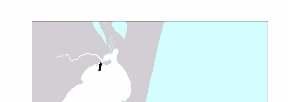
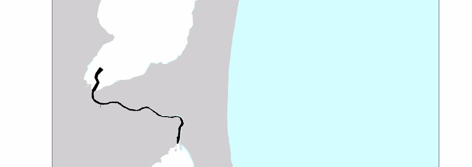

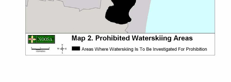
74 74
Part 9 Specific Land Uses - Foreshore & Waterway Development
 7 FORESHORE AND WATERWAY DEVELOPMENT This section applies to the following development uses proposed within the foreshore area (defined by LM LEP 2014), and contains Council s specific requirements for
Waikanae River Environmental Strategy. 12. Arapawaiti/Otaihanga Reach
 74 Waikanae River Environmental Strategy 12. Arapawaiti/Otaihanga Reach Figure 12: Arapawaiti/Otaihanga Reach 75 PART C: Protecting and Improving the River Corridor / Arapawaiti/Otaihanga Reach Waikanae
PUBLIC EXHIBITION OF COASTAL ZONE MANAGEMENT PLAN FOR COLLAROY-NARRABEEN BEACH AND FISHERMANS BEACH
 ITEM 8.3 REPORTING MANAGER TRIM FILE REF 2014/110936 ATTACHMENTS PUBLIC EXHIBITION OF COASTAL ZONE MANAGEMENT PLAN FOR COLLAROY-NARRABEEN BEACH AND FISHERMANS BEACH GROUP MANAGER NATURAL ENVIRONMENT 1
Section 2 Strategic Alignment. Contents
 Section 2 Strategic Alignment Contents 2 Strategic Alignment... 2 2.1 General... 2 2.2 SmartGrowth Strategy and Implementation Plan... 2 2.3 Walking and Cycling Strategy... 3 2.4 Built Environment Strategy...
Warfield Neighbourhood Plan: 4.4 Infrastructure
 Warfield Neighbourhood Plan: 4.4 Infrastructure Previously decided Policy headings: Policy WNP16 Transport Impact of Development Policy WNP17 Transport Proposals Policy WNP18 New School Buildings Policy
Exhibit 1 PLANNING COMMISSION AGENDA ITEM
 Exhibit 1 PLANNING COMMISSION AGENDA ITEM Project Name: Grand Junction Circulation Plan Grand Junction Complete Streets Policy Applicant: City of Grand Junction Representative: David Thornton Address:
Chapter Boat Harbour Areas Page 1
 Chapter 17 17.7 Boat Harbour Areas age 1 17.7 Boat Harbour Areas 17.7.1 Introduction Special facilities are located for the mooring and servicing of boats in two coastal areas of the City Half Moon Bay
Eastern Brook Trout. Roadmap to
 Eastern Brook Trout Roadmap to CONSERVATION Our Brook Trout heritage he wild Brook Trout is an American symbol of persistence, adaptability, and the pristine wilderness that covered North America prior
Living Streets response to the Draft London Plan
 Living Streets response to the Draft London Plan Contents Living Streets response to the Draft London Plan... 1 About Living Streets... 2 Summary... 2 Consultation response... 3 Chapter 1: Planning London
Coastal and marine recreation in New England is ingrained in the region s economic and
 RECREATION Coastal and marine recreation in New England is ingrained in the region s economic and social fabric. Recreation on the ocean and coast includes many of New Englanders most time-honored and
DRAFT for a State Policy for Healthy Spaces and Places
 DRAFT for a State Policy for Healthy Spaces and Places 1 DRAFT State Policy for Healthy spaces and Places 1. Purpose To encourage the use and development of land that builds healthy communities through
Environmental Protection on the Gold Coast of Queensland, Australia. 1. What is the appeal of the Gold Coast to tourists?
 Environmental Protection on the Gold Coast of Queensland, Australia Sections 1. What is the appeal of the Gold Coast to tourists? 2. How are Gold Coast visitor trends changing? 3. How can the impacts of
31. Rosses Point Mini-Plan
 County Development Plan 2017-2023 Volume 2, Chapter 31 Rosses Point Mini-Plan 31. Rosses Point Mini-Plan Village profile Rosses Point is a coastal settlement located approximately 8 km north-west of Sligo
Case Study 3. Case Study 3: Cebu Island, Philippines MPA Network 10
 Case studies of mpa networks Case Study 3: Cebu Island, Philippines MPA Network 10 Location and background Cebu Island in the Philippines lies in the center of the Visayan Islands, known as an area high
Living Streets Policy
 Living Streets Policy Introduction Living streets balance the needs of motorists, bicyclists, pedestrians and transit riders in ways that promote safety and convenience, enhance community identity, create
Implementing the New Fisheries Protection Provisions under the Fisheries Act
 Implementing the New Fisheries Protection Provisions under the Fisheries Act Discussion Paper Fisheries and Oceans Canada April 2013 Contents 1. Introduction 2. Managing Threats to Canada s Fisheries 3.
2. Context. Existing framework. The context. The challenge. Transport Strategy
 Transport Strategy Providing quality connections Contents 1. Introduction 2. Context 3. Long-term direction 4. Three-year priorities 5. Strategy tree Wellington City Council July 2006 1. Introduction Wellington
SA New Trial Artificial Reef Project
 BACKGROUND PAPER SA New Trial Artificial Reef Project Development of options for the trial artificial reef 1. Summary CONTENTS Each year, an estimated 236,000 South Australians participate in recreational
MEMORANDUM. Existing Operations. City of Clearwater. Michael Herrman. Date: January 26, Seminole Boat Launch Overview. M&N Job No.
 1509 W. Swann Avenue, Suite 225 Tampa, FL 33606 (813) 258-8818 Fax (813) 258-8525 www.moffattnichol.com MEMORANDUM To: From: City of Clearwater Michael Herrman Date: Subject: Seminole Boat Launch Overview
Three point plan to addressing land use and habitat loss impacts on Chesapeake Bay tidal fish and shellfish
 Three point plan to addressing land use and habitat loss impacts on Chesapeake Bay tidal fish and shellfish 1. Establish Principles for Protection of Chesapeake Bay Fish and Shellfish The Fisheries GIT
Maryland Chapter Trout Unlimited Brook Trout Conservation Effort
 Maryland Chapter Trout Unlimited Brook Trout Conservation Effort Photo by Matt Kline Portfolio of Recent Work MDTU Brook Trout Conservation Coordinator: Scott C. Scarfone, ASLA sscarfone@oasisdesigngroup.com
The Malaspina Okeover
 Unit 7 Theodosia Inlet Marine Area Substrate Exposure Current Roughness Shoreline Slope Depth Benthic Summer Temp 2.0 sq km Mud 12.5 km Flat Shallow-Photic Warm DESCRIPTION: Theodosia Inlet is the most
CHAPTER 6 10/29/2018 Clean Version REGULATING PIERS, WHARVES, MOORING BUOYS, SWIMMING RAFTS AND INFLATABLES ON ROCK LAKE
 1 2 3 4 5 6 7 8 9 10 11 12 13 14 15 16 17 18 19 20 21 22 23 24 25 26 27 28 29 30 31 32 33 34 35 36 37 38 39 40 41 42 43 44 45 46 CHAPTER 6 10/29/2018 Clean Version REGULATING PIERS, WHARVES, MOORING BUOYS,
Voting should indicate preference to one option (Option 1, Option 2, or Option 3)
") Proposals for Wied Il-Buni Options being considered for proposal for the Ministry of Infrastructure to be taken up with Transport Malta following the extension of Terminal 1 by Malta Freeport Corporation.
Proposals for Wied Il-Buni Options being considered for proposal for the Ministry of Infrastructure to be taken up with Transport Malta following the extension of Terminal 1 by Malta Freeport Corporation.
F4. Coastal Mooring Zone and moorings outside the Coastal Mooring Zone
 F4. Coastal Mooring Zone and moorings outside the Coastal Mooring Zone F4.1. Zone description This section addresses the provisions relating to moorings in the Coastal Mooring Zone and those outside the
RESOURCE CONSENT APPLICATION FOR B & R MCKENZIE MOETAPU BAY. Our Ref: Date: November2015. Our Ref:
 RESOURCE CONSENT APPLICATION FOR B & R MCKENZIE MOETAPU BAY Our Ref: 25876 Date: November2015 Our Ref: 25876 1 Our Ref: 25876 16 November 2015 1. BACKGROUND INFORMATION IN SUPPORT OF A RESOURCE CONSENT
Significant Ecological Marine Area Assessment Sheet
 Significant Ecological arine Area Assessment Sheet Name: ouhora arbour arine Values Summary: The entrance subtidal channel, tidal flats, seagrass mangrove and saltmarsh habitats of ouhora arbour have given
Comments The Plan for Port Whitby
 Comments The Plan for Port Whitby April 24th, 2013 Community Meeting #2 Summary Report Prepared by GLPi April 29th, 2013 1 Introduction The purpose of the Port Whitby Secondary Plan Update, Community Improvement
Douglas Land Use and Transportation Strategy (DLUTS) Summary. August 2013
 Summary. August 2013") Douglas Land Use and Transportation Strategy (DLUTS) Summary August 2013 Background Douglas is a large and popular residential suburb of approximately 30,000 persons on the periphery of Cork City along
Douglas Land Use and Transportation Strategy (DLUTS) Summary August 2013 Background Douglas is a large and popular residential suburb of approximately 30,000 persons on the periphery of Cork City along
Salmon Five Point Approach restoring salmon in England
 Salmon Five Point Approach restoring salmon in England Our Mission To restore the abundance, diversity and resilience of salmon stocks throughout England We will do this by:- a) Maximising the production
Management advisory for the Bay of Bengal hilsa fishery June 2012
 Page1 Management advisory for the Bay of Bengal hilsa fishery June 2012 What is the BOBLME RFMAC The BOBLME Project is supporting countries to implement an ecosystem approach to fisheries management of
Marine Management Strategy Frequently Asked Questions
 Marine Management Strategy Frequently Asked Questions Can I still go fishing at Rottnest? Yes Where will I be able to go fishing on Rottnest Island? Recreational fishing can occur at any location outside
Chagrin River TMDL Appendices. Appendix F
 Appendix F The following are excerpts from the Eastern Brook Trout Joint Venture s Conservation Strategy (Working Draft v.6), Conserving the Eastern Brook Trout: Strategies for Action Found at: http://www.easternbrooktrout.org/constrategy.html
Ship operations and activities on the Maroochy River. Final Report to the General Manager
 Ship operations and activities on the Maroochy River Final Report to the General Manager Final Report to the General Manager, Transport and Main Roads, July 2011 2 of 134 Document control sheet Contact
March Maidstone Integrated Transport Strategy Boxley Parish Council Briefing Note. Context. Author: Parish Clerk 2 March 2016
 Context. Author: Parish Clerk 2 The Draft Integrated Transport Policy (DITS) sets out a vision and objectives, and identifies a detailed programme of interventions to support the Maidstone Borough Local
TRANSPORTATION NEEDS ASSESSMENT
 TRANSPORTATION NEEDS ASSESSMENT A travel demand analysis was carried out to determine the operational issues and the potential benefit that adding traffic capacity would have on the road network. All the
University of Victoria Campus Cycling Plan Terms of Reference. 1.0 Project Description
 University of Victoria Campus Cycling Plan Terms of Reference 1.0 Project Description The Campus Cycling Plan, a first for the University, will provide a comprehensive and coordinated approach to support
Operational Policy. Queensland Parks and Wildlife Service. Mountain biking in QPWS managed areas. Visitor Management. 1 Purpose
 Queensland Parks and Wildlife Service Operational Policy Visitor Management Mountain biking in QPWS managed areas Operational policies provide a policy direction or set operational standards for day-to-day
SIGNS - RULES Signs - Rules Structure of the Rules Section Activities Discretionary Activities
 Attachment C.2 Signs - Rules.2.1 Structure of the Rules Section Four Activity Tables Commercial, Residential and Other group the District Plan zones. Each Activity Table contains rules relevant to the
Thank you for the opportunity to comment on the Draft Freshwater Fisheries Management Plan on behalf of Victoria s recreational fishing sector.
 Anthony Forster Inland Fisheries Manager Victorian Fisheries Authority By email: Anthony.Forster@vfa.vic.gov.au DRAFT FRESHWATER FISHERIES MANAGEMENT PLAN Dear Anthony, Thank you for the opportunity to
CITY OF COCOA BEACH 2025 COMPREHENSIVE PLAN. Section VIII Mobility Element Goals, Objectives, and Policies
 CITY OF COCOA BEACH 2025 COMPREHENSIVE PLAN Section VIII Mobility Element Goals, Objectives, and Policies Adopted August 6, 2015 by Ordinance No. 1591 VIII MOBILITY ELEMENT Table of Contents Page Number
Eastern Shore Islands Area of Interest Community Newsletter
 Eastern Shore Islands Area of Interest Community Newsletter Fall 2018 1ỊNTRODUCTION In addition to information on our Fisheries and Oceans Canada (DFO) website, we have now created a seasonal, community
Your views are important. Please fill in a form before you leave. Or alternatively
 Drum Property Group is delighted to welcome you to this exhibition which sets out our initial proposals for a mixed-use development at Stead s Place, Edinburgh. We are keen to hear the views of local people
Page 1. To: City of Durango - Parks and Recreation Advisory Board - Natural Lands Preservation Advisory Board Highland Avenue Durango, Colorado
 Page 1 To: City of Durango - Parks and Recreation Advisory Board - Natural Lands Preservation Advisory Board From: John Norton 2009 Highland Avenue Durango, Colorado Date: October 27, 2014 Regarding: Natural
Habitat Fact Sheets. Rocky habitats are dominated by seaweeds and often mussels, which rely on the rocks for attachment.
 Habitat Fact Sheets Habitats in the Gulf of Maine serve many important roles for the environment and for humans as well. These include: cycling nutrients, filtering pollution, trapping sediments, storing
THE PLANNING AND. Transport and the law Integrated transport planning Strategies Responsibilities of local government and road controlling authorities
 The planning and policy context Transport and the law Integrated transport planning Strategies Responsibilities of local government and road controlling authorities THE PLANNING AND POLICY CONTEXT Providing
Issues facing this region include the status of the Sluice Creek tide gates, various tidal wetlands, and locations of public access:
 5.6 Guilford Point to Madison Town Line Existing Resources This region extends from Guilford Point to the Madison town line. Named places include Grass Island and the East River. Residential, commercial,
3.9 Recreational Trails and Natural Areas
 3.9 Recreational Trails and Natural Areas 3.9.1 Introduction Parks and other recreational facilities such as trails, bicycle routes, and open space are important community resources. This section discusses
Developing a programme to make Taranaki predator-free
 Factsheet: 6 Developing a programme to make Taranaki predator-free The Taranaki Regional Council wants to initiate an innovative change in managing predators to benefit our native plants and wildlife,
Part B Design Guidance / Principles _
 Part B Design Guidance / Principles www. landlab.co.nz Queenstown Town Centre Public Realm Design Guidelines Version 7 14 June 2018 Page 006 B1 Design Guidance & Best Practice The Queenstown Town Centre
Chapter 7. Transportation. Transportation Road Network Plan Transit Cyclists Pedestrians Multi-Use and Equestrian Trails
 Chapter 7 Transportation Transportation Road Network Plan Transit Cyclists Pedestrians Multi-Use and Equestrian Trails 7.1 TRANSPORTATION BACKGROUND The District of Maple Ridge faces a number of unique
Wild Virginia and Heartwood first raised this issue at the May 19, 2014 public meeting.
 June 13, 2014 Karen Stevens Pat Sheridan, District Ranger Warm Springs Ranger District 422 Forestry Road Hot Springs, VA 24445 karenlstevens@fs.fed.us psheridan@fs.fed.us re: Lower Cowpasture Restoration
CHAPTER 7.0 IMPLEMENTATION
 CHAPTER 7.0 IMPLEMENTATION Achieving the vision of the Better Streets Plan will rely on the ability to effectively fund, build and maintain improvements, and to sustain improvements over time. CHAPTER
Lake Tahoe Shoreline Plan. 01 Scope
 Lake Tahoe Shoreline Plan 01 Scope 09.20.2016 1 Brief Description The Shoreline Plan needs a defined scope to focus work efforts and complete the planning process by the end of 2018 (within the existing
Recreational Uses of St Marys Bay and Masefield Beach Panuku Development Auckland
 Appendix D Recreational Uses of St Marys Bay and Masefield Beach Panuku Development Auckland Beca // 2 May 2018 4216571 // NZ1-15242655-52 0.52 // page 133 Recreational uses of St Marys Bay and Masefield
Devonport City Cycling Network Strategy
 Devonport City Cycling Network Strategy 2010-2013 Devonport City Cycling Network Strategy Introduction In February 2010 a draft master plan for cycleways was presented to the community. The feedback received
1 VicRoads Access Management Policies May 2006 Ver VicRoads Access Management Policies May 2006 Version 1.02
 1 VicRoads Access Management Policies May 2006 Ver 1.02 VicRoads Access Management Policies May 2006 Version 1.02 2 VicRoads Access Management Policies May 2006 Ver 1.02 FOREWORD FOR ACCESS MANAGEMENT
Puget Sound Nearshore Ecosystem Restoration Project Restore America s Estuaries Conference 2012 Tampa, FL
 Restore America s Estuaries Conference 2012 Tampa, FL presented by: Theresa Mitchell, WA Dept. of Fish & Wildlife Nearshore General Investigation Change Analysis: Comparison of historical and current
Executive Summary Route 30 Corridor Master Plan
 Route Corridor Master Plan Project Overview The Route Corridor Master Plan is a coordinated multimodal transportation and land use plan for the entire stretch of Route through East Whiteland Township,
City of Novi Non-Motorized Master Plan 2011 Executive Summary
 City of Novi Non-Motorized Master Plan 2011 Executive Summary Prepared by: February 28, 2011 Why Plan? Encouraging healthy, active lifestyles through pathway and sidewalk connectivity has been a focus
Habitat Development: Habitat Boulders Lawson Pier Foreshore Enhancement
 Habitat Development: Habitat Boulders Improve the existing habitat by stabilising beach sediments. Increase biodiversity by creating new habitats and colonisation opportunities. Loose cobble is unstable;
Fisheries Management Zone 10:
 Fisheries Management Zone 10: Lake Trout Operational Objectives and Management Photo Credit: www.jamessmedleyoutdoors.com 2 FMZ 10: Lake Trout Operational Objectives and Management Lake trout are the second
Fishing and Marine Protected Areas: how can we best share the fish...?
 Fishing and Marine Protected Areas: how can we best share the fish...? Dr Zena Dinesen Overview of this presentation Explore some key resource allocation issues for fisheries and MPA management using examples
EXECUTIVE SUMMARY. Argyll Marine Special Areas of Conservation
 Argyll Marine Special Areas of Conservation Legislative Background Under the Habitats Directive (Council Directive 92/43/EEC on the conservation of natural habitats and of wild fauna and flora), Loch Creran
summary of issues and opportunities
 1 summary of issues and opportunities EXECUTIVE SUMMARY CHAPTER 2: HISTORY - 3: LAND USE This first chapter is an overview of lessons learned from analysis of the existing conditions on El Camino as well
CITY OF BLOOMINGTON COMPLETE STREETS POLICY
 CITY OF BLOOMINGTON COMPLETE STREETS POLICY POLICY OBJECTIVE: The City of Bloomington will enhance safety, mobility, accessibility and convenience for transportation network users of all ages and abilities,
Trout Unlimited Comments on the Scope of Environmental Impact Statement for the Constitution Pipeline Project, Docket No. PF12-9
 October 9, 2012 Kimberly D. Bose, Secretary Federal Energy Regulatory Commission 888 First Street, NE, Room 1A Washington, DC 20426 RE: Trout Unlimited Comments on the Scope of Environmental Impact Statement
CHAPTER 4 DESIRED OUTCOMES: VISION, GOALS, AND OBJECTIVES
 CHAPTER 4 DESIRED OUTCOMES: VISION, GOALS, AND OBJECTIVES Vision One of the first steps in developing this Plan was articulating a vision - a clear statement of what the Plan strives to achieve and what
North Coast Corridor:
 North Coast Corridor: Connecting People, Transportation & Environment Legislative Hearing: 11.8.10 1 North Coast Corridor Region s Lifeline A Regional Strategy Mobility, Economy & Environment North Coast
Guiding Principles: Key Guiding Principle numbers: 1, 5, 15, 16 and Introduction Yachting / Motor Boating
 Chapter 10 Recreation & Tourism Guiding Principles: Chapter 4 details all the guiding principles relevant to the overall management of the Harbour. Whilst all should be given some consideration the following
PE17.1 REPORT FOR ACTION
 PE17.1 REPORT FOR ACTION Encouraging a paddling and fishing friendly City Date: February 2, 2017 To: Parks and Environment Committee From: General Manager, Parks, Forestry and Recreation Division Wards:
COUPLED MANAGEMENT STRATEGY LAKE CATHIE ESTUARY & COAST
 Lake Cathie Progress Association Inc. ABN 28 251 433 854 P.O. Box 247 Lake Cathie NSW 2445 PHONE/FAX: 02 6584 8211 EMAIL: r3packag@bigpond.com 20 th October 2009 Port Macquarie Hastings Council PO Box
Does DFO Need to Review My Project?
 Working Together for Responsible Erosion & Sediment Control Workshop Does DFO Need to Review My Project? June 6, 2014 Fisheries Protection Program Department of Fisheries and Oceans Amendments to the Fisheries
Launceston's Transport Futures. Greater travel options for the people of Launceston
 Launceston's Transport Futures Greater travel options for the people of Launceston Final Draft 13 Jan 2014 1 Page Number Executive summary 3 What is Transport Futures? 4 Vision 6 Economy, access and liveability
COUNCIL POLICY NAME: COUNCIL REFERENCE: 06/119 06/377 09/1C 10llC 12/1C INDEX REFERENCE: POLICY BACKGROUND
 COUNCIL POLICY NAME: COUNCIL ADVISORY COMMITTEES - TERMS OF REFERENCE ISSUED: APRIL 3, 2006 AMENDED: NOVEMBER 27, 2006 NOVEMBER 23, 2009 JANUARY 11, 2010 DECEMBER 17, 2012 POLICY COUNCIL REFERENCE: 06/119
Mining & Petroleum Focus Group Southern Rocky Mountain Management Plan. Synopsis of Focus Group Key Issues
 Southern Rocky Mountain Management Plan Page 1 of 6 Synopsis of Focus Group Key Issues Sectors who brought forth issues are listed after the issue in brackets. I. Timeline Completing the plan by June,
Summary of Water Access for Marinas and Public Boat Ramps
 Lake Tahoe Shoreline Plan Meeting Materials: Steering Committee Last Updated: 11-28-16 Summary of Water Access for Marinas and Public Boat Ramps Table 1: Marinas Buoy Field Assessment Marinas 1. North
Explanatory Memorandum to the Scallop Fishing (Wales) Order 2010.
 Order 2010.") Explanatory Memorandum to the Scallop Fishing (Wales) Order 2010. This Explanatory Memorandum has been prepared by the Fisheries Policy Branch of the Department for Rural Affairs and is laid before the
Explanatory Memorandum to the Scallop Fishing (Wales) Order 2010. This Explanatory Memorandum has been prepared by the Fisheries Policy Branch of the Department for Rural Affairs and is laid before the
Warm-up # 7 A day 5/17 - B day 5/18 UPDATE YOUR TABLE OF CONTENTS
 Warm-up # 7 A day 5/17 - B day 5/18 UPDATE YOUR TABLE OF CONTENTS Question: List all examples of surface water on Earth. Answer: Rivers and streams, lakes and reservoirs, (ponds) wetlands, estuaries and
Proposed Shuswap River Boating Regulations Open House
 Proposed Shuswap River Boating Regulations Open House Welcome, and thank you for attending this Open House regarding proposed boating regulations for the Shuswap River. A partnership of the Regional District
AMATS Complete Streets Policy
 AMATS Complete Streets Policy Table of Contents: Section 1. Definition of Complete Streets Section 2. Principles of Complete Streets Section 3. Complete Streets Policy Section 4. Consistency Section 5.
Overview. Existing Conditions. Corridor Description. Assessment
 Overview A study of the 23 rd Street corridor was undertaken to document the existing conditions, analyze traffic operations, and recommend remedies for deficient situations Although 23 rd Street is frequently
Can we minimize the impact of vessel moorings on coastal habitats? An interagency management approach in Queensland
 Can we minimize the impact of vessel moorings on coastal habitats? An interagency management approach in Queensland Kurt Derbyshire 1, Rebecca Batton 1, Nicola Udy 2, Kimberly Foster 3 and Richard Marsh
Oregon Estuaries defined: (Goal 16)
") Bob Bailey, Manager, Oregon Coastal Management Program Oregon Estuaries defined: (Goal 16) includes estuarine water, tidelands, tidal marshes, and submerged lands. Estuaries extend upstream to the head
Bob Bailey, Manager, Oregon Coastal Management Program Oregon Estuaries defined: (Goal 16) includes estuarine water, tidelands, tidal marshes, and submerged lands. Estuaries extend upstream to the head
RI Regulatory Setbacks & Buffers: Coastal Management Issues
 RI Regulatory Setbacks & Buffers: Coastal Management Issues New England Onsite Wastewater Training Program @ URI OWT 155 - November 29, 2012 James Boyd - Coastal Policy Analyst Photo: October 30, 2012
GONE! Coastal Erosion Happens During Storms! Why Worry About Coastal Setbacks? Goals for Today
 RI Regulatory Setbacks & Buffers: Coastal Zone Management Issues New England Onsite Wastewater Training Program @ URI OWT 155 November 21, 2013 Goals for Today Understand the impacts of storms, coastal
Ocean Beaches Strategy Version 1.0 August 2013
 Ocean Beaches Strategy 2013 2023 Version 1.0 August 2013 Contents Foreword 3 Introduction 5 Executive Summary 7 Strategy Background 9 Gold Coast City 9 Background 9 Current Services to the community 10
Waterfront User Needs Assessment & Detailed Design RESPONSE TO COMMENTS
 Waterfront User Needs Assessment & Detailed Design RESPONSE TO COMMENTS Town of Cobourg Presentation to Council Monday July 3, 2018 4 PM 1 Response topics Opportunity to clarify and correct misinterpretations
Submission Cover Sheet Mordialloc Bypass Project EES IAC
 Submission Cover Sheet Mordialloc Bypass Project EES IAC 61 Request to be heard?: yes Full Name: Organisation: Affected property: Attachment 1: Attachment 2: Attachment 3: Comments: Lucinda Bertram Aspendale
Proposed. City of Grand Junction Complete Streets Policy. Exhibit 10
 Proposed City of Grand Junction Complete Streets Policy Exhibit 10 1 City of Grand Junction Complete Streets Policy Vision: The Complete Streets Vision is to develop a safe, efficient, and reliable travel
Delivering the. Strategy 7.0
 7.0 Delivering the Strategy 7.1 Introduction This chapter presents a framework for the delivery of the strategy. Key challenges and opportunities are identified that will have an impact on the successful
Indian River Lagoon: Lessons, Challenges and Opportunities
 Indian River Lagoon: Lessons, Challenges and Opportunities Upper Chain of Lakes Lake Kissimmee Kissimmee River Indian River Lagoon Caloosahatchee Estuary Lake Okeechobee St. Lucie Estuary Mark Perry, Executive
BASS LAKE PLANNING UNIT Willow Creek Watershed
 Existing Conditions & Uses Overview Reservoir that is a popular summer recreation destination, with substantial residential and recreation development 1,085 acres in Madera County; 149 acres outside and
Vision: Traditional hamlet with an attractive business/pedestrian friendly main street connected to adjacent walkable neighborhoods
 N D. Focus Area II Vision: Traditional hamlet with an attractive business/pedestrian friendly main street connected to adjacent walkable neighborhoods Transit Road Focus Area II is located in the Hamlet
14 NOISE AND VIBRATION
 14 NOISE AND VIBRATION 14.1 EXISTING ENVIRONMENT 14.1.1 The noise environment within Poole Harbour is generally characterised by low to medium noise levels depending on location. For example, certain areas
UBCM Community Excellence Awards 2007 Submission
 UBCM Community Excellence Awards 2007 Submission Formatted: Left: 2.54 cm Category: Partnerships Project: Implementation of False Creek Anchoring Management System 1. A one-paragraph summary of the project/program
9. Parking Supporting Statement
 9. Parking Supporting Statement Content 1. Setting the Scene 2. Vision 3. Parking and the Shared Priorities 4. Issues 5. Delivery Programme in the first Plan Period 2001/02 2005/06 6. Good Practice 7.
The Isar -Plan Project in Munich Great (Un) expectations.
 expectations.") The Isar -Plan Project in Great (Un) expectations. European River Restoration Conference Session 5- Enhancement of Multi-Use Landscapes 11-13 September 2013 The Isar-Plan Project: Basic Facts Approximate
The Isar -Plan Project in Great (Un) expectations. European River Restoration Conference Session 5- Enhancement of Multi-Use Landscapes 11-13 September 2013 The Isar-Plan Project: Basic Facts Approximate
East Burke Transportation, Safety and Capacity Improvements
 East Burke Transportation, Safety and Capacity Improvements The purpose of this project is to increase mobility and improve safety for pedestrians, cyclists, and motor vehicles along VT Route 114 in the
JAP Additional Information Sheet
 JAP Additional Information Sheet Block 15: Purpose and Need The USACE purpose of the project is to provide a safe and reliable whitewater park for the recreational public in a city park, which will provide