Poole and Christchurch Bays Shoreline Management Plan Review Sub-cell 5f Section 4. Policy Development Zone 3
|
|
|
- Scott Alexander
- 6 years ago
- Views:
Transcription


1 Poole and Christchurch Bays Shoreline Management Plan Review Sub-cell 5f Section 4. Policy Development Zone 3 Bournemouth Borough Council 2011 Report V3 9T2052
2
3 A COMPANY OF HASKONING UK LTD. COASTAL & RIVERS Stratus House Emperor Way Exeter, Devon EX1 3QS United Kingdom +44 (0) Telephone Fax Internet Document title Poole and Christchurch Bays Shoreline Management Plan Review Sub-cell 5f Section 4. Policy Development Zone 3 Document short title PDZ 3 Status Report V3 Date 2011 Project name Project number Client Reference 9T2052 Bournemouth Borough Council Drafted by Checked by JGL Guthrie TL Eggiman Date/initials check.. Approved by H Hall Date/initials approval..
4
5
6
7 CONTENTS Page 4.4 PDZ 3 Poole Harbour and Associated Coastline Overview Baseline Management Scenarios Discussion And Detailed Policy Development 28
8

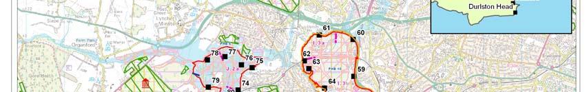
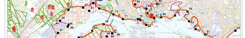
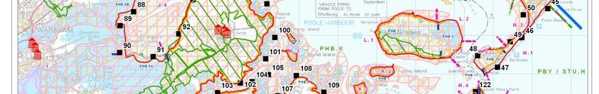
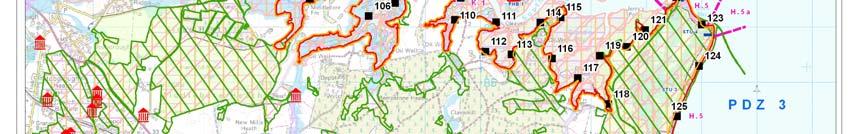
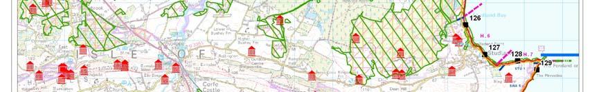
9 4.4 PDZ 3 Poole Harbour and Associated Coastline Flag Head Chine to Handfast Point, including Poole Harbour - Chainage 41.5 km to 123km. SMP 1 Management Units UNIT LOCATION CHAINAGE KM. POLICY PBY1 Sandbanks Ferry Slipway to Point House Café Hold the Line in the Short and Long Term. PHB17 North Haven Point to Sandbanks Ferry Slipway Hold the Line in the Short and Long Term. PHB16 Whitley Lake to North Haven Point Hold the Line in the Short and Long Term. PHB15 Whitley Lake Hold the Line in the Short and Long Term. PHB14 Salterns Marina to East Dorset Sailing club Hold the Line in the Short and Long Term. PHB13 Parkstone Yacht Club to Salterns Marina Hold the Line in the Short and Long Term PHB12 Parkstone Bay and Baiter Park Hold the Line in the Short and Long Term PHB11 Town Quay Hold the Existing Line in the Short and Long Term. PHB10 Holes Bay (E,N & W) Selectively Hold the Existing Line in the Short and Long Term. PHB9 Hamworthy Quays Hold the Line in the Short and Long Term. PHB8 Defence 681/2442 to Hamworthy Quay Hold the Line in the Short and Long Term. PHB7 Rockley Viaduct/Ham Do Nothing in the Short Term and to Common Selectively Retreat in the Long Term. PHB6 Lytchett Bay Do Nothing in the Short Term, Long Term Selectively Retreat. PHB5 Hyde s Quay to Holton Point Selectively Hold the Existing Line. PHB4 South Haven Point to Hyde s Quay Do Nothing (with possible selective retreat). PHB3 Brownsea Island West - Do Nothing in the Short and Long Term (Local maintenance). PHB2 Brownsea Island East - Selectively Hold the Line. PHB1 The Islands Furzey, Green, Round, Long Islands - Do Nothing in the Short and Long Term (allowing for maintenance of slipways and access points). STU4 Shell Bay Selectively Hold the Line, protect from breach. STU3 Studland Sandspit Selectively Hold the Line, dune management. STU2 The Warren to Studland Sandspit Do Nothing short term, Retreat Long term. STU1 Handfast Point to the Warren Do Nothing Note: SMP1 policy was set over a 50 year period. Short term refers to immediate approach to management of defences with long term policy being set for the 50 years. Report V
10


11 Figure Report V
12 4.4.1 OVERVIEW PRINCIPAL FEATURES (further details are provided in Appendix D) Built Environment: The main development within the zone is that of Poole, including the core of the town, harbour area and Hamworthy and the associated local communities of Lower Parkstone, Lilliput and Canford Cliffs, running to the east to the open coast, with the development of Sandbanks along the shoreline. This major conurbation lies to the north east side of Poole Harbour. To the western limits of Poole Harbour is the town of Wareham, which is located on the Frome River, along with various local communities generally around Poole Harbour shoreline. On the open coast to the south of the zone is the village of Studland. Poole Harbour contains a conventional freight and Ro-Ro Ferry Port. The main A35 runs to the north of the Harbour area with the A350 running down to Poole centre and the A351 running through to Wareham. A railway links through from Bournemouth to Poole, after Poole it cuts across the northern bays and along the western edge of the Harbour through to Weymouth. There is another railway line to Corfe Castle and Swanage on the Isle of Purbeck, but this is preserved and not part of the National network. There are schools at Turlin Moor, Lower Hamworthy and Poole along with two sewage works and several pump stations within the potential flood plain. There are also several electricity sub stations principally in the Poole Quays area of Lower Hamworthy. There are several oil well installations in the Wytch Farm area south of Poole and on Furzey Island. There are major marinas in Poole and Wareham. Heritage and Amenity: Poole Harbour has been identified by English Heritage as one of the most important areas for coastal archaeology in England. Its continuous use, from prehistoric times to present, means that structures of almost any date could survive. Poole Harbour has been historically important as a commercial harbour since pre- Roman times. The area has been inhabited since before the Iron Age and it contains a network of settlements, such as those located on Furzey and Green islands, which were exploiting mineral resources both within Poole Harbour and the Isle of Purbeck. The historic importance of the harbour is reflected in the number of Conservation Areas that border the coast here. These areas span Victorian and Edwardian eras in addition to some inter-war development. There are over 200 'Listed' Buildings of special architectural or historic interest and 13 Scheduled Monuments (SM) within the Borough of Poole (BoP). Most are located in the Old Town, Quay and High Street Conservation Areas. The Sandbanks area of Poole Harbour also falls within an Area of High Archaeological Potential. Wareham is also a town of considerable historic interest, situated on a site that was established as far back as the Iron Age. The 'Wareham and Stoborough Conservation Area' covers a large amount of the old part of the town and the surrounding land. There are approximately 250 Listed Buildings in the town of Wareham and the local parishes. There are several areas of historic landscape interest that require protection. Those of relevance include Poole Park on the northern shore of Poole Harbour and Upton House on the shore of Holes Bay. In addition Compton Acres, off Canford Cliffs Road, has been designated as a Historic Park and Garden under the National Heritage Act, There are numerous records of shipwrecks within Poole Harbour including a large ironage log boat. As well as wrecked ships, Holes Bay was traditionally used as a dumping ground for old vessels and the remains of many ships can be found there. There is also a Conservation Area at Studland. There are a number of known wrecks and potential wreck sites that lie within the area. Of particular interest is a 16th century Report V3
13 vessels in Studland Bay and the Swash Channel. The whole area is one of high amenity and tourism value. Particular value is given to the high level of recreational water use and value of the open coast along Sandbanks Peninsula and Studland Bay. The heritage and conservation status of the area is a major attraction. There is a major holiday park at Rockley Park. Nature Conservation: Poole Harbour is designated a SPA site for the bird populations and species that visit the area and also a Ramsar site due to fringes of saltmarsh and reedbed, the lagoons and birds that use these areas. There are also extensive tidal mudflats. Parts of the area around the Harbour are designated Ramsar sites, Dorset Heathland SPA and SAC for the heathland, which fringes the southern shore. Wet heathland with Dorset heath, crossleaved heath and coastal dune heathland are priority habitats and are recognised as being particularly rare within the European context. The majority of the Harbour foreshore has been designated a SSSl for its varied habitats and associated flora and fauna. The Arne reedbeds have been designated an NNR, as have the shores of Holton Heath and Studland Heath. The north shore, at Ham Common and Luscombe Valley, has been designated LNRs as well as SSSIs. The Arne peninsula is a RSPB reserve. There are also a number of SINCs. Part of Poole Harbour is included in the Poole Bay and Isle of Purbeck SMA. The intertidal areas of Poole Harbour between mean high water and mean low water plus all of the islands and some of the surrounding areas of terrestrial habitat have been designated a SSSI for the extensive intertidal mudflats and associated marine animals. The southern shore of Poole Harbour is designated both Heritage Coast and AONB. Ham Common is an area of national geological importance and is designated a SSSI. The coastline between South Haven Point and Handfast Point is considered to be of national and international landscape importance and is within Dorset AONB. The World Heritage Site starts at Old Harry. The coastline was awarded the coveted Diploma for landscape, awarded by the Council of Europe, in The coast from Studland Cliffs to Durlston Head (and beyond) is a SAC (Isle of Portland to Studland Cliffs SAC). The coast is part of the Dorset Heathland SPA, Dorset Heaths and Studland Dunes SAC and Ramsar site. Studland and Godlington Heaths are designated as a SSSl and a National Nature Reserve (NNR) for their range of habitats. It was the third most visited NNR in the UK in 2005/06 with 1 million visitors. The site also includes six British reptile species, including strong populations of the sand lizard and smooth snake. The subtidal area from South Haven Point to Handfast Point is contained in the Poole Bay to the Isle of Purbeck SMA for its marine ecology, which includes important algal communities and eel grass beds in Studland Bay. The eelgrass beds are now known to be the habitat of two species of seahorse native to the UK. Studland Cliffs are an outstanding stratigraphic and structural site of national significance and an important location for paleontological studies. At the Bay s southern end, Ballard Down is a key site for coastal geomorphology, best known for the stacks, arches and caves at Handfast Point, such as Old Harry Rocks. Old Harry Rocks is part of the World Heritage Site for its important Cretaceous exposures. KEY VALUES. This zone is probably the most complex within the SMP in terms of its values. There are a wide variety of specific drivers - natural, social, economic, landscape, mineral (oil), but it is through their interaction that the character of the area can best be described. Each area and each specific interest adds to the whole. The recreational water use, which is such an important aspect of the economic viability of the area, draws benefit from the Report V
14 outstanding landscape and the natural diversity of individual areas within the zone as a whole. This recreational use is supported by the infrastructure and facilities provided in areas principally along the northern shoreline. The structured, intensive use of open coast shoreline at Sandbanks is complemented by the more natural casual facility of the Studland beach and dunes, linked by the Ferry at the mouth of the Harbour. The residential value of the whole area is enhanced by its setting and overall vitality, within an area that contributes to the economic wellbeing of the region. Tthe port and quays contribute significantly to this. The heritage value is also a major factor in this overall value, particularly reflecting the continuous use of the area, which in itself is perpetuated by its current use. The full value of the natural environment is in the range of habitat from mud flat to saltmarsh, to reedbeds, heathland and dunes. The area is, therefore, one of continuing balance between the past and the future and between human use and nature conservation. This balance is emphasised as the strategic aim set out in the Poole Harbour Aquatic Management Plan To promote the safe and sustainable use of Poole Harbour, balancing the demands on its natural resources, minimising risk and resolving conflicts of interest To a degree this balance is supported by the zoning that has naturally developed, with the focus of human land and water use to the northeast of the area, the relatively natural development to the southern shoreline and the change in character moving up the harbour to Wareham. There are threats to this balance with the loss of saltmarsh, due in part to die back of spartina, the deterioration of the defences at Brownsea Island, the increased flood risk and pressure on defences and potential for higher rates of erosion resulting from anticipated sea level rise. While in some specific areas, such as the potential for a breach of the Sandbanks peninsula, there could be very direct consequences, over much of the zone it is disruption of interests in one area that could lead to the loss of interrelated value of the zone as a whole. It is this overall interaction which makes it important that the zone is considered as one overall unit. These values are, therefore, brought together as an interrelated set of management objectives developed from the above, but more specifically from the individual objectives identified in Appendix B and E. OBJECTIVES (the development of objectives is set out in Appendix D based on objectives listed in Appendix E) Support the overall integrated diversity of use and interests in the area as a whole. Protect the economic viability of Poole Maintain operational viability of Harbour & Port, including dredging and navigation. Reduce flood risk to Poole. Reduce flood risk to Wareham and Stoborough. Maintain the opportunity for commercial, recreational and sports use of the water, in particular the use of critical shore-based facilities, Maintain the variety of beach use over the area, Manage risk to properties due to erosion and flooding where sustainable, Minimise net loss of species/habitat (identify compensatory habitat if any net loss occurs), Maintain opportunity for natural development of the mosaic of habitats, Maintain the outstanding landscape and the views and appreciation of the varied coastal environment, Support the recording of historic environment and maintain heritage values Report V3
15 Support adaptability of coastal communities, Reduce reliance on defences. Report V


16 DESCRIPTION The zone relates to the whole area of Poole Harbour, including its bar-built open coastal area, the wide drowned valley of the Harbour and the upper estuary to the west of the Arne Headland. The following description provides an overview of these three areas. Open Coast. This area centres on the entrance to the Harbour. This entrance channel is fixed on its northern side by the relatively wide head of the Sandbanks Spit and on the southern side by the Chain Ferry Terminal on the Studland Dunes at South Haven Point. The channel is controlled by the training bank extending in a south easterly direction at the end of Shell Bay. There is a distinct step in the coast, between the shoreline to the south and that to the north. The Harbour entrance is located within the much wider Harbour valley, cutting between the clay cliffs at the southern end of Studland Bay and the cliffs forming the start of the northern curve of Poole Bay. The wider entrance has been narrowed by the development of the two spits. N Figure Open coast and entrance to Poole Harbour The southern extent of the whole zone consists of chalk cliffs forming the headland of Handfast Point. Within the very direct shelter of this Image/Data courtesy of the Channel Coastal Observatory. are the cliffs below the village of Studland. The main village is set back some 300m from the cliff line, although there are some properties within 200m. There is a Redend Point small rock outcrop in the centre of this cliffed section at Redend Point, and the lower cliff to the north sets back here as a small but distinct headland. A wider upper beach is formed at the toe of the lower set back cliff line and there are beach huts and car parks in this area. This frontage has been protected with gabion defences. South Beach to the south-east of Redend Point also has defences in the form of a timber revetment and gabions. The wider upper beach is retained at its northern end by a far less prominent headland and this is protected by gabions. Beyond this headland is the main spit. This comprises Report V3

17 a relatively wide sandy beach backed by dunes forming the main ridge. Behind these dunes the land becomes scrub heathland, through to Poole Harbour behind. In the centre of the heathland is a large lake, the Little Sea, which extends for some of the length behind the dune ridge. The road to the Chain Ferry terminal lies to the Harbour side of the heath. Shell Bay looking from South Haven Point. At the northern end of the spit, the dune ridge is wider and held forward at the root of the training bank but then ends abruptly with the slightly curved, concave Shell Bay running through to the ferry. The concrete wall defending the ferry slipway and access road extends someway around on the western side of the spit. However, within 250m of the head, saltmarsh and mud flats are developed against the inner side of the Studland Heath. The northern Sandbanks spit is fronted by a relatively wide beach that is controlled by rock groyne strong points, with a promenade running along most of the length. The groynes have been specifically designed with walkways to enhance use of the area. The beach width has been maintained with sediment recharge. The beach narrows slightly at its northern end, where the only control has been old timber groynes. The cliffs rise gradually from the spit to a level of some 20m and there are properties and gardens close to the crest. The northern end of the spit forms its narrowest section with a strip of N only about 50m between the back of the beach and the harbour side of the road behind. The road runs the full length of the spit to the ferry terminal. There are properties, shops or beach facilities between the road and the seaward beach. The main community of Sandbanks is situated on the slightly higher and significantly wider southern head of the spit. Within the inner Harbour, the road hugs the edge of the shoreline and the Luscombe Valley runs inland from the shoreline behind Canford Cliffs to the east of Lilliput Pier. Figure Sandbanks Spit Image/Data courtesy of the Channel Coastal Observatory. The foreshore of the Bay comprises sandy mud and, in places there is a narrow strip of saltmarsh fronting on to the road wall. The road is at a low level (2m ODN over most of its length), with the land rising quite steeply behind. Report V


18 Main Harbour Area. A striking feature of the main inner harbour is the relatively steeply rising land within which the harbour area is formed. This is effectively an enclosed lagoon, rather than an N active estuary system, as described in the Estuary Assessment provided as Appendix I. On the northern shore of this area, the high ground falls steeply, with a principal ridge running down through the centre of Poole and with Hamworthy sat on, in effect, a small island. Between these two areas of high ground lies the Holes Bay inlet. Figure Main Harbour Area Reproduced from Ordnance Survey Maps with the permission of the Controller of HM Stationary Office. Crown copyright To the southern side the high ground runs into the harbour as a series of ridges and infilled creeks. It is only on this southern side that a more typical estuary system, (associated with the Corfe River and the Hartland Moor to the south of the Arne Peninsula), is formed. The islands of Brownsea, Furzey, Green, Round and Long Island protrude above water level as relict hill tops, anchored by soft sandstone cliffs, rather than as features formed by estuary processes. Some reshaping of the system occurs in local erosion of cliffs, some pressure on the main channels to change but also infilling of channels, but, while recognising the local changes and the strong local flows in areas such as the entrance, this is not a typical dynamic estuary system as a whole; at the larger scale the Harbour is geomorphically quite static. Lilliput and Evening Hill Along the northern flank of the Harbour, picking up from the Luscombe Valley and Whitley Lake described above, the Sandbanks Road moves slightly away from the coast, over Evening Hill through the settlement of Lilliput. The coastal fringe is protected by a low sea wall and by various private defences to the back of gardens. This form of private defence is continued through to Lower Report V3

19 Parkstone. Within this section is the small Blue Lagoon, almost entirely enclosed by low breakwaters extending from either side of the inlet mouth. There are relatively new marinas constructed out over the foreshore in various locations. To the west is the larger cove of Poole Park, enclosed by the railway line and embankment and in front of this open, reclaimed land, understood to be in part land fill. This reclaimed area is to the front of quite large areas of property within the potential flood plain and acts as a defence to these. The Baiter recreation ground had within it a gallows, suggesting that this ground was historically relatively high, even before reclamation. Further west lies the main high ground ridge of Poole. Quite a wide area at the head of the ridge is much lower lying, with areas of the Old Town, waterside and quay within the existing flood plain. This area is the main heart of the town, with significant heritage value, public buildings, the RNLI headquarters and new moorings and hotels. This headland forms one side of the entrance to Holes Bay. Across the main channel, in Lower Hamworthy, is the main port area, which also lies on low lying land partially within the flood plain. This area, as with the area of the Old Town, is protected by quay walls. Within Holes Bay, there has been further historical reclamation over the foreshore in the area of Sterte and this has been developed as housing and as an industrial park. The main A350 runs along the edge of the reclamation and is protected over its full length by a rock revetment. Behind the reclaimed land runs the railway line and the Poole station. An area of saltmarsh lies directly seaward of the revetment at this point. The A350 continues along the edge of Holes Bay and cuts across the top of the bay where it joins the A35 running to the west. There are small areas of properties within the potential flood plain in this area at Marshes End. The railway line then cuts directly across Holes Bay on an embankment with two short bridges. Saltmarsh and mud flat make up most of the bay foreshore to the north of the railway line with deeper larger channels to the south. On the western Old Town side of the Bay there is a major marina and properties built over the slightly higher ground to the edge of the bay. To the north of the main port area at the Hamworthy entrance to the Peninsula bay is the site of the former power station. This area is under consideration for development. Image/Data courtesy of the Channel Coastal Observatory. Figure Poole and Lower Hamworthy The port area extends a further 1km along the open shore of the harbour and the railway line to the port acts as a defence for a short section beyond within a small bay. On the Report V

20 western side of the bay is Hamworthy Park, with a promenade and beach controlled by groynes, along with Environment Agency maintained flood defences. This then leads through to a further area of ad-hoc private defences, a marina and jetties. Further west is Hamworthy Common, described later. Across the estuary from Hamworthy is the Arne Peninsula. Between here and the back of Studland Heath, is the area of ridges and creeks described earlier. The land is principally agricultural or forestry, although on both the edge of the rising land and on Furzey Island are various oil wells, forming part of the Wytch Farm oil field. There are also small communities such as Goathorn. On Furzey, Green and Round Island there are properties and several slipways and jetties. On the larger Brownsea Island, there are a larger number of properties and a church. There are local defences in a few locations. To the south east of the island is the site of Branksea Castle, with a small quay and associated properties as well as the National Trust visitor centre. The largest extent of defence on the island is that maintained around the lagoon at the eastern end of the Island. This wall is in moderate condition based on visual inspections and protects important brackish features of the designated SPA and Ramsar site. Upper Estuary This section of Poole Harbour is seen as being the only large, truly estuarial part of the system. The two large rivers (Rivers Frome and Piddle) run down either side of the ridge of higher ground upon which Wareham is situated. They then meander out across largely reclaimed marsh to feed into the main Wareham Channel. To the north is the smaller Lytchett Bay fed by the Sherford River. Reproduced from Ordnance Survey Maps with the permission of the Controller of HM Stationary Office. Crown copyright Upper Estuary Figure The entrance to this area is formed between the northern end of the Arne Peninsula and the higher ground of Hamworthy Common. Along the Hamworthy frontage, to the back of the narrow foreshore, is a slowly eroding, low cliff. This is defended along its western end by gabions protecting the Rockley Park Holiday Park. These defences are privately maintained. To the western end of this is a sailing school, before the frontage runs through to where the railway line and embankment crosses the entrance to the Lytchett Bay. The short Rockley Viaduct controls the flow into and from the bay, potentially, also controlling the position of the channel into the main Wareham Channel. Flows within this channel can be strong Report V3
21 Within the Bay, on its eastern side is the community of Turlin Moor. This community lies principally on land above the existing flood plain. The northern and western frontages comprise of mudflat and salt marsh extending up to more gradually rising land to the south of Lytchett Minster. The A35 cuts in part across the flood plain on an embankment in this area, potentially defending the land to the north. To the south east of the bay, north of the railway, is the former naval munitions site of Holton Heath. This site lies mainly on the higher ground forming the ridge separating the Lytchett Bay from the estuary to the south. The railway runs to the south of this high ground, very close to the edge of the southern estuary. Its embankment is protected over a considerable length to the west of the Lytchett Viaduct and this embankment is protected by the shallow foreshore and marshes in front. The two main rivers enter the estuary, to the north (the Piddle) and to the south (the Frome) of the high ground upon which sits the town of Wareham. The whole area is one of deposition, with the rivers meandering between marsh and mud flats. Much of the area has been reclaimed with sea defences fringing the eastern edges of the marsh and with flood embankments along the meandering channels. The Piddle lies in a relatively narrow channel between Northport and the older centre of Wareham. The main A351 lies within this valley and there are properties and the defended Ryan Business Park within the potential flood plain. The Frome lies in a wider valley to the south of the town, with local areas of the quay around St Mary s Priory, grazing marsh, the south causeway and local areas of Stoborough and Ridge all within the potential tidal flood plain. The main Frome channel is important for recreational moorings. The main road to the Arne Peninsula runs from Stoborough, behind Ridge, and in areas cuts across the tidally influenced flood plain. The Arne Peninsula rises to a level of some 30m ODN (53m ODN the highest) at the village and the area is an important bird reserve, sloping down to a natural foreshore to the estuary and main harbour area.. Report V
22 PHYSICAL PROCESSES (further details are provided in Appendix C) TIDE AND WATER LEVELS (modn) Location LAT MLWS MLWN MHWN MHWS HAT Neap range Spring range Correction CD/ODN Bournemouth Poole harbour Entrance Extremes(mODN) Location: 1:1 1:10 1:25 1:50 1:100 1:200 1:500 1:1000 Bournemouth Sandbanks WAVE CLIMATE The dominant wave direction is from the south to south-west, which corresponds with the direction of longest fetch and longer period swell waves, originating in the Atlantic Ocean. This direction and the wave energy is substantially changed by the protection afforded by Handfast Point to the extent that waves along the open coast section approach in a curve from the south east. The shoreline can be subject to significant shorter period wind waves from the east and south-east. Waves in Poole Harbour are generated locally and are limited by the depth and short fetch of the harbour. The largest waves occur along the northern side of Poole Harbour from local south-westerly storm events. Wave heights at Poole Quay can be in the order of 0.9m. TIDAL FLOW Generally, within the harbour, flows are relatively low. The obvious exceptions to this are at the entrance to the harbour where flows reach 2m/sec to 3m/sec, with flow in the main channel within the harbour reaching 1m/sec. In other areas the main channels flows are more typically 0.5m/sec, decreasing over the shallow areas to 0.1m/sec. There is a strong tidal race through the constrained entrance to Lytchett Bay. The flow pattern within the Harbour is complex with areas of flood tide continuing to the south of Brownsea while the ebb tide develops through the main channel to the north. The flow patterns are described in detail in Appendix C. It is important to note that Poole Bay and Poole Harbour experience a double high tide. PROCESSES Control Features: At the open coast the dominant control feature is that of Handfast Point. The entrance channel to the harbour, controlled by the training bank, has a strong influence locally on the behaviour of the coast within the shelter of Handfast Point. Locally Redend Point acts to control development of the southern Studland shoreline. Within the Harbour, there is local influence of the various islands, ridges and the defended northern shoreline but, with the generally low energy environment, such controls are only locally significant. The main features of the harbour are therefore the channels. The open coast spits and entrance are the dominant control features of the Harbour. The behaviour of the entrance and the open coast is influenced by the training banks. Existing Defences: Existing defences have been described above. In summary: The defences along Sandbanks are generally in good condition with groynes and recharge forming a competent defence Report V3

23 Along the northern frontage of the Harbour there are a mixture of private and public defences in various condition. The main road defences are maintained in good condition. Along the main Quays the defences are in good condition with set back flood defence to the main town area of Poole. The main defences within Holes Bay are in good condition. To the western end of Hamworthy there are private toe works to the cliff that are deteriorating. The flood embankments in front of the Wareham Marshes are maintained and are in moderate condition. To the south of the harbour there are local flood defences particularly as bunds around some of the oil wells, although these are principally designed to contain potential pollutants. There are also local causeways across many of the creeks to the southern side of the Harbour at Hartland Moor, Rempston and Ower Bay. The defences at Brownsea Quay are in reasonable condition but only provide limited level of flood defence. The defence around the Lagoon is low and in only moderate condition. Regular overtopping of the Lagoon could result in its long term failure. There are defences in poor condition to the south side of Brownsea Island, with the proposal to remove these defences. There are local private rock defences at Goathorn and Shipstall. Along the Studland Peninsula there are local defences at the southern end, generally in the form of gabion baskets. These are deteriorating. The defence at South Haven Point appears to be in reasonable condition. Processes: The processes along the open coast are complex with a relatively enclosed system of sediment feed along the Sandbank Spit into the ebb tide delta of Hook Sands. This feed is variable with potential feed from the Sands back along the Spit. There is reported to be feed both to and from the main frontage of Poole Bay. Hook Sands provides an important feed to Studland and it is important to maintain this overall circulation of sediment within this local system. The general processes associated with the Studland area are summarised in the adjacent diagram (a larger reproduction of this figure can be found in Appendix C.) Within Poole Harbour there is a low level of sediment movement, with slow erosion of some of the areas of Figure cliff and low input of fine material from the river systems. Sediment Map courtesy of SCOPAC, 2004 tends to deposit in the channels and there is a need for dredging to maintain navigation depths. There remains a considerable degree of uncertainty as to the overall response of the Harbour to sea level rise; whether there is likely to be adequate sediment and width at the fringe of the harbour to allow growth and adaption of saltmarsh and development of transitional habitat. Present studies have identified an overall trend for loss of saltmarsh. This is explained in part due to reclamation in the past and may also be a result of die back of spartina. Even so the risk remains that sea level rise may well result in squeeze of the upper intertidal range of saltmarsh accelerating loss. Report V
24 Unconstrained Scenario: Although unrealistic, because of the residual impact of defences, this scenario considers how the coast would respond, if all defences were removed. It is useful in examining the pressure along the frontage. At the open coast, there would be continued erosion of the shoreline. In the absence of the training bank there would be erosion of the sand dunes along Studland, particularly at the northern end, and potential regular overtopping and potential exposure of Little Sea to regular inundation. It seems unlikely even if the Studland dunes were to be regularly breached or overtopped that there would be development of a new entrance channel in this area. However, along the Sandbanks frontage, breaching of this bank could, in time, create a new more northerly entrance to the harbour. There is little evidence to suggest that this would become a naturally preferred entrance; although equally, there is no geotechnical evidence to indicate any substantially harder geology preventing this. Creation of a permanent entrance across the Sandbanks Spit has the potential to allow creation of distinct flood and ebb dominant channels. This could result in significant change to the configuration of Hook Sands, with further consequential impacts on Studland Bay and dune system. The trend would be for a reduction in the size and influence of the ebb delta, resulting in greater exposure and erosion along the coast. This may provide greater feed of material to the north but with a tendency for material to be taken into the estuary. Such change would have major impacts on the operation of the Harbour, management of the Studland Peninsula and the important aspects of use of the coast. There is a small potential for increased sediment along the Bournemouth frontage but this is unlikely to be significant in terms of management. Within the Main Harbour, the absence of defences along the northern frontage would result in regular flooding of the narrow coastal plain. There would be a local increase in erosion, within the area of Ham Common the cliffs would continue to erode, providing increased sediment to the system. In the absence of dredging the main channels would tend to infill from their current navigational depths and potentially there would be a degree of slow infill of the whole area. It seems most probable that accretion would tend to further infill the upper estuary around Wareham. POTENTIAL BASELINE EROSION RATES Base rates have been assessed from monitoring and historical data. The range of potential erosion is assessed in terms of variation from the base rate and sensitivity in potential sea level rise. Further detail on erosion rates is provided in Appendix C. The base rates provided below are taken as an average based on historical records. The rates are a composite value based on erosion of the toe and recession of the crest of the cliff and reflect the erosion rates following failure of defences. (Sea Level Rise assumed rates: 0.06m to year 2025; 0.34m to year 2055; 1m to year Baseline date 1990.) Location Base Rate Notes 100yr. Erosion / Recession (m) Canford Cliffs 1.8m/yr Erosion resisted by defences and slopes stabilised 180m Sandbanks 1.6m/yr Erosion resisted by defences. 150m Poole Harbour North 0.2 to 0.5m/yr Erosion rate difficult to estimate due to existing defences Upper Estuary Potential accretion 50m in areas Poole Harbour South 0.2 to 0.5m/ yr Little existing data 50m in areas Studland Spit 0.6m/yr Areas of accretion held by training bank 60m Studland Cliffs 0.4m/yr Influenced by Redend Point 45m Handfast Point 0.3m/yr General erosion of the chalk cliff 30m Report V3
25 4.4.2 BASELINE MANAGEMENT SCENARIOS PRESENT MANAGEMENT Present Management is taken as that policy defined by SMP1, modified by subsequent strategies or studies. It should be noted that both in the case of SMP1 and the strategies undertaken before 2005, the period over which the assessment was carried out was 50 years. SMP1 MODIFIED POLICY MU LOCATION POLICY REF LOCATION POLICY Sandbanks PBY1 Hold the Line in the Short Sandbanks Ferry Ferry Slipway Hold the line through beach Open and Long Term and control S4 Slipway to Point to Point House recharge. Coast structures. House Café Café PHB 17 PHB 16 PHB 15 PHB 14 PHB 13 PHB 12 PHB 11 PHB 10 PHB9 PHB8 PHB7 PHB6 PHB5 North Haven Point to Sandbanks Ferry Slipway Whitley Lake to North Haven Point Whitley Lake Salterns Marina to East Dorset Sailing Club Parkstone Yacht Club to Salterns Marina Parkstone Bay and Baiter Park Town Quay Holes Bay (E,N & W) Hamworthy Quays Defence 681/2442 to Hamworthy Quay Rockley Viaduct /Ham Common Lytchett Bay Hyde s Quay to Holton Point Hold the Line in the Short and Long Term. Hold the Line in the Short and Long Term. S5 S5 North Haven Point to Sandbanks Ferry Slipway Whitley Lake to North Haven Point Hold the Existing Line. Hold the Existing Line. Hold the Line in the Short and Long Term. S5 Whitley Lake Hold the Existing Line. Hold the Line in the Short and Long Term. Hold the Line in the Short and Long Term (with possible intervention on the Banks of the Blue Lagoon) Hold the Line in the Short and Long Term S5 S5 S5 Salterns Marina to Lilliput Pier Parkstone Yacht Club to Salterns Marina Parkstone Bay and Baiter Park Hold the Existing Line. Hold the Existing Line. Hold the Existing Line. Hold the Existing Line in the Short and Long Term. S5 Town Quay Hold the Existing Line. Selectively Hold the Existing Line in the Short S5 Holes Bay (E,N & W) Hold the Existing Line. and Long Term. Hold the Line in the Short and Long Term. S5 Hamworthy Quays Hold the Existing Line. Hold the Line in the Short and Long Term. Do Nothing in the Short Term and to Selectively Retreat in the Long Term Do Nothing in the Short Term (but establish suitable Managed Retreat sites) and in the Long Term to Selectively Retreat the Existing Line Selectively Hold the Existing Line (whilst establishing suitable Managed Retreat Sites) in the Short and Long Term. S5 S5 Ham Common to Hamworthy Quays Rockley Viaduct to Ham Common Hold the Existing Line. Limited Intervention. S5 Lytchett Bay Do Nothing. S5 S5 S5 The Moors - PHB 5a River Frome to Keysworth PHB 5b Keysworth to Lytchett Bay Bridge PHB 5c Hold the Line in the short term until the Poole Bay and Harbour Strategy review outcomes are known. Then implement the measures validated by the strategy within the short term. Hold the Line in the short term until the Poole Bay and Harbour Strategy review outcomes are known. Then implement the measures validated by the strategy within the short term. Hold the Existing Line. Report V
26 PHB4 PHB3 PHB2 PHB1 STU4 South Haven Point to Hyde s Quay Brownsea Island West Brownsea Island East The Islands Furzey, Green, Round, Long Islands Shell Bay Do Nothing (with Selective Retreat at Slepe Moor) in the Short Term and Do Nothing (with possible selective retreat) Do Nothing in the Short and Long Term (Local maintenance) Selectively Hold the Line in the Short Term and Selectively Hold the Line in the Long Term. Do Nothing in the Short and Long Term (allowing for maintenance of slipways and access points) Selectively Hold the Line, protect from breach. S5 S5 S5 S5 S5 S5 South Haven Point to Hyde s Quay Brownsea Island (Undefended Western Sector) Brownsea Island (East) Lagoon PHB 2a Brownsea Island (East) Castle -PHB 2b Brownsea Island (East) South Shore PHB 2c The Islands (excluding Brownsea) Furzey, Green, Round, Long Islands Limited Intervention, restricted to localised intervention at individual properties. Limited Intervention (removal of localised defences). Hold the Line in the short-term and Managed Realignment in the long term. Hold the Line. Limited Intervention. Limited Intervention, restricted to localised intervention at individual properties S6 Shell Bay Limited Intervention. STU3 Studland Sandspit Selectively Hold the Line, dune management S6 Knoll Beach to Pilot Point Limited Intervention. STU2 The Warren to Studland Sandspit Do Nothing short term, Retreat Long term S6 S6 Redend Point to Knoll Beach (2b) The Warren to Redend Point (2a) Limited Intervention leading to Managed Realignment. Limited Intervention. STU1 Handfast Point to the Warren Do Nothing S6 Handfast Point to the Warren No Active Intervention. Note: Open coast highlighted in yellow. References: S4 Poole Bay and Harbour Strategy Poole Bay 2004 S5 Poole Bay & Harbour Strategy Study Poole Harbour 2004 S6 Poole Bay & Harbour Strategy Study Studland Bay 2004 The key objectives determined from the Catchment Flood Management Plan (2008) for the area are set out below. Prevent an increase in the number of people affected by river and tidally influenced flooding; Prevent an increase in the economic damages to residential, commercial properties and infrastructure caused by river and tidal flooding; Prevent an increase in the economic damages to agricultural land caused by river and tidally influenced flooding in the rural areas; Where appropriate to ensure the floodplains are utilised for recreational and green space; Report V3
27 Where appropriate to ensure rivers and floodplains are utilised for the benefit of nature conservation and restore them to their naturally functioning state, particularly in the urban areas; To sustain and improve the condition of internationally and nationally designated sites within areas prone to flooding; To increase biodiversity, BAP habitats and amenity values of the river-floodplain environment; and Protect significant historic environment assets and their settings from flood related deterioration. Report V

28 BASELINE SCENARIOS FOR THE ZONE No Active Intervention (Scenario 1): N Reproduced from Ordnance Survey Maps with the permission of the Controller of HM Stationary Office. Crown copyright reserved Licence AL CCO Under this scenario no works would be taken to maintain existing defences along the frontage. Because of the residual impact of structures, evolution of the unconstrained scenario would be modified, although in the longer term the development of the coast would be similar. Along the open coast the most significant change would be along the Sandbanks Peninsula. Erosion and overtopping would be anticipated to result in a breach of the spit within the second epoch. There would be loss of the beach and property along the whole frontage including the area of the cliffs at the northern end of the zone. The extent of the erosion under this scenario is shown in the adjacent figure. Open Coast showing NAI erosion As a result of this erosion, access to Sandbanks would be cut and there would be increased exposure to the northern defences within the main Harbour. The loss of control along the shoreline would disrupt navigation through the entrance channel. Figure Along the Studland frontage, erosion would initially be less severe, although this would change significantly as the training bank was lost due to lack of maintenance and outflanking at the root of the bank. At the northern end, South Haven Point defences would fail but as the control of the main frontage is lost there would be greater volume of sediment carried north towards the entrance. At the southern end of Studland, erosion would occur, impacting on use of the area but with no anticipated loss of property. Within the Harbour, to the north, as defence failed the road would be lost and there would be a slight increase in flood risk. The main impact would be in the area of Poole. The condition of defences in this area and along the eastern flank of Holes Bay, may very well survive over much of the SMP period. The main threat would come from increased flood risk. This would result in substantial inundation of the area of Old Town. There would be a similar response over the area of Lower Hamworthy and the area of the port. The loss of defences and regular inundation would provide only a limited width for adaption of habitat Report V3
29 with sea level rise, with potential for increased fringe saltmarsh, but this would be restricted due to rising land behind. To the south of Poole Harbour, there are only local defences and there would be some increased flooding as these failed and as other low lying areas were inundated due to sea level rise. This would provide some additional width for habitat adaption but, as with the northern area, this would be restricted due to rising land levels. At Brownsea, the failure of the Lagoon defences would result in significant change from the designated features of the lagoon but with the opportunity for creation of a more natural transitional saline habitat. This would however be threatened by the eventual failure of the defences in the area of the Quay. There would be increased erosion at this point of the island and increased exposure of the back shore within the Lagoon. Potentially this would constrain development of saltmarsh. This could be used as mitigation against the benefit of abandoning defence of the Lagoon. Failure of the Lagoon defences would also be likely to affect tidal flows in the major navigational channels to the north-east of Brownsea. Along the Rockley Park and Hamworthy Common area, erosion would continue. Without some form of management, the process would result in increased instability of the cliff line under the Holiday Park. This would affect assets along this frontage. Only in the longer term with sea level rise would there be substantially greater flood risk to assets within Lytchett Bay. Within the upper Estuary around Wareham, unmanaged failure of defences would result in extensive flooding of the marshes, property around Wareham and Stoborough and to the local access roads. The area exhibits good potential for accretion with sea level rise and it is anticipated that there would be significant growth in saltmarsh. Under this scenario, where defences were merely abandoned there would be an impact on the recreational boat use of the river channels, flooding well upstream within the valley of the Frome, which would significantly affect amenity, tourism and nature conservation interests within the area. The potential economic damages arising from projected erosion and flooding are identified in Table 1 at the end of this sub-section. The potential impacts on the area are assessed in Table 2. These are discussed below. The overall integrated value of the area would suffer. The balance in values would shift towards those provided by natural development of the zone but even here there could be loss in several areas of saltmarsh, depending on the response of the system to sea level rise. The operation of the Port would be severely affected and the important economic viability of the whole area would be questionable. Report V
30 With Present Management (Scenario 2): The present management scenario is based on that set by SMP1 and updated through the development of the recent strategy. Defence of Sandbanks would be maintained. Through present practice of controlled recharge both the fixed assets and the amenity value of the area would be sustained. This would require increasing effort (more frequent and higher volume recharging) in the future with the impact of sea level rise. Along the Studland frontage the existing policy of limited intervention would maintain the use of the area. It would however be important to allow a more natural development of the frontage with some acceptance of change in use. Alongside this would be the intent to maintain the training bank. The danger in this and the specific intent of preventing a breach behind the training bank and along Shell Bay would be the potential for extending hard defence in a linear manner along the line of the natural dune. Within the Main Harbour area, defences would be maintained over the whole northern frontage. This would prevent erosion and manage the risk of flooding. The shift of policy, particularly in the area of Parkstone Bay, from SMP1 policy for potential set back of defences would constrain possible habitat adaption. This shift in policy arises from the identification of risk due to landfill. There is recognised to be limited scope for such adaption but this may be a constraint at a larger scale in meeting the need for nature conservation values over the whole area. The overall policy to maintain the harbour entrance is essential for maintaining use of the Harbour. The existing policy for holding the line throughout Poole, Holes Bay and Lower Hamworthy addresses the flood risk and maintains the important economic viability of Poole. The policy for limited intervention over the southern section of the Main harbour, and with respect to the smaller islands, allows continued opportunity for adaption of habitat. At Brownsea, the policy is to allow eventual failure of the defences around the Lagoon and this supports similar adaption. Holding the line at Brownsea Quay would maintain control of the frontage but there is a continued risk of flooding to the properties. This flood risk management is likely to be untenable in the long term. Along the Hamworthy common frontage through to Rockley Viaduct, the policy is for limited intervention. This provides the opportunity for continued management of defences in front of the Holiday Park. The key issue in this area is the manner in which this might be achieved and the longer term impact and transition between this frontage and the more naturally developing frontage to the east. The do nothing policy within Lytchett Bay is based on a period of 50 years. The flood and erosion mapping has identified potential flood risk in the area as sea level rises. This needs to be addressed further in a Strategy Study. Under existing approach, the strategy clarifies the policy of selectively hold the line to the shoreline marshes at Wareham, recognising the legal constraints for defences to be maintained. The policy is for managed realignment with the intent of providing defence to key areas within the valleys associated with Wareham. This provides important scope for habitat adaption. The potential economic damages arising from projected erosion and flooding are identified in Table 1 at the end of this sub-section. The potential impacts on the area are assessed in Table 2. These are discussed below Report V3
31 The main concern under this scenario is in relation to potential for adequate adaption of habitat. To a large extent this would depend on the response of existing natural areas to adapt to sea level rise and the potential created by managed realignment at Wareham. Associated with this is the concern with respect to such areas as the Brownsea Island Lagoon, that in allowing defences to fail, there would be a loss of specific features of the internationally designated sites. Overall, but notwithstanding the above issues, this scenario offers greater potential to provide a more balanced integrated use of the whole zone. Report V
32 Table 1. Economic Assessment The following table provides a brief summary of damages determined by the SMP2 analysis for the whole PDZ. Further details are provided in Appendix H. Where further, more detailed information is provided by studies, this is highlighted. The table aims to provide an initial high level assessment of potential damages occurring under the two baseline scenarios. The damages for each epoch are current values. These are discounted to give present values in the final column. It is important for the reader to note that the loss figures quoted only refer to domestic dwellings and no account has been taken of commercial, industrial or infrastructure property values. ASSESSMENT OF EROSION DAMAGES Epoch 0-20 year years years No Active Intervention Location SMP1 MU Number of properties Value x 1000 Number of properties Value x 1000 Number of properties Value x 1000 Present Value Damages ( x1000) Flag Head Chine to Sandbanks PBY1b , , ,427 41,797 Sandbanks Head PHB 1, ,17 Whitley Lake PHB Lilliput PHB Blue Lagoon PHB ,197 3,459 Parkstone Bay PHB Poole PHB ,069 2,768 Holes Bay PHB ,170 3,520 Port of Poole PHB ,075 1,250 Lower Hamworthy PHB , ,095 7,957 Rockley/Ham Common PHB Lytchett Bay PHB Wareham PHB Poole Harbour South PHB Brownsea Island East PHB Studland Peninsular STU4 to Total for PDZ3 64, Report V2
33 With Present Management Location SMP1 MU Flag Head Chine to Sandbanks PBY1b Sandbanks Head PHB 16,17 Whitley Lake PHB 15 Lilliput PHB14 Blue Lagoon PHB13 Parkstone Bay PHB12 Poole PHB11 No. x 1000 No. x 1000 No. x 1000 Present Value Damages ( x1000) Holes Bay PHB Port of Poole PHB9 Lower Hamworthy PHB8 Rockley/Ham Common PHB7 Lytchett Bay PHB6 Wareham PHB5 Poole Harbour South PHB Brownsea Island East PHB2 Studland Peninsular STU4 to 1 Notes Total for PDZ3 682 Analysis of damages in technical Annex 8 of the Poole Bay Strategy Study (2004) gave a NAI present value of 156 million for PBY1. This included loss of recreational value but was only valued over a 50 year period. Erosion damages within the harbour area are not recorded within the strategy Report V
34 ASSESSMENT OF POTENTIAL FLOOD RISK* Flood risk total tidal and fluvial 2008 Flood risk total tidal and fluvial 2102 No Active Intervention Location SMP1 MU Number of properties Value x 1000 Number of properties Value x 1000 Averaged PVD ( x1000) Poole Harbour North PHB 6 to , ,049, ,016 Wareham PHB5 20 1, ,750 1,277 Poole Harbour South PHB , Brownsea Island PHB ,152 With Present Management Location SMP1 MU Number of properties Value x 1000 Number of properties Value x 1000 Averaged PVD ( x1000 Poole Harbour North PHB 6 to Wareham PHB Poole Harbour South PHB , Brownsea Island PHB ,152 OTHER INFORMATION: The Poole Harbour Strategy study identified 50 yr Net Present Damages of 46 Million from residential flood damages. The difference between the basic assessment carried out for the SMP2 and that of the more detailed appraisal within the strategy study differentiates between an assumption of general flooding and damages from more extreme (less frequent) events. Damages would increase significantly with sea level rise over the period beyond epoch 2. * The assessment of potential flood risk bases the number of properties at risk upon the flood zone affected by the 0.5% event (1:200) at the end of each epoch Report V2
35 Table 2. General Assessment of Objectives The following table provides an overall assessment of how the two baseline scenarios impact upon the overall objectives agreed by stakeholders. These objectives are set out in more detail within Appendix E. The table aims to provide an initial high level assessment of the two baseline scenarios, highlighting potential issues of conflict. These issues are discussed in the following section, examining alternative management scenarios from which SMP2 policy is then derived. OBJECTIVE Support the overall integrated diversity of use and interests in the area as a whole. Protect the economic viability of Poole Maintain operational viability of Harbour & Port, including navigation Reduce flood risk to Poole. Reduce flood risk to Wareham and Stoborough Maintain the opportunity for commercial, recreational and sports use of the water, in particular the use of critical shore-based facilities, Maintain the variety of beach use over the area, Manage risk to properties due to erosion and flooding where sustainable Minimise net loss of species/habitat (identify compensatory habitat if any net loss occurs), Maintain opportunity for natural development of the mosaic of habitats, Maintain the outstanding landscape and the views and appreciation of the varied coastal environment, Support the recording of historic environment and maintain heritage values. Support adaptability of coastal communities Reduce reliance on defences. NAI WPM Neutral Fails Partial Positive Neutral Fails Partial Positive Report V2 - PDZ2:
36 4.4.3 DISCUSSION AND DETAILED POLICY DEVELOPMENT In assessing the delivery of objectives under the two baseline scenarios, it is seen that there is quite a stark contrast between the delivery of those aspects relating to the built environment and those relating to nature conservation interests. This is felt to apply more in the medium to long term rather than at present; although these pressures threatening to disrupt the existing balance are starting to become apparent already. Possibly one of the most significant concerns is the lack of adjustment space available to the natural environment in response to anticipated sea level rise. This is as much a natural phenomenon as it is due to potential future maintenance of defences. The southern shore of the main harbour area provides limited space to allow any progression of mudflat, saltmarsh to transitional habitat; without squeeze of the lower habitats against the naturally rising land. To the northern side of the main harbour, while past reclamation has obviously removed some of this accommodation space, largely the even steeper rising hinterland constrains any useful opportunity to remove defences which could allow future saltmarsh development. There might be scope for some realignment at the Whitecliff Harbourside Park but the strategy has raised concerns that landfill in this area would make this difficult. Where there is scope for change, on Brownsea Island there are legislative concerns in relation to manage, as opposed to natural change, in terms of loss of brackish habitat, to that of fully saline conditions. The previous strategy studies of the area, as recorded in the Estuary Assessment (Appendix I), have identified the declining area of saltmarsh over the last few decades. This analysis is unable, however, to make confident predictions as to future behaviour. The strategy studies identify three scenarios based on possible sediment response to sea level rise. In principle, this says that if the conditions are right and there is adequate sediment in the system, there could be accretion of the harbour fringes, maintaining saltmarsh development in line with sea level rise. If this does not occur, then there would be overall squeeze of this habitat against defences and against rising ground, such that there would be accelerated further loss. Clearly this is an area for important monitoring in the future. However, it does not really provide guidance as to how management should be planned to deal with any opportunity. From the perspective of the SMP, the clear message is that in all areas, where possible, there needs to be an intent to look for opportunity to allow unconstrained width and support development of conditions that encourage natural adaptation of the ecological system. It is recommended that even with the uncertainties and even where there is an overall policy of hold the line, this is still, at the local level, an underlying intent within the plan. It is only in the area of the upper estuary that there exists a major opportunity to address some part of this general concern. Here there is the unusual constraint that agreements to maintain defences are in place. This potentially constrains the managed realignment options that could be considered and further developed. Notwithstanding these legal constraints, the above intent should apply; that in this area the aim should be to allow natural development of the marshes to address the threat of coastal squeeze elsewhere. Similarly, at Brownsea Island, the underlying intent should be to abandon management Report V3

37 of the Lagoon defences in order to allow natural adaptation, subject to full understanding of the effect on the flows in the Harbour. The other major issues or areas of difference between the two baseline scenarios are more defined. Under no active intervention, there would be massive disruption of the economic viability of the Port, the central Poole area and extensive damage to properties. At a wider level, the threat of this would be from the breach of the Sandbanks Spit or the unconstrained behaviour of the existing harbour entrance. At a local level this comes from local flooding occurring regularly, as a result of failure of specific flood defences. Without the infrastructure support of the Port and Poole itself, the recreational value of the harbour would be severely damaged. From these general positions it is possible to consider policy in the specific areas in more detail. Open Coast. From the above, the underlying intent of management may be understood as maintaining the integrity of the Sandbanks Spit and harbour entrance, while also maintaining the natural ability of the coast to the south to adapt. These underlying aims are not seen as being in conflict. South Terminal to the Chain Ferry looking in towards Brownsea South Terminal to the Chain Ferry looking towards the Sandbanks Headland Maintaining the northern spit preserves Hook Sands and the circulation of sediment onto the southern shore. The potential area of contention in this could be the training bank to Poole Harbour entrance. This structure impacts on the natural behaviour of Shell Bay and pulls the alignment of the Studland shoreline more seaward of where it might more naturally lie. It is possible that without the training bank in position, there would be erosion of the northern part of Studland Heath and that both Hook Sands and the extent of the dunes would push further to the west. While this could result in some increased supply of sediment to the southern end of Studland, there would be substantial loss or set back of the dune line and significant loss of area of the Ramsar and SAC sites. Associated with this would be the significant disruption to navigational access and egress to Poole Harbour. However historical accretion occurred along this part of the frontage long before the training bank was in place and seaward advance of the dune ridges resulted. It could therefore be argued that the beneficial effects of the training bank to the Studland frontage are minimal (or indeed detrimental), as that part of the frontage is now effectively fixed. Report V
38 On balance however, it is considered that given the existing designated boundaries of the area, and the substantial economic impact of use of the Harbour, the management of the entrance channel area is best achieved through continued maintenance of the training bank. There is little threat identified in studies of the area for substantial increase of tidal prism within Poole Harbour and the width of the entrance; although constrained at present, it is not considered to be under any significant additional threat in the future. Policy along the whole frontage is discussed in detail below. The open coast to the north (Sandbanks) is integrally linked in plan shape and to a lesser degree by sediment exchange with the main frontage of Poole Bay. There are important local assets at risk over the full length of the cliff to the north, both along and at the head of the spit. Maintaining the spit also secures the important coastal road to the rear and therefore both the essential access to the Sandbanks community and ferry which provides the local population as well as many tourists access to the natural Studland Peninsula area. Maintaining the spit also maintains the important recreational use of the frontage. As a complete unit, the policy for this frontage is, therefore, hold the line. As previously discussed in PDZ2, there is a significant risk that this will be more difficult in the future with sea level rise. The existing approach of controlling the beach with rock groynes and recharge would become increasingly expensive. There is, however, little scope for retreating the line due both to the present level of development and ultimately due to the narrowness of the spit. Inevitably, the control of the frontage would need to be more robust. Recognising this potential conflict, the local authority has already worked to design defences that actually add value rather than impose constraint of use of the frontage. An example of this is the manner in which the rock groynes have been used to provide additional effective promenade space and the variation of the shape of the rock structures to enhance natural dune and vegetation growth. This approach may be argued to be more akin to an Advance the Line (ATL) policy to develop amenity use of the area beyond that merely of coastal defence. In the future, to maintain the overall value of the area, such an approach may need to be developed further, with scope for attracting joint funding for the frontage management. As such within the third epoch, although the intent of the policy may be said to be fundamentally to maintain the defence, the actual policy could beneficially be developed as one which will actually increase the foreshore area and result in an advance of the mean low water position. Clearly this would need to be approached within a careful development framework, with the important constraints placed upon impact on the adjacent areas. Specifically: Consideration would need to be given in integrating the management with the approach along the rest of Poole Bay; Works must take account of and not substantially impact upon the Hook Sands and the consequential supply of sediment to the Studland foreshore; and An essential aspect of management would be the continued policy of developing amenity and nature conservation benefits to the area. Around the headland of Sandbanks, with the exception of the area of the ferry, much of the frontage is private defences. The overall intent of management, from a public point Report V3

39 of view would be to hold the line to sustain, overall, the integrity of the community, the control of the harbour entrance and access to the ferry and spit head. The policy would be hold the line, although locally this would be working with private owners to achieve this. Consistent with the policy for maintaining the neck of the spit and access to the community the policy for defence to the inner face of the spit would also be hold the line. This policy unit might sensibly be considered to extend all the way around the shore to the Luscombe Valley, in that this maintains important use of the coastal road around the area, maintaining the access link between Sandbanks, Canford Cliffs and to Lilliput. The road at present runs along a very narrow coastal ledge, with rising ground behind. There is no scope for realignment of the road and very little benefit in terms of reducing potential coastal squeeze. The main issues are at present overtopping and potentially in the future, direct flooding on more extreme events. To maintain the important access route, this risk would need to be considered in detail but is likely to involve raising the level of the front of the defence. This whole inner length is an area where the future behaviour of the foreshore will be critical. Should sedimentation occur in line with sea level rise, there may be increased areas of saltmarsh along this frontage. This potential is seen very locally where Shore Figure Junction of Shore Road and Banks Road Image/Data courtesy of the Channel Coastal Observatory. Road and Banks Road join and where a small occurrence draws forward the shoreline. The important intent in managing the overtopping and flood risk would therefore be to maintain the opportunity for increased sedimentation and even, potentially, in managing the risk to encourage deposition and habitat growth in the area. This latter opportunity would need to be developed in discussion with conservation bodies, in attempting to rebalance future habitat diversity in a comprehensive manner for the whole area. Along the Studland frontage, the overall intent would be to allow and encourage the natural development of the coast (notwithstanding the retention of the training bank to the south of the harbour entrance). In detail, the southern cliff to Handfast Point has to be no active intervention. The longer term intent with respect to the soft cliff between along the Studland Village frontage (and to include the north car parks and beach huts) would similarly be no active intervention. This will require some adaption from the current position of local defences and as such would sensibly be a short term policy of managed realignment, with the longer term intent to allow current use of the area to adapt to the longer term policy. Such a transition of policy would quite specifically be within that longer term intent, such that the aim would not be to maintain defences over a twenty year period but to use the first epoch to allow appropriate withdrawal of defence. Report V
40 To the north of this frontage, beyond the developed area (beach huts, car parks etc), it is considered more appropriate to treat the whole frontage through to South Haven Point as one unit, rather than as the three strategy level units defined at present. The intent of this is to reinforce the approach that the frontage needs to be managed in a continuous manner. The overriding aim is to allow the frontage to develop, within very local constraints, in a natural manner to maintain the important continuation of coastal processes and natural development of the dune and heathland. As such the preferred policy over the three epochs would be for no Active intervention. Integrated within this unit would be the management objective to maintain the continuity of the training bank, but in such a manner that it assists with control and natural variation and adaption of the whole section of coast. This would impose conditions upon the level and shape of the root of the structure, such that it aims to influence retention of the dune line, rather than there be a need to extend defence linearly over the dune to either side. South Haven Point would become a management unit in its own right. The policy would be to hold the line and maintain the constraint of the entrance and to provide access to, and maintain use of, the ferry. This unit would extend along the inner shore sufficiently to achieve these aims. Further west, the policy is discussed within the section covering the inner harbour. In summary, the area described above should be considered as a complete management zone, although within this there are two distinct sub-zones. Over the northern part the intent is to maintain the integrity of Sandbanks, looking potentially to a long term policy which may involve advance the line to enhance the amenity and resilience of the defences. Underlying that intent is to maintain the value and reduce risk to properties along the whole frontage and the cliffs at the northern end. This would include maintaining the coastal roads; Banks Road and Shore Road, extending this whole sub-zone around to the Luscombe Valley. There is little scope within this area to address the concern of possible coastal squeeze resulting from sea level rise within Poole Harbour. However, this issue needs to be borne in mind in developing future approaches to flood risk management of the road and in maintaining the low water use of the bay within the lee of the spit. Over the southern sub zone, the overall intent is one of managing the natural adaption of the cliff line and the important natural dune and heath system of Studland. The aim is to minimise management, gradually allowing the system to adapt naturally. While policy is defined by epoch, this should not be seen as a step change defined by periods of time. The aim is to continuously move forward from present to the longer term intent. The policies developed would ensure that the overall integrity of Studland Heath is maintained and that there is no risk of breaching the spit. Underlying the management of the whole area would be the intent to maintain the basic open coast defence to Poole Harbour and the existing entrance. This would necessitate maintaining the training bank which is seen as essential for navigation. This imposes some control on the development of the Studland frontage, which is seen as contributing to the policy of allowing the rest of the frontage to adapt naturally. In maintaining the training bank, particularly at the root of the structure, it is seen as important that this is achieved in a manner consistent with the use of natural processes rather than a linear extension of defence along the line of the dunes. The ferry terminal and access road at Report V3
41 South Haven Point would have a policy of hold the line. This is not seen as conflicting with the aims set out above. Main Harbour Area. Within the overall context discussed earlier, the main harbour area may be sub-divided into three principle areas. To the north is the relatively steeply rising, developed land around Poole, with the inlet of Holes Bay set back into the Poole area. To the south is the predominantly natural area of Purbeck, with its ridges of high ground interspersed by small valleys, within which there are local areas of agricultural land, mudflat, saltmarsh and heathland. This area is also seen as containing the group of smaller islands. Between these two major sub-zones is the larger island of Brownsea, which is discussed separately. Along the northern shore the area is heavily developed both in terms of the numerous marinas and associated facilities and in terms of residential and commercial development. The most significant area of development is the town of Poole and the Port area. Although at a strategy or scheme level, the northern frontage has to be subdivided into many discrete sections, in trying to provide a more comprehensive framework for shoreline management it is considered more appropriate to consider the whole area as five units. From the Luscombe Valley through to Baiter recreation ground (to the west of Poole Park Lake), the frontage is characterised predominantly by private defences to property and waterside use. There is a short section of road wall at the eastern end, protection to open ground at Whitecliff Harbourside Park and protection to the railway line in front of Poole Park Lake. The road wall is an essential defence in maintaining a principal access route and there is no scope for setting back or re-routing the main road. The railway line is an essential aspect of maintaining the economic viability of the area and the intent here would be to maintain the defence. Along with this, there is not seen to be any significant advantage in allowing open tidal incursion to the lake, as this would increase the severity of flooding to local property, the cricket ground and the amenity facilities. There may, however, be scope in the future for considering adaption of the lake area to allow development of a more natural fringe and development of brackish conditions in compensation for loss elsewhere within Poole Harbour. The detail of this falls below the level of the SMP and is identified purely as a potential opportunity for adaption. The area of Whitecliff Harbourside Park was considered in SMP1 as having potential for future realignment. This was considered within the strategy and the concern over potential contamination due to landfill sites was felt to rule this out. Without further detailed assessment, SMP2 has to concur with this. However, subject to further investigation and with respect to potential habitat loss throughout the area, this needs to be highlighted as an option for consideration in the future. Over the rest of the frontage, private defences locally defend gardens and individual properties. There is little overall threat to community assets, except possibly in the long term very locally at the back of the Blue Lagoon. Here, with projected sea level rise there may be a flood risk to the main road and a collection of properties. The whole area is an important resource and collectively the policy may be seen as being appropriately that of hold the line. However, it is unlikely that individually there would be Report V
42 significant public funding for defence. The intent would therefore be for continued support for management of private defences. In taking this approach, private land owners should be encouraged to consider the possibilities of local setback, where this did not result in instability of the low cliffs supporting hard assets. This might allow some response of the natural system. In many areas of the frontage, this would appear to be in line with the approach already being taken by individual owners. In the area of the Old Town, there has been a long history of flood risk, potentially affecting many of the well established residential and commercial properties. The quay area provides flood defence as does the frontage of West Quay. This defence is integrated with the use of the Quay, enhancing separation of traffic and pedestrian use of the working area of the Quay. There is scope within this approach for increasing the level of the defence. The potential flood risk area would extend further inland with sea level rise, affecting the newer town centre to the rear. The economic risk to the area, together with the impact on the social and economic viability of the area, is such that the policy for this unit can only be hold the line. Realistically there is no scope for realignment within this area. Situated on the western bank of the mouth to Holes Bay is the main port area. This is subject to historic flood risk but is also of such social and economic value that a policy for continued defence is the only appropriate action. This area has open ground under consideration for development and is recognised to be of significant benefit in contributing to the economic well being of the town. The area is subject to flood risk but would have little scope for adaptation to natural conditions. While it may be sensible to extend the policy of hold the line over this area, the management details for flood risk needs to be embedded within the future development planning. This general approach should be taken also to future development of the whole port area, such that, although line of the frontage is maintained, the development of facilities within the port needs to take account of present and future flood risk. This should be done in an integrated manner, thereby reducing the overall risk or need for raining of front line defences. Such an approach would aim to provide reduction in flood risk to the property and community of Lower Hamworthy behind. This community is at potential longer term risk from flooding from its southern shoreline. This section of the coast is quite similar to that to the east of Poole. There are large areas of private frontages and defences all the way through to the Royal Marine s Amphibious Training Unit at the western end. These defences, the marina and various jetties do extend over a potentially more actively eroding headland; the erosion and whole frontage is controlled by the various structures. This acts to provide some degree of control to the open area of the Hamworthy promenade to the east. Along the promenade frontage, there is a narrow beach controlled by groynes. As a policy, hold the line would deliver the principle local objectives, as well as providing long term flood risk reduction to Lower Hamworthy behind. However, as with the area to the east of Poole, the policy is seen as being delivered in part by support of local private defence in conjunction with public investment in maintaining the promenade. The final section of this northern zone is Holes Bay. At present even under no active intervention, there is little short term flood risk because of the residual life of defence to the main area of reclamation. The main risk area would be to the northern end around Report V3
43 Marshes End where there is already an identified risk of high tide levels causing flooding problems through backing up of the local sewerage systems; the land to the west of the Bay is relatively high. In the future there is greater flood risk, with sea level rise potentially affecting large areas of Poole and on more extreme conditions, the western side of the bay. Due to the reclamation and the higher levels of the shore to the west, there is generally little scope for increasing intertidal width to allow habitat adaption. However, the shoreline section running west from the Holes Bay North Roundabout to the point at which the railway line intersects the shoreline does provide some opportunity to allow the inundation of lower-lying areas adjacent to Upton Country Park. This may provide an opportunity for the creation of intertidal habitat in the longer term. Although this opportunity at Upton should be taken forward, future management of flood risk would require higher defences around much of the remainder of the bays shoreline. This is likely to be justified given the extensive economic risk which appears to be only a result of more extreme events in the future. As such, future management might be more effectively achieved by a flood barrier at the entrance to the Bay. This possibility would need to be considered at a level beyond the scope of the SMP and would in any event need to be integrated with the defence approach taken within the areas of the port and the Old Town. The southern side of the Main Harbour area extends from the northern end of the Arne Peninsula through to the western side of the Studland Heath. In principle, the approach to the area would be to allow natural development of the shoreline, quite specifically to allow adaption of habitat with respect to sea level rise. This overall policy would apply equally to the small islands within this zone of the Harbour. It is recognised that locally there are farm properties and development associated with the oil field. Maintaining or improving local defence to such features would not be precluded within the larger intent of the policy, although clearly any works would need to recognise the potential impact on environmental designations. This caveat would apply to the ability to maintain jetties and local shore installations essential for operation of the oil field. Despite the policy for no active intervention, potentially, there may still be inadequate width to maintain the area of saltmarsh within Poole Harbour. While the response of the whole Harbour to sea level rise needs to be monitored, this concern triggers the need to look for areas of habitat creation, as discussed above in relation to the northern shore and in considering other areas of Poole Harbour discussed below. The final sub-zone within the Main Harbour is Brownsea Island. The majority of the island s shoreline is undefended with small areas having local defences. The intent of the SMP plan would be to maintain this natural shoreline and as suggested by the strategy, the intent would be to remove defences progressively from around the island. It is at the eastern end and over the south eastern corner of the island that the more significant management issues arise. In the case of the Lagoon, with the deteriorating condition of the defence and the impact of sea level rise, there appears to be a general consensus that maintaining the defence is unsustainable. It is not possible to say with any precision as to when maintenance should be stopped, this being a function of the rate of deterioration which should be monitored. However, the likelihood is that over the first epoch this defence will fail. This raises issues of loss of important designated features within the SPA and Ramsar site. Despite this, given the significant constraint imposed on natural development of nature conservation value, to have other than an overall policy of no active intervention is considered unsuitable. Therefore essentially the Report V
44 wider approach would be to allow the longer term failure of defences without intervention that seeks to maintain the current habitat status. This general approach should not preclude localised management of the lagoon defences taking place I nthe short term to address health and safety concerns. The attitude of the SMP2 in considering Brownsea Island as a whole rather than as distinct sections, immediately highlights the interrelationship between management of the Lagoon and management of the main defended section around Brownsea Castle. This south east section of the island is significantly exposed to wave energy through the entrance to Poole Harbour. As such, maintaining this section of defended coast is seen as being strategically important in allowing a controlled no active intervention to take place within the Lagoon and to a degree in allowing a controlled no active intervention to take place along the southern shoreline of the Island. The defended section also provides local protection to important landing facilities, heritage site and the visitor centre to the island. These local assets are at flood risk and it is accepted that in terms of flood defence, maintaining flood defence of the property is likely to be untenable, possibly beyond 30 years. There will need to be an exit strategy for those quayside buildings as they become untenable and this indicates that managed realignment would be the preferred option in the 2nd epoch. The need to readjust the remains of the lagoon wall for ecological and navigational reasons would suggest that managed realignment is also the correct option for the third epoch. Upper Estuary This section of the zone comprises three specific areas: the Ham Common area between the railway embankment at the mouth of Lytchett Bay, Lytchett Bay itself and the upper section of the Wareham Channel and marshes around Wareham. To the eastern end of the first of these areas, there is the open ground of Ham Common, within which is a lake and open heath land. The area is part of the SPA. To the east of the Common there is a car park and jetty. Sections of this frontage have been defended but the policy now is to progressively reduce defence, allowing natural behaviour of the narrow foreshore. To the western end is the Rockley Holiday Park, which has a more continuous defence. The area is subject to slow erosion pressure but is unlikely to impact significantly on hard assets over the period of the SMP. The overall policy for the frontage would be one of managed realignment over the period of the SMP. The current defences do maintain the coast to some degree in front of what might appear to be the natural line of the coast and this potentially does provide a degree of control on the adjacent frontages. The current defence is not seen, however, as having a major impact on processes and the intent of the plan would be to allow a gradual change back to a more natural response of the shoreline. Potentially this might be staged such that failing defences might initially be maintained and that, possibly over the first epoch, the approach to defence may change from a linear defence to focus on reinforcing local sections. This would gradually reduce the impact of defences in keeping with the use of the area. This might have the benefit of creating small pockets of upper beach. It would be intended that beyond epoch 1 and during epoch 2, defence may actually be stopped, allowing the approach to defence to adapt to management of a more natural coastal edge. This would need to be assessed in relation to the wiliness of the caravan park owners to finance the costs of defence Report V3
45 To maintain the function of the railway line to the west, the embankment would be held and the defence of Ham Common adjusted to maintain processes through to this section. At present there is some local flood risk to properties around the edge of Lytchett Bay and to the property around North Holton Farm; this latter area is possibly defended by the embankment of the A35 road. In the longer term, there is an increased risk to property, including, potentially, part of the school at Turlin Moor On a broad scale the aim within this area is to allow overall natural development of the shoreline and habitat. Given that property flooding would appear to be associated with higher return period events, it would seem appropriate that the continuing risk is managed by set back defence minimising incursion on the more normal flood plain of the bay. It is uncertain to what degree the A35 acts a competent defacto defence of the area to the north. Notwithstanding this, and following appropriate numerical modelling studies, consideration should be given to allowing increased flooding to the open land and providing only local defence to property around the fringe. Around Turlin Moor there is a greater requirement to manage the flood risks more robustly. It is proposed that some realignment takes place during epoch one to set back the defensive line to a more sustainable position, followed by a hold the line policy during epochs two and three. The railway line continues to run a distance of some 600m along the side of the estuary to the west of the Rockley Viaduct. There is some concern with respect to potential contaminated land associated with the old Holton Heath Cordite Factory. The foreshore in areas is narrow against the railway line. The policy in the area would be to hold the line, with the intent of maintaining the important transport link. Further up stream, the large area of reclaimed land either side of and in front of Wareham, is cut by the two largest rivers in the Poole Harbour system. There are several existing legal agreements between the Environment Agency and relevant landowners for the Environment Agency to maintain existing defences for land drainage purposes in these areas. The presence on the River Frome of the tidal defences prevents the evacuation of drainage and river flood water in low lying agricultural areas on high tide and that this may get more pronounced over time. There is scope on the River Piddle defended area as having the best potential within the system to provide replacement saltmarsh habitat for that which may be lost elsewhere as a result of sea level rise. Certainly this upper estuary shows characteristics of having been an area of sediment retention and this would support the conclusion. The policy unit indicating the preferred area for realignment (on the west bank) would be located to the north of Keysworth Point and include the large area of saltmarsh which extends eastwards out into the estuary. The Environment Agency are currently developing a strategy for the area and, depending on the outcome of this, the SMP can only consider high level policy for the area in relation to an overall sustainable approach to management. Despite the existing commitment to defence, the long term intent of management should be for managed realignment. Defences would need to be set back to ensure that defence to properties further back towards the town was maintained. The lower defended marshes and areas upstream are designated SPA and SAC and compensatory habitat for areas affected by saline flooding would need to be identified. Report V
46 The SMP anticipates withdrawing management to the front line defences over the first epoch, this being subject to resolution of legal issues with respect to defence and in relation to identifying suitable compensatory habitat during discussions with the appropriate stakeholders. However, the policy of managed realignment is proposed for all three epochs. It is recognised that there are several different independent flood cells and therefore there is the potential for the above managed realignment to be achieved through a staged approach. This needs to recognise the important water use amenity provided by the river and such a staged approach could provide opportunity for use of the rivers to adjust to change. It would also be seen as a means to optimise development of intertidal habitat as a progressive process over the first epoch, with the potential to restore the balance of natural habitats within the Poole Harbour area over the first epoch. This process is recognised to take time and needs to be managed within a broad level plan for habitat replacement. To the eastern side of the upper estuary, along the Arne Peninsula, the policy would be for no active intervention. This will continue the present policy from the with present management Scenario. There is some indication that the main road to Arne might be within the long term extreme water level flood plain. This is a longer term risk but it might be concluded that in future, some set back defence may be required to maintain this transport link. Management Areas In summary, therefore, although the zone has been described in three principal sections policy may be better defined with five management areas. In the case of PDZ3 there are issues that cut across these areas. Management of the whole open coast area aims to maintain the barrier across the wider Poole Harbour valley, while also maintaining the existing harbour entrance. There is a potential risk of long term saltmarsh loss within Poole Harbour; in all areas, even where the general policy is for hold the line, local opportunity should be sought to address this threat to the integrity of the designated site. The potential for loss and coastal squeeze should be investigated through on-going monitoring. Navigation throughout the Harbour area is an essential value of the zone and this needs to be supported through appropriate management of all areas Report V3
47 PDZ3 Management Area Statements PBY/STU H Open Coast - Flag Head Chine to Luscombe Valley (CH. 41 TO CH 47 KM.) and South Haven Point to Handfast Point (CH. 117 TO CH KM.) Covering previous SMP1 management units PBY1(part), PHB17, PHB16, PHB15 and STU4, STU3, STU2, STU1 PHB I Luscombe Valley to Ham Common (Poole Harbour North) (CH. 47- TO CH 66.7 KM.) Covering previous SMP1 management units PHB14 to PHB8 PHB J Ham Common to Arne Peninsula (Upper Estuary) (CH TO CH 87 KM.) Covering previous SMP1 management units PHB7 to PHB5 PHB K Arne Peninsula to South Haven Point (Poole Harbour South) (CH.87 - TO CH 117 KM.) Covering previous SMP1 management units PHB1 and PHB4 PHB L Brownsea Island Covering previous SMP1 management units PHB2 and PHB3 Report V
48 Location reference: Management Area reference: Policy Development Zone: Flag Head Chine to Luscombe Valley and South Haven Point to Handfast Point PBY/STU H PDZ3 * Note: Predicted shoreline mapping is based on a combination of monitoring data, analysis of historical maps and geomorphological assessment with allowance for sea level rise. Due to inherent uncertainties in predicting future change, these predictions are necessarily indicative. For use beyond the purpose of the shoreline management plan, reference should be made to the baseline data. The following descriptions are provided to assist interpretation of the map shown overleaf. 100 year shoreline position: The following maps aim to summarise the anticipated position of the shoreline in 100 years under the two scenarios of With Present Management and under the Preferred Policy being put forward through the Shoreline Management Plan. In some areas the preferred policy does not change from that under the existing management approach. In some areas where there are hard defences this can be accurately identified. In other areas there is greater uncertainty. Even so, where the shoreline is likely to be quite clearly defined by a change such as the crest of a cliff the estimated position is shown as a single line. Where there is a difference between With Present Management and the Preferred Policy this distinction is made in showing two different lines: With Present Management. Preferred Policy. In some areas, the Preferred Policy either promotes a more adaptive approach to management or recognises that the shoreline is better considered as a width rather than a narrow line. This is represented on the map by a broader zone of management: Flood Risk Zones General Flood Risk Zones. The explanation of these zones is provided on the Environment Agency s web site The maps within this SMP document show where SMP policy might influence the management of flood risk. Indicate areas where the intent of the SMP policy is to continue to manage this risk. Indicate where over the 100 years the policy would allow increased risk of flooding. The maps should be read in conjunction with the text within the SMP document Report V3

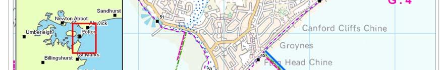
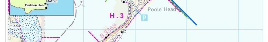
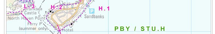


49 Report V
50 SUMMARY OF PREFERRED PLAN RECOMMENDATIONS AND JUSTIFICATION PLAN: This section of the coast has to be considered as management of the whole open coast barrier system to Poole Harbour, although management of different areas varies considerably to reflect the local values. The underlying intent of the plan is, therefore, to maintain a competent coastal barrier, with the entrance to the harbour maintained in its present position. In terms of on-going management this intent is met by the need to maintain the defence of the Sandbanks peninsula and maintain control of the Harbour entrance at the head of this peninsula and on the southern side at South Haven Point. Over the northern half of the area the more local intent is to maintain sandbanks through control of the drift locally to the shore and to provide recharge as necessary. The aim is to develop the approach being taken at present such that the frontage continues to provide both protection and amenity value. The pressure on the frontage will increase with sea level rise but the outlined approach is considered sustainable. An important consideration in management is to maintain a degree of sediment supply to the wider area, particularly through the ebb system of Hook Sands through to Studland. There is a constraint on management, therefore that works undertaken to maintain Sandbanks should not detrimentally impact on this entrance system. There may be a need in the final epoch, as pressure grows on the coast, to further develop the present approach of using coastal defence structures for amenity purposes. This would need to be taken forward within a broader framework of management so that the overall system is not disrupted. The aim for this northern section would also be to maintain defence around Sandbank Village through private and public collaboration to maintain the integrity of the village. The Management area extends within the Harbour to include the inner face of the peninsula and to maintain protection to the main shore road. On the southern side of the entrance, the dominant feature is the natural value of the Studland Peninsula, reflected in the conservation designations. The long term aim is to restore the natural functioning of coast within the area. It is accepted that this function is modified by the control of the entrance channel, particularly in relation to the training banks. These artificial constraints are not seen as being in conflict with the aim to deliver a more naturally functioning coastline. The aim or intent of the plan is, therefore, to adapt use of the frontage so that there is no requirement for hard management of the coast. This will mean that existing defences are allowed to fail or are actively removed and the local fixed assets such as beach huts, car parks are moved. This will require co-operation between various interest groups and development of a shoreline use plan. Maintaining the training bank does influence the frontage providing a degree of control to the northern end. This is seen as an important structure in providing a transition between the harder control of the Harbour entrance and the natural management of the main beach area Report V3
51 PREFERRED POLICY TO IMPLEMENT PLAN: From present day Medium term Long term Maintain defences to Sandbanks through shoreline structures and beach recharge. Maintain defences with the harbour. Work towards removal of defences to the southern end of Studland and manage use of the main beach so as to reduce conflict with a policy of NAI. Maintain defences to Sandbanks as above. Monitor NAI approach at Studland Maintain defences to Sandbanks as above. Monitor NAI approach at Studland SUMMARY OF SPECIFIC POLICIES Policy Unit PBY/STU. H.1 PBY/STU H.2 PBY/STU.H.3 PBY/STU. H.4 PBY/STU. H.5 PBY/STU. H.5a PBY/STU. H.6 PBY/STU.H.7 Flag Head Cliff to Sandbanks Head Sandbanks Village Policy Plan Comment HTL HTL HTL/A HTL HTL HTL Sandbanks Inner Face HTL HTL HTL South Haven Pt. Studland Dunes Training Bank Studland Village The Warren to Handfast Point HTL HTL HTL NAI NAI NAI HTL HTL HTL MR NAI NAI NAI NAI NAI Maintain amenity and opportunity for habitat enhancement. Private and public collaboration. Need to maintain low use of foreshore with the potential opportunity for Habitat management. Maintain access to Ferry. Key: HTL - Hold the Line, A - Advance the Line, NAI No Active Intervention MR Managed Realignment Managed adaption to naturally functioning shoreline. This would not preclude local management. Managed as part of overall unit PBY/STU. H.5 within which this sub-unit sits. Maintain existing defences within the context of longer term NAI. CHANGES FROM PRESENT MANAGEMENT The overall intent of management has not changed substantially from SMP1. The shoreline has been defined by different unit boundaries to better achieve the approach to NAI along the Studland area. IMPLICATION WITH RESPECT TO BUILT ENVIRONMENT Economics by 2025 By 2055 by 2105 Total k PV Property Potential NAI Damages/ Cost k PV Preferred Plan Damages k PV Benefits k PV Costs of Implementing plan k PV Report V
52 Location reference: Management Area reference: Policy Development Zone: Luscombe Valley to Ham Common PHB I PDZ3 * Note: Predicted shoreline mapping is based on a combination of monitoring data, analysis of historical maps and geomorphological assessment with allowance for sea level rise. Due to inherent uncertainties in predicting future change, these predictions are necessarily indicative. For use beyond the purpose of the shoreline management plan, reference should be made to the baseline data. The following descriptions are provided to assist interpretation of the map shown overleaf. 100 year shoreline position: The following maps aim to summarise the anticipated position of the shoreline in 100 years under the two scenarios of With Present Management and under the Preferred Policy being put forward through the Shoreline Management Plan. In some areas the preferred policy does not change from that under the existing management approach. In some areas where there are hard defences this can be accurately identified. In other areas there is greater uncertainty. Even so, where the shoreline is likely to be quite clearly defined by a change such as the crest of a cliff the estimated position is shown as a single line. Where there is a difference between With Present Management and the Preferred Policy this distinction is made in showing two different lines: With Present Management. Preferred Policy. In some areas, the Preferred Policy either promotes a more adaptive approach to management or recognises that the shoreline is better considered as a width rather than a narrow line. This is represented on the map by a broader zone of management: Flood Risk Zones General Flood Risk Zones. The explanation of these zones is provided on the Environment Agency s web site The maps within this SMP document show where SMP policy might influence the management of flood risk. Indicate areas where the intent of the SMP policy is to continue to manage this risk. Indicate where over the 100 years the policy would allow increased risk of flooding. The maps should be read in conjunction with the text within the SMP document Report V3

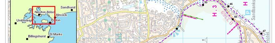
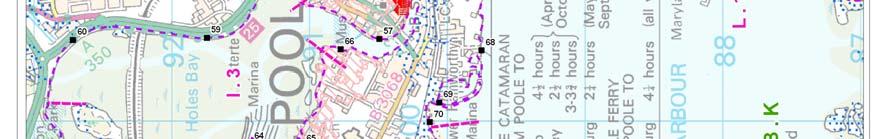
53 Report V
54 SUMMARY OF PREFERRED PLAN RECOMMENDATIONS AND JUSTIFICATION PLAN: This area includes the core residential, commercial and heritage centre of Poole. The principal aim over the whole area is to maintain the important regional and national economic viability of the area. As such the policy throughout the area is to continue to defend the built and recreational assets. There are, however, important broader issues for the whole of Poole Bay due to the potential squeeze of habitat and the inability for the Harbour to respond to sea level rise without loss of important nature conservation interest. Therefore, while the need to defend the existing shoreline is well established, there needs to be an underlying aim to consider any opportunity, locally to allow adjustment of the specific line of these defences. Specific areas that would need further consideration would be within Parkstone Bay. However, there may be smaller scale opportunity in the manner in which private defences are managed over the whole area. Within Holes Bay, the main defence is along the southern and eastern side of the bay. There is little anticipated risk to the area of the Upton Country Park and this area has in fact been identified as an area of opportunity for the creation of intertidal habitat, through a local policy of non-intervention in this specific area. This is consistent with the overall intent to maintain existing defences but to encourage an approach which looks for nature conservation gains. PREFERRED POLICY TO IMPLEMENT PLAN: From present day Medium term Long term Maintain existing defences. Maintain and raise existing defences, but working locally to allow scope of some readjustment of defences. Maintain and raise existing defences, but working locally to allow scope of some readjustment of defences. SUMMARY OF SPECIFIC POLICIES Policy Unit PHB. I.1 Luscombe Valley to Parkstone Bay Policy Plan Comment HTL HTL HTL PHB. I.2 Poole Quay HTL HTL HTL PHB. I.3 PHB. I.3a Holes Bay North-west Holes Bay HTL HTL HTL NAI NAI NAI Private and Public collaboration, further examination of potential habitat adaption. Possible investigation of barrier and adaption through development framework Opportunity to gain additional intertidal habitat. PHB. I.4 Port Area HTL HTL HTL Adaption through development framework PHB. I.5 Lower Hamworthy HTL HTL HTL Private and Public collaboration Key: HTL - Hold the Line, A - Advance the Line, NAI No Active Intervention MR Managed Realignment CHANGES FROM PRESENT MANAGEMENT No significant change from SMP1 policy. However, locally the approach to defence should look for opportunities for habitat enhancement Report V3
55 IMPLICATION WITH RESPECT TO BUILT ENVIRONMENT Economics by 2025 by 2055 by 2105 Total k PV Property Potential NAI Damages/ Cost k PV Preferred Plan Damages k PV Benefits k PV Costs of Implementing plan k PV Report V
56 Location reference: Management Area reference: Policy Development Zone: Ham Common to Arne Peninsula PHB J PDZ3 * Note: Predicted shoreline mapping is based on a combination of monitoring data, analysis of historical maps and geomorphological assessment with allowance for sea level rise. Due to inherent uncertainties in predicting future change, these predictions are necessarily indicative. For use beyond the purpose of the shoreline management plan, reference should be made to the baseline data. The following descriptions are provided to assist interpretation of the map shown overleaf. 100 year shoreline position: The following maps aim to summarise the anticipated position of the shoreline in 100 years under the two scenarios of With Present Management and under the Preferred Policy being put forward through the Shoreline Management Plan. In some areas the preferred policy does not change from that under the existing management approach. In some areas where there are hard defences this can be accurately identified. In other areas there is greater uncertainty. Even so, where the shoreline is likely to be quite clearly defined by a change such as the crest of a cliff the estimated position is shown as a single line. Where there is a difference between With Present Management and the Preferred Policy this distinction is made in showing two different lines: With Present Management. Preferred Policy. In some areas, the Preferred Policy either promotes a more adaptive approach to management or recognises that the shoreline is better considered as a width rather than a narrow line. This is represented on the map by a broader zone of management: Flood Risk Zones General Flood Risk Zones. The explanation of these zones is provided on the Environment Agency s web site The maps within this SMP document show where SMP policy might influence the management of flood risk. Indicate areas where the intent of the SMP policy is to continue to manage this risk. Indicate where over the 100 years the policy would allow increased risk of flooding. The maps should be read in conjunction with the text within the SMP document Report V3

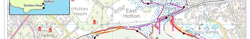
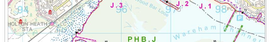
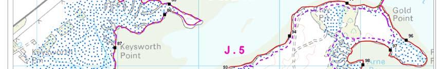
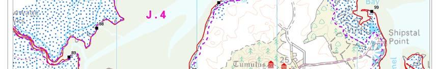
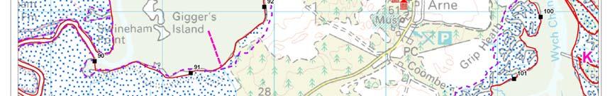

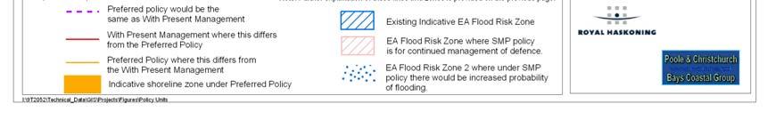
57 Report V
58 SUMMARY OF PREFERRED PLAN RECOMMENDATIONS AND JUSTIFICATION PLAN: This area provides the greatest opportunity for adjustment of defences, allowing for improvement and adaptation of the vital nature conservation interest of Poole Harbour, in line with sea level rise. This forms a primary intent for the area. The intent, however, is also to continue to manage key areas of the built environment, specifically areas of Turlin Moor, the railway line and the centres of Wareham and Stoborough. Along the Ham Common frontage the aim of the plan is to increasingly manage defences to allow a more natural response of the coast in keeping with the designated value of the area. this needs to be developed in conjunction with the owners of the Holiday Park. In the Wareham area, despite constraints imposed by agreements for continued defence, the intent would be to allow increased inundation of land currently defended, with the aim to restore a more naturally functioning system. This approach is being examined in more detail through the Environment Agency s emerging strategy. There would still be the intent to defend core areas of Wareham and Stoborough and to support adaption of amenity resources within the two rivers. The aim would be to maintain defence to the railways but this should be undertaken in a manner to minimise impact on the natural development of intertidal habitat in the area. There is recognised to be a potential issue of contamination in this area around Holton Heath and this needs further examination. PREFERRED POLICY TO IMPLEMENT PLAN: From present day Medium term Long term Maintain defences in the area, while developing a more adaptive approach which would be followed during the first epoch. Maintain defences to core areas of residential and commercial value and to the railway line. Maintain defences to core areas of residential and commercial value and to the railway line. SUMMARY OF SPECIFIC POLICIES Policy Unit PBH.J.1 PBH.J.2 Hamworthy Common Lytchett Bay Policy Plan Comment MR MR NAI NAI NAI MR The policy would allow local management and maintenance by the Caravan park's owners on the existing defences. However it is important to note that this option would not be supported by government funding. If the caravan park ceases to exist or the owners no longer undertake the maintenance of the defences the government will not fill the funding gap. In long term the intent would be to gradually remove the influence of management. Set back defence subject to impact of sea level rise Report V3
59 PBH.J.2 a PBH.J.3 Eastern Lytchett Bay Holton Railway Line MR HTL HTL HTL HTL HTL Establish new defence line to hold into future epochs PBH.J.4 Wareham MR MR MR Subject to strategy study outcome. PBH.J.5 Arne Peninsula NAI NAI NAI Key: HTL - Hold the Line, A - Advance the Line, NAI No Active Intervention MR Managed Realignment CHANGES FROM PRESENT MANAGEMENT There are significant changes from SMP1 in terms of policy, although SMP2 is developing on approaches identified in subsequent strategy for an overall approach of managed realignment. The most significant areas of change are at Ham Common, where the plan is for progressive realignment of the defences, and in the area of Wareham and Stoborough, where a policy of managed realignment is actively encouraged. IMPLICATION WITH RESPECT TO BUILT ENVIRONMENT Economics by 2025 by 2055 by 2105 Total k PV Property Potential NAI Damages/ Cost k PV Preferred Plan Damages k PV Benefits k PV Costs of Implementing plan k PV ** **Managed realignment costs complex and require further study Report V
60 Location reference: Management Area reference: Policy Development Zone: Arne Peninsula to South Haven Point PHB K PDZ3 * Note: Predicted shoreline mapping is based on a combination of monitoring data, analysis of historical maps and geomorphological assessment with allowance for sea level rise. Due to inherent uncertainties in predicting future change, these predictions are necessarily indicative. For use beyond the purpose of the shoreline management plan, reference should be made to the baseline data. The following descriptions are provided to assist interpretation of the map shown overleaf. 100 year shoreline position: The following maps aim to summarise the anticipated position of the shoreline in 100 years under the two scenarios of With Present Management and under the Preferred Policy being put forward through the Shoreline Management Plan. In some areas the preferred policy does not change from that under the existing management approach. In some areas where there are hard defences this can be accurately identified. In other areas there is greater uncertainty. Even so, where the shoreline is likely to be quite clearly defined by a change such as the crest of a cliff the estimated position is shown as a single line. Where there is a difference between With Present Management and the Preferred Policy this distinction is made in showing two different lines: With Present Management. Preferred Policy. In some areas, the Preferred Policy either promotes a more adaptive approach to management or recognises that the shoreline is better considered as a width rather than a narrow line. This is represented on the map by a broader zone of management: Flood Risk Zones General Flood Risk Zones. The explanation of these zones is provided on the Environment Agency s web site The maps within this SMP document show where SMP policy might influence the management of flood risk. Indicate areas where the intent of the SMP policy is to continue to manage this risk. Indicate where over the 100 years the policy would allow increased risk of flooding. The maps should be read in conjunction with the text within the SMP document Report V3

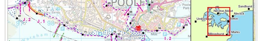
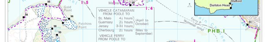
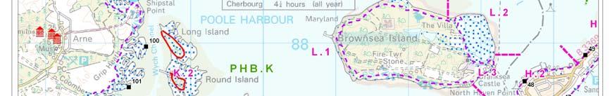
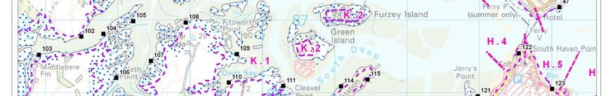
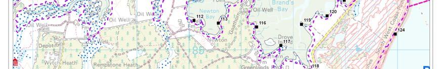
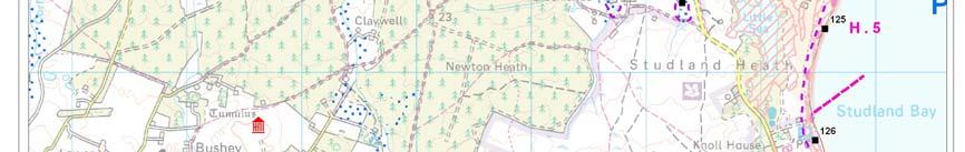
61 Report V
62 SUMMARY OF PREFERRED PLAN RECOMMENDATIONS AND JUSTIFICATION PLAN: While this area is the most natural of the main frontages within the Poole Harbour system, due to the relatively steeply rising hinterland, there are concerns that the full variety and extent of significant habitat will not be maintained with sea level rise. The overall intent within the area is to allow natural processes to dominate and for maximum adjustment of the coastal fringe. It is recognised that there are important oil field installations in the area and that there are local jetties and, in some areas, local sections of defence. The long term intent would be that where such features impact on coastal processes or on the natural development of the shoreline, these man-made features would be removed or their impact reduced. This would, however, not necessarily preclude maintenance of such structures supporting essential use of the area in the short to medium term. PREFERRED POLICY TO IMPLEMENT PLAN: From present day No Active Intervention Medium term No Active Intervention Long term No Active Intervention SUMMARY OF SPECIFIC POLICIES Policy Unit PHB. K.1 PHB. K.2 Poole Harbour South Furzey, Round, Long and Green Islands Policy Plan Comment NAI NAI NAI NAI NAI NAI This would not preclude local management. This would not preclude local management Key: HTL - Hold the Line, A - Advance the Line, NAI No Active Intervention MR Managed Realignment CHANGES FROM PRESENT MANAGEMENT No substantial change IMPLICATION WITH RESPECT TO BUILT ENVIRONMENT Economics by 2025 by 2055 by 2105 Total k PV Property Potential NAI Damages/ Cost k PV Preferred Plan Damages k PV Benefits k PV Costs of Implementing plan k PV Report V3
63 Location reference: Management Area reference: Policy Development Zone: Brownsea Island PHB L PDZ3 * Note: Predicted shoreline mapping is based on a combination of monitoring data, analysis of historical maps and geomorphological assessment with allowance for sea level rise. Due to inherent uncertainties in predicting future change, these predictions are necessarily indicative. For use beyond the purpose of the shoreline management plan, reference should be made to the baseline data. The following descriptions are provided to assist interpretation of the map shown overleaf. 100 year shoreline position: The following maps aim to summarise the anticipated position of the shoreline in 100 years under the two scenarios of With Present Management and under the Preferred Policy being put forward through the Shoreline Management Plan. In some areas the preferred policy does not change from that under the existing management approach. In some areas where there are hard defences this can be accurately identified. In other areas there is greater uncertainty. Even so, where the shoreline is likely to be quite clearly defined by a change such as the crest of a cliff the estimated position is shown as a single line. Where there is a difference between With Present Management and the Preferred Policy this distinction is made in showing two different lines: With Present Management. Preferred Policy. In some areas, the Preferred Policy either promotes a more adaptive approach to management or recognises that the shoreline is better considered as a width rather than a narrow line. This is represented on the map by a broader zone of management: Flood Risk Zones General Flood Risk Zones. The explanation of these zones is provided on the Environment Agency s web site The maps within this SMP document show where SMP policy might influence the management of flood risk. Indicate areas where the intent of the SMP policy is to continue to manage this risk. Indicate where over the 100 years the policy would allow increased risk of flooding. The maps should be read in conjunction with the text within the SMP document. Report V

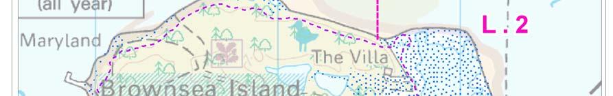
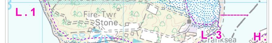
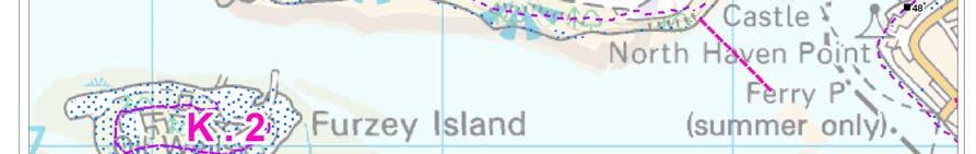

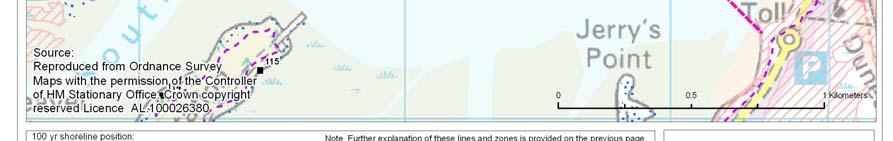
64 Report V3
Poole Bay, Poole Harbour and Wareham Flood and Coastal Erosion Risk Management. Final Strategy December Aerial photo credit: Kitchenham Ltd
 Poole Bay, Poole Harbour and Wareham Flood and Coastal Erosion Risk Management Final Strategy December 2014 Aerial photo credit: Kitchenham Ltd 1 Foreword The Poole and Wareham Strategy area is one of
Chiswell and Chesil Beach (to Wyke Narrows) 6a02 and 6a03 SUMMARY OF PREFERRED PLAN RECOMMENDATIONS AND JUSTIFICATION
 6a02 and 6a03 SUMMARY OF PREFERRED PLAN RECOMMENDATIONS AND JUSTIFICATION") Location reference: Policy Unit reference: Plan: Chiswell and Chesil Beach (to Wyke Narrows) 6a02 and 6a03 SUMMARY OF PREFERRED PLAN RECOMMENDATIONS AND JUSTIFICATION The long term aim for this section
Location reference: Policy Unit reference: Plan: Chiswell and Chesil Beach (to Wyke Narrows) 6a02 and 6a03 SUMMARY OF PREFERRED PLAN RECOMMENDATIONS AND JUSTIFICATION The long term aim for this section
Poole Bay & Harbour Coastal Group
 Poole Bay & Harbour Coastal Group POOLE BA & HARBOUR STRATEG STUD Assessment of Flood and Coast Defence Options STUDLAND BA Contents Amendment Record This report has been issued and amended as follows:
Management Area 19 Management Area 20 Management Area 21 Management Area 22. Mount s Bay West (The Greeb to Point Spaniard)
") PDZ: 8 Mount s Bay West (The Greeb to Point Spaniard) (Including Marazion and St Michael s Mount) Management Area 19 Management Area 20 Management Area 21 Management Area 22 Mount s Bay West (The Greeb
PDZ: 8 Mount s Bay West (The Greeb to Point Spaniard) (Including Marazion and St Michael s Mount) Management Area 19 Management Area 20 Management Area 21 Management Area 22 Mount s Bay West (The Greeb
DRAFT. Management Area 19 Management Area 20 Management Area 21 Management Area 22
 PDZ: 8 Mounts Bay West (The Greeb to Point Spaniard) (Including Marazion and St Michael s Mount) Management Area 19 Management Area 20 Management Area 21 Management Area 22 Mounts Bay West (The Greeb to
Studland Bay Context and Learning Aims
 Studland Bay Enquiry 7: How are coastal processes affecting Studland Bay? Context and Learning Aims Pupils will be supported in and outside of the classroom to: Identify; describe and explain the physical
SANDBANKS COAST PROTECTION
 SANDBANKS COAST PROTECTION David Robson, Senior Engineer, Coastal & Drainage Team Borough of Poole Leisure Services (T) 01202 265265 (E) d.robson@poole.gov.uk May 2003 SANDBANKS COAST PROTECTION Introduction
PDZ: 10 Clodgy Point to Godrevy Point Management Area 25 Management Area 26 Management Area 27 Management Area 28 DRAFT
 PDZ: 10 Clodgy Point to Godrevy Point Management Area 25 Management Area 26 Management Area 27 Management Area 28 Clodgy Point to Godrevy Point This area encompasses St Ives Bay and is made up of both
PDZ: 10 Clodgy Point to Godrevy Point Management Area 25 Management Area 26 Management Area 27 Management Area 28
 PDZ: 10 Clodgy Point to Godrevy Point Management Area 25 Management Area 26 Management Area 27 Management Area 28 Looking toward Hayle from Godrevy Towans Clodgy Point to Godrevy Point This area encompasses
Borough Head to Dinas Fach
 PDZ2. ST BRIDE S BAY: Newgale Borough Head to Dinas Fach CONTENTS Page PDZ2. ST BRIDE S BAY: 30 1 Local Description 32 2 Coastal Processes 36 3 Management Scenarios 38 4 Summary Comparison and Assessment
Map 8: Ayrshire Coast: Ardrossan North Bay to Stevenston Pier Map Content Descriptions
 Map 8: Ayrshire Coast: Ardrossan North Bay to Stevenston Pier Map Content Descriptions 1. Built Heritage and Archaeology A total of twenty four sites were recorded in the area covered by Map 8. Of these
SHOREHAM BEACH LOCAL NATURE RESERVE
 SHOREHAM BEACH LOCAL NATURE RESERVE Coastal Geography Education Programme 2014-15 S. Savage 2014 COASTAL GEOGRAPHY OPPORTUNITIES Shoreham Beach Shoreham Beach is a shingle spit formed over many centuries
Beach profile surveys and morphological change, Otago Harbour entrance to Karitane May 2014 to June 2015
 Beach profile surveys and morphological change, Otago Harbour entrance to Karitane May 2014 to June 2015 Prepared for Port Otago Ltd Martin Single September 2015 Shore Processes and Management Ltd Contact
Coastal Change and Conflict
 Coastal Change and Conflict Outline of the Topic Contrasting Coasts why do all coasts not look the same? Geology of the coast the impact rock structure has on the coastline Waves Constructive and destructive
Impacts of breakwaters and training walls
 Across the eastern seaboard of Australia, breakwaters and training walls have instigated fundamental perturbations to coastal and estuary processes. This has induced long-term changes to foreshore alignments,
SHORELINE MANAGEMENT PLAN REVIEW (SMP2) POOLE & CHRISTCHURCH BAYS HURST SPIT TO DURLSTON HEAD. Scoping Report
 POOLE & CHRISTCHURCH BAYS HURST SPIT TO DURLSTON HEAD. Scoping Report") SHORELINE MANAGEMENT PLAN REVIEW (SMP2) POOLE & CHRISTCHURCH BAYS HURST SPIT TO DURLSTON HEAD 23 rd July 2008 Poole & Christchurch Bays Shoreline Management Plan CONTENTS 1 Introduction...4 1.1 Coastal
SHORELINE MANAGEMENT PLAN REVIEW (SMP2) POOLE & CHRISTCHURCH BAYS HURST SPIT TO DURLSTON HEAD 23 rd July 2008 Poole & Christchurch Bays Shoreline Management Plan CONTENTS 1 Introduction...4 1.1 Coastal
Australian Coastal Councils Conference
 Australian Coastal Councils Conference Kiama March 2019 Where Has My Beach Gone? (and what can I do about it?) Dr Andrew McCowan Water Technology Where Has My Beach Gone? Where Has My Beach Gone? Where
Strumble Head to Pen y Bal (including the Nyfer Estuary).
.") PDZ 4. FISHGUARD BAY AND NEWPORT BAY: Newport Parrog Strumble Head to Pen y Bal (including the Nyfer Estuary). CONTENTS Page PDZ 4. FISHGUARD BAY AND NEWPORT BAY: 11 1 Local Description 14 2 Coastal Processes
PDZ 4. FISHGUARD BAY AND NEWPORT BAY: Newport Parrog Strumble Head to Pen y Bal (including the Nyfer Estuary). CONTENTS Page PDZ 4. FISHGUARD BAY AND NEWPORT BAY: 11 1 Local Description 14 2 Coastal Processes
NORTHERN CELL OPTIONS SHORTLIST RECOMMENDATIONS
 OPTIONS SHORTLIST RECOMMENDATIONS Coastal Unit C: Bayview Options recommended for MCDA scoring. Status quo. Planting 3. Renourishment (gravel) 6. Beach-scraping 7. Restore shingle crest. Inundation accommodation
Location of Proposed Dredging Areas, spoil disposal area, beaches identified for nourishment and the Study Area Figure 1
 42 41 4 9 Little Channel Bournemouth Beach Bournemouth Beach (Sand and gravel) Middle RORO Turning Basin Ship Channel Poole Beach Swash Channel 8 Swanage Beach Admiralty Chart 2615 Study Area Proposed
Chapter 10 Lecture Outline. The Restless Oceans
 Chapter 10 Lecture Outline The Restless Oceans Focus Question 10.1 How does the Coriolis effect influence ocean currents? The Ocean s Surface Circulation Ocean currents Masses of water that flow from one
Coastal Processes Day Criccieth
 Coastal Processes Rivers (Conwy) Rivers (Peris) Urban Studies Lowland Glaciation Tourism and National Parks Soils Sand Dunes Upland Glaciation Rural Settlements The Centre and Staff Fieldwork Equipment
COASTAL SYSTEMS WAVE ENERGY
 WAVE ENERGY The energy of a wave determines its ability to erode and transport material on the coast Wave energy depends on the fetch, the distance the wind has blown the wave Wind strength and wind duration
Case study 64. Shoreham Harbour Shingle Bypassing and Recycling
 Case study 64. Shoreham Harbour Shingle Bypassing and Recycling Authors: Tony Parker, Uwe Dornbusch Main driver: Improved defences Project stage: Ongoing construction/operation since 1992 Photo 1: Shoreham
Warm-up # 7 A day 5/17 - B day 5/18 UPDATE YOUR TABLE OF CONTENTS
 Warm-up # 7 A day 5/17 - B day 5/18 UPDATE YOUR TABLE OF CONTENTS Question: List all examples of surface water on Earth. Answer: Rivers and streams, lakes and reservoirs, (ponds) wetlands, estuaries and
14 NOISE AND VIBRATION
 14 NOISE AND VIBRATION 14.1 EXISTING ENVIRONMENT 14.1.1 The noise environment within Poole Harbour is generally characterised by low to medium noise levels depending on location. For example, certain areas
Long Beach Island Holgate Spit Little Egg Inlet Historical Evolution Introduction Longshore Transport Map, Survey and Photo Historic Sequence
 Appendix B Long Beach Island Holgate Spit Little Egg Inlet Historical Evolution Introduction The undeveloped southern end of Long Beach Island (LBI) is referred to as the Holgate spit as it adjoins the
Waikanae River Environmental Strategy. 12. Arapawaiti/Otaihanga Reach
 74 Waikanae River Environmental Strategy 12. Arapawaiti/Otaihanga Reach Figure 12: Arapawaiti/Otaihanga Reach 75 PART C: Protecting and Improving the River Corridor / Arapawaiti/Otaihanga Reach Waikanae
Chesil Beach, Dorset UK High energy, shingle coastline. Brighton Beach, Sussex UK Pebble beach
 Beaches: Depositional landform Extends from the highest high tide to the lowest low tide. Very important temporary store in coastal system. Accretion: sediment returning to the visible portion of a beach
1.1 Coastal processes produce landforms
 1.1 Coastal processes produce landforms Types of wave: destructive and constructive Destructive Carry out erosion Tall Powerful High frequency Backwash greater than the swash Take sediment from beach to
CHAPTER 8 ASSESSMENT OF COASTAL VULNERABILITY INDEX
 124 CHAPTER 8 ASSESSMENT OF COASTAL VULNERABILITY INDEX 8.1 INTRODUCTION In order to assess the vulnerability of the shoreline considered under this study against the changing environmental conditions,
Coastal Processes and Landforms
 Coastal Processes and Landforms These icons indicate that teacher s notes or useful web addresses are available in the Notes Page. This icon indicates that the slide contains activities created in Flash.
INTRODUCTION TO COASTAL ENGINEERING
 The University of the West Indies Organization of American States PROFESSIONAL DEVELOPMENT PROGRAMME: COASTAL INFRASTRUCTURE DESIGN, CONSTRUCTION AND MAINTENANCE A COURSE IN COASTAL DEFENSE SYSTEMS I CHAPTER
Part 9 Specific Land Uses - Foreshore & Waterway Development
 7 FORESHORE AND WATERWAY DEVELOPMENT This section applies to the following development uses proposed within the foreshore area (defined by LM LEP 2014), and contains Council s specific requirements for
Figure 1. Schematic illustration of the major environments on Mustang Island.
 STOP #1: PACKERY CHANNEL BEACH TO BAY We will start this field guide near the north jetty of Packery Channel and hike across the island to Corpus Christi Bay (fig. 1). The island emerges from the Gulf
Our coastline is changing
 Our coastline is changing The Isles of Scilly are a particularly unique and dramatic part of the British Isles, with coastal landscapes and seascapes that have been shaped by natural marine processes over
Oceans and Coasts. Chapter 18
 Oceans and Coasts Chapter 18 Exploring the oceans The ocean floor Sediments thicken and the age of the seafloor increases from ridge to shore The continental shelf off the northeast United States Constituent
The Physical and Human Causes of Erosion. The Holderness Coast
 The Physical and Human Causes of Erosion The Holderness Coast By The British Geographer Situation The Holderness coast is located on the east coast of England and is part of the East Riding of Yorkshire;
Llandudno Beach Management Plan and Options Appraisal
 Llandudno Beach Management Plan and Options Appraisal August, 2017 G.B. Edwards BEng (Hons) CEng FICE Head of, Mochdre Offices, Conway Road, Mochdre, Colwyn Bay, LL28 5AB. Tel. (01492) 574000 Fax. (01492)
NORTH HAVEN NORTH HAVEN SLSC
 NORTH HAVEN NORTH HAVEN SLSC Patrols: November to March, weekends and public holidays North Haven beach is the product of a major redevelopment of the northern part of the Adelaide coast. In the 1980s,
LAB: WHERE S THE BEACH
 Name: LAB: WHERE S THE BEACH Introduction When you build a sandcastle on the beach, you don't expect it to last forever. You spread out your towel to sunbathe, but you know you can't stay in the same spot
Coasts. 1. Coastal Processes. 1.1 Coastal erosion. 1.2 Sediment transport. Coastal Processes and Landforms. i. Hydraulic action
 Coasts Coastal Processes and Landforms 1. Coastal Processes 1.1 Coastal erosion i. Hydraulic action When waves strike against a rock surface, the waves trap air in the rock joints. This air is compressed
EX Beach Control Structures, Poole Numerical modelling of scheme options, Sandbanks to Branksome Dene Chine
 EX 5763 Beach Control Structures, Poole Numerical modelling of scheme options, Sandbanks to Branksome Dene Chine Report EX 5763 Release 1.0 August 2008 Document Information Project Beach Control Structures,
page - Laboratory Exercise #5 Shoreline Processes
 page - Laboratory Exercise #5 Shoreline Processes Section A Shoreline Processes: Overview of Waves The ocean s surface is influenced by three types of motion (waves, tides and surface currents). Shorelines
Map Introduction: Grimsay Map 1
 32 Map Introduction: Map This map section covers the western half of the island of. It extends from the south west coast of Bagh Scotbheinn and runs northwards, past the causeway connecting to Benbecula
Guiding Principles: Key Guiding Principle numbers: 1, 5, 15, 16 and Introduction Yachting / Motor Boating
 Chapter 10 Recreation & Tourism Guiding Principles: Chapter 4 details all the guiding principles relevant to the overall management of the Harbour. Whilst all should be given some consideration the following
GONE! Coastal Erosion Happens During Storms! Why Worry About Coastal Setbacks? Goals for Today
 RI Regulatory Setbacks & Buffers: Coastal Zone Management Issues New England Onsite Wastewater Training Program @ URI OWT 155 November 21, 2013 Goals for Today Understand the impacts of storms, coastal
1.5 How do ocean waves and currents change the face of coastal areas? (Chapter 3)
") 1.5 How do ocean waves and currents change the face of coastal areas? (Chapter 3) 1. Hydraulic Action/Pressure - air being forced into crack in rocks. 2. Corrosion (Solution) Minerals such as calcium carbonate
1.5 How do ocean waves and currents change the face of coastal areas? (Chapter 3) 1. Hydraulic Action/Pressure - air being forced into crack in rocks. 2. Corrosion (Solution) Minerals such as calcium carbonate
Inlet Management Study for Pass-A-Grille and Bunces Pass, Pinellas County, Florida
 Inlet Management Study for Pass-A-Grille and Bunces Pass, Pinellas County, Florida Final Report Submitted By Ping Wang, Ph.D., Jun Cheng Ph.D., Zachary Westfall, and Mathieu Vallee Coastal Research Laboratory
Q1. What are the primary causes/contributors to coastal erosion at Westshore and the concept of longshore / littoral drift.
 Q1. What are the primary causes/contributors to coastal erosion at Westshore and the concept of longshore / littoral drift. In order of (timing related) contribution to present problem 1. Beach is too
WHAT ARE ECOSYSTEMS? Dr. V. N. Nayak Professor of Marine Biology (Retd)
") WHAT ARE ECOSYSTEMS? Dr. V. N. Nayak Professor of Marine Biology (Retd) An ECOSYSTEM is an interacting system of plant, animals, and humans and the surrounding environment. An ecosystem contains living
WHAT ARE ECOSYSTEMS? Dr. V. N. Nayak Professor of Marine Biology (Retd) An ECOSYSTEM is an interacting system of plant, animals, and humans and the surrounding environment. An ecosystem contains living
Estuarine Shoreline Stabilization
 Estuarine Shoreline Stabilization Property Owner s Guide to Determining the Most Appropriate Stabilization Method Estuarine shorelines are dynamic features that experience continued erosion. Land is lost
Coast Survey Stretch 03 Seaview High Street to Sandown Zoo
 Coast Survey Stretch 03 Seaview High Street to Sandown Zoo Overview map of the stretch Introduction The route starts at the attractive village of Seaview, through the wooded Priory Bay, passing the remains
RI Regulatory Setbacks & Buffers: Coastal Management Issues
 RI Regulatory Setbacks & Buffers: Coastal Management Issues New England Onsite Wastewater Training Program @ URI OWT 155 - November 29, 2012 James Boyd - Coastal Policy Analyst Photo: October 30, 2012
Appendix 3. Hydrodynamic and sedimentation studies
 Appendix 3 Report EX 4945 Rev 3.0 November 2004 Document Information Project Report title Client Borough of Poole Client Representative Mr Stuart Terry Project No. DDR3553 Report No. EX 4945 Doc. ref.
Montserrat. Wise practices for coping with. i b bea n Se a
 Wise practices for coping with Montserrat Car i b bea n Se a Fisheries Division, Montserrat Physical Planning Department, Montserrat University of Puerto Rico, Sea Grant College Program Caribbean Development
The Dynamic Coast. Right Place Resources. A presentation about the interaction between the dynamic coast and people
 The Dynamic Coast Houses threatened by coastal erosion in California Right Place Resources A presentation about the interaction between the dynamic coast and people For the rest of the presentations in
TITLE: COASTAL EROSION AND LANDFORMS.
 TITLE: COASTAL EROSION AND LANDFORMS. AIM: What are the factors that influence the formation of coastal features along Fishing Pond beach Trinidad? LOCATION OF FIELD STUDY: The study was carried out in
Coastal management has lagged behind the growth in population leading to problems with pollution
 Fifty percent of the population of the industrialized world lives within 100 km of a coast. Coastal management has lagged behind the growth in population leading to problems with pollution and natural
Shorelines Earth - Chapter 20 Stan Hatfield Southwestern Illinois College
 Shorelines Earth - Chapter 20 Stan Hatfield Southwestern Illinois College The Shoreline A Dynamic Interface The shoreline is a dynamic interface (common boundary) among air, land, and the ocean. The shoreline
The Sea Geography Notes JC-Learn. JC-Learn. Geography Notes The Sea. 1 P a g e
 JC-Learn Geography Notes The Sea 1 P a g e The Sea *Here, you can choose to study the chapter on glaciation or the one on the sea, or even both, because whenever these topics come up in the Junior Cert
St Brides Bay coastal waters east
 No: 21 Seascape Character Area Name: St Brides Bay coastal waters east Looking south from Newgale Nolton Haven 21-1 View from Little Haven across St Bride s Bay Summary Description View across Broad Haven
MESSOLOGI LAGOON AREA (GREECE)
") MESSOLOGI LAGOON AREA (GREECE) 20 Contact: Kyriakos SPYROPOULOS TRITON Consulting Engineers 90 Pratinou Str. 11634 Athens (GREECE) Tel: +32 10 729 57 61 Fax: +32 10 724 33 58 e-mail: kspyropoulos@tritonsa.gr
MESSOLOGI LAGOON AREA (GREECE) 20 Contact: Kyriakos SPYROPOULOS TRITON Consulting Engineers 90 Pratinou Str. 11634 Athens (GREECE) Tel: +32 10 729 57 61 Fax: +32 10 724 33 58 e-mail: kspyropoulos@tritonsa.gr
Lincolnshire Walks. Grainthorpe. Three circular walks of 2 ¾, 9 and 9 ½ km (1 ¾, 5 ½ and 6 miles)
") Lincolnshire Walks Grainthorpe Three circular walks of ¾, 9 and 9 ½ km (1 ¾, ½ and 6 miles) Introduction Explore the coastal marshes, arable hinterland, Louth Navigation canal and the village of Grainthorpe
Lincolnshire Walks Grainthorpe Three circular walks of ¾, 9 and 9 ½ km (1 ¾, ½ and 6 miles) Introduction Explore the coastal marshes, arable hinterland, Louth Navigation canal and the village of Grainthorpe
1.5 Understand how ocean waves and currents change the face of coastal areas. (Chapter 3)
") 1.5 Understand how ocean waves and currents change the face of coastal areas. (Chapter 3) 1. Hydraulic Action/Pressure - air being forced into crack in rocks. 2. Corrosion (Solution) Minerals such as calcium
1.5 Understand how ocean waves and currents change the face of coastal areas. (Chapter 3) 1. Hydraulic Action/Pressure - air being forced into crack in rocks. 2. Corrosion (Solution) Minerals such as calcium
Name: Form: 2.To know the difference between Constructive and Destructive wave # $
 Name: Form: Landforms and landscape processes: COASTS 1. To know what factors affect the strength of waves # $ 2.To know the difference between Constructive and Destructive wave # $ 3. To be able to draw
Label the diagram below with long fetch and short fetch:
 Coastal Processes Coasts are shaped by the sea and the action of waves. The processes that take place are erosion, transportation and deposition. The power of waves is one of the most significant forces
COUPLED MANAGEMENT STRATEGY LAKE CATHIE ESTUARY & COAST
 Lake Cathie Progress Association Inc. ABN 28 251 433 854 P.O. Box 247 Lake Cathie NSW 2445 PHONE/FAX: 02 6584 8211 EMAIL: r3packag@bigpond.com 20 th October 2009 Port Macquarie Hastings Council PO Box
Overview. Beach Features. Coastal Regions. Other Beach Profile Features. CHAPTER 10 The Coast: Beaches and Shoreline Processes.
 Overview CHAPTER 10 The Coast: Beaches and Shoreline Processes Coastal regions constantly change. The beach is a dominant coastal feature. Wave activity continually modifies the beach and coastal areas.
OECS Regional Engineering Workshop September 29 October 3, 2014
 B E A C H E S. M A R I N A S. D E S I G N. C O N S T R U C T I O N. OECS Regional Engineering Workshop September 29 October 3, 2014 Coastal Erosion and Sea Defense: Introduction to Coastal/Marine Structures
Waves- how are they formed and how do they affect the coast?
 Question 7 Coasts Waves- how are they formed and how do they affect the coast? Waves are caused by friction between the wind and water causing the water to swell. The size and energy of a wave is influenced
Poole Harbour Aquatic Management Plan 2006
 Poole Harbour Aquatic Management Plan 2006 Non-Technical Summary Harbour Office, 20 New Quay Road, Poole, Dorset BH15 4AF. Tel: 01202 440200. Fax: 01202 440235. www.pooleharbouraqmp.co.uk Welcome Introduction
Formation and characteristics of different types of beaches
 Activity Title: Formation and characteristics of different types of beaches Focusing questions What different types of beaches are there in New Zealand? How are estuaries different to open coastal sandy
LAKKOPETRA (GREECE) EUROSION Case Study. Contact: Kyriakos SPYROPOULOS. TRITON Consulting Engineers. 90 Pratinou Str Athens (GREECE)
 EUROSION Case Study. Contact: Kyriakos SPYROPOULOS. TRITON Consulting Engineers. 90 Pratinou Str Athens (GREECE)") LAKKOPETRA (GREECE) Contact: Kyriakos SPYROPOULOS TRITON Consulting Engineers 90 Pratinou Str. 11634 Athens (GREECE) Tel: +32 10 729 57 61 Fax: +32 10 724 33 58 e-mail: kspyropoulos@tritonsa.gr 19 1 1.
LAKKOPETRA (GREECE) Contact: Kyriakos SPYROPOULOS TRITON Consulting Engineers 90 Pratinou Str. 11634 Athens (GREECE) Tel: +32 10 729 57 61 Fax: +32 10 724 33 58 e-mail: kspyropoulos@tritonsa.gr 19 1 1.
To: William Woods, Jenni Austin Job No: CentrePort Harbour Deepening Project - Comments on community queries
 Memo To: William Woods, Jenni Austin From: Richard Reinen-Hamill Date: Subject: cc: 1 Purpose This memo sets out our response to issues raised at and after Seatoun community consultation sessions held
Constructive waves build beaches. Each wave is low. As the wave breaks it carries material up the beach in its. material will then be deposited as
 Constructive waves Constructive waves build beaches. Each wave is low. As the wave breaks it carries material up the beach in its swash. The beach material will then be deposited as the backwash soaks
Today: Coastal Issues and Estuaries
 Today: Coastal Issues and Estuaries Coastal issues Human effect on coastlines What is an estuary Why are they so important? Circulation of water in estuary Environmental issues Coastal Issues: Problem
ALTERNATIVES FOR COASTAL STORM DAMAGE MITIGATION
 ALTERNATIVES FOR COASTAL STORM DAMAGE MITIGATION Dave Basco Old Dominion University, Norfolk, Virginia, USA National Park Service Photo STRUCTURAL (changes to natural, physical system) hardening (seawalls,
Request Number IR1-12: Flow Passage. Information Request
 Request Number IR1-12: Flow Passage Information Request Provide additional information about the 100 metre flow passage channel scenario between the Westshore Terminals and the proposed Project terminal
Marine Protected Areas (MPAs)
") Marine Protected Areas This is one of a series of guides in which Seafish explores topical issues affecting the UK seafood industry. This guide takes a practical look at : what they are, the different
Marine Protected Areas This is one of a series of guides in which Seafish explores topical issues affecting the UK seafood industry. This guide takes a practical look at : what they are, the different
Implications of proposed Whanganui Port and lower Whanganui River dredging
 PO Box 637 Wanganui 4540 Attention: Rowan McGregor Dear Rowan 1 Summary We understand that it has been proposed to bring large vessels into the Port at Whanganui requiring the excavation of a channel up
Montessori for Everyone 2013 Types of Coastlines
 Coast The coast is the part of the land that borders the sea. It is subject to constant change, as the result of the waves and deposits carried by water onto the land. Coastline The coastline is where
Taranaki Tsunami Inundation Analysis. Prepared for Taranaki Civil Defence Emergency Management Group. Final Version
 Taranaki Tsunami Inundation Analysis Prepared for Taranaki Civil Defence Emergency Management Group Final Version June 2012 AM 12/07 HBRC Plan Number 4362 Asset Management Group Technical Report Prepared
AGGREGATE DREDGING AND THE MARINE ENVIRONMENT
 AGGREGATE DREDGING AND THE MARINE ENVIRONMENT The marine Aggregate Levy Sustainability Fund ( marine ALSF ) programme represents one of the most substantial investments in UK marine research. The research
EXISTING AND PLANNED STRATEGIES AND ACTIONS CONNECTED WITH COASTAL PROTECTION IN ASPECT OF PREDICTED SEA LEVEL RISE
 EXISTING AND PLANNED STRATEGIES AND ACTIONS CONNECTED WITH COASTAL PROTECTION IN ASPECT OF PREDICTED SEA LEVEL RISE Andrzej Cieślak Long term coastal protection strategy In 2000 a new 1 Polish long term
Coastal Processes and Landforms
 Coastal Processes and Landforms These icons indicate that teacher s notes or useful web addresses are available in the Notes Page. This icon indicates that the slide contains activities created in Flash.
Reading Material. Inshore oceanography, Anikouchine and Sternberg The World Ocean, Prentice-Hall
 Reading Material Inshore oceanography, Anikouchine and Sternberg The World Ocean, Prentice-Hall BEACH PROCESSES AND COASTAL ENVIRONMENTS COASTAL FEATURES Cross section Map view Terminology for Coastal
Habitat Fact Sheets. Rocky habitats are dominated by seaweeds and often mussels, which rely on the rocks for attachment.
 Habitat Fact Sheets Habitats in the Gulf of Maine serve many important roles for the environment and for humans as well. These include: cycling nutrients, filtering pollution, trapping sediments, storing
Lecture Outlines PowerPoint. Chapter 15 Earth Science, 12e Tarbuck/Lutgens
 Lecture Outlines PowerPoint Chapter 15 Earth Science, 12e Tarbuck/Lutgens 2009 Pearson Prentice Hall This work is protected by United States copyright laws and is provided solely for the use of instructors
Environmental Protection on the Gold Coast of Queensland, Australia. 1. What is the appeal of the Gold Coast to tourists?
 Environmental Protection on the Gold Coast of Queensland, Australia Sections 1. What is the appeal of the Gold Coast to tourists? 2. How are Gold Coast visitor trends changing? 3. How can the impacts of
VENICE LOCAL COASTAL PROGRAM UPDATE: COASTAL HAZARDS WELCOME
 VENICE LOCAL COASTAL PROGRAM UPDATE: COASTAL HAZARDS WELCOME 1 Introducing the Team Hosted by the Department of City Planning and grant funded in part by the California Coastal Commission 2 Workshop Purpose
Habitat Development: Habitat Boulders Lawson Pier Foreshore Enhancement
 Habitat Development: Habitat Boulders Improve the existing habitat by stabilising beach sediments. Increase biodiversity by creating new habitats and colonisation opportunities. Loose cobble is unstable;
Case Study 3. Case Study 3: Cebu Island, Philippines MPA Network 10
 Case studies of mpa networks Case Study 3: Cebu Island, Philippines MPA Network 10 Location and background Cebu Island in the Philippines lies in the center of the Visayan Islands, known as an area high
BETWEEN A ROCK AND A HARD PLACE
 BETWEEN A ROCK AND A HARD PLACE Mike Newman Ocean-image.com Options for protecting Penzance and Newlyn from the effects of Climate Change It s not just the predicted 1 metre rise in sea level and the increased
PDZ:18 Isles of Scilly Management Area 42 Management Area 43 Management Area 44 Management Area 45 Management Area 46
 PDZ:18 Isles of Scilly Management Area 42 Management Area 43 Management Area 44 Management Area 45 Management Area 46 St Martin s from the air Isles of Scilly The Isles of Scilly is an archipelago of around
UPPER BEACH REPLENISHMENT PROJECT RELATED
 ASSESSMENT OF SAND VOLUME LOSS at the TOWNSHIP of UPPER BEACH REPLENISHMENT PROJECT RELATED to the LANDFALL OF HURRICANE SANDY - PURSUANT TO NJ-DR 4086 This assessment is in response to Hurricane Sandy
Issues facing this region include the status of the Sluice Creek tide gates, various tidal wetlands, and locations of public access:
 5.6 Guilford Point to Madison Town Line Existing Resources This region extends from Guilford Point to the Madison town line. Named places include Grass Island and the East River. Residential, commercial,
Saline Lagoons and Associated Species
 Saline Lagoons and Associated Species Saline lagoons occur in a range of dynamic environmental conditions, which give rise to varied forms and salinity. They support a distinctive fauna and flora, which
Draft Coastal Zone Management Plan for Byron Shire Coastline
 Byron Shire Council Draft Coastal Zone Management Plan for Byron Shire Coastline 26 November 2010 #1030842 Presentation Outline o o o o o o o Brief Byron Shire erosion history What is a CZMP? Why Develop
Identify one factor which influences wave strength (1 Mark) Factors which affect wave strength
 Factors which affect wave strength") Coasts revision Identify one factor which influences wave strength (1 Mark) Factors which affect wave strength Identify one factor which influences wave strength (1 Mark) Factors which affect wave strength
Coasts revision Identify one factor which influences wave strength (1 Mark) Factors which affect wave strength Identify one factor which influences wave strength (1 Mark) Factors which affect wave strength