County of Santa Barbara Permit Option Analysis Goleta Beach JULY 13, 2017
|
|
|
- Rosamond Evans
- 6 years ago
- Views:
Transcription


1 County of Santa Barbara Permit Option Analysis Goleta Beach JULY 13, 2017
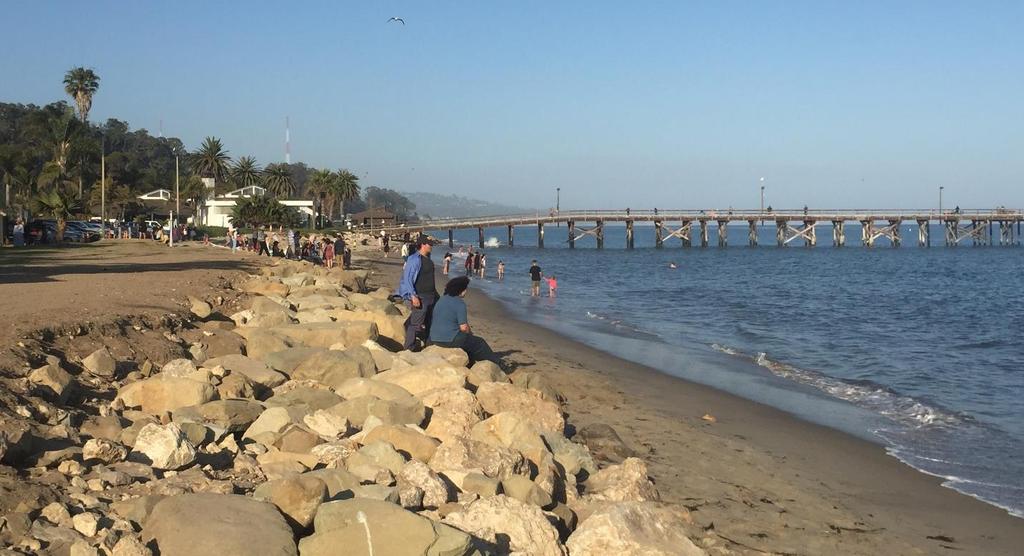
2 Introduction 2 Goleta Beach Park welcomes 1.5 million visitors annually Amenities include: Picnic Areas and Group Areas w/bbqs Public Restrooms Restaurant Kayak and Paddleboard Rentals Pier w/boat Launching Facility and Tackle Shop Fishing Bird Watching Platform Horseshoes Free Coastal Access Parking (520 spaces)
3 Recent Park Investments 3 $2 million in emergency protective measures since 2015 $5 million in recent park improvements New access bridge (under construction) New bus stop Re-routed bike path Renovated restrooms Re-built group BBQ/picnic areas Accommodates up to 200 visitors each Lift station rehabilitation


4 Historic Goleta Slough 4 Goleta Slough 1938 Goleta Slough 1928 Source: goletahistory.com


5 Source: Goleta Beach EIR 2.0 Historic Goleta Beach Park
6 Historic Goleta Beach Park Source: Goleta Beach EIR 2.0 and Google Earth


7 Historic Goleta Beach Park Looking West From Pier Looking East Toward Pier
8 Historic Sand Accretion & Erosion 8 Beach width and sand volumes oscillations occur at Goleta Beach seasonally during winter and summer, and over several decades based on climate cycles like Pacific Decadal Oscillation (20+ year frequency) and El Niño Southern Oscillation (2 to 7 year frequency). El Niños can include minor or major storm events Beach widths are highly dependent on major events Major El Niño storm events occurred in and year analysis of beach width changes along Goleta shoreline reveals oscillating pattern as opposed to long-term narrowing of the beaches (Revell 2007). County has almost 14 years of beach shoreline profile measurements Source: Google Earth

9 Historic Sand Accretion & Erosion Source: Google Earth


10 Historic Sand Accretion & Erosion 10 In 2012, Goleta Beach benefitted from past Flood Control sediment input and beach sand nourishment activities. In 2016, due to major El Niño storms and 5 year drought, average beach width decreased and Goleta Beach was no longer wide and sandy Source: Google Earth

11 Historic Sand Accretion & Erosion 11 Average 200 feet beach Average 50 feet beach Average 150 feet beach Narrow intertidal beach Source: Google Earth
12 Goleta Beach Permit History (to 2016) & 2005 Emergency Permits (Installed a total of 1,200 lineal feet of rock riprap at west end) 2008 Goleta Beach Permeable Pier (Denied by Coastal Commission) 2015 CDP No (Retained the 1,200 lineal feet of 2002 & 2005 emergency rock riprap w/special conditions, e.g., Monitoring and Adaptive Management Plan (AMP)) 2016 CDP No A1 (approved, but pending) (Retain 415 feet of geotextile cobble/sand cells)


13 Current Low Sand Supply 13 As recently as spring of 2013, Goleta Beach remained a wide sandy beach with existing revetments fully buried under sand. However; recent major storm events have occurred between 2014 to 2017 removing more than 100,000 cubic yards of sand from Goleta Beach, eroding approximately 1.2 acres of Parkland and damaging park facilities. Spring 2013 Spring 2014


14 Current Low Sand Supply 14 March 2014 A 25-Year storm event eroded approximately 6 feet of sand from the central portion of Goleta Beach Park. March 2016 A very strong El Niño eroded approximately 30,000 cubic yards of sand and 30,000 square feet of Parkland; required emergency permit
15 Current Low Sand Supply 15 Factors Drought Storms Occurring across Central and Southern California Revetted and unrevetted beaches Anticipated County Flood Control sediment deposition Fall 2017
")
16 Drought (Rainfall) 16
17 Current Low Sand Supply 17 Occurring across Central and Southern California One of the Most Powerful Climate Events of the Past 145 Years New research conducted by U.S. Geological Survey (USGS) scientists and their colleagues at UC Santa Barbara and six other institutions found that during the El Niño winter beach erosion on the Pacific coast was 76 percent above normal, and that most beaches in California eroded beyond historical extremes (UCSB The Current 2017).

")
18 Current Low Sand Supply 18 Occurring across Central and Southern California Goleta Beach (high tide, summer 2017) Ledbetter Beach (high tide, summer 2017) Butterfly Beach (high tide, summer 2017)
 Santa Barbara County Flood Control District deposited over 1 million cubic yards of")

19 Flood Control Sand Deposition 19 Sand Deposition Via Discharge Pipe at Goleta Beach From Dredging (Winter 2005) Sand Deposition Via Truck at Goleta Beach (Fall 2009) Santa Barbara County Flood Control District deposited over 1 million cubic yards of sediment from the Goleta Slough detention basins on Goleta Beach from Due to the drought, no deposition occurred from 2011 into 2017 Flood Control plans to deposit 90,000 cubic yards of sediment from airport area detention basins on Goleta Beach in Fall 2017.
20 Recent Activity (2017) 20 January 2017 Major Storms and Strong Swells Cause Park Damage January- February to 20 Feet of Landward Erosion in Unprotected Areas February to 25 Feet of Landward Erosion in Unprotected Areas January 2017 CDP (Harbor Sand Project for West-End Revetment) January 2017 Goleta Sanitary District sewer vault protection (Rock revetment) AND Emergency CDP G February 2017 Emergency CDP G (Rock Revetment in Front of Central Park Area February 2017 Emergency CDP G (Rock Revetment for Geotextile Replacement and Pier Repairs) (Sand Berm)


21 Goleta Sanitary District (GSD) Emergency Permit 21 GSD Vault Wave erosion exposed Goleta Sanitary sewer outfall vault January 2017 Rock protection for Goleta Sanitary sewer outfall vault installed by GSD January 2017


22 Emergency CDP G January 27, 2017 Protective Sand Berm 22


23 Emergency CDP G January 27, 2017 Protective Sand Berm Sand Berm eroded in 2 days


24 Emergency CDP G February 14, 2017 Rock Revetment Central Park Area 24 Installation of Emergency Revetment feet of shoreline erosion


25 Emergency CDP G February 14, 2017 Rock Revetment Central Park Area 25 Revetment fronting restroom Revetment protecting Parking Lot 3


26 Emergency CDP G February 22, 2017 Rock Revetment Geotextile Replacement 26 Revetment replacing geotextile cells Revetment protecting restroom


27 Emergency CDP G February 22, 2017 Pier Revetment Reinforcement and Repairs 27
28 Goleta Beach Park 3 Emergency Permits Emergency Permit (Jan 27) Sand Berm *Cost $75, Emergency Permit (Feb 14) Rock Revetment in front of Restroom and Parking Lot 3 *Cost $451, Emergency Permit (Feb 22) Rock Revetment for Geotextile and Pier Base Area Included Goleta Sanitary District major sewer vault and outfall additional rock protection *Cost $424,000 *Total Cost $950,000 inclusive of construction and monitoring

29 2017 Emergency Rock Revetment foot emergency revetment installed, inclusive of pier base revetment reinforcement

30 2017 Emergency Rock Revetment Central Park Area foot of emergency revetment installed at central park location

31 2017 Emergency Rock Revetment Central Park Area foot of emergency revetment July 12, 2017

32 2017 Emergency Rock Revetment Central Park Area 32 Portion of the 873 foot of emergency revetment area fronting Parking Lot 3 June 26, 2017
33 Proactive Environmental Measures 33 Pre-construction biological surveys Delay work if sensitive species present Full-time construction and environmental monitoring Coastal engineer on-site to monitor revetment placement Use of geotextile filter fabric below emergency rock to prevent backland erosion Relocation of beach wrack Removal of trash and debris Operate on beach during low tides only
34 Coastal Protection Options 34 County has explored and/or implemented multiple soft protective measures that were found to be ineffective or infeasible Permeable Pier Intended to retain sand Denied by Coastal Commission in 2008 Sand Berms Expensive, erode rapidly and are dependent upon local sand supply Cobble Filled Base Geotextile Cells Destroyed within one year of installation

")
35 Coastal Protection Options 35 Cobble Filled Base Geotextile Cells Installation of Geotextile Cells (2016)


36 Coastal Protection Options 36 Cobble Filled Base Geotextile Cells Destruction of Geotextile Cells (2017)

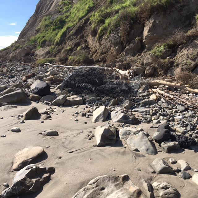
37 Geotextile Cleanup 37
38 Permit Authorities 38 Coastal Commission has permit authority over revetment County must obtain a Coastal Development Permit to retain new revetment Coastal Commission directed additional planning for managed retreat must be undertaken County will prepare an amended AMP through 2050 County will consider long term management post 2050 County must also consider ongoing costs of various options County must work with additional State and Federal regulatory agencies Army Corps of Engineers (ACOE) National Marine Fisheries Service (NMFS) Regional Water Quality Control Board (RWQCB) California State Lands Commission California Department of Fish & Wildlife (CDFW)
39 Revetment Related Concerns 39 Active Erosion: Accelerates erosion due to the presence of revetments, leading to redistribution of sand supply to a beach and/or any modification of shorezone processes Passive Erosion: Revetted shoreline can fix landward boundary of the beach preventing landward migration, causing beach to disappear Coast can retreat on both sides beyond revetment interrupting movement of sand downcoast, impacting other beaches Does not appear to be happening at Goleta Beach
40 Seas Level Rise & Managed Retreat 40 Sea Level Rise (SLR) minimal to date in California SLR is projected to be up to 2 feet by 2050 and up to 5.5 feet by 2100, although projections vary and are evolving upward Managed retreat allows the shoreline to erode landward, while removing or relocating revetments, buildings and infrastructure landward to allow for wider beaches and habitat areas, particularly given projected SLR Supported and increasingly required by Coastal Commission Options and space are limited at Goleta Beach due to Hwy 217 and Goleta Slough
41 Permit Options (through 2050)* 41 Option 1: Retain Existing 948-Foot Long Emergency Revetment and Pier Base Repairs To include an updated phased adaptive management plan Option 2: Remove Existing 873-Foot Long Emergency Revetment and Retain 75-Foot Long Pier Revetment Reinforcement and Pier Base Repairs Alternatives Considered but Found to be Ineffective *working in conjunction with Goleta Sanitary District
42 Permit Option 1 (Retain) 42 AMP Phase 1: Establish and monitor beach/revetment triggers for approximately 10 years. Potential managed retreat measures may include far west end retreat (removal of parking lot 7) Allow room for potential wider beach at Park s west end (beach may not remain wide in low sand years) Loss of 57 coastal access parking spaces Relocate revetment landward to protect existing Hwy 217, bike path, utilities, UCSB sewage lift station and west end of Park Substantial cost to County budget Substantial cost to utility companies, rate payers and UCSB
43 Permit Option 1 (Retain) continued 43 AMP Phase 2: Establish and monitor beach/revetment triggers for approximately 10 years after AMP phase 1 retreat construction completion Potential managed retreat measures could include additional retreat at Park s west end (removal of parking lot 6) Added room for wider beach at Park s west end (beach may not remain wide in low sand years) Loss of additional 55 coastal access parking spaces Relocate revetment and existing utilities landward to protect Hwy 217 and west end of Park Substantial cost to County budget Substantial cost to utility companies, rate payers and UCSB
44 Permit Option 2 (Remove) 44 Remove Existing 873-Foot Long Emergency Revetment and Retain 75-Foot Long Pier Revetment Reinforcement and Pier Base Repairs Relocate rock offsite (location TBD) or sell rock Park susceptible to erosion and severe damage or destruction of facilities during major storms Continual emergency protections and post storm repair of Park facilities required Major ongoing county budget expense
45 Permit Option 2 (Remove) - continued 45 Potential future shoreline retreat actions Remove Restroom #2 and eight (8) picnic areas/benches Relocated Goleta Sanitary District outfall vault behind historic back beach line Potential to install revetment at historic back beach line Substantial cost to County budget Substantial cost to utility companies and rate payers
46 Alternatives Considered 46 Alternatives were found to be ineffective due to inability to protect the Park from major storm events Remove Existing 873-Foot Long Emergency Revetment and Replace with Cobble Berm Reduction in Height of 873-Foot Long Emergency Revetment
47 Potential Long Term Plans (post 2050) 47 Post 2050: Landward Retreat of Revetments and Park Facilities west of Pier Retreat Park and revetment to historic back beach line Loss of substantial area of parkland and picnic areas Relocation of Goleta Sanitary District outfall vault Utility relocation Removal of restroom(s) / potential relocation Substantial cost to County s budget Substantial cost to utility companies and rate payers Post 2100: Relocation of park
48 Next Steps 48 August 22 Board of Supervisors Hearing / Direction September 30 Submittal of permit application to Coastal Commission staff Spring 2018 Anticipated Coastal Commission Hearing
Broad Beach Sand & Dune Habitat Restoration Project. Revetment Owners Meeting July 12, 2017
 Broad Beach Sand & Dune Habitat Restoration Project Revetment Owners Meeting July 12, 2017 Status of Project Entitlement Coastal Commission CDP approved 10/15 (consolidated with City of Malibu), PTI conditions
AN OVERVIEW OF RECENT PROJECTS RELATED TO SAND BUDGETS, SOUTHERN CALIFORNIA BEACHES
 AN OVERVIEW OF RECENT PROJECTS RELATED TO SAND BUDGETS, SAND SUPPLY, COASTAL ARMORING, MANAGEMENT, AND VALUING SOUTHERN CALIFORNIA BEACHES Dr. Kiki Patsch California State University Channel Islands Environmental
ST. JOSEPH PENINSULA, GULF COUNTY, FLORIDA Beach Re-Nourishment and Environmental Enhancement Project RECOMMENDATIONS
 ST. JOSEPH PENINSULA, GULF COUNTY, FLORIDA Beach Re-Nourishment and Environmental Enhancement Project RECOMMENDATIONS January 23, 2018 543 Harbor Boulevard, Suite 204 Destin, Florida 32541 850.654.1555
VENICE LOCAL COASTAL PROGRAM UPDATE: COASTAL HAZARDS WELCOME
 VENICE LOCAL COASTAL PROGRAM UPDATE: COASTAL HAZARDS WELCOME 1 Introducing the Team Hosted by the Department of City Planning and grant funded in part by the California Coastal Commission 2 Workshop Purpose
Q1. What are the primary causes/contributors to coastal erosion at Westshore and the concept of longshore / littoral drift.
 Q1. What are the primary causes/contributors to coastal erosion at Westshore and the concept of longshore / littoral drift. In order of (timing related) contribution to present problem 1. Beach is too
Building Coastal Resiliency at Plymouth Long Beach
 Building Coastal Resiliency at Plymouth Long Beach Department of Marine and Environmental Affairs March 30, 2017 Introducing Green Infrastructure for Coastal Resiliency Plymouth Long Beach & Warren s Cove
Affects of Tides on Lateral Coastal Access at. Las Varas Ranch. Gaviota, California. Photos Courtesy of California Coastal Records Project
 Affects of Tides on Lateral Coastal Access at Las Varas Ranch Gaviota, California Photos Courtesy of California Coastal Records Project September 18, 2014 Santa Barbara County Trails Council 1 As part
Climate Change Impacts to KSC Launch Complex
 Climate Change Impacts to KSC Launch Complex Presented to: 2010 International Workshop on Environment and Energy By: John Shaffer NASA Environmental Management Branch Kennedy Space Center Hurricane Season
SPECIAL SPRING 2018 STORM REPORT ON THE CONDITION OF THE MUNICIPAL BEACHES FOR THE BOROUGH OF STONE HARBOR, CAPE MAY COUNTY, NEW JERSEY
 SPECIAL SPRING 2018 STORM REPORT ON THE CONDITION OF THE MUNICIPAL BEACHES FOR THE BOROUGH OF STONE HARBOR, CAPE MAY COUNTY, NEW JERSEY Aerial photograph taken April 21, 2018 showing the view up the beach
Coastal Hazards and Management in North Carolina. Braxton Davis April 14, 2015
 Coastal Hazards and Management in North Carolina Braxton Davis April 14, 2015 Coastal Facts and Figures 320 miles of ocean beaches 12,000+ miles of estuarine shoreline 2 million + acres of sounds, creeks,
FINAL REPORT FOR 2013 ON THE CONDITION OF THE MUNICIPAL OCEANFRONT BEACHES THE BOROUGH OF AVALON, CAPE MAY COUNTY, NEW JERSEY
 FINAL REPORT FOR 2013 ON THE CONDITION OF THE MUNICIPAL OCEANFRONT BEACHES THE BOROUGH OF AVALON, CAPE MAY COUNTY, NEW JERSEY View from 12 th Street to the south taken February 28, 2013, following completion
RE: Hurricane Matthew Beach Damage Assessment and Recommendations [CSE 2416]
![RE: Hurricane Matthew Beach Damage Assessment and Recommendations [CSE 2416]](/thumbs/83/87675702.jpg "RE: Hurricane Matthew Beach Damage Assessment and Recommendations [CSE 2416]") October 25, 2016 Iris Hill Town Administrator Town of Edisto Beach 2414 Murray St Edisto Beach SC 29438 RE: Hurricane Matthew Beach Damage Assessment and Recommendations [CSE 2416] Dear Iris, Hurricane
October 25, 2016 Iris Hill Town Administrator Town of Edisto Beach 2414 Murray St Edisto Beach SC 29438 RE: Hurricane Matthew Beach Damage Assessment and Recommendations [CSE 2416] Dear Iris, Hurricane
NORTHERN CELL OPTIONS SHORTLIST RECOMMENDATIONS
 OPTIONS SHORTLIST RECOMMENDATIONS Coastal Unit C: Bayview Options recommended for MCDA scoring. Status quo. Planting 3. Renourishment (gravel) 6. Beach-scraping 7. Restore shingle crest. Inundation accommodation
The 2017 Panama City Beaches Beach Interim Renourishment Project. Answers to Common Questions
 The 2017 Panama City Beaches Beach Interim Renourishment Project The fourth renourishment of the Panama City Beaches will be under construction during March and April 2017, with a planned completion by
SHOREHAM BEACH LOCAL NATURE RESERVE
 SHOREHAM BEACH LOCAL NATURE RESERVE Coastal Geography Education Programme 2014-15 S. Savage 2014 COASTAL GEOGRAPHY OPPORTUNITIES Shoreham Beach Shoreham Beach is a shingle spit formed over many centuries
Montserrat. Wise practices for coping with. i b bea n Se a
 Wise practices for coping with Montserrat Car i b bea n Se a Fisheries Division, Montserrat Physical Planning Department, Montserrat University of Puerto Rico, Sea Grant College Program Caribbean Development
Australian Coastal Councils Conference
 Australian Coastal Councils Conference Kiama March 2019 Where Has My Beach Gone? (and what can I do about it?) Dr Andrew McCowan Water Technology Where Has My Beach Gone? Where Has My Beach Gone? Where
Collaboration: Sea-level Marin Adaptation Response Team (C-SMART)
") Collaboration: Sea-level Marin Adaptation Response Team (C-SMART) Photo Credit : Lighthawk Aerial Community Development Agency 3501 Civic Center Drive, Rm. 308 San Rafael, CA 94903 415 4736269 T www.marinslr.org
Collaboration: Sea-level Marin Adaptation Response Team (C-SMART) Photo Credit : Lighthawk Aerial Community Development Agency 3501 Civic Center Drive, Rm. 308 San Rafael, CA 94903 415 4736269 T www.marinslr.org
North Shore of Long Island, Feasibility Study
 North Shore of Long Island, Asharoken New York Asharoken, Feasibility Study Asharoken, NY Public Meeting June 30, 2015 US Army Corps of Engineers US Army Corps of Engineers New York BUILDING STRONG BUILDING
City of Del Mar Local Coastal Plan (LCP) Amendment for Sea Level Rise and Coastal Flooding
 Amendment for Sea Level Rise and Coastal Flooding") City of Del Mar Local Coastal Plan (LCP) Amendment for Sea Level Rise and Coastal Flooding 6/22/17 Presentation to Sea Level Rise Stakeholder- Technical Advisory Committee (STAC) Nick Garrity, P.E. Lindsey
City of Del Mar Local Coastal Plan (LCP) Amendment for Sea Level Rise and Coastal Flooding 6/22/17 Presentation to Sea Level Rise Stakeholder- Technical Advisory Committee (STAC) Nick Garrity, P.E. Lindsey
Volume and Shoreline Changes along Pinellas County Beaches during Tropical Storm Debby
 Volume and Shoreline Changes along Pinellas County Beaches during Tropical Storm Debby Ping Wang and Tiffany M. Roberts Coastal Research Laboratory University of South Florida July 24, 2012 Introduction
Figure79. Location map for the 10 NJBPN profile sites in Atlantic County, NJ 155
 154 Figure79. Location map for the 10 NJBPN profile sites in Atlantic County, NJ 155 ATLANTIC COUNTY SPRING 2009 to FALL 2010 The Atlantic County coastline consists of three barrier islands. Between Little
LOCAL COASTAL PROGRAM UPDATE
 LOCAL COASTAL PROGRAM UPDATE Agenda Meeting #1 General Information (1 1:45 pm) Introductions and Background Grants involved What is a Local Coastal Program? What is required? LCP Update tasks and schedule
SACO RIVER AND CAMP ELLIS BEACH SACO, MAINE SECTION 111 SHORE DAMAGE MITIGATION PROJECT APPENDIX F ECONOMIC ASSESSMENT
 SACO RIVER AND CAMP ELLIS BEACH SACO, MAINE SECTION 111 SHORE DAMAGE MITIGATION PROJECT APPENDIX F ECONOMIC ASSESSMENT Department of the Army New England District, Corps of Engineers 696 Virginia Road
Atlantic Coast of Long Island, Jones Inlet to East Rockaway Inlet, Long Beach Island, NY Construction Update
 Atlantic Coast of Long Island, Jones Inlet to East Rockaway Inlet, Long Beach Island, NY Construction Update June 2016 US Army Corps of Engineers Project Purpose Three specific damage mechanisms of coastal
ST. JOHNS GOLF CLUB PHASE II FINDINGS, PHASE III RECOMMENDATION, AND POTENTIAL PARTNERSHIP OPPORTUNITY
 ST. JOHNS GOLF CLUB PHASE II FINDINGS, PHASE III RECOMMENDATION, AND POTENTIAL PARTNERSHIP OPPORTUNITY Board of County Commissioners January 16, 2018 Introduction St. Johns Golf Club: Opened in 1989.
Shoreline Studies Program, Department of Physical Sciences, VIMS
 Living Shoreline Training Class 2017 1 Demonstration sites discussed in this talk. 2 A shoreline management plan for the entire creek made conceptual shoreline management recommendations along every stretch
23- Year Sand Volume Changes at Site 132, 15th Street, Brigantine
 149 Figure75. Location map for the 9 NJBPN profile sites in Atlantic County, NJ ATLANTIC COUNTY SPRING 2008 to FALL 2009 150 The Atlantic County oceanfront shoreline consists of three barrier islands.
The Dynamic Coast. Right Place Resources. A presentation about the interaction between the dynamic coast and people
 The Dynamic Coast Houses threatened by coastal erosion in California Right Place Resources A presentation about the interaction between the dynamic coast and people For the rest of the presentations in
Delaware Chapter Surfrider Foundation - Indian River Inlet Monitoring
 Delaware Chapter Surfrider Foundation - Indian River Inlet Monitoring In 2012, the Delaware Surfrider Foundation Chapter formed the Surf Quality and Access Committee to focus on issues such as surf spot
Oceanside Carlsbad. Solana Beach
 Oceanside Carlsbad Solana Beach BACKGROUND AND PURPOSE OF THE PROGRAM Many beaches in Southern California are actively eroding; A deficit of natural sand delivery to the beaches exists due to flood control
Public Notice U.S. Army Corps In Reply to Application Number CENAB-OP-RMS (NATIONAL HARBOR (FORMERLY PORT Baltimore District AMERICA])
![Public Notice U.S. Army Corps In Reply to Application Number CENAB-OP-RMS (NATIONAL HARBOR (FORMERLY PORT Baltimore District AMERICA])](/thumbs/89/100795623.jpg "Public Notice U.S. Army Corps In Reply to Application Number CENAB-OP-RMS (NATIONAL HARBOR (FORMERLY PORT Baltimore District AMERICA])") Public Notice U.S. Army Corps In Reply to Application Number of Engineers CENAB-OP-RMS (NATIONAL HARBOR (FORMERLY PORT Baltimore District AMERICA]) 88-01361 PN 14-05 Comment Period: January 16, 2014 to
Public Notice U.S. Army Corps In Reply to Application Number of Engineers CENAB-OP-RMS (NATIONAL HARBOR (FORMERLY PORT Baltimore District AMERICA]) 88-01361 PN 14-05 Comment Period: January 16, 2014 to
3.3 OCEANOGRAPHY/COASTAL PROCESSES
 3.3 OCEANOGRAPHY/COASTAL PROCESSES Beaches are dynamic and conditions vary based on the onshore/offshore movement of sand both seasonally and annually. Sand also moves alongshore within a generally defined
Dauphin Island East End Beach and Barrier Island Restoration Project. Beau Buhring South Coast Engineers
 Dauphin Island East End Beach and Barrier Island Restoration Project Beau Buhring South Coast Engineers Funding Funded with qualified outer continental shelf oil and gas revenues by the Coastal Impact
Town of Duck, North Carolina
 Tracking No. 00.00.2010 Erosion Mitigation And Shoreline Management Feasibility Study Town of Duck, North Carolina Coastal Planning & Engineering of North Carolina August 15, 2012 Tom Jarrett Robert Neal
DUNE STABILIZATION AND BEACH EROSION
 DUNE STABILIZATION AND BEACH EROSION CAPE HATTERAS NATIONAL SEASHORE NORTH CAROLINA ROBERT DOLAN PAUL GODFREY U. S. DEPARTMENT OF INTERIOR NATIONAL PARK SERVICE OFFICE OF NATURAL SCIENCE WASHINGTON, D.
Effectiveness of Beach Nourishment in Response to Sea Level Rise
 2014 FSBPA Annual Conference Effectiveness of Beach Nourishment in Response to Sea Level Rise Navarre Beach Santa Rosa County July 18, 2005 Lovers Key Lee County April 23, 2012 South County St. Lucie County
For more information or permission to reprint slides, please contact Donna Milligan at 1
 For more information or permission to reprint slides, please contact Donna Milligan at milligan@vims.edu 1 For more information or permission to reprint slides, please contact Donna Milligan at milligan@vims.edu
LAB: WHERE S THE BEACH
 Name: LAB: WHERE S THE BEACH Introduction When you build a sandcastle on the beach, you don't expect it to last forever. You spread out your towel to sunbathe, but you know you can't stay in the same spot
The Local Coastal Plan Workshop #1: Santa Monica s Coastal Area in the 21 st Century
 The Local Coastal Plan Workshop #1: Santa Monica s Coastal Area in the 21 st Century Civic Auditorium, East Wing Monday, February 29, 2016 6:30pm 8:30pm Approximately 60 residents and stakeholders from
Navarre Beach & Dune Restoration Project Status Report to be regularly updated June 17, 2016 Report
 Navarre Beach & Dune Restoration Project Status Report to be regularly updated June 17, 2016 Report Work Completed (June 11 to June 17) Weeks Marine Inc. (Contractor): o continued filling Segment 4 including
ALTERNATIVES FOR COASTAL STORM DAMAGE MITIGATION AND FUNCTIONAL DESIGN OF COASTAL STRUCTURES
 The University of the West Indies Organization of American States PROFESSIONAL DEVELOPMENT PROGRAMME: COASTAL INFRASTRUCTURE DESIGN, CONSTRUCTION AND MAINTENANCE A COURSE IN COASTAL DEFENSE SYSTEMS I CHAPTER
Assateague Island National Seashore North End Restoration Project Timeline
 Assateague Island National Seashore North End Restoration Project Timeline Date Event Some information provided in the Project Introduction document. Detailed events are available in a timeline compiled
New Jersey Coastal Zone Overview. The New Jersey Beach Profile Network (NJBPN) 3 Dimensional Assessments. Quantifying Shoreline Migration
 3 Dimensional Assessments. Quantifying Shoreline Migration") New Jersey Coastal Zone Overview The New Jersey Beach Profile Network (NJBPN) Objectives Profile Locations Data Collection Analyzing NJBPN Data Examples 3 Dimensional Assessments Methodology Examples Quantifying
New Jersey Coastal Zone Overview The New Jersey Beach Profile Network (NJBPN) Objectives Profile Locations Data Collection Analyzing NJBPN Data Examples 3 Dimensional Assessments Methodology Examples Quantifying
ATLANTIC COAST OF LONG ISLAND, JONES INLET TO EAST ROCKAWAY INLET, LONG BEACH ISLAND, NY. Contract #2 Construction Scope. April 18th-19th 2018
 ATLANTIC COAST OF LONG ISLAND, JONES INLET TO EAST ROCKAWAY INLET, LONG BEACH ISLAND, NY Contract #2 Construction Scope April 18th-19th 2018 New York District PLAN COMPONENTS Length of Beachfill 35,000
ALTERNATIVES FOR COASTAL STORM DAMAGE MITIGATION
 ALTERNATIVES FOR COASTAL STORM DAMAGE MITIGATION Dave Basco Old Dominion University, Norfolk, Virginia, USA National Park Service Photo STRUCTURAL (changes to natural, physical system) hardening (seawalls,
Feasibility Study for Restoration of Titlow Lagoon Fish Passage. South Puget Sound Salmon Enhancement Group
 Feasibility Study for Restoration of Titlow Lagoon Fish Passage South Puget Sound Salmon Enhancement Group January 2010 Feasibility Study for Restoration of Titlow Lagoon Fish Passage Prepared for South
HURRICANE SANDY LIMITED REEVALUATION REPORT UNION BEACH, NEW JERSEY DRAFT ENGINEERING APPENDIX SUB APPENDIX D SBEACH MODELING
 HURRICANE SANDY LIMITED REEVALUATION REPORT UNION BEACH, NEW JERSEY DRAFT ENGINEERING APPENDIX SUB APPENDIX D SBEACH MODELING Rev. 18 Feb 2015 1 SBEACH Modeling 1.0 Introduction Following the methodology
To: William Woods, Jenni Austin Job No: CentrePort Harbour Deepening Project - Comments on community queries
 Memo To: William Woods, Jenni Austin From: Richard Reinen-Hamill Date: Subject: cc: 1 Purpose This memo sets out our response to issues raised at and after Seatoun community consultation sessions held
A REVIEW OF THE CONDITION OF THE MUNICIPAL BEACHES AS A RESULT OF HURRICANE SANDY IN THE BOROUGH OF STONE HARBOR, CAPE MAY COUNTY, NEW JERSEY
 A REVIEW OF THE CONDITION OF THE MUNICIPAL BEACHES AS A RESULT OF HURRICANE SANDY IN THE BOROUGH OF STONE HARBOR, CAPE MAY COUNTY, NEW JERSEY View along the dune scarp from 103 rd Street on October 31,
Louisiana CPRA SJB Group, Baton Rouge Coastal Engineering Consultants U.S. Army Corps of Engineers Federal and State PDT Members
 Louisiana CPRA SJB Group, Baton Rouge Coastal Engineering Consultants U.S. Army Corps of Engineers Federal and State PDT Members Project Setting and Background Island Restoration Plans Pre-Screening Analysis
Future Condi,ons coastal hazard modeling and mapping
 Future Condi,ons coastal hazard modeling and mapping Presented by Bob Ba:alio, PE Environmental Science Associates, Inc. (ESA) On behalf of the physical processes team (USGS, TerraCosta- Scripps, ESA)
Blakely Island, N Thatcher Bay. Restoration Recommendation: Rank Score (total score)
") Soft Shore Protection/Structure Removal Blueprint for San Juan County Forage Fish Beaches Appendix 2: Recommendations for sites scoring below the top ten, sorted by island (east to west) Blakely Island,
Soft Shore Protection/Structure Removal Blueprint for San Juan County Forage Fish Beaches Appendix 2: Recommendations for sites scoring below the top ten, sorted by island (east to west) Blakely Island,
Nevis. Wise practices for coping with
 Wise practices for coping with Nevis Caribbean Sea Nevis Historical and Conservation Society Department of Physical Planning, Natural Resources and Environment, Fisheries Division University of Puerto
BEACH NOURISHMENT COMBINED WITH SIC VERTICAL DRAIN IN MALAYSIA. Claus Brøgger 1 and Poul Jakobsen 2
 BEACH NOURISHMENT COMBINED WITH SIC VERTICAL DRAIN IN MALAYSIA. Claus Brøgger 1 and Poul Jakobsen 2 The present paper presents measurements and results from a three year full scale Pilot Project with the
Chiswell and Chesil Beach (to Wyke Narrows) 6a02 and 6a03 SUMMARY OF PREFERRED PLAN RECOMMENDATIONS AND JUSTIFICATION
 6a02 and 6a03 SUMMARY OF PREFERRED PLAN RECOMMENDATIONS AND JUSTIFICATION") Location reference: Policy Unit reference: Plan: Chiswell and Chesil Beach (to Wyke Narrows) 6a02 and 6a03 SUMMARY OF PREFERRED PLAN RECOMMENDATIONS AND JUSTIFICATION The long term aim for this section
Location reference: Policy Unit reference: Plan: Chiswell and Chesil Beach (to Wyke Narrows) 6a02 and 6a03 SUMMARY OF PREFERRED PLAN RECOMMENDATIONS AND JUSTIFICATION The long term aim for this section
St Vincent. Grenadines. Wise practices for coping with. and the. i b bea n Se a
 Wise practices for coping with St Vincent Car i b bea n Se a and the Grenadines Bequia Community High School, Bequia, St Vincent and the Grenadines Ministry of Agriculture, Lands and Fisheries, St Vincent
New Jersey Beach Profile Network Atlantic County Profile Site Locations
 215 RICHARD STOCKTON COLLEGE OF NEW JERSEY New Jersey Beach Profile Network Atlantic County Profile Site Locations COASTAL RESEARCH CENTER Figure 128 There are nine NJBPN survey sites on the Atlantic County
US Beach Nourishment Experience:
 Beach Nourishment: Introduction of new sand to the beach by truck or dredge Large beach >1 million cubic yards (100,000 dump truck loads) Funding is a combination of federal, state, local & private Also
Unit 11 Lesson 2 How Does Ocean Water Move? Copyright Houghton Mifflin Harcourt Publishing Company
 Unit 11 Lesson 2 How Does Ocean Water Move? Catch a Wave A wave is the up-and-down movement of surface water. Catch a Wave Catch a Wave (wave effects) Surface waves are caused by wind pushing against
Overview. Beach Features. Coastal Regions. Other Beach Profile Features. CHAPTER 10 The Coast: Beaches and Shoreline Processes.
 Overview CHAPTER 10 The Coast: Beaches and Shoreline Processes Coastal regions constantly change. The beach is a dominant coastal feature. Wave activity continually modifies the beach and coastal areas.
ATLANTIC COUNTY 2006 to 2008
 ATLANTIC COUNTY 2006 to 2008 The Atlantic County oceanfront shoreline consists of three barrier islands where the northern one, Little Beach Island and a third of the second, Brigantine Island, are undeveloped
Coastal Environments Oceanographic and Engineering Expertise
 Coastal Environments Oceanographic and Engineering Expertise Coastal Environments La Jolla, CA www.coastalenvironments.com 14 May 2004 CE Ref. No. 04-05 EcoSystems Management Associates, Inc. Carlsbad,
Table 4. Volumetric Change Rates Pre-Project and Post-Project for the Town of Duck
 V. VOLUMETRIC CHANGES General Volumetric changes measured over the entire monitoring area for various time periods are provided in Table 4. The volume changes are given in terms of cubic yards/foot of
2018 Beach Preservation Project Information
 QUICK FACTS Beach Renourishment to begin late April 2018 o U.S. Army Corps of Engineers project o Project Area: 8 th St. E. to end of E. Ashley Ave. o Project Length: 2 miles o Cost: $10,900,000 o Funding:
Protecting our Beaches
 Protecting our Beaches South Amelia Island Shore Stabilization Project Nassau County, FL Mr. Drew Wallace President South Amelia Island Shore Stabilization Association (SAISSA) Mr. Bill Moore, AICP Project
Habitat Development: Habitat Boulders Lawson Pier Foreshore Enhancement
 Habitat Development: Habitat Boulders Improve the existing habitat by stabilising beach sediments. Increase biodiversity by creating new habitats and colonisation opportunities. Loose cobble is unstable;
Chapter 12: Coasts (after a brief review of Tides)
") Chapter 12: Coasts (after a brief review of Tides) 1 Questions from previous classes: What happens when a wave meets a current? wave = people walking current = bus If wave goes with the current, the wave
Chapter 12: Coasts (after a brief review of Tides) 1 Questions from previous classes: What happens when a wave meets a current? wave = people walking current = bus If wave goes with the current, the wave
FINAL REPORT FOR 2009 ON THE CONDITION OF THE MUNICIPAL OCEANFRONT BEACHES IN THE BOROUGH OF AVALON, CAPE MAY COUNTY, NEW JERSEY
 FINAL REPORT FOR 2009 ON THE CONDITION OF THE MUNICIPAL OCEANFRONT BEACHES IN THE BOROUGH OF AVALON, CAPE MAY COUNTY, NEW JERSEY Storm waves pound the inlet revetment September 10, 2009 as the series of
Town of Duck, North Carolina
 Tracking No. 00.00.2010 Erosion Mitigation And Shoreline Management Feasibility Study Town of Duck, North Carolina Coastal Planning & Engineering of North Carolina February 28, 2013 Ken Willson 1 Tracking
FINAL ENVIRONMENTAL IMPACT STATEMENT ON BROWARD COUNTY SHORE PROTECTION PROJECT SEGMENTS II AND III BROWARD COUNTY, FLORIDA
 FINAL ENVIRONMENTAL IMPACT STATEMENT ON BROWARD COUNTY SHORE PROTECTION PROJECT SEGMENTS II AND III BROWARD COUNTY, FLORIDA 1. PROJECT PURPOSE AND NEED 1.1. PROJECT AUTHORITY. 1.1.1. INITIAL AUTHORIZATION.
Absecon Island Shore Protection The planning behind the project
 Absecon Island Shore Protection The planning behind the project Most residents of Atlantic City, Ventnor, Margate and Longport are now aware of upcoming plans to protect their common coastline with a beachfill
ENGINEER S REPORT. for. BROAD BEACH GEOLOGIC HAZARD ABATEMENT DISTRICT MALIBU, CALIFORNIA July 15, 2015 TABLE OF CONTENTS
 ENGINEER S REPORT for BROAD BEACH GEOLOGIC HAZARD ABATEMENT DISTRICT MALIBU, CALIFORNIA July 15, 2015 TABLE OF CONTENTS CERTIFICATION OF FILING...1 I. INTRODUCTION...3 II. BACKGROUND...3 III. GEOLOGIC
HARBOR INFRASTRUCTURE INVENTORIES Marquette Harbor, Michigan
 HARBOR INFRASTRUCTURE INVENTORIES Marquette Harbor, Michigan Harbor Location: Marquette Harbor is located in Marquette Bay on the south shore of Lake Superior, 160 miles west of Sault Ste. Marie, MI and
David Revell, PhD And others. CSBPA Coastal Conditions 2018 Bodega Bay, CA
 David Revell, PhD And others CSBPA Coastal Conditions 2018 Bodega Bay, CA What if? How much does it cost? Beach front homeowners ask what will my house be worth in 30 years? Beach communities ask what
Follets Island Nearshore Beach Nourishment Project
 Coast & Harbor Engineering A division of Hatch Mott MacDonald Follets Island Nearshore Beach Nourishment Project Arpit Agarwal, P.E. April 1, 2016 Project Site!"#$% &'(% &)*+% )#,'-+% Shoreline Erosion
ADAPTATION TO SEA LEVEL RISE AND COASTAL IMPACTS
 ADAPTATION TO SEA LEVEL RISE AND COASTAL IMPACTS Miramar Inn, Half Moon Bay, March 1, 2014 Photo by Jack Sutton, all rights reserved 2/22/17 AdaptLA Workshop California Coastal Commission 2 Plans and regulates
An Update of Coastal Erosion in Puerto Rico
 Jack Morelock and Maritza Barreto An Update of Coastal Erosion in Puerto Rico Department of Marine Sciences, University of Puerto Rico at Mayagüez and Geography Department, University of Puerto Rico at
Dune Monitoring Data Update Summary: 2013
 Dune Monitoring Data Update Summary: 13 Shoreline Studies Program Virginia Institute of Marine Science College of William & Mary Gloucester Point, Virginia September 13 Dune Monitoring Data Update Summary:
CHAPTER 8 ASSESSMENT OF COASTAL VULNERABILITY INDEX
 124 CHAPTER 8 ASSESSMENT OF COASTAL VULNERABILITY INDEX 8.1 INTRODUCTION In order to assess the vulnerability of the shoreline considered under this study against the changing environmental conditions,
Coastal Hazards Study
 Coastal Hazards Study 2212 Beach Boulevard, Pacifica Prepared for: EXECUTIVE SUMMARY City of Pacifica 170 Santa Maria Ave Pacifica, CA 94044 Prepared by: moffatt & nichol 2185 N. California Blvd. Walnut
Impacts of breakwaters and training walls
 Across the eastern seaboard of Australia, breakwaters and training walls have instigated fundamental perturbations to coastal and estuary processes. This has induced long-term changes to foreshore alignments,
RI Regulatory Setbacks & Buffers: Coastal Management Issues
 RI Regulatory Setbacks & Buffers: Coastal Management Issues New England Onsite Wastewater Training Program @ URI OWT 155 - November 29, 2012 James Boyd - Coastal Policy Analyst Photo: October 30, 2012
Quantifying the Value of Sydney s Beaches
 Quantifying the Value of Sydney s Beaches Dave Anning Economics, Management & the Coastal Zone Forum 24 February 2011 Sydney Beaches Valuation Project Collaboration between UNSW and SCCG Value case study
TITLE: North Carolina s Changing Shorelines. KEYWORDS: erosion - shorelines - mapping - sustainability
 UNC Coastal Studies Institute Teacher Resources 1 TITLE: North Carolina s Changing Shorelines KEYWORDS: erosion - shorelines - mapping - sustainability Changing shorelines impact coastal infrastructure.
CHAPTER 281 INFLUENCE OF NEARSHORE HARDBOTTOM ON REGIONAL SEDIMENT TRANSPORT
 CHAPTER 281 INFLUENCE OF NEARSHORE HARDBOTTOM ON REGIONAL SEDIMENT TRANSPORT Paul C.-P. Lin, Ph.D., P.E. 1 and R. Harvey Sasso, P.E. 2 ABSTRACT The influence of nearshore hardbottom on longshore and cross-shore
Essentials of Oceanography Eleventh Edition
 Chapter Chapter 1 10 Clickers Lecture Essentials of Oceanography Eleventh Edition The Coast: Beaches and Shoreline Processes Alan P. Trujillo Harold V. Thurman Chapter Overview Coastal regions have distinct
Estuarine Shoreline Stabilization
 Estuarine Shoreline Stabilization Property Owner s Guide to Determining the Most Appropriate Stabilization Method Estuarine shorelines are dynamic features that experience continued erosion. Land is lost
Montauk Beach Restoration Project. Town of East Hampton, Suffolk County, Long Island, New York January 2013
 Montauk Beach Restoration Project Town of East Hampton, Suffolk County, Long Island, New York January 2013 1 Montauk Montauk is the easternmost hamlet on Long Island Only 20 square miles, Montauk boasts
U.S. ARMY CORPS OF ENGINEERS BUILDING STRONG LOS ANGELES DISTRICT
 PUBLIC NOTICE U.S. ARMY CORPS OF ENGINEERS BUILDING STRONG LOS ANGELES DISTRICT APPLICATION FOR PERMIT MODIFICATION Modification to the City of Encinitas Opportunistic Beach Fill Program Public Notice/Application
4/20/17. #32 - Coastal Erosion Case Histories - Lake Michigan
 Writing Assignment Due Monday by 11:59 pm #32 - Coastal Erosion Case Histories - Lake Michigan See main class web pages for detailed instructions Submit papers Illinois Compass No copying: Compass will
V. HARBOR DEPTHS, CHANNEL DESIGN AND PROPOSED CONSTRUCTION AND DREDGING
 V. HARBOR DEPTHS, CHANNEL DESIGN AND PROPOSED CONSTRUCTION AND DREDGING A. DISCUSSION: For the most part, projects that involve dredging and construction require a comprehensive design and review process
Nome Harbor Page 2 of 12
 Nome Harbor Nome Harbor Page 2 of 12 Condition of Improvements 30 December 2015 Nome Harbor, Alaska (CWIS No. 010422, 012270, 072742, 087755) Authorization (1) Rivers and Harbors Act, 8 August 1917 (House
FINDING OF NO SIGNIFICANT IMPACT
 DEPARTMENT OF THE ARMY CHARLESTON DISTRICT, CORPS OF ENGINEERS 69A HAGOOD AVENUE CHARLESTON, SOUTH CAROLINA 29403-5107 FINDING OF NO SIGNIFICANT IMPACT EDISTO BEACH COASTAL STORM DAMAGE REDUCTION GENERAL
SAN MATEO COUNTY SEA LEVEL RISE INITIATIVE
 SAN MATEO COUNTY SEA LEVEL RISE INITIATIVE OCEAN CLIMATE SUMMIT // MAY 17, 2016 Photo by Biking Nikon SF, all rights reserved San Mateo County has $24 billion in assets at risk from sea level rise Pacifica
Performance of Upham Beach T-Groin Project and Its Impact to the Downdrift Beach
 Performance of Upham Beach T-Groin Project and Its Impact to the Downdrift Beach Progress Report for the Period of October 2008 to April 2009 Submitted by Ping Wang, Ph.D., and Tiffany M. Roberts Department
Regular Workshop October 20, 2014 Agenda Item: Dr. Albert E. Browder, PE; Olsen Associates, Inc.
 Regular Workshop October 20, 2014 Agenda Item 8 Agenda Item: Presenter: Summary: Beach Update Town Manager; Dr. Albert E. Browder, PE; Olsen Associates, Inc. At the January 21, 2014 Regular Workshop Meeting,
SPO Regional Challenge Grant Creation of a Sea Level Adaption Working Group for Biddeford, Saco, OOB and Scarborough J.T. Lockman, AICP, Planning
 SPO Regional Challenge Grant Creation of a Sea Level Adaption Working Group for Biddeford, Saco, OOB and Scarborough J.T. Lockman, AICP, Planning Director Southern Maine Regional Planning Commission jlockman@smrpc.org
Figure 38. Locations of the 28 NJBPN profile stations in Ocean County, NJ.
 55 Figure 38. Locations of the 28 NJBPN profile stations in Ocean County, NJ. 56 Individual Site Descriptions: Northern Ocean County recovered its beaches approaching pre-hurricane Sandy elevation or width,
SELECTION OF THE PREFERRED MANAGEMENT OPTION FOR STOCKTON BEACH APPLICATION OF 2D COASTAL PROCESSES MODELLING
 SELECTION OF THE PREFERRED MANAGEMENT OPTION FOR STOCKTON BEACH APPLICATION OF 2D COASTAL PROCESSES MODELLING C Allery 1 1 DHI Water and Environment, Sydney, NSW Abstract This paper presents an approach