Results of a Suspended Solids Survey at the Whites Point Quarry, Little River, Digby County, Nova Scotia
|
|
|
- Leona Carter
- 5 years ago
- Views:
Transcription
1 Results of a Suspended Solids Survey at the Whites Point Quarry, Little River, Digby County, Nova Scotia Prepared for Global Quarry Products P.O. Box 2113 Digby, Nova Scotia B0V 1A0 By Michael Brylinsky P.O. Box 362 Canning, Nova Scotia B0P 1H0 June 2003
2 Results of a Suspended Solids Survey at the Whites Point Quarry, Little River, Digby County, Nova Scotia 1.0 Background On 30 April 2003, Global Quarry Products initiated development of a gravel quarry at Whites Point, Little River, Digby County, Nova Scotia. The first stage of development involves site preparation, mainly land clearing and grubbing, and construction of a sediment retention pond and associated structures to minimize sediment run off into the nearby coastal zone. On 27 May 2003, a Department of Fisheries and Ocean inspector examined the quarry site and issued a directive to carry out a number of remedial actions to ensure minimum sediment input into the coastal area during the construction and operational stages of the quarry. The inspector s report also stated Evidence of sediment entering the BAY from the disturbed area was found in two distinct areas along the shore and intertidal zone. The main objectives of this survey were (1) to determine if significant amounts of sediments have been exported from the quarry site into the intertidal zone as a result of the construction activities carried out up to the date of the survey, and (2) to obtain baseline background information on sediment characteristics at tide pool sites far removed from current quarry construction and operation activities. 2.0 Approach On 5 June 2003, samples for sediment analyses were collected at a number of sites located within the Whites Point Quarry area (Figure 2.1). The selection of sample sites was made based on the degree to which they would be expected to be impacted by quarry operations, especially during the early stages of land clearing and grubbing and construction of the sediment retention pond. Water samples for analysis of Total Suspended Solids (TSS) were collected from the sediment retention pond, the outflow of the sediment pond at a point below the check dams, and from six upper shoreline intertidal pools located various distances from the sediment pond. Three of the intertidal pools were located in areas considered likely to be impacted by the construction activities previously carried out (Tide Pools 1, 2 and 5), and the remaining three in areas unlikely to have been impacted (Tide Pools 3, 4 and 6). Sediment contained within the tide pools was also sampled, mainly to determine the degree to which they may have accumulated inorganic sediments, the assumption being that inorganic, as opposed to organic, sediment is the type most harmful to aquatic organisms and most likely to be the dominant type mobilized by the quarry activities. 2


3 Figure 2.1. Location of sample sites. 3
4 3.0 Methodology Water samples for TSS were collected in 500mL polyethylene containers and stored refrigerated until analysis which was carried out within 24 hours of sample collection. The samples were filtered through tared, pre-combusted Watman GF/C glass fibre filters, then oven dried at 70 ºC to a constant dry weight and reweighed to determine TSS. The percent organic content was determined by measuring the loss on combustion after combusting the filters for eight hours at 500 ºC. A total of six sediment samples were collected from the bottom of each tide pool using a small polyethylene container and each sediment sample was placed into a 20 ml sample vial. The percent organic content of the sediment was determined by drying the samples to a constant dry weight at 70 ºC, determining the total dry weight of the sample and then combusting the sample for 12 hours at 500 ºC. The organic content was then calculated as the weight loss after combustion. 4.0 Results 4.1. Total Suspended Solids Table 4.1 lists the TSS concentration and percent inorganic and organic components for water samples collected from the sediment retention pond, its outflow and each tidal pool. Figures 4.1 and 4.2 present this same information graphically. The highest TSS concentration was in the sediment retention pond and was composed largely of inorganic sediments. At the outlet from the sedimentation pond, located below the check dams, the level of TSS was much lower (about five times less than the level within the sediment pond) and the sediments were slightly greater in organic than inorganic content. TSS concentrations in the tide pools ranged between and 5.6 and 54.0 mg/l and were composed largely of organic sediments. The highest TSS level was in TP6, which is located well south of the quarry, but in close proximity to a gravel road in an area where maintenance activities had recently been completed by the Nova Scotia Department of Transportation. With the exception of this one tidal pool, there was little difference in TSS levels among the tidal pools sampled. Table 4.1. Suspended solids concentration and composition. Site TSS Percent Inorganic Percent Organic (mg/l) Content Content Sediment Pond Station WWP2* TP TP TP TP TP TP *Outflow from sedimentation pond below check dams. 4
5 75 Suspended Solids (mg/l) Sed Pond WWP2 Tide Pool 2 Tide Pool 5 Tide Pool 1 Site Tide Pool 3 Tide Pool 4 Tide Pool 6 Figure 4.1. Total suspended solids concentration in water samples (tide pool samples are ordered from left to right in increasing distance from the sediment retention pond) Percent Sed Pond WWP2 Tide Pool 2 Tide Pool 5 Tide Pool 1 Site Tide Pool 3 Tide Pool 4 Tide Pool 6 Organic Inorganic Figure 4.2. Percent organic and inorganic content of suspended sediments contained in water samples (tide pool samples are ordered from left to right in increasing distance from the sediment retention pond). 5
6 4.2. Tide Pool Sediments Sediments contained on the bottom of the tide pools varied greatly in their extent of development and visual appearance. In all cases, the thickness of the sediment layer was only on the order of a few mm at most. In the case of Tide Pool 1, the sediment layer was so poorly developed that a sample could not be collected. The colour of the sediments varied from pale brown and orange to dark olive green (Table 4.2) and appeared to be related to the type of benthic algae growing on the bottom. Salinities within the tide pools were very low and indicate that the tide pools had not recently been subjected to tidal flushing which could have resulted in the scouring out of deposited sediments. Table 4.2. Characteristics of tide pools sampled. Site Northing Location* Easting Estimated Surface Area (m 2 ) Depth (m) Salinity (ppt) Comments TP Contained very little sediment on bottom TP Pale brown sediment TP Orange sediment TP Appeared silty with light brown sediment TP Olive green sediment TP Dark green sediment *NAD 83 UTM coordinates. In almost all cases, the sediments were largely organic in composition (Table 4.3 and Figure 4.3). One exception was Tide Pool 3, located within the area considered not likely to be impacted by current quarry operations, which contained relatively high levels of inorganic sediments. Table 4.3. Summary statistics on percent inorganic matter content of tide pool sediments. Site Number of Samples Range of Values Mean Standard Deviation TP 1 * * * * TP TP TP TP TP *Sediment layer was too shallow to collect a sample. 6
7 An Analysis of Variance (ANOVA) indicated that only Tide Pool 3 was significantly different from the other tide pools in terms of the percentage of inorganic or organic matter contained in the sediments (Tables 4.4 and 4.5) Percent Tide Pool 2 Tide Pool 5 Tide Pool 3 Site Tide Pool 4 Tide Pool 6 Organic Inorganic Figure 4.3. Percent organic and inorganic contents of tide pool sediments (samples are ordered from left to right in increasing distance from the sediment retention pond; error bars are one standard error of the mean). Table 4.4. Matrix of pairwise probabilities (Bonferroni adjusted) for comparison of differences between percent inorganic content of tide pool sediments. Site Tide Pool 2 Tide Pool 3 Tide Pool 4 Tide Pool 5 Tide Pool 6 Tide Pool Tide Pool Tide Pool * Tide Pool * Tide Pool * *significantly different at the 95% probability level. 7
8 Table 4.5. Matrix of pairwise probabilities (Bonferroni adjusted) for comparison of differences between percent organic content of tide pool sediments. Site Tide Pool 2 Tide Pool 3 Tide Pool 4 Tide Pool 5 Tide Pool 6 Tide Pool Tide Pool Tide Pool * Tide Pool * Tide Pool * *significantly different at the 95% probability level. 5.0 Results of Monitoring at the Sedimentation Pond Outflow In accordance with the Nova Scotia Department of Environment and Labour (NSDEL) quarry permit requirements, monitoring for TSS is being carried out at the outflow of the sediment retention pond (Station WWP2) on a weekly basis. The permit requirements stipulate that the maximum TSS level should not exceed 50 mg/l at any time, and that the monthly arithmetic average should not exceed 25 mg/l. Table 5.1 list the results obtained to date which are well below the permit requirements. Table 5.1 Results of TSS monitoring at the outflow of the sediment retention pond (station WWP2). Date TSS (mg/l) 6 May 2003 < May May 2003 < May June June June Discussion and Conclusions The lack of any evidence of elevated TSS concentrations and inorganic sediment accumulation in tide pools located in closest proximity to the sediment retention pond indicates that there has been little, if any, export of sediments into tidal pools located within the upper intertidal area. This result is encouraging considering that the survey was carried out during the construction phase of the sediment retention pond, a time when the maximum mobilization of sediments would be expected. Once this phase has been 8
9 completed, sediment loading of the retention pond is expected to occur at a much reduced rate making it even less likely that there will be significant sediment export into the adjacent intertidal area. TSS levels at the outflow of the sediment retention pond are well below the levels stipulated in the permit requirements issued by NSDEL. Whether or not the sedimentation pond is operating efficiently enough to satisfy current CCME suspended sediment guidelines is a bit more difficult to evaluate. CCME guidelines for the protection of aquatic life are based on ambient suspended sediment levels measured during clear flow 1 periods prior to the initiation of any anthropogenic activities that may elevate suspended sediment levels. For short-term periods (24 hours or less), TSS concentrations should not increase by more than 25 mg/l over ambient levels. For long term periods (30 days or more), average TSS levels should not be increased by more than 5 mg/l over ambient levels. The only data collected during the current survey that is applicable to these criteria is that collected at site WWP2, which is located below the check dams at the outflow of the sediment retention pond. The level of TSS at this site was 13.6 mg/l, considerably below the total increase allowable for the short-term guideline, but above the allowable increase of 5 mg/l for the long-term guideline. To determine if the long-term guideline has been exceeded requires knowledge of the average ambient clear flow levels prior to the initiation of quarry activities. The only data available on TSS levels at this site prior to quarry activities is for two samples collected during May and June of In both cases TSS levels were less than 0.5mg/L, but it is not known if these values represent those for periods of clear flow conditions. If they do, it is likely that the long-term TSS guideline were being exceeded at the time of the survey. 7.0 Recommendations It is important that monitoring of sediment loading to the intertidal zone continue on a weekly basis during normal operations and perhaps more frequently during periods of activity that have the potential to create increased sediment mobilization (such as during the construction stage of the sedimentation pond and ditch construction). It is clear that a better database of ambient TSS levels must be developed in order to determine if CCME suspended sediment guidelines for the protection of aquatic life are being met. This should involve TSS sampling at all identifiable outflows from the quarry site during clear flow periods and should be carried out to ensure an adequate assessment of the seasonal variation in TSS levels. Additional monitoring of sediment characteristics at a number of upper intertidal pools should also be carried out. This should include measurements of TSS as well as the inorganic and organic composition any accumulated sediments. At least six tide pools 1 Clear flow periods refers to normal flow periods and specifically excludes both low flow and high flow conditions. 9
10 should be sampled, three located in areas most likely to be impacted by quarry operations, and three in areas unlikely to be impacted by quarry operations. 10
11 Appendix 1 Photographs of Sampling Sites 11
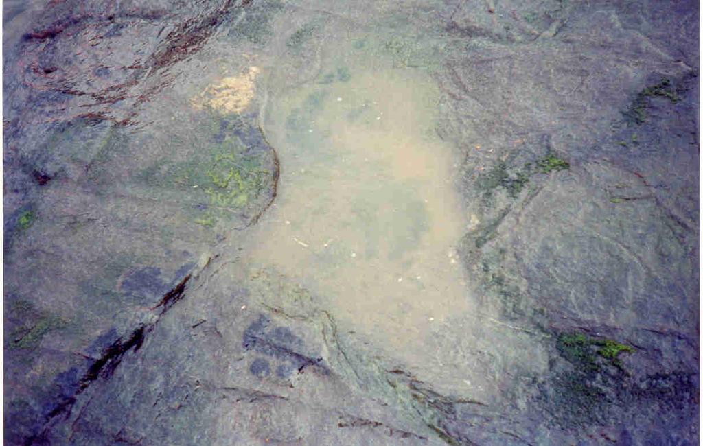
 Tide Pool")
12 Whites Point Quarry Suspended Solids Survey Outflow From Sedimentation Pond and Check Dams (Station WWP2) Tide Pool 1 12

13 Tide Pool 2 Tide Pool 3 13

14 Tide Pool 4 Tide Pool 5 14

15 Tide Pool 6 15
New York District Briefing Template
 New York District Briefing Template New York District US Army Corps of Engineers Insert Text Here Dredging Windows Workshop November 30, 2011 Aquatic Biological Survey Winter Flounder Jenine Gallo & Kate
Habitat Fact Sheets. Rocky habitats are dominated by seaweeds and often mussels, which rely on the rocks for attachment.
 Habitat Fact Sheets Habitats in the Gulf of Maine serve many important roles for the environment and for humans as well. These include: cycling nutrients, filtering pollution, trapping sediments, storing
Currents measurements in the coast of Montevideo, Uruguay
 Currents measurements in the coast of Montevideo, Uruguay M. Fossati, D. Bellón, E. Lorenzo & I. Piedra-Cueva Fluid Mechanics and Environmental Engineering Institute (IMFIA), School of Engineering, Research
CHAPTER 4: BEST MANAGEMENT PRACTICES FOR EROSION AND SEDIMENTATION CONTROL
 Figure 4.4m. Type III Floating Turbidity Barrier Source: American Boom and Barrier Corporation and Virginia Department of Transportation (DOT) Standard Sheets 71 4.4.6 Floating Turbidity Barrier Definition
Natural Bridges Field Trip Activity
 Natural Bridges Field Trip Activity This is due in class on MONDAY- March 1 - not in sections! Name TA: NOTE ON THE GRADING OF THIS ASSIGNMENT: Many of the questions below (especially in the tidepool part)
COUPLED MANAGEMENT STRATEGY LAKE CATHIE ESTUARY & COAST
 Lake Cathie Progress Association Inc. ABN 28 251 433 854 P.O. Box 247 Lake Cathie NSW 2445 PHONE/FAX: 02 6584 8211 EMAIL: r3packag@bigpond.com 20 th October 2009 Port Macquarie Hastings Council PO Box
NIANGUA SNAPSHOT ISSUE Nutrients 2 Suspended Sediment 3 Salinity 4 Summary 5
 Niangua River Watershed Snapshot Volume 14 Number 2 The 125-mile long Niangua River meanders northward from the town of Marshfield on I-44 to the Lake of the Ozarks. Its watershed covers more than 658,000
Lecture Outlines PowerPoint. Chapter 15 Earth Science, 12e Tarbuck/Lutgens
 Lecture Outlines PowerPoint Chapter 15 Earth Science, 12e Tarbuck/Lutgens 2009 Pearson Prentice Hall This work is protected by United States copyright laws and is provided solely for the use of instructors
# Post Consultation and Submissions Resource Consent Conditions for Surfing Impact Mitigation August 2016
 # Post Consultation and Submissions Resource Consent Conditions for Surfing Impact Mitigation August 2016 Surf Mitigation Management Plan 1 1 Not less than 6 months prior to the commencement of the construction
SITE SPECIFIC GUIDELINES FOR OPERATIONS DURING PACIFIC HERRING SPAWN WINDOWS
 SITE SPECIFIC GUIDELINES FOR OPERATIONS DURING PACIFIC HERRING SPAWN WINDOWS Prepared by: Introduction The Fisheries Act prohibits activities which cause the harmful alteration, disruption or destruction
Plan B Dam Breach Assessment
 Plan B Dam Breach Assessment Introduction In support of the Local Sponsor permit applications to the states of Minnesota and North Dakota, a dam breach analysis for the Plan B alignment of the Fargo-Moorhead
The Composition of Seawater
 The Composition of Seawater Salinity Salinity is the total amount of solid material dissolved in water. Most of the salt in seawater is sodium chloride, common table salt. Element Percent Element Percent
Jason Blackburn, Paul Hvenegaard, Dave Jackson, Tyler Johns, Chad Judd, Scott Seward and Juanna Thompson
 Alberta Conservation Association (ACA) Date: 2014-2015 Project Name: Owl River Walleye and Aquatic Habitat Assessment Fisheries Program Manager: Peter Aku Project Leader: Tyler Johns Primary ACA staff
Volume and Shoreline Changes along Pinellas County Beaches during Tropical Storm Debby
 Volume and Shoreline Changes along Pinellas County Beaches during Tropical Storm Debby Ping Wang and Tiffany M. Roberts Coastal Research Laboratory University of South Florida July 24, 2012 Introduction
Repeat Monitoring of Seagrass Beds for Project Next Generation Autumn 2016
 Repeat Monitoring of Seagrass Beds for Project Next Generation Autumn 2016 Prepared by April 2016 Project Next Generation: Repeat Seagrass Monitoring: Autumn 2016 1 Repeat Monitoring of Seagrass Beds for
Exemplar for Internal Assessment Resource Geography Level 3. Resource title: The Coastal Environment Kaikoura
 Exemplar for internal assessment resource Geography 3.5A for Achievement Standard 91430 Exemplar for Internal Assessment Resource Geography Level 3 Resource title: The Coastal Environment Kaikoura This
Eastern Shore Islands Area of Interest Community Newsletter
 Eastern Shore Islands Area of Interest Community Newsletter Fall 2018 1ỊNTRODUCTION In addition to information on our Fisheries and Oceans Canada (DFO) website, we have now created a seasonal, community
STUDY PERFORMANCE REPORT
 STUDY PERFORMANCE REPORT State: Michigan Project No.: F-80-R-4 Study No.: 702 Title: Effects of sediment traps on Michigan river channels Period Covered: October 1, 2002 to September 30, 2003 Study Objectives:
Chapter. The Dynamic Ocean
 Chapter The Dynamic Ocean An ocean current is the mass of ocean water that flows from one place to another. 16.1 The Composition of Seawater Surface Circulation Surface Currents Surface currents are movements
Abundance of Steelhead and Coho Salmon in the Lagunitas Creek Drainage, Marin County, California
 scanned for KRIS Abundance of Steelhead and Coho Salmon in the Lagunitas Creek Drainage, Marin County, California Prepared for: Marin Municipal Water District 220 Nellen Drive Corte Madera, California
NEVADA DEPARTMENT OF WILDLIFE STATEWIDE FISHERIES MANAGEMENT
 NEVADA DEPARTMENT OF WILDLIFE STATEWIDE FISHERIES MANAGEMENT FEDERAL AID JOB PROGRESS REPORTS F-20-50 2014 BILK CREEK RESERVOIR WESTERN REGION 1 NEVADA DEPARTMENT OF WILDLIFE, FISHERIES DIVISION JOB PROGRESS
Low Gradient Velocity Control Short Term Steep Gradient Channel Lining Medium-Long Term Outlet Control Soil Treatment Permanent [1]
![Low Gradient Velocity Control Short Term Steep Gradient Channel Lining Medium-Long Term Outlet Control Soil Treatment Permanent [1]](/thumbs/80/80811988.jpg "Low Gradient Velocity Control Short Term Steep Gradient Channel Lining Medium-Long Term Outlet Control Soil Treatment Permanent [1]") Check Dams DRAINAGE CONTROL TECHNIQUE Low Gradient Velocity Control Short Term Steep Gradient Channel Lining Medium-Long Term Outlet Control Soil Treatment Permanent [1] [1] Though not generally considered
Check Dams DRAINAGE CONTROL TECHNIQUE Low Gradient Velocity Control Short Term Steep Gradient Channel Lining Medium-Long Term Outlet Control Soil Treatment Permanent [1] [1] Though not generally considered
REVETMENTS. Purposes and Operational Constraints. Purposes Erosion control o o. Revetment Design 4/5/2016. CE A676 Coastal Engineering
 REVETMENTS Ijsseldam, the Netherlands Orson P. Smith, PE, Ph.D. Instructor Purposes and Operational Constraints Purposes Erosion control o o Embankment Toe protection for a seawall, retaining wall or other
Chapter 10 Lecture Outline. The Restless Oceans
 Chapter 10 Lecture Outline The Restless Oceans Focus Question 10.1 How does the Coriolis effect influence ocean currents? The Ocean s Surface Circulation Ocean currents Masses of water that flow from one
EcoLogic Memorandum. TO: Ben Brezell; EDR FROM: Mark Arrigo RE: Possible Impacts of Dredging Snooks Pond DATE: 6/4/07
 EcoLogic Memorandum TO: Ben Brezell; EDR FROM: Mark Arrigo RE: Possible Impacts of Dredging Snooks Pond DATE: 6/4/07 Background EDR P.C. (EDR) has been contracted by a landowner to assess the feasibility
UPPER BEACH REPLENISHMENT PROJECT RELATED
 ASSESSMENT OF SAND VOLUME LOSS at the TOWNSHIP of UPPER BEACH REPLENISHMENT PROJECT RELATED to the LANDFALL OF HURRICANE SANDY - PURSUANT TO NJ-DR 4086 This assessment is in response to Hurricane Sandy
APPENDIX C VEGETATED EMERGENCY SPILLWAY. VERSION 1.0 March 1, 2011
 APPENDIX C VEGETATED EMERGENCY SPILLWAY VERSION 1.0 March 1, 2011 [NOTE: Could use a better photo more clearly showing the emergency spillway in the context of the dam.] SECTION C-1: DESCRIPTION OF PRACTICE
HARBOUR SEDIMENTATION - COMPARISON WITH MODEL
 HARBOUR SEDIMENTATION - COMPARISON WITH MODEL ABSTRACT A mobile-bed model study of Pointe Sapin Harbour, in the Gulf of St. Lawrence, resulted in construction of a detached breakwater and sand trap to
extraction of EG and DEG from the matrix. However, the addition of all diluent at once resulted in poor recoveries.
 Informal Commentary Limit of Diethylene Glycol (DEG) and Ethylene Glycol (EG) in Sorbitol Solution, Sorbitol Sorbitan Solution and Noncrystallizing Sorbitol Solution December 2009 Monograph/Section(s):
CROSS-SHORE SEDIMENT PROCESSES
 The University of the West Indies Organization of American States PROFESSIONAL DEVELOPMENT PROGRAMME: COASTAL INFRASTRUCTURE DESIGN, CONSTRUCTION AND MAINTENANCE A COURSE IN COASTAL DEFENSE SYSTEMS I CHAPTER
Draft. Hiroki Yokoi, Yasuko Semba, Keisuke Satoh, Tom Nishida
 Draft Standardization of catch rate for blue marlin (Makaira mazara) exploited by the Japanese tuna longline fisheries in the Indian Ocean from 1971 to 2015 Hiroki Yokoi, Yasuko Semba, Keisuke Satoh, Tom
Alewife Brook, Cape Elizabeth, River Herring Monitoring Summary 2015
 University of Southern Maine USM Digital Commons Publications Casco Bay Estuary Partnership (CBEP) 2-3-2016 Alewife Brook, Cape Elizabeth, River Herring Monitoring Summary 2015 Matt Craig University of
Winter Drawdown Issues of Concern
 Winter Drawdown Issues of Concern Wetland Connectivity Amphibians Fisheries Winter Drawdown Wetland Connectivity Wetland complex near Osprey Creek is not responsive to lake level Wetland at upper end of
Memorandum. Dr. Wilbert Odem, Dr. Paul Trotta, and Mr. Justin Ramsey. From: Timothy Mahon, Patrick Belsheim, and Ali Alrayyes.
 Memorandum To: Dr. Wilbert Odem, Dr. Paul Trotta, and Mr. Justin Ramsey From: Timothy Mahon, Patrick Belsheim, and Ali Alrayyes Date: 10/17/2013 Re: Routes Decision Matrix Decision Matrix Methodology The
INLAND LAKE MANAGEMENT REPORT FY Spring 2008
 INLAND LAKE MANAGEMENT REPORT FY 2008 Spring 2008 Prepared by Robert O. Andress District Fisheries Biologist E. Daniel Catchings District Fisheries Supervisor Kevin W. Baswell District Biologist Aide Department
Technical Report. Comparison of Ventilation Standard Calibration Methods
 Physical Test Methods Sub-Group Technical Report Comparison of Ventilation Standard Calibration Methods May 2012 Author: Ian Tindall Cerulean Linford Wood East Milton Keynes, UK Sub-Group Coordinator Nils
Figure 1: Map showing the relative location of the study sub-watersheds in Plymouth (south) and Maple Grove (north), MN.
 and Maple Grove (north), MN.") II. Grass clippings Methods Grass clippings from residential lawns have frequently been cited as a significant source of nutrients and organic matter transported to receiving waters from residential developments.
II. Grass clippings Methods Grass clippings from residential lawns have frequently been cited as a significant source of nutrients and organic matter transported to receiving waters from residential developments.
Angela Lane, Lowe Environmental Impact / Karen Akuhata (WDC) The Wairoa wastewater treatment system requires a replacement consent by May 2019.
 The Wairoa wastewater treatment system requires a replacement consent by May 2019.") MEMORANDUM Job No.10292 To: From: Jamie Cox, Wairoa District Council Angela Lane, Lowe Environmental Impact / Karen Akuhata (WDC) Date: 11 September 2017 Subject: Task A2I2 Current Outfall Pipe Description
MEMORANDUM Job No.10292 To: From: Jamie Cox, Wairoa District Council Angela Lane, Lowe Environmental Impact / Karen Akuhata (WDC) Date: 11 September 2017 Subject: Task A2I2 Current Outfall Pipe Description
Midtown Corridor Alternatives Analysis
 Midtown Corridor Alternatives Analysis Ridership Forecast Methodology and Results December 2013 Prepared by the SRF Consulting Group Team for Table of Contents Introduction... 1 Methodology... 1 Assumptions...
Merkinch Greenspace. Merkinch Local Nature Reserve: Hydrological Assessment
 Merkinch Local Nature Reserve: Hydrological Assessment June 2011 EnviroCentre Craighall Business Park Eagle Street Glasgow G4 9XA t 0141 341 5040 f 0141 341 5045 w www.envirocentre.co.uk e info@envirocentre.co.uk
Training program on Modelling: A Case study Hydro-dynamic Model of Zanzibar channel
 Training program on Modelling: A Case study Hydro-dynamic Model of Zanzibar channel Mayorga-Adame,C.G., Sanga,I.P.L., Majuto, C., Makame, M.A., Garu,M. INTRODUCTION Hydrodynamic Modeling In understanding
The evolution of beachrock morphology and its influence on beach morphodynamics
 The evolution of beachrock morphology and its influence on beach morphodynamics Robert J. Turner Division of Natural Sciences, Southampton College, 239 Montauk Highway, Southampton, NY 11968, U.S.A. email:
Julebæk Strand. Effect full beach nourishment
 Julebæk Strand Effect full beach nourishment Aim of Study This study is a part of the COADAPT funding and the aim of the study is to analyze the effect of beach nourishment. In order to investigate the
JadEco, LLC PO BOX 445 Shannon, IL 61078
 Introduction: With the assistance of Lake Holiday staff and volunteers, we were able to conduct an AC electrofishing survey on May 8, 27. Water temperatures were 2.3 C (8.5 F) and water clarity was decent
Appendix M: Durras Lake Tailwater Conditions
 Appendix M: Durras Lake Tailwater Conditions M.1 Preamble WRL has completed a tailwater condition assessment for the entrance to Durras Lake, to be used as an ocean boundary condition for a future flood
Comparative growth of pinfish in field mesocosms across marsh, oyster, and soft-bottom habitat types in a Mississippi estuary
 Comparative growth of pinfish in field mesocosms across marsh, oyster, and soft-bottom habitat types in a Mississippi estuary Virginia Shervette and Fran Gelwick Department of Wildlife and Fisheries Sciences
Total Suspended Solids, Stable Flow, and Wet Weather Event Monitoring in the Unnamed Tributary to the Grand River Watershed.
 Total Suspended Solids, Stable Flow, and Wet Weather Event Monitoring in the Unnamed Tributary to the Grand River Watershed December 2004 The Cadmus Group, Inc. Grand Valley State University Annis Water
Appendix H-2 Sediment Transport Supplemental Analysis of Nearshore Cable Installation
 Appendix H-2 Sediment Transport Supplemental Analysis of Nearshore Cable Installation FINAL REPORT ADDENDUM DRAFT FINAL Supplemental Analysis of Nearshore Cable Installation ASA Project: 2011-243 Prepared
Water Quality Guidelines for Total Gas Pressure: First Update
 Water Quality Water Quality Guidelines for Total Gas Pressure: First Update Overview Report Prepared pursuant to Section 2(e) of the Environment Management Act, 1981 Approved: Date Assistant Deputy Minister
Casco Bay Intensified PSP Sampling Project
 Casco Bay Intensified PSP Sampling Project conducted by MER Corp. in cooperation with the Maine DMR with funding from the Casco Bay Estuary Partnership October 16, 2006 Problems: 1. Limited number of routine
Hamilton Public Health Services 2014 Beach Monitoring Report
 Public Health Services Health Protection Division 110 King Street West, 2nd Floor, Hamilton, ON L8P 4S6 Phone: (905) 546-2424, ext. 3570 Fax: (905) 546-2787 Hamilton Public Health Services 2014 Beach Monitoring
Unit 4: Inference for numerical variables Lecture 3: ANOVA
 Unit 4: Inference for numerical variables Lecture 3: ANOVA Statistics 101 Thomas Leininger June 10, 2013 Announcements Announcements Proposals due tomorrow. Will be returned to you by Wednesday. You MUST
CT EXPANSION PROJECT SILT FENCE DESIGN CRITERIA AND METHODOLOGY CONNECTICUT LOOP. Submitted by:..
 CT EXPANSION PROJECT SILT FENCE DESIGN CRITERIA AND METHODOLOGY CONNECTICUT LOOP Submitted by:.. Tennessee Gas Company L.L.C. 1001 Louisiana St, Suite 1000 Houston, TX 77002 July 2014 Revised March 2015
CCR Landfill 2017 Annual Inspection Report NC1 Ash Disposal Area
 CCR Landfill 2017 Annual Inspection Report NC1 Ash Disposal Area Omaha Public Power District Nebraska City Station Nebraska City, Nebraska January 19, 2018 OPPD Nebraska City Station NC1 Ash Disposal Area
RESOLUTION MEPC.209(63) Adopted on 2 March GUIDELINES ON DESIGN AND CONSTRUCTION TO FACILITATE SEDIMENT CONTROL ON SHIPS (G12)
 Adopted on 2 March GUIDELINES ON DESIGN AND CONSTRUCTION TO FACILITATE SEDIMENT CONTROL ON SHIPS (G12)") Annex 3, page 1 ANNEX 3 THE MARINE ENVIRONMENT PROTECTION COMMITTEE, RECALLING Article 38(a) of the Convention on the International Maritime Organization concerning the functions of the Marine Environment
Annex 3, page 1 ANNEX 3 THE MARINE ENVIRONMENT PROTECTION COMMITTEE, RECALLING Article 38(a) of the Convention on the International Maritime Organization concerning the functions of the Marine Environment
Request Number IR1-12: Flow Passage. Information Request
 Request Number IR1-12: Flow Passage Information Request Provide additional information about the 100 metre flow passage channel scenario between the Westshore Terminals and the proposed Project terminal
CLAM PASS ANNUAL RESTORATION & MANAGEMENT PLAN TIDAL ANALYSIS ELEMENT REPORT NO. 13
 CLAM PASS ANNUAL RESTORATION & MANAGEMENT PLAN TIDAL ANALYSIS ELEMENT REPORT NO. 13 Submitted to: Pelican Bay Services Division Prepared by: Humiston & Moore Engineers H&M File No. 13-078 November 2012
CARL BLACKWELL LAKE MANAGEMENT PLAN
 CARL BLACKWELL LAKE MANAGEMENT PLAN Background Lake Carl Blackwell impounds Stillwater Creek, 10 miles west of Stillwater in Payne County, Oklahoma (Figure 1). The lake covers 3,370 surface acres and was
Modeling of Oxygen Injection Experiment in Savannah Harbor
 593 Modeling of Oxygen Injection Experiment in Savannah Harbor S. Davie 1, H. Moorer 2, H. Rodriguez 1, Y. Plis 1 1 Tetra Tech, Inc., 2110 Powers Ferry Road, Suite 202, Atlanta, GA 30339, PH (770) 850-0949;
CHAPTER 257 SEA LEVEL TRENDS IN THE HUMBER ESTUARY : A CASE STUDY PATRICK PARLE 1
 CHAPTER 257 SEA LEVEL TRENDS IN THE HUMBER ESTUARY : A CASE STUDY ABSTRACT PATRICK PARLE 1 In 1990 Posford Duvivier were commissioned by the National Rivers Authority to collect, audit and place on a database
Appendix 21 Sea angling from the shore
 Appendix 21 Sea angling from the shore LUC SMRTS2015 Final Report 342 March 2016 Appendix 21 Sea angling from the shore Table A21.1: Summary of sample confidence levels Responses Spatial data Questionnaire
SAMPLE MAT Proceedings of the 10th International Conference on Stability of Ships
 and Ocean Vehicles 1 Application of Dynamic V-Lines to Naval Vessels Matthew Heywood, BMT Defence Services Ltd, mheywood@bm tdsl.co.uk David Smith, UK Ministry of Defence, DESSESea-ShipStab1@mod.uk ABSTRACT
Total Suspended Solids, Stable Flow, and Wet Weather Event Monitoring in the Bass River Watershed. December The Cadmus Group, Inc.
 Total Suspended Solids, Stable Flow, and Wet Weather Event Monitoring in the Bass River Watershed December 2004 The Cadmus Group, Inc. Grand Valley State University Annis Water Resources Institute Submitted
Performance of Upham Beach T-Groin Project and Its Impact to the Downdrift Beach
 Performance of Upham Beach T-Groin Project and Its Impact to the Downdrift Beach Progress Report for the Period of October 2008 to April 2009 Submitted by Ping Wang, Ph.D., and Tiffany M. Roberts Department
APPENDIX 3E HYDROACOUSTIC ANALYSIS OF FISH POPULATIONS IN COPCO AND IRON GATE RESERVOIRS, CALIFORNIA NOVEMBER
 APPENDIX 3E HYDROACOUSTIC ANALYSIS OF FISH POPULATIONS IN COPCO AND IRON GATE RESERVOIRS, CALIFORNIA NOVEMBER 23 February 24 PacifiCorp Fish Resources FTR Appendix 3E.doc Hydroacoustic Analysis of Fish
Applications of ELCIRC at LNEC
 stratification in the Guadiana estuary tidal propagation in the Óbidos lagoon Lígia Pinto Anabela Oliveira André B. Fortunato 2 O utline Stratification in the Guadiana estuary The Guadiana estuary Objectives
MISSISSIPPI MAKEOVER A Plan for Restoration, Just Around the Bend
 MISSISSIPPI MAKEOVER A Plan for Restoration, Just Around the Bend Interim Report Card 2013 Project coordinated by the Dakota County Soil and Water Conservation District and sponsored by the Minnesota Pollution
Concepts & Phenomena
 Concepts & Phenomena in coastal and port sedimentation R. Kamalian Ports and Maritime Organization of Iran and PIANC-Iran 7 9 December 2015 What is the problem? Many harbours have sedimentation problems
Transportation and Public Works Annual Motor Vehicle Collision Report
 Transportation and Public Works 22 Annual Motor Vehicle Collision Report Table of Contents Table of Contents.. 2 Introduction.. 3 22 Collision Summary. 4 Demographics 5 Collisions by Severity.. 5 Personal
Bear Cove Coastline Reestablishment
 Coastal and Ocean Engineering Undergraduate Student Forum, COASTAL-2013 Faculty of Engineering and Applied Science, Memorial University, St. john s, NL, Canada March, 2013 Bear Cove Coastline Reestablishment
The Estimations of Nutrient Cycles of Artificial Tidal Flat in Tokyo Bay
 The Estimations of utrient Cycles of Artificial Tidal Flat in Tokyo Bay Kazuo MURAKAMI, ana SASAKI, Tomohiro KUWAE, and Hirotsugu ISHII Tokyo City University The Role of Tidal Flat for Coastal Environment
Evaluation of June 9, 2014 Federal Emergency Management Agency Flood Insurance Study for Town of Weymouth, Norfolk, Co, MA
 Evaluation of June 9, 2014 Federal Emergency Management Agency Flood Insurance Study for Town of Weymouth, Norfolk, Co, MA Prepared For: Woodard & Curran 95 Cedar Street, Suite 100 Providence, RI 02903
California Department of Fish and Wildlife Report to the International Pacific Halibut Commission on 2017 California Fisheries
 IPHC-2018-AM094-AR08 Received: 22 December 2017 California Department of Fish and Wildlife Report to the International Pacific Halibut Commission on 2017 California Fisheries California Department of Fish
CHAPTER 11.1 THE WORLD OCEAN MARINE BIOMES NOTES
 CHAPTER 11.1 THE WORLD OCEAN MARINE BIOMES NOTES 1. The world ocean can be divided into zones both and. The,, and zones that apply to large lakes also apply to the ocean. 2. In addition to the depth zones,
Marginal Marine Environments
 Marginal Marine Environments Delta: discrete shoreline protuberances formed where rivers enter oceans, semi-enclosed seas, lakes or lagoons and supply sediment more rapidly than it can be redistributed
A Combined Recruitment Index for Demersal Juvenile Cod in NAFO Divisions 3K and 3L
 NAFO Sci. Coun. Studies, 29: 23 29 A Combined Recruitment Index for Demersal Juvenile Cod in NAFO Divisions 3K and 3L David C. Schneider Ocean Sciences Centre, Memorial University St. John's, Newfoundland,
GONE! Coastal Erosion Happens During Storms! Why Worry About Coastal Setbacks? Goals for Today
 RI Regulatory Setbacks & Buffers: Coastal Zone Management Issues New England Onsite Wastewater Training Program @ URI OWT 155 November 21, 2013 Goals for Today Understand the impacts of storms, coastal
Dry Hydrants. The installation of a non-pressurized pipe system into local water sources provides a ready means of supplying water to fire engines.
 Dry Hydrants What is a Dry Hydrant? A dry hydrant is a non-pressurized pipe system permanently installed in existing lakes, ponds and streams that provides a suction supply of water to a fire department
Southern Gulf of St. Lawrence (4T) Herring
 Herring") Stock Status Report 24/23 Southern Gulf of St. Lawrence (4T) Herring Background Herring are a pelagic species which form schools during feeding and spawning periods. Herring in the southern Gulf of St.
Stock Status Report 24/23 Southern Gulf of St. Lawrence (4T) Herring Background Herring are a pelagic species which form schools during feeding and spawning periods. Herring in the southern Gulf of St.
CLAM PASS RESTORATION AND MANAGEMENT PLAN BATHYMETRIC MONITORING REPORT NO. 7 Including Interior Bay Dredge Cuts and Tidal Data
 CLAM PASS RESTORATION AND MANAGEMENT PLAN BATHYMETRIC MONITORING REPORT NO. 7 Including Interior Bay Dredge Cuts and Tidal Data Submitted to: Florida Department of Environmental Protection DEP File No.
CHAPTER 10 TOTAL RECREATIONAL FISHING DAMAGES AND CONCLUSIONS
 CHAPTER 10 TOTAL RECREATIONAL FISHING DAMAGES AND CONCLUSIONS 10.1 INTRODUCTION This chapter provides the computation of the total value of recreational fishing service flow losses (damages) through time
TABLE OF CONTENTS CHAPTER TITLE PAGE LIST OF TABLES LIST OF FIGURES LIST OF ABBREVIATIONS LIST OF SYMBOLS LIST OF APPENDICES
 vii TABLE OF CONTENTS CHAPTER TITLE PAGE AUTHOR S DECLARATION DEDICATION ACKNOWLEDGEMENTS ABSTRACT ABSTRAK TABLE OF CONTENTS LIST OF TABLES LIST OF FIGURES LIST OF ABBREVIATIONS LIST OF SYMBOLS LIST OF
Southern Gulf of St. Lawrence Sea Scallop
 DFO Science Stock Status Report C3-16 (1998) 21 22 23 24 Southern Gulf of St. Lawrence Sea Scallop Background The sea scallop (Placopecten magellanicus), is a bivalve mollusc found only in the north-western
APPENDIX A Hydrodynamic Model Qualicum Beach Waterfront Master Plan
 Page 1 of 21 CLIENT: Town of Qualicum Beach PROJECT: SIGNATURE DATE CONTRIBUTORS : M. Marti Lopez REVIEWED BY : P. St-Germain, EIT APPROVED BY: J. Readshaw, P.Eng ISSUE/REVISION INDEX Issue Details Code
STUDY ON TSUNAMI PROPAGATION INTO RIVERS
 ABSTRACT STUDY ON TSUNAMI PROPAGATION INTO RIVERS Min Roh 1, Xuan Tinh Nguyen 2, Hitoshi Tanaka 3 When tsunami wave propagation from the narrow river mouth, water surface is raised and fluctuated by long
Indian River Lagoon: Lessons, Challenges and Opportunities
 Indian River Lagoon: Lessons, Challenges and Opportunities Upper Chain of Lakes Lake Kissimmee Kissimmee River Indian River Lagoon Caloosahatchee Estuary Lake Okeechobee St. Lucie Estuary Mark Perry, Executive
SARASOTA BAY ESTUARY PROGRAM OYSTER HABITAT MONITORING RESULTS: YEAR 1. Jay R. Leverone
 SARASOTA BAY ESTUARY PROGRAM OYSTER HABITAT MONITORING RESULTS: YEAR 1 by Jay R. Leverone Mote Marine Laboratory 1600 Ken Thompson Parkway Sarasota, Fl 34236 to Gary Raulerson Sarasota Bay Estuary Program
REC 6 FISHERIES HABITAT EVALUATION
 REC 6 FISHERIES HABITAT EVALUATION 1.0 EXECUTIVE SUMMARY Analysis of fisheries habitat for recreational angling opportunities was completed by reviewing the results of the CAWG 1, Characterize Stream and
INTRODUCTION TO COASTAL ENGINEERING
 The University of the West Indies Organization of American States PROFESSIONAL DEVELOPMENT PROGRAMME: COASTAL INFRASTRUCTURE DESIGN, CONSTRUCTION AND MAINTENANCE A COURSE IN COASTAL DEFENSE SYSTEMS I CHAPTER
Refined Designated Uses for the Chesapeake Bay and Tidal Tributaries
 A-1 appendixa Refined Designated Uses for the Chesapeake Bay and Tidal Tributaries BACKGROUND Federal water quality standards regulations establish that states must specify appropriate water uses to be
Youngs Creek Hydroelectric Project (FERC No. P 10359)
") Youngs Creek Hydroelectric Project (FERC No. P 10359) Resident Trout Monitoring Plan Annual Report 2010 Survey and Results of Pre Project Monitoring Prepared by: September 2010 Overview The Public Utility
Youngs Creek Hydroelectric Project (FERC No. P 10359) Resident Trout Monitoring Plan Annual Report 2010 Survey and Results of Pre Project Monitoring Prepared by: September 2010 Overview The Public Utility
NEVADA DEPARTMENT OF WILDLIFE STATEWIDE FISHERIES MANAGEMENT
 NEVADA DEPARTMENT OF WILDLIFE STATEWIDE FISHERIES MANAGEMENT FEDERAL AID JOB PROGRESS REPORTS F-20-52 2016 RYE PATCH RESERVOIR WESTERN REGION NEVADA DEPARTMENT OF WILDLIFE, FISHERIES DIVISION ANNUAL PROGRESS
Data Report : Russian River Basin Steelhead and Coho Salmon Monitoring Program Pilot Study
 Data Report 1999-1: Russian River Basin Steelhead and Coho Salmon Monitoring Program Pilot Study Sonoma County Water Agency 215 West College Avenue Santa Rosa, California 951 Prepared by David Cook Senior
Warm-up # 7 A day 5/17 - B day 5/18 UPDATE YOUR TABLE OF CONTENTS
 Warm-up # 7 A day 5/17 - B day 5/18 UPDATE YOUR TABLE OF CONTENTS Question: List all examples of surface water on Earth. Answer: Rivers and streams, lakes and reservoirs, (ponds) wetlands, estuaries and
Seagrass Surveys in Kampot
 Coastal Annual Forum 23 rd October 2014 Sihanoukville, Cambodia Seagrass Surveys in Kampot Presentation by Louis Bourne INTERNATIONAL UNION FOR CONSERVATION OF NATURE Presentation Overview Location and
Packwood Lake Intake Screen Velocity Test Report for Energy Northwest's Packwood Lake Hydroelectric Project FERC No Lewis County, Washington
 for Energy Northwest's Packwood Lake Hydroelectric Project FERC No. 2244 Lewis County, Washington Submitted to P.O. Box 968 Richland, Washington 99352-0968 Submitted by EES Consulting 1155 North State
RESOLUTION MEPC.162(56) Adopted on 13 July 2007 GUIDELINES FOR RISK ASSESSMENT UNDER REGULATION A-4 OF THE BWM CONVENTION (G7)
 Adopted on 13 July 2007 GUIDELINES FOR RISK ASSESSMENT UNDER REGULATION A-4 OF THE BWM CONVENTION (G7)") MEPC 56/23 RESOLUTION MEPC.162(56) THE MARINE ENVIRONMENT PROTECTION COMMITTEE, RECALLING Article 38(a) of the Convention on the International Maritime Organization concerning the functions of the Marine
MEPC 56/23 RESOLUTION MEPC.162(56) THE MARINE ENVIRONMENT PROTECTION COMMITTEE, RECALLING Article 38(a) of the Convention on the International Maritime Organization concerning the functions of the Marine
OECS Regional Engineering Workshop September 29 October 3, 2014
 B E A C H E S. M A R I N A S. D E S I G N. C O N S T R U C T I O N. OECS Regional Engineering Workshop September 29 October 3, 2014 Coastal Erosion and Sea Defense: Introduction to Coastal Dynamics David
Salt Ponds Shore Zone Modeling for Breakwater Placement: Summary Report
 Salt Ponds Shore Zone Modeling for Breakwater Placement: Summary Report Virginia Institute of Marine Science May 2014 Salt Ponds Shore Zone Modeling for Breakwater Placement: Summary Report For Waterway
ANNUAL INSPECTION BY A QUALIFIED PROFESSIONAL ENGINEER ALL CCR IMPOUNDMENTS CCR Rule Section (b)
") ANNUAL INSPECTION BY A QUALIFIED PROFESSIONAL ENGINEER ALL CCR IMPOUNDMENTS ASBURY POWER PLANT 21133 Uphill Lane Asbury, Missouri 64832 January 18, 2017 EMPIRE DISTRICT ELECTRIC COMPANY Prepared by: Rachel
ANNUAL INSPECTION BY A QUALIFIED PROFESSIONAL ENGINEER ALL CCR IMPOUNDMENTS ASBURY POWER PLANT 21133 Uphill Lane Asbury, Missouri 64832 January 18, 2017 EMPIRE DISTRICT ELECTRIC COMPANY Prepared by: Rachel