Southeast Volusia Coastal Projects Update
|
|
|
- Cathleen Tate
- 5 years ago
- Views:
Transcription

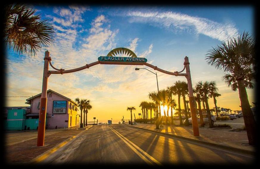
1 Southeast Volusia Coastal Projects Update Public Works Department Coastal Division August 15, 2016


2 2016 Dune Walkover Re-Decking Program Completed Dune Walkovers South End 8 th Ave. New Smyrna Beach* 12 th Avenue, New Smyrna Beach Grouper Avenue, New Smyrna Beach Mullet Avenue, New Smyrna Beach Trout Avenue, New Smyrna Beach (June)* (April) (May) (May) (May)


3 2016 Dune Walkover Re-Decking Program NS th Avenue, New Smyrna Beach June 2016 Pier Shade Structu res Material: $ 7,500 Labor: $ 18,719 Total: $ 26,219 Length: 147ft Removed & Replaced Support posts Handrails Decking Stairs Hardware Installation of composite top cap Walkover is ADA compliant *Labor Performed By Contractor


4 2016 Dune Walkover Re-Decking Program NS th Avenue, New Smyrna Beach March & April 2016 Material: $ 2,700 Length: 37 ft Removed & Replaced: Decking Handrails Stairs Hardware Installation of 2 x 8 composite top cap


5 2016 Dune Walkover Re-Decking Program SC-151 Grouper Ave, New Smyrna Beach May 2016 Material: $ 1,500 Length: 42 ft Removed & Replaced Handrail Decking Hardware Installation of composite top cap


6 2016 Dune Walkover Re-Decking Program SC-153 Mullet Ave, New Smyrna Beach May 2016 Material: $ 2,400 Length: 48 ft Removed & Replaced Handrail Decking Hardware Installation of composite top cap


7 2016 Dune Walkover Re-Decking Program SC-157 Trout Ave, New Smyrna Beach May 2016 Material: $ 3,200 Length: 71 ft Removed & Replaced Handrail Decking Hardware Installation of composite top cap


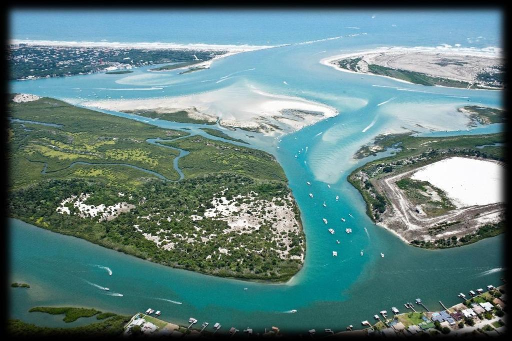
8 Ponce de Leon Inlet Markers relocated May 2016 Inlet Channel Shoal Markers

9 Smyrna Dunes Park Fishing Pier
 decking and handrail Two (2) Shade Structures with Benches Fishing")
10 Smyrna Dunes Park Fishing Pier Wilbur Boat House Fishing Pier Project Elements ADA accessible Multiple benches 350 long and 10 wide Concrete piling supports Composite (recycled plastic) decking and handrail Two (2) Shade Structures with Benches Fishing Depth-approximately 15ft.

11 Smyrna Dunes Park Fishing Pier Pier Shade Structures Existing Park Boardwalk

12 Smyrna Dunes Park Fishing Pier Project Timeline Funding authorization April 2016 Eng./design & permitting April 2016 Construction NTP September 2016 Project completion March 2017 Project Funding Inlet & Port District Florida Boating Improvement Florida Inland Navigation District (FIND)

13 Smyrna Dunes Park Boardwalk Improvements Boardwalk renovation / widening Composite (recycled plastic) decking and handrail ADA accessibility Boardwalk fishing pier ocean beaches Pedestrian access maintained during construction

14 Smyrna Dunes Park Federal & State Interagency Coordination Federal Agencies Bureau of Land Management U.S. Fish & Wildlife Service U.S. Army Corps of Engineers U.S. Coast Guard State Agencies Department of Environmental Protection Division of State Lands Timeline Interagency kickoff meeting April 11, 2016 DRAFT biological assessment May 2016 Section 7 consultation complete August 2016

15 Smyrna Dunes Park Environmentally Sensitive Habitat Southeastern Beach Mouse protection Top-down construction in sensitive areas Advance burrow surveys during construction Exclusion fencing around construction areas Daytime only operations No vehicles in sensitive habitat areas Sea Turtle protection Daytime only construction operations No on-beach construction during nesting season Gopher Tortoise protection Exclusion fencing around construction areas Advance burrow surveys during construction Relocation of animals only if unavoidable


16 Smyrna Dunes Park Project timeline - Boardwalk Improvements Conceptual site planning initiated Dec 2015 DEP & USACE ERP application April 2016 CCCL permit application submitted May 2016 Solicit Design / Build team August 2016 Construction NTP Jan Project completion August 2018 Total Estimated Cost: $5,400,000 ECHO and Inlet & Port District Funded

17 Hiles Blvd. Off-beach Parking Project Notes: Acquired: December 2014 Features: Restroom, shower, bike rack, perimeter landscaping, four (4) additional handicapped parking spaces, approx. 75 space overflow lot, W and N boundary fencing Funding: ECHO Beach Capital Const. Schedule: Bid - Winter Award Spring/Summer 2017 Complete Spring 2018 Status: Design 75% complete


18 Nearshore Artificial Reef System Ponce de Leon Inlet 2.5 miles Project Notes: Four (4) reef deployments planned in August 2016 Coordinates: Flagler Avenue reef construction area 18


19 Derelict Vessel Removal Sailboat at Marker 57 - Edgewater Sponson Race Boat at Shotgun Creek Oak Hill Abandoned Vessels along River Road Oak Hill and North Causeway NSB
20 Questions
Good Mooring to You! Jensen Beach Mooring Field. Kathy Fitzpatrick, P.E. Coastal Engineer, Martin County
 Good Mooring to You! Kathy Fitzpatrick, P.E. Coastal Engineer, Martin County Penny Cutt Regional Manager, Coastal Systems International Mooring Field Advantages Provide a safe and secure anchorage at a
ATLANTIC COAST OF LONG ISLAND, JONES INLET TO EAST ROCKAWAY INLET, LONG BEACH ISLAND, NY. Contract #2 Construction Scope. April 18th-19th 2018
 ATLANTIC COAST OF LONG ISLAND, JONES INLET TO EAST ROCKAWAY INLET, LONG BEACH ISLAND, NY Contract #2 Construction Scope April 18th-19th 2018 New York District PLAN COMPONENTS Length of Beachfill 35,000
Atlantic Coast of Long Island, Jones Inlet to East Rockaway Inlet, Long Beach Island, NY Construction Update
 Atlantic Coast of Long Island, Jones Inlet to East Rockaway Inlet, Long Beach Island, NY Construction Update June 2016 US Army Corps of Engineers Project Purpose Three specific damage mechanisms of coastal
FINDING OF NO SIGNIFICANT IMPACT
 DEPARTMENT OF THE ARMY CHARLESTON DISTRICT, CORPS OF ENGINEERS 69A HAGOOD AVENUE CHARLESTON, SOUTH CAROLINA 29403-5107 FINDING OF NO SIGNIFICANT IMPACT EDISTO BEACH COASTAL STORM DAMAGE REDUCTION GENERAL
C ITY OF NEW SMYRNA BEACH
 Quarterly Newsletter - October, November, December 2012 C ITY OF NEW SMYRNA BEACH Issue 4th Quarter The City will be bidding a fond farewell to two elected officials this month as City Commissioners Jim
FINAL ENVIRONMENTAL IMPACT STATEMENT ON BROWARD COUNTY SHORE PROTECTION PROJECT SEGMENTS II AND III BROWARD COUNTY, FLORIDA
 FINAL ENVIRONMENTAL IMPACT STATEMENT ON BROWARD COUNTY SHORE PROTECTION PROJECT SEGMENTS II AND III BROWARD COUNTY, FLORIDA 1. PROJECT PURPOSE AND NEED 1.1. PROJECT AUTHORITY. 1.1.1. INITIAL AUTHORIZATION.
10/20/2010 Version 3. Guidelines for Developing Non-motorized Boat Launches in Florida
 Guidelines for Developing Non-motorized Boat Launches in Florida 1 These guidelines were prepared by the Florida Fish and Wildlife Conservation Commission with input from a Non-motorized Boating (NMB)
Impact of Hurricane Matthew on the Atlantic Coast of Florida
 Impact of Hurricane Matthew on the Atlantic Coast of Florida A coastal engineer was driving across country and his jeep broke down in front of a monastery. It was late in the day and the monks invited
2018 Beach Preservation Project Information
 QUICK FACTS Beach Renourishment to begin late April 2018 o U.S. Army Corps of Engineers project o Project Area: 8 th St. E. to end of E. Ashley Ave. o Project Length: 2 miles o Cost: $10,900,000 o Funding:
HARBOR INFRASTRUCTURE INVENTORIES West Harbor, OH
 HARBOR INFRASTRUCTURE INVENTORIES West Harbor, OH Harbor Location: West Harbor is located on the southern shore of Lake Erie in the township of Catawba Island, OH about 50 miles east of Toledo, OH. Authority:
Trusted Partners Delivering Value, Today and Tomorrow BUILDING STRONG
 Miami-Dade County Renourishment Project U.S. Army Corps of Engineers Jacksonville District January 5, 2017 US Army Corps of Engineers Project Purpose coastal storm risk management beach erosion control
Appendix F: Public Access Plan
 Atlantic Coast of Long Island Jones Inlet to East Rockaway Inlet Long Beach Island, New York Coastal Storm Risk Management Project Hurricane Sandy Limited Reevaluation Report Appendix F: Public Access
Environmental Times Fall Volume 22 Issue 3 Published by the Palm Beach County Department of Environmental Resources Management
 Fall 2017 - Volume 22 Issue 3 Published by the Palm Beach County Department of Environmental Resources Management Celebrate Lake Worth Lagoon Fourth Annual LagoonFest on November 4 Are you ready to explore
Proposed Terrestrial Critical Habitat for the Northwest Atlantic Loggerhead Sea Turtle Population. U.S. Fish and Wildlife Service
 Proposed Terrestrial Critical Habitat for the Northwest Atlantic Loggerhead Sea Turtle Population U.S. Fish and Wildlife Service History of Loggerhead Listing (joint responsibility USFWS and NOAA Fisheries)
Recovery, Reuse, and Recycling of Debris From the Demolition of the Grace and Pearman Bridges at Charleston, South Carolina
 Recovery, Reuse, and Recycling of Debris From the Demolition of the Grace and Pearman Bridges at Charleston, South Carolina Fred Cooper, P.E. Earth Tech AECOM Three Bridges Viewed From the Charleston Side
New Jersey Scuba Diver - Artificial Reefs - Townsends
 Page 1 of 7 Townsends Reef Home & Search Artificial Reefs Contents Top of Page Deepwater Reef Latest News Prev Next Dive Sites Marine Biology Artifacts & Shipwrecks Gear & Training Bay Jack Donna's Star
Beach Nourishment Impact on Beach Safety and Surfing in the North Reach of Brevard County, Florida
 Beach Nourishment Impact on Beach Safety and Surfing in the North Reach of Brevard County, Florida Prepared by John Hearin, Ph.D. Coastal Engineering Vice Chairman Cocoa Beach Chapter Port Canaveral Patrick
2013 FEDERAL STORM RESPONSE
 2013 FEDERAL STORM Presented to the Florida Shore & Beach Association Sep 26, 2013 Presented by: COL Alan Dodd Commander, Jacksonville District September 2013 THE COLLABORATION 2 THE PROGRAM 3 THE STORMS
New Orleans Municipal Yacht Harbor
 New Orleans Municipal Yacht Harbor Marina Schematic Design Update 601 Poydras St., Suite 1860 New Orleans, LA, 70130 504-648-3560 Post-Katrina Municipal Yacht Harbor: Introduction The MYH was an approximate
INTRACOASTAL WATERWAY DEEPENING BROWARD COUNTY, FLORIDA HARD CORAL RELOCATION SUMMARY REPORT
 INTRACOASTAL WATERWAY DEEPENING BROWARD COUNTY, FLORIDA 17th Street Bridge to 4,000 Feet North of the Las Olas Blvd. Bridge HARD CORAL RELOCATION SUMMARY REPORT Prepared for: Prepared by: 204 N. Dixie
U.S. HIGHWAY 50 IMPROVEMENT PROJECT
 U.S. HIGHWAY 50 IMPROVEMENT PROJECT in the City of South Lake Tahoe Project Purpose and Need Planned Improvements Project Cost and Delivery Schedule Proposed Construction Staging Project Partners: HIGHWAY
2016 TELL THE TPO SURVEY
 RIVER TO SEA TRANSPORTATION PLANNING ORGANIZATION 2016 TELL THE TPO SURVEY CAMPAIGN SUMMARY August 2016 Introduction The River to Sea Transportation Planning Organization (TPO) conducted its second Tell
Abandoned and Derelict Vessels in the Florida Keys National Marine Sanctuary
 Abandoned and Derelict Vessels in the Florida Keys National Marine Sanctuary Steve Werndli Emergency Response and Enforcement Coordinator Florida Keys National Marine Sanctuary April 18, 2017 Derelict
Coastal Harbors and Waterways, NC (Shallow Draft Navigation) (O&M)
 (O&M)") Coastal Harbors and Waterways, NC (Shallow Draft Navigation) (O&M) Shallow draft coastal harbors include a subsistence harbor at Silver Lake CONGRESSIONAL DISTRICT: NC 3, 7 DATE: 23 April 2018 1. AUTHORIZATION:
Coastal Harbors and Waterways, NC (Shallow Draft Navigation) (O&M) Shallow draft coastal harbors include a subsistence harbor at Silver Lake CONGRESSIONAL DISTRICT: NC 3, 7 DATE: 23 April 2018 1. AUTHORIZATION:
UPC Design / CN Locally Administered PE Phase VDOT Administered CN Phase
 Presentation for County Board, February 27, 2018 Regular Hearing N. Lynn Street Esplanade and Custis Trail Improvements Funding Request for VDOT Construction Bid Award UPC Design 70762 / CN 109813 Locally
Cordova Community Pool Replacement Cordova Recreation and Park District Community Workshop #2 October 23, 2018
 Cordova Community Pool Replacement Cordova Recreation and Park District Community Workshop #2 October 23, 2018 Fall 2017 Jan. 2018 Feb. 2018 May 2018 May 2018 Aug. 2018 Oct. 2018 Oct. 2018 LPA hired by
HARBOR INFRASTRUCTURE INVENTORIES Fairport Harbor, OH
 HARBOR INFRASTRUCTURE INVENTORIES Fairport Harbor, OH Harbor Location: Fairport Harbor is located at the mouth of the Grand River on the southern shore of Lake Erie in the city of Fairport, OH, approximately
New Jersey Division of Fish and Wildlife. Excerpts from REEF NEWS 1999 OBJECTIVES OF THE REEF PROGRAM. WHAT DO ANGLERS THINK of the REEF PROGRAM?
 New Jersey Division of Fish and Wildlife Excerpts from REEF NEWS 1999 OBJECTIVES OF THE REEF PROGRAM New Jersey's Reef Program is administered by the DEP's Division of Fish and Wildlife. The objectives
Amelia Island Trails (AIT) Progress and Proposed 5-YR Plan JANUARY 16, 2018
 Progress and Proposed 5-YR Plan JANUARY 16, 2018") Amelia Island Trails (AIT) Progress and Proposed 5-YR Plan JANUARY 16, 2018 PHIL SCANLAN FRIENDS OF AIT, INC. CEO WHY AM I HERE? 1. We have made good progress on A.I. Trails. 2. We CAN T meet our Goal
Amelia Island Trails (AIT) Progress and Proposed 5-YR Plan JANUARY 16, 2018 PHIL SCANLAN FRIENDS OF AIT, INC. CEO WHY AM I HERE? 1. We have made good progress on A.I. Trails. 2. We CAN T meet our Goal
***This summary does not include shad and herring net requirements.***
 South Carolina Department of Natural Resources Marine Resources Division Summary of Seine and Gill Net Laws (Saltwater) 2013-2014 This document should be kept on board all vessels using seines or gill
Expanding Anchoring Away
 Expanding Anchoring Away Vessel taxonomy &territorial waters Maritime and admiralty law distinguished The right to navigate Federal navigational servitude as applied CZMA, reverse federalism & Florida
Nome Harbor Page 2 of 12
 Nome Harbor Nome Harbor Page 2 of 12 Condition of Improvements 30 December 2015 Nome Harbor, Alaska (CWIS No. 010422, 012270, 072742, 087755) Authorization (1) Rivers and Harbors Act, 8 August 1917 (House
Geographic Response Plan Map: EFL-25. Map Continued on Page: EFL-30. EFL25-01 Cape Canaveral Air Force Station Nesting Beach - South
 r. 80 37'30"W Banana River 28 30'0"N!d! White Geographic Response Plan Map: EFL-25 Point Map Continued on Page: EFL-30 80 30'0"W 28 30'0"N! Cactus Point a th)! er erve Map Continued on Page: EFL-26!S(!d
Mississippi Department of Marine Resources. Jimmy Sanders
 Mississippi Department of Marine Resources Jimmy Sanders Fish Aggregating Devices (FADs) Fish aggregating devices (FADs) are floating objects that are designed and strategically placed to attract pelagic
AGENCY/ORGANIZATION OFFICE/DIVISION SECTION/SUBSECTION ACTIONS (Related to Coral Reefs) Natural Resources Planning and Management Division
 Natural Resources Planning and Management Division") AGENCY/ORGANIZATION OFFICE/DIVISION SECTION/SUBSECTION ACTIONS (Related to Coral Reefs) Broward County Environmental Protection and Growth Department Natural Resources Planning and Division Broward County
AGENCY/ORGANIZATION OFFICE/DIVISION SECTION/SUBSECTION ACTIONS (Related to Coral Reefs) Broward County Environmental Protection and Growth Department Natural Resources Planning and Division Broward County
Climate Change Impacts to KSC Launch Complex
 Climate Change Impacts to KSC Launch Complex Presented to: 2010 International Workshop on Environment and Energy By: John Shaffer NASA Environmental Management Branch Kennedy Space Center Hurricane Season
STAGE #3 TRANSITION 1 at Camp Keystone
 STAGE #3 SWIM STAGE #3 TRANSITION 1 at Camp Keystone Mount bike AFTER bump T1 Changing Tent STAGE #3 Camp Keystone to Marineland 68 MILE BIKE STAGE #3 68 MILE BIKE Mile 0-10 SAG 0.0 Turn RIGHT out of T1.
Clearlake Road (State Road 501) Project Development & Environment (PD&E) Study
 Project Development & Environment (PD&E) Study") Clearlake Road (State Road 501) Project Development & Environment (PD&E) Study FROM MICHIGAN AVENUE TO INDUSTRY ROAD BREVARD COUNTY, FLORIDA Financial Project ID No: 433605-1-22-01 Federal Aid Project
Clearlake Road (State Road 501) Project Development & Environment (PD&E) Study FROM MICHIGAN AVENUE TO INDUSTRY ROAD BREVARD COUNTY, FLORIDA Financial Project ID No: 433605-1-22-01 Federal Aid Project
Tampa: Davis Islands Recreation Area
 1) PROCESS a) Provide As-Built Documentation i) Elements Design Team completed measured as-built drawings as well as extensive photo documentation of the building. ii) Elements Design Team met and held
East Central Florida Region Matt Culver, Brevard County James Gray, Indian River County Jim Oppenbourn, St. Lucie County Kathy Fitzpatrick, Martin
 James Gray, Indian River County January 14, 2015 East Central Florida Region Matt Culver, Brevard County James Gray, Indian River County Jim Oppenbourn, St. Lucie County Kathy Fitzpatrick, Martin County
FDOT Treasure Coast Traffic Report
 July 6, 2018 Barbara Kelleher, 954 777 4090 Barbara.Kelleher@dot.state.fl.us FDOT Treasure Coast Traffic Report July 6 through July 13, 2018 TREASURE COAST Construction and maintenance related lane closures
Nicholas Brown. 31 Bennett Rd Wolfeboro NH Application submitted
 Nicholas Brown 31 Bennett Rd Wolfeboro NH 03894 603-856-5454 Nick4634@gmail.com Application submitted 8-12-2017 Description of proposed project A. General Methodology The site located approximately 600
Inlet Dredging budget also slashes federal
 Family Park Broadway Street Park President Slashes Vital Coastal Funding Need Your Support and Help Soundside Park New Playgrounds Complete Beach Nourishment Shoreline Protection President Bush s proposed
HARBOR INFRASTRUCTURE INVENTORIES Muskegon Harbor, Michigan
 HARBOR INFRASTRUCTURE INVENTORIES Muskegon Harbor, Michigan Harbor Location: Muskegon Harbor is located on the east shore of Lake Michigan, 114 miles northeast of Chicago, IL. Authority: River & Harbor
Assateague Island National Seashore North End Restoration Project Timeline
 Assateague Island National Seashore North End Restoration Project Timeline Date Event Some information provided in the Project Introduction document. Detailed events are available in a timeline compiled
HARBOR INFRASTRUCTURE INVENTORIES Marquette Harbor, Michigan
 HARBOR INFRASTRUCTURE INVENTORIES Marquette Harbor, Michigan Harbor Location: Marquette Harbor is located in Marquette Bay on the south shore of Lake Superior, 160 miles west of Sault Ste. Marie, MI and
City of Deerfield Beach
 City of Deerfield Beach MARINE ADVISORY BOARD MINUTES MEETING of December 18, 2014 CITY COMMISSION CHAMBERS 150 NE 2 nd Avenue The meeting was called to order on the above date by Chair Katherine Hendrickson
{ } Jack Holland Page 1 of DOC
 Background In 1957 the Florida Legislature created the Hillsboro Inlet District. This is a special independent district that can levy taxes to finance the maintenance and improvements to the Inlet. The
HARBOR INFRASTRUCTURE INVENTORIES Oak Orchard Harbor, New York
 HARBOR INFRASTRUCTURE INVENTORIES Oak Orchard Harbor, New York Harbor Location: Oak Orchard Harbor is located on the southern shore of Lake Ontario at the mouth of Oak Orchard Creek in the village of Point
CITY OF FERNANDINA BEACH, FLORIDA
 CITY OF FERNANDINA BEACH, FLORIDA ADDENDUM ONE FOR INVITATION TO BID ITB #16-02 EGANS CREEK FISHING PIER AND KAYAK LAUNCH Prepared By: City of Fernandina Beach 204 Ash Street Fernandina Beach, FL 32034
HARBOR INFRASTRUCTURE INVENTORIES Caseville Harbor, Michigan
 HARBOR INFRASTRUCTURE INVENTORIES Caseville Harbor, Michigan Harbor Location: Caseville Harbor is located at the mouth of the Pigeon River on the east shore of Saginaw Bay, about 17 miles southwest of
GLYNN COUNTY MANAGER S OFFICE 1725 Reynolds Street, Third Floor, Brunswick, GA Phone: (912) Fax: (912)
 Fax: (912)") GLYNN COUNTY MANAGER S OFFICE 1725 Reynolds Street, Third Floor, Brunswick, GA 31520 Phone: (912) 554-7401 Fax: (912) 554-7596 www.glynncounty.org MEMO TO: FROM: The Honorable Commissioners Alan Ours,
GLYNN COUNTY MANAGER S OFFICE 1725 Reynolds Street, Third Floor, Brunswick, GA 31520 Phone: (912) 554-7401 Fax: (912) 554-7596 www.glynncounty.org MEMO TO: FROM: The Honorable Commissioners Alan Ours,
FDOT Treasure Coast Traffic Report
 July 13, 2018 Barbara Kelleher, 954 777 4090 Barbara.Kelleher@dot.state.fl.us FDOT Treasure Coast Traffic Report July 13 through July 20, 2018 TREASURE COAST Construction and maintenance related lane closures
Rising Tide Oyster Company 2.0 Acre Bellamy Site Marine Aquaculture License Application
 Rising Tide Oyster Company 2.0 Acre Bellamy Site Marine Aquaculture License Application Joshua and Jessica Carloni 264 Swain Road Barrington, N.H. 03825 Summary This is an amendment to our existing license
Keller Williams Realty Marco Island
 Keller Williams Realty Marco Island Standard Lot Size Majority of WI lots are 80x110 Majority of WD lots are 100x110 Estate Lots are typically 125x175 Water Direct vs. Water Indirect Areas of Marco Yacht
SOUTH LAKE WORTH INLET: INLET MODIFICATION FEASIBILITY STUDY
 ABSTRACT SOUTH LAKE WORTH INLET: INLET MODIFICATION FEASIBILITY STUDY John Duchock, P.E., Project Engineer Michael Jenkins, PhD., P.E., Coastal Engineering Team Leader Applied Technology & Management,
ARTIFICIAL REEF CONSTRUCTION: AN ENGINEERED APPROACH. Timothy K. Blankenship, P.E. R. Harvey Sasso, P.E.
 ARTIFICIAL REEF CONSTRUCTION: AN ENGINEERED APPROACH Timothy K. Blankenship, P.E. R. Harvey Sasso, P.E. Coastal Systems International, Inc. 464 South Dixie Highway Coral Gables, Florida 33146 Stephen Higgins
HARBOR INFRASTRUCTURE INVENTORIES Lorain Harbor, Ohio
 HARBOR INFRASTRUCTURE INVENTORIES Lorain Harbor, Ohio Harbor Location: Lorain Harbor is located on the southern shore of Lake Erie in the city of Lorain, OH about 45 miles west of Cleveland, OH. Authority:
A. INTRODUCTION For the Environmental Assessment, the term dune is used to describe the 14 to 16 foot elevation sand
 Chapter 1: Project Description A. INTRODUCTION The City of New York (the City) is proposing to enter into a grant agreement with the United States Department of Housing and Urban Development (HUD) to disburse
American Horseshoe Crabs in the Subtropics: Genetics, Phenotype, Populations, and Marine-Life Harvest
 American Horseshoe Crabs in the Subtropics: Genetics, Phenotype, Populations, and Marine-Life Harvest H. JANE BROCKMANN (University of Florida, Gainesville, FL) TIFFANY BLACK (Florida Fish and Wildlife
New Smyrna Beach Multi-use Trail
 City of New Smyrna Beach, FL ANNUAL REPORT 2014 New Smyrna Beach Multi-use Trail Photo courtesy of Don Bok. New Smyrnians are stepping out on a new, traffic-free path. In November, the City of New Smyrna
TOWN OF DENNIS 10 YR COMPREHENSIVE DREDGE PERMIT SEPTEMBER 10, 2013
 TOWN OF DENNIS 10 YR COMPREHENSIVE DREDGE PERMIT SEPTEMBER 10, 2013 WHAT IS IT? ALL NECESSARY PERMITS FOR DREDGING FOR PORTIONS OF BASS RIVER, SWAN POND RIVER, SESUIT HARBOR AND CHASE GARDEN CREEK ONE
Welcome Bruce Duarte, President, New Bedford City Council. Offshore Wind & Project Overview Bill White, MassCEC
 Welcome Bruce Duarte, President, New Bedford City Council Offshore Wind & Project Overview Bill White, MassCEC Project Schedule Chet Myers, Apex Project Update & Local Suppliers Shawn Wyatt, Cashman-Weeks
ST. LUCIE COUNTY, FLORIDA
 ST. LUCIE COUNTY, FLORIDA COASTAL STORM RISK MANAGEMENT STUDY Draft Feasibility Study & Integrated Environmental Assessment Public Meeting Presented by U.S. Army Corps of Engineers Jacksonville District
OAK INDUSTRIAL PARK LOCATION: 21 OAK ROAD, WIRI DATE: 29/10/18 PROJECT NO: DWG NO: SK
 PERSPECTIVE-0 3/0/08 :49:00 AM LOCATION: OAK ROAD, WIRI DATE: 9/0/8 PROJECT NO: 35-09 DWG NO: SK-00-0 PERSPECTIVE-0 3/0/08 :49:03 AM LOCATION: OAK ROAD, WIRI DATE: 0/9/8 PROJECT NO: 35-09 DWG NO: SK-00-03
New Jersey Division of Fish, Game and Wildlife Excerpts from REEF NEWS 1998
 New Jersey Division of Fish, Game and Wildlife Excerpts from REEF NEWS 1998 OBJECTIVES OF THE REEF PROGRAM New Jersey's Reef Program is administered by the DEP's Division of Fish, Game and Wildlife. The
TOWN OF BETHANY BEACH E-NEWSLETTER
 BETHANY BEACH NEWSLETTER Issue # TOWN OF BETHANY BEACH E-NEWSLETTER JANUARY 2019 South Atlantic and Cedarwood Street Project Complete The project begun last February is complete with the paving and striping
Figure 262. Location map for the 10 NJBPN profile sites in Atlantic County, NJ 279
 278 Figure 262. Location map for the 10 NJBPN profile sites in Atlantic County, NJ 279 ATLANTIC COUNTY SUMMARY The Atlantic County coastline consists of three barrier islands. The island of Little Beach
Special projects are mainly capital equipment purchases and improvements to the inlet. Most improvements are cost shared with FDEP and FIND.
 Background In 1957 the Florida Legislature created the Hillsboro Inlet District. This is a special independent district that can levy taxes to finance the maintenance and improvements to the Inlet. The
Geographic Response Plan Map: EFL-13NW AB 608 AB 5 1 AB 68 ") 770. !Å Heliport [ Historical!Å Site!(RSeagrass! Manatee
 770. !Å Heliport [ Historical!Å Site!(RSeagrass! Manatee") ! 27 30'0"N 80 22'30"W! Geographic Response Plan Map: EFL-13NW [k Indian River - Vero Beach to Ft. Pierce Aquatic Preserve Ft. Pierce State Park [k J a c k I s l a n d 80 18'45"W [\ 27 30'0"N ]^607A ")
! 27 30'0"N 80 22'30"W! Geographic Response Plan Map: EFL-13NW [k Indian River - Vero Beach to Ft. Pierce Aquatic Preserve Ft. Pierce State Park [k J a c k I s l a n d 80 18'45"W [\ 27 30'0"N ]^607A ")
PNWA Conference Update
 PNWA Conference Update COLONEL Jose Aguilar District Commander Portland District 2 October, 2014 US Army Corps of Engineers Projects Mouth of the Columbia (MCR) Jetties Columbia River Status Coastal Dredging
V. HARBOR DEPTHS, CHANNEL DESIGN AND PROPOSED CONSTRUCTION AND DREDGING
 V. HARBOR DEPTHS, CHANNEL DESIGN AND PROPOSED CONSTRUCTION AND DREDGING A. DISCUSSION: For the most part, projects that involve dredging and construction require a comprehensive design and review process
HARBOR INFRASTRUCTURE INVENTORIES Harbor Beach Harbor, Michigan
 HARBOR INFRASTRUCTURE INVENTORIES Harbor Beach Harbor, Michigan Harbor Location: Harbor Beach Harbor is located on the west shore of Lake Huron about 60 miles north of Port Huron, MI. Authority: Rivers
SUMMARY COSTS: (Please attach a detailed budget including all sources of recipient funding)
") VIRGINIA SALTWATER RECREATIONAL FISHING DEVELOPMENT FUND SUMMARY PROJECT APPLICATION Please complete all fields. This page should be used as a coversheet for a detailed application. NAME AND ADDRESS OF
VIRGINIA SALTWATER RECREATIONAL FISHING DEVELOPMENT FUND SUMMARY PROJECT APPLICATION Please complete all fields. This page should be used as a coversheet for a detailed application. NAME AND ADDRESS OF
ROCKAWAY BOARDWALK RECONSTRUCTION Phase 4 (B86th B60th) Access Update October 28, 2014
 Access Update October 28, 2014") ROCKAWAY BOARDWALK RECONSTRUCTION Phase 4 (B86th B60th) Access Update October 28, 2014 1 Construction Schedule Phase: Phase 1 (B86-B97) Phase 2 (B98-B108): Phase 3 (B108-B126): Phase 4a (B73-B86): Phase
ROCKAWAY BOARDWALK RECONSTRUCTION Phase 4 (B86th B60th) Access Update October 28, 2014 1 Construction Schedule Phase: Phase 1 (B86-B97) Phase 2 (B98-B108): Phase 3 (B108-B126): Phase 4a (B73-B86): Phase
Coastal Harbors and Waterways, NC (Shallow Draft Navigation) (O&M)
 (O&M)") Coastal Harbors and Waterways, NC (Shallow Draft Navigation) (O&M) Shallow draft coastal harbors include a subsistence harbor at Silver Lake CONGRESSIONAL DISTRICT: NC 3 and 7 DATE: 23 February 2015 1.
Coastal Harbors and Waterways, NC (Shallow Draft Navigation) (O&M) Shallow draft coastal harbors include a subsistence harbor at Silver Lake CONGRESSIONAL DISTRICT: NC 3 and 7 DATE: 23 February 2015 1.
Florida Department of Transportation District Four. I-95 at 6 th Avenue Interchange Improvements FDOT PM - Fernando Morales, PE
 1 Florida Department of Transportation District Four I-95 at 6 th Avenue Interchange Improvements FDOT PM - Fernando Morales, PE Presentation Outline Overview of Planning and Programming I-95 Interchange
COASTAL HAZARDS. What are Coastal Hazards?
 COASTAL HAZARDS What are Coastal Hazards? Hazards in the New Jersey coastal zone include unavoidable risks to life and property generated by: coastal flooding, waves, high winds and waves, short-term and
Follets Island Nearshore Beach Nourishment Project
 Coast & Harbor Engineering A division of Hatch Mott MacDonald Follets Island Nearshore Beach Nourishment Project Arpit Agarwal, P.E. April 1, 2016 Project Site!"#$% &'(% &)*+% )#,'-+% Shoreline Erosion
US Beach Nourishment Experience:
 Beach Nourishment: Introduction of new sand to the beach by truck or dredge Large beach >1 million cubic yards (100,000 dump truck loads) Funding is a combination of federal, state, local & private Also
FGM ARCHITECTS Estimate of Probable Construction Cost Jun 14, 2016 PADDLE TENNIS HUT CONCEPTUAL PLAN / OPTION 1 FGM#:
 PADDLE TENNIS HUT CONCEPTUAL PLAN / OPTION 1 FGM#: 16-2186.01 1.0 SITE DEVELOPMENT 1.1 Site Demolition 1 allowance 7,000 1.2492 8,745 1.2 Stormwater System exist impervious, volume control re 1 allowance
1-32 NOME HARBOR, ALASKA (CWIS NOS , 87755, 12270, & 10422) Condition of Improvement 30 September 2012
 Condition of Improvement 30 September 2012") NOME HARBOR 1-32 NOME HARBOR, ALASKA (CWIS NOS. 72742, 87755, 12270, & 10422) Condition of Improvement 30 September 2012 AUTHORIZATION: (1) Rivers and Harbors Act, 8 August 1917 (House Doc. 1932, 64th
NOME HARBOR 1-32 NOME HARBOR, ALASKA (CWIS NOS. 72742, 87755, 12270, & 10422) Condition of Improvement 30 September 2012 AUTHORIZATION: (1) Rivers and Harbors Act, 8 August 1917 (House Doc. 1932, 64th
North Shore of Long Island, Feasibility Study
 North Shore of Long Island, Asharoken New York Asharoken, Feasibility Study Asharoken, NY Public Meeting June 30, 2015 US Army Corps of Engineers US Army Corps of Engineers New York BUILDING STRONG BUILDING
6/19/2006 The Reef Ball Foundation 1
 6/19/2006 The Reef Ball Foundation 1 Overview Reef Balls are prefabricated concrete modules used as a base for natural coral reefs to form. Reef Balls have been used in 55 countries in over 3,500 projects
Island Fever Series A Mid-Winter Series Sailing Instructions The Organizing Authority is South Beach Yacht Club
 2013-2014 Island Fever Series A Mid-Winter Series Sailing Instructions The Organizing Authority is South Beach Yacht Club 1. Rules 1.1. This regatta will be governed by the rules as defined in The Racing
DRAFT. October 17, 2014 File No Mr. Brendhan Zubricki Town Administrator Essex Town Hall 30 Martin Street Essex, MA.
 GZA GeoEnvironmental, Inc. Engineers and Scientists October 17, 2014 File No. 18.0171857.00 Mr. Brendhan Zubricki Town Administrator Essex Town Hall 30 Martin Street Essex, MA. 01929 DRAFT Re: Essex River
 Page 1 of 6 Nav-Aid Basics Unlike the roads and highways that we drive on, the waterways we go boating on do not have road signs that tell us our location, the route or distance to a destination, or of
WALTON COUNTY NRDA ARTIFICIAL REEF PROGRAM
 WALTON COUNTY NRDA ARTIFICIAL REEF PROGRAM Melinda Gates Lauren Floyd Kathryn Brown Beau Suthard, PG Franky Stankiewicz Walton County - Coastal Resource Liaison APTIM - Senior Marine Biologist APTIM -
HARBOR INFRASTRUCTURE INVENTORIES Cheboygan Harbor, Michigan
 HARBOR INFRASTRUCTURE INVENTORIES Cheboygan Harbor, Michigan Harbor Location: Cheboygan Harbor is located at the mouth of the Cheboygan River, emptying into western Lake Huron approximately 16 miles southeast
Building Beaches with Navigation Sand, Just Don t Forget the Dunes!!
 Building Beaches with Navigation Sand, Just Don t Forget the Dunes!! Ken Willson Kenneth.Willson@CBI.com Introduction Decrease in Federal Funding (Shallow Draft Navigation Maintenance and Shore Protection)
Delaware Chapter Surfrider Foundation - Indian River Inlet Monitoring
 Delaware Chapter Surfrider Foundation - Indian River Inlet Monitoring In 2012, the Delaware Surfrider Foundation Chapter formed the Surf Quality and Access Committee to focus on issues such as surf spot
Beach Restoration in Okaloosa and Walton Counties. FSBPA Technology Conference Clearwater, FL
 Beach Restoration in Okaloosa and Walton Counties FSBPA Technology Conference Clearwater, FL Presented by: Duncan Greer, E.I. February 5, 2015 PRESENTATION OUTLINE 1. Overview of Project Locations 2. Eglin
Coastal Wave Energy Dissipation: Observations and Modeling
 Coastal Wave Energy Dissipation: Observations and Modeling Jeffrey L Hanson US Army Corps of Engineers Field Research Facility USACE Field Research Facility Kent K. Hathaway US Army Corps of Engineers
Environment and Public Works Committee Presentation
 Mixed Use Centers Complete Streets Guidelines Project Environment and Public Works Committee Presentation December 10, 2008 Project Objectives: Conduct an inter-departmental and agency process to study
APPENDIX D REAL ESTATE PLAN
 NAVIGATION IMPROVEMENTS SITKA HARBOR, ALASKA CHANNEL ROCK BREAKWATERS DRAFT DEFICIENCY CORRECTION EVALUATION REPORT APPENDIX D REAL ESTATE PLAN JANUARY 2011 REAL ESTATE PLAN FOR SITKA HARBOR, ALASKA CHANNEL
Recycling of Surplus Sand to Extend the Time Between Beach Fill Episodes
 Recycling of Surplus Sand to Extend the Time Between Beach Fill Episodes Cape May County, New Jersey Dr. Stewart Farrell Coastal Research Center 1795 Franklin Map Shows Inlets Inlet Morphology has Remained
Beach Renourishment in Jacksonville
 Beach Renourishment in Jacksonville Kevin Bodge, PhD, P.E. - Olsen Associates, Inc. 1978 Oct 2004 2000 2016 2011 Oct 2016 Coastal Duval County, FL Nassau Sound Blount Island Ft. George Inlet St. Johns
DELAWARE S VULNERABLE COASTAL AREAS. DELAWARE INLAND BAYS and DELAWARE BAY RECONNAISSANCE STUDY
 DELAWARE S VULNERABLE COASTAL AREAS and the DELAWARE INLAND BAYS and DELAWARE BAY RECONNAISSANCE STUDY Kimberly K. McKenna, PG Delaware Dept. of Natural Resources & Environmental Control Division of Watershed
IF YOU BUILD IT THEY WILL COME
 IF YOU BUILD IT THEY WILL COME Delaware s Artificial Reef Program is funded under the Federal Aid in Fisheries Restoration Act by the Delaware Division of Fish and Wildlife ABOUT THE COVER The tugs Fels
BookletChart. Intracoastal Waterway Matecumbe to Grassy Key NOAA Chart A reduced-scale NOAA nautical chart for small boaters
 BookletChart Intracoastal Waterway Matecumbe to Grassy Key NOAA Chart 11449 A reduced-scale NOAA nautical chart for small boaters When possible, use the full-size NOAA chart for navigation. Published by