Exploring Kikuletwa South
|
|
|
- Evelyn Wilkinson
- 5 years ago
- Views:
Transcription

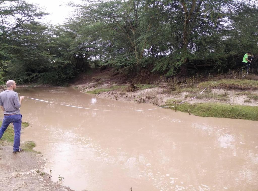
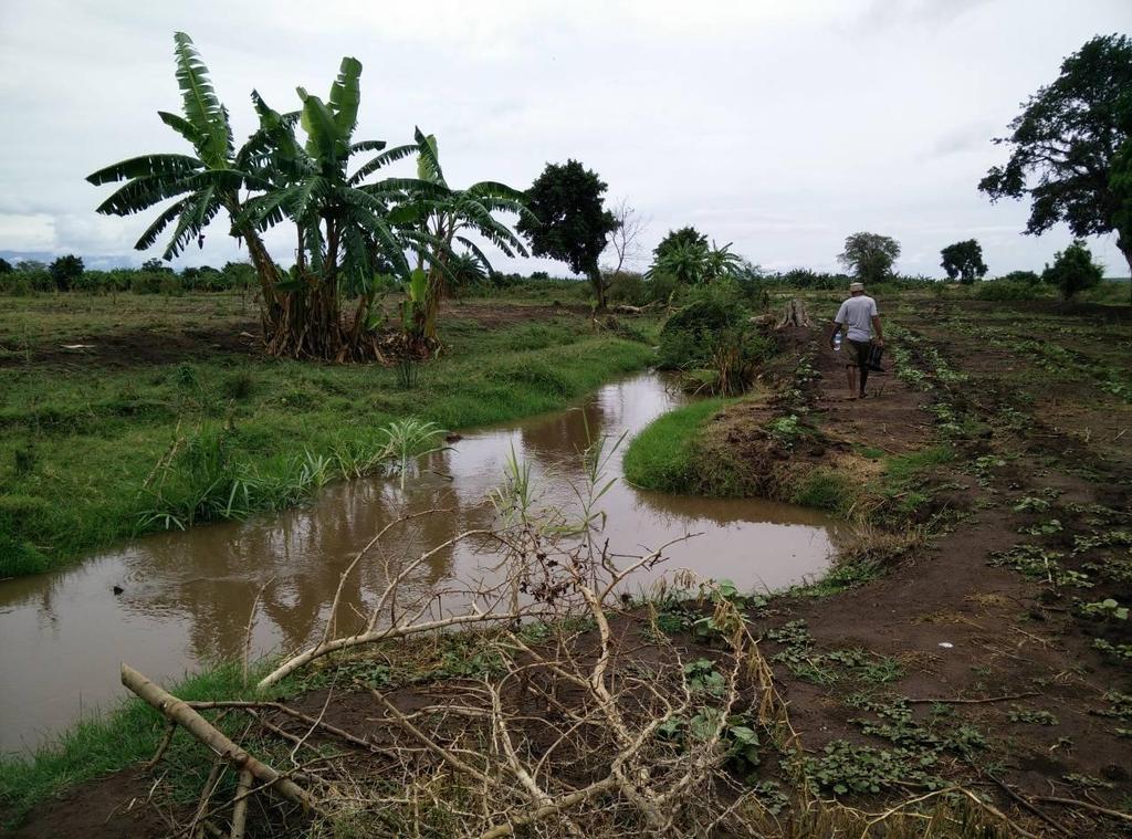
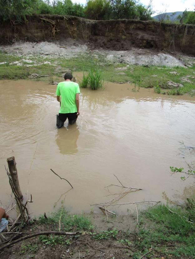
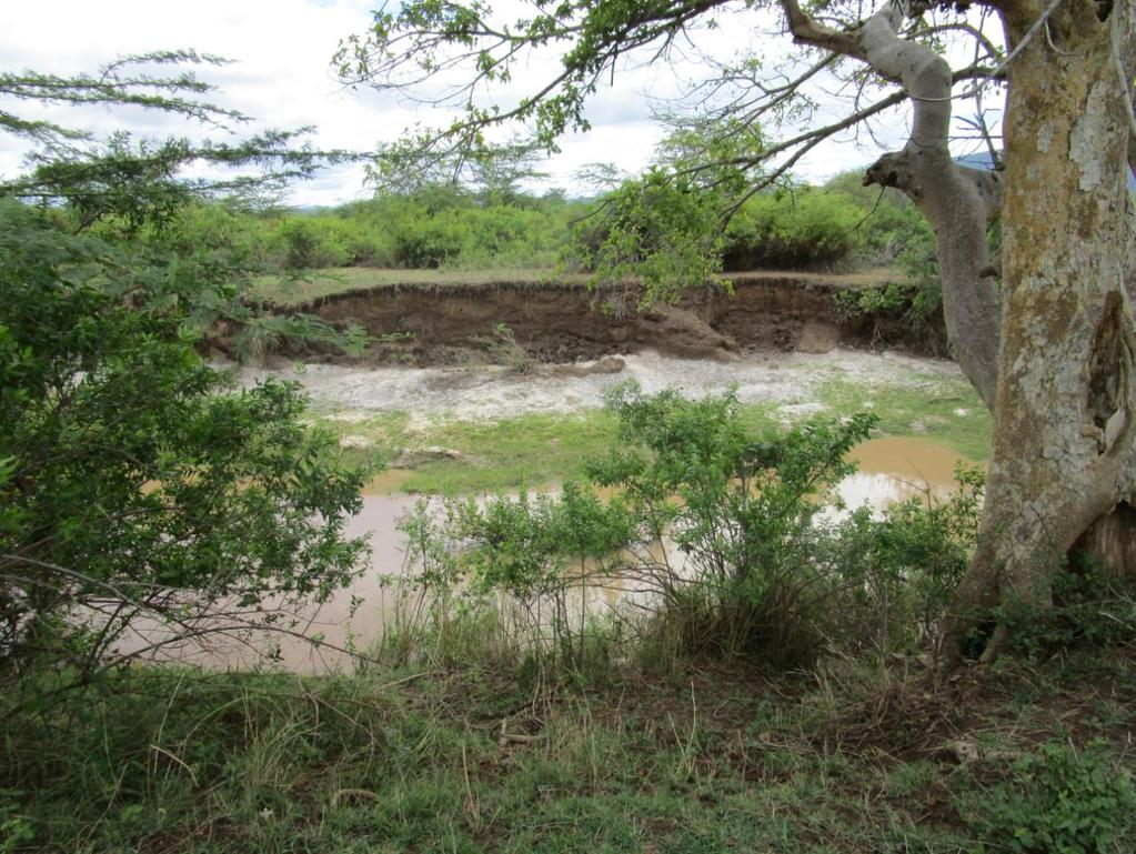
1 Exploring Kikuletwa South Tour with James (FTK) to the Kikuletwa (S) and Chem Chem region On 2 December 2014 the plan was to visit Chem Chem and get to know more about the flooding extent over there. Unfortunately the road was blocked by a high water level because of heavy rains the night before. Thus it was decided to explore the Kikuletwa and try to find the point where the Kikuletwa transforms from a small channel to a wide one. James Ashire is the village manager of FT Kilimanjaro. He arranged that a local elderly called Ashraf joined us as our guide. During our trip there were two points of attention: 1. measuring the profile of the small part of the Kikuletwa after the bifurcation of the Ronga and the Kikuletwa. At the point of bifurcation, a small part of the discharge flows in a small channel; the first part of Kikuletwa (S). 2. How far downstream will this small part of the Kikuletwa open up? In the table below the visited locations are presented and those locations are shown in Figure 1. In this report the important waypoints will be discussed one by one. As shown in Table 1. Figure 1: Waypoints 1
2 Table 1: Waypoints WAYPOINT DESCRIPTION 01 River passing Kikuletwa (S) 02 Point of profile measurement Kikuletwa House of our guide:, starting point 05 Stream within the floodplain area, very low- no velocity; no connection with the Kikuletwa River. 06 Small part Kikuletwa river Irrigation channel with banks, manmade; dry 09 Another irrigation channel with bank manmade; dry 10 New constructed road streambed 13 Irrigation channel Village along the Kikuletwa Confluence of the Kikuletwa and Tributarie Kikuletwa (S) 20 Point of measuring Kikuletwa (S) 21 2

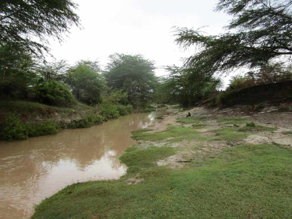
3 1 WAYPOINT 01 RIVER PASSING KIKULETWA After picking up Tamari and the elder named Ashraf at Kiruwani, we arrived at the river passway crossing the Kikuletwa and entering Chem Chem. Because of a lot of rain in the night the water level was unfortunately too high. We could not enter Chem Chem by car. We thus decided to do some measurements and return to Kiruwani were we would try to cross the river. Cornel walked to the other side with his boots and the water almost entered his boots. So we can conclude that the water was somewhat 80 or 90 cm high (at the less deepest location). Table 2: Registration of waypoint 01 LOCATION Crossing kikuletwa to Chem Chem GPS COORDINATE/WAYPOINT NUMBER 01 CURRENT WATER LEVEL (OBSERVATION) 0.9 m deepest. WIDTH OF RIVER CURRENT wide FLOODING PRESENT? yes TYPE OF WATER WAY Slingerend, met vegetatie n=0.045 TYPE OF FLOOD PLAIN Struikgewas n=0.050 BIG ELEVATION DIFFERENCES? No DRY OR WET? Dry 3
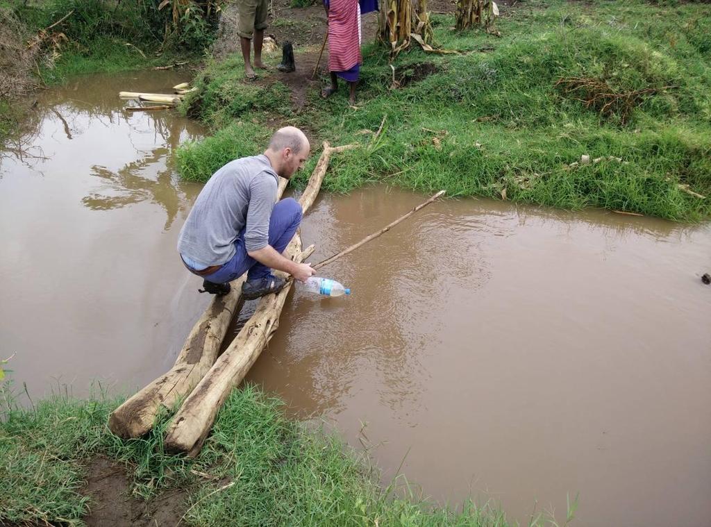
4 DEPTH [M] Chemchem region WAYPOINT 02/03 MEASUREMENT SOUTHWARDS CROSSING AND VELOCITY MEASUREMENT This spot was right after the wide part were you normally can cross the river to Chem Chem. We decided to walk 300 m and do a measurement over there. Ashraf told us that the river from this point was almost the same until the reservoir. We measured the river and it was at its top 26,5 m wide. The river itself was at this moment 8 m wide. The river was too deep to do a depth measurements (no boats were present). The water still had 3.5 m left to rise until it would flood surrounding land. We also performed a velocity measurement (see Table 3: Registration of waypoint 03Table 3). We took 20 meters and measured the following: big piece of wood sec by Jaap and 50.8 sec by Wessel Small piece of wood sec by Jaap and sec by wessel. 4 2 CROSS-SECTION KIKULETWA AT WP= DISTANCE OVER X [M] Figure 2: Cross-section Kikuletwa at wp 03 Table 3: Registration of waypoint 03 LOCATION 200 meters downstream of Chem Chem crossing point GPS COORDINATE/WAYPOINT NUMBER 02 WIDTH OF RIVER CURRENT 8 m FLOODING PRESENT? no WATER LEVEL DURING FLOODING 3,5 +? WIDTH OF RIVER DURING FLOODING 26,5 m TYPE OF WATER WAY Slingerend, met vegetatie n=0.045 TYPE OF FLOOD PLAIN Struikgewas n=0.050 SURFACE VELOCITY 20/( )/4=0.38 m/s HEIGHT OF BANKS LEFT 3.5 m TYPE OF AGRICULTURE Bushes/ none TYPE OF HOUSING - TYPE OF FLORA Trees, bushes BIG ELEVATION DIFFERENCES? yes DRY OR WET? dry 4
5 5
6 3 WAYPOINT 05 MSITUA TEMBO WATER When walking to the Kikuletwa we had to cross a small river coming from the mountains at the Msitua Tembo side. Ashraf said that this small river is not related to the river flooding (in this area). He also told us that during the long floods the water could rise to the treeline just in front of the village. Thus uptil at least this WP. It happens on average twice a year. Even sometimes during the short rains. In the past more trees where present in this area, but they are all used for making charcoal. Table 4: Registration of rivers LOCATION Small river coming from Msitua Tembo mountains/ flood line Kiruani GPS COORDINATE/WAYPOINT NUMBER 05 CURRENT WATER LEVEL (OBSERVATION) ~0.4 m WIDTH OF RIVER CURRENT 4 meter FLOODING PRESENT? yes WATER LEVEL DURING FLOODING Until treeline SURFACE VELOCITY slow BIG ELEVATION DIFFERENCES? no DRY OR WET? wet 6
7 7
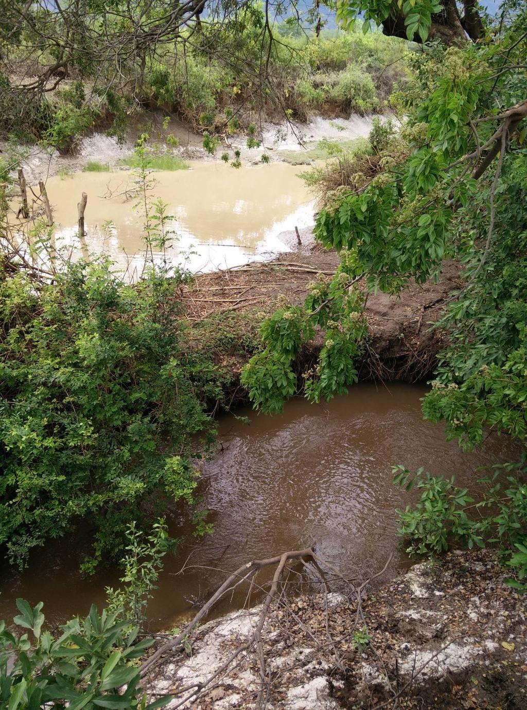
8 DEPTH [M] Chemchem region WAYPOINT 06 KIKULETWA CROSSING After a long walk through wide fields we arrived at the Kikuletwa. It was as narrow as right after the bifurcation point. A cross-sectional profile was derived by use of a log across the river. Also the speed and the E.C. was measured. The E.C. meter gave a value of 947µ Sv and the temperature was 25.4 C. CROSS-SECTION KIKULETWA AT WP=06 1 0,5 Water depth 0-0, , 5 1 1, 5 2 2, 5 3 3, 5 DISTANCE OVER X [M] Figure 3: Cross-section of the Kikuletwa at WP 06 Table 5: Registration of waypoint 06 LOCATION Kikuletwa GPS COORDINATE/WAYPOINT NUMBER 6 CURRENT WATER LEVEL (DEPTH SONAR) 90 cm WIDTH OF RIVER CURRENT 3 m FLOODING PRESENT? no TYPE OF WATER WAY Small creek, straight SURFACE VELOCITY 10/26.73=0.37 m/s DEPTH VELOCITY (0.4*D) 04*0.9=0.36 m/s HEIGHT OF BANKS LEFT 50 cm TYPE OF AGRICULTURE Banana trees TYPE OF FLORA Banana trees, little trees BIG ELEVATION DIFFERENCES? little 8
9 9

10 5 WAYPOINT 08 BRIDGE OVER DRY GULLY After crossing the Kikuletwa we arrived in the Chem Chem area. We arrived at a dry gully. Achraf told us that it was constructed by the villagers to divert water from the Kikuletwa to other land, but unfortunately the gully was too high and the water couldn t flow in. It doesn t flood in this area. Table 6: Registration of rivers LOCATION Dry gully chem chem GPS COORDINATE/WAYPOINT NUMBER 8 CURRENT WATER LEVEL (OBSERVATION) No water FLOODING PRESENT? no WATER LEVEL DURING FLOODING none 10

11 6 WAYPOINT 09 ANOTHER DRY GULLY Walking further we crossed another dry gully. It was a diversion of the gully mentioned at WP 08. This gully was also too high. Ashraf told us that the gully was man made, but it looked like a natural way because it was meandering. Also trees were next to the gully Table 7: Registration of rivers LOCATION Dry gully Chem Chem 2 GPS COORDINATE/WAYPOINT NUMBER 9 CURRENT WATER LEVEL (OBSERVATION) None FLOODING PRESENT? no 7 WAYPOINT 10 ROAD OF CHEM CHEM Walking further we arrived at the newly constructed road in Chem Chem. We asked what the flood reach was and it was told that it was some 200 meters from where we were standing now. Form this waypoint, 45 degrees and 200 meters away the water would come. 11

12 8 WAYPOINT 11 NEWLY DUG GULLY CROSSING THE ROAD We walked along the road and found a newly dug gully. We had seen the gully before when we drove there earlier with Gerbert, but this time it was bigger. Local villagers told us that the water is distracted from the Ronga and led to some rice fields further down. Table 8: Registration of rivers LOCATION Gully crossing the road GPS COORDINATE/WAYPOINT NUMBER 11 CURRENT WATER LEVEL (OBSERVATION) 30 cm WIDTH OF RIVER CURRENT 50 cm FLOODING PRESENT? No TYPE OF WATER WAY (SEE 4.2.3) Small gully 12

13 9 WAYPOINT 12 (OLD?) RIVER BED This point looked very much like an old river bed. It was deeper in the middle, had higher sides and was for a long stretch surrounded by trees. Achraf told us that in the rain season a small amount of water flows through it. It s somewhat 30 meters wide. The old river bed is next to a very wide field with any irrigation channels. The channels are dry now because of the construction of the road, but normally water would flow through. Table 9: Registration of rivers LOCATION Old river bed GPS COORDINATE/WAYPOINT NUMBER 12 CURRENT WATER LEVEL (OBSERVATION) None FLOODING PRESENT? No 13
14 14
 none WIDTH OF RIVER CURRENT 3 m HEIGHT OF BANKS LEFT 40 cm 11 WAYPOINT 14")
15 10 WAYPOINT 13 ANOTHER DRY GULLY This is the same gully we crossed at WP 09. It s 3 meter wide and 40 cm deep. No water is in it. Table 10: Registration of waypoint 13 LOCATION Dry gully GPS COORDINATE/WAYPOINT NUMBER 13 CURRENT WATER LEVEL (OBSERVATION) none WIDTH OF RIVER CURRENT 3 m HEIGHT OF BANKS LEFT 40 cm 11 WAYPOINT 14 VILLAGE MISWAKINI We arrived at a small village called Miswakini which exists of 10 houses. 15

16 12 WAYPOINT 15 THE KIKULETWA We arrived again at the Kikuletwa when walking in between two villages close to each other. The river was partly dammed to divert some water. 16

17 13 WAYPOINT 16 A BRANCH OF THE KIKULETWA This was a branch of the Kikuletwa next to another part of Miswakini village with some houses. It is 1 meter wide and has a slow flow. We asked some local villagers some questions: In the past when the Kikuletwa was bigger it never flooded in this area. We asked them about the case that more water would be flowing through the kikuletwa. Their response was that this would be no problem, the sand dug out could then be used to build small dikes around it. But their concern was with the rice fields downstream. If the water would be to high the water in the rice fields couldn t not be flown through by natural flow. Little weirs should be build then. 14 WAYPOINT 17 IRRIGATION CHANNEL FROM RICEFIELDS An irrigation channel returning from the rice fields. Looks natural. 17
 is diverted away from this branch into another dry branch next to this one. The (dry) branch is 8 meter wide and 1.5 m high.")
18 15 WAYPOINT 18 WIDE DRY BRANCH This is a wide (old) dry branch of the kikuletwa. The water from the previous mentiond irrigation channel (WP 17) is diverted away from this branch into another dry branch next to this one. The (dry) branch is 8 meter wide and 1.5 m high. It has a parabolic profile. Next to the dry branch another branch is present which is 10 m wide and 2 m high. Water flows through it. Table 11: Registration of rivers LOCATION Wide dry branch GPS COORDINATE/WAYPOINT NUMBER 18 18

19 16 WAYPOINT 19 KIKULETWA STREAM This part of the Kikuletwa is surrounded by a lot of treas. The Kikuletwa streams relatively deep compared to ground level (3m). The water from the irrigation channel has already joint the Kikuletwa. From this point on the Kikuletwa gets a wider profile. Table 12: Registration of rivers LOCATION Kikuletwa stream GPS COORDINATE/WAYPOINT NUMBER 19 FLOODING PRESENT? no TYPE OF FLORA Lots of trees 19
20 20
21 DEPTH [M] Chemchem region WAYPOINT 20 MEASUREMENT OF KIKULETWA A few meters downstream of WP 19 measurements were taken. At this point the Kikuletwa gets a wider profile. From the Msitua Tembo side a wide branch joins the Kikuletwa. There is no water flowing through now. But it will just after it rained on the mountains at Msitua Tembo. The river is 5.5 meter wide. The total width of the river bed is 18.4 meter. The river profile is shown below. The river is 0.8 m deep in the middle and can still rise 3 meters. The E.C. meter gives a value of 954 µsv and a temperature of 26.3 C. Also the velocity was measured. At the edge there is a 1.5 meter vertical and then an inclined profile towards the flowing water. CROSS-SECTION KIKULETWA AT WP20 3,5 3 2,5 2 1,5 1 0,5 0-0, DISTANCE OVER X [M] Figure 4: Cross section kikuletwa at wp20 Table 13: Registration of rivers LOCATION Measurement of kikuletwa GPS COORDINATE/WAYPOINT NUMBER 20 CURRENT WATER LEVEL (OBSERVATION) 0.8 m CURRENT WATER LEVEL (DEPTH SONAR) 0.8 m WIDTH OF RIVER CURRENT 5.5. m FLOODING PRESENT? No WATER LEVEL DURING FLOODING? WIDTH OF RIVER DURING FLOODING? SURFACE VELOCITY 20/( )/2=0.34 m/s DEPTH VELOCITY (0.4*D) 0.4*0.8=0.32 m/s HEIGHT OF BANKS LEFT 3 m TYPE OF FLORA trees BIG ELEVATION DIFFERENCES? yes 21
22 22
Tahquamenon River Assessment
 State owned land USFS land Superior Lower Falls USGS Gauging Station Superior Tahquamenon s Belle s Slater s Bass Betty B Dollarville Flooding Eckerman McMillan Mud East Kaks Twin McPhee s Hulbert Hulbert
Introduction to Check Dams
 Introduction to Check Dams Kabul, Afghanistan February 2011 3 This watershed rehabilitation and restoration training was prepared by the U.S. Department of Agriculture (USDA) team of Jon Fripp (Civil Engineer
Broadly speaking, there are four different types of structures, each with its own particular function:
 3 The selection of structures 3.1 Introduction In selecting a suitable structure to measure or regulate the flow rate in open channels, all demands that will be made upon the structure should be listed.
STREAM SURVEY File form No..
 scanned for KRIS THE RESOURCES AGENCY OF CALIFORNIA California Department of Fish and Game STREAM SURVEY File form No.. Date: September 4, 1969. NAME: North Fork Schooner Gulch Creek COUNTY: Mendocino.
Great Lakes Stream Crossing Inventory Instructions
 Great Lakes Stream Crossing Inventory Instructions This document is a guide to completing the Stream Crossing Data Sheet (2/28/11 version). Careful attention to this guidance will ensure consistent crossing
Request Number IR1-12: Flow Passage. Information Request
 Request Number IR1-12: Flow Passage Information Request Provide additional information about the 100 metre flow passage channel scenario between the Westshore Terminals and the proposed Project terminal
Advanced Hydraulics Prof. Dr. Suresh A. Kartha Department of Civil Engineering Indian Institute of Technology, Guwahati
 Advanced Hydraulics Prof. Dr. Suresh A. Kartha Department of Civil Engineering Indian Institute of Technology, Guwahati Module - 4 Hydraulic Jumps Lecture - 1 Rapidly Varied Flow- Introduction Welcome
Components of a Barrage
 Components of a Barrage Definition The only difference between a weir and a barrage is of gates, that is the flow in barrage is regulated by gates and that in weirs, by its crest height. Barrages are costlier
INDIANA REGIONAL GENERAL CONDITIONS FOR THE STATE OF INDIANA
 INDIANA REGIONAL GENERAL CONDITIONS FOR THE STATE OF INDIANA These regional conditions are in addition to but do not supersede the requirements in the Federal Register (Volume 82 No. 4 of January 6, 2017).
THE RESOURCES AGENCY OF CALIFORNIA Department of Fish and Game STREAM SURVEY
 File form No.. Date: 4/1/73. NAME: Maacama Creek COUNTY: Sonoma. STREAM SECTION: FROM: Maacama Creek Ranch TO: Chalk Hill Rd. Bridge LENGTH: 1.5 mi.. Bridge OTHER NAMES: Weather - Clear & Sunny RIVER SYSTEM:
Total Suspended Solids, Stable Flow, and Wet Weather Event Monitoring in the Bass River Watershed. December The Cadmus Group, Inc.
 Total Suspended Solids, Stable Flow, and Wet Weather Event Monitoring in the Bass River Watershed December 2004 The Cadmus Group, Inc. Grand Valley State University Annis Water Resources Institute Submitted
INCREASE METHODS OF DRAINAGE DISCHARGE OF INUNDATED WATER IN LOW FLAT LAND CONSIDERING BED DEFORMATION CHARACTERISTICS
 INCREASE METHODS OF DRAINAGE DISCHARGE OF INUNDATED WATER IN LOW FLAT LAND CONSIDERING BED DEFORMATION CHARACTERISTICS Hiroshi Takebayashi 1, Sornthep Vannarat 2 and Saifhon Tomkratoke 2 1. Disaster Prevention
Fish Habitat Restoration and Monitoring in Southeast Washington. Andy Hill Eco Logical Research, Inc.
 Fish Habitat Restoration and Monitoring in Southeast Washington Andy Hill Eco Logical Research, Inc. Fish Habitat Restoration and Monitoring in Southeast Washington Talk overview: Restoration projects
Rehabilitation of Grimes Creek, a Stream Impacted in the Past by Bucket-lined Dredge Gold Mining, Boise River Drainage, July 2008 to August 2011.
 Rehabilitation of Grimes Creek, a Stream Impacted in the Past by Bucket-lined Dredge Gold Mining, Boise River Drainage, July 2008 to August 2011. Pam Harrington TU,1020 W. Main Street Suite 440, Boise,
HYDRAULIC JUMP AND WEIR FLOW
 HYDRAULIC JUMP AND WEIR FLOW 1 Condition for formation of hydraulic jump When depth of flow is forced to change from a supercritical depth to a subcritical depth Or Froude number decreases from greater
Illinois State Water Survey
 Illinois State Water Survey HYDROLOGY DIVISION SWS Contract Report 508 COMPARISON OF 1987 AND 1989 BED PROFILE SURVEYS OF THE LOWER CACHE RIVER by Richard Allgire Office of Sediment and Wetland Studies
Total Suspended Solids, Stable Flow, and Wet Weather Event Monitoring in the Unnamed Tributary to the Grand River Watershed.
 Total Suspended Solids, Stable Flow, and Wet Weather Event Monitoring in the Unnamed Tributary to the Grand River Watershed December 2004 The Cadmus Group, Inc. Grand Valley State University Annis Water
STRUCTURE S-65 PURPOSE SPILLWAY OPERATION
 STRUCTURE S-65 This structure is a reinforced concrete, gated spillway with discharge controlled by three cable operated, vertical lift gates, and a reinforced concrete lock structure with two pairs of
MONTGOMERY COUNTY, TEXAS AND INCORPORATED AREAS VOLUME 2 OF 6
 MONTGOMERY COUNTY, TEXAS AND INCORPORATED AREAS VOLUME 2 OF 6 COMMUNITY NAME COMMUNITY NUMBER CONROE, CITY OF 480484 CUT AND SHOOT, CITY OF 481279 HOUSTON, CITY OF 480296 MAGNOLIA, CITY OF 481261 MONTGOMERY,
Culvert Design for Low and High Gradient Streams in the Midwest. Dale Higgins, Hydrologist Chequamegon-Nicolet National Forest
 Culvert Design for Low and High Gradient Streams in the Midwest Dale Higgins, Hydrologist Chequamegon-Nicolet National Forest Overview Culvert Design Considerations Hydraulic Terms Culvert Impacts Low
Exercise (3): Open Channel Flow Rapidly Varied Flow
: Open Channel Flow Rapidly Varied Flow") Exercise (3): Open Channel Flow Rapidly Varied Flow 1) A hydraulic jump exists in a trapezoidal channel having a bed width of 7 m and side slope of 1:1. The flowing discharge is 25 m 3 /sec. Construct
Exercise (3): Open Channel Flow Rapidly Varied Flow 1) A hydraulic jump exists in a trapezoidal channel having a bed width of 7 m and side slope of 1:1. The flowing discharge is 25 m 3 /sec. Construct
Fish Habitat Design, Operation and Reclamation Worksheets for
 Fish Habitat Design, Operation and Reclaation Worksheets for Appendix A Project Location Worksheet Applicant Nae: Strea Nae: Watershed Nae: Fish Habitat Suitability Classification Water Quality Zone Operation
reported in stream flow.
 Chicago River Field Trip Activity Summary Students will calculate flow rate and stream flow of a local river. Background Flow rate measures the speed at which water in a river is travelling down the river
STREAM Girls field notebook
 s STREAM Girls field notebook Welcome...... to your stream! Trout Unlimited is excited to offer you and other Girl Scouts the chance to really get to know your home waters. Over the next three days, you
BC Ministry of Forests. March Fish Stream Crossing Guidebook. Forest Practices Code of British Columbia.
 FRST 557 Lecture 7c Bridges and Culverts: Water Velocity and Discharge Lesson Background and Overview: The previous two lessons presented methods for estimating water volume flow at a particular site and
Summary of HEC 18, Evaluating Scour at Bridges FHWA NHI Should really follow HEC 18, but this summary will get you the main points.
 Summary of HEC 18, Evaluating Scour at Bridges FHWA NHI 01-001 Should really follow HEC 18, but this summary will get you the main points. 1: Determine scour analysis variables 2: Analyze long-term bed
Creek Trash Assessment (CTA) Methodology (Demonstration: Mill Run Creek, Cheltenham, Pa.)
 Methodology (Demonstration: Mill Run Creek, Cheltenham, Pa.)") Creek Trash Assessment (CTA) Methodology (Demonstration: Mill Run Creek, Cheltenham, Pa.) Mill Run Creek emerges from a storm sewer in Philadelphia to an open creek in Cheltenham. The Creek downstream
Creek Trash Assessment (CTA) Methodology (Demonstration: Mill Run Creek, Cheltenham, Pa.) Mill Run Creek emerges from a storm sewer in Philadelphia to an open creek in Cheltenham. The Creek downstream
Stevens Creek Corridor
 O F F I C E O F T H E D I R E C T O R O F P U B L I C W O R K S Stevens Creek Corridor Creek Restoration Project Volume Three Project Update: Creek Photos, Before & After BY GAIL SEEDS - PROJECT MANAGER,
STRUCTURE 65-B PURPOSE SPILLWAY OPERATION
 STRUCTURE 65-B This structure is a reinforced concrete, gated spillway with discharge controlled by three cable operated vertical lift gates and a reinforced concrete lock structure with two pairs of sector
Cross-Vane Plan View FIN-UP Habitat Consultants, Inc. 220 Illinois Avenue Manitou Springs, CO (719) P.
 P.") STREAM CHANNEL STRUCTURE DRAWINGS ISIONS W (Channel Width) (Varies) Thalweg & Flow Direction Individually Placed Footer Rocks 5' to 6' by 2' thick (Min. 2 rows of footer rocks placed tightly together with
STREAM CHANNEL STRUCTURE DRAWINGS ISIONS W (Channel Width) (Varies) Thalweg & Flow Direction Individually Placed Footer Rocks 5' to 6' by 2' thick (Min. 2 rows of footer rocks placed tightly together with
DESIGN OF BELL-MOUTH SPILLWAY AT BARVI DAM
 DESIGN OF BELL-MOUTH SPILLWAY AT BARVI DAM Akshay Haldankar 1, Mahesh Bhadra 2, Rahul Harad 3, Darpan Kapre 4, Dipali Patil 5 1,2,3,4 Under graduate,dept. of Civil Engineering, DRIEMS Neral. 5Assistant
Job 1. Title: Estimate abundance of juvenile trout and salmon.
 STUDY PERFORMANCE REPORT State: Michigan Project No.: F-53-R-13 Study No.: 461 Title: Population dynamics of juvenile rainbow trout and coho salmon in Lake Superior tributaries Period Covered: April 1,
Public Notice. Corps File No. LRE Date: March 19, 2017 Expires: March 18, 2022
 US Army Corps of Engineers Detroit District Public Notice Corps File No. LRE-2016-00006-100 Date: March 19, 2017 Expires: March 18, 2022 PUBLIC NOTICE ANNOUNCING REGIONAL CONDITIONS AND WATER QUALITY CERTIFICATIONS
SUMMARY OF MOVEMENT AND HABITAT USED BY TAGGED BROOK TROUT IN THE MAIN BRANCH AND NORTH BRANCH AU SABLE RIVER DURING SUMMER Data Submitted to:
 SUMMARY OF MOVEMENT AND HABITAT USED BY TAGGED BROOK TROUT IN THE MAIN BRANCH AND NORTH BRANCH AU SABLE RIVER DURING SUMMER 2014 Data Submitted to: Anglers of the Au Sable Submitted by: Dr. Mark R. Luttenton
Simulating Streams Through Culverts in Mat-Su, Alaska
 Simulating Streams Through Culverts in Mat-Su, Alaska Project Managers Bill Rice, P.E., USFWS Hydrologist Mary Price, USFWS Fishery Biologist The Team Approach US Fish and Wildlife Service Bill Rice, P.E.,
Pantanal / Taquari project
 Draft Prepared for: Partners for Water Pantanal / Taquari project Report November, 2004 Q3335.00 Prepared for: Partners for Water Pantanal / Taquari project Chris Stolker (WL) Report November, 2004 Contents
HY-8 Version 7.2 Build Date January 17, Federal Highway Administration.
 HY-8 Version 7.2 Build Date January 17, 2012 Federal Highway Administration http://www.fhwa.dot.gov/engineering/hydraulics/software/hy8/index.cfm SIMPLE Simple to use Use for simple culverts and bridges
RIVERS KIDS HOPE AUS. THEMED MENTOR HOUR. Background: Interesting River Facts
 KIDS HOPE AUS. THEMED MENTOR HOUR RIVERS Background: Interesting River Facts The longest river in the world is the Nile River, it reaches around 6650 kilometers in length (4132 miles). More Nile River
Hours / 100 Marks Seat No.
 17421 15116 3 Hours / 100 Seat No. Instructions (1) All Questions are Compulsory. (2) Answer each next main Question on a new page. (3) Illustrate your answers with neat sketches wherever necessary. (4)
SUBMERGED VENTURI FLUME. Tom Gill 1 Robert Einhellig 2 ABSTRACT
 SUBMERGED VENTURI FLUME Tom Gill 1 Robert Einhellig 2 ABSTRACT Improvement in canal operating efficiency begins with establishing the ability to measure flow at key points in the delivery system. The lack
Colusa Basin Drain Watershed Fish Stranding Tour Concept Paper Mike Hendrick and Brycen Swart NMFS
 Colusa Basin Drain Watershed Fish Stranding Tour Concept Paper Mike Hendrick and Brycen Swart NMFS On May 31, 2013 representatives from CDFW, USFWS, and NMFS went on a field tour to look at locations in
Low Gradient Velocity Control Short Term Steep Gradient Channel Lining Medium-Long Term Outlet Control Soil Treatment Permanent [1]
![Low Gradient Velocity Control Short Term Steep Gradient Channel Lining Medium-Long Term Outlet Control Soil Treatment Permanent [1]](/thumbs/80/80811988.jpg "Low Gradient Velocity Control Short Term Steep Gradient Channel Lining Medium-Long Term Outlet Control Soil Treatment Permanent [1]") Check Dams DRAINAGE CONTROL TECHNIQUE Low Gradient Velocity Control Short Term Steep Gradient Channel Lining Medium-Long Term Outlet Control Soil Treatment Permanent [1] [1] Though not generally considered
Check Dams DRAINAGE CONTROL TECHNIQUE Low Gradient Velocity Control Short Term Steep Gradient Channel Lining Medium-Long Term Outlet Control Soil Treatment Permanent [1] [1] Though not generally considered
River Study Fieldwork Sheets
 River Study Fieldwork Sheets Name Date Group Team Site Upper Valley 1 Lower Valley 1 Upper Valley 2 Lower Valley 2 IMPORTANT In order for data to be collected accurately and safely it is vital that you
STUDY PERFORMANCE REPORT
 STUDY PERFORMANCE REPORT State: Michigan Project No.: F-80-R-4 Study No.: 702 Title: Effects of sediment traps on Michigan river channels Period Covered: October 1, 2002 to September 30, 2003 Study Objectives:
TOP:001.3 U.S. Fish and Wildlife Service TECHNICAL OPERATING PROCEDURE
 TOP:001.3 March 12, 2015 U.S. Fish and Wildlife Service Marquette Biological Station 3090 Wright Street Marquette, Michigan 49855 U.S.A. and U.S. Fish and Wildlife Service Ludington Biological Station
Big Spring Creek Habitat Enhancement and Fishery Management Plans
 Big Spring Creek Habitat Enhancement and Fishery Management Plans November 5, 2012 Big Spring Events and Activities Center Newville, PA Charlie McGarrell Regional Habitat Biologist Pennsylvania Fish and
7.Site Note Poders in Labutta Township Labutta North Polder Shansu Sluice Gate - Shansu sluice locates in Labutta (North) polder, it is about 1.5 km n
 polder, it is about 1.5 km n") 7.Site Note Poders in Labutta Township Labutta North Polder Shansu Sluice Gate - Shansu sluice locates in Labutta (North) polder, it is about 1.5 km north direction from Labutta town. - Sluice gate is
7.Site Note Poders in Labutta Township Labutta North Polder Shansu Sluice Gate - Shansu sluice locates in Labutta (North) polder, it is about 1.5 km north direction from Labutta town. - Sluice gate is
Plan B Dam Breach Assessment
 Plan B Dam Breach Assessment Introduction In support of the Local Sponsor permit applications to the states of Minnesota and North Dakota, a dam breach analysis for the Plan B alignment of the Fargo-Moorhead
Ermenek Dam and HEPP: Spillway Test & 3D Numeric-Hydraulic Analysis of Jet Collision
 Ermenek Dam and HEPP: Spillway Test & 3D Numeric-Hydraulic Analysis of Jet Collision J.Linortner & R.Faber Pöyry Energy GmbH, Turkey-Austria E.Üzücek & T.Dinçergök General Directorate of State Hydraulic
REPORT TO THE MINISTER OF NATURAL RESOURCES. Pursuant to an appointment made by the Honourable Frank S. Miller, Minister of Natural
 Room 569, Fifth Floor, Mowat Block, Queen's Park, Toronto, Ontario. M7A la2 IN THE MATTER OF The Lakes and Rivers Improvement Act; AND IN THE MATTER OF An application by Rudolph Adam for approval under
USING A LABYRINTH WEIR TO INCREASE HYDRAULIC CAPACITY. Dustin Mortensen, P.E. 1 Jake Eckersley, P.E. 1
 USING A LABYRINTH WEIR TO INCREASE HYDRAULIC CAPACITY Dustin Mortensen, P.E. 1 Jake Eckersley, P.E. 1 Plum Creek Floodwater Retarding Structure No. 6 is located in an area of Kyle, Texas, that is currently
LESOTHO HIGHLANDS DEVELOPMENT AUTHORITY
 LESOTHO HIGHLANDS DEVELOPMENT AUTHORITY FLOW RELEASES DOWNSTREAM OF THE LESOTHO HIGHLANDS WATER PROJECT (LHWP) STRUCTURES (April 2003 to September 2003) TOWER ON MALIBAMATŠO RIVER @ KAO MARCH 2004 OPERATIONS,
Minnesota Department of Natural Resources Division of Fish and Wildlife Section of Fisheries. Fairhaven Creek 2000
 Minnesota F-29-R(P)-17 Area 340 Study 3 April 2001 Minnesota Department of Natural Resources Division of Fish and Wildlife Section of Fisheries Stream Survey Report Fairhaven Creek 2000 By Eric R. Altena
Climate Change Adaptation and Stream Restoration. Jack Williams;
 Climate Change Adaptation and Stream Restoration Jack Williams; jwilliams@tu.org 1 Goals for this presentation Develop strategies for adapting streams to climate impacts by Thinking like a watershed Understanding
NOVEMBER 2006 FLOOD DOWNSTREAM OF THE KATSE DAM STRUCTURE
 THE LESOTHO HIGHLANDS DEVELOPMENT AUTHORITY (LHDA) NOVEMBER 2006 FLOOD DOWNSTREAM OF THE KATSE DAM STRUCTURE Effects of the November 2006 Flood THE DAMAGE CAUSED BY THE FLOOD AS IT PROPAGATES DOWNSTREAM
The speed of an inline skater is usually described in meters per second. The speed of a car is usually described in kilometers per hour.
 The speed of an inline skater is usually described in meters per second. The speed of a car is usually described in kilometers per hour. Speed How are instantaneous speed and average speed different? Average
ANSWERS TO QUESTIONS IN THE NOTES AUTUMN 2018
 ANSWERS TO QUESTIONS IN THE NOTES AUTUMN 2018 Section 1.2 Example. The discharge in a channel with bottom width 3 m is 12 m 3 s 1. If Manning s n is 0.013 m -1/3 s and the streamwise slope is 1 in 200,
Minnesota Department of Natural Resources Division of Fish and Wildlife Section of Fisheries. Stream Survey Report. Luxemburg Creek.
 Minnesota F-29-R(P)-24 Area 315 Study 3 March 2016 Minnesota Department of Natural Resources Division of Fish and Wildlife Section of Fisheries Stream Survey Report Luxemburg Creek 2015 Mark Pelham Sauk
Follow this and additional works at:
 University of Massachusetts Amherst ScholarWorks@UMass Amherst International Conference on Engineering and Ecohydrology for Fish Passage International Conference on Engineering and Ecohydrology for Fish
PROFILE OF SACRAMENTO RIVER, FREEPORT TO VERONA, CALIFORNIA,
 PROFILE OF SACRAMENTO RIVER, FREEPORT TO VERONA, CALIFORNIA, FLOOD OF FEBRUARY 1986 By J.C. Blodgett and J.B. Lucas U.S. GEOLOGICAL SURVEY Open-File Report 88-82 CO CM I m r-h CM Sacramento, California
As temporary grade control facilities along waterways until final stabilization is established.
 Check Dams (CD) EC-12 Description Check dams are temporary grade control structures placed in drainage channels to limit the erosivity of stormwater by reducing flow velocity. Check dams are typically
Annex E Bridge Pier Protection Plan
 Annex E Bridge Pier Protection Plan Table E1 Bridge Types and Locations Table E2 Flow Conditions For River Sections Figure E1 Bridge Abutment Protection Figure E2 Bridge Pier Protection Figure E3 Central
Rock Ramp Design Guidelines. David Mooney MS Chris Holmquist-Johnson MS Drew Baird Ph.D. P.E. Kent Collins P.E.
 Rock Ramp Design Guidelines David Mooney MS Chris Holmquist-Johnson MS Drew Baird Ph.D. P.E. Kent Collins P.E. Rock Ramp Design Guidelines OUTLINE Local and System Interactions with Rock Ramps Ramp Geometry
Chinook Salmon Spawning Study Russian River Fall 2005
 Chinook Salmon Spawning Study Russian River Fall 2005 Sonoma County Water Agency 2150 West College Avenue Santa Rosa, California 95401 Prepared by David Cook - Senior Environmental Specialist March 27,
The Effects of Stream Adjacent Logging on Downstream Populations of Coastal Cutthroat Trout
 The Effects of Stream Adjacent Logging on Downstream Populations of Coastal Cutthroat Trout. D. S. Bateman 1, R.E. Gresswell 2, Aaron M. Berger 3, D.P. Hockman-Wert 4 and D.W. Leer 1 1 Department of Forest
EXTENT OF OBSERVATION
 scanned for KRIS THE RESOURCES AGENCY OF CALIFORNIA Department of Fish and Game STREAM SURVEY Date: May 25 and 31, 1977. NAME: Unnamed Stream (Tributary to Sonoma Creek) COUNTY: Sonoma. STREAM SECTION:
Thomson River Basin May 2013
 Thomson River Basin May 2013 Introduction Southern Rural Water is the water corporation responsible for administering and enforcing the Thomson River Basin Local Management Plan (LMP). The purpose of the
Suitable Applications Check dams may be appropriate in the following situations: To promote sedimentation behind the dam.
 Categories EC Erosion Control SE Sediment Control TC Tracking Control WE Wind Erosion Control Non-Stormwater NS Management Control Waste Management and WM Materials Pollution Control Legend: Primary Category
Blue River Restoration Project
 Blue River Restoration Project Blue River Restoration Project BUI LDI NG BRI DGES BETWEEN COMMUNI TI ES I N COOPERATI ON WI TH THE NATI ONAL FOREST FOUNDATI ON The Blue River Restoration project is an
WMS 8.4 Tutorial Hydraulics and Floodplain Modeling HY-8 Modeling Wizard Learn how to model a culvert using HY-8 and WMS
 v. 8.4 WMS 8.4 Tutorial Hydraulics and Floodplain Modeling HY-8 Modeling Wizard Learn how to model a culvert using HY-8 and WMS Objectives Define a conceptual schematic of the roadway, invert, and downstream
Encampment River-Elk River drainage divide area landform origins along USA Missouri River drainage basin landform origins research project
 10/5/12 7:30 PM Encampment River-Elk River drainage divide area landform origins along the continental divide in the Wyoming and Colorado Sierra Madre Mountains and Park Range, USA October 5, 2012! Colorado,
OPEN CHANNEL FLOW WORKSHEET 3 WATER SURFACE PROFILES
 Learning Objectives OPEN CHANNEL FLOW WORKSHEET 3 WATER SURFACE PROFILES 1. Learn about gradually varied flow and rapidly varying flow 2. Discuss different types of water surface profiles 3. Discuss the
Assignment 1 Unit 3 Work, Power, Efficiency, and Potential Energy Name: Multiple Choice. Show workings where necessary.
 Assignment 1 Unit 3 Work, Power, Efficiency, and Potential Energy Name: Multiple Choice. Show workings where necessary. 1. In which situation is work not done? A) a frozen turkey is carried upstairs B)
Study Update Tailrace Slough Use by Anadromous Salmonids
 Study Update Tailrace Slough Use by Anadromous Salmonids Goals and Objectives Identify what anadromous salmonids use the tailrace slough by: Life Stage (Juvenile, migrating and spawning adults) Timing
CHAPTER 3 TEST REVIEW
 AP PHYSICS Name: Period: Date: DEVIL PHYSICS BADDEST CLASS ON CAMPUS 50 Multiple Choice 45 Single Response 5 Multi-Response Free Response 3 Short Free Response 2 Long Free Response AP EXAM CHAPTER TEST
Assessment of Baseline Geomorphic Features at. Proposed Stream Crossings On The Proposed County Road 595. Marquette County, Michigan
 Assessment of Baseline Geomorphic Features at Proposed Stream Crossings On The Proposed County Road 595 Marquette County, Michigan Prepared for: Kennecott Eagle Minerals Company Marquette, Michigan Prepared
At the nature park. 1 Look, listen and repeat. $ Look and correct the words in blue. 3 Point to the picture. Ask and answer.
 1 At the nature park Lesson 1 1 Look, listen and repeat. $ 1.3 2 1 3 4 5 6 7 8 1 a steep hill 2 a wide river 3 a high waterfall 4 a narrow stream 5 a dark cave 6 a long bridge 7 a small island 8 a deep
Redd Dewatering and Juvenile Salmonid Stranding in the Lower Feather River,
 Redd Dewatering and Juvenile Salmonid Stranding in the Lower Feather River, 2005-2006 Interim Report for NOAA Fisheries Prepared by: California Department of Water Resources Division of Environmental Services
EXAMPLES (OPEN-CHANNEL FLOW) AUTUMN 2018
 AUTUMN 2018") EXAMPLES (OPEN-CHANNEL FLOW) AUTUMN 2018 Normal and Critical Depths Q1. If the discharge in a channel of width 5 m is 20 m 3 s 1 and Manning s n is 0.02 m 1/3 s, find: (a) the normal depth and Froude number
EXAMPLES (OPEN-CHANNEL FLOW) AUTUMN 2018 Normal and Critical Depths Q1. If the discharge in a channel of width 5 m is 20 m 3 s 1 and Manning s n is 0.02 m 1/3 s, find: (a) the normal depth and Froude number
Blue River Restoration Project William D. Linfield, P.E.
 Blue River Restoration Project William D. Linfield, P.E. 1 2 3 4 5 Blue River Restoration Project BUILDING BRIDGES BETWEEN COMMUNITIES IN COOPERATION WITH THE NATIONAL FOREST FOUNDATION Building Bridges
Hydrographic Surveying Methods, Applications and Uses
 Definition: Hydrographic Surveying Methods, Applications and Uses It is the branch of surveying which deals with any body of still or running water such as a lake, harbor, stream or river. Hydrographic
CEE 345, Part 2, Winter 2012, Final Exam Solutions (Open Channel Flow)
") CEE 45, Part, Winter 0, Final Exam Solutions (Open Channel Flow). (a) (8) List and briefl describe the forces that must be considered in an analsis of flow in a trapezoidal channel with a slope of 0.006.
CEE 45, Part, Winter 0, Final Exam Solutions (Open Channel Flow). (a) (8) List and briefl describe the forces that must be considered in an analsis of flow in a trapezoidal channel with a slope of 0.006.
Appendix A Photo Set
 Appendix A Photo Set Fish Habitat Inventory, Mattamy Richmond Lands, Spring 2009 Submitted To: Susan Murphy Mattamy Homes 123 Huntmar Drive Ottawa, Ontario K2S 1B9 KILGOUR & ASSOCIATES LTD. 1500 Bank Street,
Motion in 1 Dimension
 A.P. Physics 1 LCHS A. Rice Unit 1 Displacement, Velocity, & Acceleration: Motion in 1 Dimension In-Class Example Problems and Lecture Notes 1. Freddy the cat started at the 3 meter position. He then walked
Irrigation &Hydraulics Department lb / ft to kg/lit.
 CAIRO UNIVERSITY FLUID MECHANICS Faculty of Engineering nd Year CIVIL ENG. Irrigation &Hydraulics Department 010-011 1. FLUID PROPERTIES 1. Identify the dimensions and units for the following engineering
Hydraulic Modeling of Stream Enhancement Methods
 Hydraulic Modeling of Stream Enhancement Methods Matthew J. Curry John J. Levitsky Abstract Development within watersheds increases the amounts of runoff causing stream erosion and degradation of stream
Packwood Hydroelectric Project Barrier Analysis December 12, 2006
 Packwood Hydroelectric Project Barrier Analysis December 12, 2006 Study Area Natural barriers to upstream fish passage on Lake Creek at RM 1.03 and RM 1.95 Snyder Creek culvert under the Project tailrace
Unravelling Rivers. This pack consists of activity sheets for individual and group work, and whiteboard pictures for class discussion.
 Unravelling Rivers This pack consists of activity sheets for individual and group work, and whiteboard pictures for class discussion. Teacher guidance notes can be downloaded here. What do you know about
Cornwell brook Cornwell Manor
 Cornwell brook Cornwell Manor An Advisory Visit by the Wild Trout Trust February 2014 1 1. Introduction This report is the output of a Wild Trout Trust visit to a tributary of the Cornwell Brook at Cornwell
NWS 44: Mining Activities Location #1, Stanislaus River
 NWS 44: Mining Activities Location #1, Stanislaus River Permit is for the use of a single 8 dredge on a federal mining claim at the location described on the map and as Twp 02N Range 14E, Section 04, MDM
Risk rating. Hazard Risk Likelihood Consequ ences. Who is responsib le for risk control Leader. Examples of Risk Controls
 Hazard Risk Likelihood Consequ ences Bush fire Injury or Moderate (Midsummer - walk in bush or forest for example) cold Frostbite Hypothermia Death in winter or wet conditions Likely in alpine areas and
Section 5: Pond Outlets
 Section : Pond Outlets Defining and calculating pond outlet devices 8 Minutes Press Space, PageDown, or Click to advance. Press PageUp to reverse. Esc to exit. Right-Click for other options. Outlets Introduction
SEDIMENTATION AND NAVIGATION STUDY OF THE LOWER MISSISSIPPI RIVER AT THE WHITE RIVER CONFLUENCE, MILES 603 TO 596 HYDRAULIC MICRO MODEL INVESTIGATION
 Technical Report M7 SEDIMENTATION AND NAVIGATION STUDY OF THE LOWER MISSISSIPPI RIVER AT THE WHITE RIVER CONFLUENCE, MILES 603 TO 596 HYDRAULIC MICRO MODEL INVESTIGATION By David C. Gordon Robert D. Davinroy
Profiles Of Survey Maps 45/D7 and 45/D10
 Profiles Of Survey Maps 45/D7 and 45/D10 PROFILE OF SURVEY MAP 45 D/7DESCRIPTION of the Area covered by Survey Sheet No. 45 D/7 (Gujarat and Rajasthan) District : Banas Kantha and Sirohi Location: Latitude
3. GRADUALLY-VARIED FLOW (GVF) AUTUMN 2018
 AUTUMN 2018") 3. GRADUALLY-VARIED FLOW (GVF) AUTUMN 2018 3.1 Normal Flow vs Gradually-Varied Flow V 2 /2g EGL (energy grade line) Friction slope S f h Geometric slope S 0 In flow the downslope component of weight balances
3. GRADUALLY-VARIED FLOW (GVF) AUTUMN 2018 3.1 Normal Flow vs Gradually-Varied Flow V 2 /2g EGL (energy grade line) Friction slope S f h Geometric slope S 0 In flow the downslope component of weight balances
Dam Breach Inundation Analysis
 Dam Breach Inundation Analysis Using HEC-RAS And GIS TWO CASE STUDIES IN BRITISH COLUMBIA, CANADA Canadian Dam Association 2014 Conference - Banff Alberta Presenters 2 Dwayne Meredith, P.Ag. KWL Vernon
Aquatic Organism Passage at Road-Stream Crossings CHUCK KEEPORTS FOREST HYDROLOGIST ALLEGHENY NATIONAL FOREST WARREN, PENNSYLVANIA
 Aquatic Organism Passage at Road-Stream Crossings CHUCK KEEPORTS FOREST HYDROLOGIST ALLEGHENY NATIONAL FOREST WARREN, PENNSYLVANIA TOPICS COVERED Aquatic Organism Passage (AOP) Benefits of AOP Crossings
Geography of the Lower Fitzroy and navigation problems
 Geography of the Lower Fitzroy and navigation problems A topographic map of the Fitzroy estuary readily indicates why the Fitzroy River has proved difficult for shipping to negotiate. The river meanders
Level 2: River Module
 National Water Safety Management Programme Level 2: River Module Safeguarding lives in, on and near water This resource is the approved material for the RLSS UK s National Water Safety Management Programme
Highland Region MAP. No. 11 St. Marys River No. 12 West River No. 13 Wallace River No. 14 Toney River No. 15 Northumberland Strait
 Highland Region MAP No. 11 St. Marys River No. 12 West River No. 13 Wallace River No. 14 Toney River No. 15 Northumberland Strait 14 Route: No. 11 St. Marys River Rating: Intermediate Advanced Length: