OYSTER REEF RESTORATION; RESTORING ECOLOGICAL FUNCTION
|
|
|
- Peter Reeves
- 5 years ago
- Views:
Transcription
1 OYSTER REEF RESTORATION; RESTORING ECOLOGICAL FUNCTION Paul Jensen, David Buzan, and Ka-Leung Lee; Atkins Mark Dumesnil and Julie Sullivan; The Nature Conservancy
2 Presentation Overview The Nature Conservancy restoration programs The selection of Halfmoon Reef Events influencing the Reef Changes in freshwater inflow Navigation channel and salinity Commercial oyster dredging Major storms Design Construction and Status

3 Oyster Reef Restoration Online Newsletter
4


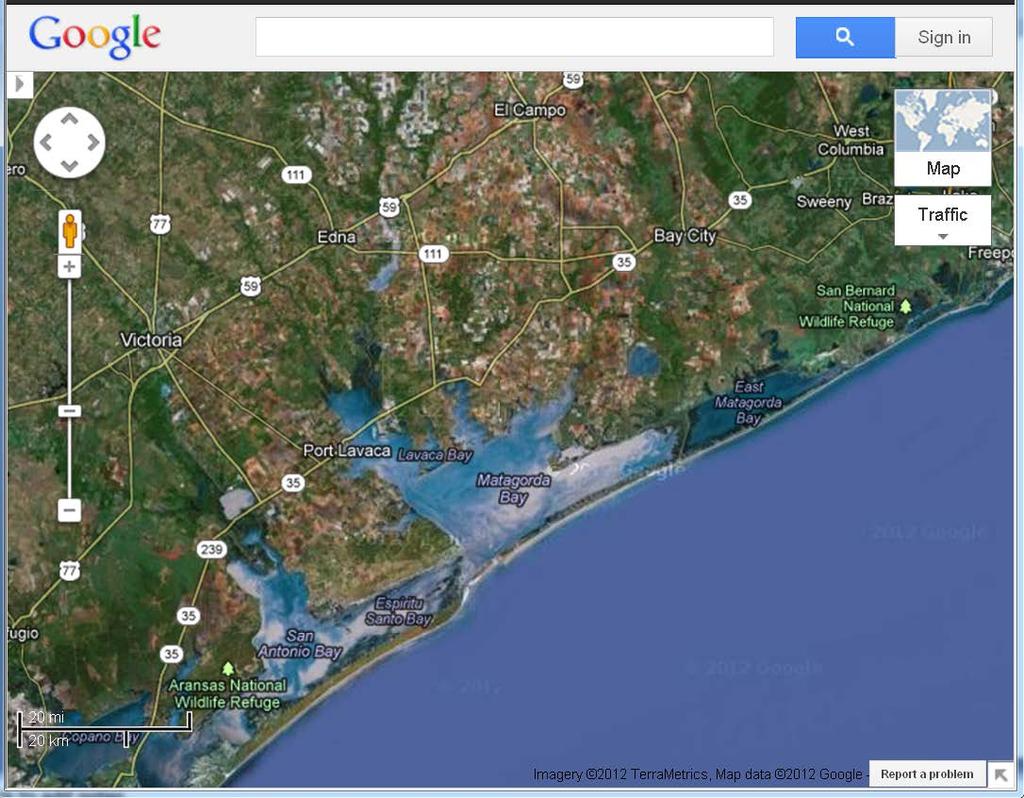
5 Halfmoon Reef in acres Halfmoon Reef Mad Island Reef Shell Reef Dog Island Reef 1905 Moore Survey
6 Major Changes in Reef From 1905 Moore Survey the reef was exposed at low water Before Civil War, the Port of Matagorda was reported to be the second largest port in Texas, after Galveston Halfmoon Reef was a major factor in navigation as well as oysters
7 Changes in Colorado River Inflow Locations The Colorado River mouth has moved extensively In Texas first century ( ) it discharged to Matagorda Bay For the next 50 years it went directly to the Gulf It has now been moved back to the Bay
8 Changes in River Flows Major impoundments on Colorado River built between Lavaca River impounded by 1980 Increasing agricultural, municipal and industrial water use
9 Harvesting Until 1920s tonging and dredging under sail were primary methods Internal combustion engines increased harvesting power Greater distribution range increased demand In some cases oyster shell dredging was done, but not certain for Halfmoon
10 Other Physical Changes Matagorda Ship Channel in early 1960s increased tidal exchange and salinities increased by about 5 ppt River diversion back into Matagorda Bay, River diversion project included rebuilding oyster reefs, 1994

11 Halfmoon Reef Restoration Shell Reef Halfmoon Reef Sammy s Reef Mad Island Reef Matagorda Bay Gulf of Mexico

12 1935 bathymetry (Source: NOAA Nautical Chart 11317, edition date July 1975

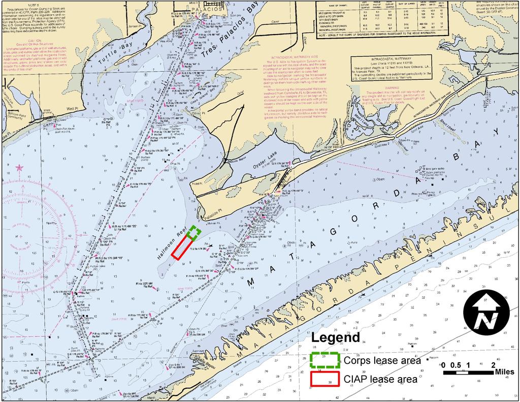
13 1992 bathymetry (Source: NOAA Nautical Chart On-Line Viewer, accessed 4/26/11, Chart 11317, edition date March 2009


14 Halfmoon Reef Restoration Shell Hash Hard Sand Mud 2009/2011 Surveys Shell Hash

15 Long-Term Ideal Restore Halfmoon Reef as close to 1905 condition as practical
16 Project Design Objectives TNC Minimums 12.7 ac w/ 20% coverage, 2 ft high after 2 years Habitat objectives maximize edge length and vertical relief, and spatial variability in size of openings and distance between rows Minimize sedimentation potential Basics stability, construction simplicity, cost minimization
17 Design Aspects Considered Materials Reef Height Row Spacing Angular Orientation Tidal Currents Material Size Distribution for Habitat and Wave Forces Construction Methods Field Experience
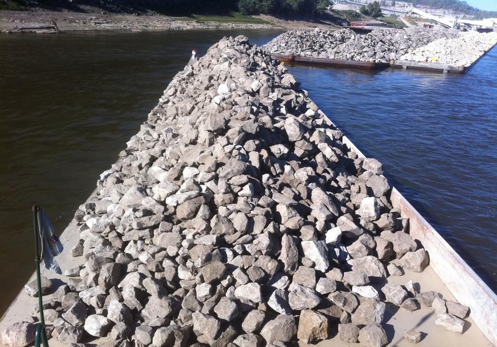
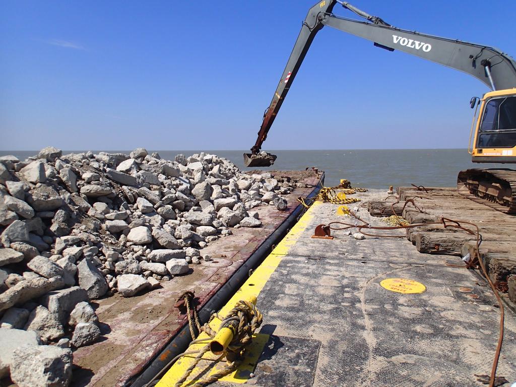
18 Design Decisions Limestone or recycled Concrete acceptable Size Range: 6 to 30, median 12 Rows 3 high, 18 wide and 650 long Spaced 30, 60 and 90 -as many as funds allow Two funds: CIAP and Federal PPA, requiring separate Plans and Specs
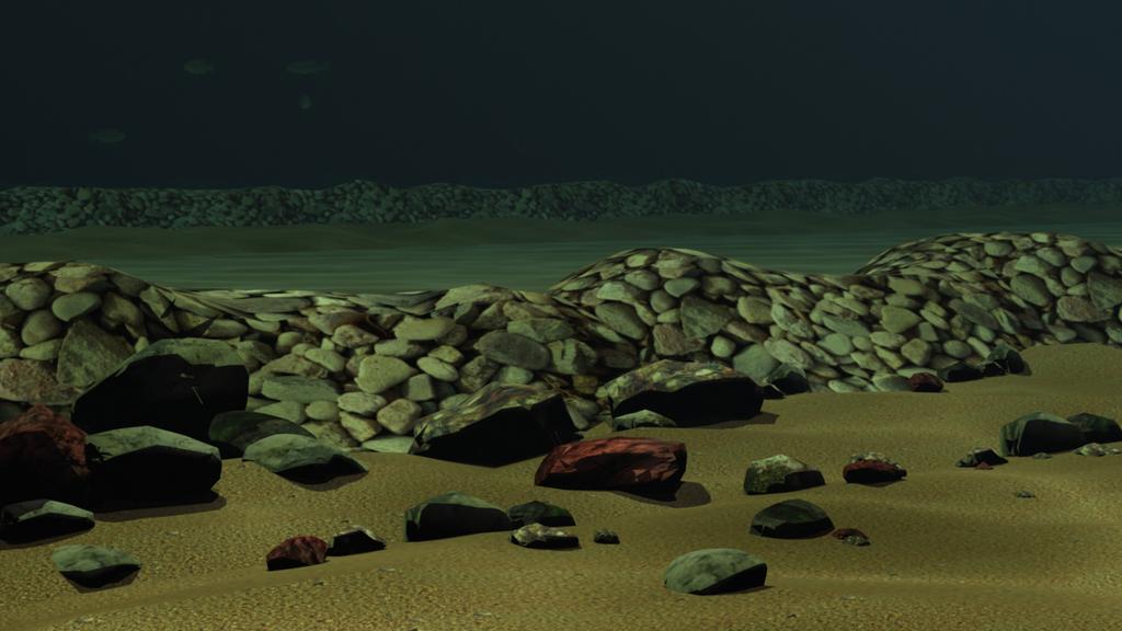
19
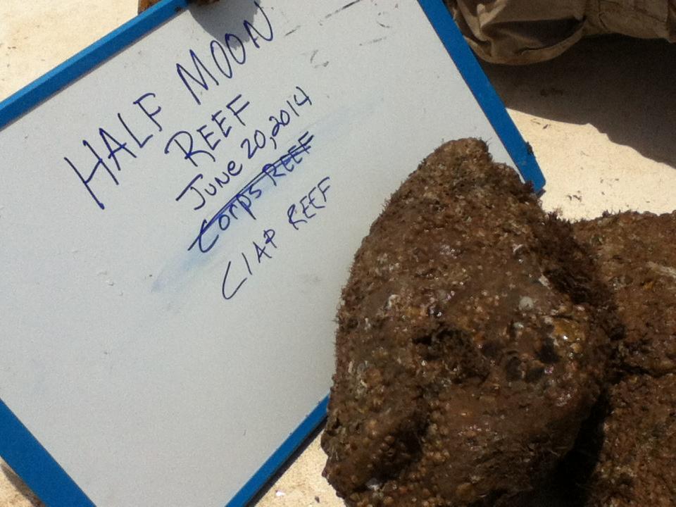
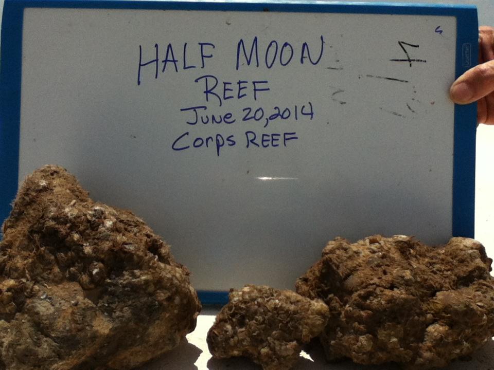
20 CIAP and Corps Reef Rows
21 CIAP Project Luhr Bros. Tower Rock won CIAP Project 26 Rows Notice to Proceed Sept. 16, 2013 Construction Oct. 18 to Dec. 3, 2013 Final As-Built Survey received Feb. 10, 2014

22 Tower Rock Material Production

23 Reef Rock Loading - Barge 4
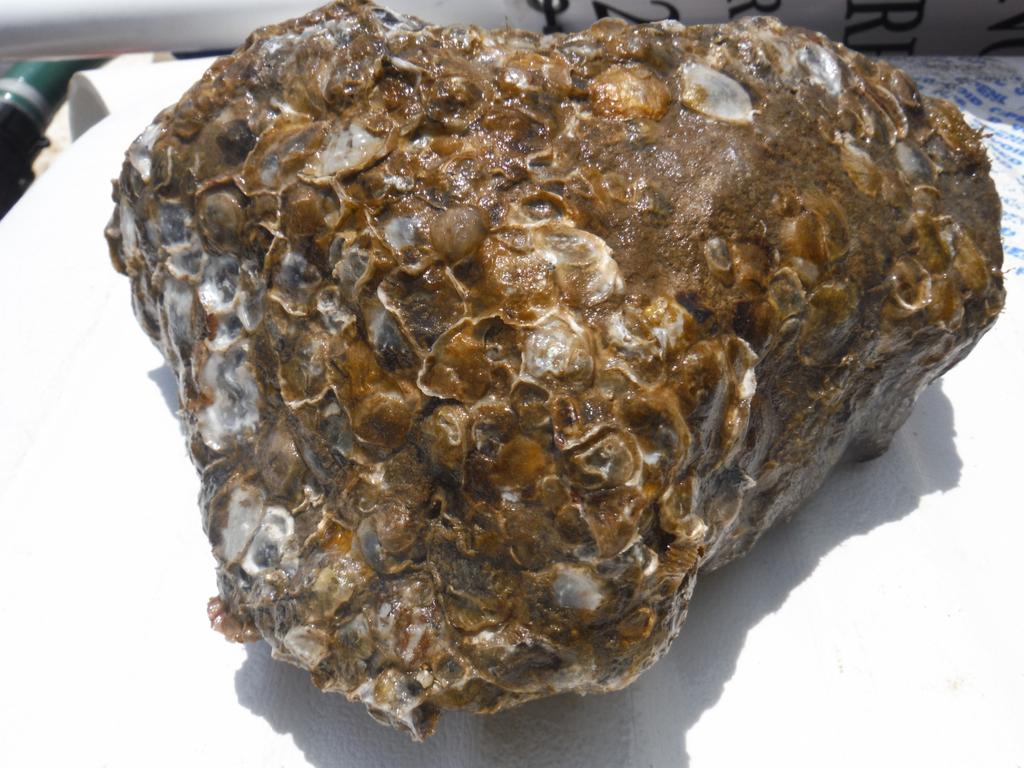
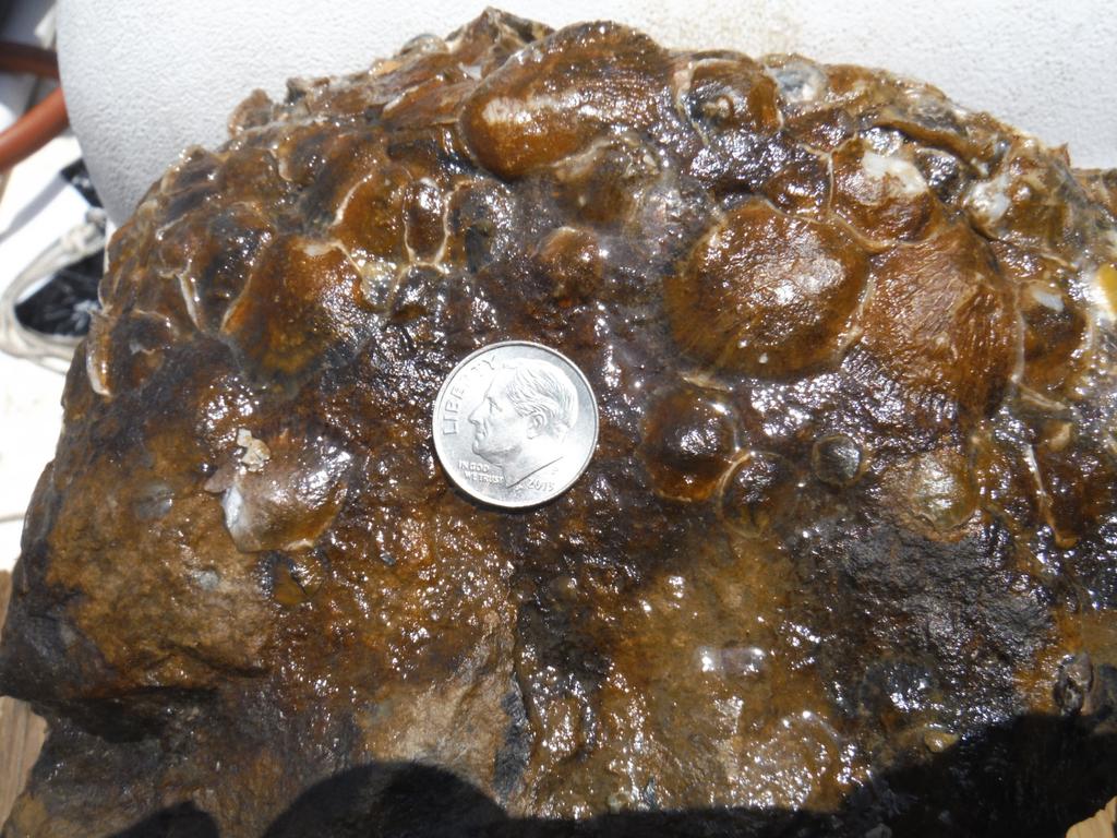
24 Barge 4
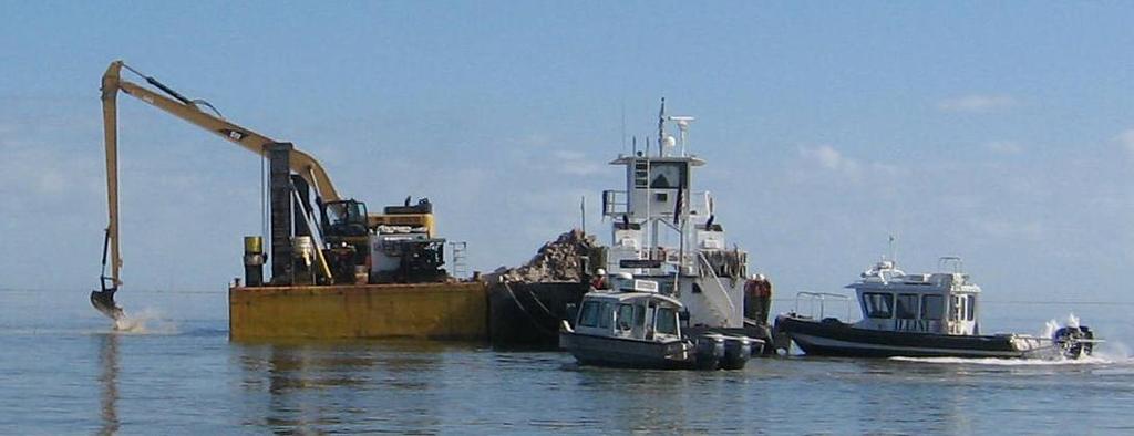
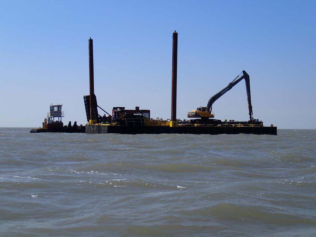
25 Luhr Bros Construction

26 Rock Placement
27 Corps Project RLB Construction had winning bid 6 Rows constructed using recycled concrete Feb. 25, 2014 RLB begins construction April 12, 2014 complete construction

28 Recycled Concrete w/ no Rebar
29
30
31 INITIAL FINDINGS Timing matters CIAP rows: barnacles and bryzoans with some spat Corps rows: good spat set Shell between rows also has good spat set Fish are attracted to all rows and area popular with fishing guides
32
33
34
35

36 Shell Between CIAP Rows
37 Follow-on Work TNC has contracted for longer term monitoring and studies to include: Colonization by mollusks, fishes and other reef species Sedimentation and substrate settlement Community health relative to surrounding areas
38 Questions
Message from the President. The Strand Line
 T E X A S C H A P T E R A M E R I C A N S H O R E & B E A C H P R E S E R V A T I O N A S S O C I A T I O N The Strand Line Volume 6, Issue 2 Summer 2012 Message from the President The meeting in Port
SARASOTA BAY ESTUARY PROGRAM OYSTER HABITAT MONITORING RESULTS: YEAR 1. Jay R. Leverone
 SARASOTA BAY ESTUARY PROGRAM OYSTER HABITAT MONITORING RESULTS: YEAR 1 by Jay R. Leverone Mote Marine Laboratory 1600 Ken Thompson Parkway Sarasota, Fl 34236 to Gary Raulerson Sarasota Bay Estuary Program
BAYKEEPER. Utilizing Volunteers in Baykeeper s Oyster Restoration Program
 NY/NJ BAYKEEPER Utilizing Volunteers in Baykeeper s Oyster Restoration Program Meredith Comi, Oyster Restoration Program Director Hooked on our Waters October 19, 2013 Baykeeper s Mission PROTECT, PRESERVE,
Follets Island Nearshore Beach Nourishment Project
 Coast & Harbor Engineering A division of Hatch Mott MacDonald Follets Island Nearshore Beach Nourishment Project Arpit Agarwal, P.E. April 1, 2016 Project Site!"#$% &'(% &)*+% )#,'-+% Shoreline Erosion
Living Shorelines. Created by: JoAnn Moody & Tina Miller-Way Discovery Hall Programs Dauphin Island Sea Lab
 Living Shorelines Created by: JoAnn Moody & Tina Miller-Way Discovery Hall Programs Dauphin Island Sea Lab Living Shorelines Subject: Life Science Grade Level: 6 th -8 th Time Required: 60 min Key Terms:
STATUS REPORT FOR THE SUBMERGED REEF BALL TM ARTIFICIAL REEF SUBMERGED BREAKWATER BEACH STABILIZATION PROJECT FOR THE GRAND CAYMAN MARRIOTT HOTEL
 August 23 STATUS REPORT FOR THE SUBMERGED REEF BALL TM ARTIFICIAL REEF SUBMERGED BREAKWATER BEACH STABILIZATION PROJECT FOR THE GRAND CAYMAN MARRIOTT HOTEL performed by Lee E. Harris, Ph.D., P.E. Consulting
Deadman s Island Appreciation for past, present and future. Project Manager- Heather Reed Ecological Consulting Services Inc.
 Deadman s Island Appreciation for past, present and future Project Manager- Heather Reed Ecological Consulting Services Inc. Deadman s Island Rare Gem 1743 1698 1742 18 th Century Used by the Spanish and
SA New Trial Artificial Reef Project
 BACKGROUND PAPER SA New Trial Artificial Reef Project Development of options for the trial artificial reef 1. Summary CONTENTS Each year, an estimated 236,000 South Australians participate in recreational
Living Shorelines Non-structural Erosion Control Practices Rhode Island Land & Water Summit, 2014
 Living Shorelines Non-structural Erosion Control Practices Rhode Island Land & Water Summit, 2014 D. Steven Brown (1) Kevin Ruddock (1) Rhonda Smith (2) The Nature Conservancy United States Fish and Wildlife
Indian River Lagoon: Lessons, Challenges and Opportunities
 Indian River Lagoon: Lessons, Challenges and Opportunities Upper Chain of Lakes Lake Kissimmee Kissimmee River Indian River Lagoon Caloosahatchee Estuary Lake Okeechobee St. Lucie Estuary Mark Perry, Executive
Nicholas Brown. 31 Bennett Rd Wolfeboro NH Application submitted
 Nicholas Brown 31 Bennett Rd Wolfeboro NH 03894 603-856-5454 Nick4634@gmail.com Application submitted 8-12-2017 Description of proposed project A. General Methodology The site located approximately 600
Evaluation of Placement Alternatives for Matagorda Ship Channel Bottleneck Removal
 Evaluation of Placement Alternatives for Matagorda Ship Channel Bottleneck Removal James Rosati III Ashley E. Frey CPT Grays Harbor, WA Wood Wood chips Flour Other CMS Shark River Inlet, NJ US Army Corps
IF YOU BUILD IT THEY WILL COME
 IF YOU BUILD IT THEY WILL COME Delaware s Artificial Reef Program is funded under the Federal Aid in Fisheries Restoration Act by the Delaware Division of Fish and Wildlife ABOUT THE COVER The tugs Fels
Advancing the Gulf of Mexico Shellfish Initiative (GoMexSI)
") Advancing the Gulf of Mexico Shellfish Initiative (GoMexSI) Gulf States Marine Fisheries Commission Mississippi-Alabama Sea Grant Consortium Gulf States Marine Fisheries Commission Annual Meeting March
Advancing the Gulf of Mexico Shellfish Initiative (GoMexSI) Gulf States Marine Fisheries Commission Mississippi-Alabama Sea Grant Consortium Gulf States Marine Fisheries Commission Annual Meeting March
Carl A. Sepulveda, P.E. Ashley Judith, P.E. Dana Cheney David Casebeer, P.E.
 Oyster Reef Mitigation for the Bayport Ship Channel Improvement Project Western Dredging Association, Dredging Summit & Expo 2015 June 23, 2015 Carl A. Sepulveda, P.E. Ashley Judith, P.E. Dana Cheney David
MEAN LOW TIDE (MLT) to MEAN LOWER LOW WATER (MLLW)
 to MEAN LOWER LOW WATER (MLLW)") MEAN LOW TIDE (MLT) to MEAN LOWER LOW WATER (MLLW) WEDA GULF COAST CHAPTER ANNUAL CONFERENCE Christopher Frabotta Deputy Chief, Operations Division Galveston District Southwestern Division November 16,
MEAN LOW TIDE (MLT) to MEAN LOWER LOW WATER (MLLW) WEDA GULF COAST CHAPTER ANNUAL CONFERENCE Christopher Frabotta Deputy Chief, Operations Division Galveston District Southwestern Division November 16,
Big Bend Oyster Research
 Big Bend Oyster Research Drs. Jennifer Seavey, Bill Pine, & Peter Frederick Department of Wildlife Ecology and Conservation, Institute of Food and Agricultural Sciences, 110 Newins-Ziegler Hall, PO Box
PLAQUEMINES PARISH BARRIER ISLAND RESTORATION & SUSTAINABILITY. MVD/Gulf Coast Regional Dredging Meeting November 5, 2013
 PLAQUEMINES PARISH BARRIER ISLAND RESTORATION & SUSTAINABILITY MVD/Gulf Coast Regional Dredging Meeting November 5, 2013 OVERVIEW 1. Barrier Island Restoration Projects in Plaquemines Parish 2. Plaquemines
National Oceanic and Atmospheric Administration (NOAA)/ Mulberry Phosphate Trustee Council September 12, 2013
/ Mulberry Phosphate Trustee Council September 12, 2013") OYSTER REEF CREATION PROJECT DESIGN AND IMPLEMENTATION IN HILLSBOROUGH BAY, FLORIDA TAMPA BAY REGIONAL PLANNING COUNCIL AGENCY ON BAY MANAGEMENT MEETING National Oceanic and Atmospheric Administration
OYSTER REEF CREATION PROJECT DESIGN AND IMPLEMENTATION IN HILLSBOROUGH BAY, FLORIDA TAMPA BAY REGIONAL PLANNING COUNCIL AGENCY ON BAY MANAGEMENT MEETING National Oceanic and Atmospheric Administration
Conservation and Restoration Florida s Coastal Marshes: An Overview of MESS. Jeff Beal, Kent Smith, Erin McDevitt, Maria Merrill
 Conservation and Restoration Florida s Coastal Marshes: An Overview of MESS Jeff Beal, Kent Smith, Erin McDevitt, Maria Merrill FWC s MESS: -Marine/Estuarine Subsection -within Aquatic Habitat Conservation
Critical Habitat for Atlantic Sturgeon
 Critical Habitat for Atlantic Sturgeon GARFO Presentation to the Chesapeake Bay Sustainable Fisheries Goal Implementation Team September 22, 2017 Julie Crocker NMFS GAR Protected Resources This Presentation
CALCASIEU SALINITY STRUCTURES. HYDRODYNAMIC MODELING (To Support Design of Salinity Barriers)
") CALCASIEU SALINITY STRUCTURES HYDRODYNAMIC MODELING (To Support Design of Salinity Barriers) Presentation Overview 1 2 3 4 5 Project Overview and CEA Circulation Modeling Vessel Hydrodynamics Modeling
CALCASIEU SALINITY STRUCTURES HYDRODYNAMIC MODELING (To Support Design of Salinity Barriers) Presentation Overview 1 2 3 4 5 Project Overview and CEA Circulation Modeling Vessel Hydrodynamics Modeling
SHORE PROTECTION AND HABITAT CREATION AT SHAMROCK ISLAND, TEXAS ABSTRACT
 SHORE PROTECTION AND HABITAT CREATION AT SHAMROCK ISLAND, TEXAS M. Cameron Perry, P.E., and Daniel J. Heilman, P.E. Coastal Engineer Shiner Moseley & Associates., Inc. 555 N. Carancahua Corpus Christi,
Figure 1. Schematic illustration of the major environments on Mustang Island.
 STOP #1: PACKERY CHANNEL BEACH TO BAY We will start this field guide near the north jetty of Packery Channel and hike across the island to Corpus Christi Bay (fig. 1). The island emerges from the Gulf
FY-16 Ongoing Contracts FY-16 Scheduled Contracts
 FY-16 Ongoing Contracts FY-16 Scheduled Contracts Christopher Frabotta Deputy Chief, Operations Division / Chief, Navigation Branch Southwestern Division - Galveston District 8 October 2015 Galveston District
THE OYSTER RESOURCE IN NORTH CAROLINA
 THE OYSTER RESOURCE IN NORTH CAROLINA NC DIVISION OF MARINE FISHERIES November 2010 History of Oysters in North Carolina Wide distribution of shell middens indicates utilization by Native Americans Early
Video-Based Mapping of Oyster Bottom in the Upper Piscataqua River, Sturgeon Creek, and Spruce Creek
 University of New Hampshire University of New Hampshire Scholars' Repository PREP Reports & Publications Institute for the Study of Earth, Oceans, and Space (EOS) 1-21-2009 Video-Based Mapping of Oyster
For more information or permission to reprint slides, please contact Donna Milligan at 1
 For more information or permission to reprint slides, please contact Donna Milligan at milligan@vims.edu 1 For more information or permission to reprint slides, please contact Donna Milligan at milligan@vims.edu
ALTERNATIVE SHORELINE TREATMENT GUIDELINE
 ALTERNATIVE SHORELINE TREATMENT GUIDELINE Prepared By: Galveston Bay Foundation 17324-A Highway 3 Webster, TX 77598 281-332-3381 www.galvbay.org May 9, 2003 17324-A Highway 3, Webster, TX 77598 Phone 281-332-3381
Biological Review of the 2014 Texas Closure
 Biological Review of the 2014 Texas Closure Report to the Gulf of Mexico Fishery Management Council by James M. Nance, Ph.D. Southeast Fisheries Science Center Galveston Laboratory January 2015 Introduction
STRUCTURE S-65 PURPOSE SPILLWAY OPERATION
 STRUCTURE S-65 This structure is a reinforced concrete, gated spillway with discharge controlled by three cable operated, vertical lift gates, and a reinforced concrete lock structure with two pairs of
Gulf Research Reports
 Gulf Research Reports Volume 6 Issue 3 January 1979 A Study of Four Oyster Reefs in Mississippi John Ogle Gulf Coast Research Laboratory DOI: 10.18785/grr.0603.06 Follow this and additional works at: http://aquila.usm.edu/gcr
Seagrasses: Vital Habitat in Texas Estuaries
 Seagrasses: Vital Habitat in Texas Estuaries Cindy Hobson Water Resources Branch Coastal Fisheries Division Texas Parks and Wildlife Department February 17, 2015 Why Care About Seagrass? Sustain coastal
LOCAL COASTAL PROGRAM UPDATE
 LOCAL COASTAL PROGRAM UPDATE Agenda Meeting #1 General Information (1 1:45 pm) Introductions and Background Grants involved What is a Local Coastal Program? What is required? LCP Update tasks and schedule
Lessons Learned from Shoreline Protection Demonstration Projects in Southwest Louisiana
 Lessons Learned from Shoreline Protection Demonstration Projects in Southwest Louisiana Tommy McGinnis and Maggie Luent CPRA Operations Division Lafayette Regional Office State of the Coast June 01, 2018
Restoration of Intertidal Oyster Reefs Affected by Boating Activity in Mosquito Lagoon, Florida
 Restoration of Intertidal Oyster Reefs Affected by Boating Activity in Mosquito Lagoon, Florida Andrea Barber, University of Central Florida Dr. Linda Walters, University of Central Florida Anne Birch,
Rising Tide Oyster Company 2.0 Acre Bellamy Site Marine Aquaculture License Application
 Rising Tide Oyster Company 2.0 Acre Bellamy Site Marine Aquaculture License Application Joshua and Jessica Carloni 264 Swain Road Barrington, N.H. 03825 Summary This is an amendment to our existing license
Sediment Management Plan Rehoboth Bay
 Sediment Management Plan Rehoboth Bay STAC Meeting November 16, 2007 Goals of the Study Improve planning for future dredging needs Reduce the dependency on dredging Study Tasks Environmental data Historical
Subtidal and intertidal restored reefs in North Carolina
 Subtidal and intertidal restored reefs in North Carolina Jonathan H. Grabowski 1, Sean P. Powers 2, Pete Peterson 3, and Hunter S. Lenihan 4 1 Gulf of Maine Research Institute/U. Maine-Darling Marine Center
Cordova Harbor Page 2 of 9
 Cordova Harbor Cordova Harbor Page 2 of 9 Condition of Improvements 30 December 2017 Cordova Harbor, Alaska (CWIS No. 087136, 087186, 087711) Authorization Rivers and Harbors Act, 30 August 1935 (R & H
NATIVE OYSTER RESTORATION AT ELKHORN SLOUGH, CALIFORNIA Summary of Elkhorn Slough National Estuarine Research Reserve and Elkhorn Slough Foundation
 NATIVE OYSTER RESTORATION AT ELKHORN SLOUGH, CALIFORNIA Summary of Elkhorn Slough National Estuarine Research Reserve and Elkhorn Slough Foundation partnership project Pain%ng by Cory and Catska Ench,
2017 Oyster Conservationist Report
 2017 Oyster Conservationist Report 2017 New Hampshire Oyster Conservationist Program FINAL REPORT December 31, 2017 Amanda Moeser 1, Alix Laferriere 1, Raymond Grizzle 2, and Krystin Ward 2 1 The Nature
FACT SHEET MCGREGOR LAKE RESTORATION HABITAT PROJECT POOL 10, UPPER MISSISSIPPI RIVER, WISCONSIN ENVIRONMENTAL MANAGEMENT PROGRAM
 FACT SHEET MCGREGOR LAKE RESTORATION HABITAT PROJECT POOL 10, UPPER MISSISSIPPI RIVER, WISCONSIN ENVIRONMENTAL MANAGEMENT PROGRAM LOCATION McGregor Lake is located within a mid-river island in Pool 10
PLANNING AND CONSTRUCTION OF SHORE PROTECTION AT SHAMROCK ISLAND, TEXAS: PROJECT UPDATE ABSTRACT
 PLANNING AND CONSTRUCTION OF SHORE PROTECTION AT SHAMROCK ISLAND, TEXAS: PROJECT UPDATE M. Cameron Perry, P.E. and Daniel J. Heilman, P.E. Coastal Engineer HDR Shiner Moseley & Associates., Inc. 555 N.
JOB REPORT. R.P. Hofstetter Marine Biologist. Survey of the Abundance and Condition of Market Oysters
 JOB REPORT R.P. Hofstetter Marine Biologist Project No. M01R1 Date; August, 1959 Project Names Oyster Investigation, Galveston Bay Period Covered* January, 19 8 Jane, 1959» Job No. B3 Survey of the Abundance
Response of a Newly Created Marsh-Wetland Affected by Tidal Forcing, Upland Discharge, and Groundwater Interaction
 Response of a Newly Created Marsh-Wetland Affected by Tidal Forcing, Upland Discharge, and Groundwater Interaction Mouth of Columbia River, Cape Disappointment State Park, Washington 12 Hans R. Moritz
SECTION II NM 26/10 NAVIGATION PUBLICATIONS ALMANACS CORRECTIONS
 NAVIGATION PUBLICATIONS ALMANACS CORRECTIONS NAUTICAL ALMANAC Ed 2011 NEW EDITION (NGA) 26/10 SAILING DIRECTIONS CORRECTIONS PUB 140 8 Ed 2010 NEW EDITION (NGA) 26/10 COAST PILOT CORRECTIONS COAST PILOT
SOCIETAL GOALS TO DETERMINE ECOSYSTEM HEALTH: A FISHERIES CASE STUDY IN GALVESTON BAY SYSTEM, TEXAS
 SOCIETAL GOALS TO DETERMINE ECOSYSTEM HEALTH: A FISHERIES CASE STUDY IN GALVESTON BAY SYSTEM, TEXAS Anthony S. Pait, NOAA, National Centers for Coastal Ocean Science Thomas P. O Connor, David R. Whitall,
New York District Briefing Template
 New York District Briefing Template New York District US Army Corps of Engineers Insert Text Here Dredging Windows Workshop November 30, 2011 Aquatic Biological Survey Winter Flounder Jenine Gallo & Kate
State of Texas Operations and Maintenance
 State of Texas Operations and Maintenance Barbour Terminal Ship Channel The Barbour Terminal Channel and Turning Basin is a 1.7-mile-long deep draft waterway that extends from the Houston Ship Channel
Building Coastal Resiliency at Plymouth Long Beach
 Building Coastal Resiliency at Plymouth Long Beach Department of Marine and Environmental Affairs March 30, 2017 Introducing Green Infrastructure for Coastal Resiliency Plymouth Long Beach & Warren s Cove
Collaborative. City of Stuart. September 7, Mark Perry, Executive Director Oceanographic Society. Upper Chain of Lakes
 Lake Okeechobee Collaborative Upper Chain of Lakes Lake Kissimmee Indian River Lagoon City of Stuart September 7, 2016 Kissimmee River Caloosahatchee Estuary Lake Okeechobee St. Lucie Estuary Everglades
La Quinta Channel Extension Port of Corpus Christi Ingleside, Texas. Mark Coyle
 La Quinta Channel Extension Port of Corpus Christi Ingleside, Texas Mark Coyle Corpus Christi Navigation Channel PCCA La Quinta Expansion Project History Corpus Christi Ship Channel Improvement Projects
Water Resources Report RKLD Annual Meeting July 30, 2016
 Water Resources Report RKLD Annual Meeting 2016 July 30, 2016 Topics Hydrology Report Indianford Dam trash rack cleanout performance Experimental Project update Review of PAS project Twin floods- 1 to
Condition of Improvements 30 December 2014 Wrangell Harbors, Alaska (CWIS No , )
") Wrangell Harbors Condition of Improvements 30 December 2014 Wrangell Harbors, Alaska (CWIS No. 010435, 021500) Authorization (1) Rivers and Harbors Act, 22 September 1922 (House Doc. 161, 67th Congress,
Wrangell Harbors Condition of Improvements 30 December 2014 Wrangell Harbors, Alaska (CWIS No. 010435, 021500) Authorization (1) Rivers and Harbors Act, 22 September 1922 (House Doc. 161, 67th Congress,
Bay of Fundy Estuary Profile
 s The is a sub-basin of the Bay of Fundy along the northwestern shore of Nova Scotia and at the western end of the Annapolis Valley. The Annapolis River is the major water source flowing into the estuary.
Modeling 3D circulation in the Choctawhatchee Bay and River System
 Modeling 3D circulation in the Choctawhatchee Bay and River System Rosemary Cyriac 1, Casey Dietrich 1, Arash Fathi 2, Clint Dawson 2, Kendra Dresback 3, Cheryl Ann Blain 4, Matthew Bilskie 5, Scott Hagen
Estuarine Shoreline Stabilization
 Estuarine Shoreline Stabilization Property Owner s Guide to Determining the Most Appropriate Stabilization Method Estuarine shorelines are dynamic features that experience continued erosion. Land is lost
Effective multi-agency collaboration improves spatial monitoring and planning in the Florida Keys
 Effective multi-agency collaboration improves spatial monitoring and planning in the Florida Keys Jim Bohnsack Southeast Fisheries Science Center NOAA Fisheries Service Miami, FL 1 The Managed Florida
Estimated on-the-ground start and end dates: 1 June October 2018
 A. Applicant Information Name of Organization: U.S. Army Corps of Engineers, Carlyle Lake 801 Lake Road, Carlyle, IL 62231 Contact Information: Robert Wilkins, Operations Manager, (618) 594-2484, Robert.Wilkins@usace.army.mil
How many adult oysters are in the Great Bay Estuary and how has it changed over time?
 Indicator: in the Great Bay Estuary Question How many adult oysters are in the Great Bay Estuary and how has it changed over time? Short Answer The number of adult oysters decreased from over 25 million
San Patricio County Guided Fishing Market Research
 Guided Fishing Market Research San Patricio County, TX Miles Philips, Extension Specialist Texas A&M Agrilife Extension College Station, TX T: 979-845-1023 E: mdphillips@ag.tamu.edu http://fishing.tamu.edu
N. Tay Evans Marine Fisheries Biologist & Technical Review Coordinator
 Massachusetts Division of Marine Fisheries Marine Fisheries Resource Recommendations: Time-of-Year Restrictions N. Tay Evans Marine Fisheries Biologist & Technical Review Coordinator Massachusetts Division
Beach. Coastal Fishing
 Coastal Discoveries PROGRAM FOR GRADES 6-8 Beach Beach Seine Students explore the high energy surf zone using seine nets to sift and sort organisms. They will learn about functions of producers, consumers,
LOXAHATCHEE RIVER WATER QUALITY AND BIOLOGICAL MONITORING TASK 2: FINAL REPORT ASSESSMENT OF LOXAHATCHEE RIVER OYSTER MAPPING & RECRUITMENT
 LOXAHATCHEE RIVER WATER QUALITY AND BIOLOGICAL MONITORING TASK 2: FINAL REPORT ASSESSMENT OF 2007-2008 LOXAHATCHEE RIVER OYSTER MAPPING & RECRUITMENT In Partial Fulfillment of Agreement No. 4600001281
EVALUATING THE EFFECTS OF BIVALVE SHELLFISH AQUACULTURE AND ITS ECOLOGICAL ROLE IN THE ESTUARINE ENVIRONMENT IN THE UNITED STATES
 EVALUATING THE EFFECTS OF BIVALVE SHELLFISH AQUACULTURE AND ITS ECOLOGICAL ROLE IN THE ESTUARINE ENVIRONMENT IN THE UNITED STATES Brett Dumbauld USDA Agricultural Research Service, Hatfield Marine Science
Eelgrass and Macroalgae Presence/Absence Preliminary Surveys BHP Proposed Grays Harbor Potash Export Facility A Task 400
 Memorandum 40600-HS-MEM-55036 Revision 0 Date: 26 July 2018 Subject: Eelgrass and Macroalgae Presence/Absence Preliminary Surveys BHP Proposed Grays Harbor Potash Export Facility A17.0202.00 Task 400 INTRODUCTION
US Sugar Land Purchase, River of Grass Project, SugarHill Sector Plan, Amendment 1
 US Sugar Land Purchase, River of Grass Project, SugarHill Sector Plan, Amendment 1 Rivers Coalition September 24, 2014 Upper Chain of Lakes Lake Kissimmee Kissimmee River Caloosahatchee Estuary Lake Okeechobee
Essential Fish Habitat: An overview of the consultation requirement for the American Association of Port Authorities
 Essential Fish Habitat: An overview of the consultation requirement for the American Association of Port Authorities National Marine Fisheries Service, Southeast Regional Office Habitat Conservation Division,
X.B WETLANDS ROGUE RIVER ESTUARY
 X.B WETLANDS ROGUE RIVER ESTUARY The Rogue River has a drainage area of 5,100 square miles, yet the estuary of the Rogue River is one of the smallest in Oregon, measuring approximately 1,880 acres during
Assessment of Artificial Reefs Impacted by Hurricane Michael
 Assessment of Artificial Reefs Impacted by Hurricane Michael Jeff Renchen, Keith Mille, Devin Resko, Christine Kittle Florida Fish and Wildlife Conservation Commission Division of Marine Fisheries Management
Mouth of the Columbia River Jetties Three-Phase Construction Plan
 Mouth of the Columbia River Jetties Three-Phase Construction Plan Project Overview October 9, 2012 US Army Corps of Engineers MCR Jetties Major Rehabilitation Sand Island pile dikes 1930-1935 Columbia
Definitions. The environment is the biological, chemical, physical, and social conditions that surround organisms.
 Marine Ecosystems Definitions An ecosystem is a geographically specified system of organisms (including humans), the environment, and the processes that control its dynamics. The environment is the biological,
CORPS ON THE COAST. North Carolina Coastal Conference Coastal Infrastructure Raleigh, NC April 14, Jim Medlock Chief, Programs Management Branch
 CORPS ON THE COAST North Carolina Coastal Conference Coastal Infrastructure Raleigh, NC April 14, 2015 Jim Medlock Chief, Programs Management Branch US Army Corps of Engineers OVERVIEW What Are The Corps
East Central Florida Region Matt Culver, Brevard County James Gray, Indian River County Jim Oppenbourn, St. Lucie County Kathy Fitzpatrick, Martin
 James Gray, Indian River County January 14, 2015 East Central Florida Region Matt Culver, Brevard County James Gray, Indian River County Jim Oppenbourn, St. Lucie County Kathy Fitzpatrick, Martin County
CLARIFICATION PAPER DREDGED MATERIAL VOLUME ESTIMATES
 CLARIFICATION PAPER DREDGED MATERIAL VOLUME ESTIMATES Prepared by Hiram Arden (Corps of Engineers), David Fox (Corps of Engineers) and Ted Benson (DNR) for the PSDDA agencies. INTRODUCTION In a PSDDA sediment
Texas passes, longshore transport, hurricanes, beach erosion and sea level
 Texas passes, longshore transport, hurricanes, beach erosion and sea level Richard L. Watson, Ph.D. (361) 749-4152 Field work can be strange! 120,000 years of sea level Years each zone exposed above S/L
OYSTER REEFS 101: AN ENGINEERS PERSPECTIVE
 OYSTER REEFS 101: AN ENGINEERS PERSPECTIVE Restore America s Estuaries, Tampa FL October 2012 Dr. Jon D. Risinger, Ph.D. Lead Coastal Engineer MWH Global, Inc. THE EASTERN OYSTER CRASSOSTREA VIRGINICA
Executive Summary. Page Annual Program Report on NH Oyster Restoration 12/23/14
 Expanding Oyster Reefs and Populations in Great Bay Estuary, NH 2014 Annual Program Report Ray Konisky 1, Ray Grizzle 2, Krystin Ward 2, Robert Eckert 2 and Kara McKeton 1 1 The Nature Conservancy, New
MILE POINT TRAINING WALL JACKSONVILLE, FL. Geotextile Tube Installation
 MILE POINT TRAINING WALL JACKSONVILLE, FL Geotextile Tube Installation PROJECT DESIGN Remove portion of existing training wall Construct new eastern and western training walls Deepen new flow improvement
An Overview of Methods for Estimating Absolute Abundance of Red Snapper in the Gulf of Mexico
 An Overview of Methods for Estimating Absolute Abundance of Red Snapper in the Gulf of Mexico JM Drymon 1, Greg Stunz 2 1. Mississippi State University, Coastal Research and Extension Center 2. Harte Research
BookletChart. Sand Key to Rebecca Shoal NOAA Chart A reduced-scale NOAA nautical chart for small boaters
 BookletChart Sand Key to Rebecca Shoal NOAA Chart 11439 A reduced-scale NOAA nautical chart for small boaters When possible, use the full-size NOAA chart for navigation. Published by the National Oceanic
Essential Fish Habitat Description White hake (Urophycis tenuis)
") Description White hake (Urophycis tenuis) In its Report to Congress: Status of the Fisheries of the United States (September 1997), NMFS determined white hake is not currently overfished, but it is approaching
Description White hake (Urophycis tenuis) In its Report to Congress: Status of the Fisheries of the United States (September 1997), NMFS determined white hake is not currently overfished, but it is approaching
LITTLE LAGOON & LITTLE LAGOON PASS: RESEARCH UPDATES & DIRECTIONS
 LITTLE LAGOON & LITTLE LAGOON PASS: RESEARCH UPDATES & DIRECTIONS Bret M. Webb, PhD, PE, DCE Professor Department of Civil, Coastal, and Environmental Engineering October 19, 2017 LLPS Meeting Acknowledgments
ELIZABETH RIVER FACTS
 ELIZABETH RIVER FACTS How is she different from inland rivers? The Elizabeth River is an estuary a tidal finger of the Chesapeake Bay, rather than a freshwater river with a spring as origin. The Elizabeth
Modeling effects of fishing closures in the Western Florida Shelf
 Modeling effects of fishing closures in the Western Florida Shelf David J. Die and Steven Saul* University of Miami * Currently SEFSC/NMFS/NOAA Outline Effects of fishing closures DWH Fishing closures
US Beach Nourishment Experience:
 Beach Nourishment: Introduction of new sand to the beach by truck or dredge Large beach >1 million cubic yards (100,000 dump truck loads) Funding is a combination of federal, state, local & private Also
NEVADA DEPARTMENT OF WILDLIFE STATEWIDE FISHERIES MANAGEMENT
 NEVADA DEPARTMENT OF WILDLIFE STATEWIDE FISHERIES MANAGEMENT FEDERAL AID JOB PROGRESS REPORTS F-20-50 2014 BILK CREEK RESERVOIR WESTERN REGION 1 NEVADA DEPARTMENT OF WILDLIFE, FISHERIES DIVISION JOB PROGRESS
1-32 NOME HARBOR, ALASKA (CWIS NOS , 87755, & 10422) Condition of Improvement 30 September 2009
 Condition of Improvement 30 September 2009") NOME HARBOR 1-32 NOME HARBOR, ALASKA (CWIS NOS. 72742, 87755, & 10422) Condition of Improvement 30 September 2009 AUTHORIZATION: (1) Rivers and Harbors Act, 8 August 1917 (House Doc. 1932, 64th Congress,
NOME HARBOR 1-32 NOME HARBOR, ALASKA (CWIS NOS. 72742, 87755, & 10422) Condition of Improvement 30 September 2009 AUTHORIZATION: (1) Rivers and Harbors Act, 8 August 1917 (House Doc. 1932, 64th Congress,
CORPS FACTS. Harbor Dredging U.S. ARMY CORPS OF ENGINEERS BUILDING STRONG
 CORPS FACTS Harbor Dredging U.S. ARMY CORPS OF ENGINEERS BUILDING STRONG Disaster Response Sedimentation in the channel is caused by the normal cycle of silt movement, erosion from high water or heavy
Abstract. Introduction. Keywords: oyster, history, management, restoration, recruitment
 Olympia oysters: Where have they gone, and can they return? Jacqueline White, Jennifer Ruesink, Alan Trimble, Eric Buhle Department of Biology, University of Washington, Seattle, WA 98195, USA Keywords:
Lamprey Rivers Advisory Committee (LRAC) Annual Report FY 2017 (Oct. 1, 2016 Sept. 30, 2017)
 Annual Report FY 2017 (Oct. 1, 2016 Sept. 30, 2017)") Lamprey Rivers Advisory Committee (LRAC) Annual Report FY 2017 (Oct. 1, 2016 Sept. 30, 2017) Participants on the Lamprey River Eco-paddle Photo courtesy of Peter Sawtell We are pleased to feature an outreach
Lamprey Rivers Advisory Committee (LRAC) Annual Report FY 2017 (Oct. 1, 2016 Sept. 30, 2017) Participants on the Lamprey River Eco-paddle Photo courtesy of Peter Sawtell We are pleased to feature an outreach
Flower Garden Banks National Marine Sanctuary Management Plan Revision
 Flower Garden Banks National Marine Sanctuary Management Plan Revision G.P. Schmahl Sanctuary Superintendent Beyond the Horizon May 12, 2011 Flower Garden Banks National Marine Sanctuary Stetson Bank
KEYNOTE PRESENTATION FSBPA olsen
 AMELIA ISAND, FLORIDA BEACH MANAGEMENT PARTNERING AND PERSERVERENCE Erik Olsen, PE associates, inc. KEYNOTE PRESENTATION FSBPA 2009 IN ORDER TO ADDRESS SHORE PROTECTION TODAY LOCAL INTERESTS PARTNER WITH:
Oyster Restoration Efforts in Virginia. Abstract
 Chapter 8 Oyster Restoration Efforts in Virginia James Wesson Virginia Marine Resources Commission P.O. Box 756 Newport News, VA 23607-0756 Roger Mann School of Marine Science Virginia Institute of Marine
Nueces County Guided Fishing Market Research
 Guided Fishing Market Research Nueces County, TX Miles Philips, Extension Specialist Texas A&M Agrilife Extension College Station, TX T: 979-845-1023 E: mdphillips@ag.tamu.edu http://fishing.tamu.edu Guided
Environmental. Effects of Dredging
 Envi~onmental Effects of Dredging Technical Notes THE VALUE OF GRAVEL DISPOSAL MOUNDS IN RIVER SIDE CHANNELS FOR FRESHWATER MUSSELS PURPOSE: This note provides information on the value of gravel disposal
Shoreline Studies Program, Department of Physical Sciences, VIMS
 Living Shoreline Training Class 2017 1 Demonstration sites discussed in this talk. 2 A shoreline management plan for the entire creek made conceptual shoreline management recommendations along every stretch
Texas Water Resources Institute
 Texas Water Resources Institute November/December 1982 Volume 8 No. 6 A Precise Environment By Lou Ellen Ruesink, Editor, Texas Water Resources Aquarium enthusiasts know just how particular fish are about
WHAT ARE ECOSYSTEMS? Dr. V. N. Nayak Professor of Marine Biology (Retd)
") WHAT ARE ECOSYSTEMS? Dr. V. N. Nayak Professor of Marine Biology (Retd) An ECOSYSTEM is an interacting system of plant, animals, and humans and the surrounding environment. An ecosystem contains living
WHAT ARE ECOSYSTEMS? Dr. V. N. Nayak Professor of Marine Biology (Retd) An ECOSYSTEM is an interacting system of plant, animals, and humans and the surrounding environment. An ecosystem contains living