Figure 38. Locations of the 28 NJBPN profile stations in Ocean County, NJ.
|
|
|
- Augustine Short
- 5 years ago
- Views:
Transcription
1 52

2 Figure 38. Locations of the 28 NJBPN profile stations in Ocean County, NJ. 53
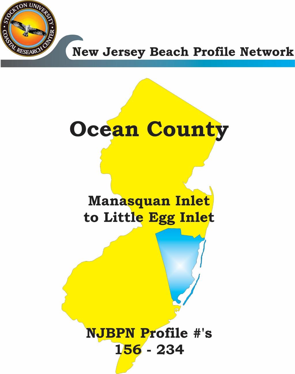
3 Individual Site Descriptions: Beaches in Northern Ocean County continued to recover slowly as sand transported offshore continued to return to the shoreline. Modest efforts in adding material continued in Mantoloking to Ortley Beach using ad hoc sources and continued recovery of overwash deposition. The winter storms from early October 2015 through northeast storm Jonas on January 23, 2016 demonstrated that wave erosion was more than likely to breach the existing dune/beach barrier because the 3-mile steel bulkhead installed in 2015 was reached at almost its entire length. Maximum elevations of scour reached 22 feet of vertical steel exposed in Mantoloking with averages in the 12 to 15 feet common. Municipal officials prudently closed all public access to the beach due to the risk of falling down the residual dune slope to the top of the wall and then the vertical drop to the wet beach or water. A dedicated effort using sand returning from offshore has managed to re-cover the exposed steel with sand and with continued grooming, create a suitable recreational beach for the coming season. The steel bulkhead without future large-scale beach nourishment will continue to be a major winter problem with no public access to the beach and a far greater potential for beach injuries than ever emerged from all prior beach nourishment activities. Any moderate northeast storm will expose the vertical surface, plus accelerate southerly longshore transport of the eroded sand in the extreme wave turbulence zone, generated between reflected and incoming storm waves within the 500-foot wide surf zone seaward of the wall. The US Army Corps of Engineers had completed three segments of its Long Beach Island project prior to Sandy. These included Surf City in 2007, Harvey Cedars in 2009 and Brant Beach in The berm width at 8.5 feet elevation (NAVD88 datum) was set at 100 feet accompanied by a dune with a crest elevation of 22 feet and a 25-foot width. There are 1:5 slopes landward and seaward to the existing beach and landward surfaces. The 22-foot elevation was designed to be high enough to prevent the 1% annual chance storm (100 year event) wave from over-topping the feature. The design worked as planned in all cases where the project had been completed. Comparable natural dunes with at least a 50-foot wide dry beach also prevented overwash especially in Barnegat Light Borough on the north end of Long Beach Island. Work continues to complete the LBI project as designed by the USACE. The passage of PL by Congress in January 2013 provided the USACE with the authorization to complete all authorized, but yet unconstructed shore protection projects in New Jersey at 100% initial federal cost. The State is in the process of dealing in court with involuntary project easement access from oceanfront owners on both Long Beach Island and in Northern Ocean County. Point Pleasant Beach, Water Street and Maryland Avenue; #156 and #155; The restoration is relatively complete in terms of beach width from the Manasquan jetty south along the boardwalk, then south of the boardwalk the dunes have been largely restored. All recovery is due to natural migration of Sandy-generated deposits back toward the beach. Minimal additional sand added during 2014 or Point Pleasant s northern site lost just over 30 cubic yards per foot of shoreline in Bay Head, Johnson Avenue; #154; The beach was restored by hauling as much overwash sand as possible back to restore the dunes. In addition the rock revetment installed after the 1962 NE storm was extended south into Mantoloking between Carrigan and Chafey Place at individual property owner expense. No beach sand was pumped in beyond that hauled back from overwash deposits or moved back onto the shoreline naturally. The site lost some beach width, and lost minor sand volume in
4 Mantoloking, 1117 Ocean Avenue; #153; Route 35 work was nearly complete restoring all types of utility work lost during Sandy. The NJ Dept. of Transportation (NJDOT) was the main sponsor of a steel vertical bulkhead constructed between the end of the rock revetment from Bay Head along the entire Mantoloking oceanfront, ending south in Brick Township. Completed at top elevation of 16.0 feet NAVD 88, this wall was initially buried in recovery sand making up a dune containing the wall as a core. This was promoted as a final line of defense for protecting NJ State highway 35. The new structure survived its first winter, but even minor storms such as the December 9, 2014 event exposed the wall for hundreds of feet as a vertical steel surface up to 10 feet high above the beach because wave action reached the structure and enhanced the erosion. Northeast storm Jonas, January 23, 2016 exposed 85% of the wall s length leaving between 6 and 22 feet of vertical surface exposed above either a wet beach at low tide or a sand surface below the elevation of low tide. Wave energy was reflected from the wall and intercepted the next incoming wave with explosive force captured on video that can be viewed at However, the Mantoloking profile remained relatively constant changing little throughout the interval, largely due to massive efforts to recover sand from offshore to re-cover the wall as soon as it was accessible and constantly searching for sand volumes from anywhere available to add to the beach. Brick Township, Public Beach #3, #152; The steel wall extends south past this site as well, and was exposed after Jonas, but at 4 to 6 foot relief instead of the extreme values seen in Mantoloking. It has been re-buried in returning beach sand. The fact that both sites 152 and 151 saw over and average of 20 cubic yards of added sand this year may be related to deposition near or beyond the south end of the steel wall caused by wave turbulence at the wall. This will be followed carefully. Toms River Township (Normandy Beach, Ortley Beach), 1 st Avenue and 8 th Avenue; #151 and #149; Overwash, dune loss and extensive structural damage occurred along this segment of Northern Ocean County. Ortley Beach was particularly hard hit. No tidal inlet breach occurred, but overwash took many homes as well as the dune and beach. Sand was hauled back to generate a dune and sand migrated back to the shoreline from Sandy-generated deposits offshore. Both sites gained double digits in sand volume in 18 months, but direct relationship to the steel wall and differential erosion/deposition due to wave interaction is a work in progress. Lavallette; White Avenue; #150; Sand volume loss and shoreline retreat hit this location harder than most for reasons not terribly clear. Seaside Heights; Franklin Avenue; #248; Infrastructure repairs and replacement is well underway, but the site did not gain sand or see shoreline advances seaward ( yds 3 /ft. and -17 feet). Seaside Park; 4 th Avenue; #148; Seaside Park is still working to finalize the post-sandy restoration of private and public infrastructure, with no significant changes recorded at the beach. There may be a sand accumulation mode that resembles a pod of material moving slowly along the shoreline with zones of accretion at the apex of the body of sand and zones of depletion where the pod ends along as much as a 1,500 foot pod length. 55
5 Midway Beach (Berkeley Township); 6 th Avenue; #347 The private dune here was wide and high enough to be an island of low damage in an otherwise devastated region. Sand accumulated at the site at the highest rate for any Northern Ocean County profile ( yds 3 /ft.) and with a 19-foot shoreline advance. Island Beach State Park; Sites #247, #246, and #146; Two of three sites gained sand, but the loser was the southernmost location, which is unusual in that normal littoral transport is from north to south. However, the northern two sites saw shoreline retreat while the southern site advanced 6 feet. Barnegat Light Borough; 10 th Street and 26 th Street; #245 and #145; Natural recovery was essentially complete by 2013 in Barnegat Light Borough, since there had been little damage due to the southern orientation of the shoreline and the huge sand volume added since the jetty realignment in The 10 th Street location lost sand volume while the 26 th Street site gained substantially ( yds 3 /ft. versus yds 3 /ft.). The shoreline change followed the pattern (-11 feet versus +95 feet). Long Beach Township (Loveladies); La Baia Street; #144; Loveladies recovered some beach material from offshore and restored dunes using sand hauled back to the beach saw minimal further enhancement. Harvey Cedars; 73 rd Street and Tranquility Drive; #143 and #142; The USACE returned to place sand on the beach to restore the project to design specifications. During 2014 there was minor sand loss ( yds 3 /ft. and yds 3 /ft.). Winter shoreline retreat was pretty extensive (-123 and -103 feet respectively). During 2015, the two sites saw yds 3 /ft. and yds 3 /ft. in sand volume changes with shoreline movements of +22 and+19 feet. Surf City; 20 th Street; #241; Surf City was the location of the initial Army Corps project effort in The project was restored to design specifications during During 2014, both the change in sand volume declined at this site and the shoreline position retreated due to impacts largely confined to the period between the fall 2013 survey and the spring 2014 review. The 2015 changes were minimal in sand volume (-2.36 yds 3 /ft.), but saw a 40-foot shoreline advance. Ship Bottom; 8 th Street; #141; Recovery was limited to landward migration of offshore deposits created from beach and dune sand eroded in Sandy. The 2015 recovery continued from 2014 as an additional 7.20 yds 3 /ft. in sand volume was added producing a sizable 48-foot shoreline advance seaward. Long Beach Township (Brant Beach, 32 nd St; #140; Beach Haven Crest, 81 st St; #139; Spray Beach) Old Whaling Rd; #138; Brant Beach was the most recent segment of LBI to receive the Army Corps beach replenishment project completed in early The USACE restored this segment to design specifications adding yds 3 /ft. 56
6 Work continued in early 2015 as site 140 gained yds 3 /ft. naturally, but sites 139 and 138 gained yds 3 /ft. and yds 3 /ft. respectively. The shoreline response was predictable with the three sites advancing 67, 289 and 186 feet due to beach nourishment work. Beach Haven; Taylor Ave; #137 and Dolphin Ave; #136; Both survey sites in Beach Haven suffered dune failure during Hurricane Sandy. Sand was hauled back to the beach to provide dune protection. The USACE contractor is working south toward Beach Haven through Holgate in future beach nourishment under the authorized LBI project. During 2015 the northern site gained yds 3 /ft. as sand moved south into the location while the southern location gained 7.66 yds 3 /ft. Long Beach Township (Holgate); Webster Ave; #135; This location is also on the agenda for the USACE to extend the Brant Beach project south to the terminal groin in Holgate. During 2015 the site gained yds 3 /ft. with an advance in the shoreline position of 43 feet. Forsythe Wildlife Refuge site; Located at the northern boundary; #234; During Sandy, total overwash occurred all along the refuge that spread clean sand across the vegetation and into Barnegat Bay. Dune recovery will be slow allowing the shorebirds to have a wide open habitat for some time. No tidal inlet breach occurred, so Long Beach Island retains its pre-sandy dimensions. The site actually gained sand volume during the winter of 2013 to 2014 (30.95 yds 3 /ft.), but lost yds 3 /ft. during the following summer. Shoreline position retreat was substantial at 117 feet over the entire year split 69 in the winter and 48 the following summer of Conditions produced beach sand accumulation in 2015 adding yds 3 /ft. to the cross section accompanied with a 152-foot shoreline advance. This advance erases the prior year s retreat. 57
 shows the backshore as a result of local efforts in maintaining the dry beach.")

7 NJBPN 156 Water Street, Point Pleasant The Water Street site is located toward the south end of the Point Pleasant Beach boardwalk. The photo on the left (taken September 29, 2014) shows the backshore as a result of local efforts in maintaining the dry beach. The photo on the right (taken December 14, 2015) shows a similar backshore to 2014 though shoreline retreat (-42.3 ft.) was recorded between the two surveys. BOARDWALK Figure 39. The volume losses between 2014 and 2015 are shown by the elevation changes in the berm and nearshore between Surveys 49 and 51. Volume losses were yds 3 /ft. No sand was brought in during the year. 58
 show a maintained beach.")
8 NJBPN 155 Maryland Avenue, Point Pleasant The Maryland Avenue profile is located south of Manasquan Inlet. The photos (left taken September 29, 2014 and right taken December 14, 2015) show a maintained beach. Installation of sand fencing seaward of existing fence is a local effort to capture wind-blown sand. Volume changes across the profile were minimal (0.72 yd 3 /ft.) between fall 2014 and fall Figure 40. A small dune is present in the fall 2015 survey, a result of human efforts to increase dune width. The site gained in volume throughout 2015 and the shoreline moved seaward (17.9 ft.) from its 2014 position. 59
 during this time period, predominantly below the 0.0 ft. datum. Figure 41.")
9 NJBPN 154 Johnson Avenue, Bay Head Both photos (left taken September 29, 2014 and right taken December 14, 2015) show the condition of the berm at the Bay Head location. While the berm appears wider in the photos, the profile lost volume ( yd 3 /ft.) during this time period, predominantly below the 0.0 ft. datum. Figure 41. The narrow dune that was created following Hurricane Sandy reaches nearly 20 feet. The comparison profiles lack significant nearshore bar development indicating limited amounts of sand available to cross-shore processes. In addition, the planar nearshore surface was lower in fall 2015 than its fall 2014 position. Shoreline advance was minimal (7.5 ft.). 60
 show the narrow dry beach that is less than 100 ft.")
10 NJBPN Ocean Avenue, Mantoloking The profile at this Mantoloking location is constantly manipulated by human efforts to protect the steel bulkhead that was installed to protect Route 35 from storm surge. The photos (left taken September 23, 2014 and right taken December 14, 2015) show the narrow dry beach that is less than 100 ft. in width and sand scraped from the berm to protect the steel bulkhead which was exposed following the October 2-5, 2015 northeast storm. Figure 42. The narrow peak in the September 2014 survey represented a dune that was created from sand used to bury the top of the 15 ft. (NAVD88) steel bulkhead. Since installation, the dune crest and seaward slope have been routinely altered and reshaped to protect the bulkhead. Volume gains occurred between Surveys 50 and 51, predominantly below the 0.0 ft. datum (7.17 yds 3 /ft.). The shoreline moved landward (-6.1 ft.) during the same time period. 61
 is the view from the top of the new dune that covers the bulkhead. Sand was brought in from a nonbeach source for the construction.")
 as a result of the installation of the steel bulkhead and additional sand brought in for its construction. The spring 2015 to fall 2015 above datum volume losses (-7.")
11 NJBPN 152 Public Beach #3, Brick Township On the left (taken September 30, 2014) shows the installation of the southern section of the steel bulkhead. The right photo (December 14, 2015) is the view from the top of the new dune that covers the bulkhead. Sand was brought in from a nonbeach source for the construction. PAVILION Figure 43. Survey 48 to Survey 50 comparison resulted in significant volume gains of the dune, beach and nearshore (31.2 yds 3 /ft.) as a result of the installation of the steel bulkhead and additional sand brought in for its construction. The spring 2015 to fall 2015 above datum volume losses (-7.33 yds 3 /ft.) were attributed to the October 2015 northeast storm event. 62
 the scarped dune is protected by a narrow 50 ft. berm. The dune crest elevation was 18.39 ft.")
12 NJBPN st Avenue, Normandy Beach On the left (September 30, 2014), the view is from the top of the dune that was created in On the right, (December 11, 2015) the scarped dune is protected by a narrow 50 ft. berm. The dune crest elevation was ft. NAVD 88 but its width was expanded landward to add additional protection to the shorefront structures. Figure 44. Dune restoration continued in 2015 and added to the volume gains between spring 2014 and fall 2015 (37.93 yds 3 /ft.). The work however did not expand the dry beach as the shoreline moved seaward 2.7 ft. during the same time period. 63

13 NJBPN 150 White Avenue, Lavallette At the Lavallete site, the photos (left taken September 30, 2014) and right (taken December 11, 2015) show the condition of the dune that was created by pushing sand against the boardwalk following Hurricane Sandy. Some sand accumulated at the seaward base of the dune after the June 2015 survey. Figure 45. Volume losses were recorded across the profile between fall 2014 and fall 2015 ( yds 3 /ft.) as the negligible summer gains were not enough to halt the losses. The shoreline moved landward (-34 ft.) during this time period. 64
 but completed by the December 11, 2015 (on right).")
 occurred mainly below the datum as the trough filled from cross-shore processes.")
14 NJBPN th Avenue, Ortley Beach By November 2013 the restored boardwalk was moved landward of its original position (about 25 feet) and a new dune was created using recovered sand but was not planted with vegetation by the 2014 survey (September 30, 2014) but completed by the December 11, 2015 (on right). BOARDWALK Figure 46. The fall 2014 to fall 2015 volume gain (14.0 yds 3 /ft. ) occurred mainly below the datum as the trough filled from cross-shore processes. The small mound of sand seaward of the planted dune was human-induced and not derived by windblown sand. Berm width was less than 100 feet in fall
. However, the 2015 photo does not show the deep runnel feature that is apparent in the profile cross section below.")

15 NJBPN 248 Franklin Avenue, Seaside Heights The two annual photos at the Franklin Avenue site show a nearly identical backshore elevation (left taken November 14, 2014 and right photo taken December 12, 2015). However, the 2015 photo does not show the deep runnel feature that is apparent in the profile cross section below. BOARDWALK Figure 47. Between the fall 2014 and fall 2015 surveys, there was a sand volume loss of yds 3 /ft. across the profile and the shoreline moved ft. landward from its 2014 position. The nearshore bar present in the 2014 surveys was not present in the spring 2015 survey and minimal in the fall 2015 survey. 66
 shows sand accumulating on the landward side of the seawardmost dune fence. BOARDWALK Figure 48.")

16 NJBPN th Avenue, Seaside Park The photo on the left (taken November 14, 2014) shows the beach has remained constant from its 2013 state with some minor growth in the dune. The right photo (taken December 7, 2015) shows sand accumulating on the landward side of the seawardmost dune fence. BOARDWALK Figure 48. The profiles show a consistent dune elevation at 26.3 ft. NAVD88 for all datasets. The seaward bump of the fall 2015 dune is the result of the sand accumulation landward of the fencing. Fall 2014 to fall 2015 comparison show a volume loss ( yd 3 /ft.) and landward shoreline movement (-30.2 ft.). Hopefully, 2016 conditions will allow the movement of the nearshore bar to the berm. 67
 show the characteristics of the foredune. Expansion of this feature continued into 2015.")

17 NJBPN 347 (originally 147) 6 th Lane, Midway Beach At the 6 th Lane location, both photos (left taken November 14, 2014 and right taken December 7, 2015) show the characteristics of the foredune. Expansion of this feature continued into The shoreline position moved landward (-4.35 ft.) during this time period. The dry beach remained at nearly 200 feet wide for both surveys. Figure 49. The entire profile gained in volume (28.97 yds 3 /ft.) between fall 2014 and fall 2015 as nearshore bar sand moved landward toward the berm. 68
 a modest natural accumulation of sand on the seaward slope was found along sporadic sections of the dune scarp. Figure 50.")
 and the shoreline moved landward (-59 ft.) from its fall 2014 position.")
18 NJBPN 247 North End, Island Beach State Park The left photo (taken November 20, 2014) shows the scarp in the dune system that was generated during Hurricane Sandy. By 2015 (right photo taken December 7, 2015) a modest natural accumulation of sand on the seaward slope was found along sporadic sections of the dune scarp. Figure 50. This site within Island Beach State Park continued an erosional trend throughout Volume losses were recorded across the profile (-25.9 yds 3 /ft.) and the shoreline moved landward (-59 ft.) from its fall 2014 position. Of notice is the lack of nearshore bars throughout and lowering of the profile below the 0.0 ft. datum. 69


19 NJBPN 246 Parking Lot A7, Island Beach State Park The photos (left November 20, 2014 and right December 7, 2015) that were taken at this Island Beach State Park location show the condition of the dune via sand fencing and natural recovery. The dunes here are lower than at the other two sites within the park, but the dune field is nearly 200 feet wide. Figure 51. This mid-park site suffered severe loss of its 16-ft high dune during Hurricane Sandy that have not restored completely. Sediment available to potential dune growth is hampered by the minimal volume gain (0.65 yds 3 /ft.) and landward movement of the shoreline (-51.9 ft.) that was recorded between fall 2014 and fall
 show the scarped dune and a wide dry beach.")
 to the spring 2015 profile. Between fall 2014 and fall 2015, there was a volume gain (12.")
20 NJBPN 146 South End, Island Beach State Park This site within the state protected area is less than a mile from the north Barnegat Inlet jetty. Both photos (left taken November 20, 2014 and right taken December 7, 2015) show the scarped dune and a wide dry beach. Here, as in the other Island Beach State Park locations, natural recovery of the dune has not restored the dune field to pre-hurricane Sandy conditions. Figure 52. The nearshore bar that was present in the fall 2014 survey added little sand volume (2.05 yds 3 /ft.) to the spring 2015 profile. Between fall 2014 and fall 2015, there was a volume gain (12.9 yds 3 /ft.) across the whole profile and the shoreline moved seaward (3.51 ft.). The area below the 0.0 ft. datum received the greatest sand gain as the nearshore trough that was present in the fall 2014 survey filled with sand. 71
21 NJBPN th Street, Barnegat Light This site is located approximately 1500 feet south of the Barnegat Inlet south jetty and was established to monitor the changes at the inlet. Both photos (left taken November 12, 2014 and right taken September 2, 2015) show healthy dune vegetation nearly three years after Hurricane Sandy. Figure 53. The focus of this profile is on the extensive dune system that has developed since the modification to the Barnegat Inlet jetty in Hurricane Sandy had no to little influence on the shoreline position or volume change and there has been modest gains for recovery since the storm. Between fall 2014 and fall 2015, volume gains were 0.52 yds 3 /ft. and the shoreline moved seaward (5.0 ft.). 72
. The stability is attributed to the profile s position with respect to the Barnegat Inlet south jetty which traps the northward-driven littoral drift. Figure 54.")
 and the shoreline moved seaward (78.9 ft.). The largest change occurred during the spring 2015 to fall 2015 time period, and could be attributed to the sand that was added to the littoral drift")
22 NJBPN th Street, Barnegat Light The profile at 26 th Street consists of a wide, high dune system that is sparsely vegetated but stable (left photo taken November 12, 2014 and right photo taken September 2, 2015). The stability is attributed to the profile s position with respect to the Barnegat Inlet south jetty which traps the northward-driven littoral drift. Figure 54. This site fared well during Hurricane Sandy due to its wide beach and high, wide dune. Between fall 2014 and fall 2015, the profile gained volume (25.08 yds 3 /ft.) and the shoreline moved seaward (78.9 ft.). The largest change occurred during the spring 2015 to fall 2015 time period, and could be attributed to the sand that was added to the littoral drift by the 2013 federal beach fill in Harvey Cedars. 73
 show a 100+ ft wide berm.")

23 NJBPN 144 La Baia Street, Loveladies The La Baia Street site is not included in the federal beach fill but has had modest gains in volume and shoreline position throughout 2014 and Both photos (left taken November 12, 2014 and right taken September 15, 2015) show a 100+ ft wide berm. An enhanced dune would provide greater storm protection to shorefront properties. Figure 55. During , the dune at La Baia St remained in its same position and elevation. The nearshore bar that was apparent in the fall 2014 survey moved onshore to the berm by fall 2015 and enabled the seaward movement of the shoreline (26.3 ft.). Volume gains for that time period were 8.88 yds 3 /ft. 74

.")
24 NJBPN rd Street, Harvey Cedars The photos (left taken November 13, 2014 and right taken September 15, 2015) show the dune condition at 73 rd Street. This site received sand from the 2013 USACE emergency beach nourishment project for sections of Long Beach Island. Figure 56. The emergency federal beach fill was completed in spring Since then, the engineered dune has remained in its same position and elevation. Berm widths have shown seasonal changes throughout with the greatest volume loss occurring between fall 2014 to spring 2015 ( yds 3 /ft.). Fall 2014 to fall 2015 volume change was yds 3 /ft. and the shoreline moved seaward 4.0 ft. 75

25 NJBPN 142 Tranquility Drive, Harvey Cedars The photos (left taken November 13, 2014 and right taken September 16, 2015) show the nearly unchanged condition of the engineered dune at Tranquility Drive. This site was included in the emergency federal beach nourishment project that was completed in spring RETAINING WALL Figure 57. The Tranquility Drive profiles show the wide, high engineered dune and wide berm. Seasonal volume losses were recorded between fall 2014 and spring 2015 (- 9.2 yds 3 /ft.). Between fall 2014 and fall 2015, the volume change was yds 3 /ft. and the shoreline moved 21 ft. seaward. The majority of the losses were from below the 0.0 ft. datum as the fall 2014 nearshore bar (located between 900 ft. and 1150 ft.) moved landward to weld onto the berm in fall

26 NJBPN th Street Surf City The photographs above were taken on November 13, 2014 (left) and September 15, 2015 (right). Both images show the view of 20 th Street access path over the engineered dune with the view to the southeast. This site was restored to design conditions in September 2013 through the emergency federal beach fill efforts. Figure 58. The engineered dune at 20 th Street remained at its elevation and position throughout Seasonal berm widths varied, but moved seaward in that time period. Between fall 2014 and fall 2015, volume change was 4.64 yds 3 /ft. and the shoreline moved seaward (21.6 ft.) influenced by cross shore processes. 77

 were recorded between spring 2015 and fall 2015 as the profile adjusted to waves produced by summer calm and October 2-5 northeast storm conditions.")
27 NJBPN th Street, Ship Bottom The photos of the 8 th Street location (left taken October 15, 2014 and right taken December 15, 2015) show the seaward base of the dune before and after the federal beach fill which was completed in spring Figure 59. The 2015 federal beach fill added height and width to the pre-existing dune and berm. Berm and nearshore volume losses ( yds 3 /ft.) were recorded between spring 2015 and fall 2015 as the profile adjusted to waves produced by summer calm and October 2-5 northeast storm conditions. Between fall 2014 and fall 2015, the profile gained volume (24.88 yds 3 /ft.) and the shoreline moved 61.2 ft seaward. These gains were attributed to the spring 2015 beach fill. 78
 show the condition of the engineered dune which remained in its position and elevation during 2014-2015. Figure 60.")
28 NJBPN nd Street, Long Beach Township The 32 nd Street location was the recipient of emergency federal beach fill in summer 2015 to restore the damages incurred from Hurricane Sandy. The photos (left taken October 17, 2014 and right taken September 2, 2015) show the condition of the engineered dune which remained in its position and elevation during Figure 60. The 32 nd Street profile experienced seasonal gains/losses prior to the beach fill in summer Between fall 2014 and fall 2015, the volume gain was yds 3 /ft. and the shoreline moved seaward ft. The greatest seasonal gain occurred between spring 2015 and fall 2015 (44.37 yds 3 /ft.). 79
 show the dune conditions before and after the nourishment project. Both views were taken from the dune crest. Figure 61.")

29 NJBPN st Street, Long Beach Township The 81 st Street location was the recipient of its first federal beach fill in summer The photos (left taken October 17, 2014 and right taken December 15, 2015) show the dune conditions before and after the nourishment project. Both views were taken from the dune crest. Figure 61. The profile changes at 81 st Street during This location was included in the federally-authorized Barnegat Inlet to Little Egg Inlet shore protection project but not constructed until summer Federal design placed the engineered dune seaward of the existing dune and at least 5 feet higher and a berm that extended over 200 ft. Between fall 2014 and fall 2015, the volume gain was yds 3 /ft. and the shoreline moved seaward ft. 80
 show the view from the dune crest.")

30 NJBPN 138 Old Whaling Road (124 th Street), Long Beach Township The 124 th Street location was included in the emergency federal beach fill in The photos (left taken October 17, 2014 before the fill and right taken December 15, 2015 after project completion) show the view from the dune crest. The preproject dune height was greater than 20 ft NAVD88 and was an important component in limiting the effects of Hurricane Sandy on shorefront properties. Figure 62. The cross section above shows the profile changes before and after the federal beach fill at 124 th Street. Sand was added to the existing dune to increase the height and width and meet engineered dune design specifications. Between fall 2014 and fall 2015, the volume gain was yds 3 /ft. and the shoreline moved seaward (184.8 ft.). 81

.")
31 NJBPN 137 Taylor Avenue, Beach Haven The photos from the Taylor Avenue location were taken from the dune crest (left taken October 31, 2014 and right taken December 15, 2015). This site is scheduled for federal beach nourishment, but the project had not reached here by the fall 2015 survey. During Hurricane Sandy, this site lost a substantial amount of the dune. Post-storm efforts restored the dune using recovered overwashed sands. Figure 64. The narrow dune at Dolphin Ave remained in its position and elevation throughout Between fall 2014 and fall 2015, the volume gain was 2.23 yds3/ft. but the shoreline moved landward ( ft.). The landward shoreline movement is attributed to the relocation of the berm sand to the nearshore in the fall 2015 survey. 82
. Both images show the condition of the dune from the dune crest.")

32 NJBPN 136 Dolphin Avenue, Beach Haven The Dolphin Avenue dune was completely eroded away during Hurricane Sandy. The photos (left taken October 31, 2014 and right photo taken December 15, 2015). Both images show the condition of the dune from the dune crest. The lost dune was replaced by a smaller feature using sand hauled back to the beach from inland deposits. Figure 64. The narrow dune at Dolphin Ave remained in its position and elevation throughout Between fall 2014 and fall 2015, the volume gain was 2.23 yds 3 /ft. but the shoreline moved landward ( ft.). The landward shoreline movement is attributed to the relocation of the berm sand to the nearshore in the fall 2015 survey. 83
. The dune was restored to its original position and elevation in 2013 and has remained consistent throughout 2014-2015. Figure 65.")

33 NJBPN 135 Webster Avenue, Long Beach Township The Webster Avenue photos were taken from the crest of the restored dune (left taken October 31, 2014 and right taken December 15, 2015). The dune was restored to its original position and elevation in 2013 and has remained consistent throughout Figure 65. The cross section above shows the seasonal changes of the berm and nearshore at Webster Avenue. This location is included within the federal shore protection project boundaries and should be completed in Between fall 2014 and fall 2015, the profile gained volume (22.94 yds 3 /ft.) and the shoreline moved seaward (10.2 ft.). 84


34 NJBPN 234 Forsythe National Wildlife Refuge, Holgate Entrance, Long Beach Township The Holgate Unit photos (left taken October 31, 2014 and right taken December 15, 2015) show the changing conditions of the berm and surf zone. This site is immediately south of the Long Beach Island terminal groin which influences the amount of sand that is available to this downdrift beach. The profile was completely overwashed during Hurricane Sandy. Figure 66. The dune present in the cross sections for the Holgate site was constructed during post-storm recovery and remained in its position and elevation during Between fall 2014 and fall 2015, the volume gain was yds 3 /ft. and the shoreline moved seaward 201 ft. The added sediment may be attributed to the transport of sand from the updrift beach nourishment and around the terminal groin. 85
35 Summary & Conclusions The beach conditions have continued to perform differently in Ocean County than those seen in Monmouth County where the New York District Corps of Engineers brought 21 miles of that County s shoreline back to design conditions. The differential continued into 2015 emphasized where the USACE continued working on the LBI segment of the shore protection project, but no work was attempted in Northern Ocean County. The right two columns show percentage of beach/dune loss recovered to elevation zero (NAVD88) and the change in shoreline position (the elevation zero point on each cross section). The percentages come from the observed beach volume lost during Sandy (column 2) together with the shoreline retreat (column 3). The survey prior to Hurricane Sandy was used as the baseline for columns 4, 5 and 6. The USACE project locations completed by December 2015 are highlighted in orange. Table 1 Ocean County Sand Volumes & Shoreline Changes 3 Years Following Sandy LOCATION Beach Loss Shoreline Beach Volume Beach Volume Beach Volume 2015 Shoreline Beach Shoreline Comparisons with pre-sandy During Sandy Storm Retreat by Fall 2013 by Fall 2014 by Fall 2015 Relative to pre-s Recovery Recovery Beach & Shoreline Data cu yds/ft. feet cu yds/ft. cu yds/ft. cu yds/ft. feet Percent Percent Water Street, Pt. Pleasant % 24% Maryland Avenue, Pt. P % 91% Johnson Avenue, Bay Head % 37% 1117 Ocean Avenue, Mant % 58% Public Beach #3, Brick Twp % 27% 1st Avenue, Normandy % 52% White Avenue, Lavallette % -15% 8th Avenue, Ortley Beach % -3% Franklin Avenue, Seaside Hgt % 29% 4th Avenue, Seaside Park % -8% 6th Lane, Midway % 350% IBSP North Site % -331% IBSP Mid Site % 2% IBSP South Site % 55% 10th Street, Barnegat Light % -143% 26th Street, Barnegat Light % 182% La Baia Street, Loveladies % 43% 73rd Street, HC % 86% Tranquility Drive, HC % 309% 20th Street, Surf City % 145% 8th Street, Ship Bottom % 226% 32nd Street, LBTwp % 113% 81st Street, LBTwp % 1241% Old Whaling Road, LBTwp % 895% Taylor Avenue, Beach Haven % 47% Dolphin Avenue, Beach Haven % 23% Webster Avenue, Holgate % 69% Forsythe Refuge % 79% Average Volume Changes (without ACOE work) 83.1% 69.7% 76.9% 59.5% 103.7% 102.2% New ACOE Work Complete Recovery including ACOE work 153.8% 131.5% Northern Ocean County Recovery 53.2% 26.3% Long Beach Island Recovery 254.4% 236.6% Tracking the changing beach volume percentages across from 2013 to 2015, the northern Ocean County sites changed erratically between steady gains (Brick Twp. public beach #3 or IBSP middle site), to variable changes (1117 Ocean Avenue Mantoloking) to steady loss since Sandy (Johnson Ave., Bay Head). Long Beach Island changes augmented by the USACE project saw positive sand volume changes at every site with eight locations of 14 with over 100% recovery in sand volume and a shoreline position 100% further seaward than it was pre- Sandy. The bottom line is seen best on the table s bottom three lines where the LBI recovery averages over 200% while the Northern County shoreline lags at 53% of sand volume and 26% of the shoreline position. 86
Figure 38. Locations of the 28 NJBPN profile stations in Ocean County, NJ.
 55 Figure 38. Locations of the 28 NJBPN profile stations in Ocean County, NJ. 56 Individual Site Descriptions: Northern Ocean County recovered its beaches approaching pre-hurricane Sandy elevation or width,
Figure 106. Locations of the 28 NJBPN profile stations in Ocean County, NJ.
 130 Figure 106. Locations of the 28 NJBPN profile stations in Ocean County, NJ. 131 2016-2017 Beach Fills in Ocean County: The federal/state/local storm damage reduction project (beachfill) between Manasquan
Figure 46. Locations of the 28 NJBPN profile stations in Ocean County, NJ. A new site was added in the Borough of Seaside Heights (#248).
.") 90 Figure 46. Locations of the 28 NJBPN profile stations in Ocean County, NJ. A new site was added in the Borough of Seaside Heights (#248). 91 OCEAN COUNTY SPRING 2008 to FALL 2009 The Ocean County shoreline
90 Figure 46. Locations of the 28 NJBPN profile stations in Ocean County, NJ. A new site was added in the Borough of Seaside Heights (#248). 91 OCEAN COUNTY SPRING 2008 to FALL 2009 The Ocean County shoreline
Figure 41. Locations of the 28 NJBPN profile stations in Ocean County, NJ.
 57 Figure 41. Locations of the 28 NJBPN profile stations in Ocean County, NJ. 58 Hurricane Sandy s Impact on the Ocean County Shoreline; In general terms, all forms of damage to beaches, dunes and public
New Jersey Beach Profile Network Ocean County Profile Site Locations
 125 RICHARD STOCKTON COLLEGE OF NEW JERSEY COASTAL RESEARCH CENTER New Jersey Beach Profile Network Ocean County Profile Site Locations Figure 73 156 155 154 153 152 151 15 149 The Ocean County shoreline
Beach Dune Performance Assessment of. New Jersey Beach Profile Network (NJBPN) Sites at. Long Beach Island, New Jersey. After Hurricane Sandy
 Sites at. Long Beach Island, New Jersey. After Hurricane Sandy") Beach Dune Performance Assessment of New Jersey Beach Profile Network (NJBPN) Sites at Long Beach Island, New Jersey After Hurricane Sandy November 13, 2012 The Richard Stockton College of NJ Coastal Research
Beach Dune Performance Assessment of New Jersey Beach Profile Network (NJBPN) Sites at Long Beach Island, New Jersey After Hurricane Sandy November 13, 2012 The Richard Stockton College of NJ Coastal Research
OCEAN COUNTY 2006 to 2008
 OCEAN COUNTY 2006 to 2008 Ocean County finally started to benefit from long-awaited startup of Federal beach nourishment projects when sand was pumped onto Surf City, Long Beach Island in late 2006. This
Figure79. Location map for the 10 NJBPN profile sites in Atlantic County, NJ 155
 154 Figure79. Location map for the 10 NJBPN profile sites in Atlantic County, NJ 155 ATLANTIC COUNTY SPRING 2009 to FALL 2010 The Atlantic County coastline consists of three barrier islands. Between Little
23- Year Sand Volume Changes at Site 132, 15th Street, Brigantine
 149 Figure75. Location map for the 9 NJBPN profile sites in Atlantic County, NJ ATLANTIC COUNTY SPRING 2008 to FALL 2009 150 The Atlantic County oceanfront shoreline consists of three barrier islands.
Beach, dune and development in the Borough of Mantoloking as of January Prepared for The Borough of Mantoloking: April 2, 2008
 Summary of 20-years of Shoreline Monitoring Between Maryland Avenue, Point Pleasant Beach, Bay Head, Mantoloking, Brick Township, to 1 st Avenue in Normandy Beach, Ocean County, New Jersey & an Evaluation
FINAL REPORT FOR 2013 ON THE CONDITION OF THE MUNICIPAL OCEANFRONT BEACHES THE BOROUGH OF AVALON, CAPE MAY COUNTY, NEW JERSEY
 FINAL REPORT FOR 2013 ON THE CONDITION OF THE MUNICIPAL OCEANFRONT BEACHES THE BOROUGH OF AVALON, CAPE MAY COUNTY, NEW JERSEY View from 12 th Street to the south taken February 28, 2013, following completion
ATLANTIC COUNTY 2006 to 2008
 ATLANTIC COUNTY 2006 to 2008 The Atlantic County oceanfront shoreline consists of three barrier islands where the northern one, Little Beach Island and a third of the second, Brigantine Island, are undeveloped
New Jersey Coastal Zone Overview. The New Jersey Beach Profile Network (NJBPN) 3 Dimensional Assessments. Quantifying Shoreline Migration
 3 Dimensional Assessments. Quantifying Shoreline Migration") New Jersey Coastal Zone Overview The New Jersey Beach Profile Network (NJBPN) Objectives Profile Locations Data Collection Analyzing NJBPN Data Examples 3 Dimensional Assessments Methodology Examples Quantifying
New Jersey Coastal Zone Overview The New Jersey Beach Profile Network (NJBPN) Objectives Profile Locations Data Collection Analyzing NJBPN Data Examples 3 Dimensional Assessments Methodology Examples Quantifying
New Jersey Beach Profile Network Atlantic County Profile Site Locations
 215 RICHARD STOCKTON COLLEGE OF NEW JERSEY New Jersey Beach Profile Network Atlantic County Profile Site Locations COASTAL RESEARCH CENTER Figure 128 There are nine NJBPN survey sites on the Atlantic County
A REVIEW OF THE CONDITION OF THE MUNICIPAL BEACHES AS A RESULT OF HURRICANE SANDY IN THE BOROUGH OF STONE HARBOR, CAPE MAY COUNTY, NEW JERSEY
 A REVIEW OF THE CONDITION OF THE MUNICIPAL BEACHES AS A RESULT OF HURRICANE SANDY IN THE BOROUGH OF STONE HARBOR, CAPE MAY COUNTY, NEW JERSEY View along the dune scarp from 103 rd Street on October 31,
FINAL REPORT FOR 2012 ON THE CHANGES SEEN ON THE OCEANFRONT BEACHES
 FINAL REPORT FOR 2012 ON THE CHANGES SEEN ON THE OCEANFRONT BEACHES IN THE BOROUGH OF MANTOLOKING, OCEAN COUNTY, NEW JERSEY FOCUSED ON THE IMPACTS OF HURRICANE SANDY View looking north on Route 5 on October
SPECIAL SPRING 2018 STORM REPORT ON THE CONDITION OF THE MUNICIPAL BEACHES FOR THE BOROUGH OF STONE HARBOR, CAPE MAY COUNTY, NEW JERSEY
 SPECIAL SPRING 2018 STORM REPORT ON THE CONDITION OF THE MUNICIPAL BEACHES FOR THE BOROUGH OF STONE HARBOR, CAPE MAY COUNTY, NEW JERSEY Aerial photograph taken April 21, 2018 showing the view up the beach
Volume and Shoreline Changes along Pinellas County Beaches during Tropical Storm Debby
 Volume and Shoreline Changes along Pinellas County Beaches during Tropical Storm Debby Ping Wang and Tiffany M. Roberts Coastal Research Laboratory University of South Florida July 24, 2012 Introduction
Figure 78. Map of Cape May County showing the locations of the 31 profile sites in the county.
 103 Figure 78. Map of Cape May County showing the locations of the 31 profile sites in the county. 104 Cape May County in 2015: Cape May County has 31 survey stations between Reeds Beach on the Western
UPPER BEACH REPLENISHMENT PROJECT RELATED
 ASSESSMENT OF SAND VOLUME LOSS at the TOWNSHIP of UPPER BEACH REPLENISHMENT PROJECT RELATED to the LANDFALL OF HURRICANE SANDY - PURSUANT TO NJ-DR 4086 This assessment is in response to Hurricane Sandy
PREPARED FOR: THE BOROUGH OF AVALON 3100 DUNE DRIVE AVALON, NJ 08202
 FINAL REPORT FOR 2012 ON THE CONDITION OF THE MUNICIPAL OCEANFRONT BEACHES FOLLOWING HURRICANE SANDY IN THE BOROUGH OF AVALON, CAPE MAY COUNTY, NEW JERSEY View from 78 th Street to the north immediately
2013 ANNUAL REPORT - TO THE CITY OF NORTH WILDWOOD ON THE CONDITION OF THE CITY BEACHES
 2013 ANNUAL REPORT - TO THE CITY OF NORTH WILDWOOD ON THE CONDITION OF THE CITY BEACHES View on June 18, 2013 from the 2 nd Avenue jetty looking south while the 2013 beach nourishment project was under
2014 ANNUAL REPORT - TO THE CITY OF NORTH WILDWOOD ON THE CONDITION OF THE CITY BEACHES
 2014 ANNUAL REPORT - TO THE CITY OF NORTH WILDWOOD ON THE CONDITION OF THE CITY BEACHES View on September 25, 2014 looking northwest into Hereford Inlet. Considerable southerly expansion of the tip of
Figure 262. Location map for the 10 NJBPN profile sites in Atlantic County, NJ 279
 278 Figure 262. Location map for the 10 NJBPN profile sites in Atlantic County, NJ 279 ATLANTIC COUNTY SUMMARY The Atlantic County coastline consists of three barrier islands. The island of Little Beach
The Stockton University Coastal
 Hurricane Sandy: Beach-dune recovery at New Jersey Beach Profile Network (NJBPN) sites By Kimberly K. McKenna 1, Stewart C. Farrell 1, and Jeffrey A. Gebert 2 1 Stockton University Coastal Research Center
TABLE OF CONTENTS APPENDIX & BIBLIOGRAPHY
 TABLE OF CONTENTS Executive Summary 1 Acknowledgements 3 Introduction 3 The New Jersey Coastal Zone 3 Storm Recovery and Beach Project Effectiveness 3 Monmouth County 4 Figure 1. Monmouth County Station
FINAL REPORT FOR 2013 ON THE CONDITION OF THE MUNICIPAL BEACHES IN THE TOWNSHIP OF UPPER, CAPE MAY COUNTY, NEW JERSEY
 FINAL REPORT FOR 2013 ON THE CONDITION OF THE MUNICIPAL BEACHES IN THE TOWNSHIP OF UPPER, CAPE MAY COUNTY, NEW JERSEY Aerial photograph at Corson s Inlet showing conditions on December 1, 2013 of the north
2015 ANNUAL REPORT - TO THE CITY OF NORTH WILDWOOD ON THE CONDITION OF THE CITY BEACHES
 2015 ANNUAL REPORT - TO THE CITY OF NORTH WILDWOOD ON THE CONDITION OF THE CITY BEACHES Ariel view of North Wildwood looking south from the Hereford Inlet perspective on June 24, 2015. The main channel
Long Beach Island Holgate Spit Little Egg Inlet Historical Evolution Introduction Longshore Transport Map, Survey and Photo Historic Sequence
 Appendix B Long Beach Island Holgate Spit Little Egg Inlet Historical Evolution Introduction The undeveloped southern end of Long Beach Island (LBI) is referred to as the Holgate spit as it adjoins the
FINAL REPORT FOR 2011 ON THE CONDITION OF THE MUNICIPAL BEACHES IN THE CITY OF BRIGANTINE BEACH, ATLANTIC COUNTY, NEW JERSEY
 FINAL REPORT FOR 2011 ON THE CONDITION OF THE MUNICIPAL BEACHES IN THE CITY OF BRIGANTINE BEACH, ATLANTIC COUNTY, NEW JERSEY Photograph was taken October 10, 2011 from 10 th Street North looking south
FINAL REPORT FOR 2009 ON THE CONDITION OF THE MUNICIPAL OCEANFRONT BEACHES IN THE BOROUGH OF AVALON, CAPE MAY COUNTY, NEW JERSEY
 FINAL REPORT FOR 2009 ON THE CONDITION OF THE MUNICIPAL OCEANFRONT BEACHES IN THE BOROUGH OF AVALON, CAPE MAY COUNTY, NEW JERSEY Storm waves pound the inlet revetment September 10, 2009 as the series of
Figure 1. Survey site locations in Monmouth County.
 6 Figure 1. Survey site locations in Monmouth County. 7 Individual Site Descriptions: The restoration of the Sea Bright shoreline was essentially complete by the fall 2013 survey. The NY Corps District
RE: Hurricane Matthew Beach Damage Assessment and Recommendations [CSE 2416]
![RE: Hurricane Matthew Beach Damage Assessment and Recommendations [CSE 2416]](/thumbs/83/87675702.jpg "RE: Hurricane Matthew Beach Damage Assessment and Recommendations [CSE 2416]") October 25, 2016 Iris Hill Town Administrator Town of Edisto Beach 2414 Murray St Edisto Beach SC 29438 RE: Hurricane Matthew Beach Damage Assessment and Recommendations [CSE 2416] Dear Iris, Hurricane
October 25, 2016 Iris Hill Town Administrator Town of Edisto Beach 2414 Murray St Edisto Beach SC 29438 RE: Hurricane Matthew Beach Damage Assessment and Recommendations [CSE 2416] Dear Iris, Hurricane
Beach Dune Performance Assessment of. New Jersey Beach Profile Network (NJBPN) Sites at. Between Manasquan Inlet and Allenhurst, New Jersey
 Sites at. Between Manasquan Inlet and Allenhurst, New Jersey") Beach Dune Performance Assessment of New Jersey Beach Profile Network (NJBPN) Sites at Between Manasquan Inlet and Allenhurst, New Jersey Related to FEMA DR JI 4086 Declared for Hurricane Sandy December
Beach Dune Performance Assessment of New Jersey Beach Profile Network (NJBPN) Sites at Between Manasquan Inlet and Allenhurst, New Jersey Related to FEMA DR JI 4086 Declared for Hurricane Sandy December
Basic Dune Physical Characteristics
 Basic Dune Physical Characteristics New Jersey s Beach and Dune Characteristics Dunes in New Jersey are mainly confined to a narrow strip of land between the beach berm and upland development. While there
Performance of Upham Beach T-Groin Project and Its Impact to the Downdrift Beach
 Performance of Upham Beach T-Groin Project and Its Impact to the Downdrift Beach Progress Report for the Period of October 2008 to April 2009 Submitted by Ping Wang, Ph.D., and Tiffany M. Roberts Department
LAB: WHERE S THE BEACH
 Name: LAB: WHERE S THE BEACH Introduction When you build a sandcastle on the beach, you don't expect it to last forever. You spread out your towel to sunbathe, but you know you can't stay in the same spot
Delaware Chapter Surfrider Foundation - Indian River Inlet Monitoring
 Delaware Chapter Surfrider Foundation - Indian River Inlet Monitoring In 2012, the Delaware Surfrider Foundation Chapter formed the Surf Quality and Access Committee to focus on issues such as surf spot
Beach profile surveys and morphological change, Otago Harbour entrance to Karitane May 2014 to June 2015
 Beach profile surveys and morphological change, Otago Harbour entrance to Karitane May 2014 to June 2015 Prepared for Port Otago Ltd Martin Single September 2015 Shore Processes and Management Ltd Contact
DUNE STABILIZATION AND BEACH EROSION
 DUNE STABILIZATION AND BEACH EROSION CAPE HATTERAS NATIONAL SEASHORE NORTH CAROLINA ROBERT DOLAN PAUL GODFREY U. S. DEPARTMENT OF INTERIOR NATIONAL PARK SERVICE OFFICE OF NATURAL SCIENCE WASHINGTON, D.
Protecting our Beaches
 Protecting our Beaches South Amelia Island Shore Stabilization Project Nassau County, FL Mr. Drew Wallace President South Amelia Island Shore Stabilization Association (SAISSA) Mr. Bill Moore, AICP Project
ST. JOSEPH PENINSULA, GULF COUNTY, FLORIDA Beach Re-Nourishment and Environmental Enhancement Project RECOMMENDATIONS
 ST. JOSEPH PENINSULA, GULF COUNTY, FLORIDA Beach Re-Nourishment and Environmental Enhancement Project RECOMMENDATIONS January 23, 2018 543 Harbor Boulevard, Suite 204 Destin, Florida 32541 850.654.1555
Dune Monitoring Data Update Summary: 2013
 Dune Monitoring Data Update Summary: 13 Shoreline Studies Program Virginia Institute of Marine Science College of William & Mary Gloucester Point, Virginia September 13 Dune Monitoring Data Update Summary:
Executive Director and Director of Education New Jersey Sea Grant Consortium
 Welcome to the 12 th Annual State of the Shore Media Event Claire antonucci Executive Director and Director of Education New Jersey Sea Grant Consortium CLAIRE ANTONUCCI Characterized by endless snowfall,
Atlantic Coast of Long Island, Jones Inlet to East Rockaway Inlet, Long Beach Island, NY Construction Update
 Atlantic Coast of Long Island, Jones Inlet to East Rockaway Inlet, Long Beach Island, NY Construction Update June 2016 US Army Corps of Engineers Project Purpose Three specific damage mechanisms of coastal
Wind Blow-out Hollow Generated in Fukiage Dune Field, Kagoshima Prefecture, Japan
 R. Nishi Wind Blow-out Hollow Generated in Fukiage Dune Field, Kagoshima Prefecture, Japan Ryuichiro Nishi, Li Elikson and Myokhin PREFACE A sand dune is vulnerable to severe waves and wind. Therefore,
Impact of Hurricane Matthew on the Atlantic Coast of Florida
 Impact of Hurricane Matthew on the Atlantic Coast of Florida A coastal engineer was driving across country and his jeep broke down in front of a monastery. It was late in the day and the monks invited
Chapter 15 SEASONAL CHANGES IN BEACHES OP THE NORTH ATLANTIC COAST OF THE UNITED STATES
 Chapter 15 SEASONAL CHANGES IN BEACHES OP THE NORTH ATLANTIC COAST OF THE UNITED STATES By John M. Darling Hydraulic Engineer, Research Division U. S. Army Coastal Engineering Research Center Corps of
Absecon Island Shore Protection The planning behind the project
 Absecon Island Shore Protection The planning behind the project Most residents of Atlantic City, Ventnor, Margate and Longport are now aware of upcoming plans to protect their common coastline with a beachfill
2018 Beach Preservation Project Information
 QUICK FACTS Beach Renourishment to begin late April 2018 o U.S. Army Corps of Engineers project o Project Area: 8 th St. E. to end of E. Ashley Ave. o Project Length: 2 miles o Cost: $10,900,000 o Funding:
North Shore of Long Island, Feasibility Study
 North Shore of Long Island, Asharoken New York Asharoken, Feasibility Study Asharoken, NY Public Meeting June 30, 2015 US Army Corps of Engineers US Army Corps of Engineers New York BUILDING STRONG BUILDING
USE OF SEGMENTED OFFSHORE BREAKWATERS FOR BEACH EROSION CONTROL
 .. CETN-III-22 4/84 PURPOSE: USE OF SEGMENTED OFFSHORE BREAKWATERS FOR BEACH EROSION CONTROL To provide information on the functional application of and general design considerations for using offshore
ALTERNATIVES FOR COASTAL STORM DAMAGE MITIGATION
 ALTERNATIVES FOR COASTAL STORM DAMAGE MITIGATION Dave Basco Old Dominion University, Norfolk, Virginia, USA National Park Service Photo STRUCTURAL (changes to natural, physical system) hardening (seawalls,
Inlet Management Study for Pass-A-Grille and Bunces Pass, Pinellas County, Florida
 Inlet Management Study for Pass-A-Grille and Bunces Pass, Pinellas County, Florida Final Report Submitted By Ping Wang, Ph.D., Jun Cheng Ph.D., Zachary Westfall, and Mathieu Vallee Coastal Research Laboratory
ALTERNATIVES FOR COASTAL STORM DAMAGE MITIGATION AND FUNCTIONAL DESIGN OF COASTAL STRUCTURES
 The University of the West Indies Organization of American States PROFESSIONAL DEVELOPMENT PROGRAMME: COASTAL INFRASTRUCTURE DESIGN, CONSTRUCTION AND MAINTENANCE A COURSE IN COASTAL DEFENSE SYSTEMS I CHAPTER
HURRICANE SANDY LIMITED REEVALUATION REPORT UNION BEACH, NEW JERSEY DRAFT ENGINEERING APPENDIX SUB APPENDIX D SBEACH MODELING
 HURRICANE SANDY LIMITED REEVALUATION REPORT UNION BEACH, NEW JERSEY DRAFT ENGINEERING APPENDIX SUB APPENDIX D SBEACH MODELING Rev. 18 Feb 2015 1 SBEACH Modeling 1.0 Introduction Following the methodology
Figure 1. Schematic illustration of the major environments on Mustang Island.
 STOP #1: PACKERY CHANNEL BEACH TO BAY We will start this field guide near the north jetty of Packery Channel and hike across the island to Corpus Christi Bay (fig. 1). The island emerges from the Gulf
CHAPTER 281 INFLUENCE OF NEARSHORE HARDBOTTOM ON REGIONAL SEDIMENT TRANSPORT
 CHAPTER 281 INFLUENCE OF NEARSHORE HARDBOTTOM ON REGIONAL SEDIMENT TRANSPORT Paul C.-P. Lin, Ph.D., P.E. 1 and R. Harvey Sasso, P.E. 2 ABSTRACT The influence of nearshore hardbottom on longshore and cross-shore
Table 4. Volumetric Change Rates Pre-Project and Post-Project for the Town of Duck
 V. VOLUMETRIC CHANGES General Volumetric changes measured over the entire monitoring area for various time periods are provided in Table 4. The volume changes are given in terms of cubic yards/foot of
Earth Science Chapter 16 Section 3 Review
 Name: Class: Date: Earth Science Chapter 16 Section 3 Review Multiple Choice Identify the choice that best completes the statement or answers the question. 1. The movement of water that parallels the shore
Assateague Island National Seashore North End Restoration Project Timeline
 Assateague Island National Seashore North End Restoration Project Timeline Date Event Some information provided in the Project Introduction document. Detailed events are available in a timeline compiled
SACO RIVER AND CAMP ELLIS BEACH SACO, MAINE SECTION 111 SHORE DAMAGE MITIGATION PROJECT APPENDIX F ECONOMIC ASSESSMENT
 SACO RIVER AND CAMP ELLIS BEACH SACO, MAINE SECTION 111 SHORE DAMAGE MITIGATION PROJECT APPENDIX F ECONOMIC ASSESSMENT Department of the Army New England District, Corps of Engineers 696 Virginia Road
Recycling of Surplus Sand to Extend the Time Between Beach Fill Episodes
 Recycling of Surplus Sand to Extend the Time Between Beach Fill Episodes Cape May County, New Jersey Dr. Stewart Farrell Coastal Research Center 1795 Franklin Map Shows Inlets Inlet Morphology has Remained
The Richard Stockton College of New Jersey Coastal Research Center
 The Richard Stockton College of New Jersey Coastal Research Center New Jersey Beach Profile Network 20-Year Report On Shoreline Changes In New Jersey Raritan Bay to Delaware Bay Prepared for: New Jersey
Oceans and Coasts. Chapter 18
 Oceans and Coasts Chapter 18 Exploring the oceans The ocean floor Sediments thicken and the age of the seafloor increases from ridge to shore The continental shelf off the northeast United States Constituent
Shorelines Earth - Chapter 20 Stan Hatfield Southwestern Illinois College
 Shorelines Earth - Chapter 20 Stan Hatfield Southwestern Illinois College The Shoreline A Dynamic Interface The shoreline is a dynamic interface (common boundary) among air, land, and the ocean. The shoreline
EVALUATION OF BEACH EROSION UP-DRIFT OF TIDAL INLETS IN SOUTHWEST AND CENTRAL FLORIDA, USA. Mohamed A. Dabees 1 and Brett D.
 EVALUATION OF BEACH EROSION UP-DRIFT OF TIDAL INLETS IN SOUTHWEST AND CENTRAL FLORIDA, USA Mohamed A. Dabees 1 and Brett D. Moore 1 The paper discusses the analysis of up-drift beach erosion near selected
ATLANTIC COAST OF LONG ISLAND, JONES INLET TO EAST ROCKAWAY INLET, LONG BEACH ISLAND, NY. Contract #2 Construction Scope. April 18th-19th 2018
 ATLANTIC COAST OF LONG ISLAND, JONES INLET TO EAST ROCKAWAY INLET, LONG BEACH ISLAND, NY Contract #2 Construction Scope April 18th-19th 2018 New York District PLAN COMPONENTS Length of Beachfill 35,000
OECS Regional Engineering Workshop September 29 October 3, 2014
 B E A C H E S. M A R I N A S. D E S I G N. C O N S T R U C T I O N. OECS Regional Engineering Workshop September 29 October 3, 2014 Coastal Erosion and Sea Defense: Introduction to Coastal/Marine Structures
Severe Beach Erosion Caused by Permanent Beach Sand Loss Through Rollover Fish Pass Bolivar Peninsula, Texas
 DRAFT DRAFT DRAFT DRAFT DRAFT DRAFT DRAFT DRAFT Severe Beach Erosion Caused by Permanent Beach Sand Loss Through Rollover Fish Pass Bolivar Peninsula, Texas September, 1999 For J. Martin Green and Alan
Climate Change Impacts to KSC Launch Complex
 Climate Change Impacts to KSC Launch Complex Presented to: 2010 International Workshop on Environment and Energy By: John Shaffer NASA Environmental Management Branch Kennedy Space Center Hurricane Season
Town of Duck, North Carolina
 Tracking No. 00.00.2010 Erosion Mitigation And Shoreline Management Feasibility Study Town of Duck, North Carolina Coastal Planning & Engineering of North Carolina February 28, 2013 Ken Willson 1 Tracking
CHAPTER 179. Performance of a Submerged Breakwater for Shore Protection
 CHAPTER 179 Abstract Performance of a Submerged Breakwater for Shore Protection Albert E. Browder',A. Member, ASCE; Robert G. Dean 2, Member, ASCE; and Renjie Chen 3 A summary is presented of the results
Overview. Beach Features. Coastal Regions. Other Beach Profile Features. CHAPTER 10 The Coast: Beaches and Shoreline Processes.
 Overview CHAPTER 10 The Coast: Beaches and Shoreline Processes Coastal regions constantly change. The beach is a dominant coastal feature. Wave activity continually modifies the beach and coastal areas.
CROSS-SHORE SEDIMENT PROCESSES
 The University of the West Indies Organization of American States PROFESSIONAL DEVELOPMENT PROGRAMME: COASTAL INFRASTRUCTURE DESIGN, CONSTRUCTION AND MAINTENANCE A COURSE IN COASTAL DEFENSE SYSTEMS I CHAPTER
Blakely Island, N Thatcher Bay. Restoration Recommendation: Rank Score (total score)
") Soft Shore Protection/Structure Removal Blueprint for San Juan County Forage Fish Beaches Appendix 2: Recommendations for sites scoring below the top ten, sorted by island (east to west) Blakely Island,
Soft Shore Protection/Structure Removal Blueprint for San Juan County Forage Fish Beaches Appendix 2: Recommendations for sites scoring below the top ten, sorted by island (east to west) Blakely Island,
STORM RESPONSE SIMULATION
 APPENDIX V STORM RESPONSE SIMULATION Final Environmental Impact Statement Village of Bald Head Island Shoreline Protection Project Brunswick County, North Carolina Delft3D Storm Response Simulations With
Aspects of New Jersey Geology 2009 The Jersey Shore
 Aspects of New Jersey Geology 2009 The Jersey Shore Looking towards Belmar at sunset. Photo from VisitUSA.com. This calendar is available for free download from www.ganj.org, the website of the Geological
Anatomy of Coastal Regions
 The Coast I. BEACH ANATOMY Anatomy of Coastal Regions Terms for different parts of beaches and coastal regions Are all about ENERGY- ie, where the ocean s energy Mostly through tides and waves, and shape
Reading Material. Inshore oceanography, Anikouchine and Sternberg The World Ocean, Prentice-Hall
 Reading Material Inshore oceanography, Anikouchine and Sternberg The World Ocean, Prentice-Hall BEACH PROCESSES AND COASTAL ENVIRONMENTS COASTAL FEATURES Cross section Map view Terminology for Coastal
Chapter 10 Lecture Outline. The Restless Oceans
 Chapter 10 Lecture Outline The Restless Oceans Focus Question 10.1 How does the Coriolis effect influence ocean currents? The Ocean s Surface Circulation Ocean currents Masses of water that flow from one
TITLE: North Carolina s Changing Shorelines. KEYWORDS: erosion - shorelines - mapping - sustainability
 UNC Coastal Studies Institute Teacher Resources 1 TITLE: North Carolina s Changing Shorelines KEYWORDS: erosion - shorelines - mapping - sustainability Changing shorelines impact coastal infrastructure.
Figure 4, Photo mosaic taken on February 14 about an hour before sunset near low tide.
 The Impact on Great South Bay of the Breach at Old Inlet Charles N. Flagg and Roger Flood School of Marine and Atmospheric Sciences, Stony Brook University Since the last report was issued on January 31
Deep-water orbital waves
 What happens when waves approach shore? Deep-water orbital waves Fig. 9.16, p. 211 Wave motion is influenced by water depth and shape of the shoreline wave buildup zone surf zone beach Wave base deepwater
The Sand Beaches of New Hampshire and Maine
 The Sand Beaches of New Hampshire and Maine Beach Preservation and Erosion Control Photographs provided by Joe Kelly and Steve Adams Cover photo: Reid State Park, ME Introduction The sand beaches of New
AD-A II~lllII I I 7
 AD-A284 157 II~lllII CONSTRUCTION OF BREAK WATERS AND BEACEFILL AT THE NAVAL AIR STATION, PATUXENT RIVER, MARYLAND C D.W.Yang, J.McWilliams 2, S.Ming 2 ABSTRACT Construction of the breakwaters and beach
Town of Duck, North Carolina
 Tracking No. 00.00.2010 Erosion Mitigation And Shoreline Management Feasibility Study Town of Duck, North Carolina Coastal Planning & Engineering of North Carolina August 15, 2012 Tom Jarrett Robert Neal
FINDING OF NO SIGNIFICANT IMPACT
 DEPARTMENT OF THE ARMY CHARLESTON DISTRICT, CORPS OF ENGINEERS 69A HAGOOD AVENUE CHARLESTON, SOUTH CAROLINA 29403-5107 FINDING OF NO SIGNIFICANT IMPACT EDISTO BEACH COASTAL STORM DAMAGE REDUCTION GENERAL
The Case of the Disappearing Shoreline
 Name The Case of the Disappearing Shoreline Humans change the earth's climate in many ways. One change is the increase of carbon dioxide in the atmosphere. As we burn more fossil fuels, we release more
Nearshore Sediment Transport What influences the loss of sediment on Beaches? - Waves - Winds - Tidal Currents - River discharge - Runoff
 Tides & Beaches Nearshore Sediment Transport What influences the loss of sediment on Beaches? - Waves - Winds - Tidal Currents - River discharge - Runoff Oceans Ocean Topography Physical Structure of the
Dear Mr. Howard Ruben,
 Mr. Howard Ruben ( Howard.Ruben@usace.army.mil) The U.S. Army Corps of Engineers New York District Planning Division-Environmental Branch 26 Federal Plaza New York, New York 10278-0090 Dear Mr. Howard
Beach Nourishment Impact on Beach Safety and Surfing in the North Reach of Brevard County, Florida
 Beach Nourishment Impact on Beach Safety and Surfing in the North Reach of Brevard County, Florida Prepared by John Hearin, Ph.D. Coastal Engineering Vice Chairman Cocoa Beach Chapter Port Canaveral Patrick
STATUS REPORT FOR THE SUBMERGED REEF BALL TM ARTIFICIAL REEF SUBMERGED BREAKWATER BEACH STABILIZATION PROJECT FOR THE GRAND CAYMAN MARRIOTT HOTEL
 August 23 STATUS REPORT FOR THE SUBMERGED REEF BALL TM ARTIFICIAL REEF SUBMERGED BREAKWATER BEACH STABILIZATION PROJECT FOR THE GRAND CAYMAN MARRIOTT HOTEL performed by Lee E. Harris, Ph.D., P.E. Consulting
The purpose and needs of the Figure Eight Island Inlet and Shoreline Management Project are as follows:
 Chapter 2 PURPOSE AND NEEDS 1. What are the purpose and needs of this project? The main concern of residents and owners at Figure Eight Island are economic losses resulting from damages to structures and
Australian Coastal Councils Conference
 Australian Coastal Councils Conference Kiama March 2019 Where Has My Beach Gone? (and what can I do about it?) Dr Andrew McCowan Water Technology Where Has My Beach Gone? Where Has My Beach Gone? Where
Building Coastal Resiliency at Plymouth Long Beach
 Building Coastal Resiliency at Plymouth Long Beach Department of Marine and Environmental Affairs March 30, 2017 Introducing Green Infrastructure for Coastal Resiliency Plymouth Long Beach & Warren s Cove
Soft Designs for a Harsh Climate: Trends in Coastal Engineering
 Alaska Department of Transportation & Public Facilities Ruth Carter, PE, and Harvey Smith, PE Coastal Engineering Section 20 October 2014 Soft Designs for a Harsh Climate: Trends in Coastal Engineering
Beach Renourishment in Jacksonville
 Beach Renourishment in Jacksonville Kevin Bodge, PhD, P.E. - Olsen Associates, Inc. 1978 Oct 2004 2000 2016 2011 Oct 2016 Coastal Duval County, FL Nassau Sound Blount Island Ft. George Inlet St. Johns
An Update of Coastal Erosion in Puerto Rico
 Jack Morelock and Maritza Barreto An Update of Coastal Erosion in Puerto Rico Department of Marine Sciences, University of Puerto Rico at Mayagüez and Geography Department, University of Puerto Rico at
Q1. What are the primary causes/contributors to coastal erosion at Westshore and the concept of longshore / littoral drift.
 Q1. What are the primary causes/contributors to coastal erosion at Westshore and the concept of longshore / littoral drift. In order of (timing related) contribution to present problem 1. Beach is too