Mineral Avenue Corridor Assessment. ITE 2017 Western District Annual Meeting San Diego, CA June 21 st
|
|
|
- Dulcie Nichols
- 5 years ago
- Views:
Transcription

1 Mineral Avenue Corridor Assessment ITE 2017 Western District Annual Meeting San Diego, CA June 21 st

2 Biography - Aaron Heumann, PE, PTOE Currently City of Littleton Transportation Engineering Manager 24 Years Combined Experience on the Public & Private Sides CO/WY Section Past President 2018 Joint Western District & Texas District Meeting Co-Chair

3 Presentation Outline Project Background Assessment Methodology Study Process Implementation Strategy Results

4 Background Mineral Avenue Study Area Neighborhoods
 - Corridor Study Limits - Mineral Ave Regional Trail - City")
5 Study Area Neighborhoods: - Meadowbrook - Polo Reserve-Polo Ridge Farms - Polo Reserve-The Sanctuary - Overlook at Platte Valley - Pinnacle at Mountain Gate - The Overlook Plateau - Outlook (The Meadows at Platte Valley) - Corridor Study Limits - Mineral Ave Regional Trail - City Limits
6 Methodology City Pilot Project Resident Engagement Community Meetings Cooperative/Iterative Process Cost Estimates Phasing Plan Resident Input Concept Design Potential Solutions

7 Process Community Involvement Information Gathering Issues Assessment Preliminary Solutions Implementation Strategy Recommendations to City Council Implementation


8 Community Involvement Project Webpage on City Website Neighborhood Meetings Development of Mission, Goals & Users Identification of Issues & Concerns Feedback on Data, Assessment, Solutions & Implementation Strategy

9 Info & Data Past Studies Physical Environment & Surrounding Land Uses Vehicular Volumes Pedestrian/Bicycle Activity Vehicle Speeds Vehicle Intersection Delays Corridor Accident History Police Enforcement History Transit & School Buses


10 Assessment Key Resident Perceived Issues Identified: Traffic Growth for Commuting & Commercial Land Use Increased Number & Severity of Accidents Speed Traffic Creating Unsafe Conditions Delay Accessing Adjacent Neighborhoods Review with residents to verify issues being addressed

11 Preliminary Solutions Roadway Changes Intersection Modifications Side Street Improvements Access Revisions Traffic Control Considerations Review with residents to identify solutions to move forward with


12 Implementation Strategy Concept Design Phasing Plan Cost Estimates Review with residents to develop an agreed upon strategy

13 Designs Mineral Avenue Modifications Platte Canyon Road Movements Side Street Improvements


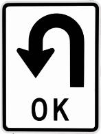
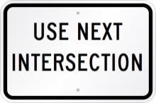
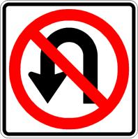
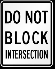
14 Mineral Avenue Modifications Recommended Right Turn Acceleration/Deceleration Lane Lane Width Narrowing Center Median Widening Speed Limit Change Specific U-turn Locations Deter Vehicle Queues from Blocking Intersections Not Recommended Median Nose Reduction Constructability Issues Cost Prohibitive
15
16
17
18
19

20 Platte Canyon Road Movements Recommended Mineral Avenue Intersection Dual NB & SB Left Turn Lanes Traffic Signal Modifications Channelized NB Right Turn Lane Mineral Drive Intersection Full Movement Access Not Recommended Meadowbrook Access to Platte Canyon Road Not Supported by Residents Cost Prohibitive
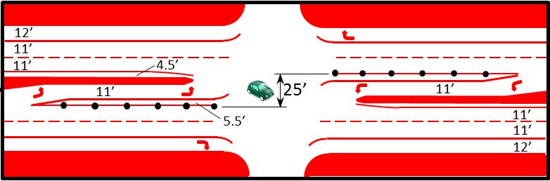
21 N Mineral Ave
22 Mineral Ave N Dual Left Turn Lanes
23 Mineral Ave N Dual Left Turn Lanes
24 Mineral Ave N Signal Modifications

25 Mineral Ave N Channelization Island
26 Mineral Ave N Full Movement
27 Mineral Ave N Channelization Islands
28 Mineral Ave N Channelization Island Channelization Islands Dual Left Turn Lanes Signal Modifications Full Movement

29 Side Street Improvements Provisional Revisions Crosswalk Striping Trail Signage Addition of Blank Out Signs on Polo Ridge Drive Pedestrian Signal Ultimate Alterations Curb Extensions Raised Crosswalk Additional Landscaping
30 Mineral Avenue Dusk Court
31 CROSSING SLOW DOWN RIDE SAFE Dusk Court PROVISIONAL Mineral Avenue CROSSING SLOW DOWN RIDE SAFE
32 CROSSING SLOW DOWN RIDE SAFE Dusk Court Curb Extensions ULTIMATE Mineral Avenue CROSSING SLOW DOWN RIDE SAFE
33 CROSSING SLOW DOWN RIDE SAFE Dusk Court ULTIMATE Mineral Avenue Raised Crosswalk CROSSING SLOW DOWN RIDE SAFE
34 CROSSING SLOW DOWN RIDE SAFE Dusk Court ULTIMATE Mineral Avenue Landscaping CROSSING SLOW DOWN RIDE SAFE
35 CROSSING SLOW DOWN RIDE SAFE Dusk Court ULTIMATE Mineral Avenue CROSSING SLOW DOWN RIDE SAFE
36 CROSSING SLOW DOWN RIDE SAFE Dusk Court ULTIMATE Mineral Avenue CROSSING SLOW DOWN RIDE SAFE
37 CROSSING SLOW DOWN RIDE SAFE Dusk Court ULTIMATE Mineral Avenue CROSSING SLOW DOWN RIDE SAFE
38 CROSSING SLOW DOWN RIDE SAFE Dusk Court ULTIMATE Mineral Avenue CROSSING SLOW DOWN RIDE SAFE

39 Phasing Plan Phase 1 Side Street Provisional Improvements Crosswalks, Trail Signage & Blank Out Signs Mineral Avenue Lane Reassignments Phase 2 Platte Canyon Road/Mineral Avenue Intersection Phase 3 Platte Canyon Road/Mineral Drive Intersection Side Street Ultimate Improvements Raised Crosswalks, Curb Extensions & Landscaping
40 Cost Estimating Phase Project Improvements Cost
41 Phase Project Improvements Cost 1A 1B Side Street Provisional Improvements Mineral Avenue Lane Reassignment Cost Estimating Crosswalk Striping Trail Signage Blank Out Signs on Polo Ridge Drive Pedestrian Signal Right Turn Acceleration/Deceleration Lane Lane Width Narrowing Center Median Widening Speed Limit Change Specific U-turn Locations Deter Vehicle Queues from Blocking Intersections $11,000 $35,000
42 Phase Project Improvements Cost 1A 1B 2A Side Street Provisional Improvements Mineral Avenue Lane Reassignment Platte Canyon Road/Mineral Avenue Intersection Cost Estimating Crosswalk Striping Trail Signage Blank Out Signs on Polo Ridge Drive Pedestrian Signal Right Turn Acceleration/Deceleration Lane Lane Width Narrowing Center Median Widening Speed Limit Change Specific U-turn Locations Deter Vehicle Queues from Blocking Intersections Dual NB & SB Left Turn Lanes Traffic Signal Modifications Channelized NB Right Turn Lane $11,000 $35,000 $92,000
43 Phase Project Improvements Cost 1A 1B 2A 3A 3B Side Street Provisional Improvements Mineral Avenue Lane Reassignment Platte Canyon Road/Mineral Avenue Intersection Platte Canyon Road/Mineral Drive Intersection Side Street Ultimate Improvements Cost Estimating Crosswalk Striping Trail Signage Blank Out Signs on Polo Ridge Drive Pedestrian Signal Right Turn Acceleration/Deceleration Lane Lane Width Narrowing Center Median Widening Speed Limit Change Specific U-turn Locations Deter Vehicle Queues from Blocking Intersections Dual NB & SB Left Turn Lanes Traffic Signal Modifications Channelized NB Right Turn Lane $11,000 $35,000 $92,000 Full Movement Access $107,000 Curb Extensions Raised Crosswalk Additional Landscaping $246,000
44 Phase Project Improvements Cost 1A 1B 2A 3A 3B Side Street Provisional Improvements Mineral Avenue Lane Reassignment Platte Canyon Road/Mineral Avenue Intersection Platte Canyon Road/Mineral Drive Intersection Side Street Ultimate Improvements Cost Estimating Crosswalk Striping Trail Signage Blank Out Signs on Polo Ridge Drive Pedestrian Signal Right Turn Acceleration/Deceleration Lane Lane Width Narrowing Center Median Widening Speed Limit Change Specific U-turn Locations Deter Vehicle Queues from Blocking Intersections Dual NB & SB Left Turn Lanes Traffic Signal Modifications Channelized NB Right Turn Lane $11,000 $35,000 $92,000 Full Movement Access $107,000 Curb Extensions Raised Crosswalk Additional Landscaping $246,000 Total $491,000


45 Funding Public Works Operating Budget Open Space Funds Capital Improvement Project Program State & Federal Grant Programs


46 Project Status To Date Community Engaged & Pleased with Process City Council Approved Phase 1 Implementation Complete After Data Collected Phase 2 & 3 Still to Come


47 Resident Perceptions Improved Operations Due to U-turn Relocation Reduced Speeds Due to Lane Narrowing, RT Accel/Decel & Lower Speed Limit Decrease Delays Due to Two-stage Left Turn Option Corridor Less Intimidating to Access

48 After Data Indications Volume Increase by <5% Slight Growth in Traffic at Intersections Decrease in Corridor Traffic Speeds by ~5 mph Comparable Delays Fewer Reported Accidents & Lower Incident of Injury Accidents


49 Project Takeaways Corridor Functioning Safer for Bicyclists & Peds Corridor More Accessible for Side Streets Minimal Impact to Vehicle Operations Demonstrated Benefits of Resident Involvement & Good Communication Safety Improvements with Minimal Impacts to Operations & Congestion City Applying Process to Other Projects


50 Comments or Questions
MINERAL AVENUE CORRIDOR ASSESSMENT STUDY IMPLEMENTATION STRATEGY
 MINERAL AVENUE CORRIDOR ASSESSMENT STUDY IMPLEMENTATION STRATEGY INTRODUCTION City Personnel Sign-in Sheet Comment Forms Please Write Down Any Feedback INTRODUCTION List of Topics for Presentation Study
Saskatchewan Drive Roadway Rehabilitation and Shared-Use Path Widening
 Saskatchewan Drive Roadway Rehabilitation and Shared-Use Path Widening We are here today to present the draft plan for the Saskatchewan Drive Roadway Rehabilitation and Shared-Use Path Widening project
Borough of Danville, PA Traffic Calming Program Guidelines
 Borough of Danville, PA Traffic Calming Program Guidelines Adopted by Borough Council on 1 INTRODUCTION Speeding Traffic is a major concern in the Borough of Danville because of its detrimental impacts
Northbound San Jose Avenue & I-280 Off-Ramp Road Diet Pilot Project
 Project Overview Fed by a two-lane Interstate-280 (I-280) off-ramp, high vehicular volumes and speeds are longstanding issues along San Jose Avenue. Residents in the surrounding neighborhoods have expressed
Advancing Transportation Choices in Des Moines. MPO Environmental Roundtable January 9, 2018
 Advancing Transportation Choices in Des Moines MPO Environmental Roundtable January 9, 2018 Presented by Jennifer McCoy, PE, PTOE City Traffic Engineer Agenda Des Moines Area Transportation Planning Connect
Mission-Geneva Transportation Study Community Workshop 2 July 8, 2006
 Community Workshop 2 July 8, 2006 Small Group Workbook 1 Basic Improvements on Mission Street Streetscape. Pedestrian-scale lighting; landscaping; community art on utility boxes; more (possibly unique)
City of Vestavia Hills Traffic Calming Policy for Residential Streets
 City of Vestavia Hills Traffic Calming Policy for Residential Streets PURPOSE: The purpose of the Traffic Calming Policy for Residential Streets is to address safety concerns related to vehicular traffic
Fields of St. Croix HOA Meeting. October 27, 2016
 Fields of St. Croix HOA Meeting October 27, 2016 Welcome! Why are we here? Update on Manning Avenue Phase 2 Project: Project Design Schedule Project Background Importance of Manning Avenue: Primary north-south
Welcome to the Quebec Alternatives Analysis Public Meeting
 Welcome to the Public Meeting Please sign in. Public Comment Please fill out a comment card and tell us what you think. Check back or comment any time at: www.quebecalternatives.com Project Area Technical
Public Information Centre
 WELCOME Public Information Centre Father Tobin Road Lougheed Middle School - Library Wednesday November 7, 2012 7:00 p.m.to 9:00 p.m. Please sign in Neighbourhood Traffic Calming Guide Background The City
Caltrans Sloat Boulevard Pedestrian Safety Project Response to Community Questions, Comments & Concerns
 Caltrans Sloat Boulevard Pedestrian Safety Project Response to Community Questions, Comments & Concerns Revised: May 10, 2016 The California Department of Transportation (Caltrans) is planning various
CITY OF WEST LAKE HILLS. Forest View Neighborhood Traffic Calming Study
 CITY OF WEST LAKE HILLS 901 South Mopac Expressway Building V, Suite 220 Austin, Texas 78746 Texas P.E. Firm Registration No. F-929 Klotz Associates Final Report Submittal: March 20, 2015 Revised Final
122 Avenue: 107 Street to Fort Road
 : 107 Street to Fort Road November 24, 2015 4:30 8:00 p.m. Meeting Purpose Summarize project work completed to date Share results of public input from Phase 1 Share the draft concept plan and proposed
25th Avenue Road Diet Project A One Year Evaluation. Transportation Fund for Clean Air Project #05R07
 25th Avenue Road Diet Project A One Year Evaluation Transportation Fund for Clean Air Project #05R07 Submitted by: The San Francisco Municipal Transportation Agency Dan Provence May 22, 2009 EXECUTIVE
Dr. M.L. King, Jr. Street North Complete Streets Resurfacing Opportunities HOUSING, LAND USE, AND TRANSPORTATION COMMITTEE MARCH 22, 2018
 Dr. M.L. King, Jr. Street North Complete Streets Resurfacing Opportunities HOUSING, LAND USE, AND TRANSPORTATION COMMITTEE MARCH 22, 2018 What s Happening The City plans to mill and resurface Dr. M.L.
CITY OF MINNEAPOLIS 26 th St E/W & 28 th St E/W Protected Bikeway. Open House - February 2017
 CITY OF MINNEAPOLIS 26 th St E/W & 28 th St E/W Protected Bikeway Open House - February 2017 2/27/2017 1 Purpose of Meeting Inform: Provide an overview of the project Opportunity to gather feedback/input/observations
SAFE ROUTES TO SCHOOL (SR2S)
") SAFE ROUTES TO SCHOOL (SR2S) In partnership with Burbank Unified School District (BUSD) & City of Burbank George Washington Elementary School Thomas Jefferson Elementary School John Muir Middle School
SAFE ROUTES TO SCHOOL (SR2S) In partnership with Burbank Unified School District (BUSD) & City of Burbank George Washington Elementary School Thomas Jefferson Elementary School John Muir Middle School
City of Sammamish. Welcome. Issaquah-Fall City Road Improvements Project Phase I Design: 242nd Avenue SE to Klahanie Drive SE
 Welcome Welcome to the third community meeting for the Issaquah-Fall City Road Improvements Project. AGENDA 6:00 p.m. Welcome and sign-in 6:10 p.m. Presentation 6:50 p.m. Open house Learn about the roadway
Everyone is a Pedestrian
 Everyone is a Pedestrian Improving Pedestrian Safety in Texas Transportation and Trinity River Project Committee 26 May 2015 Everyone is a Pedestrian Federal Highway Administration [ FHWA ] Programs to
BETHEL ROAD AND SEDGWICK ROAD CORRIDOR STUDY
 DRAFT PLAN City Council Meeting August 14, 2017 STUDY AREA Sedgwick Corridor State Route 160, principal arterial with Class 3 access management designation, commuter and freight route, connection to SR
HARRISON STREET/OAKLAND AVENUE COMMUNITY TRANSPORTATION PLAN
 HARRISON STREET/OAKLAND AVENUE Community Workshop #4: Draft Plan Review December 3, 2009 D E S I G N, C O M M U N I T Y & E N V I R O N M E N T INTRODUCTIONS Key Project Staff: Alisa Shen, Project Manager,
Appendix C. TRAFFIC CALMING PROGRAM TOOLBOX
 Appendix C. TRAFFIC CALMING PROGRAM TOOLBOX PHASE I...2 Do Not Enter Sign...3 One-Way Sign...4 Turn Prohibition...5 Pavement Markings...6 Speed Monitoring Trailer...7 Neighborhood Speed Watch...8 Police
Traffic Calming Policy
 Article I. Purpose and Goal. The purpose of this policy is to establish criteria and procedures the City will use to evaluate requests for, and if appropriate, implement traffic calming measures. Neighborhood
Brian McHugh, Buckhead Community Improvement District. SUBJECT: Wieuca Road at Phipps Boulevard Intersection Improvements Project
 MEMO TO: FROM: Brian McHugh, Buckhead Community Improvement District Jagan Kaja, AICP, WSP Parsons Brinckerhoff SUBJECT: Wieuca Road at Phipps Boulevard Intersection Improvements Project DATE: October
4. ENVIRONMENTAL IMPACT ANALYSIS 9. TRANSPORTATION AND TRAFFIC
 4. ENVIRONMENTAL IMPACT ANALYSIS 9. TRANSPORTATION AND TRAFFIC 4.9.1 INTRODUCTION The following section addresses the Proposed Project s impact on transportation and traffic based on the Traffic Study
Chapter 5. Complete Streets and Walkable Communities.
 Chapter 5. Complete Streets and Walkable Communities. 5.1 Description of Complete Streets. Cities throughout the world, and specifically the United States, are coming to embrace a new transportation and
DEPARTMENT OF ENVIRONMENTAL SERVICES. North Harrison Street (Lee Highway to Little Falls Road) Comparative Analysis. Prepared for:
 Comparative Analysis. Prepared for:") DEPARTMENT OF ENVIRONMENTAL SERVICES North Harrison Street (Lee Highway to Little Falls Road) Comparative Analysis Prepared for: Arlington County Department of Environmental Services 2100 Clarendon Boulevard,
DEPARTMENT OF ENVIRONMENTAL SERVICES North Harrison Street (Lee Highway to Little Falls Road) Comparative Analysis Prepared for: Arlington County Department of Environmental Services 2100 Clarendon Boulevard,
City of Cape Coral Traffic Calming. City Council May 16,
 City of Cape Coral Traffic Calming City Council May 16, 2016 1 In This Presentation Why Traffic Calming? What is Traffic Calming? Examples Traffic Calming in the City of Cape Coral How to develop a Traffic
AGENDA REPORT. Issue: Discussion of potential improvements on Barnwell Road at Niblick Drive
 AGENDA REPORT To: From: By: Honorable Mayor and City Council Members Warren Hutmacher, City Manager Tom Black, Public Works Director Date: March 23, 2016 Agenda: March 28, 2016 WORK SESSION AGENDA: Barnwell
TRAFFIC ACTION PLAN. Laurie Meadows Neighborhood CITY OF SAN MATEO
 TRAFFIC ACTION PLAN Laurie Meadows Neighborhood CITY OF SAN MATEO Draft January 2017 Table of Contents Introduction... 2 The Traffic Forum Process... 5 Neighborhood Traffic Issues... 7 Neighborhood Recommendations
5 Transit & Traffic. Overview
 5 Transit & Traffic Overview Montgomery Place s roadways and overall traffic circulation are unique in the city due to the narrow streets and avenues with boulevards; however, no sidewalks or curbs in
Los Altos Hills Town Council - June 18, 2015 Palo Alto City Council June 22, AGENDA ITEM #2.B Presentation
 Los Altos Hills Town Council - June 18, 2015 Palo Alto City Council June 22, 2015 AGENDA ITEM #2.B Presentation Previous Presentations Los Altos Hills Town Council in May 2014 and February 2015 Palo Alto
Mayor s Bicycle Advisory Council. Wednesday, December 13 th, 2017
 Mayor s Bicycle Advisory Council Wednesday, December 13 th, 2017 Bicyclist Fatalities, Year to Date (January 1 November 30, 2017) - MBAC Briefing Bicyclist Fatality Statistics Year to date total, 2017
CITY OF ANN ARBOR TRAFFIC CALMING PROGRAM PROCESS OVERVIEW. Petitioner defines the project area limits and gathers petition signatures.
 CITY OF ANN ARBOR TRAFFIC CALMING PROGRAM PROCESS OVERVIEW Step 1: Petition Petitioner defines the project area limits and gathers petition signatures. 50% of addresses within the project area must sign
WELCOME Public Information Centre
 WELCOME Public Information Centre Fernforest Drive Brampton Soccer Centre Community Room #2 Tuesday January 19, 2016 6:30 p.m.to 9:00 p.m. Please sign in Neighbourhood Traffic Calming Guide Background
Why invest in the 1 Street S.W. Corridor?
 Why invest in the 1 Street S.W. Corridor? This project is an investment in the Beltline Community and Calgary s economy. It is anticipated that The City s investment along this corridor will help with
CITY OF OTTAWA ROADWAY MODIFICATION APPROVAL UNDER DELEGATED AUTHORITY
 RMA-2015-ATM-038 CITY OF OTTAWA ROADWAY MODIFICATION APPROVAL UNDER DELEGATED AUTHORITY DATE: April 22, 2015 SUBJECT Approval of Roadway Modifications Recommended through an Area Traffic Management Study
MEMORANDUM. Earl Haugen and UND Transportation and Traffic Coordination Committee
 SRF No. 7766 MEMORANDUM TO: FROM: Earl Haugen and UND Transportation and Traffic Coordination Committee Rick Lane, P.E. DATE: November 26, 2013 SUBJECT: UNIVERSITY AVE REVIEW Our review of the University
MEMORANDUM. Charlotte Fleetwood, Transportation Planner
 MEMORANDUM Date: Updated August 22, 2017 To: Organization: Charlotte Fleetwood, Transportation Planner Boston Transportation Department From: Jason DeGray, P.E., PTOE, Regional Director of Engineering
WELCOME. Thank you for joining us at the Second Public Workshop for the Carlsbad Pedestrian Master Plan. We look forward to receiving your feedback.
 City of Carlsbad Pedestrian Master Plan: WELCOME WELCOME Please Sign In Provide Input at Flip Charts Review Boards Presentation of Draft Plan Thank you for joining us at the Second Public Workshop for
RESIDENTIAL TRAFFIC CALMING PROGRAM
 RESIDENTIAL TRAFFIC CALMING PROGRAM CITY OF ALEXANDRIA, KENTUCKY Prepared For: Safety & Public Works Departments 1 Table of Contents CITY OF ALEXANDRIA... 3 RESIDENTIAL TRAFFIC CALMING PROGRAM... 3 INTRODUCTION...
Public Information Meeting. Orange Camp Road. Dr. Martin Luther King Jr. Beltway to I-4. Presented by: Volusia County August 2, 2018
 Public Information Meeting Orange Camp Road Dr. Martin Luther King Jr. Beltway to I-4 Presented by: Volusia County August 2, 2018 1 Project Goals To improve the operations and safety for Orange Camp Road
Welcome! San Jose Avenue Open House August 25, 2015
 Welcome! San Jose Avenue Open House August 25, 2015 Vision Zero The City and County of San Francisco adopted Vision Zero San Francisco Vision Zero High Injury Network as a policy in 2014, committing an
Water Street Promenade. Engineering and Design Services. Public Information Meeting No. 2. Education / Infrastructure / Innovation. Maplewood Avenue &
 Public Information Meeting No. 2 Water Street Promenade Maplewood Avenue & Engineering and Design Services Adjacent Areas July 16,2014Portsmouth, NH May 10, 2016 Education / Infrastructure / Innovation
San Rafael School District. Task Force Meeting Notes. November 5, 2012
 San Rafael School District Task Force Meeting Notes November 5, 2012 Attendees (8) Wendi Kallins Program Director for Safe Routes to Schools; Laura Kelly Volunteer Liaison for Safe Routes to Schools; Leslie
RapidRide Roosevelt Seat Sea t t le t le Depa De r pa t r men men t of Sept T an r sp an or sp t or a t t a ion
 RapidRide Roosevelt Seattle Bicycle Advisory Board 1 Our mission, vision, and core values Mission: deliver a high-quality transportation system for Seattle Vision: connected people, places, and products
CITY OF LOS ANGELES INTER-DEPARTMENTAL MEMORANDUM
 CITY OF LOS ANGELES INTER-DEPARTMENTAL MEMORANDUM Date: April 1, 219 To: Honorable City Council c/o City Clerk, Room 395, City Hall Attention: Honorable Mike Bonin, Chair, Transportation Committee From:
Roadways. Roadways III.
 Introduction 97 Roadway Design Principles 98 Safe Speeds 99 Optimizing of Street Space 00 Minimum Lane Widths in the City of Boston 02 Design Features that Reduce Operating Speeds 05 Travel Lanes Transit
Balancing Operation & Safety for Motorized and Non-Motorized Traffic
 Balancing Operation & Safety for Motorized and Non-Motorized Traffic Brian Willham, PE, PTOE Iowa Director - MOVITE June 30, 2014 Learning Objectives: When & Why should we measure the performance of complete
FOLSOM-HOWARD STREETSCAPE OVERVIEW
 FOLSOM-HOWARD STREETSCAPE OVERVIEW SoMa residents should have the same kinds of amenities that other neighborhoods have. The Folsom- Howard Streetscape Project will make SoMa more livable by making it
Citizen Advisory Group Meeting #8 May 5, Welcome. Today s meeting will focus on: Land Use & Transportation CHARLOTTEPLANNING.
 Citizen Advisory Group Meeting #8 May 5, 2010 Welcome. Today s meeting will focus on: Land Use & Transportation CHARLOTTEPLANNING.ORG Meeting Agenda Handouts: o Meeting Agenda o Summary of East Seventh
REGIONAL BICYCLE AND PEDESTRIAN DESIGN GUIDELINES
 REGIONAL BICYCLE AND PEDESTRIAN DESIGN GUIDELINES November 16, 2011 Deb Humphreys North Central Texas Council of Governments Bicycle and Pedestrian Advisory Committee Snapshot of the Guide 1. Introduction
CONTENTS EXECUTIVE SUMMARY 1
 CONTENTS CHAPTER PAGE EXECUTIVE SUMMARY 1 1 ISSUES AND PURPOSE OF THE ANALYSIS 2 1.1 Background 2 1.2 Analysis Area 2 1.3 Issues and Observations 3 1.4 Project and Public Meetings 3 2 LIST OF PREFERRED
Transportation Impacts: Toronto York Spadina Subway Extension
 STAFF REPORT ACTION REQUIRED Transportation Impacts: Toronto York Spadina Subway Extension Date: June 6, 2011 To: From: Wards: Reference Number: North York Community Council Director, Transportation Services
Edenbrook Hill Drive Traffic Calming Study
 WELCOME Public Information Centre Edenbrook Hill Drive Traffic Calming Study Fletchers Meadow Secondary School Wednesday January 20, 2016 6:30 p.m.to 9:00 p.m. Please sign in Neighbourhood Traffic Calming
San Jose Transportation Policy
 San Jose Transportation Policy Protected Intersections in LOS Policies to Support Smart Growth Presented by: Manuel Pineda City of San Jose Department of Transportation Bay Area Map San Francisco Oakland
Queensboro Bridge Bus Priority Study: Summary of Recommendations. Presentation to Manhattan Community Board 8 May 4, 2011
 : Summary of Recommendations Presentation to Manhattan Community Board 8 May 4, 2011 1 Overview Study Goal: Identify cost-effective ways to improve bus speed and reliability for local and express buses
MARKET/JFK VISION ZERO PILOT PROJECT FEBRUARY 2019 EVALUATION REPORT
 MARKET/JFK VISION ZERO PILOT PROJECT FEBRUARY 2019 EVALUATION REPORT WHY IS THIS PROJECT IMPORTANT? Market Street and JFK Boulevard in Center City are key east-west corridors in the core business district.
Paoli Road Improvement Feasibility Study
 Paoli Road Improvement Feasibility Study & Public Participation Project March 24, 2015 Prepared for: Tredyffrin Township Prepared by: McMahon Associates, Inc. with Town Planning Partnership, LLC Glackin
Community Transportation Plan
 Community Transportation Plan Appendix A: Traffic Calming CITY OF DECATUR COMMUNITY TRANSPORTATION PLAN Appendix A: City of Decatur City-wide Residential Traffic Calming Program Process & Procedures The
Community Meeting February 27, 2007 Dorchester Avenue Transportation & Streetscape Improvements Action Plan February 27, 2007
 Community Meeting Tonight s Agenda 6:00 Introductions South Boston/Dot Ave Improvement Study Background 6:15 Consultant Introductions Review of Scope and Schedule Review of Proposed Corridor Wide Guidelines
Riverside Drive Complete Streets Project 3 rd Community Meeting. March 26, 2015
 Riverside Drive Complete Streets Project 3 rd Community Meeting March 26, 2015 Providing Feedback Sign-In with contact information for future updates Complete questionnaire provided tonight Complete comment
Governance and Priorities Committee Report For the July 2, 2015 Meeting
 CITY OF VICTORIA For the July 2, 2015 Meeting To: Governance and Priorities Committee Date: From: Subject: Brad Dellebuur, A/Assistant Director, Transportation and Parking Services Executive Summary The
Capital Crescent Trail Crossing at Little Falls Parkway
 M-NCPPC Montgomery Parks Capital Crescent Trail Crossing at Little Falls Parkway INTERSECTION SAFETY IMPROVEMENT STUDY COMMUNITY MEETING JUNE 13, 2018 SOMERSET ELEMENTARY SCHOOL, 7:00-9:00 PM Welcome /
5. RUNNINGWAY GUIDELINES
 5. RUNNINGWAY GUIDELINES These guidelines should be considered collectively when making runningway decisions. A runningway is the linear component of the transit system that forms the right-of-way reserved
City of Elizabeth City Neighborhood Traffic Calming Policy and Guidelines
 City of Elizabeth City Neighborhood Traffic Calming Policy and Guidelines I. Purpose: The City of Elizabeth City is committed to ensure the overall safety and livability of residential neighborhoods. One
Draft Traffic Calming Policy Paper
 Draft Traffic Calming Policy Paper What is Traffic Calming The term traffic calming is defined differently throughout the United States. The Institute of Transportation Engineers, an international educational
VT15 / Allen Martin Drive Intersection Scoping Study
 VT15 / Allen Martin Drive Intersection Scoping Study ALTERNATIVES PRESENTATION MEETING DECEMBER 19, 2016 Agenda Study Area Project Background Existing Conditions Identified Issues Proposed Alternatives
Albany Shaker Road Corridor Study Public Meeting # 2
 Albany Shaker Road Corridor Study Public Meeting # 2 Scope / Meeting Purpose This project is a CDTC Linkage Study. The Linkage Program is designed to implement the adopted planning and investment principles
POLICY FOR NEIGHBORHOOD TRAFFIC CALMING
 POLICY FOR NEIGHBORHOOD TRAFFIC CALMING I. STATEMENT OF PURPOSE This policy provides a procedure for the consideration, evaluation and implementation of requests for traffic calming measures. II. DEFINITIONS
Road Diets FDOT Process
 Florida Department of TRANSPORTATION Road Diets FDOT Process Humberto Castillero, PE, PTOE Roadway Design Office Purpose of Guide Develop a statewide lane elimination review process Balance state & local
Lincoln Avenue Road Diet Trial
 Lincoln Avenue Road Diet Trial Data Collection Report June 1, 2015 Department of Transportation Table of Contents I. Introduction...... 3 II. Data Collection Methodology & Results...... 5 A. Traffic Volume
Neighborhood Pedestrian Safety and Traffic Calming Study
 Neighborhood Pedestrian Safety and Traffic Calming Study for the area bounded by Foster Avenue, Bedford Avenue, Farragut Road and Ocean Avenue Flatbush, Brooklyn, New York prepared by Michael King, miking@trafficcalmer.com
Figure 1: Vicinity Map of the Study Area
 ARIZONA TEXAS NEW MEXICO OKLAHOMA May 5, 2016 Mr. Anthony Beach, P.E. BSP Engineers 4800 Lakewood Drive, Suite 4 Waco, Texas 76710 Re: Intersection and Access Analysis along Business 190 in Copperas Cove
WELCOME Mission-Geneva Transportation Study
 WELCOME Mission-Geneva Transportation Study Study Process and Schedule 2005 2006 Oct Nov Dec Jan Feb Mar Apr May Jun Jul Aug Sept Oct Task 2 Develop Outreach Plan Task 3 Document Existing Conditions/ Prioritize
City of Rocky Mount Residential Traffic Management Policy
 City of Rocky Mount Residential Traffic Management Policy PURPOSE To set forth the policy of the City with respect to addressing concerns regarding speeding, cut-thorough traffic, and neighborhood traffic
PROJECT OBJECTIVES. Improve vehicle capacity for the intersection. Improve pedestrian and bicycle access
 COMMUNITY MEETING Project Update March 15, 2010 Purcellville, Virginia OVERVIEW Project need / objectives Project recap Design elements Proposed improvements Summary of project benefits / next steps PROJECT
Lincoln Way Multimodal Safety and Operations Study. City and University Summary Presentation
 Lincoln Way Multimodal Safety and Operations Study City and University Summary Presentation February 27, 2018 Agenda Introductions Study Overview: Phase 1 - Discovery Phase 2 Improvement Recommendations
Pine Hills Road Pedestrian/Bicycle Safety Study Board of County Commissioners Work Session
 Pine Hills Road Pedestrian/Bicycle Safety Study Board of County Commissioners Work Session February 20, 2018 Meeting Agenda Study Overview Existing Conditions Access Management Potential Gateway Features
Major Bike Routes 102 Avenue Workshop April 21, 2015
 Major Bike Routes 102 Avenue Workshop April 21, 2015 Our Purpose Today Provide context on how Major Bike Routes fit into Edmonton s future Share information on what we heard in our last phase, and how
Seattle Department of Transportation (SDOT) Preliminary Responses to Madison-Miller Community List of Site-Specific Concerns
 Preliminary Responses to Madison-Miller Community List of Site-Specific Concerns") Seattle Department of Transportation (SDOT) Preliminary Responses to Madison-Miller Community List of Site-Specific Concerns Background In July 2002 SDOT staff met with a small group of community residents
Seattle Department of Transportation (SDOT) Preliminary Responses to Madison-Miller Community List of Site-Specific Concerns Background In July 2002 SDOT staff met with a small group of community residents
Giles Run Connector Road
 Giles Run Connector Road Laurel Hill Adaptive Reuse Area to Laurel Crest Drive South County Federation Meeting June 14, 2016 History Connector road included in the Laurel Hill Comprehensive Plan amendment
City of El Cerrito San Pablo Avenue Specific Plan. Capital Improvement Program
 City of El Cerrito San Pablo Avenue Specific Plan Capital Improvement Program May 2015 San Pablo Avenue Intersection Improvements San Pablo Avenue and Hill Street/Eastshore Boulevard Background Existing
Public Works Committee Meeting Richard E. Mastrangelo Council Chamber November 20, 2017
 Public Works Committee Meeting Richard E. Mastrangelo Council Chamber November 20, 2017 Purpose of Meeting Why are we here? Project Recap/Updates Project Limits/Segments Road Diet Concept Lessons Learned
3 TRAFFIC CONTROL SIGNAL TIMING AND SYNCHRONIZATION
 Report No. 8 of the Transportation Services Committee Regional Council Meeting of October 20, 2011 3 TRAFFIC CONTROL SIGNAL TIMING AND SYNCHRONIZATION The Transportation Services Committee recommends:
This page intentionally left blank.
 This page intentionally left blank. COMMUNITY Glenpool Community Overview Glenpool Glenpool is a city of nearly 12,000 residents located in Tulsa County southwest of Tulsa and Jenks. The city is growing
Terwillegar Drive Expressway Draft Concept Plan
 Terwillegar Drive Expressway Draft Concept Plan Anthony Henday Drive to Whitemud Drive November 28 5:00-8:00 p.m. December 1 10:00 a.m. - 3:00 p.m. Let s Talk Today you can: Learn about the new direction
Arlington Public Schools Thomas Jefferson Site Evaluation Transportation Networks. Thomas Jefferson Working Group Meeting #6 November 10, 2014
 Arlington Public Schools Thomas Jefferson Site Evaluation Transportation Networks Thomas Jefferson Working Group Meeting #6 November 10, 2014 2 3 INTRODUCTION 4 Goal of our work: Identify and assess multi-modal
OCALA/MARION TPO CITY OF BELLEVIEW CORRIDOR PLAN STUDY PRESENTATION TO THE BELLEVIEW CITY COMMISSION JANUARY 25, :00 PM
 OCALA/MARION TPO CITY OF BELLEVIEW CORRIDOR PLAN STUDY PRESENTATION TO THE BELLEVIEW CITY COMMISSION JANUARY 25, 2016 6:00 PM STUDY AREA Ocala/Marion TPO US-441 Corridor Study 2 Ocala/Marion TPO US-441
MONTCLAIR TOWNSHIP PEDESTRIAN SAFETY COMMITTEE
 + MONTCLAIR TOWNSHIP PEDESTRIAN SAFETY COMMITTEE + PEDESTRIAN SAFETY COMMITTEE CURRENT MISSION: The Committee was formed in 2013 to call attention to and eliminate unsafe conditions on Montclair streets
NEIGHBOURHOOD TRAFFIC COMMITTEE POLICY AND PROCEDURE
 The City of Vaughan 2141 Major Mackenzie Drive Vaughan, Ontario Canada L6A 1T1 Tel (905) 832-2281 NEIGHBOURHOOD TRAFFIC COMMITTEE POLICY AND PROCEDURE REVISED JUNE 2010 APPLICABILITY The Neighbourhood
Community Task Force November 15, 2017
 Community Task Force November 15, 2017 Welcome and Introductions Project Partners Regional Transportation District (RTD) Colorado Department of Transportation (CDOT) Denver Regional Council of Governments
MARK MESSIER TRAIL LONG-RANGE PLANNING STUDY WELCOME. Mark Messier Trail Planning Study 137 Avenue to Anthony Henday Drive.
 WELCOME Mark Messier Trail Planning Study 137 Avenue to Anthony Henday Drive December 5, 2013 MEETING PURPOSE To gather your thoughts and ideas for Mark Messier Trail concept plans between 137 Avenue and
Bikeway action plan. Bicycle Friendly Community Workshop March 5, 2007 Rochester, MN
 Bikeway action plan Summary The was held on March 5, 2007 at the Rochester Mayo Civic Center. The workshop was hosted by Rochester-Olmsted County Planning Department in collaboration with the League of
TRAFFIC CALMING PLANNER S PORTFOLIO
 TRAFFIC CALMING PLANNER S PORTFOLIO ISSUE 8 January 2017 PLANNER S PORTFOLIO TRAFFIC CALMING 1 OVERVIEW 2 3 4 ENGINEERED TRAFFIC CALMING MEASURES SIGNS AND PAVEMENT MARKINGS EMERGENCY RESPONSE DELAYS 5
Tonight is for you. Learn everything you can. Share all your ideas.
 Strathcona Neighbourhood Renewal Draft Concept Design Tonight is for you. Learn everything you can. Share all your ideas. What is Neighbourhood Renewal? Creating a design with you for your neighbourhood.
Government of the District of Columbia Department of Transportation
 Government of the District of Columbia Department of Transportation November 1, 2017 Stephen Gardner Advisory Neighborhood Commission 3D P.O. Box 40846 Palisades Station Washington, DC 20016 3D06@anc.dc.gov
THE ALAMEDA CONCEPT DESIGN COMMUNITY MEETING 3. A Plan for The Beautiful Way JANUARY 28, 2010
 CONCEPT DESIGN COMMUNITY MEETING 3 JANUARY 28, 2010 AGENDA INTRODUCTION COMMUNITY INPUT ROADWAY STUDIES STREETSCAPE DESIGN STATIONS DISCUSSION SUMMARY AND DISCUSSION NEXT STEPS CLOSE INTRODUCTION SCHEDULE
North Avenue Corridor Study
 North Avenue Corridor Study Advisory Committee Meeting #6 July 1, 2014 Agenda Concept Revisions based on Advisory Committee feedback Review of New Concept Scoring & Costs Concept Discussion/Questions Voting:
ORANGE COUNTY PUBLIC WORKS TRAFFIC INVESTIGATIONS
 ORANGE COUNTY PUBLIC WORKS TRAFFIC INVESTIGATIONS STAFF REPORT OF: January 6, 2019 SUPERVISORIAL DISTRICT: 5 SUBJECT: LOCATION: INVESTIGATOR: O Neill Drive at Roanoke Drive; Ladera Ranch; TB 922-E6 Clever