November 20, 2017 // 6:00 p.m. // 1 s t Floor Conference Room 301 Walnut Street, Windsor, CO AGENDA
|
|
|
- Raymond Nelson
- 5 years ago
- Views:
Transcription
1 TOWN BOARD WORK SESSION November 20, 2017 // 6:00 p.m. // 1 s t Floor Conference Room 301 Walnut Street, Windsor, CO AGENDA GOAL of this Work Session is to have the Town Board receive information on topics of Town business from the Town Manager, Town Attorney and Town staff in order to exchange ideas and opinions regarding these topics. Members of the Public in attendance are asked to be recognized by the Mayor before participating in any discussions of the Town Board. 1. Crosswalk presentation and policy discussion 2. Meet with Comcast about current and future Comcast Services No packet materials received 3. Future Meetings Agenda The Town of Windsor will make reasonable accommodations for access to town services, programs, and activities, and will make special communication arrangements for persons with disabilities. Please call by noon on the day prior to the meeting to make arrangements.
2 MEMORANDUM Date: January 20, 2017 To: Mayor and Town Board Via: From: Re: Item #: WKS - 1 Kelly Arnold, Town Manager Dennis Wagner, Director of Engineering Kelly Houghteling, Assistant to Town Manager Terry Walker, Director of Public Works Scott Ballstadt, Director of Planning Rick Klimek, Chief of Police Paul Hornbeck, Senior Planner Brian Rowe, Streets Foreman Pedestrian Crossing Treatment Guidelines Background / Discussion Included in Windsor s current Strategic Plan is a commitment to establish standards and criteria for pedestrian crosswalks. The traffic code requires vehicles to yield the right-of-way to crossing pedestrians at any intersection where crossing is not prohibited, regardless of marked crosswalks. At the same time, the code requires pedestrians to wait until it is safe before attempting to cross. Thus, motorists and pedestrians share responsibility for safe street crossings. The main function of a marked crosswalk is to prepare drivers for the likelihood of encountering a pedestrian. Crosswalks also create an atmosphere of walkability and accessibility for pedestrians and reinforce the location and legitimacy of a crossing. Policies and guidelines published by these northern Colorado municipalities were reviewed: Boulder, Fort Collins, Lafayette, Loveland, Greeley and Longmont. It was decided that Pedestrian Crossing Treatment Installation Guidelines adopted by the City of Boulder in 2011 was the most definitive and logical. Fox-Tuttle Transportation Group, a private consulting firm, has worked with the City of Boulder since the original version of Boulder s document was developed in Fox-Tuttle, now Fox- Tuttle-Hernandez (FTH) Transportation Group, has consulted with Windsor on downtown parking and developed a street re-striping plan for Main St. from 4 th St. east to 1 st Street in order to accommodate diagonal parking in the 300 block. FTH is also working with the Town of Erie on pedestrian crossing treatment guidelines based on Boulder s.
3 According to the Executive Summary in Boulder s document, When Boulder s original Pedestrian Crossing Treatment Warrants were developed in 1996, there were relatively few studies available at the federal, state and municipal levels with respect to the installation of crosswalks and other crossing treatments. Over the past few years more studies have been published which assist in the formulation of specific local policies. However, national standards still provide little guidance for the installation of marked crosswalks and treatments, particularly at mid-block locations. Over the past fourteen years, the City of Boulder has undertaken an extensive evaluation of the effectiveness and safety of various treatments being tested at crossing locations in the City. The City has installed demonstration devices at nearly 40 locations including two-lane and multi-lane crossings. These treatments have included enhanced crosswalk signing, pedestrian-actuated flashing signs, raised crossings on right-turn bypass islands, and other devices. This evaluation has shown that while these devices most often result in a significant increase in driver compliance (yielding to crossing pedestrians) at crosswalks, some of these devices may lead to higher vehicle-vehicle and vehicle-pedestrian accidents at multi-lane, high pedestrian/vehicle volume locations. The results of the data collection to date have been incorporated into these guidelines, though the City of Boulder will continue to evaluate these and other treatments and may make changes to the guidelines over time. Earlier this year, Windsor signed a contract with FTH to write guidelines based on Boulder s but tailored specifically for Windsor. Bill Fox with FTH met with the Windsor staff listed above and others twice during the development of the guidelines. The guidelines include four steps to evaluate a potential crossing location: Step 1: Identification and description of crossing location. Step 2: Physical data collection. Step 3: Traffic data collection and operation observations. Step 4: Apply data to Figure 1, Table 1 and Figure 2 to determine appropriate treatments. To start out, the staff group decided it would be useful for Bill Fox to apply Boulder s thresholds to three intersections in Windsor that already have marked crosswalks to test them against the level of treatment suggested by the Boulder guidelines. The following is what he reported: Hollister Lake/Saratoga Drive had very low pedestrian volumes and would not warrant a crossing treatment. 7 th St./Garden Dr. had a bit more crossing activity, including some school children, but still would not have warranted a crossing treatment. Windshire Dr./Jacoby Rd. is a school crossing in a school zone with very high pedestrian activity. Boulder s criteria would call for the existing crossing treatments plus a raised median refuge island. Based on the above three intersections, the Windsor staff group decided Windsor s parameters should be somewhat less restrictive than Boulder s. An explanation of those parameters follows. The flowchart in Figure 1 in the attached draft guideline is a tool to determine whether an intersection is a candidate for crossing treatments. Average Daily Traffic (ADT) volume is an important factor in analyzing an intersection for crosswalk treatments. According to Boulder s guidelines, the ADT must be more than Page 2 of 2
4 1,500 vehicles per day if crossing treatment is to be considered. The Windsor staff group decided that parameter should be lowered to 1,000 vpd. A second important factor is pedestrian volume. Boulder s guidelines sets minimum pedestrian volume thresholds at 20 peds per hour in any one hour or 18 peds per hour in any two hours or 15 peds per hour in any three hours, with young, elderly, and disabled pedestrians counting 2x toward volume thresholds. Windsor staff group decided those parameters should be lowered to 18 in any one hour or 16 in any two hours or 12 in any three hours. A third important parameter in Boulder s guidelines is whether the pedestrian crossing serves a multi-use path, defined as a path with increased importance for pedestrian and bicycle transportation and connectivity. An example in Windsor is the Poudre River Trail. According to the Figure 1 flowchart, a multi-use path crossing is a candidate for treatment regardless of pedestrian volume as long as minimum vehicles per day is met. Windsor s staff group went one step farther and recommends that a crossing providing direct access to a school, park or other civic facility be a candidate for treatment based on engineering judgement. Financial Impact Guidelines can provide a consistent procedure for considering the installation of crossing treatments where needed on a case-by-case basis. Of course, implementation of crossing treatments requires funds and therefore must be considered carefully in the annual budgeting process. Relationship to Strategic Plan Thoughtful Framework and Supportive Infrastructure Safe, Well-Planned Community with Spirit and Pride Recommendation Adopt guidelines and start following the next steps in Section 4.0. Attachments Draft Windsor Pedestrian Crossing Guidelines Page 3 of 3


5 Town of Windsor Pedestrian Crossing Guidelines DRAFT Prepared for: Town of Windsor Engineering Department 301 Walnut Street Windsor, Colorado 80550


6 For More Information, please contact: Engineering Department 301 Walnut Street Windsor, Colorado (970) Page i
7 TABLE OF CONTENTS Town of Windsor Pedestrian Crossing Guidelines EXECUTIVE SUMMARY DEFINITIONS CROSSING LOCATION EVALUATION PROCEDURES AND CONSIDERATIONS Evaluation Steps Additional Evaluation Considerations Types of Crossing Treatments at Uncontrolled Locations Minimum Vehicle Volume For Treatments Minimum Pedestrian Volume for Treatments at Uncontrolled Crossing Locations Definition of a Pedestrian Median Refuge and Minimum Median Refuge Width Distance to Nearest Marked or Protected Crossing Conditions That May Limit the Use of Rectangular Rapid Flash Beacons at Pedestrian Crossings Selecting Between a Pedestrian Traffic Signal, HAWK Beacon, or RRFBs Signal Progression and Traffic Operational Considerations Differential Vehicle Queue Lengths and Pedestrian Safety Unmarked Pedestrian Crossing Facilitation SUPPLEMENTAL POLICIES Crosswalk Lighting Avoiding Overuse of Crossing Treatments Multi-Use Path Crossings Textured and Colored Pavement Treatments Accessible Crosswalks Raised Crossings at Right-Turn Bypass Islands Removal of Treatments NEXT STEPS Page ii
8 LIST OF FIGURES AND TABLES Town of Windsor Pedestrian Crossing Guidelines Crossing Location Evaluation Worksheet Figure 1 Pedestrian Crossing Treatment Flowchart...22 Table 1 Criteria for Crossing Treatments at Uncontrolled Locations...23 Figure 2a Town of Windsor Guidelines for the Installation of Pedestrian Hybrid (HAWK) Beacons, Pedestrian Signals, or Rectangular Rapid Flash Beacon (RRFB) Signs on Low-Speed Roadways...24 Figure 2b Town of Windsor Guidelines for the Installation of Pedestrian Hybrid (HAWK) Beacons, Pedestrian Signals, or Rectangular Rapid Flash Beacon (RRFB) Signs on High-Speed Roadways...24 Page iii
9 EXECUTIVE SUMMARY Providing safe and efficient pedestrian facilities is a long-established goal of the Town of Windsor. The decision to travel as a pedestrian is in part subject to the pedestrian s ability and perceived ability to safely and efficiently cross roadways along the travel route. On this basis, the Town of Windsor has established this document to provide a set of criteria, procedures, and policies to guide the installation of pedestrian crossing treatments on Windsor s roadways. Specifically, this document summarizes: Criteria for Pedestrian crossing Procedures for evaluating the need for crossing treatments Types of crossing treatments that may be applicable for a particular set of pedestrian volumes, pedestrian types, vehicular volumes, vehicular speeds, and roadway geometry. National standards provide little guidance for the installation of marked crosswalks and treatments, particularly at mid-block locations. Crosswalks and other crossing treatments are typically installed based on engineering judgment. Key issues, such as the circumstances in which a crosswalk should be installed, how much safety benefit crosswalks provide, and the application of various crossing enhancements are still commonly debated topics. Local communities, such as The City of Boulder, have experimented with different pedestrian crossing treatments, under a variety of crossing situations, to improve safety for pedestrians by increasing the rate at which motorists yield to crossing pedestrians. In fact, this document has taken advantage of much of that work and has been patterned after Boulder s Pedestrian Crossing Treatment Installation Guidelines. These Pedestrian Crossing Guidelines are intended to provide a consistent procedure for considering the installation of crossing treatments where needed on a case-by-case basis in the Town of Windsor. Implementation of crossing treatments will require funds that could potentially have been spent on other transportation system improvements, and, therefore, must be considered carefully in the funding allocation process. Information published by the Federal Highways Administration (FHWA) suggests that on two-lane roadways, marked crosswalks alone (without any signs or other treatments) at uncontrolled locations have no effect on pedestrian accident rates. The study suggests that, on higher volume, multi-lane roadways, marked crosswalks alone (without any other treatments) are associated with higher vehicle-pedestrian accidents rates compared to unmarked locations. Page 1
10 1.0 DEFINITIONS This section includes the definitions of some of the common technical terms used in this document. Average Daily Traffic (ADT) The amount of vehicular traffic that crosses an imaginary line across a roadway in a 24-hour period. ADT information typically includes both directions of vehicle travel (if on a two-way street). Controlled Pedestrian Crossing A pedestrian crossing where motorists are required to stop by either a stop sign or traffic signal (including a HAWK beacon). Crosswalk Lighting Street lighting applied at a pedestrian crossing to help approaching motorists see a crossing pedestrian. Crosswalk lighting is at a vehicular scale like normal street lighting rather than a pedestrian scale that is often used along a sidewalk. Curb Extensions A roadway edge treatment where a curbline is bulged out toward the middle of the roadway to narrow the width of the street. Curb extensions are sometimes call neckdowns, and are often used at the location of a pedestrian crosswalk to minimize the distance and time that a crossing pedestrian must be in the roadway. Differential Vehicle Queuing See also Vehicle Queue. A condition on a roadway with two or more travel lanes in a single direction where the line of stopped traffic in one travel lane is significantly longer than the line of stopped traffic in the adjacent travel lane. Differential vehicle queuing across a pedestrian crosswalk can cause a significant safety concern as it increased the potential for multiple threat pedestrian accidents where a pedestrian can step out from behind a stopped vehicle in one lane into the path of a moving vehicle traveling in the same direction in the adjacent lane. Gap in Traffic A gap in traffic is the space between vehicles approaching the pedestrian crossing. Gaps are typically measured in seconds, not distance, as it is the length of the gap in time that a pedestrian must be able to cross in. A directional gap is the gap between vehicles approaching in a single direction. A directional gap can be measured between vehicles in Page 2
11 a single lane, or between vehicles approaching in the same direction but in different lanes on a multi-lane approach. If there is no median refuge at the crossing, a pedestrian will need to find an acceptable gap in traffic approaching from two directions at once. This is much more challenging than finding a gap in each approach direction separately. HAWK Beacon Lane A pedestrian hybrid beacon is a relatively new type of crossing treatment used to both warn and control traffic at a pedestrian crossing. It is actuated by a pedestrian push button, and uses a combination of circular yellow and red traffic signal displays to first warn motorists of a pedestrian that is about to cross the street, then require the motorist to stop for the pedestrian crossing, and then release the motorist to proceed once the pedestrian has cleared the crossing. The Beacon is a hybrid between a pedestrian traffic signal and a stop sign. A portion of the roadway surface designated for motor vehicle travel, typically in a single direction, that is delineated by pavement marking stripes. Types of lanes include: through lanes for travel along the length of the roadway, often through intersections; turn lanes which are typically on intersection approaches and provide space for left or right turning motorists; bike lanes which are designated for bicycle travel in the same direction as the automobile travel, are typically narrower than vehicle lanes, and are usually located along the outside edges of the roadway. Marked Crosswalk A pedestrian crossing that is delineated by white crosswalk pavement markings. Marked crosswalks typically also are delineated by a variety of traffic signs. Marked crosswalks would also have curb ramps if there is curb and gutter in an area. Median Refuge An area in the middle of a roadway where a crossing pedestrian can take shelter from approaching traffic in either direction. In the context of these guidelines, the median refuge must include a raised median of some width (see Section for a description of types of median refuges). A median refuge allows a pedestrian to cross each direction of approaching traffic in a separate step. By using the refuge, the pedestrian must only find an acceptable gap in traffic for one approach direction at a time. Page 3
12 Minimum Pedestrian Volume Threshold The minimum amount of pedestrian crossing traffic (typically in a one-hour period) that must be present to warrant the installation of a pedestrian crossing treatment. See Section Motorist Compliance Data Observations made and recorded at a pedestrian crossing where it is determined if the approaching motorist complied with their legal requirement to yield to a crossing pedestrian who is in or about to enter the crosswalk. Multiple Threat Accidents A type of pedestrian accident that occurs on a roadway with two or more lanes in the same direction. A motorist that stops for a crossing pedestrian can obscure the view of the pedestrian from another motorist approaching in the adjacent travel lane. If the second motorist does not slow down it creates the potential for a crossing pedestrian to step out in front of a high-speed approach vehicle with potentially dire consequences. Multi-Use Path An off-street pathway (may be paved or soft surface) that is designated by the community as having increased significance for transportation and connectivity over that of a typical sidewalk or trail. An example in Windsor is the Poudre River Trail that winds through the community. Multi-use paths are typically designated on the Towns Trail System Master Plan, and are facilities where traveling as a pedestrian or bicyclist is encouraged. Multi-Use Path Crossing A location where a sidewalk or trail that has been designated as a multi-use path intersects a roadway at-grade, and the path extends on both sides of the roadway or terminates at a civic facility. Neckdowns See Curb Extensions Pedestrian Traffic Signal A conventional traffic signal with circular red, yellow, and green displays for motorists and Walk/Don t Walk signals for pedestrians that is applied at a pedestrian crossing. Typically, a pedestrian signal would be applied in a mid-block location since it would be considered a normal intersection related traffic signal if it were to be applied at an intersection. Page 4
13 Raised Median An area in the middle of a roadway, commonly separating vehicles traveling in opposite directions, that is surrounded by curb and gutter and is physically raised above the surrounding pavement where vehicles travel. Raised medians often contain landscaped areas. See also Median Refuge. Rectangular Rapid Flash Beacons (RRFBs) RRFBs are small rectangular yellow flashing lights that are deployed with pedestrian crossing warning signs. They are typically actuated by a pedestrian push button and flash for a predetermined amount of time, to allow a pedestrian to cross the roadway, before going dark. RRFBs are warning devices and do not themselves create a legal requirement for a vehicle to stop when they are flashing. School Crossing A School Crossing is defined as a crossing location where ten or more student pedestrians per hour are crossing. Uncontrolled Pedestrian Crossing An established pedestrian crossing that does not include a traffic signal, a HAWK beacon, or a stop sign that requires motor vehicles to stop before entering the crosswalk. For example, Windsor s crosswalks with signs and/or pedestrian actuated flashing yellow lights are considered uncontrolled. Vehicle Queue A line of stopped vehicles in a single travel lane, commonly caused by traffic control at an intersection. Page 5
14 2.0 CROSSING LOCATION EVALUATION Town of Windsor Pedestrian Crossing Guidelines 2.1 Evaluation Steps Evaluation of an individual crossing location for potential crossing treatments in the Town of Windsor should include the following four basic steps: Step 1: Identification & Description of Crossing Location Step 2: Physical Data Collection Step 3: Traffic Data Collection & Operational Observations Step 4: Determine Appropriate Treatment (Fig 1 & 2, Table 1) The Crossing Location Evaluation Worksheet is included on the following page which will guide staff through these steps. A detailed discussion of each of these procedures is provided in the following text. Step 1 Identification and Description of Crossing Location a) Identify the pedestrian crossing location. Including the major street and specific location of the crossing (i.e. cross-street, street address, intersection path or trail, etc.) b) Determine if the crossing location connects both ends of a multi-use path or provides direct access to a civic facility. If it does, the minimum pedestrian volume requirements are not required to be met to apply the treatments prescribed in Table 1 (see the policy discussion in Section 2.4 for more information). c) Note the posted speed along the major street at the crossing location. d) Identify the existing traffic control (if any) and any existing crossing treatments. Including signs, markings, or physical treatments, street lighting, and curb ramps. Page 6
15 Step 2 Physical Data Collection a) Determine the existing roadway configuration. Including the number of lanes and the presence of painted or raised medians at the crossing location b) Identify the nearest marked or protected crossing and measure the distance to this crossing. c) Measure the stopping sight distance (SSD) on all vehicular approaches to the crossing. If the SSD is less than eight times (8x) the posted speed limit (in feet), determine if improvements (such as removal of obstructions) and/or lowering of the posted speed limit are feasible means to mitigate the inadequate SSD. Step 3 Traffic Data Collection and Operational Observations a) Gather or collect pedestrian crossing volumes during the peak hours of use. Typically, AM, mid-day, and PM peak hours. Near schools may only require two hours of data collection (AM and PM peak hours corresponding to school opening and closing times). All pedestrian volumes should include and differentiate between pedestrians and bicyclists and should note separately the number of young, elderly, and/or disabled pedestrians. Where school crossing traffic is anticipated, the volume of student pedestrians (school age pedestrians on their way to/from school) should also be separately noted. Whenever possible, collected during warm-weather months (May through September) and during fair weather conditions to represent peak crossing activity (i.e.: avoid snow, rain, or high winds). Schedule to coincide with times when nearby businesses are open. If school traffic is an issue, the counts should be scheduled on school days when classes are in session. Page 7
16 Step 3 Continued Traffic Data Collection and Operational Observations Given the potential fluctuation in pedestrian traffic from day to day, it may be necessary to collect up to three days of data (use additional Crossing Location Evaluation Worksheets as needed) to determine if an enhanced pedestrian crossing treatment is warranted as follows: Day 1: If the minimum pedestrian volume threshold (see Figure 1) is exceeded, no further pedestrian data collection is needed. If the threshold has not been exceeded, but at least 50% of the minimum pedestrian volume was observed, proceed to a second day of data collection. Day 2: If the minimum pedestrian volume threshold is exceeded, no further pedestrian data collection is needed. If the threshold has not been met but again the volume is at least 50% of the minimum threshold, proceed to a third day of data collection. Day 3: If the minimum pedestrian volume still has not been met, then no marked pedestrian crossing treatment is warranted by pedestrian crossing volume. b) Gather or collect hourly and average daily traffic (ADT) volumes for automobile traffic along the major roadway at the crossing location. A one-day sample should be adequate, with hourly volumes collected during the same hour as the pedestrian crossing volumes. c) Observe vehicular queues extending from downstream signals or intersections that back into the potential crossing location to understand any impacts to safety at the crossings, as well as any "differential" queuing that may occur on a lane to lane basis.. Note the formation of vehicle queues from adjacent intersections. If one or both directional queues reach back to the crossing location, record the number of times per hour that it reaches the crossing location and note the maximum queue length. If there is more than one through lane in each direction, it should be noted if the queues reaching back to the crossing are approximately the same length in each lane, or is there a significant difference in the length of the queues in each lane. If the queues are routinely of different length as they extend beyond the crossing location, notes should be made as to the potential cause of the differential queuing. Page 8
 to determine appropriate treatment(s) for signalized, stopcontrolled, or uncontrolled locations. b) Consider and incorporate the information in Section 2.")

17 Step 4 Determine Appropriate Treatments a) Apply the evaluation with the available data by utilizing: Figure 1 Pedestrian Crossing Treatment Flowchart Table 1 Criteria for Crossing Treatments at Uncontrolled Locations (if applicable) to determine appropriate treatment(s) for signalized, stopcontrolled, or uncontrolled locations. b) Consider and incorporate the information in Section 2.2 and in Figure 2 as appropriate. 2.2 Additional Evaluation Considerations The following information should be considered by the user of these guidelines when determining the appropriate pedestrian crossing treatment: Types of Crossing Treatments at Uncontrolled Locations (Refer to Table 1) Table 1 identifies six primary types of uncontrolled crossing treatments for consideration depending on the: Physical roadway conditions Vehicle volume Pedestrian volume at the potential crossing location Specific characteristics, behavior, etc. The crossing types are as follows with typical signs illustrated: Crossing Type A: Marked crosswalk. State Law Yield to Pedestrians In Crosswalk (special) signs mounted on the side of the roadway at the crossing, with diagonal down arrow placards (W16-7P). [The State Law Yield to Pedestrians In Crosswalk sign is a special word message sign with three background colors as shown to the right]. An alternative to the State Law Yield To Pedestrians In Crosswalk is the use of a standard Page 9
 mounted upstream from the crossing. If a school crossing, then the school crossing (S1-1) sign should be used.")

18 pedestrian crossing warning sign (W11-2), but compliance studies have determined that the use of the State Law. sign, shown previously, yields higher driver yielding compliance at the crossing. Advance pedestrian warning signs (W11-2) mounted upstream from the crossing. If a school crossing, then the school crossing (S1-1) sign should be used. Crossing Type B: Same as Type A above, plus State Law Yield to Pedestrians Within Crosswalk signs (R1-6) mounted on flexible bollards on the centerline (if no median present) or the State Law Yield To Pedestrians in Crosswalk mounted on sign posts in the median, if median is present. Crossing Type C: Same as Type B above, plus Add neckdowns (curb extensions, as shown to the right) and median refuge island to shorten the pedestrian crossing distance and increase the visibility of pedestrians to approaching motorists. Crossing Type D: Marked crosswalk. Median refuge island. [Note: If a median refuge cannot be constructed on a 2-way street then go to Crossing Type F] State Law Yield - To Pedestrians In Crosswalk signs mounted on the side of the roadway and in the median at the crossing, with diagonal down arrow placards (W16-7P). Pedestrian actuated Rectangular Rapid Flash Beacons (RRFBs) mounted with the State Law. signs as shown on the next page. Advance pedestrian warning signs (W11-2) mounted upstream from the crossing. Page 10
 sign should be used. Consider adding curb extensions if on-street parking exists and storm drainage can be accommodated.")
19 If there are two approach lanes in a single direction, then install advance yield lines and Yield Here To Pedestrians (R1-5) signs. If a school crossing, then the school crossing (S1-1) sign should be used. Consider adding curb extensions if on-street parking exists and storm drainage can be accommodated. [Note: If pedestrian volume falls above the RRFB limit line on Figure 2, go to Crossing Type F] Crossing Type E: Use where the speed limit is greater than 45 miles per hour. Determine if the speed limit can be effectively reduced to 40 or 45 mph AND a raised median refuge island can be installed. If yes, go to Crossing Type D. If not, go to Crossing Type F. Crossing Type F: There are three or more through lanes in a given direction to cross, or is otherwise not suitable for an uncontrolled marked crosswalk. Consider a HAWK beacon, pedestrian traffic signal, or grade-separated pedestrian crossing. Refer to Figure 2 when considering crossing treatment types. Must consider corridor signal progression, grades, physical constraints, and other engineering factors. In Table 1 there are two columns that list: 1) # of lanes crossed to reach a refuge 2) # of multiple threat lanes per crossing This information does not directly play in to the use of Table 1, but the information provides important context for the user as they help distinguish the crossing types and support the difference in recommended crossing treatments. These topics are discussed in more detail in the following sections. Page 11


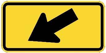
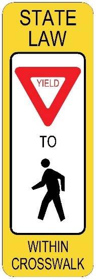
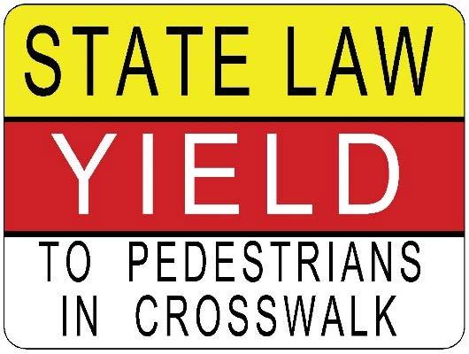
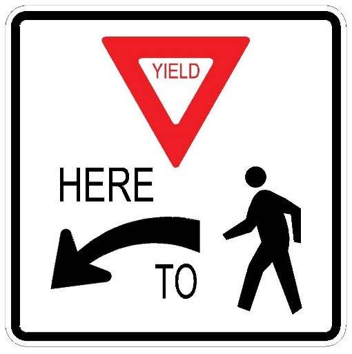
20 Typical Signs That May Be Used At Pedestrian Crossings: W11-2 S1-1 W16-7P W16-7P R1-6 Special State Law R1-5 Page 12
21 2.2.2 Minimum Vehicle Volume for Treatments Recognizing the limited availability of resources to implement crossing treatments within the Town of Windsor, crossing treatments should generally not be installed at locations where the ADT is lower than 1,000 vehicles per day. Exceptions may be made at school crossing locations where the peak hour vehicle traffic exceeds 10% of the ADT. School crossings are defined as locations where 10 or more student pedestrians are crossing per hour. Treatments for roadways with greater than 1,000 vehicles per day should be installed based on the criteria in Figure 1, Table 1, and the information in Figure 2 (a or b depending on the speed limit) Minimum Pedestrian Volume for Treatments at Uncontrolled Crossing Locations For reference in Windsor s Pedestrian Crossing Guide, the City of Boulder has evaluated crosswalk enhancements at uncontrolled crossing locations over the years and has determined that there is a clear relationship between driver compliance (yielding) and the pedestrian and/or bicycle crossing volume. Data collected at crosswalks in Boulder with rectangular rapid flash beacon signs (RRFB) or State Law-Yield signs installed shows that driver compliance typically increases with higher crossing volumes. It is theorized that the primary reason for this relationship is that drivers tend to ignore enhanced crossing treatments over time at locations where they infrequently see pedestrians crossing. The following graphs illustrate this relationship: Ped Volume vs. Compliance (City of Boulder) Study of 13 Locations with Rapid Flash Beacon Signs Study of 12 Locations with State Law Yield Signing The above data also illustrates that, below roughly 20 pedestrians per hour, driver compliance decreases significantly. Thus, Boulder s base threshold for consideration of an enhanced crossing treatment at an uncontrolled location is 20 pedestrians per hour. This threshold is consistent with recent national guidance and policies adopted by other states and cities, as determined through literature research. Page 13
22 Boulder s Minimum Pedestrian Volume Thresholds are as follows: 20 peds per hour* in any one hour, or 18 peds per hour* in any two hours, or 15 peds per hour* in any three hours 10 school aged pedestrians traveling to/from school in any one hour** * Young, elderly, and disabled pedestrians count 2x towards volume thresholds ** School Crossing defined as a crossing location where ten or more student pedestrians per hour are crossing By way of comparison to Boulder, the Town of Windsor is not a college or university town, and does not have an extensive bus transit network that generates pedestrian travel. As a result, it is likely that the Town of Windsor currently does not generate as much pedestrian and bicycle traffic per capita as Boulder does. Yet the need to provide enhanced pedestrian crossings is just as great. As a result, the pedestrian volume thresholds for considering crossing enhancements have been set slightly lower than those used in Boulder: Town of Windsor s Minimum Pedestrian Volume Thresholds are as follows: 18 peds per hour* in any one hour, or 16 peds per hour* in any two hours, or 12 peds per hour* in any three hours 10 school aged pedestrians traveling to/from school in any one hour Pedestrian Median Refuge and Minimum Median Refuge Width A pedestrian refuge median is a useful tool in increasing the safety and efficiency of a pedestrian crossing, and the presence (or not) of a median refuge will influence the type of pedestrian crossing treatment that can be considered (see Table 1). Definition: A location in the middle of a pedestrian crossing where a pedestrian can take refuge, thereby separating their crossing into two steps, across each direction of approaching traffic. Separating the crossing into two directional crossings greatly increases the number of acceptable gaps for pedestrians to safely cross a roadway. Page 14
.")
23 A pedestrian refuge must include some type of raised median as described below: NO: A painted center median or a painted turn lane cannot be considered a refuge. SOMETIMES: A raised median nose at an intersection (next to a left-turn bay for example). This type can only be considered a pedestrian refuge for the adjacent crosswalk if the median is at least 4 feet wide AND the left-turn volume is less than 20 vehicles per hour. This low left-turn volume means that during most pedestrian crossings there will not be a vehicle in the left-turn lane and the pedestrian will be shadowed by the width of the median and the adjacent turn lane as they cross the street. YES: A raised median at a mid-block pedestrian crossing can only be considered as a refuge if it is at least 6 feet wide (preferably 8 feet wide) and includes curb ramps or a walkway at grade through the median. A median of this width will: o allow over two feet on each side for splash protection o store a group of pedestrians; and o accommodate the storage of a bicycle without it overhanging into the traffic lanes. MULTI-USE PATH crossing locations: A 10 median refuge width is desirable to better accommodate bicycles with child trailers, recumbent bicycles, and tandem bicycles. Pedestrian Refuge, NYC Source: NACTO Distance to Nearest Marked or Protected Crossing The Pedestrian Crossing Treatment Flowchart in Figure 1 includes consideration of spacing criteria for an uncontrolled crossing to the nearest marked or projected crossing. The flowchart requires that a new uncontrolled mid-block crossing be at least 300 feet from the nearest crossing. However, the flowchart allows this spacing criteria to be waived if the proposed crossing serves a multi-use path, or the pedestrian crossing volume exceeds twice the minimum threshold. As with this entire PCG, this criteria is also subject to engineering judgment. In urban conditions where typical block length is 500 feet or less, the engineer may want to consider allowing a minimum spacing of 200 feet, provided that the resultant pedestrian crossing: Page 15

24 Does not cross any auxiliary lanes (left or right-turn lanes or their transitions) where it is anticipated that vehicles will be changing lanes and may be distracted from observing pedestrians in the crosswalk Is not in an intersection influence area where it will create undue restriction to vehicular traffic operations Conditions That May Limit the Use of Rectangular Rapid Flash Beacons Pedestrian actuated rectangular rapid flash beacons (RRFBs) at uncontrolled pedestrian crossings on four lane roadways have the potential to greatly increase motorist yielding to pedestrians at these unsignalized crosswalks (illustrated to the right). However, in other communities it has been learned that the use of RRFBs may not be appropriate in locations where there is a combination of both high traffic volumes and high pedestrian volumes. In these extreme conditions, there may be an increase in traffic accidents and/or traffic delay that make the use of RRFBs inappropriate. In these cases, the use of conventional pedestrian traffic signals or the HAWK signals (illustrated below) may be more appropriate. While the decision not to use RRFBs at a pedestrian crossing should be based on engineering judgment, the limit line in Figure 2 has been prepared to aid in this determination Selecting Between a Pedestrian Traffic Signal, HAWK Beacon, or RRFBs Pedestrian Traffic Signals may be considered for application at high volume pedestrian crossings based on engineering judgment. The MUTCD contains warranting procedures for conventional pedestrian traffic signals based on automobile and vehicle traffic volumes to help determine if a pedestrian signal is appropriate. These signals are typically considered when there are over 130 pedestrians an hour crossing a roadway. Hybrid Beacons (HAWK beacons; illustrated to the right) may also be considered and the MUTCD contains warranting guidelines that utilize automobile traffic, pedestrian traffic, automobile speeds, and pedestrian crossing distance. HAWK beacons may be installed where the crossing volume is as low as 20 pedestrians per hour, depending on the crossing distance, automobile traffic volume, and engineering judgment. Rectangular Rapid Flashing Beacons (RRFB) has been successful in increasing motorist yielding to pedestrians at HAWK Signal, Stapleton, CO. Source: Streetsblog Denver Page 16
25 unsignalized crossings, typically where there are two travel lanes in each direction as noted in Section A minimum crossing volume of 15 to 20 pedestrians per hour is typically required, as discussed in Section However, also as noted in Section 2.2.6, there may be cases where the combination of high pedestrian and traffic volumes may make application of RRFBs inappropriate. Figure 2a and Figure 2b illustrate recommendations for the use of RRFBs overlain on the MUTCD HAWK beacon and Pedestrian Traffic Signal warrant guidelines. These recommendations are based on safety and operational evaluations performed over the years at high volume RRFB locations in other communities. Factors to Consider for Type of Pedestrian Signal - Automobile volume - Vehicular speeds - Bicycle and pedestrian volumes - Crossing distance - Presence of a median or not - Potential impact to corridor signal progression - Proximity to a signalized intersection In many cases, either HAWK beacons or RRFBs could be considered for application, and the final decision should be based on engineering judgment Signal Progression and Traffic Operational Considerations The installation of RRFBs, HAWK beacons, or pedestrian traffic signals can all have a significant impact on the automobile traffic operation in a corridor. When selecting the crossing treatment type and how it will be operated, consider the: Automobile volume Pedestrian crossing volume Spacing to the adjacent signalized intersections Type of pedestrian population (high school students, elementary students, elderly, a mix) Where practical, HAWK beacons and pedestrian traffic signals should be coordinated with the signal progression in the corridor to minimize the impact of the new traffic signal on corridor traffic flow. However, coordinated signals may be less responsive to pedestrian actuation, and the delay in pedestrian service may result in some pedestrians crossing against the signal rather than waiting. Not coordinating the pedestrian crossing signals may result in unacceptable increases in automobile congestion and delay. Page 17
26 RRFBs used at high volume pedestrian crossings in congested roadway corridors can also have a significant impact on automobile congestion and compromise effective signal progression. The RRFB limit line in Figure 2 can help minimize this problem. Once again, engineering judgment will need to be applied to reach the best compromise for all involved Differential Vehicle Queue Lengths and Pedestrian Safety A pedestrian crossing of a roadway with two or more lanes in a single direction has the potential for multiple threat type accidents. Definition: A multiple threat accident is when one lane of traffic stops for a pedestrian and obscures the view of the crossing pedestrian to a motorist in the adjacent travel lane. The result is that a pedestrian can step in front of a vehicle that is approaching too fast to stop. This condition is exacerbated when there are vehicle queues that back across the pedestrian crossing. If the queue in one lane backs into the crossing and is much longer than the queue in the adjacent lane, a motorist would commonly assume that the stopped traffic in one lane is the result of the queuing (which may usually be the case). Now if a vehicle in one lane stops for a pedestrian, instead of the queue, there is an even greater chance for a multiple threat accident. Therefore, it is important for the engineer to be aware of the formation of queues to and across the pedestrian crossing from a downstream intersection. It is even more important for the engineer to be aware of routine occurrence of one queue longer than the other across the pedestrian crossing. The Operational Observations section of the Crossing Location Evaluation Worksheet has a place to note this occurrence. When deciding to install an uncontrolled crossing treatment (or not), the engineer should consider if differential vehicle queue lengths is an issue. If so, can the queue be mitigated (say by signal timing adjustments at the downstream intersection). If differential queues cannot be minimized, it may be reason to not install an unprotected crossing treatment (such as Crossing Types A, B, or C) Unmarked Pedestrian Crossing Facilitation Town of Windsor staff is aware of the fact that there are locations where pedestrians regularly cross arterial roadways, yet the crossing does not serve a multi-use path or a school, and the pedestrian volume is below the minimum thresholds in Figure 1 for installing the types of marked and signed treatments detailed in Table 1. These locations typically occur on four-lane roadways and are often identified by social trails to and across the roadway. Page 18
27 In some cases, subject to engineering judgment, it may be appropriate to install treatments that facilitate pedestrian or bicycle crossings, but stop short of the signed and marked crossing treatments defined in Table 1. This type of treatment or pedestrian facilitation may include curb ramps and/or a raised median refuge, but no effort is made to attract pedestrians to this crossing. The treatments simply acknowledge the low volume, but regular pedestrian crossing that occurs at a location. Installing these treatments does not endorse the use of the crossing nor attempt to attract new users to the crossing. The treatment simply acknowledges that the crossing is occurring, will not likely go away, and some level of facilitation can make it safer for the pedestrians or bicyclists that are using the crossing already. The only other option would be to ignore the crossing, but staff does not believe this is an appropriate response. These treatments will only be considered if the location is more than 300 feet from the nearest signed and marked pedestrian crossing (whether it is controlled or uncontrolled), and it is believed that there is little potential to redirect pedestrians to a more defined crossing location. Page 19
28 Town of Windsor - Pedestrian Crossing Guidelines Crossing Location Evaluation Worksheet Page 1 of 2 STEP 1 - LOCATION DESCRIPTION Major Street: Crossing Location: Is this a multi-use path crossing? Yes No Posted Speed Limit: mph Existing Traffic Control: Stop Sign Traffic Signal Uncontrolled Existing Crossing Treatments (if any): Nearby Pedestrian Generators (School, transit stop, commercial, etc.): STEP 2 - PHYSICAL DATA Roadway Configuration: 2-Lane 5 Lane w/striped Median 3-Lane w/striped Median 5 Lane w/raised Median 3 Lane w/raised Median 6 Lane 4 Lane Other: Crossing Distance By Direction: ft total ft to median (if applicable + note direction) Nearest Marked or Protected Pedestrian Crossing: ft to median (if applicable + note direction) Distance to: ft (For uncontrolled location only) Stopping Sight Distance (SSD) = ft ft. Is SSD 8x Speed Limit? Yes No If No, are improvements to SSD feasible? Yes No STEP 3a - TRAFFIC DATA Pedestrian Crossing Volumes / Bicycle Crossing Volumes: AM Mid-Day PM Other Time: to to to to Date/Day of Week: / / / / Major Street Vehicular Volume (Hourly): # of Transit Boardings (if applicable) # of Young Peds / Bicyclists / / / / # of Elderly Peds # of Disabled Peds # of Non-Y/E/D Peds / Bicyclists / / / / TOTAL PEDS (Actual) (Include All Bicyclists in Total Sum) TOTAL PEDS (Adjusted for 2x Y/E/D Major Street Vehicular Volume (Daily): ADT = veh/day
29 Town of Windsor - Pedestrian Crossing Guidelines Crossing Location Evaluation Worksheet (Continued) Page 2 of 2 STEP 3b - OPERATIONAL OBSERVATIONS Nearest Intersection (Direction #1): Cross Street Name: Located ft to the N S E W of crossing location Signalized? Y N Distance from Crossing ft How many times per hour did the downstream vehicle queue back up into pedestrian crossing? If multiple lanes per direction, are queue lengths approximately equal? AM Mid-Day PM Other Y N Y N Y N Y N If NO (above),which lane is longer (inside, outside, middle) and by how much (feet)? Nearest Intersection (Direction #2): Cross Street Name: Located ft to the N S E W of crossing location Signalized? Y N Distance from Crossing ft How many times per hour did the downstream vehicle queue back up into pedestrian crossing? If multiple lanes per direction, are queue lengths approximately equal? AM Mid-Day PM Other Y N Y N Y N Y N If NO (above),which lane is longer (inside, outside, middle) and by how much (feet)? STEP 4 - APPLY DATA TO FIGURE 1 and TABLE 1 Recommended Treatment(s):
30 Town of Windsor Pedestrian Crossing Guidelines Figure 1 Pedestrian Crossing Treatment Flowchart UNCONTROLLED CROSSING LOCATION Identify candidate crossing location CONTROLLED CROSSING LOCATION No action recommended N ADT 1,000 vpd (1)? Uncontrolled Is location controlled or uncontrolled? Controlled Install marked N crosswalk Y Stop Stop sign or Signal School signal Crossing?** Install marked controlled? crosswalk w/ Crossing serves Meets min. Multi-Use Path N N school transit stop or other pedestrian Crossing OR crossing sign noticeable, defined volume direct access to on mast arm and regular thresholds (2) civic area? (5) crossing (2) (S1-1)?? Y Existing N ADT 1,000 N No action Y marked vpd? recommended crosswalk? Consider installing unmarked pedestrian crossing facilitation (4) Meets 2x the minimum N Nearest marked N pedestrian volume or protected Y Y Y thresholds (2)? crossing > 300 away (3)? Staff Install marked Direct peds to concerns crosswalk w/ nearest marked or about driver Y Multi-Use Path advance protected crossing compliance at Y Y Crossing? pedestrian signs crosswalk? (W11-2) Direct peds. to nearest marked or protected crossing or consider HAWK beacon, traffic signal or gradeseparated crossing Not Feasible Remove sight distance obstruction or lower speed limit N Feasible Adequate stopping sight distance? (8x speed limit) Y Go to Table 1 Y Consider neckdowns, median refuge, or additional signs to increase driver awareness of pedestrians N No action recommended N Meets min. pedestrian volume thresholds (2) Y? N No action recommended Install marked crosswalk Install marked w/ school pedestrian crosswalk w/ N School Y (1) Exceptions to the 1,000 vpd min. roadway volume threshold crossing sign (S1-1) and advance pedestrian Crossing?** may be made for School Crossings where the peak hour traffic down arrow (16-7p) at exceeds 10% of the daily traffic signs (W11-2) crosswalk plus advance (S1-1) signs (2) Minimum Pedestrian Volume Thresholds: - 18 peds per hour* in any one hour, or (4) - 16 peds per hour* in any two hours, or An unmarked pedestrian crossing facilitation is any treatment that improves a pedestrian s ability to cross a roadway, short of the marked, signed and enhanced crossings detailed in Table 1. Installation of - 12 peds per hour* in any three hours this type of pedestrian facilitation is subject to engineering judgment and may include curb ramps and/or * Young, elderly, and disabled pedestrians count 2x towards volume thresholds a raised median refuge. However, no effort is made to attract pedestrians or recommend that ** School Crossing defined as a crossing location where ten or more student pedestrians pedestrians cross at this location. The treatments simply provide an improvement for a low volume per hour are crossing. pedestrian crossing where pedestrians are already crossing and will like continue to cross. (5) A multiuse path crossing of a roadway does not need to meet the minimum pedestrian crossing (3) Distance to nearest marked or protected crossing may be reduced to 200 in urban conditions, subject thresholds. Similarly, a crossing that provides direct access to a school, park, or other civic facility may to engineering judgment, where 1) the crosswalk does cross any auxiliary lanes, and 2) crossing be installed, based on engineering judgement, even if it does not meet the minimum pedestrian crossing treatments and crossing activity would not create undue restriction to vehicular traffic operations. thresholds.
Town of Windsor Pedestrian Crossing Guidelines
 Town of Windsor Pedestrian Crossing Guidelines Prepared for: Town of Windsor Engineering Department 301 Walnut Street Windsor, Colorado 80550 For More Information, please contact: Engineering Department
In response to your request for information on mid-block pedestrian crossing policies and guidelines, the following information is enclosed:
 August 18, 2016 City of Brentwood, Tennessee Mr. Kirk Bednar City Manager 5211 Maryland Way P. O. Box 788 Brentwood, Tennessee 37024 VIA ELECTRONIC MAIL Dear Mr. Bednar: In response to your request for
Guidance for Installation of Pedestrian Crosswalks on Michigan State Trunkline Highways
 Guidance for Installation of Pedestrian Crosswalks on Michigan State Trunkline Highways Michigan Department of Transportation July 7, 2014 Engineering Manual Preamble This manual provides guidance to administrative,
MEMORANDUM. Date: 9/13/2016. Citywide Crosswalk Policy
 MEMORANDUM Date: 9/13/2016 Re: Citywide Crosswalk Policy Foreword Through the s Circulation Element and Complete Streets Policy, it is the City s goal to promote walking trips and provide safe facilities
City of Albert Lea Policy and Procedure Manual 4.10 ALBERT LEA CROSSWALK POLICY
 4.10 ALBERT LEA CROSSWALK POLICY PURPOSE: Pedestrian crosswalks are an integral part of our transportation infrastructure. To be effective and promote safety, marked crosswalks must be installed after
UNCONTROLLED PEDESTRIAN CROSSING GUIDELINES
 City and County of Denver UNCONTROLLED PEDESTRIAN CROSSING GUIDELINES Prepared for: Prepared by: Adopted September 2016 This page is intentionally left blank. Contents for Denver Uncontrolled Pedestrian
PEDESTRIAN SAFETY IMPROVEMENT EVALUATION GUIDELINE FOR UNCONTROLLED CROSSINGS
 PEDESTRIAN SAFETY IMPROVEMENT EVALUATION GUIDELINE FOR UNCONTROLLED CROSSINGS Traffic Safety Engineering Division Updated: April 2018 EXECUTIVE SUMMARY NDOT Traffic Safety Engineering Division developed
Document 2 - City of Ottawa Pedestrian Crossover (PXO) Program
 Program") 40 Document 2 - City of Ottawa Pedestrian Crossover (PXO) Program OVERVIEW The City of Ottawa Pedestrian Crossover (PXO) Program provides the basis for PXO implementation in Ottawa. The program s processes
40 Document 2 - City of Ottawa Pedestrian Crossover (PXO) Program OVERVIEW The City of Ottawa Pedestrian Crossover (PXO) Program provides the basis for PXO implementation in Ottawa. The program s processes
Appendix A: Crosswalk Policy
 Appendix A: Crosswalk Policy Appendix A: Crosswalk Policy Introduction This citywide Crosswalk Policy is aimed at improving pedestrian safety and enhancing pedestrian mobility by providing a framework
Designing for Pedestrian Safety in Washington, DC
 Designing for Pedestrian Safety in Washington, DC February 25, 2014 George Branyan Pedestrian Program Coordinator District Department of Transportation DC Journey to work mode split: 2012 Means of Transportation
Active Transportation Facility Glossary
 Active Transportation Facility Glossary This document defines different active transportation facilities and suggests appropriate corridor types. Click on a facility type to jump to its definition. Bike
Designing for Pedestrian Safety
 Designing for Pedestrian Safety Treatments at Unsignalized Pedestrian Crossings Presented by: Charlie Zegeer PBIC Director August 17, 2010 Crossing Crashes Part 1: General Principles 3 2 Why do people
CITY OF SARATOGA SPRINGS PEDESTRIAN CROSSING TOOLBOX
 CITY OF SARATOGA SPRINGS PEDESTRIAN CROSSING TOOLBOX This toolbox is to be used to guide pedestrian crossing improvements within the City of Saratoga Springs. Details for each crossing type are provided.
Broad Street Bicycle Boulevard Design Guidelines
 Broad Street Bicycle Boulevard Design Guidelines Building from the strategies introduced in the 2013 Bicycle Transportation Plan and community input received thus far, City Transportation Staff have identified
Addendum to SDDCTEA Pamphlet 55 17: Better Military Traffic Engineering Revision 1 Effective: 24 Aug Crosswalk Guidelines
 Addendum to SDDCTEA Pamphlet 55 17: Better Military Traffic Engineering Revision 1 Effective: 24 Aug 2017 Crosswalk Guidelines Warrants for Uncontrolled Crosswalk Locations Crosswalks at Midblock Locations
Chapter 5: Crossing the Street
 Chapter 5: Crossing the Street Whether walking or bicycling, a student s journey to school will more than likely require crossing one or more streets. Per the Safe Routes to School Guide, maintained by
AGENDA ITEM F-5 Public Works
 AGENDA ITEM F-5 Public Works Recommendation STAFF REPORT City Council Meeting Date: 9/13/2016 Staff Report Number: 16-163-CC Consent Calendar: Adopt a resolution to establish a citywide crosswalk policy
Appendix T CCMP TRAIL TRAFFIC & TRANSPORTATION DESIGN STANDARD
 Appendix T CCMP 3.3.4 TRAIL TRAFFIC & TRANSPORTATION DESIGN STANDARD 3.3.4 Trail Traffic and Transportation Design Multi-use trails have certain design standards, which vary depending on the agency that
Development of Arlington County s Marked Crosswalk Guidelines. Jon Lawler, P.E. Design Engineer Arlington County, VA
 Development of Arlington County s Marked Crosswalk Guidelines Jon Lawler, P.E. Design Engineer Arlington County, VA April 13, 2015 Transportation System Users Residents Estimated 215,000 in 2014 Lowest
Broadway Street Pedestrian Safety Study Cass Street to 700 Feet North of Randall Avenue
 Broadway Street Pedestrian Safety Study Cass Street to 700 Feet North of Randall Avenue Prepared for: City of De Pere, Wisconsin Prepared by: June, 2017 Broadway Street Pedestrian Safety Study Cass Street
Pedestrian & Bicycle Safety Innovations & Applications
 Pedestrian & Bicycle Safety Innovations & Applications County Engineers Association of Maryland Spring, 2017 Conference May 25, 2017 George Branyan Pedestrian Program Coordinator District Department of
MEMORANDUM. Charlotte Fleetwood, Transportation Planner
 MEMORANDUM Date: Updated August 22, 2017 To: Organization: Charlotte Fleetwood, Transportation Planner Boston Transportation Department From: Jason DeGray, P.E., PTOE, Regional Director of Engineering
PEDESTRIAN ACCOMMODATIONS DPS 201 AT ROUNDABOUTS
 PEDESTRIAN ACCOMMODATIONS DPS 201 AT ROUNDABOUTS WHY THEY WORK FOR PEDESTRIANS IF DESIGNED CORRECTLY Separated sidewalks direct peds to crosswalks Splitter island Slow speed exit Truck apron Crosswalk
IMPROVING PEDESTRIAN SAFETY AT UNCONTROLLED CROSSINGS. Guidelines for Marked Crosswalks
 IMPROVING PEDESTRIAN SAFETY AT UNCONTROLLED CROSSINGS Presented by Nazir Lalani P.E. Traffex Engineers Inc. N_lalani@hotmail.com Guidelines for Marked Crosswalks Source: FHWA, Safety Effects of Marked
Off-road Trails. Guidance
 Off-road Trails Off-road trails are shared use paths located on an independent alignment that provide two-way travel for people walking, bicycling, and other non-motorized users. Trails specifically along
GLOSSARY CROSSWALK. CROSSING TYPES
 CROSSWALK The part of a roadway at an intersection included within the connections of the lateral lines of the sidewalks on opposite sides of the street measured from the curbs, or in the absence of curbs
Chapter 2: Standards for Access, Non-Motorized, and Transit
 Standards for Access, Non-Motorized, and Transit Chapter 2: Standards for Access, Non-Motorized, and Transit The Washtenaw County Access Management Plan was developed based on the analysis of existing
Pedestrians and Bicyclists. Bruce Friedman and Scott Wainwright FHWA MUTCD Team
 Impact of the New MUTCD on Pedestrians and Bicyclists Bruce Friedman and Scott Wainwright FHWA MUTCD Team Development of the 2009 MUTCD NPA published in the Federal Register on January 2, 2008 Received
CROSSING GUARD PLACEMENT CONSIDERATIONS AND GAP ASSESSMENT
 CROSSING GUARD PLACEMENT CONSIDERATIONS AND GAP ASSESSMENT Many factors contribute to the need for a Crossing Guard. General federal guidance, provided by the FHWA MUTCD, states that adult crossing guards
City of Vallejo Traffic Calming Toolbox
 City of Vallejo Traffic Calming Toolbox June 1, 2013 Final Table of Contents Introduction... 1 Non-Physical Devices... 3 High-Visibility Crosswalk... 3 In Pavement Lighted Crosswalk... 4 Rapid Flashing
Bicycle Boulevards and Neighborhood Greenways
 Bicycle Boulevards and Neighborhood Greenways Traffic Safety is Improving for Everyone 90 80 70 60 50 40 30 20 10 0 PORTLAND: TOTAL TRAFFIC FATALITIES 1986-2008 1986 1987 1988 1989 1990 1991 1992 1993
DEPARTMENT OF ENVIRONMENTAL SERVICES. North Harrison Street (Lee Highway to Little Falls Road) Comparative Analysis. Prepared for:
 Comparative Analysis. Prepared for:") DEPARTMENT OF ENVIRONMENTAL SERVICES North Harrison Street (Lee Highway to Little Falls Road) Comparative Analysis Prepared for: Arlington County Department of Environmental Services 2100 Clarendon Boulevard,
DEPARTMENT OF ENVIRONMENTAL SERVICES North Harrison Street (Lee Highway to Little Falls Road) Comparative Analysis Prepared for: Arlington County Department of Environmental Services 2100 Clarendon Boulevard,
PART 4 HIGHWAY TRAFFIC SIGNALS
 2016 Edition Page 111 PART 4 HIGHWAY TRAFFIC SIGNALS CHAPTER 4A. GENERAL [This is a new section. There is no corresponding section in the MUTCD.] Section 4A.100 Traffic Control Device Alternatives for
Bicycle Facilities Planning
 Bicycle Facilities Planning Overview Types of Cyclists Purpose for Riding Types of Facilities Bike Lanes Bicycle Boulevards Cycle Tracks Intersections Signals Signing and Marking Discussion Types of Bicyclists
PEDESTRIAN CROSSING TREATMENTS
 PEDESTRIAN CROSSING TREATMENTS BEST PRACTICES Presented by: Doug Enderson, P.E., PTOE Cody Salo, P.E. 1 PRESENTER INTRODUCTIONS Doug Enderson, P.E., PTOE Ped Crossing Experience: ADA Design-Build ADA Inventory
Fundamentals of Traffic Control Devices
 Fundamentals of Traffic Control Devices Traffic Engineering & Operations October 8, 2014 Raj Ponnaluri, Angela Wilhelm, and Christopher Lewis Agenda Agenda Signs Pavement Markings Signals Traffic Operations
C. Best Practice Pedestrian Treatment Toolbox
 C. Best Practice Pedestrian Toolbox The Best Practice Pedestrian Toolbox presents the recommended tools in striping, signalization, signage, geometry and other categories for improving both uncontrolled
POTENTIAL PEDESTRIAN SAFETY IMPROVEMENT EVALUATION GUIDELINE
 POTENTIAL PEDESTRIAN SAFETY IMPROVEMENT EVALUATION GUIDELINE Traffic Safety Engineering Division Updated: August 2016 EXECUTIVE SUMMARY During the February 2015 Transportation Board meeting, Governor Brian
Designing for Pedestrian Safety. Alabama Department of Transportation Pre-Construction Conference May 2016
 Designing for Pedestrian Safety Alabama Department of Transportation Pre-Construction Conference May 2016 1 Designing for Pedestrians Marking Crosswalks at Signalized intersections High Visibility Markings
C/CAG. Sunnybrae Elementary School Walking and Bicycling Audit. San Mateo-Foster City School District JUNE 2013
 Sunnybrae Elementary School Walking and Bicycling Audit JUNE 2013 San Mateo-Foster City School District C/CAG City/County Association of Governments of San Mateo County SUNNYBRAE ELEMENTARY SCHOOL WALKING
Pedestrian Crossing Facilitation Guideline Development
 Pedestrian Crossing Facilitation Guideline Development TZD Conference Melissa Barnes October, 2017 Why? Minnesota Go: Minnesota s multimodal transportations system maximizes the health of people, the environment,
PEDESTRIAN CROSSING SOLUTIONS ANDREA HARTH, PE, PTOE TEC ENGINEERING, INC.
 PEDESTRIAN CROSSING SOLUTIONS ANDREA HARTH, PE, PTOE TEC ENGINEERING, INC. Pedestrian Safety 2017 Pedestrian Crashes in Ohio Crash Severity Number % Fatal Crash 141 4.9% Injury Crash 2546 89.1% Property
The DC Pedestrian Master Plan
 The DC Pedestrian Master Plan September 28, 2010 George Branyan Pedestrian Program Coordinator District Department of Transportation Presentation Agenda Scope of the Plan Methodology Recommendations Implementation
Citywide Sidewalk and Crosswalk Programs
 Citywide Sidewalk and Crosswalk Programs Council Meeting October 20, 2015 Presented by Rita Hu and Jamal Mahmoud Program Goals Implement the City s comprehensive plan. Provide pedestrian with safe walking
Caltrans Sloat Boulevard Pedestrian Safety Project Response to Community Questions, Comments & Concerns
 Caltrans Sloat Boulevard Pedestrian Safety Project Response to Community Questions, Comments & Concerns Revised: May 10, 2016 The California Department of Transportation (Caltrans) is planning various
Establishing Procedures and Guidelines for Pedestrian Treatments at Uncontrolled Locations
 1 Establishing Procedures and Guidelines for Pedestrian Treatments at Uncontrolled Locations Yan Qi Southern Illinois University Edwardsville 66th Illinois Traffic Engineering and Safety Conference Champaign,
Access Location, Spacing, Turn Lanes, and Medians
 Design Manual Chapter 5 - Roadway Design 5L - Access Management 5L-3 Access Location, Spacing, Turn Lanes, and Medians This section addresses access location, spacing, turn lane and median needs, including
CHAPTER 16 PEDESTRIAN FACILITIES DESIGN AND TECHNICAL CRITERIA TABLE OF CONTENTS
 CHAPTER 16 PEDESTRIAN FACILITIES DESIGN AND TECHNICAL CRITERIA TABLE OF CONTENTS Section Title Page 16.1 General... 16-1 16.1.1 AASHTO Reference... 16-1 16.1.2 ADA Requirements... 16-1 16.2 Sidewalks...
St. Francis Drive through the City of Santa Fe Corridor Study
 VII. ENGINEERING AND ENVIRONMENTAL EVALUATION TRAIL CONNECTIVITY In the southern portion of the Corridor there is a lack of a sidewalk, trail or bicycle facility within the right-ofway. However, the City
Pedestrian Crossing Guidelines 2016
 Pedestrian Crossing Guidelines 2016 Engineering Services 1.0 Introduction and Background The City of Kingston s first Pedestrian Crossing Guidelines were approved by Council in 2008 in order to provide
Cycle Track Design Best Practices Cycle Track Sections
 Design Best Practices Sections It is along street segments where the separation and protection methods of cycle tracks offer more comfort than conventional bicycle lanes, and are more attractive to a wide
Agenda. Overview PRINCE GEORGE S PLAZA METRO AREA PEDESTRIAN PLAN
 PRINCE GEORGE S PLAZA METRO AREA PEDESTRIAN PLAN May 28, 2008 Agenda Welcome and introductions Project overview and issue identification Planning context and strengths Design challenges and initial recommendations
Pedestrian Safety at Interchanges
 Countermeasure Strategies for Pedestrian Safety Pedestrian Safety at Interchanges Meghan Mitman Fehr and Peers December 10, 2015 Today s Presentation Introduction and housekeeping Audio issues? Dial into
Appendix A. Knoxville TPO Greenway Signage Guidelines. Appendix A: Knoxville TPO Greenway Signage Guidelines Knox to Oak Ridge Greenway Master Plan
 Appendix A Knoxville TPO Greenway Signage Guidelines 75 Overview: Adequate signing and marking are essential on shared-use paths, especially to alert bicyclists to potential conflicts and to convey regulatory
Watertown Complete Streets Prioritization Plan. Public Meeting #1 December 14, 2017
 Watertown Complete Streets Prioritization Plan Public Meeting #1 December 14, 2017 Goals for Public Meeting Overview of MassDOT Complete Streets Funding Program Educate the community on Complete Streets
Crossing Treatments Methodology Page 1 of 22
 Crossing Treatments Methodology Page 1 of 22 Shared Use Path Roadway Intersections Guidelines for Assigning Priority and Determining Traffic Control at Shared Use Path/Roadway Intersections Pinellas County,
Appendix C. City of Fort Collins Recommended Bicycle Design Guidelines. Appendix C: Recommended Bicycle Design Guidelines 1
 Appendix C City of Fort Collins Recommended Bicycle Design Guidelines Appendix C: Recommended Bicycle Design Guidelines 1 This appendix provides general design considerations for implementation of bicycle
Traffic Engineering Update on Bike/Ped Topics. Marc Lipschultz, P.E. PTOE Central Office Traffic Engineering Division
 Traffic Engineering Update on Bike/Ped Topics Marc Lipschultz, P.E. PTOE Central Office Traffic Engineering Division Bicycle/Pedestrian Advisory Committee August 3, 2016 Agenda Share the Road / Bikes May
ROUNDABOUTS/TRAFFIC CIRCLES
 GENERAL 1. Description This standard identifies minimum requirements that shall be met for Roundabouts and Neighborhood Traffic Circles in the design and construction of elements for Arlington County Horizontal
Who is Toole Design Group?
 2018 AASHTO Bike Guide Status Update NCHRP 15 60 Amalia Leighton Cody, PE, AICP & Kenneth Loen, PE Washington APWA October 4, 2018 Who is Toole Design Group? TDG is a full service engineering, planning
APPENDIX A: Complete Streets Checklist DRAFT NOVEMBER 2016
 APPENDIX A: Complete Streets Checklist DRAFT NOVEMBER 2016 Complete Streets Checklist MetroPlan Orlando s Complete Streets Checklist is an internal planning tool for staff to further implementation of
Ottawa Beach Road Study
 Ottawa Beach Road Study Prepared For: Park Township September 30, 2014 Project No. G140303 OTTAWA BEACH ROAD STUDY PREPARED FOR: PARK TOWNSHIP SEPTEMBER 30, 2014 PROJECT NO. G140303 TABLE OF CONTENTS 1.0
Attachment No. 4 Approved by National Committee Council
 Attachment No. 4 Approved by National Committee Council The Signals Technical Committee distributed a technical committee recommendation to sponsors concerning pedestrian hybrid beacons following the January
MEMORANDUM. Discussion of the planned crosswalk improvement on Mount Vernon Road near Stratham Drive
 MEMORANDUM To: From: Mayor and City Council Michael Smith, Public Works Director Date: August 24, 2015 Subject: Discussion of the Mount Vernon Road Crosswalk Improvement ITEM DESCRIPTION Discussion of
Traffic Control at. Pedestrian Crossings. City of Saskatoon 2004
 Traffic Control at Pedestrian Crossings City of Saskatoon 2004 Introduction Walking is the most universal form of travel. Every personal trip involves walking, alone or in combination with taking public
Guidance. ATTACHMENT F: Draft Additional Pages for Bicycle Facility Design Toolkit Separated Bike Lanes: Two-Way to One-Way Transitions
 ATTACHMENT F: Draft Additional Pages for Bicycle Facility Design Toolkit Separated Bike Lanes: Two-Way to One-Way Transitions This treatment provides a transition from two-way separated bike lanes to one-way
2014 FHWA Aging Road User Handbook. Recommendations to Accommodate Aging Pedestrians. Lifesaver National Conference. What is the Handbook?
 2014 FHWA Aging Road User Handbook Recommendations to Accommodate Aging Pedestrians Lifesaver National Conference March 17, 2015 Revised June 2014 1 What is the Handbook? 1998 1st Edition 2001 2nd Edition
HAWK Signal. Pedestrian Safety. Illinois Traffic Engineering & Safety Conference Thursday, October 21, 2010
 HAWK Signal Pedestrian Safety Illinois Traffic Engineering & Safety Conference Thursday, October 21, 2010 Background Information High-intensity Activated crosswalk Developed by the City of Tuscon, AZ First
Dr. M.L. King, Jr. Street North Complete Streets Resurfacing Opportunities HOUSING, LAND USE, AND TRANSPORTATION COMMITTEE MARCH 22, 2018
 Dr. M.L. King, Jr. Street North Complete Streets Resurfacing Opportunities HOUSING, LAND USE, AND TRANSPORTATION COMMITTEE MARCH 22, 2018 What s Happening The City plans to mill and resurface Dr. M.L.
Improving Pedestrian Safety at Unsignalized Crossings. Shawn Turner, P.E. Texas A&M Transportation Institute
 Improving Pedestrian Safety at Unsignalized Crossings Shawn Turner, P.E. Texas A&M Transportation Institute Overview of Presentation What are the issues/problems? Framework for crossing treatments Marked
Safety Benefits of Raised Medians and Pedestrian Refuge Areas. FHWA Safety Program.
 Safety Benefits of Raised Medians and Pedestrian Refuge Areas FHWA Safety Program http://safety.fhwa.dot.gov There s a signal up the block, but looking left there s a gap in traffi c. Looking right there
TRAFFIC CALMING GUIDE FOR TORONTO CITY OF TORONTO TRANSPORTATION SERVICES DIVISION
 TRAFFIC CALMING GUIDE FOR TORONTO CITY OF TORONTO TRANSPORTATION SERVICES DIVISION CITY OF TORONTO TRANSPORTATION SERVICES DIVISION 2016 TRAFFIC CALMING GUIDE FOR TORONTO TABLE OF CONTENTS Introduction
5. RUNNINGWAY GUIDELINES
 5. RUNNINGWAY GUIDELINES These guidelines should be considered collectively when making runningway decisions. A runningway is the linear component of the transit system that forms the right-of-way reserved
Town of Mooresville, North Carolina Neighborhood Traffic Calming and Control Device Policy
 Town of Mooresville, North Carolina Neighborhood Traffic Calming and Control Device Policy Adopted January 6, 2014 Town of Mooresville Development Services Department TOWN OF MOORESVILLE NEIGHBORHOOD TRAFFIC
Implementing Complete Streets in Ottawa. Project Delivery Process and Tools Complete Streets Forum 2015 October 1, 2015
 Implementing Complete Streets in Ottawa October 1, 2015 The Essentials Complete Streets Implementation Framework will become part of the routine delivery of City transportation projects Approach uses every
Zlatko Krstulich, P.Eng. City of O9awa
 Zlatko Krstulich, P.Eng. City of O9awa 1. Introduction to the Ontario Traffic Manual Series 2. What is OTM Book 18: Bicycle Facilities? 3. Study / Committee Team Members 4. Brief overview of the content
General Design Factors
 Chapter 3: 3-1.0 Introduction General Design Factors Mn/DOT s goals include encouraging and accommodating safe bicycling. From a design perspective, these goals are achieved by first having an understanding
Developed by: The American Traffic Safety Services Association (ATSSA) 15 Riverside Parkway, Suite 100 Fredericksburg, VA
 15 Riverside Parkway, Suite 100 Fredericksburg, VA") Addendum Developed by: The American Traffic Safety Services Association (ATSSA) 15 Riverside Parkway, Suite 100 Fredericksburg, VA 22406-1022 800-272-8772 This material is based upon work supported by
Addendum Developed by: The American Traffic Safety Services Association (ATSSA) 15 Riverside Parkway, Suite 100 Fredericksburg, VA 22406-1022 800-272-8772 This material is based upon work supported by
Draft North Industrial Area-Wide Traffic Plan
 Summary of North Industrial and Hudson Bay Industrial Recommended Improvements Table 1. Summary of s Item Location 1 2 3 4 5 6 7 8 9 10 11 12 Millar Ave north of 51st St Super 8 Motel back lane 400 Block
ATTACHMENT NO. 11. RRLRT No. 2. Railroad / Light Rail Transit Technical Committee TECHNICAL COMMITTEE: Busway Grade Crossings STATUS/DATE OF ACTION
 ATTACHMENT NO. 11 RRLRT No. 2 TECHNICAL COMMITTEE: TOPIC: Railroad / Light Rail Transit Technical Committee Busway Grade Crossings STATUS/DATE OF ACTION RRLRT TC Draft: 06/23/2011 RRLRT TC Approval: 06/27/2014
USER GUIDE FOR R1-6 GATEWAY TREATMENT
 USER GUIDE FOR R1-6 GATEWAY TREATMENT FOR PEDESTRIAN CROSSINGS Prepared by: Western Michigan University T.Y. Lin International December 2016 Acknowledgements Michigan Department of Transportation MDOT
Simulation Analysis of Intersection Treatments for Cycle Tracks
 Abstract Simulation Analysis of Intersection Treatments for Cycle Tracks The increased use of cycle tracks also known as protected bike lanes has led to investigations of how to accommodate them at intersections.
CHAPTER 2G. PREFERENTIAL AND MANAGED LANE SIGNS
 2011 Edition - Revision 2 Page 275 Section 2G.01 Scope CHAPTER 2G. PREFERENTIAL AND MANAGED LANE SIGNS 01 Preferential lanes are lanes designated for special traffic uses such as high-occupancy vehicles
ADA & Public Rights of Way
 ADA & Public Rights of Way Overview of Current and Up-coming Requirements FDOT Design Training Expo 2012 Orlando, FL Dean Perkins, RA - ADA Coordinator Florida Department of Transportation Office of Design,
On Road Bikeways Part 1: Bicycle Lane Design
 On Road Bikeways Part 1: Bicycle Lane Design Presentation by: Nick Jackson Bill Schultheiss, P.E. September 04, 2012 FOLLOW THE CONVERSATION ON TWITTER Toole Design Group is live tweeting this webinar
Accommodating Pedestrians in the Work Zone
 Accommodating Pedestrians in the Work Zone Guidance for Section C Plan Preparers Some impacts cannot be avoided and those impacts apply to residents, businesses, motorists, and pedestrians alike. However,
PEDESTRIAN ACCOMMODATIONS DPS 201 AT INTERCHANGES
 PEDESTRIAN ACCOMMODATIONS DPS 201 AT INTERCHANGES UNDERSTANDING THE ISSUES Intersections of freeway ramp terminals at crossroads are the most critical components of an interchange Challenge: balance mobility
CURBSIDE ACTIVITY DESIGN
 5 CURBSIDE ACTIVITY DESIGN This chapter provides design guidance for separated bike lanes adjacent to curbside activities including parking, loading and bus stops. Typical configurations are presented
City of Elizabeth City Neighborhood Traffic Calming Policy and Guidelines
 City of Elizabeth City Neighborhood Traffic Calming Policy and Guidelines I. Purpose: The City of Elizabeth City is committed to ensure the overall safety and livability of residential neighborhoods. One
USER GUIDE FOR R1-6 GATEWAY TREATMENT
 USER GUIDE FOR R1-6 GATEWAY TREATMENT FOR PEDESTRIAN CROSSINGS Prepared by: Western Michigan University T.Y. Lin International December 2016 Updated May 2018 Acknowledgements Michigan Department of Transportation
TOWN OF CHAPEL HILL POLICY AND PROCEDURES FOR TRAFFIC CALMING MEASURES
 TOWN OF CHAPEL HILL POLICY AND PROCEDURES FOR TRAFFIC CALMING MEASURES (Adopted by the Town Council on June 30, 2004) (Revised December 6, 2010) (Revised February 8, 2016) POLICY AND PROCEDURES FOR TRAFFIC
Oregon Supplement to the Manual on Uniform Traffic Control Devices. Adopted July 2005 by OAR
 Oregon Supplement to the Manual on Uniform Traffic Control Devices Adopted July 2005 by OAR 734-020-0005 2003 Edition Oregon Supplement to the MUTCD Page 2 INTRODUCTION Traffic control devices installed
Designing Complete Streets: What you need to know
 Designing Complete Streets: What you need to know Getting from this to this. Continuous sidewalk Buffer w/trees Bicycle lane Raised median Buildings close to the street Flexibility in design Design and
ADA Training Accessible Pedestrian Signal (APS) 2018 MnDOT
 2018 MnDOT") ADA Training Accessible Pedestrian Signal (APS) 2018 MnDOT APS and ADA APS is not currently an ADA Standard and is provided at the discretion of the Title II entity APS is recognized in the MnMUTCD, but
ADA Training Accessible Pedestrian Signal (APS) 2018 MnDOT APS and ADA APS is not currently an ADA Standard and is provided at the discretion of the Title II entity APS is recognized in the MnMUTCD, but
Figure 3B-1. Examples of Two-Lane, Two-Way Marking Applications
 Figure 3B-1. Examples of Two-Lane, Two-Way Marking Applications A - Typical two-lane, two-way marking with passing permitted in both directions B - Typical two-lane, two-way marking with no-passing zones
APPENDIX D LEVEL OF TRAFFIC STRESS METHODOLOGY
 APPENDIX D LEVEL OF TRAFFIC STRESS METHODOLOGY 01 WHAT IS LEVEL OF TRAFFIC STRESS? When people bicycle on roadways, they encounter varying levels of stress from traffic. A quiet residential street with
MEMORANDUM INTRODUCTION AREA DESCRIPTION. DATE: December 8, 2017
 7719 SOUTH MAIN STREET MIDVALE, UT 84047 P 801.307.3400 MEMORANDUM DATE: December 8, 2017 TO: FROM: SUBJECT: PROJECT NUMBER: 344-7517-003 PROJECT NAME: Keith Ludwig, P.E. Midvale City Lesley Burns, Midvale
DPS 201 RECTANGULAR RAPID FLASHING BEACON (RRFB)
") DPS 201 RECTANGULAR RAPID FLASHING BEACON (RRFB) WHY? PEDESTRIANS NEED TO CROSS CASE STUDY: RRFB (ST. PETERSBURG, FL) St. Petersburg, FL Problem/Background Multi-lane, high-speed roadways Conflicts at
DPS 201 RECTANGULAR RAPID FLASHING BEACON (RRFB) WHY? PEDESTRIANS NEED TO CROSS CASE STUDY: RRFB (ST. PETERSBURG, FL) St. Petersburg, FL Problem/Background Multi-lane, high-speed roadways Conflicts at
Appendix C. Bicycle Route Signage
 Appendix C Bicycle Route Signage This page intentionally left blank. APPENDIX C - BICYCLE ROUTE AND WAYFINDING SIGNAGE Bicycle route signs are wayfinding signs that guide bicyclists along preferred, designated
SCHOOL CROSSING PROTECTION CRITERIA
 CITY OF MADISON TRAFFIC ENGINEERING SCHOOL CROSSING PROTECTION CRITERIA January 2016 Adopted as Policy on August 31, 1976, by Common Council by Amended Resolution #29,540 Amended on September 14, 1976,