Date: September 7, Project #: Re: Spaulding Youth Center Northfield, NH Property. Traffic Impact Study
|
|
|
- Jason Cole
- 5 years ago
- Views:
Transcription
1 To: Ms. Susan C. Ryan Spaulding Youth Center 72 Spaulding Road Northfield, NH Date: September 7, 2017 Project #: From: Robin Bousa Director of Transportation Systems Re: Spaulding Youth Center Northfield, NH Property Evan Drew, PE Project Engineer Traffic Impact Study VHB has completed a traffic impact study for a proposed medical office park to be located on the Spaulding Youth Center (SYC) property, west of Shaker Road in Northfield, New Hampshire. VHB previously completed a preliminary site access assessment for the proposed project on July 18, 2017, which was submitted to the Town of Northfield Planning Board and the New Hampshire Department of Transportation (NHDOT). The site access assessment was prepared to determine how access will be provided to the site. The scope of work for the preliminary site access evaluation was limited to Shaker Road at NH 140 (Tilton Road) and the site driveway. Comments from the NHDOT on the site access assessment were received by VHB on Wednesday, August 9, 2017 and are included in this memorandum as an Appendix item along with a response to comments by VHB. This formal traffic impact study is intended to build upon the preliminary site access assessment by expanding the study area, evaluating project impacts, and identifying possible mitigation for the SYC development program on the local transportation system. At a scoping session with the NHDOT and Town officials, the study area for this assessment was determined to include: US 3 at the intersections of NH 132/Shaw s Plaza, I-93 Exit 20 Northbound Ramps/NH 140, and I-93 Exit 20 Southbound Ramps; NH 132 at the intersections of I-93 Exit 19 Northbound Off-Ramp and I-93 Exit 19 Southbound On-Ramp; and the local intersections of Elm Street/Bay Street at Summer Street/Granite Street and Bay Street/Shedd Road at Bay Hill Road. It is important to note that the I-93 Exit 19 interchange and the local intersections were included in the study area at the scoping because, at that time, the SYC development program was contemplating a secondary site access via Shedd Road. This secondary access has since been eliminated from the development program as requested by the Town, except for a possible gated emergency access. This memorandum includes the following: A description of the existing local roadway network near the site beyond the site access; A description of the planned development program; Trip generation and distribution estimates for the proposed use; A description of the traffic volume network development; An evaluation of No Build and Build traffic operations at the study area intersections; Potential mitigation measures; and Conclusions. 2 Bedford Farms Drive Suite 200 Bedford, NH P
 border the site to the north and west.")
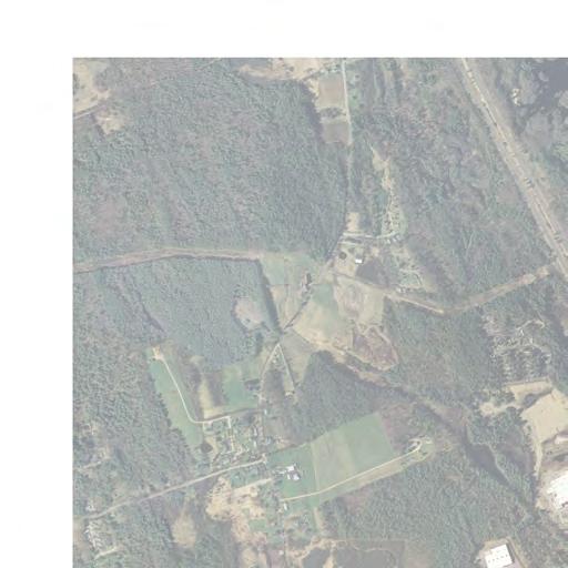
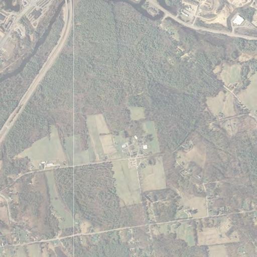
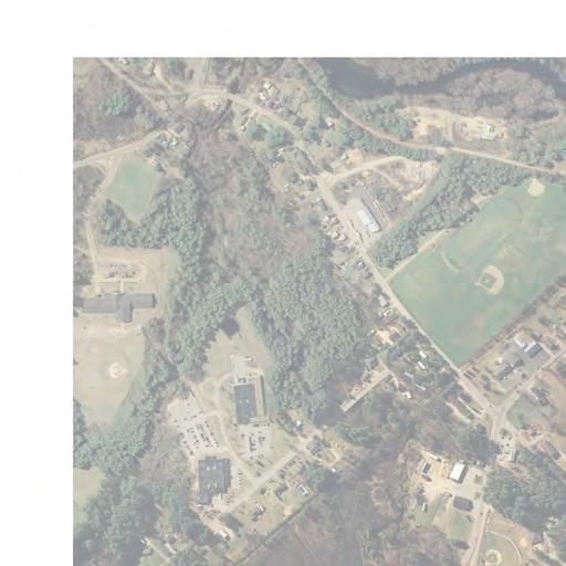
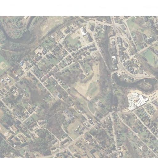
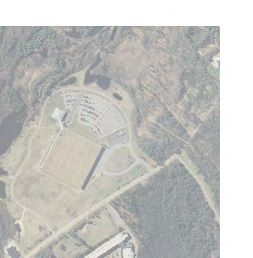
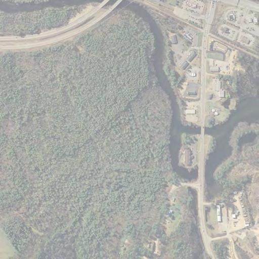
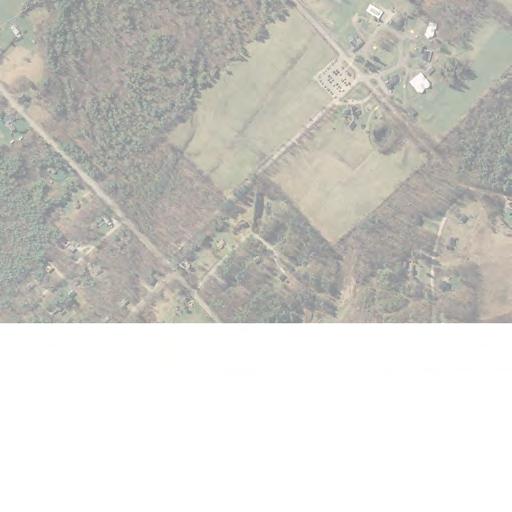
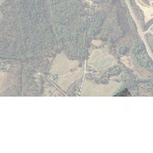
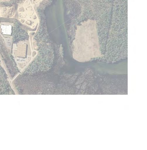
2 Ref: September 7, 2017 Page 2 Development Program The nearly 470-acre site is located in Northfield, NH and is bound by Shaker Road, Shedd Road, and Bay Hill Road to the east and south. The Winnipesaukee River and Interstate 93 (I-93) border the site to the north and west. The proposed development program calls for constructing one million square feet of medical facilities and other supporting ancillary uses. The master plan shows multiple buildings throughout the site concentrated on the north and east edges of the property. As the site planning process progresses, the number and locations of the buildings will be refined. A preliminary concept of a potential site buildout is shown in Figure 1. Per the request of the Northfield Planning Board, primary access to the site has been limited to Shaker Road to the east. Potential emergency access could be provided along Shedd Road to the west. The location of the site in relation to the local roadway system is shown in Figure 2. Figure 1: Preliminary Site Buildout Concept

3
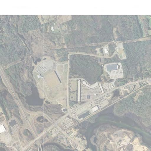
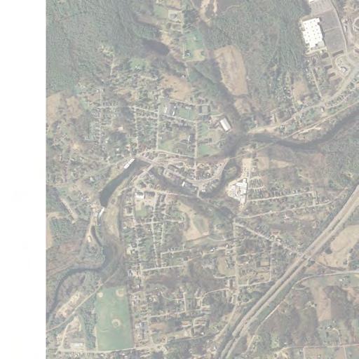
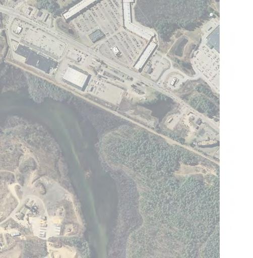
4 Ref: September 7, 2017 Page 3 Study Area Intersections The following section provides an overview of the study area intersections with regard to location, traffic control, pedestrian amenities and posted limited. Figure 3 shows the existing specific lane geometry at each location. US 3 / NH 132 (Laconia Road) at NH 140 (Tilton Road) and I-93 Exit 20 Northbound Ramps Approximately one half mile northwest of the existing unsignalized intersection of NH 140 and Shaker Road is the signalized intersection of NH 140, US 3 / NH 132 and the I-93 Exit 20 Northbound Ramps. Sidewalk and a signalized pedestrian crosswalk are provided across the south approach (NH 140). The speed limit along US 3 is 35 miles per hour and NH 140 is posted at 35 miles per hour approaching the intersection. US 3 (Laconia Road) at NH 132 (Sanborn Road) and Shaw s Plaza US 3 / NH 132 runs east and splits at approximately 0.15 miles at a signalized intersection, where US 3 continues east and NH 132 continues north. The Shaw s Plaza entrance approaches from the south. Sidewalks are available on the northwest and southwest quadrants of the intersection, with no signalized pedestrian crossings provided. NH 132 is posted at 40 miles per hour. US 3 (Laconia Road) at I-93 Exit 20 Southbound Ramps Over a quarter of a mile west of the US 3 intersection with NH 140 and I-93 Exit 20 Northbound Ramps is the signalized intersection of US 3 at I-93 Exit 20 Southbound Ramps. This intersection has three approaches and sidewalk available along the south side of US 3. Bay Hill Road and Bay Street at Shedd Road About three quarters of a mile west of the Spaulding Youth Center is the unsignalized intersection of Shedd Road with Bay Hill Road and Bay Street. Bay Street approaches from the west and continues uncontrolled as the name changes to Bay Hill Road and the roadway curves to the south. Shedd Road approaches Bay Street / Bay Hill Road from the northeast and is stop-controlled. No pedestrian facilities or parking facilities exist at this location. Shedd Road, Bay Street and Bay Hill Road are posted at 30 miles per hour. Elm Street and Summer Street at Bay Street and Granite Street About a mile and a quarter west of the Spaulding Youth Center and less than a quarter mile south from downtown Tilton is the unsignalized intersection of Elm Street and Summer Street with Bay Street and Granite Street. Elm Street approaches from the northwest and continues uncontrolled as the name changes to Summer Street to the South. Bay Street approaches from the east and is stop controlled. Granite Street is a dead-end roadway that approaches from the north and is stop-controlled. Sidewalk exists along the east side of the intersection. Elm Street, Summer Street, and Bay Street are posted at 30 miles per hour and Granite Street is posted at 25 miles per hour. NH 132 (Park Street) at Summer Street and I-93 Exit 19 Southbound On-Ramp Approximately a mile south of downtown Tilton is the unsignalized intersection of NH 132 with Summer Street and the I-93 Exit 19 Southbound On-Ramp. NH 132 runs north-south, with a skewed stop-controlled approach from the northeast (Summer Street) and yield-controlled, one-way on-ramps to I-93 Southbound. Sidewalks are available on the southeast corner of the intersection but there are no crosswalks. NH 132 and Summer Street are posted at 30 miles per hour.
5
6 Ref: September 7, 2017 Page 4 NH 132 (Park Street) at I-93 Exit 19 Northbound Off-Ramp Approximately a quarter mile south of the intersection of NH 132 at Summer Street and I-93 Exit 19 Southbound On-Ramp is the intersection of NH 132 with the I-93 Exit 19 Northbound Off-Ramp. NH 132 runs north-south, with a skewed stop-controlled I-93 Northbound Off-Ramp approach. A sidewalk continues from the intersection to the north, but ends at this location with no existing crosswalks. NH 132 is posted at 30 miles per hour. Trip Generation As presented in the previous site access evaluation memorandum, site-generated trips have been estimated based on a combination of rates published by the Institute of Transportation Engineers (ITE) and other local data. Unfortunately, there are no ITE Land Use Codes (LUC) that accurately represent the proposed development program. The ITE LUC of 720, Medical-Dental Office Building is not appropriate as this LUC is based on individual buildings that are much smaller (less than 120,000 sf) than the proposed campus. Use of LUC 720 also would not incorporate the potential for internal shared trips between the facilities within a campus setting. Therefore, the proposed trip generation estimates have been prepared using ITE LUC 610, Hospital combined with local data collected at the Robert G. Dodge Business Park located in Biddeford, ME. ITE LUC 610, Hospital has been assumed for half of the potential development (500,000 sf). The Hospital ITE data base includes facilities ranging in size from 100,000 sf to 1,800,000 sf with 5 sites similar in size to the proposed one million square foot development program. Since this data base includes several very large hospitals, it is assumed that internal capture between uses within the facility is accounted for (which could be similar in nature to the proposed site). The trip estimates for the remaining 500,000 sf are based on rates observed at a local medical office park in Biddeford, ME. Traffic counts collected at this site were used to develop weekday morning and weekday evening trip generation rates for this 193,000-sf park consisting of nine different buildings. Businesses within the park vary from general health care to dentists, dermatology, eye care, counseling services and a hotel. The trip generation rates developed from this location result in 2.23 trips per 1,000 sf during the weekday morning peak period and 1.89 trips per 1,000 sf during the weekday evening peak period. The weekday morning rate calculated is similar to ITE LUC 720, but the weekday evening calculated rate is lower than ITE. A technical memorandum documenting the detailed trip generation methodology dated March 20, 2017 was previously submitted to and reviewed by the NHDOT as part of the preliminary site access evaluation. As seen in the following table, the trip generation estimate proposed for the Spaulding Youth Center property is expected to generate approximately 1,590 trips (1,125 entering, 465 exiting) during the weekday morning peak period and 1,410 trips (375 entering, 1,035 exiting) during the weekday evening peak period.
7 Ref: September 7, 2017 Page 5 Table 1 - Trip Generation Estimate Weekday Morning Peak Hour Weekday Evening Peak Hour Land Use Type Square Footage Total Enter Exit Total Enter Exit Hospital* 500, Business Park** 500,000 1, Total 1,000,000 1,590 1, , ,035 * ITE Trip Generation Manual 9th Edition ** Robert G Dodge Business Park Trip Rates Trip Distribution Gravity Model A population-based gravity model was prepared to estimate a potential trip distribution for the proposed development. The detailed methodology and approach to the distribution model was also documented in the previously submitted site access evaluation; however, a brief overview is provided herein. For planning purposes, populations within 15, 30, and 45 mile radii were compiled and considered to represent the core or primary business area of the model. Due to the proximity to I-93, the 15, 30, and 45-mile radius delineations would generally follow an estimated travel time window of 15, 30, and 45 minutes for communities that have access to I-93. Community populations were weighted based on proximity to the site, as well as proximity to other potential competing medical facilities offering specialty medicine and in a large campus environment. These two factors were used to determine the likelihood of the population to work at or visit the site. Overall, the distribution model estimates the following: 54 percent to/from the northwest of Shaker Road via NH 140 towards Tilton and I-93 Exit 20 o 15 percent to/from the south via I-93, using Exit 20 o 13 percent to/from the north via I-93, using Exit 20 o 13 percent to/from the west via US 3 / NH 11 o 8 percent to/from the east via US 3 / NH 11 (Lakes Region) o 2 percent to/from the north via NH 132 o 2 percent to/from the south via I-93 Exit 19 o 1 percent to/from the south via NH percent to/from the southeast of Shaker Road via NH 140 towards Belmont 9 percent via Shaker Road internal to Northfield
8 Ref: September 7, 2017 Page 6 Trip assignments for the site-generated traffic are provided in Figures 4 and 5 for the weekday morning and evening peak hours respectively. Traffic Network Development Weekday morning and weekday evening are the peak periods selected as the critical hours for analysis purposes. As such, weekday morning and evening peak hour turning movement counts conducted in February 2017 were used as a basis for the previously submitted preliminary site access evaluation study. The count data revealed that the peak hours for the Shaker Road intersection with NH 140 occur at 6:45 AM to 7:45 AM for the weekday morning and 3:45 PM to 4:45 PM for the weekday evening. During the same traffic count collection, counts at the intersection of Bay Street and Bay Hill Road with Shedd Road were also recorded with similar peak periods. Additional traffic count data was recorded in April and May 2017 for the other study area intersections. The peak hours for the US 3 / NH 11 corridor occur at 7:00 AM to 8:00 AM for the weekday morning and 3:45 PM to 4:45 PM for the weekday evening and for the Exit 19 corridor at 7:00 AM to 8:00 AM for the weekday morning and 4:30 PM to 5:30 PM for the weekday evening. The other intersections identified for this study had similar peak hours, but are far enough away from the corridors that they do not share common peak hours. Copies of the traffic counts are provided in the Appendix. As for the site access study, it was assumed for this traffic impact study that the opening year of the project would be 2027 and the 10-year forecast horizon would be Seasonal Variation NHDOT guidelines require that private development traffic impact studies consider traffic operations based on peak month conditions. The most recent traffic data ( ) from the NHDOT Urban Highway (Group 4) Averages, NHDOT Recreational Highway (Group 5) and the closest permanent count station (Count Station # Belmont, US 3 and NH 11 near Mosquito Bridge) averages were compared when evaluating seasonal adjustments required for the February, April and May 2017 counts. Based on the data, seasonal adjustment factors of 1.21, 1.09, and 1.05 were used for the weekday morning peak hour factors and 1.24, 1.16, and 1.11 for the weekday evening peak hour factors for February, April, and May traffic data respectively. Back-up calculations to support these adjustments factors are provided in the Appendix. Growth Historical growth trends were obtained from five NHDOT Count Stations: # (Belmont US 3 / NH 11 West of Union Road), # (Belmont NH 140 at Gilmanton Town Line), # (Franklin US 3 / NH 11 at Tilton Town Line), # (Northfield I-93 Between Exits 18 and 19), and # (Tilton I-93 Between Exits 19 and 20). The annual growth rates from all five local count stations average to about one percent, annually. No site-specific developments in Northfield or the other surround communities that would have a regional impact were identified. Traffic Networks The existing raw data weekday morning and evening peak hour traffic, pedestrian, and truck volumes counted in February, April, and May 2017 are provided in Figures 6 through 9. Intersections were seasonally adjusted as described above to their respective peak month conditions with adjustments as necessary to balance flows. These base volumes
9
10
11
12
13
14
15 Ref: September 7, 2017 Page 7 were factored for growth to reflect the opening year (2027) and 10-year forecast (2037) traffic volumes. The 2027 and 2037 No Build traffic volume networks are provided in Figures 10 through 13. The trips generated by the proposed development were added to the 2027 and 2037 No Build peak hour traffic volumes to establish the Build networks. The 2027 and 2037 Build traffic volume networks are shown in Figures 14 through 17. Traffic Analyses Signalized and unsignalized intersection capacity analyses were performed for the study area intersections. Levels of service (LOS) were calculated based on the criteria published in the 2000 Highway Capacity Manual 1. Level of service is the term that defines the conditions that may occur on a given roadway or at an intersection when accommodating various traffic volume loads. Levels of service range from A to F with LOS A representing the best operating conditions and LOS F representing the worst. Copies of the level of service calculations have been provided in the Appendix. Unsignalized Intersections Table 2 summarizes the intersection level of service results for the No Build and the Build conditions for the unsignalized intersections. It is important to note that the project is not anticipated to have a measurable impact on the unsignalized study area intersections since the Shedd Road access has been eliminated from the development program. While a small number of trips was assigned to the Exit 19 interchange for analysis purposes, it is not likely that motorists will choose this exit to travel to/from the site as the Exit 20 interchange will provide a quicker and more convenient travel route. The intersections were included in the study to meet the scoping requirements. Elm Street and Summer Street at Bay Street and Granite Street The Bay Street approach to the intersection with Elm Street and Summer Street is projected to operate at LOS B through the year 2037 with average delays approximating 14 seconds per vehicle during the weekday morning and evening peak hours. The 95 th percentile queue exiting from Bay Street is anticipated to be 35 feet or less (approximating 1 vehicle). The Granite Street approach to the intersection with Elm Street and Summer Street is projected to operate at LOS B through 2037 with average delays approximating 11 seconds per vehicle during the weekday morning and evening peak hours. The 95 th percentile queue exiting from Granite Street is anticipated to be less than a car length. Bay Hill Road and Bay Street at Shedd Road The Shedd Road approach to the intersection with Bay Street and Bay Hill Road is projected to operate at LOS A through 2037 with average delays approximately 9 to 10 seconds per vehicle during the weekday morning and evening peak hours. 1 Highway Capacity Manual, Federal Highway Administration, Transportation Research Board, 2000.
16
17
18
19
20
21
22
23
24 Ref: September 7, 2017 Page 8 Table 2 Unsignalized Intersection Capacity Analysis Summary INTERSECTION AND APPROACH Peak 2027 No Build 2027 Build Period Demand* Delay^ LOS+ Demand Delay LOS Elm Street and Summer Street at Bay Street and Granite Street Left/right turn from Granite St AM B B Left/right turn from Bay St AM B B Left/right turn from Granite St PM B B Left/right turn from Bay St PM B B Bay Hill Road and Bay Street at Shedd Road Left/right turn from Shedd Rd AM A A Left/right turn from Shedd Rd PM 30 9 A 30 9 A NH 132 at Summer Street Left/right turn from Summer St AM D D Left/right turn from Summer St PM C C NH 132 at I-93 Exit 19 Northbound Off-Ramp Left/right turn from Off-Ramp AM B B Left/right turn from Off-Ramp PM D D * Demand in vehicles per hour. ^ Delay in seconds per vehicle. + Level of service.
25 Ref: September 7, 2017 Page 9 Table 2 Continued -Unsignalized Intersection Capacity Analysis Summary INTERSECTION AND APPROACH Peak 2037 No Build 2037 Build Period Demand* Delay^ LOS+ Demand Delay LOS Elm Street and Summer Street at Bay Street and Granite Street Left/right turn from Granite St AM B B Left/right turn from Bay St AM B B Left/right turn from Granite St PM B B Left/right turn from Bay St PM B B Bay Hill Road and Bay Street at Shedd Road Left/right turn from Shedd Rd AM A A Left/right turn from Shedd Rd PM 30 9 A 30 9 A NH 132 at Summer Street Left/right turn from Summer St AM E E Left/right turn from Summer St PM D D NH 132 at I-93 Exit 19 Northbound Off-Ramp Left/right turn from Off-Ramp AM B C Left/right turn from Off-Ramp PM E F * Demand in vehicles per hour. ^ Delay in seconds per vehicle. + Level of service. NH 132 at Summer Street The intersection of NH 132 with Summer Street is projected to operate at same level of service with and without the development program. Vehicles exiting form Summer Street are projected to operate at LOS D or better in 2027, but degrade to slightly to a LOS E in 2037 during the morning peak hour. The primary movement exiting from Summer Street is the traffic accessing the I-93 southbound on-ramp. Delays and queues for vehicles exiting from Summer Street are not projected to be excessive. Average delays are projected to be 43 seconds per vehicle. The 95 th percentile queue exiting from Summer Street is anticipated to be approximately 100 feet during the 2027 morning peak hour (approximately 4 vehicles) and 125 feet during the 2037 morning hour (approximately 5 vehicles). NH 132 at I-93 Exit 19 Northbound Off-Ramp The I-93 Exit 19 Northbound Off-Ramp approach to the intersection with NH 132 is projected to operate at LOS C or better through the year 2037 during the morning peak hour. The 95 th percentile queue is approximated to be 60 feet (2 vehicles) for the off-ramp. During the 2027 opening year, the off-ramp is projected to operate at LOS D during the weekday evening peak hour, but degrading to the LOS E/F threshold by the year 2037 with delays ranging between 47
26 Ref: September 7, 2017 Page 10 seconds (No Build) and 52 seconds (Build) per vehicle. The 95 th percentile queue for the off-ramp is projected to be approximately 325 feet (No Build) to 335 feet (Build) during the 2037 evening peak hour. While the analysis results show minimal impact on the intersection s operations, it is important to restate that with the elimination of the Shedd Road site access, it is not anticipated that the small number of trips that were assigned to Exit 19 will materialize as a result of the project. Signalized Intersections Tables 3 and 4 summarize the intersection level of service results for the 2027 and 2037 No Build conditions for the signalized intersections and Tables 5 and 6 summarize the results the 2027 and 2037 Build conditions. US 3 at I-93 Exit 20 Southbound Ramps This intersection is projected to operate at LOS B in the weekday morning peak hour and LOS C in the weekday evening peak hour under both the 2027 and 2037 No-Build conditions. The maximum queue is anticipated to occur during the evening peak hour when the worst case 95 th percentile queue is expected to be 24 vehicles for the US 3 / NH 11 westbound approach for these conditions. Under the 2027 and 2037 Build conditions operations will degrade one to two levels of service. The intersection is projected to operate at LOS C for both weekday morning peak hour conditions and LOS D in 2027 and LOS E in the 2037 Build weekday evening peak hour conditions. The maximum queue is anticipated to occur during the evening peak hour when the 95 th percentile queue is expected to be 25 vehicles for the US 3 / NH 11 westbound approach in 2027 and 29 vehicles in US 3 / NH 132 at NH 140 and I-93 Exit 20 Northbound Ramps This intersection is projected to operate at LOS D in the 2027 and 2037 No Build weekday morning peak hour and LOS E in the weekday evening peak hour. Under the existing timings, the westbound approach is anticipated to operate near or over capacity during the peak hours in The maximum queue is anticipated to occur during the evening peak hour when the 95 th percentile queue is expected to be 47 vehicles for the US 3 / NH 11 westbound approach. Under the 2037 Build conditions, the intersection is projected to further degrade and operate at LOS E in the weekday morning peak hour and LOS F in the weekday evening peak hour. US 3 at NH 132 and Shaw s Plaza This intersection is projected to operate at LOS C or better through the year 2037 under the No Build condition. The maximum queue is anticipated to occur during the evening peak hour when the 95 th percentile queue is expected to be 21 vehicles for the US 3 / NH 11 westbound approach. Under the future Build condition, the intersection is projected to operate at degrade to LOS C in the weekday evening peak hour. The maximum queue is anticipated to be 24 vehicles for the US 3 / NH 11 westbound approach.
27 Ref: September 7, 2017 Page 11 Table No Build Signalized Intersection Capacity Analysis Summary INTERSECTION AND APPROACH AM Peak Hour PM Peak Hour v/c* Delay^ LOS+ Max 95 th % Queue~ v/c Delay LOS US 3 / NH 132 at I-93 Exit 20 Southbound Ramps B C Max 95 th % Queue~ US 3 Eastbound A 125 (Thru) A 225 (Thru) US 3 Westbound B 225 (Thru) C 525 (Thru) I-93 Exit 20 SB Off-Ramp Southbound C 200 (Left) C 200 (Left) US 3 / NH 132 at I-93 Exit 20 Northbound Ramps and NH D E US 3 Eastbound D 400 (Thru) D 575 (Thru) US 3 Westbound D 775 (Thru) E 1025 (Thru) NH 140 Northbound D 325 (Left) D 275 (Left) I-93 Exit 20 NB Off-Ramp Southbound D 275 (Left) D 425 (Left) US 3 / NH 132 at NH 132 and Shaw s Plaza B B US 3 Eastbound A 150 (Left) B 375 (Thru) US 3 Westbound B 275 (Thru) B 450 (Thru) Shaw s Plaza Northbound C 25 (Left) D 75 (Left) NH 132 Southbound C 50 (Thru) D 75 (Thru) * Volume demand to capacity ratio. ^ Delay in seconds per vehicle. + Level of service. ~ Queue measured in feet.
28 Ref: September 7, 2017 Page 12 Table No Build Signalized Intersection Capacity Analysis Summary INTERSECTION AND APPROACH AM Peak Hour PM Peak Hour v/c* Delay^ LOS+ Max 95 th % Queue~ v/c Delay LOS US 3 / NH 132 at I-93 Exit 20 Southbound Ramps B C Max 95 th % Queue~ US 3 Eastbound A 125 (Thru) A 275 (Thru) US 3 Westbound C 250 (Thru) E 600 (Thru) I-93 Exit 20 SB Off-Ramp Southbound C 200 (Left) C 200 (Left) US 3 / NH 132 at I-93 Exit 20 Northbound Ramps and NH D E US 3 Eastbound D 450 (Thru) D 675 (Thru) US 3 Westbound E 925 (Thru) F 1175 (Thru) NH 140 Northbound D 375 (Left) E 325 (Left) I-93 Exit 20 NB Off-Ramp Southbound D 325 (Left) E 500 (Left) US 3 / NH 132 at NH 132 and Shaw s Plaza B B US 3 Eastbound A 175 (Left) B 450 (Thru) US 3 Westbound B 325 (Thru) C 525 (Thru) Shaw s Plaza Northbound C 25 (Left) D 75 (Left) NH 132 Southbound C 50 (Thru) D 75 (Thru) * Volume demand to capacity ratio. ^ Delay in seconds per vehicle. + Level of service. ~ Queue measured in feet.
29 Ref: September 7, 2017 Page 13 Table Build Signalized Intersection Capacity Analysis Summary INTERSECTION AND APPROACH AM Peak Hour PM Peak Hour v/c* Delay^ LOS+ Max 95 th % Queue~ v/c Delay LOS US 3 / NH 132 at I-93 Exit 20 Southbound Ramps C D Max 95 th % Queue~ US 3 Eastbound A 150 (Thru) A 250 (Thru) US 3 Westbound C 250 (Thru) E 625 (Thru) I-93 Exit 20 SB Off-Ramp Southbound D 375 (Left) C 225 (Left) US 3 / NH 132 at I-93 Exit 20 Northbound Ramps and NH D E US 3 Eastbound D 400 (Thru) D 600 (Thru) US 3 Westbound D 750 (Thru) F 1050 (Thru) NH 140 Northbound E 525 (Left) F 725 (Left) I-93 Exit 20 NB Off-Ramp Southbound E 600 (Thru) E 425 (Left) US 3 / NH 132 at NH 132 and Shaw s Plaza B B US 3 Eastbound A 175 (Left) B 425 (Thru) US 3 Westbound B 325 (Thru) B 475 (Thru) Shaw s Plaza Northbound C 25 (Left) D 75 (Left) NH 132 Southbound C 50 (Thru) D 75 (Thru) * Volume demand to capacity ratio. ^ Delay in seconds per vehicle. + Level of service. ~ Queue measured in feet.
30 Ref: September 7, 2017 Page 14 Table Build Signalized Intersection Capacity Analysis Summary INTERSECTION AND APPROACH AM Peak Hour PM Peak Hour v/c* Delay^ LOS+ Max 95 th % Queue~ v/c Delay LOS US 3 / NH 132 at I-93 Exit 20 Southbound Ramps C E Max 95 th % Queue~ US 3 Eastbound A 175 (Thru) A 275 (Thru) US 3 Westbound C 275 (Thru) F 725 (Thru) I-93 Exit 20 SB Off-Ramp Southbound D 400 (Left) C 250 (Left) US 3 / NH 132 at I-93 Exit 20 Northbound Ramps and NH E F US 3 Eastbound D 425 (Thru) D 725 (Thru) US 3 Westbound E 900 (Thru) F 1200 (Thru) NH 140 Northbound E 575 (Left) F 775 (Left) I-93 Exit 20 NB Off-Ramp Southbound E 625 (Thru) E 475 (Left) US 3 / NH 132 at NH 132 and Shaw s Plaza B C US 3 Eastbound A 175 (Left) B 500 (Thru) US 3 Westbound B 375 (Thru) C 600 (Thru) Shaw s Plaza Northbound C 25 (Left) D 75 (Left) NH 132 Southbound C 50 (Thru) D 75 (Thru) * Volume demand to capacity ratio. ^ Delay in seconds per vehicle. + Level of service. ~ Queue measured in feet.
31 Ref: September 7, 2017 Page 15 Proposed Mitigation As mentioned previously, the US 3 corridor signals are not currently operating in a coordinated signal system. Previous NHDOT projects laid the framework so that the US 3 corridor could be coordinated using time of day plans for the signalized intersections. Installation of a signal system upgrade to provide modern technology could greatly improve traffic flow and assist in managing congestion and queues between intersections where problems exist today, as well as mitigate the impact of the proposed project. As presented in Tables 7 and 8, providing new signal technology to the corridor will restore capacity, reduce queues and return the level of service for the Build condition back to No Build levels. The signal system upgrade proposed to mitigate project-related impacts would extend beyond the three signalized intersections on US 3 evaluated in this study. In order for the corridor to work effectively the system upgrade would include the signalized intersections at Sherwood Drive, Exit 20, NH 132/Shaw s, Tanger Outlets/BJ s Wholesale Club, and Home Depot. Although final design of the system has not been completed at this time, the components are anticipated to include items such as TS2-1 controllers (including a new master controller), video detection, wireless communications, new signal heads, and new pedestrian equipment at the Exit 20 Northbound Ramps/NH 140 intersection. A planning level (conceptual) cost estimate suggests that the cost of this upgrade would be approximately $250,000. US 3 at I-93 Exit 20 Southbound Ramps This intersection was retimed and the coordination offset revised for both the morning and evening peak hours at half the cycle lengths used for the US 3 / NH 11 at NH 140 and I-93 Exit 20 Northbound Ramps intersection. No physical modifications were introduced into the mitigation analysis. With the new signal timings, this intersection is projected to operate at LOS C or better through Most notably, the proposed mitigation greatly reduces the 95 th percentile queue for the westbound through critical movement for the 2037 Build condition to a level that is 4 vehicles (100 feet) less than the 2037 No Build (evening) condition. Likewise, the improvements also reduce the volume to capacity ratio for the westbound approach so that it remains under capacity. US 3 / NH 132 (Laconia Road) at NH 140 (Tilton Road) and I-93 Exit 20 Northbound Ramps This intersection was retimed and the coordination offset revised for both the AM and PM peak hour periods. Phase overlaps were introduced for right-turn only lanes for the NH 140 northbound and US 3 / NH 11 eastbound approaches; this would require the furnishing and installing two new 4-section bimodal or 5-section signal heads. This intersection has one signalized pedestrian crossing across the NH 140 Northbound approach. Part of the mitigation analysis calls for changing the signalized pedestrian crossing from an exclusive phase, where each pedestrian call is serviced in an exclusive pedestrian phase for 36 seconds, to a concurrent phase with right turn on red movements from US 3 / NH 11 eastbound prohibited during the walk phase of the pedestrian crossing. With the new signal timings, phase overlaps, and signal modifications, this intersection is projected to operate at LOS D during the 2037 weekday morning peak hour and LOS E during the 2037 weekday evening peak hour. The mitigation reduces the Build intersection delay to less than the No Build condition and keeps the individual intersection approaches under capacity. In addition, the 2037 westbound queue during the Build weekday evening is substantially reduced to approximately 500 feet less than the No Build condition.
32 Ref: September 7, 2017 Page 16 US 3 (Laconia Road) at NH 132 (Sanborn Road) and Shaw s Plaza This intersection was retimed and the coordination offset revised for both the AM and PM Peak Hour periods. No physical modifications were introduced into the mitigation analysis. With the new signal timings, this intersection is projected to operate at LOS C or better through the 2037 peak hours. Retiming and coordination offset adjustments did not provide a substantial improvement to this intersection, but they were necessary in coordination with the US 3 / NH 11 at I-93 Exit 20 Northbound Ramps and NH 140 intersection. Table Build with Mitigation Signalized Intersection Capacity Analysis Summary INTERSECTION AND APPROACH AM Peak Hour PM Peak Hour v/c* Delay^ LOS+ Max 95 th % Queue~ v/c Delay LOS US 3 / NH 132 at I-93 Exit 20 Southbound Ramps B B Max 95 th % Queue~ US 3 Eastbound A 125 (Thru) A 175 (Thru) US 3 Westbound B 200 (Thru) B 425 (Thru) I-93 Exit 20 SB Off-Ramp Southbound C 225 (Left) C 225 (Left) US 3 / NH 132 at I-93 Exit 20 Northbound Ramps and NH D D US 3 Eastbound C 250 (Thru) D 425 (Thru) US 3 Westbound C 450 (Thru) D 550 (Thru) NH 140 Northbound D 325 (Left) D 400 (Left) I-93 Exit 20 NB Off-Ramp Southbound E 375 (Thru) E 300 (Left) US 3 / NH 132 at NH 132 and Shaw s Plaza B C US 3 Eastbound A 175 (Left) B 450 (Thru) US 3 Westbound B 400 (Thru) B 550 (Thru) Shaw s Plaza Northbound D 25 (Left) D 100 (Left) NH 132 Southbound D 75 (Thru) D 100 (Thru) * Volume demand to capacity ratio. ^ Delay in seconds per vehicle. + Level of service. ~ Queue measured in feet.
33 Ref: September 7, 2017 Page 17 Table Build with Mitigation Signalized Intersection Capacity Analysis Summary INTERSECTION AND APPROACH AM Peak Hour PM Peak Hour v/c* Delay^ LOS+ Max 95 th % Queue~ v/c Delay LOS US 3 / NH 132 at I-93 Exit 20 Southbound Ramps B C Max 95 th % Queue~ US 3 Eastbound A 150 (Thru) A 200 (Thru) US 3 Westbound B 225 (Thru) C 500 (Thru) I-93 Exit 20 SB Off-Ramp Southbound C 275 (Left) C 250 (Left) US 3 / NH 132 at I-93 Exit 20 Northbound Ramps and NH D E US 3 Eastbound C 275 (Thru) D 500 (Thru) US 3 Westbound C 475 (Thru) D 675 (Thru) NH 140 Northbound D 375 (Left) E 450 (Left) I-93 Exit 20 NB Off-Ramp Southbound E 400 (Thru) E 350 (Left) US 3 / NH 132 at NH 132 and Shaw s Plaza B C US 3 Eastbound A 200 (Left) B 525 (Thru) US 3 Westbound B 450 (Thru) C 650 (Thru) Shaw s Plaza Northbound D 25 (Left) D 100 (Left) NH 132 Southbound D 75 (Thru) D 100 (Thru) * Volume demand to capacity ratio. ^ Delay in seconds per vehicle. + Level of service. ~ Queue measured in feet. Conclusion The proposed development program calls for constructing a one million square foot medical business park on 470 acres in Northfield, NH. Trip generation estimates indicate that the proposed development will generate approximately 1,590 trips (1,125 entering and 1,035 exiting) during the weekday morning peak hour and 1,410 trips (375 entering and 1,035 exiting) during the weekday evening peak hour. As detailed in the site access study from July 18, 2017, the primary access to the development is proposed via a new four-legged, signalized intersection on NH 140 by relocating Shaker Road to align with the existing Pike Industries driveway. This impact study analyzed critical intersections, including three signalized intersections and four unsignalized intersections in Tilton and Northfield, NH.
34 Ref: September 7, 2017 Page 18 With most of the predicted traffic using I-93 Exit 20, as outlined in the Trip Generation and Distribution memorandum dated March 20, 2017, the Build impact on the unsignalized intersections identified in the Town of Northfield, including I-93 Exit 19, are predicted to be minor and mitigation analysis was not pursued. Expected increases in delay per vehicle from No-Build to Build conditions on the I-93 Exit 19 Southbound On-Ramp intersection from Summer Street are 5 seconds for the weekday morning peak hour and 3 seconds for the weekday evening peak hour. Expected increases in delay per vehicle from No-Build to Build conditions on the I-93 Exit 19 Northbound Off-Ramp intersection are 1 second for the weekday morning peak hour and 5 seconds for the weekday evening peak hour. Without the need of highway geometry changes or additional lanes to the US 3 / NH 11 corridor (I-93 Exit 20), the proposed mitigation to the existing signalized system not only manages, but improves upon the No-Build conditions of the area. For the 2037 Build analysis, the mitigation at the existing signalized intersections of I-93 Exit 20 includes overlap phasing, retiming, coordination, and equipment modifications to accommodate the additional Spaulding Youth Center Development trips. Introducing additional traffic signal technologies, such as video detection, updated traffic signal controllers, and signal interconnect will not only allow for the one million square foot development to be accommodated on the regional transportation system, but will substantially improve traffic operations for all roadway users that use the US 3 / NH 11 corridor through the area.
Shockoe Bottom Preliminary Traffic and Parking Analysis
 Shockoe Bottom Preliminary Traffic and Parking Analysis Richmond, Virginia August 14, 2013 Prepared For City of Richmond Department of Public Works Prepared By 1001 Boulders Pkwy Suite 300, Richmond, VA
METHODOLOGY. Signalized Intersection Average Control Delay (sec/veh)
") Chapter 5 Traffic Analysis 5.1 SUMMARY US /West 6 th Street assumes a unique role in the Lawrence Douglas County transportation system. This principal arterial street currently conveys commuter traffic
Chapter 5 Traffic Analysis 5.1 SUMMARY US /West 6 th Street assumes a unique role in the Lawrence Douglas County transportation system. This principal arterial street currently conveys commuter traffic
Traffic Impact Analysis Chatham County Grocery Chatham County, NC
 Chatham County Grocery Chatham County, NC TABLE OF CONTENTS 1. INTRODUCTION... 1 1.1. Location and Study Area... 1 1.2. Proposed Land Use and Access... 2 1.3. Adjacent Land Uses... 2 1.4. Existing ways...
1609 E. FRANKLIN STREET HOTEL TRAFFIC IMPACT STUDY EXECUTIVE SUMMARY
 1609 E. FRANKLIN STREET HOTEL TRAFFIC IMPACT STUDY EXECUTIVE SUMMARY Prepared for: The Town of Chapel Hill Public Works Department Traffic Engineering Division Prepared by: HNTB North Carolina, PC 343
INDUSTRIAL BUILDING 3009 HAWTHORNE ROAD CITY OF OTTAWA TRANSPORTATION OVERVIEW REVISED. Prepared for: Canada Inc.
 INDUSTRIAL BUILDING 3009 HAWTHORNE ROAD CITY OF OTTAWA TRANSPORTATION OVERVIEW REVISED Prepared for: 7849648 Canada Inc. Octiober 1, 2015 114-598 Overview_2.doc D. J. Halpenny & Associates Ltd. Consulting
Traffic Impact Analysis Walton Acres at Riverwood Athletic Club Clayton, NC
 Traffic Impact Analysis Walton Acres at Riverwood Athletic Club Clayton, NC 1. TABLE OF CONTENTS INTRODUCTION...1 1.1. Site Location and Study Area...1 1.2. Proposed Land Use and Site Access...2 1.3.
THIS PAGE LEFT BLANK INTENTIONALLY
 GA SR 25 Spur at Canal Road Transportation Impact Analysis PREPARED FOR GLYNN COUNTY, GEORGIA 1725 Reynolds Street, Suite 300 Brunswick, Georgia 31520 PREPARED BY 217 Arrowhead Boulevard Suite 26 Jonesboro,
INDUSTRIAL BUILDING 1660 COMSTOCK ROAD CITY OF OTTAWA TRANSPORTATION OVERVIEW. Prepared for:
 INDUSTRIAL BUILDING 1660 COMSTOCK ROAD CITY OF OTTAWA TRANSPORTATION OVERVIEW Prepared for: Simluc Contractors Limited 2550 Blackwell Street, Ottawa K1B 5R1 October 18, 2013 113-584 Overview_1.doc D. J.
MEETING FACILITY 2901 GIBFORD DRIVE CITY OF OTTAWA TRANSPORTATION BRIEF. Prepared for: Holiday Inn Express 2881 Gibford Drive Ottawa, ON K1V 2L9
 MEETING FACILITY 2901 GIBFORD DRIVE CITY OF OTTAWA TRANSPORTATION BRIEF Prepared for: Holiday Inn Express 2881 Gibford Drive Ottawa, ON K1V 2L9 December 18, 2012 112-566 Brief_1.doc D. J. Halpenny & Associates
MEDICAL/OFFICE BUILDING 1637 BANK STREET OTTAWA, ONTARIO TRANSPORTATION OVERVIEW. Prepared for:
 MEDICAL/OFFICE BUILDING 1637 BANK STREET OTTAWA, ONTARIO TRANSPORTATION OVERVIEW Prepared for: 2434984 Ontario Inc. 13-5510 Canotek Road Ottawa, Ontario K1J 9J5 June 4, 2015 115-613 Report_2.doc D. J.
TRAFFIC IMPACT STUDY COMPREHENSIVE UPDATE TOWN OF THOMPSON S STATION, TENNESSEE PREPARED FOR: THE TOWN OF THOMPSON S STATION
 TRAFFIC IMPACT STUDY COMPREHENSIVE UPDATE TOWN OF THOMPSON S STATION, TENNESSEE PREPARED FOR: THE TOWN OF THOMPSON S STATION Transportation Consultants, LLC 1101 17 TH AVENUE SOUTH NASHVILLE, TN 37212
Gateway Transportation Study
 Gateway Transportation Study Amherst, Massachusetts SUBMITTED TO University of Massachusetts Amherst Town of Amherst SUBMITTED BY Vanasse Hangen Brustlin, Inc. Watertown, Massachusetts March 213 Back of
URBAN QUARRY HEADQUARTERS 2717 STEVENAGE DRIVE CITY OF OTTAWA TRANSPORTATION OVERVIEW. Prepared for: Urban Quarry 4123 Belgreen Drive, Ottawa K1G 3N2
 URBAN QUARRY HEADQUARTERS 2717 STEVENAGE DRIVE CITY OF OTTAWA TRANSPORTATION OVERVIEW Prepared for: Urban Quarry 4123 Belgreen Drive, Ottawa K1G 3N2 February 27, 2014 113-584 Overview_1.doc D. J. Halpenny
Subject: Solberg Avenue / I-229 Grade Separation: Traffic Analysis
 MEMORANDUM Transportation Bill Troe, AICP Jason Carbee, AICP 12120 Shamrock Plaza Suite 300 Omaha, NE 68154 (402) 334-8181 (402) 334-1984 (Fax) To: Project File Date: Subject: Solberg Avenue / I-229 Grade
Route 28 (South Orleans Road)/Route 39 (Harwich Road)/Quanset Road Intersection
/Route 39 (Harwich Road)/Quanset Road Intersection") TRAFFIC FEASIBILITY STUDY Route 28 (South Orleans Road)/Route 39 (Harwich Road)/Quanset Road Intersection Orleans, Massachusetts Prepared for: Town of Orleans Prepared by: Fay, Spofford & Thorndike, LLC
TRAFFIC FEASIBILITY STUDY Route 28 (South Orleans Road)/Route 39 (Harwich Road)/Quanset Road Intersection Orleans, Massachusetts Prepared for: Town of Orleans Prepared by: Fay, Spofford & Thorndike, LLC
Evaluation of M-99 (Broad Street) Road Diet and Intersection Operational Investigation
 Road Diet and Intersection Operational Investigation") Evaluation of M-99 (Broad Street) Road Diet and Intersection Operational Investigation City of Hillsdale, Hillsdale County, Michigan June 16, 2016 Final Report Prepared for City of Hillsdale 97 North Broad
Evaluation of M-99 (Broad Street) Road Diet and Intersection Operational Investigation City of Hillsdale, Hillsdale County, Michigan June 16, 2016 Final Report Prepared for City of Hillsdale 97 North Broad
Henderson Avenue Mixed-Use Development
 Zoning Case: Z145-3 Traffic Impact Analysis Henderson Avenue Mixed-Use Development Dallas, TX October 26 th, 216 Kimley-Horn and Associates, Inc. Dallas, Texas Project #644827 Registered Firm F-928 Traffic
HILTON GARDEN INN HOTEL HOTEL EXPANSION 2400 ALERT ROAD, OTTAWA TRANSPORTATION BRIEF. Prepared for:
 HILTON GARDEN INN HOTEL HOTEL EXPANSION 2400 ALERT ROAD, OTTAWA TRANSPORTATION BRIEF Prepared for: Bona Building & Management Co. Ltd. Place Vanier, 333 North River Road Vanier, Ontario K1L 8B9 October
Figure 1: East West Connector Alignment Alternatives Concept Drawing
 Page 2 of 9 Figure 1: East West Connector Alignment Alternatives Concept Drawing The Montebello Drive extension will run north south and connect Wilsonville Road to the Boones Ferry Road to Brown Road
Donahue Drive Corridor Traffic Operational Evaluation
 Donahue Drive Corridor Traffic Operational Evaluation PREPARED FOR: THE CITY OF AUBURN PREPARED BY: JANUARY 2007 Donahue Drive Corridor Study--Auburn, Alabama TABLE OF CONTENTS Introduction... 1 Background
MEMORANDUM. Our project study area included the following locations:
 MEMORANDUM Date: To: From: Subject: Najib O. Habesch Nick M. Fomenko, PE, PTOE Bushnell Park North Traffic Assessment BETA Project #: 4461 As part of our contract to undertake the design of the Bushnell
TRANSPORTATION ANALYSIS REPORT US Route 6 Huron, Erie County, Ohio
 TRANSPORTATION ANALYSIS REPORT US Route 6 Huron, Erie County, Ohio December 12, 2012 Prepared for: The City of Huron 417 Main Huron, OH 44839 Providing Practical Experience Technical Excellence and Client
NEW YORK CENTRAL PARK SUBDIVISION BLAIS STREET/ST-PIERRE STREET EMBRUN, ONTARIO TRAFFIC IMPACT STUDY. Prepared for:
 NEW YORK CENTRAL PARK SUBDIVISION BLAIS STREET/ST-PIERRE STREET EMBRUN, ONTARIO TRAFFIC IMPACT STUDY Prepared for: Solidex Holdings Limited & Investissement Maurice Lemieux Investments Attn: Mr. Anthony
Harrah s Station Square Casino
 Transportation Analysis Harrah s Station Square Casino Pittsburgh, Pennsylvania Submitted To: City of Pittsburgh and Pennsylvania Gaming Control Board Prepared By: DKS Associates GAI Consultants December
5858 N COLLEGE, LLC N College Avenue Traffic Impact Study
 5858 N COLLEGE, LLC nue Traffic Impact Study August 22, 2016 Contents Traffic Impact Study Page Preparer Qualifications... 1 Introduction... 2 Existing Roadway Conditions... 5 Existing Traffic Conditions...
Appendix C. NORTH METRO STATION AREA TRAFFIC IMPACT STATEMENT 88th Avenue Station
 Appendix C NORTH METRO STATION AREA TRAFFIC IMPACT STATEMENT 88th Avenue Station Prepared for: Regional Transportation Department and URS Corporation as part of the North Metro EIS David Evans and Associates,
Traffic Impact Study. Roderick Place Columbia Pike Thompson s Station, TN. Transportation Group, LLC Traffic Engineering and Planning
 F i s c h b a c h Transportation Group, LLC Traffic Engineering and Planning Traffic Impact Study Roderick Place Columbia Pike Thompson s Station, TN Prepared March 2016 Ms. Gillian L. Fischbach, P.E.,
OFFICE/RETAIL DEVELOPMENT 1625 BANK STREET OTTAWA, ONTARIO TRANSPORTATION BRIEF. Prepared for: Canada Inc.
 OFFICE/RETAIL DEVELOPMENT 1625 BANK STREET OTTAWA, ONTARIO TRANSPORTATION BRIEF Prepared for: 9402209 Canada Inc. December 15, 2015 115-625 Report_2.doc D. J. Halpenny & Associates Ltd. Consulting Transportation
2136 And 2148 Trafalgar Road Townhouse Development Traffic Brief. Paradigm Transportation Solutions Limited
 2136 And 2148 Trafalgar Road Townhouse Development Traffic Brief Paradigm Transportation Solutions Limited March 217 March 217 Project: 1627 Diana Vlasic, M.C.I.P., R.P.P Metropolitan Consulting 445 Paletta
FAIRFIELD INN & SUITES HOTEL 135 THAD JOHNSON PRIVATE OTTAWA TRANSPORTATION BRIEF. Prepared for:
 FAIRFIELD INN & SUITES HOTEL 135 THAD JOHNSON PRIVATE OTTAWA TRANSPORTATION BRIEF Prepared for: Bona Building & Management Co. Ltd. Place Vanier, 333 North River Road Vanier, Ontario K1L 8B9 August 12,
TRAFFIC IMPACT STUDY And A TRAFFIC SIGNAL WARRANT ANALYSIS FOR A SENIOR LIVING AND APARTMENT DEVELOPMENT
 TRAFFIC IMPACT STUDY And A TRAFFIC SIGNAL WARRANT ANALYSIS FOR A SENIOR LIVING AND APARTMENT DEVELOPMENT DEERFIELD TOWNSHIP, WARREN COUNTY, OHIO Nantucket Circle and Montgomery Road () Prepared for: ODLE
TRAFFIC IMPACT ANALYSIS
 TRAFFIC IMPACT ANALYSIS FOR THE CHAMPAIGN UNIT#4 SCHOOL DISTRICT PROPOSED HIGH SCHOOL (SPALDING PARK SITE) IN THE CITY OF CHAMPAIGN Final Report Champaign Urbana Urbanized Area Transportation Study 6/24/2014
HOLIDAY INN HOTEL 235 KING EDWARD AVENUE CITY OF OTTAWA TRANSPORTATION BRIEF. Prepared for:
 HOLIDAY INN HOTEL 235 KING EDWARD AVENUE CITY OF OTTAWA TRANSPORTATION BRIEF Prepared for: Momentum Planning & Communications 1165 Greenlawn Crescent Ottawa, ON K1L 6C2 June 29, 2015 115-618 Brief_1.doc
OTTAWA TRAIN YARDS PHASE 3 DEVELOPMENT CITY OF OTTAWA TRANSPORTATION IMPACT STUDY. Prepared for:
 OTTAWA TRAIN YARDS PHASE 3 DEVELOPMENT CITY OF OTTAWA TRANSPORTATION IMPACT STUDY Prepared for: The Ottawa Train Yards Inc. 223 Colonnade Road South, Suite 212 Nepean, Ontario K2E 7K3 January 17, 2012
Traffic Impact and Access Study PROPOSED DURKEE FARM ESTATES. Foster Street Littleton, Massachusetts. Prepared for: Grimes Road, LLC.
 Traffic Impact and Access Study PROPOSED DURKEE FARM ESTATES Foster Street Littleton, Massachusetts Prepared for: Grimes Road, LLC. Westford, MA Prepared by: MDM Transportation Consultants, Inc. 28 Lord
STILLWATER AVENUE CORRIDOR STUDY Old Town, Maine
 Draft Study STILLWATER AVENUE CORRIDOR STUDY Old Town, Maine SUBMITTED TO: BANGOR AREA COMPREHENSIVE TRANSPORTATION SYSTEM SUBMITTED BY: I MAY 23, 2017 DRAFT STILLWATER AVENUE STUDY FINAL REPORT Table
QUICKIE C STORE AND GAS BAR 1780 HERON ROAD OTTAWA, ONTARIO TRANSPORTATION BRIEF. Prepared for:
 QUICKIE C STORE AND GAS BAR 1780 HERON ROAD OTTAWA, ONTARIO TRANSPORTATION BRIEF Prepared for: Quickie Convenience Stores Larny Holdings Ltd. c/o PBC Group April 15, 2015 115-615 Report_1.doc D. J. Halpenny
COMMERCIAL DEVELOPMENT 2015 ROBERTSON ROAD OTTAWA, ONTARIO TRANSPORTATION BRIEF. Prepared for:
 COMMERCIAL DEVELOPMENT 2015 ROBERTSON ROAD OTTAWA, ONTARIO TRANSPORTATION BRIEF Prepared for: First Bay Properties Inc. 311 Richmond Road, Suite 203 Ottawa, ON K1Z 6X3 August 8, 2017 117-663 Brief_1.doc
Chapter 4 Traffic Analysis
 Chapter 4 Traffic Analysis PURPOSE The traffic analysis component of the K-68 Corridor Management Plan incorporates information on the existing transportation network, such as traffic volumes and intersection
Capital Region Council of Governments
 March 23, 2018 Capital Region Council of Governments PROJECT CONCEPT REPORT Realignment of Swamp and Northfield Road s approaches to Route 44 (Boston Turnpike) Town of Coventry SUMMARY: The Town of Coventry
ALLEY 24 TRAFFIC STUDY
 ALLEY 24 TRAFFIC STUDY in City of Frostburg, Maryland January 2013 3566 Teays Valley Road Hurricane, WV Office: (304) 397-5508 www.denniscorporation.com Alley 24 Traffic Study January 2013 Frostburg, Maryland
TRANSPORTATION IMPACT STUDY PROPOSED RIVERFRONT 47 MIXED USE DEVELOPMENT
 November 2016 TRANSPORTATION IMPACT STUDY PROPOSED RIVERFRONT 47 MIXED USE DEVELOPMENT & Aspinwall Borough, Sharpsburg Borough & O Hara Township, Allegheny County, Pennsylvania Prepared for: Riverfront
TRAFFIC ASSESSMENT River Edge Colorado
 TRAFFIC ASSESSMENT River Edge Colorado Submitted by: Fehr & Peers 621 17th Street, Ste. 231 Denver, CO 8293 (33) 296-43 December, 21 App. M-2 Traffic Assessment River Edge Colorado December 21 TABLE OF
PINESTONE TRAFFIC IMPACT STUDY Travelers Rest, South Carolina
 PINESTONE TRAFFIC IMPACT STUDY Travelers Rest, South Carolina Prepared for Longbranch Development Prepared by January 13, 219 ii Table of Contents Subject Page Signature Page... i Table of Contents...
Technical Memorandum TRAFFIC IMPACT STUDY. RIDLEY ROAD CONVENIENCE STORE Southampton County, VA. Prepared for: Mr. David Williams.
 Technical Memorandum TRFFIC IMPCT STUDY RIDLEY ROD CONVENIENCE STORE Southampton County, V Prepared for: Mr. David Williams By: Charles Smith, P.E., PTOE EPR Charlottesville, V July 2014 1 TBLE OF CONTENTS
Memorandum Pershing Road Suite 400 Kansas City, MO Tel Fax
 Memorandum 2400 Pershing Road Suite 400 Kansas ity, MO 64108 Tel 816 329 8600 Fax 816 329 8601 www.transystems.com To: Mr. avid Gurss Kansas epartment of Transportation wight. Eisenhower State Office ldg.
Walmart (Store # ) 60 th Street North and Marion Road Sioux Falls, South Dakota
 60 th Street North and Marion Road Sioux Falls, South Dakota") Walmart (Store #4865-00) 60 th Street North and Marion Road Sioux Falls, South Dakota Prepared for: Wal-Mart Stores, Inc. Bentonville, Arkansas Prepared by: Kimley-Horn and Associates, Inc. ã2013 Kimley-Horn
Walmart (Store #4865-00) 60 th Street North and Marion Road Sioux Falls, South Dakota Prepared for: Wal-Mart Stores, Inc. Bentonville, Arkansas Prepared by: Kimley-Horn and Associates, Inc. ã2013 Kimley-Horn
DUNBOW ROAD FUNCTIONAL PLANNING
 DUNBOW ROAD FUNCTIONAL PLANNING Final Report August 3, 216 #31, 316 5th Avenue NE Calgary, AB T2A 6K4 Phone: 43.273.91 Fax: 43.273.344 wattconsultinggroup.com Dunbow Road Functional Planning Final Report
Glenn Avenue Corridor Traffic Operational Evaluation
 Glenn Avenue Corridor Traffic Operational Evaluation PREPARED FOR: THE CITY OF AUBURN PREPARED BY: DECEMBER 2007 Glenn Avenue Corridor Study--Auburn, Alabama TABLE OF CONTENTS Introduction... 1 Background
APPENDIX D. Traffic Impact Study Creighton Manning Engineering, LLP
 APPENDIX D Traffic Impact Study Creighton Manning Engineering, LLP Traffic Impact Study Catskill Access Evaluation NYS Thruway Exit 21 Town of Catskill, New York CM Project No. 114-232 Prepared For: Greene
FRONT RANGE CROSSINGS TRAFFIC IMPACT STUDY
 FRONT RANGE CROSSINGS TRAFFIC IMPACT STUDY Prepared for: City of Thornton And Colorado Department of Transportation Prepared by: 11 Blake Street, Suite 2 Denver, Colorado 822 Contact: Brian Bern, PE, PTOE
6060 North Central Expressway Mixed-Use Site Dallas, Texas
 Volume 1 Traffic Impact Analysis 6060 North Central Expressway Mixed-Use Site Dallas, Texas April 30, 2018 Kimley-Horn and Associates, Inc. Dallas, Texas Project #063238300 Registered Firm F-928 Traffic
Traffic Impact Study WestBranch Residential Development Davidson, NC March 2016
 Traffic Impact Study WestBranch Residential Development Davidson, NC March 216 TRAFFIC IMPACT STUDY FOR THE WestBranch Residential Development LOCATED IN DAVIDSON, NC Prepared For: Lennar Carolinas, LLC
Traffic Circulation Study for Neighborhood Southwest of Mockingbird Lane and Airline Road, Highland Park, Texas
 ARIZONA TEXAS NEW MEXICO OKLAHOMA February 13, 2015 Mr. Meran Dadgostar P.E., R.S. Town of Highland Park 4700 Drexel Dr. Highland Park, Texas 75205 Re: Traffic Circulation Study for Neighborhood Southwest
December 4, Merrimac Zoning Board of Appeals 2-8 School Street Merrimac, MA Attn: Kathy Marshall. Dear Board Members:
 December 4, 28 Merrimac Zoning Board of Appeals 2-8 School Street Merrimac, MA 86 Attn: Kathy Marshall RE: RAMSHEAD MERRIMAC, MA Dear Board Members: Bayside Engineering, Inc. has received the MDM Transportation
Deer Street Parking Garage & Deer Street Associates Development
 Traffic Impact and Access Study Deer Street Parking Garage & Deer Street Associates Development Portsmouth, New Hampshire Submitted to: City of Portsmouth, New Hampshire 1 Junkins Avenue Portsmouth, New
Traffic Impact Analysis
 Traffic Impact Analysis Isle of Capri Casinos, Inc. Waterloo, Iowa SEH No. A-CLAAS0501.00 November 16, 2004 Table of Contents (Continued) Table of Contents Certification Page Table of Contents Page 1.0
Transportation Impact Study for Abington Terrace
 Transportation Impact Study for Abington Terrace Abington Township, Montgomery County, PA Sandy A. Koza, P.E., PTOE PA PE License Number PE059911 Prepared by McMahon Associates, Inc. 425 Commerce Drive,
Chapter 16: Traffic and Parking A. INTRODUCTION
 Chapter 6: Traffic and Parking A. ITRODUCTIO This chapter examines the potential traffic and parking impacts of the proposed Fresh Kills Park roads. The analysis of transit and pedestrians is presented
Troutbeck Farm Development
 Troutbeck Farm Development Willistown Township, Chester County PA For Submission To: Willistown Township Last Revised: October, 4 TPD# INLM.A. 5 E. High Street Suite 65 Pottstown, PA 9464 6.36.3 TPD@TrafficPD.com
HENDERSON DEVELOPMENT 213, 217, 221, 221 ½, 223 HENDERSON AVENUE and 65 TEMPLETON STREET OTTAWA, ONTARIO TRANSPORTATION OVERVIEW.
 HENDERSON DEVELOPMENT 213, 217, 221, 221 ½, 223 HENDERSON AVENUE and 65 TEMPLETON STREET OTTAWA, ONTARIO TRANSPORTATION OVERVIEW Prepared for: 2294170 Ontario Inc. February 2, 2017 117-652 Report_1.doc
Traffic Impact Study for Rolling Ridge Redevelopment
 Traffic Impact Study for Rolling Ridge Redevelopment Webster Groves, Missouri October 19, 2018 Prepared For: Gershman Commercial Real Estate 150 North Meramec Avenue Suite 500 St. Louis, Missouri 63105
List of Attachments. Location Map... Site Plan... City of Lake Elsinore Circulation Element... City of Lake Elsinore Roadway Cross-Sections...
 List of Attachments Exhibits Location Map... Site Plan... City of Lake Elsinore Circulation Element... City of Lake Elsinore Roadway Cross-Sections... Existing Lane Geometry and Traffic Controls... Existing
TRAFFIC STUDY GUIDELINES Clarksville Street Department
 TRAFFIC STUDY GUIDELINES Clarksville Street Department 9/1/2009 Introduction Traffic studies are used to help the city determine potential impacts to the operation of the surrounding roadway network. Two
Traffic Impact Study. Westlake Elementary School Westlake, Ohio. TMS Engineers, Inc. June 5, 2017
 TMS Engineers, Inc. Traffic Impact Study Westlake Elementary School Westlake, Ohio June 5, 2017 Prepared for: Westlake City Schools - Board of Education 27200 Hilliard Boulevard Westlake, OH 44145 TRAFFIC
Road Conversion Study Plumas Street
 Plumas Street Phase I Submitted to The Regional Transportation Commission of Washoe County Submitted by Zong Tian, Ph.D., P.E. Saeedeh Farivar Haiyuan Li, Ph.D. Center for Advanced Transportation Education
Highway 111 Corridor Study
 Highway 111 Corridor Study June, 2009 LINCOLN CO. HWY 111 CORRIDOR STUDY Draft Study Tea, South Dakota Prepared for City of Tea Sioux Falls Metropolitan Planning Organization Prepared by HDR Engineering,
Clay Street Realignment Project Traffic Study
 Final Clay Street Realignment Project Traffic Study November 24, 2009 Prepared for: City of Placerville RS07-2466 2990 Lava Ridge Court, Suite 200 Roseville, CA 95661 (916) 773-1900 Fax (916) 773-2015
Waterford Lakes Small Area Study
 Waterford Lakes Small Area Study Existing Traffic Conditions PREPARED FOR: ORANGE COUNTY PUBLIC WORKS DEPARTMENT TRAFFIC ENGINEERING DIVISION ORLANDO, FLORIDA PREPARED WITH: INWOOD CONSULTING ENGINEERS
Roundabout Feasibility Memorandum
 Roundabout Feasibility Memorandum To From Gwen Pipkin Bill Howell Date June 18, 2013 Subject Roundabout Feasibility Study SR 29 PD&E Study From Oil Well Road to SR 82 Collier County, FL FPID 417540-1-22-01
Gene Dillon Elementary School Traffic Study Division Street Site
 To: From: Dr. James Hess, Superintendent Jordan Schwarze, PE, Senior Engineer Matt Pacyna, PE, Senior Associate Date: March 30, 2016 Subject: Gene Dillon Elementary School Traffic Study reet Site Memorandum
PRELIMINARY DRAFT WADDLE ROAD / I-99 INTERCHANGE PROJECT ALTERNATIVE ANALYSIS FINAL TRAFFIC SUMMARY REPORT
 PRELIMINARY DRAFT WADDLE ROAD / I-99 INTERCHANGE PROJECT ALTERNATIVE ANALYSIS FINAL TRAFFIC SUMMARY REPORT Prepared by: In Association with: November 2013 EXECUTIVE SUMMARY Patton Township, in partnership
4. ENVIRONMENTAL IMPACT ANALYSIS 9. TRANSPORTATION AND TRAFFIC
 4. ENVIRONMENTAL IMPACT ANALYSIS 9. TRANSPORTATION AND TRAFFIC 4.9.1 INTRODUCTION The following section addresses the Proposed Project s impact on transportation and traffic based on the Traffic Study
Intersection of Massachusetts Avenue and Maple Street in Lexington Signalized Intersection and Roundabout Comparison
 Intersection of Massachusetts Avenue and Maple Street in Lexington Signalized Intersection and Roundabout Comparison Michael Wallwork, Roundabout Expert, Orange Park, Florida Tom Bertulis (MS, PE, PTOE),
King Soopers #116 Thornton, Colorado
 Traffic Impact Study King Soopers #116 Thornton, Colorado Prepared for: Galloway & Company, Inc. 1.0 EXECUTIVE SUMMARY King Soopers #116, a grocery marketplace anchored commercial development, is proposed
Draft North Industrial Area-Wide Traffic Plan
 Summary of North Industrial and Hudson Bay Industrial Recommended Improvements Table 1. Summary of s Item Location 1 2 3 4 5 6 7 8 9 10 11 12 Millar Ave north of 51st St Super 8 Motel back lane 400 Block
D.13 Transportation and Traffic
 This section addresses transportation and traffic issues and impacts related to the Proposed Project. Section D.13.1 provides a description of the affected environment for the Proposed Project. Applicable
BLUE SEA VILLAGE MER BLEUE 2159 MER BLEUE ROAD OTTAWA, ONTARIO TRANSPORTATION IMPACT ASSESSMENT. Prepared for: Ontario Limited.
 BLUE SEA VILLAGE MER BLEUE 2159 MER BLEUE ROAD OTTAWA, ONTARIO TRANSPORTATION IMPACT ASSESSMENT Prepared for: 2534189 Ontario Limited April 6, 2018 117-668 TIA Report_2.doc D. J. Halpenny & Associates
Highway 49, Highway 351 and Highway 91 Improvements Feasibility Study Craighead County
 Highway 49, Highway 351 and Highway 91 Improvements Feasibility Study Craighead County Executive Summary March 2015 Highway 49, Highway 351 and Highway 91 Improvements Feasibility Study Craighead County
Los Altos Hills Town Council - June 18, 2015 Palo Alto City Council June 22, AGENDA ITEM #2.B Presentation
 Los Altos Hills Town Council - June 18, 2015 Palo Alto City Council June 22, 2015 AGENDA ITEM #2.B Presentation Previous Presentations Los Altos Hills Town Council in May 2014 and February 2015 Palo Alto
Traffic Study North Shore School District 112
 Traffic Study North Shore School District 112 Proposed Expansion of Northwood Junior High School Prepared By: May 1, 2015 1. Introduction Kenig, Lindgren, O Hara, Aboona, Inc. (KLOA, Inc.) has been retained
FINAL DESIGN TRAFFIC TECHNICAL MEMORANDUM
 FINAL DESIGN TRAFFIC TECHNICAL MEMORANDUM July 2014 FINAL (SR 43) Project Development and Environment Study From State Road 60 (Adamo Drive) to I-4 (SR 400) Hillsborough County, Florida Work Program Item
TRAFFIC IMPACT STUDY. Creekside Thornton, Colorado. For. August 2015 November 2015 Revised: August Prepared for:
 TRAFFIC IMPACT STUDY For Creekside Thornton, Colorado August 215 November 215 Revised: August 216 Prepared for: Jansen Strawn Consulting Engineers 45 West 2 nd Avenue Denver, Colorado 8223 Prepared by:
FINAL Albertville Business Park AUAR Update Traffic Study
 FINAL Albertville Business Park AUAR Update Traffic Study Prepared for City of Albertville, MN July 20, 2017 SRF No. 10060.00 Table of Contents Introduction... 1 Existing Conditions... 1 Data Collection...
South Albion-Bolton Community Plan North Hill Supermarket Transportation Study Part B: Evaluation of Alternatives
 Community Plan North Hill Supermarket Transportation Study Part B: Evaluation of Alternatives Prepared for: The Town of Caledon August 9 Transportation Solutions Ltd. 43 Forest Road Cambridge, ON N1S 3B4
REDEVELOPMENT TRAFFIC IMPACT STUDY
 REDEVELOPMENT TRAFFIC IMPACT STUDY For Wendy s Parker, Colorado January 215 Prepared for: Sterling Design Associates, LLC 29 W. Littleton Boulevard #3 Littleton, Colorado 812 Prepared by: 1233 Airport
Traffic Impact Statement
 Traffic Impact Statement Mixed Use Development, US 41 and Old Trail Drive aka Tide-Starbucks 4900 9 th Street North General Development Site Plan (GDSP) Collier County, FL 10/6/2015 Prepared for: Prepared
APARTMENT BUILDING DEVELOPMENT 1161 HERON ROAD OTTAWA, ONTARIO TRANSPORTATION IMPACT STUDY. Prepared for:
 APARTMENT BUILDING DEVELOPMENT 1161 HERON ROAD OTTAWA, ONTARIO TRANSPORTATION IMPACT STUDY Prepared for: 1649362 Ontario Inc. c/o Manor Park Management 231 Brittany Drive, Suite D Ottawa ON K1K 0R8 July
Wesbrook Place Traffic Analysis of Redistributed Dwelling Units
 Wesbrook Place Traffic Analysis of Redistributed Dwelling Units 1 Summary This report presents an analysis of the changes in traffic volumes in the Wesbrook Place neighbourhood associated with a redistribution
Design Traffic Technical Memorandum
 State Road 7 Extension PD&E Study Design Traffic Technical Memorandum Palm Beach County, FL October 2010 State Road 7 Extension PD&E Study Design Traffic Technical Memorandum Palm Beach County, FL Prepared
APPENDIX D Traffic Impact Study (Draft Report)
") ENVIRONMENTAL IMPACT ASSESSMENT (EIA) REGISTRATION, TRAFFIC IMPACT STUDY (DRAFT REPORT), AND WATER SUPPLY SOURCE ASSESSMENT (WSSA): CAMPING PLAGE ABOITEAU BEACH, CAP-PELÉ, NB APPENDIX D (Draft Report)
ENVIRONMENTAL IMPACT ASSESSMENT (EIA) REGISTRATION, TRAFFIC IMPACT STUDY (DRAFT REPORT), AND WATER SUPPLY SOURCE ASSESSMENT (WSSA): CAMPING PLAGE ABOITEAU BEACH, CAP-PELÉ, NB APPENDIX D (Draft Report)
NO BUILD TRAFFIC OPERATIONS
 3. 23 NO BUILD TRAFFIC OPERATIONS This section addresses the operations of the transportation system and details how it would be expected to function under year 23 No Build conditions with the projected
Traffic Study of Fuller Street, Cady Street, West Street and West Avenue. Final Report
 Traffic Study of Fuller Street, Cady Street, West Street and West Avenue Final Report July 2005 Prepared for: Town of Ludlow Prepared by: Pioneer Valley Planning Commission 26 Central Street West Springfield,
TRAFFIC IMPACT STUDY
 TRAFFIC IMPACT STUDY for the GLEN ELLEN COUNTRY CLUB SENIOR RESIDENTIAL REDEVELOPMENT 84 Millis, Massachusetts Prepared by: McMahon Associates, Inc. Prepared for: Toll Brothers, Inc. August 216 DRAFT
Michael A. Werthmann, PE, PTOE Principal
 9575 West Higgins Road, Suite 400 Rosemont, Illinois 60018 p: 847-518-9990 f: 847-518-9987 MEMORANDUM TO: FROM: Brian Lorenc GHB-630, LLC Michael A. Werthmann, E, TOE rincipal Luay R. Aboona, E rincipal
TRAFFIC IMPACT STUDY CRITERIA
 Chapter 6 - TRAFFIC IMPACT STUDY CRITERIA 6.1 GENERAL PROVISIONS 6.1.1. Purpose: The purpose of this document is to outline a standard format for preparing a traffic impact study in the City of Steamboat
Traffic Impact Study Little Egypt Road Development Denver, North Carolina June 2017
 Traffic Impact Study Little Egypt Road Development Denver, North arolina June 2017 N. Little Egypt Road DQ\ QDQFLQJ VDOHV RU RWKHU SHUIRUPDQFH EDVHG FULWHULD Proposed Site Driveways Site Driveway 1 TRAFFI
ORLEANS GARDENS SHOPPING CENTRE 1615 ORLEANS BOULEVARD CITY OF OTTAWA, ONTARIO TRANSPORTATION IMPACT STUDY. Prepared for:
 ORLEANS GARDENS SHOPPING CENTRE 1615 ORLEANS BOULEVARD CITY OF OTTAWA, ONTARIO TRANSPORTATION IMPACT STUDY Prepared for: Orleans Gardens Shopping Centre Inc. 2851 John Street, Suite 1 Markham, ON K3R 5R7
DIMARCO CANANDAIGUA PROPERTIES HOUSING PROJECT CANANDAIGUA, ONTARIO COUNTY, NEW YORK
 TRAFFIC IMPACT STUDY FOR THE DIMARCO CANANDAIGUA PROPERTIES HOUSING PROJECT CANANDAIGUA, ONTARIO COUNTY, NEW YORK MARCH 14, 2017 PREPARED FOR: 1950 Brighton Henrietta Town Line Rd Rochester, NY 14623 PREPARED
4.0 TRANSPORTATION SYSTEMS
 Transportation Systems 4.0 TRANSPORTATION SYSTEMS This chapter examines the impacts of the Central Corridor Extension on existing roadways and traffic operations and discusses the transit service, operations,