TRAFFIC STUDY GUIDELINES Clarksville Street Department
|
|
|
- Lucas Wells
- 5 years ago
- Views:
Transcription
1 TRAFFIC STUDY GUIDELINES Clarksville Street Department 9/1/2009


2 Introduction Traffic studies are used to help the city determine potential impacts to the operation of the surrounding roadway network. Two types of traffic studies are described in these guidelines including, Traffic Assessment and Traffic Impact Study. These studies are required by the City Code and Access Ordinance. The reviewing agency is the Clarksville Street Department (CSD). Written recommendations will be provided from the Traffic Engineer or Street Department Engineering Manager to the Regional Planning Commission. A Traffic Assessment (TA)is designed to be a preliminary look at the potential impacts of a new zoning request but requires only a limited amount of effort to produce. This study will assist the planning commission and the Street Department in determining the amount of potential impact that exists for a proposed zoning change. A Traffic Impact Study (TIS) is a more detailed document, requiring additional investigation and analysis. The TIS is required at the time of construction plan approval. Both of these levels of study are described to assist a developer or consultant. Both studies are required to be performed and stamped by a Licensed Professional Engineer with experience in Traffic Engineering. Traffic Assessment Policy for Rezoning Applications A Traffic Assessment should be required for all rezoning submittals if such rezoning request is equal to or exceeds the minimum acreage for the following zone districts, as listed below. Traffic Assessments may be required if determined by the City Street Department, Regional Planning Commission or City Council due to location of the site to be rezoned even if the thresholds described in this section are not met. Table 1 shows the size for a site being rezoned that would require a Traffic Assessment. The developer or land owner may request a waiver from the traffic assessment requirement in a written request to the planning commission. The City with input from the planning commission may waive the requirement based on engineering judgment or knowledge of the surrounding area. Prior to conducting a Traffic Assessment, the Traffic Engineering performing the study shall meet with the CSD in a Scoping Meeting. The purpose of the meeting will be to determine the specifics of the study assumptions, including types of land uses to assume for trip generation, any access concerns, and availability of traffic counts. September 1,
3 Table 1 Minimum Development Size Requiring a Traffic Assessment ZONE DISTRICT BEING MINIMUM ACREAGE OR UNITS REQUESTED R-1/RM-1 70 ACRE R-1A/RM-2 60 ACRE R-2 42 ACRE R-2D 13 ACRE OR 150 UNITS R-3 13 ACRE OR 150 UNITS R-4 5 ACRE OR 150 UNITS MLUD 1 ACRE PUD 13 ACRE OR 150 UNITS E-1/EM ACRE E-1A/EM-1A 105 ACRE C-1 NO REQUIREMENT C-2 1 ACRE C-3 1 ACRE C-4 ANY REQUEST C-5 1 ACRE M-1 20 ACRES M-2 50 ACRES Source: Clarksville Street Department and Planning Commission Note: Traffic Assessments may be required at the discretion of the Planning Commission and Street Department if they deem the project in an area of safety concern or high traffic congestion Traffic Assessment is typically a short 3-5 page report and shall include the following sections: General Site Description Trip Generation Roadway Conditions and Access Potential Conclusions General Site Description This section should describe the size of the site requesting to be rezoned and details of the surrounding land uses and roadway access. This section should also state the specific zoning change requested including existing zoning of the property in question and the proposed zoning. If preliminary plans are known they can be presented here. Trip Generation This section should calculate the Average Daily Traffic, morning peak hour traffic and afternoon peak hour traffic that could potentially be generated by full development of the land use change. The maximum density allowed by the proposed zoning classification should be used when calculating the number of potential generated trips. The Traffic Engineering Professional conducting the study shall use information and procedures described in the book produced by the Institute of Transportation Engineers (ITE) Trip Generation, 8 th Edition or latest edition. Often the proposed or likely plans for development of this site may be substantially less than the full development allowed within the current zoning ordinance. This can be considered by the September 1,
4 Planning Commission and Street Department in their review of the information. However, the traffic assessment shall present at a minimum the trips generated by the maximum development allowed. Table 2 shall be used to determine the appropriate land use to use for trip generation calculations. The Street Department may allow a lower generation rate if engineering judgment deems it reasonable. Roadway Conditions and Access Potential This section should determine the classification of all the roadwaya surrounding the site as defined by the City Access Ordinance found in the City Code. In addition, if requested by the CSD then a roadway segment level of service should be calculated using the methods described in the latest edition of the Highway Capacity Manual for two lane or multi-lane highways. Traffic volumes may be acquired from CSD or TDOT annual counts. Table 2 ITE Land Use Code to be used for zoning categories ZONE DISTRICT BEING ITE Lane Use Code REQUESTED R-1/RM R-1A/RM R R-2D 220 R R MLUD ** PUD 220 E-1/EM E-1A/EM-1A 210 C C C and/or 932** C and/or 853** C and/or 932** M M Source: Clarksville Street Department Note: ** TBD by CSD Traffic Engineer Any potential safety hazard or access concern should be identified. If requested by the CSD or Planning Commission, additional analysis may be required such as intersection LOS calculations or sight distance calculations. LOS calculations should again follow the procedures described in the Highway Capacity Manual. Sight distance should be calculated based on the approach speed on the adjacent road and procedures described in the AASHTO book, A Policy on Geometric Design of Highways and Streets for both intersection sight distance and stopping sight distance. Conclusions This section must offer an engineering opinion of the ability of the surrounding street network to support the potential traffic generated by the proposed land use change. September 1,
5 Other traffic studies may be required if determined by the City Street Department, Regional Planning Commission or City Council including but not limited to Signal Warrant Analysis, Speed Study or Signalized Intersection Level of Service. Additional studies may be required at the development phase (preliminary plat/site plan) as well. Traffic Impact Study Requirements and Procedures Traffic Impact Studies are performed to determine the impacts of development proposals on the transportation network and to present measures for mitigating those impacts. The study assists the City's planners, public works department and reviewers in evaluating appropriate land uses, intensities, and mitigation measures for a project based on the impacts to the transportation system in the area. Based on this evaluation recommendations to the transportation network in the vicinity of the project site can be analyzed to ensure adequate mobility will be maintained after the proposed development is constructed. The Traffic Impact Study shall be prepared under the supervision of a professional engineer registered in the State of Tennessee with specific training and experience in traffic engineering. The cover page should be stamped by the licensed engineer responsible for all of the work presented in the report. The Traffic Impact Study should fully document the methodologies, findings, conclusions and recommendations of the study, including the basis for all assumptions and traffic parameters utilized. The report should be presented in a logical format which includes tables and figures in order to clearly and accurately convey the data, analysis, and results of the study. These guidelines provide a general framework on which a Traffic Impact Study should be based. All Traffic Impact Studies should utilize and reference the appropriate data sources, tables, figures, and analysis worksheets. Level of Traffic Impact Study The following conditions will require a Traffic Impact Study: New developments that will generate over 1,000 Average Daily Trips (ADT) or over 100 trips per peak hour. The trip generation should be calculated based on the latest edition of the Institute of Transportation Engineers (ITE) Trip Generation Manual. In situations when a project site is within a congested area, near or within an area of high growth or near an intersection with a high number of crashes, the City may decide that a study is necessary. This condition is determined by the CSD. If a smaller portion of a larger development is submitted, the City may require a study based on the size of the larger project. This condition is determined by the CSD. September 1,
6 The amount of traffic expected to be generated by the new development will determine the level of study required. The level of study required is detailed in Table 3. As shown, a Level I study is required if the expected ADT is over 500 but less than 3,000. A Level II study is required for a project with an expected ADT of over 3,000 but less than 6,000 and a Level III study is required for all projects with an expected ADT of over 6,000. Table 3 - Level of Traffic Impact Study Required Level of Study Criteria Study Area I <3,000 ADT All site access points, adjacent roadways, and major intersections. All signalized intersections on each street serving the site within ¼ mile. II 3,000<6,000 ADT All site access points, adjacent roadways, and major intersections. All signalized and major unsignalized intersections on each street serving the site within ¼ mile. III >6,000 ADT All site access points, adjacent roadways, and major intersections. All signalized and major unsignalized intersections on each street serving the site within ½ mile. Source: Clarksville Street Department Waiver for Traffic Impact Study The CSD, with input from the Planning Commission, may grant a waiver for a Traffic Impact Study if the applicant shows that the impact of the development on the transportation network is insignificant. A waiver may also be granted if the CSD and the applicant agree that the impacts of the traffic generated by the development are negligible. The waiver request shall be made in writing and shall include the data and analysis necessary to support the request. If a waiver is granted, the CSD will notify the applicant in writing. September 1,
7 Scope of Traffic Impact Study Before beginning a Traffic Impact Study, the traffic engineering professional performing the study must meet with the CSD to determine the scope of the study. The scoping meeting should be set up with the CSD s Traffic Engineer or Engineering Manager. The CSD will work with the developer's consultant to determine the appropriate parameters and assumptions for the study. The following items should be discussed in the scoping meeting: The level of detail needed for the study Identification of study area and key intersections Trip generation data to be used Assumptions for pass-by and internal trip reductions Any roadway improvement projects in the vicinity of the site Approved, but unconstructed development projects to be included in the study Assumptions for background growth Analysis periods and the typical peak hours for the proposed land use Consideration of pedestrian and bicycle accommodations Analysis software to be used The minutes of the scoping meeting shall be prepared by the traffic engineering professional performing the study. The minutes shall be submitted to the CSD s Traffic Engineer. Approval from the CSD s Traffic Engineer shall be obtained prior to initiating the Traffic Impact Study. Field Data Collection Manual peak hour traffic volumes should be collected at the intersections within the study area. The count data must be no more than 24 months old. A Traffic Impact Study will also require field data collection. The required data to be collected include sight distance measurements, posted speed limit, identification of bicycle and pedestrian facilities, lane usage and lane width for roadways and intersections. Also, the functional classification of the roadway should be identified. In addition, driveways across from or adjacent to the site should be located. Finally, the traffic control at intersections should be identified as well as traffic signal phasing and timings. September 1,
8 Traffic Impact Study Report Requirements The Traffic Impact Study shall address the following information: I. Project Description a) Describe the purpose and objectives of the study. b) Describe the specific location of the project and include an area map locating the project site. c) Identify the current zoning of the site and if the site must be rezoned in order for the proposed development to be constructed. d) Describe the current development on the site, if any, and the proposed use for the project site. e) Identify the size of the project site and the size of the proposed development, i.e. if residential, the number and type of dwelling units; if retail, the square footage, etc. Include a detailed site plan for the proposed project. f) Identify the specific location of all project accesses, including proposed roads and driveways. The distances between adjacent driveways, as well as the distances from existing intersections, shall be specified. g) Identify the size of each phase of development if it will be developed in more than one phase. The proposed timing for the development of phases should be specified. II. Existing Setting a) Describe all roadways located within the study area, including the number of lanes, lane usage at intersections, lane widths, roadway classification, and speed limit. Identify if sidewalks and bike facilities are present. The study area will be determined by the scoping meeting and will be documented in the meeting minutes. b) Describe all intersections within the study area including the type of traffic control device, traffic signal phasing if applicable, and the lane usage for each approach. III. Existing Traffic Volumes a) Specify the time and location for all manual traffic counts. b) Identify the specific AM and PM peak hour determined by the traffic counts. c) Show the existing turning movement peak hour traffic volumes on a figure. (See Figure 2 in Appendix) d) Provide any 24-hour traffic count information in a table. IV. Evaluation of Current Traffic Operations a) Perform capacity analysis for the roadway segments and intersections using the current Highway Capacity Software (HCS+), or equivalent software package. September 1,
9 b) List the Level of Service (LOS) for the overall intersection for signalized intersections and the LOS for all critical turning movements for unsignalized intersections. c) The LOS calculations should be based on the latest version of the Highway Capacity Manual. Acceptable software programs for conducting capacity analysis are the latest version of the McTrans Highway Capacity Software (HCS+ or latest version), SIDRA and Synchro. In addition, use of software packages such as Sim Traffic, CORSIM, Passer 2, Passer 3, Transyt 7F or Synchro that performs traffic signal coordination or micro-simulation may be required in addition to the capacity analysis software in order to evaluate traffic operations. Any other software to be used in any analysis must be approved by the CSD Traffic Engineer prior to submittal of the report. V. VI. Background Traffic Operations a) Typically a growth rate should be applied to existing volumes to obtain background traffic conditions for the study horizon year (the build-out year of the proposed project). The growth rate to be used should be based on historical traffic count information, with additional consideration given to the likelihood for future growth in the study area. The historical traffic growth rate can be based on ADT counts located in the vicinity of the project. The background growth rate should be pre-approved by the CSD s Traffic Engineer. b) Based on the expected build-out of the project, apply the growth rate to the existing peak hour traffic volumes for each year of the expected build-out time. c) Show the background peak hour traffic volumes on a figure. (See Figure 3 in Appendix) d) Include peak hour traffic assignments for any approved, but unconstructed projects that will result in traffic increases on the roadways and intersections within the study area. e) Show the peak hour traffic assignments for the approved, but unconstructed projects on a separate figure. Where applicable these traffic assignments should be added to the background peak hour traffic volumes to obtain total background peak hour traffic volumes. These total background traffic volumes should be shown on a separate figure. VI. Trip Generation a) Determine the daily, AM, and PM peak hour trip generation for the project based on the trip generation data listed in the latest edition of the ITE Trip Generation. b) Show the trip generation calculations for each proposed land use and for all phases of the project. c) Determine if the proposed land uses justify the inclusion of pass-by and/or internal trip reductions. Document all assumptions, calculations and conclusions. d) Use the latest edition of the ITE Trip Generation Handbook, to determine the percentage of trips to be reduced for pass-by and/or internal trips. September 1,
10 e) Present the results of the trip generation in a table. VII. Trip Distribution Determine the directional distribution of the new trips generated by the proposed project. The directional distribution should be based on the gravity model or other acceptable trip distribution model, counts at a similar, nearby location, or analysis of population and employment data within the influence area of the project. a) If the proposed project is a mixed-use development, each land use may justify a separate trip distribution. b) Include figures showing the directional distribution for each land use and/or phase. (See Figure 4 in Appendix) c) Trip distribution percentages shall be submitted and approved prior to initiation of any capacity or level of service analysis VIII. Traffic Assignment a) Based on the directional distribution and the trip generation calculations, determine the traffic assignment for the proposed project. b) Include the traffic assignment for each land use and/or phase on separate figures. (See Figure 5 in Appendix) c) If pass-by traffic is assumed, include a figure showing the pass-by traffic assignment. The percentage of pass-by trips must be pre-approved by the City's Traffic Consultant. d) As identified above, the traffic assignment for each land use and/or phase should be presented on a separate figure. Also include the total traffic assignment generated by the entire proposed project on a figure. This figure should be labeled "Total Site Generated Traffic." IX. Analyses of Projected Peak Hour Traffic a) Include a figure showing the projected peak hour traffic volumes based on the background peak hour traffic volumes plus the total site generated traffic volumes. (See Figure 6 in Appendix) b) Determine the LOS for roadway segments and intersections during the AM and PM peak hours, based on the existing roadway geometrics and traffic control. c) The results of the capacity analyses should be presented in a tabular format showing LOS and delay for each approach and critical movement. The LOS should be shown for each critical turning movement for unsignalized intersections. d) Utilize the capacity analyses to determine if any improvements are required to obtain a minimum LOS D for signalized intersections. In addition, all movements should be maintained at LOS E or better. September 1,
11 e) For any unsignalized intersections operating at LOS E or F, determine if there are feasible measures to improve the traffic operations to LOS D or better. f) Use M.D. Harmelink's Volume Warrants for Left-Turn Storage Lanes at Unsignalized Intersections found in the TDOT Roadway Design Guidelines to determine if left turn lanes are needed at unsignalized intersections. g) Evaluate and discuss the need for right turn deceleration lanes at intersections and driveways within the study area. h) Determine the LOS for roadway segments and intersections, for the projected conditions with the recommended improvements. i) The results of the capacity analyses with the recommended improvements should be presented in a table. j) Evaluate whether or not the proposed site plan design conforms to the City's Access Ordinance, as well as the design requirements of the Subdivision Regulations. If certain design parameters do not meet the City requirements, assess the feasibility and desirability of conforming to the access requirements. k) Address any sight distance issues based on the intersection sight distance and stopping sight distance as described in the AASHTO book, A Policy on Geometric Design of Highways and Streets. l) If the land use is such that trucks will be utilizing the project accesses, evaluate the truck turning radii based on the turning radii listed in the AASHTO's, A Policy on Geometric Design of Highways and Streets. In most cases the WB-50 will be the size truck that should be used for the analyses. Clearly state all assumptions for truck access and truck sizes. m) If a signal is proposed for an intersection, signal warrant analyses must be performed using the volume-related signal warrants listed in the latest edition of the Manual on Uniform Traffic Control Devices. X. Conclusions and Recommendations a) Identify any recommended roadway improvements, including roadway widening, left turn lanes, right turn deceleration lanes, new roadway connections, turn lane extensions, etc. Specify turn lane storage lengths, taper and transition lengths, and lane widths. b) Include any modifications to existing or additions of new traffic control devices. c) Include a list of site access evaluations and recommendations. d) Include recommended improvements to pedestrian and bicycle facilities. e) Include improvements that are scheduled to be performed by the city, state, or county. Clearly identify the funding sources for these improvements. f) Timing for the completion of the recommendations should be stated. This timing should be based on logical construction phasing and when improvements are needed. g) Include the recommendations on a figure which clearly illustrates the necessary improvements. This figure should be a scaled drawing that demonstrates the feasibility of all recommended improvements. (See Figure 7 in Appendix) September 1,
12 XI. Appendices a) Include all manual peak hour traffic counts and any 24-hour counts conducted. b) Include the capacity analyses worksheets. c) Include trip generation worksheets. d) Include all calculations for pass-by and internal trip reductions. e) Include left turn lane warrant analyses. f) Include any turning radii analyses. g) Include any other information needed to support the analyses performed in the Traffic Impact Study. Traffic Impact Study Report Outline The Traffic Impact Study should follow the following outline: EXECUTIVE SUMMARY 1. Site Location and Study Area 2. Development Description a. Land Use and Intensity b. Site Plan/Subdivision Plat c. Zoning d. Phasing and Development Plan 3. Planned Public or Private Transportation Improvements 4. Findings 5. Conclusions and Recommendations I. INTRODUCTION A. Purpose of Report B. Study Objectives II. PROJECT DESRIPTION III. EXISTING SETTING A. Regional and Local Access 1. Area Roadway Network 2. Intersections within Study Area 3. Existing Traffic Volumes and Conditions 4. Transit Service 5. Bicycle and Pedestrian Facilities September 1,
13 IV. PLANNED PUBLIC OR PRIVATE TRANSPORTATION IMPROVEMENTS A. Description of Improvements B. Responsible Party for Improvements C. Timing for Improvements V. BACKGROUND TRAFFIC VOLUMES A. Historical Growth Rate B. Non-site Traffic for Other Approved Developments in Study Area 1. Method of Projections 2. Traffic Assignment VI. PROJECTED TRAFFIC A. Site Traffic 1. Trip Generation (New Trips, Pass-by Trips, Internal Trips) 2. Trip Distribution and Assignment a. New Trip Distribution b. Pass-By Trip Distribution c. Modal Split d. Trip Assignment B. Total Future Traffic (Total Traffic Conditions, including background and project traffic) VII. TRAFFIC ANALYSIS A. Site Access (Median Openings, Driveway Spacing, Left and Right Turn Deceleration Lanes, Throat Lengths, Queue Analysis) B. Capacity and Level of Service at Study Roadways and/or Intersections C. Traffic Signal Warrant Analyses D. Traffic Safety (Qualitative Site Observations and Future Conditions Issues) E. Sight Distance (Based on Field Observations and Measurements) F. Site Circulation and Parking (Automobile and Truck Access and Circulation) G. Pedestrian and Bicycle Accessibility H. Improvements Needed to Accommodate Site Traffic, Status of Improvements Already Funded, Programmed or Planned (Capital Improvement Programs and Transportation Improvement Programs) I. Schedule of Needed Improvements VIII. CONCLUSIONS & RECOMMENDATIONS A. Summary of Analysis B. Summary of Needed Improvements C. Schedule of When Improvements Will Be Needed IX. TYPICAL FIGURES A. Project Location B. Existing Peak Hour Traffic Volumes (all intersections to be shown on one figure) C. Background Peak Hour Traffic Volumes (all intersections to be shown on one figure). D. Directional Distribution of Traffic Generated by the Site (distribution should be carried through all intersections within study area) E. Assignment of Traffic Generated by the Site (assignment should be carried through all intersections within study area) September 1,
14 F. Total Projected Peak Hour Traffic Volumes (all intersections to be shown on one figure) G. Recommended Roadway and Traffic Control Improvements (Drawn to Scale) X. TYPICAL TABLES A. Existing Peak Hour Levels of Service B. Background Peak Hour Levels of Service C. Trip Generation of Proposed Site D. Projected Peak Hour Levels of Service With Existing Geometries & Traffic Control E. Projected Peak Hour Levels of Service With Recommended Improvements F. Traffic Signal Warrant Analysis XI. TYPICAL APPENDICES A. Traffic Counts B. Capacity and Level of Service Analysis Worksheets C. Historical and Background Growth Data D. Trip Generation Calculations E. Additional Volume Figures (If needed) F. Left Turn Lane Calculations 8. Submission and Review of Traffic Impact Study Three (3) copies of the Traffic Impact Study should be submitted to the Clarksville Street Department together with the development plans. The Traffic Impact Study must be sealed and signed by the professional engineer responsible for the preparation of the study. The City of Clarksville and the City's Traffic Consultant will review the Traffic Impact Study with the development plat/site plan submittal. If the Traffic Impact Study does not contain all the information discussed in the scoping meeting, the applicant will be notified, and a revised study will need to be submitted. The CSD Traffic Engineer will review the study within 15-days or submittal. After reviewing the completed Traffic Impact Study, the CSD s Traffic Engineer will provide written comments to the Regional Planning Commission Office. If the proposed development's land use or size is significantly altered after the CSD has reviewed the Traffic Impact Study, the study will need to be revised to address the changes. If the development is not constructed within two years, the study will need to be revised to include updated traffic count data and other transportation related changes in the study area. Please note that changes to the site plan including driveway locations, number of driveways, size of development, types of land uses included, or anything affecting the total number of trips generated by the site may require the revision of an approved traffic study. September 1,
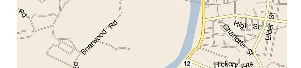
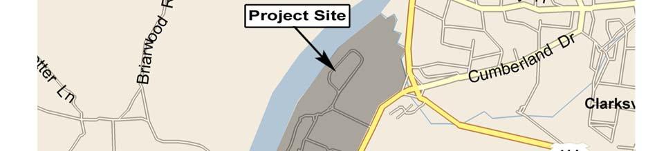
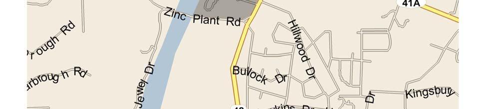
15 APPENDIX EXAMPLE FIGURES September 1,
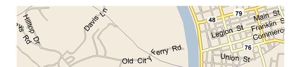

16 Clarksville Marina Traffic Impact Study January 2009 EXAMPLE FIGURE ONLY of 26
17 Clarksville Marina Traffic Impact Study January 2009 EXAMPLE FIGURE ONLY of 26
18 Clarksville Marina Traffic Impact Study January 2009 EXAMPLE FIGURE ONLY of 26
19 Clarksville Marina Traffic Impact Study January 2009 EXAMPLE FIGURE ONLY of 26
20 Clarksville Marina Traffic Impact Study January 2009 EXAMPLE FIGURE ONLY of 26
21 Clarksville Marina Traffic Impact Study January 2009 EXAMPLE FIGURE ONLY of 26
22 Clarksville Marina Traffic Impact Study January 2009 EXAMPLE FIGURE ONLY of 26
TRAFFIC IMPACT STUDY CRITERIA
 Chapter 6 - TRAFFIC IMPACT STUDY CRITERIA 6.1 GENERAL PROVISIONS 6.1.1. Purpose: The purpose of this document is to outline a standard format for preparing a traffic impact study in the City of Steamboat
4.0 TRAFFIC IMPACT STUDIES
 SECTION 4 4.0 TRAFFIC IMPACT STUDIES 4.1 TRAFFIC IMPACT STUDY REQUIREMENTS The City has established Traffic Impact Study (TIS) requirements for the purpose of ensuring that both the quantitative and qualitative
CHAPTER 4 TRANSPORTATION IMPACT STUDY TABLE OF CONTENTS
 CHAPTER 4 TRANSPORTATION IMPACT STUDY TABLE OF CONTENTS Section Title Page 4.1 Introduction... 4-1 4.1.1 General... 4-1 4.1.2 Applicant Responsibility... 4-1 4.1.3 Capacity and Safety Issues... 4-1 A.
Traffic Impact Study WestBranch Residential Development Davidson, NC March 2016
 Traffic Impact Study WestBranch Residential Development Davidson, NC March 216 TRAFFIC IMPACT STUDY FOR THE WestBranch Residential Development LOCATED IN DAVIDSON, NC Prepared For: Lennar Carolinas, LLC
Traffic Impact Analysis Walton Acres at Riverwood Athletic Club Clayton, NC
 Traffic Impact Analysis Walton Acres at Riverwood Athletic Club Clayton, NC 1. TABLE OF CONTENTS INTRODUCTION...1 1.1. Site Location and Study Area...1 1.2. Proposed Land Use and Site Access...2 1.3.
Traffic Impact Analysis Chatham County Grocery Chatham County, NC
 Chatham County Grocery Chatham County, NC TABLE OF CONTENTS 1. INTRODUCTION... 1 1.1. Location and Study Area... 1 1.2. Proposed Land Use and Access... 2 1.3. Adjacent Land Uses... 2 1.4. Existing ways...
Traffic Impact Analysis (TIA) Process and Procedures Manual. September 2017
 Process and Procedures Manual. September 2017") Traffic Impact Analysis (TIA) Process and Procedures Manual Post Office Box 664 101 Huntersville-Concord Road Huntersville, NC 28070 Phone 704-766-2220 Fax 704-992-5528 www.huntersville.org (c) 2017, Town
Traffic Impact Analysis (TIA) Process and Procedures Manual Post Office Box 664 101 Huntersville-Concord Road Huntersville, NC 28070 Phone 704-766-2220 Fax 704-992-5528 www.huntersville.org (c) 2017, Town
Technical Memorandum TRAFFIC IMPACT STUDY. RIDLEY ROAD CONVENIENCE STORE Southampton County, VA. Prepared for: Mr. David Williams.
 Technical Memorandum TRFFIC IMPCT STUDY RIDLEY ROD CONVENIENCE STORE Southampton County, V Prepared for: Mr. David Williams By: Charles Smith, P.E., PTOE EPR Charlottesville, V July 2014 1 TBLE OF CONTENTS
TRAFFIC IMPACT STUDY And A TRAFFIC SIGNAL WARRANT ANALYSIS FOR A SENIOR LIVING AND APARTMENT DEVELOPMENT
 TRAFFIC IMPACT STUDY And A TRAFFIC SIGNAL WARRANT ANALYSIS FOR A SENIOR LIVING AND APARTMENT DEVELOPMENT DEERFIELD TOWNSHIP, WARREN COUNTY, OHIO Nantucket Circle and Montgomery Road () Prepared for: ODLE
Traffic Impact Study Little Egypt Road Development Denver, North Carolina June 2017
 Traffic Impact Study Little Egypt Road Development Denver, North arolina June 2017 N. Little Egypt Road DQ\ QDQFLQJ VDOHV RU RWKHU SHUIRUPDQFH EDVHG FULWHULD Proposed Site Driveways Site Driveway 1 TRAFFI
1609 E. FRANKLIN STREET HOTEL TRAFFIC IMPACT STUDY EXECUTIVE SUMMARY
 1609 E. FRANKLIN STREET HOTEL TRAFFIC IMPACT STUDY EXECUTIVE SUMMARY Prepared for: The Town of Chapel Hill Public Works Department Traffic Engineering Division Prepared by: HNTB North Carolina, PC 343
Traffic Impact Study. Westlake Elementary School Westlake, Ohio. TMS Engineers, Inc. June 5, 2017
 TMS Engineers, Inc. Traffic Impact Study Westlake Elementary School Westlake, Ohio June 5, 2017 Prepared for: Westlake City Schools - Board of Education 27200 Hilliard Boulevard Westlake, OH 44145 TRAFFIC
Walmart (Store # ) 60 th Street North and Marion Road Sioux Falls, South Dakota
 60 th Street North and Marion Road Sioux Falls, South Dakota") Walmart (Store #4865-00) 60 th Street North and Marion Road Sioux Falls, South Dakota Prepared for: Wal-Mart Stores, Inc. Bentonville, Arkansas Prepared by: Kimley-Horn and Associates, Inc. ã2013 Kimley-Horn
Walmart (Store #4865-00) 60 th Street North and Marion Road Sioux Falls, South Dakota Prepared for: Wal-Mart Stores, Inc. Bentonville, Arkansas Prepared by: Kimley-Horn and Associates, Inc. ã2013 Kimley-Horn
Highway 111 Corridor Study
 Highway 111 Corridor Study June, 2009 LINCOLN CO. HWY 111 CORRIDOR STUDY Draft Study Tea, South Dakota Prepared for City of Tea Sioux Falls Metropolitan Planning Organization Prepared by HDR Engineering,
Project Report. South Kirkwood Road Traffic Study. Meadows Place, TX October 9, 2015
 Meadows Place, TX October 9, 2015 Contents 1 Introduction... 1 2 Data Collection... 1 3 Existing Roadway Network... 2 4 Traffic Volume Development... 2 5 Warrant Analysis... 3 6 Traffic Control Alternative
Glenn Avenue Corridor Traffic Operational Evaluation
 Glenn Avenue Corridor Traffic Operational Evaluation PREPARED FOR: THE CITY OF AUBURN PREPARED BY: DECEMBER 2007 Glenn Avenue Corridor Study--Auburn, Alabama TABLE OF CONTENTS Introduction... 1 Background
List of Attachments. Location Map... Site Plan... City of Lake Elsinore Circulation Element... City of Lake Elsinore Roadway Cross-Sections...
 List of Attachments Exhibits Location Map... Site Plan... City of Lake Elsinore Circulation Element... City of Lake Elsinore Roadway Cross-Sections... Existing Lane Geometry and Traffic Controls... Existing
Transportation Impact Study for Abington Terrace
 Transportation Impact Study for Abington Terrace Abington Township, Montgomery County, PA Sandy A. Koza, P.E., PTOE PA PE License Number PE059911 Prepared by McMahon Associates, Inc. 425 Commerce Drive,
PINESTONE TRAFFIC IMPACT STUDY Travelers Rest, South Carolina
 PINESTONE TRAFFIC IMPACT STUDY Travelers Rest, South Carolina Prepared for Longbranch Development Prepared by January 13, 219 ii Table of Contents Subject Page Signature Page... i Table of Contents...
5858 N COLLEGE, LLC N College Avenue Traffic Impact Study
 5858 N COLLEGE, LLC nue Traffic Impact Study August 22, 2016 Contents Traffic Impact Study Page Preparer Qualifications... 1 Introduction... 2 Existing Roadway Conditions... 5 Existing Traffic Conditions...
TRAFFIC IMPACT STUDY COMPREHENSIVE UPDATE TOWN OF THOMPSON S STATION, TENNESSEE PREPARED FOR: THE TOWN OF THOMPSON S STATION
 TRAFFIC IMPACT STUDY COMPREHENSIVE UPDATE TOWN OF THOMPSON S STATION, TENNESSEE PREPARED FOR: THE TOWN OF THOMPSON S STATION Transportation Consultants, LLC 1101 17 TH AVENUE SOUTH NASHVILLE, TN 37212
TABLE OF CONTENTS TABLE OF CONTENTS... I APPENDICES... III LIST OF EXHIBITS... V LIST OF TABLES... VII LIST OF ABBREVIATED TERMS...
 TABLE OF CONTENTS TABLE OF CONTENTS... I APPENDICES... III LIST OF EXHIBITS... V LIST OF TABLES... VII LIST OF ABBREVIATED TERMS... IX 1 INTRODUCTION... 1 1.1 Project Overview... 1 1.2 Analysis Scenarios...
TRANSPORTATION ANALYSIS REPORT US Route 6 Huron, Erie County, Ohio
 TRANSPORTATION ANALYSIS REPORT US Route 6 Huron, Erie County, Ohio December 12, 2012 Prepared for: The City of Huron 417 Main Huron, OH 44839 Providing Practical Experience Technical Excellence and Client
Evaluation of M-99 (Broad Street) Road Diet and Intersection Operational Investigation
 Road Diet and Intersection Operational Investigation") Evaluation of M-99 (Broad Street) Road Diet and Intersection Operational Investigation City of Hillsdale, Hillsdale County, Michigan June 16, 2016 Final Report Prepared for City of Hillsdale 97 North Broad
Evaluation of M-99 (Broad Street) Road Diet and Intersection Operational Investigation City of Hillsdale, Hillsdale County, Michigan June 16, 2016 Final Report Prepared for City of Hillsdale 97 North Broad
TRAFFIC IMPACT ANALYSIS
 TRAFFIC IMPACT ANALYSIS FOR THE CHAMPAIGN UNIT#4 SCHOOL DISTRICT PROPOSED HIGH SCHOOL (SPALDING PARK SITE) IN THE CITY OF CHAMPAIGN Final Report Champaign Urbana Urbanized Area Transportation Study 6/24/2014
THIS PAGE LEFT BLANK INTENTIONALLY
 GA SR 25 Spur at Canal Road Transportation Impact Analysis PREPARED FOR GLYNN COUNTY, GEORGIA 1725 Reynolds Street, Suite 300 Brunswick, Georgia 31520 PREPARED BY 217 Arrowhead Boulevard Suite 26 Jonesboro,
SECTION 1 - TRAFFIC PLANNING
 SECTION 1 - TRAFFIC PLANNING 1.1 TRAFFIC OPERATIONS 1.1.1 Roadway Functional Classification The Multnomah County Comprehensive Framework Plan s Policy 34: Trafficways and the Functional Classification
Transportation Impact Study Guidelines AS ADOPTED BY REGION OF WATERLOO COUNCIL SEPTEMBER 18, 2013 REPORT NO. P
 Transportation Impact Study Guidelines AS ADOPTED BY REGION OF WATERLOO COUNCIL SEPTEMBER 18, 2013 REPORT NO. P-13-088 HOUSEKEEPING EDITS APPLIED UPDATED TO FILE VERSION 4, JULY 22, 2014 TABLE OF CONTENTS
Traffic Impact Statement
 Traffic Impact Statement Mixed Use Development, US 41 and Old Trail Drive aka Tide-Starbucks 4900 9 th Street North General Development Site Plan (GDSP) Collier County, FL 10/6/2015 Prepared for: Prepared
Truck Climbing Lane Traffic Justification Report
 ROUTE 7 (HARRY BYRD HIGHWAY) WESTBOUND FROM WEST MARKET STREET TO ROUTE 9 (CHARLES TOWN PIKE) Truck Climbing Lane Traffic Justification Report Project No. 6007-053-133, P 101 Ι UPC No. 58599 Prepared by:
Shockoe Bottom Preliminary Traffic and Parking Analysis
 Shockoe Bottom Preliminary Traffic and Parking Analysis Richmond, Virginia August 14, 2013 Prepared For City of Richmond Department of Public Works Prepared By 1001 Boulders Pkwy Suite 300, Richmond, VA
TRAFFIC IMPACT STUDY. Creekside Thornton, Colorado. For. August 2015 November 2015 Revised: August Prepared for:
 TRAFFIC IMPACT STUDY For Creekside Thornton, Colorado August 215 November 215 Revised: August 216 Prepared for: Jansen Strawn Consulting Engineers 45 West 2 nd Avenue Denver, Colorado 8223 Prepared by:
Figure 1: Vicinity Map of the Study Area
 ARIZONA TEXAS NEW MEXICO OKLAHOMA May 5, 2016 Mr. Anthony Beach, P.E. BSP Engineers 4800 Lakewood Drive, Suite 4 Waco, Texas 76710 Re: Intersection and Access Analysis along Business 190 in Copperas Cove
EXECUTIVE SUMMARY. Page 1 of 6
 EXECUTIVE SUMMARY The purpose of this report is to identify conformance with the original traffic impact study for the proposed retail development on Lot 5 of Riverdale Retail Filing No. 1 located on the
Defining Purpose and Need
 Advanced Design Flexibility Pilot Workshop Session 4 Jack Broz, PE, HR Green May 5-6, 2010 Defining Purpose and Need In your agency s project development process, when do design engineers typically get
Roadway Classification Design Standards and Policies. Pueblo, Colorado November, 2004
 Roadway Classification Design Standards and Policies Pueblo, Colorado November, 2004 Table of Contents Page Chapter 1. General Provisions 1.1 Jurisdiction 3 1.2 Purpose and Intent 3 1.3 Modification 3
INDUSTRIAL BUILDING 3009 HAWTHORNE ROAD CITY OF OTTAWA TRANSPORTATION OVERVIEW REVISED. Prepared for: Canada Inc.
 INDUSTRIAL BUILDING 3009 HAWTHORNE ROAD CITY OF OTTAWA TRANSPORTATION OVERVIEW REVISED Prepared for: 7849648 Canada Inc. Octiober 1, 2015 114-598 Overview_2.doc D. J. Halpenny & Associates Ltd. Consulting
Troutbeck Farm Development
 Troutbeck Farm Development Willistown Township, Chester County PA For Submission To: Willistown Township Last Revised: October, 4 TPD# INLM.A. 5 E. High Street Suite 65 Pottstown, PA 9464 6.36.3 TPD@TrafficPD.com
D.13 Transportation and Traffic
 This section addresses transportation and traffic issues and impacts related to the Proposed Project. Section D.13.1 provides a description of the affected environment for the Proposed Project. Applicable
FRONT RANGE CROSSINGS TRAFFIC IMPACT STUDY
 FRONT RANGE CROSSINGS TRAFFIC IMPACT STUDY Prepared for: City of Thornton And Colorado Department of Transportation Prepared by: 11 Blake Street, Suite 2 Denver, Colorado 822 Contact: Brian Bern, PE, PTOE
4. ENVIRONMENTAL IMPACT ANALYSIS 9. TRANSPORTATION AND TRAFFIC
 4. ENVIRONMENTAL IMPACT ANALYSIS 9. TRANSPORTATION AND TRAFFIC 4.9.1 INTRODUCTION The following section addresses the Proposed Project s impact on transportation and traffic based on the Traffic Study
6060 North Central Expressway Mixed-Use Site Dallas, Texas
 Volume 1 Traffic Impact Analysis 6060 North Central Expressway Mixed-Use Site Dallas, Texas April 30, 2018 Kimley-Horn and Associates, Inc. Dallas, Texas Project #063238300 Registered Firm F-928 Traffic
Traffic Impact Study. Roderick Place Columbia Pike Thompson s Station, TN. Transportation Group, LLC Traffic Engineering and Planning
 F i s c h b a c h Transportation Group, LLC Traffic Engineering and Planning Traffic Impact Study Roderick Place Columbia Pike Thompson s Station, TN Prepared March 2016 Ms. Gillian L. Fischbach, P.E.,
A Traffic Operations Method for Assessing Automobile and Bicycle Shared Roadways
 A Traffic Operations Method for Assessing Automobile and Bicycle Shared Roadways A Thesis Proposal By James A. Robertson Submitted to the Office of Graduate Studies Texas A&M University in partial fulfillment
Waterford Lakes Small Area Study
 Waterford Lakes Small Area Study Existing Traffic Conditions PREPARED FOR: ORANGE COUNTY PUBLIC WORKS DEPARTMENT TRAFFIC ENGINEERING DIVISION ORLANDO, FLORIDA PREPARED WITH: INWOOD CONSULTING ENGINEERS
Walton Acres at Riverwood Athletic Club Clayton, North Carolina
 9. CONCLUSIONS This Traffic Impact Analysis Update was conducted to determine the potential traffic impacts of the proposed Walton Acres at Riverwood Athletic Club residential development, located east
Complete Street Analysis of a Road Diet: Orange Grove Boulevard, Pasadena, CA
 Complete Street Analysis of a Road Diet: Orange Grove Boulevard, Pasadena, CA Aaron Elias, Bill Cisco Abstract As part of evaluating the feasibility of a road diet on Orange Grove Boulevard in Pasadena,
Atlanta Braves Stadium and Mixed- Use Development
 Transportation Analysis Atlanta Braves Stadium and Mixed- Use Development DRI #2381 Cobb County, Georgia Prepared for: BRED Co., LLC Prepared by: Kimley-Horn and Associates, Inc. 817 West Peachtree Street
TOWN OF CHAPEL HILL POLICY AND PROCEDURES FOR TRAFFIC CALMING MEASURES
 TOWN OF CHAPEL HILL POLICY AND PROCEDURES FOR TRAFFIC CALMING MEASURES (Adopted by the Town Council on June 30, 2004) (Revised December 6, 2010) (Revised February 8, 2016) POLICY AND PROCEDURES FOR TRAFFIC
TRAFFIC ASSESSMENT River Edge Colorado
 TRAFFIC ASSESSMENT River Edge Colorado Submitted by: Fehr & Peers 621 17th Street, Ste. 231 Denver, CO 8293 (33) 296-43 December, 21 App. M-2 Traffic Assessment River Edge Colorado December 21 TABLE OF
Chapter 4 Traffic Analysis
 Chapter 4 Traffic Analysis PURPOSE The traffic analysis component of the K-68 Corridor Management Plan incorporates information on the existing transportation network, such as traffic volumes and intersection
Traffic Signal Redesign 50% Design Report
 Traffic Signal Redesign 50% Design Report Joseph Davis, Jace Elkins, Jordan Weyrauch and Zach Crimmins CENE 486 Capstone J3Z Engineering March 10 th, 2016 Table of Contents 1.0 Project Description...1
9 Leeming Drive Redevelopment Ottawa, ON Transportation Brief. Prepared By: Stantec Consulting Ltd.
 9 Leeming Drive Redevelopment Ottawa, ON Transportation Brief Prepared By: Stantec Consulting Ltd. TIA GUIDELINES CHECKLIST Report Context Municipal Address Comment: Section 1.1 Location relative to major
EAST AND SOUTH STREET CITY OF ANAHEIM, CALIFORNIA
 T R A F F I C I M P A C T A N A LY S I S EAST AND SOUTH STREET CITY OF ANAHEIM, CALIFORNIA April 217 T R A F F I C I M P A C T A N A LY S I S EAST AND SOUTH STREET CITY OF ANAHEIM, CALIFORNIA Submitted
Magnolia Place. Traffic Impact Analysis. Prepared for: City of San Mateo. Prepared by: Hexagon Transportation Consultants, Inc.
 Magnolia Place Traffic Impact Analysis Prepared for: City of San Mateo Prepared by: Hexagon Transportation Consultants, Inc. Updated January 4, 2010 Table of Contents 1. Introduction...1 2. Existing Conditions...6
NIAGARA REGION. Guidelines for Transportation Impact Studies
 NIAGARA REGION Guidelines for Transportation Impact Studies May 2012 Table of Contents 1 Introduction 1 1.1 Purpose of a Transportation Impact Study 1 1.2 Purpose of These Guidelines 2 1.3 Need for a TIS
North Oakville. Terms of Reference for Transportation Impact Studies and Transportation Functional Design Studies
 North Oakville Terms of Reference for Transportation Impact Studies and Transportation Functional Design Studies North Oakville Terms of Reference for Transportation Impact Studies and Transportation
Table of Contents FIGURES TABLES APPENDICES. Traffic Impact Study Hudson Street Parking Garage MC Project No.: A Table of Contents
 Traffic Impact Study Hudson Street Parking Garage MC Project No.: 151714A Table of Contents Table of Contents I. INTRODUCTION... 2 II. EXISTING CONDITIONS... 5 III. 215 EXISTING TRAFFIC CONDITIONS... 6
DUNBOW ROAD FUNCTIONAL PLANNING
 DUNBOW ROAD FUNCTIONAL PLANNING Final Report August 3, 216 #31, 316 5th Avenue NE Calgary, AB T2A 6K4 Phone: 43.273.91 Fax: 43.273.344 wattconsultinggroup.com Dunbow Road Functional Planning Final Report
METHODOLOGY. Signalized Intersection Average Control Delay (sec/veh)
") Chapter 5 Traffic Analysis 5.1 SUMMARY US /West 6 th Street assumes a unique role in the Lawrence Douglas County transportation system. This principal arterial street currently conveys commuter traffic
Chapter 5 Traffic Analysis 5.1 SUMMARY US /West 6 th Street assumes a unique role in the Lawrence Douglas County transportation system. This principal arterial street currently conveys commuter traffic
HENDERSON DEVELOPMENT 213, 217, 221, 221 ½, 223 HENDERSON AVENUE and 65 TEMPLETON STREET OTTAWA, ONTARIO TRANSPORTATION OVERVIEW.
 HENDERSON DEVELOPMENT 213, 217, 221, 221 ½, 223 HENDERSON AVENUE and 65 TEMPLETON STREET OTTAWA, ONTARIO TRANSPORTATION OVERVIEW Prepared for: 2294170 Ontario Inc. February 2, 2017 117-652 Report_1.doc
ALLEY 24 TRAFFIC STUDY
 ALLEY 24 TRAFFIC STUDY in City of Frostburg, Maryland January 2013 3566 Teays Valley Road Hurricane, WV Office: (304) 397-5508 www.denniscorporation.com Alley 24 Traffic Study January 2013 Frostburg, Maryland
Road Conversion Study Plumas Street
 Plumas Street Phase I Submitted to The Regional Transportation Commission of Washoe County Submitted by Zong Tian, Ph.D., P.E. Saeedeh Farivar Haiyuan Li, Ph.D. Center for Advanced Transportation Education
Bistro 6. City of Barrie. Traffic Impact Study for Pratt Hansen Group Inc. Type of Document: Final Report. Project Number: JDE 1748
 City of Barrie Traffic Impact Study for Pratt Hansen Group Inc. Type of Document: Final Report Project Number: JDE 1748 Date Submitted: June 12 th, 2017 06/12/17 John Northcote, P.Eng. Professional License
GWINNETT COUNTY DEPARTMENT OF TRANSPORTATION
 GWINNETT COUNTY DEPARTMENT OF TRANSPORTATION 1 of 7 June 20, 2007 GENERAL: The following guidelines shall be used in the determination of the requirement for left turn lanes for development projects and
Donahue Drive Corridor Traffic Operational Evaluation
 Donahue Drive Corridor Traffic Operational Evaluation PREPARED FOR: THE CITY OF AUBURN PREPARED BY: JANUARY 2007 Donahue Drive Corridor Study--Auburn, Alabama TABLE OF CONTENTS Introduction... 1 Background
Lyons Avenue/Dockweiler Road Extension Project Draft Environmental Impact Report. Appendix I Traffic Impact Study
 Lyons Avenue/Dockweiler Road Extension Project Draft Environmental Impact Report Appendix I Traffic Impact Study Street 0 80-1947 500.4501 RITA ld Court 0 91355-1096 400.7401 LA n Avenue 0 590-3745 300-9301
REDEVELOPMENT TRAFFIC IMPACT STUDY
 REDEVELOPMENT TRAFFIC IMPACT STUDY For Wendy s Parker, Colorado January 215 Prepared for: Sterling Design Associates, LLC 29 W. Littleton Boulevard #3 Littleton, Colorado 812 Prepared by: 1233 Airport
DRAFT. Corridor study. Honeysuckle Road. October Prepared for the City of Dothan, AL. Prepared by Gresham, Smith and Partners
 DRAFT Corridor study Honeysuckle Road October 2017 Prepared for the City of Dothan, AL Prepared by TABLE OF CONTENTS SECTION I... 1 STUDY SUMMARY... 1 INTRODUCTION... 1 CONCLUSIONS... 5 SECTION II... 7
CITY OF ALPHARETTA DOWNTOWN MASTER PLAN TRAFFIC EVALUATION
 CITY OF ALPHARETTA DOWNTOWN MASTER PLAN TRAFFIC EVALUATION June 2015 CITY OF ALPHARETTA DOWNTOWN MASTER PLAN TRAFFIC EVALUATION Introduction The Alpharetta Downtown Master Plan was developed in the fall
Traffic Impact Memorandum. May 22, 2018
 BISHOP PROFESSIONAL DEVELOPMENT BUILDING Proposed Land-use Change & Parking Modification 3601 SW 31st Street Topeka, Kansas 66614 CFS Project No. 185077 Traffic Impact Memorandum May 22, 2018 Prepared
Exhibit 1 PLANNING COMMISSION AGENDA ITEM
 Exhibit 1 PLANNING COMMISSION AGENDA ITEM Project Name: Grand Junction Circulation Plan Grand Junction Complete Streets Policy Applicant: City of Grand Junction Representative: David Thornton Address:
Traffic Calming Policy
 Article I. Purpose and Goal. The purpose of this policy is to establish criteria and procedures the City will use to evaluate requests for, and if appropriate, implement traffic calming measures. Neighborhood
2.0 LANE WIDTHS GUIDELINE
 2.0 LANE WIDTHS GUIDELINE Road Engineering Design Guidelines Version 2.0.1 May 2018 City of Toronto, Transportation Services City of Toronto Page 0 Background In early 2014, Transportation Services initiated
BLOSSOM AT PICKENS SIGNALIZED INTERSECTION IMPROVEMENT STUDY
 BLOSSOM AT PICKENS SIGNALIZED INTERSECTION IMPROVEMENT STUDY Class Project Report for ECIV 542 Traffic Engineering Submitted by Omor Sharif Muchun Song Narges Kaveshgar Quyen Pham Chih-Yao Lin Submission
Marina Loft (DRC 51-R-12)
") Marina Loft (DRC 51-R-12) traffic study prepared for: Cymbal Development OCtober 2012 Traf Tech October 1, 2012 Mr. Asi Cymbal - President Cymbal Development 3470 North Miami Avenue Upper Suite Miami,
Marina Loft (DRC 51-R-12) traffic study prepared for: Cymbal Development OCtober 2012 Traf Tech October 1, 2012 Mr. Asi Cymbal - President Cymbal Development 3470 North Miami Avenue Upper Suite Miami,
Subject: Solberg Avenue / I-229 Grade Separation: Traffic Analysis
 MEMORANDUM Transportation Bill Troe, AICP Jason Carbee, AICP 12120 Shamrock Plaza Suite 300 Omaha, NE 68154 (402) 334-8181 (402) 334-1984 (Fax) To: Project File Date: Subject: Solberg Avenue / I-229 Grade
FORM A PASCO COUNTY ACCESS CONNECTION PERMIT APPLICATION
 FORM 901.3.A PASCO COUNTY ACCESS CONNECTION PERMIT APPLICATION The following information is required from all applicants directly or indirectly accessing any collector or arterial road or as otherwise
ACCESS MANAGEMENT PLAN FOR SR-741 & MIAMISBURG-SPRINGBORO/ AUSTIN PIKE MONTGOMERY COUNTY, OHIO
 ACCESS MANAGEMENT PLAN FOR SR-741 & MIAMISBURG-SPRINGBORO/ AUSTIN PIKE MONTGOMERY COUNTY, OHIO Prepared For: Miami Valley Regional Planning Commission (MVRPC) Prepared By: DLZ Ohio, Inc. Project #0321-1003-00
City of Vestavia Hills Traffic Calming Policy for Residential Streets
 City of Vestavia Hills Traffic Calming Policy for Residential Streets PURPOSE: The purpose of the Traffic Calming Policy for Residential Streets is to address safety concerns related to vehicular traffic
City of Elizabeth City Neighborhood Traffic Calming Policy and Guidelines
 City of Elizabeth City Neighborhood Traffic Calming Policy and Guidelines I. Purpose: The City of Elizabeth City is committed to ensure the overall safety and livability of residential neighborhoods. One
Update to DOTD Roundabout Design Policy
 Update to DOTD Roundabout Design Policy Roundabout In Louisiana Louisiana has 18 roundabouts in operation and 53 proposed History EDSM s or Engineering Directives and Standards set DOTD policies, procedures,
Roadway Classification Review
 District of North Vancouver 355 West Queens Road North Vancouver British Columbia V7N 4N5 Roadway Classification Review District of North Vancouver January 2013 District of North Vancouver Roadway Classification
Henderson Avenue Mixed-Use Development
 Zoning Case: Z145-3 Traffic Impact Analysis Henderson Avenue Mixed-Use Development Dallas, TX October 26 th, 216 Kimley-Horn and Associates, Inc. Dallas, Texas Project #644827 Registered Firm F-928 Traffic
TRAFFIC AND SAFETY NOTE 608A. Spacing for Commercial Drives and Streets. To Promote a Uniform Practice in Determining Access Spacing
 TRAFFIC AND SAFETY NOTE 608A SUBJECT: PURPOSE: Spacing for Commercial Drives and Streets To Promote a Uniform Practice in Determining Access Spacing COORDINATING UNIT: Geometric Design Unit INFORMATION:
Draft Report. Traffic Impact Study. Superstore, Wal-Mart, and Kent Development. Yarmouth, Nova Scotia. Prepared for
 oad & Traffic Management Road & Traffic Management R Atlantic Traffic Engineering Specialists Draft Report Traffic Impact Study Superstore, Wal-Mart, and Kent Development Yarmouth, Nova Scotia Prepared
SELECTED ROADWAY CAPACITY ANALYSIS
 CHAPTERFOUR SELECTED ROADWAY CAPACITY ANALYSIS 4.1 SELECTED ROADWAY CAPACITY ANALYSIS Introduction Capacity analysis was performed on six selected roadways within the Dearborn County study area using the
INTERSECTION SAFETY STUDY State Route 57 / Seville Road
 INTERSECTION SAFETY STUDY State Route 57 / Seville Road City of Wadsworth, Medina County, Ohio Prepared For: City of Wadsworth Engineering Department 120 Maple Street Wadsworth, OH 44281 Prepared By: GPD
Appendix B. Environmental Resource Technical Memorandum. Assessment on Travel Pattern and Access Impacts
 Appendix B Environmental Resource Technical Memorandum Assessment on Travel Pattern and Access Impacts TECHNICAL MEMORANDUM ENVIRONMENTAL RE-EVALUATION FOR UNION STATION TO OAK CLIFF DALLAS STREETCAR To:
CITY OF SASKATOON COUNCIL POLICY
 ORIGIN/AUTHORITY Clause 1, Report No. 1-1980 and Clause 4, Report No. 22-1990 of the Works and Utilities Committee; Clause 6, Report No. 17-2004 of the Planning and Operations Committee; and Clause D5,
Bridge Street Corridor Study Report
 Bridge Street Corridor Study Report Prepared for: Prepared by: BRIDGE STREET CORRIDOR STUDY REPORT PREPARED FOR: CITY OF ARROYO GRANDE COMMUNITY DEVELOPMENT DEPARTMENT 300 EAST BRANCH STREET ARROYO GRANDE,
JONESBORO HIGHWAY 63 HIGHWAY 18 CONNECTOR STUDY
 JONESBORO HIGHWAY 63 HIGHWAY 18 CONNECTOR STUDY Craighead County May 2007 JONESBORO HIGHWAY 63 HIGHWAY 18 CONNECTOR STUDY Craighead County May 2007 Prepared by Planning and Research Division Arkansas State
City of Memphis On-Street Parking Modification Guidelines
 City of Memphis Effective Date: December 1, 2013 Bicycle/Pedestrian Program 125 N. Main Street Memphis, TN 38103 (901) 576-6710 www.bikepedmemphis.com City of Memphis Executive Summary It is current practice
The current document is revised based on the comments received on:
 General Overview 1 Introduction Over the last several years, the Waterford Lakes area has experienced increased congestion due to a substantial increase in residential and commercial development. The current
Include autoturn exhibits of WB-67 trucks at each roundabout.
 1 Along the through path, the desired relationship is R1>R2
Capital Region Council of Governments
 March 23, 2018 Capital Region Council of Governments PROJECT CONCEPT REPORT Realignment of Swamp and Northfield Road s approaches to Route 44 (Boston Turnpike) Town of Coventry SUMMARY: The Town of Coventry
USA Parkway Traffic Operations Analysis, Roundabout Option. Pedro Rodriguez, NDOT; Bryan Gant, Jacobs; Randy Travis, NDOT
 Technical Memorandum TO: Hoang Hong, NDOT DATE: September 21, 2012 FROM: SUBJECT: COPIES: John Karachepone, Jacobs USA Parkway Traffic Operations Analysis, Pedro Rodriguez, NDOT; Bryan Gant, Jacobs; Randy
Place Vanier 250 Montreal Road Transportation Impact Study Addendum. Prepared for Broccolini Construction September 20 th, 2012
 Update for the May 31 st, 2012 Traffic Impact Study Prepared for Broccolini Construction 111-23596-00 September 20 th, 2012 2611 Queensview Drive, Suite 300, Ottawa, Ontario CANADA K2B 8K2 Telephone: 613-829-2800
Abrams Associates. Transportation Impact Analysis. City of Rocklin. Prepared for: David Mohlenbrok City of Rocklin 4081 Alvis Court Rocklin, CA 95677
 Transportation Impact Analysis Sierra College Boulevard Commercial Project City of Rocklin Prepared for: David Mohlenbrok City of Rocklin 081 Alvis Court Rocklin, CA 95677 Prepared by: 1875 Olympic Boulevard,
SCHOOL TRAFFIC ASSESSMENT
 PK# 2415-17.387 Z178-150 TRAFFIC IMPACT ANLAYSIS: SCHOOL TRAFFIC ASSESSMENT Project: In Dallas, Texas Prepared for: City of Dallas On behalf of: Dallas Independent School District Prepared by: Hunter W.