Paoli Road Improvement Feasibility Study
|
|
|
- Geoffrey McDaniel
- 5 years ago
- Views:
Transcription


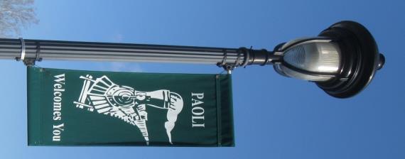

1 Paoli Road Improvement Feasibility Study & Public Participation Project March 24, 2015 Prepared for: Tredyffrin Township Prepared by: McMahon Associates, Inc. with Town Planning Partnership, LLC Glackin Thomas Panzak, Inc. and Meliora Design, LLC Stell Environmental Enterprises, Inc. Greater Valley Forge TMA
2 Table of Contents forward Introduction Traffic & Safety Assessment Public Involvement: Discovery & Listening i executive summary paoli history today s transportation setting public outreach process xiii acknowledgements project history work plan transportation data & operations A paoli on the move website B public outreach events C summary of events outreach effort goals of the study project partners traffic safety assessment environmental assessment public outreach results from the discover & learning phase A transportation hotspots B pedestrian hotspots C the top ranked issues D visual preference survey results project team how to use this report 3.3 key issues to consider
3 Table of Contents Concepts Assessment Planning & Zoning Public Involvement: Scenarios & Deciding Final Concepts & Implementation Plan roadway & intersection improvement concepts A transportation operational design criteria B corridor improvements C Intersection improvements D future traffic operations E achieving community objectives D short-term improvement opportunities Improvements by others the vision for paoli A great streets B improve paoli s intersections & blocks C a vision for paoli D public investment as a catalyst for private investment recommended zoning changes A designate future streets on an official map B potential amendments to town center and transit districts C consider form-based code provisions D parking alternatives public outreach process summary of outreach events public outreach results from the discover & learning phase public outreach results from the deciding phase final improvement concepts performance measures comparing improvement concepts 12 streetscape plan 26 implementation plan


4 Table of Contents appendix A Traffic & Pedestrian Count Data B Existing Conditions Traffic Analyses C Environmental Screening D Public Feedback - Out of Study Area Comments E Detailed Conceptual Layout Exhibits F Best Practices G Future Conditions Traffic Projections and Analyses H Evaluation of Measures of Effectiveness


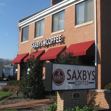
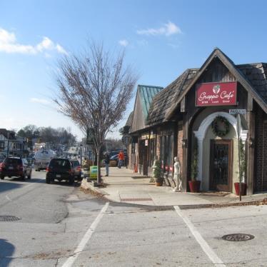
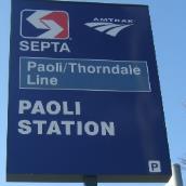
5 Over the last twenty years, project partners have been coordinating on plans for a new Paoli Intermodal Transportation Center and redevelopment of the Amtrak Rail Yards property. With these two major initiatives underway, Tredyffrin Township led the Paoli Road Improvement Feasibility Study to identify solutions that address existing and future multi-modal transportation needs that are consistent with the community s overall vision for the heart of Paoli. Introduction Study Goals 1 Implement an effective outreach program to engage the project stakeholders and public, to seek community input and obtain feedback on the transportation improvement options to accommodate motorists, pedestrians, bicyclists, and transit that will support a more The Paoli Train Station, located at Lancaster Avenue (U.S. Route 30) and North Valley Road, supports Amtrak and SEPTA regional rail service. It is the busiest rail station in Chester County. Design of a new Intermodal Transportation Center is underway, along with plans to redevelop the former rail yard adjacent to the station. Lancaster Avenue (U.S. Route 30), North Valley Road, and East/West Central Avenues provide critical access to the Paoli Train Station and the Paoli Business District, while also supporting local and regional trips. The purpose of this project was to identify improvement concepts for key roadways and intersections that will fulfill the existing and future transportation demands. 2 walkable community offering multi-modal transportation choices. Develop conceptual transportation improvement options to accommodate motorists, pedestrians, bicyclists, and transit that will support a more walkable community offering multi-modal transportation choices. Partnerships for Paoli s Future Concurrent The Paoli Train with Station the Paoli is Road located Improvement at the intersection Feasibility of Lancaster Study, SEPTA Avenue led (U.S. the development Route 30) and of a North concept Valley plan Road for the in the new Paoli heart Intermodal of Paoli. Center. The two projects were closely coordinated with regard to both technical design issues and community outreach. The following project partners have been working together to improve the transportation system in Paoli and realize the vision of the new Paoli Intermodal Transportation Center and were integrally involved in the Paoli Roadway Feasibility Study. Tredyffrin Township Willistown Township Chester County Delaware Valley Regional Planning Commission PennDOT Amtrak SEPTA 3 Support the Township in the selection of a preferred transportation improvement plan that addresses the project needs and Paoli community vision, while balancing the many factors affecting implementation feasibility, such as costs, safety, physical constraints, environmental impacts, and community impacts. i


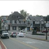
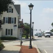
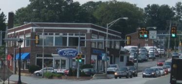
6 Transportation Setting Lancaster Avenue (U.S. Route 30) carries over 21,000 vehicles per day and supports regional mobility, as well as local access to residential areas, businesses, and the Paoli Train Station. Several intersections along Lancaster Avenue operate with poor levels of service and are congested during weekday commuter peak periods. Pedestrian facilities are inconsistent, incomplete, and inadequate to support safe access to the Paoli Train Station, businesses, and other destinations in the heart of Paoli. Speeding and cut through traffic are issues, particularly on East and West Central Avenues. There is a lack of physical design elements and visual cues to alert motorists to the appropriate travel speeds in residential neighborhoods. Study Area Top Ten Community Issues 1. Traffic congestion 2. Safety 3. Pedestrian access 4. Parking Availability 5. Economic Development 6. Streetscape Enhancements 7. Speeding/Cut Through 8. Environmental Sustainability 9. Bus/Truck Traffic 10. Bicycle Access ii Paoli Road Improvement Feasibility Study & Public Involvement Project


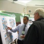
7 One of the primary goals of the Paoli Road Improvement Feasibility Study was to engage stakeholders and the public in the development of transportation improvement solutions. The public involvement process included four phases: Discovery, Listening, Options, and Deciding. Throughout the process, all stakeholders were given multiple opportunities and channels to communicate their ideas and shape the vision for the Paoli area. The community s preferences are one of several important factors in the evaluation and selection of the preferred improvement concepts. Public Involvement Process Discovery Listening Concepts Deciding Gather facts, agree on goals, engage the community and explain the study 260 people 8 Stakeholder Meetings 23 people Road Safety Audit Determine the issues and concerns of the community as well as their vision for Paoli. 244 people Community Survey & Questionnaire Responses 310 people Online Visual Preference Survey Responses Identify preliminary improvement scenarios and refine them based on community feedback. 53 people 2 Stakeholder Meetings 200 people Open House #2 Compare improvement scenarios based on critical performance measures, including public support and achievement of community vision. 224 people Open House #3 2 Presentations to Board of Supervisors 300 people Open House #1 4,153 visitors Project website - A multi-disciplinary team of transportation professionals and community members documented 162 specific issues that adversely impact vehicular, bicycle, pedestrian, and transit travel through the study area. Community members identified traffic and pedestrian hot spots at Open House #1 and provided input on key transportation issues to be addressed by improvement alternatives. Stakeholder meetings with neighborhood groups, businesses, and property owners engaged people who may be directly affected by the project in the alternatives development and refinement process. Open House attendees participated in a dotmocracy to vote and express their preferences for improvement concepts and specific design features. Tredyffrin Township Forward and Executive Summary iii


8 Vision for Paoli To realize the goals for a safer, less congested, transit-friendly, more walkable, more vibrant village, the Paoli Road Improvement Feasibility Study calls for a combination of public infrastructure investments in streets, intersections, parking, and sidewalks, as well as refinements to Township ordinances. These public investments will create a positive environment for private investment consistent with the community goals for Paoli. New Connections Concurrent with the Paoli Road Improvement Feasibility Study, SEPTA developed a concept plan for the new Paoli Intermodal Transportation Center that included a new extension of Darby Road from Lancaster Avenue to North Valley Road, which would replace the existing North Valley Road bridge over the rail lines. Additionally, other potential new roadway connections were identified during the study process, including the extension of Paoli Plaza and development of a new Spine Road through the future development on the Amtrak rail yard site. These new connections can become Great Streets that help to ease congestion and create a Great Place in the heart of Paoli. iv Paoli Road Improvement Feasibility Study & Public Involvement Project


9 Based on the existing conditions and input from the community, improvement concepts were developed for three corridors and two intersections that provide critical multi-modal access within the study area. The improvement concepts reflect current design standards and were developed to address existing deficiencies and achieve project goals. Preliminary improvement concepts were evaluated based on community objectives and were vetted through the public involvement process and technical coordination meetings with PennDOT, SEPTA, and other project partners. Improvement Concepts Focus Areas Goals Lancaster Avenue East Central Avenue West Central Avenue Lancaster Avenue and Paoli Pike Intersection North Valley Road and E./W. Central Avenue Intersection Improve the overall transportation system for all users Achieve the community vision for Paoli Work within the context of the new Paoli Intermodal Transportation Center Offer a feasible solution for the existing and long-term transportation needs of the community West Central Avenue N. Valley Road & E./W. Central Avenue East Central Avenue Concept 1 Concept 2 Concept 3 Lancaster Avenue & Paoli Pike Lancaster Avenue Tredyffrin Township Forward and Executive Summary v


10 Lancaster Avenue Concepts One of the community objectives for Lancaster Avenue was to transform the corridor into a more pedestrian friendly destination. In addition to wider sidewalks, the concepts incorporate curb extensions, high visibility crosswalks, and pedestrian signal heads and push buttons at intersections to improve safety and comfort for pedestrians. Concept 1 Wide sidewalks and left-turn lanes $18.7 M Estimated Cost 11% Community Support Concept 2 Concept 1 + On-street parking $19.7 M Estimated Cost 53% Community Support Concept 3 Concept 2 + Bike Lanes $20.3 M Estimated Cost 36% Community Support vi Notes: See Chapters 4 and 6 for additional details on improvement concepts. Community support based on public input during Open House #3. Paoli Road Improvement Feasibility Study & Public Involvement Project


 and multi-use trail on south side")

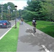
11 The key community concerns for East Central Avenue were improving bicycle and pedestrian access, reducing vehicular speeds, and providing environmentally sustainable stormwater management and streetscape improvements. In addition to narrowed travel lanes and continuous bicycle and pedestrian facilities, the concepts include raised crosswalks to calm traffic and improve safety. East Central Avenue Concepts Sidewalks on both sides, narrowed travel lanes, and bike lanes Concept 1 $2.5 M Estimated Cost 17% Community Support Sidewalks on both sides, maintain north side curbline, narrowed travel lanes and bike lanes Concept 3 $5.6 M Estimated Cost 16% Community Support Sidewalk on north side (optional) and multi-use trail on south side Concept 4 $5.0 M Estimated Cost 67% Community Support Tredyffrin Township Notes: See Chapters 4 and 6 for additional details on improvement concepts. Concept 2 incorporated on-street parking and was eliminated based on comments given by the public during Open House #2. Community support based on public input during Open House #3. Forward and Executive Summary vii


12 West Central Avenue Concepts Key objectives for the West Central Avenue concepts include better accommodations for bicyclists and pedestrians and calming or slowing traffic on the neighborhood street that carries significant commuter traffic. Concepts for West Central Avenue reflect the narrow right-of-way and road width, state ownership, and coordination with the plan for of a parallel spine road through the Amtrak Rail Yards property. Concept 1 Wide sidewalks, narrowed travel lanes, and striped shoulders $2.8 M Estimated Cost 80% Community Support Concept 2 Wide sidewalks and narrowed street width $3.1 M Estimated Cost 20% Community Support Notes: See Chapters 4 and 6 for additional details on improvement concepts. Community support based on public input during Open House #3. viii Paoli Road Improvement Feasibility Study & Public Involvement Project


13 The offset configuration of East/West Central Avenue and North Valley Road intersection and other deficiencies at the intersection present challenges to walkability, bikeability, overall mobility, safety, and congestion. All of the concepts include improved pedestrian accommodations to improve access to the Paoli Train Station and future Intermodal Transportation Center. North Valley Road and E./W. Central Avenue Intersection Concepts Signalized offset intersections Concept A $6.3 M Estimated Cost 0% Community Support Signalized realigned intersection Concept B $7.3 M Estimated Cost 40% Community Support Roundabout Concept C $6.6 M Estimated Cost 60% Community Support Tredyffrin Township Notes: See Chapters 4 and 6 for additional details on improvement concepts. Community support based on public input during Open House #3. Forward and Executive Summary ix


14 Lancaster Avenue and Paoli Pike Intersection Concepts Key challenges associated with the Lancaster Avenue and Paoli Pike intersection include walkability, bikeability, congestion, safety, and access management. All three concepts incorporate the relocation of Greenwood Avenue opposite Paoli Pike, the extension of Paoli Plaza westward to Plank Avenue, and improved pedestrian accommodations. Concept A Greenwood Avenue relocation $3.1 M Estimated Cost 16% Community Support Concept B Paoli Pike realignment and Plank Avenue realignment $8.2 M Estimated Cost 68% Community Support Concept C Paoli Pike realignment between Richmond Road and Plank Avenue $8.0 M Estimated Cost 16% Community Support x Notes: See Chapters 4 and 6 for additional details on improvement concepts. Community support based on public input during Open House #3. Paoli Road Improvement Feasibility Study & Public Involvement Project


15 The Paoli Road Improvement Feasibility Study includes a streetscape plan to show how the potential roadway and intersection improvements can incorporate a variety of streetscape elements, including street trees and landscape elements, lighting, sidewalks, and crosswalks. Community preferences for streetscape elements and materials were identified as part of the Visual Preference Survey. The improvement concepts and streetscape plan also reflect a Smart Transportation and Complete Streets approach and incorporate current best practices for bicycle and pedestrian facilities, traffic calming, access management, and green streets. Bicycle and Pedestrian Facilities Best Practices The improvement concepts include a broad range of bicycle and pedestrian facilities to improve safety and mobility for all users of the transportation system. Streetscape Plan Sidewalks Multi-use trails Bicycle lanes Paved Shoulders Shared Lanes Traffic Calming The improvement concepts include several traffic calming measures to slow travel speeds, discourage cut-through traffic, and create a safer and more comfortable environment for walking and biking. Roundabouts Curb Extensions Raised Crosswalks Reduced Lane Widths On-Street Parking Access Management Access management strategies were incorporated into the improvement concepts, particularly for Lancaster Avenue, to reduce congestion and provide safe and efficient access to businesses along the corridor. Joint and Cross Access Driveway Spacing Frontage and Reverse Frontage Roads A Smart Transportation and Complete Streets Approach calls for considering the needs of all users of the transportation system (pedestrians, bicyclists, transit users, and motorists) and integrating transportation and land use planning, design, and investments. Green Streets Sustainable stormwater strategies manage and treat stormwater at the source and within the street improvements and also provide plantings and landscaping to visually enhance the community. Tree Trenches Bioswales Bioretention Tredyffrin Township Notes: Since the Study does not designate a preferred improvement concept, the streetscape plans are based on the most popular concepts from the final open house. Forward and Executive Summary xi
16 Implementation Plan Due to the large scope of improvements identified in the Paoli Road Improvement Feasibility Study, as well as their associated costs, the transportation improvements will likely be implemented in a phased approach over time. The implementation plan outlines short, intermediate, and long term priority actions, starting with selecting the preferred transportation improvement concepts. Since funding is a critical issue for advancing projects, potential funding opportunities have been identified in the Study. Short-term 0-4 years Intermediate 4-8 years Long-term Beyond 8 years Select preferred transportation improvements and consider project phasing. Continue to implement elements of the preferred transportation improvements. Complete the selected transportation improvements. Modify regulatory policies and ordinances. Secure needed rights-of-way and easements. Identify funding sources to advance the various transportation projects. Coordinate with project partners to secure funding. Ongoing Maintain roadways and sidewalks. Provide traffic calming and pedestrian improvements in advance of larger transportation projects. Monitor land development activities. Develop a parking management plan. Funding for Paoli Transportation Projects Paoli Intermodal Transportation Center Phase 1 xii Organizational Financial Action Plan Regulatory Future Studies, Design, Engineering The implementation plan identifies organizational actions, regulatory actions, financial actions, and additional studies, design, and engineering required to move projects towards completion. Paoli Road Improvement Feasibility Study & Public Involvement Project Amtrak, SEPTA, and PennDOT have allocated $36 million for engineering and construction of the first phase of improvements to the Paoli Train Station. This project will improve accessibility of station facilities with construction of a pedestrian overpass, a new high level center platform, and the installation of three elevators linking the inbound and outbound parking lots. Darby Road Extension Bridge and Associated Road Improvements The Delaware Valley Regional Planning Commission s FY2015 Transportation Improvement Program (TIP) includes almost $16 million in FY15 FY18 for design on the new Darby Road Extension Bridge, in conjunction with the planned improvements for the Paoli Intermodal Transportation Center. Traffic Signal Upgrades along Lancaster Avenue Tredyffrin Township was awarded approximately $565,000 through PennDOT s Automated Red Light Enforcement (ARLE) Grant Program to upgrade and provide adaptive traffic control for signals along Lancaster Avenue between Plank Avenue and PA Route 252 through the heart of Paoli and pedestrian improvements at the signalized intersections. As an initial phase for improvements along Lancaster Avenue, this project will help to reduce congestion, improve safety, and promote mobility.


17 Acknowledgements A significant amount of collaboration with project partners and other organizations was required to complete this Study. Staff from the following organizations were instrumental in providing input, feedback, time, and ideas that were instrumental in the evaluation of the study area and in developing improvement recommendations: Southeast Pennsylvania Transportation Authority (SEPTA) and their Paoli Station Design Team Pennsylvania Department of Transportation (PennDOT) Delaware Valley Regional Planning Commission Amtrak Tredyffrin Township staff from many departments also provided assistance throughout the Study process. In addition, the number of community members that came to meetings and went to the project website was exceptional, which allowed for a community driven process and Study. Throughout the process, the community engaged the project team to learn about the project, identify problems and potential solutions, and provide feedback on potential improvement concepts. Chester County Planning Commission Paoli Transit Associates Station Area Developer Paoli Business Association Tredyffrin Township Planning Commission Willistown Township, Chester County The Delaware Valley Friends School also opened their facilities to host several community events. Tredyffrin Township Forward and Executive Summary xiii
18
Chapter 3 Public Involvement -
 Paoli Road Improvement Feasibility Study and Public Participation Project Chapter 3 Public Involvement - Discovery & Listening 3.1 Public Outreach Process 2 3.1A Paoli On The Move Website 3 3.1B Public
Executive Summary Route 30 Corridor Master Plan
 Route Corridor Master Plan Project Overview The Route Corridor Master Plan is a coordinated multimodal transportation and land use plan for the entire stretch of Route through East Whiteland Township,
Ocean Park Boulevard Streetscape Improvement Project Alternatives & Trade Offs
 City Council Study Session January 27, 2009 Ocean Park Boulevard Streetscape Improvement Project Alternatives & Trade Offs Scope of Work Purpose of Tonight s Meeting Review work to date and direct staff
CITY OF BLOOMINGTON COMPLETE STREETS POLICY
 CITY OF BLOOMINGTON COMPLETE STREETS POLICY POLICY OBJECTIVE: The City of Bloomington will enhance safety, mobility, accessibility and convenience for transportation network users of all ages and abilities,
Exhibit 1 PLANNING COMMISSION AGENDA ITEM
 Exhibit 1 PLANNING COMMISSION AGENDA ITEM Project Name: Grand Junction Circulation Plan Grand Junction Complete Streets Policy Applicant: City of Grand Junction Representative: David Thornton Address:
Ocean Park Boulevard Green Street Project Alternatives & Trade Offs
 Planning Commission March 4, 2009 Ocean Park Boulevard Green Street Project Alternatives & Trade Offs Purpose of Tonight s Meeting Review concept plans and options Provide input on alternatives and trade-offs
Make Lincoln Highway an economically vibrant corridor that is safe, efficient, and beautiful for local residents and visitors.
 Lincoln Highway Streetscape Plan Stakeholder Workshop #2 Handout Contents Introduction and Project Vision Planning Principles Specific Recommendations including a Proposed Typical Roadway Section Renderings
Mayor s Bicycle Advisory Council. Wednesday, December 13 th, 2017
 Mayor s Bicycle Advisory Council Wednesday, December 13 th, 2017 Bicyclist Fatalities, Year to Date (January 1 November 30, 2017) - MBAC Briefing Bicyclist Fatality Statistics Year to date total, 2017
Living Streets Policy
 Living Streets Policy Introduction Living streets balance the needs of motorists, bicyclists, pedestrians and transit riders in ways that promote safety and convenience, enhance community identity, create
BIKE PLAN CONTENTS GATEWAY
 CONTENTS Acknowledgments...vii Great Rivers Greenway District Board of Directors... vii Great Rivers Greenway District Staff... vii Project Consultants... vii Committees... viii Citizens Advisory Committee
Chapter 5 Planning & Zoning
 Paoli Road Improvement Feasibility Study and Public Participation Project Chapter 5 Planning & Zoning Evaluation 5.1 The Vision for Paoli 2 5.1A Great Streets 3 5.1B Improve Paoli s Intersections & Blocks
STONY PLAIN ROAD STREETSCAPE
 Jasper Place Revitalization Strategy: Vision The people involved in the Jasper Place Revitalization Strategy envision: Goal 1: Feeling safe in our community Create a community where feeling safe is common--where
Chapter 3: Multi-Modal Circulation and Streetscapes
 CHAPTER 3: MULTI-MODAL CIRCULATION AND STREETSCAPES Chapter 3: Multi-Modal Circulation and Streetscapes Overview Streetscape improvements have already been completed for Depot Street between Main Avenue
Princeton Avenue and Spruce Street Transportation and Site Access Enhancements Project
 Princeton Avenue and Spruce Street Transportation and Site Access Enhancements Project Mercer County Planning Division AECOM Transportation (formerly DMJM Harris) January 29, 2009 Agenda Project Status
Bicycle and Pedestrian Facilities Toolbox (Excerpt from Figure 3.1)
") Appendix B Neighborhood Connections Summaries This Appendix is a supplement to the information presented in Chapter 3 Connect People. The Appendix includes a summary or profile for each of the proposed
Appendix B Neighborhood Connections Summaries This Appendix is a supplement to the information presented in Chapter 3 Connect People. The Appendix includes a summary or profile for each of the proposed
Clackamas County Comprehensive Plan
 ROADWAYS The County s road system permits the movement of goods and people between communities and regions, using any of a variety of modes of travel. Roads provide access to virtually all property. They
Tonight is for you. Learn everything you can. Share all your ideas.
 Strathcona Neighbourhood Renewal Draft Concept Design Tonight is for you. Learn everything you can. Share all your ideas. What is Neighbourhood Renewal? Creating a design with you for your neighbourhood.
EXECUTIVE SUMMARY. Vision
 Vision Walking and bicycling in Salt Lake City will be safe, convenient, comfortable, and viable transportation options that connect people to places, foster recreational and economic development opportunities,
Agenda. Overview PRINCE GEORGE S PLAZA METRO AREA PEDESTRIAN PLAN
 PRINCE GEORGE S PLAZA METRO AREA PEDESTRIAN PLAN May 28, 2008 Agenda Welcome and introductions Project overview and issue identification Planning context and strengths Design challenges and initial recommendations
Summary: Mercer County Princeton Avenue & Spruce Street Study January 2009
 Summary: Several recent studies have assessed potential development and redevelopment opportunities in the Mercer Crossing area of Trenton, Ewing, and Lawrence. This Princeton Avenue and Spruce Street
WALKNBIKE DRAFT PLAN NASHVILLE, TENNESSEE EXECUTIVE SUMMARY NASHVILLE, TENNESSEE
 NASHVILLE, TENNESSEE EXECUTIVE SUMMARY Executive Summary A world-class multi-modal transportation system is essential to a vibrant city and better quality of life. -Mayor Barry The WalknBike plan aims
Chapter 5. Complete Streets and Walkable Communities.
 Chapter 5. Complete Streets and Walkable Communities. 5.1 Description of Complete Streets. Cities throughout the world, and specifically the United States, are coming to embrace a new transportation and
CONNECTIVITY PLAN. Adopted December 5, 2017 City of Virginia Beach
 CONNECTIVITY PLAN Adopted December 5, 2017 City of Virginia Beach CONTENTS 1.0 Background & Purpose... 2 2.0 Existing Inventory & Analysis... 3 ViBe District Existing Walking Conditions... 4 3.0 ViBe District
CONNECTING PEOPLE TO PLACES
 CONNECTING PEOPLE TO PLACES 82 EAST BENCH MASTER PLAN 07 Introduction The East Bench transportation system is a collection of slow moving, treelined residential streets and major arteries that are the
Item to be Addressed Checklist Consideration YES NO N/A Required Description Complete Streets Guidelines
 Passaic County Complete Streets Checklist - Concept Development Project Name Item to be Addressed Checklist Consideration YES NO N/A Required Description Complete Streets Guidelines Existing Plans Have
Vision: Traditional hamlet with an attractive business/pedestrian friendly main street connected to adjacent walkable neighborhoods
 N D. Focus Area II Vision: Traditional hamlet with an attractive business/pedestrian friendly main street connected to adjacent walkable neighborhoods Transit Road Focus Area II is located in the Hamlet
Proposed. City of Grand Junction Complete Streets Policy. Exhibit 10
 Proposed City of Grand Junction Complete Streets Policy Exhibit 10 1 City of Grand Junction Complete Streets Policy Vision: The Complete Streets Vision is to develop a safe, efficient, and reliable travel
PRINCE GEORGE S PLAZA METRO AREA PEDESTRIAN PLAN
 PRINCE GEORGE S PLAZA METRO AREA PEDESTRIAN PLAN May 28, 2008 Agenda Welcome and introductions Project overview and issue identification Planning context and strengths Design challenges and initial recommendations
Community Task Force July 25, 2017
 Community Task Force July 25, 2017 Welcome and Introductions Project Partners Regional Transportation District (RTD) Colorado Department of Transportation (CDOT) Denver Regional Council of Governments
SANTA CLARA COUNTYWIDE BICYCLE PLAN August 2008
 SANTA CLARA COUNTYWIDE BICYCLE PLAN August 2008 To assist VTA and Member Agencies in the planning, development and programming of bicycle improvements in Santa Clara County. Vision Statement To establish,
BETHEL ROAD AND SEDGWICK ROAD CORRIDOR STUDY
 DRAFT PLAN City Council Meeting August 14, 2017 STUDY AREA Sedgwick Corridor State Route 160, principal arterial with Class 3 access management designation, commuter and freight route, connection to SR
GARLAND ROAD/GASTON AVENUE/ GRAND AVENUE INTERSECTION IMPROVEMENT STUDY
 MEETING OF AFFECTED PROPERTY OWNERS AND STAKEHOLDERS GARLAND ROAD/GASTON AVENUE/ GRAND AVENUE INTERSECTION IMPROVEMENT STUDY CSJ 0009-02-067 Meeting Agenda 1 2 3 4 5 6 7 8 9 10 Opening Remarks State Representative
RZC Appendix 8A Marymoor Subarea Street Requirements
 RZC Appendix 8A Marymoor Subarea Street Requirements For additional design details for Marymoor Subarea infrastructure, refer to the 2017 Marymoor Subarea Infrastructure Planning Report. STREET REQUIREMENTS
SR 1005 SECTION PTC PAOLI TRANSPORTATION CENTER HIGHWAY IMPROVEMENTS CONCEPTUAL ALTERNATIVES ANALYSIS CHESTER COUNTY, PENNSYLVANIA TREDYFFRIN TOWNSHIP
 SR 1005 SECTION PTC PAOLI TRANSPORTATION CENTER HIGHWAY IMPROVEMENTS CONCEPTUAL ALTERNATIVES ANALYSIS CHESTER COUNTY, PENNSYLVANIA TREDYFFRIN TOWNSHIP Submitted To: Pennsylvania Department of Transportation
CITY OF COCOA BEACH 2025 COMPREHENSIVE PLAN. Section VIII Mobility Element Goals, Objectives, and Policies
 CITY OF COCOA BEACH 2025 COMPREHENSIVE PLAN Section VIII Mobility Element Goals, Objectives, and Policies Adopted August 6, 2015 by Ordinance No. 1591 VIII MOBILITY ELEMENT Table of Contents Page Number
Lee s Summit Road Improvement Study Public Open House June 7, 2007 Summary of Comment Card Responses
 Lee s Summit Road Improvement Study Public Open House June 7, 2007 Summary of Comment Card Responses Introduction At the Lee s Summit Road Improvement Study Public Open House held Thursday, June 7, 2007
University of Victoria Campus Cycling Plan Terms of Reference. 1.0 Project Description
 University of Victoria Campus Cycling Plan Terms of Reference 1.0 Project Description The Campus Cycling Plan, a first for the University, will provide a comprehensive and coordinated approach to support
East Burke Transportation, Safety and Capacity Improvements
 East Burke Transportation, Safety and Capacity Improvements The purpose of this project is to increase mobility and improve safety for pedestrians, cyclists, and motor vehicles along VT Route 114 in the
Transportation Planning Division
 Transportation Planning Division Presentation Outline Study Tasks Recap of Previous Meetings Data Collected Focus Areas within Study Limits Design Principles Tool Box Recommended Concepts Schedule Moving
Arlington s Master Transportation Plan
 Arlington s Master Transportation Plan The Master Transportation Plan (MTP) Adopted in eight parts Goals & Policies element and MTP Map adopted in 2007 Bicycle, Pedestrian and Demand and Systems Management
Montford Drive Parking & Circulation Study
 Montford Drive Parking & Circulation Study Parking & Circulation Study Follow up to the Area Plan based on what we heard Purpose 1 2 3 4 To look closer and evaluate parking and network related issues (including
5. RUNNINGWAY GUIDELINES
 5. RUNNINGWAY GUIDELINES These guidelines should be considered collectively when making runningway decisions. A runningway is the linear component of the transit system that forms the right-of-way reserved
Ocean Park Boulevard Green Street Project Community Workshop
 Ocean Park Boulevard Green Street Project Community Workshop 2.2.10 Project Objectives Community Priority: reclaim OPB for public open space. Build upon LUCE principles; neighborhood enhancement, connectivity,
PROJECT FACT SHEET May 25, 2018
 SITE CHALLENGES & PROJECT BACKGROUND In 2014, the City of Aspen identified the Castle Creek Bridge and Hallam Street corridor as a deficient link in Aspen s bicycle and pedestrian network. Safe and efficient
COMPLETE STREETS PLANNER S PORTFOLIO
 COMPLETE STREETS PLANNER S PORTFOLIO ISSUE 3 APRIL 2016 PLANNER S PORTFOLIO COMPLETE STREETS 1 2 6 10 14 OVERVIEW MATURE NEIGHBORHOODS GROWING SUBURBS CENTRAL PLACES ACTIVITY CORRIDORS Planner s Portfolio
WELCOME. Purpose of the Open House. Update you on the project. Present a draft recommended plan. Receive your input
 WELCOME Purpose of the Open House The Town of Smiths Falls has initiated the Beckwith Street Redevelopment Plan that includes the preparation of a streetscape functional design for the renewal of Beckwith
TOWN OF PORTLAND, CONNECTICUT COMPLETE STREETS POLICY
 TOWN OF PORTLAND, CONNECTICUT COMPLETE STREETS POLICY I. VISION, GOALS & PRINCIPLES VISION To improve the streets of Portland making them safer and more accessible for all users including pedestrians,
Bikeway action plan. Bicycle Friendly Community Workshop March 5, 2007 Rochester, MN
 Bikeway action plan Summary The was held on March 5, 2007 at the Rochester Mayo Civic Center. The workshop was hosted by Rochester-Olmsted County Planning Department in collaboration with the League of
Caltrans Sloat Boulevard Pedestrian Safety Project Response to Community Questions, Comments & Concerns
 Caltrans Sloat Boulevard Pedestrian Safety Project Response to Community Questions, Comments & Concerns Revised: May 10, 2016 The California Department of Transportation (Caltrans) is planning various
Board of Supervisors February 27, 2017
 : Traffic Analysis Results & Draft Conceptual Plan Board of Supervisors February 27, 2017 Transportation Solutions Building Better Communities Presentation Overview Background Summary of Traffic Analysis
North Shore Transportation Improvement Strategy
 North Shore Transportation Improvement Strategy Preliminary, Near-term Recommendation 2016 April Transportation Improvement Strategy (TIS) Comprehensive and Analytical A multi-modal transportation strategy
WELCOME. Stakeholder Involvement Group Meeting #2 Round Lake Public Works October 24, 2018
 WELCOME Stakeholder Involvement Group Meeting #2 Round Lake Public Works October 24, 2018 MEETING AGENDA 1. Welcome and Introductions 2. Study Progress Update 3. Problem Statement 4. Technical Analysis
Providence Downtown Transit Connector STAKEHOLDER MEETING #2. Stakeholder Meeting #1 October 24, 2016
 Providence Downtown Transit Connector STAKEHOLDER MEETING #2 Stakeholder Meeting #1 October 24, 2016 February 2017 1 AGENDA 1 DTC Goals and Expectations 2 Street Design Concepts 3 Potential Benefits and
Plant City Walk-Bike Plan
 Plant City Walk-Bike Plan Plant City Commute Mode Share 2.2% 1.4% 2.9% Drove alone 10.2% Carpooled Public transportation (0.1%) Walked Used a Bike (0.4%) 82.9% Taxicab, motorcycle, or other means Worked
San Jose Transportation Policy
 San Jose Transportation Policy Protected Intersections in LOS Policies to Support Smart Growth Presented by: Manuel Pineda City of San Jose Department of Transportation Bay Area Map San Francisco Oakland
Lincoln Highway Streetscape Plan Concept Plan
 Lincoln Highway Streetscape Plan Concept Plan November 14, 2014 Introduction This report provides a summary of conceptual transportation, land use, and design recommendations in the Lincoln Highway Streetscape
Bridges and Arizona Crossings
 Circulation and Transportation 5-11 Discovery Street/Barham Drive. Discovery Street is planned 5.4.3 Specific Plan Circulation Improvements to be extended eastward from its terminus at Craven Road Circulation
PROJECT FACT SHEET March 21, 2018
 SITE CHALLENGES & PROJECT BACKGROUND In 2014, the City of Aspen identified the Castle Creek Bridge and Hallam Street corridor as a deficient link in Aspen s bicycle and pedestrian network. Safe and efficient
MARKET/JFK VISION ZERO PILOT PROJECT FEBRUARY 2019 EVALUATION REPORT
 MARKET/JFK VISION ZERO PILOT PROJECT FEBRUARY 2019 EVALUATION REPORT WHY IS THIS PROJECT IMPORTANT? Market Street and JFK Boulevard in Center City are key east-west corridors in the core business district.
FONTAINE AVENUE STUDY Final Report
 FONTAINE AVENUE STUDY Final Report March 28, 2005 FONTAINE AVENUE STUDY City of Charlottesville March 28, 2005 Renaissance Planning Group Kenneth Schwartz, FAIA, AICP Director of Design Leigh Wilkerson,
PROJECT OBJECTIVES. Improve vehicle capacity for the intersection. Improve pedestrian and bicycle access
 COMMUNITY MEETING Project Update March 15, 2010 Purcellville, Virginia OVERVIEW Project need / objectives Project recap Design elements Proposed improvements Summary of project benefits / next steps PROJECT
Chapter 2: Standards for Access, Non-Motorized, and Transit
 Standards for Access, Non-Motorized, and Transit Chapter 2: Standards for Access, Non-Motorized, and Transit The Washtenaw County Access Management Plan was developed based on the analysis of existing
HARRISON STREET/OAKLAND AVENUE COMMUNITY TRANSPORTATION PLAN
 HARRISON STREET/OAKLAND AVENUE Community Workshop #4: Draft Plan Review December 3, 2009 D E S I G N, C O M M U N I T Y & E N V I R O N M E N T INTRODUCTIONS Key Project Staff: Alisa Shen, Project Manager,
Table #6 VISION CHARACTERISTICS
 Table #6 VISION White Flint is a place to live, work, play, shop, and walk with sufficient density to encourage quality redevelopment. Vibrant streets and consistent streetscapes are important. CHARACTERISTICS
BUDGET FOR RESEDA BOULEVARD, STREET RECONSTRUCTION / VISION ZERO PROGRAM, REPORT BACK, COUNCIL FILE
 FORM GEN. 160 (Rev. 11-02) CITY OF LOS ANGELES INTERDEPARTMENTAL CORRESPONDENCE Date: To: Honorable City Council From: Gary Lee Moore, City Engineer Bureau of Engineering 7%mt /Electronically signed by
City of Hamilton s Transportation Master Plan (TMP) Public Consultation 3 December 2015
 Public Consultation 3 December 2015") City of Hamilton s Transportation Master Plan (TMP) Public Consultation 3 December 2015 McPhail Transportation Planning Services Ltd. AGENDA 6:00 7:00 pm Viewing Boards / Q & A with the Team 7:00 7:50
City of Hamilton s Transportation Master Plan (TMP) Public Consultation 3 December 2015 McPhail Transportation Planning Services Ltd. AGENDA 6:00 7:00 pm Viewing Boards / Q & A with the Team 7:00 7:50
50 Avenue S.W. Corridor Study Glenmore Aquatic Centre Drop-In Event
 Project overview The City of Calgary is conducting a transportation corridor study of 5 Avenue S.W., between Crowchild Trail and 4A Street S.W. In 29, it was reclassified as a Parkway under the Calgary
Welcome to the Quebec Alternatives Analysis Public Meeting
 Welcome to the Public Meeting Please sign in. Public Comment Please fill out a comment card and tell us what you think. Check back or comment any time at: www.quebecalternatives.com Project Area Technical
Introduction. North 12 th Complete Street Project Overview
 Introduction On Wednesday, March 1, 2017, the City of Sacramento, in partnership with Sacramento Regional Transit District and the Sacramento Housing and Redevelopment Agency, hosted a community outreach
TRANSPORTATION NEEDS ASSESSMENT
 TRANSPORTATION NEEDS ASSESSMENT A travel demand analysis was carried out to determine the operational issues and the potential benefit that adding traffic capacity would have on the road network. All the
MnDOT Implementation of Complete Streets Policy. January 2014
 MnDOT Implementation of Complete Streets Policy January 2014 1 Prepared by Minnesota Department of Transportation 395 John Ireland Boulevard Saint Paul, Minnesota 55155-1899 Phone: 651-296-3000 Toll-Free:
City Avenue Projects
 City Avenue Projects City Avenue Special Services District Conceived in the early 1990 s Lita Cohen, Jim Ettelson, Joe Manko, and Michael Nutter Saint Joseph s provided key start-up support. True Public/Private
MAG Town of Cave Creek Bike Study Task 6 Executive Summary and Regional Significance Report
 Page 1 MAG Town of Cave Creek Bike Study Task 6 Executive Summary and Regional Significance Report August 1, 2012 MAG Project #481 Page 2 Task 6 Executive Summary and Regional Significance Report Introduction
Chapter 5 Future Transportation
 Chapter 5 Future Transportation The Future Land Use Plan identifies the desired land use designations. The land uses desired for Crozet depend, in large part, on the success of the transportation system,
Status February Transportation Priority Projects in Chester County
 Transportation Priority Projects in Chester County February 2018 Highway & Trail Projects # Project Scope Current /Phase 1 US 202 over Amtrak Major bridge rehabilitation 17.6 2017-2019 2 US 202 at PA 926
Complete Streets. Complete Streets and other City Initiatives. City & County Initiatives. Honolulu Complete Streets Program
 City & County Initiatives Complete Streets and other City Initiatives Health and the Built Environment Hawaii Public Health Conference Mark Garrity Department of Transportation Services City & County of
Bicycle and Pedestrian Connectivity Study Phase 2
 Connectivity Study Phase 2 Process PROCESS OUTCOMES Phase Prepared By STEP I Public Participation and Outreach 1. RTP Outreach activities, and development of the Bike and Ped Task Force Phase 1 2011 OCPC
A CHANGING CITY. of Edmonton, it is essential that it reflects the long-term vision of the City.
 A CHANGING CITY By the year 2040, Edmonton will be home to more than 1 million people. To accommodate growth and support a healthy and compact city, we need a new approach to development/redevelopment
COWETA HIGH SCHOOL AND EAST HIGHWAY 51
 COWETA HIGH SCHOOL AND EAST HIGHWAY 51 Lack of sidewalks along Ben Lumpkin Rd. Lack of crosswalks and ramps at intersection. Hwy 51 is wide to cross as a pedestrian. No ADA compliance or connection to
Complete Streets. Designing Streets for Everyone. Sarnia
 Complete Streets Designing Streets for Everyone Sarnia Complete Streets ~ Sarnia ~ 2018 Introduction Our City is made up of a network of streets that we use to go for a walk, cycle to work, drive to the
ACTIVE TRANSPORTATION/NONMOTORIZED TRANSPORTATION
 ACTIVE TRANSPORTATION/NONMOTORIZED TRANSPORTATION BACKGROUND Active transportation, also known as nonmotorized transportation, is increasingly recognized as an important consideration when planning and
Mineral Avenue Corridor Assessment. ITE 2017 Western District Annual Meeting San Diego, CA June 21 st
 Mineral Avenue Corridor Assessment ITE 2017 Western District Annual Meeting San Diego, CA June 21 st Biography - Aaron Heumann, PE, PTOE Currently City of Littleton Transportation Engineering Manager 24
INNER LOOP EAST. AIA Rochester Annual Meeting November 13, 2013 TRANSFORMATION PROJECT. Bret Garwood, NBD Erik Frisch, DES
 INNER LOOP EAST TRANSFORMATION PROJECT AIA Rochester Annual Meeting November 13, 2013 Bret Garwood, NBD Erik Frisch, DES Why? We are building a city that encourages walking, biking and enjoying the outdoor
APPENDIX 2 LAKESHORE ROAD TRANSPORTATION REVIEW STUDY EXECUTIVE SUMMARY
 APPENDIX 2 LAKESHORE ROAD TRANSPORTATION REVIEW STUDY EXECUTIVE SUMMARY Appendix 2 City of Mississauga Lakeshore Road FINAL REPORT Transportation Review Study December 2010 EXECUTIVE SUMMARY Study Purpose
STEERING COMMITTEE MEETING June 17, Streetscape Overview Burlington Comprehensive Master Plan
 STEERING COMMITTEE MEETING June 17, 2015 Streetscape Overview Burlington Comprehensive Master Plan 1 Introduction Slide This slide show was presented to the Burlington Steering Committee on June 17, 2015
Figure 4-10: Pedestrian Improvements Types of Potential Station Area Improvements - Place-Making Improvements
 INCORPORATE FEATURE PAVIN IN CROSSWALK AND INTERSECTION FIELDS Identifies high-priority pedestrian areas and create a station identity through colorful and interesting patterns ADD CURB EXTENSIONS Extending
Citizen Advisory Group Meeting #8 May 5, Welcome. Today s meeting will focus on: Land Use & Transportation CHARLOTTEPLANNING.
 Citizen Advisory Group Meeting #8 May 5, 2010 Welcome. Today s meeting will focus on: Land Use & Transportation CHARLOTTEPLANNING.ORG Meeting Agenda Handouts: o Meeting Agenda o Summary of East Seventh
City of Wilsonville 5 th Street to Kinsman Road Extension Project
 City of Wilsonville 5 th Street to Kinsman Road Walking Tour & Neighborhood Workshop Summary Report Public Outreach Overview On July 18 th, 2017, the City of Wilsonville hosted a neighborhood walking tour
PROPOSED BICYCLE AND PEDESTRIAN FACILITY Vicinity of Route 123/I-495 Interchange Tysons, Fairfax County, Virginia
 PROPOSED BICYCLE AND PEDESTRIAN FACILITY Vicinity of Route 123/I-495 Interchange Tysons, Fairfax County, Virginia PRELIMINARY ENGINEERING REPORT Prepared for: Prepared by: July 2017 Table of Contents 1
5 Circulation & Parking
 5 Circulation & Parking Downtown Parking & Circulation Strategy. Downtown Wayne has a somewhat disconnected system of local public streets to connect downtown with the residential neighborhoods, and primary
THE ALAMEDA CONCEPT DESIGN COMMUNITY MEETING 3. A Plan for The Beautiful Way JANUARY 28, 2010
 CONCEPT DESIGN COMMUNITY MEETING 3 JANUARY 28, 2010 AGENDA INTRODUCTION COMMUNITY INPUT ROADWAY STUDIES STREETSCAPE DESIGN STATIONS DISCUSSION SUMMARY AND DISCUSSION NEXT STEPS CLOSE INTRODUCTION SCHEDULE
WELCOME. Thank you for joining us at the Second Public Workshop for the Carlsbad Pedestrian Master Plan. We look forward to receiving your feedback.
 City of Carlsbad Pedestrian Master Plan: WELCOME WELCOME Please Sign In Provide Input at Flip Charts Review Boards Presentation of Draft Plan Thank you for joining us at the Second Public Workshop for
Outreach Approach RENEW SF served as the primary liaison with the North Beach community; the Chinatown. Executive Summary
 Executive Summary Executive Summary The Columbus Avenue Neighborhood Transportation Study s objective is to identify changes to transportation infrastructure and policies that could enhance the livability
Making Phoenix Streets Complete. City of Phoenix Complete Streets Initiative
 Making Phoenix Streets Complete City of Phoenix Complete Streets Initiative City of Phoenix Planning Commission March 2014 Presentation Outline What are Complete Streets? Benefits of Complete Streets Complete
2016 Planning Conference July 26, CONNECT COLUMBUS Building Columbus Transportation Future
 2016 Planning Conference July 26, 2016 CONNECT COLUMBUS Building Columbus Transportation Future What Is Connect Columbus? Project Process OUR PROCESS COMPLETE ONGOING Discovery + Desire Project Goals Columbus
Berkeley Strategic Transportation Plan A-76
 Berkeley Strategic Transportation Plan A-76 Appendices 1. A Team Effort 2. Where We ve Been A-11 Berkeley Strategic Transportation Plan Alameda County Transportation Plan Alameda County will be served
NM-POLICY 1: Improve service levels, participation, and options for non-motorized transportation modes throughout the County.
 Transportation PRINCE WILLIAM COUNTY 2008 COMPREHENSIVE PLAN NON-MOTORIZED PLAN CONTENTS Goals, Policies, and Action Strategies Table 4 (Bike Facility Classifications and Descriptions) Table 5 (Bike Facility
BROOKLAND Multi-Modal Transportation & Streetscape Study* NE Washington, DC
 BROOKLAND Multi-Modal Transportation & Streetscape Study* NE Washington, DC The study s goal is to create a multi-modal transportation and streetscape design plan to increase transportation efficiency,
122 Avenue: 107 Street to Fort Road
 : 107 Street to Fort Road November 24, 2015 4:30 8:00 p.m. Meeting Purpose Summarize project work completed to date Share results of public input from Phase 1 Share the draft concept plan and proposed
Status April Transportation Priority Projects in Chester County
 Transportation Priority Projects in Chester County April 2017 Highway & Trail Projects # Project Scope Current /Phase 1 US 202 over Amtrak Major bridge rehabilitation 17.567 began 03/17 2017 2 US 202 at