Incentive Zoning. Zoning Ordinance Advisory Committee June 21, Pam Thompson, Senior Planner, Sustainable Development and Construction
|
|
|
- Fay Fletcher
- 5 years ago
- Views:
Transcription


1 Incentive Zoning Zoning Ordinance Advisory Committee June 21, 2018 Pam Thompson, Senior Planner, Sustainable Development and Construction
2 Presentation Overview Stakeholder questions Updated charts Design elements Parking Transparency/connection to street Sidewalks Screening Next steps 2
3 Categories of Questions Density/development volume Increase volume for G, H, and I Increase building volume in A, B, C to match D, E, F Consider MF-3(A) and MU-3 (July) Residential proximity slope (July) TOD requirements Design Discuss open space purpose, flexibility Parking Effect on planned development districts TBD discussion in July 3
4 Incentives New Recommendation Locations update from high opportunity, etc. to the MVA categories High opportunity incentives become available in categories A, B, and C Non-R/ECAP incentives become available in D, E, & F R/ECAP incentives become available in G, H, and I TOD becomes a bonus in above geographies Details to be discussed 4
5 Incentives New Recommendation MF-1(A) and MF-2(A) Districts Current Category A, B, C Category D, E, F Cat. G, H, I 5% at 60% & 5% at 80% & 5%<100% 5% at 80% 10% at 80% 5% at 60% & 5% at 60% 5% at 80% Setbacks 10-15' no changes 10% at 80% & 5% at 100% none required Max unit density per acre none Floor area ratio none no changes Height 36' 51' 66' 85' 51' 66' 85' 85 Max stories no max no changes Lot coverage (residential) 60% 80% 80% 85% 80% 80% 85% 85% Min lot size unit varies remove requirements Res. Proximity Slope required no changes Transit Oriented Development Max lot coverage of 85%. One parking space per unit. Of the required parking, at least 15 percent must be available for guest parking. 5
6 Incentives New Recommendation MU-1 District Current Category A, B, C Category D, E, F Cat. G, H, I 5% at 60% & 5% at 60% 5% at 60% & 5% at 80% 5% at 80% & 5%<100% 5% at 80% 10% at 80% Setbacks 0-20' no changes current + 65= 80 to 90 current + 80= 95 to 105 current + 65= 80 to 90 current + 105= Max unit density to 130 FAR (total dev) Remove FAR requirement Height no change Stories 7-9 no change Lot coverage 80% no change min lot size/bdrm n/a no change Res. Proximity Slope required no changes Transit Oriented Development current + 80= 95 to % at 80% & 5% at 100% none required current + 105= current + 105= 120 to to 130 For MU-1, additional 15 units/acre on density and max lot coverage of 85%. One parking space per unit. Of the required parking, at least 15 percent must be available for guest parking. 6
7 Incentives New Recommendation MU-2 District Current Category A, B, C Category D, E, F Cat. G, H, I 5% at 60% & 5% at 60% 5% at 60% & 5% at 80% 5% at 80% & 5%<100% 5% at 80% 10% at 80% Setbacks 0-20' no changes current + 40 current + 60 current + 80 = current + 35 current + 55 Max Unit density = = = = FAR Remove FAR requirement Height no change Stories no change Lot coverage 80% no change min lot size/bdrm n/a no change Res. Proximity Slope required no changes Transit Oriented Development 10% at 80% & 5% at 100% none required current + 75 = current + 75 = For MU-2, additional 15 units on density and max lot coverage of 85%. One parking space per unit. Of the required parking, at least 15 percent must be available for guest parking. 7
8 Incentives - Parking Previous 1 ¼ space per unit, plus ¼ space per unit of guest parking Concern: This is actually 1 ½ spaces per unit, which is not a reduction This seems to be too little parking. Clarification: 1 1/4 space per unit. Of the required parking, at least 15 percent must be available for guest parking. No additional parking is required for accessory uses that are limited principally to residents. 8
9 Incentives - TODs TOD area defined as ½ mile radius from a fixedline transit station. Includes DART light rail, TRE, high speed rail, trolley stop, etc., but not bus stops. For transit-oriented development (TOD) areas: 1 space per unit. Guest parking requirements parallel non-tod developments. 9
10 Review - Design Elements Parking Transparency/connection to street Sidewalks Screening
11 Design Requirements Additional design controls can reduce auto dependency, reduce the need for parking, and encourage alternative modes of transit. Encourage walkability No parking and only minimal drive aisles in front of the building (between building and street) Minimum percentage of ground-floor entrances to open directly to the sidewalk or open space Pedestrian amenities such as wide sidewalks and street trees. Require minimum amount of ground floor transparency and encourage architecturally interesting buildings. Only short fences with pedestrian gates allowed in front. Provide a minimum percentage of the property as open space Open space, green space, or recreational area Intended to provide active and passive recreation (such as playgrounds), to provide landscaping area, or to enable groundwater recharge, for example. Open space is not intended to be driven or parked upon. 11
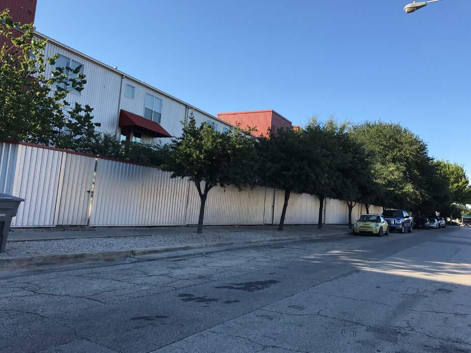
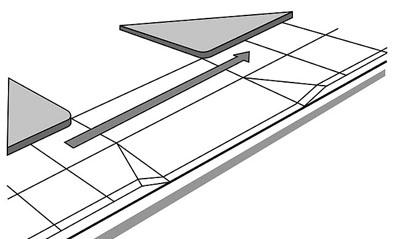
12 Design element: No parking between the front of the building and the street 12


13 Front yards Code requires minimum front yards, often leading to this: 13


14 No parking in front No parking in the front allows for this (exception for loading zone): 14


15 No parking in front As communities age, landscaped front yards can provide for large shade trees 15
16 Design Surface Parking Previous No parking and only minimal drive aisles in front of the building (between building and street) Except when configured as indented parking, no on-site surface parking, parking lot, parking surface, or driving surface is permitted between the street-facing façade and the street. Concern - Disallowing all parking between the façade and the street is too limiting. Clarification: Except when configured as indented parking, no on-site surface parking, parking lot, parking surface, or driving surface is permitted between the street-facing front façade and the street. For buildings with more than one street-facing front façade, only the first two streetfacing front facades are subject to this requirement. A maximum of 10 percent of the total on-site parking may be provided as surface parking in a side yard. 16
17 Design element: Encourage a passenger loading/unloading space 17
18 Passenger loading/unloading A loading zone allows for easy pickup/drop off for ride-hailing services. 18
19 Design element: Allow only short fences with pedestrian gates in front of building 19


20 Only short fences in front Tall fences make it harder to walk and take transit 20

21 Only short fences in front Allowing short fences with pedestrian gates provides privacy without reducing walkability Image: Billingsley Company 21
22 Design element: Require a minimum percentage of ground floor street-facing entrances to connect to the street and allow structures in front yards 22


23 Ground floor entrances connect to street Otherwise, this can happen: 23

24 Ground floor entrances connect to street And this: Unused on-street parking No connection to sidewalk Residents must exit away from the street and through the parking lot to get to retail across the street. 24
25 Ground floor entrances connect to street Purpose: Residents can enter and leave directly from the building or their unit, without crossing a parking lot Concern: elevation change, safety, marketability Clarification: Downtown Plano, City Line in Richardson, Vitruvian Park and Brickyard in Farmers Branch, Cypress Waters, etc. all utilize this design element Requirement is for 60% of the ground floor units, which allows flexibility for elevation changes. 25
26 Ground floor entrances connect to street Minimum of 60% of the street-level, street-facing dwelling units must have individual entries that access the street/sidewalk Individual entries may be gated and private front yards separated from the public space with a short fence. 26

27 Front yard/pedestrian access details Example of how a 15 front yard setback might be used to provide amenity space as regulations allow. 27
28 Front yard/pedestrian access details Encouraging ground floor units to face the street often requires some flexibility for balconies, stoops, stairs, landscaping, etc. Balconies, unenclosed stairs and stoops, ramps, handrails, safety railings, and utility equipment may encroach into the front and side yards. Retaining walls, seat walls, benches, planters, sculptures, bicycle racks, and fences all not exceeding four feet in height are permitted within the required front yard. 28
29 Design element: Require transparency and architectural elements 29


30 Require transparency Walking next to a wall or fence can be uncomfortable 30
31 Require transparency 31


32 Require transparency Transparency adds eyes on the street, contributing to safety. 32
33 Require Transparency Non-required fencing along a street or trail must be a minimum of 50% open. 33


34 Require architectural elements Variation in materials and fenestration adds interest 34
35 Require Architectural Elements Building facades should meet minimum architectural standards that include elements such as building material variation, articulation, awnings, increased transparency, and variations in building massing. 35
36 Design element: Sidewalks, landscaping, and pedestrian lighting 36

37 Require wide sidewalks and encourage shade


38 Require wide sidewalks and encourage shade Wide sidewalks and shade make walking much more pleasant 38
39 Sidewalks and lighting An average six-foot-wide sidewalk with at least five feet of unobstructed width must be provided. Provide a landscape buffer between the sidewalk and the street to protect pedestrians from traffic. Pedestrian lighting must be provided along the sidewalks. 39
40 Design element: Sidewalks and driveways 40

41 Sidewalks and Driveways

42 Sidewalks and Driveways

43 Sidewalks and Driveways
44 Sidewalks and Driveways Sidewalks must be clearly delineated across driveways; maintain the grade, slope, and material of the adjacent sidewalk on either side of the driveway or use enhanced material; and ensure no more than a two percent cross slope. Driveways curb cuts must be at least 12 feet but no more than 24 feet in length measured parallel to the frontage and must be at least 20 feet from any crosswalk. 44
45 Design element: Screening and placement of utilities, service functions, and parking 45


46 Service areas Back of house functions should be screened and away from entrances and pedestrian areas 46


47 Screen parking lots Berms can provide landscaping and shade, and break up an expanse of pavement. 47
48 Screening Service entries, loading areas and loading docks should be located away from primary street facades. Parking lot screening add earthen berms, fences, or green fences to screen parking lots from view. Height should be between 3 and 4 feet. All aboveground parking structures must be wrapped by a building or have a facade that is similar in materials and appearance to the facade of the main structure the parking serves. 48
49 Appendix 49


50 Examples of mixed-income communities Mixed-income communities in Dallas Image: Billingsley Company Sylvan Thirty 75 units/acre 50


51 Examples of mixed-income communities Mixed-income communities in Dallas Image: Lang Partners Zang Triangle 91 units per acre Oaks Trinity 55 units per acre 51
 and MF-")
52 Four Story Wrap 4 acres 311 total units 70 units/acre 4 stories Garage parking Setbacks similar to MF-1(A) and MF- 2(A) 52
 and MF- 2(A) Mixed")
53 Five Story Podium 2 acres 164 total units 105 units/acre 5 stories underground parking Setbacks similar to MF-1(A) and MF- 2(A) Mixed income 53

 and MF- 2(A) 15% set aside is 51 units")
54 Six Story Podium 2.6 acres 340 total units units/acre* 6 stories (5 over podium) Garage parking Lot coverage 80-85%* Setbacks similar to MF-1(A) and MF- 2(A) 15% set aside is 51 units *almost works under current proposal 54
55 Location New Recommendation Market category A, B, or C Housing units - median ~$390,500 and up Higher than average rates of new construction and rehabilitation Lower than average rates of subsidized units, code violations, vacancy, and foreclosure filings Market category D, E, or F Housing units - median between $117,600 to $267,100 Average rates of new construction, rehabilitation, and subsidized units Slightly lower rates of code violations and vacancy, but slightly higher rates of foreclosure Market category G, H, or I Housing units - median between $41,500 and $91,300 Lower than average rates of new construction and rehabilitation Higher than average rates of subsidized units, code violations, vacancy, and foreclosure filings 55

56 Location New Recommendation 56

57 Location New Recommendation 57
58 Appendix Prior Actions November 5, 2014 Voluntary compliance agreement (VCA) signed with the U.S. Department of Housing and Urban Development (HUD) to encourage the development of housing at a wide variety of price points and create greater economic opportunity in areas of concentrated poverty. October 7, 2015 Council adopted Neighborhood Plus a neighborhood revitalization plan. Goal 6.2: Expand affordable housing options and encourage its distribution throughout the city and region December 2015 Staff began research of a voluntary inclusionary zoning (VIZ) program to help meet the requirements of the agreement with HUD and Goal 6.2 in Neighborhood Plus. 58
59 Appendix Prior Actions October 2016 through March 2017 staff met with: Housing, City Attorney s Office, Code, Building Inspection Habitat for Humanity Inclusive Communities Project Members of the development community Housing Committee was briefed on VIZ on May 16, 2016; August 1, 2016; and May 15, ZOAC was briefed June 2017 September 2017 Council briefed on a market value analysis on January 17, 2018 Council and its Economic Development and Housing Committee were briefed on a Comprehensive Housing Policy March-April 2018 Council approved the Comprehensive Housing Policy on May 9,
60 Incentive Zoning Zoning Ordinance Advisory Committee June 21, 2018 Pam Thompson Senior Planner Sustainable Development and Construction /planning/pages/code-amendments.aspx
ATTACHMENT 4 - TDM Checklist. TDM Checklist Overview
 ATTACHMENT 4 - TDM Checklist TDM Checklist Overview The proposed checklist rates developments on the degree to which they are TDM and transit supportive. Points are assigned based on the level of transit
7/23/2017 VIA . Michael Hanebutt City of Sacramento Community Development Department 300 Richards Boulevard, 3 rd Floor Sacramento, CA 95811
 7/23/2017 VIA EMAIL Michael Hanebutt City of Sacramento Community Development Department 300 Richards Boulevard, 3 rd Floor Sacramento, CA 95811 RE: 65 th Street Apartments (DR17-220) Dear Mr. Hanebutt:
Bicycle and Pedestrian Advisory Committee (BPAC) November 21, 2013
 November 21, 2013") Bicycle and Pedestrian Advisory Committee (BPAC) November 21, 2013 OVERALL LAND USE CONCEPT Overall Broadway Valdez District: 95.5 acres (35.1 acres right-of ways + 60.4 acres developable land) Plan Subareas:
Bicycle and Pedestrian Advisory Committee (BPAC) November 21, 2013 OVERALL LAND USE CONCEPT Overall Broadway Valdez District: 95.5 acres (35.1 acres right-of ways + 60.4 acres developable land) Plan Subareas:
Arapahoe Square Zoning + Design Standards & Guidelines Task Force Meeting 9 January 27, 2016
 Arapahoe Square Zoning + Design Standards & Guidelines Task Force Meeting 9 January 27, 2016 Agenda 3:00 Opening/Welcome 3:15 Touch Base on Schedule and Milestones Moving Forward 3:20 Review the Overall
Non-required Fences Update
 Non-required Fences Update Quality of Life & Environment Committee January 11, 2016 Presented by the Department of Sustainable Development and Construction Purpose Follow up on the May 26, 2015, August
complete streets design and construction standards public primer City of Edmonton
 complete streets design and construction standards public primer City of Edmonton introduction Complete Streets are streets for everyone: people who walk, wheel, bike, take transit, or drive. They are
APPENDIX A: Complete Streets Checklist DRAFT NOVEMBER 2016
 APPENDIX A: Complete Streets Checklist DRAFT NOVEMBER 2016 Complete Streets Checklist MetroPlan Orlando s Complete Streets Checklist is an internal planning tool for staff to further implementation of
City of Walnut Creek TELEGRAPH AVENUE BART LINE SELF-GUIDED TOD TOUR 19TH STREET BART STATION
 TELEGRAPH AVENUE City of Walnut Creek BART LINE SELF-GUIDED TOD TOUR 19TH STREET BART STATION Self-Guided TOD Tour With the Walnut Creek BART Station located squarely within its boundaries, the West Downtown
RIVERSIDE, Newton MA BH NORMANDY RIVERSIDE LLC. Riverside Station. A green, transit-oriented community
 Riverside Station A green, transit-oriented community October 6, 2011 TONIGHT S AGENDA: 1. Project Update (5 min.) 2. Master Plan Update (10 min.) 3.Traffic Plan Update (10 min.) Questions & Answers MASTER
Corpus Christi Metropolitan Transportation Plan Fiscal Year Introduction:
 Introduction: The Safe, Accountable, Flexible, Efficient Transportation Equity Act: A Legacy for Users (SAFETEA-LU) has continued the efforts started through the Intermodal Surface Transportation Efficiency
AND GUIDING PRINCIPLES. Boise, Idaho 1997
 USTICK CONCEPT MASTER PLAN AN AND GUIDING PRINCIPLES Boise City Comprehensiv ehensive e Plan Boise, Idaho 1997 GOALS, OBJECTIVES AND POLICIES BOISE CITY ~ NEIGHBORHOOD MASTER PLANS USTICK CONCEPT MASTER
In station areas, new pedestrian links can increase network connectivity and provide direct access to stations.
 The Last Mile Planning for Pedestrians Planning around stations will put pedestrians first. Making walking to stations safe and easy is important; walking will be a part of every rapid transit Accessible
 COMPLETE STREETS CHECKLIST City of Philadelphia The City of Philadelphia's Complete Streets policies are designed ensure that city streets are safe, comfortable and convenient for people of all ages and
Stakeholder Meeting Handouts. January 2013
 January 2013 Stakeholder Meeting Handouts The Case FOR Parking Minimum Requirements Reduce street congestion around the development site Avoid parking spillover Create orderly development patterns Anticipate
CURBSIDE ACTIVITY DESIGN
 5 CURBSIDE ACTIVITY DESIGN This chapter provides design guidance for separated bike lanes adjacent to curbside activities including parking, loading and bus stops. Typical configurations are presented
Aurora Urban Street Standards For Transit Oriented Developments and Urban Centers
 Aurora Urban Street Standards For Transit Oriented Developments and Urban Centers I. Purpose These standards will be applied to create a safe, comfortable, pleasant and pedestrian-friendly multi-modal
McLean Main Street Public Forum Follow-up
 McLean Main Street Public Forum Follow-up Sponsored & Hosted by John W. Foust, Dranesville District Supervisor McLean Planning Committee Fairfax County Office of Community Revitalization and Reinvestment
Illustrated Principles of Good Planning
 Illustrated Principles of Good Planning The Miami 21 Zoning Code incorporates time-tested planning principles into the zoning regulations of our City. These are principles that make for better neighborhoods,
NJDOT Complete Streets Checklist
 Background The New Jersey Department of Transportation s Complete Streets Policy promotes a comprehensive, integrated, connected multi-modal network by providing connections to bicycling and walking trip
Item to be Addressed Checklist Consideration YES NO N/A Required Description Complete Streets Guidelines
 Passaic County Complete Streets Checklist - Concept Development Project Name Item to be Addressed Checklist Consideration YES NO N/A Required Description Complete Streets Guidelines Existing Plans Have
Sidewalk Cafe City of St. Petersburg City Code Chapter 16, Land Development Regulations
 Section 16.50.370 Sidewalk Café Sections: 16.50.370.1 Generally 16.50.370.2 Declarations 16.50.370.3 Definitions 16.50.370.4 Permit Required 16.50.370.5 Application, Permit and Fee 16.50.370.6 Liability
TRANSIT-ORIENTED DEVELOPMENT POLICY. City Planning and Development Department Kansas City, Missouri
 TRANSIT-ORIENTED DEVELOPMENT POLICY City Planning and Development Department Kansas City, Missouri TOD Framework Connectivity: Expand transit access, increase mobility options Integrated system of pedestrian,
summary of issues and opportunities
 1 summary of issues and opportunities EXECUTIVE SUMMARY CHAPTER 2: HISTORY - 3: LAND USE This first chapter is an overview of lessons learned from analysis of the existing conditions on El Camino as well
Obey Creek PEDESTRIAN CIRCULATION EAST WEST PARTNERS PEDESTRIAN CIRCULATION CREEK SIDE LANE SLIP STREET SCOTT MURRAY MAIN STREETS EAST/WEST
 THE VILLAGE AT PEDESTRIAN CIRCULATION MAIN STREETS NORTH/SOUTH MAIN STREETS EAST/WEST SLIP STREET CREEK SIDE LANE PEDESTRIAN CIRCULATION DESCRIPTION: Circulation through the downtown of is organized by
2200 FIFTH STREET CONTINUED PRELIMINARY DESIGN REVIEW
 D E S I G N R E V I E W C O M M I T T E E S t a f f R e p o r t CONTINUED PRELIMINARY DESIGN REVIEW For Committee Discussion/ Majority Recommendation MARCH 16, 2017 Design Review #DRCP2016-0006 of the
Table #6 VISION CHARACTERISTICS
 Table #6 VISION White Flint is a place to live, work, play, shop, and walk with sufficient density to encourage quality redevelopment. Vibrant streets and consistent streetscapes are important. CHARACTERISTICS
DRAFT - CITY OF MEDFORD TRANSPORTATION SYSTEM PLAN Roadway Cross-Sections
 Roadway Cross-Sections Medford s roadway cross-section standards apply to new and reconstructed roads. The crosssections take into consideration roadway function and operational characteristics, including
5 CIRCULATION AND STREET DESIGN
 5 CIRCULATION AND STREET DESIGN This chapter describes circulation and streetscape improvements proposed for the Northwest Chico Specific Plan Area. It includes detailed design specifications for existing
DALLAS MIDTOWN REDEVELOPMENT PLAN FOCUS NORTH TEXAS Peer Chacko, AICP, Assistant Director, City of Dallas
 DALLAS MIDTOWN REDEVELOPMENT PLAN FOCUS NORTH TEXAS 2014 Peer Chacko, AICP, Assistant Director, City of Dallas Dallas Midtown: Strategic growth area Future transit node 2 Peterson Road Study Area Galleria
APPENDIX F DESIGN STANDARDS REVIEW SUMMARIES AND REDLINES
 APPENDIX F DESIGN STANDARDS REVIEW SUMMARIES AND REDLINES 092775000 Carson City ADA Transition Plan 2015-03-25 Carson City ADA Transition Plan.docx March 2015 APPENDIX This page intentionally left blank.
See Figure 38, Existing Nonmotorized Connections.
 Nonmotorized Connections Existing Nonmotorized Connections Pedestrian, vehicle and bike traffic access and movements are confined primarily to Penny Drive on campus. Due to the steep slope along the length
Agenda. Overview PRINCE GEORGE S PLAZA METRO AREA PEDESTRIAN PLAN
 PRINCE GEORGE S PLAZA METRO AREA PEDESTRIAN PLAN May 28, 2008 Agenda Welcome and introductions Project overview and issue identification Planning context and strengths Design challenges and initial recommendations
Vision: Traditional hamlet with an attractive business/pedestrian friendly main street connected to adjacent walkable neighborhoods
 N D. Focus Area II Vision: Traditional hamlet with an attractive business/pedestrian friendly main street connected to adjacent walkable neighborhoods Transit Road Focus Area II is located in the Hamlet
MEETING Agenda. Introductions. Project Overview. Key Study Components. Alternative Station Concepts. Preferred Station Concept. Next Steps.
 City GARLAND Council ROADVISION Briefing STUDY VISION STUDY Dallas, TX April 8, 2010 1 1 MEETING Agenda Introductions Project Overview Key Study Components Alternative Station Concepts Preferred Station
BE IT ORDAINED BY THE CITY COUNCIL OF THE CITY OF CHARLOTTE:
 Petition No. 2010-066 Petitioner: Charlotte-Mecklenburg Planning Department 10-5-10 AN ORDINANCE AMENDING APPENDIX A OF THE CITY CODE ZONING ORDINANCE ORDINANCE NO. BE IT ORDAINED BY THE CITY COUNCIL OF
TRAVEL PLAN: CENTRAL EUROPEAN UNIVERSITY CAMPUS REDEVELOPMENT PROJECT TRAVEL PLAN. Central European University Campus Redevelopment Project.
 TRAVEL PLAN Central European University Campus Redevelopment Project Page 1 Table of Contents Introduction... 3 Background... 7 Building Users... 7 Transportation in Community Consultation... 7 Summary
DISCUSSION DRAFT 12 PARKING & MOBILITY
 12 PARKING & MOBILITY 12.1 PARKING DESIGN...429 Standards for all Bicycle Parking 429 Short-Term Bicycle Parking 429 Long-Term Bicycle Parking 430 Alternative Compliance 430 Standards for all Motor Vehicle
ROUTE 81 CORRIDOR STUDY DESIGN CONCEPTS
 RT 81 Corridor Study CLINTON ROUTE 81 CORRIDOR STUDY DESIGN CONCEPTS View north on High Street, with potential improvements to the streetscape Draft Recommendations November 8 th, 2018 TOWN OF CLINTON
Multimodal Through Corridors and Placemaking Corridors
 68 Multimodal Through Corridors and Placemaking Corridors Corridors have different functions in a region. Some corridors are used to get smoothly and rapidly through a region or to get quickly to major
1.3 Pedestrian Environments
 SECTION 1: COMMERCIAL DEVELOPMENT 1.3 Pedestrian Environments Design Principle The quality of the pedestrian environment often defines the overall success of a commercial project. Attention to the development
Designing Pedestrian Facilities for Accessibility. Module 3 Curb Ramps & Blended Transitions
 Module 3 & Other Purpose: Allow pedestrians to transition between the street and sidewalks, islands, etc. Typically installed at: Intersections (1 ramp at each end of each crosswalk) Mid-block crossings
4.7 Landscape Provisions.
 4.7. A. Intent. Landscaping of required Yards and required Bufferyards is an essential element of the design of a site with respect to promoting the public health, safety, comfort, convenience and general
ADA Training Standard Plans
 ADA Training Standard Plans SCREEN READABLE VERSION IS IN THE MAKING AND WILL BE MADE AVAILABLE SOON 2018 MnDOT 2 Standard Plans 2017 Overview Overview PROWAG and Curb Ramp Basics Curb Ramp Types ADA Curb
DESIGN CODE. Enterprise West Harlow London Road North Design Code 21
 DESIGN CODE Enterprise West Essex @ Harlow London Road North Design Code 21 4 MAXIMUM BUILDING HEIGHTS 4.1 Table 4A sets out maximum building height standards for each character area within the LDO boundary.
APPLICATION NUMBER A REQUEST FOR
 APPLICATION NUMBER 5270 A REQUEST FOR FRONT YARD SETBACK AND SIDE YARD SETBACK VARIANCES TO ALLOW THE CONSTRUCTION OF A 6 SOLID WOODEN FENCE ON THE FRONT PROPERTY LINE (LOT 1 OF CLOISTER SUBDIVISION) AND
Public Workshop #2. September 14, 2016
 Public Workshop #2 September 14, 2016 Agenda Welcome Project Overview Where We Have Been Alternatives for State Street Land Use Street Design Next Steps 2 Project Overview Create a Vibrant State Street
Neighborhood Design. City Council Update June 4, 2018
 Neighborhood Design City Council Update June 4, 2018 Stakeholder Committee Stakeholder Meetings (7 meetings) Planning Commission Update City Council Update Stakeholder Committee Review / Revisions Council
Martha Coello, Fairfax County DOT Jeffrey Hermann, Fairfax County DOT Abi Lerner, VDOT. May 19, 2014
 Traforming Tyso From An Auto Oriented Activity Center Into a Multi-Modal Center Martha Coello, Fairfax County DOT Jeffrey Hermann, Fairfax County DOT Abi Lerner, VDOT May 19, 2014 2 11 miles to Dulles
RECOMMENDED MOTION: I MOVE TO PASS SECOND READING AND ADOPT ORDINANCE 556, TO REMOVE NE 173RD STREET FROM THE DESIGNATED PEDESTRIAN-ORIENTED STREETS.
 CITY OF WOODINVILLE, WA REPORT TO THE CITY COUNCIL 17301 133rd Avenue NE, Woodinville, WA 98072 wvvw.ci.woodinville.wa.us To: Honorable City Council Date: 02/05/2013 From: Richard A. Leahy, City Manager
R o s s l y n, A r l i n g t o n C o u n t y, V i r g i n i a. S i t e P l a n R e v i e w C o m m i t t e e M e e t i n g # 5
 1 4 0 1 W i l s o n B o u l e v a r d & 1 4 0 0 K e y B o u l e v a r d R o s s l y n, A r l i n g t o n C o u n t y, V i r g i n i a S i t e P l a n R e v i e w C o m m i t t e e M e e t i n g # 5 1 2.
CHAPTER 16 PEDESTRIAN FACILITIES DESIGN AND TECHNICAL CRITERIA TABLE OF CONTENTS
 CHAPTER 16 PEDESTRIAN FACILITIES DESIGN AND TECHNICAL CRITERIA TABLE OF CONTENTS Section Title Page 16.1 General... 16-1 16.1.1 AASHTO Reference... 16-1 16.1.2 ADA Requirements... 16-1 16.2 Sidewalks...
David Hung, Associate Planner City of Sacramento Community Development Department 300 Richards Boulevard, 3 rd Floor Sacramento, CA
 June 13, 2016 VIA EMAIL David Hung, Associate Planner City of Sacramento Community Development Department 300 Richards Boulevard, 3 rd Floor Sacramento, CA 959811 RE: Fire Station 14 (DR16-128) Dear Mr.
Appendix A-2: Screen 1 Alternatives Report
 Appendix A-2: Screen 1 Alternatives Report SCREEN 1 ALTERNATIVES REPORT Western & Ashland Corridors Bus Rapid Transit (BRT) Project Prepared for Chicago Transit Authority 567 West Lake Street Chicago,
Brian D. Hare, P.E. Bureau of Design PennDOT PA APA Annual Conference Investing in a Sustainable Future October 5, 2009
 Brian D. Hare, P.E. Bureau of Design PennDOT 2009 PA APA Annual Conference Investing in a Sustainable Future October 5, 2009 1 What is Smart Transportation? Photographer: heyjude. Used through license
Bicycle and Pedestrian Plans and Improvements
 Bicycle and Pedestrian Plans and Improvements Presented to the City Council By Randle Harwood, Planning and Development, and Richard Zavala, Parks and Community Services September 24, 2013 Purpose Review
S T A T I O N A R E A P L A N
 The Circulation and Access Plan describes vehicle, pedestrian, and transit improvements recommended within the Concept Plan. In order to create and sustain a vibrant business district that provides pedestrian-friendly
To: Planning Commission Date: September 19, 2012 From: By: Subject:
 To: Planning Commission Date: September 19, 2012 From: By: Subject: City of Woodinville, WA Report to the planning commission 17301 133 rd Avenue NE, Woodinville, WA 98072 www.ci.woodinville.wa.us Richard
Report. Typical Sections. City of Middleton, WI
 Report Typical Sections City of Middleton, WI December 2006 Report for City of Middleton, Wisconsin Typical Sections repared by: Traffic Associates LLC and STRAND ASSOCIATES, INC. 910 West Wingra Drive
Roadway Classification Design Standards and Policies. Pueblo, Colorado November, 2004
 Roadway Classification Design Standards and Policies Pueblo, Colorado November, 2004 Table of Contents Page Chapter 1. General Provisions 1.1 Jurisdiction 3 1.2 Purpose and Intent 3 1.3 Modification 3
SECTION 1 - TRAFFIC PLANNING
 SECTION 1 - TRAFFIC PLANNING 1.1 TRAFFIC OPERATIONS 1.1.1 Roadway Functional Classification The Multnomah County Comprehensive Framework Plan s Policy 34: Trafficways and the Functional Classification
WHEREAS delivery trucks also pass through the Narrows, into the northern parking lot, to loading docks in the back of the building.
 CEDAR-ISLES-DEAN NEIGHBORHOOD ASSOCIATION ( CIDNA ) RESOLUTION OPPOSING A DRUG STORE DRIVE THRU, AND COMMENDING DORAN COMPANIES FOR PROPOSING MITIGATING AMENITIES INCLUDING NEW LANDSCAPING AND A DEDICATED
Single Family Detached District Summary of Allowable Uses
 Single Family Detached District Summary of Allowable Uses (Please refer to Section 18-160 for the most up-to-date list: Section 18-160) Accessory Uses Accessory community center private (SUP) Accessory
Existing Transportation System
 < Open for Additional Text Transportation System Existing Transportation System This section describes vehicular transportation associated with Children s. transportation are described in a separate section
HENDERSON DEVELOPMENT 213, 217, 221, 221 ½, 223 HENDERSON AVENUE and 65 TEMPLETON STREET OTTAWA, ONTARIO TRANSPORTATION OVERVIEW.
 HENDERSON DEVELOPMENT 213, 217, 221, 221 ½, 223 HENDERSON AVENUE and 65 TEMPLETON STREET OTTAWA, ONTARIO TRANSPORTATION OVERVIEW Prepared for: 2294170 Ontario Inc. February 2, 2017 117-652 Report_1.doc
Omaha s Complete Streets Policy
 Omaha s Complete Streets Policy (Adopted August 2015) VISION To create great places and enhance our quality of life, the City of Omaha will provide safe, accessible streets for all users. Complete Streets
7 NE 145TH STREET STATION TOD POTENTIAL
 7 NE 145TH STREET STATION TOD POTENTIAL Key Findings The 145th Street Station area has limited TOD potential, primarily because of its location in an area that is currently zoned predominantly single-family
Streetscape: Core Shopping District
 Streetscape: Core Shopping District DRAFT DRAFT DRAFT May 00 Core Shopping District: Phase Blue Island s Core Shopping District is located along Western Avenue, between Grove and Union Streets. Streetscape
CITY OF BLOOMINGTON COMPLETE STREETS POLICY
 CITY OF BLOOMINGTON COMPLETE STREETS POLICY POLICY OBJECTIVE: The City of Bloomington will enhance safety, mobility, accessibility and convenience for transportation network users of all ages and abilities,
PRINCE GEORGE S PLAZA METRO AREA PEDESTRIAN PLAN
 PRINCE GEORGE S PLAZA METRO AREA PEDESTRIAN PLAN May 28, 2008 Agenda Welcome and introductions Project overview and issue identification Planning context and strengths Design challenges and initial recommendations
ACTIVE TRANSPORTATION
 ACTIVE TRANSPORTATION Mobility 2040 Supported Goals Improve the availability of transportation options for people and goods. Support travel efficiency measures and system enhancements targeted at congestion
12/4/2016 VIA . RE: Grocery Outlet Del Paso (DR16-328)
") 12/4/2016 VIA EMAIL Ethan Meltzer, Assistant Planner City of Sacramento Community Development Department 300 Richards Blvd, 3 rd Floor Sacramento, CA 95811 RE: Grocery Outlet Del Paso (DR16-328) Dear Mr.
12/4/2016 VIA EMAIL Ethan Meltzer, Assistant Planner City of Sacramento Community Development Department 300 Richards Blvd, 3 rd Floor Sacramento, CA 95811 RE: Grocery Outlet Del Paso (DR16-328) Dear Mr.
NEWMARKET UPHAM S CORNER
 SOUTH STATION Planning Initiative NEWMARKET UPHAM S CORNER COLUMBIA ROAD (P) FOUR CORNERS/GENEVA Working Advisory Group (WAG) Meeting #5 TALBOT AVENUE MORTON STREET BLUE HILL AVE/CUMMINS HWY (P) RIVER
5/7/2013 VIA . RE: University Village Safeway Expansion (P13-019)
") 5/7/2013 VIA EMAIL David Hung, Associate Planner Community Development Department, Current Planning Division City of Sacramento 300 Richards Boulevard, 3 rd Floor Sacramento, CA 95811 RE: University Village
5/7/2013 VIA EMAIL David Hung, Associate Planner Community Development Department, Current Planning Division City of Sacramento 300 Richards Boulevard, 3 rd Floor Sacramento, CA 95811 RE: University Village
A CHANGING CITY. of Edmonton, it is essential that it reflects the long-term vision of the City.
 A CHANGING CITY By the year 2040, Edmonton will be home to more than 1 million people. To accommodate growth and support a healthy and compact city, we need a new approach to development/redevelopment
CITY MANUALS AND STANDARDS REVIEW
 GEORGETOWN SIDEWALK MASTER PLAN CITY MANUALS AND STANDARDS REVIEW RESOURCES AND STANDARDS As part of the Master Plan process, a review and evaluation of current City documents and policies relevant to
Supplemental Plan Check Corrections Sheet for Bicycle Parking Ordinance (Effective 3/13/2013)
") Supplemental Plan Check Corrections Sheet for Bicycle Parking Ordinance (Effective 3/13/2013) Plan Check/PCIS Application No.: Date: Job Address: Zone: Plan Check Engineer: Telephone: E-mail: firstname.lastname@lacity.org
Supplemental Plan Check Corrections Sheet for Bicycle Parking Ordinance (Effective 3/13/2013) Plan Check/PCIS Application No.: Date: Job Address: Zone: Plan Check Engineer: Telephone: E-mail: firstname.lastname@lacity.org
Figure 5-1 Complete Street Zones. Roadside. May include frontage, pedestrian throughway, furnishings and curbside areas.
 Design Guidelines 5 The design guidelines presented in this section provide descriptions related to the form and function of the four Complete Streets zones: roadside, parking, roadways and lanes, median,
APPENDIX A BICYCLE, PEDESTRIAN, AND TRANSIT ASSESSMENT WORKSHEET. B. Subdivision/Site Development Plan/Grading Permit Name and Number:
 APPENDIX A BICYCLE, PEDESTRIAN, AND TRANSIT ASSESSMENT WORKSHEET I. GENERAL INFORMATION A. Project name: B. Subdivision/Site Development Plan/Grading Permit Name and Number: C. Project address: D. Project
Complete Streets Workshop Follow-up. April 27, 2011 Rockledge City Hall
 Complete Streets Workshop Follow-up April 27, 2011 Rockledge City Hall Agenda Complete Streets draft briefing presentation and sample policy language Share your Complete Streets projects and post workshop
Executive Summary Route 30 Corridor Master Plan
 Route Corridor Master Plan Project Overview The Route Corridor Master Plan is a coordinated multimodal transportation and land use plan for the entire stretch of Route through East Whiteland Township,
Design Overview. Section 4 Standard Plans for Design. Pedestrian Access Routes. Pedestrian Access Routes. Overview. Cross Slope
 Design Overview Section 4 Standard Plans for Design Fall, 2017 Ann Johnson, PE Services Brady Rutman, SRF Consulting Group Overview Design Basics Recommendations: The Zone System Driveway Crossings Pedestrian
STONY PLAIN ROAD STREETSCAPE
 Jasper Place Revitalization Strategy: Vision The people involved in the Jasper Place Revitalization Strategy envision: Goal 1: Feeling safe in our community Create a community where feeling safe is common--where
Off-road Trails. Guidance
 Off-road Trails Off-road trails are shared use paths located on an independent alignment that provide two-way travel for people walking, bicycling, and other non-motorized users. Trails specifically along
Toronto Sidewalk Café Manual
 Toronto Sidewalk Café Manual SEPTEMBER 2015. TRANSPORTATION SERVICES. PUBLIC REALM SECTION FALL 2015 PROJECT UPDATE Project Overview the project THE MANUAL Describes the requirements for the design of
The following is submitted together with the plans and application for the staff and plan commission consideration of approval.
 October 7, 2015 Revised November 10, 2015 Revised January 13, 2016 Ms. Katherine Cornwell Department of Planning & Development City of Madison 215 Martin Luther King Jr. Blvd PO Box 2985 Madison, Wisconsin
Southview Blvd & 3 rd Avenue Improvement Project. Public Open House December 4, to 7pm
 Southview Blvd & 3 rd Avenue Improvement Project Public Open House December 4, 2014 5 to 7pm Southview Blvd & 3 rd Avenue Public Information Meeting Agenda Presentation 5:30 to 6:15 pm Purpose of Project
Three Springs Design Guidelines Fencing and Wall Standards
 Three Springs Design Guidelines Fencing and Wall Standards Original Adopted: June 12, 2006 Minor Amendment: December 2012 Minor Amendment: March 23, 2017 TABLE OF CONTENTS: FENCING AND WALLS 1.0 INTRODUCTION
Transportation, Parking & Roads
 Transportation, Parking & Roads Design Carolina North as a walkable community Design the transportation system and development patterns (i.e., urban design elements such as density, building design, mix
Comments The Plan for Port Whitby
 Comments The Plan for Port Whitby April 24th, 2013 Community Meeting #2 Summary Report Prepared by GLPi April 29th, 2013 1 Introduction The purpose of the Port Whitby Secondary Plan Update, Community Improvement
WELCOME. Purpose of the Open House. Update you on the project. Present a draft recommended plan. Receive your input
 WELCOME Purpose of the Open House The Town of Smiths Falls has initiated the Beckwith Street Redevelopment Plan that includes the preparation of a streetscape functional design for the renewal of Beckwith
INNER LOOP EAST. AIA Rochester Annual Meeting November 13, 2013 TRANSFORMATION PROJECT. Bret Garwood, NBD Erik Frisch, DES
 INNER LOOP EAST TRANSFORMATION PROJECT AIA Rochester Annual Meeting November 13, 2013 Bret Garwood, NBD Erik Frisch, DES Why? We are building a city that encourages walking, biking and enjoying the outdoor
CHAPTER 7.0 IMPLEMENTATION
 CHAPTER 7.0 IMPLEMENTATION Achieving the vision of the Better Streets Plan will rely on the ability to effectively fund, build and maintain improvements, and to sustain improvements over time. CHAPTER
City of Margate, Florida. Neighborhood Traffic Management Manual
 City of Margate, Florida Neighborhood Traffic Management Manual Table of Contents Page No. I. INTRODUCTION... 1 II. TRAFFIC CALMING REQUEST AND PROCESSING PROCEDURES... 2 1. COMPLETE AND SUBMIT PROJECT
REMOVE BARRIERS TO, ENCOURAGE CREATION OF AND PROVIDE GUIDELINES FOR SAFE ROUTES (ALL DISTRICTS)
") Ordinance 2009-98 AN ORDINANCE OF THE BOARD OF SUPERVISORS OF PIMA COUNTY, ARIZONA; RELATING TO ZONING; AMENDING THE PIMA COUNTY ZONING CODE TITLE 18 BY AMENDING SECTION 18.03.020 (DEFINITIONS) TO ADD
Ordinance 2009-98 AN ORDINANCE OF THE BOARD OF SUPERVISORS OF PIMA COUNTY, ARIZONA; RELATING TO ZONING; AMENDING THE PIMA COUNTY ZONING CODE TITLE 18 BY AMENDING SECTION 18.03.020 (DEFINITIONS) TO ADD
Bicycle Master Plan Goals, Strategies, and Policies
 Bicycle Master Plan Goals, Strategies, and Policies Mobilizing 5 This chapter outlines the overarching goals, action statements, and action items Long Beach will take in order to achieve its vision of
JOINT PARTNERSHIPS: Working Together To Support Light Rail in Santa Monica
 JOINT PARTNERSHIPS: Working Together To Support Light Rail in Santa Monica ITY OF ANTA MONICA RAIL-VOLUTION / OCTOBER 17, 2012 SARAH LEJEUNE, PRINCIPAL PLANNER, STRATEGIC + TRANSPORTATION PLANNING DIVISION
Existing Pedestrian Conditions. PSAC February 8, 2011
 Existing Pedestrian Conditions PSAC February 8, 2011 Contents 1. Project Background & Goals 2. Pedestrian Activity: Where people walk 3. Pedestrian Safety: The conditions people face Project Background
01. VICINITY OF GREENBRAE POC: EXISTING CONDITIONS
 01. VICINITY OF GREENBRAE POC: EXISTING CONDITIONS Existing Bus Stop Existing US101 On-ramp Existing POC Old Redwood Highway Rich Street City ROW Environmental Study Limit Industrial Way NO DESIGNATED
AGENDA REPORT. Issue: Discussion of potential improvements on Barnwell Road at Niblick Drive
 AGENDA REPORT To: From: By: Honorable Mayor and City Council Members Warren Hutmacher, City Manager Tom Black, Public Works Director Date: March 23, 2016 Agenda: March 28, 2016 WORK SESSION AGENDA: Barnwell
Sponsored by Mrs. Gina Gregory and Mr. Reggie Copeland.
 AN ORDINANCE REGULATION TO AMEND THE SUBDIVISION REGULATIONS FOR THE CITY OF MOBILE, ALBAMA CODES TO CREATE NEW WALKABLE STREET STANDARDS THAT ENABLES TRADITIONAL, WALKABLE VILLAGE AND NEIGHBORHOOD CENTERS