Palou Complete Street Project Barneveld Avenue to Crisp Road Project overview and concept design Community Meeting #2 May 13, 2015
|
|
|
- Oswald Hoover
- 5 years ago
- Views:
Transcription

1 Palou Complete Street Project Barneveld Avenue to Crisp Road Project overview and concept design Community Meeting #2 May 13, 2015

2 Agenda Welcome and introductions Project overview, history and goals Concept ideas, model block 5 minutes 10 minutes 45 minutes and break-out group discussion Questions and answers 15 minutes
3 Project Team SAN FRANCISCO PUBLIC WORKS Oscar Gee, Project Manager Marci Camacho, Project Management Assistant Bo Sousa, Streets and Highways Bill Bulkley, Landscape Architect Kevin Quach, Landscape Architecture Julian Pham, Public Affairs MUNICIPAL TRANSPORTATION AGENCY Felipe Robles, Transportation Planner

4 Palou Avenue: East of 3rd Street Approximately 1.6 miles
5 Schedule Current June 2015 July 2015 Fall 2015 Spring 2016 Spring 2017 planning phase design phase construction Next meeting presentation of Conceptual Plan: July

6 Overall Project Budget Streetscape budget (2011 Prop B funds): $3.68 million Paving budget: $3.45 million Sewer budget: $1.9 million


7 Review pedestrian safety, traffic calming, greening, and improved traffic times project goals with guiding policies from: Better Streets Plan Complete Streets Policy Bicycle Plan Vision Zero Muni Forward Walk first Green Connections Candlestick & Hunters Point Shipyard long term plan Improve pedestrian safety Provide traffic calming Greening Project Goals
8 Design Considerations Pedestrian improvements and amenities at possible intersections of: Quint-Silver, Dunshee, Phelps, Newhall, 3 rd, Lane, Keith, Jennings, Ingalls, Hawes, and Crisp-Griffith. Improve visibility at all 4 way stops Enhance bus shelters with Next Bus system Streetscape improvements: Street trees and plantings Review Candlestick Park-Hunter s Point Shipyard and Bayview Transportation Improvement Plan from 3 rd to Crisp.


9 Candlestick Park-Hunter s Point Shipyard Bayview Transportation Improvement Plan Palou Avenue from 3 rd to Crisp Palou and Keith looking north Existing Palou street section Proposed Palou street section

10 Repaving Curb ramps Pedestrian improvements Landscaping Key elements of the project
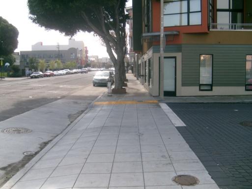
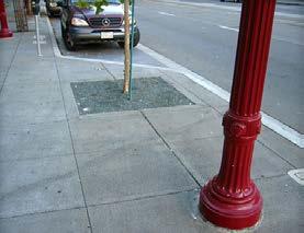
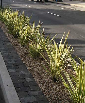
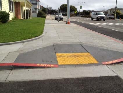
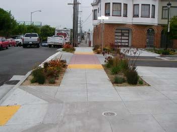
11 Crosswalks treatments Pedestrian and bus bulbouts Design Elements Planting Joint Utility Pole Bus stop improvements Street trees
12 Summary of Community Meeting #1 Feedback Pedestrian safety, traffic and parking: 1. Improve visibility at intersections for cars and pedestrians 2. Improve the function of the 5 way at Quint/Silver intersection for drivers and pedestrians 3. Cars go in the wrong lane to get around the buses, even at Lane and Keith where it is 2 lanes wide. 4. Cars are parked to the intersections which make it so hard to see 5. There are trees at the street corners that impair visibility 6. It is really hard to pull out of driveways.
13 Summary of Community Meeting #1 Feedback Block and intersection specific comments: 1. Newhall to 3 rd (1600 block)- How to make more functional and help with queuing buses and vehicles 2. At 3rd Street, the pedestrians don t abide by traffic lights- they just run across the street to catch their buses without paying attention 3. 3rd to Lane: Cars parking on sidewalks 4. 3rd to Jennings (1300 block):we need to slow down the traffic here. 5. High travel speeds occur on the wide lanes. 6. Jennings to Ingalls (1200 block):this has a blind crest at the top, which creates many close calls. We need a speed bump to slow traffic down.
14 Summary of Community Meeting #1 Feedback Community connection opportunities at: 1. Community Garden and Phelps Mini Park 2. Vacant lot(s) at Jennings Greening Opportunities to break up the pavement 1. We need extra effort in greening to offset all this traffic and pollution from buses and cars. For complete community meeting notes, visit

15 Key plan for intersection concepts Sewer work not shown on Key Plan: Side sewer lateral replacement between Jennings to Ingalls Main sewer repair: between Ingalls to Hawes

16 Quint Silver Details Concept: reduce 5-way intersection to 4-way with cul-de-sac. Vision Zero: Not on list Collision report: 1 collision, 1 death, vehicle/pedestrian High costs: $$ Utility relocation: none

17 Dunshee Street Details Concept: raised crosswalk Vision Zero not on list Collision report 1 vehicle,1 injury High costs $ Utility relocation none

18 Phelps Street Details Concept: bulbouts: 2 bus, 1 pedestrian Vision Zero: not on list Collision report: 3 collisions, 0 injuries High costs: $$$$$$$ Utility relocation: $$ high & low pressure hydrants
19 Newhall Street Details Concept: 4 pedestrian bulbouts Vision Zero: not on list Collision report: 7 collisions, 4 injury, 1 pedestrian High costs: $$ Utility relocation: $ low pressure hydrant

20 3 rd Street Details Completed: bulbouts, 2 bus, 2 pedestrian Vision Zero: Vision Zero work completed Collision report: 15 collisions, 16 injuries, 8 pedestrians High costs: $ Utility relocation: None

21 Lane Street Details 2014: new paving and curb ramps Concept: 4 pedestrian bulbouts Vision Zero: Not on list Collision report: 6 collisions, 7 injuries, 2 pedestrians High costs: $$$$$ Utility relocation: $ low pressure hydrant

22 Keith Street Details Concept: bulbouts: 2 bus, 2 pedestrian Vision Zero: on list Collision report: 6 collisions, 4 injuries, 1 pedestrian High costs: $$$$$$$ Utility relocation: $ low pressure hydrant
23 Jennings Street Details Concept: 3 bulbouts, 1 bus, 2 pedestrian, 2 median islands Vision Zero: not on list Collision report: 3 collisions, 0 injuries High costs: $$$$$ Utility relocation: $ low pressure hydrant

24 Ingalls Street Details Concept: 2 pedestrian bulbouts, 2 curb ramps Vision Zero: not on list Collision report: 3 collisions, 3 injuries High costs: $$$ Utility relocation: none

25 Hawes Street Details Concept: 3 bulbouts, 1 bus, 2 pedestrian, 2 median islands Vision Zero: not on list Collision report: 3 collisions, 0 injuries High costs: $$$$$ Utility relocation: $ low pressure hydrant

26 Crisp - Griffith Details Concept: to reduce the 5-way intersection into a 4-way intersection with cul-de-sac Vision Zero: not on list Collision report: 2 collisions, 0 injuries High costs: $$$$$$ Utility relocation: None Remove railroad tracks

27 Possible Model Block Opportunity: Jennings SFUSD Public Works right-of-way At the last community meeting, the community expressed interest in vacant lots at Jennings: Public Works right-of-way at Jennings San Francisco Unified School District parcel Community would like the opportunity to create a special place along Palou: All or part of the lot could be used for a mini-park, plaza, sitting area, as well as educational, recreational and artistic functions Opportunities available: OCII grant for $450,000 construction funding Challenge Grant for funding to help with model block project SFUSD as a community partner in programming, connecting the school to the greater neighborhood, and potentially for the additional parcel Foster community building and stewarding to develop ideas for the lot plan and coordinate with neighbors to make it happen

28 SFMTA proposed bike route to improve safety

29 SFMTA proposed bus route
30 Title VI of the Civil Rights Act of 1964 states Title VI prohibits discrimination on the basis of race, color, and national origin in programs and activities receiving federal financial assistance. San Francisco Public Works wants to ensure that residents and communities impacted by this project have been included in the decision making process. Participation in the Title VI questionnaire assists SFPW in assuring that we have an effective and representative community outreach program
31 Discussion and questionnaire What are your preferred improvements? How would you rank the top 6 intersections? (#1 being top priority) Quint-Silver Dunshee Phelps Newhall 3 rd Lane Keith Jennings Ingalls Hawes Crisp-Griffith Are there any other improvements you would like to see? What would you like to see at the Model Block if the grant is approved?
32 Questions? Thank you for participating tonight!
California Department of Transportation, District 4. Sloat Boulevard Project Skyline Blvd. to 19 th Ave. Community Update January 13, 2016
 California Department of Transportation, District 4 Sloat Boulevard Project Skyline Blvd. to 19 th Ave. Community Update January 13, 2016 Agenda Welcome and introductions Project overview, history and
Polk Streetscape Project
 What is this project? The Polk Streetscape Project is an effort to improve safety for everyone traveling on Polk Street between Union and McAllister streets. Also included in this project are paving, sewer
Caltrans Sloat Boulevard Pedestrian Safety Project Response to Community Questions, Comments & Concerns
 Caltrans Sloat Boulevard Pedestrian Safety Project Response to Community Questions, Comments & Concerns Revised: May 10, 2016 The California Department of Transportation (Caltrans) is planning various
Fifth & Kirkham Traffic-Calming Project. 5 th Avenue and Kirkham Street Presented at the UCSF Quarterly Parnassus Community Meeting May 3, 2018
 Fifth & Kirkham Traffic-Calming Project 5 th Avenue and Kirkham Street Presented at the UCSF Quarterly Parnassus Community Meeting May 3, 2018 1 Agenda Welcome and introductions Project history, goals,
Pedestrian and Bicycle Improvements in Balboa Park Station Area
 Pedestrian and Bicycle Improvements in Balboa Park Station Area Jamie Parks & Jen Wong, SFMTA, Livable Streets December 15, 2015 Balboa Park Station CAC Monthly Meeting Vision Zero SF Zero traffic deaths
Project Goal and Description. Why Broadway? Broadway SFMTA.COM/BROADWAY. The goal of the Broadway Safety Improvement
 PROJECT OVERVIEW Project Goal and Description The goal of the Broadway Safety Improvement d St Van Ness Ave Project is to improve safety and comfort for all who Franklin St Hyde St Octavia St Gough St
Geary Corridor Bus Rapid Transit SFMTA Citizens Advisory Committee
 Geary Corridor Bus Rapid Transit SFMTA Citizens Advisory Committee Project Update SAN FRANCISCO COUNTY TRANSPORTATION AUTHORITY SAN FRANCISCO MUNICIPAL TRANSPORTATION AGENCY August 6, 2015 Project Overview
PRINCE GEORGE S PLAZA METRO AREA PEDESTRIAN PLAN
 PRINCE GEORGE S PLAZA METRO AREA PEDESTRIAN PLAN May 28, 2008 Agenda Welcome and introductions Project overview and issue identification Planning context and strengths Design challenges and initial recommendations
Replace century-old sewer & water pipes Pedestrian-scale sidewalk lighting
 PROJECT OVERVIEW The Masonic Avenue Streetscape Project is an effort to improve safety for everyone travelling on Masonic Avenue between Geary Boulevard and Fell Street. This project will bring a variety
BD RESOLUTION NO RESOLUTION ADOPTING THE VISION ZERO RAMP INTERSECTION STUDY PHASE 1
 BD00 RESOLUTION NO. - RESOLUTION ADOPTING THE VISION ZERO RAMP INTERSECTION STUDY PHASE [NTIP PLANNING] FINAL REPORT WHEREAS, The Vision Zero Ramp Intersection Study Phase was recommended by Commissioner
VISION ZERO SF: ELIMINATING TRAFFIC DEATHS BY 2024 JANUARY 5, 2017
 Through Vision Zero SF we commit to working together to prioritize street safety and eliminate traffic deaths in San Francisco by 2024 VISION ZERO SF: ELIMINATING TRAFFIC DEATHS BY 2024 JANUARY 5, 2017
Dewey Area Traffic Calming Project
 SFMTA Municipal Transportation Agency Image: Crosswalk of California Street and Grant Avenue Dewey Area Traffic Calming Project 10 08 2013 SAN FRANCISCO, CALIFORNIA Tonight s Agenda Introductions Project
FOLSOM-HOWARD STREETSCAPE OVERVIEW
 FOLSOM-HOWARD STREETSCAPE OVERVIEW SoMa residents should have the same kinds of amenities that other neighborhoods have. The Folsom- Howard Streetscape Project will make SoMa more livable by making it
Memo. Ocean Avenue Corridor Design Project Public Workshop #2 Summary
 Ocean Avenue Corridor Design Project Public Workshop #2 Summary The second public workshop for the Ocean Avenue Corridor Design Project was held on Wednesday, May 14, 2014 from, 6 to 8 pm at Lick Wilmerding
Agenda. Overview PRINCE GEORGE S PLAZA METRO AREA PEDESTRIAN PLAN
 PRINCE GEORGE S PLAZA METRO AREA PEDESTRIAN PLAN May 28, 2008 Agenda Welcome and introductions Project overview and issue identification Planning context and strengths Design challenges and initial recommendations
Brooklyn Boulevard (County Road 152) Reconstruction Project Phase I. OPEN HOUSE June 20, 2017
 Reconstruction Project Phase I. OPEN HOUSE June 20, 2017") Brooklyn Boulevard (County Road 152) Reconstruction Project Phase I OPEN HOUSE June 20, 2017 Brooklyn Boulevard (County Road 152) Phase I Project Partners Project Lead Other Project Partners include Brooklyn
Brooklyn Boulevard (County Road 152) Reconstruction Project Phase I OPEN HOUSE June 20, 2017 Brooklyn Boulevard (County Road 152) Phase I Project Partners Project Lead Other Project Partners include Brooklyn
SAN FRANCISCO MUNICIPAL TRANSPORTATION AGENCY
 THIS PRINT COVERS CALENDAR ITEM NO. : 10.2 DIVISION: Sustainable Streets BRIEF DESCRIPTION: SAN FRANCISCO MUNICIPAL TRANSPORTATION AGENCY Adopting Conceptual Proposal for Streetscape Improvements to Broadway,
The Wiggle Route in Context
 The Wiggle Route in Context In a city of hills, the Wiggle is an important route because it winds its way along the flattest streets from Market to the Panhandle, bringing residents to local parks and
Ocean Park Boulevard Green Street Project Community Workshop
 Ocean Park Boulevard Green Street Project Community Workshop 2.2.10 Project Objectives Community Priority: reclaim OPB for public open space. Build upon LUCE principles; neighborhood enhancement, connectivity,
Henderson Ave. Complete Streets Project
 Henderson Ave. Complete Streets Project Meeting Purpose To finalize conceptual components of project prior to proceeding with preliminary engineering www.dallascompletestreets.wordpress.com MeetingAgenda
Tonight is for you. Learn everything you can. Share all your ideas.
 Strathcona Neighbourhood Renewal Draft Concept Design Tonight is for you. Learn everything you can. Share all your ideas. What is Neighbourhood Renewal? Creating a design with you for your neighbourhood.
Environment and Public Works Committee Presentation
 Mixed Use Centers Complete Streets Guidelines Project Environment and Public Works Committee Presentation December 10, 2008 Project Objectives: Conduct an inter-departmental and agency process to study
HARRISON STREET/OAKLAND AVENUE COMMUNITY TRANSPORTATION PLAN
 HARRISON STREET/OAKLAND AVENUE Community Workshop #4: Draft Plan Review December 3, 2009 D E S I G N, C O M M U N I T Y & E N V I R O N M E N T INTRODUCTIONS Key Project Staff: Alisa Shen, Project Manager,
Mission-Geneva Transportation Study Community Workshop 2 July 8, 2006
 Community Workshop 2 July 8, 2006 Small Group Workbook 1 Basic Improvements on Mission Street Streetscape. Pedestrian-scale lighting; landscaping; community art on utility boxes; more (possibly unique)
El Camino Real Specific Plan. TAC/CAC Meeting #2 Aug 1, 2018
 El Camino Real Specific Plan TAC/CAC Meeting #2 Aug 1, 2018 Land Use Alternatives Goals and Tradeoffs Parks & open space Housing Retail & services Civic spaces Parking Community gathering spaces 3 Alternatives
SAN FRANCISCO MUNICIPAL TRANSPORTATION AGENCY
 THIS PRINT COVERS CALENDAR ITEM NO.: 13 DIVISION: Sustainable Streets BRIEF DESCRIPTION: SAN FRANCISCO MUNICIPAL TRANSPORTATION AGENCY Endorsing the Planning Department s 2014 Update to the conceptual
Pedestrian Safety Workshop SAN FRANCISCO, CALIFORNIA
 Pedestrian Safety Workshop 02 15 2011 SAN FRANCISCO, CALIFORNIA 1 Agenda Walking in San Francisco Accomplishments and Current Pedestrian Activities Mayor s Pedestrian Safety Executive Directive Next Steps
Sloat Blvd. Pedestrian Safety Improvement Project
 Sloat Blvd. Pedestrian Safety Improvement Project Department of Public Works Project team and background Budget Schedule Scope of work Sloat Blvd - Everglade Drive Sloat Blvd - Forest View Drive Sloat
SAN FRANCISCO MUNICIPAL TRANSPORTATION AGENCY
 THIS PRINT COVERS CALENDAR ITEM NO. : 11 DIVISION: Sustainable Streets BRIEF DESCRIPTION: SAN FRANCISCO MUNICIPAL TRANSPORTATION AGENCY Approving traffic modifications on Twin Peaks Boulevard between Christmas
STREETSCAPE CONCEPTS
 STREETSCAPE S CARGO WAY CARGO WAY CYCLE TRACK Streetscape Concepts JENNINGS ST Illustrative Plan EVANS AVE PG&E BAY TRAIL HERON S HEAD PARK The recommended improvements build off the planned improvements
APPENDIX A: Complete Streets Checklist DRAFT NOVEMBER 2016
 APPENDIX A: Complete Streets Checklist DRAFT NOVEMBER 2016 Complete Streets Checklist MetroPlan Orlando s Complete Streets Checklist is an internal planning tool for staff to further implementation of
MASONIC AVENUE STREET DESIGN STUDY Community Workshop 2. Masonic Ave Street Design Study Community Workshop 2 August 10, 2010
 Masonic Ave Street Design Study Community Workshop 2 August 10, 2010 Introduction MASONIC AVENUE STREET DESIGN STUDY Community Workshop 2 SF Municipal Transportation Agency Javad Mirabdal, Project Manager
SAFE STREETS FOR ALL. A Report to Land Use Committee on Street widths in Hunters Point Shipyard and Candlestick Point Developments
 SAFE STREETS FOR ALL A Report to Land Use Committee on Street widths in Hunters Point Shipyard and Candlestick Point Developments Background: Candlestick Point Hunters Point Shipyard Redevelopment Project
Knox Street Complete Streets Project
 Knox Street Complete Streets Project Meeting Purpose Get community feedback on two conceptual street design options Meeting Agenda Presentation (20 minutes) Project background and schedule Summary of preferences
Geary Corridor Bus Rapid Transit
 Geary Corridor Bus Rapid Transit Near-term Improvements Update SAN FRANCISCO COUNTY TRANSPORTATION AUTHORITY SAN FRANCISCO MUNICIPAL TRANSPORTATION AGENCY Phasing Packages Phase 1 Near-term: Delivers project
Outreach Approach RENEW SF served as the primary liaison with the North Beach community; the Chinatown. Executive Summary
 Executive Summary Executive Summary The Columbus Avenue Neighborhood Transportation Study s objective is to identify changes to transportation infrastructure and policies that could enhance the livability
Design Guidelines. Overview. Design Vision for Yellow Brick Road
 Design Guidelines Overview This section presents the design vision for the Yellow Brick Road network. The Yellow Brick Road is envisioned to be an interconnected network of safe and secure roadways where
Derby Street. Project Updates. Salem, Massachusetts
 Derby Street Project Updates Salem, Massachusetts September 13, 2017 Project Limits Derby Street Project Objectives 1. Improve complete streets elements on Derby Street 2. Improve sidewalks on finger streets
MARTIN LUTHER KING JR. WAY
 OCTOBER 2011 40 Vision and Goals The Martin Luther King, Jr. Way Illustrative Master Plan that follows has been developed through a process of community involvement. It expresses a long term vision for
Freeway ramp intersection study
 Freeway ramp intersection study Supporting Vision Zero: Zero traffic deaths in San Francisco by 2024 Study Goals: Primary Improve Safety Improve Accessibility Secondary Provide Efficient Circulation Accommodate
PROJECT OVERVIEW. 20th Avenue Project Limits (Lincoln Way to Wawona St)
") PROJECT OVERVIEW In 2014, San Francisco adopted Vision Zero as City policy, with a commitment to eliminate all traffic deaths in the City by 2024. nue Project Limits (Lincoln Way to St) Collision data
PROJECT OVERVIEW In 2014, San Francisco adopted Vision Zero as City policy, with a commitment to eliminate all traffic deaths in the City by 2024. nue Project Limits (Lincoln Way to St) Collision data
ABOUT THIS OPEN HOUSE
 ABOUT THIS OPEN HOUSE Welcome, and thanks for joining us today for the Folsom-Howard Near-Term Project! The purpose of today s open house is to: Understand how the near-term project ties into the larger
Welcome! Thank you for joining us today for a Geary Rapid project open house. Geary Rapid Project. SFMTA.com/GearyRapid
 Welcome! Thank you for joining us today for a Geary Rapid project open house. Get the most out of this event: 1. Sign in and get your feedback sheet 2. Visit project information stations hosted by project
Ocean Park Boulevard Streetscape Improvement Project Alternatives & Trade Offs
 City Council Study Session January 27, 2009 Ocean Park Boulevard Streetscape Improvement Project Alternatives & Trade Offs Scope of Work Purpose of Tonight s Meeting Review work to date and direct staff
SAN FRANCISCO MUNICIPAL TRANSPORTATION AGENCY
 THIS PRINT COVERS CALENDAR ITEM NO.: 10.3 DIVISION: Sustainable Streets BRIEF DESCRIPTION: SAN FRANCISCO MUNICIPAL TRANSPORTATION AGENCY Approving various traffic and parking modifications on Bay Street
Bicycle Network. Vision Zero San Francisco The City and County of San
 PROJECT BACKGROUND Project Needs 1. 17th between Church and Sanchez is identified as a location where there is a disproportionate number of crashes involving people riding bikes. 2. There is currently
Vision Zero Priority Projects (March 2017)
") Key in 201 or of Key Potrero Ave., from Division to Cesar Chavez Begin Construction Spring 201 Winter 201 Achieved Safety measures include dedicated transit lane, sidewalk widening, buffers for existing
Key in 201 or of Key Potrero Ave., from Division to Cesar Chavez Begin Construction Spring 201 Winter 201 Achieved Safety measures include dedicated transit lane, sidewalk widening, buffers for existing
Geary Corridor Bus Rapid Transit: Staff-Recommended Alternative
 Geary Corridor Bus Rapid Transit: Staff-Recommended Alternative Urban Forestry Council January 24, 2014 SAN FRANCISCO COUNTY TRANSPORTATION AUTHORITY SAN FRANCISCO MUNICIPAL TRANSPORTATION AGENCY Today
SAN FRANCISCO MUNICIPAL TRANSPORTATION AGENCY
 THIS PRINT COVERS CALENDAR ITEM NO. : 10.3 DIVISION: Sustainable Streets Division BRIEF DESCRIPTION: SAN FRANCISCO MUNICIPAL TRANSPORTATION AGENCY Approving traffic and parking modifications to install
PEDALING FORWARD. A Glance at the SFMTA s Bike Program for SFMTA.COM
 PEDALING FORWARD A Glance at the SFMTA s Bike Program for 2017-2021 SFMTA.COM INTRODUCTION About This Booklet More people from all walks of life see their bicycle as a more convenient way to get where
West Capitol Avenue Road Rehabilitation and Safety Enhancement Project
 West Capitol Avenue Road Rehabilitation and Safety Enhancement Project Stakeholder Focus Group Meeting #2 Tuesday, August 28, 2018 7:00 8:00 a.m. West Sacramento City Hall 1110 West Capitol Avenue, West
Commerce Street Complete Street Project from Good Latimer Expressway to Exposition Avenue
 Commerce Street Complete Street Project from Good Latimer Expressway to Exposition Avenue T A N Y A B R O O K S A S S I S T A N T D I R E C T O R M O B I L I T Y P L A N N I N G M O B I L I T Y A N D S
COWETA HIGH SCHOOL AND EAST HIGHWAY 51
 COWETA HIGH SCHOOL AND EAST HIGHWAY 51 Lack of sidewalks along Ben Lumpkin Rd. Lack of crosswalks and ramps at intersection. Hwy 51 is wide to cross as a pedestrian. No ADA compliance or connection to
Better Market Street Project Update. Urban Forestry Council September 17, 2014
 Better Market Street Project Update Urban Forestry Council September 17, 2014 Project Area Limits Better Market Street Schedule Market Street City s busiest transit corridor Over 85 buses per hour 14 surface
SFMTA SAN FRANCISCO MUNICIPAL TRANSPORTATION AGENCY
 SFMTA SAN FRANCISCO MUNICIPAL TRANSPORTATION AGENCY VAN NESS BUS RAPID TRANSIT PROJECT UPDATE PRESENTATION TO SFMTA BOARD OF DIRECTORS RELEASE OF DRAFT ENVIRONMENTAL IMPACT STATEMENT / REPORT 10 18 2011
Poor pavement condition Substandard Intersections. / Substandard bike/pedestrian/transit accommodations. Driveway access Environmental concerns
 Public Informational Meeting University Avenue (Allen Boulevard Segoe Road) March 23, 2011 City of Madison City of Middleton Village of Shorewood Hills Dane County Existing Roadway Conditions Poor pavement
THE ALAMEDA CONCEPT DESIGN COMMUNITY MEETING 3. A Plan for The Beautiful Way JANUARY 28, 2010
 CONCEPT DESIGN COMMUNITY MEETING 3 JANUARY 28, 2010 AGENDA INTRODUCTION COMMUNITY INPUT ROADWAY STUDIES STREETSCAPE DESIGN STATIONS DISCUSSION SUMMARY AND DISCUSSION NEXT STEPS CLOSE INTRODUCTION SCHEDULE
Atwood Avenue Fair Oaks Avenue Cottage Grove Road
 Atwood Avenue Fair Oaks Avenue Cottage Grove Road Agenda Purpose Review project scope & goals Present design alternatives Gather feedback Answer Questions Format Open House Presentation Q&A Open House
Chapter 4 TOOLBOX AND SAMPLE BIKE BOULEVARD LAYOUT
 Chapter 4 TOOLBOX AND SAMPLE BIKE BOULEVARD LAYOUT OVERVIEW This chapter describes a cohesive set of strategies to create a bicycle boulevard, namely to make streets safer and more efficient for bicycle
About the study. North Milwaukee Ave. Key goals of this study are to: Achieve Vision Zero* by. Harmonize the space and improve walkability
 About the study Key goals of this study are to: North Milwaukee Avenue is a local and regional street for multiple modes of transportation. It is officially zoned and functions as a pedestrian street southeast
20 th Avenue Neighborway Project August 2, Second Open House
 20 th Avenue Neighborway Project August 2, 2018 - Second Open House General Comments We love the plan in general and appreciate the SFMTA looking out for walkers and bikers. Can we get better traffic enforcement
BALBOA AREA: TRANSPORTATION PROJECTS & PLANNING
 BALBOA AREA: TRANSPORTATION PROJECTS & PLANNING TRANSPORTATION FOR ALL AGES, ABILITIES & MEANS CHANGING PATTERNS: TRENDING TO WALKING, BIKING, TRANSIT San Francisco s Change in Number of Commuters by Mode
Better Market Street. Engineering, Maintenance & Safety Committee (EMSC) February 28, 2018
 February 28, 2018") Better Market Street Engineering, Maintenance & Safety Committee (EMSC) February 28, 2018 1 Market Street Market Street - San Francisco by rulenumberone2 2 Market Street is the... City s busiest pedestrian
Better Market Street Engineering, Maintenance & Safety Committee (EMSC) February 28, 2018 1 Market Street Market Street - San Francisco by rulenumberone2 2 Market Street is the... City s busiest pedestrian
25th Avenue Road Diet Project A One Year Evaluation. Transportation Fund for Clean Air Project #05R07
 25th Avenue Road Diet Project A One Year Evaluation Transportation Fund for Clean Air Project #05R07 Submitted by: The San Francisco Municipal Transportation Agency Dan Provence May 22, 2009 EXECUTIVE
STEERING COMMITTEE MEETING June 17, Streetscape Overview Burlington Comprehensive Master Plan
 STEERING COMMITTEE MEETING June 17, 2015 Streetscape Overview Burlington Comprehensive Master Plan 1 Introduction Slide This slide show was presented to the Burlington Steering Committee on June 17, 2015
122 Avenue: 107 Street to Fort Road
 : 107 Street to Fort Road November 24, 2015 4:30 8:00 p.m. Meeting Purpose Summarize project work completed to date Share results of public input from Phase 1 Share the draft concept plan and proposed
MASONIC AVENUE STREET DESIGN STUDY Community Workshop 3. Masonic Ave Street Design Study Community Workshop 3 September 30, 2010
 Masonic Ave Street Design Study Community Workshop 3 September 30, 2010 Introduction MASONIC AVENUE STREET DESIGN STUDY Community Workshop 3 SF Municipal Transportation Agency Javad Mirabdal, Project Manager
Chapter 3: Multi-Modal Circulation and Streetscapes
 CHAPTER 3: MULTI-MODAL CIRCULATION AND STREETSCAPES Chapter 3: Multi-Modal Circulation and Streetscapes Overview Streetscape improvements have already been completed for Depot Street between Main Avenue
SURVEY minutes to complete this questionnaire. Your feedback will help the City determine a future design for Ocean Avenue and Geneva Avenue. Thanks!
 OCEAN AVENUE CORRIDOR DESIGN ROJECT WORSHO #4 Thank you for your interest in the Ocean Avenue Corridor Design project. lease take a few SURVEY minutes to complete this questionnaire. Your feedback will
Item to be Addressed Checklist Consideration YES NO N/A Required Description Complete Streets Guidelines
 Passaic County Complete Streets Checklist - Concept Development Project Name Item to be Addressed Checklist Consideration YES NO N/A Required Description Complete Streets Guidelines Existing Plans Have
September 20, 2016 L Taraval Rapid Project SFMTA Board of Directors Meeting
 September 20, 2016 L Taraval Rapid Project SFMTA Board of Directors Meeting WHY TARAVAL STREET L TARAVAL PROJECT GOALS 1. Improve state of good repair of our transit system Track and overhead replacement
UPTOWN REGIONAL BIKE CORRIDORS PROJECT SAN DIEGO ASSOCIATION OF GOVERNMENTS
 UPTOWN REGIONAL BIKE CORRIDORS PROJECT SAN DIEGO ASSOCIATION OF GOVERNMENTS SUMMARY REPORT: COMMUNITY UPDATE MEETING February 6, 2014 6 8:30 p.m. Roosevelt Middle School Library 3366 Park Blvd, San Diego
WORKSHOP 2 SUMMARY OVERVIEW GENERAL COMMENTS. Walking and Biking. Greening & Stormwater. Transportation & Parking. Lighting, Art and Identity
 WORKSHOP 2 SUMMARY OVERVIEW On May 9, 2016, 55 people came to the second public meeting for the Lower Haight Public Realm Plan. Roughly 34 of attendees were neighborhood residents. The open house was a
Complete Streets. Designing Streets for Everyone. Sarnia
 Complete Streets Designing Streets for Everyone Sarnia Complete Streets ~ Sarnia ~ 2018 Introduction Our City is made up of a network of streets that we use to go for a walk, cycle to work, drive to the
NJDOT Complete Streets Checklist
 Background The New Jersey Department of Transportation s Complete Streets Policy promotes a comprehensive, integrated, connected multi-modal network by providing connections to bicycling and walking trip
San Francisco s Capital Plan & the Mayor s Transportation Task Force 2030: Funding the next steps for transportation
 San Francisco s Capital Plan & the Mayor s Transportation Task Force 2030: Funding the next steps for transportation San Francisco Capital Needs In 2006, the Mayor and Board of Supervisors approved San
Governance and Priorities Committee Report For the July 2, 2015 Meeting
 CITY OF VICTORIA For the July 2, 2015 Meeting To: Governance and Priorities Committee Date: From: Subject: Brad Dellebuur, A/Assistant Director, Transportation and Parking Services Executive Summary The
Water Street Promenade. Engineering and Design Services. Public Information Meeting No. 2. Education / Infrastructure / Innovation. Maplewood Avenue &
 Public Information Meeting No. 2 Water Street Promenade Maplewood Avenue & Engineering and Design Services Adjacent Areas July 16,2014Portsmouth, NH May 10, 2016 Education / Infrastructure / Innovation
Community Meeting February 27, 2007 Dorchester Avenue Transportation & Streetscape Improvements Action Plan February 27, 2007
 Community Meeting Tonight s Agenda 6:00 Introductions South Boston/Dot Ave Improvement Study Background 6:15 Consultant Introductions Review of Scope and Schedule Review of Proposed Corridor Wide Guidelines
SAFE ROUTES TO SCHOOL (SR2S)
") SAFE ROUTES TO SCHOOL (SR2S) In partnership with Burbank Unified School District (BUSD) & City of Burbank George Washington Elementary School Thomas Jefferson Elementary School John Muir Middle School
SAFE ROUTES TO SCHOOL (SR2S) In partnership with Burbank Unified School District (BUSD) & City of Burbank George Washington Elementary School Thomas Jefferson Elementary School John Muir Middle School
Community Advisory Committee of Market and Octavia Area Plan City and County of San Francisco. Meeting Minutes
 Community Advisory Committee of Market and Octavia Area Plan City and County of San Francisco Meeting Minutes Monday, November 17, 7:00 PM Regular Meeting Committee Members Present: Jason Henderson, Robin
Merrick and Memorial Neighborhood Study 5/14/2014 Public Meeting
 Merrick and Memorial Neighborhood Study 5/14/2014 Public Meeting Study Area April 9 Public Meeting Comments Summary Pedestrian Safety - A Walking Neighborhood Pedestrian traffic is very difficult A need
Ocean Park Boulevard Green Street Project Alternatives & Trade Offs
 Planning Commission March 4, 2009 Ocean Park Boulevard Green Street Project Alternatives & Trade Offs Purpose of Tonight s Meeting Review concept plans and options Provide input on alternatives and trade-offs
REGIONAL BICYCLE AND PEDESTRIAN DESIGN GUIDELINES
 REGIONAL BICYCLE AND PEDESTRIAN DESIGN GUIDELINES November 16, 2011 Deb Humphreys North Central Texas Council of Governments Bicycle and Pedestrian Advisory Committee Snapshot of the Guide 1. Introduction
Multi-Modal Traffic Analysis. Parisi and Associates
 Mill Valley to Corte Madera Bicycle and Pedestrian Corridor Study Appendix D: Multi-Modal Traffic Analysis Prepared by Parisi and Associates August 2009 Appendix D - Multi-Modal Traffic Analysis Table
12/4/2016 VIA . RE: Grocery Outlet Del Paso (DR16-328)
") 12/4/2016 VIA EMAIL Ethan Meltzer, Assistant Planner City of Sacramento Community Development Department 300 Richards Blvd, 3 rd Floor Sacramento, CA 95811 RE: Grocery Outlet Del Paso (DR16-328) Dear Mr.
12/4/2016 VIA EMAIL Ethan Meltzer, Assistant Planner City of Sacramento Community Development Department 300 Richards Blvd, 3 rd Floor Sacramento, CA 95811 RE: Grocery Outlet Del Paso (DR16-328) Dear Mr.
Chicago Safe Routes to School Safe Routes to High School (SRTS/SRTHS)
") Chicago Safe Routes to School Safe Routes to High School (SRTS/SRTHS) Marshall Community High School and Faraday Elementary School Recommended Improvements Agenda Goals Related Programs Project Location/Area
Chicago Safe Routes to School Safe Routes to High School (SRTS/SRTHS) Marshall Community High School and Faraday Elementary School Recommended Improvements Agenda Goals Related Programs Project Location/Area
Geary Bus Rapid Transit Project
 Geary Bus Rapid Transit Project Urban Forestry Council Planning and Funding Committee Meeting September 13, 2016 SAN FRANCISCO COUNTY TRANSPORTATION AUTHORITY SAN FRANCISCO MUNICIPAL TRANSPORTATON AGENCY
Hennepin Avenue Reconstruction Washington Avenue to 12 th Street
 CITY OF MINNEAPOLIS Hennepin Avenue Reconstruction Washington Avenue to 12 th Street April 2016 1 Upcoming Opportunities Public Meeting #2 April 25, 2016 Minneapolis Central Library Doty Board Room Repeat
Options. Agenda. Program
 July 2013 Workshops Agenda Parc 55 Main Library Open house 6-6:15pm 10-10:15am Presentation 6:15-7:00pm 10:15-11am Exhibit stations review & comments 7-8:20pm 11am - 12:20pm Meeting close 8:20-8:30pm 12:20-12:30pm
Broad Street Bicycle Boulevard Design Guidelines
 Broad Street Bicycle Boulevard Design Guidelines Building from the strategies introduced in the 2013 Bicycle Transportation Plan and community input received thus far, City Transportation Staff have identified
MASTER BICYCLE AND PEDESTRIAN PLAN
 VILLAGE OF NORTHBROOK MASTER BICYCLE AND PEDESTRIAN PLAN DRAFT PLAN OPEN HOUSE May 2, 2018 AGENDA 1. Community Engagement 2. Vision and Goals 3. General Structure of Plan 4. Recommendations Overview 5.
Cross Street Corridor Non-Motorized Enhancement Project Project Description
 Cross Street Corridor Non-Motorized Enhancement Project Project Description A cooperative study of the Cross Street neighborhood was completed in May 2002 by the City of Ypsilanti, the Depot Town Downtown
Paoli Road Improvement Feasibility Study
 Paoli Road Improvement Feasibility Study & Public Participation Project March 24, 2015 Prepared for: Tredyffrin Township Prepared by: McMahon Associates, Inc. with Town Planning Partnership, LLC Glackin
UDC Street Cross Sections
 UDC Street Cross Sections Local Street - Downtown Local Street Mountable Curb Local Street Vertical Curb Alley Major Arterial Minor Arterial Residential Lane Residential Collector Residential Collector
TOWN OF MORAGA MORAGA WAY AND CAMINO PABLO/CANYON ROAD IMPROVEMENTS Town Council Meeting March 13, 2019
 TOWN OF MORAGA MORAGA WAY AND CAMINO PABLO/CANYON ROAD IMPROVEMENTS Town Council Meeting March 13, 2019 1 Edric Kwan, Public Works Director Josh Peterman, Principal, Fehr and Peers Shawn Knapp, Senior
CITY OF SLO SEEKS INPUT ON PREFERRED ALTERNATIVE FOR BROAD STREET BICYCLE BOULEVARD PROJECT
 City of San Luis Obispo, News Release DATE: August 1, 2017 RELEASE: Immediate CONTACT: Luke Schwartz (805) 781-7190 Transportation Planner-Engineer, Public Works CITY OF SLO SEEKS INPUT ON PREFERRED ALTERNATIVE
Fulton Market Streetscape
 Fulton Market Streetscape Ogden Avenue to Halsted Street Public Meeting Recommended Improvements December 10th, 2014 Meeting Purpose and Goals Present Existing Conditions Community Input and Charrette
Welcome to the Quebec Alternatives Analysis Public Meeting
 Welcome to the Public Meeting Please sign in. Public Comment Please fill out a comment card and tell us what you think. Check back or comment any time at: www.quebecalternatives.com Project Area Technical
TRANSPORTATION STANDARDS
 INTRODUCTION LOCAL STREETS ON-STREET PARKING SIDEWALKS STREET LIGHTING STREET FURNISHINGS TRAFFIC CALMING STREET TREES MEDIAN PLANTING BOULEVARD LOCATIONS VILLAGE CENTER STREET LOCATIONS RESIDENTIAL STREET