Austin Avenue Bridges Project. Public Meeting Summary
|
|
|
- Daniela Johns
- 5 years ago
- Views:
Transcription


1 Austin Avenue Bridges Project Public Meeting Summary June 29, 2016

2 Red Table Safety and Connectivity Notes: 1. Would like to see forensic report evaluations 2. What is the lifespan? 3. Extend safety considerations all the way to Williams Drive 4. Turning traffic causes wrecks at San Gabriel Boulevard 5. Pedestrian traffic visibility problems 6. Increase connectivity routes for pedestrians 7. North side parking area needed 8. Cantilever or widen bridge for pedestrians/cyclists 9. Add pedestrian ramp access 10. Safety of downtown businesses 11. Slow traffic 12. Separate pedestrian bridges Aesthetics and Character Notes: 13. Transition to more historic character 14. Preference shared for no significant aesthetic changes to existing bridges 15. Add lighting on & below consistent with downtown lights 8
3 CONTENTS Meeting Details... 1 Notices and Advertisements of the Public Meeting... 1 Public Workshop... 2 Presentation... 3 Workshop Activities... 3 Charrette Results... 3 APPENDICES Appendix A Sign-in Sheets Appendix B Public Workshop Handouts and Photo Examples Appendix C Facilitator Guide Appendix D Walking Tour Guide i


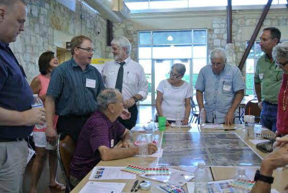
4 Austin Avenue Bridges Project Public Meeting Summary The City of Georgetown is studying Austin Avenue from Morrow Street to 3 rd Street including the two historically significant bridges crossing the San Gabriel River. This study is evaluating a range of both short and long term solutions for Austin Avenue while balancing considerations such as safety, mobility, public input, impacts to property owners, and cost. MEETING DETAILS The City of Georgetown hosted the second public meeting for the Austin Avenue Bridges Project in a workshop format. The purpose of this meeting was to develop a vision for the future of the bridges that balances its needs and the wants of the community. A walking tour of the project was conducted prior to the meeting for interested attendees. At the workshop, the project team provided a brief presentation and then community members participated in a workshop to share input on the project. The team did collect RSVPs for the workshop and walking tour to help prepare for activities. Wednesday, June 29, :30 p.m. San Gabriel Community Center 445 E. Morrow Street, Georgetown, TX Austin Ave. Public Workshop NOTICES AND ADVERTISEMENTS OF THE PUBLIC MEETING The following methods were used to inform the community of the meeting: Direct Mail A letter was mailed to 49 property owners abutting project limits on June 13, 2016, notifying them of the upcoming public meeting. Notifications notifications were sent to the stakeholder database including public officials, landowners, businesses, community organizations, and other interested parties who signed up for updates. notifications were sent on the following dates: June 2, 2016, to 592 individual addresses June 23, 2016 to 594 individual addresses June 28, 2016 to 594 individual addresses. The meeting was also promoted by Georgetown Online through s sent to contacts in their database. Austin Ave. Public Workshop Flyer 1

5 Media Advertisements A media release was sent to local media outlets on June 24, Meeting announcements and reminders were posted to Facebook on June 22, June 27, and June 29, Signage Large signs were placed on the north and south end of the San Gabriel Trail on June 3, The signs displayed public meeting details and project contact information. Notification signs were also placed at the Georgetown Public Library, the Georgetown Recreation Center, the Georgetown Municipal Complex, City Hall and the Williamson Museum. The meeting information was also shared on the digital display monitors at both the Recreation Center and Georgetown Public Library. The City also utilized digital message boards the week of June 25 th along Austin Ave., alerting north and southbound traffic to the public meeting. Austin Ave. Meeting Notification San Gabriel Trail Additional Outreach Public meeting flyers and project information contact cards were distributed to local business and City offices on June 23, PUBLIC WORKSHOP A walking tour was conducted prior to the public workshop to explain existing conditions, maintenance considerations, and trail/pedestrian considerations through a hands on approach. A bus picked up approximately 15 citizens from the Community Center and dropped them off near the Blue Hole (close to the bridges). The City Project Manager, Nat Waggoner, and the team Project Manager, John Mutchler, led the tour and discussions including: A tour under the south bridge and discussion of the history of the bridges, components of the structures, recent inspection reports, City maintenance and structurally deficient components A tour of sidewalks on top of the south bridge and discussed functionally obsolete components, trail and pedestrian elements, and safety A quick Q&A session The bus then brought attendees back in time for the public meeting. Reference Appendix E for the Guide that was used for planning purposes. 2

. Below is brief description of activities at the meeting. Presentation The presentation included the purpose and need, timeline, and process for the project.")
6 There were 69 RSVPs for the meeting and 58 attendees that signed in. Attendees were randomly assigned a color that corresponded with a workshop table and were provided with a handout that summarized public involvement collected to date. At each table there were graphic examples of different types of enhancements, improvements, and bridge design photos to be considered as the groups talked through possible improvements (reference Appendix B). Below is brief description of activities at the meeting. Presentation The presentation included the purpose and need, timeline, and process for the project. A review of the public input collected to date was shared followed by an overview of the ground rules and explanation of the workshop. Workshop Activities After the presentation, attendees divided into five groups (two blue groups, two green groups, and one red group) to participate in a charrette activity. For 20 minutes, groups brainstormed possible improvements to Austin Avenue related to safety and connectivity. Groups marked their suggestions on aerial maps with numbered stickers, and a table scribe noted detailed comments on easel paper. For another 20 minutes, groups repeated this process, focusing on aesthetic and character elements. Groups used colored dots (red for safety and green for connectivity) to represent considerations and cut out specific photo examples to share preferences. Reference Appendix D for the Guide developed for facilitators to generate discussions and collect feedback. Charrette Results Notes were taken by a volunteer at each table that corresponded with the maps. A volunteer from each group gave a short presentation highlighting the discussion from their table. The notes below do not follow consistent numbering and bulleting. These were the notes submitted from each group and they represent comments and observations made by participants. The project team added some clarification where needed to explain the intent. Austin Ave Public Workshop 3

7 Blue Table Safety Considerations Turn lanes - 3 locations o 2 nd St. o San Gabriel Village Blvd. o Morrow St. Enhanced Pedestrian Crosswalks Economic impact to downtown was big concern Connectivity Considerations Path to Sheraton Hotel and Conference Center Blue Hole Park and Trail Two Rivers apartments to San Gabriel River Trail Aesthetic Considerations Several in the group wanted to see a separate pedestrian bridge or one that appears to be separate Can make statement architecturally while still being sensitive to complementing the existing character of Georgetown Character Considerations Possible event venue (e.g. weddings) Group was divided (some felt the bridges need replacement; others felt no replacement was necessary) Update and think about safety 4

8 Green Table Safety and Connectivity Notes: R1: Better pedestrian access/walkways R2: Center turn lane to businesses R3: No left turn lanes to San Gabriel Village Blvd., due to cut through traffic and speed concerns R4: Pedestrian crossing at 2nd and Main with a traffic light G1: Drop pedestrian & bike bridge below traffic G2: Connections from south to north rivers with trail access G3: Replace low water crossings on North & South rivers (Picture 1) G4: Sidewalks on both sides of Austin Ave from downtown to rivers G5: Existing trails on both rivers to connect to pedestrian and bike bridge Aesthetics and Character Notes: 1. Park area east of Austin on S. San Gabriel with access 2. Lighting (light features) 3. Scenic overlooks on bridges 4. Benches along new pathways & sitting areas 5. Separation between pedestrians and traffic 6. Remove billboards 7. Keep natural beauty of rivers 8. Landscaped areas entering river 9. Extend downtown aesthetics & streetscapes to rivers 5

9 Green Table Safety Considerations: 1. Left turn stops flow of traffic; need turn lane 2. Sidewalks too narrow, no protection 3. Speed concerns 4. Traffic congestion -stopped traffic 5. Trail safety - falling debris 6. Overall safety for citizens of Georgetown Connectivity Considerations: 1. Trail - Both bridges, both sides to Austin Avenue 2. Pedestrian bridge connection to Regional Trail and to Austin Ave Character & Aesthetics Considerations: 1. Architecture of downtown incorporate into bridge 2. Current bridge railings 3. Lighting- preferably LED 4. Cathedral arches like College Street Bridge 5. Need more uplighting 6. Use existing railings some way Artistic Considerations: 7. Steers crossing the river (highlighting the Chisolm Trail) 8. Gateway signage 6

10 Blue Table Safety and Connectivity Considerations: Intersections - San Gabriel Village Blvd, 2nd St, & Austin Ave o Vehicular and pedestrian lanes o Turn lanes too short o Reduce the number of lanes but have one continuous turn lane Pedestrian Crossings o Separate bicycle & pedestrian corridors Consider lifetime of bridge Character and Aesthetics Considerations: Should some kind of Historic and Architectural Review Commission guidelines be applied? Lighting considerations (LED) Consider gateway to city o Reflect old town issues while considering flooding, wider traffic lanes, fly overs 7
Introduction. North 12 th Complete Street Project Overview
 Introduction On Wednesday, March 1, 2017, the City of Sacramento, in partnership with Sacramento Regional Transit District and the Sacramento Housing and Redevelopment Agency, hosted a community outreach
City of Wilsonville 5 th Street to Kinsman Road Extension Project
 City of Wilsonville 5 th Street to Kinsman Road Walking Tour & Neighborhood Workshop Summary Report Public Outreach Overview On July 18 th, 2017, the City of Wilsonville hosted a neighborhood walking tour
Executive Summary Route 30 Corridor Master Plan
 Route Corridor Master Plan Project Overview The Route Corridor Master Plan is a coordinated multimodal transportation and land use plan for the entire stretch of Route through East Whiteland Township,
Memo. Ocean Avenue Corridor Design Project Public Workshop #2 Summary
 Ocean Avenue Corridor Design Project Public Workshop #2 Summary The second public workshop for the Ocean Avenue Corridor Design Project was held on Wednesday, May 14, 2014 from, 6 to 8 pm at Lick Wilmerding
RiNo Railroad Crossing Connectivity Analysis. Stakeholder Workshop June 29, 2017
 RiNo Railroad Crossing Connectivity Analysis Stakeholder Workshop June 29, 2017 Ideas and Considerations Presented at Stakeholder Workshop Primary Focus: 38 th Street (between Walnut & Wynkoop) 1 Basic
UPTOWN REGIONAL BIKE CORRIDORS PROJECT SAN DIEGO ASSOCIATION OF GOVERNMENTS
 UPTOWN REGIONAL BIKE CORRIDORS PROJECT SAN DIEGO ASSOCIATION OF GOVERNMENTS SUMMARY REPORT: COMMUNITY UPDATE MEETING February 6, 2014 6 8:30 p.m. Roosevelt Middle School Library 3366 Park Blvd, San Diego
WalkShop. Highland Creek Village
 On June 5, 2014, 15 people participated in a for the Transportation Master Plan. The purpose of the was to receive feedback from a diverse range of local stakeholders and document existing transportation
Merrick and Memorial Neighborhood Study 5/14/2014 Public Meeting
 Merrick and Memorial Neighborhood Study 5/14/2014 Public Meeting Study Area April 9 Public Meeting Comments Summary Pedestrian Safety - A Walking Neighborhood Pedestrian traffic is very difficult A need
Ann Arbor Downtown Street Plan
 1 Ann Arbor Downtown Street Plan Public Workshop #1 We know that. 2 Public right-of-way (streets, sidewalks, and alleys) make up 30% of the total District area of downtown. Streets need to provide mobility
Lee s Summit Road Improvement Study Public Open House June 7, 2007 Summary of Comment Card Responses
 Lee s Summit Road Improvement Study Public Open House June 7, 2007 Summary of Comment Card Responses Introduction At the Lee s Summit Road Improvement Study Public Open House held Thursday, June 7, 2007
Ulster County Non-motorized Transportation Plan
 Ulster County Non-motorized Transportation Plan NTAC Meeting NOTES Ulster County Community College Date 08.29.07 Time: 1:00 p.m. - 3:00 p.m. Agenda Welcome /Intro Project Status Report o Project is on
San Jose Transportation Policy
 San Jose Transportation Policy Protected Intersections in LOS Policies to Support Smart Growth Presented by: Manuel Pineda City of San Jose Department of Transportation Bay Area Map San Francisco Oakland
ROUTE 81 CORRIDOR STUDY DESIGN CONCEPTS
 RT 81 Corridor Study CLINTON ROUTE 81 CORRIDOR STUDY DESIGN CONCEPTS View north on High Street, with potential improvements to the streetscape Draft Recommendations November 8 th, 2018 TOWN OF CLINTON
Hamilton Transportation Master Plan Public Consultation. Public Information Centre One Summary
 Hamilton Transportation Master Plan Public Consultation Public Information Centre One Summary Table of Contents Introduction 1 Purpose 2 What Was Presented 2 Who Came to the Meeting 2 The Breakout Sessions
50 Avenue S.W. Corridor Study Glenmore Aquatic Centre Drop-In Event
 Project overview The City of Calgary is conducting a transportation corridor study of 5 Avenue S.W., between Crowchild Trail and 4A Street S.W. In 29, it was reclassified as a Parkway under the Calgary
o n - m o t o r i z e d transportation is an overlooked element that can greatly enhance the overall quality of life for the community s residents.
 N o n - m o t o r i z e d transportation is an overlooked element that can greatly enhance the overall quality of life for the community s residents. 84 Transportation CHAPTER 11 INTRODUCTION Transportation
CHAPTER 3: Vision Statement and Goals
 Davidson Walks & Rolls: Active Transportation Master Plan CHAPTER 3 Contents: Overview Vision Statement Measurable Goals Public Outreach CHAPTER 3: Vision Statement and Goals Overview The vision statement
Make Lincoln Highway an economically vibrant corridor that is safe, efficient, and beautiful for local residents and visitors.
 Lincoln Highway Streetscape Plan Stakeholder Workshop #2 Handout Contents Introduction and Project Vision Planning Principles Specific Recommendations including a Proposed Typical Roadway Section Renderings
BROOKLAND Multi-Modal Transportation & Streetscape Study* NE Washington, DC
 BROOKLAND Multi-Modal Transportation & Streetscape Study* NE Washington, DC The study s goal is to create a multi-modal transportation and streetscape design plan to increase transportation efficiency,
West Capitol Avenue Road Rehabilitation and Safety Enhancement Project
 West Capitol Avenue Road Rehabilitation and Safety Enhancement Project Stakeholder Focus Group Meeting #2 Tuesday, August 28, 2018 7:00 8:00 a.m. West Sacramento City Hall 1110 West Capitol Avenue, West
WELCOME. Stakeholder Involvement Group Meeting #2 Round Lake Public Works October 24, 2018
 WELCOME Stakeholder Involvement Group Meeting #2 Round Lake Public Works October 24, 2018 MEETING AGENDA 1. Welcome and Introductions 2. Study Progress Update 3. Problem Statement 4. Technical Analysis
Downtown Naples Mobility and Connectivity Study. Naples City Council Presentation January 2017
 Downtown Naples Mobility and Connectivity Study Naples City Council Presentation January 2017 Agenda 1. Introduction 2. Scope Review 3. Project Schedule 4. Existing Conditions 5. Public Charrette 6. Mobility
EXECUTIVE SUMMARY. Vision
 Vision Walking and bicycling in Salt Lake City will be safe, convenient, comfortable, and viable transportation options that connect people to places, foster recreational and economic development opportunities,
UPC Design / CN Locally Administered PE Phase VDOT Administered CN Phase
 Presentation for County Board, February 27, 2018 Regular Hearing N. Lynn Street Esplanade and Custis Trail Improvements Funding Request for VDOT Construction Bid Award UPC Design 70762 / CN 109813 Locally
Beach Cities Living Streets Design Manual and Aviation Boulevard Multimodal Corridor Plan
 Beach Cities Living Streets Design Manual and Aviation Boulevard Multimodal Corridor Plan AGENDA 1 Introductions & Project Scope 2 Public Outreach Recap 3 Living Streets Design Manual 4 Aviation Boulevard
Tonight is for you. Learn everything you can. Share all your ideas.
 Strathcona Neighbourhood Renewal Draft Concept Design Tonight is for you. Learn everything you can. Share all your ideas. What is Neighbourhood Renewal? Creating a design with you for your neighbourhood.
WELCOME! Please complete a comment sheet as we value your feedback. 4 pm to 8 pm. September 15, Hosted by: AECOM on behalf of City of Calgary
 WELCOME! Thank you for attending our open house. There will be no formal presentation today so please take the time to read the boards. If you have any questions, please do not hesitate to approach one
Meeting Summary Public Information Meeting #1 Warren County Pathway Corridor Project September 27, 2018
 Meeting Summary Public Information Meeting #1 Warren County Pathway Corridor Project September 27, 2018 The first public information meeting for the Warren County Pathway Corridor Project was held on Thursday,
Lincoln Neighborhood Corridor Plan The LiNC
 CITY OF SANTA MONICA Lincoln Neighborhood Corridor Plan The LiNC PLANNING COMMISSION September 2, 2015 COMMUNITY DESIGN + ARCHITECTURE TEAM: Community Design + Architecture Iteris Studio 111 Urban Place
STONY PLAIN ROAD STREETSCAPE
 Jasper Place Revitalization Strategy: Vision The people involved in the Jasper Place Revitalization Strategy envision: Goal 1: Feeling safe in our community Create a community where feeling safe is common--where
Transit Choices December 8, 2016
 Transit Choices December 8, 2016 Agenda 1. Network Redesign Status 2. Public Hearings & Bus Stops 3. Public Education Plan 4. Capital Projects Update 1 st Draft Winter Outreach October 2015 February 2016
Good Neighbor Plan Initiative Update. Transportation & Trinity River Project Committee 9 September 2013 Dallas Love Field Phase One Final Report
 Good Neighbor Plan Initiative Update Transportation & Trinity River Project Committee 9 September 213 Dallas Love Field Phase One Final Report PURPOSE As briefed to the Transportation and Environmental
Caltrans Sloat Boulevard Pedestrian Safety Project Response to Community Questions, Comments & Concerns
 Caltrans Sloat Boulevard Pedestrian Safety Project Response to Community Questions, Comments & Concerns Revised: May 10, 2016 The California Department of Transportation (Caltrans) is planning various
City of Davis East Covell Corridor Plan
 Community Open House #2 January 22, 2014 6:00 8:00 p.m. Veterans Memorial Center, Club Room City of Davis Introduction The (ECCP) is a taking a comprehensive look at the existing transportation systems
Polk Streetscape Project
 What is this project? The Polk Streetscape Project is an effort to improve safety for everyone traveling on Polk Street between Union and McAllister streets. Also included in this project are paving, sewer
122 Avenue: 107 Street to Fort Road
 : 107 Street to Fort Road November 24, 2015 4:30 8:00 p.m. Meeting Purpose Summarize project work completed to date Share results of public input from Phase 1 Share the draft concept plan and proposed
Non-Motorized Transportation 7-1
 Non-Motorized Transportation 7-1 Transportation facilities no longer mean just accommodating a vehicle powered by a combustion engine. Pedestrian and non-motorized facilities are important modes of travel
GIS Based Data Collection / Network Planning On a City Scale. Healthy Communities Active Transportation Workshop, Cleveland, Ohio May 10, 2011
 The Purpose of GIS Based Network Planning GIS Based Data Collection / Network Planning Healthy Communities Active Transportation Conference Tuesday, May 10, 2011 10:00 AM Norman Cox, LLA, ASLA. Ann Arbor,
Transportation Planning Division
 Transportation Planning Division Presentation Outline Study Tasks Recap of Previous Meetings Data Collected Focus Areas within Study Limits Design Principles Tool Box Recommended Concepts Schedule Moving
Montgomery Road Project Stakeholder Focus Group Meeting # 1 January 29, 2014
 Stakeholder Focus Group (SFG) Meeting #1: The first SFG meeting for the Montgomery Road Study was held on at the Montgomery Village Hall, 200 N. River Street, in Montgomery, Illinois from 2:00-4:00 PM.
Chapter 5 Future Transportation
 Chapter 5 Future Transportation The Future Land Use Plan identifies the desired land use designations. The land uses desired for Crozet depend, in large part, on the success of the transportation system,
SAN FRANCISCO MUNICIPAL TRANSPORTATION AGENCY
 THIS PRINT COVERS CALENDAR ITEM NO. : 11 DIVISION: Sustainable Streets BRIEF DESCRIPTION: SAN FRANCISCO MUNICIPAL TRANSPORTATION AGENCY Approving traffic modifications on Twin Peaks Boulevard between Christmas
CITY OF PORTSMOUTH PLANNING DEPARTMENT
 CITY OF PORTSMOUTH PLANNING DEPARTMENT MEMORANDUM TO: JOHN P. BOHENKO, CITY MANAGER FROM: JULIET T.H. WALKER, PLANNING DIRECTOR SUBJECT: BICYCLE / PEDESTRIAN PLAN PROGRESS UPDATE DATE: 3/13/2018 Background
5 CIRCULATION AND STREET DESIGN
 5 CIRCULATION AND STREET DESIGN This chapter describes circulation and streetscape improvements proposed for the Northwest Chico Specific Plan Area. It includes detailed design specifications for existing
Summary of Comments Public Meeting: Marietta Street Resurfacing Project Atlanta Contemporary August 29, 2017 / 6:00 pm to 8:00 pm
 Renew Atlanta hosted a public meeting to discuss the Marietta Street Resurfacing project at. Councilmember Cleta Winslow attended the public meeting, where over seventy (70) citizens to include representatives
MASTER BICYCLE AND PEDESTRIAN PLAN
 VILLAGE OF NORTHBROOK MASTER BICYCLE AND PEDESTRIAN PLAN DRAFT PLAN OPEN HOUSE May 2, 2018 AGENDA 1. Community Engagement 2. Vision and Goals 3. General Structure of Plan 4. Recommendations Overview 5.
» Draft Recommendations» Discussion» Next Steps. Plan for Walking and Biking
 SAC Meeting Plan #3 for September Walking and 12, Biking 2018 » Draft Recommendations» Discussion» Next Steps Plan for Walking and Biking » Stakeholder and Public Outreach» Background data collection and
Citizen Advisory Group Meeting #8 May 5, Welcome. Today s meeting will focus on: Land Use & Transportation CHARLOTTEPLANNING.
 Citizen Advisory Group Meeting #8 May 5, 2010 Welcome. Today s meeting will focus on: Land Use & Transportation CHARLOTTEPLANNING.ORG Meeting Agenda Handouts: o Meeting Agenda o Summary of East Seventh
Ocean Park Boulevard Green Street Project Alternatives & Trade Offs
 Planning Commission March 4, 2009 Ocean Park Boulevard Green Street Project Alternatives & Trade Offs Purpose of Tonight s Meeting Review concept plans and options Provide input on alternatives and trade-offs
COWETA HIGH SCHOOL AND EAST HIGHWAY 51
 COWETA HIGH SCHOOL AND EAST HIGHWAY 51 Lack of sidewalks along Ben Lumpkin Rd. Lack of crosswalks and ramps at intersection. Hwy 51 is wide to cross as a pedestrian. No ADA compliance or connection to
Prepare the Mock Street Set-Up with masking tape on the floor of the training space.
 Pedestrian Safety 25 minutes Objectives Participants will be able to: understand basic elements of pedestrian safety understand that a police officer s role is to be helpful Materials A hat representing
HARRISON STREET/OAKLAND AVENUE COMMUNITY TRANSPORTATION PLAN
 HARRISON STREET/OAKLAND AVENUE Community Workshop #4: Draft Plan Review December 3, 2009 D E S I G N, C O M M U N I T Y & E N V I R O N M E N T INTRODUCTIONS Key Project Staff: Alisa Shen, Project Manager,
TRANSPORTATION NEEDS ASSESSMENT
 TRANSPORTATION NEEDS ASSESSMENT A travel demand analysis was carried out to determine the operational issues and the potential benefit that adding traffic capacity would have on the road network. All the
General Plan Circulation Element Update Scoping Meeting April 16, 2014 Santa Ana Senior Center, 424 W. 3rd Street, Santa Ana, CA 92701
 General Plan Circulation Element Update Scoping Meeting April 16, 2014 Santa Ana Senior Center, 424 W. 3rd Street, Santa Ana, CA 92701 Meeting Agenda 1. Purpose of Scoping Meeting 2. Project Overview 3.
A CHANGING CITY. of Edmonton, it is essential that it reflects the long-term vision of the City.
 A CHANGING CITY By the year 2040, Edmonton will be home to more than 1 million people. To accommodate growth and support a healthy and compact city, we need a new approach to development/redevelopment
Roosevelt Estates Neighborhood Improvements
 Roosevelt Estates Neighborhood Improvements Transportation Alternatives Application May 5 th, 2016 Qualifying Activities Construction of on-road and off-road trail facilities for pedestrians, bicyclists,
City Birmingham Multi-Modal Transportation Plan Visioning Workshop Results Meeting
 City Birmingham Multi-Modal Transportation Plan Visioning Workshop Results Meeting Monday, January 28, 2013 7:30 PM, City Hall Norman Cox, PLA, ASLA. Ann Arbor, Michigan. www.greenwaycollab.com Community
Orinda Bicycle, Trails and Walkways Master Plan
 Orinda Bicycle, Trails and Walkways Master Plan Public Meeting October 15, 2008 Presented by: Ian Moore, Alta Lauren Ledbetter, Alta Bruce Wolff, Alta Introductions City of Orinda Monica Pacheco, Assistant
WELCOME. Thank you for joining us at the Second Public Workshop for the Carlsbad Pedestrian Master Plan. We look forward to receiving your feedback.
 City of Carlsbad Pedestrian Master Plan: WELCOME WELCOME Please Sign In Provide Input at Flip Charts Review Boards Presentation of Draft Plan Thank you for joining us at the Second Public Workshop for
Fitting Light Rail through Well-established Communities
 Fitting Light Rail through Well-established Communities San Francisco 2008 Michael D. Madden Chief, Project Development, Maryland Transit Administration Project Setting Located inside the Capital Beltway
Virginia Street Bus RAPID Transit Extension Project. Environmental Assessment (EA) Presentation Public Hearing June 22, 2017
 Presentation Public Hearing June 22, 2017") Virginia Street Bus RAPID Transit Extension Project Environmental Assessment (EA) Presentation Public Hearing June 22, 2017 Presentation to RTC July 17, 2015 Presentation Overview Project Timeline Environmental
Virginia Street Bus RAPID Transit Extension Project Environmental Assessment (EA) Presentation Public Hearing June 22, 2017 Presentation to RTC July 17, 2015 Presentation Overview Project Timeline Environmental
Complete Streets for Niagara A working method to visualize the creation of a complete street June 20th, 2013
 Complete Streets for Niagara A working method to visualize the creation of a complete street June 20th, 2013 C O N T E N T S Introduction and background of the report What is a complete street? What can
MAKE YOUR PLACE IN CHANNELSIDE
 MAKE YOUR PLACE IN CHANNELSIDE INTRODUCTION PROJECT LIMITS Channelside Drive from Cumberland Ave to Kennedy Boulevard EXISTING CONDITIONS EXISTING CONDITIONS CHANNELSIDE DRIVE FROM E. CUMBERLAND AVENUE
Proposed Bridge Street East Bicycle Lanes Public Open House Thursday, April 27, 2017
 WELCOME Proposed Bridge Street East Bicycle Lanes Public Open House Thursday, April 27, 2017 Purpose of the Open House The purpose of this Open House is to gain public input on the bicycle lanes proposed
Update on the Downtown Street Event Closure Recommendations. Briefing to City Council March 26, 2008
 Update on the Downtown Street Event Closure Recommendations Briefing to City Council March 26, 2008 Background Information June 5, 2008 Austin City Council unanimously adopted Ordinance No. 20090605-045
TRANSPORTATION COMMISSION Agenda Staff Report
 TRANSPORTATION COMMISSION Agenda Staff Report Agenda Item No. 5.a DATE: JULY 31, 2014 TO: FROM: SUBJECT: TRANSPORTATION COMMISSION COMMUNITY DEVELOPMENT DEPARTMENT - PLANNING DRAFT OLYMPIC CORRIDOR PREFERRED
Exhibit 1 PLANNING COMMISSION AGENDA ITEM
 Exhibit 1 PLANNING COMMISSION AGENDA ITEM Project Name: Grand Junction Circulation Plan Grand Junction Complete Streets Policy Applicant: City of Grand Junction Representative: David Thornton Address:
Advancing Transportation Choices in Des Moines. MPO Environmental Roundtable January 9, 2018
 Advancing Transportation Choices in Des Moines MPO Environmental Roundtable January 9, 2018 Presented by Jennifer McCoy, PE, PTOE City Traffic Engineer Agenda Des Moines Area Transportation Planning Connect
City of Sammamish. Welcome. Issaquah-Fall City Road Improvements Project Phase I Design: 242nd Avenue SE to Klahanie Drive SE
 Welcome Welcome to the third community meeting for the Issaquah-Fall City Road Improvements Project. AGENDA 6:00 p.m. Welcome and sign-in 6:10 p.m. Presentation 6:50 p.m. Open house Learn about the roadway
TRAVEL PLAN: CENTRAL EUROPEAN UNIVERSITY CAMPUS REDEVELOPMENT PROJECT TRAVEL PLAN. Central European University Campus Redevelopment Project.
 TRAVEL PLAN Central European University Campus Redevelopment Project Page 1 Table of Contents Introduction... 3 Background... 7 Building Users... 7 Transportation in Community Consultation... 7 Summary
Thank you for attending
 Improving mobility safety comfort WELCOME Thank you for attending The purpose of this meeting is to: Learn about the project Prioritize potential walking and biking improvements on Snelling Ave Gather
Winnipeg Walk Bike Projects Downtown Tire Talk - Summary
 Winnipeg Walk Bike Projects Downtown Tire Talk - Summary Downtown Projected Bike Lane System Connecting The Forks to the Exchange District (Fort Street, Garry Street & The Forks to Assiniboine Connection)
Duwamish Way-finding and CTR Report
 V. North Tukwila When the North Tukwila Manufacturing and Industrial Center was designated in 1992 as part of the region s land use and transportation plan, the plan called for the area to set a light-rail
PRIORITIES RESULTS YOUR PRIORITIES FOR BRIDGEPORT 5% 4% 13% RESIDENTIAL CHOICES TRAILS & PARKS
 Community Visioning Open House The Community Visioning Open House was held on January, 31st 2018 at Harrisburg Area Community College (HACC), Lancaster Campus. Approximately 80 people attended this Open
El Camino Real Specific Plan. TAC/CAC Meeting #2 Aug 1, 2018
 El Camino Real Specific Plan TAC/CAC Meeting #2 Aug 1, 2018 Land Use Alternatives Goals and Tradeoffs Parks & open space Housing Retail & services Civic spaces Parking Community gathering spaces 3 Alternatives
Bicycle Pedestrian Master Plan Pre Bid Meeting Portsmouth, NH August 15, 2013
 Bicycle Pedestrian Master Plan Pre Bid Meeting Portsmouth, NH August 15, 2013 2005 Master Plan GOAL: Provide for safe and convenient bicycle and pedestrian circulation throughout the City. Develop a city
Public Input Meeting Summary June 27, 2017 Center Avenue
 To: File: Kristie Leshovsky Tom Trowbridge City of Moorhead 193803913 Center Avenue Planning and Preliminary Engineering Study From: Peggy Harter, PE Stantec Consulting Services Date: July 19, 2017 Reference:
Capital Metro Downtown Multimodal Station
 Capital Metro Downtown Multimodal Station Open House December 11, 2015 Project Goals & Objectives 1 2 3 4 Address near- and long- term MetroRail operational needs Address existing safety issues and modal
Table #6 VISION CHARACTERISTICS
 Table #6 VISION White Flint is a place to live, work, play, shop, and walk with sufficient density to encourage quality redevelopment. Vibrant streets and consistent streetscapes are important. CHARACTERISTICS
CITY MANUALS AND STANDARDS REVIEW
 GEORGETOWN SIDEWALK MASTER PLAN CITY MANUALS AND STANDARDS REVIEW RESOURCES AND STANDARDS As part of the Master Plan process, a review and evaluation of current City documents and policies relevant to
Bayshore Bikeway Stakeholder Meeting #2, 2/2/2015
 Bayshore Bikeway Stakeholder Meeting #2, 2/2/2015 SANDAG hosted the second of two stakeholder meetings on Monday, February 2, 2015. The meeting was held at the Woodbury School of Architecture in the Barrio
Streetscape: Core Shopping District
 Streetscape: Core Shopping District DRAFT DRAFT DRAFT May 00 Core Shopping District: Phase Blue Island s Core Shopping District is located along Western Avenue, between Grove and Union Streets. Streetscape
Ocean Park Boulevard Streetscape Improvement Project Alternatives & Trade Offs
 City Council Study Session January 27, 2009 Ocean Park Boulevard Streetscape Improvement Project Alternatives & Trade Offs Scope of Work Purpose of Tonight s Meeting Review work to date and direct staff
Sistrunk Corridor DOTMOCRACY SUMMARY
 DOTMOCRACY SUMMARY The TOUCH initiative is a true collaborative working with multi- sector community organizations and agencies to reduce tobacco use and exposure to secondhand smoke, improve access to
PEDESTRIAN ACTION PLAN
 ATTACHMENT 2 CITY OF SANTA MONICA PEDESTRIAN ACTION PLAN CITY OF SANTA MONICA PEDESTRIAN ACTION PLAN This page intentionally left blank EXECUTIVE SUMMARY CHAPTER 1 EXECUTIVE SUMMARY Setting the Stage
95 th Street Corridor Transportation Plan. Steering Committee Meeting #2
 95 th Street Corridor Transportation Plan Steering Committee Meeting #2 February 18, 2015 PURPOSE OF THE MEETING Update Steering Committee Present Community/Stakeholder Survey Results Present Transportation
CITY OF COCOA BEACH 2025 COMPREHENSIVE PLAN. Section VIII Mobility Element Goals, Objectives, and Policies
 CITY OF COCOA BEACH 2025 COMPREHENSIVE PLAN Section VIII Mobility Element Goals, Objectives, and Policies Adopted August 6, 2015 by Ordinance No. 1591 VIII MOBILITY ELEMENT Table of Contents Page Number
Public Feedback Comments Appendix G. Appendix G. Public Feedback Comments. Virginia Beach Bikeways and Trails Plan 2011 Page G-1
 Public Feedback Comments Virginia Beach Bikeways and Trails Plan 2011 Page G-1 This is a complete collection to date of responses to the feedback survey which was used at public open houses in December
Safe Streets. City of Lake Forest Park. March 21, 2017
 Safe Streets City of Lake Forest Park March 21, 2017 1 01 WELCOME 2 Agenda WELCOME WHAT IS THIS PROJECT? CONTEXT DRAFT CITYWIDE PROJECTS EXERCISE INTRODUCTION 3 02 WHAT IS THIS PROJECT? 4 WHAT IS THIS
Community Meeting February 27, 2007 Dorchester Avenue Transportation & Streetscape Improvements Action Plan February 27, 2007
 Community Meeting Tonight s Agenda 6:00 Introductions South Boston/Dot Ave Improvement Study Background 6:15 Consultant Introductions Review of Scope and Schedule Review of Proposed Corridor Wide Guidelines
Complete Streets. Designing Streets for Everyone. Sarnia
 Complete Streets Designing Streets for Everyone Sarnia Complete Streets ~ Sarnia ~ 2018 Introduction Our City is made up of a network of streets that we use to go for a walk, cycle to work, drive to the
Display Boards Including Five Refined Design Concepts
 APPENDIX D Workshop Session 3 Sign-in sheets Agenda Booklet Display Boards Including Five Refined Design Concepts PowerPoint Presentation Questions Recorded Discussion of Preference Exercise AGENDA
Rhode Island Moving Forward Long-Range Transportation Plan 2040 Municipal Roundtable Newport County
 Rhode Island Moving Forward Long-Range Transportation Plan 2040 Municipal Roundtable Newport County www.planri.com PlanRI2040@gmail.com Municipal Roundtable Meeting Summary Date/time: Location: Wednesday,
CRESTON ROAD COMPLETE AND SUSTAINABLE STREETS CORRIDOR PLAN
 CRESTON ROAD COMPLETE AND SUSTAINABLE STREETS CORRIDOR PLAN Preferred Plan Community Presentation September 27, 2017 City of El Paso de Robles in partnership with: Local Government Commission, W-Trans,
SAN FRANCISCO MUNICIPAL TRANSPORTATION AGENCY
 THIS PRINT COVERS CALENDAR ITEM NO.: 10.3 DIVISION: Sustainable Streets BRIEF DESCRIPTION: SAN FRANCISCO MUNICIPAL TRANSPORTATION AGENCY Approving various traffic and parking modifications on Bay Street
US 41 COMPLETE STREETS CORRIDOR PLANNING STUDY from University Parkway to Whitfield Avenue
 41 US 41 COMPLETE STREETS CORRIDOR PLANNING STUDY from University Parkway to Whitfield Avenue EXECUTIVE SUMMARY DRAFT FEBRUARY 2019 Project Overview The US 41 Complete Streets Corridor Planning Study,
Vision: Traditional hamlet with an attractive business/pedestrian friendly main street connected to adjacent walkable neighborhoods
 N D. Focus Area II Vision: Traditional hamlet with an attractive business/pedestrian friendly main street connected to adjacent walkable neighborhoods Transit Road Focus Area II is located in the Hamlet
HUDSON, MA PUBLIC FEEDBACK SUMMARY Second Public Meeting October 26, :30pm Welcome and Rotary Trivia - 7:00-8:30pm Event
 MAIN STREET ROTARY HUDSON, MA PUBLIC FEEDBACK SUMMARY Second Public Meeting October 26, 2016-6:30pm Welcome and Rotary Trivia - 7:00-8:30pm Event The Second Public Meeting for the redesign of the Main
Clay Street Bridge Replacement Project
 Clay Street Bridge Replacement Project Frequently Asked Questions (FAQs) The project is located in downtown Placerville on Clay Street between US Highway 50 and Main Street and Cedar Ravine Road. The proposed
Developing a Bike/Pedestrian Plan Using ArcInfo and Public Participation Rob Shumowsky, Madison County Council of Governments
 Developing a Bike/Pedestrian Plan Using ArcInfo and Public Participation Rob Shumowsky, Madison County Council of Governments Abstract: The Madison County Council of Governments is creating a bike/pedestrian