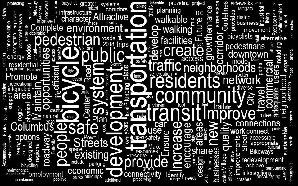
2016 Planning Conference July 26, CONNECT COLUMBUS Building Columbus Transportation Future
|
|
|
- Dennis Fowler
- 5 years ago
- Views:
Transcription


1 2016 Planning Conference July 26, 2016 CONNECT COLUMBUS Building Columbus Transportation Future

2 What Is Connect Columbus?

3 Project Process OUR PROCESS COMPLETE ONGOING
4 Discovery + Desire

5 Project Goals


6 Columbus in Context Columbus remains the largest city in the U.S. without any form of rail transportation.

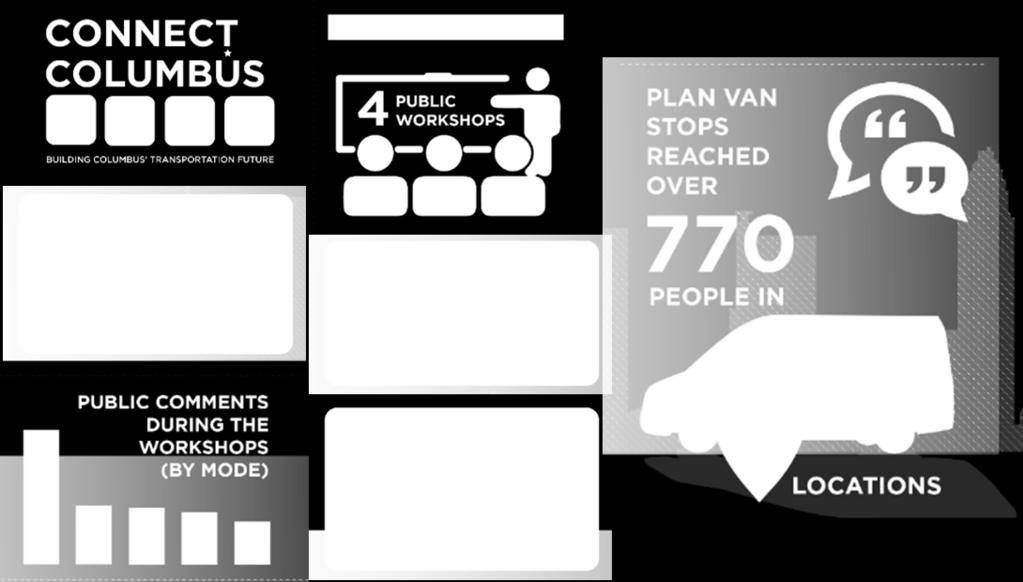
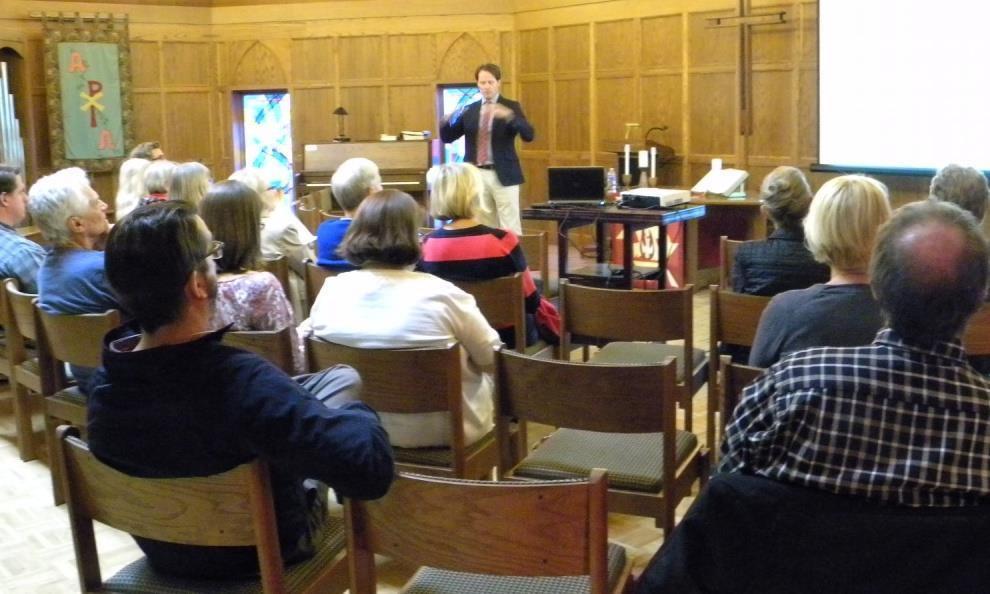
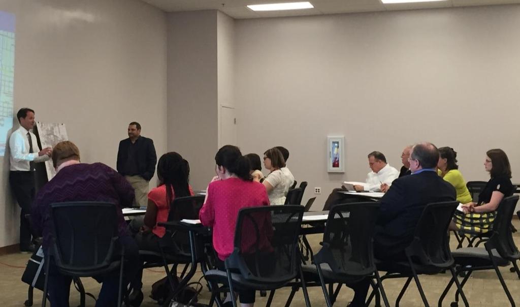
7 Ongoing Outreach

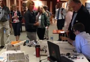
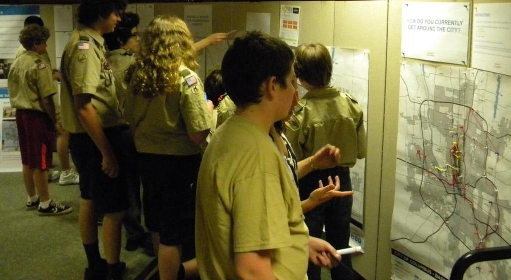
8 Week-Long Public Workshops

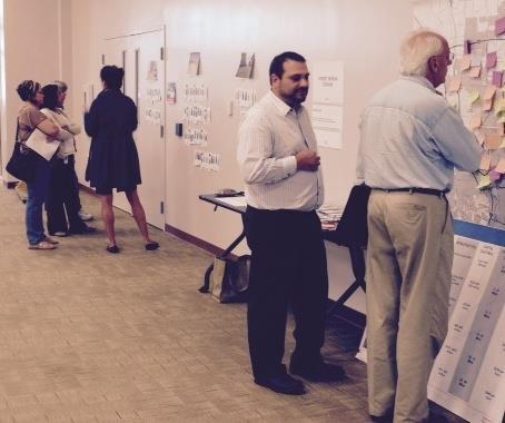
9 Week-Long Public Workshops

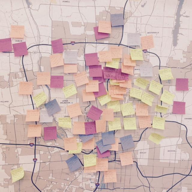
10 Week-Long Public Workshops
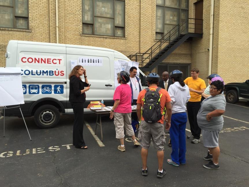
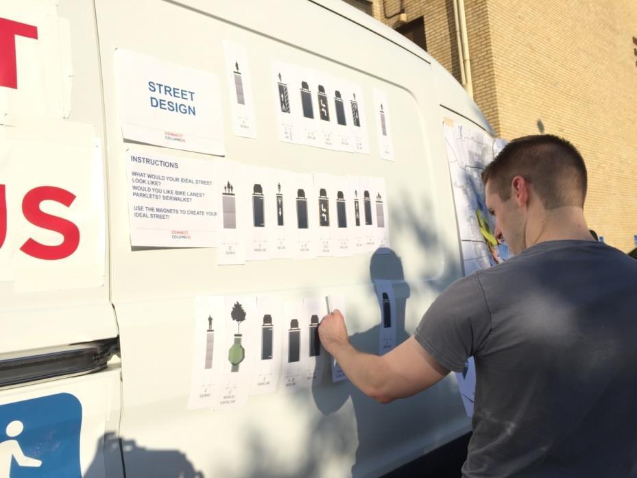

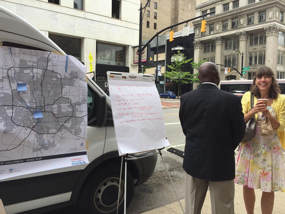
11 Plan Van
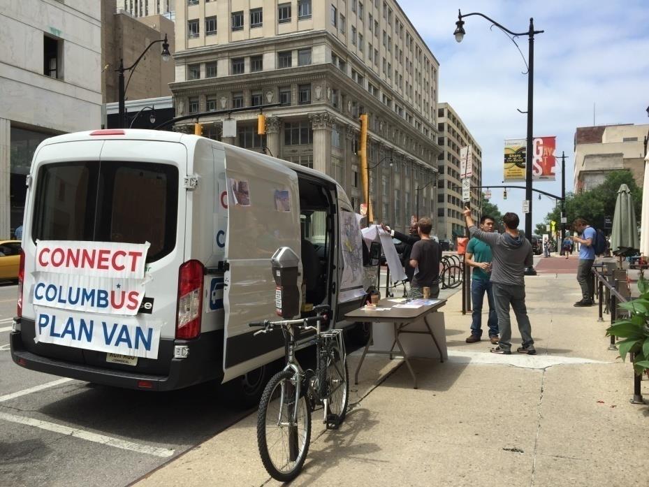
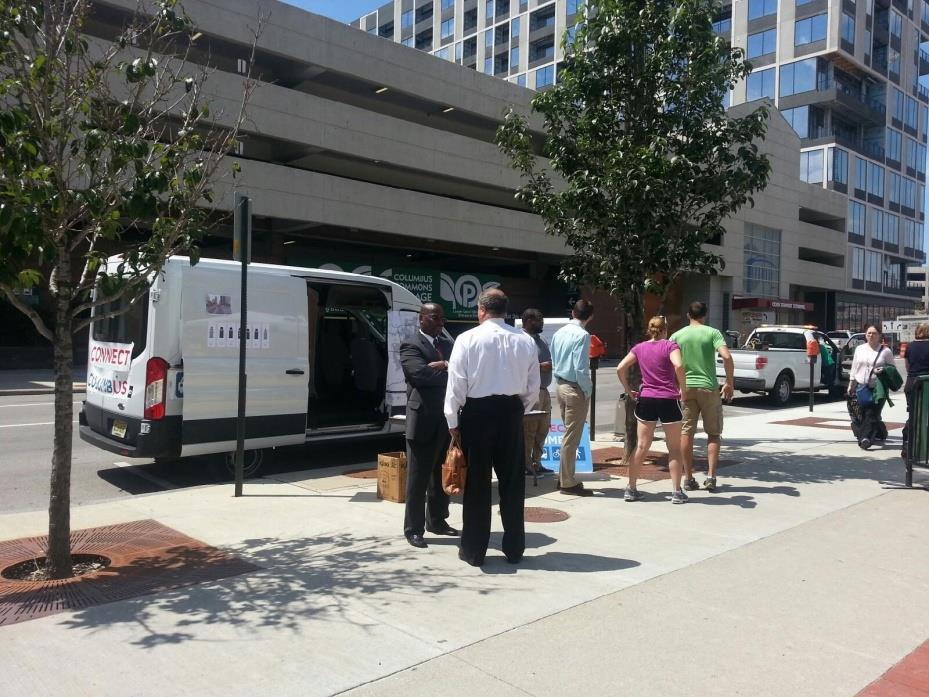

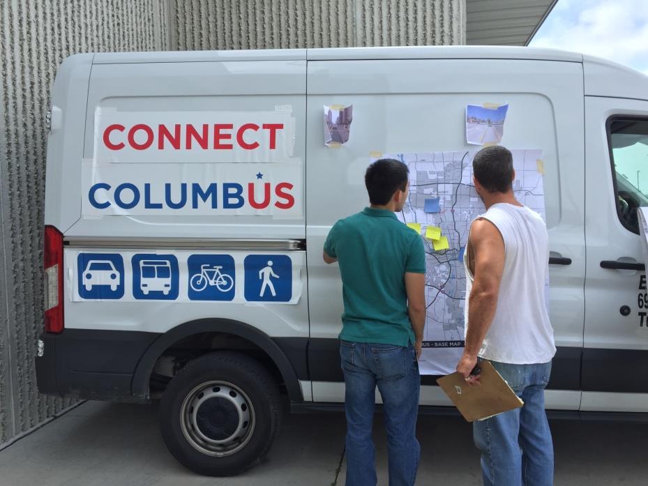
12 Plan Van

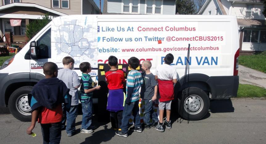

13 Plan Van John Burroughs Elementary


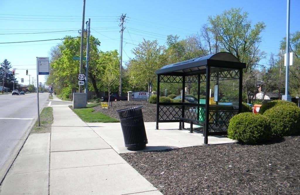
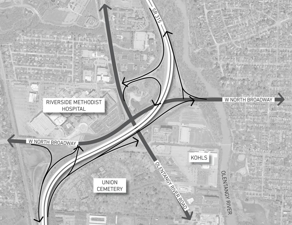
14 John Burroughs Elem. Student Suggestions


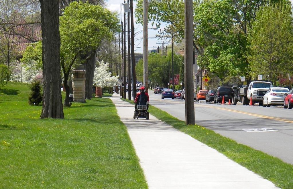
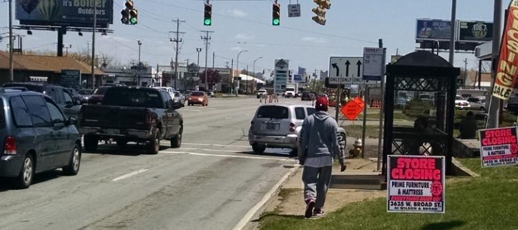
15 Boy Scouts Visit Workshop

16 Yay Bikes! Ride

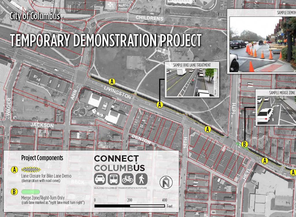
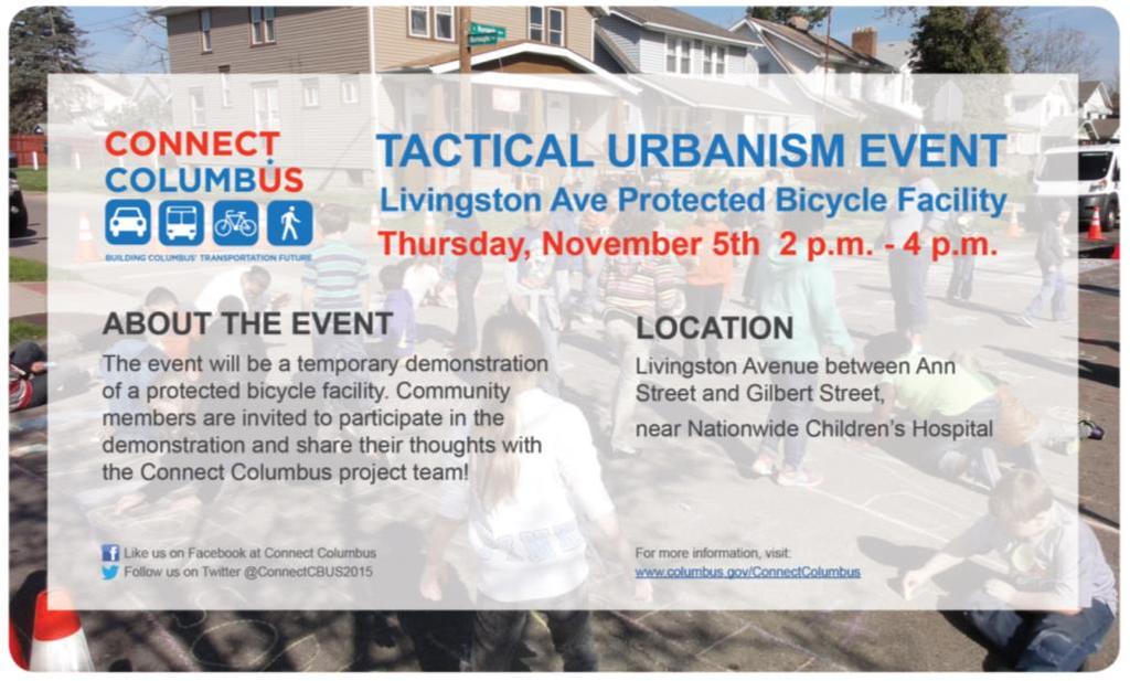
17 Tactical Urbanism Event
18 Household Trips 60% OF HOUSE- HOLD TRIPS ARE 5 MILES OR LESS IN LENGTH. Source: NHTSA 85% OF THESE ARE DRIVEN A DISTANCE THAT IS EASILY VIABLE BY BICYCLE, TRANSIT OR WALK. 1IN 6 HOUSEHOLD Source: NHTSA TRIPS ARE COMMUTE TRIPS Source: AASHTO
19 Comfortable Travel Distances Auto 5 to 50 miles Local Bus 1 to 8 miles 12.3 miles 5 miles Bike 1 to 5 miles 1 mile Walk 0 to 1


20 Prerequisites for Viable Options


21 Protected Crossing Broad Street Protected Crossing on Broad Street

22 Walking in Columbus


23 Walking in Columbus Hilltop German Village Hilltop German Village
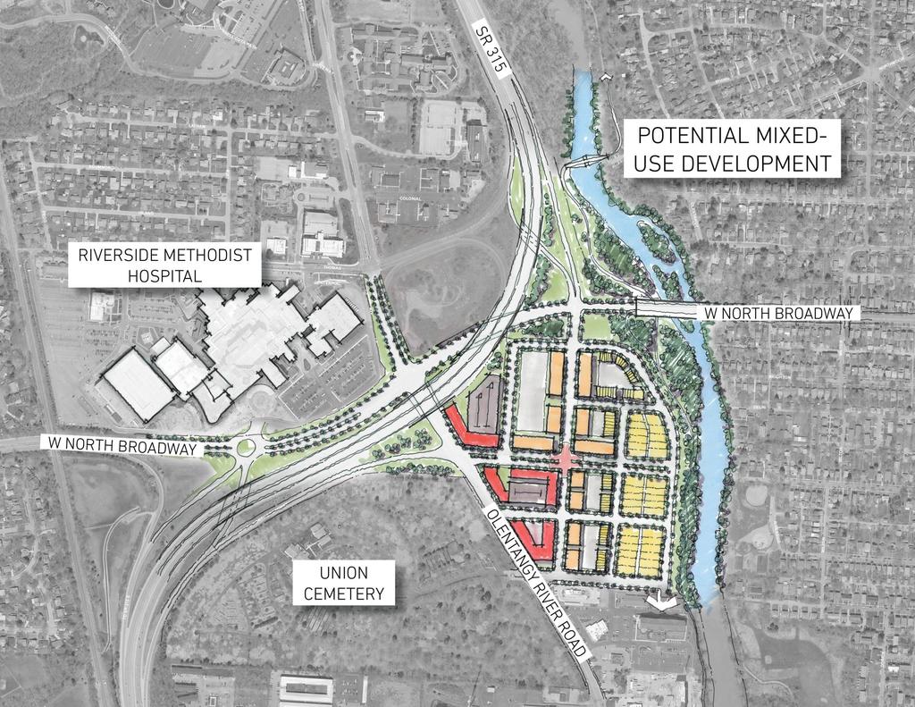
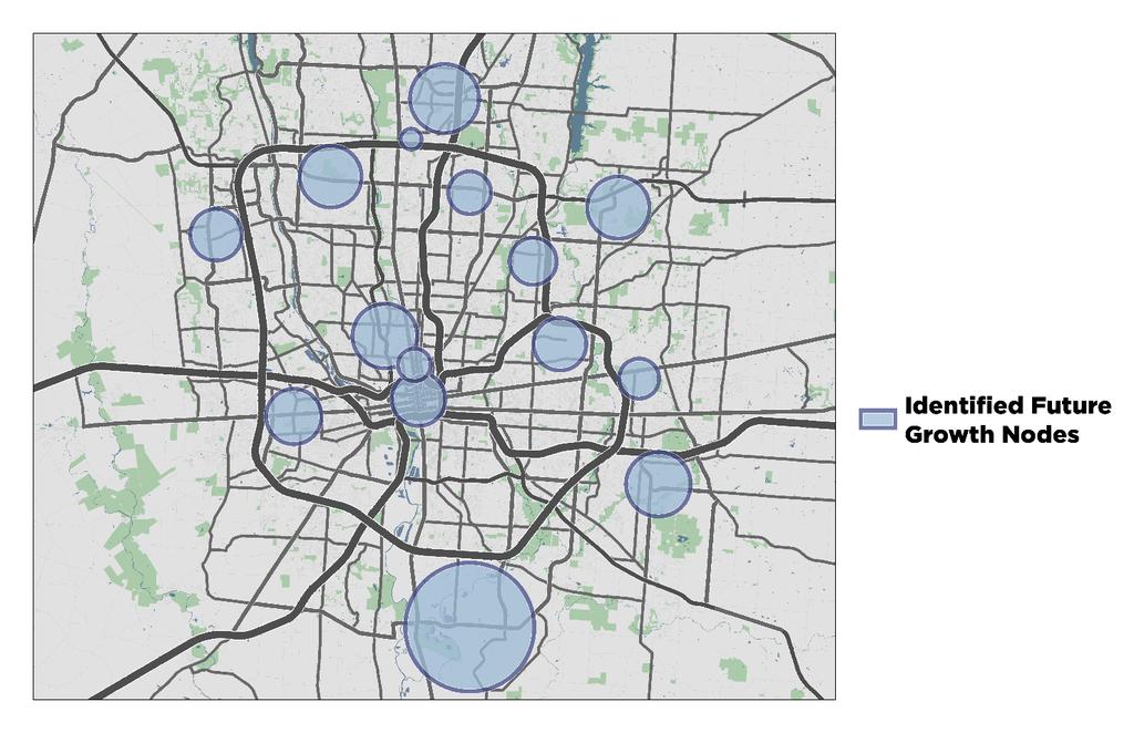
24 POTENTIAL REDEVELOPMENT
25

26
27
28 Design

29 What Decisions Must We Make? Do We Need More Money To Reach Our Goals? Should We Be Spending The Money We Already Have Differently? How Important Are Bike Facilities? Premium Transit Projects? Should We Have Policies and Incentives That Discourage Driving?


30 The Connect Columbus Scenarios TREND SCENARIO INFILL SCENARIO Growth and investment continues as usual Emphasis on roadway widening projects Strain on existing resources Growth and investment is concentrated in compact regional centers Emphasis on premium transit, bicycle facilities, and creating walkable cores More efficient use of existing resources
31 Rethinking Growth

32 What Can We Learn? Are Congestion + Air Quality Better or Worse? Where Does Transit Perform Best? Are Compact Land Use Policies Worth the Sacrifice?
33 Document
34 City Plans
35 City Plans


36 Urban Form in Columbus Urban Core / Downtown General Urban Suburban
37 City Plans
38 Transportation Functional Emphasis CHARACTERISTIC Mobility Street Transition Street Access Street DESCRIPTION DRIVEWAYS MINIMUM TRANSIT STOP SPACING Priority is facilitating traffic flow Discouraged Serves combination of traffic flow and providing access Allowed; must be approved feet Focus on providing access and connections Expected 750 feet (if applicable) Transit Priority Street 1250 feet - - Non-Priority Street 750 feet - - VERTICAL STREETSCAPE ELEMENTS Allowed, depending on frontage context Required Allowed, depending on frontage context LOADING AND DELIVERIES Discouraged; must be managed Allowed; must be managed Allowed; must be managed
39 Transportation Functional Emphasis Mobility Street Function vs. Access Driveways on Mobility Street Threshold LOW Analysis/Mitigation HIGH Access Transition Access Mobility
40 Transportation Functional Emphasis Mobility Street Function vs. Access Driveways on Access Street Threshold HIGH Analysis/Mitigation LOW Access Transition Access Mobility


41 TIS Standards/Access Management Mitigation Required If vehicle LOS D May require road widening - May not be feasible Transportation Benefits Bicycle Improvements Parking Management Transportation Demand Management Network Connections Roadway Capacity Improvements Transit projects Traffic Calming


42 Multimodal Thoroughfare Plan Where information comes together for implementation Map of Columbus networks Update to the previous plan Includes: Right of Way widths Functional classification Modal priority
43 THANK YOU
San Jose Transportation Policy
 San Jose Transportation Policy Protected Intersections in LOS Policies to Support Smart Growth Presented by: Manuel Pineda City of San Jose Department of Transportation Bay Area Map San Francisco Oakland
Measuring and Communicating Mobility:
 Measuring and Communicating Mobility: The District Mobility Project Stephanie Dock, District Department of Transportation TRB Transportation Issues in Major Cities Committee May 2, 2017 Deconstructing
Mobility and Congestion
 Technical Memorandum Mobility and Congestion Prepared for: Prepared by: September 25, 2013 1 Table of Contents 1. Introduction... 1 2. Congestion Forecasting Process... 1 2.1 Mobility and Congestion Terms...
How To Encourage More Efficient Transportation in Brazilian Cities
 How To Encourage More Efficient Transportation in Brazilian Cities Todd Litman Victoria Transport Policy Institute Presented Seminar on Discouraging The Use Of Cars São Paulo, Brazil 3 September 2013 Creating
modes, the increased roadway capacity is the implied solution, which, in turn, has been shown to lead to more driving (induced demand).
.") EXECUTIVE SUMMARY A. Introduction The San Francisco Congestion Management Program (CMP) is a biennial program conducted in accordance with state law to monitor congestion and adopt plans for mitigating
EXECUTIVE SUMMARY A. Introduction The San Francisco Congestion Management Program (CMP) is a biennial program conducted in accordance with state law to monitor congestion and adopt plans for mitigating
ROADSOADS CONGESTION HAMPTON SYSTEMYSTEM MANAGEMENT. Part II Roadway Congestion Analysis Mitigation Strategies and Evaluation
 HAMPTON ROADSOADS CONGESTION MANAGEMENT SYSTEMYSTEM Part II Roadway Congestion Analysis Mitigation Strategies and Evaluation Presented by: Dwight Farmer, PE Deputy Executive Director, Transportation April
MASTER BICYCLE AND PEDESTRIAN PLAN
 VILLAGE OF NORTHBROOK MASTER BICYCLE AND PEDESTRIAN PLAN DRAFT PLAN OPEN HOUSE May 2, 2018 AGENDA 1. Community Engagement 2. Vision and Goals 3. General Structure of Plan 4. Recommendations Overview 5.
Stakeholder Meeting Handouts. January 2013
 January 2013 Stakeholder Meeting Handouts The Case FOR Parking Minimum Requirements Reduce street congestion around the development site Avoid parking spillover Create orderly development patterns Anticipate
MAYFIELD ROAD CORRIDOR MULTIMODAL TRANSPORTATION PLAN. Public Workshop
 MAYFIELD ROAD CORRIDOR MULTIMODAL TRANSPORTATION PLAN Public Workshop 06.06.18 AGENDA Project Process & Schedule Document Review Summary Project Goals Initial Findings Concept Development Next Steps PROJECT
ACTIVE TRANSPORTATION
 ACTIVE TRANSPORTATION Mobility 2040 Supported Goals Improve the availability of transportation options for people and goods. Support travel efficiency measures and system enhancements targeted at congestion
Broward Boulevard Gateway Implementation Project, Downtown Walkability Analysis, & Joint Development Initiative (JDI)
") Broward Boulevard Gateway Implementation Project, Downtown Walkability Analysis, & Joint Development Initiative (JDI) City of Fort Lauderdale ~ Commission Conference July 10, 2012 Page 1 of 15 A Multi-Agency
Broward Boulevard Gateway Implementation Project, Downtown Walkability Analysis, & Joint Development Initiative (JDI) City of Fort Lauderdale ~ Commission Conference July 10, 2012 Page 1 of 15 A Multi-Agency
In station areas, new pedestrian links can increase network connectivity and provide direct access to stations.
 The Last Mile Planning for Pedestrians Planning around stations will put pedestrians first. Making walking to stations safe and easy is important; walking will be a part of every rapid transit Accessible
and Rural Multimodal Networks 2017 ALTA PLANNING + DESIGN
 Small Town and Rural Multimodal Networks 2017 ALTA PLANNING + DESIGN SMALL TOWN AND RURAL MULTIMODAL NETWORKS GUIDE Why a Rural and Small Town Focused Guide? ONE SIZE DOES NOT FIT ALL. The new FHWA-endorsed
Access BART: TOD and Improved Connections. October 29, 2008
 Access BART: TOD and Improved Connections October 29, 2008 1 Access BART Study Goals Evaluate at the system-level land use and access scenarios to optimize ridership Identify station clusters that provide
Paoli Road Improvement Feasibility Study
 Paoli Road Improvement Feasibility Study & Public Participation Project March 24, 2015 Prepared for: Tredyffrin Township Prepared by: McMahon Associates, Inc. with Town Planning Partnership, LLC Glackin
City of Wausau Wausau Center Urban Design and Transportation Master Plan. Design Workshop // October 18, 2018
 City of Wausau Wausau Center Urban Design and Transportation Master Plan Design Workshop // October 18, 2018 Design Workshops // October 15-18 Workshop Study Evaluate circulation and parking patterns around
Regional Transportation Needs Within Southeastern Wisconsin
 Regional Transportation Needs Within Southeastern Wisconsin #118274 May 24, 2006 1 Introduction The Southeastern Wisconsin Regional Planning Commission (SEWRPC) is the official areawide planning agency
CITY OF COCOA BEACH 2025 COMPREHENSIVE PLAN. Section VIII Mobility Element Goals, Objectives, and Policies
 CITY OF COCOA BEACH 2025 COMPREHENSIVE PLAN Section VIII Mobility Element Goals, Objectives, and Policies Adopted August 6, 2015 by Ordinance No. 1591 VIII MOBILITY ELEMENT Table of Contents Page Number
Develop a Multi-Modal Transportation Strategy (Theme 6)
") DEVELOP A MULTI-MODAL TRANSPORTATION STRATEGY (THEME 6) WHY IS THIS THEME ADDRESSED? Develop a Multi-Modal Transportation Strategy (Theme 6) Statement of Ideal Reduce resident and visitor reliance on single
DEVELOP A MULTI-MODAL TRANSPORTATION STRATEGY (THEME 6) WHY IS THIS THEME ADDRESSED? Develop a Multi-Modal Transportation Strategy (Theme 6) Statement of Ideal Reduce resident and visitor reliance on single
VISION Long Range Plan Update Board Workshop. February 10, 2016
 VISION 2040 Long Range Plan Update Board Workshop February 10, 2016 Vision 2040 Key Milestones UNDERSTAND THE NEED IDENTIFY A RANGE OF OPTIONS EVALUATE COMMUNITY OPTIONS DEFINE PROJECTS & PLANS Vision
Building Community Partnerships for Mobility:
 Building Community Partnerships for Mobility: San Francisco 2008 Presented by: Cynthia Hoyle, AICP Transportation Planning Consultant Champaign-Urbana Mass Transit District Background The Heartland Champaign-Urbana,
West Village Mobility & Integration
 West Village Mobility & Integration PRESENTED TO TOPCA Town Hall November 9, 2017 [7189-21] Port Credit 2 West Village + Mobility AWalkable Community A CompleteCommunity A SustainableCommunity 3 Mobility
T1-A - Service Reduction (Re-sizing)
") Key T1-A Choice A Key T1-B Choice B Key T1-C Choice C Key T1-D Choice D Key T1-E Choice E Key T1-F Choice F Key Choice G T2 T1-A - Service Reduction (Re-sizing) Description This key choice would represent
Key T1-A Choice A Key T1-B Choice B Key T1-C Choice C Key T1-D Choice D Key T1-E Choice E Key T1-F Choice F Key Choice G T2 T1-A - Service Reduction (Re-sizing) Description This key choice would represent
Chapter 2. Bellingham Bicycle Master Plan Chapter 2: Policies and Actions
 Chapter 2 Bellingham Bicycle Master Plan Chapter 2: Policies and Actions Chapter 2: Policies and Actions The Bicycle Master Plan provides a road map for making bicycling in Bellingham a viable transportation
Sacramento Grid 2.0. The Downtown Transportation Study
 Sacramento Grid 2.0 The Downtown Transportation Study April 20, 2016 The Grid 4.25 square miles Street grid defined at birth of City Lettered and numbered streets spaced every 400 ft East-west alleys halfway
We believe the following comments and suggestions can help the department meet those goals.
 The Honorable Secretary Anthony Foxx The Secretary of Transportation United States Department of Transportation 1200 New Jersey Avenue, SE Washington, DC 20590 August 30, 2013 Dear Secretary Foxx, Thank
Moving Cambridge. City of Cambridge Transportation Master Plan Public Consultation Centre. March 7, :00 8:00 PM.
 City of Cambridge Transportation Master Plan Public Consultation Centre March 7, 2018 5:00 8:00 PM Region of Waterloo City of Cambridge Transportation Master Plan Public Consultation Centre March 7, 2018
Hamilton Transportation Master Plan Public Consultation. Public Information Centre One Summary
 Hamilton Transportation Master Plan Public Consultation Public Information Centre One Summary Table of Contents Introduction 1 Purpose 2 What Was Presented 2 Who Came to the Meeting 2 The Breakout Sessions
Chapter 7. Transportation. Transportation Road Network Plan Transit Cyclists Pedestrians Multi-Use and Equestrian Trails
 Chapter 7 Transportation Transportation Road Network Plan Transit Cyclists Pedestrians Multi-Use and Equestrian Trails 7.1 TRANSPORTATION BACKGROUND The District of Maple Ridge faces a number of unique
City of Hamilton s Transportation Master Plan (TMP) Public Consultation 3 December 2015
 Public Consultation 3 December 2015") City of Hamilton s Transportation Master Plan (TMP) Public Consultation 3 December 2015 McPhail Transportation Planning Services Ltd. AGENDA 6:00 7:00 pm Viewing Boards / Q & A with the Team 7:00 7:50
City of Hamilton s Transportation Master Plan (TMP) Public Consultation 3 December 2015 McPhail Transportation Planning Services Ltd. AGENDA 6:00 7:00 pm Viewing Boards / Q & A with the Team 7:00 7:50
Public Consultation Centre
 Region of Waterloo Transportation Master Plan Update Public Consultation Centre See the Information Package on how to contact the Project Team and complete the Comment Sheet www.regionofwaterloo.ca/en/exploring-the-region/transportation-master-plan.aspx
WELCOME. City of Greater Sudbury. Transportation Demand Management Plan
 WELCOME City of Greater Sudbury Transportation Demand Management Plan Public Consultation Session St. Andrew s Place, Activity Hall 111 Larch Street Wednesday September 13, 2017 6:00 to 8:00 pm Welcome
Moving Towards Complete Streets MMLOS Applications
 Moving Towards Complete Streets MMLOS Applications Transportation Education Series May 18 th, 2012 It s not just for cars! Presentation Overview The Complete Streets Movement What is Multi-Modal Level
Clackamas County Comprehensive Plan
 ROADWAYS The County s road system permits the movement of goods and people between communities and regions, using any of a variety of modes of travel. Roads provide access to virtually all property. They
WHAT CAN WE DO? SECTION 6
 WHAT CAN WE DO? SECTION 6 SATOMORROW MLTIMODAL TRANSPORTATION PLAN THE MLTIMODAL TRANSPORTATION PLAN What is a Multimodal Transportation Plan? The SA Tomorrow Multimodal Transportation Plan is the first
City of Novi Non-Motorized Master Plan 2011 Executive Summary
 City of Novi Non-Motorized Master Plan 2011 Executive Summary Prepared by: February 28, 2011 Why Plan? Encouraging healthy, active lifestyles through pathway and sidewalk connectivity has been a focus
TRANSPORTATION TRAINING TOPICS. April 6, 2010
 TRANSPORTATION TRAINING TOPICS April 6, 2010 Roles of Transportation Providers Context and Policy Makers Division of Transportation and Traffic Other City Operations Other Transportation Operators CMA
Ann Arbor Downtown Street Plan
 1 Ann Arbor Downtown Street Plan Public Workshop #1 We know that. 2 Public right-of-way (streets, sidewalks, and alleys) make up 30% of the total District area of downtown. Streets need to provide mobility
HARRISON STREET/OAKLAND AVENUE COMMUNITY TRANSPORTATION PLAN
 HARRISON STREET/OAKLAND AVENUE Community Workshop #4: Draft Plan Review December 3, 2009 D E S I G N, C O M M U N I T Y & E N V I R O N M E N T INTRODUCTIONS Key Project Staff: Alisa Shen, Project Manager,
Kauaʻi Multimodal Land Transportation Plan. County Council Workshop
 Kauaʻi Multimodal Land Transportation Plan County Council Workshop September 20, 2012 Meeting Plan Project Background Plan Development Process Plan Overview Recommended Action 2 Project Background 3 Project
Balboa Area Transportation Demand Management
 Balboa Area Transportation Demand Management April 2016 Presented by: Jeff Tumlin What Are We Aiming For? Transportation is not an end in itself. It is merely a means by which we support the community.
 Time of Change We Are Growing We Are An Attractive Place To Live We Are Age Diverse + Living Longer 50000 40000 30000 20000 10000 0 2010 Census Job Density Housing Sheds Transit Sheds The Project FUNDING
Martha Coello, Fairfax County DOT Jeffrey Hermann, Fairfax County DOT Abi Lerner, VDOT. May 19, 2014
 Traforming Tyso From An Auto Oriented Activity Center Into a Multi-Modal Center Martha Coello, Fairfax County DOT Jeffrey Hermann, Fairfax County DOT Abi Lerner, VDOT May 19, 2014 2 11 miles to Dulles
Solana Beach Comprehensive Active Transportation Strategy (CATS)
") Solana Beach Comprehensive Active Transportation Strategy (CATS) 3.0 Goals & Policies The Solana Beach CATS goals and objectives outlined below were largely drawn from the Solana Beach Circulation Element
Solana Beach Comprehensive Active Transportation Strategy (CATS) 3.0 Goals & Policies The Solana Beach CATS goals and objectives outlined below were largely drawn from the Solana Beach Circulation Element
Project Kickoff Meeting February 15, 2018
 Project Kickoff Meeting February 15, 2018 Scope of Work: Study Area Project Goals Develop traffic calming alternatives to the Vine Street local right of way, to mitigate speeding. Develop concept plans
APPENDIX B. TDM Existing Conditions
 APPENDIX B TDM Existing Conditions SCARBOROUGH CENTRE TMP TRANSPORTATION DEMAND MANAGEMENT INTRODUCTION Scarborough Centre has grown into a mixed-use hub for population, transportation, and employment
Improving Pedestrian Access to Transit: The Sacramento Pedestrian Master Plan
 Improving Pedestrian Access to Transit: The Sacramento Pedestrian Master Plan Matt Haynes Fehr & Peers Associates San Francisco, California Rail~Volution 2005 Presentation Outline Policies What are most
Evolution of urban transport policies: International comparisons
 Centre for Transport Studies Evolution of urban transport policies: International comparisons Prof Peter Jones Centre for Transport Studies, UCL Presentation to the IATSS GIFTS Workshop, November 2015
Chapter 5 Future Transportation
 Chapter 5 Future Transportation The Future Land Use Plan identifies the desired land use designations. The land uses desired for Crozet depend, in large part, on the success of the transportation system,
Providing an Efficient and Multi-modal Transportation System
 Providing an Efficient and Multi-modal Transportation System Welcome and Introductions The Plan Process Transportation Overview Workshop Discussions Report Out and Next Steps AGENDA Comprehensive Plan
Exhibit 1 PLANNING COMMISSION AGENDA ITEM
 Exhibit 1 PLANNING COMMISSION AGENDA ITEM Project Name: Grand Junction Circulation Plan Grand Junction Complete Streets Policy Applicant: City of Grand Junction Representative: David Thornton Address:
Community Transportation Plan Acknowledgements
 Community Transportation Plan Acknowledgements The Decatur CTP was developed with participation and guidance from City of Decatur staff, its Resident Boards and Commissions, and numerous residents, business
TRANSPORTATION ASSESSMENT
 TRANSPORTATION ASSESSMENT Traffic Modeling The mobility findings analysis for Dallas was based on the methodology of the North Central Texas Council of Government s Regional travel demand model. This model
BUILDING THE CASE FOR TRAVEL OPTIONS IN WASHING TON COUNTY. Image: Steve Morgan. Image: Steve Morgan
 BUILDING THE CASE FOR TRAVEL OPTIONS IN WASHING TON COUNTY Image: Steve Morgan Image: Steve Morgan Image: TriMet Image: TriMet WHAT ARE TRAVEL OPTIONS PROGRAMS? Travel options programs encourage residents,
Executive Summary Route 30 Corridor Master Plan
 Route Corridor Master Plan Project Overview The Route Corridor Master Plan is a coordinated multimodal transportation and land use plan for the entire stretch of Route through East Whiteland Township,
CONNECTING PEOPLE TO PLACES
 CONNECTING PEOPLE TO PLACES 82 EAST BENCH MASTER PLAN 07 Introduction The East Bench transportation system is a collection of slow moving, treelined residential streets and major arteries that are the
Transportation Mobility Element
 Transportation Mobility Element Goals, OVERALL GOAL: ESTABLISH A TRANSPORTATION SYSTEM THAT ENHANCES COMPACT DEVELOPMENT, REDEVELOPMENT, AND QUALITY OF LIFE, THAT IS SENSITIVE TO CULTURAL AND ENVIRONMENTAL
5/31/2016 VIA . Arwen Wacht City of Sacramento Community Development Department 300 Richards Blvd., 3 rd Floor Sacramento, CA 95811
 5/31/2016 VIA EMAIL Arwen Wacht City of Sacramento Community Development Department 300 Richards Blvd., 3 rd Floor Sacramento, CA 95811 RE: El Pollo Loco (P16-028) Dear Ms. Wacht: WALKSacramento has reviewed
2025 Comprehensive Plan for the City of Temple Terrace Florida. Mobility Element. Adopted by City Council June 30, 2009
 2025 Comprehensive Plan for the City of Temple Terrace Florida Mobility Element Adopted by City Council June 30, 2009 Effective Date September 22, 2009 GOAL 2: To protect and promote the quality of life
Cities Connect. Cities Connect! How Urbanity Supports Social Inclusion
 Cities Connect! How Urbanity Supports Social Inclusion Todd Litman Victoria Transport Policy Institute Metropolis Toronto, Canada - 14 June 2006 Cities Connect People with people. People with jobs. People
Circulation in Elk Grove includes: Motor vehicles, including cars and trucks
 Circulation, as it is used in this General Plan, refers to the many ways people and goods move from place to place in Elk Grove and the region. Circulation in Elk Grove includes: Motor vehicles, including
Draft MOBILITY ELEMENET. Community Meeting May 22, 2013
 Draft MOBILITY ELEMENET Community Meeting May 22, 2013 Agenda Presentation Ira Brown New Mobility Paradigm Movement of People Implementation Q&A Ira Brown and Dave Roseman Small Group Discussion at Each
Gerald Ollivier Lead Transport Specialist World Bank, New Delhi. Transforming Cities through Integrated Planning Corridor Scale
 Gerald Ollivier Lead Transport Specialist World Bank, New Delhi Transforming Cities through Integrated Planning Corridor Scale JOB ACCESSIBILITY: ZHENGZHOU A: LINE 1, 2, AND 3 AND WALKING: 12% B. SCENARIO
Multi-Modal Transportation Programs
 Multi-Modal Transportation Programs Supporting the Lawrence Strategic Plan Critical Success Factors: Safe, Healthy and Welcoming Neighborhoods Innovative Infrastructure & Asset Management Effective Governance
Developing a Birmingham Transport Space Allocation policy. David Harris Transport Policy Manager Economy Directorate Birmingham City Council
 Developing a Birmingham Transport Space Allocation policy David Harris Transport Policy Manager Economy Directorate Birmingham City Council Birmingham s Sustainable Urban Mobility Plan Birmingham Connected
Exceeding expectations: The growth of walking in Vancouver and creating a more walkable city in the future through EcoDensity
 Exceeding expectations: The growth of walking in Vancouver and creating a more walkable city in the future through EcoDensity Melina Scholefield, P. Eng. Manager, Sustainability Group, City of Vancouver
modes, the increased roadway capacity is the implied solution, which, in turn, has been shown to lead to more driving (induced demand).
.") CONGESTION MANAGEMEN T PROGRAM DECEMBER, 201 7 EXECUTIVE SUMMARY A. Introduction Every two years, the San Francisco County Transportation Authority (SFCTA) prepares the San Francisco Congestion Management
CONGESTION MANAGEMEN T PROGRAM DECEMBER, 201 7 EXECUTIVE SUMMARY A. Introduction Every two years, the San Francisco County Transportation Authority (SFCTA) prepares the San Francisco Congestion Management
Why are we still talking about Complete Streets?
 Why are we still talking about Complete Streets? Jeremy R. Klop, AICP Complete Streets and Capital Projects Session March 1, 2013 Public Works Officers Institute League of California Cities Conference,
CITY OF BLOOMINGTON COMPLETE STREETS POLICY
 CITY OF BLOOMINGTON COMPLETE STREETS POLICY POLICY OBJECTIVE: The City of Bloomington will enhance safety, mobility, accessibility and convenience for transportation network users of all ages and abilities,
FHWA s Strategic Agenda for Pedestrian and Bicycle Transportation. Purdue Road School March 8, 2017
 FHWA s Strategic Agenda for Pedestrian and Bicycle Transportation Purdue Road School March 8, 2017 1 Strategic Agenda for Pedestrian and Bicycle Transportation Provides a framework for organizing FHWA
Berkeley Strategic Transportation Plan A-76
 Berkeley Strategic Transportation Plan A-76 Appendices 1. A Team Effort 2. Where We ve Been A-11 Berkeley Strategic Transportation Plan Alameda County Transportation Plan Alameda County will be served
Tulsa Metropolitan Area LONG RANGE TRANSPORTATION PLAN
 Tulsa Metropolitan Area LONG RANGE TRANSPORTATION PLAN Indian Nations Council of Governments August 2005 CONTACTING INCOG In developing the Destination 2030 Long Range Transportation Plan, INCOG s Transportation
Appendix C 3. Bicycle / Pedestrian Planning
 Appendix C 3. Bicycle / Pedestrian Planning BICYCLE/PEDESTRIAN PLANNING 2005 Master Plan GOAL: Provide for safe and convenient bicycle and pedestrian circulation throughout the City. Develop a city-wide
October 29, Modern traffic mitigation for development in cities: Moving beyond LOS
 Modern traffic mitigation for development in cities: Moving beyond LOS October 29, 2018 Modern traffic mitigation for development in cities: Moving beyond LOS State Smart Transportation Initiative Practical
Rewriting the Playbook: Updating Traffic Engineering and Planning Manuals to Reflect Livability Principles
 Rewriting the Playbook: Updating Traffic Engineering and Planning Manuals to Reflect Livability Principles Reid Ewing Department of City and Metropolitan Planning University of Utah Probably Not the Right
2. TRANSPORTATION ELEMENT.
 2. TRANSPORTATION ELEMENT. The purpose of this element is to assist in establishing an adequate transportation system within the City and to plan for future motorized and non-motorized traffic circulation
Multimodal Through Corridors and Placemaking Corridors
 68 Multimodal Through Corridors and Placemaking Corridors Corridors have different functions in a region. Some corridors are used to get smoothly and rapidly through a region or to get quickly to major
Kitchener Integrated Transportation Master Plan
 Final Report Kitchener Integrated Transportation Master Plan TRANSPORTATION S ROLE IN A COMPLETE AND HEALTHY KITCHENER June 2013 Table of Contents Executive Summary: Implementation Measures... 1 1. Travel
Community Task Force March 14, 2018
 Community Task Force March 14, 2018 Welcome and Introductions Project Partners Regional Transportation District (RTD) City of Aurora Colorado Department of Transportation (CDOT) Denver Regional Council
5/7/2013 VIA . RE: University Village Safeway Expansion (P13-019)
") 5/7/2013 VIA EMAIL David Hung, Associate Planner Community Development Department, Current Planning Division City of Sacramento 300 Richards Boulevard, 3 rd Floor Sacramento, CA 95811 RE: University Village
5/7/2013 VIA EMAIL David Hung, Associate Planner Community Development Department, Current Planning Division City of Sacramento 300 Richards Boulevard, 3 rd Floor Sacramento, CA 95811 RE: University Village
CONTEXT SENSITIVE STREETS STANDARDS COMMITTEE
 CONTEXT SENSITIVE STREETS STANDARDS COMMITTEE February 23, 2015 Prepared by: Denise Chaplick, AICP City Jacksonville Bicycle and Pedestrian Coordinator Source: NCDOT Complete Streets Planning and Design
Bus Rapid Transit Plans
 Twin Cities Region Bus Rapid Transit Plans ULI Minnesota Workshop Connecting Bus Rapid Transit to the Community December 15, 2009 John Levin Director of Service Development Metro Transit Metropolitan Area
ATTACHMENT 4 - TDM Checklist. TDM Checklist Overview
 ATTACHMENT 4 - TDM Checklist TDM Checklist Overview The proposed checklist rates developments on the degree to which they are TDM and transit supportive. Points are assigned based on the level of transit
3.1 Introduction and Purpose
 3Transportation and Circulation Element City of Woodland General Plan 2035 3.1 Introduction and Purpose Mobility and accessibility are important aspects of the City of Woodland s small-town character.
Appendix T 1: Additional Supporting Data
 Appendix T 1: Additional Supporting Data Project Delivery Delays with the implementation of the 2000 TIP became apparent early in the decade. In response to direction among policy officials, ARC began
Classification Criteria
 SCHEDULE D TO RECOMMENDED OFFICIAL PLAN AMENDMENT NO. 40 SCHEDULE C-4 Road Criteria Criteria Traffic Service Objective Land Service/Access Typical Daily Traffic Volume Flow characteristics Travel Speed
complete streets design and construction standards public primer City of Edmonton
 complete streets design and construction standards public primer City of Edmonton introduction Complete Streets are streets for everyone: people who walk, wheel, bike, take transit, or drive. They are
Physical Implications of Complete Streets Policies
 Presentation Overview Physical Implications of Complete Norm Cox, ASLA, LLA Landscape Architect Ann Arbor, Michigan, 10:45 to Noon What Are Complete Streets? What Matters to Bicyclists and Pedestrians
Transportation Master Plan Advisory Task Force
 Transportation Master Plan Advisory Task Force Network Alternatives & Phasing Strategy February 2016 BACKGROUND Table of Contents BACKGROUND Purpose & Introduction 2 Linking the TMP to Key Council Approved
Thank you for this opportunity to discuss with you how we can work together to make our streets more complete.
 Thank you for this opportunity to discuss with you how we can work together to make our streets more complete. 1 2 3 Thank you for this opportunity to discuss with you how we can work together to make
Road Diets: Reconfiguring Streets for Multi-Modal Travel
 Road Diets: Reconfiguring Streets for Multi-Modal Travel Tom Grant, P.E., PTOE What is a Road Diet? Reconfiguration of travel lanes to benefit all roadway users (i.e., Complete Street) Reclaiming the space
Planning Guidance in the 2012 AASHTO Bike Guide
 Planning Guidance in the 2012 AASHTO Bike Guide Presentation by: RJ Eldridge Peter Lagerwey August 22, 2012 WEBINAR 2: PLANNING GUIDANCE IN THE 2012 AASHTO BIKE GUIDE Today s Webinar Significant Updates
Item to be Addressed Checklist Consideration YES NO N/A Required Description Complete Streets Guidelines
 Passaic County Complete Streets Checklist - Concept Development Project Name Item to be Addressed Checklist Consideration YES NO N/A Required Description Complete Streets Guidelines Existing Plans Have
3/10/2016 VIA th Street, Suite 203 Sacramento, CA
 3/10/2016 VIA EMAIL Arwen Wacht, Associate Planner City of Sacramento Community Development Department 300 Richards Boulevard, 3 rd Floor Sacramento, CA 95811 RE: Natomas Fountains (P16-012) Dear Ms. Wacht:
Complete Streets: Policy Framework Complete Streets: Implementation Plans A more Complete Street: Laurier Bike Lane Pilot Project
 Complete Streets Initiatives City of Ottawa Complete Streets: Policy Framework Complete Streets: Implementation Plans A more Complete Street: Laurier Bike Lane Pilot Project Zlatko.Krstulic@Ottawa.ca May
Bellevue Transportation: Challenges, Opportunities and Priorities Bellevue Downtown Association September 20, 2018
 Bellevue Transportation: Challenges, Opportunities and Priorities Bellevue Downtown Association September 20, 2018 Dave Berg Transportation Director City of Bellevue Traffic, traffic and more traffic!
Report. Typical Sections. City of Middleton, WI
 Report Typical Sections City of Middleton, WI December 2006 Report for City of Middleton, Wisconsin Typical Sections repared by: Traffic Associates LLC and STRAND ASSOCIATES, INC. 910 West Wingra Drive
 MEMORANDUM - CITY OF PASADENA Department Of Transportation DATE: OCTOBER 21, 2008 TO: ENVIRONMENTAL ADVISORY COMMISSION FROM: ~ FRED C. DOCK, DIRECTOR OF TRANSPORTATION SUBJECT: UPDATE ON DEPT. OF TRANSPORTATION
2014 Wisconsin Tribal Transportation Conference. Matt Halada Transportation Planner NE Region
 2014 Wisconsin Tribal Transportation Conference Matt Halada Transportation Planner NE Region Implementing Wisconsin s Pedestrian and Bicycle Accommodations Law (Complete Streets) Tools and methods for
Brian D. Hare, P.E. Bureau of Design PennDOT PA APA Annual Conference Investing in a Sustainable Future October 5, 2009
 Brian D. Hare, P.E. Bureau of Design PennDOT 2009 PA APA Annual Conference Investing in a Sustainable Future October 5, 2009 1 What is Smart Transportation? Photographer: heyjude. Used through license