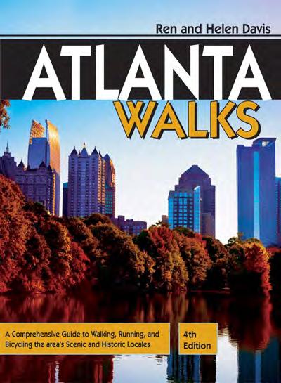
4th Edition. Atlanta Walks
|
|
|
- Sophie Kathleen Barrett
- 6 years ago
- Views:
Transcription
1
2 4th Edition Atlanta Walks
3
4 4th Edition Atlanta Walks A Comprehensive Guide to Walking, Running, and Bicycling the Area s Scenic and Historic Locales Ren and Helen Davis
5 Published by PEACHTREE PUBLISHERS 1700 Chattahoochee Avenue Atlanta, Georgia Copyright 1988, 1993, 1998, 2003, 2011 by Render S. Davis and Helen E. Davis All photos 1998, 2003, 2011 by Render S. Davis and Helen E. Davis All rights reserved. No part of this publication may be reproduced, stored in a retrieval system, or transmitted in any form or by any means electronic, mechanical, photocopy, recording, or any other except for brief quotations in printed reviews, without prior permission of the publisher. This book is a revised edition of Atlanta s Urban Trails.Vol. 1, City Tours.Vol. 2, Country Tours. Atlanta: Susan Hunter Publishing, Maps by Twin Studios and XNR Productions Book design by Loraine M. Joyner Cover design by Maureen Withee Composition by Robin Sherman Fourth Edition Manufactured in August 2011 in Harrisonburg, Virgina, by RR Donnelley & Sons in the United States of America Library of Congress Cataloging in Publication Data Davis, Ren, Atlanta walks : a comprehensive guide to walking, running, and bicycling the area s scenic and historic locales / written by Ren and Helen Davis. -- 4th ed. p. cm. Includes bibliographical references and index. ISBN (alk. paper) 1. Atlanta (Ga.)--Tours. 2. Atlanta Region (Ga.)--Tours. 3. Walking--Georgia--Atlanta-- Guidebooks. 4. Walking--Georgia--Atlanta Region--Guidebooks. 5. Outdoor recreation--georgia--atlanta--guidebooks. 6. Outdoor recreation--georgia--atlanta Region--Guidebooks. I. Davis, Helen. II. Title. F294.A83D ' dc
6 C O N T E N T S Preface...xii How To Use This Guide...xiv The PATH Foundation...xv The Belt Line Project...xvii MARTA System Map...xix Trail Locator Map...xx Tips for the Trek...1 Shoe Selection...1 Preparing to Walk...2 Walking with Children...2 A Guide for Teachers...4 A Selection of Adventure Walks with Children...4 Bicycling...5 Accessibility for Disabled Persons...6 INTOWN ATLANTA 1 Atlanta Heritage Trails Two walks through the heart of the city, including historic Underground Atlanta, the Capitol, Five Points, Centennial Olympic Park, Sweet Auburn, and Martin Luther King, Jr. National Historic District. Atlanta Skyline Trail: 4.4 miles, Easy; Sweet Auburn/King Historic District: 2.5 miles, Easy Atlanta University Center The campuses of Clark Atlanta Univer - sity, Morehouse and Spelman Colleges, the Interdenominational Theological Center, and old Morris Brown form the historically black university complex. 4.3 miles, Easy West End A Victorian neighborhood featuring the Wren s Nest, Hammonds House, and E. P. Howell Park. 1.5 miles, Easy Outdoor Activity Center Walking Woodland preserve featuring exhibits and activities near the heart of the city. 1.5 miles, Easy Moderate Cascade Springs Nature Preserve Walking Lush woodlands with cascading stream and mineral springs. Site of Civil War Battle of Utoy Creek. 2.3 miles, Easy Moderate Historic Oakland Cemetery Walking, Running Atlanta s first municipal burial ground (1850). A Victorian treasure where many notable Atlantans are buried. 2.3 miles, Easy Grant Park A Victorian neighborhood surrounding a large city park including Zoo Atlanta and the Cyclorama. 5.0 miles, Moderate...69
7 CONTENTS 8 Inman Park Site of the pivotal Civil War Battle of Atlanta in Later, Atlanta s first planned residential community. Excellent Victorian architecture. 3.0 miles, Moderate Freedom Park, Candler Park, & Little Five Points Urban park with part of the PATH Foundation s trail system. Links the Jimmy Carter Library and Museum with the Candler Park and Little Five Points communities. 5.2 miles, Moderate Midtown Early 20th-century residential commun - ity near Peachtree Road and Piedmont Park. 3.1 miles, Easy Moderate Peachtree Promenade Walking, Running Historic Peachtree Street and West Peachtree from the Fox Theatre District to Pershing Point. 4.0 miles, Easy Moderate Georgia Tech Historic college campus, site of Tech Tower and Dodd-Grant Field. 4.3 miles, Moderate Piedmont Park & Atlanta Botanical Garden A park that has been a gathering place for Atlantans for more than a century. Adjacent Atlanta Botanical Garden features rare, exotic, and native plants; the Fuqua Conservatory; and Canopy Walk through the Storza Forest Preserve. 5.3 miles (including gardens), Moderate Ansley Park One of Atlanta s earliest automobile communities. Filled with large old homes, winding streets, and pocket parks. 4.0 miles, Moderate Virginia-Highland & Morningside Two mid-20th century residential areas featuring craftsman bungalows and custom designed houses. Popular shopping and dining area. 6.3 miles, Moderate Druid Hills A park-like, early 20th century neigh - borhood designed by Frederick Law Olmsted. Elegant estate homes, Druid Hills Golf Club, Fernbank Museum of Natural History. 6.3 miles, Moderate...142
8 Around Atlanta 17 Fernbank Forest Walking A woodland path through an old-growth forest, a science center, and a natural history museum. 2.0 miles, Moderate Emory University The campus of a renowned university featuring historic buildings, performance venues, a museum, galleries, and green spaces. 3.3 miles, Moderate Tanyard Creek Park & Brookwood Hills Site of the Civil War Battle of Peachtree Creek (1864) and a tree-shaded mid-20th century neighborhood. 5.7 miles, Moderate Peachtree Battle Avenue & Atlanta Memorial Park Site of the Civil War Battle of Peachtree Creek (1864), tree-lined streets of large estates, a popular city park, and a municipal golf course named for golfing legend Bobby Jones. 6.0 miles, Moderate Garden Hills A neighborhood of large homes built in the 1920s and more modest bungalows constructed during the post-depression years. Community park with playground and swimming pool. 4.7 miles, Moderate Difficult Atlanta History Center & Buckhead s Beautiful Homes Headquarters of the Atlanta History Center, Museum, re-created Tullie Smith farm complex, Swan House, and gardens. Nearby estates, including Georgia Governor s Mansion, along famous West Paces Ferry Road. 6.3 miles, Moderate Difficult Brookhaven Prestigious, old golf club community. National Register Historic District 3.7 miles, Moderate Oglethorpe University & Silver Lake Historic college campus and nearby residential area near a lake. 4.0 miles, Moderate Chastain Park Pleasant walk along PATH Trail through a city park with tennis center, community pool, and golf course. 3.5 miles, Easy AROUND ATLANTA 26 Historic Marietta Old town square and commercial district close to historic antebellum homes. Confederate and National Cemeteries are both nearby. 5.8 miles, Moderate...214
9 CONTENTS 27 Silver Comet Trail: Mavell Road to Floyd Road Follow the route of the old Silver Comet train on this section of the PATH Foundation s linear rail-trail through western Cobb County. 4.2 miles (one way), add 3.0 miles (roundtrip) for walk through Heritage Park, Easy Moderate Silver Comet Trail: Floyd Road to Florence Road The continuation of the PATH trail provides a scenic route over Olley Creek and golf course, near Wild Horse Creek Park, and past Powder Springs. 7.3 miles (one way), Easy Moderate Kennesaw Mountain National Battlefield Park Walking, Running, Equestrian (limited) A Civil War national historic park with a visitor center, museum, preserved fortifications, and network of trails miles, Moderate Difficult Chattahoochee Nature Center Walking Center offers an environmental learning center with displays and interpretive programs about wildlife habitats along the adjacent Chattahoochee River. Trails, wildlife exhibits, ponds. 2.0 miles, Easy Moderate Historic Roswell Old mill village with preserved antebellum houses including Bulloch Hall, home of Martha Bulloch Roosevelt (mother of President Theodore Roosevelt). Old mill ruins, shopping and dining areas. 4.5 miles, Moderate Autrey Mill Nature Preserve Walking Scenic woodlands surround a complex of historic buildings. 2.2 miles, Moderate Big Creek Greenway: Alpharetta Section A thin ribbon of woodland, surrounded by residential and commercial developments, winds through Piedmont forest and along the banks of meandering Big Creek. 6.1 miles (one-way), Easy Big Creek Greenway: Forsyth County Section Continuation of the greenway, this section follows the creek on a winding route southwest of Cumming. 6.8 miles, Easy Dunwoody Nature Center Walking, Running Surrounded by residential neighborhoods, the center offers trails, playscapes, gardens, gallery spaces, and ball fields in adjacent Dunwoody Park. 2.1 miles, Easy Moderate...269
10 Around Atlanta 36 Little Mulberry Park, Equestrian (limited) Gwinnett County park features over 12 miles of trails including paved multiuse paths, rugged woodland trails, lakeside trails, and horse trails. Park features include Miller Lake, Katrina Miller Nature Preserve, playgrounds, and picnic pavilions miles, Easy Difficult Suwanee Creek Greenway Linear park, with paved and graveled trails, follows course of Suwanee Creek east of Old Town Suwanee. 4.7 miles (one-way), Easy Moderate South Peachtree Creek PATH Trail and Clyde Shepherd Nature Preserve Linear PATH trail, multipurpose DeKalb Co. park, and nature preserve along South Peachtree Creek and wetlands. 4.8 miles, Easy Historic Decatur Small-town atmosphere, campus of Agnes Scott College, historic buildings, and pioneer cemetery. 6.0 miles, Moderate Avondale Estates A 1920s planned community and National Register Historic District. 4.4 miles, Easy Stone Mountain Memorial Park Recreational park with 3,200 acres, the world s largest rock carving, re-created antebellum plantation, golf course, lake, museums, and scenic railroad. Historic walk-up trail, Cherokee Loop Trail, and paved walkways miles, Easy Difficult Reynolds Nature Preserve Walking Woodland preserve with interpretive center, ponds, and historic buildings. 3.5 miles, Easy Moderate Historic Jonesboro Site of an 1864 Civil War battle, antebellum and Victorian houses, and Confederate Cemetery. Nearby Lovejoy and Fitzgerald plantations. 3.8 miles, Easy Sweetwater Creek State Park Walking Ruins of Civil War era textile mill, creekside and hillside trails, state-of-the-art LEED Certified visitor center. 5.8 miles, Moderate Difficult Panola Mountain State Conservation Park Walking Mountain, Woodland, Rock Outcrop, and Fitness Trails. Visitor center with exhibits and interpretive programs miles, Moderate Difficult...326
11 CONTENTS 46 Davidson Arabia Mountain Nature Preserve Walking, Running Designated a National Heritage Area, this ancient rock outcrop area features rare plant life, unique geological features, and historic quarry sites. Nature center offers educational programs and gallery spaces. 5.8 miles, Moderate Strenuous Cochran Mill Nature Preserve & Park Walking, Running Fulton County Park features a nature center with exhibits, classrooms, and activities adjacent to woodlands and historic mill ruins. 4.6 miles, Moderate Difficult CHATTAHOOCHEE RIVER NATIONAL RECREATION AREA CRNRA Introduction Palisades West Unit Walking, Running Paces Mill Trail, open meadow, take-out point for raft trips. 6.1 miles, Moderate Difficult Palisades East Unit Walking, Running Mountain and floodplain loop trail and scenic overlook miles, Moderate Difficult Cochran Shoals & Powers Island Units Jogging and fitness course; mountain and floodplain trails miles, Moderate Difficult Sope Creek Unit Historic mill ruins, Sibley Pond, woodland trails. 5.1 miles, Moderate Johnson Ferry Unit Walking, Running Floodplain trail, boat ramp, put-in for boat and raft trips. 2.5 miles, Easy Gold Branch Unit Walking, Running Rugged forest trails bordering Bull Sluice Lake and the Chattahoochee River. 4.2 miles, Moderate Difficult Vickery Creek Unit Walking, Running Hillside and creekside trails, ruins of Roswell Mill dam. Near historic Roswell. 4.5 miles, Moderate Difficult Island Ford Unit Walking, Running Floodplain and hillside trails, rock outcroppings, boat launch area, Chattahoochee River National Recreation Area headquarters and visitor center. 3.0 miles, Moderate...371
12 Chattahoochee River National Recreation Area 56 Medlock Bridge Unit Walking, Running Rolling hills, thick forest, and open floodplain a diverse wildlife habitat. 3.0 miles, Easy Moderate Jones Bridge Unit Walking, Running Ruins of the old bridge and scenic view of the Chattahoochee River. 6.8 miles, Easy Moderate Selected bibliography Index...383
13 P R E F A C E xii Revisit Favorite Walks, Explore New Trails Come explore Atlanta on foot and discover the many facets of this city with its colorful past, fast-paced present, and dynamic future. Walk in the shadows of an ever-changing skyline, stroll quiet streets lined with old Victorian houses, cross the campuses of a half dozen universities, or meander through thick forests abundant with wildlife. Hear fading echoes of marching troops along the paths of Civil War battles from Kennesaw Mountain to Inman Park, and Utoy Creek to Jonesboro. Or trace the origins of the civil rights movement from Sweet Auburn the birthplace of Dr. Martin Luther King, Jr. to the campuses of the Atlanta University Center. Walking provides the opportunity to meet people who give a city its life, and to linger while enjoying sights, sounds, and aromas. The Atlanta area s rolling terrain and moderate climate make it an enjoyable place in which to walk during any season of the year. We have been exploring Atlanta on foot since 1985, when we began researching our original guide, Atlanta s Urban Trails. The debut of Atlanta Walks in 1993 provided a selection of the city s favorite treks in an updated, single volume. As Atlanta has continued to grow through the years, we have revisited many areas, updating chapters to make each as timely and accurate as possible. Also, we have not forgotten runners and bicyclists and have noted the routes most suitable to their interests. Now we are pleased to introduce the fourth, revised and expanded edition of Atlanta Walks. In addition to updating existing chapters, we have added seven new destinations, including a trek through historic Midtown, new sections of the Silver Comet and Big Creek Greenway Trails, a signature Gwinnett County Park on Little Mulberry Creek, and a popular linear park near Suwanee. For each walk, we provide Global Positioning System (GPS) coordinates for the starting points (recorded on a DeLorme PN-20 GPS unit using TOPO USA 7.0 software).
14 Preface Like so many cities, Atlanta struggles to balance the often opposing interests of growth and preservation. By exploring on foot, we invite you to experience Atlanta s historic places and scenic parks firsthand, offering a true sense of the fabric of the city. We believe this experience is indispensable to those who wish to understand the necessary balance between Atlanta s development and its natural and architectural heritage. We hope this guide will aid in fostering this understanding. We have also launched our website, to provide information on our current books, upcoming projects, book signings and presentations, guided walks, photography galleries, and other information to enhance your explorations. We hope you will visit often and share your comments and ideas for new places to discover. For many years, Atlanta s leaders worked to earn a place for Atlanta among the world s great cities. Vibrant street life, diverse culture, and pedestrian accessibility are hallmarks of these world-class destinations, yet these characteristics were often overlooked in Atlanta s early development. Atlanta moved closer to attaining these qualities when it was selected to host the 1996 Centennial Olympic Games, making the many structural and cultural changes necessary to host such a truly worldclass event. Still, much more needs to be done to make the city a genuinely pedestrian-friendly community. Space does not permit us to individually thank the dozens of people who have helped us create this guide. Representatives from neighborhood associations, historical preservation societies, libraries, state and national parks, and colleges provided invaluable assistance for which we are truly grateful. Thanks also to Margaret Quinlin, Kathy Landwehr, Phyllis Mueller, Melanie McMahon Ives, Loraine Joyner, Jessica Alexander, Kate DePalma, Sarah Doss, and all of the staff at Peach tree Publishers who shared our dream and turned it into a reality. Special thanks also to the many organization and community leaders who enthusiastically helped us gather information and, when needed, gave us directions. With any project there are always individuals who provide the inspiration to take on the task and the encouragement to persevere. In our case, there were two. The first was our longtime friend and walking companion, the late Dr. Richard Blumberg, who showed us that walking was a mental and physical exercise to be shared by all generations. The second is our son, Nelson. We began this adventure when he was only a toddler. Now he and his wife, Alyson, enjoy using the guide as they undertake their own explorations of Atlanta and share their new discoveries. xiii
15 H O W T O U S E T H I S G U I D E Discover Atlanta s Treasures and other walks in the area. A map accompanies each chapter with the cardinal direction denoted and each walk route shaded with numerical symbols for historical markers and notable houses, sites, and buildings. ABBREVIATIONS AND SYMBOLS NR National Register of Historic Places NL National Historic Landmark xiv This guidebook covers 58 walks in 57 chapters, spanning nearly 270 miles around metro Atlanta. The treks are grouped into four sections: Intown, Near Town, Around Town, and the Chattahoochee River National Recreation Area. Each chapter includes: location and directions to the area; trail distance; starting point GPS coordinates; terrain details and orienting area features; parking tips; information about area public transportation (if available); historical background for the area; numbered locations of and information about historical markers and notable houses, sites, and buildings; special features and events listed by month of occurrence; nearby attractions; Historical markers (l designated by number in circle on maps) Notable Places (n designated by number in square on maps) MARTA Paved path Unpaved path or trail
16 T H E P A T H F O U N D A T I O N Non-Profit Group Creates Paths for Pedestrians and Bicyclists Established in 1991, the PATH Foundation is a private, nonprofit organization dedicated to enhancing the pedestrian experience in Atlanta. With the aid of corporate contributions, private donations, and government grants, PATH plans to create a network of trails that tie the city together. In their own words, PATH envisions a ribbon of urban oasis winding its way through neighborhoods, shopping areas, and commercial districts... alongside streams and woodlands... (and) historic landmarks.... The PATH network of trails is becoming a reality. By combining newly constructed paths with existing sidewalks, the foundation has created an expanding network of multiuse trails accessible from nearly anywhere in the city, with more in planning and development. Their first project was the 18-milelong Stone Mountain Atlanta Greenway Trail, stretching from the west entrance of Stone Mountain Park in DeKalb County to Greenbriar Mall in southwest Atlanta. Portions of the trail follow marked sidewalks, while others are dedicated paths meandering through parks and green spaces. The system is marked by PATH signs and is patrolled on foot or bike by both volunteer trail rangers and local police officers. One especially scenic and historic part of the Stone Mountain Atlanta trail follows the once-proposed route of Freedom Parkway, a highly controversial road project that was planned to link downtown Atlanta with the Jimmy Carter Presidential Center. After years of neighborhood opposition to the major roadway, a smaller-scale project was completed but miles of graded right-of-way were simply abandoned. PATH and the neighborhood groups saw this as an opportunity to create a pedestrian corridor connecting the Center and its adjacent, historically rich neighborhoods of Inman Park and Candler Park with the nearby historic and scenic community of Druid Hills. The resulting footpath winds xv
17 THE PATH FOUNDATION xvi past Victorian homes and along the edge of the Candler Park Golf Course. Another long stretch of the Stone Mountain Atlanta trail meanders through woodlands and past residential areas on a 5-mile concrete ribbon connecting Clarkston with Stone Mountain Village. From there it is only a short walk to the entrance of Stone Mountain Park. PATH continues to expand its network. The Trolley Line Trail follows a southerly 7-mile course that links with the Stone Mountain Atlanta Greenway Trail near Atlanta Medical Center and Agnes Scott College. A 3.5-mile loop trail in Atlanta s Chastain Park is also included in this guide. The foundation s most ambitious and longest trail is the Silver Comet, extending westward nearly 62 miles from Smyrna to the Alabama state line where it links with the Chief Ladiga Trail. Southeast of the city, a paved multiuse trail links Panola Mountain State Conservation Park and Davidson-Arabia Mountain Nature Preserve. To the west, the Lionel Hampton and Westside PATH Trails connect popular city parks with the Atlanta University campus. Even more important than scenic and historic attractions found along PATH trails are the people. From dawn to dusk, the paths are alive with walkers, joggers, in-line skaters, and bicyclists, all enjoying the benefits of exercise and the renewal of a sense of community that is essential for a healthy, livable city. For more information about the PATH Foundation, its projects, and trail maps and guides, contact the PATH Foundation, ; Maps of the Stone Mountain Atlanta Greenway Trail and Silver Comet Trail are available for a small fee.
18 T H E B E L T L I N E P R O J E C T Bringing to Life a Vision for New City Parks and Greenspaces A century ago, Atlanta was the railway transportation hub of the South - east, with nearly 1,000 trains traveling through or around the city each day. Atlanta was crisscrossed and encircled by a belt line of rails. After World War II, highways began to replace these ribbons of steel and eventually, many of the railroad routes around Atlanta were abandoned and forgotten, becoming weed-infested eyesores. In 1999, Georgia Tech graduate student Ryan Gravel proposed reclaiming these neglected properties, utilizing them to create a multiuse corridor of trails, parks, and light-rail transit lines connecting more than 45 communities surrounding the city. He envisioned the belt line as a vehicle for revitalizing many in-town neighborhoods, providing parks and green spaces, while at the same time offering opportunities for mixed use developments along the 22-mile-long rail corridor. In 2004, Atlanta Mayor Shirley Franklin and the City Council endorsed the concept and commiss - ioned a financial feasibility study of the green space opportunities. At the same time, MARTA conducted its own study of the potential links between proposed light-rail lines along the Belt Line with the existing MARTA rapid-rail system. A year later, Mayor Franklin created the Belt Line Partnership to facilitate short and long-range planning, and to develop the sources of public and private sector funding needed to turn the vision into reality. The first five-year plan was approved in Despite the effects of the financial recession and other complications, development of the first portions of the project are underway with completion of a trail east of Piedmont Park, linking the historic Old Fourth Ward and Glenwood Park; a path near Westview Cemetery that meanders southeast toward Hillside Park; and a paved trail connecting Atlanta Memorial Park and Ardmore Park. Gravel s master s thesis became the genesis for what is, today, a xvii
19 $2.5 billion, 25-year project that has been described as the most comprehensive economic development effort ever undertaken in the City of Atlanta and among the largest, most wide-ranging urban development projects currently underway in the United States. It is certainly our hope that future editions of this guide will profile the parks and trails planned along the Belt Line. For section maps of the Belt Line, to schedule a guided van tour, or to get the latest information on the project s development, visit www. beltline.org. THE BELT LINE PROJECT xviii
20 I-285 N I-75 NORTH LINE I-285 BUCKHEAD n11 n10 n8 n7 NORTH SPRINGS [P] n9 SANDY SPRINGS [P] DUNWOODY [P] MEDICAL CENTER [P] ne8 ne9 ne10 DORAVILLE [P] CHAMBLEE [P] BROOKHAVEN [P] NORTHEAST LINE I-85 MARTA System Map ne7 LENOX [P] n6 LINDBERGH CENTER [P] (Transfer Point) I-285 n5 ARTS CENTER n4 MIDTOWN BANKHEAD n3 NORTH AVENUE I-20 HAMILTON E. HOLMES HIGHTOWER [P] WEST LINE I-75 WEST LAKE [P] VINE CITY [P] GEORGIA DOME/GWCC S5 S6 S7 n2 W5 W4 W3 W2 W1 e1 e2 e3 e4 e5 e6 e7 e8 e9 S1 GARNETT WEST END [P] ASHBY [P] OAKLAND CITY [P] LAKEWOOD FORT McPHERSON [P] EAST POINT [P] COLLEGE PARK [P] S3 S4 HARTSFIELD-JACKSON INTERNATIONAL AIRPORT P4 S2 SOUTH LINE n1 I-85 CIVIC CENTER PEACHTREE CENTER GEORGIA STATE KING MEMORIAL EDGEWOOD CANDLER PARK [P] INMAN PARK REYNOLDSTOWN [P] I-285 EAST LAKE [P] DECATUR AVONDALE [P] KENSINGTON [P] INDIAN CREEK [P] FIVE POINTS STATION (Transfer Point) [P] Station with Free Parking EAST LINE I-20 xix Information on MARTA rail and bus schedules is available at ;
21 33-34 Trail Locator Map MARIETTA I-75 US 41 GA 120 LOWER ROSWELL RD ROSWELL ROSWELL RD JOHNSON FY GA MANSELL RD 32 PEACHTREE INDUSTRIAL BLVD N BANKHEAD HWY 44 I-20 I-85 S COBB DR EAST-WEST CONNECTOR I-285 CHATTAHOOCHEE RIVER NORTHSIDE DR DOWNTOWN ATLANTA I-75 I PEACHTREE RD BUCKHEAD I-675 I US 78 PONCE DE LEON AVE WESLEY CHAPEL RD I-20 SNAPFINGER RD 41 STONE MOUNTAIN DECATUR xx GA JONESBORO Numbers correspond to walk numbers.
22 Start Your Walk On the Right Foot Today, more than 60 million Americans enjoy recreational walking. Whether as part of a planned fitness program or simply for enjoyment and recreation, a long walk can be good for body and soul. Whether you are setting out for a leisurely stroll through the neighborhood or an all-day hike, a little advance planning is needed to ensure comfort, safety, and pleasure. The following tips will get a good walking program off on the right foot. SHOE SELECTION For frequent walks or long hikes, a pair of high-quality walking shoes is essential. Things to look for include: T I P S F O R T H E T R E K Strong heel support: Walking puts pressure on the heel as you stride, so make sure the shoe s heel is well built with quality materials and construction. Shock absorbency: Examine the composition of the sole. It should absorb the impact of walking and disperse the shock. The materials should not be so soft as to feel fluffy, nor so hard as to accelerate foot fatigue. Comfort: Fit is critical. When trying on shoes, wear socks of the same thickness as those you will wear while walking. Shoes should have a snug heel and instep, but not tight, with room in the toe box for the toes to wriggle. Shoes that are too tight or too loose may cause blisters. Shoes should feel comfortable; it is important to walk around the store to check shoe comfort. Different brands of shoes will fit your feet differently. Traction: Consider the surface of the area you plan to walk. A walking shoe or cross trainer with athletic shoe soles are good for walking on sidewalks, paved multi-use trails, and boardwalks, but the tread of a lug type sole is needed when hiking in the woods, especially on unpaved or rugged trails with changes in elevation. Workmanship: Examine the shoe s construction for quality. Look at the stitching between the sole and 1
23 TIPS FOR THE TREK 2 the upper part of the shoe. Leather uppers are ideal for flexibility and to promote air circulation. Value: High-quality shoes range in cost from $75.00 to about $ PREPARING TO WALK A number of items are important to think about before your walking adventure begins. Loosen up. Stretching is an important part of a walking program, as it is with any exercise. It is best to first take a short walk to loosen muscles and then stretch for 5 to 10 minutes. While stretching, focus on your lower back, hamstrings, calves, arms, upper torso, and abdomen. Build endurance gradually. Those who are beginning a walking program should take it easy at first. Walking the routes that are appropriate for your physical ability will yield the most benefit and the most pleasure. It is vital to build up endurance gradually. Plan for weather and bring water. A daypack containing a rain jacket, water and snack foods is important for long hikes. Cool down. After a long walk, it is a good idea to cool down with gentle stretches. EXPLORING WITH COMPASS, MAP AND GPS A growing number of outdoor enthusiasts are utilizing compasses, topographical maps, and GPS units to enhance their adventures, whether on well-established trails or across unfamiliar landscapes. For most, it is the fun of plotting coordinates and tracing routes as they walk, while others join in more structured activities like orienteering and geocaching. Orienteering involves navigating a route with map and compass by following a predetermined set of way points. It can be enjoyed individually, in groups, and even in timed competitions. To learn more, contact the Georgia Orienteering Club at Geocaching has become increasingly popular with the availability of affordable GPS units. Like scavenger hunts from days gone by, geocachers provide GPS coordinates and clues to the location of hidden objects (usually a waterproof container with logbook and small objects) in parks and public places in the U.S. and around the world. Searchers are invited to use coordinates to find the cache, sign the book, and trade an object in the box for one they are carrying. While the caches are at or near the provided coordinate, they are often well hidden, and solving the clues is necessary for finally locating them. New geocaches are being added all the time and many may be found along the walks profiled in this guide. To learn more about geocaching and begin your searches, visit WALKING WITH CHILDREN Tips for Parents We learn some of what we hear; we learn more when we read and listen;
24 Walking with Children but we learn the most when we experience activities as part of a significant group. Walking can be great family exercise as well as an opportunity to share time together while learning the history of an area or enjoying the beauty of nature. To make walks a great learning experience, pick a chapter in advance and read it as a family. Pick out sights from the beginning, middle, and end that you know will interest your child. When children are younger it may be the different shapes of buildings or where a trail makes a zig-zag, connects with another trail, or reaches water. As children prepare for fourth grade s introduction to Georgia history and eight grade s year-long study of Georgia history, it may be the homes or sites of historical figures, locations of the Civil War battles, or places where transportation influenced the development of Atlanta. Turn the walk into the child s adventure by drawing a map with the locations you chose in advance and let the child act as the pathfinder and lead others to the targets. Take plenty of pictures, especially when you reach the marked destinations. Shortly after you return home, write a family story about what you saw and talked about on your walk. Include downloaded photographs in the stories. For the beginning reader, these stories will be great fun to learn to read. For the elementaryaged student these are a wonderful resource for the assigned essays of What did you do...? For the older student, they provide a great reference for learning Georgia history. For everyone, these are a wonderful keepsake of inexpensive family adventures that will be rich in memories of times spent together. It is easy to include infants and toddlers in the fun; simply put them in a backpack or stroller and take off. (In cool weather, remember that these children are not exercising and need to be dressed warmly.) Once the children are old enough to walk on their own, involving them in the walk can be both challenging and rewarding. Remember, while adults may walk for both physical and mental fitness, children may not understand these intangible benefits and may need a different motivation. Children do not have the same level of stamina as most adults, so modify the walk time and distance accordingly. Children also have a tendency to run and then rest, so allow ample time for breaks during the walk. Remember to refresh children often with water and snacks to keep their energy levels and spirits high. Walking with young children may mean compromising on the benefits that adults seek from the exercise, but it can be a marvelous time to share in children s curiosity and wonder about the world around them. Some ways to challenge kids on a nature walk include: Carry a bird, animal, or plant guide: Spend time identifying things seen along the path, learn about 3
25 TIPS FOR THE TREK 4 different habitats, and if appropriate, bring some specimens home to study. Take an environmental walk: Carry a plastic bag and pick up trash or collect items for recycling. When walks are planned to take into account each person s physical conditioning and interests, walking can be a joyful experience for all generations of the family. A GUIDE FOR TEACHERS Author s note: Italicized words below are social studies objectives. Bringing history alive for your students happens best when you experience first-hand the places where historical activities took place. While you explore the walks in this book, take lots of photos and include your pictures in your classroom lessons to tell the stories of geographic terms, the influence of geography on our history, the importance of transportation in the development of many parts of Atlanta s history, the effects of man on our geography and the location of historic events. In these days of reduced school funds and reduced hours in school, it may not be easy to take a class field trip during school, so consider offering to guide a walk from the book on a weekend day, inviting the students families to join you. Show the use of latitude and longitude with a GPS unit to identify the beginning point of the walk. Have students use cardinal directions to read the map and locate the identified sites. Not only will your students gain the richness of experiences out of the classroom that combine map reading skills and viewing sites of historical events and people, but the parents of your students will get to know you better, which always improves the important trust relationship between home and teachers. Recommend the Tips for Parents (see previous section) that are age appropriate for the children. Engage students to use the information from the book to develop timelines and organize events chronologically that form Atlanta s history. Challenge students to draw conclusions and make generalizations of how transportation has affected political decisions in the development of Atlanta. Watch the richness of the students writings develop when they report about a common experience with three of their most significant life groups: their families, their classmates, and their teacher. A SELECTION OF ADVENTURE WALKS WITH CHILDREN Chapter 4: Outdoor Activity Center Chapter 6: Oakland Cemetery Chapter 7: Grant Park Chapter 12: Georgia Tech Chapter 13: Piedmont Park & Atlanta Botanical Garden
26 Bicycling Chapter 17: Fernbank Forest Chapter 18: Emory University Chapter 25: Chastain Park [PATH Trail section] Chapter 27: Silver Comet Trail Mavell Road to Floyd Road Chapter 28: Silver Comet Trail Floyd Road to Florence Road Chapter 30: Chattahoochee Nature Center Chapter 32: Autrey Mill Nature Preserve Chapter 33: Big Creek Greenway Alpharetta Section Chapter 34: Big Creek Greenway Forsyth County Section Chapter 35: Dunwoody Nature Center Chapter 36: Little Mulberry Park Chapter 37: Suwanee Creek Greenway Chapter 38: South Peachtree Creek PATH Trail & Clyde Shepherd Nature Preserve Chapter 41: Stone Mountain Park Chapter 42: Reynolds Nature Preserve Chapter 45: Panola Mountain State Conservation Park Chapter 46: Davidson-Arabia Mountain Nature Preserve [PATH Trail section] Chapter 47: Cochran Mill Nature Preserve & Park Chapter 50: CRNRA Cochran Shoals & Powers Island Units [Fitness Trail] BICYCLING Many of the trails described in this book follow lightly traveled streets or paved multiuse trails that are ideal for bicycling as well as walking. Bike travelers may find it helpful to link several neighboring trails for an extended ride. A few tips for riding in and around Atlanta are important: Always wear a helmet: Wearing a helmet is an important part of safe bicycling. A high percentage of bicycling-related fatalities are due to head injuries. Ride with the flow of traffic: Use designated bicycle lanes if they are provided. If you are riding in a group in a heavily trafficked area, travel single file. Obey all traffic rules: Use hand signals at intersections. When in doubt, give the automobile the rightof-way. Station adults at front and back of group: If you are riding with children, it is best to position an adult at the front of the group and one at the back. 5
27 TIPS FOR THE TREK 6 Be visible: If you will be riding in poor visibility, wear reflective vests or clothing, and make sure the bicycles have reflectors. Do not wear earplug audio devices: Avoid any devices that might hinder you from hearing. Use designated routes. If you are traveling on wooded paths, follow designated routes to minimize damage to the surrounding environment. Most importantly, have fun! ACCESSIBILITY FOR DISABLED PERSONS The occurrence and quality of sidewalks in Atlanta is inconsistent: Sidewalk pavement is often broken and uneven because of tree roots growing beneath it, while construction and repair projects often keep sidewalks and streets inaccessible to disabled persons. Well-maintained curb ramps and sidewalks are generally found throughout downtown Atlanta, but are less frequent in the suburbs. Therefore, for disabled persons, finding an accessible, non-downtown route to explore may pose a challenge. All government buildings, most commercial buildings, and museums are required by law to be accessible to the disabled, although their surrounding area and approach may not be. For best results, before setting out for your adventure, drive the route you want to explore and evaluate area accessibility conditions for yourself. Below are a few walks, or portions of walks, from the guide that are most accessible for the mobility impaired due to limited traffic and well-maintained sidewalks and curbing: Chapter 2: Atlanta University Center Chapter 9: Freedom Park, Candler Park and Little Five Points Chapter 12: Georgia Tech Chapter 13: Piedmont Park & Atlanta Botanical Garden Chapter 17: Fernbank Forest [section] Chapter 18: Emory University Chapter 24: Oglethorpe University & Silver Lake [campus section] Chapter 25: Chastain Park [PATH Trail] Chapter 27: Silver Comet Trail Mavell Road to Floyd Road Chapter 28: Silver Comet Trail Floyd Road to Florence Road Chapter 33: Big Creek Greenway Alpharetta Section Chapter 34: Big Creek Greenway Forsyth County Section Chapter 36: Little Mulberry Park [paved trails]
28 Chapter 37: Suwanee Creek Greenway [paved sections] Chapter 38: South Peachtree Creek PATH Trail [section] Chapter 40: Avondale Estates Chapter 41: Stone Mountain Park [paved sections] Chapter 46: Davidson-Arabia Mountain Nature Preserve [PATH trail section] Chapter 50: CRNRA Cochran Shoals & Powers Island Units [Fitness Trail] Accessibility for Disabled Persons 7
City of Atlanta-MARTA Sales Tax Referendum Draft Project List. Atlanta City Council Work Session May 19, 2016
 1 City of Atlanta-MARTA Sales Tax Referendum Draft Project List Atlanta City Council Work Session May 19, 2016 2 SB 369 - MARTA Sales tax for up to 0.50% is allowed in the City of Atlanta for MARTA Purpose
Perryville TOD and Greenway Plan
 Perryville TOD and Greenway Plan Greenway Glossary Pathway: A bicycle and pedestrian path separated from motorized vehicular traffic by an open space, barrier or curb. Multi-use paths may be within the
DEKALB COUNTY. 22. Priority Projects for DeKalb County
 DEKALB COUNTY 2 0 1 4 T R A N S P O R T A T I O N P L A N 22. Priority s for DeKalb County Following the completion of the project prioritization metrics, each project was able to be compared to other
Obey Creek PEDESTRIAN CIRCULATION EAST WEST PARTNERS PEDESTRIAN CIRCULATION CREEK SIDE LANE SLIP STREET SCOTT MURRAY MAIN STREETS EAST/WEST
 THE VILLAGE AT PEDESTRIAN CIRCULATION MAIN STREETS NORTH/SOUTH MAIN STREETS EAST/WEST SLIP STREET CREEK SIDE LANE PEDESTRIAN CIRCULATION DESCRIPTION: Circulation through the downtown of is organized by
Corpus Christi Metropolitan Transportation Plan Fiscal Year Introduction:
 Introduction: The Safe, Accountable, Flexible, Efficient Transportation Equity Act: A Legacy for Users (SAFETEA-LU) has continued the efforts started through the Intermodal Surface Transportation Efficiency
Bicycle and Pedestrian Facilities Toolbox (Excerpt from Figure 3.1)
") Appendix B Neighborhood Connections Summaries This Appendix is a supplement to the information presented in Chapter 3 Connect People. The Appendix includes a summary or profile for each of the proposed
Appendix B Neighborhood Connections Summaries This Appendix is a supplement to the information presented in Chapter 3 Connect People. The Appendix includes a summary or profile for each of the proposed
Non-Motorized Transportation 7-1
 Non-Motorized Transportation 7-1 Transportation facilities no longer mean just accommodating a vehicle powered by a combustion engine. Pedestrian and non-motorized facilities are important modes of travel
Pre-Visit Lesson for Baltimore Kids on the GFT. Attached Framework C(3) Standards for 4 th grade Social Studies, maps and activity descriptions
 Standards for 4 th grade Social Studies, maps and activity descriptions") Pre-Visit Lesson for Baltimore Kids on the GFT. Attached Framework C(3) Standards for 4 th grade Social Studies, maps and activity descriptions The field trip is in a Baltimore City park. Every city park
Pre-Visit Lesson for Baltimore Kids on the GFT. Attached Framework C(3) Standards for 4 th grade Social Studies, maps and activity descriptions The field trip is in a Baltimore City park. Every city park
2.0 Existing Conditions
 20 2.0 Existing Conditions 2.1 Land Use, Future Growth Patterns, Physical Barriers Geographic Overview Sutter County s land use pattern is characterized by extensive agricultural areas, significant natural
Villa Rica Trail Master Plan
 Public Meeting April 18, 2018 v Presentation Outline Introductions & Benefits of Trails Master Planning Process Preliminary Findings Trail Branding Construction Standards Next Steps & Schedule PATH Planning
Developing a Bike/Pedestrian Plan Using ArcInfo and Public Participation Rob Shumowsky, Madison County Council of Governments
 Developing a Bike/Pedestrian Plan Using ArcInfo and Public Participation Rob Shumowsky, Madison County Council of Governments Abstract: The Madison County Council of Governments is creating a bike/pedestrian
Decatur Past and Present
 CHAPTER 2 Decatur Past and Present T he following sections detail the physical and social characteristics that make Decatur the city it is today. It touches on history, population, destinations, natural
CONNECTING PEOPLE TO PLACES
 CONNECTING PEOPLE TO PLACES 82 EAST BENCH MASTER PLAN 07 Introduction The East Bench transportation system is a collection of slow moving, treelined residential streets and major arteries that are the
CITY OF ALPHARETTA DOWNTOWN MASTER PLAN TRAFFIC EVALUATION
 CITY OF ALPHARETTA DOWNTOWN MASTER PLAN TRAFFIC EVALUATION June 2015 CITY OF ALPHARETTA DOWNTOWN MASTER PLAN TRAFFIC EVALUATION Introduction The Alpharetta Downtown Master Plan was developed in the fall
US287 Asset Inventory Fort Collins. Figure 5-1 Fort Collins Bridges and Traffic Signals
 Chapter 5: City of Fort Collins US287 through Fort Collins is known as College Avenue, runs for approximately 9.25 miles, and bisects the City north to south. Within the City, US287 is a principal arterial.
A COMPREHENSIVE APPROACH TO TRANSPORTATION AT SUNTRUST PARK AND THE BATTERY ATLANTA
 A COMPREHENSIVE APPROACH TO TRANSPORTATION AT SUNTRUST PARK AND THE BATTERY ATLANTA Overview The Atlanta Braves strategically selected the location for SunTrust Park to provide an environment rich in transportation
Chapter 5 Future Transportation
 Chapter 5 Future Transportation The Future Land Use Plan identifies the desired land use designations. The land uses desired for Crozet depend, in large part, on the success of the transportation system,
Speed Limits Study and Proposal. Public Input Session: 8/14/13
 Speed Limits Study and Proposal Public Input Session: 8/14/13 Why is Decatur a unique place for this project? First Community Transportation Plan in the nation with a Health Impact Assessment. Strong sense
Section 5: Bike and Pedestrian
 Section 5: Bike and Pedestrian Existing Conditions: One defining feature of Glynn County appreciated by both residents and visitors is the extensive sidewalk and bike path system. The City of Brunswick,
MAG Town of Cave Creek Bike Study Task 6 Executive Summary and Regional Significance Report
 Page 1 MAG Town of Cave Creek Bike Study Task 6 Executive Summary and Regional Significance Report August 1, 2012 MAG Project #481 Page 2 Task 6 Executive Summary and Regional Significance Report Introduction
I-20 East Transit Initiative
 I-20 East Transit Initiative Public Meetings Tuesday, October 26 DeKalb Medical Center Hillandale Community Room 2801 DeKalb Medical Parkway Lithonia, GA 30058 6:00pm 8:00pm Wednesday, October 27 East
SPOTLIGHT ON BOISE WELCOME TO BOISE, IDAHO. Contents
 WELCOME TO BOISE, IDAHO Boise is the capital and most populous city of the U.S. state of Idaho, as well as the county seat of Ada County. Located on the Boise River in southwestern Idaho, the population
Bicycle and Pedestrian Plans and Improvements
 Bicycle and Pedestrian Plans and Improvements Presented to the City Council By Randle Harwood, Planning and Development, and Richard Zavala, Parks and Community Services September 24, 2013 Purpose Review
Walking is Amplifying Georgia Tourism. Build it and they will come Georgia Walks Summit March 16, 2018
 Walking is Amplifying Georgia Tourism Build it and they will come Georgia Walks Summit March 16, 2018 Mutually Beneficial Infrastructure What s good for local residents is good for visitors Local residents
DRAFT. System Components. Greenway Trails. Introduction. Trail Types. Zebulon Greenway Master Plan
 5 System Components Wakefield Street Photo Simulation showing Sharrows Introduction The Master Plan identifies various system components that, together, create a comprehensive greenway system. These components
NEWMARKET UPHAM S CORNER
 SOUTH STATION Planning Initiative NEWMARKET UPHAM S CORNER COLUMBIA ROAD (P) FOUR CORNERS/GENEVA Working Advisory Group (WAG) Meeting #5 TALBOT AVENUE MORTON STREET BLUE HILL AVE/CUMMINS HWY (P) RIVER
TOWN OF WILLIAMSTON, SC BICYCLE AND PEDESTRIAN MASTER PLAN TOWN OF WILLIAMSTON, SC BICYCLE AND PEDESTRIAN MASTER PLAN
 TOWN OF WILLIAMSTON, SC BICYCLE AND PEDESTRIAN MASTER PLAN Americans Want Choices 55% of Americans would rather drive less & walk more. Transit use is growing faster than population or highway travel.
Gordon County Trail Master Plan
 Gordon County Trail Master Plan Public Meeting March 28, 2017 Agenda Introduction Methodology Types of Trail Facilities Rivers to Ridge Master Plan Branding / Amenities / Design Standards Next Steps Questions
Montco 2040 Implementation Grant Program Award Summary
 Municipality Montco 2040 Implementation Grant Program - 2017 Award Summary Support Downtowns Walk/Bike Montco Name of Project Business Parks Total Project Cost Grant Award Schwenksville Main Street Pedestrian
and older adults and people with disabilities still face barriers when using the pedestrian network and public transportation.
 Background Afterthe1980Olympics,theLakePlacid/NorthElbacommunityadoptedaneconomicstrategy ofdevelopingandmarketingeventstoincreaseareatourism.thisstrategyhasbeenvery successful.overrecentyearsthevolumeofvisitorshasincreased,andthelengthofthe
Cherry Creek Transportation and Land Use Forum September 25, 2013 Meeting Summary
 Cherry Creek Transportation and Land Use Forum September 25, 2013 Meeting Summary I. LEAD-IN TO SMALL GROUP DISCUSSION, POLLING AND STEERING COMMITTEE/TECHNICAL TASK FORCE DISCUSSION The meeting began
Transportation Investment Act Gwinnett County. Charlotte J. Nash, Chairman Gwinnett County Board of Commissioners
 Transportation Investment Act Gwinnett County Charlotte J. Nash, Chairman Gwinnett County Board of Commissioners April 25, 2012 Transportation Investment Act Gwinnett County Gwinnett County Transportation
Illustrated Principles of Good Planning
 Illustrated Principles of Good Planning The Miami 21 Zoning Code incorporates time-tested planning principles into the zoning regulations of our City. These are principles that make for better neighborhoods,
GRAHAM PEDESTRIAN TRANSPORTATION PLAN
 GRAHAM PEDESTRIAN TRANSPORTATION PLAN Chapter 1 I 1.1 Scope and Purpose n March of 2005, the City of Graham contracted with Greenways Incorporated (GWI) to create a Pedestrian Transportation Plan. The
2014 Atlanta BeltLine Running Series Sponsorship Packet
 2014 Atlanta BeltLine Running Series Sponsorship Packet A Program of the beltline.org/run Health & Fitness PROGRAMS 2014 Running Series Health & Fitness Activities Online Health Community The 2014 Atlanta
Fitting Light Rail through Well-established Communities
 Fitting Light Rail through Well-established Communities San Francisco 2008 Michael D. Madden Chief, Project Development, Maryland Transit Administration Project Setting Located inside the Capital Beltway
Agenda. Overview PRINCE GEORGE S PLAZA METRO AREA PEDESTRIAN PLAN
 PRINCE GEORGE S PLAZA METRO AREA PEDESTRIAN PLAN May 28, 2008 Agenda Welcome and introductions Project overview and issue identification Planning context and strengths Design challenges and initial recommendations
Tuesday, September 25 th Mount Holly Municipal Complex 400 East Central Avenue 5:30pm to 7:30pm. Activity Stations o Where do you Live?
 Meeting Information Overview The public workshop for the Mount Holly Comprehensive Bicycle Plan occurred on September 25, 2018. The drop-in workshop allowed attendees to participate in a series of interactive
Public Feedback Comments Appendix G. Appendix G. Public Feedback Comments. Virginia Beach Bikeways and Trails Plan 2011 Page G-1
 Public Feedback Comments Virginia Beach Bikeways and Trails Plan 2011 Page G-1 This is a complete collection to date of responses to the feedback survey which was used at public open houses in December
WHEREAS delivery trucks also pass through the Narrows, into the northern parking lot, to loading docks in the back of the building.
 CEDAR-ISLES-DEAN NEIGHBORHOOD ASSOCIATION ( CIDNA ) RESOLUTION OPPOSING A DRUG STORE DRIVE THRU, AND COMMENDING DORAN COMPANIES FOR PROPOSING MITIGATING AMENITIES INCLUDING NEW LANDSCAPING AND A DEDICATED
Methuen Rail Trail City of Methuen Public Information Meeting Methuen City Hall
 Methuen Rail Trail City of Methuen Public Information Meeting Methuen City Hall September 22, 2016 Agenda 1 Welcome and Introductions 2 Methuen Rail Trail Update 3 What is a Rail Trail? 4 Conceptual Design
Parks, Open Space, Trails and Recreation Master Plan
 5.3 DEFINITIONS AND VOCABULARY In order to fully understand the range of trails that have been developed, and should be developed, throughout the community, a vocabulary needs to be established for the
West End Connectivity Master Plan
 West End Connectivity Master Plan Office of Commissioner Juan C. Zapata District 11 Page 1 of 13 Juan C. Zapata MIAMI- DADE COUNTY COMMISSIONER Introduction I am pleased to announce the West End Connectivity
 Time of Change We Are Growing We Are An Attractive Place To Live We Are Age Diverse + Living Longer 50000 40000 30000 20000 10000 0 2010 Census Job Density Housing Sheds Transit Sheds The Project FUNDING
General Design Factors
 Chapter 3: 3-1.0 Introduction General Design Factors Mn/DOT s goals include encouraging and accommodating safe bicycling. From a design perspective, these goals are achieved by first having an understanding
Table #6 VISION CHARACTERISTICS
 Table #6 VISION White Flint is a place to live, work, play, shop, and walk with sufficient density to encourage quality redevelopment. Vibrant streets and consistent streetscapes are important. CHARACTERISTICS
RESOLUTION NO ?? A RESOLUTION OF THE CITY OF NEPTUNE BEACH ADOPTING A COMPLETE STREETS POLICY
 RESOLUTION NO. 2018-?? A RESOLUTION OF THE CITY OF NEPTUNE BEACH ADOPTING A COMPLETE STREETS POLICY WHEREAS, safe, convenient, and accessible transportation for all users is a priority of the City of Neptune
Living Streets Policy
 Living Streets Policy Introduction Living streets balance the needs of motorists, bicyclists, pedestrians and transit riders in ways that promote safety and convenience, enhance community identity, create
Tonight is for you. Learn everything you can. Share all your ideas.
 Strathcona Neighbourhood Renewal Draft Concept Design Tonight is for you. Learn everything you can. Share all your ideas. What is Neighbourhood Renewal? Creating a design with you for your neighbourhood.
8 Bicycle and Pedestrian Facilities
 8 Bicycle and Pedestrian Facilities 8.1 Existing Facilities The facilities available to walkers and bikers are diverse in the rural ACOG area. Walking and biking are, by their nature, localized modes of
APPENDIX A Urban Control Zone Corridor Study Reports
 APPENDIX A Urban Control Zone Corridor Study Reports California Sites Table A-1. California Study Corridors California Study Corridor County Name Length (miles) State Highway 1 Orange 7.0 State Highway
CHAPTER 1 INTRODUCTION
 CHAPTER 1 INTRODUCTION Chapter Table of Contents THE 2017 HOUSTON BIKE PLAN 1-1 HOUSTON BIKEWAYS PROGRAM 1-2 HISTORY OF BICYCLE PLANNING IN HOUSTON 1-3 BICYCLE LEVEL OF COMFORT 1-3 EXISTING PLANS, PROGRAMS
MEETINGS & CONFERENCES
 MEETINGS & CONFERENCES EXPERIENCE THE SOUL OF THE MOUNTAINS. BE WELCOMED BY A LEGENDARY VALLEY. FIND NEW INSPIRATION AMIDST CENTURY-OLD TREES AND STUNNING GRANITE MOUNTAIN PEAKS. THE SQUAW VALLEY ALPINE
MONTGOMERY METROPOLITAN PLANNING ORGANIZATION (MPO) BICYCLE AND PEDESTRIAN PLAN
 BICYCLE AND PEDESTRIAN PLAN") MONTGOMERY METROPOLITAN PLANNING ORGANIZATION (MPO) BICYCLE AND PEDESTRIAN PLAN May 22, 2012 TIMELINE May 1 May 15: Bicycle and Pedestrian Subcommittee Review of Draft Bicycle and Pedestrian Plan May 24:
MONTGOMERY METROPOLITAN PLANNING ORGANIZATION (MPO) BICYCLE AND PEDESTRIAN PLAN May 22, 2012 TIMELINE May 1 May 15: Bicycle and Pedestrian Subcommittee Review of Draft Bicycle and Pedestrian Plan May 24:
Visitor Guidelines for WPC-owned Properties. Last revised 5/20/2010
 WESTERN PENNSYLVANIA CONSERVANCY Visitor Guidelines for WPC-owned properties 800 Waterfront Dr., Pittsburgh, PA 15222 412-288-2777, www.waterlandlife.org Visitor Guidelines for WPC-owned Properties Last
DOWNTOWN TENINO. Goal: Get more People in Downtown. A Pamphlet of Concepts for
 A Pamphlet of Concepts for DOWNTOWN TENINO The Tenino Planning Commission believes that the highest potential for economic development and business development in the City of Tenino (in the short-term)
Elon Bicycle, Pedestrian and Lighting Plan. Pedestrian Rail Crossings Study
 Elon Bicycle, Pedestrian and Lighting Plan Pedestrian Rail Crossings Study Project Overview The Town of Elon, Elon University and the Twin Lakes Retirement Community began a comprehensive bicycle, pedestrian
MASTER BICYCLE AND PEDESTRIAN PLAN
 VILLAGE OF NORTHBROOK MASTER BICYCLE AND PEDESTRIAN PLAN DRAFT PLAN OPEN HOUSE May 2, 2018 AGENDA 1. Community Engagement 2. Vision and Goals 3. General Structure of Plan 4. Recommendations Overview 5.
Vision: Traditional hamlet with an attractive business/pedestrian friendly main street connected to adjacent walkable neighborhoods
 N D. Focus Area II Vision: Traditional hamlet with an attractive business/pedestrian friendly main street connected to adjacent walkable neighborhoods Transit Road Focus Area II is located in the Hamlet
welcome to quarry park
 welcome to quarry park Quarry Park is a mixed-use community with deep roots in Calgary s history. For more than 50 years the area was a gravel extraction site that occupied premium riverside real estate
DES MOINES AREA MPO. Presentation to Iowa Commercial Real Estate Association. April 6, 2017
 DES MOINES AREA MPO Presentation to Iowa Commercial Real Estate Association April 6, 2017 Presentation Outline MPO Overview Trends We re Watching Plans, Projects, Initiatives, Regional Transportation Priorities
Chapter VISION, MISSION, AND GOALS AND OBJECTIVES. Vision. Mission. Goals and Objectives CONNECTING COMMUNITIES ACROSS THE ST.
 VISION, MISSION, AND GOALS AND OBJECTIVES Chapter 3 The Plan s vision, mission, and goals and objectives were developed through a series of interactive exercises with the Citizens Advisory Committee (CAC)
3.9 Recreational Trails and Natural Areas
 3.9 Recreational Trails and Natural Areas 3.9.1 Introduction Parks and other recreational facilities such as trails, bicycle routes, and open space are important community resources. This section discusses
Introduction. Who is WILMAPCO. Why are walkable communities important
 Walkable Community Workshops Round 1 April 2005 SPONSORED BY WILMAPCO AND CCOBH CITY OF NEW CASTLE EDGEMOOR GARDENS CIVIC ASSOCIATION WITH FUNDING BY DELAWARE DEPARTMENT OF TRANSPORTATION AND THE DELAWARE
2. THAT the Mayor and Corporate Officer be authorized to execute all documents related to this matter.
 COUNCIL REPORT Report No. PRC 016-2016 EXECUTIVE COMMITTEE Date: March 2, 2016 File No: 6240-01 To: From: Subject: Mayor and Council Heidi Enns, General Manager, Parks, Recreation and Culture BikeBC Program
Chapter 7. Transportation. Transportation Road Network Plan Transit Cyclists Pedestrians Multi-Use and Equestrian Trails
 Chapter 7 Transportation Transportation Road Network Plan Transit Cyclists Pedestrians Multi-Use and Equestrian Trails 7.1 TRANSPORTATION BACKGROUND The District of Maple Ridge faces a number of unique
CHAPTER 3: Vision Statement and Goals
 Davidson Walks & Rolls: Active Transportation Master Plan CHAPTER 3 Contents: Overview Vision Statement Measurable Goals Public Outreach CHAPTER 3: Vision Statement and Goals Overview The vision statement
Introduction. North 12 th Complete Street Project Overview
 Introduction On Wednesday, March 1, 2017, the City of Sacramento, in partnership with Sacramento Regional Transit District and the Sacramento Housing and Redevelopment Agency, hosted a community outreach
Bicycle Friendly Niagara Falls
 Bicycle Friendly Niagara Falls STAKEHOLDER COMMITTEE MEETING 2 SUPPORTED BY THE OATH COMMUNITY FUND AT THE COMMUNITY FOUNDATION FOR GREATER BUFFALO Develop a Bicycle Master Plan to document the city s
COUNCIL POLICY NAME: COUNCIL REFERENCE: 06/119 06/377 09/1C 10llC 12/1C INDEX REFERENCE: POLICY BACKGROUND
 COUNCIL POLICY NAME: COUNCIL ADVISORY COMMITTEES - TERMS OF REFERENCE ISSUED: APRIL 3, 2006 AMENDED: NOVEMBER 27, 2006 NOVEMBER 23, 2009 JANUARY 11, 2010 DECEMBER 17, 2012 POLICY COUNCIL REFERENCE: 06/119
Complete Streets. Designing Streets for Everyone. Sarnia
 Complete Streets Designing Streets for Everyone Sarnia Complete Streets ~ Sarnia ~ 2018 Introduction Our City is made up of a network of streets that we use to go for a walk, cycle to work, drive to the
Sandwich Pedestrian/Bicycle Planning
 Sandwich Pedestrian/Bicycle Planning Improved Pedestrian and Bicycle Connections with the Cape Cod Canal Multi-use Path February 2014 Table of Contents Introduction... 1 Background... 1 Study Goals...
PRINCE GEORGE S PLAZA METRO AREA PEDESTRIAN PLAN
 PRINCE GEORGE S PLAZA METRO AREA PEDESTRIAN PLAN May 28, 2008 Agenda Welcome and introductions Project overview and issue identification Planning context and strengths Design challenges and initial recommendations
WALK- AND bike-friendly TURLOCK
 WALK- AND bike-friendly TURLOCK Ideas to Encourage Walking and Biking Benefits to the COMMUNITY Get Connected People who walk and bike have many more opportunities for casual interactions with friends
CHAPTER 7.0 IMPLEMENTATION
 CHAPTER 7.0 IMPLEMENTATION Achieving the vision of the Better Streets Plan will rely on the ability to effectively fund, build and maintain improvements, and to sustain improvements over time. CHAPTER
PETITION AND LETTER WRITING BEST PRACTICES
 PETITION AND LETTER WRITING BEST PRACTICES Petitions and campaign letters can be a great way to bring important bicycle and pedestrian policies and projects to the attention of elected officials. They
SUPPORTING DOCUMENTATION PROPOSED TRAILS DEVELOPMENT AND IMPLEMENTATION PLAN
 SUPPORTING DOCUMENTATION PROPOSED TRAILS DEVELOPMENT AND IMPLEMENTATION PLAN Prepared For: Prepared By: Town of Rocky Mountain House Recreation, Parks and Community Services 1 INTRODUCTION 1.1 Purpose
2.0 Ballpark District
 2.0 Ballpark District 2.1 Introduction The Ballpark District is located in the south central portion of the City of Lake Elsinore, just north of the City limit line in this area. The Ballpark District
I-20 East Transit Initiative. Stakeholder Advisory Committee Meeting September 9, :00-6:00 PM
 I-20 East Transit Initiative Stakeholder Advisory Committee Meeting September 9, 2010 4:00-6:00 PM Meeting Agenda Introductions Project Background Study Overview Role of the SAC Initial Study Findings
5 CIRCULATION AND STREET DESIGN
 5 CIRCULATION AND STREET DESIGN This chapter describes circulation and streetscape improvements proposed for the Northwest Chico Specific Plan Area. It includes detailed design specifications for existing
PRICE TAGS. Issue 36. July 7, Vanishing
 PRICE TAGS Issue 36 July 7, 2004 Vanishing Two adjacent lots on Radcliffe Avenue The most expensive house in B.C. is on Radcliffe Avenue in West Vancouver; it just sold for $17 million. But an equally
Summer has come to an end and cooler weather is in sight. This is the perfect time of year to start walking and enjoying our downtown area.
 The Phoenix Biomedical Campus Physical Activity Initiative University of Arizona Life & Work Connections and The Mel & Enid Zuckerman College of Public Health Summer has come to an end and cooler weather
CONNECTIVITY PLAN. Adopted December 5, 2017 City of Virginia Beach
 CONNECTIVITY PLAN Adopted December 5, 2017 City of Virginia Beach CONTENTS 1.0 Background & Purpose... 2 2.0 Existing Inventory & Analysis... 3 ViBe District Existing Walking Conditions... 4 3.0 ViBe District
Advanced Transit Oriented Developments (ATODs) - Defined
 - Defined") Advanced Transit Oriented Developments (ATODs) - Defined Work previously undertaken at Florida International University (FIU) in the Lehman Center for Transportation Research (LCTR), the School of Architecture
Advanced Transit Oriented Developments (ATODs) - Defined Work previously undertaken at Florida International University (FIU) in the Lehman Center for Transportation Research (LCTR), the School of Architecture
summary of issues and opportunities
 1 summary of issues and opportunities EXECUTIVE SUMMARY CHAPTER 2: HISTORY - 3: LAND USE This first chapter is an overview of lessons learned from analysis of the existing conditions on El Camino as well
Complete Streets Training. Georgia Municipal Association June 27, 2016
 Complete Streets Training Georgia Municipal Association June 27, 2016 Overview What are CS? GDOT s Policy Case Study 2 What are Complete Streets? According to the National Complete Streets Coalition, complete
SAFE ROUTES TO SCHOOL
 SAFE ROUTES TO SCHOOL Forest Ridge Elementary School Existing Conditions and ACTION PLAN > Oak Creek - Franklin Joint School District Table of Contents CONTEXT Enrollment Boundaries
Community Open House December 13, A project of the Green Infrastructure Center, supported by Skeo Solutions
 Community Open House December 13, 2011 A project of the Green Infrastructure Center, supported by Skeo Solutions Project Background The Green Infrastructure Center, Inc. (GIC) was formed in 2006 to help
City of Atlanta Approved TSPLOST Purposes and Recommended Projects List 1
 City of Atlanta Approved TSPLOST Purposes and Recommended Projects List Atlanta BeltLine Title Mode, Project Type Atlanta BeltLine/Multi-use Trails Council District Description Length (miles) To From Rev
Circulation in Elk Grove includes: Motor vehicles, including cars and trucks
 Circulation, as it is used in this General Plan, refers to the many ways people and goods move from place to place in Elk Grove and the region. Circulation in Elk Grove includes: Motor vehicles, including
NORTH HIGHLAND LAKE ROAD PROJECT
 NORTH HIGHLAND LAKE ROAD PROJECT The purpose of this special newsletter is to inform the residents of Flat Rock about the facts concerning the proposed N. Highland Lake Road Project and clarify some misconceptions.
OTO BIKE/PED PLAN REPORT
 OTO BIKE/PED PLAN REPORT 6/30/2012 Implementation in FY2012 This report outlines the bike/ped accomplishments related to the OTO Bike/Ped Plan. Activities occurring during the 2012 Fiscal Year, July 1,
o n - m o t o r i z e d transportation is an overlooked element that can greatly enhance the overall quality of life for the community s residents.
 N o n - m o t o r i z e d transportation is an overlooked element that can greatly enhance the overall quality of life for the community s residents. 84 Transportation CHAPTER 11 INTRODUCTION Transportation
General Plan Circulation Element Update Scoping Meeting April 16, 2014 Santa Ana Senior Center, 424 W. 3rd Street, Santa Ana, CA 92701
 General Plan Circulation Element Update Scoping Meeting April 16, 2014 Santa Ana Senior Center, 424 W. 3rd Street, Santa Ana, CA 92701 Meeting Agenda 1. Purpose of Scoping Meeting 2. Project Overview 3.
Roadway Classification Design Standards and Policies. Pueblo, Colorado November, 2004
 Roadway Classification Design Standards and Policies Pueblo, Colorado November, 2004 Table of Contents Page Chapter 1. General Provisions 1.1 Jurisdiction 3 1.2 Purpose and Intent 3 1.3 Modification 3
FINAL PLAN APPENDIX D CITY OF BERKELEY BIKE PLAN D-1
 CITY OF BERKELEY BIKE PLAN D-1 . Proposed Programs D.1. EDUCATION This appendix presents the recommended bicycle-related programs for the City of Berkeley. The recommendations are organized in four E s:
TRANSPORTATION COMMISSION Agenda Staff Report
 TRANSPORTATION COMMISSION Agenda Staff Report Agenda Item No. 5.a DATE: JULY 31, 2014 TO: FROM: SUBJECT: TRANSPORTATION COMMISSION COMMUNITY DEVELOPMENT DEPARTMENT - PLANNING DRAFT OLYMPIC CORRIDOR PREFERRED
Spearfish Canyon State Park & Bismarck Lake
 Spearfish Canyon State Park & Bismarck Lake Land Exchange Between the U.S. Forest Service and the State of South Dakota July 12, 2016 Background In 2006, the State of South Dakota received title to several
CITY OF ELKO BICYCLE AND PATHWAY PLAN
 CITY OF ELKO BICYCLE AND PATHWAY PLAN INTRODUCTION: The City of Elko is intended to provide the basic framework for the development of a functional bicycle and pathway system for the community with connections
3.0 Future Conditions
 3.0 Future Conditions In order to be able to recommend appropriate improvements to the transportation system of the Town, it is important to first understand the nature and volume of traffic that is expected