TABLE OF CONTENTS. Chapter 1: Introduction 4.3 Avenues Chapter 5: Constrained Right-Of-Ways. Chapter 2: Goals
|
|
|
- Alaina Harrison
- 6 years ago
- Views:
Transcription
1
2
3 TABLE OF CONTENTS Chapter 1: Introduction 4.3 Avenues What is Context Sensitive Street Design? How Can Context Sensitive Streets Help Create A More Livable Community? What Locations In The Jacksonville Region Are Most Suited For Context Sensitive Street Design? What is the Purpose of this Handbook?... 2 Chapter 2: Goals Local lstreets... t Local Residential Streets One-Way Couplets. 37 Chapter 5: Constrained Right-Of-Ways 5.1 Boulevards Avenues Local Streets Context Sensitive Street Design Goals... 4 Chapter 3: Design Guidelines The Public Realm Context The Traveled Way Traveled Way Lane Width Bicycle Lanes Intersections Medians Mid-Block Crosswalks On-Street Parking The Streetside Sidewalks Street Trees Public Transit Streetscape Features Chapter 4: Context Sensitive Street Design Types 4.1 Boulevards Multi-Way Boulevard 33 Chapter 6: Where to Get More Information? 1. Edgewater Drive Orlando, FL Elizabeth Avenue Corridor Charlotte, NC Hendricks Avenue Jacksonville, FL Kings Road Jacksonville, FL 50 Chapter 7: Implementing Design Guidelines 7.1 Implementing Design Guidelines. 51 Chapter 8: Conclusion 8.1 Conclusion.. 55 Chapter 9: Bibliography 9.1 Bibliography... 57
4
5 CHAPTER 1. INTRODUCTION 1.11 What is the Purpose of this Handbook? The design of streets directly affects the quality of life in a community. The purpose of this handbook is to provide the City of Jacksonville with context sensitive street design guidelines that support the goals adopted in the City of Jacksonville s 2030 Comprehensive Plan s Future Land Use Element (FLUE), City of Jacksonville Visioning Plans, 2030 Mobility Plan, Horizon 2030 Recommendations and the North Florida TPO's 2035 Long Range Transportation Plan (LRTP). These goals seek to promote community livability by providing safe options for travel in the region and by considering the traffic function of a street in conjunction with other modes of travel and the character of the surrounding community when making transportation decisions on local streets of significance. This handbook crosses traditional boundaries between land-use and transportation planning. Conventional street classification systems focus almost exclusively on two street functions: vehicular movement and vehicle access to adjacent properties. This approach has resulted in a traffic hierarchy of streets consisting of arterial, collector and local streets. However, these classifications can neglect other travel needs such as safe sidewalks, bikeways and access to transit. The design guidelines in this handbook focus on a broader set of design classifications that support the 2030 Mobility Plan, linking the design of streets to multi-modal street function, community livability and economic vitality. The guidelines are intended to serve as tools for improving existing streets and designing new streets throughout the City of Jacksonville. The design guidelines are not standards; they are recommendations intended to complement the existing standards and guidelines adopted in local plans. Guidelines and sources of information referenced in the bibliography are intended to encourage engineers and street designers to consider design elements beyond dthe minimum i requirements, and to integrate streets more closely with planned land use. Design of streets and intersections is performed by registered engineers, and the experience and judgment of those individuals is essential. Guidelines in this handbook are appropriate in many cases, but are not a substitute for engineering experience and judgment. Guidelines in this handbook are intended to assist in the design of new and reconstructed streets. Although they are not necessarily intended to be applied to maintenance projects that preserve and extend the service life of existing highways and structures, they can be used to complement projects when minor retrofits are needed. This handbook is one of several work products undertaken as part of the 2030 Mobility Plan study sponsored in 2010 by the City of Jacksonville Planning and Development Department. Design guidelines are compiled from current regional transportation practices in metropolitan areas throughout the United States as well as from the 2030 Mobility Plan priorities for linking land use to transportation. 1.2 What is Context Sensitive Street Design? Context Sensitive Street Design (CSSD) is an approach to roadway planning, design and street operation, to meet regional transportation goals while enhancing neighborhoods and considering the adjacent uses of land. CSSD respects traditional street design objectives for safety, efficiency, capacity, and maintenance, while integrating community objectives and values relating to compatibility, livability, sense of place, urban design, cost and environmental impacts. 1.3 How Can Context Sensitive Streets Help Create a More Livable Community? Many communities in Florida and across the U.S. realize that designing g neighborhoods, subdivisions, business districts and shopping centers around the automobile has diminished, not enhanced the quality of life. Some of the basic transportation elements that must be restored to improve community livability include: A connected network of sidewalks and bike routes Safe, dependable and accessible travel options for community members who cannot afford a car or can t drive 1
6 Affordable transit that gets people to job centers, retail centers, and recreation facilities Traffic management in neighborhoods, main streets, shopping centers and downtowns, that is compatible with bicycling and walking. While the car offers us a high level of accessibility, people s ability to move and to reach destinations is often constrained by traffic congestion. An important factor in our decision to use other modes of transportation is based on how long one could be stuck in traffic on expressways and highways. Walking and bicycling, on the other hand, offer many people cost effective personal mobility, yet there are very few places that are easily accessible to non-motorized modes of travel. Many children can ride bikes in their neighborhoods, h but visiting iti friends 1-2 miles away or riding to school is difficult or not safe, particularly if the trip involves crossing a highway. Most people opt not to walk or bike because the route to the store or park is indirect, does not have sidewalks and there are too many fast cars competing for the road space. Taking the bus can be equally frustrating. The bus stop is frequently too far from work or home, or the bus service is infrequent or slow, and few amenities are available. These are only a few of the varying and valid transportation needs and objectives of a community that are typically considered in Context Sensitive Street Design (CSSD). Additionally, CSSD designers and planners must also take into account the role of the entire right-of-way as public space, and the role of the street in shaping the character, function and livability of adjacent land uses and neighborhoods. 1.4 What Locations In The Jacksonville Region Are Most Suited For Context Sensitive Street Design? As a part of the 2030 Mobility Plan and in conjunction with the FLUE, five distinct, concentric Development Areas have been created in order to apply the mobility fee, establish project priorities, iti and determine the appropriate land use criteria for each area, in an effort to tie in transportation planning and land use. The Development Areas are a geographic link between land use and transportation. These areas are the Central Business District (CBD), the Urban Priority Area (UPA), the Urban Area (UA), the Suburban Area (SA) and the Rural Area (RA). Characterized by having a higher population density, constrained roadway right-of-ways and an abundance of pedestrian oriented building fabric already in place, this handbook focuses on applying Context Sensitive Streets solutions to roadway facilities within the CBD, UPA and UA Development Areas. Although this document focuses on the CBD, UPA and UA development areas, all five are described below. In addition, Figure 1, on page 3 illustrates the 2030 Mobility Plan Development Areas within the City of Jacksonville. Central Business District i t (CBD) The CBD is the downtown commercial, most urbanized, oldest and geographic heart of the city. All of the area in the CBD is included within the boundaries of the Downtown Development of Regional Impact (DRI) and under the jurisdiction of the Jacksonville Economic Development Commission. Urban Priority Area (UPA) The UPA is the first tier Development Area outside of the CBD and generally includes the historic i core of the City and major connecting corridors. The intent of the 2030 Mobility Plan is to encourage revitalization and the use of existing infrastructure through redevelopment and infill development at urban densities which are highly supportive of transit. Urban Area (UA) The UA is the second tier Development Area from the CBD and generally corresponds with the densely developed portions of the City that have been in residential or employment generating uses prior to the 1968 city/county consolidation. It also includes major arterial corridors which connect the other Development Areas. Similar to the 2
7 UPA, the intent of the UA is to encourage revitalization and the use of existing infrastructure through redevelopment and infill development, but at moderate urban densities which are transit friendly. Suburban Area (SA) The SA is the third tier Development Area from the CBD and generally corresponds with the urbanizing portions of the City in areas that have usually been developed after consolidation. This development area can be characterized as being dominated with low to medium density autocentric development. Rural Area (RA) The RA consists of all lands outside of the SA and corresponds with predominantly undeveloped portions of the City with land uses such as Agriculture, Recreation, Conservation, or Public Buildings Facilities. Figure Mobility Plan Development Areas 3


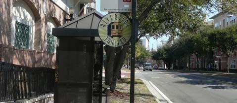
8 CHAPTER 2. GOALS Enhancing the quality of life and livability of Jacksonville is a basic goal of the 2030 Mobility Plan. How we design our streets can play a significant role in contributing to this goal. A livable street should facilitate environmental conditions that support independence and freedom of choice; provide orientation, safety and comfort; encourage a sense of community yet provide sufficient privacy; foster a sense of neighborly ownership and responsibility; avoid disturbing nuisances; and enhance the economic value of adjacent property. 2.1 Context Sensitive Street Design Goals Below are goals for context sensitive street design that support guiding principles, goals and objectives expressed in the City of Jacksonville 2030 Comprehensive Plan, City of Jacksonville Visioning Plans, 2030 Mobility Plan, North Florida TPO 2035 LRTP and Horizon 2030 Recommendations. Provide A Variety Of Transportation Choices One of the primary goals expressed throughout the community is the need to develop a multimodal regional transportation system that integrates various mobility options to handle Jacksonville's current and future transportation demands. The availability of a variety of transportation choices gives people both independence and control over their lives. Providing choice contributes to livability by allowing people to provide for their own needs and aspirations, without t dependency on others to meet their transportation needs. This is especially true for those who can t or choose not to drive. The images below highlight a variety of transportation choices that are available within the CBD, UPA and UA development areas. Improve Connectivity of Existing Transit Integrated transportation systems link a variety of transit modes to meet the needs of local, commuter, and regional travelers. They form a reliable and thorough web of mobility options which connect residents to activity nodes-the workplace, shopping and recreation, etc. This includes a network of walkable streets, pedestrian and bicycle paths, as well as connected local and regional streets. A safe, reliable and efficient mass transit system is a critical factor in the success of a livable community and the transportation system designed to support it. While Jacksonville's transit system is extensive, there is a general sense that the system could be improved with better connections, accessibility, enhanced security and more frequent service to encourage more use as an alternative source of mobility. 4 Examples of transportation choices that are currently available in Jacksonville.


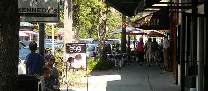
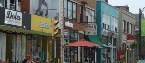
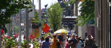
9 Create Walkable and Connected Neighborhoods In order to develop walkable and connected neighborhoods, special attention needs to be paid to prioritizing the quality of the pedestrian experience. Every transportation trip begins and ends with walking. Walkability is a term that describes the pedestrian's ease of movement and safety, both of which contribute to quality of life and sense of place. Environments that are conductive to walking are conductive to people. Often, the best way to improve other forms of transportation is to improve walkability. Walking conditions therefore have a major impact on how people perceive the transportation system, since we experience activities by the amount of time they take, not just distance traveled. Improve Mobility While Advancing Neighborhood Character Mobility describes the quality and ease of movement for any mode of transportation - walking, bicycling, driving, or riding transit. Mobility, and the infrastructure that supports it, is as much a part of Jacksonville's character and context as its building stock, landscape, historic assets and natural resources. Often, transportation planning and design considers context only in terms of land use (traffic generation) and two elements of site design - parking and access (driveways). The Context Sensitive Streets design process expands this understanding of context to include the aspects of building and site design that create support for pedestrian and transit activity while also contributing to a place's unique character, helping to distinguish it from its neighbors. Create Signature Streets Creating identifiable streets provides the framework or "mental map" that orients people as to where they are within the region. Context Sensitive streets are a major element that shapes the urban form by establishing the character and identity of the communities they serve. Providing identity and orientation for a community involves considering the design implications of changes in land-use and street types. Context Sensitive street design provides these opportunities and creates places where people want to be, be seen and meet others. Provide For Economic Growth Transportation connectivity is inextricably linked to the concept of economic growth. The history of Jacksonville is closely tied to its evolution as a transportation hub for the movement of goods and people. The City's port, roadway network, freight intermodal systems, and related industrial activities are a vital component to Jacksonville's economic sustainability. Therefore, street design must accommodate the accessibility and movement of goods by truck as well as people by other modes. Pictured below, Riverside/Avondale s Shoppes of St. Johns Avenue is a local example of a corridor that embraces context sensitive street design goals. Provide A Safe & Healthy Environment A safe environment minimizes exposure to vehicle accidents and other hazards, and contributes to livability by enhancing people's sense of comfort and giving them freedom to choose to walk and bicycle without danger. Creating a safe environment requires controlling negative impacts of traffic, noise, pollution, crime, minimizing disrupting historical resources, the natural environment and other undesirable impacts. A safe environment also supports people choosing an alternative to the automobile and fosters public social contact. 5


 and non-motorized (bicycle) vehicle movement. Streetside - the areas where pedestrian use is a priority.")


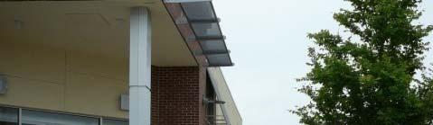
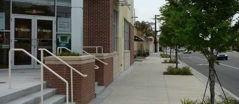
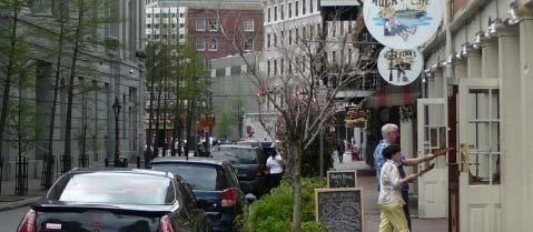
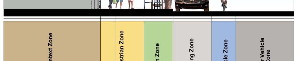
10 CHAPTER 3. DESIGN GUIDELINES What are the Design Guidelines? The following design considerations and guidelines identify the individual elements that make up context sensitive urban thoroughfare design and present ideas to consider specific recommendations for designing balanced multi-modal streets. Photo examples of each of the street elements also are provided. How to Use the Guidelines The guidelines are intended to assist in the preparation of street cross sections and street improvement plans. They can be used to help decide which features should be emphasized when the availability of right-of- way is an issue and which h tradeoffs should be made among design elements. The design elements for an urban thoroughfare are organized into three areas, the Context, Traveled Way and Streetside. Figure 3.1 on page 7 illustrates the Public Realm or components of an urban thoroughfare. Context - the adjacent land use elements that abut the street and define the street's character. Traveled Way - the traveled way elements devoted to motorized (automobile/truck/transit) and non-motorized (bicycle) vehicle movement. Streetside - the areas where pedestrian use is a priority. Design guidelines are presented in two sections: general principles address choices of elements to include in street design to provide livable context sensitive streets. general considerations provide preferred dimensions within a minimum and maximum range of design elements. 3.1 The Public Realm The public realm is the overall setting in which people experience the character and use of a street. It is composed of the traveled way, streetside and context. Context sensitive streets are complex systems that support all travel modes, vehicle movements, land uses, business, leisure and recreational activities and social interactions. The traveled way and streetside usually occupy the public street right of way. Within the traveled way are the vehicle travel lanes and bicycle lanes. Within the streetside are on-street parking and sidewalks. The adjacent context is closely related to the streetside, because adjacent land-use influences the context sensitive street type as well as the character and intensity of the use of the street. The images below highlight a variety of context sensitive public realms. Figure 3.2 on page 7 illustrates the elements of a context sensitive thoroughfare. 6 Examples of context sensitive public realms.


11 Figure 3.1 Components of an urban thoroughfare. Source: ITE Designing Walkable Urban Thoroughfares. Figure 3.2 An illustration of the elements of a context sensitive thoroughfare. Source: ITE Designing Walkable Urban Thoroughfares. 7


 to accentuate gateways or entries to land-use areas.")


12 General Principles and Considerations Facilitate alternative travel mode choice by integrating the design of all three sub-realms. Design the street as an integrated whole, considering the inter-relationships among the vehicle travel needs, bicycle and pedestrian needs and adjoining land-use needs. Provide identity and orientation to the CBD, UPA and UA development areas by integrating the design of all three sub-realms. Consider how the adjoining land uses are an area or district with a coherent identity consistent with the 2030 Comprehensive Plan and City of Jacksonville Visioning Plans. Define specific lengths and segments of the street as a fundamental part of the adjoining landuse areas. Use streets (segments and intersections) to accentuate gateways or entries to land-use areas. Use intersections as opportunities to provide transition from one land-use area or street type to another. Maintain consistent regional street design types and streetscape features through these areas. Connect rather than separate land uses, neighborhoods and districts across context sensitive streets. Design pedestrian crossings for ease and frequency of use to connect uses and neighborhoods across context sensitive streets. Preserve and improve existing interconnected network of streets to encourage walking and bicycling, support use of transit, reduce the number and length of vehicle trips and conserve energy. Protect and enhance neighborhoods by reducing regional traffic traveling on neighborhood streets. Provide an interconnected local street network to allow direct connections to local destinations, reduce local traffic on arterial streets, and provide more arterial street capacity for longer distance and through traffic. Support pedestrian access to transit from adjacent context, as well as outdoor pedestrian activity, by providing sidewalks scaled to the intensity of adjacent context, as discussed in streetside realm. All context sensitive streets should be multi-modal in design, providing sidewalks for pedestrian access to transit and to adjacent land uses, as well as special pedestrian features on transit streets and bicycle lanes. Under constrained right of way conditions, tradeoffs among design features should ldbe considered dbased on the discussion i in Chapter 5. Constrained Right of Way. 8 Examples of context sensitive public realms.


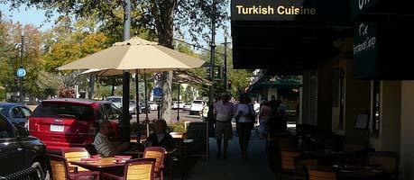
13 3.2 Context The site planning and building design of the adjacent land use can significantly contribute to walking and transit use as a competitive choice over the automobile within a context t sensitive streets t environment. The design guidelines for adjacent land use are to insure that the design of buildings supports and enhances the pedestrian and transit experience. The design of viable, well-functioning urban thoroughfares depends on a clear understanding of the application of context sensitive principles p in designing thoroughfares in the urban environment. Once urban context is understood, the function of each thoroughfare can be established and the design parameters can be selected to achieve a balance between land use and transportation design. This linkage demands special tools. While it is possible to "feel" the character of an urban area, it can be hard to define and describe the specific features that collectively give shape and character to a particular urban setting, whether it is a small town, activity center, main street, or high-density regional downtown. Not only does context influence the design of thoroughfares, but the design of the thoroughfare itself helps to define and shape the context as much as adjacent land uses and buildings define and shape context. For these reasons, this document recommends a clear focus on context first, followed by detailed transportation planning to support the context in a balanced way. Conventional o thoroughfare oug design processes emphasize e vehicular mobility and the provision of automobile access to adjoining land uses, primarily using functional classification, traffic volume and design speed as the determinants for design parameters. The principles of context sensitive streets t expand the design process to better integrate t thoroughfares with their surroundings. The result in many communities is a new emphasis on urban thoroughfares with features that emphasize multimodal safety and mobility as well as support for the activities of the adjacent land uses. Graphic examples of context sensitive land uses are highlighted g below and on page 10. General Principles Promote architectural and site design standards that enhance the overall aesthetic appearance of the City of Jacksonville. Encourage a higher level of design standards beyond minimum code compliance. Use the relationship between the building and street to improve neighborhood character and the pedestrian environment. Ensure that the design of parking lots benefits the atmosphere of the pedestrian environment. Create primary entrances for pedestrians that are easily accessible from transit stops, with as direct a path as possible to the transit stop. Examples of context sensitive land uses. 9


14 Make primary entrances to buildings visible from the street and sidewalk. Maintain at least one entrance from public right-of-way at retail establishments t with doors unlocked dduring regular business hours. Incorporate transitions from the sidewalk to the front door such as grade separation, landscaping, and/or porches at individual entrances to residences. Incorporate passageways into mid-block developments, particularly on long blocks, that facilitate pedestrian movement through the depth of the block to the front of the next parallel block. Activate mid-block passageways so that they are visually interesting and safe spaces. Provide direct access to building entrances from sidewalks and streets. Locate buildings at the front property line or at the required setback to create a strong street wall. Where additional setback is necessary, that area can be used to create an "outdoor room" adjacent to the street, incorporating seating or water features for example. Above: Jacksonville s River City Marketplace/Parkway Shops commercial district contains land uses that do not properly address the street. Below: Orlando s Baldwin Park development contains context that properly accommodates pedestrians, cyclist and motorists. Use architectural features to provide continuity at the street where openings occur due to driveways or other breaks in the sidewalk and building wall. 10 Examples of context sensitive context.


15 3.3 The Traveled Way The traveled way comprises the central portion of the thoroughfare. It contains the design elements that allow for the movement of vehicles, transit, bicycles and freight. The traveled way is also where vehicles, via on-street parking, interface with the street-side. Many of the conflicts that occur on thoroughfares take place within the traveled way between two or more moving vehicles, moving and parking vehicles, bicyclists and vehicles, and vehicles and pedestrians crossing at midblock locations and intersections. Design of the traveled way should provide a balanced transportation system that fully integrates automobile, public transportation, bicycle, pedestrian and freight needs as they relate to the 2030 Mobility Plan transportation and land-use components. Context sensitive street design concepts for the traveled way should minimize traffic hazards ards and conflicts between travel modes and emphasize safe travel for all modes. Design guidelines address the number of travel lanes, as well as the width and use of the traveled way. The traveled way is composed of vehicle travel lanes, bicycle lanes, medians, intersections, on-street parking and other elements devoted to vehicle movement. The graphics below are various examples of context sensitive traveled ways. General Principles All context sensitive streets should be multimodal in design, providing transit improvements and bicycle lanes. Trade-offs among design features should be considered based on the discussion in Chapter 5. Constrained Right-of-Way. General Considerations Preferred traveled way width for a two-lane context sensitive street is 46 feet without a median left-turn lane (34 feet without on-street parking) and 57 feet with a median left-turn t lane (45 feet without t onstreet parking). Traveled way widths vary when raised medians are provided. Preferred traveled way width for a four-lane context sensitive thoroughfare is 68 feet without a median left-turn lane (56 feet without on-street parking), and 79 feet with a median left-turn lane (67 feet without on-street parking). Traveled way widths vary when raised medians are provided. Figure 3.3 on page 12 identifies the suggested design parameters for context sensitive travelways and urban thoroughfares. 3.4 Traveled Way Lane Width Street width is necessary to support desirable design elements in appropriate contexts, such as to provide adequate space for safe lateral positioning of vehicles, on-street parking, landscaped medians and bicycle lanes. Wide streets (greater than 60 feet), however, create barriers for pedestrians and encourage higher vehicular speeds. Wide streets can reduce the level of pedestrian interchange that supports economic and community activity. Wide streets discourage crossings for transit connections. The overall width of the street affects the building height to width ratio, a vertical spatial definition that is an important visual Identify thoroughfare type based on Figures 3.3 (p.12) and 4.1 (p.30). This establishes the general parameters for the cross-section (such as median width, parking lane width, streetsidewidth t idth and function). Consider use of parallel alternative routes to reduce traffic volumes on any one street and to minimize the number of travel lanes. Consider reducing the total number of travel lanes to decrease the width of street for pedestrian crossings. Examples of context sensitive traveled ways. 11
16 12 Figure 3.3 Institute of Engineers Suggested Design Parameters For Walkable Urban Thoroughfares


17 design component of urban thoroughfares. Lane width is only one component of the overall width of the street but is often cited as the design element that most adversely affects pedestrian crossings. In fact, many factors affect pedestrian crossing safety and exposure, including the number of lanes, presence of pedestrian refuges, curb extensions, walking speed and conflicting traffic movements at intersections. General Principles Determine the overall width of the street and the traveled way on the accumulated width of the desired design elements (e.g., parking, bicycle lanes, travel lanes and median). Prioritize design elements that constitute an ideal cross-section and eliminate lower-priority elements when designing in constrained rights of way. Reducing lane width is one means of fitting the design into the available right of way. Curb lane widths should be measured to the face of curb unless the gutter and catch basin inlets do not accommodate bicycles and motor vehicles. However, to preserve available width for best use, inlets should be designed to safely accommodate bicycle and motor vehicle travel. Consider use of designated transit lanes along street routes in dense, heavily traveled urban areas. Consider retrofitting existing thoroughfares as part of repaving and restriping ti i projects, as shown in the image below. General Considerations Context sensitive street travel and turning lane widths vary from a minimum of 10 feet to 14 feet, depending on land use and functional classification. Refer to Figure 3.3 on page 12 for recommended traveled way lane widths. Provide a preferred 11 wide travel lane width within CBD, UPA and UA development areas for boulevard and avenue context sensitive street t design types. Outside roadway lane width on all new collector and arterial roadways should not be less than 14 wide, if no separate bicycle facilities are present. 3.5 Bicycle Lanes Bicycle travel should be served on multimodal context sensitive streets. Bicyclists vary in their level of skill and confidence, trip purpose and preference for facility types; thus, the mobility needs of bicyclists in urban contexts t vary as well. Bicycle facilities should encompass a system of interconnected routes, paths and on-street bicycle lanes that provide for safe and efficient bicycle travel. The width of the street and the speed and volume of adjacent traffic are the most critical factors in providing safe bicycle lanes. If adequate facilities cannot be provided, then the safety of both the bicyclist and driver is compromised. Graphic examples of context sensitive bicycle facilities are shown below. Repaving and restriping projects are affordable solutions to making existing urban thoroughfares context sensitive. Examples of context sensitive bicycle lanes and facilities. 13
18 General Principles The design of bicycle lanes on thoroughfares within the CBD, UPA and UA development areas should be coordinated with the City of Jacksonville Bicycle Network Plan, within the 2030 Mobility Plan. Bicycle lanes are not required on every street. However bike lanes are suggested on all new avenues and boulevards projected to serve in excess of 1,660 vehicles per day. Bicycle lanes are preferred along existing avenues and boulevards, if the necessary traveled way width is present. Availability of parallel bicycle facilities does not eliminate the need to have a bicycle lane on thoroughfares. Bicyclists need to access properties p along corridors, and they often benefit from traffic signals and other controls found on urban thoroughfares. It is often more prudent to provide the recommended or maximum dimensions for bicycle facilities, curb lanes and parking lanes and to eliminate other design elements to maximize bicyclist safety. For example it may be desirable to convert a four-lane undivided street to a three-lane street with left-turn lanes to provide bicycle lanes rather than narrowing all of the other design elements to retain four lanes. Bicycle travel on sidewalks should be discouraged, even if the sidewalk width meets the width requirements of ashared multi-use path. Bicycles on sidewalks travel at higher speeds than pedestrians, creating the potential for serious injury. Provide secure parking at transit stations and commercial sites and businesses. General Considerations A marked bicycle lane should be a minimum of four feet wide (not including gutter), with five feet generally preferred. Wider lanes are preferred next to on-street parking to avoid opening car doors. If there is a right turn lane at an intersection, the bicycle lane should be placed to the left of the right turn lane, to clearly separate the bicycle's through movement from the motor vehicle's turning movements. On one-way streets, bike lanes should be placed on the right side of the street. Bike lanes on the left side are unfamiliar and unexpected for most motorists. A minimum of five (5) feet is recommended between a shared use path and the traveled way. A physical barrier, with a minimum height of 42 inches to prevent cyclist from toppling over, is recommended when the distance is less than five (5) feet. Figure 3.4 Institute of Engineers Recommended Bicycle Lane Widths 14
19 The minimum recommended width for a paved two-way shared use path is ten (10) feet. The width should be increased if there is expected substantial use by bicyclists, probable shared use with joggers and in-line skaters, and locations with steep grades or where bicyclists are likely to ride two abreast. A design speed of 20 mph should be used for shared use paths. Figure 3.4 on page 14 illustrates the ITE s recommended practice for bicycle lanes on walkable urban thoroughfares. 3.6 Intersections Intersections have a significant place-making function as well as a transportation function. Significant land uses and architecturally significant buildings are located at intersections and might provide pedestrian access directly from the corners. Intersections may also serve as gateways and are frequently the first thing visitors see when they enter a neighborhood. Multimodal intersections operate with pedestrians, bicycles, cars, buses and trucks, and in some cases, trains. The diverse uses of intersections involve a high level of activity and shared space. Intersections have the unique characteristic of accommodating the almost-constant occurrence of conflicts between all modes, and most collisions on thoroughfares take place at intersections. This characteristic is the basis for most intersection design standards, particularly for safety. Designing multimodal intersections with the appropriate accommodations for all users is performed on a case-by-case basis. The design extends beyond the immediate intersection and encompasses the approaches, medians, streetside and driveways, and adjacent context. Context sensitive intersections should be designed with an understanding of the community objectives and priorities related to design trade-offs such as vehicular capacity and level l of service, largevehicle turning requirements, conflicts, pedestrian and bicycle convenience, accessibility and the efficiency of public transit service. General Principles Minimize conflicts between modes such as signal phasing that separates vehicle movements and pedestrian crossings, bicycle lanes extended to the crosswalk, pedestrian refuge islands, lowspeed channelized right turns and so forth. Provide crosswalks on all approaches. Accommodate all modes with the appropriate levels of service for pedestrians, bicyclists, transit and motorists given the recommended speed, volume and expected mix of traffic. Avoid elimination of any travel modes due to intersection design. Intersection widening for additional turn lanes to relieve traffic congestion should be balanced against impacts to pedestrians, bicyclists and transit. Minimize pedestrian exposure to moving traffic. Keep crossing distances as short as practical and use operational techniques (protected left-turn signal phasing and prohibited right turn on red) to separate pedestrians and traffic as much as possible. Design for slow speeds at critical pedestrian-vehicle conflict points, such as corners, by using smaller curb return radii or low-speed channelized right-turn t lanes. Avoid extreme intersection angles and break up complex intersections with pedestrian refuge islands. Keep intersections easily and fully comprehensible for all users. Strive for simplicity in intersection design avoid designing gintersections with more than four approaches (or consider a modern roundabout) and keep cross streets as perpendicular as possible. Ensure intersections are fully accessible to the disabled and hearing and sight impaired. 15


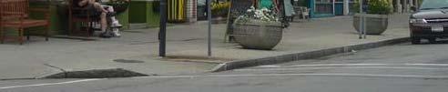
20 General Considerations The preferred location for pedestrian crossings is at intersections. However, if the block length exceeds 400 feet, consider adding a midblock crossing. The target spacing for pedestrian crossings in the most intensive urban areas is every 200 to 300 feet. Increases in intersection vehicular capacity by adding lanes increase pedestrian wait times and crossing distances, and discourage pedestrian activity and bicycle use. Therefore, consider interconnecting streets in the network, using parallel routes and other strategies before increasing the number of travel lanes. Where possible, facilitate shared cross-access legal agreements between adjacent properties to close and consolidate nonresidential di driveways near an intersection. ti If needed to reduce speeds along a thoroughfare, use speed tables or narrower lanes starting on the approach to intersections, or other speed-management techniques. Traffic control alternatives should be evaluated for each intersection, including stop control, traffic signals and modern roundabouts. ABOVE: Englewood s University Boulevard and its intersections present a hostile environment for pedestrians and cyclist. BELOW: Riverside s Park & King serves as an example of a context sensitive intersection. Design for U-turn movements to facilitate access to property whenever adding a raised median. The median or the median nose adjacent to a turn lane should extend to the crosswalk. Medians can end prior to the crosswalk for a continuous pedestrian crossing or can extend through the crosswalk if a channel at street grade or a ramp is provided through the median. Median noses extended through the crosswalk provide a refuge area for pedestrians. Carefully review turning radii of large vehicles that may strike the extended median nose. The images to the right, illustrate good and bad examples of roadway intersections within Jacksonville s CBD, UPA and UA development areas. 16


21 3.7 Medians Medians are the center portion of a street that separate opposing directions of travel. Medians vary in width and purpose and can be raised with curbs or painted and flush with the pavement. Medians on lowspeed urban thoroughfares are used for access management, accommodation of turning traffic, safety, pedestrian refuge, landscaping and lighting and utilities. Based on these functions, this guidance addresses raised curbed medians with a discussion of alternate applications such as flush medians interspersed with landscaped median islands. In addition to their operational and safety functions, well-designed and landscaped medians can serve as a focal point of the street or an identifiable gateway into a community, neighborhood, or district. Medians can be used to create tree canopies over travel lanes, offer attractive landscaping and provide space for lighting and urban design features. Wider medians can provide pedestrian refuge at long intersection crossings and midblock crossings. Medians vary in width depending on available right of way and function. Because medians increase the width of a street, the designer must weigh the benefits of a median against the increase in pedestrian crossing distance and possible decrease in available streetside widths. Operational and safety benefits of medians include storage for turning vehicles, enforcing turn restrictions, reducing conflicts, providing pedestrian refuge, reducing certain types of crashes such as head-on collisions and space for vehicles crossing the thoroughfare at unsignalized intersections. With some innovation in design, curbed medians can provide biofiltration swales to retain and improve the quality of stormwater runoff. Flexibility in median width design revolves around the median's function, appurtenances and landscaping to be accommodated in the median and available right of way. The designer needs to consider the trade-offs between the provision of a median and other design elements, particularly in constrained rights of way. Graphic examples of context sensitive medians are shown on pages 17 and 18. General Principles and Considerations Where medians are provided at intersections as refuge, they should be wide enough to accommodate groups of pedestrians, wheelchair users, bicyclists and people pushing strollers. To keep streets compact and pedestrian-scaled, median width typically should not exceed 18 feet in walkable urban environments except on ceremonial view corridors and parkways or where dual left turns are provided. On boulevards and wide avenues (more than 60 feet) where median dimensions need to remain continuous and left turn lanes are Examples of context sensitive medians. 17


.")

. Mountable medians can be super-reinforced with grass-crete pavers or concrete with added rebar.")
22 provided, medians should be feet, to allow for a turn lane plus pedestrian refuge. Apply medians as part of a corridor access management strategy t to improve safety and multimodal operational efficiency. Evaluate impacts on land access and ensure adequate locations for U-turns. Avoid providing overly wide medians at the expense of unreasonably narrowing the streetside. In walk-able urban contexts, streetsides of appropriate width should take higher priority than wide medians. However, the design needs to balance the safety, operational and pedestrian comfort needs of the street. In contrast to medians in rural areas, the width of medians at intersections in urban areas should only be as wide as necessary to provide the desired function (accommodation of longitudinal left turns, pedestrian refuge and so forth). Otherwise, the intersection loses operation efficiency and vehicles crossing the median may use the width inappropriately (side-by-side queuing, angled stopping and so forth). If the median will not be landscaped, consider using alternative contrasting materials to create visual interest and an aesthetic appearance. Raised medians in low-speed urban contexts should be constructed with vertical curbs to provide refuge for pedestrians, access management and a place to install signs, utilities and landscaping. If emergency access is a concern, mountable curbs should be considered in special locations (where medians are carried across intersections, access managed thoroughfares near fire stations, or within 200 to 300 feet of an intersection approach that frequently experiences long queues). Mountable medians can be super-reinforced with grass-crete pavers or concrete with added rebar. Where flush medians are desirable to maintain access to fronting property (e.g., suburban commercial corridors), consider using textured or colored paving or stamped concrete for the median lane interspersed with raised landscaped islands to channelize turning traffic, divide opposing lanes of traffic and provide pedestrian refuge where appropriate. On multilane thoroughfares, medians aid pedestrians in their crossing. A median of 6 to 8 feet can be more desirable to a crossing pedestrian than the same width added to another element of the thoroughfare. 18 Examples of context sensitive medians.


23 General Principles Design and installation of a median will vary according to street type and right-of-way width. If a median is used, it should be wide enough for landscaping and pedestrian refuge. In the absence of other design elements such as landscaping, street trees, and on-street parking, a median may encourage higher traffic speeds. This unintended consequence should be carefully considered when designing streets in residential areas or where there are likely to be many pedestrians. Spacing between median openings depends on the street type and land use context. In general, spacing should be longer in areas with higher speeds, fewer driveways, and larger setbacks. Spacing should be more frequent in areas where smaller block lengths and more access is desired. General Considerations Use medians for installation of traffic control, lighting, landscaping, street trees, pedestrian refuges, speed change lanes, turning lanes and storage, to reduce headlight glare, to reserve right-of-way for future roadway expansion, to reduce or eliminate turning movement conflicts, and to prohibit hazardous turns from driveways and cross-streets. t Medians should be used on boulevard and avenue street types with four or more lanes. The minimum median width shall be 12 feet unless otherwise approved by the City Engineer. Ensure U-turns can be negotiated at downstream intersections or median breaks when medians are used for access management. Modify existing medians at intersections and mid-block crossings to comply with ADA requirements. 3.8 Mid-Block Crosswalks Midblock crossings provide convenient locations for pedestrians to cross urban thoroughfares in areas with infrequent intersection crossings or where the nearest intersection crossing creates substantial out-of-direction travel. When the spacing of intersection crossings is far apart or when the pedestrian destination is directly across the street, pedestrians will cross where necessary to get to their destination directly and conveniently, exposing themselves to traffic where drivers might not expect them. Midblock crossings, therefore, respond to pedestrian behavior. Properly designed and visible mid-block crosswalks, signals and warning signs warn drivers of potential pedestrians, protect crossing pedestrians and encourage walking in high-activity areas. Examples of mid-block crossings are shown below. Examples of context sensitive mid-block crossings. 19


24 General Considerations Factors to evaluate before installing midblock crosswalks include proximity to other crossing points, sight distance, vehicle speed, crash records, illumination, i traffic volumes, pedestrian volumes and nearby pedestrian generators. Pedestrians should not be expected to make excessive or inconvenient diversions in their travel path to cross at an intersection. On the other hand, because midblock crossings are not generally expected by motorists, they should be used only where truly needed and appropriately signed, marked and illuminated. Midblock crossings should be identifiable to pedestrians with vision and hearing impairments. Where there is a signal, a locator tone at the pedestrian detector might be sufficient. A tactile strip across the width of the sidewalk at the curbline and at pedestrian refuge islands needs to be used so that visually impaired pedestrians are alerted to the presence of the crossing. For a crosswalk to exist at a midblock location, it must be a marked crosswalk and have high visibility to drivers who may not anticipate a midblock crossing. Midblock crosswalks should be marked with a higher-visibility crosswalk marking such as longitudinal or diagonal lines or should be constructed with a high-contrast alternative pavement. When an unsignalized midblock crosswalk is installed, warning signs should be placed for both directions of traffic. A pedestrian warning sign with an "AHEAD" notice or a distance plaque should be placed in advance of the crossing, and a pedestrian warning sign with a downward diagonal arrow plaque should be placed at the crossing location. On multilane facilities, an advanced stop bar should be considered. Consider providing mid-block crossings when protected intersection crossings are spaced greater than 600 feet, or so that crosswalks are located no greater than 300 feet apart in high pedestrian volume locations. Provide raised median pedestrian refuges at mid-block crossings where total crossing is greater than 60 feet. Figure 3.5 illustrates a sketch of a context sensitive mid-block crossing. 3.9 On-Street Parking On-street parking is permitted and provided on many of the best context sensitive streets. On-street parking is often desired in residential and commercial areas for its convenient access to street front entrances. Residents, shoppers, and businesses are amenable to limited slowing of traffic as a trade-off for the economic benefits of onstreet parking. These benefits include: 1. Higher Efficiency: In urban environments, users typically select on- street parking spaces over off-street surface lots and garage parking, while still having the highest turnover in use. 20 Figure An example of a context sensitive mid-block crossing.


25 2. Better Land Use: Using the curbside for parking saves considerable amounts of land from life as an off-street surface parking lot. Mediumsized town centers can save an average of more than two acres of land by providing on-street parking. This efficiency can allow for much higher-density commercial development than is possible if the center relies only on off-street surface lots. 3. Increased Safety: Automobile drivers tend to travel at significantly slower speeds in the presence of features such as on-street parking and small building setbacks, making the environment more friendly for pedestrians, cyclist and drivers. 4. Better Pedestrian Environment: Streetscapes featuring on-street parking and other compatible characteristics such as generous sidewalks, mixed land uses, and higher densities tend to have more than five times the number of pedestrians walking in these areas compared with the control sites, which lack these traits. On-street parking is included as a higher priority design element in most of the context sensitive street design types. This priority reflects the document's emphasis on high intensity commercial areas. However, in lower intensity areas and along many corridor segments, on-street parking is not necessary to serve adjacent land use. The additional width may be used for other desirable design elements, such as increasing the width of the sidewalk, the landscaped pedestrian buffer strip or median. Graphic examples of how context sensitive on-street parking has been integrated into a variety of urban environments are shown below. General Principles and Considerations On-street parking should be located based on the characteristics of the thoroughfare type, needs of the adjacent land uses and applicable local policies and plans for parking management. On-street parking should be primarily parallel parking on highervolume urban arterial boulevards and avenues. Angled parking may be used on low-speed and low-volume collector avenues and streets with ground floor commercial uses, primarily those serving as main streets. On-street parking should be prohibited on streets with speeds greater than 35 mph due to potential hazards associated with maneuvering in and out of spaces. In developing and redeveloping areas, provide the amount of onstreet parking for planned, rather than existing, land use densities. If more parking is needed, consider public or shared parking structures or integrate the design of parking facilities with adjacent land uses. The preferred width of a parallel on-street parking lane is eight (8) feet wide on commercial thoroughfares (all types) or where there is an anticipated high turnover of parking and seven (7) feet wide on residential thoroughfares. Examples of context sensitive on-street parking. 21


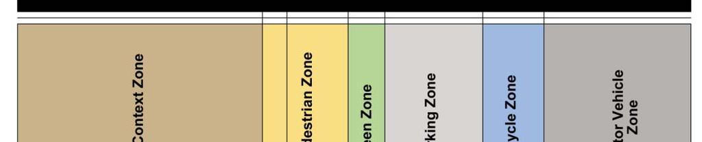
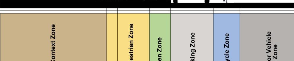
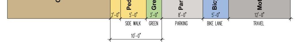
26 Extend sidewalks or curb at transit stops equal to width of on-street parking lane to improve pedestrian visibility and accessibility to transit and provide additional space for level landings at curb ramps. 310Th 3.10 The Streetsidet The streetside is the portion of the thoroughfare that accommodates nonvehicular activity walking as well as the business and social activities of the street. It extends from the face of the buildings or edge of the private property to the face of the curb. A well-designed streetside is important to the thoroughfare's function as a "public place." Thoroughfares are the most extensively used civic spaces in our communities. General Principles and Considerations The streetside t requires attention ti to pedestrian safety, as well as comfort and ease of access. Pedestrian safety and comfort are directly related to the width of the sidewalk, the amount of buffering from traffic, and illumination. Design the streetside to accommodate the needs of a broad range of users, including older pedestrians, people with disabilities and children. Provide physical and spatial definition to the street to reduce the impact and dominance of automobile traffic on the safety and comfort of pedestrians. Physical spatial definition of streets also provides a sense of place, enhancing the status of the street and adjacent property values. Orient land uses to the street to increase and focus pedestrian activity to support ease of access to and use of public transit. Supporting an active pedestrian environment is vital to the function and identity of a context sensitive street within commercial areas Sidewalks The beauty and livability of a city depends greatly on the design of its streets. The character and quality of the space between the curb and the face of a building has a lot to do with the way people walking in the city feel about it. Creating comfort for the pedestrian is an important way to generate positive economic activity on context sensitive streets. The streetscape is composed of two elements: the clear walking area or pedestrian zone and the area between the curb and the pedestrian zone, the amenity zone. These zones are typically distinguished by a change in materials, from hard materials to greenery, though in areas of high pedestrian traffic, the amenity zone may include less planting and more paving. Elements that should be located in the amenity zone include: street trees, ground cover or paving stones, street furniture, trash cans, kiosks, lights, utility poles, and parking meters. Figures 3.6 through 3.11 provide cross section design examples for context sensitive sidewalks. Examples of context sensitive sidewalks are provided on pages Examples of context sensitive sidewalks.


27 Figure 3.6. Five feet provide two-way pedestrian traffic and ADA minimum Clearance. This applies to residential and non-commercial uses. Figure 3.7. Eight feet combine two-way pedestrian traffic, window shopping and a 3-foot amenity/green zone. The amenity zone buffers pedestrians from traffic. Examples of 5 and 8 wide sidewalks. 23


28 Figure feet provide an opportunity for street amenities to be located along the curb or along storefronts. t Figure feet provide an opportunity to create outdoor dining or café space on the sidewalk, with up to 7-feet clear for seating. 24 Examples of 10 and 12 sidewalks.


29 Figure provide an opportunity for a variety of outdoor use of the sidewalk for shopping or dining, i with ample area for high h levels l of pedestrian activity. Figure with transit stop is sufficient for a transit shelter. Examples of 15 and 12 sidewalks with transit shelters. 25


 standards for sidewalk design involving width, surface texture, slope and")

30 General Principles Establishing an active pedestrian environment is vital to the function of a context sensitive street. Provide adequate width for all sidewalk uses, including loading and unloading of people from on-street parking, walking traffic, window shopping traffic, bicycle parking and use of street furniture. Sidewalks wider than 10 feet accommodate more intensive pedestrian traffic and use of the sidewalk by local merchants and residents. Provide pedestrian-scaled lighting to provide a separation from street traffic and spatial definition that is human scale. Consider special paving treatments to separate the streetside from the traveled way at intersection crossings. Provide continuous sidewalk improvements along major arterial streets. Close gaps between pedestrian connections. Provide pedestrian and sidewalk improvements on all new and redevelopment street projects. Provide special pedestrian features on transit streets, such as bus shelters, benches, market crossings at major transit stops and wider sidewalks. General Considerations Remove all utility poles, lights, meters from the pedestrian zone and relocate them in the amenity zone; install underground utilities whenever possible. Use consistent, continuous widths of concrete for sidewalks. Comply with ADA (Americans with Disabilities Act) standards for sidewalk design involving width, surface texture, slope and curb ramps. Build sidewalks in selected places in core and commercial areas that are wide enough to accommodate sidewalk cafes, clear walking zones and amenity zones, when possible. Change the paving material at crosswalks in areas where pedestrian traffic is high and vehicular traffic needs calming. Provide five-foot (5') minimum wide sidewalks on both sides of all local streets. Where buildings are located along side the right-of- way, sidewalk width shall be increased by (3) feet. Provide eight-foot (8') minimum wide sidewalks on both sides of all streets within the CBD development area. 26 Examples of context sensitive sidewalks.


 for street trees, without grates, shall be seven feet (7').")
31 3.12 Street Trees The importance of street trees should not be underestimated. Street trees are indispensable to the attractiveness, comfort and safety of street design. Street trees make Jacksonville's streets better places to walk, cycle and sit but can sometimes be taken for granted, with people missing them when the trees are removed or heavily pruned, making the street look less green and attractive. Examples of street trees in context sensitive urban environments are shown below. Design Principles Take advantage of street trees to create a unified sense of place throughout the CBD, UPA and UA development areas. Plant regularly spaced trees in straight rows; the number and spacing of trees should be based on the need to allow adequate room for root and branch growth while still providing a continuous canopy; trees should be centered in the width of the amenity zone. Plant trees in lawns or ground cover whenever possible. Use paving in the amenity zone where lawns are not practical and provide grates and guards to protect trees. Locate trees a sufficient distance from street intersections to provide clear viewing distances for cars. Preserve existing mature trees through flexible street designs. Provide sufficient i maintenance to ensure the quality of street t trees and landscaping within the amenity zone. General Considerations The minimum amenity zone width (area between edge of sidewalk and back of curb) for street trees, without grates, shall be seven feet (7'). Design for wider amenity zones in less intense commercial areas to further buffer pedestrian and automobile traffic patterns. All shrubbery, bushes, groundcover and landscape berms located within a median or landscape island shall not be higher than two (2) feet from the pavement surface. Landscaping items located within the utility strip (amenity zone) or adjacent to the outside edge of pavement shall not be greater than 2.5 feet in height when located within the line of sight required to maintain adequate sight distance at all intersections, horizontal curves, driveways and pedestrian crossings. All trees used in streetside landscaping shall have a maximum trunk diameter of 4 inches and shall have an unobstructed clear height of seven feet (7') from the sidewalk or roadway surface to the bottom of the branches. Recommended species include Live Oaks (where space is eight feet or less between curbs and sidewalk), Crape Myrtles (where space is three feet or less between curbs or sidewalks ) and Cabbage Palms. Recommended spacing for Live Oaks is 25 feet, on center; Crape Myrtles is 12 feet, on center; and Cabbage Palms eight (8) feet, on center. Examples of context sensitive street trees. 27
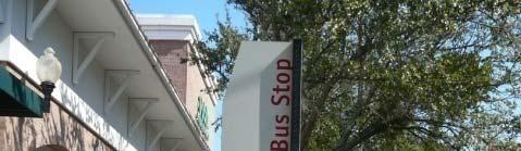
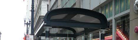
32 3.13 Public Transit Transit shelters should be oriented to provide easy access to and from the public pedestrian network and the transit boarding/deboarding area. Many of Jacksonville's urban thoroughfares are existing or proposed public transportation corridors. The types of services accommodated on these thoroughfares range from local bus service and automated people movers, to bus rapid transit, streetcar and commuter rail. These types of transit services can be accommodated either within a dedicated right of way in the thoroughfare or in mixed-flow lanes. In both cases the design of the thoroughfare needs to consider the special requirements of transit vehicles, running ways and operations, whether they exist or are planned for the future. The purpose of this section is to identify the key elements of transit that affect the design of thoroughfares. Characteristics of various system technologies are shown on page 29 in Figure General Principles Access to transit in lower density neighborhoods and corridors requires pedestrian connections from the land-use areas to transit stops. Transit stops in more densely developed areas require sufficient sidewalk width to provide accessibility and transit stop amenities. Provide safe pedestrian crossings within bus rapid transit and streetcar station areas. Provide streetscape improvements to support pedestrian accessibility to transit stops. Transit-oriented features should serve as amenities for surrounding land uses and activities. Leverage desired transit facilities from private sector when impacts warrant them. Enhance bicycle access through the provision of bike racks, bicycle lanes and lockers at skyway, bus rapid transit and commuter rail stations. General Considerations Use Jacksonville Transportation Authority (JTA) standards for length of bus stop, bus stop on a curb extension or bus turnout design. Transit shelters and stops should include end-user friendly transit system and specific route information to help encourage higher public transit usage. Provide secure bicycle parking at transit stations Streetscape Features Streetscape features serve pedestrian and outdoor activities, as well as provide lighting and signs for motor vehicle drivers. Streetscape features are the context sensitive elements that furnish the street environment and enhance community livability. General Principles and Considerations Street fixtures should be no more than 14' tall to provide adequate lighting at a pedestrian scale. Street fixtures should have sufficient detail to create scale for the pedestrian. Lights should be spaced 60' apart to minimize glare and allow for street trees and traffic signals. Seating, trash receptacles, bicycle racks, kiosks and bus shelters should be unified in nature and located within the amenity zone. Provide public art at strategic locations. 28 Examples of context sensitive public transit.


33 Figure 3.12 System Technology Operating Characteristics Examples available mass transit system technologies in common (wide) use. 29


 fall into this category: boulevards, avenues and streets. Figure 4.")
 and transit. Figure 4.")
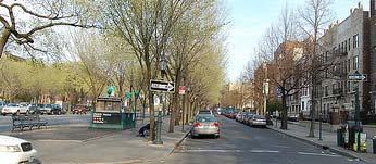
34 CHAPTER 4 CONTEXT SENSITIVE STREET DESIGN TYPES Context sensitive street thoroughfare types differ based on purpose and design emphasis required to support the 2030 Mobility Plan land-use components. Figure 4.1 shows the relationship between context sensitive streets thoroughfare types and functional classification. In general, boulevards serve an arterial function, avenues may be arterials or collectors and streets typically serve a collector or local function in the network. In walkable areas, all thoroughfare types have a strong pedestrian orientation. As this document focuses on urban thoroughfares in the CBD, UPA and UA Development Areas, only three of the types in Figures 4.1 and 4.2 (page 31) fall into this category: boulevards, avenues and streets. Figure 4.2 shows specific thoroughfare types that are commonly used in the United States and gives a general description of each type. These thoroughfare types typically serve a mix of modes, including pedestrian, bicycle users, motor vehicles (for passenger and freight) and transit. Figure 4.3 (page 32) displays general characteristics of urban thoroughfares. Sections 4.1 to 4.6 provide additional detail of these urban thoroughfare types and their variations. Examples of context sensitive streets are illustrated below. Figure 4.1 Relationship Between Functional Classification and Thoroughfare Type 30 Examples of context sensitive streets.
35 Figure 4.2 Thoroughfare Type Descriptions Table 4.2. Shaded cells represent thoroughfare types that are not addressed in this document. 31
 Transit Service Driveway Pedestrian Median Curb Parking Emphasis Access Facilities")
![[1] Bicycle Facilities Freight Mvmt.](/docs-images/72/67844480/images/36-1.jpg "[2] Freeway 4 to 6+ 45 to 65 Express Required No No No Optional separated pathway or shoulder Regional truck route Expressway/ Parkway 4 to 6 45 to 55 Express Required No No Optional separated")


36 Figure 4.3 Urban Thoroughfare Characteristics Urban Thoroughfare Type Number of Through Lanes Desired Operating Speed (mph) Transit Service Driveway Pedestrian Median Curb Parking Emphasis Access Facilities [1] Bicycle Facilities Freight Mvmt. [2] Freeway 4 to to 65 Express Required No No No Optional separated pathway or shoulder Regional truck route Expressway/ Parkway 4 to 6 45 to 55 Express Required No No Optional separated pathway Optional separated pathway or shoulder Regional truck route Boulevard Multi way Boulevard Avenue Street Rural Road Local Street Alley/Rear Lane 4 to 6 30 to 35 Express and local Required Limited Optional Sidewalk Bike lanes or parallel route Regional truck route 4 to 6 25 to 35 Express and local Required on access Yes from access Yes on access Regional route/local deliveries only Sidewalk lanes lane roadway on accessroadway 2 to 4 25 to 30 Local Optional Yes Yes Sidewalk Bike lanes or shared Local truck route 2 25 Local or none No Yes Yes Sidewalk Shared Local deliveries only 2 25 to 35 Local or none No Yes No No Shared or shoulder Local deliveries only 2 25 Local or none No Yes Yes Sidewalk Shared Local ldeliveries i only 1 5 to 10 None No Yes No Shared Shared Local deliveries only Shaded cells represent thoroughfare types that are not addressed in this report. Notes: [1] Boulevard, MultiwayBoulevard, Avenue, and Street thoroughfare types have sidewalks on both sides. Sidewalk width varies as a function of context zone, fronting land use and other factors. [2] Freight movement is divided into three categories: 1) Regional truck route, 2) Local truck route and 3) Local deliveries only. Cells show highest order of truck movement allowed. SOURCE: Designing Walkable Urban Thoroughfares: A Context Sensitive Approach. Institute of Transportation Engineers 32 Examples of urban thoroughfares.


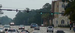
37 4.1 Boulevards Boulevards are typically thoroughfares with medians and four or more lanes that serve a mix of regional and local traffic and carry the most important transit routes. In conjunction with wide sidewalks that also include street trees, the median primarily serves as a pedestrian refuge and provides a sense of enclosure to calm traffic speeds. Access control is a secondary benefit. Desirable features on boulevards can include on-street parking, bicycle lanes, more intensive land use orientation to the street and wide sidewalks. The Right-Of-Way ranges from 80 to 120 feet or greater. Examples of context sensitive boulevards are shown below. Figure 4.4 on page 34 illustrates the typical cross-section of a boulevard. 4.2 Multi-Way Boulevard The Multi-Way Boulevard maintains through-motor vehicle speeds and enhancing access with differentiated lanes for traffic. The "through lanes", or center lanes, operate in a similar manner as principle arterials or boulevards. The primary difference is the opportunity to travel in slower lanes in the adjacent context-sensitive lanes. These "local lanes provide a slower interface to the building frontage, greater opportunity for transit stops, bicycle traffic, on-street parking and generally a greater pedestrian experience. The right-of-way for a Multi- Way Boulevard is typically 200 feet in width or greater. There are very few Multi-way Boulevards within the limits of the CBD, UPA and UA development areas. Figure 4.5 on page 35 illustrates the typical cross-section of a multi-way boulevard. Examples of multi-way boulevards are shown on page Avenues Avenues can serve a diverse set of functions in a wide variety of land use contexts. They provide access from neighborhoods to commercial areas, between major intercity destinations and, in some cases, through neighborhoods. Avenues serve an important function in providing transportation choices, because they are designed to provide a balance of service for all modes of transport. They provide for high quality pedestrian access, high levels of transit accessibility and bicycle accommodations such as bike lanes, yet they may also carry significant automobile traffic. Avenues and streets are similar to each other in form but avenues can be up to four lanes with a median. The right-ofway ranges from 60 to 80 feet in width or greater. Figure 4.6 on page 36 illustrates the typical cross-section section of an avenue. Examples of avenues are shown on page 36. Examples of Context Sensitive Boulevards. 33


38 Figure 4.4 Typical boulevard street design type. These facilities emphasize e bicycle, pedestrian and transit t travel modes. 34 Examples of Context Sensitive Boulevards.


39 Figure 4.5 Typical multi-way boulevard street design type. Examples of context sensitive multi-way boulevards. 35


40 Figure 4.6 Typical avenue street design type. These facilities provide a balance a of all modes of travel. 36 Examples of context sensitive avenues.


 illustrates the typical cross-section of a Local Residential Street.")

41 4.4 Local Streets Local Streets provide access to residential, industrial, or commercial districts, as well as to mixed-use areas. Speeds and motor vehicle traffic volumes are low, providing a safe and comfortable environment for pedestrians and bicyclists. Streets are generally two lanes and serve predominantly local traffic. 4.5 Local - Residential Streets Local Residential Streets are the most common street type and account for the most lane miles of all the City s streets. Typically consisting of two lanes, they can be characterized as having limited continuity and not being suitable for through traffic. Furthermore, these streets are typically built during the land development process, rather than as a result of specific public projects. Local Residential Streets are designed and maintained to provide access to abutting land uses. The predominant land use along Local Residential Streets will be either single family or multi-family housing, with a full range of possible densities. The Right-Of-Way for a local residential street in the UPA, UA and CBD development areas range from feet or greater. Figure 4.7 (right) illustrates the typical cross-section of a Local Residential Street. Examples of local streets are shown below. 4.6 One-Way Couplets One Way Couplets are streets consisting of paired one-way streets, spaced no greater than one block apart that are used to increase Figure 4.7 illustrates the typical cross-section of a local residential street. capacity of intensely developed commercial areas. One-Way Couplets are a dominant thoroughfare type in the CBD. The Right-Of-Way of the CBD s couplets typically ranges from 60 to 80 in width. Figure 4.8 on page 40 illustrates the typical cross-section of one direction of a one way couplet. Examples of One-Way Couplets are shown on page 38. Examples of context sensitive local streets. 37


42 Figure 4.8 Typical one-way couplet street design type. 38 Examples of context sensitive one-way couplets.


, Urban Priority (UPA), and Urban (UA) development areas, it is critical to provide at least a minimum width amenity zone to accommodate street")
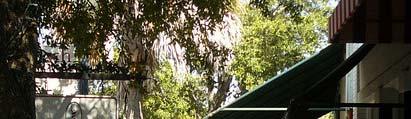
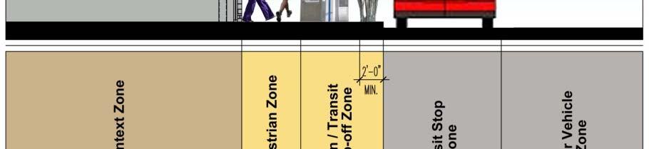
43 CHAPTER 5. CONSTRAINED RIGHT-OF-WAYS The nature of thoroughfare design is balancing the desired design elements of the thoroughfare with right-of-way constraints. Designing g thoroughfares in constrained rights-of-way requires prioritizing the design elements and emphasizing the higher-priority design elements in constrained conditions. Higher priority design elements are those that help the thoroughfare meet the vision and context sensitive objectives of the community. Lower-priority elements have less influence on achieving the objectives and can be relinquished in cases of insufficient right-of-way. Often the width of the public right-of-way varies along the thoroughfare, making the job of the designer even more challenging. When the width of the right-of-way varies, it is useful to prioritize design elements and develop a series of varying cross sections representing: Optimal conditions sections without right-of-way constraints that can accommodate all desirable elements; Predominant representing sections of the predominant right-of- way width in the corridor that accommodate all of the higher-priority elements; Functional minimum representing a typically constrained section where most of the higher-priority elements can be accommodated; and Absolute minimum representing severely constrained sections where only the highest-priority design elements can be accommodated without changing the type of thoroughfare. Below the absolute minimum, or if the predominant right-of-way is equal to or less than the absolute minimum, consider changing the thoroughfare to a different type while attempting to maintain basic function. In constrained conditions it might be tempting to minimize the streetside width and only provide the minimum pedestrian throughway (5 feet). However, within the Central Business District (CBD), Urban Priority (UPA), and Urban (UA) development areas, it is critical to provide at least a minimum width amenity zone to accommodate street trees, utility poles and other appurtenances. Without the amenity zone, trees, utilities, benches, shelters and other street paraphernalia might encroach into the pedestrian zone or result in an inadequate width streetside when the community s vision for the context zone is ultimately achieved. The graphics below are examples of constrained right-of-ways within the City of Jacksonville. The following sections within this chapter provide a greater description of challenges and opportunities in designing context sensitive boulevards, avenues and streets within constrained rights-of-ways. Examples of constrained Right-Of-Ways. 39


 and a 12-foot minimum")


44 5.1 Boulevards Boulevards are major arterial streets. They are distinguished from the other context sensitive street design types by providing a minimum of four travel lanes, a central landscaped median, wide sidewalks, bicycle lanes and in some cases, on-street parking. Widths Ideal width feet. This width provides a generous dimension for a boulevard, easily accommodating all the desirable design elements. Wide sidewalks can be accommodated, as well as a 27-foot-wide median. Predominant/Functional Width feet. At this width, all design elements can be accommodated: four travel lanes, bicycle lanes, a wide streetside (pedestrian and amenity zone) and a 12-foot minimum landscaped median. A 12-foot median can accommodate a narrow left-turn lane (10 feet) and a 2-foot-wide extended median nose at intersections. Absolute minimum width - 80 feet. This width represents a possible design condition for an existing constrained right-of-way. At this width, the 11-foot travel lanes and 12-foot landscaped median are the absolute minimum width for a boulevard that also serves as an arterial. Tradeoffs Right-of-ways of 80 feet or less require elimination i of either travel lanes, bicycle lanes or streetside width. At less than 80 feet and with fewer than four lanes, the cross section becomes an avenue. Typical Boulevard Priorities Higher priorities Pedestrian sidewalks with transit access Bicycle lanes Number of travel lanes Median for landscaping and pedestrian refuge Lower priorities Width of travel lanes On-street parking Priorities should be evaluated on a case-by-case basis, specifically related to the surrounding immediate context. The images below highlight various examples of boulevards within Jacksonville s CBD, UPA and UA development areas. Figure 5.1 on page 41 illustrates the various widths of boulevards. 40 Existing examples of boulevards in Jacksonville within constrained right-of-ways.


45 Figure 5.1.Typical boulevard cross section within various rights of way. 41
46 42 Figure 5.2.Typical avenue cross sections within various rights of way.


47 5.2 Avenues Avenues are typically collector or constrained arterial streets. They are distinguished from the other context sensitive street types with a narrower right-of-way than a boulevard, fewer travel lanes, bicycle lanes, wide sidewalks and potentially on-street parking. Widths Ideal width - 93 feet. This width provides a generous dimension for an avenue, easily accommodating all of the desirable design elements. Two travel lanes, bicycle lanes, on-street parking, 15 foot-wide streetsides and a 12-foot-wide landscaped median. Predominant/Functional Width - 80 feet. At this width, on-street parking has been omitted in favor of maintaining bicycle lanes and a streetside that includes a wide amenity zone to buffer the pedestrian from potential conflict with motorized vehicles. Absolute minimum width - 60 feet. This width represents a possible design condition for an existing constrained right-of-way, where there is typically 40-feet of pavement between existing curbs. At this width, three travel lanes and bicycle lanes are maintained, while the streetside has been reduced to 8.5 feet in width. Tradeoffs Avenues have the greatest t flexibility in what can be accommodated d within an available right-of-way. However, once the right-of-way width drops below 60-feet the conditions may call for a reclassification of an avenue into a local street. Avenue Priorities Higher priorities Pedestrian sidewalks with transit access Bicycle lanes On-Street Parking Lower priorities Median for landscaping and pedestrian refuge Number of travel lanes Width of travel lanes Priorities should be evaluated on a case-by-case basis, specifically related to the surrounding immediate context. The images below highlight various examples of avenues within Jacksonville s CBD, UPA and UA development areas. Figure 5.2 on page 42 illustrates conceptual cross sections of avenues. Existing examples of avenues in Jacksonville within constrained right-of-way. 43


48 5.3 Local Streets Local Streets provide for direct access to specific land uses or sites. Local streets are the most common street type within the CBD, UPA and UA development areas. Widths Ideal width - 60 feet. This width provides a generous dimension for a local l street, t easily accommodating all the desirable design elements. Two travel lanes, on-street parking, a 5-foot minimum sidewalk and 5.5-feet of landscaped amenity zone space to buffer pedestrians from motorized vehicles. In many cases, within the UPA and UA development zones, local street right-of-ways are as wide as 80-feet in width. Predominant/Functional width - 50 feet. At this width, on-street parking is omitted in favor of maintaining a desirable streetside width with a 7.6-foot amenity zone serving as a buffer between the pedestrian zone (sidewalk) and the traveled way. Absolute minimum width - 33 feet. This width represents a possible design condition for an existing constrained right-of-way within some of the UPA's historic residential neighborhoods. At this width, trade offs have to be considered to accommodate desirable design elements for local streets. Tradeoffs Because their right-of-way widths tend to vary within the CBD, UPA and UA development areas, local streets offer great flexibility in what can be accommodated within their available right-of-way. Local Street Priorities Higher priorities Pedestrian sidewalks with landscaped amenity zones serving as buffers On-Street Parking Lower priorities Median for landscaping and pedestrian refuge Number of travel lanes Width of travel lanes Bicycle lanes Priorities should be evaluated on a case-by-case basis, specifically related to the surrounding immediate context. The images below highlight various examples of local streets in Jacksonville. Figures 5.3 (page 45) and 5.4 (page 46) illustrate the various widths of context sensitive local streets and one-way street couplets. 44 Existing examples of local streets in Jacksonville within constrained right-of-way.


49 Figure 5.3.Typical local street cross sections within various rights of way. 45
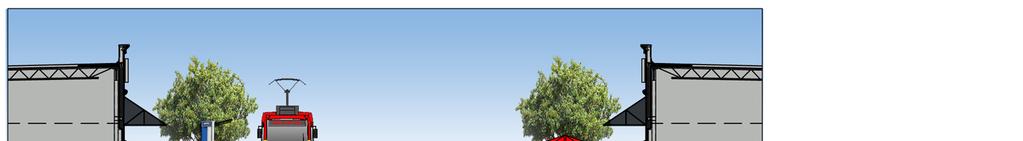
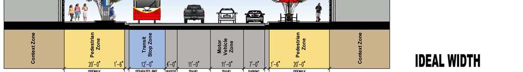


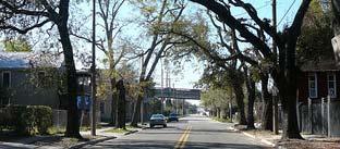
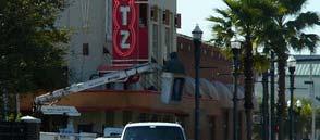
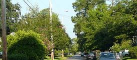

50 46 Figure 5.4.Typical one way couplet cross sections within various rights of way.


 to the City of Orlando.")

, and an increase in automobile travel delays by only 10 seconds during the morning peak hours.")

51 CHAPTER 6. BEST PRACTICES It is important that the safe and efficient movement of traffic, pedestrians and cyclists is maintained on the streets and, also, in the vicinity of trams, light rail and level crossings, within a context sensitive streets setting. In addition to supporting the type of environment that encourages the use of multimodal transportation, it is critical that our roadways are designed, constructed and modified to fit seamlessly with the surrounding land uses and neighborhood context. To facilitate this, several examples of best practices for the implementation of context sensitive streets, within an urban setting, are provided in this section. These examples are intended to serve as guides on which to implement the successful execution of principles, policies and concepts that can be utilized to enhance the quality of our streets. jurisdiction and maintenance from the Florida Department of Transportation (FDOT) to the City of Orlando. A series of Before and After Evaluations were conducted in order to assess the project's impact. As a result of the road diet, analysis indicated that Edgewater Drive had seen a 23% increase in pedestrian traffic (2,632 trips after versus 2,136 trips before), a 30% increase in bicycle traffic (486 trips after versus 375 trips before), and an increase in automobile travel delays by only 10 seconds during the morning peak hours. Furthermore, the automobile Daily Traffic Volume for this roadway had decreased 12%, from 20,501 trips before improvements to 18,131 trips four months after the project s completion. Images of Edgewood Drive are shown below Case Study #1: Edgewater Drive, Orlando, FL Edgewater Drive is a north-south roadway that carries approximately 20,000 Average Daily Trips per day. The roadway serves as College Park's Main Street while accommodating some through-traffic. A 2001/02 roadway re-striping project converted this narrow undivided four-lane facility to a three-lane roadway with bike lanes and parallel parking in this urban Orlando neighborhood. This road diet involved a transfer of 2002 Edgewater Drive in Orlando, FL. 47


52 Case Study #2: Elizabeth Avenue Corridor Project, Charlotte, NC The Elizabeth Avenue Business Corridor project converted a boulevard into a pedestrian-friendly "main street" environment. Home to the local community college and a major hospital complex, the initial program for the Elizabeth Avenue Business Corridor Project was meant to be a road diet plan alone, focused on creating a better pedestrian space and slowing traffic through the heavily traveled corridor. However foresight dictated addressing related issues that would come up in the future as well. Added to the project was the undergrounding of cable, phone, and power lines as well as replacing a 100 year old sewer and water system. All of these infrastructure systems would also have to be kept away from the streetcar track slabs that were to be laid many years before streetcar operation. Instead of digging up the road several times for numerous utility fixes and a new streetcar line it was decided that everything would be done at once to coordinate with each entity. Completed in 2009, the project also includes some special design features including bike lanes that circumnavigate the streetcar loading island. Learning from the Portland experience, bike lanes were placed level with the road instead of elevated so that pedestrians knew of the throughway. This raised the price from $1 million for a road diet alone to $14.5 million for the total reconstruction project. It was one of the first times in the US modern streetcar era that tracks were laid in the street many years before anticipated service, making this project a national benchmark for transportation and utility coordination. In July 2010, the Federal Transit Administration announced that it would allocate a $25 million Urban Circulator Grant to the City of Charlotte for the implementation of the streetcar s first 1.5 mile phase. Construction is estimated to begin in When construction starts, this section of Elizabeth Avenue will not have to be torn up again. Elizabeth Avenue Business Corridor Project Objectives: - Provide streetscape improvements for Elizabeth Avenue - Promote redevelopment of Elizabeth Avenue by developers - Tie project in with CATS Southeast Corridor work and streetcar spur line for downtown - Improve street lighting and provide new mast arms at intersections - Provide streetcar track installation now to minimize impacts to CPCC and new development by Grubb properties - Relocate overhead utilities to underground - Increase waterline and sewer line capacity for future development - Provide streetscape improvements for Elizabeth Avenue Estimated Project Cost: $14,500,000 (for entire section from Kings to Hawthorne) Below: Before and after images of the Elizabeth Avenue project Before (2002) & After (2010): Elizabeth Avenue in Charlotte, NC.


53 Case Study #3: Hendricks Avenue, Jacksonville, FL The Hendricks Avenue project extends about a mile from Prudential Drive south to Mitchell Avenue, along a constrained corridor lined with restaurants, offices and retail shops. This 60' wide stretch of roadway, serves as both a major arterial and avenue within the City of Jacksonville's functional roadway classification system. The purpose of the $6.8 million renovation project was to enhance the visual appeal and underground utilities as a part of the City's Town Center plan. Completed in 2006, the formerly undivided four-lane roadway was converted into a three-lane facility with bike lanes, parallel parking, wider sidewalks, pedestrian scale lighting and landscaping. Since the completion of this streetscape project, Hendricks Avenue has continued to grow in popularity as a multimodal l friendly commercial corridor, linking Downtown Jacksonville with San Marco Square The top right aerial captures the intersection of Hendricks and Landon Avenues in The bottom right aerial is of the intersection in 2010, after the completion of the streetscape and line diet project. The four images below illustrate the environment of this constrained right-of-way today Hendricks Avenue in Jacksonville, FL. 49


54 Case Study #4: Kings Road Pedestrian Enhancements, Jacksonville, FL Kings Road/US 23, stretching 2.5 miles from Martin Luther King Jr. Parkway to Interstate 95, is both a major arterial and constrained avenue, just northwest of Downtown Jacksonville, that bisects the campus of Edward Waters College. Within an existing 60-foot right of way, the street serves one of the broadest range of traffic and transportation needs of all streets within the CBD, UPA and UA development areas. As of 2009, the average annual daily traffic count was 15,100 vehicles for this stretch of US 23. In 2002, the Florida Department of Transportation (FDOT), in conjunction with Edward Waters College, Jacksonville Transportation Authority (JTA) and a consultant team, developed a corridor plan that would be the foundation of a revitalization effort for Kings Road. The long term intent of the plan was to discourage the use of heavy truck traffic on Kings Road, while also incorporating design elements that would enhance pedestrian safety and economically benefit the college and surrounding community. The challenge was finding a balance a between ee pedestrians, s, neighborhood livability and arterial traffic circulation. The resulting recently completed pedestrian enhancement project, between Whitner Street and Spires Avenue, strikes that balance. Widely supported by the college and surrounding community, the master plan will be implemented in phases as the college expands along the corridor. Key features of the $1.43 million retrofit include: Maintaining the existing 4-lane roadway The creation of a landscaped buffer on both sides of Kings Road between the traveled way and sidewalk An improved signalized mid-block pedestrian crossing New signalization and pedestrian enhancements at several intersections Pedestrian scale ornamental street lights Enhanced transit stops Utility relocation and upgrades 50 Kings Road Pedestrian Enhancement Project in Jacksonville, FL.
Multimodal Through Corridors and Placemaking Corridors
 68 Multimodal Through Corridors and Placemaking Corridors Corridors have different functions in a region. Some corridors are used to get smoothly and rapidly through a region or to get quickly to major
o n - m o t o r i z e d transportation is an overlooked element that can greatly enhance the overall quality of life for the community s residents.
 N o n - m o t o r i z e d transportation is an overlooked element that can greatly enhance the overall quality of life for the community s residents. 84 Transportation CHAPTER 11 INTRODUCTION Transportation
ACTIVE TRANSPORTATION
 ACTIVE TRANSPORTATION Mobility 2040 Supported Goals Improve the availability of transportation options for people and goods. Support travel efficiency measures and system enhancements targeted at congestion
Active Transportation Facility Glossary
 Active Transportation Facility Glossary This document defines different active transportation facilities and suggests appropriate corridor types. Click on a facility type to jump to its definition. Bike
Broad Street Bicycle Boulevard Design Guidelines
 Broad Street Bicycle Boulevard Design Guidelines Building from the strategies introduced in the 2013 Bicycle Transportation Plan and community input received thus far, City Transportation Staff have identified
City of Wayzata Comprehensive Plan 2030 Transportation Chapter: Appendix A
 A1. Functional Classification Table A-1 illustrates the Metropolitan Council s detailed criteria established for the functional classification of roadways within the Twin Cities Metropolitan Area. Table
Report. Typical Sections. City of Middleton, WI
 Report Typical Sections City of Middleton, WI December 2006 Report for City of Middleton, Wisconsin Typical Sections repared by: Traffic Associates LLC and STRAND ASSOCIATES, INC. 910 West Wingra Drive
REGIONAL BICYCLE AND PEDESTRIAN DESIGN GUIDELINES
 REGIONAL BICYCLE AND PEDESTRIAN DESIGN GUIDELINES November 16, 2011 Deb Humphreys North Central Texas Council of Governments Bicycle and Pedestrian Advisory Committee Snapshot of the Guide 1. Introduction
INDOT Complete Streets Guideline & Policy
 INDOT Complete Streets Guideline & Policy INTRODUCTION The Complete Streets guidelines build upon multiple efforts and promote a multimodal transportation system that is integrated and sustains land use
CONNECTING PEOPLE TO PLACES
 CONNECTING PEOPLE TO PLACES 82 EAST BENCH MASTER PLAN 07 Introduction The East Bench transportation system is a collection of slow moving, treelined residential streets and major arteries that are the
CONTEXT SENSITIVE STREETS STANDARDS COMMITTEE
 CONTEXT SENSITIVE STREETS STANDARDS COMMITTEE February 23, 2015 Prepared by: Denise Chaplick, AICP City Jacksonville Bicycle and Pedestrian Coordinator Source: NCDOT Complete Streets Planning and Design
Classification Criteria
 SCHEDULE D TO RECOMMENDED OFFICIAL PLAN AMENDMENT NO. 40 SCHEDULE C-4 Road Criteria Criteria Traffic Service Objective Land Service/Access Typical Daily Traffic Volume Flow characteristics Travel Speed
County of Greenville South Carolina. Traffic Calming Program Neighborhood Traffic Education Program and Speed Hump Program
 County of Greenville South Carolina Traffic Calming Program Neighborhood Traffic Education Program and Speed Hump Program (rev) August 2008 I. PURPOSE The potential negative impacts from vehicular traffic
Proposed. City of Grand Junction Complete Streets Policy. Exhibit 10
 Proposed City of Grand Junction Complete Streets Policy Exhibit 10 1 City of Grand Junction Complete Streets Policy Vision: The Complete Streets Vision is to develop a safe, efficient, and reliable travel
CITY OF BLOOMINGTON COMPLETE STREETS POLICY
 CITY OF BLOOMINGTON COMPLETE STREETS POLICY POLICY OBJECTIVE: The City of Bloomington will enhance safety, mobility, accessibility and convenience for transportation network users of all ages and abilities,
Recommended Roadway Plan Section 2 - Land Development and Roadway Access
 Recommended Roadway Plan Section 2 - Land Development and Roadway Access SECTION 2 Land Development and Roadway Access 2.1 Land Use and Access Management The Federal Highway Administration (FHWA) defines
Exhibit 1 PLANNING COMMISSION AGENDA ITEM
 Exhibit 1 PLANNING COMMISSION AGENDA ITEM Project Name: Grand Junction Circulation Plan Grand Junction Complete Streets Policy Applicant: City of Grand Junction Representative: David Thornton Address:
Living Streets Policy
 Living Streets Policy Introduction Living streets balance the needs of motorists, bicyclists, pedestrians and transit riders in ways that promote safety and convenience, enhance community identity, create
Omaha s Complete Streets Policy
 Omaha s Complete Streets Policy (Adopted August 2015) VISION To create great places and enhance our quality of life, the City of Omaha will provide safe, accessible streets for all users. Complete Streets
Aurora Urban Street Standards For Transit Oriented Developments and Urban Centers
 Aurora Urban Street Standards For Transit Oriented Developments and Urban Centers I. Purpose These standards will be applied to create a safe, comfortable, pleasant and pedestrian-friendly multi-modal
complete streets design and construction standards public primer City of Edmonton
 complete streets design and construction standards public primer City of Edmonton introduction Complete Streets are streets for everyone: people who walk, wheel, bike, take transit, or drive. They are
Roadway Classification Design Standards and Policies. Pueblo, Colorado November, 2004
 Roadway Classification Design Standards and Policies Pueblo, Colorado November, 2004 Table of Contents Page Chapter 1. General Provisions 1.1 Jurisdiction 3 1.2 Purpose and Intent 3 1.3 Modification 3
Vision: Traditional hamlet with an attractive business/pedestrian friendly main street connected to adjacent walkable neighborhoods
 N D. Focus Area II Vision: Traditional hamlet with an attractive business/pedestrian friendly main street connected to adjacent walkable neighborhoods Transit Road Focus Area II is located in the Hamlet
CITY OF COCOA BEACH 2025 COMPREHENSIVE PLAN. Section VIII Mobility Element Goals, Objectives, and Policies
 CITY OF COCOA BEACH 2025 COMPREHENSIVE PLAN Section VIII Mobility Element Goals, Objectives, and Policies Adopted August 6, 2015 by Ordinance No. 1591 VIII MOBILITY ELEMENT Table of Contents Page Number
CURBSIDE ACTIVITY DESIGN
 5 CURBSIDE ACTIVITY DESIGN This chapter provides design guidance for separated bike lanes adjacent to curbside activities including parking, loading and bus stops. Typical configurations are presented
Chapter 2: Standards for Access, Non-Motorized, and Transit
 Standards for Access, Non-Motorized, and Transit Chapter 2: Standards for Access, Non-Motorized, and Transit The Washtenaw County Access Management Plan was developed based on the analysis of existing
Complete Streets. Designing Streets for Everyone. Sarnia
 Complete Streets Designing Streets for Everyone Sarnia Complete Streets ~ Sarnia ~ 2018 Introduction Our City is made up of a network of streets that we use to go for a walk, cycle to work, drive to the
Chapter 7. Transportation. Transportation Road Network Plan Transit Cyclists Pedestrians Multi-Use and Equestrian Trails
 Chapter 7 Transportation Transportation Road Network Plan Transit Cyclists Pedestrians Multi-Use and Equestrian Trails 7.1 TRANSPORTATION BACKGROUND The District of Maple Ridge faces a number of unique
NM-POLICY 1: Improve service levels, participation, and options for non-motorized transportation modes throughout the County.
 Transportation PRINCE WILLIAM COUNTY 2008 COMPREHENSIVE PLAN NON-MOTORIZED PLAN CONTENTS Goals, Policies, and Action Strategies Table 4 (Bike Facility Classifications and Descriptions) Table 5 (Bike Facility
M-58 HIGHWAY ACCESS MANAGEMENT STUDY Mullen Road to Bel-Ray Boulevard. Prepared for CITY OF BELTON. May 2016
 M-58 HIGHWAY ACCESS MANAGEMENT STUDY Prepared for CITY OF BELTON By May 2016 Introduction Missouri State Highway 58 (M-58 Highway) is a major commercial corridor in the City of Belton. As development has
INTRODUCTION THOROUGHFARE SYSTEM CLASSIFICATIONS
 INTRODUCTION The thoroughfare plan will assist public officials in the development of a specialized system for efficient and safe movement of vehicular traffic while minimizing potential conflicts with
City of Elizabeth City Neighborhood Traffic Calming Policy and Guidelines
 City of Elizabeth City Neighborhood Traffic Calming Policy and Guidelines I. Purpose: The City of Elizabeth City is committed to ensure the overall safety and livability of residential neighborhoods. One
5 CIRCULATION AND STREET DESIGN
 5 CIRCULATION AND STREET DESIGN This chapter describes circulation and streetscape improvements proposed for the Northwest Chico Specific Plan Area. It includes detailed design specifications for existing
APPENDIX A: Complete Streets Checklist DRAFT NOVEMBER 2016
 APPENDIX A: Complete Streets Checklist DRAFT NOVEMBER 2016 Complete Streets Checklist MetroPlan Orlando s Complete Streets Checklist is an internal planning tool for staff to further implementation of
Solana Beach Comprehensive Active Transportation Strategy (CATS)
") Solana Beach Comprehensive Active Transportation Strategy (CATS) 3.0 Goals & Policies The Solana Beach CATS goals and objectives outlined below were largely drawn from the Solana Beach Circulation Element
Solana Beach Comprehensive Active Transportation Strategy (CATS) 3.0 Goals & Policies The Solana Beach CATS goals and objectives outlined below were largely drawn from the Solana Beach Circulation Element
City of Novi Non-Motorized Master Plan 2011 Executive Summary
 City of Novi Non-Motorized Master Plan 2011 Executive Summary Prepared by: February 28, 2011 Why Plan? Encouraging healthy, active lifestyles through pathway and sidewalk connectivity has been a focus
Access Management in the Vicinity of Intersections
 Access Management in the Vicinity of Intersections FHWA-SA-10-002 Technical Summary Photo: Ralph Bentley (used with permission) 0 Access Management is: The design, implementation and management of entry
Appendix C. TRAFFIC CALMING PROGRAM TOOLBOX
 Appendix C. TRAFFIC CALMING PROGRAM TOOLBOX PHASE I...2 Do Not Enter Sign...3 One-Way Sign...4 Turn Prohibition...5 Pavement Markings...6 Speed Monitoring Trailer...7 Neighborhood Speed Watch...8 Police
West Dimond Blvd Upgrade Jodhpur Street to Sand Lake Road
 West Dimond Blvd Jodhpur St to Sand Lake CSS Transportation Project Summary Municipality of Anchorage Project # 05 005 Project Manager: John Smith, P.E. (MOA PM&E) Project Administrator: Julie Makela,
Tonight is for you. Learn everything you can. Share all your ideas.
 Strathcona Neighbourhood Renewal Draft Concept Design Tonight is for you. Learn everything you can. Share all your ideas. What is Neighbourhood Renewal? Creating a design with you for your neighbourhood.
Agenda. Overview PRINCE GEORGE S PLAZA METRO AREA PEDESTRIAN PLAN
 PRINCE GEORGE S PLAZA METRO AREA PEDESTRIAN PLAN May 28, 2008 Agenda Welcome and introductions Project overview and issue identification Planning context and strengths Design challenges and initial recommendations
Appendix 3 Roadway and Bike/Ped Design Standards
 Appendix 3 Roadway and Bike/Ped Design Standards OTO Transportation Plan 2040 4/20/2017 Page A3-1 Adopted Standards The adopted OTO Design Standards and Major Thoroughfare Plan are contained herein.
Bicycle and Pedestrian Advisory Committee (BPAC) November 21, 2013
 November 21, 2013") Bicycle and Pedestrian Advisory Committee (BPAC) November 21, 2013 OVERALL LAND USE CONCEPT Overall Broadway Valdez District: 95.5 acres (35.1 acres right-of ways + 60.4 acres developable land) Plan Subareas:
Bicycle and Pedestrian Advisory Committee (BPAC) November 21, 2013 OVERALL LAND USE CONCEPT Overall Broadway Valdez District: 95.5 acres (35.1 acres right-of ways + 60.4 acres developable land) Plan Subareas:
TRAFFIC CALMING GUIDE FOR TORONTO CITY OF TORONTO TRANSPORTATION SERVICES DIVISION
 TRAFFIC CALMING GUIDE FOR TORONTO CITY OF TORONTO TRANSPORTATION SERVICES DIVISION CITY OF TORONTO TRANSPORTATION SERVICES DIVISION 2016 TRAFFIC CALMING GUIDE FOR TORONTO TABLE OF CONTENTS Introduction
Physical Implications of Complete Streets Policies
 Presentation Overview Physical Implications of Complete Norm Cox, ASLA, LLA Landscape Architect Ann Arbor, Michigan, 10:45 to Noon What Are Complete Streets? What Matters to Bicyclists and Pedestrians
Chapter 5 Future Transportation
 Chapter 5 Future Transportation The Future Land Use Plan identifies the desired land use designations. The land uses desired for Crozet depend, in large part, on the success of the transportation system,
Planning Guidance in the 2012 AASHTO Bike Guide
 Planning Guidance in the 2012 AASHTO Bike Guide Presentation by: RJ Eldridge Peter Lagerwey August 22, 2012 WEBINAR 2: PLANNING GUIDANCE IN THE 2012 AASHTO BIKE GUIDE Today s Webinar Significant Updates
Executive Summary Route 30 Corridor Master Plan
 Route Corridor Master Plan Project Overview The Route Corridor Master Plan is a coordinated multimodal transportation and land use plan for the entire stretch of Route through East Whiteland Township,
AMATS Complete Streets Policy
 AMATS Complete Streets Policy Table of Contents: Section 1. Definition of Complete Streets Section 2. Principles of Complete Streets Section 3. Complete Streets Policy Section 4. Consistency Section 5.
Item to be Addressed Checklist Consideration YES NO N/A Required Description Complete Streets Guidelines
 Passaic County Complete Streets Checklist - Concept Development Project Name Item to be Addressed Checklist Consideration YES NO N/A Required Description Complete Streets Guidelines Existing Plans Have
Corpus Christi Metropolitan Transportation Plan Fiscal Year Introduction:
 Introduction: The Safe, Accountable, Flexible, Efficient Transportation Equity Act: A Legacy for Users (SAFETEA-LU) has continued the efforts started through the Intermodal Surface Transportation Efficiency
Off-road Trails. Guidance
 Off-road Trails Off-road trails are shared use paths located on an independent alignment that provide two-way travel for people walking, bicycling, and other non-motorized users. Trails specifically along
County of Spartanburg South Carolina
 County of Spartanburg South Carolina Traffic Calming Program June 2012 (Revised/Program on Hold) PURPOSE The potential negative impacts from vehicular traffic on residential roads have been a longstanding
PRINCE GEORGE S PLAZA METRO AREA PEDESTRIAN PLAN
 PRINCE GEORGE S PLAZA METRO AREA PEDESTRIAN PLAN May 28, 2008 Agenda Welcome and introductions Project overview and issue identification Planning context and strengths Design challenges and initial recommendations
COWETA HIGH SCHOOL AND EAST HIGHWAY 51
 COWETA HIGH SCHOOL AND EAST HIGHWAY 51 Lack of sidewalks along Ben Lumpkin Rd. Lack of crosswalks and ramps at intersection. Hwy 51 is wide to cross as a pedestrian. No ADA compliance or connection to
NEWMARKET UPHAM S CORNER
 SOUTH STATION Planning Initiative NEWMARKET UPHAM S CORNER COLUMBIA ROAD (P) FOUR CORNERS/GENEVA Working Advisory Group (WAG) Meeting #5 TALBOT AVENUE MORTON STREET BLUE HILL AVE/CUMMINS HWY (P) RIVER
RESOLUTION NO ?? A RESOLUTION OF THE CITY OF NEPTUNE BEACH ADOPTING A COMPLETE STREETS POLICY
 RESOLUTION NO. 2018-?? A RESOLUTION OF THE CITY OF NEPTUNE BEACH ADOPTING A COMPLETE STREETS POLICY WHEREAS, safe, convenient, and accessible transportation for all users is a priority of the City of Neptune
5 Circulation & Parking
 5 Circulation & Parking Downtown Parking & Circulation Strategy. Downtown Wayne has a somewhat disconnected system of local public streets to connect downtown with the residential neighborhoods, and primary
Bicycle Facilities Planning
 Bicycle Facilities Planning Overview Types of Cyclists Purpose for Riding Types of Facilities Bike Lanes Bicycle Boulevards Cycle Tracks Intersections Signals Signing and Marking Discussion Types of Bicyclists
Cycle Track Design Best Practices Cycle Track Sections
 Design Best Practices Sections It is along street segments where the separation and protection methods of cycle tracks offer more comfort than conventional bicycle lanes, and are more attractive to a wide
Chapter 3 DESIGN SPECIFICATIONS
 Brampton PathWays Planning and Design Guidelines 27 Chapter 3 DESIGN SPECIFICATIONS 3.1 CLASS 1 MULTI-USE PATH Off-road multi-use trails are the backbone of the Brampton PathWays Network. They are typically
Implementing Complete Streets in Ottawa. Project Delivery Process and Tools Complete Streets Forum 2015 October 1, 2015
 Implementing Complete Streets in Ottawa October 1, 2015 The Essentials Complete Streets Implementation Framework will become part of the routine delivery of City transportation projects Approach uses every
Roadways. Roadways III.
 Introduction 97 Roadway Design Principles 98 Safe Speeds 99 Optimizing of Street Space 00 Minimum Lane Widths in the City of Boston 02 Design Features that Reduce Operating Speeds 05 Travel Lanes Transit
Defining Purpose and Need
 Advanced Design Flexibility Pilot Workshop Session 4 Jack Broz, PE, HR Green May 5-6, 2010 Defining Purpose and Need In your agency s project development process, when do design engineers typically get
On Road Bikeways Part 1: Bicycle Lane Design
 On Road Bikeways Part 1: Bicycle Lane Design Presentation by: Nick Jackson Bill Schultheiss, P.E. September 04, 2012 FOLLOW THE CONVERSATION ON TWITTER Toole Design Group is live tweeting this webinar
Clackamas County Comprehensive Plan
 ROADWAYS The County s road system permits the movement of goods and people between communities and regions, using any of a variety of modes of travel. Roads provide access to virtually all property. They
EXECUTIVE SUMMARY. Vision
 Vision Walking and bicycling in Salt Lake City will be safe, convenient, comfortable, and viable transportation options that connect people to places, foster recreational and economic development opportunities,
This chapter describes the proposed circulation system and transportation alternatives associated with
 5.0 Circulation 5.1 OVERVIEW This chapter describes the proposed circulation system and transportation alternatives associated with West Landing, and summarize the information contained in the Existing
5/31/2016 VIA . Arwen Wacht City of Sacramento Community Development Department 300 Richards Blvd., 3 rd Floor Sacramento, CA 95811
 5/31/2016 VIA EMAIL Arwen Wacht City of Sacramento Community Development Department 300 Richards Blvd., 3 rd Floor Sacramento, CA 95811 RE: El Pollo Loco (P16-028) Dear Ms. Wacht: WALKSacramento has reviewed
DRAFT - CITY OF MEDFORD TRANSPORTATION SYSTEM PLAN Roadway Cross-Sections
 Roadway Cross-Sections Medford s roadway cross-section standards apply to new and reconstructed roads. The crosssections take into consideration roadway function and operational characteristics, including
Non-Motorized Transportation 7-1
 Non-Motorized Transportation 7-1 Transportation facilities no longer mean just accommodating a vehicle powered by a combustion engine. Pedestrian and non-motorized facilities are important modes of travel
How To Encourage More Efficient Transportation in Brazilian Cities
 How To Encourage More Efficient Transportation in Brazilian Cities Todd Litman Victoria Transport Policy Institute Presented Seminar on Discouraging The Use Of Cars São Paulo, Brazil 3 September 2013 Creating
Circulation in Elk Grove includes: Motor vehicles, including cars and trucks
 Circulation, as it is used in this General Plan, refers to the many ways people and goods move from place to place in Elk Grove and the region. Circulation in Elk Grove includes: Motor vehicles, including
Transportation Master Plan Advisory Task Force
 Transportation Master Plan Advisory Task Force Network Alternatives & Phasing Strategy February 2016 BACKGROUND Table of Contents BACKGROUND Purpose & Introduction 2 Linking the TMP to Key Council Approved
4 MOBILITY PLAN. Mobility Plan Objectives. Mobility Context. 1. Integrate with Local and Regional Transit Improvements
 Harbor Mixed Use CHAPTER Transit Corridor 4: Mobility Plan 4 MOBILITY PLAN Mobility Plan Objectives The Harbor Corridor Plan seeks to expand and improve the ways that people move along and through the
East Burke Transportation, Safety and Capacity Improvements
 East Burke Transportation, Safety and Capacity Improvements The purpose of this project is to increase mobility and improve safety for pedestrians, cyclists, and motor vehicles along VT Route 114 in the
Designing Complete Streets: What you need to know
 Designing Complete Streets: What you need to know Getting from this to this. Continuous sidewalk Buffer w/trees Bicycle lane Raised median Buildings close to the street Flexibility in design Design and
TRANSPORTATION NEEDS ASSESSMENT
 TRANSPORTATION NEEDS ASSESSMENT A travel demand analysis was carried out to determine the operational issues and the potential benefit that adding traffic capacity would have on the road network. All the
Town of Babylon Sustainable Complete Streets Policy
 Town of Babylon Sustainable Complete Streets Policy Steve Bellone, Supervisor Adopted July 14, 2010 1 Table of Contents Vision... 3 Policy Statement... 3 Definition... 3 Road Users... 4 Network... 4 Roads...
5. RUNNINGWAY GUIDELINES
 5. RUNNINGWAY GUIDELINES These guidelines should be considered collectively when making runningway decisions. A runningway is the linear component of the transit system that forms the right-of-way reserved
Perryville TOD and Greenway Plan
 Perryville TOD and Greenway Plan Greenway Glossary Pathway: A bicycle and pedestrian path separated from motorized vehicular traffic by an open space, barrier or curb. Multi-use paths may be within the
10.0 CURB EXTENSIONS GUIDELINE
 10.0 CURB EXTENSIONS GUIDELINE Road Engineering Design Guidelines Version 1.0 March 2017 City of Toronto, Transportation Services City of Toronto Page 0 Background In early 2014, Transportation Services
12/4/2016 VIA . RE: Grocery Outlet Del Paso (DR16-328)
") 12/4/2016 VIA EMAIL Ethan Meltzer, Assistant Planner City of Sacramento Community Development Department 300 Richards Blvd, 3 rd Floor Sacramento, CA 95811 RE: Grocery Outlet Del Paso (DR16-328) Dear Mr.
12/4/2016 VIA EMAIL Ethan Meltzer, Assistant Planner City of Sacramento Community Development Department 300 Richards Blvd, 3 rd Floor Sacramento, CA 95811 RE: Grocery Outlet Del Paso (DR16-328) Dear Mr.
What Is a Complete Street?
 Session 5 Charleen Zimmer, AICP, Zan Associates May 5-7, 2010 What Is a Complete Street? May 2010 5-1 Not a Complete Street More of a Complete Street May 2010 5-2 Benefits of Complete Streets Safety for
2025 Comprehensive Plan for the City of Temple Terrace Florida. Mobility Element. Adopted by City Council June 30, 2009
 2025 Comprehensive Plan for the City of Temple Terrace Florida Mobility Element Adopted by City Council June 30, 2009 Effective Date September 22, 2009 GOAL 2: To protect and promote the quality of life
Route 7 Corridor Study
 Route 7 Corridor Study Executive Summary Study Area The following report analyzes a segment of the Virginia State Route 7 corridor. The corridor study area, spanning over 5 miles in length, is a multi
Access Management Regulations and Standards
 Access Management Regulations and Standards Efficient highway operation Reasonable property access Concept of Access Management The way to manage access to land development while simultaneously preserving
APPROVE A RESOLUTION ADOPTING A COMPLETE STREETS POLICY
 STAFF REPORT MEETING DATE: September 13, 2016 TO: FROM: City Council Bob Brown, Community Development Director Russ Thompson, Public Works Director Patrick Filipelli, Management Analyst 922 Machin Avenue
TOWN OF PORTLAND, CONNECTICUT COMPLETE STREETS POLICY
 TOWN OF PORTLAND, CONNECTICUT COMPLETE STREETS POLICY I. VISION, GOALS & PRINCIPLES VISION To improve the streets of Portland making them safer and more accessible for all users including pedestrians,
2. Context. Existing framework. The context. The challenge. Transport Strategy
 Transport Strategy Providing quality connections Contents 1. Introduction 2. Context 3. Long-term direction 4. Three-year priorities 5. Strategy tree Wellington City Council July 2006 1. Introduction Wellington
City of Vallejo Traffic Calming Toolbox
 City of Vallejo Traffic Calming Toolbox June 1, 2013 Final Table of Contents Introduction... 1 Non-Physical Devices... 3 High-Visibility Crosswalk... 3 In Pavement Lighted Crosswalk... 4 Rapid Flashing
EXECUTIVE SUMMARY: TRANSIT-ORIENTED DEVELOPMENT IN SMITHS FALLS, ONTARIO; A COMPARISON BETWEEN TWO SITES
 EECUTIVE SUMMARY: TRANSIT-ORIENTED DEVELOPMENT IN SMITHS FALLS, ONTARIO; A COMPARISON BETWEEN TWO SITES Topic and Purpose In 2007, the Mayor of Ottawa s Task Force on Transportation suggested adding a
ROUNDABOUTS/TRAFFIC CIRCLES
 GENERAL 1. Description This standard identifies minimum requirements that shall be met for Roundabouts and Neighborhood Traffic Circles in the design and construction of elements for Arlington County Horizontal
21.07 TRANSPORT CONNECTIVITY AND INFRASTRUCTURE
 21.07 TRANSPORT CONNECTIVITY AND INFRASTRUCTURE 21.07-1 Connectivity and Choice Transport connectivity and mode choice are critical to achieving productive, sustainable and socially just cities. Travel
Appendix T CCMP TRAIL TRAFFIC & TRANSPORTATION DESIGN STANDARD
 Appendix T CCMP 3.3.4 TRAIL TRAFFIC & TRANSPORTATION DESIGN STANDARD 3.3.4 Trail Traffic and Transportation Design Multi-use trails have certain design standards, which vary depending on the agency that
Hennepin County Pedestrian Plan Public Comment Report
 Hennepin County Pedestrian Plan Public Comment Report On May 31, 2013, the draft Hennepin County Pedestrian Plan was released for a 45-day public comment period ending July 15, 2013. The county received
CHAPTER 16 PEDESTRIAN FACILITIES DESIGN AND TECHNICAL CRITERIA TABLE OF CONTENTS
 CHAPTER 16 PEDESTRIAN FACILITIES DESIGN AND TECHNICAL CRITERIA TABLE OF CONTENTS Section Title Page 16.1 General... 16-1 16.1.1 AASHTO Reference... 16-1 16.1.2 ADA Requirements... 16-1 16.2 Sidewalks...
Chapter 6 Transportation Plan
 Chapter 6 Transportation Plan Transportation Plan Introduction Chapter 6 Transportation Plan Transportation Plan Introduction This chapter describes the components of Arvada s transportation system, comprised
Retrofitting Urban Arterials into Complete Streets
 Retrofitting Urban Arterials into Complete Streets John N. LaPlante, P.E., P.T.O.E., T.Y. Lin International Prepared for: Illinois Traffic Engineering & Safety Conference Urbana, Illinois October 18, 2007
Moving Towards Complete Streets MMLOS Applications
 Moving Towards Complete Streets MMLOS Applications Transportation Education Series May 18 th, 2012 It s not just for cars! Presentation Overview The Complete Streets Movement What is Multi-Modal Level