Bremen Elementary. SAFE ROUTES TO SCHOOL TRAVEL PLAN October 9, 2012
|
|
|
- Arleen Strickland
- 6 years ago
- Views:
Transcription


1 Bremen Elementary SAFE ROUTES TO SCHOOL TRAVEL PLAN October 9, 2012
2 Introduction The purpose of the Bremen Elementary Safe Route to School (SRTS) Plan is to encourage school age children to travel to school by means other than a motorized vehicle, specifically active methods of transportation such as walking or biking. The benefits of promoting active transportation models include encouraging increased physical activity and developing healthy habits, developing a sense of freedom and responsibility, and supporting an environmentally friendly activity while creating a safer area around the school. The Ohio Safe Routes to School (SRTS) program is funded by the Federal Highway Administration and administered by the Ohio Department of Transportation (ODOT). The program supports projects and programs that enable and encourage walking and bicycling to and from school. The Ohio SRTS Program funds two types of projects: 1) Infrastructure Projects: Infrastructure projects, or engineering projects, include operational and physical improvements and establish safer and fully accessible pedestrian and bicycle infrastructure, such as crossings, walkways, trails and bikeways. All infrastructure projects must improve conditions for students walking or bicycling within two miles of the target school. 2) Non-Infrastructure Projects: Non-infrastructure projects include education, encouragement, and enforcement activities intended to affect student or driver behavior, and evaluation activities to monitor impact of the SRTS program. The goal of SRTS programs is to provide pedestrians and bicyclists a safe way to travel to and from school. With community involvement, and efforts by schools and citizens, the program improves the health and well-being of children by enabling and encouraging students to walk or bike to school. SRTS programs improve infrastructure, making walking and bicycling a more appealing method of transportation for students. Through implementation of SRTS programs, results show reduction in traffic and air pollution, and encouragement for a healthy active lifestyle at an early age. The Ohio SRTS Program funds countermeasures in five categories called the 5 Es. The Five Es of Safe Routes to School: Engineering Strategies create safer environments for walking and bicycling to school through improvements to the infrastructure surrounding schools. These improvements focus on reducing motor vehicle speeds and conflicts with pedestrians and bicyclists, and establishing safer and fully accessible crossings, walkways, trails and bikeways. Education Programs target children, parents, caregivers, and neighbors, teaching how to walk and bicycle safely and informing drivers on how to drive more safely around pedestrians and bicyclists. Education programs can also incorporate personal security issues, as well as health and environmental messages. Enforcement Strategies increase the safety of children bicycling and walking to school by helping to change unsafe behaviors of drivers, as well as pedestrians and bicyclists. A community approach to enforcement involves students, parents, caregivers, school personnel, crossing guards and law enforcement officers. Bremen Elementary SRTS (Draft) Bremen, OH 1 Oct. 2012
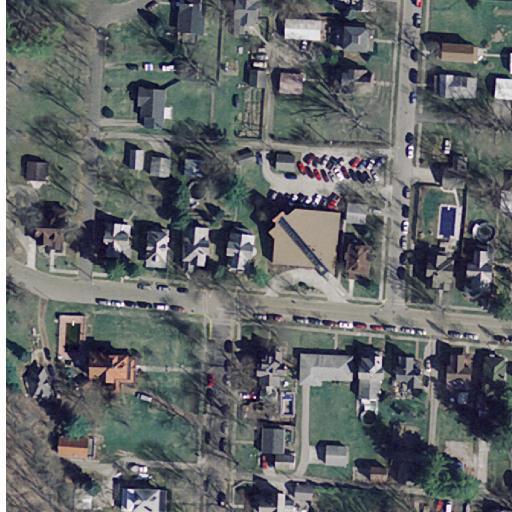
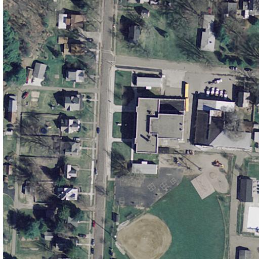
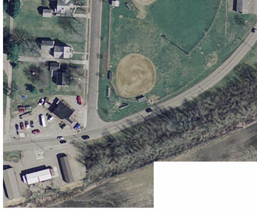
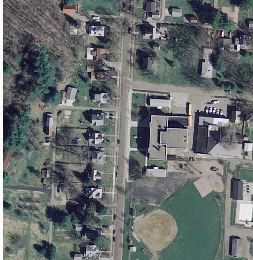
3 Encouragement Activities promote walking and bicycling to school to children, parents and community members. Events such as Walk to School Day, contests such as a Frequent Walker/Bicyclist challenge, or on-going programs such as Walking School Bus or Bicycle Train can promote and encourage walking and bicycling as a popular way to get to school. Evaluation Evaluation is an important component of SRTS programs that can be incorporated into each of the other Es. Collecting information before and after program activities or projects are implemented allow communities to track progress and outcomes, and provide information to guide program development. Background The village of Bremen is located in Fairfield County, Ohio. Within the Village of Bremen, key individuals involved with the community and the school district were tasked with creating a successful SRTS Program (see next page for the SRTS Committee members information). The Bremen School Travel Plan targets Bremen Elementary for this study. This study includes a review of crash records from , results from a walk audit, identification of existing conditions, and determination of possible countermeasures and solutions. Specific improvement suggestions were developed for the school to address short, medium, and long term needs of students to encourage walking and biking. SECTION 1: OUR SCHOOL School District School Name School Address Grades served Fairfield Union Local Bremen Elementary School (completed 2010) 210 Strayer Avenue Bremen, OH Pre K-4 Bremen Elementary Students Average Daily Student Enrollment Black, non- Hispanic American Indian or Alaska Native Asian or Pacific Islander Hispanic Multi- Racial White, non- Hispanic Economically Disadvantaged Limited English Proficient Students with Disabilities Migrant Bremen Elementary SRTS (Draft) Bremen, OH 2 Oct. 2012
4 Community Representatives: Name address 5 E Role: Eric Oberg eric@railstotrails.org Evaluation/Encouragement Sally Grimm sgrimm003@columbus.rr.com Encouragement/Education Pat Paskins patsvision@yahoo.com Encouragement/Education Sue Schmitz mini.achers712@yahoo.com Encouragement/Education Junee VanDyke Encouragement/Education Local Government Representatives: Name address 5 E Role: Doug Hockman oilcity2@frontier.com Engineering/Enforcement Our SRTS team members include: School Representatives: Name address 5 E Role: Frederick Burns FrederickBurns@fairfieldunion.k12.oh.us Education/Evaluation Education Representative: Name address 5 E Role: Carole Osbourne CaroleOsborne@fairfieldunion.k12.oh.us Education/Evaluation Sandy Seifert SandraSeifert@fairfieldunion.k12.oh.us Education/Evaluation Dave Senften DaveSenften@fairfieldunion.k12.oh.us Education/Evaluation Health Representatives: Name address 5 E Role: Rose Ann Elliot RoseAnnElliott@fairfieldunion.k12.oh.us Education Public Safety Representatives: Name address 5 E Role: John Warner jwarner@sheriff.fairfield.oh.us Education & Enforcement Other: Name address 5 E Role Deborah Nance bobatjc@ohiohills.com Encouragement/Education Jane & John Snider jjsnider99@yahoo.com Encouragement/Education 1A. The lead contact for our Plan is: Name: Eric Oberg Affiliation: Bremen Resident, Parent Phone Number: address: eric@railstotrails.org Mailing address: 3520 Durbin Run Rd. Bremen, OH Bremen Elementary SRTS (Draft) Bremen, OH 3 Oct. 2012
5 SECTION 2: OUR SRTS VISION Our SRTS Vision: The BSAFFE Committee wishes to advocate for, support and promote walking and biking to school at Bremen Elementary. With the support of Safe Routes to School program, we hope to increase the number of students and residents who walk and bike through innovative and fun programming as well as improved facilities. SECTION 3: CURRENT STUDENT TRAVEL 3A. How many students live within walking and bicycling distance of school? Distance From School Number of Students % of Student Body Within 1/4 mile of school - - Within 1/2 mile of school Within 1 mile of school Within 2 miles of school See Appendix A for the school attendance boundary map 3B. How many students are currently walking and bicycling to school? What are the primary walking and bicycling routes? Number of students (morning trips) Number of students (afternoon trips) Primary walking/bicycling routes Walk Bike School bus Family Vehicle Carpool Public Transit Strayer Avenue to Marietta Street Angle Street to Marietta Street Other 3C. Are there any school or district policies that impact students walking or bicycling to school? District Bus Policies Policy: The transportation policies of the board are aimed at providing a safe, efficient, and economical method of getting students to and from school. The board provides school bus transportation to all elementary and secondary school students to the extent determined by the administration and approved by the board. Districts are not required to bus students who live closer than two miles to the school they attend. Most students within the school district utilize the bussing system provided or are driven to school by an adult. Forty-five percent of students live within two miles of the school where hazard bussing has been Bremen Elementary SRTS (Draft) Bremen, OH 4 Oct. 2012


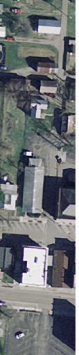
 and the drop off in front of the school are designated for parents, while the designated bus area is on the south side of")


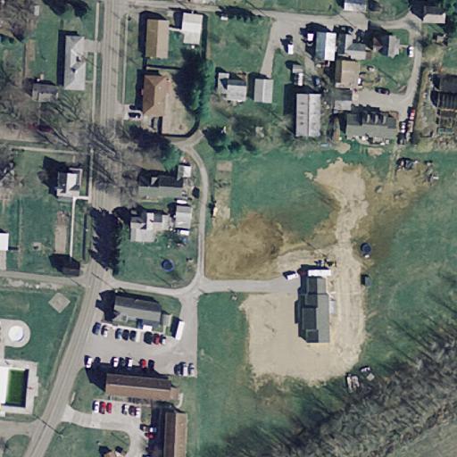
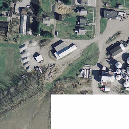
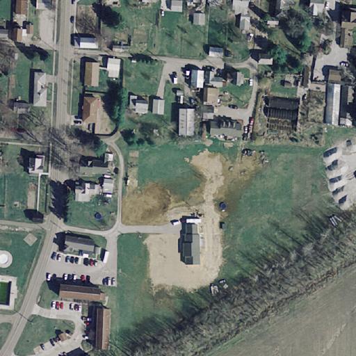
6 implemented. Most of the pre-kindergarten and kindergarten students are driven to and from school by parents. School Travel Policies Policy: The primary consideration in all matters pertaining to transportation is the safety and welfare of student riders; the transportation program meets all requirements regarding the testing and approval of bus drivers, standards for buses and safe speeds. There are no restrictions or age requirements on bicycling to or from school. The bike rack is located on the north side of the building, adjacent to the staff parking lot. A school rule is that bicyclists are not allowed to travel through the north parking lot when arriving or leaving the school; they must travel on Strayer Avenue as the parking lot becomes busy with motorized vehicles and is not safe for students. Students who bike are released out of the north side door of the school and must walk their bikes to Strayer Avenue before mounting and riding. 3D. School Arrival and Dismissal Process There currently are two designated areas for students to be dropped off/picked up by motorized vehicles, and one designated area for the buses. The north parking lot (with entrances off of Ford Street and Adale Street) and the drop off in front of the school are designated for parents, while the designated bus area is on the south side of the school. Some parents choose to drop their kids off at the bus drop off/pick up as well. Students are only permitted to enter the school through entrances located on the south side of the building. There are two entrances for the students; one entrance is for pre-kindergarten and kindergarten students, the other entrance is for grades 1-4. Students are not permitted into the building before 9:00 AM unless under severe weather conditions. During the A.M. arrival, there is a staff member located at the student entrance for grades 1-4, and at kindergarten entrance. There is no staff monitor for the north parking lot throughout the AM arrival. Student drop off at front of school During dismissal, the school operates with a staggered release process. The pre-kindergarten and kindergarten students are released first, then grades 1-4. Students riding a bus wait inside the building for the arrival of their bus before boarding. Also, a Valet dismissal process takes place at the north side door for students whose parents pick them up by a vehicle or students who walk or bike to school (the dismissal time for these students starts at the same time the pre-k kindergarten and kindergarten students are released). Students are not allowed to walk or ride their bike through the parking lot; they must walk out to Strayer Avenue. During dismissal, there are staff members located at the exits for the kindergarten and grades 1-4 (at the doors), as well as staff located in the north parking lot for the Valet release. The district does not provide crossing guards or police officers serving the school and there is no student safety patrol program in place at the elementary school. Bike rack on north side of school Bus drop off area on south side of school Bremen Elementary SRTS (Draft) Bremen, OH 5 Oct. 2012
7 3E. Parent Attitudes towards walking and biking Reasons parents gave for not allowing their children to walk or bicycle to school include: 1) Residing too far away/outside of town 2) Weather or climate 3) Speed of traffic along route 4) Amount of traffic along route 5) Safety of intersections and crossings 3F. Safety Issues and Concerns The greatest safety concern parents have is distance. A good portion of the students live outside of the village, and it is not safe for the students to walk to school on the rural roads. Weather is also a major concern for parents. The traffic safety concerns are the amount of traffic, and the speed of the traffic along the different route. This provides an unsafe environment for students to utilize walking and/or bicycling to school. Other areas for concern include safety at intersections and crossings, crime, and sidewalk conditions. See Appendix B for a summary and break down of the parent and student surveys. Relevant traffic crashes There were no pedestrian crashes within the STP study area between 2007 and G. Walking and bicycling encouragement activities at the school. The elementary school does not currently provide activities that encourage walking and bicycling to school. However, there is a bi-annual Health and Safety Fair that has a class on bike safety. There is also a school program called the Mileage Club which rewards students for the miles they walk during recess. The school and community have plans to start a Bike Rodeo, Walking School Bus, and a Bike to school day. SECTION 4: KEY ISSUES IMPACTING SAFE WALKING AND BICYCLING TO SCHOOL 1) Many sidewalks near the school are in poor condition; they are deteriorating, cracking, crumbling, and uneven. Some crossings over driveways are not level. Sidewalks provide a safe and healthy option of travel for pedestrians, and the current conditions present potential tripping hazards for anyone utilizing these pathways. See pictures on the following page. Bremen Elementary SRTS (Draft) Bremen, OH 6 Oct. 2012


 would be")

 Eastbound Marietta St.")

8 Northbound Strayer Ave. east sidewalk north of school Northbound Strayer Ave. west sidewalk across from school Eastbound Marietta St. north sidewalk between Oak St. & Bartlett St. 2) The existing crosswalks (or lack of) near the school present potential hazards for pedestrians. Existing crosswalk pavement markings on Strayer Avenue and along Marietta Street are faded and need to be restriped. There is no crosswalk on Angle Street across from the school; many students live in the apartments located southeast of the school and cross Angle Street. There are no crossing guards to assist students in the morning and afternoon hours. A Rectangular Rapid Flashing Beacon (RRFB) would be a good addition to increase visibility for a proposed Angle Street crosswalk. Northbound Strayer Ave. crosswalk at Ford St. Eastbound Angle St. (no crosswalk) Eastbound Marietta St. crosswalk at Oak St. Proposed ladder style crosswalk and signs for Strayer Ave. at Ford St. Example of a Rectangular Rapid Flashing Beacon (RRFB). These are activated by pedestrian pushbutton and can be solar powered or hardwired. Bremen Elementary SRTS (Draft) Bremen, OH 7 Oct. 2012


 The existing roadway signing")


9 3) In addition to the crosswalks, there is a lack of ADA curb ramps at many of the crossings/intersections near the school. The existing curb ramps are not ADA compliant. In some cases, crosswalks do not have curb ramps installed. The potential hazards for not having ADA compliant curb ramps installed affects pedestrians, bicyclists, and persons using wheelchairs or scooters. Curb at Marietta St. & Strayer Ave. intersection Curb at Strayer Ave. & Ford St. intersection Curb at Marietta St. & Oak St. intersection 4) The existing roadway signing around the school needs to be updated. There is no school zone signing on Angle Street. There is a twenty-four hour school zone speed limit sign on Strayer Avenue. There are no crosswalk signs along Marietta Street. Westbound Angle St. east of school Northbound Strayer Ave. south of school Southbound Strayer Ave. north of school 5) 6) 7) 8) Proposed School Zone sign with flashing beacons 9) Bremen Elementary SRTS (Draft) Bremen, OH 8 Oct. 2012
10 There are no educational opportunities for students to learn about walking or bicycling to school. There are no existing programs such as Walking School Bus, Bike Train, Walk/Bike-to- School, or a Bike Rodeo to teach students proper procedures to walk or bike to school. There is the Health & Safety Fair held every other year which incorporates bike and helmet safety, but is not geared for education on walking or bicycling to school. SECTION 5: RECOMMENDED SRTS COUNTERMEASURES 5A. Non-infrastructure Countermeasure Recommendations EDUCATION COUNTERMEASURES: Listed in the table below are the education strategies that the SRTS team plans to implement in the next 12 months. Issue Get more students walking to school EDUCATION Walking School Bus Countermeasure List the medium and long term strategies (those that your team will undertake beyond 12 months) below: 1. Safety songs/sayings in program curriculum for presentation to parents 2. Bike Train 3. Class on bike safety at the Health and Safety Fair ENCOURAGEMENT COUNTERMEASURES: Listed in the table below are the encouragement strategies that the SRTS team plans to implement in the next 12 months. ENCOURAGEMENT Issue Countermeasure Show how easy it is to walk to school Walk To School Day Show how easy it is to bike to school Bike To School Day How do you incentivize participation in Frequent walking/biking program walking/biking? Bremen Elementary SRTS (Draft) Bremen, OH 9 Oct. 2012
11 ENFORCEMENT COUNTERMEASURES: Listed in the table below are the enforcement strategies that the SRTS team plans to implement in the next 12 months. ENFORCEMENT Issue Countermeasure How do you highlight good practices? Produce good tickets for proper safe walking and biking habits to be given by sheriff office. List the medium and long term strategies (those that your team will undertake beyond 12 months) below: 1. With successful installation of new crosswalks and activated crossing lights (RRFB s), we will work with sheriff s office to enforce proper use of these new devices and treatments. EVALUATION COUNTERMEASURES: List and describe the evaluation strategies that your team plans to implement in the next 12 months in the table below. Issue How do we track progress? EVALUATION Countermeasure We will resurvey both at school and with parents after our first year of efforts. Bremen Elementary SRTS (Draft) Bremen, OH 10 Oct. 2012
12 5B. 12-Month SRTS Non-Infrastructure Activity Calendar. Non-Infrastructure Countermeasure Jun Jul Aug Sept Oct Nov Dec Jan Feb Mar Apr May Participate in International Walk to School Month Lead: Rose Ann Elliot PLAN IMPLEMENT Participate in Bike to School Day PLAN Lead: IMPLEMENT Eric Oberg, Parent Walking School Bus PLAN Lead: IMPLEMENT Frederick Burns, Principal Incorporate current frequent walking to Plan include biking and walking to school Lead: IMPLEMENT Rose Ann Elliot Good Ticket Program Plan Lead: Eric Oberg/John Warner IMPLEMENT Resurvey Plan Lead: Frederick Burns IMPLEMENT
13 5C. Infrastructure Countermeasure Recommendations Map ID Location Issue Countermeasure Timeframe Priority Jurisdiction Responsible Estimated Cost Possible Funding Source Marietta Street/Strayer Avenue intersection Students living northeast of the school must cross Marietta Street to get to school. There are no existing crosswalk signs along Marietta Street. There are no curb ramps on some corners. Install ADA compliant curb ramps and remark crosswalks with ladderstyle markings. Short-Term High Village Medium ODOT SRTS Marietta Street/Oak Street intersection Students living northeast of the school must cross Marietta Street to get to school. There are no existing crosswalk signs along Marietta Street. There are no curb ramps on most corners. Install ADA compliant curb ramps and remark crosswalks with ladderstyle markings. Short-Term High Village Medium ODOT SRTS Strayer Avenue/Ford Street intersection The existing crosswalk pavement markings are faded and there are no school crossing signs. Re-mark the crosswalk boundaries on Strayer Avenue with possible epoxy and/or polyester material. Install ADA compliant curb ramps. Replace existing sidewalk. Install school crossing signs. Short-Term High Village Low ODOT SRTS Status
14 Angle Street (southeast of the school, adjacent to the bus entrance) Strayer Avenue Angle Street and Strayer intersection Students living in the apartments southeast of the school cross Angle Street to get home; There is no crosswalk. There is no sidewalk along Angle Street south of Ford Street. The existing school zone signs have a 24- hour speed limit of 20 M.P.H. on Strayer Avenue. There is one sign north of the school for southbound traffic, and one sign south of the school for northbound traffic. There is no crosswalk is front of the school. There is no school zone indicator at this intersection. Install a crosswalk with ladder-style markings and school crossing signs with Rectangular Rapid Flashing Beacons. Extend the existing sidewalk on the west side of Angle Street south of Ford Street to the bus entrance. Install new sidewalk along the apartment complex southeast of the school. Install ADA compliant curb ramps at the crossings. Install curb and gutter (Type 2) along west side of Angle Street (210 ) between Adale Street and bus entrance. Remove and relocate fence along eastern property edge of City Pool. Remove existing catch basin and install new on both sides of Angle Street (2 total). Replace the existing sign north of the school with a sign with flashers indicating school zone and speed limit of 20 M.P.H. (when flashing). Remove the sign south of the school. Install a crosswalk with ladder-style markings across Strayer Ave. on the west side of the school. Install ADA compliant curb ramps. Install a sign with flashers indicating school zone speed on the south side of the street, west of the intersection (for traffic travelling east on Angle Street). Short-Term High Village Medium ODOT SRTS Short-Term High Village Low ODOT SRTS Short-Term High Village Low ODOT SRTS
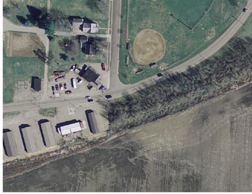
15 Angle Street and Adale Street intersection The existing sign on Angle Street does not indicate a school zone, and indicates a speed limit of 25 M.P.H. There are no crosswalk pavement markings across Adale Street. Strayer Avenue Poor sidewalk conditions present potential hazards for pedestrians. Angle Street between Marietta Street and Ford Street Poor sidewalk conditions present potential hazards for pedestrians. Ford Street Poor sidewalk conditions present potential hazards for pedestrians. Driveway entrance to local business Stuart Burial Vaults crosses over sidewalk and presents potential hazards for Marietta Street pedestrians. Poor sidewalk conditions present potential hazards for pedestrians. Oak Street Poor sidewalk conditions present potential hazards for pedestrians. Replace existing sign with a sign with flashers indicating school zone and speed limit of 20 M.P.H. (when flashing). Install crosswalk with ladderstyle markings on Adale Street, and install ADA compliant curb ramps. Replace existing sidewalk (948 ). Tree removal where necessary. Replace existing sidewalk (604 ). Tree removal where necessary. Replace existing sidewalk (255 ). Tree removal where necessary. Install ladder-style crosswalk markings at the driveway to Stuart Burial Vaults. Replace existing sidewalk (1195 ). Tree removal where necessary. Replace existing sidewalk (600 ) between Marietta Avenue and Walnut Street. Tree removal where necessary. Short-Term High Village Low ODOT SRTS Short-Term High Village Medium ODOT SRTS Short-Term High Village Medium ODOT SRTS Short-Term High Village Low ODOT SRTS Short-Term High Village Medium ODOT SRTS Medium- Term Medium Village Medium ODOT SRTS and/or Village
16 Fort Street Poor sidewalk conditions present potential hazards for pedestrians. Replace existing sidewalk (600 ) between Marietta Avenue and Walnut Street. Tree removal where necessary. Medium- Term Medium Village Medium ODOT SRTS and/or Village Bartlett Street Poor sidewalk conditions present potential hazards for pedestrians. Replace existing sidewalk (600 ) between Marietta Avenue and Walnut Street. Tree removal where necessary. Medium- Term Medium Village Medium ODOT SRTS and/or Village Purvis Avenue Poor sidewalk conditions present potential hazards for pedestrians. Replace existing sidewalk (600 ) between Marietta Avenue and Walnut Street. Tree removal where necessary. Medium- Term Medium Village Medium ODOT SRTS and/or Village On the following page are the Infrastructure Countermeasure Recommendation Map and the Bremen Elementary Walking Map. The estimated construction and engineering costs for each of the countermeasures are in Appendix C.


17


18
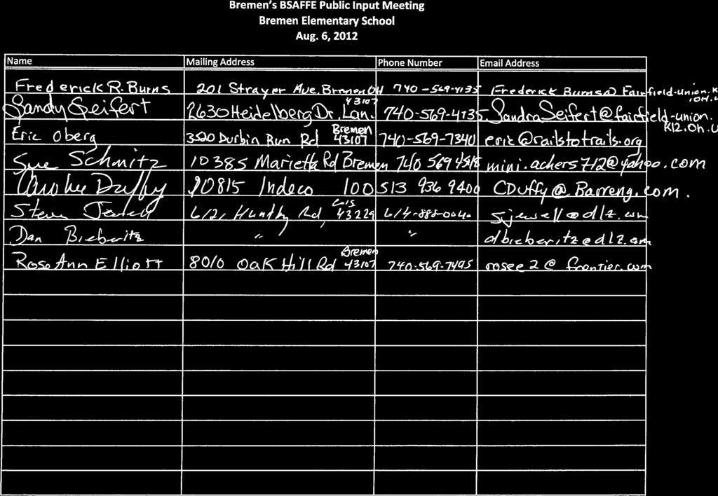
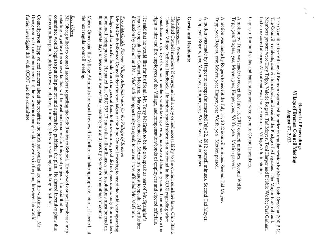
19 SECTION 6: PUBLIC INPUT The first public meeting was held on Monday, August 6, 2012 at 7:00 pm at the Bremen Elementary School. Public meeting notices went out in the monthly water bill, which goes to all residents in Bremen. For this public meeting, no one, except members of the SRTS team (BSAFFE Committee) showed up. Therefore, instead of the public meeting, a committee meeting was conducted. The proposed recommended SRTS countermeasures, both infrastructure and non-infrastructure, were discussed in detail and the 12-month activity chart was also reviewed. Below is the Public Meeting Notice and in Appendix D is the sign-in sheet for the meeting. Since no residents showed up for the August 6 th public meeting, besides the residents on the BSAFFE Committee, it was decided that the School Travel Plan should be presented to the Village Council. On August 27, 2012, Eric Oberg presented the School Travel Plan to the Bremen Village Council. (Meeting Minutes are found in Appendix D.) There was one comment from the Village Council and that was from Councilperson Troy Tripp. He mentioned his concern about replacing the sidewalks that are brick in the infrastructure countermeasure recommendations. The Village would like to keep the existing brick sidewalks. They brick sidewalks could be taken up and re-level the base and then put back, but they would not like the brick sidewalks replaced with concrete. The majority of the sidewalks that need to be replaced are not the brick sidewalks.
20
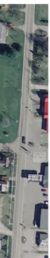
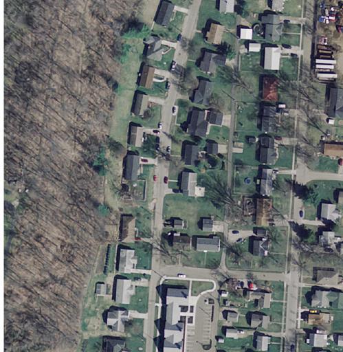
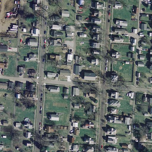
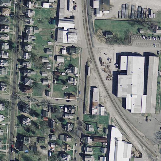
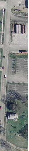
21 Appendix Appendix A School Attendance Boundary Map


22 SAFE ROUTES TO SCHOOL Bremen Elementary School - Fairfield Union - Fairfield Co There are 90 students within a 0.5 mile radius of the Bremen Elementary School. There are 23 students between 0.5 mile and 1.0 mile and 28 students between 1.0 mile and 2.0 miles. The total enrollment of the school is 315 students. City Boundary Roads by Type Interstates US Routes State Routes Local Roads School Location School District Students 0.5 Mile Radius 0.5 to 1.0 Mile Radius 1.0 to 2.0 Mile Radius Feet Minutes To Walk
23 Appendix Appendix B Parent & Student Survey Summary
24 Bremen Elementary Parent & Student Survey Summary Parent Survey Student Survey Parent Survey Student Survey Tuesday Morning - Feb. Tuesday Afternoon - Feb. How Child Gets to School Percent Percent How Child Leaves from School Percent Percent Walking = 18 9% 33 13% 19 10% 33 14% School Bus = 92 47% % 83 42% % Bike = 4 2% 3 1% 4 2% 3 1% Family Vehicle = 60 31% 87 34% 60 31% 83 34% Other = 22 11% 10 4% 30 15% 14 6% Total = I would not feel comfortable at any age for my child to walk or bike to school w/o an adult. Yes Percent % Issues Distance % Convenience of Driving 8 4% Time 39 20% Child's Participation in After School Programs 15 8% Speed of Traffic Along Route 69 35% Amount of Traffic Along Route 68 35% Adults to Bike/Walk With 28 14% Sidewalks or Pathways 50 26% Safety of Intersections and Crossings 52 27% Crossing Guards 24 12% Violence or Crime 46 23% Weather or climate 74 38% If problem was changed or Improved, would you let your child walk or bike. Distance 33 17% Convenience of Driving 2 1% Time 9 5% Child's Participation in After School Programs 5 3% Speed of Traffic Along Route 18 9% Amount of Traffic Along Route 18 9% Adults to Bike/Walk With 14 7% Sidewalks or Pathways 19 10% Safety of Intersections and Crossings 18 9% Crossing Guards 11 6% Violence or Crime 18 9% Weather or climate 17 9%
25 Appendix Appendix C - Infrastructure Countermeasures Cost Estimate
26 Bremen Elementary - SRTS Cost Estimate 2012 Cost Estimate SHORT-TERM IMPROVEMENTS COST Contingency Engineering Total 10% 15% 1) RRFB (Solar) - Angle Street (2) $16,000 $1,600 $2,400 $20,000 2) Crosswalk Stripping - Angle St. (1) $550 $55 $83 $688 3) Install ADA Compliant Curb Ramps At Angle St. Crosswalk (2) $1,200 $120 $180 $1,500 4) Crosswalk Stripping - Strayer Ave. & Ford St. Intersection (3) $1,650 $165 $248 $2,063 5) Install ADA Compliant Curb Ramps At Strayer Ave. & Ford St. Intersection (6) $3,600 $360 $540 $4,500 6) Crosswalk Stripping - Strayer Ave. & Marietta St. Intersection (3) $1,650 $165 $248 $2,063 7) Install ADA Compliant Curb Ramps At Strayer Ave. & Marietta St. Intersection (5) $3,000 $300 $450 $3,750 8) Crosswalk Striping - Oak St. & Marietta St. Intersection (4) $2,200 $220 $330 $2,750 9) Install ADA Compliant Curb Ramps At Marietta St. & Oak St. Intersection (8) $4,800 $480 $720 $6,000 10) Crosswalk Striping - Angle St. & Adale St. Intersection (1) $550 $55 $83 $688 11) Install ADA Compliant Curb Ramps At Adale St. & Angle St. Intersection (2) $1,200 $120 $180 $1,500 12) Crosswalk Striping - Angle St. & Ford St. Intersection (2) $1,100 $110 $165 $1,375 13) Install ADA Compliant Curb Ramps At Ford St. & Angle St. Intersection (4) $2,400 $240 $360 $3,000 14) Install ADA Compliant Curb Ramps At Marietta St. & Purvis Ave. Intersection (4) $2,400 $240 $360 $3,000 15) Install ADA Compliant Curb Ramps At Marietta St. & Fort St. Intersection (2) $1,200 $120 $180 $1,500 16) Install ADA Compliant Curb Ramps At Marietta St. & Bartlett St. Intersection (2) $1,200 $120 $180 $1,500 17) Crosswalk Stripping - Strayer Ave. (1) $550 $55 $83 $688 18) Install ADA Compliant Curb Ramps At Strayer Ave. Crosswalk (2) $1,200 $120 $180 $1,500 19) School Crosswalk Signs With Post Reflectors (6) $1,400 $140 $210 $1,750 20) School Zone With Speed Limit & Flashing Indicator Signs (3) $16,500 $1,650 $2,475 $20,625 21) Crosswalk Stripping Along Ford St. (1) $1,650 $165 $248 $2,063 TOTAL = $66,000 $6,600 $9,903 $82,503
27 MEDIUM-TERM IMPROVEMENTS COST Contingency Engineering Total 10% 15% 1) Replace Existing Sidewalk Areas Along Strayer Ave.(948') $35,185 $3,519 $5,278 $43,982 2) Replace Existing Sidewalk Areas Along Marietta St. (1195') $44,350 $4,435 $6,653 $55,438 3) Replace Existing Sidewalk Areas Along Angle St. (604') $22,415 $2,242 $3,362 $28,019 4) Replace Existing Sidewalk Areas Along Ford St. (255') $9,465 $947 $1,420 $11,832 5) Install New Sidewalk Along Angle St. (770') $24,000 $2,400 $3,600 $30,000 6) Remove & Install Fence Along Angle St. (210') $8,000 $800 $1,200 $10,000 7) Install Curb & Gutter Type 2 Along Angle St. (210') $5,250 $525 $788 $6,563 8) Remove & Install Catch Basin On Angle St. (2) $5,000 $500 $750 $6,250 9) Install 12" Storm Pipe Along angle St. (80) $3,600 $360 $540 $4,500 10) Tree Removal (10) $12,000 $1,200 $1,800 $15,000 11) Potential Right-Of-Way Plans & Survey for Temporary Easements (assumed 40 parcels) $45,000 $45,000 12) Temporary Easement Costs $9,000 $9,000 TOTAL = $178,265 $16,928 $70,391 $265,584 LONG-TERM IMPROVEMENTS COST Contingency Engineering Total 10% 15% 1) Replace Existing Sidewalk Areas Along Fort St. (600' on each side from Marietta St. Walnut St.) $44,540 $4,454 $6,681 $55,675 2) Replace Existing Sidewalk Areas Along Bartlett St. (600' on each side from Marietta St. Walnut St.) $44,540 $4,454 $6,681 $55,675 3) Replace Existing Sidewalk Areas Along Oak St. (600' on each side from Marietta St. Walnut St.) $44,540 $4,454 $6,681 $55,675 4) Replace Existing Sidewalk Areas Along Purvis Ave. (600' on each side from Marietta St. Walnut St.) $44,540 $4,454 $6,681 $55,675 5) Potential Right-Of-Way Plans & Survey for Temporary Easements (assumed 40 parcels) $0 $50,000 $50,000 6) Temporary Easement Costs $6,000 $6,000 TOTAL = $184,160 $17,816 $76,724 $278,700
28 Appendix Appendix D Public Meeting Sign-in & Village Council Minutes
29
30
31
32
Wellington Exempted Village School District SAFE ROUTES TO SCHOOL TRAVEL PLAN January 2014
 Wellington Exempted Village School District SAFE ROUTES TO SCHOOL TRAVEL PLAN January 2014 OHIO SAFE ROUTES TO SCHOOL WELLINGTON EXEMPTED VILLAGE SCHOOL DISTRICT TRAVEL PLAN SECTION 1: WELLINGTON EXEMPTED
ARCADIA ELEMENTARY & MIDDLE SCHOOLS
 ARCADIA ELEMENTARY & MIDDLE SCHOOLS SAFE ROUTES TO SCHOOL TRAVEL August 2013 ARCADIA LOCAL SCHOOLS OHIO SAFE ROUTES TO SCHOOL SCHOOL TRAVEL Ohio Safe Routes to School Travel Plan Local Schools www.dot.state.oh.us/saferoutes
THORNVILLE-GLENFORD STP
 THORNVILLE-GLENFORD STP SAFE ROUTES TO SCHOOL TRAVEL PLAN September 2013 OHIO SAFE ROUTES TO SCHOOL SCHOOL TRAVEL PLAN SECTION 1: OUR SCHOOL/S 1A. Identify Target Schools School District School Name School
CHILLICOTHE CITY SCHOOLS. SAFE ROUTES TO SCHOOL TRAVEL PLANS for Allen, Mt. Logan, Tiffin & Worthington Elementary Schools January 2013
 CHILLICOTHE CITY SCHOOLS SAFE ROUTES TO SCHOOL TRAVEL PLANS for Allen, Mt. Logan, Tiffin & Worthington Elementary Schools January 2013 i Ohio s Safe Routes to School Travel Plan Template www.dot.state.oh.us/saferoutes
PROSPECT ELEMENTARY GIRARD INTERMEDIATE GIRARD JUNIOR HIGH
 PROSPECT ELEMENTARY GIRARD INTERMEDIATE GIRARD JUNIOR HIGH SAFE ROUTES TO SCHOOL SCHOOL TRAVEL PLAN January 8, 2014 2 SECTION 1: OUR SCHOOLS School District School Name School Address Grades served Girard
ASHTABULA AREA SCHOOLS STP
 ASHTABULA AREA SCHOOLS STP SAFE ROUTES TO SCHOOL TRAVEL PLAN April 2013 OHIO SAFE ROUTES TO SCHOOL SCHOOL TRAVEL PLAN SECTION 1: OUR SCHOOL/S 1A. Identify Target Schools School District School Name School
AMHERST EXEMPTED VILLAGE SCHOOLS AND SAINT JOSEPH SCHOOL
 AMHERST EXEMPTED VILLAGE SCHOOLS AND SAINT JOSEPH SCHOOL SAFE ROUTES TO SCHOOL TRAVEL PLAN 12/11/18 DRAFT OHIO SAFE ROUTES TO SCHOOL SCHOOL TRAVEL PLAN Ohio s Safe Routes to School Travel Plan Template
FRANKLIN, ISHAM MEMORIAL, OVERLOOK & VALLEY VIEW ELEMENTARY SCHOOLS
 FRANKLIN, ISHAM MEMORIAL, OVERLOOK & VALLEY VIEW ELEMENTARY SCHOOLS SAFE ROUTES TO SCHOOL TRAVEL PLAN August 2013 OHIO SAFE ROUTES TO SCHOOL SCHOOL TRAVEL PLAN SECTION 1: OUR SCHOOL(S) School District
ZANESVILLE CITY SCHOOLS STP. SAFE ROUTES TO SCHOOL TRAVEL PLAN February 2015
 ZANESVILLE CITY SCHOOLS STP SAFE ROUTES TO SCHOOL TRAVEL PLAN February 2015 SECTION 1: OUR SCHOOL(S) School District School Name School Address Grades served City Schools Average Daily Student Enrollment
NORTH UNION LOCAL SCHOOLS
 NORTH UNION LOCAL SCHOOLS SAFE ROUTES TO SCHOOL TRAVEL PLAN November 2015 OHIO SAFE ROUTES TO SCHOOL SCHOOL TRAVEL PLAN SECTION 1: OUR SCHOOL(S) 1A. Identify Target Schools School District School Name
SAFE ROUTES TO SCHOOL
 SAFE ROUTES TO SCHOOL Forest Ridge Elementary School Existing Conditions and ACTION PLAN > Oak Creek - Franklin Joint School District Table of Contents CONTEXT Enrollment Boundaries
CLEVELAND HEIGHTS STP
 CLEVELAND HEIGHTS STP SAFE ROUTES TO SCHOOL TRAVEL PLAN February 2014 OHIO SAFE ROUTES TO SCHOOL SCHOOL TRAVEL PLAN TEMPLATE SECTION 1: OUR SCHOOL(S) 1A. Identify Target Schools School District School
FREMONT CITY SCHOOLS STP
 FREMONT CITY SCHOOLS STP SAFE ROUTES TO SCHOOL TRAVEL PLAN February 2014 OHIO SAFE ROUTES TO SCHOOL SCHOOL TRAVEL PLAN SECTION 1: OUR SCHOOL(S) 1A. Identify Target Schools School District School Name School
Vallecito Elementary School. Travel Plan
 Vallecito Elementary School Travel Plan TABLE OF CONTENTS 1. PURPOSE... 1 1.1. SR2S PLANNING, IMPLEMENTATION AND MONITORING... 1 1.2. MARIN COUNTY MEASURE A... 1 2. VALLECITO ELEMENTARY SCHOOL PROFILE...
July 5, Arthur R. Ware, Jr. Elementary School 2017 Safe Routes to School Walkabout Report
 July 5, 2017 Arthur R. Ware, Jr. Elementary School 2017 Safe Routes to School Walkabout Report 1 Walkabout Report Introduction On April 28, 2017, City, School, and SAWMPO staff met to conduct a Safe Routes
CITY OF OAK CREEK SAFE ROUTES TO SCHOOL ACTION PLAN. East Middle School
 CITY OF OAK CREEK SAFE ROUTES TO SCHOOL ACTION PLAN East Middle School CITY OF OAK CREEK SAFE ROUTES TO SCHOOL ACTION PLAN East Middle School Why Safe Routes to School? Safe Routes to School ( SRTS ) is
S A F E R O U T E S T O S C H O O L H E R M A N TOW N S C H O O L S A N D P R O C TO R S C H O O L S P L A N A P P R OVA L S
 S A F E R O U T E S T O S C H O O L H E R M A N TOW N S C H O O L S A N D P R O C TO R S C H O O L S P L A N A P P R OVA L S WHAT IS SAFE ROUTES TO SCHOOL? In 1969, nearly 50% of children walked or rode
SAFE ROUTES TO SCHOOL
 SAFE ROUTES TO SCHOOL Edgewood Elementary School Existing Conditions and ACTION PLAN > Oak Creek - Franklin Joint School District Table of Contents CONTEXT Enrollment Boundaries Enrollment
BEXLEY CITY SCHOOL DISTRICT
 BEXLEY CITY SCHOOL DISTRICT SAFE ROUTES TO SCHOOL TRAVEL PLAN December 2012 OHIO SAFE ROUTES TO SCHOOL SCHOOL TRAVEL PLAN SECTION 1: OUR SCHOOLS 1A. Identify Target Schools School District School Name
Orange Center Elementary School
 Drag and drop pic and stretch/crop to the limits of the blue rectangle (delete this text box) Orange Center Elementary School Drag and drop pic and stretch/crop to the limits of the blue rectangle (delete
CITY OF KASSON TRANSPORTATION ALTERNATIVES KASSON SAFE ROUTES TO SCHOOL
 ve ha 8t G B A Mantorville Ave N 240th Ave 16th St NE 11th Ave NE K-M HIGH SCHOOL SUNRISE TRAIL TO MANTORVILLE MNTH 57 SUNSET TRAIL TO MANTORVILLE NE PARK 16TH ST NE TRAIL K-M ELEMENTARY SCHOOL K-M MIDDLE
C/CAG. Sunnybrae Elementary School Walking and Bicycling Audit. San Mateo-Foster City School District JUNE 2013
 Sunnybrae Elementary School Walking and Bicycling Audit JUNE 2013 San Mateo-Foster City School District C/CAG City/County Association of Governments of San Mateo County SUNNYBRAE ELEMENTARY SCHOOL WALKING
DANIEL WRIGHT ELEMENTARY
 DANIEL WRIGHT ELEMENTARY SAFE ROUTES TO SCHOOL TRAVEL PLAN February 2016 OHIO SAFE ROUTES TO SCHOOL SCHOOL TRAVEL PLAN TEMPLATE SECTION 1: OUR SCHOOL(S) 1A. Identify Target Schools School District School
Hidden Oaks Elementary School
 Hidden Oaks Elementary School SCHOOL ROUTE PLAN For HIDDEN OAKS ELEMENTARY SCHOOL LOCATION 13 ORANGE COUNTY Prepared for: ORANGE COUNTY SCHOOL ASSESSMENT PROGRAM ORANGE COUNTY PUBLIC WORKS Traffic Engineering
Introduction.
 2307-1.0. Introduction. Delaware s Safe Routes to School (SRTS) Program was established September 10, 2002 when Governor Ruth Ann Minner signed Senate Bill 353 of the 141st General Assembly of Delaware
Drag and drop pic and stretch/crop to the limits of the blue rectangle (delete this text box) Maxey Elementary School
 Maxey Elementary School") Drag and drop pic and stretch/crop to the limits of the blue rectangle (delete this text box) Maxey Elementary School SCHOOL ROUTE PLAN For MAXEY ELEMENTARY SCHOOL LOCATION 33 ORANGE COUNTY Prepared for:
Drag and drop pic and stretch/crop to the limits of the blue rectangle (delete this text box) Maxey Elementary School SCHOOL ROUTE PLAN For MAXEY ELEMENTARY SCHOOL LOCATION 33 ORANGE COUNTY Prepared for:
San Ramon Elementary School. Travel Plan
 San Ramon Elementary School Travel Plan TABLE OF CONTENTS 1. PURPOSE... 1 1.1. SR2S PLANNING, IMPLEMENTATION AND MONITORING... 1 1.2. MARIN COUNTY MEASURE A... 1 2. SAN RAMON ELEMENTARY SCHOOL PROFILE...
FLETCHER AVENUE PEDESTRIAN AND BICYCLIST BEHAVIOR CHANGE FORMATIVE RESEARCH PROJECT
 FLETCHER AVENUE PEDESTRIAN AND BICYCLIST BEHAVIOR CHANGE FORMATIVE RESEARCH PROJECT EXTENT OF CHANGES IN PEDESTRIAN AND BICYCLIST ATTITUDES AND BEHAVIORS DIRECTLY AFTER A COMPLETE STREETS PROJECT IN FLORIDA
BEVERLY GARDENS ELEMENTARY SCHOOL TRAVEL PLAN
 BEVERLY GARDENS ELEMENTARY SCHOOL TRAVEL PLAN City of Riverside, Ohio Ohio Safe Routes to School Plan INDEX SECTION 1: TARGET SCHOOLS AND THE SAFE ROUTES TO SCHOOL TEAM SECTION 2: INTRODUCTION SECTION
CITY OF FRANKLIN STP. SAFE ROUTES TO SCHOOL TRAVEL PLAN February 2015
 CITY OF FRANKLIN STP SAFE ROUTES TO SCHOOL TRAVEL PLAN February 2015 SECTION 1: OUR SCHOOL(S) School District School Name School Address Grades served Average Daily Student Enrollment Franklin City Schools
SECTION 1 - CONTACT INFORMATION
 SECTION 1 - CONTACT INFORMATION Please complete the information below. The person identified as the Project Contact Person will be the primary point of contact for Georgia DOT staff. Organization: (Please
Hedgepeth Williams Middle School and Paul Robeson Elementary School Trenton, NJ. School Travel Plan
 Hedgepeth Williams Middle School and Paul Robeson Elementary School Trenton, NJ School Travel Plan Hedgepeth Williams Middle School Description: Hedgepeth-Williams Middle School is located at 301 Gladstone
OCEAN DRIVE ELEMENTARY SCHOOL
 OCEAN DRIVE ELEMENTARY SCHOOL North Myrtle Beach, SC Safe Routes to School Travel Plan JANUARY 2017 SRTS Team Roster SRTS Team members represent key community stakeholders, share work of developing the
Sardis Elementary School Road Safety Plan. Produced by: Sardis Elementary School - Safer School Travel Team in cooperation with Safer City
 Sardis Elementary Road Safety Plan Produced by: Sardis Elementary - Safer Travel Team in cooperation with Safer City Plan completed in January 2016 1 Acknowledgements It takes commitment and community
Meadow Woods Elementary School
 Drag and drop pic and stretch/crop to the limits of the blue rectangle (delete this text box) Meadow Woods Elementary School Drag and drop pic and stretch/crop to the limits of the blue rectangle (delete
Safe Routes to School Action Plan Aberdeen, Idaho
 Background Aberdeen, Idaho is a largely agricultural community of nearly 2,000 people and is located in the southeast portion of the state on the western edge of American Falls Reservoir. The community
2 Mark Twain Elementary School Report
 2 Mark Twain Elementary School Report Principal: Greg Kaatz Grades: K-2 Enrollment: 323 Address: 425 N. Church Street First bell: 8:10 a.m. Silverton, OR 97381 Last bell: 2:30 p.m. Free & Reduced Lunch:
About the Studio. Edward J. Bloustein School of Planning and Public Policy - Rutgers University
 About the Studio Edward J. Bloustein School of Planning and Public Policy - Rutgers University Purpose of studio: Help City of Bayonne apply for Safe Routes to School (SRTS) funding by producing a School
Safe Routes to School Travel Plan 2011 Reading-Fleming Intermediate School (RFIS)
") Safe Routes to School Travel Plan 0 Reading-Fleming Intermediate School (RFIS) Reading Fleming Intermediate School 50 Court Street Flemington, NJ 088 Grades: 5-6 Introduction Reading-Fleming Intermediate
Safe Routes to School Travel Plan 0 Reading-Fleming Intermediate School (RFIS) Reading Fleming Intermediate School 50 Court Street Flemington, NJ 088 Grades: 5-6 Introduction Reading-Fleming Intermediate
Lawrence Safe Routes to School. Community Meeting January 14, 2015
 Lawrence Safe Routes to School Community Meeting January 14, 2015 Safe Routes to School The 6 E s Education Encouragement Enforcement Engineering Evaluation Equity What are the elements of a SRTS plan?
Grandview Heights Safe Routes to School School Travel Plan Ohio Department of Transportation, District 6 February 23, 2012
 Grandview Heights Safe Routes to School School Travel Plan Ohio Department of Transportation, District 6 February 23, 2012 Grandview Heights School Travel Plan (STP) Safe Routes to School Table of Contents
AGENDA. 5. Next Steps a. Survey Distribution b. Draft Action Plan/Recommendations c. Review at next meeting in advance of document preparation
 Congdon Elementary Safe Routes to School Plan Update SRTS Team Meeting #2-Walk Audit March 21, 2018, 3:00 p.m. Congdon Elementary School Art Room-Duluth, MN 1. Welcome and Introductions 2. SRTS Review
Safe Routes to School Comprehensive Plan
 Safe Routes to School Comprehensive Plan City of Apple Valley Dakota County, MN May 2010 Prepared by: Project Background The Statewide Health Improvement Program (SHIP) aims to help Minnesotans live longer,
ST. HENRY ELEMENTARY & MIDDLE SCHOOLS
 ST. HENRY ELEMENTARY & MIDDLE SCHOOLS SAFE ROUTES TO SCHOOL TRAVEL PLAN December 2013 OHIO SAFE ROUTES TO SCHOOL SCHOOL TRAVEL PLAN TABLE OF CONTENTS Table of Contents 2 Section 1: Our Schools 3 School
Rim Rock Elementary School Walking and Biking Audit
 Rim Rock Elementary School Walking and Biking Audit September 29, 2016 Rim Rock Elementary School Audit for Walking and Biking September 29, 2016 Audit Team Members: Sam Atkins, City Engineer, City of
Introduction Additional Safe Routes to School Resources Main Street Elementary School Survey Results Field Audit...
 Contents Introduction... 2 Additional Safe Routes to School Resources... 2... 3 Survey Results... 4 Field Audit... 6 Proposed Safe Routes to School Elements... 9 Typical Safe Routes to School Summary...
Bringing together community and health. Physical Activity and Nutrition Unit Office of Statewide Health Improvement Initiatives
 Bringing together community and health. Physical Activity and Nutrition Unit Office of Statewide Health Improvement Initiatives Physical Activity and Nutrition Unit Office of Statewide Health Improvement
Implementing the Three Es of School Zone Traffic Calming
 Implementing the Three Es of School Zone Traffic Calming Use this evaluation tool as a guide to analyze the specific safety needs of your school. SCHOOL PROFILE School Name: School District: Address: Phone
Improvements Infrastructure Gap Assessment and Improvements Street Striping
 Infrastructure Project Proposal The federal-aid Safe Routes to School program funds infrastructure/engineering projects that fall into two categories: Design (available only to School Development Authority
THE PLAINS ELEMENTARY SCHOOL SCHOOL TRAVEL PLAN
 THE PLAINS ELEMENTARY SCHOOL SCHOOL TRAVEL PLAN We would like to extend a special thank you to all of those involved in the development of this plan. Our group especially appreciates the efforts and support
Safe Routes to School Comprehensive Plan
 Safe Routes to School Comprehensive Plan City of Rosemount Dakota County, MN June 2010 Prepared by: Project Background The Statewide Health Improvement Program (SHIP) aims to help Minnesotans live longer,
KENTON CITY SCHOOLS STP
 KENTON CITY SCHOOLS STP SAFE ROUTES TO SCHOOL TRAVEL PLAN January 2014 OHIO SAFE ROUTES TO SCHOOL SCHOOL TRAVEL PLAN SECTION 1: OUR SCHOOL/S 1A. Identify Target Schools School District School Name School
Parent Survey Report: One School in One Data Collection Period
 Parent Survey Report: One School in One Data Collection Period School Name: Bilquist Elementary School Set ID: 15803 School Group: Clackamas County Month and Year Collected: December 2016 School Enrollment:
Monument Elementary School Trenton, NJ School Travel Plan
 Monument Elementary School Trenton, NJ School Travel Plan Prepared by Greater Mercer TMA With Assistance from Alan M. Voorhees Transportation Center; Rutgers, The State University of New Jersey and NJ
Parent Survey Report: One School in One Data Collection Period
 Parent Survey Report: One School in One Data Collection Period School Name: Pinckney Elementary School Set ID: 12170 School Group: Douglas County Month and Year Collected: October 2014 School Enrollment:
APPENDIX A: Complete Streets Checklist DRAFT NOVEMBER 2016
 APPENDIX A: Complete Streets Checklist DRAFT NOVEMBER 2016 Complete Streets Checklist MetroPlan Orlando s Complete Streets Checklist is an internal planning tool for staff to further implementation of
Windy Ridge Elementary School
 Windy Ridge Elementary School SCHOOL ROUTE PLAN For WINDY RIDGE ELEMENTARY SCHOOL LOCATION 54 ORANGE COUNTY Prepared for: ORANGE COUNTY SCHOOL ASSESSMENT PROGRAM ORANGE COUNTY PUBLIC WORKS Traffic Engineering
Agenda. Overview PRINCE GEORGE S PLAZA METRO AREA PEDESTRIAN PLAN
 PRINCE GEORGE S PLAZA METRO AREA PEDESTRIAN PLAN May 28, 2008 Agenda Welcome and introductions Project overview and issue identification Planning context and strengths Design challenges and initial recommendations
Safe Routes to School. Winton Woods City Schools Informational Presentation Public Input Meeting October, 2017
 Safe Routes to School Winton Woods City Schools Informational Presentation Public Input Meeting October, 2017 Presentation Overview What is Safe Routes to School? How is the School Travel Plan developed?
Transportation Planning Division
 Transportation Planning Division Presentation Outline Study Tasks Recap of Previous Meetings Data Collected Focus Areas within Study Limits Design Principles Tool Box Recommended Concepts Schedule Moving
National Safe Routes to School Program: Initial Results
 National Safe Routes to School Program: Initial Results Lauren Marchetti National Center for Safe Routes to School 9 th Annual New Partners for Smart Growth Thursday, February 4, 2010 Seattle, WA August
Village of Caldwell Safe Routes to School School Travel Plan Ohio Department of Transportation, District 10 May 31, 2012
 Village of Caldwell Safe Routes to School School Travel Plan Ohio Department of Transportation, District 10 May 31, 2012 Caldwell School Travel Plan (STP) Safe Routes to School Table of Contents Part 1:
Chapter 2. Bellingham Bicycle Master Plan Chapter 2: Policies and Actions
 Chapter 2 Bellingham Bicycle Master Plan Chapter 2: Policies and Actions Chapter 2: Policies and Actions The Bicycle Master Plan provides a road map for making bicycling in Bellingham a viable transportation
Venetia Valley Elementary School. Travel Plan
 Venetia Valley Elementary School Travel Plan TABLE OF CONTENTS 1. PURPOSE... 1 1.1. SR2S PLANNING, IMPLEMENTATION AND MONITORING... 1 1.2. MARIN COUNTY MEASURE A... 1 2. VENETIA VALLEY ELEMENTARY SCHOOL
West Capitol Avenue Road Rehabilitation and Safety Enhancement Project
 West Capitol Avenue Road Rehabilitation and Safety Enhancement Project Stakeholder Focus Group Meeting #2 Tuesday, August 28, 2018 7:00 8:00 a.m. West Sacramento City Hall 1110 West Capitol Avenue, West
Doull Elementary School
 Doull Elementary School Safe Routes to School Walking Audit and Recommendations WalkDenver Fall 2013 Doull Elementary School (ECE grade 5) 2520 South Utica Street, Denver 80219 This project was supported
WINTON WOODS CITY SCHOOLS
 WINTON WOODS CITY SCHOOLS SAFE ROUTES TO SCHOOL TRAVEL PLAN August 2017 OHIO SAFE ROUTES TO SCHOOL SCHOOL TRAVEL PLAN SECTION 1: OUR SCHOOL/S School District School Name School Address Grades served Winton
Chapter 3.3 Horizon Elementary School. Volusia County MPO. June 2009
 Chapter 3.3 Horizon Elementary School Port Orange, FL Volusia County MPO June 2009 Volusia County MPO School Bicycle and Pedestrian Review Study, Phase 3C School Summary Horizon Elementary School is located
City of Wilsonville 5 th Street to Kinsman Road Extension Project
 City of Wilsonville 5 th Street to Kinsman Road Walking Tour & Neighborhood Workshop Summary Report Public Outreach Overview On July 18 th, 2017, the City of Wilsonville hosted a neighborhood walking tour
Everyone is a Pedestrian
 Everyone is a Pedestrian Improving Pedestrian Safety in Texas Transportation and Trinity River Project Committee 26 May 2015 Everyone is a Pedestrian Federal Highway Administration [ FHWA ] Programs to
Parent Survey Report: One School in One Data Collection Period
 Parent Survey Report: One School in One Data Collection Period School Name: Broken Arrow Elementary School Set ID: 12172 School Group: Douglas County Month and Year Collected: October 2014 School Enrollment:
Conway Elementary School
 Conway Elementary School Safe Routes to School Travel Plan February 2012 Prepared with assistance from the SC SRTS Resource Center INTRODUCTION This Travel Plan represents the work of the Conway Elementary
Sebastopol Charter School Traffic Management Plan
 Sebastopol Charter School The serves as the working document in support of these essential goals: to ensure the safety and efficiency of student arrival to and departure from school to ensure the safety
Lake Whitney Elementary School
 Lake Whitney Elementary School SCHOOL ROUTE PLAN For LAKE WHITNEY ELEMENTARY SCHOOL LOCATION 18 ORANGE COUNTY Prepared for: ORANGE COUNTY SCHOOL ASSESSMENT PROGRAM ORANGE COUNTY PUBLIC WORKS Traffic Engineering
Elkton Elementary School Walkabout Report
 Elkton Elementary School Walkabout Report Introduction On September 12, 2017, stakeholders at Elkton Elementary School in Elkton, Virginia met to examine the walking and bicycling networks around the school
3 Silverton High School Report
 3 Silverton High School Report Principal: Justin Lieuallen Grades: 9-12 Enrollment: 1,277 Address: 1456 Pine Street First bell: 7:55 a.m. Silverton, OR 97381 Last bell: 3:05 p.m. Free & Reduced Lunch:
SCHOOL ROUTE PLAN. For HUNTER S CREEK ELEMENTARY SCHOOL LOCATION 14 ORANGE COUNTY. Prepared for:
 SCHOOL ROUTE PLAN For HUNTER S CREEK ELEMENTARY SCHOOL LOCATION 14 ORANGE COUNTY Prepared for: ORANGE COUNTY SCHOOL ASSESSMENT PROGRAM ORANGE COUNTY PUBLIC WORKS Traffic Engineering Division 42 South John
Active Transportation Facility Glossary
 Active Transportation Facility Glossary This document defines different active transportation facilities and suggests appropriate corridor types. Click on a facility type to jump to its definition. Bike
MEMORANDUM. Discussion of the planned crosswalk improvement on Mount Vernon Road near Stratham Drive
 MEMORANDUM To: From: Mayor and City Council Michael Smith, Public Works Director Date: August 24, 2015 Subject: Discussion of the Mount Vernon Road Crosswalk Improvement ITEM DESCRIPTION Discussion of
EXECUTIVE SUMMARY. Vision
 Vision Walking and bicycling in Salt Lake City will be safe, convenient, comfortable, and viable transportation options that connect people to places, foster recreational and economic development opportunities,
TABLE OF CONTENTS. Executive Summary
 Executive Summary Background... ES-1 Pedestrian Network... ES-2 Bikeway Network... ES-2 Collision History... ES-2 Public Input... ES-4 Conclusions and Recommendations... ES-4 1. Introduction and Setting
Ottawa Beach Road Study
 Ottawa Beach Road Study Prepared For: Park Township September 30, 2014 Project No. G140303 OTTAWA BEACH ROAD STUDY PREPARED FOR: PARK TOWNSHIP SEPTEMBER 30, 2014 PROJECT NO. G140303 TABLE OF CONTENTS 1.0
Pedestrian, Bicycle and Traffic Calming Strategic Implementation Plan. January 18, 2011
 Pedestrian, Bicycle and Traffic Calming Strategic Implementation Plan January 18, 2011 Tonight s Agenda Receive update on project Provide feedback on two policy issues Complete Streets Policy Project Prioritization
Arlington Public Schools Thomas Jefferson Site Evaluation Transportation Networks. Thomas Jefferson Working Group Meeting #6 November 10, 2014
 Arlington Public Schools Thomas Jefferson Site Evaluation Transportation Networks Thomas Jefferson Working Group Meeting #6 November 10, 2014 2 3 INTRODUCTION 4 Goal of our work: Identify and assess multi-modal
Sunset Park Center for Accelerated Studies
 Sunset Park Center for Accelerated Studies The following are a simple list of advantages, disadvantages, and recommendations based on a community assessment. It is not intended to be a list of complete
Complete Streets Funding Program Project Prioritization Plan
 Funding Program Project Prioritization Plan Location and Type Needs South Street Crosswalk Installation Stripe a new formalized crosswalk across South Street at the Anne T. Dunphy School pedestrian path
Corpus Christi Metropolitan Transportation Plan Fiscal Year Introduction:
 Introduction: The Safe, Accountable, Flexible, Efficient Transportation Equity Act: A Legacy for Users (SAFETEA-LU) has continued the efforts started through the Intermodal Surface Transportation Efficiency
Chapter 3.9 Timbercrest Elementary School. Volusia County MPO. November 2008
 Chapter 3.9 Timbercrest Elementary School Deltona, FL Volusia County MPO November 2008 Volusia County MPO School Bicycle and Pedestrian Review Study, Phase 3B School Summary Timbercrest Elementary School
NM-POLICY 1: Improve service levels, participation, and options for non-motorized transportation modes throughout the County.
 Transportation PRINCE WILLIAM COUNTY 2008 COMPREHENSIVE PLAN NON-MOTORIZED PLAN CONTENTS Goals, Policies, and Action Strategies Table 4 (Bike Facility Classifications and Descriptions) Table 5 (Bike Facility
Redwood City Safe Routes to School Report
 Redwood City Safe Routes to School Report August 2013 PREPARED BY: Alta Planning + Design REDWOOD CITY SCHOOL DISTRICT Redwood City School District Redwood City Safe Routes to School Report Prepared for:
F L E T C H E R A V E N U E
 Jan. 29, 2014 Introduction F L E T C H E R A V E N U E FDOT Local Agency Program (LAP) Project FPN: 428214-1-58-01 CIP 63090 Hillsborough County, Traffic Engineering, PWD Stake holders and partners are
Chapter 3.5 Osteen Elementary School. Volusia County MPO. November 2008
 Chapter 3.5 Osteen Elementary School Osteen, FL Volusia County MPO November 2008 Volusia County MPO School Bicycle and Pedestrian Review Study, Phase 3B School Summary Osteen Elementary School is located
Non-Motorized Transportation 7-1
 Non-Motorized Transportation 7-1 Transportation facilities no longer mean just accommodating a vehicle powered by a combustion engine. Pedestrian and non-motorized facilities are important modes of travel
PRINCE GEORGE S PLAZA METRO AREA PEDESTRIAN PLAN
 PRINCE GEORGE S PLAZA METRO AREA PEDESTRIAN PLAN May 28, 2008 Agenda Welcome and introductions Project overview and issue identification Planning context and strengths Design challenges and initial recommendations
Guidance. ATTACHMENT F: Draft Additional Pages for Bicycle Facility Design Toolkit Separated Bike Lanes: Two-Way to One-Way Transitions
 ATTACHMENT F: Draft Additional Pages for Bicycle Facility Design Toolkit Separated Bike Lanes: Two-Way to One-Way Transitions This treatment provides a transition from two-way separated bike lanes to one-way
LTAC: Katie Mencarini, Central & Hampton Roads streets and a fifteen minute debrief to discuss the findings. Participants walked along Mill Road
 Walkabout Summary On June 3, 2013, five participants met at Glen Allen Elementary School in Glen Allen, Virginia to take a closer look at the walking and biking network around the school. In addition to
TOWN OF PORTLAND, CONNECTICUT COMPLETE STREETS POLICY
 TOWN OF PORTLAND, CONNECTICUT COMPLETE STREETS POLICY I. VISION, GOALS & PRINCIPLES VISION To improve the streets of Portland making them safer and more accessible for all users including pedestrians,
Summary Report School Walking & Bicycling Audits. Mesa County Regional Transportation Planning Office
 Summary Report School Walking & Bicycling Audits Mesa County Regional Transportation Planning Office This page left blank intentionally WALKING & BICYCLING AUDIT SUMMARY 2 Executive Summary Background:
NJDOT Complete Streets Checklist
 Background The New Jersey Department of Transportation s Complete Streets Policy promotes a comprehensive, integrated, connected multi-modal network by providing connections to bicycling and walking trip
Triangle Elementary School Walkabout Report
 Triangle Elementary School Walkabout Report Introduction On May 30, 2018, stakeholders at Triangle Elementary School in Triangle, Virginia met to examine the walking and bicycling networks around the school