APRIL 2017 JUNE 2017 CITY OF HOBART TRANSPORT STRATEGY CONSULTATION PAPER 4: LOCAL AREA TRAFFIC MANAGEMENT
|
|
|
- Wesley Ray
- 6 years ago
- Views:
Transcription

1 APRIL 2017 JUNE 2017 CITY OF HOBART TRANSPORT STRATEGY CONSULTATION PAPER 4: LOCAL AREA TRAFFIC MANAGEMENT
2 CITY OF HOBART TRANSPORT STRATEGY CONSULTATION PAPER 4: LOCAL AREA TRAFFIC MANAGEMENT
3 HOW TO MAKE A SUBMISSION Your submission can be as long or short as you want. You do not have to answer all or any questions in the paper, they are there as a guide. An online survey is available at the Your Say City of Hobart website. Online yoursay.hobarcity.com.au coh@hobartcity.com.au Transport Strategy in the Subject Line. Post Transport Strategy City of Hobart GPO Box 503 Hobart TAS 7001 Submissions should be lodged by 31 August 2017 Image credit: Alastair Bett i
4 TABLE OF CONTENTS LIST OF MAPS, TABLES AND CHARTS IV SECTION 1 BACKGROUND 1 ABOUT THE CITY OF HOBART S TRANSPORT STRATEGY 1 WHAT ARE THE CITY OF HOBART S GOALS AND OBJECTIVES? 2 HOW WILL WE DEVELOP THE TRANSPORT STRATEGY? 4 ABOUT THE CONSULTATION 5 ABOUT THE CITY OF HOBART AND TASMANIA 6 Population overview 7 Settlement patterns 8 Employment and sources of income 8 SECTION 2 LOCAL AREA TRAFFIC MANAGEMENT 11 Summary Module 4: Local Area Traffic Management 12 What is local area traffic management? 13 SPATIAL CONTEXT 15 CONTEXT: ROLES AND RESPONSIBILITIES 19 Australian Government 19 Tasmanian Government 19 Local government 20 The community 21 ii City of Hobart Transport Strategy Consultation Paper 1: Freight, Port and Air
5 SECTION 3 MAKING STREETS BETTER FOR PEOPLE 25 STREETS PERFORM MANY ROLES 25 CONCEPTUAL FRAMEWORKS 26 a. Local road hierarchy 26 b. Smart roads 29 c. Complete streets 30 d. Link and place 31 Traffic management and road safety 36 Enforcement 36 Education 36 Engineering 37 SPECIFIC AREAS 41 Local retail precincts 41 Special activity precincts 45 WALKING, CYCLING, ACCESS ISSUES AND HEALTHY BY DESIGN 47 PARKING 48 COMMON LOCAL AREA TRAFFIC MANAGEMENT DEVICES 52 ENVIRONMENT AND CLIMATE CHANGE 56 HOW THE CITY OF HOBART DECIDES WHAT TO DO NEXT 58 GLOSSARY 61 ATTACHMENT 1 LINKS TO OTHER AUSTRALIAN JURISDICTIONS TRAFFIC CONTROL DEVICE MANUALS AND GUIDELINES 65 iii
6 LIST OF MAPS, TABLES AND CHARTS MAPS Map 1: Map 2: Hobart activity centres Extent of commuter parking surrounding the city centre FIGURES Figure 1: Road network Figure 2: Road type and function Figure 3: The dual function of streets Figure 4: Link and Place Status Figure 5: Collaborative professional framework Figure 6: Sandy Bay retail precinct TABLES Table 1: Tasmanian local government road hierarchy Table 2: Hobart commuter parking locations CHARTS Chart 1: Three Es Chart 2: Vehicle collision chance of death correlation with impact speed, iv CoH Transport Strategy Consultation Paper 4: Local Area Traffic Management
7 v

8 vi City CoH of Transport Hobart Strategy Transport Strategy Consultation Consultation Paper 4: Local Paper Area 1: Traffic Freight, Management Port and Air
9 SECTION 1 BACKGROUND ABOUT THE CITY OF HOBART S TRANSPORT STRATEGY The City of Hobart is planning for the future transport needs of our community. We want to ensure that as we move into the next part of the 21st century, we have strategies in place to support growth in our population and the economy. Transport plays a vital part in delivering the food we eat and the products we export and import. Transport affects so many parts of our lives how we travel to work or get to school and sport and leisure activities. It helps us to stay in touch with family and friends. It is time to review our current transport strategies to meet the needs of Hobart into the future. This is why we are developing the Transport Strategy for Hobart. On any given day, the Hobart municipal area may host up to residents, workers, students and a large number of people shopping or visiting the city. The safety and efficiency of the city s transport and road network is of paramount importance to businesses, residents, road users, transport operators, parents and school children, the government sector, tourists and visitors alike. Although there is diversity in the transport task in Hobart, most people want the same thing. They want to be able to move about with ease and safety, in a timely manner, whether they are in a bus or a car, on foot or riding a bicycle. It is essential to involve the community in discussions about how these sometimes conflicting needs can be met into the future. We need to have an understanding of the full breadth of issues, views and ideas, based on different health and education needs, age groups, occupations and day-to-day activities, so that we can develop the best strategies for our transport network. We also need to make sure that the City of Hobart s transport strategies for the future are effectively integrated with the policies and activities of the Tasmanian Government, the federal government, and other local councils, all of whom have responsibilities for land-use planning, infrastructure and transport networks and services. Because Hobart is many things to many different people, it is time to ask some important questions and to discuss the future of transport for the Hobart municipal area with as many people as possible. That is why we intend to engage with you over the next six months, to find out what you think should be in the City of Hobart s Transport Strategy. We have ideas and we want to hear yours. 1
10 WHAT ARE THE CITY OF HOBART S GOALS AND OBJECTIVES? The development of the City of Hobart s Transport Strategy follows the release of our Capital City Strategic Plan This contains the agreed goals and strategic objectives that are relevant to the development of the Transport Strategy: Vision In 2025 Hobart will be a city that is highly accessible through efficient transport options. Goal 2 Urban management City planning promotes our city s uniqueness, is people-focussed and provides connectedness and accessibility. Strategic Objective 2.1 A fully accessible and connected city environment Develop and implement a transport strategy Enhance transport connections within Hobart Identify and implement infrastructure improvements to enhance road safety Implement the parking strategy Parking A Plan for the Future Identify and implement measures to support the use of public transport Implement the Principal Bicycle Network Review network operation of city streets and adopt a network operating plan. Goal 3 Environment and natural resources An ecologically sustainable city maintains its unique character and values our natural resources. Strategic Objective 3.2 Strong environmental stewardship Regulate and manage potentially polluting activities and protect and improve the environment. There are other interrelated goals and strategic objectives in the City of Hobart s Capital City Strategic Plan which will have a bearing on the final Transport Strategy, including social inclusion objectives, building community resilience and supporting city growth. Further information on the Capital City Strategic Plan is available at hobartcity.com.au/publications/strategies_ and_plans/capital_city_strategic_plan_2015_- _ CoH Transport Strategy Consultation Paper 4: Local Area Traffic Management
11 DISCUSSION The City of Hobart has set the broad objectives within which this Transport Strategy will be developed, but we can also consider more detailed guiding objectives that are not only specific to Hobart but are also relevant to improving regional outcomes. This approach recognises Hobart s role as the capital city of Tasmania and the hub of southern regional Tasmania, which includes Brighton, Central Highlands, Clarence, Derwent Valley, Glamorgan Spring Bay, Glenorchy, Huon Valley, Kingborough, Sorell, Southern Midlands and Tasman local government areas. Through the Southern Tasmanian Councils Authority, these councils have agreed on a vision for a regional transport system that: maximises the efficient use of current infrastructure, assets and services is well maintained, resilient and managed in a sustainable manner for the long term supports seamless intermodal connections for passengers and freight is capable of supporting future economic growth and meeting the needs of our communities, while supporting quality of life improves accessibility and safety for all users provides an integrated and well connected transport system for rural and urban areas improves environmental and health outcomes for our community responds to climate change and an oil constrained future by lowering greenhouse gas emissions and reducing car dependency is integrated with land-use planning is planned, coordinated and funded through a cooperative partnership approach between different levels of government and the community. 1 More information on the Southern Integrated Transport Plan is available at stategrowth.tas. gov.au/freight/planning/regionalplans/southern QUESTIONS Have we provided you with enough information to understand the links between the City of Hobart s strategic plan and the development of this Transport Strategy? Do you think these are suitable guiding objectives for us to plan for Hobart s future transport needs? 1 Department of Infrastructure, Energy and Resources, Southern Integrated Transport Plan 2010, p.3. 3
12 HOW WILL WE DEVELOP THE TRANSPORT STRATEGY? The City of Hobart has a strategic objective to enhance community engagement so it is essential to engage with all sectors of the community to identify issues and discuss the best way forward as early as possible. Developing the City of Hobart Transport Strategy is a complex task and we do not expect that everyone will want to comment on every aspect. For example, residents and ratepayers may not be interested in last mile freight delivery to Salamanca Place and freight operators may have no interest in arrangements for residential parking. Therefore, consultation on the transport task will be broken up into modules for comment and discussion. You can choose to engage with one or as many you feel are important to you or your user group. Anticipated timeframes for release and engagement of the modules: Module 1: Freight, Port and Air September October 2016 (Consultation undertaken) Module 2: Private Transport November March 2017 (Consultation undertaken) Module 3: Public Transport April May 2017 (Consultation undertaken) Module 4: Local Area Traffic Management June July 2017 Our role will be to provide you with background information and discussion points and to record your views, issues and ideas. We have also included questions that are designed to generate thinking and ideas around each topic. You do not have to answer every question. You may have other comments, issues or ideas to contribute. We will connect with you through social media, newspapers, letters, workshops and websites. You will have the opportunity to give us your feedback through the City of Hobart s Your Say website, feedback forms, meetings and public forums. At the end of this round of consultation, your feedback and further research on each of the four modules will be brought together to form the draft City of Hobart Transport Strategy There will be another opportunity for you to comment on the draft Transport Strategy before it is finalised. The final Transport Strategy should be finished in the first half of STEP 1 STEP 2 STEP 3 STEP 4 establish scope of legislation, regulation and policy assess transport strategies from other jurisdictions finalise methodology round 1 of engagement with community, government and peak stakeholder groups on modules 1 to 4 incorporate feedback and ideas from Step 2 integrate draft land use and transport planning strategies complete draft Transport Strategy round 2 of engagement on draft Transport Strategy incorporate feedback and finalise Transport Strategy Council considers and adopts the City of Hobart Transport Strategy CoH Transport Strategy Consultation Paper 4: Local Area Traffic Management
13 QUESTIONS Are you aware of the City of Hobart s Your Say website, which is used to provide feedback on projects and programs for Hobart? To assist with refining our engagement processes, would you like to see any particular type of consultation method? For example, is it easier for you to access information about the Transport Strategy through a website or by visiting one of the City of Hobart s offices to obtain relevant papers and information? For future consultation on the draft strategy would you prefer to attend forums or to provide feedback through written or website submissions? ABOUT THE CONSULTATION In Australia, local councils, states and territories, and the Australian Government have responsibility for delivering services and the day-to-day function of our transport network. Each consultation paper we release will include information on who is responsible for various aspects of Tasmania s transport network. More detailed information on relevant legislation, regulation and policy is included in the Background papers and further reading section. Relevant statistics and data are provided when available. More extensive data is often available in the references and materials listed under Background papers and further reading at the end of this document. Impacts on social, economic and environmental issues are important across the whole of the transport network. Therefore, the consultation papers contain information and discussion on topics such as road safety, tourism, climate change, health and the environment. Some papers will also cover topics that are specific to that particular module only. If you have difficulty accessing any of the referenced websites or any of these documents, please contact the City of Hobart by with Transport Strategy in the subject line: coh@hobartcity.com.au or call

14 ABOUT THE CITY OF HOBART AND TASMANIA Hobart is a defined local government area (LGA) that has direct boundaries with Glenorchy, Clarence and Kingborough. It is the geographic and historical centre of Tasmania s capital city, Greater Hobart. The Hobart city centre and surrounds, is the highest order activity centre in Tasmania. It is the centre of government and the primary focus for Tasmania s peak legal, finance and banking services, specialised health and education precincts, speciality retail, tourism and cultural facilities. It provides uses and services not found elsewhere in the region or state. Over the past decade, the Southern Tasmania region has grown at a faster rate than the north and north-west regions, contributing the majority of growth at a state level. 6 CoH Transport Strategy Consultation Paper 4: Local Area Traffic Management
 Tasmania has the oldest and slowest-growing population in Australia.")
15 Population overview Population as of 30 June 2015 (ABS) Tasmania: projected to be by June Greater Hobart: (42% of state population) Hobart LGA (24% of metropolitan area) Tasmania has the oldest and slowest-growing population in Australia. It is projected that 25 per cent of the state s population will be 65 or more years old in 2030, an increase of nearly Tasmanians in that age group compared to The Hobart municipal area has a younger population profile than some of the surrounding LGAs and is forecast to age less rapidly than other part of the metropolitan area. In 2007, 12.3 per cent of Hobart s population was aged between 18 and 25 compared with the state average of 7.7 per cent. Hobart s lower median age can be attributed to the local university student population. The Tasmanian Government has committed to increasing Tasmania s population to by 2050 to offset the impacts of a declining population 3. Further information on the implications of an ageing Tasmanian population can be found at: stategrowth.tas.gov.au/ data/assets/pdf_ file/0017/100376/background_issues_paper. pdf Further information on the Tasmanian Government population growth strategy can be found at: stategrowth.tas.gov.au/ data/ assets/pdf_file/0014/124304/population_ Growth_Strategy_Growing_Tas_Population_ for_web.pdf 2 Department of Treasury and Finance, 2014 Population Projections: Tasmania and its Local Government Areas, December 2004, Tasmanian Government. 3 Department of Infrastructure, Energy and Resources, Glenorchy to Hobart city centre Transit Corridor: Transit Corridor Assessment Report Stage 1, Demographic Influences and Travel Patterns, Tasmania,
16 Settlement patterns Tasmania has the most regional and dispersed population of any state or territory in Australia, with 58 per cent of the population living outside the greater capital city area. Greater Hobart s geography, along with limited planning restrictions on greenfield subdivisions, has resulted in a highly dispersed settlement pattern. Low-density urban areas often have high levels of car ownership and use. In comparison, denser urban areas often have high levels of alternative transport use such as public transport, walking and cycling, because origin and destination points are closer together. Greater Hobart has an average population density of approximately 12 people per hectare, which is low for Australian cities. Housing and population growth for Greater Hobart predominantly occurs in outer urban areas of Clarence, Kingborough, Sorell and Brighton, based on choice and housing affordability. Historically, the majority of affordable housing stock has been located on the urban fringe in public housing estates, although this continues today through greenfield subdivisions appealing to first-home buyers and lower income groups. The Southern Tasmania Regional Land Use Strategy identified a Greater Hobart Residential Strategy to manage residential growth by establishing a 20- year urban growth boundary based upon 50 per cent of growth occurring in existing suburbs and 50 per cent on greenfield sites. Currently, 15 per cent of growth is in existing suburbs and 85 per cent on greenfield sites. It recommended that 25 per cent of infill growth (equivalent to 3312 dwellings) occur in the Hobart LGA. Employment and sources of income The number of people employed in Tasmania was estimated at persons in April 2017, 4 including within the Greater Hobart area., The unemployment rate across Tasmania and within each region is decreasing. Tasmania s current unemployment rate of 5.8 per cent is the same as the national average of 5.8 per cent (April 2017). In 2009, the Australian Bureau of Statistics reported that Tasmania had the lowest average total annual per capita income (or wagederived income) in Australia: 31.5 per cent of Tasmanians are reliant on federal income support payments or on low incomes, with 13 per cent of the population living below the poverty line. 5 Key industry sectors for employment within Greater Hobart are: public administration and safety health care and social assistance education and training retail and trade professional, scientific and technical services. Although tourism is not a recognised stand-alone sector within standard industry classifications, it also generates significant employment within the Hobart area. Visitor numbers to Tasmania have been growing steadily. More than 1 million people visited Tasmania on scheduled air and sea services during the year ending March 2014 (not including cruise ship visitors). Numbers of interstate visitors rose by 14.2 per cent, to in the three years from to Australian Bureau of Statistics, ABS Cat No Department of Premier and Cabinet, Social Inclusion Strategy Report, Tasmanian Government. ( tas.gov.au/ data/assets/pdf_file/0005/109616/social_ Inclusion_Strategy_Report.pdf) 8 CoH Transport Strategy Consultation Paper 4: Local Area Traffic Management
17 DISCUSSION A key role of national, state and local government is the provision of transport networks that are affordable and facilitate access and mobility for all members of the community. At a national and state level, transport costs represent a major expense for many households, whether using public transport or a private vehicle. This is especially true in Tasmania, where median incomes are lower than the national average, a high proportion of the population relies on government income, the population is relatively dispersed and there is limited public transport infrastructure. QUESTIONS If the Tasmanian Government reaches its population targets to increase the population of Tasmania to by 2050 what challenges will this pose for Hobart s transport network? How can the Transport Strategy contribute to achieving population growth targets in Hobart, the southern region and the rest of Tasmania over the next 12 years? Will the current arrangements for transport in and out of Hobart be able to cope with growth in population in infill areas within the municipal area? How can the City of Hobart plan for and manage an increasingly ageing population using our transport networks? How can the City of Hobart plan for and manage increases in the resident (postsecondary) student population on our transport networks? What are the challenges facing those who travel in and out of the city who are on low incomes? 9

18 10 City CoH of Transport Hobart Strategy Transport Strategy Consultation Consultation Paper 4: Local Paper Area 1: Traffic Freight, Management Port and Air
19 SECTION 2 LOCAL AREA TRAFFIC MANAGEMENT This is the fourth and final consultation paper (modules) for the development of the City of Hobart Transport Strategy Module 1: Freight, Port and Air (Consultation undertaken) Module 2: Private Transport (Consultation undertaken) Module 3: Public Transport (Consultation undertaken) Module 4: Local Area Traffic Management 11

20 SUMMARY MODULE 4: LOCAL AREA TRAFFIC MANAGEMENT Hobart is Tasmania s capital city and southern Tasmania s regional centre. It is the home of the Tasmanian Government and a vibrant hub of tourism, business and retail. The Hobart city centre and surrounds is the largest employment district in southern Tasmania. It is also home to residents across 14 suburbs. 6 Large numbers of people travel to and from Hobart every day. This includes: residents of southern Tasmania travelling to and from work people journeying to Hobart as the seat of government and centre of business for the state primary, secondary and tertiary students tourists based in Hobart making day visits to surrounding areas. 6 Australian Bureau of Statistics, QuickStats Hobart Local Government Area, Census of Population and Housing, 2011, Canberra. 12 CoH Transport Strategy Consultation Paper 4: Local Area Traffic Management
21 The residential and suburban areas of Hobart contain the majority of the roads and streets owned and managed by the City. They are places where we live and interact with our friends and neighbors. They contain schools, shops, businesses, parks and sportsgrounds. Roads and streets provide us with the principal connections between all these places. Parks, gardens, bushland areas and laneways also provide important connections in and around Hobart. Managing the use of roads and streets has been with us since people began to live in villages and towns. The way in which we manage the publicly owned space between private properties has the potential to improve the livability of our suburbs, towns and cities. There is a growing realisation that we need to rethink our design philosophy from one that places cars and their parking first, to a more holistic approach where our local streets again become places where people are placed at the centre of our transport network management. The development of the City of Hobart Transport Strategy is an opportunity to plan for local area traffic management, in collaboration with the community, peak stakeholder groups, other local councils, business owners, schools and the Tasmanian Government. What is local area traffic management? For the City of Hobart, local area traffic management emphasises the safety, walkability and livability of a suburban area and its local road network, rather than focussing on its capacity and efficiency. It covers on-street parking and control, pedestrian crossings and school zones, and physical traffic calming measures such as roundabouts, speed humps, lane narrowing and posted speed limits. Effective local area traffic management will also consider locally occurring traffic-generating uses such as schools, shopping precincts, hospitals, recreational and social facilities, as well as changes in development patterns to increase density. Local area traffic management focuses on traffic and movement problems and solutions within the context of a local precinct or suburb, rather than individual streets. The traditional approach has been to identify locations with inappropriate traffic volumes and speeds and to design and implement measures that reduce or mitigate the impact. Contemporary local area traffic management adopts a more holistic approach, ensuring that all transport modes are considered. It seeks to create positive impacts on traffic and connectivity through improvements to walking, cycling and public transport routes, with recognition of the importance of streetscapes. Local area traffic management must also be considered in the broader metropolitan context. Not only do some roads perform both local and metropolitan functions, but the functioning of state roads and local arterial roads can alter the management of the local areas. For further information on the function of state and local roads see Consultation Paper 2: Private Transport. 13
22 DISCUSSION Local area traffic management plays an important role in shaping our urban environments and the places where we live. It is how local government can safely provide for the movement of pedestrians, cyclists, public transport and cars within precincts or suburbs, with a high level of amenity. Local area traffic management aims to influence driver behaviour in local streets, both directly by physical changes to the environment and indirectly by influencing driver perceptions of what is appropriate behaviour. For these reasons, there is often a high level of community interest in how the City of Hobart approaches local area traffic management. The City of Hobart has several advisory local traffic committees, where City officers, Aldermen and community representatives can meet and discuss local traffic issues. There are committees in the following suburbs: Glebe Lenah Valley and Mount Stuart South Hobart West Hobart. The traffic committees started in the early 1990s when the City of Hobart undertook local area traffic management studies across Hobart. The committees have continued since then as a way of maintaining contact with the community regarding traffic issues and concerns in the suburbs. However, people can raise any traffic management concerns on local streets in other ways. s, telephone calls and letters are regularly received and often highlight issues with traffic speeds and volumes; request consideration of speed humps or other traffic calming measures; identify opportunities for improved walking, cycling or public transport facilities; or simply request a yellow line to restrict parking to improve safety. QUESTIONS Can you identify where physical traffic management measures such as speed humps, roundabouts, road surface changes or chicanes have successfully influenced driver behaviour to be more appropriate for a local street? 14 CoH Transport Strategy Consultation Paper 4: Local Area Traffic Management

23 SPATIAL CONTEXT Decisions about local area traffic management must be made within a broader spatial context. No suburb or local area within a city exists in isolation. For Hobart, this means that the impact of potential traffic calming measures within a local area needs to be considered in the context of the metropolitan area. Ideally, a road or transport network should operate in a systematic and clear fashion. Major roads linking the metropolitan areas move the greatest volumes of traffic and play a critical role in linking major population centres and moving freight. Some local roads are also managed for volume and efficiency as local arterial and collector roads, while others are managed for local level movement only. Traffic connections are generally provided from a major arterial road to a local arterial road, and then filter down to a collector road, then local road. An example is the connection of Burnett Street onto the Brooker Highway. The Brooker Highway acts as a major arterial road (a state road), Burnett Street is then the local arterial road, with Letitia Street a collector road off Burnett. From there, there are any number of local roads that connect to Letitia Street to move local traffic to residences and businesses within the suburb. Figure 1: Road network. Source: Various, Including Planning Tank : 15
24 For an efficient road network, the systematic maintenance of these connections is critical. Changes to one part of the network can cause flow-on effects. For example, the impact of decisions either permanent or temporary changes to higher order roads can be felt at the local level: commuters will often look for the quickest travel route (real or perceived), which can result in traffic accessing local roads to reach their destination. Within any local area, it is necessary to recognise that the transport considerations are not only about movements in and out, but movements through and within. Roads within a local area may serve many functions, such as: providing for vehicle and pedestrian access to residential properties providing for access to local shops, services, schools, parks, sports facilities etc providing space for social interactions within a neighbourhood providing links to surrounding suburbs or centres. The multiple functions of the road network in a local area often leads to competing interests between residents, local businesses and commuters that need to be balanced through local area traffic management. Within Hobart these competing interests are exacerbated, as our inner-suburbs and local areas are located in the geographic centre of Greater Hobart. They are often used as links to the city centre from outlying suburbs, have adjacent residential areas with limited offstreet parking and contain activity centres and specific land uses which attract people from a broader catchment (see Section 3 on special activity precincts). What are activity centres? Activity centres are areas where there is a concentration of commercial and other land uses. Their primary role is usually as a dispenser of retail goods and services, but they can also be locations for education, community meeting places and settings for recreation, leisure and entertainment. The Hobart municipal area contains the highest order activity centre in the state within the city centre. This activity centre attracts a large number of people moving in and out each day. More relevant to local area traffic management, it also contains lower order activity centres. The Sandy Bay, New Town and North Hobart shopping areas are recognised as neighbourhood centres, servicing not only the surrounding residential areas but a broad catchment drawn from surrounding suburbs and beyond. Complementing these are several local centres, providing a focus for the day-to-day needs of their surrounding residential users. Sometimes adjoining suburbs also rely upon these. These are located in Lower Sandy Bay, South Hobart, Battery Point and Lenah Valley. 16 CoH Transport Strategy Consultation Paper 4: Local Area Traffic Management

25 Map 1: Hobart activity centres Source: Emma Riley & Associates 17
26 DISCUSSION The spatial context of a local area is a critical component in local area traffic management and maintaining an effective transport system. Consideration of the adjacent uses, the presence of significant traffic generator uses such as a school, supermarket or a sporting facility, the location and function of the local area in a metropolitan context and the application of the local road hierarchy, will all influence traffic management priorities and measures. In making decisions about local area traffic management measures to be implemented, engagement with both the community and businesses is fundamental, as there are competing interests for the management of traffic flow, parking and improved pedestrian and cycling facilities. All groups need to be consulted and brought along during the process of design and change of public spaces. QUESTIONS Can you think of Hobart examples where competing interests of through traffic and local community needs are apparent? How often do you visit a local activity centre? What mode or modes of transport do you use to visit a local activity centre? 18 CoH Transport Strategy Consultation Paper 4: Local Area Traffic Management

27 CONTEXT: ROLES AND RESPONSIBILITIES Australian Government The Australian Government supports major road infrastructure and transport projects through specific funding programs. These programs can be directed to either state or local government projects. Funding to local government is set by the Local Government Grants Commission in each state. Infrastructure Australia is an independent statutory body which provides advice to all jurisdictions. It also provides decision makers within the Commonwealth Government advice and guidance on specific infrastructure investments of national priority, through the Infrastructure Priority List. Aside from the provision of funding, the Australian Government does not have a significant role to play in the management of local area traffic constraints. Examples of Australian Government funding programs for local government projects include the Roads to Recovery and Black Spot programs. For more information on Infrastructure Australia visit Tasmanian Government The Tasmanian Government is responsible for state-owned roads. These roads move significant volumes of traffic around the state and provide key passenger and freight connections. The impact of decisions by the Tasmanian Government on state roads can be felt at a local level, sometimes causing flow-on effects to local arterial and collector roads and vice versa. The Tasmanian Government, through the Department of State Growth, has been responsible for the approval of all traffic management in Tasmania, including traffic calming devices designed and installed throughout the local road network. In December 2014 the responsibility for approvals on local streets was delegated to local government, although there is still a lack of clarity about which measures are now within the approval capacity of local government. It is understood that the department will be producing guidance notes for local governments to install devices in a consistent and coherent manner. 19
28 The department also takes a lead role in education programs that might influence driver behaviour, including within local areas. Its other responsibilities include the provision of adult school crossing guards, setting of speed limits and maintaining line marking. Tasmania Police has a lead role in enforcement and often runs targeted campaigns to draw attention to aspects of road safety, such as speeding, driving under the influence of alcohol and the use of mobile phones in vehicles. The Tasmanian Government is also responsible for statewide and regional land use planning, which is given effect through the Resource Management and Planning System of Tasmania. The Land Use Planning and Approvals Act 1993 is an integral piece of legislation within that system and established the legislative framework for the declaration of Regional Land Use Strategies, as well as the approval of planning provisions controlling use and development. Both the Minister for Planning and the Tasmanian Planning Commission (an independent statutory authority) are tasked with relevant approval powers relating to these functions. Beyond these planning functions, the Tasmanian Government affects settlement patterns though the provision of grants and subsidies such as first-home owner/builder grants. The Tasmanian Government has responsibility for the Department of Education and related school policy. Decisions on where schools are located, catchment areas and school opening times can all have an impact on the transport needs of students. Local government Local government shoulders much of the infrastructure responsibilities of local area traffic management. Where broader network decisions have been made by other arms of government, local government must manage any impacts at the local level. Local roads are categorised into a hierarchy which is used to determine the allocation of funding from the Australian Government. This funding, along with other Australian Government funding programs, can then be used to undertake road maintenance and improvements and implement traffic management measures identified as necessary. It can also be used to implement other road changes to improve the flow of traffic or provide for other transport modes. Local government also has powers under the Local Government Act 1993 to make by-laws to regulate and control conduct on local roads in a municipal area. The Local Government (Highways) Act 1982 also provides powers to manage local roads, this includes on-street parking controls such as resident parking schemes. 20 CoH Transport Strategy Consultation Paper 4: Local Area Traffic Management

29 The community Ultimately, all levels of government exist to provide a framework for the community to solve the various issues our settlements create. Our rules and regulations apply to all of us. In a perfect world, with individuals practising altruistic, courteous behaviour, paying attention to others and giving way on streets, the task of managing our transport network would be much easier. Instead negotiating the differing perspectives, understanding and desires of communities is often the hardest aspect of navigating the roles and responsibilities in the transport sector. 21
30 DISCUSSION The complex world of legislation, regulation, policies and funding agreements and programs at the local, state and national levels provides the context within which the City of Hobart is developing this Transport Strategy. It also provides the scope of the objectives and goals that the community may want to see reflected in the Transport Strategy. Previous consultation papers have provided a detailed listing of the regulatory and legislative framework within Tasmania. There are legislative powers that the City of Hobart has that enable the day-to-day activity of its transport and road network. The Land Use Planning and Approvals Act 1993 provides powers to support the integration of transport plans and strategies involving the City of Hobart with the land-use planning system. There are specific regional policies that are part of the declared Southern Tasmanian Regional Land Strategy , which also need to be followed by the City. While the City of Hobart shoulders the direct responsibility for traffic management within local areas, it must make decisions within the broader governance and spatial context. Decisions by the Tasmanian Government can affect traffic throughout the entire metropolitan area, while traffic decisions in local areas can impact upon transport across the metropolitan area. Collaboration and cooperation are also important when considering ideas for local area traffic management. In addition to local residents and business, the City of Hobart has to consider the broader community, stakeholder groups, the Tasmanian Government and any other local councils and authorities that may have an interest or be affected. QUESTIONS Have we provided you with enough information to understand the context within which the Transport Strategy is being developed? What extra information would you like to access during the consultation process and development of the draft strategy? 22 CoH Transport Strategy Consultation Paper 4: Local Area Traffic Management
31 23

32 24 City of Hobart Transport Strategy Consultation Paper 1: Freight, Port and Air
33 SECTION 3 MAKING STREETS BETTER FOR PEOPLE STREETS PERFORM MANY ROLES Local streets perform or have the potential to perform many roles within communities. Streets are components within larger transport networks that facilitate movement to and from, and between and within, the places we live, work, study, shop and play. Streets are also an integral part of urban landscape systems like stormwater catchments and the urban forest. They carry critical infrastructure, power, water, sewage and telecommunications, both underground and overhead, and they provide storage space for private vehicles. Local streets are also places where people live. They have a value which is related to the roles that they play in our lives. They connect us to our neighbours, our communities and to the outside world. Much of our lives happen in the streets we know. If we think of the street we grew up on, a good friend s street, a grandparent s street, or your current street, it s clear that a street is more than a means of getting somewhere else. Streets are places of life and memory, a day-to-day setting that can be like an extension of our home. Although, these benefits are only enjoyed in streets that are designed to accommodate people and not just cars. When neighbourhood streets are designed to support all activities and not just vehicle movement, people are encouraged to walk or ride a bike more often and so often feel more connected to their neighbourhood. Incorporating trees and landscaping into local streets can calm traffic, contribute shade, cleaner air and habitat for native animals. Comfortable, well-designed retail precincts encourage people to shop locally and spend time there. In these ways, the design of our streets can influence the health, wellbeing and safety of communities, promote sustainable local economies, enhance a sense of place, and improve our urban ecosystems. These are all benefits that are central to the purpose and concerns of local government. This section describes the conceptual framework used for categorising and managing roads and streets in Tasmanian local government areas, and how specific places need special consideration. It introduces emerging alternative planning frameworks that allow planners, designers and asset managers to consider the potential of streets as community places in addition to their role as conduits for the movement of traffic. 25

34 CONCEPTUAL FRAMEWORKS a. local road hierarchy Roads are managed in accordance with a hierarchy. The Local Government (Highways) Act 1982 specifies categories of highways and roads. Local roads are those owned and managed by local government. In Tasmania, there are also state roads which are owned and managed by the Tasmanian Government and for which there is a separate hierarchy (see Consultation Paper 2 for further information). In December 2013, the Report of the Auditor- General, No. 5 of , Infrastructure Financial Accounting in Local Government, was presented to both Houses of Parliament. The report included 23 recommendations which, if adopted, will help to ensure that Tasmanian councils establish consistent and transparent depreciation and valuation practices for council assets. Recommendation 23 proposed a draft road hierarchy for use by all councils. The Local Government Road Hierarchy was developed by the Department of Premier and Cabinet s Local Government division in conjunction with other areas of government. In July 2015, the Minister for Planning and Local Government asked all Tasmanian councils to adopt the hierarchy and the City of Hobart now uses this hierarchy. The local government road hierarchy highlights the transport mode priority for each road type based on the number of vehicle movements and the purpose of that road. The hierarchy informs local area traffic management and is also used to determine the allocation of funding from the Australian Government. 26 CoH Transport Strategy Consultation Paper 4: Local Area Traffic Management
35 Table 1: Tasmanian local government road hierarchy. Source: Tasmanian Government Local Government Division: Department of Premier and Cabinet Classification 1. Arterial 2. Collector 3. Link 4. Local Access 5. Minor Access Unformed Functional Criteria Function/ predominant purpose Provide the principal links between urban centres and rural regions. Connect arterial roads to local areas and supplement arterial roads in providing for traffic movements between urban areas, or in some cases rural population centres. Provide a link between the arterial or collector roads and local access roads. Provide access to residential properties and in some cases commercial properties and in some cases commercial properties, at a local level. Provide access to residential properties and irregular access to community facilities such as parks and reserves. Roads not maintained by the council or non constructed/ maintained road reserves or roads that have a very low level of services. Connectivity description High connectivity - connecting precincts, localities, suburbs, and rural population centres. High connectivity - supplements arterial roads in connecting suburbs, business districts and localised facilities. Medium connectivity - connects traffic at a neighbourhood level with collector and arterial roads. Low - connects individual properties within a neighbourhood to link roads. Low - provides access to properties. Future roads or roads that have a very low level of service. Guidance Metrics Average Annual Daily Traffic (AADT) Heavy vehicles permitted Average Annual Daily Truck Traffic or Equivalent Heavy Vehicles (AADTT/ EHV) Public Transport Route >10000 vehicles per day (vpd) vpd vpd vpd <50vpd N/A Yes - thoroughfare Yes - thoroughfare Yes - some through traffic >1000 AADTT or > 10% EHV AADTT or > 10% EHV <250 AADTT or > 10% EHV No thoroughfare, local access only No thoroughfare, local access only N/A N/A N/A N/A Yes Yes Yes No No N/A Carriageway form 2 or 4 lanes 2 lanes 2 lanes 1 or 2 lanes Typically 1 lane N/A Running surface Sealed Sealed Sealed Sealed/ unsealed Sealed/ unsealed Unformed 27
36 Arterial and collector roads have high connectivity. They connect precincts, localities and suburbs. The management focus for these roads is on traffic volume and efficiency. These are the roads that should demonstrate efficient movement of vehicles and are appropriate for smart road measures such as clearways. Link roads connect traffic at a neighbourhood level with the arterial and collector roads. Local access roads and minor access roads have low connectivity and provide access within neighbourhoods and specifically to individual properties. Local access and minor access roads have much lower vehicle numbers. The management focus for these roads is less about efficient movement of vehicles and more about providing amenity and safety for all users, such as pedestrians and cyclists. Figure 2: Road type and function. Source: Brindle (1987) As Figure 2 (Road type and function) describes, there is tension between the traffic carrying function and local access (and amenity) on roads. This can be especially true for urban arterial and collector roads. Traffic management principles for arterial roads are less well-defined than for local streets. As a consequence, actions which result in the traffic carrying function or roadside factors encroaching on the road environment will not normally be able to be implemented. Traffic management will normally be aimed at managing relatively high levels of conflict between: traffic movement and activities generated by abutting land use the desire of residents for local street functions to dominate, with severe restrictions on traffic speed and the width allocated to traffic movement. The extent of these conflicting demands may vary considerably throughout the day and a balance needs to be made to achieve traffic operations acceptable to the needs of both motorists and abutting residents. 28 CoH Transport Strategy Consultation Paper 4: Local Area Traffic Management

37 Beyond a basic road hierarchy A basic road hierarchy classification assists road managers in the range of engineering and financial aspects of operating and maintaining the asset, however, our streets are used for much more than just moving people and goods. They are places where we live and die. They influence community health and safety, local economies, our sense of place and vibrancy, and the health of our urban ecosystems. We ll now discuss other ways of looking at and thinking about our roads and streets. b. Smart roads SmartRoads was developed by the Victorian Government as a framework for delivering integrated and more sustainable transport networks. As part of this a road use hierarchy allocates priority road use by transport mode, place and time of day. The hierarchy establishes which modes of transport have priority, on which routes and at what times providing flexibility to the network and ensuring that it works better for everyone. In a local area context, a smart roads framework could include: facilitating good pedestrian access into and within activity centres in periods of high demand prioritising public transport on key routes encouraging cars to use alternative routes around activity centres to reduce the level of through traffic encourage bicycle use by developing a bicycle facility network catering for freight vehicles on important routes. For more information on the Victorian Government s SmartRoads framework go to: traffic-management/smartroads 29

38 c. Complete streets The complete streets concept integrates transport planning and urban design and is based on the principle that all people, regardless of age, physical ability or mode of transport, should have safe and practical access to and within their community, both along and across streets. A complete street is designed holistically, in response to the human scale. It is walkable, and does not disadvantage people relative to vehicle movement. The complete streets framework also recognises streets as places to be, not just a way to get somewhere else. This kind of street is one we might visit for unnecessary activities, not just to achieve the necessary access or movement functions between home and work or school. Underpinning the complete streets system is a road user hierarchy (as opposed to a traditional road hierarchy). This promotes the relative importance of different road users to bring balance to local roads, providing design priority to pedestrians, bicycle riders, public transport patrons, service vehicles, motorcycle riders, freight and car drivers respectively. Street types are categorised by their function and surrounding land use, not just their traffic volumes or carrying capacity. Unlike the traditional road hierarchy, the complete streets concept recognises that streets are places to go and spend time. Place-making is part of the approach this often includes street furniture, landscaping, art and activation to create places for people. However, the concept still recognises that some roads will need to maintain a primary function of moving traffic. Implementing the complete streets approach at a local level begins with an understanding of the experience of how people use the street. Complete street measures could include: better pedestrian footpaths and crossings street trees for shading traffic calming measures to slow vehicles adding cycling lanes public transport measures such as bus stops, shelters and priority bus lanes providing seats and related street furniture so people have places to rest, relax and interact. These measures combined can contribute to more attractive streetscapes and better transport networks for the community. 30 CoH Transport Strategy Consultation Paper 4: Local Area Traffic Management
 and destinations in their own right (places), with each street (or segment of street) having its own")
39 d. Link and place The Link and Place framework was first developed by London s Department of Transport and has since been adopted by many authorities. In the link and place framework, streets are recognised as both conduits for movement (links) and destinations in their own right (places), with each street (or segment of street) having its own particular balance of these functions. The link and place classification system establishes the strategic role of a street based on the balance of people movement and staying activities. These measures are plotted on a matrix to determine the appropriate design approach for the street. The design objective of a link is to save time, whereas the design objective for a place street is to spend time. Figure 3: the dual functions of streets Source: Peter Jones, Link and Place: a Guide to Street Planning and Design, Some streets are much more than thoroughfares, but destinations in their own right. They buzz with life and attract people who come to socialise, shop, play, eat, relax, people watch and stroll. These uses are known as staying activities. High levels of staying activities indicate a street with a high place value. Using a link and place approach, staying activities are counted, measured, analysed and used as evidence to inform design in the same way that traditional approaches count and measure traffic movements to provide evidence for specific design approaches. Salamanca Place is a good example of a street with a high place value. It has a strong and unique sense of place due to its position in Sullivans Cove, its historic architecture, parklands and views of the water and kunanyi/ Mount Wellington. It thrums with people every Saturday market day and hosts events and festivals periodically throughout the year. Salamanca is a place of significant social and economic exchange, and while there are cars in the street, the movement of vehicles is a lesser function than the staying activities and pedestrian movements. Some parts of the city centre, and also some of our retail and special activity precincts also have these staying qualities. 31


40 Figure 4: Link and Place Status Source: Based on Jones, P., Boujenko, N. and Marshall, S. (2007a). Link and Place: A Guide to Street Planning and Design. Landor Press, London. Figure 5: Collaborative professional framework Link and place differs from conventional frameworks due to the recognition of the place role. In this way, it requires a multi-disciplinary approach (traffic engineering plus urban design/landscape architecture) to ensure that the place qualities of a street are always considered in planning and design. Link and place provides a collaborative framework to ensure that network efficiency and the quality of streets as places for people are considered during design. Source: South Australian Active Living Coalition, Streets for People: Compendium for South Australian Practice, 2012, Government of South Australia Most streets are a combination of link and place, and many of our streets would have a number of different classifications along different segments of the same road. Macquarie Street, for example, would have its link and place function changing at various points across its length between the Brooker Highway and the retail precinct and residential village of South Hobart. 32 CoH Transport Strategy Consultation Paper 4: Local Area Traffic Management

41 Naked Streets Contemporary approaches to local area traffic management also focus on the integration of non-engineering methods of traffic calming. While not a conceptual framework, as such, there are a range of techniques which are emerging or have been used around the world. One approach shown to be effective is the naked streets approach. At its most basic level, it involves the removal of traffic control devices such as Stop signs, Give Way signs, holding lines, traffic signals etc. This is based on the theory that removing road users certainty will lead them to be more aware and drive at slower speeds, as they must be constantly on the lookout for what other road users are doing. The cost of streetscape work to safely integrate the free movement of pedestrians and vehicles can, however, be high and only justified in inner city or high pedestrian flow precincts. This approach is not common in Australia, although rudimentary examples exist, for example within the Falls Festival camping and parking areas, where cars and people move through areas with very little formal traffic control devices. 33

42 DISCUSSION The local road hierarchy is a starting point for local area traffic management. Application of the local road hierarchy provides a consistent statewide approach to local roads and it identifies how roads should be managed according to traffic volume and efficiency or for amenity and safety. Conflict can arise when vehicle numbers, more commonly experienced on a collector road for example, start using what has in the past been a local access road. Sometimes this is a result of rat running, other times because particular land uses attract people from outside the local area (i.e. a sporting venue). These roads are often not designed for the amount of traffic they come to experience, which can lead to safety and amenity impacts on residents. Over time, lower order roads can become higher order roads through consistent changes in travel patterns. Similarly, conflict can arise when a high vehicle generator such as school or a retail outlet is located in a local area. Encouraging smarter use of our roads is an efficient and cost effective way of improving the transport network in urban areas. The prioritisation of different modes of transport in different areas and on different roads means that physical changes can be made, which can further encourage the intended use. Smart roads also reflect that there are some times during the day where the free flow of traffic may be more critical to some parts of the community than others. Along Macquarie Street during the morning peak, a clearway to enable vehicles to turn into Molle Street is in place. This provides for much more efficient movement of vehicles through the city and along the city fringe, but also disperses vehicles onto local collector roads. This steady stream of traffic can then lead to problems for pedestrians and bicycle riders trying to cross Molle Street at Collins Street from the Hobart Rivulet path. However, during non-peak times 34 CoH Transport Strategy Consultation Paper 4: Local Area Traffic Management
43 traffic volumes are less so the clearway can be shorter, enabling residents and businesses to park closer to their properties and pedestrians and bicycle riders to more easily cross the road. Here then is an illustration of the wider problem, finding the balance and sharing the public space we call the road. The more contemporary conceptual frameworks of complete streets and link and place provide us with ways to refine further our thinking about our built urban environment. Around greater Hobart there are examples of areas which have high place values and where the link function has been reduced. The recent work in the Hobart waterfront in Morrison Street is an excellent example of a much higher value being given to the place. Cars can still move through the area, but the priority assigned to the vehicles has been lowered in recognition of the importance of pedestrians and visitors. Suburban streets such as Lansdowne Crescent or Allison Street in West Hobart are examples of streets where trees and landscaping add to the ambience and feeling of the area. Again, the place values are being elevated slightly above the linking function of the streets. Other roads such as Augusta Road, Macquarie Street and Sandy Bay Road link large residential catchments to the city and other areas. They carry much greater volumes of traffic and people. They are links, and the challenge for these roads is to enhance their liveability while minimising the impacts on the major movement function they perform. By thinking about the more nuanced conceptual frameworks presented here, and considering how we might move beyond a basic classification system for our roads, we might reconsider the priority we assign to various transport modes in various situations. These are starting points for real discussions about how we develop our transport systems and build our communities. QUESTIONS Have we explained the various ways (frameworks) to think about our roads and streets? Are there areas that you frequent within Hobart, where some of the smart roads principles could help with local traffic management? Would you prefer the City of Hobart to simply focus efforts on improving streets for cars? Do you think we should be managing streets for all road users, and as urban spaces, to create a more livable city? 35
44 Traffic management and road safety Traffic management on a city scale focuses on facilitating traffic movement in an appropriate way to help build a great place to live, work and play. The purpose of traffic management at a local level is to balance the competing demands of accessibility and amenity, depending on the function of the road, and generally prioritises the: movement of people and goods as a high priority in the context of local arterial roads livability and amenity of local and minor roads. Local area traffic management uses a range of tools to manage traffic and these will depend on the purpose of the road. Traffic calming is the term given to the measures designed to limit the volume or speed of traffic to improve the safety or amenity of streets. Traffic calming is therefore an essential component of local area traffic management. In general, there are three aspects considered important in the road traffic system known as the three Es : engineering education enforcement. The three Es are interlinked, with actions required from each sector to ensure the best outcomes. A discussion of common engineering treatments for local area traffic management is provided later in this section and more details are provided in Attachment 1. Enforcement Enforcement is the responsibility of the Tasmania Police. Local government also has some delegated powers to enforce parking controls. Education Education has traditionally occurred as part of statewide campaigns and in Tasmania is generally driven by the Department of State Growth. Schools and advocacy groups such as Bicycle Network have also had a role in providing basic road safety programs to students and members of the community. The community can also be an active participant in educating and influencing behaviour change that can contribute to traffic management in the local area. When residents feel socially connected to their neighbourhoods and part of a strong community, they are more likely to walk and spend time in the street. Community activity along busy roads, enhanced through events, activity and art, can assist in slowing down traffic. Even the everyday way that front yards are presented and used can contribute to traffic management. Front yards that are maintained as semi-public spaces with visual interest and opportunities for social interaction can provide cues to traffic moving through the area that it is a public space (a street) rather than just a road which is for moving traffic efficiently. Chart 1: Three Es Source: City of Hobart 36 CoH Transport Strategy Consultation Paper 4: Local Area Traffic Management
45 Reclaiming your street The Rossmoyne Street residents group came together after Darebin City Council in Victoria announced its Drive with Your Heart Campaign in Several separate groups had already been active along the 2.7 kilometre street and were brought together when the council invited residents to organise a street party that would help them reclaim the street, making it less a traffic corridor and more a living space. A street party was held in June One of the key elements that produced ideas for further action was an ideas box, which led to a number of planter boxes along the street. Through a series of brainstorming sessions, it was decided that a scarecrow competition would bring a visual element to the street and help slow traffic. More than 40 residents made scarecrows for their front yards. Scarecrows helped people let their creativity out, became a talking point for neighbours who had never met before and helped slow traffic in the street.7 7 Victoria Walks, Rossmoyne Street Scarecrow Competition, viewed 16 May 2016, < rossmoynestreetscarecrows/>. Engineering In urban environments, improving the safety of vulnerable road users pedestrians both young and old, bicycle and motorcycle riders is a major reason for local government to implement engineering measures to manage traffic. Engineering treatments on local roads are generally initiated by local governments and fall into two main categories: intersection treatments and mid-block treatments. Traffic management at intersections generally takes the form of devices installed to improve the safety of an intersection and reduce serious injury crashes. Intersection treatments could include roundabouts, traffic signals, chicanes, traffic islands or the banning of turning movements, depending on the situation The most effective treatment to reduce vehicle speeds at intersections is typically the installation of a roundabout due to vehicles on every approach being required to slow down to a speed sufficient to allow them to give way to other traffic. Roundabouts also change the angle of impact during crashes, which can reduce the severity of crashes. The response of a human body to impact is well researched and documented. In general, death and injury rates of pedestrians drop significantly when impact speeds are 40 km/hr, with the chance of death almost eliminated at less than 30km/hr. There are three classes of device that could be used in a mid-block location (mid-block treatment) to reduce vehicle speeds. They are vertical displacement devices (such as road humps), horizontal displacement devices (such as chicanes) or a road narrowing treatment (such as kerb outstands or the installation of median treatments). Each device has certain advantages and disadvantages. Generally, traffic calming measures in mid-block locations would have an emphasis on the reduction of vehicle speeds. 37
46 Chart 2: Vehicle collision chance of death correlation with impact speed, Source: Based on Work from Monash University Accident Research Centre Studies and Department for Transport: London, Transport Research Laboratory September 2010 D.C.Richards Aside from the treatments described above, traffic calming can also be achieved by more severe methods. This could include the closure of access to a residential street from one end (effectively turning the street into a cul-de-sac), making the road a one-way street, or other similar treatments to reduce the amount of through traffic. While these types of treatments can be very effective, they also can be very divisive in that they may transfer problems to other nearby streets and typically require strong justification to implement. Further information on treatments and the approaches taken in other Australian States and Territories is provided in Attachment CoH Transport Strategy Consultation Paper 4: Local Area Traffic Management
47 DISCUSSION Local area traffic management has the potential to provoke strong feelings within the community. While some roads within suburbs or local precincts are required to be managed for traffic movement in a metropolitan context, all road environments within a local area are viewed by residents and businesses as an essential element of place. Traffic management is undertaken to modify driver behaviour, such that the behaviour is considered reasonable for the surrounding area in which they are travelling. Low vehicle speeds reduce the chance of death for both pedestrians and vehicle occupants if crashes occur. Engineering solutions for traffic management that restrict driver access (such as banning turning movements, making streets one-way), or present an obstacle to drivers (such as road humps) can be a source of controversy. One of the most effective and least controversial engineering methods of traffic management at intersections is the installation of roundabouts. Some organisations, however, consider that some intersection roundabout designs do not provide sufficient benefits for pedestrians and bicycle riders. This can be true at multi-lane roundabouts operating at higher speeds on major roads. In a suburban context, however, well designed roundabouts still provide the most effective way of slowing all vehicle traffic at junctions for the benefit of all road users. In mid-block locations, one widely accepted management measure, which also provides for pedestrian crossing, is the installation of median and other treatments that reduce the available width for traffic to produce a road environment which presents as slower driving. However, such measures are not as effective nor indeed often possible in already narrow residential streets. Such treatments, when not holistically designed, can also produce squeeze points that can be dangerous for bicycle riders. The City of Hobart considers traffic speeds, volumes, crash rates, user group understanding and resident and other stakeholder views before implementing traffic calming or other devices to improve safety outcomes. Even then, limits to budgets and resources mean that not every possible project can be undertaken. Changing, modifying and rebuilding our urban environment takes time. Even if money was no object, understanding where issues and opportunities exist, consulting with communities and stakeholders, designing responses that balance the conflicting desires of stakeholders and gaining the approvals required to construct the works takes time. Taking a complete streets approach requires an initial period of strategic work to identify areas where the priority objective is pedestrian safety and comfort. There are benefits in improving safety across all roads. The measures used to improve safety, however, must be appropriate for the road, whether it is an arterial road where the principal outcome is to move passengers and freight safely and efficiently or a local road where there is less pressure for efficient traffic movement. 39
48 There are broader benefits arising from the complete streets approach, including the potential to improve pedestrian, cycling and motorist safety through better traffic calming measures, footpaths that can better accommodate people with disabilities, lighting, landscaping and furniture. Complete streets in local areas support healthier neighbourhoods. Streets that are safer and more comfortable to be in encourage people to walk and cycle for day-to-day trips. This in turn has benefits for the environment, with reduced car dependence, vehicle-related emissions and traffic congestion. Adoption of complete streets policies can result in a more people friendly and equitable approach to how we use our streets and public spaces. Age, ability, income, ethnicity or travel choice does not inform the experience they will have in using a street. It recognises that people who travel by foot or on bicycle are legitimate users of the transportation system and equally deserving of safe facilities to accommodate their travel. In embracing this approach, there is a need for the community to also embrace a change in how they think about travel. QUESTIONS Do you think lower vehicle speeds are safer for all road users in suburban areas? Which streets in your area do you think would benefit from a complete streets rethink? Are there any streets in Hobart that you think are approaching a complete street? 40 CoH Transport Strategy Consultation Paper 4: Local Area Traffic Management
49 SPECIFIC AREAS Local retail precincts Main streets or local retail precincts are the heart of many local communities. There are a number of identified local retail precincts within Hobart. These include (but are not limited to): Augusta Road, Lenah Valley Elizabeth Street, Hobart Hampden Road, Battery Point Macquarie Street, South Hobart New Town Road, New Town Sandy Bay Road, Lower Sandy Bay. These precincts provide the focus for dayto-day services within suburban residential areas and in some instances for surrounding suburbs. In a number of these precincts there is a contradictory relationship between the road s use as an arterial or collector transport route, and its function as a pedestrian friendly shopping precinct. In some contexts, these issues can be easily resolved through simple traffic calming and place-making measures such as narrowing the carriageway, widening footpaths, providing better pedestrian crossings, providing street furniture, lighting and trees. While some of these measures are not engineered traffic calming measures, they enhance the place value of the precinct, making it more comfortable and inviting for pedestrians. This creates more activity on the street and in turn can encourage a reduction in vehicle speeds. North Hobart is a good example of a vibrant, buzzing precinct with almost constant people activity on the footpaths. These activities, combined with a carefully designed streetscape that maximises pedestrian amenity and minimises vehicle space through the shopping area, support a vibrant economy where people want to spend time. Good driver behaviour is encouraged by the street design and as a result the traffic moves through slowly, providing a more comfortable environment in the precinct. Although not included in the retail precincts plan (because planning for it was already underway at that time), the City of Hobart is improving the Sandy Bay retail precinct through resurfacing footpaths and inclusion of furniture and lighting. 41

50 Figure 6: Sandy Bay retail precinct Source: City of Hobart Plan for Hobart s local retail precincts A Plan for Hobart s Local Retail Precincts, was undertaken for the City of Hobart by a team of consultants: MRCagney, Inspiring Place, John Mongard Landscape Architects, Village Well and Freshstart Communications. Communities were engaged as part of the planning and highlighted local traffic management issues within each of Hobart s major suburban retail precincts. Augusta Road, Lenah Valley This retail precinct has grocers, cafes, pharmacies, hairdressers, medical services, a florist, post office, pizza shop, boutique and a service station. It is located on an old tram route and the wide street does not encourage pedestrian crossing at any point. While it has a 50 km/hr speed limit, there is very little protection offered to pedestrians or cyclists in navigating this area. The balance of this street is skewed towards cars as opposed to pedestrian movement, and this is reflected in the streetscape. The streetscape prioritises vehicle movement, which also highlights its use as an important collector road for the suburb. Concerns raised by the community during the workshops included traffic speed and pedestrian safety at crossings, as well as safety for school children. The community wanted to see more seating, trees and space where the local street can be enjoyed. (Construction of a major capital upgrade of the Lenah Valley retail precinct streetscape will begin in 2017). 42 CoH Transport Strategy Consultation Paper 4: Local Area Traffic Management
51 Elizabeth Street, Hobart This precinct has a varied land use including used car lots, retail shops such as clothing stores and florists, offices, banks, and a multitude of cafes and restaurants. While this strip has historically been a major transport route, it has wide footpaths and good pedestrian links and the nature of the businesses in this precinct encourage an active street frontage. It links the city with the North Hobart shopping strip at one end, which is one of the more active precincts in Hobart. At the other end it has Hobart s pedestrian mall and major bus interchange, and connects the city to the waterfront Sullivans Cove. Elizabeth Street has always been a wellused pedestrian route for people walking to work from North Hobart, New Town and beyond its role is set to change as 430 university students have taken up residence on Elizabeth Street between Melville and Brisbane Streets. This accommodation building will increase pedestrian activity and street life. The Elizabeth Street retail precinct is scheduled to be upgraded in Hampden Road, Battery Point Hampden Road is a significant historic streetscape with a mix of retail, commercial and residential uses. The historic narrow roads and limited available parking in the precinct make it an attractive place for pedestrian access. The precinct plan investigated a village green concept which could result in temporary or permanent street closures. Developing this concept would further encourage this area s role as a pedestrian friendly environment. The Battery Point precinct upgrade is scheduled for Macquarie Street, South Hobart Similar to Augusta Road, this street was an old tram route. It is an important access road for shops, residences and other trafficgenerating uses such as St John s Calvary Hospital, the City s waste facility at McRobies Gully, the Cascade Brewery, two primary schools, a child care and early learning centre and residential development that extends all the way to the base of kunanyi/ Mount Wellington. In terms of local traffic management, designing the form of the street to encourage pedestrian and cycling activity safely is considered important. As well as the school traffic, both pedestrian and vehicular, there is a large retirement village nearby, putting this shopping strip in the unique position of needing to provide safe access routes for all of these age groups. Identified concerns include vehicle speeds and negative perceptions of heavy vehicles accessing the McRobies Gully waste facility, the Cascade Brewery and other light industrial uses in the area. Safe pedestrian crossing points have been identified for many years as a concern for the community. The South Hobart retail precinct will get underway in , however, initial priority works to improve pedestrian crossings will occur during New Town Road, New Town This road forms a key connector from the northern suburbs through to North Hobart and the city centre. Although the precinct in parts has high quality heritage buildings, the streetscape is dominated by the traffic in this area, which is generally destinationbound and doesn t engage with the adjacent land use. There are opportunities to further encourage this road to be used as a pedestrian friendly village main street. This could involve the inclusion of safe crossing points, greater use of street trees and other features to reduce the appearance of the area as a thoroughfare. New Town s retail precinct will be upgraded in Sandy Bay Road, Lower Sandy Bay This shopping centre operates as a dropin locality for the local community as they travel elsewhere. There is the broader area closer to the beach which functions more as a destination as it has restaurants, the beach and parks. However, the retail district is not functioning to its full potential and is not helped by the large volumes of traffic on Sandy Bay Road that discourages pedestrian use. Lower Sandy Bay is not included on the City s capital works program at this time. Full information on the local retail precincts plan can be found at: 43
52 DISCUSSION Local retail precincts are often the spatial focus of a local area and provide an important function for meeting the needs of the community. The City of Hobart recognises these areas as important community places and has made a strategic commitment to making these local environments more vibrant, accessible and people friendly. Historically, these local retail precincts have developed along significant traffic routes. This presents both benefits and challenges associated with traffic management in these areas. On the one hand, shops may rely on passing trade with high perceived parking demands and the roads functioning as arterial or collector roads. On the other hand, local communities may desire a more pedestrian and people focused space. The City has a strategic objective to enhance Hobart s suburban retail precincts. A Plan for Hobart s Local Retail Precincts has provided a framework from which specific local shopping precinct areas can be developed. The projects are being planned, designed and constructed progressively, using a collaborative approach with the local communities. QUESTIONS Does the presence of a local retail precinct in your suburb provide you with a great place to meet and socialise with your friends and family? Thinking about your local shopping area, what improvements do you think could be made to encourage you to visit more often? 44 CoH Transport Strategy Consultation Paper 4: Local Area Traffic Management
53 Special activity precincts Hobart has a number of special activity precincts for a range of different uses. The term refers to an established use or development, or a cluster of uses, which serve a specific purpose. These include Calvary Hospital in Lenah Valley and South Hobart, University of Tasmania Sandy Bay campus, schools, major recreational facilities such as the Queens Domain, Long Beach Reserve, Creek Road Netball Centre and major industrial activities such as the Cascade Brewery or the McRobies Gully Waste Management Centre. Special activity precincts can also include tourist areas, such as Fern Tree, kunanyi/mount Wellington, Battery Point and Sullivans Cove. Special activity precincts often attract high levels of traffic through increased visitation that would otherwise not be experienced in that area. High traffic volumes lead to management challenges associated with parking pressures, safety and impacts on amenity for surrounding areas. In a land use planning context, particular purpose zones are often applied to special activity precincts, which recognise the unusual circumstance of their location and how that use may not be compatible with the surrounding area. However, over time the land uses within a special activity precinct can change in scale and intensity, which in turn changes the traffic management considerations. Similarly, over the past 50 years increased ownership and use of private motor vehicles has increased motor vehicle traffic in all areas. Like all areas and precincts, traffic management responses will be unique to the circumstance of the special activity precinct and its characteristics. The City considers the users of a site, the challenges those users face such as mobility or age, and whether the use of a site is consistent throughout the day or specific to certain times. Schools as special activity precincts Schools can have significant traffic challenges at very specific times of day. Between 8.15 and 9.15 in the morning and 2.30 and 3.30 in the afternoon there can be a significant increase in vehicles accessing a school as parents park to drop off or collect their children. Outside of these hours, a street can often function as a local or minor road with no unusual traffic levels or traffic issues. It may be appropriate to limit parking to short-term pick up and drop off during these times, reduce vehicle speed and ensure that there are safe crossing points for students. Areas for buses are also important, but these areas may be able to act as parking spaces outside of the pick-up and drop-off times. Speed limits are currently reduced to 40 km/hr around primary schools. This recognises the increased number of pedestrians around schools and that children are more vulnerable as they may not yet have developed sufficient cognitive maturity to safely cross roads without adult assistance. Ideally, the road and street network surrounding a school should support and encourage as many local students as possible to walk, scoot, bicycle or use public transport to get to school. Apart from providing excellent health and wellbeing benefits, more students actively travelling to school means fewer cars creating the traffic issues that are experienced around Hobart s schools. 45
54 DISCUSSION Traffic management responses will generally be unique to each special activity centre. The City of Hobart will continue to engage with the local community and businesses and undertake analysis of traffic flows and driver behaviour. This will determine if the implementation of local traffic management measures is necessary and if so, the appropriate types of measures that could be implemented. QUESTIONS Do you agree with the concept of implementing specific traffic management and urban design responses in special activity precincts? How do you think local streets could support students walking or riding to school, rather than being driven? 46 CoH Transport Strategy Consultation Paper 4: Local Area Traffic Management
55 WALKING, CYCLING, ACCESS ISSUES AND HEALTHY BY DESIGN Our local areas are in many instances where we walk with our families, friends, pets or by ourselves. Riding a bicycle on a local street or footpath is often a rite of passage, with that first taste of independence, walking or riding to a friend s house. Walking for many people is the start and finish of every journey. Health professionals tell us walking and other active transport modes help us get the exercise we need to remain in good shape. Reducing social isolation by walking can assist in improving your frame of mind and mental health. Access issues are very real for individuals who require mobility devices or other assistance such as white canes to move around. People with young children in prams and strollers also require appropriate pedestrian facilities and footpaths to move around. The Heart Foundation and other leading health promotion bodies promote the concept of healthy by design. By producing good quality urban environments where walking and cycling is inviting, interesting, safe, convenient and comfortable, and providing appropriate information and recognition of the benefits, a strong walking and cycling culture can be developed and supported. Providing good infrastructure to support walking and cycling and resolving access issues in our streets is therefore very important. The vast majority of the City of Hobart s approximately 300 kilometres of urban roads have footpaths on at least one side, with most having facilities on both sides. The Australian Bureau of Statistics tells us that over 25 per cent of Hobart residents walk to work, which is a very high percentage compared with other local government areas around Tasmania, and indeed around Australia. Walkability is a measure of how friendly an area is for walking. In general, the City of Hobart scores very well in most areas. However, as has been discussed in this paper, continuing to improve the walking, cycling and accessibility of local areas and the city is a key way to directly improve the livability of Hobart. Local residential areas in many parts of the world have lower speed limits to also assist with improving road safety and livability outcomes for the area. Within Hobart, for example, the Battery Point area and the Hobart waterfront is covered by a 40 km/hr speed limit. As Chart 2 demonstrates, such low-speed environments are safer for all road users, especially pedestrians and bicycle riders. More information about the benefits of walking can be found at Victoria Walks: More information about the Heart Foundation s Healthy By Design, can be found here: heartfoundation.org.au/programs/healthy-bydesign-tasmania More information on the City of Hobart s Equal Access Strategy can be found here: Strategies_and_Plans/Equal_Access_Strategy 47
56 Pedestrian priority routes The concept of defining a principal pedestrian network is not new. A great walking city has a fine-grained walking network providing multiple routes, links and connections often enhanced by public laneways and links through private land. Linking a city centre to its suburban areas for pedestrians can be enhanced by planning and improving key corridors. Many cities around the world have defined principal networks for various transport modes, i.e. motor vehicles, trams, buses, bicycles and walking. The concept sits well within the Smart Roads framework and other conceptual frameworks. A principal pedestrian network supports walking trips to and around major destinations. The City of Hobart has adopted a Principal Bicycle Network plan and has previously flagged the concept of developing a Principal Pedestrian Walking Corridor plan for the Hobart municipal area. Work to identify key pedestrian routes (by usage) and establish key principles for walkability began in 2016, however, further work is required to finalise the routes and consult with the community about their adoption. Key considerations along such corridors include width of pedestrian space and control of footpath clutter (such as business signage), the footpath surface type and condition, wayfinding signage, seating, safety after dark, night-time lighting and adjacent property frontage/facade engagement. Street trees, interesting features and comfort infrastructure such as drinking fountains are also important. Side road and junction crossing facilities are also considerations. An example of a highly detailed walking plan is the City of Melbourne s Walking Plan walking-plan aspx 48 PARKING Australia is a nation that loves its cars. In January 2016, there were 18.4 million registered motor vehicles in Australia. 8 Unlike a country such as Denmark, which has higher bicycle ownership than car ownership, Australia has 0.76 cars per person nationwide. 9 As examined in more detail in Consultation Paper 2: Private Transport, we currently have a transport system that is highly dependent on private cars, with large numbers of people travelling in and out of the Hobart city centre every day. To provide parking for city centre workers and others with long-term access needs, paid parking managed by the City of Hobart is available within a 15 minute walk of the city centre and includes: Paid parking location Parking bays Lower Domain Road 92 Tasmanian Cricket Association Ground North and South CoH Transport Strategy Consultation Paper 4: Local Area Traffic Management 203 Davies Avenue 17 Regatta Grounds Car Park 112 Tennis Centre North Car Park 42 Aberdeen Car Park 35 Table 2: Hobart commuter parking locations Source: City of Hobart 8 Australian Bureau of Statistics, Motor Vehicle Census, viewed 6 June 2017, < mf/9309.0>. 9 Australian Bureau of Statistics, Media Release, viewed 6 June 2017, < lookup/9309.0media%20release131%20jan%202015>.
57 In addition, there are extensive areas of on-street car parking around local streets. In areas outside the city centre, on-street parking within inner suburbs has continued to increase. The City operates a residential parking scheme for suburbs on the fringes of the city centre. This helps residents that have limited off-street parking by providing residential parking permits to access an onstreet parking space near their home. With the expanding reach of our suburbs, city workers may now travel up to 45 minutes or more into the city, park on the outskirts and then walk to work. They make this decision for a combination of reasons, including the adequacy of the public transport network, the complexity of their trip and the affordability of parking in the city centre. Some make the decision to park and walk for the added health benefits. Many commuters park on residential streets in West Hobart, North Hobart, South Hobart, Battery Point and Sandy Bay. Commuter parking is also an issue around some special activity precincts, such as the University of Tasmania s Sandy Bay campus and Calvary Hospital in Lenah Valley. There is a valid argument that all roads are public assets, available to be used by all the community, and provide a resource (in this instance parking) which assists the city s workers, students and others to go about their business. The residential parking permit areas applied to inner-city streets limit parking to generally two hours at a time, thereby discouraging allday parking and producing available spaces for residents, visitors and businesses in an area. The City of Hobart s paid commuter parking areas complement this approach by encouraging commuters to park in areas where there is less impact on local residents. Parking restrictions are often implemented to assist with traffic flow or road safety. In particular, prohibiting parking close to curves and crests, near driveways or in locations to assist two vehicles to pass each other (to maintain two-way traffic flow on narrow streets) is an important aspect of managing the road network. Requests are regularly received from the community for yellow lines (or no stopping restrictions) near driveways, at schools, near pedestrian crossing points, near intersections and other locations to improve sight distances for drivers and therefore safety. Bus stops and loading zones assist with access to public transport and support businesses and freight companies to operate. The City of Hobart may install parking time restrictions and parking charges to help vehicle turnover for businesses or other enterprises which require access by people in vehicles, especially in suburban areas. Charging for parking is also an effective mechanism to manage parking demand and encourage other transport modes for access to an area. The City of Hobart has a parking strategy, Parking A Plan for the Future 2013, which covers in detail many aspects of on-street and off-street parking. The strategy can be accessed at 49


58 Map 2: Extent of commuter parking surrounding the city centre Source: City of Hobart Parking A Plan for the future 2013 NORTH HOBART COMMUTER LIMIT. EXTENT OF PARKING BY COMMUTER TO CBD. SANDY BAY COMMUTER LIMIT. EXTENT OF COMMUTER PARKING SURROUNDING THE CBD, NORTH HOBART SHOPPING AREA & SANDY BAY SHOPPING AREA 50 CoH Transport Strategy Consultation Paper 4: Local Area Traffic Management
59 DISCUSSION Parking of vehicles by people who do not live in a local residential area is an issue that is regularly raised by members of the community as having a negative impact. A comprehensive response to these issues is the only way to resolve them. In the immediate term, providing parking permits reduces the impact in specific areas, however, it does not resolve the problem as it will often spread the impact further. A broader community discussion about how we want to see our communities develop, and the impacts of our transport choices, is required. The City increasing its parking supply is not the answer, as this encourages single occupant vehicle use that adds to traffic congestion and has unsustainable, ongoing environmental impacts. A comprehensive parking policy could include the following actions: limit all-day parking in inner-city areas to reduce the impact on local communities ensure all-day parking in the city is perceived to be expensive, thereby discouraging commuters to bring their car into town provide for free, well designed park-andride facilities in the outer suburbs, and express bus services from these facilities into the city centre encourage higher density living in the innercity areas and on key public transit corridors to limit urban sprawl provide good cycling facilities to encourage greater cycling use provide good cycling, pedestrian and public transport infrastructure near special activity precincts and retail precincts to encourage alternative modes of transport to these locations ensure current policies and strategies encourage the use of alternative transport options ensure that governance on these issues occurs at a southern regional level, as opposed to making decisions within one local government area at a time. Ultimately, our roads and streets are public assets and are managed by the City of Hobart for the benefit of the entire community. QUESTIONS As a resident, do you feel you have an ownership of the kerb space outside your residence? Do you use inner-city suburbs for commuter parking and walk into the city centre? What would encourage you to use an alternative mode of transport to access the city centre other than a car? 51
60 COMMON LOCAL AREA TRAFFIC MANAGEMENT DEVICES Different traffic management devices are appropriate in different locations and in general have different outcomes. Some reduce speed or traffic volume. Others reduce crash risk or increase pedestrian or bicycle safety. Common categories and treatment devices include (but are not limited to): Vertical deflection devices road humps road cushions flat-top road humps wombat crossings raised pavements. Horizontal deflection devices chicanes lane narrowing/kerb extensions slow points centre blister islands driveway links centre median pedestrian crossings mid-block median treatments roundabouts. Diversion devices full road closures half road closures modified T intersection left in/left out islands. Signs, linemarking and other treatments signage, linemarking and other treatments (including speed limits; prohibiting traffic movements; one-way streets, give way and stop signs; etc) children s crossings (with or without an adult crossing guard) shared zones school zones traffic lights threshold treatments tactile surface treatments bicycle facilities bus facilities zebra crossings. The devices are described in detail in various standards and guides but can be reproduced here because of copyright protections links to available material are included in Attachment 1. The design and implementation of traffic management and control devices is assisted by Austroads design guides and for some devices directed by Australian Standards. Design guides and design standards are quite different things. As they suggest, guidelines are intended to assist design to the best extent possible, but understanding that we live in a world that is not flat and square, there is some flexibility in the final outcome. Design standards on the other hand are generally quite prescriptive, which reflects the higher levels of risk involved in these installations. Information about Austroads and Austroads guides is available here: austroads-guides Information about Standards Australia is available here: 52 CoH Transport Strategy Consultation Paper 4: Local Area Traffic Management
 around Australia have additional legislation, guidelines and warrants (conditions) for the installation of common local area traffic management")
61 The arrangements for the design, approval and installation of common devices, however, are not as simple as complying with Austroads design guides and Australian standards. Different jurisdictions (states and territories) around Australia have additional legislation, guidelines and warrants (conditions) for the installation of common local area traffic management devices. In Tasmania, local government has delegation from the state government (Transport Commissioner) to approve some traffic control and management devices. Other devices, under the current legislative and administrative arrangements, require approval by the Transport Commissioner, for example speed limits, traffic signals and speed humps. In the case of speed humps, section 31 of the Local Government (Highways) Act 1982 controls the arrangements under which road humps can be installed. The Transport Commission must provide approval for the road hump, and such an approval can only be given for a road hump on a road leading to or from a car park or a road in a residential area (clauses 4a and 4b). This limits where such devices can be legally installed and has implications for the use of wombat crossings (a wombat crossing is a zebra crossing on a raised hump). Physical traffic control devices for pedestrian crossings are but one aspect of the range of things which must be undertaken to improve the safety and amenity of pedestrians. Driver behaviours must also change to allow for the safe implementation of traffic control devices. 53

62 Emerging pedestrian treatments Road and traffic engineering, as with many aspects of our lives, is a continuously evolving discipline. Austroads is the peak organisation of Australasian road transport and traffic agencies. Austroads research report Achieving Safe Systems Speeds on Urban Arterial Roads: Compendium of Good Practice describes recent work which will, in time, help guide road and traffic regulators to introduce new treatments on urban arterial roads in Australia: A significant proportion of road crashes occur on urban arterial roads including those that lead to fatalities and serious injuries. Vulnerable road users are particularly at risk on these roads, while intersection crashes are typically high risk locations. Urban arterial roads cover a variety of environments including high speed roads (80 km/h), strip shopping centres and school zones with lower speed limits (e.g. 40 km/h) and have a mix of road users and functions. The key aim of this project was to identify effective measures for speed and crash management on urban arterial roads while taking into account the different road environments, functions and the presence of vulnerable road users. This Compendium of Good Practice provides information on speed and crash effectiveness, indicative costs, applicability, and current uses for 27 engineering-based treatments on urban arterial roads at intersections and midblocks. An inclusive definition has been used for urban arterial roads in this study, with information on treatments provided for higher traffic volume roads. While the focus is on engineering (infrastructure) measures, some information on non-engineering-based treatments (e.g. enforcement, in-vehicle systems, road user education, and publicity) is also provided for completeness. Similarly, some information on speed management measures in work and school zones is provided. The Compendium embraces the Safe System approach to road safety, seeking to ensure, wherever practicable, that the measures (either as a stand-alone treatment or in combination) will lower the operating speed at intersections and midblock sections to Safe System speeds. Both the incidence and severity of crashes on urban arterial roads are likely to be reduced as a result. 10 Raised pedestrian crossing with Zebra markings also known as Wombat Crossings (location Melbourne, Victoria) Austroads, Achieving Safe Systems Speeds on Urban Arterial Roads: Compendium of Good Practice, Research Report AP- R514-16, 11 April 2016, Summary. CoH Transport Strategy Consultation Paper 4: Local Area Traffic Management


63 The City of Hobart has recently installed raised pedestrian crossings along two major pedestrian routes: Morrison Street on the Hobart waterfront and Gore Street, South Hobart on the Hobart Rivulet path. Additionally, raised pedestrian crossing points are soon to be installed on two side streets along Augusta Road, Lenah Valley, within the shopping precinct. These treatments are considered best practice and provide excellent pedestrian amenity. When installed with zebra crossing markings, these crossings are known as wombat crossings. These are an emerging treatment that, when installed in appropriate locations, can provide significant safety benefits when compared to zebra crossings alone. The City is investigating the viability of installing wombat crossings at two roundabouts on Hill Street, West Hobart. Raised pedestrian crossing at Gore Street (South Hobart) Raised pedestrian crossing at Brooke Street (Hobart Waterfront) 55
64 ENVIRONMENT AND CLIMATE CHANGE Our climate is changing. The 2016 State of the Climate report identifies that our climate has already warmed by 1 C. 11 There has been an increase in extreme weather events, including extreme bush fires, and sea levels have risen around Australia. These changes are impacting on our coastal settlements, infrastructure and ecosystems and these impacts will continue to worsen. In Tasmania, between and residential buildings, with a current value of $4 billion, are at risk of inundation from a sealevel rise of 1.1 metres by A sea-level rise of this magnitude will also put at risk up to 2000 kilometres of Tasmania s roads, up to 160 kilometres of Tasmania s railways and up to 300 commercial buildings. These assets have an estimated value of up to $4.5 billion, $700 million and $1 billion respectively. 12 Under the Climate Change (State Action) Act 2008, Tasmania has a legislated greenhouse gas emission reduction target of 60 per cent below 1990 levels by The Tasmanian Climate Change Office has developed Tasmania s Draft Climate Change Action Plan , for more information see: dpac.tas. gov.au/divisions/climatechange The City of Hobart recognises the importance of strong environmental stewardship and resilience to climate change. The City has been formally involved in climate change action since 2000 and is continuing to reduce greenhouse gas emissions and adapt to climate impacts and hazards. In 2010 the City had already reduced its own emissions by 70 per cent from 2000 levels and has committed to reducing its greenhouse gas emissions by 17 per cent from the 2010 levels by The City has also committed to a reduction target of 35 per cent for its energy use from 2010 to The City has taken a lead with its own fleet management. For example, it has purchased a range of hybrid vehicles for its construction and maintenance vehicle fleet. The fleet now includes five compressed natural gas and three hybrid 6.5 tonne works trucks. All new diesel fleet vehicles purchased comply with the European Union s Euro 6 emission regulations. 13 It has installed two recharging connections for electric vehicles in the Hobart Central car park in Melville Street. Our transport choices have a significant impact on emissions. In Tasmania, transport is the energy sector s largest sub-sector emitter; making it a key area for emission savings. Fuel use has reduced slightly in the Tasmanian transport sector recently, reducing emissions. The high proportion of walkers and cyclists in Hobart is one contributing factor, as well as changes in vehicle ownership and improvements in fuel efficiency. Changes in some industrial transport tasks could be a contributing factor. 14 Short trips (less than 5 km) by motor vehicles make up a large proportion of trips in Tasmania and the emissions from those trips could be reduced if trips were made by other means. We have more choices than ever before. New bike paths, walking tracks, park-and-ride facilities and electric vehicle advancements have provided a greater range of transport options in Hobart. Further information on the City of Hobart s climate change policies can be found at: hobartcity.com.au 11 CSIRO and Australian Bureau of Meteorology, State of the Climate 2016, Department of the Environment and Energy, Australia, Climate change impacts in Tasmania, viewed 14 November 2016, < 13 European Commission, Transport Emissions, viewed 14 November 2016, <ec.europa.eu/environment/air/transport/ road.htm> 14 Tasmania s latest greenhouse gas accounts for were released on 6 May 2016 as part of the Australian Government s State and Territory Greenhouse Gas Inventories CoH Transport Strategy Consultation Paper 4: Local Area Traffic Management
65 DISCUSSION Transitioning away from fossil fuel use remains the internationally accepted approach to changing our emissions trajectory and limiting longer term catastrophic climate change. This could include: increasing the uptake of public transport and active transport options switching to low-emission vehicles switching to biofuels improving vehicle fuel efficiency switching to electric vehicles improving freight efficiency travel demand management improved urban design. The City of Hobart is limited in its ability to adopt some of these measures, as most are policies under the control of either the Tasmanian or Australian governments. But the City of Hobart can be a strong advocate for state and national policy settings that may encourage improved fuel efficiency and switching to low-emission vehicles or biofuels. Local area traffic management to support walking, cycling and public transport for short trips is a very real way to reduce the negative impacts of transport-related vehicle emissions. QUESTIONS Do you understand the impacts of climate change on successive generations? Do you make choices about your transport because of climate change concerns? Should more attention be given to reducing emissions from the transport sector? 57
66 HOW THE CITY OF HOBART DECIDES WHAT TO DO NEXT The City of Hobart, as with most local government organisations, works within a budget framework that seeks to balance affordable rates, fees and charges with a capital works program. A limited budget must maintain existing assets and in certain circumstances construct new or upgraded assets or support other programs as determined by the Council. The City of Hobart has an asset management section which assesses existing road and footpath infrastructure as one asset class amongst a whole portfolio of Council assets and prioritises the renewal program each year based on the highest needs. Assets degrade over time and the general objective of the asset management program is to extract the maximum life out of assets before they are replaced or renewed. Generally, when road and footpath assets are deemed to be in need of replacement, a like-for-like replacement is undertaken. The City also has access to other Australian Government funding programs, such as the Black Spot program and Roads to Recovery funding. The state government also provides funding, such as the Vulnerable Road Users program. Many of these programs are based on identified and demonstrated needs and are competitive between local government organisations. The Black Spot funding program, for example, requires an evidence base of actual crashes at a specific location to qualify for funds to build engineering solutions. This evidence base is provided by the Tasmania Police crash record database. A second category within the Black Spot program can use a road safety audit approach to look at an area which might benefit from a particular project to address a particular issue. The City of Hobart has also adopted other strategic programs to improve areas, the retail precincts project (discussed in this paper) is a good example of targeted projects and spending to support the City s strategic aims. The Transforming Hobart Inner-City Action Plan projects, such as Liverpool Street and Morrison Street, are also good examples. These projects support the City s strategic goals to make Hobart more livable and support local communities. In summary, the City undertakes local area traffic management and road safety projects in the broad categories of: Reactive projects: Projects where documented crash histories make a project eligible for BlackSpot or similar road safety funding. Proactive projects: Projects where the City has developed a program of works to support key strategic goals. Examples include the retail precinct projects and asset replacement projects. The 10-year Transforming Hobart capital works program also includes individual projects, where demonstrated community benefits and needs exist. Opportunistic projects: Projects where the City or other infrastructure providers may be undertaking major underground infrastructure upgrades of stormwater, sewerage or water mains, and the opportunity to make beneficial adjustments to road and footpath infrastructure is available. The Collins Street (Argyle to Campbell Street) major stormwater main reconstruction in 2015 is an excellent example of this. The end result was a kerb and gutter adjustment that provided improved bus access to the city. 58 CoH Transport Strategy Consultation Paper 4: Local Area Traffic Management
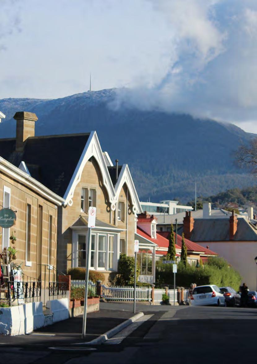
67 59

68 60 CoH Transport Strategy Consultation Paper 4: Local Area Traffic Management
69 GLOSSARY activity centres Places which are the focus for services, employment and social interaction in cities and towns. They provide a broader function than just retail and commercial centres. They are also community meeting places, centres of community and government services, locations for education and employment, settings for recreation, leisure and entertainment activities, and places for living through new forms of high-density housing with good levels of amenity, in mixed land-use settings. arterial roads Arterial and collector roads connect precincts, localities and suburbs. The management focus for these roads is on traffic volume and efficiency. Capital City Strategic Plan Contains the City of Hobart s agreed goals and strategic objectives that are relevant to the development of the Transport Strategy. Census The Census of Population and Housing is undertaken by the Australian Bureau of Statistics and records a wide range of data about the Australian population. chicane A road barrier that creates artificial bends or narrowed sections of the road to reduce traffic speed. collector roads Arterial and collector roads connect precincts, localities and suburbs. The management focus for these roads is on traffic volume and efficiency. congestion When traffic (volumes) demand exceeds the available transport network capacity and vehicles experience significant travel time delay greenfield A term used in urban planning for land that has had no previous construction and development. greenhouse gases Greenhouse gases trap heat in the atmosphere and make the Earth warmer. Those with the most significant impact on climate change and global warming are water vapour, carbon dioxide, methane and nitrous oxide. Other common greenhouse gases include ozone and chlorofluorocarbons. 61
70 infill development Development of vacant or underused parcels within existing urban areas that are already largely developed. kerb outstand A section of the kerb that extends into the roadway to provide better line of sight for pedestrians and car drivers. last mile Final destination of freight in the logistics chain, often on roads managed by local government. link roads Link roads connect traffic at a neighbourhood level with the arterial and collector roads. local access roads Local access roads and minor access roads have low connectivity and provide access within neighbourhoods and specifically to individual properties. local government area (LGA) The geographical area that a local council is responsible for managing. local road network Part of the road network for which local government is responsible. minor access roads Local access roads and minor access roads have low connectivity and provide access within neighbourhoods and specifically to individual properties. rat running When drivers leave arterial and collector roads to use minor roads to avoid traffic lights or congestion. Special activity centre The term refers to an established use or development, or a cluster of uses, which serve a specific purpose. traffic island A raised section in the middle of a road that provides pedestrians with a place to stop and slows traffic speeds. transport task A piece of work to be done, in the transport sense the task is to move a person or good (physical item) from a to b. 62 CoH Transport Strategy Consultation Paper 4: Local Area Traffic Management
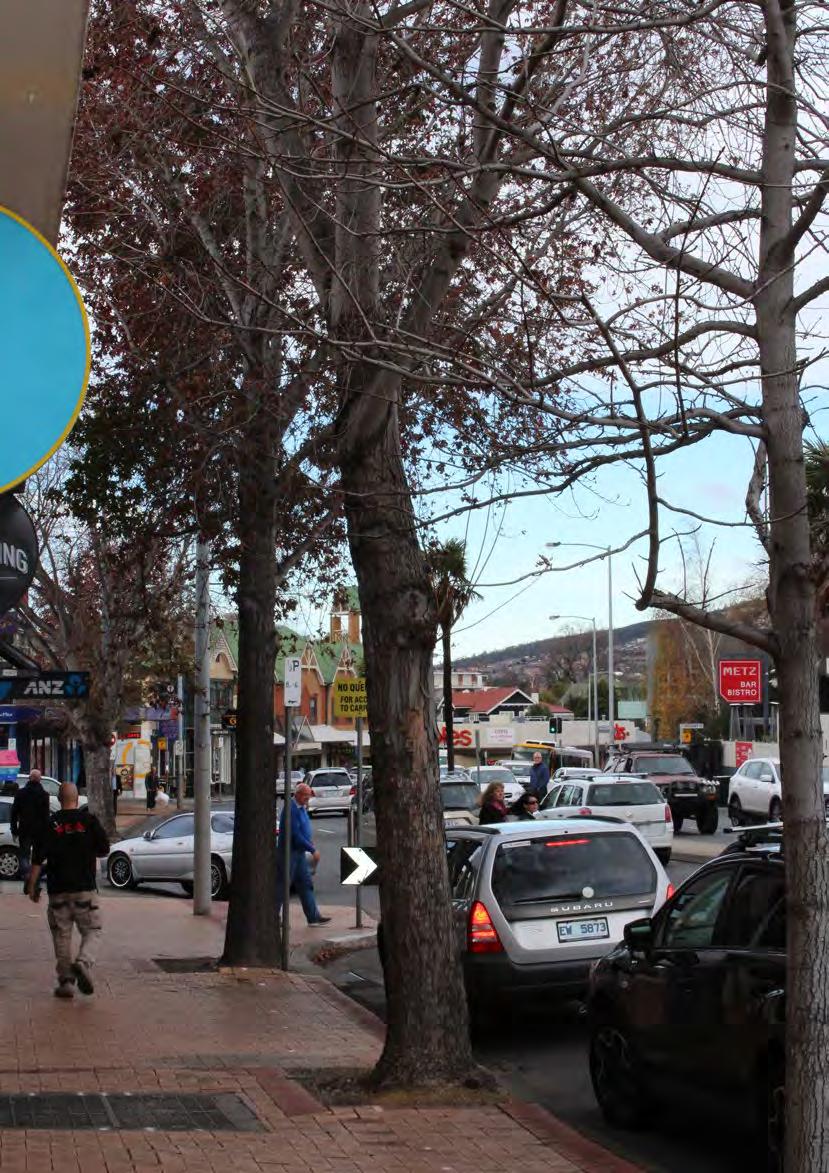
71 63

72 64 CoH Transport Strategy Consultation Paper 4: Local Area Traffic Management
Launceston's Transport Futures. Greater travel options for the people of Launceston
 Launceston's Transport Futures Greater travel options for the people of Launceston Final Draft 13 Jan 2014 1 Page Number Executive summary 3 What is Transport Futures? 4 Vision 6 Economy, access and liveability
21.07 TRANSPORT CONNECTIVITY AND INFRASTRUCTURE
 21.07 TRANSPORT CONNECTIVITY AND INFRASTRUCTURE 21.07-1 Connectivity and Choice Transport connectivity and mode choice are critical to achieving productive, sustainable and socially just cities. Travel
2. Context. Existing framework. The context. The challenge. Transport Strategy
 Transport Strategy Providing quality connections Contents 1. Introduction 2. Context 3. Long-term direction 4. Three-year priorities 5. Strategy tree Wellington City Council July 2006 1. Introduction Wellington
Living Streets response to the Draft London Plan
 Living Streets response to the Draft London Plan Contents Living Streets response to the Draft London Plan... 1 About Living Streets... 2 Summary... 2 Consultation response... 3 Chapter 1: Planning London
DRAFT for a State Policy for Healthy Spaces and Places
 DRAFT for a State Policy for Healthy Spaces and Places 1 DRAFT State Policy for Healthy spaces and Places 1. Purpose To encourage the use and development of land that builds healthy communities through
Planning for tennis in your Local Government Area. A resource from Tennis Australia
 Planning for tennis in your Local Government Area A resource from Tennis Australia Part 1 July 2016 ABOUT THIS RESOURCE This resource forms part of Tennis Australia's Local Government Engagement Program.
Exhibit 1 PLANNING COMMISSION AGENDA ITEM
 Exhibit 1 PLANNING COMMISSION AGENDA ITEM Project Name: Grand Junction Circulation Plan Grand Junction Complete Streets Policy Applicant: City of Grand Junction Representative: David Thornton Address:
Draft Greater Sydney Region Plan
 Powered by TCPDF (www.tcpdf.org) Draft Greater Sydney Region Plan Submission_id: 31452 Date of Lodgment: 15 Dec 2017 Origin of Submission: Online Organisation name: UNSW Sydney Organisation type: Other
Transportation Master Plan Advisory Task Force
 Transportation Master Plan Advisory Task Force Network Alternatives & Phasing Strategy February 2016 BACKGROUND Table of Contents BACKGROUND Purpose & Introduction 2 Linking the TMP to Key Council Approved
Transit boulevard: A new road type for Sydney s Growth Centres
 Transit boulevard: A new road type for Sydney s Growth Centres Cleaver, M. A., de Roos, M. P., NSW Centre for Road Safety, Roads and Traffic Authority, NSW Collins, G., Network Services, Roads and Traffic
University of Victoria Campus Cycling Plan Terms of Reference. 1.0 Project Description
 University of Victoria Campus Cycling Plan Terms of Reference 1.0 Project Description The Campus Cycling Plan, a first for the University, will provide a comprehensive and coordinated approach to support
Active Travel Strategy Dumfries and Galloway
 Active Travel Strategy Dumfries and Galloway Our Active Travel Strategy The agreed Interventions for Dumfries and Galloway Council s Local Transport Strategy includes an action to Develop an Active Travel
This objective implies that all population groups should find walking appealing, and that it is made easier for them to walk more on a daily basis.
 Walking for life The Norwegian Walking Strategy Guro Berge Norwegian public Roads Administration "Walking for life" is the slogan for the National Walking Strategy that is now being formulated in Norway.
Speed Limit Policy Isle of Wight Council
 APPENDIX B Speed Limit Policy Isle of Wight Council 2009 Contents Section 1 Introduction 1.1 Links with the Local Transport Plan Section 2 Speed Limits on Urban Roads and Residential Areas 2.1 20mph Limits
COUNCIL POLICY NAME: COUNCIL REFERENCE: 06/119 06/377 09/1C 10llC 12/1C INDEX REFERENCE: POLICY BACKGROUND
 COUNCIL POLICY NAME: COUNCIL ADVISORY COMMITTEES - TERMS OF REFERENCE ISSUED: APRIL 3, 2006 AMENDED: NOVEMBER 27, 2006 NOVEMBER 23, 2009 JANUARY 11, 2010 DECEMBER 17, 2012 POLICY COUNCIL REFERENCE: 06/119
Active Transportation Infrastructure Investment A Business Case
 Active Transportation Infrastructure Investment A Business Case In 2016, the Real Estate Foundation awarded the Capital Regional District a $50,000 grant for Shifting Gears: Land Use Change through Active
March Maidstone Integrated Transport Strategy Boxley Parish Council Briefing Note. Context. Author: Parish Clerk 2 March 2016
 Context. Author: Parish Clerk 2 The Draft Integrated Transport Policy (DITS) sets out a vision and objectives, and identifies a detailed programme of interventions to support the Maidstone Borough Local
9. Parking Supporting Statement
 9. Parking Supporting Statement Content 1. Setting the Scene 2. Vision 3. Parking and the Shared Priorities 4. Issues 5. Delivery Programme in the first Plan Period 2001/02 2005/06 6. Good Practice 7.
Walking and Cycling Action Plan Summary. A Catalyst for Change The Regional Transport Strategy for the west of Scotland
 Walking and Cycling Action Plan Summary A Catalyst for Change The Regional Transport Strategy for the west of Scotland 2007-2021 Strathclyde Partnership for Transport Contents Purpose...2 Issues, Constraints
THE PLANNING AND. Transport and the law Integrated transport planning Strategies Responsibilities of local government and road controlling authorities
 The planning and policy context Transport and the law Integrated transport planning Strategies Responsibilities of local government and road controlling authorities THE PLANNING AND POLICY CONTEXT Providing
GD 0043/18 ACTIVE TRAVEL STRATEGY
 GD 0043/18 ACTIVE TRAVEL STRATEGY 2018-2021 May 2018 Minister s Introduction There is strong evidence that regular physical activity reduces the risk of a range of health conditions. The best way to increase
Delivering the. Strategy 7.0
 7.0 Delivering the Strategy 7.1 Introduction This chapter presents a framework for the delivery of the strategy. Key challenges and opportunities are identified that will have an impact on the successful
Living Streets Policy
 Living Streets Policy Introduction Living streets balance the needs of motorists, bicyclists, pedestrians and transit riders in ways that promote safety and convenience, enhance community identity, create
CHAPTER 7.0 IMPLEMENTATION
 CHAPTER 7.0 IMPLEMENTATION Achieving the vision of the Better Streets Plan will rely on the ability to effectively fund, build and maintain improvements, and to sustain improvements over time. CHAPTER
Developing a Birmingham Transport Space Allocation policy. David Harris Transport Policy Manager Economy Directorate Birmingham City Council
 Developing a Birmingham Transport Space Allocation policy David Harris Transport Policy Manager Economy Directorate Birmingham City Council Birmingham s Sustainable Urban Mobility Plan Birmingham Connected
CITY OF SAINT JOHN TRAFFIC CALMING POLICY
 CITY OF SAINT JOHN TRAFFIC CALMING POLICY VERSION: 1.0 April 10, 2012 Pedestrians, Cyclists and Motorists Sharing Street Spaces CONTENTS INTRODUCTION... 3 POLICY GOAL... 3 POLICY OBJECTIVES... 3 GUIDING
PERSONALISED TRAVEL PLANNING IN MIDLETON, COUNTY CORK
 PERSONALISED TRAVEL PLANNING IN MIDLETON, COUNTY CORK Elaine Brick Principal Transport Planner AECOM Abstract Smarter Travel funding was awarded to the Chartered Institute of Highways and Transportation
Exceeding expectations: The growth of walking in Vancouver and creating a more walkable city in the future through EcoDensity
 Exceeding expectations: The growth of walking in Vancouver and creating a more walkable city in the future through EcoDensity Melina Scholefield, P. Eng. Manager, Sustainability Group, City of Vancouver
Devonport City Cycling Network Strategy
 Devonport City Cycling Network Strategy 2010-2013 Devonport City Cycling Network Strategy Introduction In February 2010 a draft master plan for cycleways was presented to the community. The feedback received
City of Novi Non-Motorized Master Plan 2011 Executive Summary
 City of Novi Non-Motorized Master Plan 2011 Executive Summary Prepared by: February 28, 2011 Why Plan? Encouraging healthy, active lifestyles through pathway and sidewalk connectivity has been a focus
Bristol City Council has produced a draft Bristol Transport Strategy document.
 Bristol Transport Strategy Summary Document Introduction Bristol City Council has produced a draft Bristol Transport Strategy document. The Strategy fills a gap in transport policy for Bristol. We have
CAIRNGORMS NATIONAL PARK AUTHORITY FOR DECISION
 CAIRNGORMS NATIONAL PARK AUTHORITY FOR DECISION Title: Prepared by: A9 Dualling Project: Dalraddy to Slochd Murray Ferguson, Director of Planning and Rural Development and Gavin Miles, Head of Planning
WELCOME. City of Greater Sudbury. Transportation Demand Management Plan
 WELCOME City of Greater Sudbury Transportation Demand Management Plan Public Consultation Session St. Andrew s Place, Activity Hall 111 Larch Street Wednesday September 13, 2017 6:00 to 8:00 pm Welcome
Service Business Plan
 Service Business Plan Service Name Transportation Planning Service Type Public Service Owner Name Kaylan Edgcumbe Budget Year 2019 Service Owner Title Service Description Manager of Transportation Planning
Welcome. Background. Goals. Vision
 Welcome The formal Public Information Centre (PIC) for the Transportation Master Plan How We GO will be held in early 2017. At that time we will present the recommended transportation system for Niagara
Ormond & McKinnon Walks Response to Draft Glen Eira Community Plan
 Response to Draft Glen Eira Community Plan We would like to take this opportunity to thank Glen Eira City Council for the opportunity to comment on the Glen Eira Draft Community Plan. Below is an outline
Chapter 7. Transportation. Transportation Road Network Plan Transit Cyclists Pedestrians Multi-Use and Equestrian Trails
 Chapter 7 Transportation Transportation Road Network Plan Transit Cyclists Pedestrians Multi-Use and Equestrian Trails 7.1 TRANSPORTATION BACKGROUND The District of Maple Ridge faces a number of unique
Strategy for Walking & Cycling Action Plan
 Strategy for Walking & Cycling Action Plan To achieve higher levels of walking and cycling activity, the destinations which people access have to be available within suitable distances and designed to
Perryville TOD and Greenway Plan
 Perryville TOD and Greenway Plan Greenway Glossary Pathway: A bicycle and pedestrian path separated from motorized vehicular traffic by an open space, barrier or curb. Multi-use paths may be within the
Ann Arbor Downtown Street Plan
 1 Ann Arbor Downtown Street Plan Public Workshop #1 We know that. 2 Public right-of-way (streets, sidewalks, and alleys) make up 30% of the total District area of downtown. Streets need to provide mobility
1 VicRoads Access Management Policies May 2006 Ver VicRoads Access Management Policies May 2006 Version 1.02
 1 VicRoads Access Management Policies May 2006 Ver 1.02 VicRoads Access Management Policies May 2006 Version 1.02 2 VicRoads Access Management Policies May 2006 Ver 1.02 FOREWORD FOR ACCESS MANAGEMENT
Communiqué ABC Meeting #41 Cairns 2-3 August 2012
 Communiqué ABC Meeting #41 Cairns 2-3 August 2012 Esplanade shared path, Cairns Queensland The Australian Bicycle Council met in Cairns on 2-3 August 2012. Cairns Cycling Update Hellius Visser, Director
Classification Criteria
 SCHEDULE D TO RECOMMENDED OFFICIAL PLAN AMENDMENT NO. 40 SCHEDULE C-4 Road Criteria Criteria Traffic Service Objective Land Service/Access Typical Daily Traffic Volume Flow characteristics Travel Speed
University of Leeds Travel Plan
 University of Leeds Travel Plan 2015-2018 Contents 1: Introduction 1.1 What is a Travel Plan? 1.2 Why do we need one? 1.3 Sustainability Strategy 2: Overview 2.1 The bigger picture 2.2 The City scale 2.3
CITY OF WEST KELOWNA COUNCIL POLICY MANUAL
 CITY OF WEST KELOWNA COUNCIL POLICY MANUAL Page 1 of 7 DEPARTMENT: Engineering Services SUBJECT: Traffic Calming Policy (Revised June 6, 2017) Policy Statement: The provision of traffic calming measures
Your views are important. Please fill in a form before you leave. Or alternatively
 Drum Property Group is delighted to welcome you to this exhibition which sets out our initial proposals for a mixed-use development at Stead s Place, Edinburgh. We are keen to hear the views of local people
Kelowna On the Move. Pedestrian and Bicycle Master Plan
 Kelowna On the Move Pedestrian and Bicycle Master Plan Executive Summary April 2016 Purpose of the Plan The Pedestrian and Bicycle Master Plan identifies infrastructure, planning, and policy requirements
City of Elizabeth City Neighborhood Traffic Calming Policy and Guidelines
 City of Elizabeth City Neighborhood Traffic Calming Policy and Guidelines I. Purpose: The City of Elizabeth City is committed to ensure the overall safety and livability of residential neighborhoods. One
Tulsa Metropolitan Area LONG RANGE TRANSPORTATION PLAN
 Tulsa Metropolitan Area LONG RANGE TRANSPORTATION PLAN Indian Nations Council of Governments August 2005 CONTACTING INCOG In developing the Destination 2030 Long Range Transportation Plan, INCOG s Transportation
CITY OF BLOOMINGTON COMPLETE STREETS POLICY
 CITY OF BLOOMINGTON COMPLETE STREETS POLICY POLICY OBJECTIVE: The City of Bloomington will enhance safety, mobility, accessibility and convenience for transportation network users of all ages and abilities,
Reflections on our learning: active travel, transport and inequalities
 Reflections on our learning: active travel, transport and inequalities Jill Muirie Glasgow Centre for Population Health Active travel definition Active travel refers to walking, cycling or using some other
Berwick Health and Education Precinct: Casey Amendment C207 (Part 1) Submission to Planning Panels Victoria
 Submission to Planning Panels Victoria") Berwick Health and Education Precinct: Casey Amendment C207 (Part 1) Submission to Planning Panels Victoria August 2018 CONTENTS 1 Executive summary... 1 2 Summary of the amendment... 2 3 Submission...
Berwick Health and Education Precinct: Casey Amendment C207 (Part 1) Submission to Planning Panels Victoria August 2018 CONTENTS 1 Executive summary... 1 2 Summary of the amendment... 2 3 Submission...
Climate Change Action Plan: Transportation Sector Discussion Paper: Cycling
 Climate Change Action Plan: Transportation Sector Discussion Paper: Cycling ontario.ca/climatechange Contents 1. Minister of Transportation s message... 3 2. Introduction... 5 3. Sector Overview and Support
Thank you for this opportunity to discuss with you how we can work together to make our streets more complete.
 Thank you for this opportunity to discuss with you how we can work together to make our streets more complete. 1 2 3 Thank you for this opportunity to discuss with you how we can work together to make
APPENDIX B. TDM Existing Conditions
 APPENDIX B TDM Existing Conditions SCARBOROUGH CENTRE TMP TRANSPORTATION DEMAND MANAGEMENT INTRODUCTION Scarborough Centre has grown into a mixed-use hub for population, transportation, and employment
Transportation Assessment
 Transportation Assessment Midtown Open House February 10, 2018 Overview Midtown in Focus Overview & Purpose of Today Transportation Assessment overview Summary of Transportation work to date Review & Analysis
ABERDEEN: CITY OF THE FUTURE
 ABERDEEN: CITY OF THE FUTURE A contribution towards discussions on a future transport strategy for Aberdeen and its Region Prepared by the Centre for Transport Research University of Aberdeen June 2010
May 12, 2016 Metro Potential Ballot Measure Issue Brief: Local Return
 Summary: Local return is an important revenue source for cities to maintain their local transportation infrastructure. Most cities use their local return to operate small bus systems and repave streets,
Section 2 Strategic Alignment. Contents
 Section 2 Strategic Alignment Contents 2 Strategic Alignment... 2 2.1 General... 2 2.2 SmartGrowth Strategy and Implementation Plan... 2 2.3 Walking and Cycling Strategy... 3 2.4 Built Environment Strategy...
City of Toronto Complete Streets Guidelines
 Round One This is a summary of the Complete Streets Guidelines Survey posted on June 18 th, 2015 and live until July 2 nd, 2015. The survey was designed to solicit feedback on the draft Complete Streets
Regional Cycling Plan
 Adopted December 2008 Quality for Life Adopted December 2008 For more information, contact: Greater Wellington 142 Wakefield Street PO Box 11646 Manners Street Wellington 6142 T 04 384 5708 F 04 385 6960
CRICKET VICTORIA-CRICKET AUSTRALIA SUBMISSION TO INFRASTRUCTURE VICTORIA LAYING THE FOUNDATIONS DRAFT PLAN 10 MARCH 2016
 CRICKET VICTORIA-CRICKET AUSTRALIA SUBMISSION TO INFRASTRUCTURE VICTORIA LAYING THE FOUNDATIONS DRAFT PLAN 1. INTRODUCTION 10 MARCH 2016 Thank you for the opportunity to provide a submission in response
TOWN OF PORTLAND, CONNECTICUT COMPLETE STREETS POLICY
 TOWN OF PORTLAND, CONNECTICUT COMPLETE STREETS POLICY I. VISION, GOALS & PRINCIPLES VISION To improve the streets of Portland making them safer and more accessible for all users including pedestrians,
Douglas Land Use and Transportation Strategy (DLUTS) Summary. August 2013
 Summary. August 2013") Douglas Land Use and Transportation Strategy (DLUTS) Summary August 2013 Background Douglas is a large and popular residential suburb of approximately 30,000 persons on the periphery of Cork City along
Douglas Land Use and Transportation Strategy (DLUTS) Summary August 2013 Background Douglas is a large and popular residential suburb of approximately 30,000 persons on the periphery of Cork City along
ATTACHMENT 4 - TDM Checklist. TDM Checklist Overview
 ATTACHMENT 4 - TDM Checklist TDM Checklist Overview The proposed checklist rates developments on the degree to which they are TDM and transit supportive. Points are assigned based on the level of transit
ONE SIZE DOESN T FIT ALL RECONCILING OVERLAPPING TRANSPORT NETWORKS IN A CONSTRAINED URBAN ENVIRONMENT
 One Size Doesn t Fit All S Corbett, C Chenery Page 1 ONE SIZE DOESN T FIT ALL RECONCILING OVERLAPPING TRANSPORT NETWORKS IN A CONSTRAINED URBAN ENVIRONMENT Authors/Presenters: Sam Corbett, Principal Transport
Berkeley Strategic Transportation Plan A-76
 Berkeley Strategic Transportation Plan A-76 Appendices 1. A Team Effort 2. Where We ve Been A-11 Berkeley Strategic Transportation Plan Alameda County Transportation Plan Alameda County will be served
TRAFF IC CALMING POLICY
 TRAFF IC CALMING POLICY Policy No: 45396 Approved by Council 28 May 2008 C11/05/08 Further amendment by Council 22 June 2011 vide c08/06/11 Contents 1 Problem Statement 1 2 Desired Outcomes 2 3 Strategic
ACTIVE TRANSPORTATION
 ACTIVE TRANSPORTATION Mobility 2040 Supported Goals Improve the availability of transportation options for people and goods. Support travel efficiency measures and system enhancements targeted at congestion
FAQ s Walsh Road / Ferguson Road Pilot Scheme
 FAQ s Walsh Road / Ferguson Road Pilot Scheme What is happening? Traffic calming measures are being installed as a pilot. Temporary Bollards will be installed to the east of 1 Ferguson Road and a Temporary
PEDESTRIAN ACTION PLAN
 ATTACHMENT 2 CITY OF SANTA MONICA PEDESTRIAN ACTION PLAN CITY OF SANTA MONICA PEDESTRIAN ACTION PLAN This page intentionally left blank EXECUTIVE SUMMARY CHAPTER 1 EXECUTIVE SUMMARY Setting the Stage
Logan City Council Planning for Tennis Together
 Logan City Council Planning for Tennis Together February 2016 Introduction Tennis Queensland and Tennis Australia are seeking the opportunity to proactively work with the Logan City Council (LCC) to address
AMATS Complete Streets Policy
 AMATS Complete Streets Policy Table of Contents: Section 1. Definition of Complete Streets Section 2. Principles of Complete Streets Section 3. Complete Streets Policy Section 4. Consistency Section 5.
Chapter 2. Bellingham Bicycle Master Plan Chapter 2: Policies and Actions
 Chapter 2 Bellingham Bicycle Master Plan Chapter 2: Policies and Actions Chapter 2: Policies and Actions The Bicycle Master Plan provides a road map for making bicycling in Bellingham a viable transportation
Richmond Connects Visioning Update
 Richmond Connects Visioning Update To date there have been four elements of the visioning process: Vision20 Night at Byrd Theatre on May 3rd Advisory Committee Meeting on May 12 th Public Visioning Workshop
Proposed. City of Grand Junction Complete Streets Policy. Exhibit 10
 Proposed City of Grand Junction Complete Streets Policy Exhibit 10 1 City of Grand Junction Complete Streets Policy Vision: The Complete Streets Vision is to develop a safe, efficient, and reliable travel
NOTES FROM JUNIOR COUNCIL ORIENTATION SESSION HELD ON MONDAY, JANUARY 22, 2018, AT 3:30 PM IN COUNCIL CHAMBERS, CITY HALL
 CITY OF KAMLOOPS Junior Council Meeting Agenda March 12, 2018, at 3:30 pm in Council Chambers, 7 Victoria Street West, Kamloops, BC Page 1. APPROVAL OF THE AGENDA 2. MINUTES Attachment Recommendation:
TRAVEL PLAN: CENTRAL EUROPEAN UNIVERSITY CAMPUS REDEVELOPMENT PROJECT TRAVEL PLAN. Central European University Campus Redevelopment Project.
 TRAVEL PLAN Central European University Campus Redevelopment Project Page 1 Table of Contents Introduction... 3 Background... 7 Building Users... 7 Transportation in Community Consultation... 7 Summary
RESOLUTION NO ?? A RESOLUTION OF THE CITY OF NEPTUNE BEACH ADOPTING A COMPLETE STREETS POLICY
 RESOLUTION NO. 2018-?? A RESOLUTION OF THE CITY OF NEPTUNE BEACH ADOPTING A COMPLETE STREETS POLICY WHEREAS, safe, convenient, and accessible transportation for all users is a priority of the City of Neptune
Capital and Strategic Planning Committee. Item III - B. April 12, WMATA s Transit-Oriented Development Objectives
 Capital and Strategic Planning Committee Item III - B April 12, 2018 WMATA s Transit-Oriented Development Objectives Page 24 of 76 Washington Metropolitan Area Transit Authority Board Action/Information
Circulation in Elk Grove includes: Motor vehicles, including cars and trucks
 Circulation, as it is used in this General Plan, refers to the many ways people and goods move from place to place in Elk Grove and the region. Circulation in Elk Grove includes: Motor vehicles, including
Draft Eastern District Plan
 Powered by TCPDF (www.tcpdf.org) Draft Eastern District Plan Submission_id: 31453 Date of Lodgment: 15 Dec 2017 Origin of Submission: Online Organisation name: UNSW Sydney Organisation type: Other First
Corporate. Report COUNCIL DATE: June 26, 2006 NO: C012 COUNCIL-IN-COMMITTEE. TO: Mayor & Council DATE: June 22, 2006
 Corporate NO: C012 Report COUNCIL DATE: June 26, 2006 COUNCIL-IN-COMMITTEE TO: Mayor & Council DATE: June 22, 2006 FROM: General Manager, Engineering FILE: 0410-20(MoT/Gate) SUBJECT: Surrey Response on
Frome Street Bicycle Route
 The Adelaide City Council invites engagement from the community about Frome Street Bicycle Route Project Summary Adelaide City Council is seeking feedback on design options to construct bicycle facilities
Active Travel Towns Funding Scheme Project Proposal. Sligo. Sligo Local Authorities
 Active Travel Towns Funding Scheme 2014-2016 Project Proposal for Sligo by Sligo Local Authorities Introduction Over the last two years, Sligo Local Authorities have implemented years 1 & 2 of their 5
REGIONAL BICYCLE AND PEDESTRIAN DESIGN GUIDELINES
 REGIONAL BICYCLE AND PEDESTRIAN DESIGN GUIDELINES November 16, 2011 Deb Humphreys North Central Texas Council of Governments Bicycle and Pedestrian Advisory Committee Snapshot of the Guide 1. Introduction
HAMILTON BIKING PLAN OUR VISION: A BIKE FRIENDLY CITY
 HAMILTON BIKING PLAN 2015-2045 OUR VISION: A BIKE FRIENDLY CITY INTRODUCTION Biking as a travel option is experiencing a resurgence internationally and in New Zealand, growing as a familyfriendly and healthy
POLICY: TRAFFIC CALMING
 2006 MAY REFERENCE: COUNCIL APPROVED BY COUNCIL MAY 23, 2006 CITY OPERATIONS - NO. 608 POLICY: TRAFFIC CALMING A. All requests for traffic calming within the City shall be considered in accordance with
GREATER DANDENONG ROAD SAFETY STRATEGY
 GREATER DANDENONG ROAD SAFETY STRATEGY 2016-22 Table of Contents Table of Contents... 2 Executive Summary... 3 Road Safety in Greater Dandenong... 4 Context... 5 Community Engagement... 14 Road Safety
WEST CENTRAL DRAFT DISTRICT PLAN SUBMISSION 3 HASSAL ST WESTMEAD
 Ref: OBF 170330 LGSC - DDP Sub 30 March 2017 Greater Sydney Commission PO Box 257 PARRAMATTA NSW 2124 Attention: District Commissioner - Professor Edward Blakely Dear Professor Ed Blakeley, WEST CENTRAL
Rochester Area Bike Sharing Program Study
 roc bike share Rochester Area Bike Sharing Program Study Executive Summary ~ January 2015 JANUARY 2015 8484 Georgia Avenue, Suite 800 Silver Spring, MD 20910 3495 Winton Pl., Bldg E, Suite 110 Rochester,
Salmon Five Point Approach restoring salmon in England
 Salmon Five Point Approach restoring salmon in England Our Mission To restore the abundance, diversity and resilience of salmon stocks throughout England We will do this by:- a) Maximising the production
Access BART: TOD and Improved Connections. October 29, 2008
 Access BART: TOD and Improved Connections October 29, 2008 1 Access BART Study Goals Evaluate at the system-level land use and access scenarios to optimize ridership Identify station clusters that provide
2015 Florida Main Street Annual Conference. Complete Streets Equal Stronger Main Streets
 WHAT ARE COMPLETE STREETS? CASE STUDIES COMPLETING YOUR MAIN STREET 2015 Florida Main Street Annual Conference St. Petersburg, Florida August 19, 2015 WHAT ARE COMPLETE STREETS? CASE STUDIES COMPLETING
APPENDIX 2 PROPOSAL FOR REPLACEMENT FOR POOLE (DOLPHIN) LEISURE CENTRE FINAL SPECIFICATION
 LEISURE CENTRE FINAL SPECIFICATION") APPENDIX 2 PROPOSAL FOR REPLACEMENT FOR POOLE (DOLPHIN) LEISURE CENTRE FINAL SPECIFICATION 1 PURPOSE 1.1 To provide the following information and supporting evidence for the Member decision (reference
APPENDIX 2 PROPOSAL FOR REPLACEMENT FOR POOLE (DOLPHIN) LEISURE CENTRE FINAL SPECIFICATION 1 PURPOSE 1.1 To provide the following information and supporting evidence for the Member decision (reference
Bicycle Master Plan Goals, Strategies, and Policies
 Bicycle Master Plan Goals, Strategies, and Policies Mobilizing 5 This chapter outlines the overarching goals, action statements, and action items Long Beach will take in order to achieve its vision of
Report to Cabinet. 18 May 2016
 Agenda Item 8 Report to Cabinet 18 May 2016 Subject: Presenting Cabinet Member: Proposed CCTV Enforcement of Traffic Contraventions in a Bus Lane (Key Decision Ref. No. HE030) Highways and Environment
West Dimond Blvd Upgrade Jodhpur Street to Sand Lake Road
 West Dimond Blvd Jodhpur St to Sand Lake CSS Transportation Project Summary Municipality of Anchorage Project # 05 005 Project Manager: John Smith, P.E. (MOA PM&E) Project Administrator: Julie Makela,
4 Ridership Growth Study
 Clause 4 in Report No. 15 of Committee of the Whole was adopted, without amendment, by the Council of The Regional Municipality of York at its meeting held on November 16, 2017. 4 Ridership Growth Study
Catalyst for Change:
 Catalyst for Change: Toronto Examples Linking Health and Transportation Presented at Walk 21 Conference Vancouver 2011 Monica Campbell, Director Healthy Public Policy Toronto Public Health 1 About Toronto