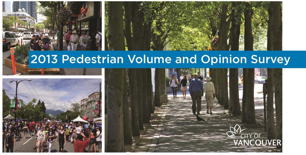
2013 Pedestrian Volume and Opinion Survey. City of Vancouver 1
|
|
|
- Adela Brooks
- 6 years ago
- Views:
Transcription
1 MAY 2015
2 City of Vancouver 1
3 TABLE OF CONTENTS 1. SUMMARY PURPOSE BACKGROUND TRANSPORTATION 2040 PLAN (2012) GREENEST CITY OTHER CITY PEDESTRIAN INITIATIVES PEDESTRIAN CORRIDORS AND VIBRANT PUBLIC SPACE STREET FURNITURE AND AMENITIES PROGRAM PEDESTRIAN WAYFINDING PEDESTRIAN VOLUMES METHODOLOGY REVIEW OF RESULTS DOWNTOWN PENINSULA LOCATIONS OUTSIDE OF DOWNTOWN PENINSULA CANADA LINE LOCATIONS OPINION SURVEY METHODOLOGY ON-STREET SURVEYS ONLINE SURVEYS REVIEW OF RESULTS ORIGINS AND DESTINATIONS PURPOSE OF TRIP MAIN MODE OF TRAVEL MODE CHOICE ROUTE CHOICE TIME WILLING TO WALK RATINGS SPECIFIC CONCERNS CONCLUSIONS City of Vancouver
4 1. SUMMARY The 2013 Pedestrian Survey collected volumes of people walking on a variety of Vancouver s commercial streets and surveyed the opinions of people walking to determine their travel patterns, main mode of transportation, and experiences using walking facilities. Building on the 2008 survey, volumes were collected at 400 locations on 60 commercial streets, and on-street and online opinion surveys were conducted. This report is structured as follows: Section 1 contains a summary and introduction. Section 2 outlines the purpose. Section 3 contains the background. Section 4 contains the pedestrian volumes and methodology. Section 5 contains the opinion survey. Appendix A provides the volume data by block (both sides). Appendix B provides data for the opinion survey. PEDESTRIAN VOLUMES Volume data was collected on generally the same commercial streets as in 2008 with some locations added to provide greater resolution. The counting locations include commercial streets downtown, Business Improvement Areas (BIAs), and Neighbourhood Centres around the city. Locations were added to the 2008 location list for a finer counting mesh on commercial high streets such as Commercial Drive, Cordova Street, and Denman Street, generally at the request of BIAs. The number of blocks counted outside the downtown peninsula is slightly lower than 2008, but still accounts for over a quarter of the total locations. Overall, a total of 798 sidewalks were counted on weekdays between the hours of 10am and 6pm (the same time periods as in 2008). There were two typical volume distributions during the day walking volumes either exhibited two peaks during the count period, one near 12pm and the other near 4pm or 5pm, or volumes increased steadily from morning until the end of the count period. Based on the streets that were counted in 2013 and 2008, pedestrian volumes on the downtown peninsula have increased by slightly over 4% from Volumes outside the downtown peninsula have increased by 3% from Citywide, volumes have increased by 4%. These results appear to be consistent with the findings of TransLink s 2011 and 2008 Trip Diary Surveys. Table 1 shows the walking mode share in Vancouver for the past three City of Vancouver 3
5 Trip Diary Surveys (2004, 2008, and 2011). The walking mode share increased slightly from 2004 to The decrease from 2004 to 2008 may be due to different survey methodology, for the 2004 trip diary survey was done in the spring and the 2008 and 2011 surveys were done in the fall. The survey results also appear to be consistent with the results of the 2011 National Household Survey, which also found a small increase in the proportion of people walking to work. Table 1. Vancouver Walking Mode Share Walking Mode Share (24 hours) (Source: TransLink s 2004, 2008, and 2011 Trip Diary Survey) % 15.4% 17.0% Although overall walking volumes have increased since 2008, results varied for individual blocks and BIAs. The busiest blocks in 2013 have changed slightly since 2008, but are still all located downtown. They include sections of Robson, Granville, Burrard, and Georgia Streets. Granville Street (from Pender to Robson) and Georgia Street (from Howe to Hornby) now comprise the highest ranked blocks in 2013, surpassing Robson Street which previously held the top spots. Burrard Street ranked about the same as in The shift from Robson Street to Granville Street is probably due to the Canada Line construction on Granville in 2008, the opening of the reconstructed Granville Mall, and the return of bus routes on Granville Street. On several of the downtown peninsula s busiest streets, the number of people walking exceeded the number of people moving in vehicles. For example, along the 900 block of Robson Street, 65% of all people walked and 35% were moved by vehicles. In general, busy walking streets outside of the downtown had lower volumes than busy walking streets in the downtown; however some locations outside of the downtown still ranked highly. The busiest locations outside of the downtown were clustered around the intersections of East Broadway and Commercial Drive, and West Broadway and Cambie, which are both major transit interchange locations. The pedestrian volume data serves as a benchmark for changes on individual streets, subareas, and the city as a whole. The data will also be used by staff for a number of engineering and planning applications, such as: Informing planning decisions around future rapid transit stations, Making operational decisions on sidewalk widths, Providing reference volumes for new pedestrian infrastructure, Special event planning (such as 800 Block Robson programming), Assisting businesses by identifying high foot traffic locations, and providing a baseline to monitor the success of marketing and promotional initiatives. PEDESTRIAN OPINIONS As in 2008, an opinion survey was carried out on streets in the Metro Core (defined as the downtown peninsula and south of and including Broadway Street from Clarke Drive to Burrard Street) and in seven Neighbourhood Centres. A shorter version of the survey was also available online for the month of November Over 1300 pedestrians (1189 onstreet and 157 online) provided information on their transportation choices, opinions on walking facilities, and specific concerns. On-street respondents also provided trip-specific information, such as origin and destination. In the Metro Core, 90% of people surveyed started their trip in Vancouver, of which 68% started their trip in the downtown peninsula. 57% of trips were business related (work, shopping, restaurants/other services) and 59% of pedestrians walked the entire distance (the remaining 41% used another mode, such as transit, for the part of their trip). As in 2008, these results suggest that the majority of people walking in the Metro Core complete their trip entirely on foot. Most pedestrians surveyed in Neighbourhood Centres (92%) began their trip in Vancouver (only 6% of these trips originating in the downtown peninsula). In Neighbourhood Centres, 58% of trips were business related and 51% walked the entire distance. These results are generally consistent with the Metro Core. The smaller percentage of people who walked the entire distance may be attributed to less dense and less mixed land use patterns. In general, people were satisfied with crossing conditions at signalized crosswalks, the amount of space on sidewalks, streetscape character, and the behaviour of other people walking on the sidewalk. These results are consistent with those from People surveyed on-street in the Metro Core and online were more satisfied with curb ramp placement and quality than those surveyed in Neighbourhood Centres, and slightly more people surveyed in the Metro Core were satisfied with sidewalk amenities. People were less satisfied with crossing at un-signalized crosswalks and with the behaviour of cyclists and drivers. In the open-ended general concerns responses, common issues included: Sidewalk maintenance, 4 City of Vancouver
6 Sidewalk cleanliness (street cleaning and availability of garbage and recycling containers), Lighting, Lack of amenities and weather protection, and Improving curb ramps at crossings. The length of time pedestrians are normally willing to walk, and General opinions on City pedestrian facilities. The Opinion Survey results provide a better idea of how pedestrians are using sidewalks and where there are opportunities to improve facilities and services. 2. PURPOSE This survey was carried out to obtain updated information on walking on commercial streets. It builds on previous pedestrian surveys that were carried out in 1973, 1977, 1991, 2001/2002 and The 2013 survey includes most streets investigated in the 2008 survey and adds blocks on commercial high streets to capture a more complete picture of the network. Locations included downtown, around Canada Line stations, within Neighbourhood Centres, and in Business Improvement Areas (BIAs) across the city. Using the same locations for each survey provides an opportunity to compare walking volumes from one survey to the next. This helps to assess trends and to predict future growth. Volumes on individual blocks are used for engineering and planning applications, including: Prioritizing pedestrian improvements, Informing improvements transportation facilities, Designing pedestrian oriented streets, Locating on-street litter containers, and Reviewing corridors and access points for new buildings. Volume counts can also be used by the City for monitoring the results of public realm and land use initiatives. Businesses can use the data for researching locations and reviewing marketing efforts. To better understand pedestrian travel behaviour and satisfaction, pedestrians were interviewed at a number of locations in the Metro Core (the downtown peninsula and West Broadway), Neighbourhood Centres, BIA areas, and online via the City s website. These surveys were intended to determine: Walking origins and destinations, Purpose for trips, Modes of transportation used, Mode and route choice, 3. BACKGROUND Vancouver has a high walking mode share compared with municipalities in the Lower Mainland and similarly sized cities across North America 1. This is particularly true for the downtown peninsula. According to the 2011 Canada National Household Survey, walking to work 2 is most common in the downtown peninsula and the communities immediately adjacent to downtown (Table 2). The community with the highest walk to work mode share is the West End, with Downtown close behind (Figure 1). While there was a slight decrease in the mode share of Downtown residents walking to work between 2006 and 2011, it is worth noting that with a 9% increase in downtown population during this period, the number of downtown residents who responded that, on a daily basis, they regularly walked to work increased from 8,500 to 10,800 (about 2,300 new commuters who walk to work). The City as a whole increased in total walk to work volumes by 2,700 residents over the same period. In viewing the Journey to Work data, it is important to keep in mind that work trips account for a relatively small fraction of overall trips in the region (in the 2011 Trip Diary, work and school trips combined accounted for about 20% of trips over a 24-hours period). It is also important to note that 2006 Journey to Work data was part of the mandatory census. In 2011 the Journey to Work data was captured by the non-mandatory National Household Survey, which has a smaller response rate than the 2006 Census data. Communities in the downtown peninsula tend to have higher walking mode shares due to high residential and employment densities, regional shopping and entertainment and educational destinations. Additionally, the well-connected street grid and relatively short blocks in the downtown peninsula help make walking an attractive mode of transportation. A key strategy of city and regional transportation, climate change, and land use plans is to increase walking as a primary mode of travel. Recent City transportation initiatives relevant to this study are summarized below. 1 Based on TransLink s Trip Diary Surveys, Canadian National Household Survey, and US Censes results 2 People with fixed and non-fixed places of employment. City of Vancouver 5

7 Figure 1. Vancouver Communities Table National Household Survey Journey to Work: Walk Mode Share Community Change Arbutus - Ridge 5.7% 4.9% 5.3% 0.4% Downtown 39.1% 37.9% 37.3% -0.6% Dunbar-Southlands 3.7% 3.5% 4.8% 1.3% Fairview 16.6% 20.2% 18.8% -1.4% Grandview-Woodland 8.2% 8.1% 9.0% 0.9% Hastings-Sunrise 3.9% 4.0% 4.2% 0.2% Kensington-Cedar Cottage 2.5% 3.1% 3.4% 0.3% Kerrisdale 5.1% 5.4% 4.2% -1.2% Killarney 2.5% 2.2% 1.9% -0.3% Kitsilano 9.2% 12.0% 10.3% -1.7% Marpole 5.2% 4.4% 3.5% -0.9% Mount Pleasant 9.9% 9.7% 12.0% 2.3% Oakridge 6.4% 4.9% 3.4% -1.5% Renfrew-Collingwood 2.4% 1.7% 2.1% 0.4% Riley Park 5.5% 6.6% 7.6% 1.0% Shaughnessy 6.5% 6.0% 5.7% -0.3% South Cambie 11.2% 13.5% 11.6% -1.9% Strathcona 28.6% 21.3% 24.0% 2.7% Sunset 3.8% 3.6% 2.6% -1.0% Victoria-Fraserview 1.8% 1.8% 2.0% 0.2% West End 37.2% 39.6% 37.7% -1.9% West Point Grey 5.6% 8.0% 6.6% -1.4% City of Vancouver 10.7% 12.2% 12.5% 0.3% Metro Vancouver 5.8% 6.3% 6.3% 0.0% Vancouver as a % of Metro Vancouver 52% 54.0% 54.3% 6 City of Vancouver

8 3.1 TRANSPORTATION 2040 PLAN (2012) Transportation 2040 succeeds Vancouver s 1997 Transportation Plan. One of its key targets is that at least two-thirds of all trips will be made on foot, bike, or transit by This will be accomplished, in part, by good land use decisions and by supporting vibrant public spaces that encourage a culture of walking, cycling, and social interaction. Walking policies supported in the plan include: Make streets safer for walking. Provide generous, unobstructed sidewalks on all streets. Make streets accessible for all people. Make streets and public spaces rain-friendly. Address gaps in the pedestrian network. Provide a blueprint for great pedestrian realm design. Make the city easy to navigate on foot. Enable and encourage creative uses of the street. Create public plazas and gathering spaces throughout the city. the completion of the Carrall Street Greenway, and the completion of the Seaside Greenway/York Bikeway. The plan also supports creating vibrant public space. Since 2008, a number of public space programs have been launched that encourage pedestrian activity. The Parklet Program, which creates a mini park by extending a platform over a parking spot, has added 4 new parklets since 2012 throughout the city. The Pavements-to-Plazas Program converts parts of a street into a public plaza, and provides quick, low-cost, high-impact public space; typically these conversions are side streets and odd intersections such as Bute Street near Davie. Additionally, on-going seasonal closures continue to encourage pedestrian activity within the downtown core. The 800 block of Robson Street, which was first closed to vehicles during the 2010 Winter Olympic Games, is now closed yearly during the summer months to vehicles and open to other road users (Figure 2). 3.2 GREENEST CITY 2020 Greenest City 2020 Action Plan (GCAP) sets out actions to make Vancouver the greenest city in the world by increasing the number of green jobs, reducing community-based greenhouse gas emissions, and making walking, cycling, and public transit preferred transportation options. Actions specifically related to transportation in GCAP are: Make active transportation choices such as walking and cycling feel safe, convenient, and comfortable. Plan for complete communities to encourage increased walking and cycling, and support improved transit service. 3.3 OTHER CITY PEDESTRIAN INITIATIVES Some recent City initiatives that are also aimed at benefiting pedestrians are noted below PEDESTRIAN CORRIDORS AND VIBRANT PUBLIC SPACE The Transportation Plan identifies a number of corridors within the City for pedestrianpriority streets. These are streets which may include car-free or shared spaces through parts or all of the day. A number of pedestrian corridors have been developed since 2008, including Phase 1 of the Comox-Helmcken Greenway (from Stanley Park to Hornby Street), Figure Block Robson Street seasonal closure (left panel) and Parklet on Fraser Street (right panel) STREET FURNITURE AND AMENITIES PROGRAM The Transportation 2040 Plan continues to support the provision of increased pedestrian amenities that help to enhance the pedestrian realm and provide opportunities to rest. This includes installation of benches, public toilets, litter receptacles, and bus shelters. City of Vancouver 7
9 The City has been rolling out key pedestrian amenities within its Street Furniture contract since PEDESTRIAN WAYFINDING The City's current pedestrian way finding signage was installed prior to the 2010 Winter Olympic Games, with the goal to update the graphics periodically. Maps in the downtown Vancouver began to be replaced in the fall of 2014 and maps in the rest of the city will be replaced or installed in The new maps are more user friendly and orientated to the user s perspective, have a similar look and feel with other way finding signage, and support digital applications 4. PEDESTRIAN VOLUMES 4.1 METHODOLOGY To track changes in pedestrian activity in a consistent manner, the 2013 volume counts were carried out following the same general methodology used in the 2008 survey. The 2013 survey involved counting mid-block volumes on commercial street sidewalks in the downtown peninsula as well as in Neighbourhood Centres, BIAs, and around Canada Line stations outside of the downtown. The opportunity for extra data collection (beyond that funded by the City) was made available to BIAs at their expense. Volumes were counted on weekdays in May, June, September, and October With the exception of three days counted in early July, the July to August period was omitted to avoid the tourist season and to best capture base level pedestrian volumes. In a given mid-block location, volume data was collected on both sidewalks of the block between 10am and 2pm and between 3pm and 6pm. Pedestrian volumes were recorded and uploaded using tablets. Rainfall information was obtained for each day from Environment Canada to examine its impact on walking volumes. However, counting overall activity rather than individual pedestrians is an indication of the number of walking trips made at a given location, and is consistent with data collection methods used for other transportation counts (e.g. vehicles, bicycles). Daytime walking volumes on weekdays during the period of 10am to 2pm and 3pm to 6pm are shown in Appendix A. Section A of Appendix A contains the maps showing the count locations in addition to the metadata for the study. Section B contains the weekday volume data. Construction sites often require temporary re-routing or closure of sidewalks, and construction scaffolding often restricts the available width of the sidewalk. Efforts were made to avoid collecting volume data when there was construction related impacts to sidewalks. However, there were some locations where construction partially obstructed or closed one sidewalk (less than ten locations). Additionally, to compare the 2013 and 2008 volumes, some locations were counted in 2013 that in 2008 had unavoidable large-scale construction projects. Most significantly, Canada Line construction impacted Granville Street between Cordova and Robson, the intersection of Mainland and Davie Streets, and Cambie Street between the Cambie Bridge and Kent Avenue North. In 2008 the Carrall Street Greenway was also being constructed between Pacific Boulevard and Water Street, and there were many smaller scale developments across the City (e.g. the Shangri-La, CBC expansion) that had localized but potentially significant impacts on sidewalks and pedestrian activity. For 2013 walking volume counts, some new locations were added to provide finer detail on commercial streets (such as Commercial Drive), whereas some of the more isolated locations collected in 2008 were omitted from the 2013 locations. When interpreting the data, it is important to note that walking volumes were only counted on commercial streets. Volumes on residential streets and off street paths were not counted as part of the survey, so trends on these corridors are not captured. For all locations, walking volumes were recorded by counting every pedestrian that passed a screenline mid-block on the sidewalk. Data was categorized by side of the street and direction of travel. People that made a return trip on the same route during the count period were counted twice. As a result, the volumes in this report are not an accurate estimation of the number of unique individuals that were present at a given location. 8 City of Vancouver
10 Table 3. Population Change for the Downtown Peninsula Population 47,288 58,345 70,101 87,975 99,230 Population Change in 5 years - 23% 20% 25% 13% (Source: 1991,1996,2006 Census, 2011 National Household Survey) Table 4. Downtown 24-Hour Walking Mode Shares Number of Walking Trips 68, , ,700 72, ,336 Walking Mode Share 20% 30% 27% 30% 35% (Source: TransLink Trip Diary Surveys ) 4.2 REVIEW OF RESULTS DOWNTOWN PENINSULA DAYTIME: MONDAY TO FRIDAY The downtown peninsula is defined as all streets on the peninsula west of and including Main Street and north of and including the False Creek Bridges. Total volumes by block are shown in Figure 3. In 2013, the total number of people walking counted on streets in the downtown peninsula was 1,370,000 (on 266 blocks). Approximately 1,300,000 pedestrians were counted on the same blocks in 2008, representing an increase of just over 4% since the 2008 survey. This is consistent with an increase in walking mode share in the downtown peninsula as well as a continuing increase in downtown population of 9% from 2006 to Volumes on streets counted in the downtown have increased concurrently with population increase. Census population data for the downtown from 1991 to 2011 is shown in Table 3 and TransLink s last six Trip Diary surveys from 1994, 1999, 2004, 2008, and 2011 are shown in Table 4. Of these data sources, Trip Diary surveys give the most complete picture of transportation trends, including walking mode share and trips, as they include all trips made in a typical day. The period from 2008 to 2011 shows a slower rate of growth in walking mode share than the growth from 1994 to In 2004 there was a slight decrease in walking mode share. This may be due to differences in the 2004 survey from the 2008 and 2011 surveys including season and sample size. From 2008 to 2011 there is a 5% increase in downtown walking mode share concurrently with a 9% increase in the downtown population. The number of walking trips increased by four times the number of new downtown residents during the period. Accordingly, the 2013 survey results appear to be consistent with TransLink s mode share data. City of Vancouver 9

11 Figure Pedestrian Volumes on the Downtown Peninsula, 10am to 6pm 10 City of Vancouver
12 Table Highest Growth Blocks in the Downtown Peninsula Rank Block Change Rank Block Change Volume Volume Volume Volume 1 Pender, E of Cambie (100W block) 8,132 2, % 14 Cambie, S of Cordova (300 block) 6,030 3,131 93% 2 Abbott, S of Pender (500 block) 6,720 2, % 15 Beatty, S of Pender (500 block) 2,339 1,257 86% 3 Dunsmuir, E of Citadel Parade (0 block) 1, % 16 Carrall, S of Expo (700 block) % 4 Pender, E of Jervis (1200W block) 3,128 1, % 17 Mainland, S of Helmcken (1100 block) 4,426 2,426 82% 5 Carrall, S of Hastings (400 block) 5,094 1, % 18 Nelson, E of Hamilton (300 block) 3,187 1,747 82% 6 Carrall, S of Pender (500 block) 2, % 19 Granville, S of Pender (500 block) 18,689 10,388 80% 7 Hastings, E of Cambie (100W block) 4,977 2, % 20 Pacific Blvd, N of Nelson (900 block) % 8 Abbott, S of Keefer (600 block) 5,042 2, % 21 Expo Blvd, N of Griffins Way (600 block) 4,168 2,374 76% 9 Davie, S of Hamilton (300 block) 6,605 3, % 22 Cambie, S of Smithe (900 block) 1, % 10 Abbott, S of Water (200 block) 3,555 1, % 23 Granville, S of Hastings (400 block) 15,477 9,104 70% 11 Robson, E of Denman (1600 block) 7,119 3, % 24 Jervis, S of Melville (600 block) 1, % 12 Cambie, S of Robson (800 block) 2,841 1, % 25 Smithe, E of Granville (600 block) 6,598 3,966 66% 13 Burrard, S of Cordova (300 block) 7,525 3,860 95% CHANGES SINCE 2008 INDIVIDUAL BLOCKS AND BIAS Table 5 summarizes the 25 blocks that had the highest percentage growth in walking volumes in the downtown peninsula from 2008 to Although there was a small increase in pedestrian volumes within the downtown peninsula, there were more considerable differences that occurred on individual blocks and BIAs. For example, the downtown block with the largest increase was Pender Street east of Cambie, with an increase of almost 200% since The block with the largest decrease was Denman Street south of Davie with a decrease of 65% since However, the day that this street was counted may have been affected by rain. The block with the largest decrease that was not affected by rain is Seymour Street south of Davie, with a decrease of 54%. It is interesting to note that Granville Street south of Georgia has the largest increase in the absolute number of pedestrians (about 9500 when compared to 2008) but does not rank in the top 25 growth blocks (with a growth of 61%). This increase is likely due to the completion of Canada Line construction on that block in late 2008 and the return of transit routes to Granville Street. When interpreting changes on individual blocks, it is important to recognize that walking volumes can be quite variable, especially at the block level. Normal variations for pedestrian counts on an individual block are in the range of ±12% (2008 Pedestrian Survey), and variations in volume can be higher due to factors such as weather and seasonal effects. Changes on an individual block that are within 12% should not be considered significant. When comparing corridors, larger BIAs, and areas made up of many blocks, overall pedestrian volumes are more stable than at the individual block level. Changes within BIAs in the downtown peninsula that were counted in 2008 are shown in Figure 4. The volumes are shown in Section E of Appendix A and summarized below. City of Vancouver 11
13 Volume 2013 Pedestrian Volume and Opinion Survey The Downtown, Gastown, and Yaletown BIAs all saw an increase in pedestrian volumes with the Gastown BIA having the largest increase of 30%. Within the Downtown BIA, the Granville Mall (400 to 700 block of Granville Street) experienced an increase in pedestrian volumes from about 47,000 in 2008 to 76,500 in 2013 (+63%). This increase is most likely due to the completion of Canada Line construction and re-opening of the Granville Mall to transit and pedestrians. The Chinatown, Robson Street, and West End BIAs saw a decrease in pedestrian volumes. GENERAL COMMENTS ON VOLUME DATA Comparing the volume of people moving along the street by walking with the volume of people in vehicles highlights the important role sidewalks play in moving people around the city. Table 7 compares a selection the busiest pedestrian blocks in the downtown peninsula with mid-block automobile traffic volume data available within one block. Based on TransLink s 2011 Trip Diary Survey, an average auto occupancy of 1.30 is used for calculating the number of people travelling in vehicles. Figure 4. Downtown BIAs - Change in Walking Volumes For most locations, the walking volumes increase from the morning to the evening. In general, the volumes also have one peak around noon (12pm 1pm) or two peaks with the second peak occurring in the evening (4-6pm). In some instances, volumes will decrease below the pre-noon peak levels and then increase to the second peak in the afternoon. In other instances, the volumes steadily increase while at the same time experience two or one peaks. Figure 5 shows sample plots of pedestrian volumes distribution by hour. BUSIEST LOCATIONS The highest walking volumes (counting sidewalks on both sides of the street for each block) were along Granville Street (between Georgia and Smithe), Burrard Street (between Georgia and Melville), Georgia Street (between Granville and Burrard), and Robson Street (between Richards and Bute). The total volumes (i.e. both sidewalks for each block) for the 25 busiest blocks in the downtown peninsula are shown in Table 6. Of the pedestrian volumes on individual sidewalks (see Appendix A), the busiest location was the east side of 700 block Granville Street, with a volume of just over 15,000 pedestrians between 10am and 6pm. Volumes on the west side of the street were less (almost 9,200) but is still ranked as the 12 th busiest location in the city. Some streets had large differences in volumes between the different sides of the street. For example, the north side of 600 block of West Cordova Street had roughly 7,000 more pedestrians due to the presence of the Waterfront SkyTrain Station. Factors that may influence which side of the street people choose to walk along include access to major destinations (e.g. SkyTrain station, library), a more interesting street-front (e.g. shops, restaurants), better protection from inclement weather, more convenient pedestrian crossings, and avoidance of construction site inconveniences. 12 City of Vancouver

14 Figure 5. Typical Volume Distributions by Hour City of Vancouver 13
15 Table Busiest Blocks in the Downtown Peninsula Block Total Block Total Block Rank (10am-6pm) Rank (10am-6pm) Block 1 25,042 Granville, S of Georgia (700 block) 14 15,344 Georgia, E of Granville (600W block) 2 18,689 Granville, S of Pender (500 block) 15 14,605 Robson, E of Howe (700 block) 3 17,960 Georgia, E of Howe (700W block) 16 13,933 Robson, E of Hornby (800 block) 4 17,354 Granville, S of Dunsmuir (600 block) 17 13,709 Georgia, E of Burrard (900W block) 5 17,266 Burrard, S of Georgia (700 block) 18/19 13,492 Burrard, S of Alberni (750 block) 6 17,238 Robson, E of Seymour (500 block) 18/19 13,492 Robson, E of Granville (600 block) 7 16,812 Granville, S of Robson (800 block) 20 13,111 Cordova, E of Seymour (500W block) 8 16,651 Burrard, S of Melville (600 block) 21 11,921 Robson, E of Richards (400 block) 9 16,544 Georgia, E of Hornby (800W block) 22 11,483 Granville, S of Smithe (900 block) 10 16,468 Robson, E of Burrard (900 block) 23 10,498 Pender, E of Howe (700W block) 11 16,359 Robson, E of Thurlow (1000 block) 24 10,221 Pender, E of Hornby (800W block) 12 16,192 Robson, E of Bute (1100 block) 25 9,979 Cordova, E of Granville (600W block) 13 15,477 Granville, S of Hastings (400 block) The Ratio Ped/Auto column in Table 7 provides an estimate of the number of pedestrians compared to the number of people in automobiles for each of the 10 blocks. This analysis shows that walking is a busier mode of transportation than driving for 9 of these 10 blocks. Even on some major vehicle corridors (i.e. Georgia Street, Burrard Street), the number of pedestrians rivals or surpasses the number of people in automobiles at the peak pedestrian hour. When the same analysis is performed with volume data from 10am-6pm (rather than the peak pedestrian hour), 7 of the 11 blocks still see more people walking than in automobiles (Table 8). For example, the majority of people moving along Robson Street from Hornby to Bute do so on foot (roughly 60%-70%). However, only one-third of the space on the street right-of-way is dedicated to pedestrians, including the portions of the sidewalk where obstructions (e.g. hydro poles, parking metres, and signs) restrict the amount of available walking space. 14 City of Vancouver
16 Table 7.Downtown Peninsula Walking and Auto Volumes, Peak Pedestrian Hour. Block Rank Block Ped. Peak Hour Walking Automobiles (Drivers & Passengers Ratio - Ped./Auto 3 Georgia, E of Howe (700W block) 5-6pm 3,795 3, Burrard, S of Georgia (700 block) 5-6pm 3,177 2, Burrard, S of Melville (600 block) 4-5pm 3,426 2, Robson, E of Burrard (900 block) 4-5pm 2,957 1, Robson, E of Bute (1100 block) 5-6pm 2,918 1, Robson, E of Hornby (800 block) 5-6pm 2, Georgia, E of Burrard (900W block) 4-5pm 2,508 3, /19 Burrard, S of Alberni (750 block) 4-5pm 2,701 2, Robson, E of Richards (400 block) 12-1pm 2, Granville, S of Smithe (900 block) 5-6pm 2, Table 8. Downtown Peninsula Walking and Auto Volumes, 10am-6pm. Block Rank Block Walking Automobiles (Drivers & Passengers) Ratio - Ped./Auto 3 Georgia, E of Howe (700W block) 17,960 21, Burrard, S of Georgia (700 block) 17,266 8, Burrard, S of Melville (600 block) 16,651 15, Robson, E of Burrard (900 block) 16,468 10, Robson, E of Bute (1100 block) 16,192 9, Robson, E of Hornby (800 block) 13,933 5, Georgia, E of Burrard (900W block) 13,709 25, /19 Burrard, S of Alberni (750 block) 13,492 19, Robson, E of Richards (400 block) 11,921 5, Granville, S of Smithe (900 block) 11,483 5, City of Vancouver 15
17 PEDESTRIAN FLOW RATES AND LEVEL OF SERVICE In addition to pedestrian volumes, Appendix A contains the 2013 Rate for each sidewalk. The 2013 Rate is defined as the peak hour pedestrian flow rate, in pedestrians per minute per metre. This value is intended to provide an indication of the maximum pedestrian volume, per minute, in relation to the effective width of the sidewalk (i.e. the width of the sidewalk that is free of obstructions). The sidewalk widths included in Appendix A were measured excluding any trees, tree grates, parking metres, bus shelters, street furniture, or other objects that are obstructing the sidewalk. To calculate the effective average width of the sidewalk, an additional 0.6 m was subtracted from the measured sidewalk width (accounting for the unusable sidewalk space adjacent to buildings). Higher flow rates imply greater congestion on a given sidewalk. Excluding locations affected by construction, peak hour flow rates for streets in the downtown peninsula were as low as 0.2 for Georgia Street east of Beatty (south sidewalk of the viaduct), and as high as 29.2 for Georgia Street east of Hornby (north sidewalk of the 700W block). This method of using flow rates to determine the Level of Service (LOS) for pedestrians is the same as used for the 2008 Pedestrian Survey, and was developed in the Highway Capacity Manual (HCM) published by the Transportation Research Board. The LOS is an indication of a pedestrian s perception of the overall travel experience on a given sidewalk segment (by block in this case). Table 9 shows the LOS criteria for platoon-adjusted flow rates, which accounts for the platooning of pedestrians at intersections in urban settings. Since the majority of streets in the downtown peninsula are constrained by traffic signals, the Platoon Adjusted LOS Criteria is the most applicable (as people walking will bunch up at intersections, creating more congestion). In 2008, there were 22 sidewalks in the downtown peninsula that were Platoon Adjusted LOS D or lower. As Table 10 shows, this study found 8 sidewalks in the downtown peninsula that were LOS D (8 across the entire city) with no sidewalk rated lower than D. The vast majority of sidewalks counted were less congested than these locations, and operated at LOS A through C in the peak hour. downtown peninsula had 28 sidewalks that were crowded at peak hour (36 locations across the entire city). As discussed in further detail in Appendix B, the results of the 2013 Opinion Survey were generally positive with respect to the width of the sidewalk. Pedestrians seem generally satisfied with the overall width of sidewalks. When given the opportunity to comment on a specific concern (usually associated with a particular location or neighbourhood), insufficient sidewalks ranks just outside of the top ten concerns in eleventh place. In 2008, insufficient sidewalk width was the fifth most common response. This might be attributed to planning and active transportation policies introduced in the past five year which support wider sidewalks where possible. Table 9. Pedestrian Levels of Service. LOS Flow Rate (ped/min/m) A < or = 1.64 B C D E F > Another measure of sidewalk LOS has been proposed by Jan Gehl, a Danish public space consultant, and used by the current Department of Transportation in New York City. With over thirty years of monitoring streets in Copenhagen and around the world, Gehl uses quality of the pedestrian experience rather than capacity as the guiding principle. According to Gehl, when sidewalk volumes are above 13.1 pedestrians per meter per minute, pedestrians will choose alternate routes. Using Gehl s quality-based LOS, the 16 City of Vancouver
18 Table 10. LOS on the 25 Highest Rate Sidewalks at Peak Pedestrian Hour Across Vancouver Block Side Rate (ped/min/m) Platoon Adjusted LOS Criteria Block Side Rate (ped/min/m) Platoon Adjusted Los Criteria 1 Georgia, E of Hornby (800W Block) North 29.2 D 14 41st, E of Yew (2100W Block) North 17.2 C 2 41st, E of Ash (500W Block) North 28.0 D 15 Alberni, E of Bute (1100 Block) North 16.8 C 3 Robson, E of Seymour (500 Block) South 27.2 D 16 Davie, E of Thurlow (1000 Block) North 16.5 C 4 Water, E of Richards (300 Block) North 26.2 D 17 Pender, E of Hornby (800W Block) South 16.2 C 5 Bute, S of Alberni (700 Block) East 25.0 D 18 Robson, E of Thurlow (1000 Block) North 15.6 C 6 41st, E of Yew (2100W Block) South 21.5 D 19 Pender, E of Bute (1100W Block) South 15.5 C 7 Melville, W of Burrard (1000 Block) North 20.5 D 20 Seymour, S of Georgia (700 Block) West 15.3 C 8 Helmcken, E of Hamilton (300 Block) South 20.0 D 21 Robson, E of Bute (1100 Block) South 15.3 C 9 Seymour, S of Pender (500 Block) East 19.0 C 22 Davie, E of Bute (1100 Block) North 15.3 C 10 Pender, E of Bute (1100W Block) North 18.6 C 23 Granville, S of Robson (800 Block) West 15.0 C 11 Denman, S of Pendrell (1100 Block) East 18.5 C 24 Cambie, S of Water (200 Block) West 14.9 C 12 49th, E of Cambie (400W Block) North 17.9 C 25 Pender, E of Cambie (100W Block) South 14.4 C 13 Mainland, S of Helmcken (1100 Block) East 17.3 C Table Highest Growth Blocks Outside of the Downtown Peninsula. Block Total Pedestrians 2013 Change 08 to 13 Block Total Pedestrians 2013 Change 08 to th, E of Cambie (400W block) 6, % 6 Cambie, S of 41st Ave (5700) 2, % 2 Cambie, S of King Edward (4100) % 7 Cambie, S of 8th Ave (2400 block) 6, % 3 Cambie, S of Broadway (2500) 5, % 8 41st, E of Ash (500W block) 2, % 4 Hastings, E of Kaslo (2800E) 1, % 9 Marine Drive, W of Cambie (500W) % 5 Cambie, S of 24th Ave (4000) 1, % 10 Marine Drive, E of Cambie (400W) % City of Vancouver 17
19 4.2.2 LOCATIONS OUTSIDE OF DOWNTOWN PENINSULA DAYTIME, MONDAY TO FRIDAY For the 2013 survey the number of non-downtown locations was roughly constant compared to the 2008 survey at 124 locations (there were 130 locations in 2008). Appendix A contains a map of all of the locations outside of downtown (Section A) as well as the walking volumes for each block (Section B). The total number of pedestrians counted on streets outside of downtown in 2008 was 269,700 over 108 blocks. In 2013, 266,300 pedestrians were counted on the same 108 blocks outside of downtown (a decrease of 1.3% since 2008). This decrease is most likely not significant due to the relatively small decline. It is expected that as Vancouver continues to grow, some of the largest increases in pedestrian volumes will occur outside the downtown. Indeed, growths as high as 2000% were recorded around new Canada Line Stations (north side of 49 th Avenue east of Cambie Street). Table 12 contains the ten blocks which had the highest growth in walking volumes outside of the downtown peninsula. As the downtown peninsula is almost built up, the Neighbourhood Centres outside of downtown will absorb a larger proportion of Vancouver s growth. Under new neighbour planning projects, such as the various Community Plans, the Neighbourhood Centres are proposed to become denser, mixed use communities where people can work, shop and obtain services within walking or cycling distance of their homes. Accordingly, the increasing number of blocks counted outside of downtown will help provide a stronger baseline of data to track changes in Neighbourhood Centres in future pedestrian surveys. CHANGES SINCE 2008 INDIVIDUAL BLOCKS AND BIAS The largest increase outside of the downtown peninsula occurred on 49th Avenue east of Cambie, which saw a 2712% increase in pedestrian volume since The largest decrease outside of downtown was 80% along 41st Ave east of Victoria (2000 block). Changes for BIAs outside of downtown are summarized in Figure 6. More detail for changes in BIA pedestrian volumes can be found in Section E of Appendix A. It is worth noting that BIAs that have three or fewer blocks are not discussed here (West Broadway, Collingwood, Kerrisdale, and Pt. Grey Village). Only BIAs with at least three blocks with data from 2008 and 2013 have been summarized below since the stability of these summaries depends on the number of blocks counted within each BIA. Generally, the greater the number of blocks within a BIA counted, the more stable the results when comparing two different surveys. BUSIEST LOCATIONS The busiest walking locations outside of downtown tended to be clustered around: Commercial Drive and Broadway, The Cambie corridor around Canada Line stations, and The Broadway transit corridor. Seven of the ten busiest blocks for walking outside of downtown are either on or within two blocks of Cambie and Broadway. The busiest corridors outside of the downtown were Commercial Drive between Broadway and Kitchener and Cambie Street between Broadway and 6th Ave. The stretch of Granville Street between Broadway and 11th Avenue was the next busiest pedestrian corridor outside of downtown. High volumes of people walking were also seen on other blocks outside of downtown, particularly: Broadway, east of Laurel, 49th Avenue and Cambie, and 4th Avenue east of Vine. Total counts for the 25 busiest blocks outside of downtown are shown in Table 13. Comparisons of the volume of people walking on a given block with the volume of people in vehicles were completed for locations outside of downtown. Comparisons were made for each of the busiest pedestrian blocks outside of downtown where vehicle volume data was available within 3 blocks (without crossing a major arterial road). Table 15 contains the results of the comparison of 12 of these blocks. Three of these locations had more people walking than people in automobiles moving along the street during the peak pedestrian hour. PEDESTRIAN FLOW RATES AND LEVEL OF SERVICE As previously discussed in section 4.2.1, Appendix A contains data for the peak hour pedestrian flow rate in pedestrians per minute per metre. Excluding locations affected by construction, pedestrian flow rates for streets located outside of downtown varied from 0.2 for Hastings east of Semlin (north sidewalk), to 28.0 for 41st Avenue east of Ash (north sidewalk). In general, sidewalks outside of downtown do not get as crowded as those in the downtown peninsula. No sidewalks outside of downtown were found to be platoon-adjusted LOS D in the peak pedestrian hour. When Jan Gehl s measure of LOS is considered, only 8 sidewalks outside of downtown that reach the criteria for being considered crowded. 18 City of Vancouver

20 Volume 2013 Pedestrian Volume and Opinion Survey Figure 6. BIAs Outside Downtown - Change in Walking Volumes CANADA LINE LOCATIONS The 2008 Pedestrian Survey was completed before the opening of the Canada Line in Many of the locations where volumes were collected in 2008 were near present Canada Line station or were directly affected by Canada Line construction, especially on Cambie Street from the Cambie Bridge to Marine Drive and on Granville Street downtown. Table 13 shows the Canada Line stations within Vancouver and any blocks near the station (within 1 kilometer) that were included in both the 2008 or 2013 Pedestrian Survey. In general, blocks that were located near Canada Line stations saw significant growth from 2008 to The location that saw the largest increase in walking was Cambie Street south of King Edward Avenue with an increase of about 250%. In fact, the top five percentage increase locations were located on Cambie Street from 8 th Avenue to 49 th Avenue. The Canada Line stations that saw the least amount of associated walking growth were Cambie Street and 6 th Avenue (near the Olympic Village station) and Pacific Boulevard and Davie Street (near the Yaletown-Roundhouse station). Both of these locations saw a small decrease in volume of about 2-3%, which may not be significant considering walking volume variations tend to fluctuate by about 12%. Additionally, volumes on Cambie Street near 6 th Avenue may be those walking across the bridge instead of taking rapid transit. In general, the change from 2008 to 2013 in pedestrian volumes was significantly higher in areas around new rapid transit stations at the block level, the corridor level, and the BIA level. City of Vancouver 19
21 Table 12. Busiest Blocks Outside of the Downtown Peninsula. Total Pedestrians (10am - 6pm) Block Total Pedestrians (10am - 6pm) Block 1 7,638 Commercial, S of 8th Ave (2400 block) 14 4,843 Commercial, S of 4th Ave (2000 block) 2 7,620 Commercial, S of Broadway (2500 block) 15 4,744 Granville, S of 10th Ave (2600 block) 3 6,715 Cambie, S of 8th Ave (2400 block) 16 4,471 Pender, E of Main (200E) 4 6,473 Commercial, S of Kitchener (1400 block) 17 4,429 Granville, S of 11th Ave (2700 block) 5 6,211 Broadway, E of Laurel (800W block) 18 4,425 Broadway, E of Mackenzie (2800W block) 6 6,140 49th, E of Cambie (400W block) 19 4,418 Commercial, S of 10th Ave(2600 block) 7 5,906 Cambie, S of Broadway (2500 block) 20 4,268 Gore, S of Pender (500 block) 8 5,899 Granville, S of Broadway (2500 block) 21 4,260 Keefer, E of Main (200 block) 9 5,799 4th, E of Vine (2200W block) 22 4,194 Broadway, E of Granville (1400W block) 10 5,577 Commercial, S of Grant (1500 block) 23 4,172 Fraser, S of 46th Ave (6200 block) 11 5,510 41st, E of Yew (2100W block) 24 4,147 Granville, S of 13th Ave (2900 block) 12 5,163 Fraser, S of E 46th Ave, (6300 block) 25 4,087 Broadway, E of Quebec (100E block) 13 4,991 Hastings, E of Nanaimo (2400E block) City of Vancouver 20
22 Table 13. Total Pedestrian Volumes on Blocks Near Canada Line Stations Station Name Marine Drive Langara - 49th Ave Oakridge - 41st Ave King Edward Broadway - City Hall Block Total Pedestrians (10am - 6pm) % Change Cambie, S of 65th Ave (8100 block) % Marine Drive, E of Cambie (400W block) % Marine Drive, W of Cambie (500W block) % Cambie, S of 48th Ave (6300 block) West Side % Cambie, S of 49th Ave (6500 block) % 49th Ave, E of Cambie (400W block) 1,124 6, % 49th Ave, E of Ash (500W block) % Cambie, S of 40th Ave (5600 block) 1,731 1,718-1% Cambie, S of 41st Ave (5700 block) % 41st Ave, E of Cambie (400W block) % 41st Ave, E of Ash (500W block) 1,179 2, % Cambie, S of King Edward (4100 block) % Cambie, S of 24th Ave (4000 block) 484 1, % Cambie, S of Broadway (2500 block) 1,752 5, % Cambie, S of 10th Ave ( block) 1,860 2,594 39% Olympic Village Cambie, S of 6th Ave (2200 block) 2,766 2,673-3% Yaletown - Roundhouse Davie, S of Hamilton (300 block) 3,031 6, % Davie, S of Pacific (100 block) - 4,610 - Pacific Blvd, N of Davie (1100 block) 2,941 2,890-2% Pacific Blvd, S of Davie (1200 block) 2,284 2,859 25% Vancouver City Centre Granville, S of Georgia (700 block) 15,513 25,042 61% Total % City of Vancouver 21
23 5. OPINION SURVEY The 2013 Opinion Survey was carried out at 23 on-street locations in the Metro Core and 7 locations in Neighbourhood Centres. As in 2008, people who did not have the time to provide comments on-street had the option of completing a shorter survey online. Appendix B contains the complete results of the Opinion Survey, including graphs and tables that show the results for each question, broken down by the three survey locations. 5.1 METHODOLOGY ON-STREET SURVEYS The 2013 Pedestrian Opinion Survey collected 1,189 on-street surveys in the Metro Core and in Neighbourhood Centres. The on-street surveys were conducted on weekdays between 10 am and 6 pm in November Trip-specific information was collected for each pedestrian s origin and destination, purpose, modes of travel used, mode and route choice, and time willing to walk under normal conditions. Additionally, respondents were asked open questions on positive and negative behaviour of other road users. Respondents were also asked about their general opinions of walking conditions and were given an opportunity to express any specific concerns they had about walking in Vancouver ONLINE SURVEYS There were 157 surveys that were collected online over the month of November This survey was intended as a supplement to the on-street survey. If people walking were not able to stop and complete an on-street survey, they were given a card with the website address to complete the survey online. Since the online survey was not completed in the field, it did not collect trip-specific information such as origin and destination, purpose of trip, and modes of travel used. Online survey respondents were asked about factors affecting their usual route and mode choice, amount of time they are willing to walk, positive and negative behaviours of other road users, opinion of walking conditions, and specific concerns. people are beginning and ending their walking trips in the same neighbourhood, or whether they are travelling between neighbourhoods or municipalities. The results of the survey were slightly different for the Metro Core and Neighbourhood Centres. On-street Metro Core In the Metro Core, almost 90% of trips originated within Vancouver, and almost 92% had Vancouver as their destination (about the same as in 2008). Of those starting or ending their trips in Vancouver, 68% started in the downtown peninsula (72% in 2008) and 75% ended their trip in the downtown peninsula (the same as in 2008). On-street Neighbourhood Centres In Neighbourhood Centres, almost 92% of trips originated within Vancouver, and 98% had Vancouver as their destination, both of which are slightly higher than the Metro Core. Far fewer pedestrians surveyed in the Neighbourhood Centres started and ended their trip in the downtown peninsula compared to the Metro Core. Of those starting or ending their trips in Vancouver, only 6% started in the downtown peninsula and 6% had the downtown peninsula as their destination PURPOSE OF TRIP On-street survey respondents were asked the purpose of their trip. Results to this question varied depending on whether the survey was conducted in the Metro Core or the Neighbourhood Centres. Figure 7 shows the purpose of trip results for the Metro Core and Neighbourhood Centres. On-street Metro Core In the Metro Core, the top response for purpose of trip was Work (26%), followed by Restaurant and Other Services (17%), Shopping (14%), and Other (13%). As in 2008, the top three responses are commerce related and account for the majority (57%) of pedestrian activity. Compared to 2008, the results are distributed similarly, but with a higher percentage of pedestrians who responded Other (13% in 2013 compared to 0.9% in 2008). 5.2 REVIEW OF RESULTS ORIGINS AND DESTINATIONS On-street survey respondents were asked about their trip-specific origin and destination to gain a better idea of their travel patterns. This information helps to determine whether 22 City of Vancouver

24 Figure 7. Metro Core and Neighbourhood Centre Pedestrian Purpose of Trip Metro Core Neighbourhood Centre On-street Neighbourhood Centres The top three responses for trip purpose in the Neighbourhood Centres were Shopping (29%), Other (20%), and Restaurant and Other Services (16%). As in the Metro Core, the majority (58%) of the responses were commerce related. There is also a similar increase in pedestrians that responded Other from Fewer people listed Work, Restaurants and Services, and School as their trip purpose in 2013 when compared to About the same percentage of people listed Shopping as their trip purpose in 2008 and It is possible that more people were responding with Other for their trip purpose when they were going to a bank, clinic, or other appointment rather than listing Personal or Social, or Restaurant and Other Service. As in 2008, a lower percentage of pedestrians listed Work as their trip purpose in Neighbourhood Centres than in the Metro Core, likely due to higher employment density in the Metro Core compared to Neighbourhood Centres, and Neighbourhood Centres role as local shopping and service destinations. Unlike 2008, the same percentage of pedestrians listed School in both the Metro Core and Neighbourhood Centres. This could be due to increasing population, changing demographics, and new schools in the Metro Core since 2008, such as changes in the Olympic Village. City of Vancouver 23
25 5.2.3 MAIN MODE OF TRAVEL On-street survey respondent were asked about other modes of transportation used on their current trip in addition to walking. While the distribution of the most common responses to this question was consistent for both Metro Core and Neighbourhood Centre respondents, the proportions of each mode of travel differ depending on where the survey was conducted. On-street Metro Core A majority of people surveyed in the Metro core walked the entire distance (59% -down from 64% in 2008). The next most common response was transit and walking (28% - down from 32% in 2008) and driving and walking (7% - up slightly from 4% in 2008). Cycling and walking remained relatively stable at 2%. These responses support the land use decisions that have shaped the Metro Core, making walking and public transit the most viable mode for many people. On-Street Neighbourhood Centres While still the most common response, slightly fewer respondents in the Neighbourhood Centres walked the whole way when compared to the Metro Core (51% - down from 60% in 2008). The next most common modes were transit and walking (27% - up from 20% in 2008) and driving and walking (18% - up from 9% in 2008). Cycling and walking was similar in Neighbourhood Centres (2%). The difference between modes of travel used in the Metro Core and the Neighbourhood Centres is most likely due to the less dense land use patterns and less frequent transit service ROUTE CHOICE Respondents of both on-street and online surveys were asked about factors that influence their route choice when walking. Similar to mode choice, on-street respondents were asked about their trip-specific route choice, whereas online respondents were asked about their usual route choice. The possible choices were Most Direct/Shortest, Safest, Close to Transit/Parking, Pleasant Environment, Access to Shopping/Services/Entertainment, and Other. In some cases, respondents gave multiple responses. On-street Metro Core and Neighbourhood Centres The majority of people surveyed in the Metro Core responded that they chose their current route due to it being the Most Direct or Shortest (53%). The next most common response was Pleasant Environment (16%), followed by Access to Shopping/Services /Entertainment (13%). The distribution of the three most common responses was consistent between 2008 and The results are similar for Neighbourhood Centres, with the majority choosing Most Direct/Shortest (54%), Pleasant Environment (11%), and Access to Shopping/Services/Entertainment (20%). A higher percentage of people surveyed in Neighbourhood Centres choose Access to Shopping/Services/Entertainment than in the Metro Core. This may be a result of people being surveyed on commercial high streets surrounded by residential areas in Neighbourhood Centers MODE CHOICE An additional question on mode choice was asked in the 2013 survey. Respondents were asked their reason for choosing to walk in both on-street and online surveys (on-street surveys were asked about their mode choice for that specific route while online surveys asked about their mode choice in general). The possible choices were Convenience, Exercise, Pleasure, Environment, Other Modes not Available, and Other. In some cases, multiple responses were given by respondents. Figure 8 shows mode choice and route choice for the Metro Core and Neighbourhood Centres. For on-street surveys, results were similar for the Metro Core and Neighbourhood Centers. The majority of pedestrians choose Convenience as the reason for their mode choice (41% in the Metro Core and 44% in Neighbourhood Centres). The second most common response was Exercise (27% in the Metro Core and 24% in Neighbourhood Centres), and the third was Environment (19% in the Metro Core and Neighbourhood Centres). 24 City of Vancouver
.")
26 Figure 8. Metro Core and Neighbourhood Centre Pedestrian Mode of Travel Online Online respondents most commonly chose routes with a Pleasant Environment (33% - similar to the 34% in 2008). Fewer pedestrians said they choose the Most Direct/Shortest Routes (24% - down from 31% in 2008). The third most common response was choosing a route that had Access to Shopping/Services/Entertainment (21% - up from 13% in 2008). The results from the online survey differ from the on-street responses, as the online responses are distributed more evenly across the categories compared to the on-street responses. These differences may be due to the completion of the survey off-street, the general nature of the question (rather than trip-specific), and the demographics of the people completing the survey. Metro Core TIME WILLING TO WALK All survey respondents were asked about the time they were willing to walk under normal circumstances. As Figure 9 shows, a large majority of respondents said they were normally willing to walk between 15 and 30 minutes to a destination (38% in the Metro Core, 32% in Neighbourhood Centres and 55% Online). Almost half of respondents in the Metro Core (48%) and Neighbourhood Centres (49%) said they were willing to walk more than 30 minutes to a destination. The results are similar to 2008, where the majority of pedestrians said they were normally willing to walk between 15 and 30 minutes (39% in the Metro Core, 47% in Neighbourhood Centres, and 51% Online), and almost half of respondents in the Metro Core and Neighbourhood Centres said they were willing to walk more than 30 minutes to their destination. Neighbourhood Centre City of Vancouver 25

27 Figure 9. Total On-Street Responses: Time Willing to Walk Quality of sidewalks 87% on-street and 89% online rated Okay to Very Good. Some areas where pedestrians expressed lower satisfaction were: Behaviour of cyclists 29% on-street and 15% online rated Poor to Very Poor Crossing at un-signalized marked crosswalks 25% on-street rated Poor to Very Poor Behaviour of drivers 22% on-street and 11% online rated Poor to Very Poor Compared to 2008 survey results for the Metro Core, roughly the same percentage of pedestrians were satisfied with crossing at signalized crosswalks, amount of sidewalk space, behaviour of other people using sidewalks, quality of sidewalks, and character of the streets RATINGS In addition to the previous questions, pedestrians were asked ten questions over four different categories (Crossings, Sidewalks, Streetscape, and Behaviour) intended to rate their satisfaction with the walking environment in Vancouver. In most cases, the responses in the Metro Core, Neighbourhood Centres and Online were distributed similarly. Differences between survey locations will be pointed out when appropriate. The full results are presented in Appendix B. Citywide, pedestrians were generally satisfied with: Crossing at signalized crosswalks 96% on-street and 93% online rated Okay to Very Good. Amount of sidewalk space 96% on-street and 86% online rated Okay to Very Good. Behaviour of other people using the sidewalk 94% on-street and 90% online rated Okay to Very Good. Character of the streetscape 89% on-street and 82% online rated Okay to Very Good Compared to the Metro Core, more people in Neighbourhood Centres were satisfied the behaviour of other pedestrians (2% greater) while less people were satisfied with marked crosswalks (7% less), placement and quality of curb ramps (7% less), and streetscape character (4% less). The Metro Core and Neighbourhood Centres had the same percentage of respondents that were satisfied with sidewalk amenities (85%). In 2008, only 74% of respondents in Neighbourhood Centres were satisfied with sidewalk amenities while 83% of respondents in the Metro Core were satisfied. This could be a result of infrastructure improvements made for the Olympics (in the Cambie Village and upgrades to bus shelters citywide, for example) and new infrastructure as a result of community plans outside of the Metro Core SPECIFIC CONCERNS The final two questions of the survey were open-ended and gave respondents the opportunity to express their opinion on the behaviour of other sidewalk and road users, and to express any general concerns not accounted for in the other survey questions. The first open-ended question had two parts: the first part asked respondents about good road and sidewalk user behaviour that should be reinforced, and the second part asked about negative behaviour they would like changed. The second open-ended question asked respondents to voice general concerns at specific locations. Responses were grouped together according to the category of concern. Behaviour of Sidewalk and Road Users The responses for positive behaviour and negative behaviour generally complemented each other. For example, those who said that respect from other road users should be reinforced 26 City of Vancouver
RICHARDS STREET BIKE LANE
 RICHARDS STREET BIKE LANE Welcome! The City of Vancouver is planning to upgrade and extend the Street protected bike lane to provide better cycling access in the downtown area, and a safer and more comfortable
- 1 - TAC SUSTAINABLE URBAN TRANSPORTATION AWARD SUBMISSION - VANCOUVER TRANSPORTATION PLAN PROGRESS REPORT (MAY 2006) SUMMARY
 SUMMARY") - 1 - TAC SUSTAINABLE URBAN TRANSPORTATION AWARD SUBMISSION - VANCOUVER TRANSPORTATION PLAN PROGRESS REPORT (MAY 2006) SUMMARY The Transportation Plan Progress Report 2006, reviewed the progress made on
- 1 - TAC SUSTAINABLE URBAN TRANSPORTATION AWARD SUBMISSION - VANCOUVER TRANSPORTATION PLAN PROGRESS REPORT (MAY 2006) SUMMARY The Transportation Plan Progress Report 2006, reviewed the progress made on
Exceeding expectations: The growth of walking in Vancouver and creating a more walkable city in the future through EcoDensity
 Exceeding expectations: The growth of walking in Vancouver and creating a more walkable city in the future through EcoDensity Melina Scholefield, P. Eng. Manager, Sustainability Group, City of Vancouver
41st Avenue B-Line Kerrisdale Village Street Improvements
 1. WELCOME! 41st Avenue B-Line Kerrisdale Village Improvements Public Open House Please sign in so we can provide updates and information on construction The City of Vancouver is working with TransLink
5 Implementation Ideas
 Downtown Transportation Plan Implementation Ideas 5 Implementation Ideas The ideas in this section are an outcome of the consultation process that occurred during the development of the Plan. When developing
Presented by RBC Royal Bank and TransLink
 How to Get Around in 2010 August 13 th, 2009 Presented by RBC Royal Bank and TransLink Olympic and Paralympic Transportation Team Presentation Overview Overview of the Olympic Games Transportation environment
Viaducts, Eastern Core and False Creek Flats Cycling Improvements HUB Vancouver/UBC committee 2013/05/13
 Viaducts, Eastern Core and False Creek Flats Cycling Improvements HUB Vancouver/UBC committee 2013/05/13 Table of Contents Executive Summary Cycling in the Viaducts Area: Current Situation and the City
ECONOMY PEOPLE ENVIRONMENT
 Report Back on Local Transit Improvements May 29, 2013 ECONOMY PEOPLE ENVIRONMENT Intro Council Requested Report Back Topics Progress on Planning for Broadway Subway False Creek Bridges Local Transit Improvements
Briefing Paper #1. An Overview of Regional Demand and Mode Share
 2011 Metro Vancouver Regional Trip Diary Survey Briefing Paper #1 An Overview of Regional Demand and Mode Share Introduction The 2011 Metro Vancouver Regional Trip Diary Survey is the latest survey conducted
Pattullo Bridge Replacement Project Community Connections Phase 2 Consultation. Appendix 3: Open House Display Boards
 Replacement Project Community Connections Phase 2 Consultation Appendix 3: Open House Display Boards November 2016 Welcome! Welcome to the Replacement Project Public Open House We Want to Hear from You
CITY OF VANCOUVER ADMINISTRATIVE REPORT
 CITY OF VANCOUVER ADMINISTRATIVE REPORT Report Date: May 31, 2007 Author: Paul Storer Phone No.: 604.873.7693 RTS No.: 06348 VanRIMS No.: 13-5000-20 Meeting Date: June 12, 2007 TO: FROM: SUBJECT: Standing
Downtown Public Spaces
 Downtown ublic Spaces The plan will help support a variety of new and expanded public spaces - here are some potential concepts. s ob R arklets are small, modular, sidewalk extensions with seating suitable
PEDESTRIAN ACTION PLAN
 ATTACHMENT 2 CITY OF SANTA MONICA PEDESTRIAN ACTION PLAN CITY OF SANTA MONICA PEDESTRIAN ACTION PLAN This page intentionally left blank EXECUTIVE SUMMARY CHAPTER 1 EXECUTIVE SUMMARY Setting the Stage
OAKRIDGE CENTRE RETAIL IMPACT ASSESSMENT
 OAKRIDGE CENTRE RETAIL IMPACT ASSESSMENT Coriolis Consulting Corp. and Site Economics Ltd. June 2013 Objectives 1. Evaluate risk of material decline in viability of existing commercial locations in City
Chapter 7. Transportation. Transportation Road Network Plan Transit Cyclists Pedestrians Multi-Use and Equestrian Trails
 Chapter 7 Transportation Transportation Road Network Plan Transit Cyclists Pedestrians Multi-Use and Equestrian Trails 7.1 TRANSPORTATION BACKGROUND The District of Maple Ridge faces a number of unique
Observations from an Emerging Bike Culture Chris & Melissa Bruntlett Tuesday, November 4 th, #AKLConversations
 Observations from an Emerging Bike Culture Chris & Melissa Bruntlett Tuesday, November 4 th, 2014 @modacitylife #AKLConversations Vancouver Bike Culture Prior to 2008 Mayor Gregor Robertson Doubled annual
Standing Committee on Policy and Strategic Priorities. Mount Pleasant Industrial Area Parking Strategy and Access Improvements
 POLICY REPORT Report Date: April 23, 2018 Contact: Lon LaClaire Contact No.: 604.873.7722 RTS No.: 9944 VanRIMS No.: 08-2000-20 Meeting Date: May 16, 2018 TO: FROM: SUBJECT: Standing Committee on Policy
Transportation & Land Use. Workshop: March 6, 2013
 Marpole Community Plan Transportation & Land Use Workshop: March 6, 2013 Overview 1 Community Plan 2 Transportation 2040 & Community Plans 3 4 Overview 1 Community Plan 2 Transportation 2040 & Community
EXECUTIVE SUMMARY: TRANSIT-ORIENTED DEVELOPMENT IN SMITHS FALLS, ONTARIO; A COMPARISON BETWEEN TWO SITES
 EECUTIVE SUMMARY: TRANSIT-ORIENTED DEVELOPMENT IN SMITHS FALLS, ONTARIO; A COMPARISON BETWEEN TWO SITES Topic and Purpose In 2007, the Mayor of Ottawa s Task Force on Transportation suggested adding a
Sixth Line Development - Transit Facilities Plan
 Memorandum Date: November 13, 2012 To: From: c.c. Subject: Rob Freeman (Freeman Planning) Kevin Phillips Sixth Line Development - Transit Facilities Plan 33016631 This memo was prepared to review the transit
Tonight is for you. Learn everything you can. Share all your ideas.
 Strathcona Neighbourhood Renewal Draft Concept Design Tonight is for you. Learn everything you can. Share all your ideas. What is Neighbourhood Renewal? Creating a design with you for your neighbourhood.
Standing Committee on Policy and Strategic Priorities. Potential Granville Bridge Connector Public Engagement
 ADMINISTRATIVE REPORT Report Date: January 22, 2019 Contact: Paul Storer Contact No.: 604.873.7693 RTS No.: 12877 VanRIMS No.: 08-2000-20 Meeting Date: January 30, 2019 TO: FROM: SUBJECT: Standing Committee
A CHANGING CITY. of Edmonton, it is essential that it reflects the long-term vision of the City.
 A CHANGING CITY By the year 2040, Edmonton will be home to more than 1 million people. To accommodate growth and support a healthy and compact city, we need a new approach to development/redevelopment
Standing Committee on Planning, Transportation and Environment
 ADMINISTRATIVE REPORT Report Date: May 13, 2013 Contact: Jerry Dobrovolny Contact No.: 604.873.7331 RTS No.: 9847 VanRIMS No.: 08-2000-20 Meeting Date: May 29, 2013 TO: FROM: SUBJECT: Standing Committee
WELCOME! We want to hear from you! CAMBIE BRIDGE INTERIM IMPROVEMENTS KEY OBJECTIVES:
 WELCOME! CAMBIE BRIDGE ITERIM IMPROVEMETS The City of Vancouver is planning to make interim improvements to Cambie Bridge to make it safer and more comfortable for people of all ages and abilities to walk
4 DISRUPTION MANAGEMENT PLAN HIGHWAY 7 RAPIDWAY CONSTRUCTION BETWEEN BAYVIEW AVENUE AND WARDEN AVENUE TOWNS OF MARKHAM AND RICHMOND HILL
 4 DISRUPTION MANAGEMENT PLAN HIGHWAY 7 RAPIDWAY CONSTRUCTION BETWEEN BAYVIEW AVENUE AND WARDEN AVENUE TOWNS OF MARKHAM AND RICHMOND HILL The Transportation Services Committee recommends the adoption of
Centennial Neighbourhoods Transportation Management Plan Summary of Phase 1 Consultation. Overview of Issues
 1 Centennial Neighbourhoods Transportation Management Plan Summary of Phase 1 Consultation The Centennial Neighbourhoods Transportation Management Plan (CNTMP) is being undertaken to support the Secondary
Social Indicators and Trends 2014
 Social Indicators and Trends 2014 Healthy City for All Target By 2020: make the majority (over 50 per cent) of trips on foot, bike or transit (Greenest City Action Plan/Transportation 2040). Indicators
Coolest Cities Results Summary
 Coolest Cities Results Summary About Coolest Cities Canada s six largest urban areas provide homes and jobs for almost 15 million people, nearly half of our population. Transporting these citizens to and
EUCLID AVENUE PARKING STUDY CITY OF SYRACUSE, ONONDAGA COUNTY, NEW YORK
 EUCLID AVENUE PARKING STUDY CITY OF SYRACUSE, ONONDAGA COUNTY, NEW YORK CITY OF SYRACUSE DEPARTMENT OF PUBLIC WORKS 1200 CANAL STREET EXTENSION SYRACUSE, NEW YORK 13210 DRAFT REPORT DATE: November 13,
Active Transportation Infrastructure Investment A Business Case
 Active Transportation Infrastructure Investment A Business Case In 2016, the Real Estate Foundation awarded the Capital Regional District a $50,000 grant for Shifting Gears: Land Use Change through Active
Prepared For: Shieldbay Developments Inc. c/o Matson, McConnell Ltd. 2430A Bloor Street West Toronto, Ontario M6S 1P9.
 Prepared For: Shieldbay Developments Inc. c/o Matson, McConnell Ltd. 2430A Bloor Street West Toronto, Ontario M6S 1P9 Prepared By: URS Canada Inc. 4 th Floor, 30 Leek Crescent Richmond Hill, Ontario L4B
January Project No
 January 13 2015 Project No. 5070.05 Neil Connelly, Director University of Victoria, Campus Planning and Sustainability PO Box 1700 STN CSC Victoria, BC V8P 5C2 Dear Neil: Re: UVic 2014 Traffic Final Report
Transportation Assessment
 Transportation Assessment Midtown Open House February 10, 2018 Overview Midtown in Focus Overview & Purpose of Today Transportation Assessment overview Summary of Transportation work to date Review & Analysis
Coquitlam Cross-town Bike Route Improving Bicycle Facilities in a Mature Suburban Environment
 Coquitlam Cross-town Bike Route Improving Bicycle Facilities in a Mature Suburban Environment Sarah Rocchi, Vice-President, Projects, Opus International Consultants (Main Presenter) Catherine Mohoruk,
5 CIRCULATION AND STREET DESIGN
 5 CIRCULATION AND STREET DESIGN This chapter describes circulation and streetscape improvements proposed for the Northwest Chico Specific Plan Area. It includes detailed design specifications for existing
UBC Vancouver Transportation Status Report Fall 2014
 UBC Vancouver Transportation Status Report Fall 2014 July 2015 1. Introduction... 1 1.1. Context... 1 1.2. Transportation Monitoring Program... 2 1.3. Changes at UBC Affecting Travel Patterns... 4 1.4.
APPENDIX 2 LAKESHORE ROAD TRANSPORTATION REVIEW STUDY EXECUTIVE SUMMARY
 APPENDIX 2 LAKESHORE ROAD TRANSPORTATION REVIEW STUDY EXECUTIVE SUMMARY Appendix 2 City of Mississauga Lakeshore Road FINAL REPORT Transportation Review Study December 2010 EXECUTIVE SUMMARY Study Purpose
TRANSPORTATION & MOBILITY
 TRANSPORTATION & MOBILITY ROADWAY SYSTEM There are approximately 40 miles of roadways in Manitou Springs. For planning purposes, roadways are typically assigned a functional classification which defines
HENDERSON DEVELOPMENT 213, 217, 221, 221 ½, 223 HENDERSON AVENUE and 65 TEMPLETON STREET OTTAWA, ONTARIO TRANSPORTATION OVERVIEW.
 HENDERSON DEVELOPMENT 213, 217, 221, 221 ½, 223 HENDERSON AVENUE and 65 TEMPLETON STREET OTTAWA, ONTARIO TRANSPORTATION OVERVIEW Prepared for: 2294170 Ontario Inc. February 2, 2017 117-652 Report_1.doc
May 5, 2009 File:
 MMM Group Limited Suite 600 1455 West Georgia Street Vancouver, BC V6G 2T3 t: 604-685-9381 f: 604-683-8655 www.mmm.ca May 5, 2009 File: 50-09001-007 1420 1055 West Hastings Street Vancouver, BC V6E 2E9
COLUMBUS AVENUE NEIGHBORHOOD TRANSPORTATION STUDY
 COLUMBUS AVENUE NEIGHBORHOOD TRANSPORTATION STUDY Pedestrian Survey Findings Survey Main Findings: Transit and walking are the main two modes used by both visitors and residents of the area, regardless
Welcome! Public Open House on UBC s Transportation Plan
 1 Welcome! Public Open House on UBC s Transportation Plan Public open house hours: to When it comes to on-campus transportation, what do you think is working well and what are some opportunities for improvement?
1999 On-Board Sacramento Regional Transit District Survey
 SACOG-00-009 1999 On-Board Sacramento Regional Transit District Survey June 2000 Sacramento Area Council of Governments 1999 On-Board Sacramento Regional Transit District Survey June 2000 Table of Contents
Downtown BRT Corridor Alternatives Review: 1 st, 2 nd, 3 rd and 4 th Avenue. Bus Rapid and Conventional Transit Planning and Design Services
 Downtown BRT Corridor Alternatives Review: 1 st, 2 nd, 3 rd and 4 th Avenue Bus Rapid and Conventional Transit Planning and Design Services City of Saskatoon February 2018 Project Team HDR Corporation
El Centro Mobility Hub
 The El Centro drive shed comprises a major portion of the El Centro downtown area, which is well served by bus routes. The proposals intend to promote use of public transit through improvements and enhancements
U NIVERSITY OF B RITISH C OLUMBIA. Fall 2010 Transportation Status Report
 U NIVERSITY OF B RITISH C OLUMBIA Fall 2010 Transportation Status Report 1 April 2011 U NIVERSITY OF B RITISH C OLUMBIA Fall 2010 Transportation Status Report Contents 1. INTRODUCTION... 1 1.1. Context...
Complete Street Analysis of a Road Diet: Orange Grove Boulevard, Pasadena, CA
 Complete Street Analysis of a Road Diet: Orange Grove Boulevard, Pasadena, CA Aaron Elias, Bill Cisco Abstract As part of evaluating the feasibility of a road diet on Orange Grove Boulevard in Pasadena,
Anniedale- Tynehead NCP Best Practices in Transportation Planning Summary
 Anniedale- Tynehead NCP Best Practices in Transportation Planning Summary The City of Surrey Anniedale-Tynehead NCP Best Practices Transportation Summary This document provides a summary of the Bunt &
6.0 PEDESTRIAN AND BICYCLE FACILITIES 6.1 INTRODUCTION 6.2 BICYCLE DEMAND AND SUITABILITY Bicycle Demand
 6.0 PEDESTRIAN AND BICYCLE FACILITIES 6.1 INTRODUCTION Bicycle and pedestrian travel along and in the vicinity of the corridor is part of the vision of Somerset and Hunterdon counties and the integrated
DEPARTMENT OF ENVIRONMENTAL SERVICES. North Harrison Street (Lee Highway to Little Falls Road) Comparative Analysis. Prepared for:
 Comparative Analysis. Prepared for:") DEPARTMENT OF ENVIRONMENTAL SERVICES North Harrison Street (Lee Highway to Little Falls Road) Comparative Analysis Prepared for: Arlington County Department of Environmental Services 2100 Clarendon Boulevard,
DEPARTMENT OF ENVIRONMENTAL SERVICES North Harrison Street (Lee Highway to Little Falls Road) Comparative Analysis Prepared for: Arlington County Department of Environmental Services 2100 Clarendon Boulevard,
CONNECTING PEOPLE TO PLACES
 CONNECTING PEOPLE TO PLACES 82 EAST BENCH MASTER PLAN 07 Introduction The East Bench transportation system is a collection of slow moving, treelined residential streets and major arteries that are the
WELCOME. Purpose of the Open House. Update you on the project. Present a draft recommended plan. Receive your input
 WELCOME Purpose of the Open House The Town of Smiths Falls has initiated the Beckwith Street Redevelopment Plan that includes the preparation of a streetscape functional design for the renewal of Beckwith
Implementation Report # False Creek Bridges
 Implementation Report #1 2013-04-24 False Creek Bridges ECONOMY PEOPLE ENVIRONMENT Intro Council Requested Report Back Topics Progress on Planning for Broadway Subway False Creek Bridges Local Transit
Contents. Champaign-Urbana Mass Transit District Stop Placement Guidelines
 Contents Champaign-Urbana Mass Transit District Introduction... 1 Stop Spacing... 2 Rural... 2 Low Density Suburban... 2 General Urban... 2 Urban Core... 2 Operational Safety... 3 Stop Placement... 4 Nearside
Executive Summary BEYOND THE B-LINE: RAPID TRANSIT LINE PHASE II - COMMERCIAL DRIVE WEST. Final Draft December 13, Appendix B BROADWAY/LOUGHEED
 BEYOND THE B-LINE: BROADWAY/LOUGHEED RAPID TRANSIT LINE PHASE II - COMMERCIAL DRIVE WEST Appendix B Executive Summary Final Draft December 13, 1999 UMA Lloyd Lindley Davidson Yuen Simpson Architects BROADWAY/LOUGHEED
Transportation Master Plan Advisory Task Force
 Transportation Master Plan Advisory Task Force Network Alternatives & Phasing Strategy February 2016 BACKGROUND Table of Contents BACKGROUND Purpose & Introduction 2 Linking the TMP to Key Council Approved
CONNECTIVITY PLAN. Adopted December 5, 2017 City of Virginia Beach
 CONNECTIVITY PLAN Adopted December 5, 2017 City of Virginia Beach CONTENTS 1.0 Background & Purpose... 2 2.0 Existing Inventory & Analysis... 3 ViBe District Existing Walking Conditions... 4 3.0 ViBe District
Purpose and Need. Chapter Introduction. 2.2 Project Purpose and Need Project Purpose Project Need
 Chapter 2 Purpose and Need 2.1 Introduction The El Camino Real Bus Rapid Transit (BRT) Project (Project) would make transit and other transportation improvements along a 17.6-mile segment of the El Camino
Bikeway action plan. Bicycle Friendly Community Workshop March 5, 2007 Rochester, MN
 Bikeway action plan Summary The was held on March 5, 2007 at the Rochester Mayo Civic Center. The workshop was hosted by Rochester-Olmsted County Planning Department in collaboration with the League of
CITY OF VANCOUVER ADMINISTRATIVE REPORT
 RR-1(a) CITY OF VANCOUVER ADMINITRATIVE REORT Report Date: May 15, 2006 Author: Memon / Klimchuk/ cholefield / LaClaire hone No.: 6849/7345/6619/7336 RT No.: 04698 VanRIM No.: 13-1400-10 Meeting Date:
APPENDIX A: Complete Streets Checklist DRAFT NOVEMBER 2016
 APPENDIX A: Complete Streets Checklist DRAFT NOVEMBER 2016 Complete Streets Checklist MetroPlan Orlando s Complete Streets Checklist is an internal planning tool for staff to further implementation of
City of Novi Non-Motorized Master Plan 2011 Executive Summary
 City of Novi Non-Motorized Master Plan 2011 Executive Summary Prepared by: February 28, 2011 Why Plan? Encouraging healthy, active lifestyles through pathway and sidewalk connectivity has been a focus
CLOSED. The draft concept design has been broken down into 5 categories for the purpose of this survey:
 Old Strathcona s neighbourhood renewal process is now at the draft concept design phase. Over the last several months, the city has been gathering local knowledge and resident input that has been used
Welcome. The Brooklin Secondary Plan and Transportation Master Plan are collectively referred to as the Brooklin Study.
 Welcome The Town of Whitby is undertaking a study to prepare a Secondary Plan and Transportation Master Plan to guide and manage growth in the Brooklin area. The Brooklin Secondary Plan and Transportation
Governance and Priorities Committee Report For the July 2, 2015 Meeting
 CITY OF VICTORIA For the July 2, 2015 Meeting To: Governance and Priorities Committee Date: From: Subject: Brad Dellebuur, A/Assistant Director, Transportation and Parking Services Executive Summary The
Appendix A-K Public Information Centre 2 Materials
 Appendix A-K Public Information Centre 2 Materials Our Rapid Transit Initiative Make an impact on the future of transit Join the discussion on Rapid Transit in London You re invited to a Public Information
Route 7 Corridor Study
 Route 7 Corridor Study Executive Summary Study Area The following report analyzes a segment of the Virginia State Route 7 corridor. The corridor study area, spanning over 5 miles in length, is a multi
Pocatello Regional Transit Master Transit Plan Draft Recommendations
 Pocatello Regional Transit Master Transit Plan Draft Recommendations Presentation Outline 1. 2. 3. 4. What is the Master Transit Plan? An overview of the study Where Are We Today? Key take-aways from existing
Exhibit 1 PLANNING COMMISSION AGENDA ITEM
 Exhibit 1 PLANNING COMMISSION AGENDA ITEM Project Name: Grand Junction Circulation Plan Grand Junction Complete Streets Policy Applicant: City of Grand Junction Representative: David Thornton Address:
SETTINGS AND OPPORTUNITIES MOBILITY & ACCESS
 7 mobility & access how do people use el camino what is it like to drive on el camino/to park along el camino what is the pedestrian experience like what is the role of transit along the corridor what
DON MILLS-EGLINTON Mobility Hub Profile
 Mobility Hub Profile Dundas Don Mills-Eglinton West-Bloor Anchor Hub Gateway Hub N MOBILITY HUBS: Places of connectivity between regional and rapid transit services, where different modes of transportation
TRAVEL PLAN: CENTRAL EUROPEAN UNIVERSITY CAMPUS REDEVELOPMENT PROJECT TRAVEL PLAN. Central European University Campus Redevelopment Project.
 TRAVEL PLAN Central European University Campus Redevelopment Project Page 1 Table of Contents Introduction... 3 Background... 7 Building Users... 7 Transportation in Community Consultation... 7 Summary
Determining bicycle infrastructure preferences A case study of Dublin
 *Manuscript Click here to view linked References 1 Determining bicycle infrastructure preferences A case study of Dublin Brian Caulfield 1, Elaine Brick 2, Orla Thérèse McCarthy 1 1 Department of Civil,
METRO Light Rail: Changing Transit Markets in the Phoenix Metropolitan Area
 METRO Light Rail: Changing Transit Markets in the Phoenix Metropolitan Area Abhishek Dayal, AICP Planner III, METRO Light Rail Phoenix, AZ BACKGROUND Transit in the Phoenix Region Transit services in the
Report Date: July 16, 2013 Contact: Jerry Dobrovolny Contact No.: RTS No.: VanRIMS No.: Meeting Date: July 23, 2013
 RR-3 ADMINISTRATIVE REPORT Report Date: July 16, 2013 Contact: Jerry Dobrovolny Contact No.: 604.873.7331 RTS No.: 10182 VanRIMS No.: 08-2000-20 Meeting Date: July 23, 2013 TO: FROM: SUBJECT: Vancouver
pedestrian safety study Summary Report
 pedestrian safety study April 24, 2012 CITY OF VANCOUVER PEDESTRIAN SAFETY STUDY SUMMARY REPORT Prepared by In association with Dr. Tarek Sayed, P.Eng., Department of Civil Engineering, University of British
KING STREET TRANSIT PILOT
 STREET TRANSIT PILOT Update toronto.ca/kingstreetpilot #kingstreetpilot HIGHLIGHTS PREVIOUS HIGHLIGHTS TRANSIT RELIABILITY TRANSIT TRAVEL TIMES 85% of streetcars arriving within 4 minutes westbound during
Kelowna On the Move. Pedestrian and Bicycle Master Plan
 Kelowna On the Move Pedestrian and Bicycle Master Plan Executive Summary April 2016 Purpose of the Plan The Pedestrian and Bicycle Master Plan identifies infrastructure, planning, and policy requirements
122 Avenue: 107 Street to Fort Road
 : 107 Street to Fort Road November 24, 2015 4:30 8:00 p.m. Meeting Purpose Summarize project work completed to date Share results of public input from Phase 1 Share the draft concept plan and proposed
WHITE PAPER: TRANSIT SERVICE FOR SOUTH SHAGANAPPI
 9/27/2012 TRANSIT PLANNING WHITE PAPER: TRANSIT SERVICE FOR SOUTH SHAGANAPPI 2012 Calgary Transit 1 Table of Contents Purpose... 3 Area of Change... 3 Background... 3 Access to destinations... 5 Connecting
Davie Village Public Space Improvements
 Davie Village Public Space Improvements Phase 3: May/June 2015 Refined Design Concept Questionnaire Summary Background In June 2015, City of Vancouver staff, with design consultant PFS Studio, hosted two
Safer Cycling: How the City of Vancouver is Proactively Improving Cycling Safety
 Safer Cycling: How the City of Vancouver is Proactively Improving Cycling Safety Brian Patterson, MCIP, RPP Urban Systems 2015 Canadian Association of Road Safety Professionals (CARSP) Conference Session
Welcome. If you have any questions or comments on the project, please contact:
 Welcome This drop-in public open house is intended to provide information about the Bay Street bike lanes project. This project proposes a dedicated cycling facility along Bay Street between Aberdeen Avenue
APPENDIX H EXISTING TRAFFIC CONDITIONS ANALYSIS
 APPENDIX H EXISTING TRAFFIC CONDITIONS ANALYSIS MEMO : Peter Steacy, P.Eng. Date: December 3, 2014 : Ian Borsuk, P.Eng. Job No.: 3414015-000 Subject: City of Ottawa O-Train Extension Planning & EA Study
In station areas, new pedestrian links can increase network connectivity and provide direct access to stations.
 The Last Mile Planning for Pedestrians Planning around stations will put pedestrians first. Making walking to stations safe and easy is important; walking will be a part of every rapid transit Accessible
Satisfaction with Canada Line and Connecting Buses. Wave 2
 Satisfaction with Canada Line and Connecting Buses March 10, 2011 Prepared by: NRG Research Group Wave 2 Suite 1380-1100 Melville Street Vancouver, BC V6E 4A6 Table of Contents Summary... 3 Method.. 8
5. Automobile Circulation, Wayfinding and Signage
 5. Automobile Circulation, Wayfinding and Signage Policy: The City Center should have a balanced, safe, and interconnected circulation system that provides expanded travel opportunities for transit, pedestrian,
Chapter 2 Current and Future Conditions
 Chapter 2 Current and Future Conditions 2.1 An Overview of Ottawa s Transportation System The City of Ottawa is home to about 870,700 people. The city covers an area of 2,760 square kilometres of which
Customer Satisfaction Tracking Report 2016 Quarter 1
 Customer Satisfaction Tracking Report 2016 Quarter 1 May 2016 Prepared by: NRG Research Group Project no. 317-15-1445 Suite 1380-1100 Melville Street Vancouver, BC V6E 4A6 Table of Contents Background
10.0 CURB EXTENSIONS GUIDELINE
 10.0 CURB EXTENSIONS GUIDELINE Road Engineering Design Guidelines Version 1.0 March 2017 City of Toronto, Transportation Services City of Toronto Page 0 Background In early 2014, Transportation Services
We want to hear from you!
 Welcome Improvement Program We want to hear from you! As part of the Transportation 2040 plan, the City is implementing an ongoing cycling spot improvement program for existing bicycle routes. We are currently
Table #6 VISION CHARACTERISTICS
 Table #6 VISION White Flint is a place to live, work, play, shop, and walk with sufficient density to encourage quality redevelopment. Vibrant streets and consistent streetscapes are important. CHARACTERISTICS
San Jose Transportation Policy
 San Jose Transportation Policy Protected Intersections in LOS Policies to Support Smart Growth Presented by: Manuel Pineda City of San Jose Department of Transportation Bay Area Map San Francisco Oakland
Policy Context & Network Planning Principles UBC Bike Design Course, Vancouver Dale Bracewell, Manager, Active Transportation
 Policy Context & Network Planning Principles UBC Bike Design Course, Vancouver Dale Bracewell, Manager, Active Transportation Work With our Partners Municipal Regional Provincial Federal Railways, borders,
STONY PLAIN ROAD STREETSCAPE
 Jasper Place Revitalization Strategy: Vision The people involved in the Jasper Place Revitalization Strategy envision: Goal 1: Feeling safe in our community Create a community where feeling safe is common--where
o n - m o t o r i z e d transportation is an overlooked element that can greatly enhance the overall quality of life for the community s residents.
 N o n - m o t o r i z e d transportation is an overlooked element that can greatly enhance the overall quality of life for the community s residents. 84 Transportation CHAPTER 11 INTRODUCTION Transportation
Plant City Walk-Bike Plan
 Plant City Walk-Bike Plan Plant City Commute Mode Share 2.2% 1.4% 2.9% Drove alone 10.2% Carpooled Public transportation (0.1%) Walked Used a Bike (0.4%) 82.9% Taxicab, motorcycle, or other means Worked
CHAPTER 3. Transportation and Circulation
 CHAPTER 3 Transportation and Circulation 3.0 TRANSPORTATION AND CIRCULATION This chapter evaluates traffic circulation, transit, parking, pedestrian, bicycle, and rail operational conditions in the Project
complete streets design and construction standards public primer City of Edmonton
 complete streets design and construction standards public primer City of Edmonton introduction Complete Streets are streets for everyone: people who walk, wheel, bike, take transit, or drive. They are