Planning Cities for People. A Guide to Prosperous, Low-Carbon Urbanization
|
|
|
- Joshua Gordon
- 6 years ago
- Views:
Transcription

1 Planning Cities for People A Guide to Prosperous, Low-Carbon Urbanization
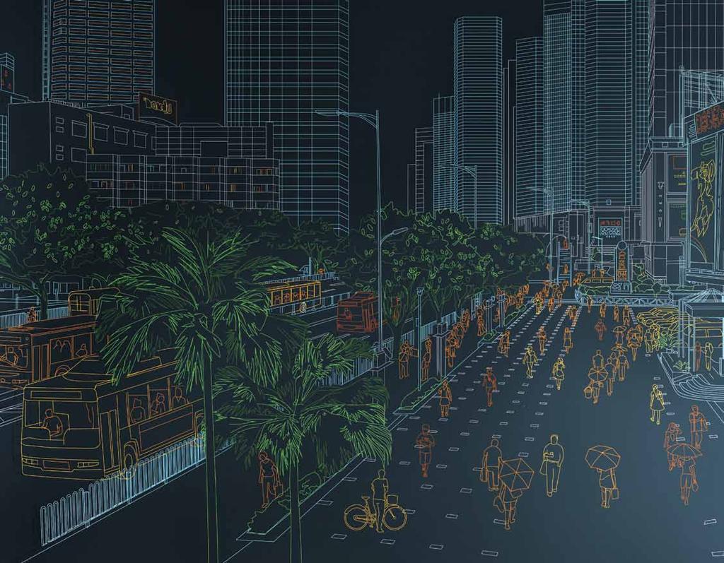
2 The world s next generation of cities will need to overcome extreme challenges posed by population growth, congestion, and energy insecurity. China is experiencing the greatest urban population boom in human history, and the plans for its cities will determine whether they feature easy mobility or are plagued by traffic congestion; whether they use energy and other resources efficiently or lock in high energy consumption for decades; and even whether they are friendly and welcoming or alienate their residents. The right standards can make all the difference and that difference will last for decades. Chinese officials have already taken the first step by prioritizing low-carbon and eco cities. To succeed, these efforts must be guided by sustainable urban planning. This report synthesizes the best practices in urban planning from around the world into eight quantifiable principles. These principles should be refined and adapted to Chinese conditions, but when that is done, they can help ensure that Chinese cities will grow to be the most prosperous and energyefficient cities in the world.
3 China s urban opportunity China s leaders have a limited window of opportunity to plan for prosperous, livable, low-carbon cities. These cities must make public transport, walking, and bicycling their top priorities. As China continues its impressive economic growth, unprecedented numbers of its citizens are migrating to cities, seeking greater job opportunities, income, and quality of life. Car ownership is on the rise, and China has already passed the United States as the largest car market in the world. Similar to U.S. cities in the 1950s and 60s, Chinese cities are working to accommodate the explosive growth of automobile travel by building highways, ring roads, and parking lots. However, due to China s high population density, the problems of private-car-oriented transportation are much more acute than in the lowerdensity cities of the West. Despite the incredible pace of road construction, traffic in Beijing is frequently at a standstill. And in Shanghai, projections show that car use will need to be restricted and transit, bike, and pedestrian mode share increased to improve mobility and bring congestion back to a manageable level. The reality is that high-density cities cannot be designed around the car. It simply won t work. China s leaders have a limited window of opportunity to plan for prosperous, livable, low-carbon cities. These cities must make public transport, walking, and bicycling their top priorities. Without this planning, these burgeoning cities will not reach their full potential. They will be gridlocked and polluted. The commutes of millions of people will become a daily misery, countless square kilometers of arable land will be needlessly lost, and China s powerful economic engine will stall as goods and people become mired in congestion. Chinese cities will struggle to attract the high-tech businesses and top-notch talent that are crucial to maintaining economic growth. Benefits of sustainable urban planning Improve mobility Reduce carbon emissions Attract economic activity Improve air quality Preserve arable land Support a harmonious and prosperous society Chinese decision makers must leapfrog over the rest of the world s urban planning mistakes and establish a new paradigm for the cities of the future. The following is a guide to get started. Compiled by a world-renowned team of urban planning experts with years of experience working in China, this booklet summarizes international best practices. When applied together, we believe the following principles will help China create beautiful, thriving cities that will be models of smart urban development for the rest of the world. These principles depend on and reinforce each other. Together, they are a recipe for success. We hope this guide will serve as the basis for effective urban planning that suits China s specific needs. The eight principles 1 Develop neighborhoods that promote walking 2 Prioritize bicycle networks 3 Create dense networks of streets and paths 4 Support high-quality transit 5 Zone for mixed-use neighborhoods Match density to transit capacity Create compact regions with short commutes Increase mobility by regulating parking and road use


4 1 Ground-floor Develop neighborhoods that promote walking Walkable streets and neighborhoods are the foundation of every great city. Walking reduces auto dependence, supports public transit, improves health, and promotes community. Simple measures such as limiting road width, block lengths, and setbacks between buildings and sidewalks encourage walking. Sidewalks that feature amenities like shade, benches, and street lighting also encourage foot traffic. Designing streets that are safe to cross and providing comfortable, interesting places to walk should be the first priorities for establishing livable, low-carbon cities. Shorten street crossings and emphasize pedestrian safety and convenience. Limit street width to 45 meters for through traffic and 25 meters for local access. Limit traffic speeds on local streets to 25 km per hour or less. Design streets with traffic-calming features to help enforce speed limits. Encourage ground-level activity and create places to relax along primary pedestrian routes. To encourage sidewalk activity, visibility, and safety, residential developments should have multiple access points, and perimeter walls should be eliminated or replaced with see-through fences. Encourage sidewalk activity by zoning for varied uses; limit the distance between buildings and the sidewalk to the following averages: Retail uses: 1 meter Offices and businesses: 3 meters Homes and apartments: 5 meters retail and services and car-free streets encourage walking. Design features in Hong Kong slow traffic and keep pedestrians safe. Create direct routes and permeable blocks to shorten walking distance. Pedestrian activity, as shown here in Chongqing, China, creates community and supports businesses. Limit average block length to 150 meters. Create public paths to allow pedestrian access through existing superblock developments. Develop safe, well-marked, and direct pedestrian routes, at least 3 meters wide, to transit, shopping, and job centers. New York City has pedestrian friendly streets throughout downtown. 3 4


5 Superblock configuration Suggested configuration Single-use, superblock neighborhood. Single-use, superblock neighborhoods discourage pedestrians by spacing intersections far apart and creating wide, dangerous street crossings. Pedestrians must walk long distances to reach destinations. Neighborhood of small blocks and mixed uses in Hong Kong Dense, mixed-use development and small block sizes encourage pedestrian activity. Smaller blocks shorten walking distances, and narrow street crossings help keep pedestrians safe. 5 6


6 2 The Hongzhou bike-sharing system is the largest in the world. Prioritize bicycle networks In the 1980s, millions of Chinese people depended on bicycling as their primary mode of transportation. Bicycling is no longer safe or convenient in many Chinese cities. In recent years, cities across the globe have been working to reintroduce bicycles as an integral part of city life because they are a simple, inexpensive, and low-carbon way for city residents to travel between destinations, including transit stations. To ease congestion, Chinese cities must once again encourage cyclists by providing safe conditions, including bike lanes and secure bicycle parking. Design streets that emphasize bike safety and convenience. Create dedicated bike lanes, at least 3 meters wide in each direction, on all streets except low-speed local streets. Provide secure bike parking in buildings, on streets, and at transit stations. Create auto-free streets and greenways to encourage non-motorized travel. Establish car-free corridors across the city grid, no more than 800 meters apart. Bike lanes should be protected from car traffic. Bicycling is a key, low-cost component of any city s transportation network. Where possible, bike parking should be included at transit stations. 7 8
7 3 Discouraged: Arterial-dominant street network Prioritizes cars over people Discourages pedestrian activity Recommended: Dense networks of streets and paths Prioritizes people over cars Supports pedestrian and economic activity Create dense networks of streets and paths It is a common misconception that wide streets are more efficient and improve traffic flow. In fact, gated superblocks divided by wide roads actually contribute to China s traffic congestion. Case studies show that a denser network of narrower streets better optimizes traffic flow while creating more direct routes and improving safety for pedestrians. Road design should maximize human mobility rather than vehicle throughput. Narrow streets that allow one-way motor traffic as well as bicycles and pedestrians will significantly reduce congestion and fuel use in Chinese cities by minimizing traffic signal delays. Create dense street networks that enhance walking, bicycling, and vehicle traffic flow. Plan for a minimum of 50 intersections per square kilometer. Vary block size and street design to provide multiple options for all types of traffic. Disperse high traffic volumes over narrow, parallel routes rather than concentrating on fewer major arterials. Incorporate through roads that connect surrounding neighborhoods at least every 300 meters. Replace major arterials wider than 45 meters with efficient one-way couplets (in other words, divide wide arterials into two one-way thoroughfares handling traffic in opposite directions). Arterial-dominant street network Network of arterials and superblocks Preferred street network Network of varying street widths and block sizes 9 10


8 Before: Guangzhou before BRT 4Support high-quality transit Hong Kong, New York City, Singapore, and other affluent cities have the densest public transit networks in the world. While metro can be an integral part of a transit network, a growing number of cities are turning to bus rapid transit for its low cost, quick implementation, and flexible routes. Each Chinese city will need to determine the appropriate mix of transit solutions for its conditions, but cities can guarantee the overall success of their transit by providing frequent, fast, and direct service in easily accessible locations. Ensure frequent and direct transit service. Establish at least one high-capacity, high-speed transit corridor every 800 to 1,000 meters with dedicated transit lanes. Minimize the number of transfers needed for most passengers. Provide an integrated multi modal system and ensure seamless transfers to all available transit options. Locate transit stations within walking distance of homes, jobs, and services. All housing and job centers should be within 400 meters of a local transit station and 800 meters of regional transit service. Modern BRT systems, like this one in Jinan, China, feature all the conveniences of metro systems. After: The Guangzhou BRT system which opened in February 2010, moves almost 27,000 passengers per hour per direction during peak commute hours, and integrates with bike lanes, metro, and other bus systems
9 Ideal travel times from mass transit stations 10 min 10 min Legend BRT station BRT corridor Bike-sharing station Bus line Metro line Kilometers Guangzhou Bus Rapid transit (BRT) corridor and connecting bus and metro lines February


10 5 Zone for mixed-use neighborhoods The Jing an Metro Station is a good example of transit-oriented, mixed-use development. The station is integrated with a shopping center. Traditional Chinese neighborhoods had lively streets where children played sports and the elderly played mah-jongg. These neighborhoods had problems too, but it was the lively mix of shops and services near homes and jobs that gave these areas their charm and identity. By trading traditional housing for modern apartments, the Chinese people are losing their communities unique sense of place and the efficiency of compact neighborhoods. China s cities of tomorrow need to combine the benefits of modern housing with the best qualities of traditional urban neighborhoods. Encourage an optimal balance of housing and services through zoning codes. Housing options should accommodate a mix of income levels and age groups. Shops, schools, parks, and services should be located within 400 meters of housing. This includes age-specific services, such as day care. Provide a variety of accessible parks and open space. Neighborhood parks should be located within 500 meters of housing; large regional parks within 1 kilometer. Unique natural environments and local cultural and historical assets should be preserved and creatively reused. Parks, jobs, housing, shops, restaurants, and the Jing an Temple are all located near the metro station. Every city should feature many parks. Parks, restaurants, and housing are concentrated nearby. Local historic buildings were retrofitted for modern uses. Passengers have easy access to the Jing an Temple. Jing an Metro Station
11 High-density hubs of various sizes cluster mixed activities across a city The density and size of the center corresponds to the level of transit service. City, town, and village centers are located at the crossroads of transit boulevards. Residential neighborhoods are directly accessible to centers. Walkable, mixed-use cities are built from a variety of street types Superblocks with wide arterials before modification. A walkable mixed-use neighborhood A walkable neighborhood features a variety of uses and locates jobs, shops, and transit stations within walking distance of housing. Legend Residential Office Civic Street level retail Replace major arterials with one-way street pairs and add transit to remaining arterials. Mixed-use small blocks replace super blocks Add car free streets, some with dedicated transit lines. Unfocused density 45% of jobs and homes in area are within walking distance of station. Transit-oriented density 80% of jobs and homes in area are within walking distance of station. Add narrow local streets with bike lanes and sidewalks. 400M 400M 17 18


12 6Match density to transit capacity High density is crucial to low-carbon cities, but density alone is not enough. In order to avoid congestion, housing must be located close to public transit and jobs. Density also needs to be related to the capacity of all modes of transportation. If roads are designed as suggested in this guide with bike and pedestrian-friendly corridors, transit priority lanes on major arterials, and one-way arterial couplets activities can be concentrated to make walking, cycling, and mass transit more convenient than driving. This will shorten trip distances, save travel time, and preserve millions of square kilometers of arable land. Match density to the maximum peak-hour capacity of a transit system. Both residential and commercial density should be designed to match the area s peak commute transit capacity. Major job centers should only be located where high-volume transit services are available. In key employment areas, zone for mixed-use districts that combine everyday uses. A mix of recreation, services, and retail should be located in employment areas to provide for workers daily needs. In Curitiba, Brazil, high-rise development is focused within 200 meters of mass transit lines. In Guangzhou, density is focused around the BRT corridor. The system s capacity matches commute-hour transit demand
13 7Create compact regions with short commutes 20 km 10 km 5 km Kunming Pop: 3,200,000 Kunming Regional Growth The Kunming region an example of compact, transit-oriented growth. Chenggong, the new town to the south, creates several major new employment centers, balances new jobs with housing, connects to the historic center with four new high-capacity transit lines, and preserves valuable agricultural lands in a greenbelt. When completed, Chenggong will be a dense, smallblock, mixed-use development with a high level of transit service. Community location has a long-term impact on sustainability. New city centers placed far from existing cities are inconvenient and rarely thrive. City planners can avoid this by locating compact new sub-centers within or adjacent to existing cities. In addition to protecting arable land, this strategy significantly decreases the cost of providing transit, utilities, and other services to these new locations, while reducing most residents daily commute. Reduce sprawl by focusing development in areas adjacent to and within existing cities. Regional development should seek a compact footprint through preservation, reuse, and infill of existing areas, balanced with dense areas of new growth. Where possible, new development should avoid agricultural lands and other environmental assets. Create a jobs / housing balance within a short commute distance. Decentralize job centers and aim to limit commutes to approximately 5 kilometers or 15 minutes. Create smaller decentralized job centers that encourage reverse commutes. Legend: Regional transit service BRT Metro line (various colors) High speed rail Railway Lake Dian Agriculture Chenggong Pop: 1,500,


14 8Increase mobility by regulating parking and road use Avoiding gridlock requires limiting the use of vehicles to levels that the road network can support. Peak commute-hour car trips are often unnecessary and should be discouraged. There are many ways to discourage driving. London, Hamburg, and Zurich, for example, restrict parking in popular destinations served by public transit. Singapore and Stockholm have implemented road-use charges. Chinese cities should consider these strategies which complement the above principles to help relieve their congestion problems. 23 Cities may choose to charge tolls for use of overloaded roads. 80,000 Singapore s Electronic Road Pricing system has cut congestion and raised money for public transit and other uses. Limit parking in key employment districts to discourage driving during peak traffic periods. Limit parking ratios in employment areas to 0.2 stalls per worker. Eliminate long-term street parking to ease congestion and reduce street width. Remove all parking-space minimums for residential buildings and establish citywide parking-space maximums consistent with targets for private car use. Adjust car fees by time of day and destination. Institute a congestion-management system that limits auto use in key urban and employment districts at peak traffic hours. Charge tolls for use of overloaded roads and bridges and use the fees to support transit. Vary parking charges by time of day and location to insure high turnover. Road pricing reduces congestion and raises money for local government: Some facts from Singapore and London. kilograms of CO 2 emissions reduced in Singapore s traffic congestion zone 37 percent more Londoners are riding buses into the city during toll times than before congestion pricing yuan annual operation cost for the traffic congestion zone program 65million in Singapore 330 million yuan in annual revenue raised by Singapore s traffic congestion zone program 50 percent decline in bus delays in London 85 percent of people entering London when tolls are charged now take public transit 20 percent increase in Singapore commuters using public transit 30 in percent decrease in congestion since congestion pricing was implemented London 24

15 The plan for Chenggong: The principles have been combined to create a mixed-use, walkable, and livable town. Mixed uses and small blocks Small blocks and mixed uses replace typical superblocks to create a more walkable community. The greater street density improves pedestrian access and disperse traffic. Walkable neighborhoods Each neighborhood has a roughly 500-meter walking radius, centered on local parks, schools, and other civic uses. Rendering of Chenggong Applying the principles in Chenggong, a low-carbon new town Auto-free streets A network of car free streets, some with bus access, others for bikes and pedestrians, are spaced no more than 800 meters apart throughout the town. Accessible parks Linear greenways, neighborhood parks, and larger community parks are located throughout the plan and are easily reached by car-free streets and quiet local roads. Chenggong is a new town planned for ecological design, its urban form for the next stage of Kunming s next followed typical superblock patterns with generation of growth. It is currently the administrative center for the greater Kunming region and includes Yunnan University, a major new center for education and research. While its original plan embraced many best practices large single-use areas. Its central district, projected to house 230,000 residents and approximately 200,000 jobs, has been redesigned according to the eight principles described here. Paired one-way streets and narrow arterials Through traffic is carried on streets no wider than 45 meters. Highervolume traffic is diverted onto one-way street pairs, no more than 30 meters wide in each direction to allow easy pedestrian crossing. Transit-oriented development Areas with high levels of transit service, such as the crossing of two metro or BRT lines, have higher density, more commercial development, and a greater mix of uses
16 The principles introduced here represent what some of the world s leading experts believe to be best practices in urban design. Cities are gradually adopting these measures, but those that have embraced them are the most livable and economically secure cities in the world. These principles support each other. Blocks with mixed uses encourage walking, and walkable cities create customers for local businesses. Smaller block sizes encourage bike and pedestrian use, which cuts down on traffic, allowing public transit and automobile traffic to run better and so on. Enacting all eight principles is the key to a sustainable, livable city. While these principles are a synthesis of international best practices, China s challenges and opportunities are unique. Many of these recommendations are not consistent with current planning rules and regulations. It is time to apply cutting-edge scientific thought about what makes cities successful and to reexamine our cities in light of this most recent understanding. China has the resources and vision to leapfrog over the rest of the world and create the best cities of the future. Now is the time to seize this opportunity and lay the foundation for a healthy future. The ClimateWorks Foundation brought together the organizations represented here. We hope this document will serve as the beginning of a dialogue in which we can work together to ensure that the cities of tomorrow are the best possible cities for China and the world FSC Soy Ink Rec
17 29
How To Encourage More Efficient Transportation in Brazilian Cities
 How To Encourage More Efficient Transportation in Brazilian Cities Todd Litman Victoria Transport Policy Institute Presented Seminar on Discouraging The Use Of Cars São Paulo, Brazil 3 September 2013 Creating
Chapter 7. Transportation. Transportation Road Network Plan Transit Cyclists Pedestrians Multi-Use and Equestrian Trails
 Chapter 7 Transportation Transportation Road Network Plan Transit Cyclists Pedestrians Multi-Use and Equestrian Trails 7.1 TRANSPORTATION BACKGROUND The District of Maple Ridge faces a number of unique
Solana Beach Comprehensive Active Transportation Strategy (CATS)
") Solana Beach Comprehensive Active Transportation Strategy (CATS) 3.0 Goals & Policies The Solana Beach CATS goals and objectives outlined below were largely drawn from the Solana Beach Circulation Element
Solana Beach Comprehensive Active Transportation Strategy (CATS) 3.0 Goals & Policies The Solana Beach CATS goals and objectives outlined below were largely drawn from the Solana Beach Circulation Element
2. Context. Existing framework. The context. The challenge. Transport Strategy
 Transport Strategy Providing quality connections Contents 1. Introduction 2. Context 3. Long-term direction 4. Three-year priorities 5. Strategy tree Wellington City Council July 2006 1. Introduction Wellington
Transportation Master Plan Advisory Task Force
 Transportation Master Plan Advisory Task Force Network Alternatives & Phasing Strategy February 2016 BACKGROUND Table of Contents BACKGROUND Purpose & Introduction 2 Linking the TMP to Key Council Approved
Appendix A-K Public Information Centre 2 Materials
 Appendix A-K Public Information Centre 2 Materials Our Rapid Transit Initiative Make an impact on the future of transit Join the discussion on Rapid Transit in London You re invited to a Public Information
Perryville TOD and Greenway Plan
 Perryville TOD and Greenway Plan Greenway Glossary Pathway: A bicycle and pedestrian path separated from motorized vehicular traffic by an open space, barrier or curb. Multi-use paths may be within the
Performance Criteria for 2035 Long Range Transportation Plan
 Minimizing Impacts on Natural, Historic, Cultural or Archeological Resources 2035 LRTP Weighting Factor: 7% Objective 1.1: Use appropriate planning and design criteria to protect and enhance the built
CONNECTING PEOPLE TO PLACES
 CONNECTING PEOPLE TO PLACES 82 EAST BENCH MASTER PLAN 07 Introduction The East Bench transportation system is a collection of slow moving, treelined residential streets and major arteries that are the
T1-A - Service Reduction (Re-sizing)
") Key T1-A Choice A Key T1-B Choice B Key T1-C Choice C Key T1-D Choice D Key T1-E Choice E Key T1-F Choice F Key Choice G T2 T1-A - Service Reduction (Re-sizing) Description This key choice would represent
Key T1-A Choice A Key T1-B Choice B Key T1-C Choice C Key T1-D Choice D Key T1-E Choice E Key T1-F Choice F Key Choice G T2 T1-A - Service Reduction (Re-sizing) Description This key choice would represent
June 2015 REGIONAL TRANSPORTATION SNAPSHOT
 June 2015 REGIONAL TRANSPORTATION SNAPSHOT THE REGION Who are we? The Greater Toronto and Hamilton Area (GTHA), consisting of Durham Region, Halton Region, the City of Hamilton, Peel Region, the City of
Vision: Traditional hamlet with an attractive business/pedestrian friendly main street connected to adjacent walkable neighborhoods
 N D. Focus Area II Vision: Traditional hamlet with an attractive business/pedestrian friendly main street connected to adjacent walkable neighborhoods Transit Road Focus Area II is located in the Hamlet
Roadways. Roadways III.
 Introduction 97 Roadway Design Principles 98 Safe Speeds 99 Optimizing of Street Space 00 Minimum Lane Widths in the City of Boston 02 Design Features that Reduce Operating Speeds 05 Travel Lanes Transit
Planning Regionally With Transit
 Planning Regionally With Transit Nathan Coats Director of Operations CTAA Expo 2015 Tampa Began 1992. Serves eastern Cache County to Preston, ID. Population- 115,000 34 bus fleet, 26 fixed route buses;
Development, transport and traffic management in Copenhagen
 Development, transport and traffic management in Copenhagen / Mikkel Balskilde Hansen, Head of Traffic Unit The Technical and Environmental Administration 2. October 2017 Copenhagen facts INHABITANTS Municipality
In station areas, new pedestrian links can increase network connectivity and provide direct access to stations.
 The Last Mile Planning for Pedestrians Planning around stations will put pedestrians first. Making walking to stations safe and easy is important; walking will be a part of every rapid transit Accessible
Regional Transportation Needs Within Southeastern Wisconsin
 Regional Transportation Needs Within Southeastern Wisconsin #118274 May 24, 2006 1 Introduction The Southeastern Wisconsin Regional Planning Commission (SEWRPC) is the official areawide planning agency
Concept of Sustainable Transport and integrated Land Use Planning- An Overview. Manfred Breithaupt GIZ Water, Energy, Transport
 Concept of Sustainable Transport and integrated Land Use Planning- An Overview Manfred Breithaupt GIZ Water, Energy, Transport The adverse impacts of growth in motorization - in economic, environmental
2015 Florida Main Street Annual Conference. Complete Streets Equal Stronger Main Streets
 WHAT ARE COMPLETE STREETS? CASE STUDIES COMPLETING YOUR MAIN STREET 2015 Florida Main Street Annual Conference St. Petersburg, Florida August 19, 2015 WHAT ARE COMPLETE STREETS? CASE STUDIES COMPLETING
CITY OF BLOOMINGTON COMPLETE STREETS POLICY
 CITY OF BLOOMINGTON COMPLETE STREETS POLICY POLICY OBJECTIVE: The City of Bloomington will enhance safety, mobility, accessibility and convenience for transportation network users of all ages and abilities,
Creating walkable, bikeable and transit-supportive communities in Halton
 Creating walkable, bikeable and transit-supportive communities in Halton By presenting current research and best practices, the information in this paper is meant to support and broaden discussion on how
Welcome. Background. Goals. Vision
 Welcome The formal Public Information Centre (PIC) for the Transportation Master Plan How We GO will be held in early 2017. At that time we will present the recommended transportation system for Niagara
Stakeholder Meeting Handouts. January 2013
 January 2013 Stakeholder Meeting Handouts The Case FOR Parking Minimum Requirements Reduce street congestion around the development site Avoid parking spillover Create orderly development patterns Anticipate
Cherry Creek Transportation and Land Use Forum September 25, 2013 Meeting Summary
 Cherry Creek Transportation and Land Use Forum September 25, 2013 Meeting Summary I. LEAD-IN TO SMALL GROUP DISCUSSION, POLLING AND STEERING COMMITTEE/TECHNICAL TASK FORCE DISCUSSION The meeting began
PEDALING FORWARD. A Glance at the SFMTA s Bike Program for SFMTA.COM
 PEDALING FORWARD A Glance at the SFMTA s Bike Program for 2017-2021 SFMTA.COM INTRODUCTION About This Booklet More people from all walks of life see their bicycle as a more convenient way to get where
Exceeding expectations: The growth of walking in Vancouver and creating a more walkable city in the future through EcoDensity
 Exceeding expectations: The growth of walking in Vancouver and creating a more walkable city in the future through EcoDensity Melina Scholefield, P. Eng. Manager, Sustainability Group, City of Vancouver
City of Novi Non-Motorized Master Plan 2011 Executive Summary
 City of Novi Non-Motorized Master Plan 2011 Executive Summary Prepared by: February 28, 2011 Why Plan? Encouraging healthy, active lifestyles through pathway and sidewalk connectivity has been a focus
EXECUTIVE SUMMARY: TRANSIT-ORIENTED DEVELOPMENT IN SMITHS FALLS, ONTARIO; A COMPARISON BETWEEN TWO SITES
 EECUTIVE SUMMARY: TRANSIT-ORIENTED DEVELOPMENT IN SMITHS FALLS, ONTARIO; A COMPARISON BETWEEN TWO SITES Topic and Purpose In 2007, the Mayor of Ottawa s Task Force on Transportation suggested adding a
o n - m o t o r i z e d transportation is an overlooked element that can greatly enhance the overall quality of life for the community s residents.
 N o n - m o t o r i z e d transportation is an overlooked element that can greatly enhance the overall quality of life for the community s residents. 84 Transportation CHAPTER 11 INTRODUCTION Transportation
Eliminate on-street parking where it will allow for a dedicated bus only lane %
 Traffic Dashboard Priorities Survey Responses Introduction 1) Are you familiar with bus rapid transit (BRT)? a. No, BRT is new to me. 597 23.5% b. I ve heard of BRT, but I don t know much about it. 1,136
ACTIVE TRANSPORTATION
 ACTIVE TRANSPORTATION Mobility 2040 Supported Goals Improve the availability of transportation options for people and goods. Support travel efficiency measures and system enhancements targeted at congestion
How to Develop a Pedestrian Safety Action Plan
 How to Develop a Pedestrian Safety Action Plan Course Introduction Presented by: Peter Eun FHWA RC Safety Engineer Ryan Snyder President, Ryan Snyder Associates, LLC Paul Zykofsky Director, Land Use and
Complete Streets. Designing Streets for Everyone. Sarnia
 Complete Streets Designing Streets for Everyone Sarnia Complete Streets ~ Sarnia ~ 2018 Introduction Our City is made up of a network of streets that we use to go for a walk, cycle to work, drive to the
ATTACHMENT 4 - TDM Checklist. TDM Checklist Overview
 ATTACHMENT 4 - TDM Checklist TDM Checklist Overview The proposed checklist rates developments on the degree to which they are TDM and transit supportive. Points are assigned based on the level of transit
Low Carbon Cities. Principles and Practices for China s Next Generation of Growth
 Low Carbon Cities Principles and Practices for China s Next Generation of Growth Low Carbon City Currently the trends throughout China show a drama cally increasing dependence on auto use. This is more
complete streets design and construction standards public primer City of Edmonton
 complete streets design and construction standards public primer City of Edmonton introduction Complete Streets are streets for everyone: people who walk, wheel, bike, take transit, or drive. They are
Urban planners have invested a lot of energy in the idea of transit-oriented
 DOES TRANSIT-ORIENTED DEVELOPMENT NEED THE TRANSIT? D A N I E L G. C H AT M A N Urban planners have invested a lot of energy in the idea of transit-oriented developments (TODs). Developing dense housing
Cities Connect. Cities Connect! How Urbanity Supports Social Inclusion
 Cities Connect! How Urbanity Supports Social Inclusion Todd Litman Victoria Transport Policy Institute Metropolis Toronto, Canada - 14 June 2006 Cities Connect People with people. People with jobs. People
Highway 217 Corridor Study. Phase I Overview Report
 Highway 217 Corridor Study Phase I Overview Report November 3, 24 BACKGROUND AND OVERVIEW Study purpose The Highway 217 Corridor Study is developing multi-modal transportation solutions for traffic problems
Anniedale- Tynehead NCP Best Practices in Transportation Planning Summary
 Anniedale- Tynehead NCP Best Practices in Transportation Planning Summary The City of Surrey Anniedale-Tynehead NCP Best Practices Transportation Summary This document provides a summary of the Bunt &
CHAPTER 7.0 IMPLEMENTATION
 CHAPTER 7.0 IMPLEMENTATION Achieving the vision of the Better Streets Plan will rely on the ability to effectively fund, build and maintain improvements, and to sustain improvements over time. CHAPTER
7 Complete Streets & Roadway Aesthetics
 7 Complete Streets & Roadway Aesthetics 7.1 OVERVIEW Our streets lay the foundation for how we interface with travel needs, physical exercise, social exchanges and access to goods and services. They are
2045 Long Range Transportation Plan. Summary of Draft
 2045 Long Range Transportation Plan Summary of Draft Fredericksburg Area Metropolitan Planning Organization The George Washington Region includes the City of Fredericksburg and the counties of Caroline,
Monroe Street Reconstruction Business Focus Group Notes July 18, 2016, HotelRED
 Monroe Street Reconstruction Business Focus Group Notes July 18, 2016, HotelRED Total participants: 31 Focus Group Conversation #1: During this exercise, participants talked in small table groups in response
Chapter 5 Future Transportation
 Chapter 5 Future Transportation The Future Land Use Plan identifies the desired land use designations. The land uses desired for Crozet depend, in large part, on the success of the transportation system,
Living Streets Policy
 Living Streets Policy Introduction Living streets balance the needs of motorists, bicyclists, pedestrians and transit riders in ways that promote safety and convenience, enhance community identity, create
North Coast Corridor:
 North Coast Corridor: Connecting People, Transportation & Environment Legislative Hearing: 11.8.10 1 North Coast Corridor Region s Lifeline A Regional Strategy Mobility, Economy & Environment North Coast
NEWMARKET UPHAM S CORNER
 SOUTH STATION Planning Initiative NEWMARKET UPHAM S CORNER COLUMBIA ROAD (P) FOUR CORNERS/GENEVA Working Advisory Group (WAG) Meeting #5 TALBOT AVENUE MORTON STREET BLUE HILL AVE/CUMMINS HWY (P) RIVER
Advanced Transit Oriented Developments (ATODs) - Defined
 - Defined") Advanced Transit Oriented Developments (ATODs) - Defined Work previously undertaken at Florida International University (FIU) in the Lehman Center for Transportation Research (LCTR), the School of Architecture
Advanced Transit Oriented Developments (ATODs) - Defined Work previously undertaken at Florida International University (FIU) in the Lehman Center for Transportation Research (LCTR), the School of Architecture
Berkeley Strategic Transportation Plan A-76
 Berkeley Strategic Transportation Plan A-76 Appendices 1. A Team Effort 2. Where We ve Been A-11 Berkeley Strategic Transportation Plan Alameda County Transportation Plan Alameda County will be served
WALK- AND bike-friendly TURLOCK
 WALK- AND bike-friendly TURLOCK Ideas to Encourage Walking and Biking Benefits to the COMMUNITY Get Connected People who walk and bike have many more opportunities for casual interactions with friends
Canada s Capital Region Delegation to the Velo-City Global 2010 Conference
 Canada s Capital Region Delegation to the Velo-City Global 2010 Conference Report of Findings from Visits, Meetings & Presentations In Amsterdam-Den Haag, Utrecht, Berlin & Copenhagen The Itinerary Copenhagen
A CHANGING CITY. of Edmonton, it is essential that it reflects the long-term vision of the City.
 A CHANGING CITY By the year 2040, Edmonton will be home to more than 1 million people. To accommodate growth and support a healthy and compact city, we need a new approach to development/redevelopment
TRAVEL PLAN: CENTRAL EUROPEAN UNIVERSITY CAMPUS REDEVELOPMENT PROJECT TRAVEL PLAN. Central European University Campus Redevelopment Project.
 TRAVEL PLAN Central European University Campus Redevelopment Project Page 1 Table of Contents Introduction... 3 Background... 7 Building Users... 7 Transportation in Community Consultation... 7 Summary
Measuring Transportation: Traffic, Mobility and Accessibility
 Measuring Transportation: Traffic, Mobility and Accessibility THIS FEATURE COMPARES THREE APPROACHES TO MEASURING TRANSPORTATION SYSTEM PERFORMANCE. TRAFFIC-BASED MEASUREMENTS EVALUATE MOTOR VEHICLE MOVEMENT;
Chapter 2. Bellingham Bicycle Master Plan Chapter 2: Policies and Actions
 Chapter 2 Bellingham Bicycle Master Plan Chapter 2: Policies and Actions Chapter 2: Policies and Actions The Bicycle Master Plan provides a road map for making bicycling in Bellingham a viable transportation
WELCOME TO OPEN HOUSE # 1 June 14, 2017
 Langstaff Road Weston Road to Highway 7 Class Environmental Assessment Study WELCOME TO OPEN HOUSE # 1 June 14, 2017 Please sign in and join our mailing list Purpose of Open House #1 & Study Area York
Access BART: TOD and Improved Connections. October 29, 2008
 Access BART: TOD and Improved Connections October 29, 2008 1 Access BART Study Goals Evaluate at the system-level land use and access scenarios to optimize ridership Identify station clusters that provide
Uniting Cleveland through the Euclid Corridor Transportation Project
 Zhang 1 Uniting Cleveland through the Euclid Corridor Transportation Project Jinmeng Zhang As a bus passenger takes a ride to downtown Cleveland through Euclid Avenue, constructions can be seen along the
Chapter 5. Principles Appropriating Process
 Chapter 5 Principles Appropriating Process New, post and other urbanism [ ] However these urbanism are perceived, they do represent different values and sensibilities. They need to be situated in time
San Jose Transportation Policy
 San Jose Transportation Policy Protected Intersections in LOS Policies to Support Smart Growth Presented by: Manuel Pineda City of San Jose Department of Transportation Bay Area Map San Francisco Oakland
Corpus Christi Metropolitan Transportation Plan Fiscal Year Introduction:
 Introduction: The Safe, Accountable, Flexible, Efficient Transportation Equity Act: A Legacy for Users (SAFETEA-LU) has continued the efforts started through the Intermodal Surface Transportation Efficiency
Corridor Vision Workshop Summary James Madison Elementary February 22,2018
 Corridor Vision Workshop Summary James Madison Elementary February 22,2018 WHY DEVELOP THIS STUDY? Ogden City is planning for better connectivity and access to jobs and housing. Working with area partners,
Executive Summary Route 30 Corridor Master Plan
 Route Corridor Master Plan Project Overview The Route Corridor Master Plan is a coordinated multimodal transportation and land use plan for the entire stretch of Route through East Whiteland Township,
CITY OF COCOA BEACH 2025 COMPREHENSIVE PLAN. Section VIII Mobility Element Goals, Objectives, and Policies
 CITY OF COCOA BEACH 2025 COMPREHENSIVE PLAN Section VIII Mobility Element Goals, Objectives, and Policies Adopted August 6, 2015 by Ordinance No. 1591 VIII MOBILITY ELEMENT Table of Contents Page Number
Madison Urban Area and Dane County. Bicycle Transportation Plan Summary. September Introduction. Bicycle Plan Scope and Planning Process
 Bicycle Transportation Plan Summary Madison Urban Area and Dane County Introduction September 2000 Bicycling is an important mode of transportation in the Madison urban area and countywide that is available
Better Market Street Project Update. Urban Forestry Council September 17, 2014
 Better Market Street Project Update Urban Forestry Council September 17, 2014 Project Area Limits Better Market Street Schedule Market Street City s busiest transit corridor Over 85 buses per hour 14 surface
Public Consultation Centre For. Transportation Master Plan Update. Information Package
 Public Consultation Centre For Transportation Master Plan Update Information Package Date Location Hours Tuesday, September 12, 2017 Wednesday, September 13, 2017 Tuesday, September 19, 2017 Cambridge
MCTC 2018 RTP SCS and Madera County RIFP Multi-Modal Project Eval Criteria GV13.xlsx
 MCTC 8 RTP SCS and Madera County RIFP Multi-Modal Project Eval Criteria GV.xlsx Madera County Transportation Commission Regional Transportation Plan / Sustainable Communities Strategy Multi-Modal Project
Building a Liveable Ottawa 2031 Backgrounder 5: Barrhaven/Riverside South/Leitrim
 Building a Liveable Ottawa 2031 Backgrounder 5: Barrhaven/Riverside South/Leitrim Wards 3 and 22 Official Plan Transportation Master Plan Cycling Plan Pedestrian Plan October 2013 ottawa.ca/liveableottawa
Building a Liveable Ottawa 2031 Backgrounder 4: Kanata/Stittsville
 Building a Liveable Ottawa 2031 Backgrounder 4: Kanata/Stittsville Wards 4, 6 and 23 Official Plan Transportation Master Plan Cycling Plan Pedestrian Plan October 2013 ottawa.ca/liveableottawa Building
5 CIRCULATION AND STREET DESIGN
 5 CIRCULATION AND STREET DESIGN This chapter describes circulation and streetscape improvements proposed for the Northwest Chico Specific Plan Area. It includes detailed design specifications for existing
Approaches. Livable Neighborhood Design. Examples. Traditional neighborhood development. CE 594 University of Wisconsin- Milwaukee
 Approaches Livable Neighborhood Design CE 594 University of Wisconsin- Milwaukee Traditional neighborhood design (TND), new urbanism, transit friendly design, transit oriented development and walkable
Appendix C 3. Bicycle / Pedestrian Planning
 Appendix C 3. Bicycle / Pedestrian Planning BICYCLE/PEDESTRIAN PLANNING 2005 Master Plan GOAL: Provide for safe and convenient bicycle and pedestrian circulation throughout the City. Develop a city-wide
Circulation in Elk Grove includes: Motor vehicles, including cars and trucks
 Circulation, as it is used in this General Plan, refers to the many ways people and goods move from place to place in Elk Grove and the region. Circulation in Elk Grove includes: Motor vehicles, including
Gerald Ollivier Lead Transport Specialist World Bank, New Delhi. Transforming Cities through Integrated Planning Corridor Scale
 Gerald Ollivier Lead Transport Specialist World Bank, New Delhi Transforming Cities through Integrated Planning Corridor Scale JOB ACCESSIBILITY: ZHENGZHOU A: LINE 1, 2, AND 3 AND WALKING: 12% B. SCENARIO
Public Consultation Centre
 Region of Waterloo Transportation Master Plan Update Public Consultation Centre See the Information Package on how to contact the Project Team and complete the Comment Sheet www.regionofwaterloo.ca/en/exploring-the-region/transportation-master-plan.aspx
Multimodal Through Corridors and Placemaking Corridors
 68 Multimodal Through Corridors and Placemaking Corridors Corridors have different functions in a region. Some corridors are used to get smoothly and rapidly through a region or to get quickly to major
Draft MOBILITY ELEMENET. Community Meeting May 22, 2013
 Draft MOBILITY ELEMENET Community Meeting May 22, 2013 Agenda Presentation Ira Brown New Mobility Paradigm Movement of People Implementation Q&A Ira Brown and Dave Roseman Small Group Discussion at Each
City of Hamilton s Transportation Master Plan (TMP) Public Consultation 3 December 2015
 Public Consultation 3 December 2015") City of Hamilton s Transportation Master Plan (TMP) Public Consultation 3 December 2015 McPhail Transportation Planning Services Ltd. AGENDA 6:00 7:00 pm Viewing Boards / Q & A with the Team 7:00 7:50
City of Hamilton s Transportation Master Plan (TMP) Public Consultation 3 December 2015 McPhail Transportation Planning Services Ltd. AGENDA 6:00 7:00 pm Viewing Boards / Q & A with the Team 7:00 7:50
Proposed. City of Grand Junction Complete Streets Policy. Exhibit 10
 Proposed City of Grand Junction Complete Streets Policy Exhibit 10 1 City of Grand Junction Complete Streets Policy Vision: The Complete Streets Vision is to develop a safe, efficient, and reliable travel
VILNIUS SUMP. Gintarė Krušinskaitė International project manager place your logo here
 VILNIUS SUMP Gintarė Krušinskaitė International project manager Gintare.krusinskaite@vilniustransport.lt place your logo here 19 April, 2017 WHERE DID WE CAME FROM? Mobility management and mobility planning
Report. Typical Sections. City of Middleton, WI
 Report Typical Sections City of Middleton, WI December 2006 Report for City of Middleton, Wisconsin Typical Sections repared by: Traffic Associates LLC and STRAND ASSOCIATES, INC. 910 West Wingra Drive
Purpose and Need. Chapter Introduction. 2.2 Project Purpose and Need Project Purpose Project Need
 Chapter 2 Purpose and Need 2.1 Introduction The El Camino Real Bus Rapid Transit (BRT) Project (Project) would make transit and other transportation improvements along a 17.6-mile segment of the El Camino
Downtown BRT Corridor Alternatives Review: 1 st, 2 nd, 3 rd and 4 th Avenue. Bus Rapid and Conventional Transit Planning and Design Services
 Downtown BRT Corridor Alternatives Review: 1 st, 2 nd, 3 rd and 4 th Avenue Bus Rapid and Conventional Transit Planning and Design Services City of Saskatoon February 2018 Project Team HDR Corporation
EVAN GLASS. Montgomery County Council District 5
 EVAN GLASS 1. Do you support funding and advancing the Purple Line to groundbreaking as described in the Locally Yes. As a member of the recently convened Purple Line Implementation Advisory Group, I will
Non-Motorized Transportation 7-1
 Non-Motorized Transportation 7-1 Transportation facilities no longer mean just accommodating a vehicle powered by a combustion engine. Pedestrian and non-motorized facilities are important modes of travel
Non-motorized Transportation Planning Resource Book Mayor s Task Force on Walking and Bicycling City of Lansing, Michigan Spring 2007 pg.
 Non-motorized Transportation Planning Resource Book pg. 105 of 158 Non-motorized Transportation Planning Resource Book pg. 106 of 158 Non-motorized Transportation Planning Resource Book pg. 107 of 158
Goal 3: Foster an environment of partnerships and collaboration to connect our communities and regions to one another.
 Non-Motorized Transportation Plan (NMTP) Draft Vision, Goal and,, Tri-County Regional Planning Commission (TCRPC) Purpose The purpose of the Tri-County Regional Planning Commission (TCRPC) Non-Motorized
Mainstreet Master Plan Land Use
 Mainstreet Master Plan 04 Land Use Top Recommendations Active Uses: Promote active ground-floor uses such as retail, restaurants, galleries and personal services with interactive storefronts for Mainstreet
12/4/2016 VIA . RE: Grocery Outlet Del Paso (DR16-328)
") 12/4/2016 VIA EMAIL Ethan Meltzer, Assistant Planner City of Sacramento Community Development Department 300 Richards Blvd, 3 rd Floor Sacramento, CA 95811 RE: Grocery Outlet Del Paso (DR16-328) Dear Mr.
12/4/2016 VIA EMAIL Ethan Meltzer, Assistant Planner City of Sacramento Community Development Department 300 Richards Blvd, 3 rd Floor Sacramento, CA 95811 RE: Grocery Outlet Del Paso (DR16-328) Dear Mr.
Discussion Paper 1 June 2014 Current State of Transportation in Burlington
 Discussion Paper 1 June 2014 Current State of Transportation in Burlington www.burlington.ca/goyourway Discussion Paper 1: Current State of Transportation in Burlington The City of Burlington is developing
Transportation, Parking & Roads
 Transportation, Parking & Roads Design Carolina North as a walkable community Design the transportation system and development patterns (i.e., urban design elements such as density, building design, mix
BELFAST RAPID TRANSIT. Ciarán de Búrca Director, Transport Projects Division Department for Regional Development
 BELFAST RAPID TRANSIT Ciarán de Búrca Director, Transport Projects Division Department for Regional Development Objectives of Belfast Rapid Transit To provide a modern, safe, efficient and high quality
Ajax: The Road to Complete Streets
 Ajax: The Road to Complete Streets Hubert Ng, Senior Transportation Planner Elysia Leung, Transportation Demand Management Coordinator Complete Streets Forum October 1, 2015 Overview 1 2 Introduction to
What future for mid-sized cities? Prof. Emer. Antony Stathopoulos National Technical University of Athens
 What future for mid-sized cities? Prof. Emer. Antony Stathopoulos National Technical University of Athens These cities can range in size from 50,000 to 250,000 in population. Street in Larnaca in 1878
5 Circulation & Parking
 5 Circulation & Parking Downtown Parking & Circulation Strategy. Downtown Wayne has a somewhat disconnected system of local public streets to connect downtown with the residential neighborhoods, and primary
City of Wayzata Comprehensive Plan 2030 Transportation Chapter: Appendix A
 A1. Functional Classification Table A-1 illustrates the Metropolitan Council s detailed criteria established for the functional classification of roadways within the Twin Cities Metropolitan Area. Table
About the Active Transportation Alliance
 About the Active Transportation Alliance Chicagoland s voice for better biking, walking and transit Founded 1985 7,000 members, ~33 full time staff Serve Chicago metro region 1 More Cars, More Driving
City of Waterloo Complete Streets Policy
 City of Waterloo Complete Streets Policy Chris Hodgson P. Eng City of Waterloo Complete Streets Forum 2011 April 28-29 Toronto Waterloo context: Current population Major employers Universities and student