Agent Based Urban Models The Notting Hill Carnival Model
|
|
|
- Ilene Ross
- 6 years ago
- Views:
Transcription
1 Lectures on Complexity and Spatial Simulation Thursday, 21 March, 2013 Session 5: Lecture 6: Agent Based Urban Models The Notting Hill Carnival Model Michael
2 Outline of the Talk 1. My Major Example: The Notting Hill Carnival 2. The Model: Flocking and Crowding: Swarms 3. Using such Models in Policy Questions?
3 1. My Major Example: The Notting Hill Carnival How to solve problems of packing many people into small spaces and not letting them crush each other to death, and developing a quality environment which minimises crime. We will look at the nature of the problem and then at the data needed to observe and understand the problem this is an issue in its own right as it is complicated by lack of preference data and crude data on how people flock and disperse and track to the event itself


4 Intelligent Space were contracted by the GLA Carnival review group for the project and CASA was involved in the modeling Intelligent Space is a spin off company from the Bartlett School of Planning and CASA DR JAKE DESYLLAS Project Manager ELSPETH DUXBURY Management of Crowd Observation ZACHARAY AU Risk Assessment Consultant
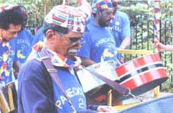
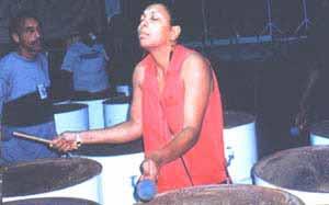
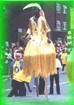
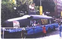
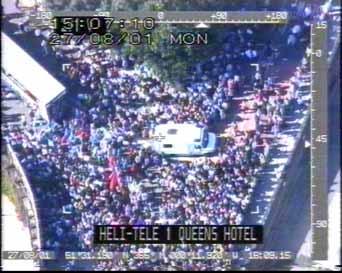
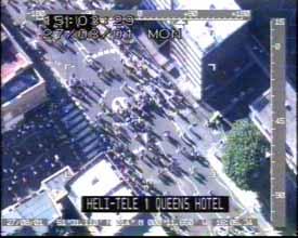
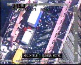
5 a.what is the Notting Hill Carnival A Two day Annual event based on a street parade and street concerts in inner London which is a celebration of West Indian ethnic culture. Started in 1964 as The Notting Hill Festival; attracting 150,000 people by 1974 It attracts up to 1 million visitors and spreads over an are of about 3.5 sq miles Here are some pictures


6
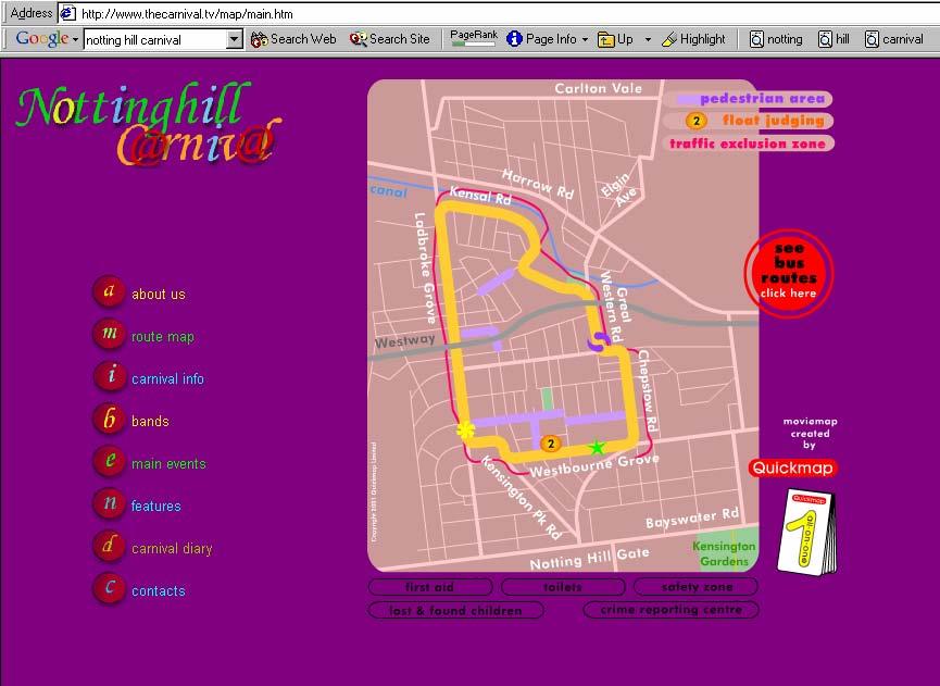
7
8 b.the Project: Public Safety We have been involved in the problem of redesigning the route location for the parade which is judged to be unsafe because of crowding and because of the crime and environmental hazards generated by concentration in a small area: for example crime has risen by about 15% annually for the last 10 years 430 reported crimes committed last year. 3 murders in 2000.
9 710,000 visitors in continuous parade along a circular route of nearly 3 miles 90 floats and 60 support vehicles move from noon until dusk each day. 40 static sound systems 250 street stalls selling food. peak crowds occur on the second day between 4 and 5 pm 260,000 visitors in the area. 500 accidents, 100 requiring hospital treatment 30 percent related to wounding 430 crimes committed over the two days 130 arrests 3500 police and stewards each day.
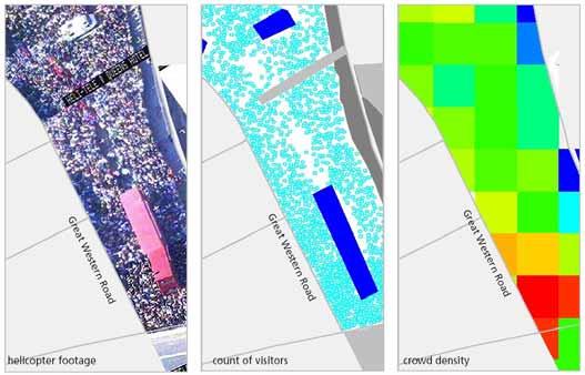
10 c. Observing the Carnival: Data We have used 4 different methods to determine the number of people at carnival Intelligent Space Flow Survey : 38 streets, 80 people days 2. Intelligent Space Crowd Density Survey : 1022 digital images, creating a composite image of carnival LUL Tube Exit and Entrance Survey 4. St Johns Ambulance Accident data
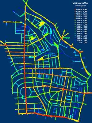
11


12 Visitors to Carnival 2001 Source Sunday Monday Total ISP survey 172, , ,980 Extrapolated Counts 39,217 48,222 87,439 Westbourne Park Tube 13,726 25,810 39,536 Residents 44,353 44,353 44,353 Total 269, , ,300 Occupancy of Carnival Area ,400, Total Visitors 1,200,000 1,000, ,000 Total Occupancy , , :00-10:00-11:00-12:00-13:00-14:00-15:00-16:00-17:00-18:00-19:00-20:00-21:00-22:00-23:00-10:00 11:00 12:00 13:00 14:00 15:00 16:00 17:00 18:00 19:00 20:00 21:00 22:00 23:00 00: Occupancy , Occupancy Time Total Visitors 532, , , , , , ,000 1,098,000 1,084,000 1,165, , ,000 Year
 15% 10% 4 3. Ladbroke Grove (North) 10% 13% 4.")
13 Access to Carnival is very unevenly distributed Road Name % of Total Flows % of Total Flows 1. Kensington Park Road In 19% Out 14% 3 2. Westbourne Grove (East) 15% 10% 4 3. Ladbroke Grove (North) 10% 13% 4. Great Western Road 9% 12% Sum Routes % 49% 2 1
14 7. The Model: Flocking and Crowding: Swarms We need to simulate how visitors to the carnival move form their entry points to the events that comprise the carnival the locations of the bands and the line of the parade The problem is complicated by 1. We do not know the actual (shortest) routes linking entry points to destinations 2. Detailed control of the event by the police etc. is intrinsic to the event we need to introduce this control slowly to assess its effect
15 We define agents as walker/visitors (W) who move, the bands that can be moved (B), the paraders who move in a restricted sense (P), and the streets (S) that can be closed
16 We run the model in three stages, slowly introducing more control to reduce congestion 1. We first find the shortest routes from the ultimate destinations of the walkers to their entry points using a SWARM algorithm this is our attraction surface 2. This gives us the way walkers move to the carnival and in the second stage we simulate this and assess congestion 3. We then reduce this congestion by closing streets etc and rerunning the model, repeating this stage, until a safe situation emerges
17 Here is a flow chart of how we structure the model
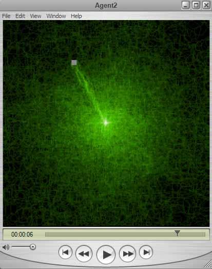
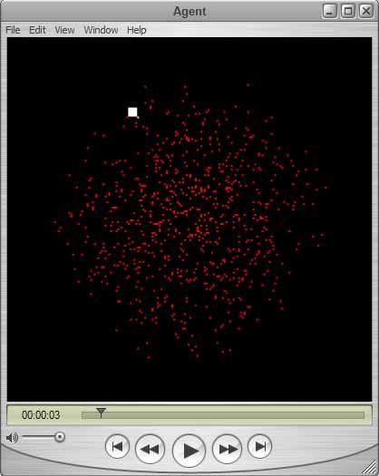
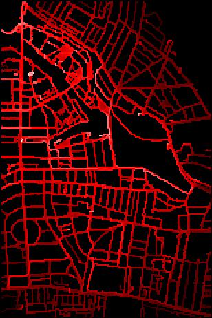
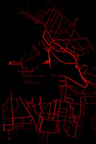
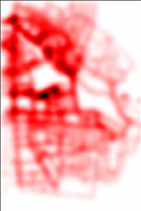
18 The First Stage: Computing the Attraction- Access Surface We compute the access surface using the concept of swarm intelligence which essentially enables us to let agents search the space between origins and destinations to provide shortest routes, and these determine the access surface. This is an increasingly popular method of finding routes in networks and it is based on the idea that if you launch enough agents and let them wander randomly through the network, they will find the objects in question
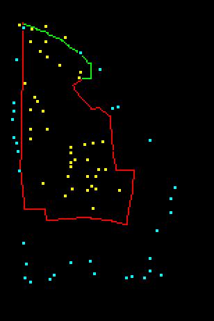
19 Let me show you how this works we will load in the agents onto the parade routes and the sound systems, then let them wander randomly without imposing a street network, and they will find a selected set of entry points the subway stations in this case. Then the pattern is built up this way We show first the parade and the sound systems and the subway stations Then the random access map Then the shortest routes computed


20 Let me tell you how swarming works and show you some movies of this process.

21

22 Let s do this for the real street geometry and run the movie to see how this happens

23 Let me run the First Stage Swarm Movie
24 The Second and Subsequent Stages In essence, once we have generated the access and shortest route surfaces, we use these or a combination of these a linear/weighted combination as the final surface and we then pass to a second stage. We use a regression model to estimate entry point volumes and then let these walkers out at the entry points and then let them establish their steady state around the carnival thus we run the model again We generate a new density surface and this then enables us to pass to a third stage


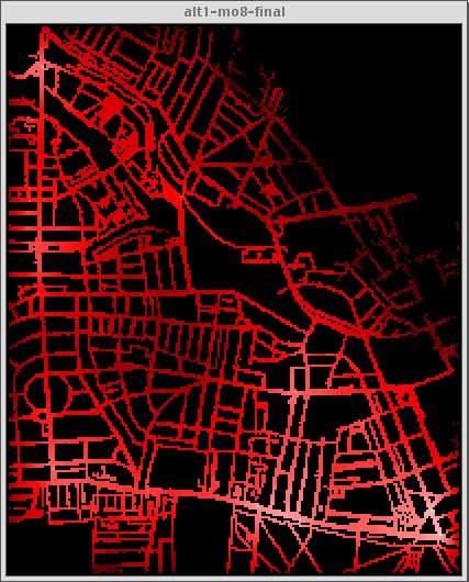
25 Let me run the Second Stage Unconstrained Simulation Movie
26 In the third stage, we figure out where the crowding is worst and then introduce simple controls close streets etc In fact in the existing simulation we already have several streets and subway stations controlled and we can test these alternatively Thus in the existing simulation, we can figure out if the existing controls are optimal
27
28 Crowd Analysis There is a substantial amount of analysis possible from this model with numerous additional graphics such as peak density analysis etc Basically we can compute densities for each pixel and groups of pixels at any cross section of time and over any time period. We can also deal with distance moved and all related derivatives in terms of velocity with respect to each agent and cluster of agents as well as locations. Here s a typical example

29 Density, occupancy, distance traveled & population at risk 1 0 Stage 1 Stage 2 Stage 3 Exploration Simulation Optimisation time t


30 3. Using such Models in Policy There are six routes which were given to us by the GLA and Westminster essentially we are engaged in what if analysis. The general principles is to break the loop of the carnival & reduce densities.


31 Here are the density maps for each scheme where the model has been run given new entry points and volumes from the regression model
32
33 Analysis of Crowding Statistics Existing Alt 1 Alt 2 Alt 3 Alt 4 Alt 5 Alt Carnival MO8 MO5 MO7 MO6 MO4 MO9 maximum density max neighbor density av density av distance in last iteration av distance from origin chair W-E L Park E-W L H M-H
34 Questions? You can get lots of info on all this in my book Cities and Complexity,, various chapters
Safety in Numbers? Modelling Crowds and Designing Control for the Notting Hill Carnival
 Urban Studies, Vol. 40, No. 8, 1573 1590, July 2003 Safety in Numbers? Modelling Crowds and Designing Control for the Notting Hill Carnival Michael Batty, Jake Desyllas and Elspeth Duxbury [Paper first
Pedestrian Dynamics: Models of Pedestrian Behaviour
 Pedestrian Dynamics: Models of Pedestrian Behaviour John Ward 19 th January 2006 Contents Macro-scale sketch plan model Micro-scale agent based model for pedestrian movement Development of JPed Results
Living Streets response to the Draft London Plan
 Living Streets response to the Draft London Plan Contents Living Streets response to the Draft London Plan... 1 About Living Streets... 2 Summary... 2 Consultation response... 3 Chapter 1: Planning London
Application of Dijkstra s Algorithm in the Evacuation System Utilizing Exit Signs
 Application of Dijkstra s Algorithm in the Evacuation System Utilizing Exit Signs Jehyun Cho a, Ghang Lee a, Jongsung Won a and Eunseo Ryu a a Dept. of Architectural Engineering, University of Yonsei,
Pedestrian Behaviour Modelling
 Pedestrian Behaviour Modelling An Application to Retail Movements using Genetic Algorithm Contents Requirements of pedestrian behaviour models Framework of a new model Test of shortest-path model Urban
Will the New Low Emission Zone Reduce the Amount of Motor Vehicles in London?
 Will the New Low Emission Zone Reduce the Amount of Motor Vehicles in London? Philip Osborne I. INTRODUCTION An initiative of the 2016 London Mayor s election campaign was to improve engagement with Londoners
Analyzing Traffic Engineering Problems in Small Cities D onald S. Berry
 Analyzing Traffic Engineering Problems in Small Cities D onald S. Berry Director, Traffic and Transportation Division National Safety Council Chicago, Illinois According to the Public Roads Administration,
London Safety Camera Partnership
 London Safety Camera Partnership Between 2001 and 2003 over 17,000 speed related collisions occurred in London, of which 2,000 people lost their lives or were seriously injured. Excessive and inappropriate
Optimization and Search. Jim Tørresen Optimization and Search
 Optimization and Search INF3490 - Biologically inspired computing Lecture 1: Marsland chapter 9.1, 9.4-9.6 2017 Optimization and Search Jim Tørresen 2 Optimization and Search Methods (selection) Optimization
This objective implies that all population groups should find walking appealing, and that it is made easier for them to walk more on a daily basis.
 Walking for life The Norwegian Walking Strategy Guro Berge Norwegian public Roads Administration "Walking for life" is the slogan for the National Walking Strategy that is now being formulated in Norway.
Safe Routes to School
 Safe Routes to School Paul Osborne, Safe Routes to Schools Project Director, Sustrans The Danesmead Wing, 33 Fulford Cross, York YO10 4PB, UK paulo@sustrans.org.uk Summary Safe Routes to Schools is a practical
CONTENTS PREFACE 1.0 INTRODUCTION AND SCOPE 2.0 POLICY AND GOVERNANCE 3.0 SUMMARY OF PROGRESS 4.0 NATURE OF DEMAND 5.0 TRAVEL AND PARKING INITIATIVES
 CONTENTS PREFACE 1.0 INTRODUCTION AND SCOPE 2.0 POLICY AND GOVERNANCE 3.0 SUMMARY OF PROGRESS 4.0 NATURE OF DEMAND 5.0 TRAVEL AND PARKING INITIATIVES 6.0. TARGETS PREFACE The University of St Andrews has
Poseidon Team Description Paper RoboCup 2016, Leipzig, Germany
 Poseidon Team Description Paper RoboCup 2016, Leipzig, Germany Yasamin Alipour 1, Melina Farshbaf Nadi 1, Kiana Jahedi 2, Kimia Javadi 1, Pooria Kaviani 3, Seyedeh Behin Mousavi Madani 1, Rozhina Pourmoghaddam
Speed Limits Study and Proposal. Public Input Session: 8/14/13
 Speed Limits Study and Proposal Public Input Session: 8/14/13 Why is Decatur a unique place for this project? First Community Transportation Plan in the nation with a Health Impact Assessment. Strong sense
New Seward and 36 th Avenue Intersection Conceptual Design
 University of Alaska Anchorage New Seward and 36 th Avenue Intersection Conceptual Design Prepared By: Zaid S. Hussein Dana Menendez Galen Jones Civil Engineering Department Prof. Osama Abaza CE A404 Highway
National Road Safety Campaign / Road Safety Audit. International Road Federation (IRF) India Chapter
 India Chapter") National Road Safety Campaign / Road Safety Audit International Road Federation (IRF) India Chapter Road Safety Scenario - India 125,000 deaths every year, and 500,000 injuries 342 deaths per day, equivalent
National Road Safety Campaign / Road Safety Audit International Road Federation (IRF) India Chapter Road Safety Scenario - India 125,000 deaths every year, and 500,000 injuries 342 deaths per day, equivalent
Speed Limits in the Hoddle Grid
 Speed Limits in the Hoddle Grid Recent History of speed limits March 2013 Docs # 7738485 1 Introduction Muncipalities have power to Erect speed limit signs BUT Municipalities DO NOT have the power to approve
Designing a Traffic Circle By David Bosworth For MATH 714
 Designing a Traffic Circle By David Bosworth For MATH 714 Abstract We all have had the experience of sitting in a traffic jam, or we ve seen cars bunched up on a road for some no apparent reason. The use
A CHANGING CITY. of Edmonton, it is essential that it reflects the long-term vision of the City.
 A CHANGING CITY By the year 2040, Edmonton will be home to more than 1 million people. To accommodate growth and support a healthy and compact city, we need a new approach to development/redevelopment
Pocatello Regional Transit Master Transit Plan Draft Recommendations
 Pocatello Regional Transit Master Transit Plan Draft Recommendations Presentation Outline 1. 2. 3. 4. What is the Master Transit Plan? An overview of the study Where Are We Today? Key take-aways from existing
Tokyo: Simulating Hyperpath-Based Vehicle Navigations and its Impact on Travel Time Reliability
 CHAPTER 92 Tokyo: Simulating Hyperpath-Based Vehicle Navigations and its Impact on Travel Time Reliability Daisuke Fukuda, Jiangshan Ma, Kaoru Yamada and Norihito Shinkai 92.1 Introduction Most standard
1. UK policy context
 1. UK policy context 2. Political leadership The Mayor s Vision My vision to create Healthy Streets aims to reduce traffic, pollution and noise, create more attractive, accessible and people-friendly streets
Investigating Commute Mode and Route Choice Variability in Jakarta using multi-day GPS Data
 Investigating Commute Mode and Route Choice Variability in Jakarta using multi-day GPS Data Zainal N. Arifin Kay W. Axhausen Conference paper STRC 2011 Investigating Commute Mode and Route Choice Variability
Traffic circles. February 9, 2009
 Traffic circles February 9, 2009 Abstract The use of a traffic circle is a relatively common means of controlling traffic in an intersection. Smaller Traffic circles can be especially effective in routing
Integrated Pedestrian Simulation in VISSIM
 Integrated Pedestrian Simulation in VISSIM PTV worldwide MUGS Conference October 30-31, 2008 Wellington Founded > 1979 30 years fast approaching Employees > Approximately 800 persons in the PTV Group worldwide
Saving Lives: Using ICT to Serve Government NGOs Partnership for Road Safety
 Sultanate of Oman Country Workshop Saving Lives: Using ICT to Serve Government NGOs Partnership for Road Safety Presented by: Major. Khalifa Ali Al Zidi Traffic Systems Supervisor, DGIT Royal Oman Police
 www.newsflashenglish.com The 4 page 60 minute ESL British English lesson 15/08/14 Today, let s talk about the world famous Notting Hill Carnival in London. Traditionally it is held over the August Bank
Bristol City Council has produced a draft Bristol Transport Strategy document.
 Bristol Transport Strategy Summary Document Introduction Bristol City Council has produced a draft Bristol Transport Strategy document. The Strategy fills a gap in transport policy for Bristol. We have
Open Research Online The Open University s repository of research publications and other research outputs
 Open Research Online The Open University s repository of research publications and other research outputs Developing an intelligent table tennis umpiring system Conference or Workshop Item How to cite:
Blocking time reduction for level crossings using the genetic algorithm
 Computers in Railways X 299 Blocking time reduction for level crossings using the genetic algorithm Y. Noguchi 1, H. Mochizuki 1, S. Takahashi 1, H. Nakamura 1, S. Kaneko 1 & M. Sakai 2 1 Nihon University,
Nine Elms Pimlico Bridge Design Team speak at the London Festival of Architecture
 Nine Elms Pimlico Bridge Design Team speak at the London Festival of Architecture On Wednesday 14 th June members of the Nine Elms Pimlico Bridge Design Team presented their work for a new pedestrian and
Spatial Patterns / relationships. Model / Predict
 Human Environment Spatial Patterns / relationships Model / Predict 2 3 4 5 6 Comparing Neighborhoods with high Quality of Life & health Overlap matrix NPUs with high NH & NQoL SEC High QoL High Health
Update June 2018 OUR 2017 PUBLIC ENGAGEMENT
 Update June 2018 Hi, Let s Get Wellington Moving (LGWM) is developing a Recommended Programme of Investment (RPI) that meets our programme objectives and supports the city s and region s growth. As part
Encouragement. Chapter 4. Education Encouragement Enforcement Engineering & Facilities Evaluation & Planning. Encouragement Chapter 4
 Encouragement Education Encouragement Enforcement Engineering & Facilities Evaluation & Planning Photo above: Children show off their ribbons at the Tour de Virginia Beach. Virginia Beach Bikeways and
A hybrid and multiscale approach to model and simulate mobility in the context of public event
 A hybrid and multiscale approach to model and simulate mobility in the context of public event Daniel H. Biedermann, Peter M. Kielar, Oliver Handel, André Borrmann Carolin Torchiani, David Willems, Stefan
Speed Limit Policy Isle of Wight Council
 APPENDIX B Speed Limit Policy Isle of Wight Council 2009 Contents Section 1 Introduction 1.1 Links with the Local Transport Plan Section 2 Speed Limits on Urban Roads and Residential Areas 2.1 20mph Limits
HENDERSON DEVELOPMENT 213, 217, 221, 221 ½, 223 HENDERSON AVENUE and 65 TEMPLETON STREET OTTAWA, ONTARIO TRANSPORTATION OVERVIEW.
 HENDERSON DEVELOPMENT 213, 217, 221, 221 ½, 223 HENDERSON AVENUE and 65 TEMPLETON STREET OTTAWA, ONTARIO TRANSPORTATION OVERVIEW Prepared for: 2294170 Ontario Inc. February 2, 2017 117-652 Report_1.doc
UNDERSTANDING WALKING NETWORKS TO ENABLE SMARTER CHOICES IN TRANSPORT PLANNING IN DUNDEE. Gillian Iversen Atkins
 UNDERSTANDING WALKING NETWORKS TO ENABLE SMARTER CHOICES IN TRANSPORT PLANNING IN DUNDEE Gillian Iversen Atkins 1. INTRODUCTION 1.1. Smarter Choices, Smarter Places The Smarter Choices agenda encourages
CENTRAL OTAGO DISTRICT COUNCIL
 CENTRAL OTAGO DISTRICT COUNCIL DATE: 1 December, 2008 SUBJECT: Blossom Festival Research Survey Report 2008 (EDT 01-02-11) Purpose The purpose of this report is to summarise the outcomes of a visitor survey
ROUNDABOUT CAPACITY: THE UK EMPIRICAL METHODOLOGY
 ROUNDABOUT CAPACITY: THE UK EMPIRICAL METHODOLOGY 1 Introduction Roundabouts have been used as an effective means of traffic control for many years. This article is intended to outline the substantial
Author s Name Name of the Paper Session. Positioning Committee. Marine Technology Society. DYNAMIC POSITIONING CONFERENCE September 18-19, 2001
 Author s Name Name of the Paper Session PDynamic Positioning Committee Marine Technology Society DYNAMIC POSITIONING CONFERENCE September 18-19, 2001 POWER PLANT SESSION A New Concept for Fuel Tight DP
MARKHOUSE ROAD IMPROVEMENTS
 MARKHOUSE ROAD IMPROVEMENTS www.enjoywalthamforest.co.uk Waltham Forest is changing and we want you to be part of it. Thanks to a funding pot of 27million from Transport for London, we re delivering the
Design and Evaluation of Adaptive Traffic Control System for Heterogeneous flow conditions. SiMTraM & CosCiCost2G
 Design and Evaluation of Adaptive Traffic Control System for Heterogeneous flow conditions SiMTraM & CosCiCost2G Tom Mathew IIT Bombay Outline 1. Heterogeneous traffic 2. Traffic Simulation 3. Traffic
Risk on the Road. Pedestrians, Cyclists and Motorcyclists August 2015
 Risk on the Road Pedestrians, Cyclists and Motorcyclists August 215 Contents Key Facts... 4 Pedestrians... 5 Pedestrian risk by time of day and age... 8 Cyclists... 11 Motorcyclists... 14 Glossary... 17
MANITOBA'S ABORIGINAL COMMUNITY: A 2001 TO 2026 POPULATION & DEMOGRAPHIC PROFILE
 MANITOBA'S ABORIGINAL COMMUNITY: A 2001 TO 2026 POPULATION & DEMOGRAPHIC PROFILE MBS 2005-4 JULY 2005 TABLE OF CONTENTS I. Executive Summary 3 II. Introduction.. 9 PAGE III. IV. Projected Aboriginal Identity
Notting Hill Carnival
 CHAPTER FIFTEEN Notting Hill Carnival The Notting Hill Carnival is the biggest street festival in Europe. It takes place in Notting Hill Gate, an area of west London, on the last Sunday and Monday of August.
The Application of Pedestrian Microscopic Simulation Technology in Researching the Influenced Realm around Urban Rail Transit Station
 Journal of Traffic and Transportation Engineering 4 (2016) 242-246 doi: 10.17265/2328-2142/2016.05.002 D DAVID PUBLISHING The Application of Pedestrian Microscopic Simulation Technology in Researching
Applying Bi-objective Shortest Path Methods to Model Cycle Route-choice
 Applying Bi-objective Shortest Path Methods to Model Cycle Route-choice Chris Van Houtte, Judith Y. T. Wang, and Matthias Ehrgott September 30, 2009 Outline Commuter Cyclists Motivation Choice Set Route
April 30 th, Reducing the Risks to Child Pedestrians
 April 30 th, 2018 Reducing the Risks to Child Pedestrians Technical Tips Audio is broadcast through computer speakers Download resources in the File Share pod (above the slides) If you experience audio
IAN WHITE ASSOCIATES. Crawley Station Gateway Public Realm
 IAN WHITE ASSOCIATES Crawley Station Gateway Public Realm contents 1. objectives & client brief 2. site appraisal 3. best practice guidance 4. design concept 1. objectives & client brief Crawley Train
Design and Evaluation of Adaptive Traffic Control System for Heterogeneous flow conditions
 Design and Evaluation of Adaptive Traffic Control System for Heterogeneous flow conditions Tom Mathew IIT Bombay Outline 1. Heterogeneous traffic 2. Traffic Simulation 3. Traffic Signal control 4. Adaptive
Appendix PDX Portland, Oregon 2003 Annual Report on Freeway Mobility and Reliability
 (http://mobility.tamu.edu/mmp) Office of Operations, Federal Highway Administration Appendix PDX Portland, Oregon 2003 Annual Report on Freeway Mobility and Reliability This report is a supplement to:
ENHANCED PARKWAY STUDY: PHASE 2 CONTINUOUS FLOW INTERSECTIONS. Final Report
 Preparedby: ENHANCED PARKWAY STUDY: PHASE 2 CONTINUOUS FLOW INTERSECTIONS Final Report Prepared for Maricopa County Department of Transportation Prepared by TABLE OF CONTENTS Page EXECUTIVE SUMMARY ES-1
Temporal and Spatial Variation in Non-motorized Traffic in Minneapolis: Some Preliminary Analyses
 Temporal and Spatial Variation in Non-motorized Traffic in Minneapolis: Some Preliminary Analyses Spencer Agnew, Jason Borah, Steve Hankey, Kristopher Hoff, Brad Utecht, Zhiyi Xu, Greg Lindsey Thanks to:
Corridor Vision Workshop Summary James Madison Elementary February 22,2018
 Corridor Vision Workshop Summary James Madison Elementary February 22,2018 WHY DEVELOP THIS STUDY? Ogden City is planning for better connectivity and access to jobs and housing. Working with area partners,
Carnival safety success Lesson plan - BBC British Council 2002
 Carnival safety success Lesson plan - BBC British Council 2002 Teacher s notes Carnival Safety Success This news report is about the Notting Hill Carnival 2002 held on the 25 th and 26 th August, in London.
International Journal of Innovative Research in Science, Engineering and Technology. (A High Impact Factor, Monthly, Peer Reviewed Journal)
") A Preliminary Study on Possible Alternate Roadways to Reduce Traffic Hazards at Velachery Township in Chennai Traffic Flow Minimization- a Prelimary Study Deepak R, Gangha G Department of Civil Engineering,
A Preliminary Study on Possible Alternate Roadways to Reduce Traffic Hazards at Velachery Township in Chennai Traffic Flow Minimization- a Prelimary Study Deepak R, Gangha G Department of Civil Engineering,
A STUDY OF SIMULATION MODEL FOR PEDESTRIAN MOVEMENT WITH EVACUATION AND QUEUING
 A STUDY OF SIMULATION MODEL FOR PEDESTRIAN MOVEMENT WITH EVACUATION AND QUEUING Shigeyuki Okazaki a and Satoshi Matsushita a a Department of Architecture and Civil Engineering, Faculty of Engineering,
Government Accelerators
 Government Accelerators Reduction in the number of road s fatalities in the UAE United Arab Emirates Presented By: Ministry Of Infrastructure Development Statistics - Roads` accidents and fatalities
CHAPTER 7.0 IMPLEMENTATION
 CHAPTER 7.0 IMPLEMENTATION Achieving the vision of the Better Streets Plan will rely on the ability to effectively fund, build and maintain improvements, and to sustain improvements over time. CHAPTER
Non-motorized Transportation Planning Resource Book Mayor s Task Force on Walking and Bicycling City of Lansing, Michigan Spring 2007 pg.
 Non-motorized Transportation Planning Resource Book pg. 105 of 158 Non-motorized Transportation Planning Resource Book pg. 106 of 158 Non-motorized Transportation Planning Resource Book pg. 107 of 158
Better Search Improved Uninformed Search CIS 32
 Better Search Improved Uninformed Search CIS 32 Functionally PROJECT 1: Lunar Lander Game - Demo + Concept - Open-Ended: No One Solution - Menu of Point Options - Get Started NOW!!! - Demo After Spring
How to plan an event. Step 1: First things first. Step 2: How to make it all happen?
 As an event organiser, you have a legal responsibility to ensure the health, safety and welfare of all those involved in your event - all employees, volunteer helpers and contractors as well as members
Wayfinding and Walking in London. Lilli Matson Transport for London May 2013
 Wayfinding and Walking in London Lilli Matson Transport for London May 2013 I want to make walking in London as attractive and enjoyable as possible by making walking count Mayor of London Boris Johnson
A numerical simulation of oil spill in Istanbul strait
 Coastal Engineering 135 A numerical simulation of oil spill in Istanbul strait S. Can 1, S. Nishio 2 & M. Uchida 2 1 Maritime Faculty Istanbul Technical University, Turkey 2 Faculty of Maritime Sciences,
Appendix LOU Louisville, Kentucky 2003 Annual Report on Freeway Mobility and Reliability
 (http://mobility.tamu.edu/mmp) Office of Operations, Federal Highway Administration Appendix LOU Louisville, Kentucky 2003 Annual Report on Freeway Mobility and Reliability This report is a supplement
Chapter 4 Traffic Analysis
 Chapter 4 Traffic Analysis PURPOSE The traffic analysis component of the K-68 Corridor Management Plan incorporates information on the existing transportation network, such as traffic volumes and intersection
Tulsa Metropolitan Area LONG RANGE TRANSPORTATION PLAN
 Tulsa Metropolitan Area LONG RANGE TRANSPORTATION PLAN Indian Nations Council of Governments August 2005 CONTACTING INCOG In developing the Destination 2030 Long Range Transportation Plan, INCOG s Transportation
CENG 466 Artificial Intelligence. Lecture 4 Solving Problems by Searching (II)
") CENG 466 Artificial Intelligence Lecture 4 Solving Problems by Searching (II) Topics Search Categories Breadth First Search Uniform Cost Search Depth First Search Depth Limited Search Iterative Deepening
CENG 466 Artificial Intelligence Lecture 4 Solving Problems by Searching (II) Topics Search Categories Breadth First Search Uniform Cost Search Depth First Search Depth Limited Search Iterative Deepening
Utilization of the spare capacity of exclusive bus lanes based on a dynamic allocation strategy
 Urban Transport XX 173 Utilization of the spare capacity of exclusive bus lanes based on a dynamic allocation strategy X. Wang 1 & Q. Li 2 1 Department of Transportation Management Engineering, Zhejiang
Highway 217 Corridor Study. Phase I Overview Report
 Highway 217 Corridor Study Phase I Overview Report November 3, 24 BACKGROUND AND OVERVIEW Study purpose The Highway 217 Corridor Study is developing multi-modal transportation solutions for traffic problems
Welcome! San Jose Avenue Open House August 25, 2015
 Welcome! San Jose Avenue Open House August 25, 2015 Vision Zero The City and County of San Francisco adopted Vision Zero San Francisco Vision Zero High Injury Network as a policy in 2014, committing an
BUILDING THE CASE FOR TRAVEL OPTIONS IN WASHING TON COUNTY. Image: Steve Morgan. Image: Steve Morgan
 BUILDING THE CASE FOR TRAVEL OPTIONS IN WASHING TON COUNTY Image: Steve Morgan Image: Steve Morgan Image: TriMet Image: TriMet WHAT ARE TRAVEL OPTIONS PROGRAMS? Travel options programs encourage residents,
ROUTE 11 Downtown to KU to 31 st and Iowa SERVICE DESIGN
 ROUTE EVALUATION ROUTE 11 s ROUTE 11 Downtown to KU to 31 st and Iowa SERVICE DESIGN Route 11 is a route coordinated between Lawrence Transit and KU on Wheels that operates between the Downtown Transit
City of Elizabeth City Neighborhood Traffic Calming Policy and Guidelines
 City of Elizabeth City Neighborhood Traffic Calming Policy and Guidelines I. Purpose: The City of Elizabeth City is committed to ensure the overall safety and livability of residential neighborhoods. One
Building a Toronto that Moves
 Building a Toronto that Moves Image courtesy of the City of Toronto Setting Election Priorities for Walking, Cycling & Public Transit Toronto is a fast-paced, dynamic city. It s a city that moves except
Connecting Sacramento: A Trip-Making and Accessibility Study
 Connecting Sacramento: A Trip-Making and Accessibility Study Study Overview and Highlights July 2017 Purpose of this study Local governments and transportation agencies often make challenging decisions
Shot-by-shot directional source deghosting and directional designature using near-gun measurements
 H1-1-3 Shot-by-shot directional source deghosting and directional designature using near-gun measurements Neil Hargreaves, Rob Telling, Sergio Grion Dolphin Geophysical, London, UK Introduction In this
AWARENESS ENGAGEMENT ACTION
 2030 Youth Force OUR PURPOSE 2030 Youth Force is a youth network in the Asia-Pacific region working collectively towards a high quality life for all by 2030 with the vision of Leaving No One Behind. HOW
Literature Review: Final
 Jonathan Sigel Section A December 19 th, 2016 Literature Review: Final Function and Purpose of a Roundabout: Roundabouts are a location in which multiple roads are joined together in a circle, with an
Lesson 14: Games of Chance and Expected Value
 Student Outcomes Students use expected payoff to compare strategies for a simple game of chance. Lesson Notes This lesson uses examples from the previous lesson as well as some new examples that expand
CALIFORNIA STATE UNIVERSITY, NORTHRIDGE
 CALIFORNIA STATE UNIVERSITY, NORTHRIDGE Connecting Reseda Boulevard & CSUN: One Great Street A graduate project submitted in partial fulfillment of the requirements For the degree of Master of Urban Planning
2017 SWAMP CABBAGE FESTIVAL PARADE ENTRY FORM. Welcome to the 2017 Swamp Cabbage Festival and Parade!
 2017 SWAMP CABBAGE FESTIVAL PARADE ENTRY FORM CELEBRATING THE FLORIDA STATE TREE IN THE CITY WITH HEART Welcome to the 2017 Swamp Cabbage Festival and Parade! Saturday, February 25, 2016, 10:00 AM Theme:
Estimating benefits of travel demand management measures
 Estimating benefits of travel demand management measures E. ~ani~uchi' and H. Hirao Department of Civil Engineering Systems, Kyoto University, Japan Abstract This paper presents models for estimating benefits
Reflections on our learning: active travel, transport and inequalities
 Reflections on our learning: active travel, transport and inequalities Jill Muirie Glasgow Centre for Population Health Active travel definition Active travel refers to walking, cycling or using some other
/435 Artificial Intelligence Fall 2015
 Final Exam 600.335/435 Artificial Intelligence Fall 2015 Name: Section (335/435): Instructions Please be sure to write both your name and section in the space above! Some questions will be exclusive to
2016 Mardi Gras Parade Float Entry Form
 2016 Mardi Gras Parade Float Entry Form Friday 12th August 2016, Simpson, Sutton (through car park) and George Streets, Mount Isa. Nominations close 30th July 2016. Please do not submit an incomplete application
Volume Studies CIVL 4162/6162
 Volume Studies CIVL 4162/6162 Lesson Objectives Define critical parameters of interest in traffic volume studies Compute and interpret hourly, daily, weekly, and monthly adjustment factors Collect intersection
Typical Rush Hour Commute. PennyforTransportation.com
 Typical Rush Hour Commute In the News Overview of the Plan Collaborative plan with projects in every community Prioritizing connectivity and congestion relief Dedicated transportation-specific funding;
Traffic Impact Memorandum. May 22, 2018
 BISHOP PROFESSIONAL DEVELOPMENT BUILDING Proposed Land-use Change & Parking Modification 3601 SW 31st Street Topeka, Kansas 66614 CFS Project No. 185077 Traffic Impact Memorandum May 22, 2018 Prepared
TEST OF ENGLISH FOR EDUCATIONAL PURPOSES
 TEST OF ENGLISH FOR EDUCATIONAL PURPOSES Practice Test 2 SOURCE BOOKLET University of Reading 2007-12 Questions relating to the following text are in the Task Booklet University of Reading 2007-12 page
2015 ICC CRICKET WORLD CUP. action SUPPORTING THE. A Great Delivery
 2015 ICC CRICKET WORLD CUP action SUPPORTING THE A Great Delivery An overview of Hamilton's involvement in the ICC Cricket World Cup 2015 INTRODUCTION In February and March 2015, Hamilton hosted three
Finite Element Analysis of an Aluminium Bike Frame
 Finite Element Analysis of an Aluminium Bike Frame Word Count: 1484 1 1. Introduction Each new bike model must pass a series of structural tests before being released for public retail. The purpose of
RIVER CROSSINGS: EAST OF SILVERTOWN CROSSINGS
 TRANSPORT FOR LONDON RIVER CROSSINGS: EAST OF SILVERTOWN CROSSINGS SUPPORTING TECHNICAL DOCUMENTATION TRAFFIC IMPACT REPORT Neil Georgeson July 2014 This report examines the traffic impacts that potential
Nebraska Births Report: A look at births, fertility rates, and natural change
 University of Nebraska Omaha DigitalCommons@UNO Publications since 2000 Center for Public Affairs Research 7-2008 Nebraska Births Report: A look at births, fertility rates, and natural change David J.
LOCOMOTION CONTROL CYCLES ADAPTED FOR DISABILITIES IN HEXAPOD ROBOTS
 LOCOMOTION CONTROL CYCLES ADAPTED FOR DISABILITIES IN HEXAPOD ROBOTS GARY B. PARKER and INGO CYLIAX Department of Computer Science, Indiana University, Bloomington, IN 47405 gaparker@cs.indiana.edu, cyliax@cs.indiana.edu
RESEARCH Massachusetts Recreational Boater Survey. Project Summary
 Coastal and Marine Spatial Planning RESEARCH Project Summary 2010 Massachusetts Recreational Boater Survey The 2010 Massachusetts Recreational Boater Survey gathered spatial and economic data relating
CS Lecture 5. Vidroha debroy. Material adapted courtesy of Prof. Xiangnan Kong and Prof. Carolina Ruiz at Worcester Polytechnic Institute
 CS 3353 Lecture 5 Vidroha debroy Material adapted courtesy of Prof. Xiangnan Kong and Prof. Carolina Ruiz at Worcester Polytechnic Institute Searching for a number Find a specific number 91-3 26 54 73
NOVEMBER VETERANS DAY
 NOVEMBER 10-11 VETERANS DAY 3696 Main Street, Riverside, CA 92501 (951)781-8241 runinfo@missioninnmuseum.org 41ST ANNUAL PRESENTED BY IN PARTNERSHIP WITH SPONSORSHIP OPPORTUNITIES & APPLICATION PACKET
Lewisham Pharmaceutical Needs Assessment Appendix B - Lewisham The Place
 Lewisham Pharmaceutical Needs Assessment 2018 Appendix B - Lewisham The Place Lewisham is the 13 th largest borough in London by population size and the 5 th largest in Southwark Inner London Source: MYE