SHAHJAHANABAD SAFETY AUDIT REPORT
|
|
|
- Morgan Holly Morgan
- 6 years ago
- Views:
Transcription

1 SHAHJAHANABAD SAFETY AUDIT REPORT
2

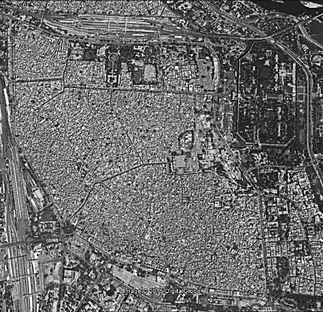
3 INTRODUCTION Safety Audits were conducted by INTACH and SafetiPin in Delhi s walled city of Shahjahanabad. The audits were done to assess the infrastructure and services gaps that exist in the area and to document these as objective data. This can then be used as an advocacy tool to facilitate upgradation of the area. Shahjahanabad, being a centuries old settlement is currently facing many issues and challenges. Being densely populated housing residences and wholesale markets along with many heritage buildings; the area attracts people from all parts of the city for domestic shopping as well as national and international tourists. However, the infrastructure is inadequate to support these. The area, thus is in dire need of redevelopment. METHODOLOGY The audits were carried out using the SafetiPin App. SafetiPin, is a map-based mobile phone application, which works to make communities and cities safer by providing safety-related information collected by users and by trained auditors. At the core of the app is the Women s Safety Audit. A Women s Safety Audit (WSA) is a participatory tool for collecting and assessing information about perceptions of urban safety in public spaces. The audit is based on nine parameters Lighting, Openness, Visibility, Crowd, Security, Walkpath, Availability of Public Transport, Gender Usage of Public Spaces and Feeling. The audits were done in the evening hours of 5pm-0pm on nine selected routes inside Shahjahanabad, to evaluate the level of safety and identify ways to improve it. A total of 80 audit pins and 6 hazard pins were collected The nine areas selected for study are:. Red Fort. Chandni Chowk. Fatehpuri Masjid 4. Jama Masjid Precinct 5. Chawri Bazaar 6. Katra Neel 7. Sitaram Bazaar 8. Paranthe Wali Gali 9. Kinari Bazaar
4 Parameter Rating Parameter Rating SHAHJAHANABAD An Overview of Findings Safety Audits indicate that the Walled City has an overall safety rating of 5/0, i.e. it is rated Average with respect to safety. Safety Audits of the nine areas of Shahjahanabad indicate that the area offers basic safety in the evening hours. Each of the nine areas studied is different from the other. While the Jama Masjid, Red Fort and Chandni Chowk have been planned with a certain grandeur, the streets being used for commerce as well as residential purposes have a more intimate scale. The varying scales and uses has a direct relation with the perceived feeling of safety. While the parameters of gender usage and security are rated poorly, the area fares average in all other parameters. However, due to extreme congestion, open drains and litter, and less women using these spaces, these areas feel uncomfortable Average Audit Parameter Rating (out of ) Light Open Visible Crowd Security Path Transport Gender Usage Feeling Red Fort Chandni Chowk Fatehpuri Masjid Jama Masjid Chawri Bazaar Katra Neel Sitaram Bazaar Paranthe Wali Gali Kinari Bazaar Average Audit Parameters (on a scale of ) for the Nine Study Areas


5 Many streetlights don t work and the area is well lit by light from the shops. Safety Audits reveal that certain issues are common across all nine areas. The exposed electrical wires are a major threat to life and property. In many places they are very close to the windows of buildings and also hanging very low in the streets. Another major issue is the loading/unloading of goods taking place throughout the day. This adds to the congestion on the streets already choked with vehicles. Gender Usage Transport Light - Open Visible Path Crowd Security Correlation of Audit Parameters with Feeling of Safety. Movement & Storage of Goods along public right of way. Map showing Hazard Pins in Shahjahanabad Electrical Wires along with being a safety hazard also add to the visual clutter, affecting the experience of the heritage city.


6 Security Rating of Shahjahanabad Walk path Rating of Shahjahanabad.


7 This area has many facilities in place. However, their maintenance needs more attention. The dead edges along building, condition of walk paths and the working of streetlights are all critical issues. There exists a dedicated walk path is most areas. However, it is not being maintained making it difficult to walk on. These are also being used for displaying of goods by the shops, impinging on the walking space. The public toilet is located with it s entrance facing the walk path which makes it extremely uncomfortable for women to use it. The walk path is also used as a dumping ground for disused items. There is a Police Station in the area adding to the feeling of security. CCTV Cameras have been installed in many areas like chowks, junctions and outside metro stations. This adds to the feeling of security.


8 The area has diverse range of activities taking place. While the market catering to clothes and domestic goods encourages women users, the hardware and automobile markets see very few women visitors. Also, the presence of vendors on the streets keeps it lively. However, the storage of goods on the streets is problematic. Dead spaces encourage homeless people to locate themselves and men to loiter. For women these areas are uncomfortable to pass by. Goods and vehicles located on the walk path and along the street make it difficult for everyone to walk. The new buildings being constructed have a different visual aesthetics. The number of windows looking onto the street is reducing. The old buildings in the area have more windows and balconies, they thus offer greater visual connectivity with the street making them feel safer.


9 Rating of Gender Usage in Shahjahanabad Rating of Visibility in Shahjahanabad

10 Parameter Rating 0. RED FORT Safety Audits indicate that the area has an overall safety rating of 4/0, i.e. Average with the Red Fort entrance junction faring better than other areas..8 AVERAGE Majority of the area is well lit except for a few spots.. ABOVE AVERAGE The edge conditions of the complex are defined by wide open spaces and roads. 0.6 POOR The area is flanked primarily by boundary walls except the Chandni Chowk junction. 0.9 BELOW AVERAGE The Red Fort sees many tourists who along with few hawkers keep the entrance gate active. But, the other areas are secluded. 0. POOR Except the Red Fort Entrance, the area around the complex does not have any security.. ABOVE AVERAGE In most parts of this area, the walk paths in good condition.. ABOVE AVERAGE The area is well serviced by Metro and Bus, along with autos and cycle-rickshaws. 0. POOR The area is used by very few women.. BELOW AVERAGE The area mostly seems uncomfortable Average Audit Parameters (on a scale of ) Map showing Audit Pins 5 4


11 5 Being an arterial road, this stretch is wide open but there are no pedestrians using it. The Red Fort is one of the most visited tourist destinations. The junction at the entrance to the Fort, where it connects with Chandni Chwok is very active till the evening hours. There is also constant police patrolling in this area. However, the other parts of the Red Fort do not see much activity. At few points, for example near the Petrol Pump or at the junction with road leading to Jama Masjid, there are a few hawkers. While they add eyes to the street, their locating themselves on the walk path makes it difficult to walk. On its eastern side, the Fort is flanked by an arterial road. This ensures easy access to public transport. Overall, the area though has provision for walk path which is well lit as well. The lack of activity generating functions along the stretch makes it secluded. 4 No pedestrians as no activity happening along this stretch to attract people. Walk path flanked by high boundary wall. Signage is partially covered. Also only men loitering on the road. Edge of the Red Fort Walk path occupied by vendors
..8 AVERAGE Being one of the wide streets on the Old City, the street scale is comfortable.")
12 Parameter Rating 0. CHANDNI CHOWK Safety Audits indicate that the area has an overall Safety Rating of 5/0, i.e. Average..6 AVERAGE Majority of the area is well lit by street lights & light from shops. Lighting is poor after shops shut down (around 9pm)..8 AVERAGE Being one of the wide streets on the Old City, the street scale is comfortable..0 ABOVE AVERAGE The street is defined by shops atleast on one side along with many hawkers ensuring lots of eyes on the street.. ABOVE AVERAGE The street is occupied by shoppers, hawkers, along with worshippers going to the religious institutions.. AVERAGE Presence of Temple, Gurudwara and public buildings like Town Hall offers some security..8 AVERAGE This stretch offers a colonnaded shaded path in many parts but the spill out from shops makes it difficult to walk on..9 ABOVE AVERAGE The Chandni Chowk metro station abuts the street and cycle rickshaws and autos are also available. 0.8 BELOW AVERAGE Being a wholesale market selling a variety of products the area has many women shoppers but their number reduces in the evening hours.. AVERAGE The area felt comfortable Average Audit Parameters (on a scale of ) Map showing Audit Pins


13 Chandni Chowk being one of the oldest wholesale markets of Delhi fares average in all the audit parameters. The shops cater to household goods and clothes. It also has many administrative and religious institutions. As a result it attracts many visitors of which a significant percentage are women. However, the women seen on the street reduces post sunset. Women accompanied by family members are seen using the religious buildings. Compared to other parts of Old Delhi, this area has a better gender mix. Being originally designed as processional path, the street is very wide. The large number of vehiclescycle rickshaws, autos, two-wheelers and cars have congested the area. The absence of a rickshaw prompts them to park themselves anywhere on the street. Private vehicles too are parked on street. The access to the metro station from Town Hall side gets very secluded and unsafe. The other exit/entry points need to be better defined. Owing to the diverse nature of user groups this stretch feels comfortable even in the evening. The religious buildings tend to extend into the public right of way. The need to take off ones shoes makes the area inaccessible to the passer by. Public facilities have been provided but the walk path needs to be provided integrating these. The stretch has a colonnaded walk path or an open path atleast on one side of the road. This is in fair condition in most parts. However, it is lit only by the light from the shops. Also, a lot of wires are seen hanging over it.

14 Parameter Rating 0. FATEHPURI MASJID Safety Audits indicate that the area has an overall Safety Rating of 4/0, i.e. Average..5 AVERAGE There are street lights provided along the stretch but many do not work..6 AVERAGE The Fatehpuri Masjid junction is open but as one moves in the interior streets the scale starts to shrink..0 ABOVE AVERAGE The presence of vendors and shops ensures good visibility..0 ABOVE AVERAGE The area around the Masjid sees many visitors-worshippers and shoppers Average Audit Parameters (on a scale of ). BELOW AVERAGE While there is some policing in front of the Masjid, the other areas are not patrolled..9 ABOVE AVERAGE The walk path is in fair condition making it comfortable to walk on.. BELOW AVERAGE The Chandni Chowk metro station abuts the street and cycle rickshaws and autos are available POOR The area has very few women visitors.. AVERAGE The area felt fine. Map showing Audit Pins


15 4 The Fatehpuri Masjid defines one end of the axis of Chandni Chowk. This mosque being smaller than the Jama Masjid, the lack of grandness translates into a seamless interface with it s surroundings. Unlike the edges of the Jama Masjid which is defined by a boundary wall, this masjid has shops all along it. Towards it s northern edge is the Spice Market. The area is active even in the evening hours though there are less women visible. The walk path along the shops is in good condition as it is being maintained by the shop owners themselves. But in parts where it gets occupied by a hawker, it becomes narrow. Being a crowded area this makes walking a little difficult. This combined with the congestion generates an average overall feeling. The edge of the Masjid has shops in it. This makes it an active edge instead of a dead boundary wall. There is a police booth at the junction but at times there is no policeman present. The entrance to the Masjid is from a chowk. This is very congested and the open area is used to park more private vehicles. The stretch has a walk path which is in a fair condition in most parts. However, the hawkers occupy parts of it reducing the space for walking.

16 Parameter Rating 04. JAMA MASJID PRECINCT Safety Audits indicate that the area has an overall Safety Rating of 4/0, i.e. Average..5 AVERAGE Street lights have been provided, but some do not work. Few are also hidden among trees..8 AVERAGE The entrance area to the mosque is open but the street otherwise isn t.. BELOW AVERAGE The street presence is due to the shops on one side as the Jama Masjid creates a blank edge.. AVERAGE The entrance to the Jama Masjid is crowded, but the remaining stretch does not have many users. O.8 BELOW AVERAGE There is a guard at the entrance to the Masjid but the other areas offer no sense of security..9 ABOVE AVERAGE There is a walk path provided but it is being used as an extension to the shops, making it unusable in some parts.. ABOVE AVERAGE Metro Station and Bus Stops are nearby and can be reached by both autos and cycle rickshaws. 0.4 POOR There are very few women using this area. The shops deal with automobile and hardware products..0 BELOW AVERAGE The congestion makes this area uncomfortable Average Audit Parameters (on a scale of ) 4 Map showing Audit Pins


17 4 The Jama Masjid precinct has diverse edge conditions. Most of it is mixed use with shops on the ground floor and residences on the upper floor. There are few public buildings like a hospital and police station along it. The way these important functions interface with the road i.e. the public realm also plays an important role in determining the feeling of safety. Certain parts have dead walls flanking them. There are no or very few windows overlooking the road. The absence of a walk path and the vehicles parked all along, make it extremely uncomfortable. The area around the mosque is lined with shops on the ground floor. These spill out onto the road. Private vehicles too are parked on the road itself. These make the area extremely congested. The buildings define the road edge followed by cars parked along it. In the absence of any walk path, people walk on the road itself. The high boundary walls provide a support for homeless people. While they do enhance the visibility, they make these parts uncomfortable to cross despite the walk path being a wide one.

18 Parameter Rating 05. CHAWRI BAZAAR Safety Audits indicate that the area has an overall Safety Rating of 4/0, i.e. Average..4 AVERAGE There are few street lights in the area which along with light from the shops ensure average lighting in the area..9 ABOVE AVERAGE The bazaar street is of a comfortable scale, however, vehicular and goods congestion is a problem.. ABOVE AVERAGE The mixed use nature of the street having shops and residences, along with street vendors ensure one s high visibility..8 AVERAGE The bazaar experiences a lot of customers even in the evening hours and also people working in the shops..0 BELOW AVERAGE While there is a police booth and some security outside the metro station, there are parts where there is no policing..5 AVERAGE The walk path exists but is occupied by good spilling out from the shops..8 ABOVE AVERAGE The metro station is located within 0minutes walk. Cycle rickshaws too are easily available. 0.5 POOR While there are many people in the street, veryfew are women.. BELOW AVERAGE The congestion, low gender usage, loadingunloading of goods; all make this place uncomfortable Average Audit Parameters (on a scale of ) 4 Map showing Audit Pins


19 4 The Chawri Bazaar metro station at night. The Chawri Bazaar extends from the Chawri Bazaar Metro Station upto the Jama Masjid. This mixed use street offers high visibility. But the nature of commercial activity does not encourage many women users. There is some security near the metro station but throughout the street the security is less. There exists a walk path on both sides of the street along the shops. Constantly loading/unloading of goods and stacking them on the footpath itself makes it difficult to walk on. The bazaar has a comfortable open scale with two-three storey high structures. The bazaar street has a comfortable open scale. Wholesale hardware market in Chawri Bazaar is not frequented by women. Few women were seen passing by. The goods are stored on the footpath and along the road causing hindrance to pedestrian movement.

20 Parameter Rating 06. KATRA NEEL Safety Audits indicate that the area has an overall Safety Rating of 4/0, i.e. Average..6 AVERAGE There are few street lights and the area is lit due to light from the shops. After the shops close, the area is poorly lit..6 AVERAGE The Katra Neel has an intimate scale while opens up along the Town Hall side..7 AVERAGE The area has many small temples along with shops ensuring some visibility.. ABOVE AVERAGE The area is used by residents cum shop owners, shoppers, devotees visiting the temples; thus keeping the area active.. BELOW AVERAGE There is a guard house at the entrance but no regular policing inside or towards Town Hall.. AVERAGE The walk path is in a poor condition in Katra Neel though towards Town Hall it is in better condition..7 AVERAGE The Chandni Chowk metro station is available within 0minutes. 0.6 POOR The area despite having clothes shops and temples, does not have women users in the evening hours. 0.8 BELOW AVERAGE The area is uncomfortable because of congestion Average Audit Parameters (on a scale of ) Map showing Audit Pins

21 Parameter Rating 07. SITARAM BAZAAR Safety Audits indicate that the area has an overall Safety Rating of 7/0, i.e. Good..7 AVERAGE There are street lights provided in the area but still a patches with low lighting exist.. BELOW AVERAGE The street is not very wide and is congested due to vehicles and goods..7 GOOD Being a mixed use street with shops, residences and a number of street vendors, the stretch offers good visibility GOOD The area is crowded owing to shops. Average Audit Parameters (on a scale of ). ABOVE AVERAGE Police Booth is located in this area adding to the feeling of safety..6 AVERAGE A walk path exists but is not in a good condition and is used by shops for keeping goods..8 GOOD The stretch has the Chawri Bazaar metro station at one end and cycle rickshaws and autos are available..6 AVERAGE The area has some women users even in the evening hours.. ABOVE AVERAGE The feeling is comfortable in this area. Map showing Audit Pins

22 Parameter Rating 08. PARANTHE WALI GALI Safety Audits indicate that the area has an overall Safety Rating of 7/0, i.e. Good..0 ABOVE AVERAGE The area is lit by street lights as well as light from shops and eateries.. BELOW AVERAGE The street is narrow with three storey buildings, making it uncomfortable..5 GOOD The area is famous for its paranthas and sees many visitors who along with the local people ensure high visibility..0 GOOD The area is full of people-localites, shoppers, foodies Average Audit Parameters (on a scale of ).0 ABOVE AVERAGE The area is regularly patrolled by Police..0 BELOW AVERAGE There is no proper walk path and the drains of the edges are left uncovered..7 GOOD The Chandni Chowk metro station is within0 minutes walk.. ABOVE AVERAGE There are many women visiting this area..0 ABOVE AVERAGE The area feels comfortable. Map showing Audit Pins

23 Paramter Rating 09. KINARI BAZAAR Safety Audits indicate that the area has an overall Safety Rating of 5/0, i.e. Average..6 AVERAGE Light from the shops and the street lights ensure the area is lit..0 BELOW AVERAGE The street has a very intimate scale cause of its narrow street and three storey high buildings.. ABOVE AVERAGE The shops and residences ensure high presence on street along with a few vendors..6 GOOD The area sees crowd in big numbers Average Audit Parameters (on a scale of ) 0. VERY POOR There is no security along this stretch. 0.8 BELOW AVERAGE The narrow street with its open drains on the side is very difficult to walk on..5 GOOD The Chandni Chowk metro station is within 0 minutes and can be reached by cycle rickshaw..5 AVERAGE The area has few women visitors as the market caters to jewelry and clothing accessories..5 AVERAGE The area is comfortable. Map showing Audit Pins

.")
24 RECOMMENDATIONS Safety Audits of Shahjahanabad reveal that by better urban management of services and upgradation of infrastructure, the area can be made much safer. Regulation of movement of goods. The shops have goods delivered throughout the day. Autos, cycle rickshaws and hand pulled carts are all parked along the road. This causes congestion hindering both pedestrian and vehicular movement. Creating Vehicular Parking Zones. In the absence of defined parking zones, private vehicles are all parked on the road. Proper parking zones need to be created. These have to be located to ensure they are convenient to use. The existing parking areas, for example the one near Meena Bazaar needs to be upgraded. Integrated Public Transport (IPT). Attention needs to be given for better integration of IPT into the transportation network. Metro Feeder service to major destinations can be introduced. Dedicated stands for cycle rickshaws and auto rickshaws need to be established. Proper stands outside metro stations and along each road or major junction will help streamline their operation. Bus Stops too need to be improved near the Red Fort. Overhead electrical wires need to be shifted underground. Also, the infrastructure provision should not pose a threat to human safety. Improve Street lighting. There is provision for street lighting. However, it is insufficient. Many old light poles without the lamp can be spotted. A lot of the street lights do not work. The area is well lit by the light from the shops. After the shops close i.e. after 8pm, the area becomes dark. Dark spots have also been identified in certain areas where there are no shops. Improve Drainage and Sanitation. In certain areas like Kinari Bazaar and Paranthe Wali Gali, open drains run along the side of the street. These make walking difficult besides becoming a breeding ground for infection spreading insects. Congestion on the street Transformers and electrical wire along the street.


25 Maintenance of Walkpaths. The walkpaths are broken in many parts. Some shop owners are maintaining the path in front of their shops. Also, the stalking of goods along the walk path needs to be prohibited. In certain areas, the footpath needs to be widened. There needs to be regular checks for monitoring and maintenance. Improve Police Presence. Ensuring that this is constant police patrolling in the entire area will make it safer. Space for Hawkers. In the absence of any designated space, the hawkers and vendors locate themselves on the street or on the footpath. Control encroachments and expansions. This is extremely important along narrow streets. The overhangs from the shops and projections on upper floors further increase the sense of enclosure, reducing openness. Building bye-laws are needed to regulate these. Activate dead zones. The areas along blank boundary walls and where the back of a building defines the street edge, these need to be activated. The areas being used for dumping need to be cleared. Street Furniture can be provided which would allow for better use of the area. For example, the area along the secondary entrance to the Jama Masjid. Clearing the area and turning that into a cycle rickshaw stand could ease congestion on the main entry side. Provision can then also be made for hawkers to locate themselves there. Restoration of abandoned structures. Many structures in the old city are lying vacant. This reduces one s visibility in that area. If these structures can be retrofitted/restored and become habitable, they can be used to introduce new activities into these areas. Currently, certain areas on account of the nature of activity, do not encourage women users. A new function could become a catalyst for change and revive the magic of the heritage city. Entrance to the Paranthe Wali Gali. Old buildings retaining the original built character of the walled city.
Manila-Quezon City. My City Initiative Delhi. A Safety Analysis. a project by World Vision India
 Manila-Quezon City A Safety Analysis My City Initiative Delhi a project by World Vision India Safetipin, in collaboration with World Vision India, conducted safety audits in Lalbagh and Madanpur Khadar.
Supporting Safer Cities. ENHANCING LAST MILE CONNECTIVITY a safety analysis of the RK Ashram Marg Metro Station
 Supporting Safer Cities ENHANCING LAST MILE CONNECTIVITY a safety analysis of the RK Ashram Marg Metro Station This Report has been prepared as part of the Project being undertaken with NDMC to Enhance
Bhopal. A Safety Analysis Report
 Bhopal A Safety Analysis Report This Report has been prepared as part of the Project, Mobile based Safety Audits to collect data on Women Safety undertaken with UN Women. The safety audits were conducted
Supporting Safer Cities. ENHANCING LAST MILE CONNECTIVITY a safety analysis of the Mandi House Metro Station
 Supporting Safer Cities ENHANCING LAST MILE CONNECTIVITY a safety analysis of the Mandi House Metro Station This Report has been prepared as part of the Project being undertaken with NDMC to Enhance the
BOGOTA. Introduction: Methodology: 19,351 Audit Pins. 1,927 km covered
 BOGOTA Introduction: Safetipin, is a map-based mobile phone and online application, which works to make communities and cities safer by providing safetyrelated information collected by users and by trained
TEAM: ROAD: SECTION: K K Nagar Walkability Survey 19 th June 2013
 K K Nagar Walkability Survey 19 th June 2013 TEAM: ROAD: SECTION: Length of surveyor s foot in cms. (any one): (this surveyor will measure distances required in Table II and points 2.c and 4.a in Table
Signage and condition of road and pavements on both sides of Chesil Street
 Signage and condition of road and pavements on both sides of Chesil Street Tuesday 26 July and Tuesday 2nd August 2016, both at 6 p.m. Audited by: Janet Berry, Angela Stevenson, Mike Slinn, Phil Gagg,
summary of issues and opportunities
 1 summary of issues and opportunities EXECUTIVE SUMMARY CHAPTER 2: HISTORY - 3: LAND USE This first chapter is an overview of lessons learned from analysis of the existing conditions on El Camino as well
Walking Audit Supporting Information
 Walking Audit Supporting Information Planning to do a walking audit of your streets? Here s some helpful suggestions to help get you started. 1. Preparing for your audit Decide where you want to walk.
EXECUTIVE SUMMARY: TRANSIT-ORIENTED DEVELOPMENT IN SMITHS FALLS, ONTARIO; A COMPARISON BETWEEN TWO SITES
 EECUTIVE SUMMARY: TRANSIT-ORIENTED DEVELOPMENT IN SMITHS FALLS, ONTARIO; A COMPARISON BETWEEN TWO SITES Topic and Purpose In 2007, the Mayor of Ottawa s Task Force on Transportation suggested adding a
Cluster 5/Module 2 (C5/M2): Pedestrians and Transit Oriented Development (TOD)
: Pedestrians and Transit Oriented Development (TOD)") 1 Cluster 5/Module 2 (C5/M2): Pedestrians and Transit Oriented Development (TOD) This presentation is one of the support materials prepared for the capacity building program Building Leaders in Urban Transport
1 Cluster 5/Module 2 (C5/M2): Pedestrians and Transit Oriented Development (TOD) This presentation is one of the support materials prepared for the capacity building program Building Leaders in Urban Transport
Low Carbon Mobility Plan For Indian Cities
 Low Carbon Mobility Plan For Indian Cities Data Requirement and BAU Scenario Workshop on Developing Policies and Strategies for Low Carbon Transport in India, 24-25 August, 2012 In Indian context NMT and
interchange audit ABERDEEN Introduction Purpose of the Interchange Audit Interchange Audit Linking cycling with public transport
 interchange audit ABERDEEN Bus Station RAILWAY Station FERRY PORT Interchange Audit Susan Warren Jolin Warren 20 March 2014 Linking cycling with public transport Image copyright Boon Low Introduction Purpose
Footpath design. A guide to creating footpaths that are safe, comfortable, and easy to use
 Footpath design A guide to creating footpaths that are safe, comfortable, and easy to use November 2013 Contents Introduction / 1 Zoning system / 2 Width / 4 Height / 5 Surface / 5 Footpath elements /
MOBILITY ACCESSIBILITY
 MOBILITY OR ACCESSIBILITY Alternative Mobility Solutions and Pedestrianization of Existing Urban Neighbourhoods (AAPKI SADAK) Project Team Ashok B. Lall Architects Aastha Chauhan Innovative Transport Solutions
o n - m o t o r i z e d transportation is an overlooked element that can greatly enhance the overall quality of life for the community s residents.
 N o n - m o t o r i z e d transportation is an overlooked element that can greatly enhance the overall quality of life for the community s residents. 84 Transportation CHAPTER 11 INTRODUCTION Transportation
Traffic and Transport Safety TABLE 9.5.7: LOCATION OF MAJOR PARKING PLACES IN UDAIPUR CITY TABLE 9.5.8: MODE WISE ACCIDENT TREND IN UDAIPUR
 TABLE 9.5.7: LOCATION OF MAJOR PARKING PLACES IN UDAIPUR CITY SI No. Stretch Link Length (m) Existing Parking Demand in ECS 1 Patel Chowk to Choraha 1600 291 2 Udaipol Choraha to Surajpol Choraha 530 158
N_RD_ N_RD_ N_RD_ N_RD_ N_RD_ N_RD_6
 Neighborhood Environment Walkability Survey We would like to find out more information about the way that you perceive or think about your Please answer the following questions about your neighborhood
CONNECTING PEOPLE TO PLACES
 CONNECTING PEOPLE TO PLACES 82 EAST BENCH MASTER PLAN 07 Introduction The East Bench transportation system is a collection of slow moving, treelined residential streets and major arteries that are the
Reducing Encroachment Problems on Roads to Reduce Traffic Congestion instead of Widening the Road
 e t International Journal on Emerging Technologies (Special Issue-ICTOAD-2017) 8(1): 25-29(2017) (Published by Research Trend, Website: www.researchtrend.net) ISSN No. (Print) : 0975-8364 ISSN No. (Online)
A CHANGING CITY. of Edmonton, it is essential that it reflects the long-term vision of the City.
 A CHANGING CITY By the year 2040, Edmonton will be home to more than 1 million people. To accommodate growth and support a healthy and compact city, we need a new approach to development/redevelopment
IAN WHITE ASSOCIATES. Crawley Station Gateway Public Realm
 IAN WHITE ASSOCIATES Crawley Station Gateway Public Realm contents 1. objectives & client brief 2. site appraisal 3. best practice guidance 4. design concept 1. objectives & client brief Crawley Train
CHECKLIST 2: PRELIMINARY DESIGN STAGE AUDIT
 CHECKLIST 2: PRELIMINARY DESIGN STAGE AUDIT 2.1 General topics 2.1.1 Changes since previous audit Do the conditions for which the scheme was originally designed still apply? (for example, no changes to
Investment in Active Transport Survey
 Investment in Active Transport Survey KEY FINDINGS 3 METHODOLOGY 7 CYCLING INFRASTRUCTURE 8 Riding a bike 9 Reasons for riding a bike 9 Mainly ride on 10 Comfortable riding on 10 Rating of cycling infrastructure
Bristol City Council has produced a draft Bristol Transport Strategy document.
 Bristol Transport Strategy Summary Document Introduction Bristol City Council has produced a draft Bristol Transport Strategy document. The Strategy fills a gap in transport policy for Bristol. We have
Parking Management Strategy: Case of Udaipur
 Parking Management Strategy: Case of Udaipur Implemented by Supported by In Association with City Partner Table of Contents Introduction 4 Selection of Road Stretch for Developing and Pilot Testing the
Overview. Existing Conditions. Corridor Description. Assessment
 Overview A study of the 23 rd Street corridor was undertaken to document the existing conditions, analyze traffic operations, and recommend remedies for deficient situations Although 23 rd Street is frequently
1. TRANSFORM CITY ROAD WEST INTO A GREAT CENTRAL city street
 1. TRANSFORM CITY ROAD WEST INTO A GREAT CENTRAL city street Understanding City Road West City Road West (between Clarendon Street and ower Street) is a local street, and can be significantly enhanced
4.1 Introduction. 4.2 Aspects of walkable communities
 4 Community walkability Community walkability Making communities walkable Urban form Feeling secure 4.1 Introduction Walkability describes the extent to which the built environment is walking-friendly.
Intersection Improvement in Udaipur: A Demonstration of Passive Junction Design Solutions
 Intersection Improvement in Udaipur: A Demonstration of Passive Junction Design Solutions Implemented by Supported by In Association with City Partner Table of Contents Introduction 3 Context 3 Approach
Chapter 4: Jyllinge-Sallingvej
 Chapter 4: Jyllinge-Sallingvej 4.1 Case Context and Existing Situation 4.1.1 Case Study Area and Character Sections Placement and direction of photos see Appendix 1, where also house numbers and street
Smart Network Smarter Choices
 Employer Site Audit Form Please fill in this site audit form giving as much detail as possible. Remember to take photos to support the audit. Once completed please return the form to business@centro.org.uk
Walking and Cycling Action Plan Summary. A Catalyst for Change The Regional Transport Strategy for the west of Scotland
 Walking and Cycling Action Plan Summary A Catalyst for Change The Regional Transport Strategy for the west of Scotland 2007-2021 Strathclyde Partnership for Transport Contents Purpose...2 Issues, Constraints
Ormond & McKinnon Walks Response to Draft Glen Eira Community Plan
 Response to Draft Glen Eira Community Plan We would like to take this opportunity to thank Glen Eira City Council for the opportunity to comment on the Glen Eira Draft Community Plan. Below is an outline
SPACES INSTRUMENT: OBSERVERS MANUAL
 SURVEY OF THE PHYSICAL ENVIRONMENT IN LOCAL NEIGHBOURHOODS SPACES INSTRUMENT: OBSERVERS MANUAL Contact: Terri Pikora Health Promotion Evaluation Unit Department of Public Health The University of Western
Background. Caversham a vision for the future. Joint public meeting arranged by:
 Joint public meeting arranged by: Sharing our Streets Caversham a vision for the future and Caversham Traders Association This presentation followed a presentation by Simon Beasley, Network Manager for
TRAVEL PLAN: CENTRAL EUROPEAN UNIVERSITY CAMPUS REDEVELOPMENT PROJECT TRAVEL PLAN. Central European University Campus Redevelopment Project.
 TRAVEL PLAN Central European University Campus Redevelopment Project Page 1 Table of Contents Introduction... 3 Background... 7 Building Users... 7 Transportation in Community Consultation... 7 Summary
AUTOMATED AND ZERO EMISSION VEHICLES HOW THEY MIGHT RESHAPE OUR STREETS
 AUTOMATED AND ZERO EMISSION VEHICLES HOW THEY MIGHT RESHAPE OUR STREETS BACKGROUND: This study is a collaboration between Urban Circus (Visualisation) and Ethos Urban (Urban Design) Ideas were workshopped
Mainstreaming Gender in Urban Planning
 Mainstreaming Gender in Urban Planning Dr. Anvita Arora Presentation at Panel Discussion: Gender and Mobility, Velo-City, 2018, Access to Life Rio de Janeiro, Brazil WHAT IS GENDER MAINSTREAMING In 1997,
Bentleigh GLEN EIRA COUNCIL TRANSFORMATIONAL CONCEPTS 15
 2 Bentleigh GLEN EIRA COUNCIL TRANSFORMATIONAL CONCEPTS 15 Bentleigh Bentleigh urban design context The Bentleigh activity centre is a busy strip shopping centre that runs along Centre Road and is dissected
Centennial Neighbourhoods Transportation Management Plan Summary of Phase 1 Consultation. Overview of Issues
 1 Centennial Neighbourhoods Transportation Management Plan Summary of Phase 1 Consultation The Centennial Neighbourhoods Transportation Management Plan (CNTMP) is being undertaken to support the Secondary
PAGHAM NEIGHBOURHOOD PLAN INFRASTRUCTURE GROUP
 PAGHAM NEIGHBOURHOOD PLAN INFRASTRUCTURE GROUP SUMMARY OF FINDINGS AND PRIORITIES PARKING There was a high level of response to this topic which included many aspirations to provide car parking near to
Broad Street Bicycle Boulevard Design Guidelines
 Broad Street Bicycle Boulevard Design Guidelines Building from the strategies introduced in the 2013 Bicycle Transportation Plan and community input received thus far, City Transportation Staff have identified
7/23/2017 VIA . Michael Hanebutt City of Sacramento Community Development Department 300 Richards Boulevard, 3 rd Floor Sacramento, CA 95811
 7/23/2017 VIA EMAIL Michael Hanebutt City of Sacramento Community Development Department 300 Richards Boulevard, 3 rd Floor Sacramento, CA 95811 RE: 65 th Street Apartments (DR17-220) Dear Mr. Hanebutt:
Pedestrian overcrowding and emotions in Thessaloniki, Greece
 Pedestrian overcrowding and emotions in Thessaloniki, Greece Eva Papakonstanti & Ioanna Tsakalakidou (Urban & spatial planners) The background of Thessaloniki Thessaloniki is the second largest city of
2. Context. Existing framework. The context. The challenge. Transport Strategy
 Transport Strategy Providing quality connections Contents 1. Introduction 2. Context 3. Long-term direction 4. Three-year priorities 5. Strategy tree Wellington City Council July 2006 1. Introduction Wellington
Winnipeg Walk Bike Projects Downtown Tire Talk - Summary
 Winnipeg Walk Bike Projects Downtown Tire Talk - Summary Downtown Projected Bike Lane System Connecting The Forks to the Exchange District (Fort Street, Garry Street & The Forks to Assiniboine Connection)
Chapter 5. Principles Appropriating Process
 Chapter 5 Principles Appropriating Process New, post and other urbanism [ ] However these urbanism are perceived, they do represent different values and sensibilities. They need to be situated in time
TS 109 DURHAM ROAD QTC PHASE 4 PROJECT PROPOSAL. Page 1
 TS 109 DURHAM ROAD QTC PHASE 4 PROJECT PROPOSAL Page 1 Table of Contents 1.0 Introduction... 3 2.0 Project Overview... 3 3.0 Project Proposals... 4 3.1 Enfield Road / Durham Road Junction... 3 5 3.2 Summerfield
DESIGN CODE. Enterprise West Harlow London Road North Design Code 21
 DESIGN CODE Enterprise West Essex @ Harlow London Road North Design Code 21 4 MAXIMUM BUILDING HEIGHTS 4.1 Table 4A sets out maximum building height standards for each character area within the LDO boundary.
SOCIAL EXCLUSION IN URBAN
 SOCIAL EXCLUSION IN URBAN TRANSPORT Addressing the Gender Bias Himani Jain (Ph.D.) Principal Consultant P4Planning Consultants Gendered Cities Distinguishes socially constructed roles determined from being
BICYCLE PARKING IN RESIDENTIAL AREAS
 Infrastructure Give Cycling a Push INFRASTRUCTURE/ PARKING BICYCLE PARKING IN RESIDENTIAL AREAS Overview In residential areas, all residents should have safe overnight storage for a bicycle. This is crucial
14. PROPOSED PEDESTRIAN CROSSING IMPROVEMENTS IN MOORHOUSE AVENUE
 165 14. PROPOSED PEDESTRIAN CROSSING IMPROVEMENTS IN MOORHOUSE AVENUE General Manager responsible: General Manager City Environment, DDI 941-8528 Officer responsible: Transport and Greenspace Unit Manager
5 CIRCULATION AND STREET DESIGN
 5 CIRCULATION AND STREET DESIGN This chapter describes circulation and streetscape improvements proposed for the Northwest Chico Specific Plan Area. It includes detailed design specifications for existing
Introduction. Prince Street Cycling Ambition Fund Public Realm Project
 Introduction The (CAF) project will create a high quality, 8-80 s cycle route up the west side of Prince Street from Cumberland Road, over Prince Street bridge to the Centre. This is part of the City Centre
Heaven or Hell? Designing the impact of autonomous vehicles on cities and suburbs
 Heaven or Hell? Designing the impact of autonomous vehicles on cities and suburbs Ellen Dunham-Jones Professor of Architecture Director, MS in Urban Design Georgia Institute of Technology We don t know
MOBILITY CHALLENGES IN HILL CITIES
 MOBILITY CHALLENGES IN HILL CITIES Lalmuansanga Ralte, MCS Pvt Secretary to Minister & Under Secretary Urban Development & Poverty Alleviation Department Govt. of Mizoram DEMOGRAPHIC OVERVIEW INDIA MIZORAM
Your views are important. Please fill in a form before you leave. Or alternatively
 Drum Property Group is delighted to welcome you to this exhibition which sets out our initial proposals for a mixed-use development at Stead s Place, Edinburgh. We are keen to hear the views of local people
Figure 4-10: Pedestrian Improvements Types of Potential Station Area Improvements - Place-Making Improvements
 INCORPORATE FEATURE PAVIN IN CROSSWALK AND INTERSECTION FIELDS Identifies high-priority pedestrian areas and create a station identity through colorful and interesting patterns ADD CURB EXTENSIONS Extending
Transportation Assessment
 Transportation Assessment Midtown Open House February 10, 2018 Overview Midtown in Focus Overview & Purpose of Today Transportation Assessment overview Summary of Transportation work to date Review & Analysis
Transportation system and station for greater Goris town
 Community-led Urban Strategies in Historic Towns (COMUS) Transportation system and station for greater Goris town Preliminary Technical Assessment Contents Executive Summary... 3 Report... 5 1. Goris Background
Complete Streets. Designing Streets for Everyone. Sarnia
 Complete Streets Designing Streets for Everyone Sarnia Complete Streets ~ Sarnia ~ 2018 Introduction Our City is made up of a network of streets that we use to go for a walk, cycle to work, drive to the
Living Streets response to the Draft London Plan
 Living Streets response to the Draft London Plan Contents Living Streets response to the Draft London Plan... 1 About Living Streets... 2 Summary... 2 Consultation response... 3 Chapter 1: Planning London
Oxfordshire Local Transport Plan 4 Science Vale Cycle Network Project Proposal Didcot Ladygrove Link
 Overview of project: The Ladygrove Link will provide a modern, direct, off-road, active travel route from the new Didcot North East development and new leisure centre to the strategic Cow Lane Tunnel.
Solana Beach Comprehensive Active Transportation Strategy (CATS)
") Solana Beach Comprehensive Active Transportation Strategy (CATS) 3.0 Goals & Policies The Solana Beach CATS goals and objectives outlined below were largely drawn from the Solana Beach Circulation Element
Solana Beach Comprehensive Active Transportation Strategy (CATS) 3.0 Goals & Policies The Solana Beach CATS goals and objectives outlined below were largely drawn from the Solana Beach Circulation Element
Bike-sharing. The State of Play:
 Bike-sharing Dock-less bike-sharing schemes have recently commenced in major Australian cities and they seem to have polarised the community. While the schemes are having positive impacts in urban areas,
7 Complete Streets & Roadway Aesthetics
 7 Complete Streets & Roadway Aesthetics 7.1 OVERVIEW Our streets lay the foundation for how we interface with travel needs, physical exercise, social exchanges and access to goods and services. They are
Cyril Cummins Reserve Facility Audit
 Cyril Cummins Reserve Facility Audit Document number 000211 Client / Site Location Auditor Tennis Victoria 67 Liberty Parade Bellfield VIC 3081 Andrew Sodomaco Audit date 30 Aug 2015 Site summary Total
LEA BRIDGE ROAD - A STREET FOR EVERYONE Public consultation document
 LEA BRIDGE ROAD - A STREET FOR EVERYONE Public consultation document TELL US Bakers Arms to Leyton Green Road (Section D, E, F) Leyton Green Road to Whipps Cross Roundabout (Section G) YOUR VIEWS www.enjoywalthamforest.co.uk
Appendix 12 Parking on footways and verges
 Appendix 12 Parking on footways and verges Legal position Parking on footways and verges whether wholly or partly is banned throughout London, unless signs are placed to allow parking. The ban requires
Cycle network linking Wolverhampton city centre and Bilston town centre with employment sites and residential areas:
 Context and Problems Corridor length 12.3 km; Population within 800m 59,922; Jobs within 800m 59,100; Unemployment 11%; Average Index of Multiple Deprivation 46; Households with no car 45%; Proportion
Chapter 4 Route Window C3 Hyde Park and Park Lane shafts. Transport for London
 Chapter 4 Route Window C3 Hyde Park and Park Lane shafts Transport for London HYDE PARK AND PARK LANE SHAFTS 4 Route Window C3 Hyde Park and Park Lane shafts Introduction 4.1 In this route window, which
SETTINGS AND OPPORTUNITIES MOBILITY & ACCESS
 7 mobility & access how do people use el camino what is it like to drive on el camino/to park along el camino what is the pedestrian experience like what is the role of transit along the corridor what
Planning Regionally With Transit
 Planning Regionally With Transit Nathan Coats Director of Operations CTAA Expo 2015 Tampa Began 1992. Serves eastern Cache County to Preston, ID. Population- 115,000 34 bus fleet, 26 fixed route buses;
12/4/2016 VIA . RE: Grocery Outlet Del Paso (DR16-328)
") 12/4/2016 VIA EMAIL Ethan Meltzer, Assistant Planner City of Sacramento Community Development Department 300 Richards Blvd, 3 rd Floor Sacramento, CA 95811 RE: Grocery Outlet Del Paso (DR16-328) Dear Mr.
12/4/2016 VIA EMAIL Ethan Meltzer, Assistant Planner City of Sacramento Community Development Department 300 Richards Blvd, 3 rd Floor Sacramento, CA 95811 RE: Grocery Outlet Del Paso (DR16-328) Dear Mr.
Cycling Inclusive Transport Planning
 Cycling Inclusive Transport Planning Dr. Anvita Arora, Dr. Mark Zuidgeest*, Mark Kirkels Interface for Cycling Expertise *Cycling Academic Network ADB Transport Forum, Manila Activity Clinic 11 May 27th,
National Cycle Network Funding Scheme 2012/2012 Application Form. Waterford City Council. Paul Cleary, Executive Engineer. 3.2km 289, ,000
 National Cycle Network Funding Scheme 2012/2012 Application Form Section 1:Project Outline Name and Address of Local Authority Contact person/proposed project manager Waterford City Council Paul Cleary,
Clarkson Walkability Audit: Results and Recommendations Summary
 Clarkson Walkability Audit: Results and Recommendations Summary The following document was prepared by the Region of Peel and includes a summary of comments made by participants during our breakout discussion
Sistrunk Corridor DOTMOCRACY SUMMARY
 DOTMOCRACY SUMMARY The TOUCH initiative is a true collaborative working with multi- sector community organizations and agencies to reduce tobacco use and exposure to secondhand smoke, improve access to
AUTOMATED AND ZERO EMISSION VEHICLES HOW THEY MIGHT RESHAPE OUR STREETS
 AUTOMATED AND ZERO EMISSION VEHICLES HOW THEY MIGHT RESHAPE OUR STREETS STURT ST BALLARAT WATERGARDENS TAYLORS LAKES SIMPSON ST YARRAVILLE CHAPEL ST SOUTH YARRA RINGWOOD STATION MONASH FREEWAY SA NSW VIC
NAPIER AVENUE PEDESTRIAN AND BICYCLE PLAN
 NAPIER AVENUE PEDESTRIAN AND BICYCLE PLAN Prepared By: DRAFT: 1/17/1 WHAT ARE WALKABILITY AUDITS AND WHY ARE THEY IMPORTANT? Walkability is important for a community and everyone benefits from walking.
George Street Concept Design
 George Street Concept Design City of Sydney with Gehl Architects This document sets out the design principles that will guide the detailed design of George Street. It outlines strategies and concepts for
RE: Minor Betterments Projects near William Walker Elementary
 Washington County Department of Land Use and Transportation Operations & Maintenance Division Attn: Minor Betterments Program Coordinator 1400 SW Walnut Street, MS 51 Hillsboro, OR 97123 lutops@co.washington.or.us
21.07 TRANSPORT CONNECTIVITY AND INFRASTRUCTURE
 21.07 TRANSPORT CONNECTIVITY AND INFRASTRUCTURE 21.07-1 Connectivity and Choice Transport connectivity and mode choice are critical to achieving productive, sustainable and socially just cities. Travel
Sidewalk Cafe City of St. Petersburg City Code Chapter 16, Land Development Regulations
 Section 16.50.370 Sidewalk Café Sections: 16.50.370.1 Generally 16.50.370.2 Declarations 16.50.370.3 Definitions 16.50.370.4 Permit Required 16.50.370.5 Application, Permit and Fee 16.50.370.6 Liability
Position of ITDP on the Recent Delhi High Court Decision to Ban Cycle Rickshaws on Old Delhi Roads
 Position of ITDP on the Recent Delhi High Court Decision to Ban Cycle Rickshaws on Old Delhi Roads Background On May 17 th, 2006, the Delhi High Court passed an order directing the Municipal Corporation
Microscale Audit of Pedestrian Streetscapes (MAPS), Mini Version
, Mini Version") Microscale Audit of Pedestrian Streetscapes (MAPS), Mini Version Training Manual & Picture Guide Developed by: Carrie Geremia Kelli Cain Revised February 11, 2014 Tool and protocol developed by: James
Microscale Audit of Pedestrian Streetscapes (MAPS), Mini Version Training Manual & Picture Guide Developed by: Carrie Geremia Kelli Cain Revised February 11, 2014 Tool and protocol developed by: James
Chapter 5 Future Transportation
 Chapter 5 Future Transportation The Future Land Use Plan identifies the desired land use designations. The land uses desired for Crozet depend, in large part, on the success of the transportation system,
Cherry Creek Transportation and Land Use Forum September 25, 2013 Meeting Summary
 Cherry Creek Transportation and Land Use Forum September 25, 2013 Meeting Summary I. LEAD-IN TO SMALL GROUP DISCUSSION, POLLING AND STEERING COMMITTEE/TECHNICAL TASK FORCE DISCUSSION The meeting began
Plainfield Gateway. Plainfield Context
 Plainfield Gateway The western arm of The Campus, much like the Thomas Street Placita eastern arm, must connect residents and workers from the western side of the neighborhood to The Campus and the activity
FONTAINE AVENUE STUDY Final Report
 FONTAINE AVENUE STUDY Final Report March 28, 2005 FONTAINE AVENUE STUDY City of Charlottesville March 28, 2005 Renaissance Planning Group Kenneth Schwartz, FAIA, AICP Director of Design Leigh Wilkerson,
RICHMOND BICYCLE AND PEDESTRIAN PLAN. September 2014 Prepared by the Midcoast Council of Governments
 2578 RICHMOND BICYCLE AND PEDESTRIAN PLAN September 2014 Prepared by the Midcoast Council of Governments Introduction Bicycle and pedestrian activity is an important factor of a successful village center.
Proposed Development by Cala Homes in Dollicott - Report o n Roads and Traffic
 Proposed Development by Cala Homes in Dollicott - Report o n Roads and Traffic Dolicott Development - Traffic report v1.0 compressed.docx Page 1 of 10 Proposed Development by Cala Homes in Dollicott Report
City of Toronto Complete Streets Guidelines
 Round One This is a summary of the Complete Streets Guidelines Survey posted on June 18 th, 2015 and live until July 2 nd, 2015. The survey was designed to solicit feedback on the draft Complete Streets
REPORT ON TRANSPORT AND PARKING, 2017
 NEIGHBOURHOOD DEVELOPMENT PLAN 2017 REPORT ON TRANSPORT AND PARKING, 2017 COMPILED BY: NEIGHBOURHOOD DEVELOPMENT PLAN STEERING COMMITTEE AND ROLVENDEN PARISH COUNCIL CONSULTANTS: TONY FULLWOOD ASSOCIATES,
COWETA HIGH SCHOOL AND EAST HIGHWAY 51
 COWETA HIGH SCHOOL AND EAST HIGHWAY 51 Lack of sidewalks along Ben Lumpkin Rd. Lack of crosswalks and ramps at intersection. Hwy 51 is wide to cross as a pedestrian. No ADA compliance or connection to
March Maidstone Integrated Transport Strategy Boxley Parish Council Briefing Note. Context. Author: Parish Clerk 2 March 2016
 Context. Author: Parish Clerk 2 The Draft Integrated Transport Policy (DITS) sets out a vision and objectives, and identifies a detailed programme of interventions to support the Maidstone Borough Local
CONNECTIVITY PLAN. Adopted December 5, 2017 City of Virginia Beach
 CONNECTIVITY PLAN Adopted December 5, 2017 City of Virginia Beach CONTENTS 1.0 Background & Purpose... 2 2.0 Existing Inventory & Analysis... 3 ViBe District Existing Walking Conditions... 4 3.0 ViBe District
Exhibit 1 PLANNING COMMISSION AGENDA ITEM
 Exhibit 1 PLANNING COMMISSION AGENDA ITEM Project Name: Grand Junction Circulation Plan Grand Junction Complete Streets Policy Applicant: City of Grand Junction Representative: David Thornton Address:
Ballston Station Multimodal Study WMATA and Arlington County. Meeting Minutes
 Date of Meeting: June 10, 2010 Location: Ballston Metrorail Station and NRECA Building 4301 Wilson Blvd, Arlington, VA Subject: Ballston Station Multimodal Study Stakeholder Meeting #1 Summary: This first