CITY OF WEST LAKE HILLS. Forest View Neighborhood Traffic Calming Study
|
|
|
- Amie Spencer
- 6 years ago
- Views:
Transcription

1 CITY OF WEST LAKE HILLS 901 South Mopac Expressway Building V, Suite 220 Austin, Texas Texas P.E. Firm Registration No. F-929 Klotz Associates Final Report Submittal: March 20, 2015 Revised Final Report Submittal: April 2, 2015
2
3
4 TABLE OF CONTENTS EXECUTIVE SUMMARY...ES-1 INTRODUCTION... 1 Methodology... 1 Existing Conditions... 1 DATA COLLECTION... 5 TRAFFIC CALMING SOLUTIONS... 6 Measure of Effectiveness (MOE)... 6 PRELIMINARY COST ESTIMATE POTENTIAL TRAFFIC CALMING IMPROVEMENTS CONCLUSION TABLES Table 1 Table 2 Table 3 Table 4 Table 5 Table 6 Existing Geometric and Traffic Conditions Summary of Existing Traffic Volumes Vehicular Speed Analysis Potential Traffic Calming Solutions Comparison Summary of Preliminary Cost Estimates Potential Traffic Improvements Plan FIGURES Figure 1 Figure 2 Figure 3 Figure 4 Speed Limit Pavement Markings Narrow Travel Lanes Rumble Strips Speed Humps APPENDICES Appendix A Corridor Map with Geometric and Traffic Data Appendix B Corridor Photographs Appendix C Potential Traffic Improvements Plan TOC-1 April 2015
5 EXECUTIVE SUMMARY This report presents a summary of findings for a Traffic Calming Study conducted by Klotz Associates for the Forest View Drive/Rocky River Road/Westlake Drive Corridor (the Corridor) from Redbud Trail to Bee Caves Road in West Lake Hills, Texas. The purpose of this Traffic Calming Study was to evaluate existing geometric and traffic conditions, assess traffic calming alternatives and provide recommendations to reduce speeding and cutthrough traffic along the Corridor. The Corridor is approximately 1.3 miles long and includes seven (7) intersections. The data collected for this Traffic Calming Study included 24-hour bi-directional traffic volumes, site investigations, historical studies, and planned improvement projects in the vicinity of the study corridor. Multiple site investigations were conducted to observe current traffic characteristics and to identify existing roadway conditions. Vehicular speeding was observed at three (3) locations, where traffic data was collected, i.e., vehicles were traveling above the speed limit. Based on the results of a detailed analysis of traffic data and existing roadway conditions, potential recommendations were provided in the form of active and passive traffic calming solutions such as narrow lanes, pavement markings and signage improvements, rumble strips, and speed humps. Additional signage and pavement markings modifications may be considered to improve the traffic performance. A combination of one or more traffic calming solutions can be utilized to alleviate the speeding concerns. Neighborhood Association and residents feedback would be needed to develop an acceptable plan for implementing traffic calming solutions. ES-1 April 2015
6 INTRODUCTION This report presents a summary of findings for a Traffic Calming Study conducted by Klotz Associates for the Forest View Drive/Rocky River Road/Westlake Drive Corridor from Redbud Trail to Bee Caves Road (the Corridor) in West Lake Hills, Texas. The purpose of this Traffic Calming Study was to evaluate existing geometric and traffic conditions, assess traffic calming alternatives and provide recommendations to reduce speeding and cutthrough traffic along the corridor. Methodology The methodology used to complete this Study included: Conducting site investigations at the Corridor Collecting 24-hour bi-directional traffic volumes at three (3) locations within the Corridor for a typical weekday (Tuesday, Wednesday, or Thursday) Evaluating potential traffic calming alternatives based on roadway geometrics and lane configurations Recommending potential traffic calming solutions Existing Conditions The Corridor is approximately 1.3 miles long and mostly travels in the north-south direction between the study limits. A Corridor Map is presented as Exhibit 1 in Appendix A. The entire Corridor, including the seven (7) intersections within the study limits, was visited to document the existing roadway geometric and traffic conditions, as shown in Table 1. The Corridor and intersection photographs are provided in Appendix B Corridor Photographs, and are also summarized in the following sections. Intersection 1 Redbud Trail and Forest View Drive Intersection: Redbud Trail and Forest View Drive travels in the east-west and north-south direction, respectively, at this four (4)-approach intersection. The Redbud Trail west approach provides one shared leftthrough-right turn lane. The Redbud Trail east approach provides one shared through-right turn lane and one left turn lane. Redbud Trail has narrow shoulders, and no curbs and April
7 Table 1. Existing Geometric and Traffic Conditions Segment ID A B C D E F Street Segment Name Forest View Dr (From Redbud Trail to Cedar Park Dr) Forest View Dr (From Cedar Park Dr to Oak Ridge Dr) Forest View Dr (From Oak Ridge Dr to Rocky Ledge Rd) Rocky River Rd (From Rocky Ledge Rd to Reveille Rd) Rocky River Rd (From Reveille Rd to Westlake Dr) Westlake Dr (From Rocky River Rd to Bee Caves Rd) Min. Street Width (Feet) Segment Length (Feet) 26 1, , ,500 Posted Speed Limit Signs NB: No SB: No NB: 30MPH SB: No NB: 25MPH SB: 25MPH NB: 25MPH SB: 25MPH NB: No SB: No NB: 30MPH SB: No Existing Yellow Pavement Markings Yes (Faded) Yes Yes None Yes Yes curbs and sidewalks close to its intersection with Forest View Drive. The posted speed limit on Redbud Trail is 30 miles per hour (MPH) in the vicinity of this intersection. The Forest View Drive north approach serves as a private gated access to the Bee Creek Preserve. There are no curbs, sidewalks, or pavement markings on the Forest View north approach. The Forest View Drive south approach provides one shared left-through-right turn lane. There are no posted speed limit signs on the Forest View Drive south approach in the vicinity of the intersection. There are standard curbs but no sidewalks on both sides of the south approach. There are yellow pavement markings in the center of Forest View Drive south approach to separate the opposing vehicular traffic flow. The vehicular traffic at the Forest View Drive and Redbud Trail intersection is controlled by a stop sign on the Forest View Drive South Approach facing the northbound traffic. April
8 Intersection 2 Cedar Park Drive and Forest View Drive Intersection: Cedar Park Drive and Forest View Drive runs in the east-west and north-south direction, respectively, at this three-approach intersection. All three (3) approaches provide one shared left-throughright turn lane. There is curb and gutter with no sidewalk on both sides of the Cedar Park Drive east approach. The posted speed limit on this approach is 25 MPH in the vicinity of this intersection facing the eastbound vehicular traffic. There are existing speed humps located on the Cedar Park Drive east approach. There are no visible pavement markings on this approach in the vicinity of the intersection. The north and south Forest View Drive approaches have curb and gutter and no sidewalks in the vicinity of the intersection. The Forest View Drive north approach has yellow pavement markings in the center to separate opposing vehicular traffic, whereas there are no pavement markings on the Forest View Drive south approach. There are no posted speed limit signs on Forest View Drive in the vicinity of the intersection. The vehicular traffic at the Forest View Drive and Cedar Park Drive intersection is controlled by stop signs on all three (3) approaches. Intersection 3 Oak Ridge Drive and Forest View Drive Intersection: Oak Ridge Drive and Forest View Drive travels in the east-west and north-south direction, respectively, at this three-approach intersection. All three (3) approaches provide one shared leftthrough-right turn lane. There is curb and gutter on both sides of the east Oak Ridge Drive approach, whereas sidewalks are available only on the south side of this approach. There are no posted speed limit signs on Oak Ridge Drive in the vicinity of this intersection. There are yellow pavement markings in the center to separate opposing vehicular traffic flow on this approach in the vicinity of the intersection. The north and south Forest View Drive approaches have curb and gutter and no sidewalk in the vicinity of the intersection. There are no existing pavement markings on Forest View Drive north approach. There is a 30 MPH posted speed limit sign on the north approach facing the northbound traffic. There are yellow pavement markings in the center of Forest View Drive south approach to separate opposing vehicular traffic. There are no posted speed limit signs on the Forest View Drive south approach. The vehicular traffic at the Forest View Drive and Oak Ridge Drive intersection is controlled by stop signs on all three (3) approaches. April
9 Intersection 4 Rocky Ledge Road and Rocky River Road Intersection: Rocky Ledge Road and Rocky River Road runs in the east-west and north-south direction, respectively at this three-approach intersection. All three (3) approaches provide one shared left-throughright turn lane. There are no curbs or sidewalks on either side of the Rocky Ledge Road east approach. There are no posted speed limit signs on Rocky Ledge Road in the vicinity of this intersection. The north and south Rocky River Road approaches have flushed curbs and no sidewalks in the vicinity of the intersection. There are no visible existing pavement markings on any of the three (3) approaches of this intersection. There is a 25 MPH posted speed limit sign on the Rocky River Road south approach facing the southbound traffic. The vehicular traffic at the Rocky Ledge Road and Rocky River Road intersection is controlled by stop signs on all three (3) approaches. Intersection 5 Rocky River Road and Reveille Road Intersection: Rocky River Road and Reveille Road travels in the east-west and north-south direction, respectively at this three-approach intersection. All three (3) approaches provide one shared left-through-right turn lane. There are flushed curbs on both sides of the Rocky River Road east approach. There are no sidewalks, posted speed limits signs or pavement markings on the east approach. There are flushed curbs and yellow pavement markings on the Rocky River Road west approach. There are no sidewalks or posted speed limits signs on the west approach. The Reveille Road south approach has no curbs in the vicinity of the intersection. There are flushed sidewalks only on the east side of the south approach. There are yellow pavement markings in the center of Reveille Road to separate opposing vehicular traffic. There is a 25 MPH posted speed limit sign facing the southbound direction on the Reveille Road South approach. The vehicular traffic at the Reveille Road and Rocky River Road intersection is controlled by stop signs on all three (3) approaches. Intersection 6 Rocky River Road and Westlake Drive Intersection: Rocky River Road and Westlake Drive runs in the east-west and north-south direction, respectively, at this three-approach intersection. All three (3) approaches provide one shared left-through-right turn lane. There are flushed curbs and yellow pavement markings on the Rocky River Road east approach. There are no posted speed limit signs or sidewalks on this approach. The Westlake Drive north approach has shoulders and yellow pavement markings in the vicinity April
10 of the intersection. There are no sidewalks on either side of the north approach. There is a 25 MPH posted speed limit sign on the Westlake Drive north approach facing the northbound traffic. The Westlake Drive south approach has flushed curbs and yellow pavement markings in the vicinity of the intersection. There are no sidewalks or posted speed limit signs on the Westlake Drive south approach. The vehicular traffic at the Westlake Drive and Rocky River Road intersection is controlled by a stop sign on the Rocky River Road east approach facing the westbound traffic. Intersection 7 Bee Caves Road and Westlake Drive Intersection: Bee Caves Road and Westlake Drive travels in the east-west and north-south direction, respectively at this fourapproach intersection. The Bee Caves Road east approach provides an exclusive right turn lane, a through lane and a shared through-left turn lane. There are no curbs, sidewalks or posted speed limit signs on the Bee Caves Road east approach. The Bee Caves Road west approach provides a shared right-through lane and a shared through-left turn lane. There are no curbs or sidewalks on the Bee Caves Road west approach. There is a 40 MPH posted speed limit sign on the west approach facing the westbound traffic. The Westlake Drive north approach provides an exclusive right turn lane and a shared through-left turn lane. There are flushed and raised curbs on the east and west side of the roadway, respectively. There is a 25 MPH posted speed limit sign on the north approach facing the northbound traffic. The Westlake Drive south approach provides access to the Trinity School and serves as a private access to the facility. There are curbs and yellow pavement markings on the Westlake Drive south approach. There are no sidewalks or posted speed limit signs on the Westlake Drive south approach. The vehicular traffic at the Bee Caves Road and Westlake Drive intersection is controlled by a traffic signal. DATA COLLECTION Data collected for the Corridor included 24-hour bi-directional traffic volumes, site investigations and historical traffic studies in the vicinity of the Corridor. Daily traffic volumes were collected by GRAM Traffic Counting Inc., on Wednesday, January 21, 2015, at the following three (3) locations along the Corridor, as shown on Exhibit 1. April
11 Forest View Drive North of Cedar Park Drive Rocky River Drive Between Rocky Ledge Road and Reveille Road Westlake Drive Between West Spring Drive and Bee Caves Road A summary of existing daily traffic volumes is shown in Table 2. The analysis of the collected traffic data shows that the morning and evening peak hour traffic occurred from 7 AM to 8 AM and from 5 PM to 6 PM, respectively. The analysis of the 85 th Percentile Speed revealed that vehicles are traveling at a higher speed at all three (3) data collection locations, as shown in Table 3. TRAFFIC CALMING SOLUTIONS A city s transportation network is generally comprised of three different street classifications, which includes local, collector and arterial roadways. Local streets are generally lower volume streets (500 to 8,000 vehicles per day) primarily providing access to residential properties. Collector streets have higher traffic volumes (8,000 to 10,000 vpd) and connect local streets to arterial streets. Arterial streets carry the highest volume of traffic (14,000 to 46,000 vpd) and generally connect to highways. Traffic calming measures are typically appropriate on two-lane local or collector streets. All street segments in this Corridor fit within either local or residential collector street functional classification. The study objective was to investigate potential geometric and traffic solutions, which can enhance neighborhood quality of life by improving vehicular mobility and road users safety that fits in the given neighborhood environment. The primary focus is to reduce vehicular speeds and/or the volume of nonlocalized traffic on the subject corridor. Measure of Effectiveness (MOE) The purpose of the analysis, design and implementation of traffic calming solutions is to provide better conditions for neighborhood living such as slower speeds or lower traffic volumes. The positive impact of each traffic calming measure can be based on a subjective ranking scale that rates the reduction of speed, reduction of traffic volume, safety enhancement and projected maintenance for each measure. April
12 Table 2. Summary of Existing Traffic Volumes Time Period Daily Traffic Volumes (Vehicles Per Day) Forest View Drive Rocky River Road Westlake Drive NB SB NB SB NB SB 12:00-1:00 AM :00-2:00 AM :00-3:00 AM :00-4:00 AM :00-5:00 AM :00-6:00 AM :00-7:00 AM :00-8:00 AM :00-9:00 AM :00-10:00 AM :00-11:00 AM :00-12:00 PM :00-1:00 PM :00-2:00 PM :00-3:00 PM :00-4:00 PM :00-5:00 PM :00-6:00 PM :00-7:00 PM :00-8:00 PM :00-9:00 PM :00-10:00 PM :00-11:00 PM :00-12:00 AM Total / Direction 979 1, ,099 4,721 TOTAL 2,055 1,694 9,820 Percentage 48% 52% 55% 45% 52% 48% Street Functional Classification Local Local Collector April
13 Table 3. Vehicular Speed Analysis Street Segment Name Direction Posted Speed Limit (MPH) 85 th Percentile Speed Limit (MPH) Forest View Drive Rocky River Road Westlake Drive Northbound Not Posted 33 Southbound Not Posted 34 Northbound Southbound Northbound Southbound Not Posted 32 Reduced Speed Calming measures that keep operating speeds at or below the lawful speed will be given higher priority than measures that have little or no impact on speeds. Reduced Traffic Volume Traffic calming measures that have a greater impact on reducing the volume of traffic will be given higher priority than measures which have no impact on reducing traffic volumes. Enhanced Safety Calming measures which have the potential to reduce crashes will be given higher priority than measures which would not necessarily reduce crash potential. Projected Maintenance Most traffic calming measures will require some level of maintenance depending on the amount and type of traffic, weather, and the stability of roadway surface. Traffic calming measures which require little to no maintenance will be given higher preference than measures which require frequent maintenance or replacement. There are many potential active or passive traffic calming solutions available, which may be used depending upon street classification, roadway width, connectivity and access, traffic volume and estimated costs. The following four (4) traffic calming solutions were discussed and evaluated based on the MOEs. Speed limit signs and Speed limit pavement markings Narrow Travel Lanes Rumble Strips Speed Humps April
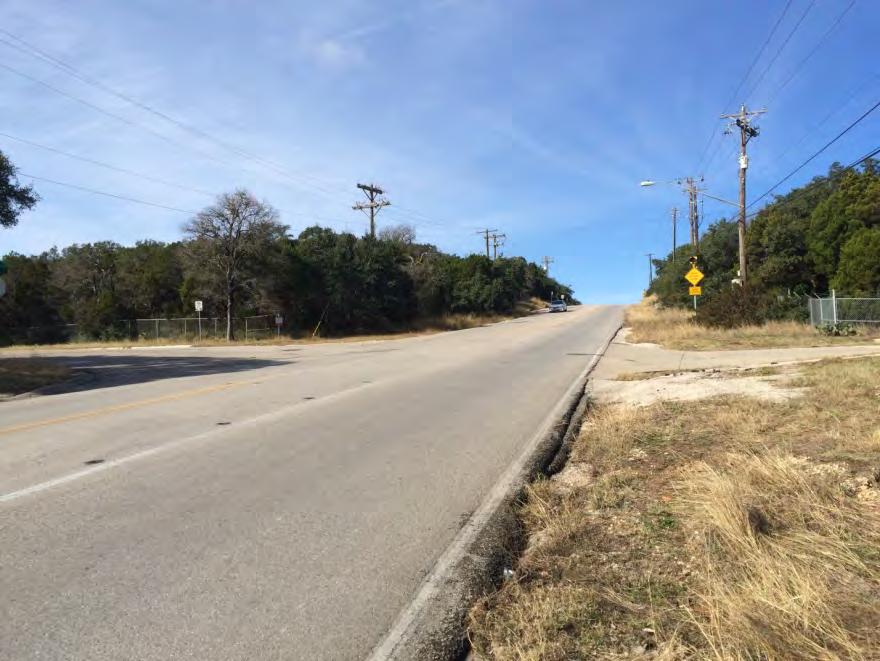
14 Speed limit signs and speed limit pavement markings are traffic control devices used to communicate the safe and reasonable operating speed on a particular roadway. Under Texas state law, all residential streets are 30 mph unless otherwise posted, based on a traffic engineering study. Speed limit signs are typically placed at the primary entrance to a neighborhood or where speed limits change. Speed feedback signs (which display vehicular speed information) can also be used to heighten driver awareness. A speed limit pavement marking provides an additional display of the lawful speed limit on the roadway. These markings are used to supplement speed limit signs, as shown in Figure 1. Advantages Inexpensive Constant reminder to the driver of the regulatory speed limit Catches the attention of motorists Disadvantages May not affect the driving behavior of frequent roadway users Effectiveness decreases on straight and/or wide streets or when faded Excessive signs can cause visual clutter Markings require continuous maintenance Figure 1: Speed Limit Pavement Markings Eligibility Considerations Streets that have a documented speeding problem Streets that have speed limits which differ from 30 mph April

15 Narrow Travel Lanes are created by using pavement markings, raised pavement markers or vertical panels, as shown in Figure 2. These treatments can be applied at pavement edges to create shoulders or parking lanes. They can also be applied inside to create painted medians and to provide buffer for vehicles traveling in the opposite direction. Bike lane installation was not considered feasible due to narrow road width. Advantages Travel lane narrowing may cause motorists to reduce their operating speeds Painted median provides buffer for vehicles traveling in the opposing direction Disadvantages Effectiveness decreases on straight and/or wide streets Excessive signs can cause visual clutter Markings require continuous maintenance Not as effective when markings are faded Level of speed reduction is usually minimal Eligibility Considerations Streets that have a documented speeding problem Streets that have speed limits which differ from 30 mph Figure 2: Narrow Travel Lanes Rumble strips are patterned sections of rough pavement or applications of raised material, which when driven over cause vibration and noise in a vehicle, as shown in Figure 3. This treatment is intended to direct the attention of the motorist back to the roadway. April
16 Advantages May be used to heighten motorists awareness Disadvantages Noisy and may be annoying to nearby residents Require continuous maintenance Eligibility Considerations Streets that have a documented speeding problem Adjacent property owners must agree to installation Figure 3: Rumble Strips Speed humps are asphalt or pre-formed rubber cushions applied to the road surface and are uncomfortable to negotiate at high operating speeds, as shown in Figure 4. This kind of treatment is called active traffic calming solution which requires vertical deflection in the vehicular travel path. Advantages Effective in reducing vehicle speeds Relatively easy for bicyclists and EMS to cross Disadvantages Makes traveling on the roadway uncomfortable for motorists and may increase noise Increases emergency vehicle response time by 8-10 seconds when installed in pairs Requires continuous maintenance April

17 Eligibility Considerations Street must not have more than one lane of travel in each direction Street segment must be approximately ¼ mile long without interruption by a traffic control device or other traffic calming features Street segment must not be within ¼ mile from a Fire Department facility that it significantly interferes with emergency vehicle operations Figure 4: Speed Humps The selected traffic calming solutions evaluation based on MOEs are summarized in Table 4. Table 4. Potential Traffic Calming Solutions Comparison Measure of Effectiveness (MOEs) Speed Limit Signs & Pavement Markings Narrow Travel Lanes Rumble Strips Speed Humps Reduced Speed Medium Medium Low High Reduced Volume Low Medium Low High Enhanced Safety Low Medium Low High Maintenance High Medium Medium Low Installation Costs Low* Medium Medium High Impact on EMS Response Time No No No Yes Abutting Residents Approval Needed No No Yes Yes * Medium if Speed Feedback signs used April
18 PRELIMINARY COST ESTIMATE A planning-level cost estimate was developed for each potential traffic calming solution. This preliminary cost estimate is provided as a planning level assessment of project cost for budget purposes. Actual construction cost may vary based on the detailed design and prices at the time of construction. The preliminary cost estimates are summarized in Table 5. Table 5. Summary of Preliminary Cost Estimates Alternative Estimated Cost Speed Limit Signs and Speed Limit Pavement Markings (6 locations) $6K $8K Narrow Travel Lanes (Segments A, B and Reveille Road) $10K $12K Rumble Strips (1 for each Segments A thru F) $12K $15K Speed Humps (Segments A, D and Reveille Road) $30K $40K Speed Feedback Signs (Two locations) $15K $20K POTENTIAL TRAFFIC CALMING IMPROVEMENTS A combination of one or more traffic calming solutions can be utilized to alleviate the speeding concerns. Neighborhood Association and residents feedback would be needed to finalize an acceptable plan for implementing traffic calming solutions along the Corridor. Appropriate traffic calming solutions include: Speed Limit Signs Installation at six (6) locations Speed Limit Pavement Markings Placement at seven (7) locations Narrow Travel Lanes Installation for Segments A, B and Reveille, where road pavement is wider than 22 feet. Given the narrow existing pavement width along the corridor (20 to 26 ), a white pavement marking delineating a 10 to 11 lane width would be appropriate. Vertical Panels could be an aesthetic issue in this corridor, and raised pavement markers would cost more without significantly increasing the effectiveness. All-way Stop installation at Rocky River Rd and Rocky River Cove Intersection Speed Humps Installation for Reveille Road, and Segments A and D Driver Speed Feedback signs may be installed at two (2) locations Additional signage and pavement markings modifications were also identified that may improve the traffic performance, although they do not specifically address traffic calming. The traffic signage and pavement markings modifications include: a. Installation of additional stop bars b. Speed enforcement by local police department April
19 c. Standardizing existing signs The potential traffic improvements are summarized in Table 6 and are also shown in Appendix C Traffic Improvements Plan. Table 6. Potential Traffic Improvements Plan Potential Traffic Improvement Solutions Speed Limit Signs Speed Limit Pavement Markings All-Way Stop Signs Narrow Travel Lanes Driver Speed Feedback Signs Speed Humps Approximate Location Forest View Drive Southbound: South of City Limits Forest View Drive Southbound: South of Cedar Park Drive Forest View Drive Northbound: North of Cedar Park Drive Rocky River Road Southbound: South of Reveille Road Rocky River Road Northbound: North of Westlake Drive Westlake Drive Southbound: South of Rocky River Road Forest View Drive: South of Cedar Park Drive Rocky River Road: South of Forest View Drive Rocky River Road: North of Rocky Ledge Road Westlake Drive: South of Rocky River Road Westlake Drive: North of Bee Caves Road Reveille Road: South of Rocky River Road Reveille Road: North of Bee Caves Road Rocky River Road and Rocky River Cove Intersection Segment A - Forest View Drive (South of City Limits) Segment B - Forest View Drive (Cedar Park to Rocky River Road) Reveille Road (Rocky River Road to Bee Caves Road) Forest View Drive Southbound: South of City Limits Reveille Road Southbound: South of Rocky River Road Segment A - Forest View Drive (1 Row, South of City Limits) Segment D - Rocky River (1 Row, approx. 400 South of Rocky Ledge) Reveille Road (Two Rows, approx. 500 Apart) CONCLUSION A Traffic Calming Study was performed for the Corridor to develop and assess traffic calming alternatives to reduce speeding and cut-through traffic. Data collection and site investigations were performed to determine existing traffic volumes and patterns, roadway geometrics, speed limits, and lane configurations. April
20 All three (3) locations where traffic data was collected showed evidence of speeding. The information gathered from the data collection and site investigations was used to evaluate existing conditions and to develop potential traffic calming solutions. The comparison of traffic calming solutions and their associated costs were also discussed. Various traffic calming solutions were identified to alleviate the speeding concerns. Neighborhood Association and residents feedback would be needed to finalize an acceptable plan for implementing traffic calming solutions along the Corridor. April
21 Appendix A Corridor Map with Geometric and Traffic Data April 2015
22 Legend "$ STOP SIGNS BUCKEYE BUCKEYE REDBUD "$ 1 ³ TRAFFIC SIGNAL ") TRAFFIC DATA COLLECTION LOCATION X XXX / XX INTERSECTION NUMBER Posted Speed Limit 30 MPH 25 MPH (Not Posted) Daily Traffic Volume (vehicles per day) / Vehicular Speed (miles per hour) AUSTIN CITY LIMITS "$ 6 Segment E (700') "$ "$ "$ 5 WESTLAKE 770/29 ROCKY RIVER ") Segment D (800') 4 "$ "$ "$ ROCKY RIVER CV Segment C (1500') ROCKY LEDGE Segment B (650') "$ "$ "$ "$ 3 924/ /34 2 "$ "$ "$ OAK RIDGE CEDAR PARK ") FOREST VIEW Segment A (1800') 979/33 BIRNAM WOOD Path: G:\ \07.00 CADD\Corridor_Map.mxd BEE CAVES /32 WESTLAKE ") Segment F (1500') 5099/34 REVEILLE WESTWOOD WESTBROOK Corridor Map with Geometric and Traffic Data KLOTZ PROJ. NO.: SCALE: NTS DATE: EXHIBIT 1
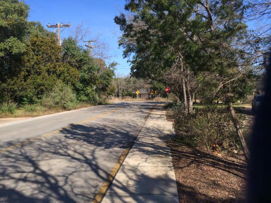
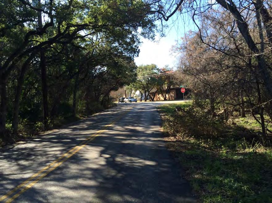
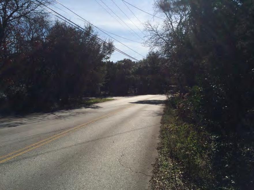
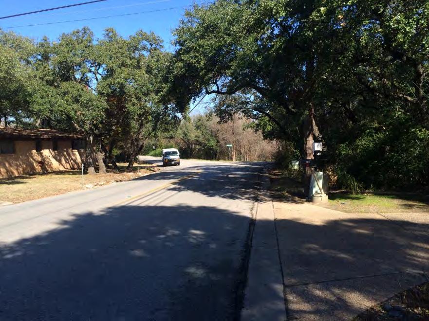
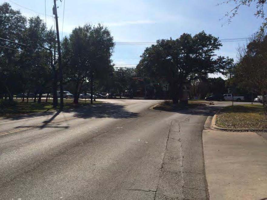
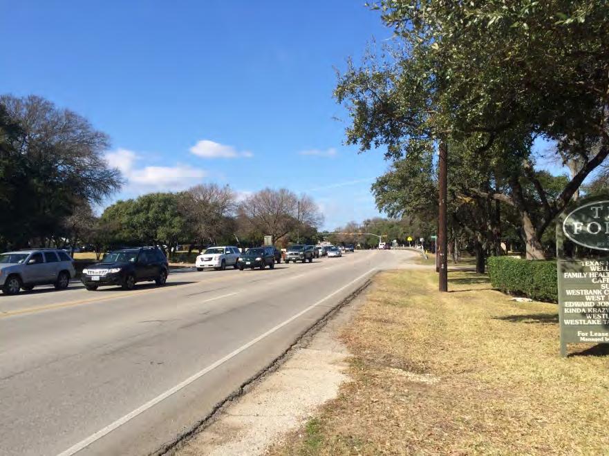
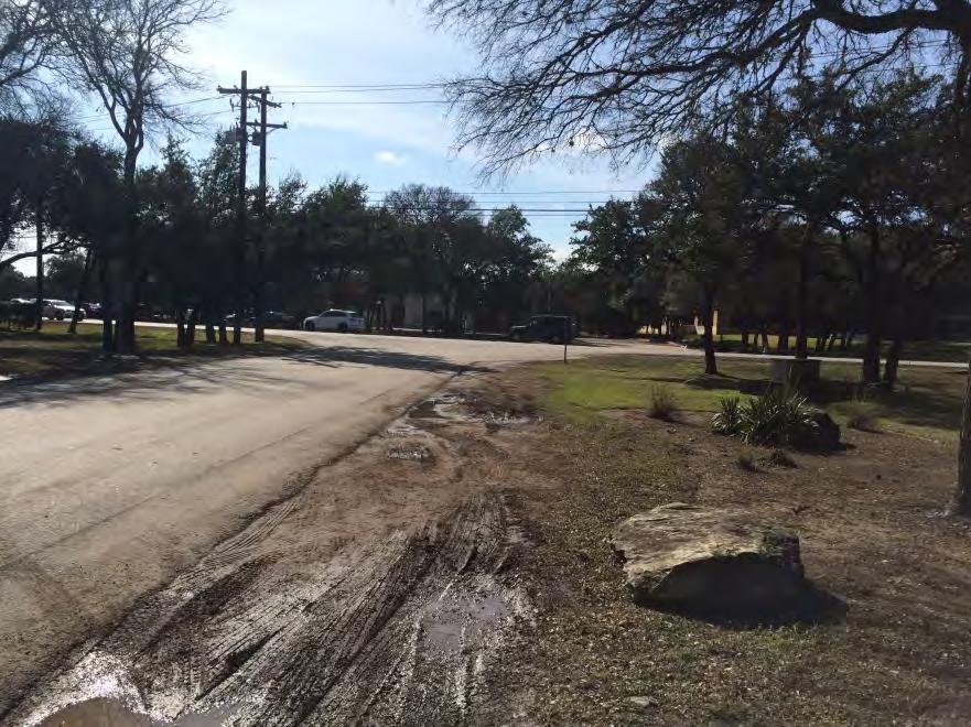
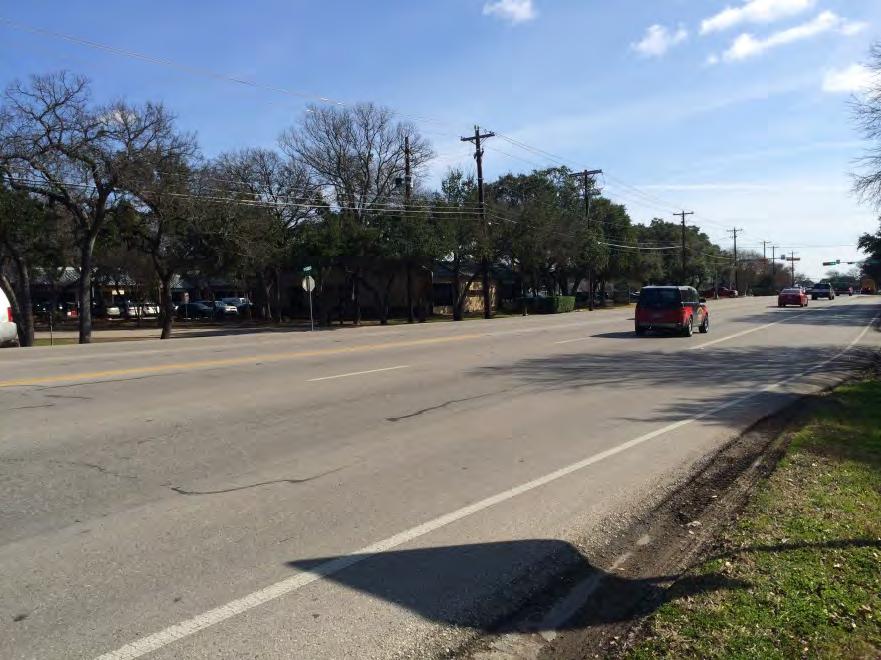
23 Appendix B Corridor Photographs April 2015

24 Forest View Dr and Redbud Trail Intersection: Redbud Trail East Approach, Looking East Forest View Dr and Redbud Trail Intersection: Redbud Trail East Approach, Looking West B-1


25 Forest View and Redbud Trail Intersection: Forest View North Approach, Looking North Forest View and Redbud Trail Intersection: Forest View North Approach, Looking South B-2


26 Forest View and Redbud Trail Intersection: Redbud Trail West Approach, Looking West Forest View and Redbud Trail Intersection: Redbud Trail West Approach, Looking East B-3


27 Forest View and Redbud Trail Intersection: Forest View South Approach, Looking South Forest View and Redbud Trail Intersection: Forest View South Approach Looking North B-4


28 Forest View and Cedar Park Intersection: Cedar Park Drive East Approach, Looking East Forest View Drive and Cedar Park Intersection: Cedar Park East Approach, Looking East B-5


29 Forest View and Cedar Park Intersection: Forest View North Approach Looking North Forest View and Cedar Park Intersection: Forest View Dr North Approach, Looking South B-6


30 Forest View and Cedar Park Intersection: Forest View Dr South Approach, Looking South Forest View and Cedar Park Intersection: Forest View Dr South Approach Looking North B-7


31 Forest View and Oak Ridge Intersection: Oak Ridge Drive East Approach, Looking East Forest View Drive and Oak Ridge Intersection: Oak Ridge East Approach, Looking West B-8


32 Forest View and Oak Ridge Intersection: Forest View North Approach, Looking North Forest View and Oak Ridge Intersection: Forest View North Approach, Looking South B-9

33 Forest View Drive and Oak Ridge Intersection: Oak Ridge West Approach, Looking West Forest View Drive and Oak Ridge Intersection: Oak Ridge West Approach, Looking East B-10


34 Forest View and Oak Ridge Intersection: Forest View South Approach, Looking South Forest View and Oak Ridge Intersection: Forest View South Approach, Looking North B-11


35 Rocky River and Rocky Ledge Intersection: Rocky Ledge East Approach, Looking East Rocky River and Rocky Ledge Intersection: Rocky Ledge East Approach, Looking West B-12


36 Rocky River and Rocky Ledge Intersection: Rocky River North Approach, Looking North Rocky River and Rocky Ledge Intersection: Rocky River North Approach, Looking South B-13


37 Rocky River and Rocky Ledge Intersection: Rocky River South Approach, Looking South Rocky River and Rocky Ledge Intersection: Rocky River South Approach, Looking North B-14

38 Rocky River Road and Reveille Intersection: Rocky River East Approach, Looking East Rocky River Road and Reveille Intersection: Rocky River East Approach, Looking West B-15

39 Rocky River Road and Reveille Intersection: Rocky River West Approach, Looking West Rocky River Road and Reveille Intersection: Rocky River West Approach, Looking East B-16

40 Rocky River Road and Reveille Road Intersection: Reveille South Approach, Looking South Rocky River Road and Reveille Road Intersection: Reveille South Approach, Looking North B-17

41 Westlake Drive and Rocky River Intersection: Rocky River East Approach, Looking East Westlake Drive and Rocky River Intersection: Rocky River East Approach, Looking West B-18

42 Westlake Drive and Rocky River Intersection: Westlake North Approach, Looking North Westlake Drive and Rocky River Intersection: Westlake North Approach, Looking South B-19

43 Westlake Drive and Rocky River Intersection: Westlake South Approach, Looking South Westlake Drive and Rocky River Intersection: Westlake South Approach, Looking North B-20


44 Westlake Drive and Bee Caves Intersection: Bee Caves Road East Approach, Looking East Westlake Drive and Bee Caves Intersection: Bee Caves Road East Approach, Looking West B-21

45 Westlake Drive and Bee Caves Intersection: Westlake North Approach, Looking North Westlake Drive and Bee Caves Intersection: Westlake North Approach, Looking South B-22


46 Westlake Drive and Bee Caves Road Intersection: Bee Caves West Approach, Looking West Westlake Drive and Bee Caves Intersection: Bee Caves West Approach, Looking East B-23


47 Westlake Drive and Bee Caves Road Intersection: Westlake South Approach, Looking South Westlake Drive and Bee Caves Intersection: Westlake South Approach, Looking North B-24

48 Reveille Road and Bee Caves Road Intersection: Bee Caves East Approach, Looking East Reveille Road and Bee Caves Road Intersection: Bee Caves East Approach, Looking West B-25

49 Reveille Road and Bee Caves Road Intersection: Reveille North Approach, Looking North Reveille Road and Bee Caves Road Intersection: Reveille North Approach, Looking South B-26

50 Reveille Road and Bee Caves Road Intersection: Bee Caves West Approach, Looking West Reveille Road and Bee Caves Road Intersection: Bee Caves West Approach, Looking East B-27
51 Appendix C Potential Traffic Improvements Plan April 2015
52 BUCKEYE Legend for Potential Impovements SPEED LIMIT SIGNS REDBUD ³ DRIVER FEEDBACK SIGNS # SPEED HUMPS "$ ALL WAY STOP SIGNS ") SPEED LIMIT PAVEMENT MARKINGS NARROW LANES AUSTIN CITY LIMITS 200' ") Segment E (700') 300' # 200' ") 500' 400' WESTLAKE # 400' Segment D (800') ROCKY RIVER ROCKY RIVER CV "$ ") ") Segment C (1500') ROCKY LEDGE 375' Segment B (650') ") 250' PARK CEDAR OAK RIDGE # FOREST VIEW Segment A (1800') BIRNAM WOOD 500' Path: G:\ \07.00 CADD\Potential_Improvements.mxd BEE CAVES 200' ") ") Segment F (1500') 200' WESTLAKE REVEILLE # WESTWOOD WESTBROOK Potential Traffic Improvements Plan KLOTZ PROJ. NO.: SCALE: NTS DATE: EXHIBIT 2
TRAFFIC CALMING TOOLBOX. For the residents of the City of Decatur, Georgia
 TRAFFIC CALMING TOOLBOX For the residents of the City of Decatur, Georgia 2 City of Decatur Traffic Calming Toolbox Public Works Department 2635 Talley Street Decatur, GA 30030 404.377.5571 3 Welcome to
WELCOME Public Information Centre
 WELCOME Public Information Centre Fernforest Drive Brampton Soccer Centre Community Room #2 Tuesday January 19, 2016 6:30 p.m.to 9:00 p.m. Please sign in Neighbourhood Traffic Calming Guide Background
Public Information Centre
 WELCOME Public Information Centre Father Tobin Road Lougheed Middle School - Library Wednesday November 7, 2012 7:00 p.m.to 9:00 p.m. Please sign in Neighbourhood Traffic Calming Guide Background The City
POLICY FOR NEIGHBORHOOD TRAFFIC CALMING
 POLICY FOR NEIGHBORHOOD TRAFFIC CALMING I. STATEMENT OF PURPOSE This policy provides a procedure for the consideration, evaluation and implementation of requests for traffic calming measures. II. DEFINITIONS
TOWN OF PAYSON TRAFFIC CALMING MANUAL
 TOWN OF PAYSON TRAFFIC CALMING MANUAL APPROVED BY THE PAYSON TOWN COUNCIL SEPTEMBER 6, 2007 TOWN OF PAYSON TRAFFIC CALMING POLICY 1.0 Introduction Traffic Calming involves retrofitting physical devices
City of Tamarac, Florida Traffic Calming Policy
 City of Tamarac, Florida Traffic Calming Policy Temp. Reso. 12614 Exhibit 1 I. Introduction: The City of Tamarac recognizes that the conditions of residential streets can greatly affect neighborhood livability
CITY OF COCONUT CREEK IMPLEMENTATION GUIDELINES FOR TRAFFIC CALMING
 CITY OF COCONUT CREEK IMPLEMENTATION GUIDELINES FOR TRAFFIC CALMING I. Introduction: The City of Coconut Creek recognizes that the conditions of residential streets can greatly affect neighborhood livability;
City of Vallejo Traffic Calming Toolbox
 City of Vallejo Traffic Calming Toolbox June 1, 2013 Final Table of Contents Introduction... 1 Non-Physical Devices... 3 High-Visibility Crosswalk... 3 In Pavement Lighted Crosswalk... 4 Rapid Flashing
As the Toronto Transit Commission (TTC) operates a transit service on Avenue Road, City Council approval of this report is required.
 operates a transit service on Avenue Road, City Council approval of this report is required.") REPORT FOR ACTION Corridor Safety Review - Avenue Road Date: September 27, 2017 To: Toronto and East York Community Council From: Acting Director, Transportation Services, Toronto and East York District
REPORT FOR ACTION Corridor Safety Review - Avenue Road Date: September 27, 2017 To: Toronto and East York Community Council From: Acting Director, Transportation Services, Toronto and East York District
Citizens Handbook for Requesting Traffic Calming Devices
 Citizens Handbook for Requesting Traffic Calming Devices January 19, 2015 Table of Contents 1. PURPOSE... - 1-2. DEFINITIONS... - 2-3. GENERAL INFORMATION... - 3-3.1. ELIGIBILITY REQUIREMENTS... - 3-3.2.
DEPARTMENT OF ENVIRONMENTAL SERVICES. North Harrison Street (Lee Highway to Little Falls Road) Comparative Analysis. Prepared for:
 Comparative Analysis. Prepared for:") DEPARTMENT OF ENVIRONMENTAL SERVICES North Harrison Street (Lee Highway to Little Falls Road) Comparative Analysis Prepared for: Arlington County Department of Environmental Services 2100 Clarendon Boulevard,
DEPARTMENT OF ENVIRONMENTAL SERVICES North Harrison Street (Lee Highway to Little Falls Road) Comparative Analysis Prepared for: Arlington County Department of Environmental Services 2100 Clarendon Boulevard,
TOWN OF CHAPEL HILL POLICY AND PROCEDURES FOR TRAFFIC CALMING MEASURES
 TOWN OF CHAPEL HILL POLICY AND PROCEDURES FOR TRAFFIC CALMING MEASURES (Adopted by the Town Council on June 30, 2004) (Revised December 6, 2010) (Revised February 8, 2016) POLICY AND PROCEDURES FOR TRAFFIC
CITY OF OTTAWA ROADWAY MODIFICATION APPROVAL UNDER DELEGATED AUTHORITY
 RMA-2015-ATM-038 CITY OF OTTAWA ROADWAY MODIFICATION APPROVAL UNDER DELEGATED AUTHORITY DATE: April 22, 2015 SUBJECT Approval of Roadway Modifications Recommended through an Area Traffic Management Study
MEMORANDUM. Charlotte Fleetwood, Transportation Planner
 MEMORANDUM Date: Updated August 22, 2017 To: Organization: Charlotte Fleetwood, Transportation Planner Boston Transportation Department From: Jason DeGray, P.E., PTOE, Regional Director of Engineering
FINAL DESIGN TRAFFIC TECHNICAL MEMORANDUM
 FINAL DESIGN TRAFFIC TECHNICAL MEMORANDUM July 2014 FINAL (SR 43) Project Development and Environment Study From State Road 60 (Adamo Drive) to I-4 (SR 400) Hillsborough County, Florida Work Program Item
City of Elizabeth City Neighborhood Traffic Calming Policy and Guidelines
 City of Elizabeth City Neighborhood Traffic Calming Policy and Guidelines I. Purpose: The City of Elizabeth City is committed to ensure the overall safety and livability of residential neighborhoods. One
City of Vestavia Hills Traffic Calming Policy for Residential Streets
 City of Vestavia Hills Traffic Calming Policy for Residential Streets PURPOSE: The purpose of the Traffic Calming Policy for Residential Streets is to address safety concerns related to vehicular traffic
Peer Review of Highlands Neighborhood Traffic and Pedestrian Safety Plan
 FINAL REPORT March 14, 2017 Prepared for: Ada County Highway District Prepared by: SIX MILE ENGINEERING, PA Executive Summary The (Highlands Safety Plan) developed by the Ada County Highway District (ACHD)
TRAFFIC CALMING POLICY & PROCEDURES
 TRAFFIC CALMING POLICY & PROCEDURES AS ADOPTED BY MONTCLAIR TOWNSHIP COUNCIL AUGUST 4, 2009 TABLE OF CONTENTS 1. INTRODUCTION... 2 Purpose... 2 Traffic Calming Definition... 2 Statement Of Township Council
West Broad Street Traffic Study
 West Broad Street Traffic Study Prepared for the Town of Plainville by Central Connecticut Regional Planning Agency (CCRPA) October 2011 Central Connecticut Regional Planning Agency 225 N. Main St. Suite
Chapter 4 Traffic Analysis
 Chapter 4 Traffic Analysis PURPOSE The traffic analysis component of the K-68 Corridor Management Plan incorporates information on the existing transportation network, such as traffic volumes and intersection
Northbound San Jose Avenue & I-280 Off-Ramp Road Diet Pilot Project
 Project Overview Fed by a two-lane Interstate-280 (I-280) off-ramp, high vehicular volumes and speeds are longstanding issues along San Jose Avenue. Residents in the surrounding neighborhoods have expressed
Residential Traffic Calming Program Guide. Town of Ashland, Virginia
 Residential Traffic Calming Program Guide Town of Ashland, Virginia August 1, 2006 TABLE OF CONTENTS A. INTRODUCTION... 1 B. GOALS... 1 C. CRITERIA... 1 D. IDENTIFYING NEIGHBORHOOD TRAFFIC CONCERNS...
City of Margate, Florida. Neighborhood Traffic Management Manual
 City of Margate, Florida Neighborhood Traffic Management Manual Table of Contents Page No. I. INTRODUCTION... 1 II. TRAFFIC CALMING REQUEST AND PROCESSING PROCEDURES... 2 1. COMPLETE AND SUBMIT PROJECT
City of Turlock Traffic Calming Program
 Table of Contents Introduction... 3 Definitions... 3 Purpose... 3 Goals and Objectives... 3 Policy Statements... 4 Minimum Qualifying Criteria... 6 Traffic Calming Request Process... 7 Step No. 1: Complete
County of Spartanburg South Carolina
 County of Spartanburg South Carolina Traffic Calming Program June 2012 (Revised/Program on Hold) PURPOSE The potential negative impacts from vehicular traffic on residential roads have been a longstanding
TRAFFIC ACTION PLAN. Laurie Meadows Neighborhood CITY OF SAN MATEO
 TRAFFIC ACTION PLAN Laurie Meadows Neighborhood CITY OF SAN MATEO Draft January 2017 Table of Contents Introduction... 2 The Traffic Forum Process... 5 Neighborhood Traffic Issues... 7 Neighborhood Recommendations
Edenbrook Hill Drive Traffic Calming Study
 WELCOME Public Information Centre Edenbrook Hill Drive Traffic Calming Study Fletchers Meadow Secondary School Wednesday January 20, 2016 6:30 p.m.to 9:00 p.m. Please sign in Neighbourhood Traffic Calming
3.1 TRAFFIC CALMING PROCESS SUMMARY
 SECTION 3 3.0 TRAFFIC CALMING 3.1 TRAFFIC CALMING PROCESS SUMMARY Traffic calming is a means in which to reduce speeds and minimize vehicular traffic on local neighborhood streets. Citizen involvement
Military Road Safety Improvements
 Military Road Safety Improvements 26 th Road North to 31 st Street North SUMMARY OF DATA REVIEW AND PRELIMINARY RECOMMENDATIONS Prepared for: Department of Environmental Services Traffic Engineering and
Giles Run Connector Road
 Giles Run Connector Road Laurel Hill Adaptive Reuse Area to Laurel Crest Drive South County Federation Meeting June 14, 2016 History Connector road included in the Laurel Hill Comprehensive Plan amendment
Ottawa Beach Road Study
 Ottawa Beach Road Study Prepared For: Park Township September 30, 2014 Project No. G140303 OTTAWA BEACH ROAD STUDY PREPARED FOR: PARK TOWNSHIP SEPTEMBER 30, 2014 PROJECT NO. G140303 TABLE OF CONTENTS 1.0
Honorable Members of the Mobility Solutions, Infrastructure and Sustainability Committee
 Memorandum DATE May 11, 2018 CITY OF DALLAS TO Honorable Members of the Mobility Solutions, Infrastructure and Sustainability Committee SUBJECT Neighborhood Traffic Management Program On Monday, May 14,
Revised Neighborhood Traffic Calming Program
 Revised Neighborhood Traffic Calming Program Adopted by Town Council on: May 15, 2012 Resolution #: 2012-31 TABLE OF CONTENTS 1.0 INTRODUCTION...3 2.0 PROGRAM MISSION STATEMENT AND OBJECTIVES...3 3.0 POLICIES...3
Neighborhood Traffic Calming Program
 Neighborhood Traffic Calming Program Adopted by Town Council on: October 23 rd, 2007 Resolution #: 2007-124 PROPOSED REVISIONS February 8, 2012 pg. 1 TABLE OF CONTENTS 1.0 INTRODUCTION...3 2.0 PROGRAM
By: Bill Baranowski, PE TRAFFIC CALMING EXAMPLES IN SUGARHOUSE, DAYBREAK, AND WEST JORDAN CITY
 By: Bill Baranowski, PE TRAFFIC CALMING EXAMPLES IN SUGARHOUSE, DAYBREAK, AND WEST JORDAN CITY 1977 HIGHLAND RUGBY TOUR 1945 WHERE??? What is more contentious than traffic calming? 1951 LOOKING SOUTHEAST
TOWN OF HALTON HILLS TRAFFIC CALMING PROTOCOL. Page 1 of 25
 TOWN OF HALTON HILLS TRAFFIC CALMING PROTOCOL Page 1 of 25 PROCESS FOR INSTALLATION OF TRAFFIC CALMING DEVICES The Process for Installation of Traffic Calming Devices has been prepared to provide an objective
Improve the livability of our streets by
 Pedestrian and Traffic Calming Policy March 2018 2 of 6 Neighborhood Traffic Calming Policy The City of Aspen continually strives to protect multimodal function while maintaining a high standard of safety.
VILLAGE OF NILES TRAFFIC CALMING POLICY
 INTRODUCTION There is increasing interest across the country in developing new strategies to reduce the speed and amount of traffic in residential neighborhoods. Measurement of speeds, traffic volumes,
Malvern Borough Local Traffic Calming
 Malvern Borough Local Traffic Calming Purpose: To address speeding and high volume cut-through traffic on Malvern Borough owned residential streets. Traffic Calming Measures: Traffic Calming Measures (TCM)
Proposed Action, Purpose and Need Technical Memorandum
 Proposed Action, Purpose and Need Technical Memorandum MoPac (State Loop 1) Intersections, Austin District From North of Slaughter Lane to South of La Crosse Avenue CSJ: 3136-01-015 Travis County, Texas
TRANSPORTATION ANALYSIS REPORT US Route 6 Huron, Erie County, Ohio
 TRANSPORTATION ANALYSIS REPORT US Route 6 Huron, Erie County, Ohio December 12, 2012 Prepared for: The City of Huron 417 Main Huron, OH 44839 Providing Practical Experience Technical Excellence and Client
MAG Town of Cave Creek Bike Study Task 6 Executive Summary and Regional Significance Report
 Page 1 MAG Town of Cave Creek Bike Study Task 6 Executive Summary and Regional Significance Report August 1, 2012 MAG Project #481 Page 2 Task 6 Executive Summary and Regional Significance Report Introduction
Neighborhood Traffic Calming Guidelines
 Neighborhood Traffic Calming Guidelines ADOPTED BY THE CITY COUNCIL OF ARROYO GRANDE BY RESOLUTION NO. 2016-4718 ON APRIL 12, 2016 COMMUNITY DEVELOPMENT DEPARTMENT ENGINEERING DIVISION 300 East Branch
RIVERSIDE DRIVE: 21st to 41st
 RIVERSIDE DRIVE: 21st to 41st Traffic Calming, Parking Lane, and Bike Lane Traffic Calming Options Traffic Calming Design Alternatives and Recommendations by Road Section Parking Lane & Bike Lane Guidance
Figure 1: Vicinity Map of the Study Area
 ARIZONA TEXAS NEW MEXICO OKLAHOMA May 5, 2016 Mr. Anthony Beach, P.E. BSP Engineers 4800 Lakewood Drive, Suite 4 Waco, Texas 76710 Re: Intersection and Access Analysis along Business 190 in Copperas Cove
Traffic Analysis and Design Report. NW Bethany Boulevard. NW Bronson Road to NW West Union Road. Washington County, Oregon
 Traffic Analysis and Design Report NW Bethany Boulevard NW Bronson Road to NW West Union Road Washington County, Oregon May 2011 Table of Contents Table of Contents Section 1 Executive Summary... 2 Section
Mineral Avenue Corridor Assessment. ITE 2017 Western District Annual Meeting San Diego, CA June 21 st
 Mineral Avenue Corridor Assessment ITE 2017 Western District Annual Meeting San Diego, CA June 21 st Biography - Aaron Heumann, PE, PTOE Currently City of Littleton Transportation Engineering Manager 24
CITY OF ROCK HILL, SOUTH CAROLINA. Neighborhood Traffic Calming Program A Policy for Use of Traffic Calming on Local (Residential) Streets
 Streets") CITY OF ROCK HILL, SOUTH CAROLINA Neighborhood Traffic Calming Program A Policy for Use of Traffic Calming on Local (Residential) Streets I. Statement of Purpose: This program provides a process and a
CITY OF ROCK HILL, SOUTH CAROLINA Neighborhood Traffic Calming Program A Policy for Use of Traffic Calming on Local (Residential) Streets I. Statement of Purpose: This program provides a process and a
MEMORANDUM TERESA MCCLISH, COMMUNITY DEVELOPMENT DIRECTOR SUBJECT: CONSIDERATION OF DRAFT NEIGHBORHOOD TRAFFIC CALMING GUIDELINES
 MEMORANDUM TO: FROM: BY: TRAFFIC COMMISSION TERESA MCCLISH, COMMUNITY DEVELOPMENT DIRECTOR MATT HORN, CITY ENGINEER SUBJECT: CONSIDERATION OF DRAFT NEIGHBORHOOD TRAFFIC CALMING GUIDELINES DATE: MARCH 28,
County of Greenville South Carolina. Traffic Calming Program Neighborhood Traffic Education Program and Speed Hump Program
 County of Greenville South Carolina Traffic Calming Program Neighborhood Traffic Education Program and Speed Hump Program (rev) August 2008 I. PURPOSE The potential negative impacts from vehicular traffic
Appendix C. TRAFFIC CALMING PROGRAM TOOLBOX
 Appendix C. TRAFFIC CALMING PROGRAM TOOLBOX PHASE I...2 Do Not Enter Sign...3 One-Way Sign...4 Turn Prohibition...5 Pavement Markings...6 Speed Monitoring Trailer...7 Neighborhood Speed Watch...8 Police
Fleur Drive Reconstruction
 Fleur Drive Reconstruction October 29, 2018 1 Agenda: Fleur Drive Reconstruction Project Scope & Cost Overview Fleur Drive Cross Section Elements - Travel Lane Widths - Sidewalk Widths - Parkway Widths
Broad Street Bicycle Boulevard Design Guidelines
 Broad Street Bicycle Boulevard Design Guidelines Building from the strategies introduced in the 2013 Bicycle Transportation Plan and community input received thus far, City Transportation Staff have identified
Pavement Markings (1 of 3)
") Pavement Markings (1 of 3) DESCRIPTION AND DEFINITION Disadvantages Relatively high cost (over typical Crash reduction as yet unknown painted edge line) No tactile effect The STOP AHEAD pavement marking
Pavement Markings (1 of 3) DESCRIPTION AND DEFINITION Disadvantages Relatively high cost (over typical Crash reduction as yet unknown painted edge line) No tactile effect The STOP AHEAD pavement marking
INDUSTRIAL BUILDING 3009 HAWTHORNE ROAD CITY OF OTTAWA TRANSPORTATION OVERVIEW REVISED. Prepared for: Canada Inc.
 INDUSTRIAL BUILDING 3009 HAWTHORNE ROAD CITY OF OTTAWA TRANSPORTATION OVERVIEW REVISED Prepared for: 7849648 Canada Inc. Octiober 1, 2015 114-598 Overview_2.doc D. J. Halpenny & Associates Ltd. Consulting
Henderson Avenue Mixed-Use Development
 Zoning Case: Z145-3 Traffic Impact Analysis Henderson Avenue Mixed-Use Development Dallas, TX October 26 th, 216 Kimley-Horn and Associates, Inc. Dallas, Texas Project #644827 Registered Firm F-928 Traffic
Albany Shaker Road Corridor Study Public Meeting # 2
 Albany Shaker Road Corridor Study Public Meeting # 2 Scope / Meeting Purpose This project is a CDTC Linkage Study. The Linkage Program is designed to implement the adopted planning and investment principles
Dr. M.L. King, Jr. Street North Complete Streets Resurfacing Opportunities HOUSING, LAND USE, AND TRANSPORTATION COMMITTEE MARCH 22, 2018
 Dr. M.L. King, Jr. Street North Complete Streets Resurfacing Opportunities HOUSING, LAND USE, AND TRANSPORTATION COMMITTEE MARCH 22, 2018 What s Happening The City plans to mill and resurface Dr. M.L.
City of Memphis. To: John E. Cameron, PE City Engineer. From: Kyle Wagenschutz. Cc: Manny Belen, Randall Tatum. Date: November 5, 2015
 City of Memphis Tennessee A C Wharton, Jr. Mayor Jack Sammons Chief Administrative Officer Division of Engineering John E. Cameron, P.E. City Engineer Memo To: John E. Cameron, PE City Engineer From: Kyle
TRAFFIC CALMING GUIDE FOR TORONTO CITY OF TORONTO TRANSPORTATION SERVICES DIVISION
 TRAFFIC CALMING GUIDE FOR TORONTO CITY OF TORONTO TRANSPORTATION SERVICES DIVISION CITY OF TORONTO TRANSPORTATION SERVICES DIVISION 2016 TRAFFIC CALMING GUIDE FOR TORONTO TABLE OF CONTENTS Introduction
To: ACHD Commissioners and Director 3/14/2017. Peer Review of Highlands Neighborhood Traffic and Pedestrian Safety Plan Information Briefing
 Paul Woods, President Rebecca W. Arnold, Vice President Kent Goldthorpe, Commissioner Sara M. Baker, Commissioner Jim D. Hansen, Commissioner MEMORANDUM Engineering To: ACHD Commissioners and Director
Saskatchewan Drive Roadway Rehabilitation and Shared-Use Path Widening
 Saskatchewan Drive Roadway Rehabilitation and Shared-Use Path Widening We are here today to present the draft plan for the Saskatchewan Drive Roadway Rehabilitation and Shared-Use Path Widening project
TRAFFIC CALMING TOOLBOX
 TRAFFIC CALMING TOOLBOX Traffic control devices are those official signs and striping placed in the public right-of-way and recognized by the public such as STOP signs, curve warning signs, centerline
Borough of Danville, PA Traffic Calming Program Guidelines
 Borough of Danville, PA Traffic Calming Program Guidelines Adopted by Borough Council on 1 INTRODUCTION Speeding Traffic is a major concern in the Borough of Danville because of its detrimental impacts
Off-road Trails. Guidance
 Off-road Trails Off-road trails are shared use paths located on an independent alignment that provide two-way travel for people walking, bicycling, and other non-motorized users. Trails specifically along
TRAFFIC ACTION PLAN. North Shoreview Neighborhood CITY OF SAN MATEO
 TRAFFIC ACTION PLAN North Shoreview Neighborhood CITY OF SAN MATEO Draft February 2017 Table of Contents Introduction... 1 The Traffic Forum Process... 4 Neighborhood Traffic Issues... 6 Neighborhood Recommendations
Enclosure 1. Crimson Drive Traffic Safety and Calming Review Report
 Enclosure 1 Crimson Drive Traffic Safety and Calming Review Report Prepared by: Tahir Hameed, P.Eng. Traffic Safety Engineer Planning Engineering and Safety Transportation Planning and Engineering Date:
REGIONAL BICYCLE AND PEDESTRIAN DESIGN GUIDELINES
 REGIONAL BICYCLE AND PEDESTRIAN DESIGN GUIDELINES November 16, 2011 Deb Humphreys North Central Texas Council of Governments Bicycle and Pedestrian Advisory Committee Snapshot of the Guide 1. Introduction
Traffic Calming SECTION 1, CHAPTER Introduction What is Traffic Calming?
 SECTION 1, CHAPTER 6 Traffic Calming 6.1 Introduction 6.1.1 What is Traffic Calming? Traffic calming deals with neighborhood traffic issues comprehensively using the three E s, Education, Enforcement,
3.1 TRAFFIC CALMING PROCESS SUMMARY
 SECTION 3 3.0 TRAFFIC CALMING 3.1 TRAFFIC CALMING PROCESS SUMMARY Traffic calming is a means in which to reduce speeds and minimize vehicular traffic on local neighborhood streets. Citizen involvement
CITY OF ORILLIA POLICY MANUAL
 Page 1 of 34 1 INTRODUCTION 1.1 Background The Public Works Department receives numerous concerns, both real and perceived, from residents regarding high traffic volumes, short-cutting, speeding and overall
Glenn Avenue Corridor Traffic Operational Evaluation
 Glenn Avenue Corridor Traffic Operational Evaluation PREPARED FOR: THE CITY OF AUBURN PREPARED BY: DECEMBER 2007 Glenn Avenue Corridor Study--Auburn, Alabama TABLE OF CONTENTS Introduction... 1 Background
City of Mountlake Terrace Traffic Calming Guide
 City of Mountlake Terrace Traffic Calming Guide A Guide For Managing Traffic in Mountlake Terrace Neighborhoods July 2017 City of Mountlake Terrace Department of Community and Economic Development Table
Lake Whitney Elementary School
 Lake Whitney Elementary School SCHOOL ROUTE PLAN For LAKE WHITNEY ELEMENTARY SCHOOL LOCATION 18 ORANGE COUNTY Prepared for: ORANGE COUNTY SCHOOL ASSESSMENT PROGRAM ORANGE COUNTY PUBLIC WORKS Traffic Engineering
DRAFT - CITY OF MEDFORD TRANSPORTATION SYSTEM PLAN Roadway Cross-Sections
 Roadway Cross-Sections Medford s roadway cross-section standards apply to new and reconstructed roads. The crosssections take into consideration roadway function and operational characteristics, including
Traffic Calming Guidelines
 Traffic Calming Guidelines New England Section Technical Committee ITE New England Section Annual Meeting December 5, 2016 1 ACKNOWLEDGEMENTS INSTITUTE OF TRANSPORTATION ENGINEERS NEW ENGLAND SECTION TECHNICAL
Boston Post Road Design Feasibility Study
 Boston Post Road Design Feasibility Study Prepared for the City of Rye Final Report July 18, 2007 Prepared by: Buckhurst Fish & Jacquemart (BFJ) 115 Fifth Avenue New York, NY 10003 www.bfjplanning.com
TRAFFIC STUDY. Birch Bluff Road / Pleasant Avenue 01/15/2018. City of Tonka Bay 4901 Manitou Road Tonka Bay, MN WSB PROJECT NO.
 TRAFFIC STUDY Birch Bluff Road / Pleasant Avenue 01/15/2018 City of Tonka Bay 4901 Manitou Road Tonka Bay, MN 55331 WSB PROJECT NO. 10805-000 Birch Bluff Road/ Pleasant Avenue Traffic Study For: City of
2.0 LANE WIDTHS GUIDELINE
 2.0 LANE WIDTHS GUIDELINE Road Engineering Design Guidelines Version 2.0.1 May 2018 City of Toronto, Transportation Services City of Toronto Page 0 Background In early 2014, Transportation Services initiated
APPENDIX D LEVEL OF TRAFFIC STRESS METHODOLOGY
 APPENDIX D LEVEL OF TRAFFIC STRESS METHODOLOGY 01 WHAT IS LEVEL OF TRAFFIC STRESS? When people bicycle on roadways, they encounter varying levels of stress from traffic. A quiet residential street with
133 rd Street and 132 nd /Hemlock Street 132 nd Street and Foster Street MINI ROUNDABOUTS. Overland Park, Kansas
 133 rd Street and 132 nd /Hemlock Street 132 nd Street and Foster Street MINI ROUNDABOUTS Overland Park, Kansas September 1, 2017 TABLE OF CONTENTS 1. INTRODUCTION... 1 2. LITERATURE REVIEW... 1 3. CONCEPT
FRONT RANGE CROSSINGS TRAFFIC IMPACT STUDY
 FRONT RANGE CROSSINGS TRAFFIC IMPACT STUDY Prepared for: City of Thornton And Colorado Department of Transportation Prepared by: 11 Blake Street, Suite 2 Denver, Colorado 822 Contact: Brian Bern, PE, PTOE
EUCLID AVENUE PARKING STUDY CITY OF SYRACUSE, ONONDAGA COUNTY, NEW YORK
 EUCLID AVENUE PARKING STUDY CITY OF SYRACUSE, ONONDAGA COUNTY, NEW YORK CITY OF SYRACUSE DEPARTMENT OF PUBLIC WORKS 1200 CANAL STREET EXTENSION SYRACUSE, NEW YORK 13210 DRAFT REPORT DATE: November 13,
ORANGE COUNTY PUBLIC WORKS TRAFFIC INVESTIGATIONS
 ORANGE COUNTY PUBLIC WORKS TRAFFIC INVESTIGATIONS STAFF REPORT OF: January 6, 2019 SUPERVISORIAL DISTRICT: 5 SUBJECT: LOCATION: INVESTIGATOR: O Neill Drive at Roanoke Drive; Ladera Ranch; TB 922-E6 Clever
1609 E. FRANKLIN STREET HOTEL TRAFFIC IMPACT STUDY EXECUTIVE SUMMARY
 1609 E. FRANKLIN STREET HOTEL TRAFFIC IMPACT STUDY EXECUTIVE SUMMARY Prepared for: The Town of Chapel Hill Public Works Department Traffic Engineering Division Prepared by: HNTB North Carolina, PC 343
Traffic Impact Study WestBranch Residential Development Davidson, NC March 2016
 Traffic Impact Study WestBranch Residential Development Davidson, NC March 216 TRAFFIC IMPACT STUDY FOR THE WestBranch Residential Development LOCATED IN DAVIDSON, NC Prepared For: Lennar Carolinas, LLC
TRAFFIC ACTION PLAN. North Central Neighborhood CITY OF SAN MATEO
 TRAFFIC ACTION PLAN North Central Neighborhood CITY OF SAN MATEO Draft February 2017 Table of Contents Introduction... 1 The Traffic Forum Process... 4 Neighborhood Traffic Issues... 6 Neighborhood Recommendations
Town of Mooresville, North Carolina Neighborhood Traffic Calming and Control Device Policy
 Town of Mooresville, North Carolina Neighborhood Traffic Calming and Control Device Policy Adopted January 6, 2014 Town of Mooresville Development Services Department TOWN OF MOORESVILLE NEIGHBORHOOD TRAFFIC
122 Avenue: 107 Street to Fort Road
 : 107 Street to Fort Road November 24, 2015 4:30 8:00 p.m. Meeting Purpose Summarize project work completed to date Share results of public input from Phase 1 Share the draft concept plan and proposed
A plan for improved motor vehicle access on Railroad Avenue in Provincetown
 A plan for improved motor vehicle access on Railroad Avenue in Provincetown February 2011 A plan for improved motor vehicle access on Railroad Avenue in Provincetown INTRODUCTION AND PROBLEM IDENTIFICATION
TRAFFIC ACCIDENT ANALYSIS
 TRAFFIC ACCIDENT ANALYSIS Westheimer at Chimney Rock and Westheimer at Dunvale Prepared for Prepared by Klotz Associates, Inc. 1160 Dairy Ashford, Suite 500 Houston, Texas 77079 The preparation of this
Street / Bob Billings Parkway Lawrence, Kansas CFS Project No
 Drive Improvements 6 th Street to 15 th Street / Bob Billings Parkway Lawrence, Kansas 6644 CFS Project No. 15-56 Traffic Impact Study July 15, 15 Prepared for: City of Lawrence Public Works Department
Lincoln Avenue Road Diet Trial
 Lincoln Avenue Road Diet Trial Data Collection Report June 1, 2015 Department of Transportation Table of Contents I. Introduction...... 3 II. Data Collection Methodology & Results...... 5 A. Traffic Volume
City of Cape Coral Traffic Calming. City Council May 16,
 City of Cape Coral Traffic Calming City Council May 16, 2016 1 In This Presentation Why Traffic Calming? What is Traffic Calming? Examples Traffic Calming in the City of Cape Coral How to develop a Traffic
Active Transportation Facility Glossary
 Active Transportation Facility Glossary This document defines different active transportation facilities and suggests appropriate corridor types. Click on a facility type to jump to its definition. Bike
City of Roxboro Traffic Calming Policy for Neighborhood Streets
 City of Roxboro Traffic Calming Policy for Neighborhood Streets The City of Roxboro wishes to have a procedure whereby its residents can petition the City to incorporate traffic calming devices and systems
Dear Mr. Tweed: Sincerely, Min Zhou, P.E. Vice President
 December 17, 2012 Mr. Steve Tweed City of Long Beach, Department of Public Works Traffic & Transportation Bureau, 10 th Floor City Hall 333 West Ocean Boulevard Long Beach, CA 90802 Subject: Broadway and
Overview. Updated pictures of the intersection are shown in Exhibits 1 thru 4, and the aerial photo provided by Google Maps is shown in Exhibit 5.
 Overview The (here in after referred to as the Village ) is submitting the follow up interim RLRC Safety Report for the intersection of Lincoln Highway (US 30) at Orchard Drive. Additional reports, as
CHAPTER 3A. GENERAL PAGE CHAPTER 3B. PAVEMENT AND CURB MARKINGS PAGE
 Virginia Supplement to the 2009 MUTCD Revision 1 Page TC-3-1 PART 3. MARKINGS CHAPTER 3A. GENERAL PAGE Section 3A.01 Functions and Limitations Section 3A.02 Standardization of Application Section 3A.03