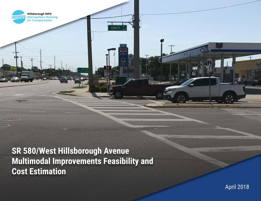
SR 580/West Hillsborough Avenue Multimodal Improvements Feasibility and Cost Estimation
|
|
|
- Ellen Sutton
- 6 years ago
- Views:
Transcription
1


2 SR 580/West Hillsborough Avenue Multimodal Improvements Feasibility and Cost Estimation April 2018 Completed For: In Coordination With: Hillsborough County Metropolitan Planning Organization 601 East West Hillsborough Avenue, 18 th Floor Tampa, FL Task Authorization: TOA 04 Florida Department of Transportation, District North Malcom McKinley Drive Tampa, FL Prepared By: Tindale Oliver 1000 North Ashley Drive, Suite 400 Tampa, FL Technical Memorandum April 2018
3 SR 580/WEST HILLSBOROUGH AVENUE MULTIMODAL IMPROVEMENTS FEASIBILITY AND COST ESTIMATION Table of Contents Table of Contents... i Appendices... ii List of Tables... ii List of Figures... ii Introduction... 1 Engineering Analysis... 2 Assessment of Existing Conditions and Deficiencies... 2 Typical Section... 2 Design and Posted Speed... 2 Pedestrian Ramps... 2 Sidewalks... 2 Traffic Control Devices... 3 Sight Distance... 4 Drainage... 4 Recommended Improvements... 4 Roadway... 4 All Study Locations... 4 Town & Country Boulevard Improvements... 4 Hanley Road Improvements... 5 Anderson Road/Air Cargo Road Improvements... 5 Dale Mabry Interchange Area... 5 Signing and Pavement Markings... 5 Signalization... 6 Lighting... 6 Recommendations Discussion... 6 Town & Country Boulevard... 6 Hanley Road... 8 Anderson Road/Air Cargo Road... 8 Dale Mabry Interchange Area... 9 Preliminary Cost Estimate FDOT Scope Clarification Technical Memorandum i April 2018
4 Appendices SR 580/WEST HILLSBOROUGH AVENUE MULTIMODAL IMPROVEMENTS FEASIBILITY AND COST ESTIMATION Appendix A: Concept Plans Appendix B: Cost Estimate Worksheets Appendix C: FDOT Scope Clarification Meeting Minutes (2/12/2018) List of Tables Table 1: Recommended Improvement Cost Estimates... 9 List of Figures Figure 1: SR 580/West Hillsborough Avenue Study Area... 1 Technical Memorandum ii April 2018
5 SR 580/WEST HILLSBOROUGH AVENUE MULTIMODAL IMPROVEMENTS FEASIBILITY AND COST ESTIMATION GPC Task # TOA-06 Prepared for: Hillsborough MPO 601 E Kennedy Boulevard, FL 18 Tampa FL, MPO Project Manager: Tony LaColla, AICP Prepared by: Tindale Oliver 1000 N Ashley Drive, Suite 400 Tampa, FL Engineer s Certification I, Allan B. Sequeira, certified that I currently hold an active Professional Engineer s License in the State of Florida and I am competent through education and experience to provide engineering services in the civil and traffic engineering disciplines contained in this report, I further certify that this report was prepared by me or under my responsible charge as defined in Chapter 61G F.A.C. and that all statements, conclusions, and recommendations made herein are true and correct to the best of my knowledge and ability. Allan B. Sequeira, P.E. State of Florida Board of Professional Engineers Professional Engineer License No Technical Memorandum April 2018
6
7 SR 580/WEST HILLSBOROUGH AVENUE MULTIMODAL IMPROVEMENTS FEASIBILITY AND COST ESTIMATION Introduction The SR 580/600 West Hillsborough Avenue Multimodal Safety Review was conducted by the Hillsborough Metropolitan Planning Organization (MPO) in coordination with FDOT District 7 to augment the recently-completed Hillsborough Avenue Access Management Study. This review effort was intended to identify opportunities to implement design and operation best practices to improve pedestrian and bicycle safety and comfort along Hillsborough Avenue from west of Memorial Highway (MP 4.849) to east of Himes Avenue (MP 9.701) for a total length of 4.85 miles. The study relies on the 2014 FDOT Bicycle/Pedestrian Access to Transit Audit of W. Hillsborough Avenue in the vicinity of Hanley Road, 2011 Hillsborough MPO Walk-Bike Plan (Phase II) and other FDOT on-call safety reviews to identify potential areas of improvement. Improvement concepts are consistent with both the Federal Highway Administration s (FHWA) Pedestrian Safety Design Best Practices and FDOT s emerging guidance on implementing Complete Streets. Accordingly, the main focus for the study was the following four locations previously identified for potential multimodal safety improvements: Town N Country Boulevard Hanley Road Anderson Road Dale Mabry Highway Interchange Area Himes Avenue Figure 1 shows the study corridor extent and the four focus locations. The proposed improvements have been coordinated with FDOT District 7 for incorporation in a goes-with project to complement a programmed access management/safety project (FM# ) from Memorial Highway to Himes Avenue. Figure 1: SR 580/West Hillsborough Avenue Study Area Technical Memorandum 1 April 2018
8 SR 580/WEST HILLSBOROUGH AVENUE MULTIMODAL IMPROVEMENTS FEASIBILITY AND COST ESTIMATION Engineering Analysis Existing conditions were evaluated based on office and field reviews. Field reviews were conducted in July Assessment of Existing Conditions and Deficiencies This Technical Memorandum analyzes the existing conditions with the design criteria from the current edition of FDOT s Plans Preparation Manual (PPM) (January 2017), Chapter 2 and Chapter 25, as well as FDOT Design Standards (FY edition) to develop alternatives concept that would improve the mobility and safety of pedestrian and bicyclists along the corridor. Existing components reviewed include roadway, signing & pavement markings, and signalization. The proposed improvements will be required to comply with the design criteria in the latest FDOT Design Manual (FDM), effective January 2018; therefore, this document also considers the design criteria from the January 2018 FDM. Other documents used for multimodal review included in this document include the following: American Association of State Highway and Transportation Officials (AASHTO), A Policy on Geometric Design of Highways and Streets, 6 th Ed. (2011) AASHTO, Roadside Design Guide (2011) Americans with Disabilities Act Accessibility Guidelines (ADAAG) Typical Section Existing Roadway Typical Section consists of a 6-lane divided roadway with curb & gutter and sidewalk on both sides. The travel lane widths are ft for the inside and middle lanes and from ft for the outside lane. Design and Posted Speed The design speed is 45 mph in the urban typical sections and 50 mph in the suburban section between SR 589 and Dale Mabry Highway. The posted speed is 45 mph throughout the project limits Pedestrian Ramps Existing pedestrian curb ramps are present at all intersections and pedestrian crossings within the project limits. Curb ramps Most existing pedestrian curb ramps within the project limits do not meet current FDOT requirements. Existing deficiencies include ramp slope, landing width or depth, cross slope, or flare slope. Detectable Warning Surface Several pedestrian ramps within the project limits are missing detectable warning surfaces. Two specific locations are at the intersection of Town N Country Boulevard and Hanley Road. Sidewalks Existing concrete sidewalks are located throughout the project limits on both sides of the subject corridor. The existing sidewalk varies in width from 5 6 ft. Technical Memorandum 2 April 2018
9 SR 580/WEST HILLSBOROUGH AVENUE MULTIMODAL IMPROVEMENTS FEASIBILITY AND COST ESTIMATION Traffic Control Devices Signing Existing signs include ground-mounted single-post signs along the roadside and median. Single-post advance street name signs are located at several locations within the limits. The Design Criteria and Guidelines that must be followed included: FDOT Design Standards Manual on Uniform Traffic Control Devices (MUTCD) ADAAG A sign inventory is not included in the scope of this Technical Memorandum. Based on field observations, many existing groundmounted signs are in fair condition, and some are in poor condition or are sub-standard with current criteria, including reflectivity, legend size, lateral offset, or vertical clearance above the sidewalk. The Designer is responsible for conducting an inventory and review of all existing signage with FDOT Design Standards, FDOT Traffic Engineering Manual (TEM), and MUTCD. Pavement Markings Based on field observations, the existing pavement markings are generally in fair condition, with faded striping and raised reflective pavement markers missing or with low reflectivity. The proposed improvements include replacing crosswalk markings in conjunction with resurfacing and upgrading crosswalk markings with specialemphasis markings at the subject signalized intersection (Town N Country Boulevard, Hanley Road, Anderson Road). Traffic Signals There are 15 signalized intersections within the project limits: Webb Road Town N Country Boulevard* Kelly Road Hanley Road* Emergency signal (MP 6.123) Sawyer Road George Road Eisenhower Boulevard Benjamin Road Hoover Boulevard Anderson Road* N Hesperides Street N Lois Avenue Dale Mabry Highway Himes Avenue *Selected for pedestrian and bicycle improvements based on prior studies and potential for geometric improvements. Pedestrian Signalization as Study Locations Town N Country Boulevard, Hanley Road, and Anderson Road include existing pedestrian signals (count-down type) and pedestrian detectors (push-buttons) for the major street movement. Due to the proposed curb return modifications, the pedestrian signal poles at several locations will have to be replaced (see proposed concept plans in Appendix A). Technical Memorandum 3 April 2018
10 SR 580/WEST HILLSBOROUGH AVENUE MULTIMODAL IMPROVEMENTS FEASIBILITY AND COST ESTIMATION Sight Distance Based on office and field reviews, a sight triangle obstruction was identified at the CVS egress driveway located just east of the intersection of Hanley Road. Sight triangle obstructions were determined by FDOT and AASHTO criteria for intersections with stop-controlled movements. The sight triangle obstruction is a traffic railing for the Sweetwater Creek canal. The District Traffic Operations Office should be contacted to determine if there is a significant crash history related to the existing sight triangle obstructions at this location. Drainage The existing drainage system consists of a closed drainage system with curb inlets and pipes. The Design Criteria and Guidelines that must be followed included: FDOT PPM, Volume 1, Section FDM, Part 2, Section FDOT Drainage Manual This Technical Memorandum does not include an evaluation of the hydraulic, safety and physical adequacies of the existing drainage system. However, several drainage inlets will need to be removed and relocated due to the proposed curb radii modification, pedestrian ramps, and lane width reduction at the Dale Mabry Interchange to accommodate the proposed shared-use path. The Designer must evaluate the hydraulic, safety, and physical adequacies of the existing drainage system. Recommended Improvements To address the project purpose and identified deficiencies, the following improvements were analyzed and are summarized. Roadway All Study Locations Mill and resurface existing pavement necessary to upgrade pavement markings. Reconstruct sub-standard pedestrian ramps. Town N Country Boulevard Improvements Option 1 Reduce NE corner radius and provide highemphasis crosswalks while maintaining existing pedestrian configuration. This option will impact one drainage structure. Option 2 Construct a raised refuge pedestrian island and maintain existing curb returns and pedestrian configuration. Repurpose the NB approach lane configuration by changing the outside through lane to an exclusive right-turn lane. This will not impact the drainage structure identified in Option 1, but will require milling and resurfacing of the northbound approach to change lane designation. Option 3 Add a pedestrian crosswalk on the east leg of the intersection and provide one pedestrian ramp per highemphasis crosswalk. Modify the NE corner radius to reduce turning speeds and pedestrian crossing distance. This option will impact four drainage structures. Technical Memorandum 4 April 2018
11 SR 580/WEST HILLSBOROUGH AVENUE MULTIMODAL IMPROVEMENTS FEASIBILITY AND COST ESTIMATION Option 4 Add pedestrian crosswalk on the east leg of the intersection and provide one pedestrian ramp per highemphasis crosswalk. Construct a raised refuge pedestrian island and maintain existing curb returns. Repurpose the NB approach to modify the outside through lane to an exclusive right-turn lane. This will impact three drainage structures and require milling resurfacing of the northbound approach to change the lane designation. Option 3 is the recommended option at this location because it provides the best overall accommodation for pedestrians given that right-of-way is not available to construct a right turn island (Options 2 and 4) in keeping with best geometric design practices for pedestrains.. Hanley Road Improvements Option 1 Reduce NE corner radius and reconstruct crosswalk ramps. Option 2 Eliminate WB-to-NB right-turn lane and reduce NE corner radius. Option 1 is the recommended option at this location. Whereas Option 2 would further compact the intersection and resolve the sight triangle issue at the CVS driveway to the immediate east, high WB right-turning traffic volume is a contra-indication for removing the WB to NB right-turn lane at this location. Anderson Road/Air Cargo Road Improvements Reduce NE and NW radius at Anderson Road/Air Cargo Road. Repurpose the NB approach to provide two southbound through lanes. Alternative options were not considered/are not viable at this location. This design concept will improve conditions for pedestrians and is supported by turning movement counts at this location and is consistent with recent improvements to Air Cargo Road at the south leg of the intersection. Dale Mabry Interchange Area A shared-use pathway was evaluated for cyclists to navigate throughout the Dale Mabry interchange; however, due to the high construction cost and impacts to the existing features, intermediate improvements are proposed at the NB off-ramp signalized intersection only. These include realignment of the crosswalk between the island and northbound right turn lane, widening of the sidewalk from through the island to allow for cyclists to share the space with pedestrians in order to avoid the weave area to the east of the interchange, and improvements to the sidewalk immediately east of the interchange to address ponding issues and sediment build-up on the sidewalk. Signing and Pavement Markings Update all sub-standard ground-mounted signs to comply with the latest editions of FDM, FDOT TEM, and MUTCD. Replace and upgrade all pavement markings to meet the latest FDM, including high-emphasis crosswalks at all subject signalized intersections. Technical Memorandum 5 April 2018
12 SR 580/WEST HILLSBOROUGH AVENUE MULTIMODAL IMPROVEMENTS FEASIBILITY AND COST ESTIMATION Signalization Install pole-mounted countdown pedestrian signals with ADA-compliant detector. Replace loop assemblies impacted by milling and resurfacing. Lighting Lighting analysis should be conducted at the subject signalized intersections to measure existing vertical illuminance for pedestrian visibility. Recommendations Discussion The following sections detail the proposed improvements at each location. Auto-turn was used to analyze the vehicle swept path, and the design vehicle used for these modification was a WB-60. Concept Roadway, Sign & Pavement Marking, and Signalization Plans for each location and each option are included as Appendix A. Town N Country Boulevard At Town N Country Boulevard, improvement recommendations focus on reducing the turn radii and shortening the crossing distance by modifying the geometry at the NW corner and providing a crosswalk across the east leg of the intersection. Option 1 The proposed pedestrian improvements includes reducing the NE curb radii to encourage motorists to make the right turn at a lower speed. By reducing the curb return radius, the pedestrian crossing distance is also reduced and pedestrians are exposed for a shorter length of time. As a result of the curb radii modification, a drainage structure will need to be removed and a new drainage structure installed at the new edge of the pavement. The design vehicle path was allowed to use the inside receiving lane to make a right-turn maneuvers. Additional improvements included reconstructing all pedestrian ramps to meet current FDOT Standard Index 304 with Detectable Warning surfaces, installing special-emphasis crosswalk markings, pedestrian countdown signals, and ADA pedestrian detectors. Technical Memorandum 6 April 2018
13 SR 580/WEST HILLSBOROUGH AVENUE MULTIMODAL IMPROVEMENTS FEASIBILITY AND COST ESTIMATION Option 2 The intent of this option is to minimize impacts to the existing intersection configuration while improving pedestrian safety. The proposed improvements consist of constructing a pork chop raised island between the WB right-turn lane and the through-travel lane. The objective of this island is to channelize right-turn movements in a manner that keeps turning speeds low, allows for improve sightlines for pedestrians and drivers of turning vehicles, and minimizes pedestrian crossing distances. The raised island will be constructed in conjunction with the outside SB through lane change from a through lane to an exclusive right-turn lane. During the field review, it was observed that vehicles traveling in the inside SB through lane will cross the intersection and weave to the outside lane due to the existing alignment and skew angle. It was also noted that Town & Country Boulevard is a two-way roadway with one lane in each direction upstream and downstream of the intersection; therefore, capacity should not be significantly impacted. It is also recommended that traffic turning movements and level of service (LOS) analysis be performed prior to implementing this alternative. The change in the proposed lane configuration will allow for a larger pork chop island, which would balance the need for larger turning radii with pedestrian safety and mobility goals. Additional improvements include reconstructing all pedestrian ramps to meet current FDOT Standard Index 304 with Detectable Warning surfaces and installing special-emphasis crosswalk markings, pedestrian countdown signals, and ADA pedestrian detectors. Option 3 This alternative includes all recommendations from Option 1 (reducing NE corner right turn radii) as well as adding a pedestrian crosswalk on the east leg of the intersection and providing one pedestrian ramp per high-emphasis crosswalk, which is a best practice. Installing two pedestrian ramps per corner will ensure that each ramp points directly into the crosswalk and the curb ramp on the other side of the street. Directional curb ramps also help visionimpaired pedestrians by pointing them in the correct direction while crossing. The proposed crosswalk alignment will require the traffic separator to be moved away from the intersection, requiring roadway widening on the EB and WB approaches to allow for adequate space between the pedestrian ramps and provide for straight crosswalk alignment. Four drainage structures also will be impacted and will need to be relocated. Option 4 This alternative includes all recommendations from Option 2 (providing a right turn island at the NE corner and the requisite redesignation of the northbound outside lane to a right-turn only lane) as well as adding a pedestrian crosswalk on the east leg of the intersection and providing one pedestrian ramp per high-emphasis crosswalk, which is a best practice, as stated in the previous option. Widening will be require on the EB and WB approaches, and four drainage structures also will be impacted. The preferred option for Town N Country Boulevard is Option 3. This option enhances pedestrian access and safety by reducing the NE curb radii to encourage motorists to make the right-turn at a lower speed and shorten the pedestrian crossing distance. This Technical Memorandum 7 April 2018
14 SR 580/WEST HILLSBOROUGH AVENUE MULTIMODAL IMPROVEMENTS FEASIBILITY AND COST ESTIMATION option also provides the ideal intersection pedestrian crossing layout by providing two pedestrian ramps per corner. Hanley Road Improvements at Hanley Road include reducing the radii on the NE corner of the intersection and realigning the crosswalks. Option 1 The proposed pedestrian improvements include reducing the NE curb radii to encourage motorists to make the right turn at a lower speed. By reducing the curb return radius, the pedestrian crossing distance is also reduced and pedestrians are exposed for a shorter length of time. As a result of the curb radii modification, a drainage structure will need to be removed and a new drainage structure installed at the new edge of the pavement. The design vehicle path was allowed to use the inside receiving lane to make the right-turn maneuver. Additional improvements include reconstructing all pedestrian ramps to meet current FDOT Standard Index 304 with Detectable Warning surfaces and installing special-emphasis crosswalk markings, pedestrian countdown signals, and ADA pedestrian detectors. Option 2 This option also includes reducing the NE curb radii and eliminating the WB-to-NB right-turn lane. The proposed lane elimination will reduce the sight distance obstruction at the CVS egress driveway located just east of the intersection of Hanley Road. The sight triangle obstruction is a traffic railing for the Sweetwater Creek canal bridge Number (100335). This recommendation will need to be coordinated with the District Traffic Operations Office to determine if there is a significant crash history related to the existing sight triangle obstructions at this location. It is also recommended that a traffic operation analysis be conducted to determine the LOS impacts related to the removal of this lane. The curb radii reduction noted previously will encourage lower speeds and shorter pedestrian distances. Additional improvements include reconstructing all pedestrian ramps to meet current FDOT Standard Index 304 with Detectable Warning surfaces and installing special-emphasis crosswalk markings, pedestrian countdown signals, and ADA pedestrian detectors. The preferred option for Hanley Road is Option 1. This option enhances pedestrian access and safety by reducing the NE curb radii to encourage motorists to make the right turn at a lower speed and shortens the pedestrian crossing distance. Additionally, Option 1 can be implemented without additional engineering study or analysis, as required in Option 2. Anderson Road/Air Cargo Road The proposed pedestrian improvements include reducing NE and NW curb radii to provide the same pedestrian benefits noted in the previous alternatives. In addition, the NB approach lane configuration will be improved by adding an additional through lane and improving the storage length for the inside SB-to-EB left-turn lane. These improvements will be implemented by eliminating the striped island. Technical Memorandum 8 April 2018

15 SR 580/WEST HILLSBOROUGH AVENUE MULTIMODAL IMPROVEMENTS FEASIBILITY AND COST ESTIMATION Dale Mabry Interchange Area A shared-use pathway was evaluated for cyclists to navigate throughout the Dale Mabry interchange, which is a partial cloverleaf with three right-turn-only lanes and a continuous auxiliary acceleration lane and numerous weaving and merging movements between through bicyclists and vehicles. The proposed shared-use path will provide bicyclists with an alternative route in addition to the existing bike lanes that would remove the weaving and merging conflicts, with the exception of the on/off ramp crossings. The proposed improvements include widening the sidewalk to 10 ft throughout the interchange to allow for bicyclists and pedestrians to share this facility. Several existing features will be impacted by the proposed sidewalk widening and will require additional engineering analysis. For instance, the swale areas will be reduced, and two drainage structures (mitered end section) may be impacted on the NE quadrant. All pedestrian ramps should be modified to accommodate bicyclists, and the ramps should match the 10-ft shared path width. Additionally, underneath the interchange overpass, the bridge embankment in the WB direction restricts sidewalk widening, which will require cutting back the embankment or reducing the lane width. For the purpose of this technical memorandum the lane width reduction from (12 ft to 11 ft) was used between the SB and NB off-ramps. The lane reduction will impact the existing edge of pavement, drainage structures, and guardrail. The preliminary engineering cost estimate for the shared-use path was $1,005,234. Due to the numerous impacts to the existing features and the high estimated construction cost for these improvements, an interim solution was analyzed for the continuous auxiliary acceleration lane, which is the area with the most conflict. The proposed interim improvements include widening the sidewalk to 10 ft from just east of the signalized northbound off-ramp intersection to approximately 300 ft east of the intersection. Other proposed improvements shown in Figure 2, include constructing a bicycle ramp 1 just east of the eastbound to northbound on ramp to allow bicyclists to transition onto the sidewalk. The channelized right-turn pork chop island on the SE quadrant should also be reconstructed to provide for the new 10-ftwide shared use path ramps 2. During the field review, the sidewalk adjacent to the right-turn NB off-ramp 3 was observed to be flooded. It is recommend that the swale/sidewalk be re-graded or consider adding a drainage structure to mitigate this deficiency. Additional improvements include green pavement markings, proposed warning signs, and high-emphasis crosswalks. Figure 2: Location of Improvements for Northbound Off-Ramp Area Technical Memorandum 9 April 2018
16 SR 580/WEST HILLSBOROUGH AVENUE MULTIMODAL IMPROVEMENTS FEASIBILITY AND COST ESTIMATION Preliminary Cost Estimate A preliminary construction cost estimate was developed based on estimated quantities for the recommended improvements listed in this Technical Memorandum. The unit prices are from the current FDOT Pay Item Average Unit Cost, 12-Month Moving Average from Area 8 (Hillsborough County) for the period 10/2016 to 9/2017. The cost estimate includes 10% for Maintenance of Traffic, 10% for mobilization, 20% for design fee, and 2% construction/cei. The table summarizes the cost of improvements to be consider for inclusion under the upcoming access management/safety project (FM# ). The preliminary construction cost estimate is based on estimated quantities for the recommended improvements and unit prices from the current FDOT Pay Item Average Unit Cost, 12-Month Moving Average from Area 8 (Hillsborough County) for the period 10/2016 to 9/2017. The cost estimate includes, 20% design fee, 2% constructability, 10% MOT, and 10% Mobilization. Cost estimate worksheets are included as Appendix B. Table 1: Recommended Improvement Cost Estimates Location of Improvement Description Preliminary Construction Cost Estimate Option 1 $ 167,229 Town & County Boulevard Option 2 $166,641 Option 3 $206,425 Option 4 $339,151 Hanley Road Option 1 $ 161,455 Option 2 $210,213 Anderson Road/Air Cargo Road $115,803 Dale Mabry Interchange From N Church Ave to Himes Ave $1,005,234 Dale Mabry Interchange Interim Improvements From NB off-ramp to approx. 300 E $201,640 Technical Memorandum 10 April 2018
17 SR 580/WEST HILLSBOROUGH AVENUE MULTIMODAL IMPROVEMENTS FEASIBILITY AND COST ESTIMATION FDOT Scope Clarification On Thursday February 8, 2018 FDOT performed a scope clarification field review and debriefed from this review on Monday February 12, Outcomes of the Scope Clarification process related to the project recommendations are as follows: A copy of the Scope Clarification Meeting Minutes is provided as Appendix C. FDOT will verify the curb radius recommendations citing concern at Anderson Road which is a high-freight area. FDOT will consider options to incorporate a pedestrian crosswalk at the east leg of W. Hillsborough Avenue and Hanley Road as part of an innovative U-turn lane treatment being considered at this location. At the intersection of Town N Country Boulevard and W. Hillsborough Avenue, FDOT will consider coordinating with Hillsborough County to designate the northbound outside shared thru/right lane as a right turn only lane and this may allow for additional reduction in the turn radii on the northeast corner of this intersection. FDOT will extend the project limit to Himes Avenue and is considering ramp improvements at Himes Avenue to transition eastbound bike traffic from the sidewalk back to the bike lane on Hillsborough Avenue to the east of Himes Avenue and constructing a fence or railing at the back of sidewalk between Dale Mabry Highway and Himes Avenue to discourage pedestrian mid-block crossing between the Al Lopez Park property and the retail uses along the north side of W. Hillsborough Avenue. FDOT may elect not to realign the crosswalk across W. Hillsborough Ave at northbound Dale Mabry highway citing concerns related to turn lane length and other issues. This will not have major impacts on the project intent, however. Technical Memorandum 11 April 2018
18 APPENDIX A: Concept Roadway, Sign & Pavement Marking, and Signalization Plans
19 CONTRACT PLANS COMPONENTS STATE OF FLORIDA DEPARTMENT OF TRANSPORTATION CHIPLEY CONTRACT PLANS PENSACOLA FORT WALTON BEACH PANAMA CITY TALLAHASSEE 10 LAKE CITY 295 JACKSONVILLE ST AUGUSTINE GAINESVILLE OCALA DAYTONA BEACH INDEX OF ROADWAY PLANS FINANCIAL PROJECT ID DELAND 4 SHEET NO. SHEET KEY SHEET ROADWAY PLANS HILLSBOROUGH COUNTY (10150) NEW PORT RICHEY TAMPA ST PETERSBURG 75 4 ORLANDO LAKELAND BARTOW BEACH LINE EXPRESSWAY FLORIDA'S TURNPIKE MELBOURNE - COCOA SIGNING AND PAVEMENT MARKING PLANS SIGNALIZATION PLANS GOVERNING DESIGN STANDARDS: Florida Department of Transportation, FY Design Standards ebook (DSeB) and applicable Design Standards Revisions (DSRs) at the following website: GOVERNING STANDARD SPECIFICATIONS: Florida Department of Transportation, JANUARY 2017 Standard Specifications STATE ROAD NO. 580 LOCATION OF PROJECT 75 FT PIERCE SARASOTA - BRADENTON 95 WEST PALM BEACH FT MYERS 75 NAPLES 75 FT LAUDERDALE MIAMI KEY WEST ROADWAY PLANS ENGINEER OF RECORD: ALLAN B. SEQUEIRA, P.E. P.E. NO.: TINDALE OLIVER, INC N. ASHLEY DRIVE, SUITE 400 TAMPA, FLORIDA CONTRACT NO.: C-9T09 VENDOR NO.: CERTIFICATE OF AUTHORIZATION NO.: 5249 FDOT PROJECT MANAGER: THE OFFICIAL RECORD OF THIS SHEET IS THE ELECTRONIC FILE DIGITALLY SIGNED AND SEALED UNDER RULE 61G , F.A.C. for Road and Bridge Construction at the following website: CONSTRUCTION FISCAL SHEET CONTRACT NO. YEAR NO. 1 $USER$ $$ $TIME$ $FILE$

 LEGEND")


 ALLAN")

20 TO W N N COUNTRY BO ULEVARD 0 10 N 50 Feet END OF TYPE "F" CURB & GUTTER SR-580 (HILLSBOROUGH AVENUE) LEGEND DENOTES MILLING DENOTES SIDEWALK DENOTES SOD DENOTES WIDENING REVISIONS END OF TYPE "F" CURB & GUTTER END SIDEWALK CONSTRUCTION BEGIN OF TYPE "F" CURB & GUTTER BEGIN OF SIDEWALK CONSTRUCTION OF RESURFACING R 51' R 65' END OF SIDEWALK CONSTRUCTION EXIST. DRAINAGE STUCTURE (TO BE RELOCATED) BEGIN SIDEWALK CONSTRUCTION BEGIN TYPE "F" CURB & GUTTER CR-C CR-H PROPOSED WIDENING CR-A CR-F TINDALE OLIVER, INC. STATE OF FLORIDA 1000 N. ASHLEY DRIVE, SUITE 400 DEPARTMENT OF TRANSPORTATION TAMPA, FLORIDA ROADWAY PLAN ROAD NO. COUNTY FINANCIAL PROJECT ID FBPE CERT. OF AUTH. NO.: 5249 HILLSBOROUGH AVE AT TOWN N COUNTRY BLVD (1) ALLAN SEQUEIRA, P.E., HILLSBOROUGH SHEET NO. 2 THE OFFICIAL RECORD OF THIS SHEET IS THE ELECTRONIC FILE DIGITALLY SIGNED AND SEALED UNDER RULE 61G , F.A.C. $USER$ $$ $TIME$ $FILE$


 580")


21 TO W N N COUNTRY BO ULEVARD 0 10 N 50 Feet END TYPE "F" CURB & GUTTER END SIDEWALK CONSTRUCTION LEGEND DENOTES MILLING DENOTES SIDEWALK DENOTES SOD DENOTES WIDENING SR-580 (HILLSBOROUGH AVENUE) CR-F REVISIONS TINDALE OLIVER, INC. END TYPE "F" CURB & GUTTER END SIDEWALK CONSTRUCTION BEGIN TYPE "F" CURB & GUTTER BEGIN SIDEWALK CONSTRUCTION CR-H 1000 N. ASHLEY DRIVE, SUITE 400 TAMPA, FLORIDA FBPE CERT. OF AUTH. NO.: 5249 ALLAN SEQUEIRA, P.E., BEGIN SIDEWALK CONSTRUCTION BEGIN TYPE "F" CURB & GUTTER CR-C CR-A STATE OF FLORIDA DEPARTMENT OF TRANSPORTATION ROADWAY PLAN ROAD NO. COUNTY FINANCIAL PROJECT ID HILLSBOROUGH AVE AT TOWN N COUNTRY BLVD (2) 580 HILLSBOROUGH SHEET NO. 3 THE OFFICIAL RECORD OF THIS SHEET IS THE ELECTRONIC FILE DIGITALLY SIGNED AND SEALED UNDER RULE 61G , F.A.C. $USER$ $$ $TIME$ $FILE$
22 TO W N N COUNTRY BO ULEVARD 0 10 N 50 Feet BEGIN TYPE "F" CURB & GUTTER BEGIN SIDEWALK CONSTRUCTION LEGEND DENOTES MILLING DENOTES SIDEWALK DENOTES SOD DENOTES WIDENING (HILLSBOROUGH AVENUE) BEGIN TYPE "F" CURB & GUTTER CR-A CR-A BEGIN SIDEWALK CONSTRUCTION EXIST. DRAINAGE STUCTURE (TO BE RELOCATED) END TYPE "F" CURB & GUTTER END SIDEWALK CONSTRUCTION REVISIONS TINDALE OLIVER, INC. SR-580 END TYPE "F" CURB & GUTTER END SIDEWALK CONSTRUCTION EXIST. DRAINAGE STUCTURE (TO BE RELOCATED) BEGIN TYPE "F" CURB & GUTTER BEGIN SIDEWALK CONSTRUCTION OF RESURFACING R 51' CR-C PROPOSED WIDENING CR-A R 55' EXIST. DRAINAGE STUCTURE (TO BE RELOCATED) END SIDEWALK CONSTRUCTION CR-A CR-C END TYPE "F" CURB & GUTTER 1000 N. ASHLEY DRIVE, SUITE 400 TAMPA, FLORIDA FBPE CERT. OF AUTH. NO.: 5249 R 65' CR-A PROPOSED WIDENING CR-A R 50' END TYPE "F" CURB & GUTTER END SIDEWALK CONSTRUCTION EXIST. FIRE HYDRANT (TO BE RELOCATED) EXIST. DRAINAGE STUCTURE (TO BE RELOCATED) BEGIN TYPE "F" CURB & GUTTER BEGIN SIDEWALK CONSTRUCTION STATE OF FLORIDA DEPARTMENT OF TRANSPORTATION ROADWAY PLAN ROAD NO. COUNTY FINANCIAL PROJECT ID HILLSBOROUGH AVE AT TOWN N COUNTRY BLVD (3) 580 HILLSBOROUGH ALLAN SEQUEIRA, P.E., SHEET NO. 4 THE OFFICIAL RECORD OF THIS SHEET IS THE ELECTRONIC FILE DIGITALLY SIGNED AND SEALED UNDER RULE 61G , F.A.C. $USER$ $$ $TIME$ $FILE$
23 TO W N N COUNTRY BO ULEVARD 0 10 N 50 Feet BEGIN TYPE "F" CURB & GUTTER BEGIN SIDEWALK CONSTRUCTION SR-580 (HILLSBOROUGH AVENUE) LEGEND DENOTES MILLING DENOTES SIDEWALK DENOTES SOD DENOTES WIDENING REVISIONS END TYPE "F" CURB & GUTTER END SIDEWALK CONSTRUCTION EXIST. DRAINAGE STUCTURE (TO BE RELOCATED) EXIST. DRAINAGE STUCTURE BEGIN TYPE "F" CURB & GUTTER (TO BE RELOCATED) BEGIN SIDEWALK CONSTRUCTION CR-C END SIDEWALK CONSTRUCTION CR-C END TYPE "F" CURB & GUTTER CR-C OF RESURFACING PROPOSED PROPOSED WIDENING WIDENING CR-A CR-A BEGIN TYPE "F" CURB & GUTTER CR-A CR-A BEGIN SIDEWALK CONSTRUCTION END TYPE "F" CURB & GUTTER END SIDEWALK CONSTRUCTION EXIST. FIRE HYDRANT (TO BE RELOCATED) EXIST. DRAINAGE STUCTURE (TO BE RELOCATED) EXIST. DRAINAGE STUCTURE (TO BE RELOCATED) BEGIN TYPE "F" CURB & GUTTER END TYPE "F" CURB & GUTTER BEGIN SIDEWALK CONSTRUCTION END SIDEWALK CONSTRUCTION TINDALE OLIVER, INC. STATE OF FLORIDA 1000 N. ASHLEY DRIVE, SUITE 400 DEPARTMENT OF TRANSPORTATION TAMPA, FLORIDA ROADWAY PLAN ROAD NO. COUNTY FINANCIAL PROJECT ID FBPE CERT. OF AUTH. NO.: 5249 HILLSBOROUGH AVE AT TOWN N COUNTRY BLVD (4) R 51' R 55' R 50' R 94' 580 HILLSBOROUGH ALLAN SEQUEIRA, P.E., SHEET NO. 5 THE OFFICIAL RECORD OF THIS SHEET IS THE ELECTRONIC FILE DIGITALLY SIGNED AND SEALED UNDER RULE 61G , F.A.C. $USER$ $$ $TIME$ $FILE$
")


 580 HILLSBOROUGH")


24 HANLEY RO AD 0 10 N 50 Feet SR-580 (HILLSBOROUGH AVENUE) LEGEND DENOTES MILLING DENOTES SIDEWALK DENOTES SOD END TYPE "F" CURB AND GUTTER END SIDEWALK CONSTRUCTION BEING SIDEWALK CONSTRUCTION BEGIN TYPE "F" CURB & GUTTER CR- A CR- H BEGIN TYPE "F" CURB AND GUTTER END SIDEWALK CONSTRUCTION REVISIONS TINDALE OLIVER, INC. R 30' CR- K END TYPE "F" CURB & GUTTER END SIDEWALK CONSTRUCTION 1000 N. ASHLEY DRIVE, SUITE 400 TAMPA, FLORIDA FBPE CERT. OF AUTH. NO.: 5249 R 40' END TYPE "F" CURB AND GUTTER END SIDEWALK CONSTRUCTION EXIST. DRAINAGE STUCTURE (TO BE RELOCATED) BEGIN TYPE "F" CURB & GUTTER BEGIN SIDEWALK CONSTRUCTION CR- C STATE OF FLORIDA DEPARTMENT OF TRANSPORTATION ROADWAY PLAN ROAD NO. COUNTY FINANCIAL PROJECT ID HILLSBOROUGH AVE AT HANLEY RD (1) 580 HILLSBOROUGH ALLAN SEQUEIRA, P.E., SHEET NO. 6 THE OFFICIAL RECORD OF THIS SHEET IS THE ELECTRONIC FILE DIGITALLY SIGNED AND SEALED UNDER RULE 61G , F.A.C. $USER$ $$ $TIME$ $FILE$


")


 STATE OF FLORIDA DEPARTMENT")


25 HANLEY RO AD 0 10 N Feet 50 END OF TYPE "F" CURB & GUTTER END OF SIDEWALK CONSTRUCTION END OF TYPE "F" CURB & GUTTER END OF SIDEWALK CONSTRUCTION TYPE "F" CURB & GUTTER EXIST. DRAINAGE STUCTURE (TO BE RELOCATED) BEGIN OF TYPE "F" CURB & GUTTER BEGIN OF SIDEWALK CONSTRUCTION CR- K CR- A CR- A END OF TYPE "F" CURB & GUTTER CR- H BEGIN OF TYPE "F" CURB & GUTTER BEGIN OF SIDEWALK CONSTRUCTION END OF SIDEWALK CONSTRUCTION LEGEND DENOTES MILLING DENOTES SIDEWALK DENOTES SOD REVISIONS TINDALE OLIVER, INC. R 30' R 40' 1000 N. ASHLEY DRIVE, SUITE 400 TAMPA, FLORIDA FBPE CERT. OF AUTH. NO.: 5249 R40' SR-580 R40' (HILLSBOROUGH AVENUE) STATE OF FLORIDA DEPARTMENT OF TRANSPORTATION ROADWAY PLAN ROAD NO. COUNTY FINANCIAL PROJECT ID HILLSBOROUGH AVE AT HANLEY RD (2) 580 HILLSBOROUGH ALLAN SEQUEIRA, P.E., CR-G R 25' R 3' R 3' R 25' RAISED CONCRETE SEPARATOR WITH TYPE "F" CURB & GUTTER BEGIN OF TYPE "F" CURB & GUTTER BEGIN OF SIDEWALK CONSTRUCTION CR-G SHEET NO. 7 THE OFFICIAL RECORD OF THIS SHEET IS THE ELECTRONIC FILE DIGITALLY SIGNED AND SEALED UNDER RULE 61G , F.A.C. $USER$ $$ $TIME$ $FILE$
")


26 N SR-580 (HILLSBOROUGH AVENUE) LEGEND DENOTES MILLING DENOTES SIDEWALK DENOTES SOD REVISIONS BEGIN SIDEWALK CONSTRUCTION BEGIN TYPE "F" CURB & GUTTER ANDERSO N RO AD Feet END TYPE "F" CURB & GUTTER END TYPE "F" CURB & GUTTER END SIDEWALK CONSTRUCTION CR-A CR-A R 40' END SIDEWALK CONSTRUCTION BEGIN SIDEWALK CONSTRUCTION BEGIN TYPE "F" CURB & GUTTER CR-A R 65' CR-A TINDALE OLIVER, INC. STATE OF FLORIDA 1000 N. ASHLEY DRIVE, SUITE 400 DEPARTMENT OF TRANSPORTATION TAMPA, FLORIDA ROADWAY PLAN ROAD NO. COUNTY FINANCIAL PROJECT ID FBPE CERT. OF AUTH. NO.: 5249 HILLSBOROUGH AVE AT ANDERSON RD ALLAN SEQUEIRA, P.E., HILLSBOROUGH SHEET NO. 8 THE OFFICIAL RECORD OF THIS SHEET IS THE ELECTRONIC FILE DIGITALLY SIGNED AND SEALED UNDER RULE 61G , F.A.C. $USER$ $$ $TIME$ $FILE$
27 N Feet OF RESURFACING LEGEND DENOTES MILLING DENOTES SIDEWALK DENOTES SOD SR-580 (HILLSBOROUGH AVENUE) TYPE "F" CURB & GUTTER REVISIONS 6' 10' DROP CURB 0.02 OF RESURFACING 4' MIN BIKE "RAMP" 6' OF RESURFACING BEGIN TYPE "F" CURB & GUTTER BEGIN GUARDRAIL OF RESURFACING BEGIN TYPE "F" CURB & GUTTER OF RESURFACING PROPOSED 10' WIDE SIDEWALK TYPE "E" CURB & GUTTER EXIST. MAST ARM () EXIST. LIGHT POLE () N DALE M ABRY HW Y TINDALE OLIVER, INC N. ASHLEY DRIVE, SUITE 400 TAMPA, FLORIDA CR-A MOD. NB OFF RAM P FBPE CERT. OF AUTH. NO.: 5249 CR-B MOD. CR-H MOD. CR-A MOD. CR-E MOD. END TYPE "F" CURB & GUTTER CR-A MOD. OF RESURFACING ROAD NO. END TYPE "F" CURB & GUTTER END GUARDRAIL STATE OF FLORIDA DEPARTMENT OF TRANSPORTATION COUNTY REGRADE SWALE AND/OR PROPOSED 10' WIDE SIDEWALK INSTALL DRAINAGE STRUCTURE FINANCIAL PROJECT ID ROADWAY PLAN HILLSBOROUGH AVE EAST OF DALE MABRY HIGHWAY SHEET NO. THE OFFICIAL RECORD OF THIS SHEET IS THE ELECTRONIC FILE DIGITALLY SIGNED AND SEALED UNDER RULE 61G , F.A.C. ALLAN SEQUEIRA, P.E., HILLSBOROUGH INTERIM IMPROVEMENTS 9 $USER$ $$ $TIME$ $FILE$
28 MUST TURN RIGHT RIGHT LANE THRU TRUCKS OVER TWO AXLES BIDIRECTIONAL YELLOW 6" DBL. YELLOW N Feet (10'X30' SKIP) 9.5' THRU SR-580 (HILLSBOROUGH AVENUE) REVISIONS W EST W AVE Hilsborough Town N Country BLVD (10'X30' 20 SPACING CENTER TO 20 SPACING CENTER TO CENTER 6" YELLOW 12' BIDIRECTIONAL YELLOW 10' (TYP) TINDALE OLIVER, INC N. ASHLEY DRIVE, SUITE 400 TAMPA, FLORIDA ' FBPE CERT. OF AUTH. NO.: 5249 ALLAN SEQUEIRA, P.E., ' 12" WHITE 13.5 TO W N N COUNTRY 12" WHITE 10.5' BO ULEVARD 9' 10.5' 9' 12" WHITE 8' 6" DBL. YELLOW ROAD NO. 580 TRUCKS OVER TWO AXLES STATE OF FLORIDA DEPARTMENT OF TRANSPORTATION COUNTY 20 SPACING CENTER TO CENTER SPACING CENTER TO CENTER 11.5' 6" YELLOW (10'X30' SKIP) Hilsborough BLVD Town N Country 5300 FINANCIAL PROJECT ID W 580 EAST SPEED LIMIT 45 SIGNING AND PAVEMENT MARKING PLAN HILLSBOROUGH AVE AT TOWN N COUNTRY BLVD (1) SHEET NO. 10 THE OFFICIAL RECORD OF THIS SHEET IS THE ELECTRONIC FILE DIGITALLY SIGNED AND SEALED UNDER RULE 61G , F.A.C. $USER$ $$ $TIME$ $FILE$
29 MUST TURN RIGHT RIGHT LANE THRU TRUCKS OVER TWO AXLES BIDIRECTIONAL YELLOW 6" DBL. YELLOW N Feet (10'X30' SKIP) 9.5' THRU SR-580 (HILLSBOROUGH AVENUE) REVISIONS W EST W AVE Hilsborough 20 SPACING CENTER TO 20 SPACING CENTER TO CENTER 5300 Town N Country BLVD (10'X30' SKIP) 6" YELLOW 12' BIDIRECTIONAL YELLOW TINDALE OLIVER, INC N. ASHLEY DRIVE, SUITE 400 TAMPA, FLORIDA ' FBPE CERT. OF AUTH. NO.: 5249 ALLAN SEQUEIRA, P.E., ' 12" WHITE 13.5 TO W N N COUNTRY 12" WHITE 10.5' BO ULEVARD 9' 12" WHITE 10.5' 8' 14 ROAD NO. 580 TRUCKS 6" DBL. YELLOW OVER TWO AXLES 8" WHITE 18" WHITE STATE OF FLORIDA DEPARTMENT OF TRANSPORTATION 20 SPACING CENTER TO CENTER 11.5' 20 SPACING CENTER TO CENTER 6" YELLOW (10'X30' SKIP) 7700 AVE Hilsborough BLVD Town N Country 5300 FINANCIAL PROJECT ID W 580 TO BE RELOCATED EAST SPEED LIMIT 45 SIGNING AND PAVEMENT MARKING PLAN HILLSBOROUGH AVE AT TOWN N COUNTRY BLVD (2) SHEET NO. 11 THE OFFICIAL RECORD OF THIS SHEET IS THE ELECTRONIC FILE DIGITALLY SIGNED AND SEALED UNDER RULE 61G , F.A.C. $USER$ $$ $TIME$ $FILE$
30 MUST TURN RIGHT RIGHT LANE THRU TRUCKS OVER TWO AXLES BIDIRECTIONAL YELLOW 6" DBL. YELLOW N Feet (10'X30' SKIP) 9.5' THRU SR-580 (HILLSBOROUGH AVENUE) REVISIONS W EST W AVE Hilsborough Town N Country BLVD (10'X30' 20 SPACING CENTER TO 20 SPACING CENTER TO CENTER 6" YELLOW 12' BIDIRECTIONAL YELLOW 10' (TYP) TINDALE OLIVER, INC N. ASHLEY DRIVE, SUITE 400 TAMPA, FLORIDA ' 12" WHITE FBPE CERT. OF AUTH. NO.: 5249 ALLAN SEQUEIRA, P.E., ' 13.5 TO W N N COUNTRY 12" WHITE 10.5' BO ULEVARD 9' 10.5' 9' 12" WHITE 8' 6" DBL. YELLOW ROAD NO. 580 TRUCKS OVER TWO AXLES STATE OF FLORIDA DEPARTMENT OF TRANSPORTATION COUNTY 20 SPACING CENTER TO CENTER SPACING CENTER TO CENTER 11.5' 6" YELLOW (10'X30' SKIP) Hilsborough BLVD Town N Country 5300 FINANCIAL PROJECT ID W 580 EAST SPEED LIMIT 45 SIGNING AND PAVEMENT MARKING PLAN HILLSBOROUGH AVE AT TOWN N COUNTRY BLVD (3) SHEET NO. 12 THE OFFICIAL RECORD OF THIS SHEET IS THE ELECTRONIC FILE DIGITALLY SIGNED AND SEALED UNDER RULE 61G , F.A.C. $USER$ $$ $TIME$ $FILE$

 9.")


 6\" YELLOW 12'")


31 MUST TURN RIGHT RIGHT LANE THRU TRUCKS OVER TWO AXLES BIDIRECTIONAL YELLOW 6" DBL. YELLOW N Feet (10'X30' SKIP) 9.5' THRU SR-580 (HILLSBOROUGH AVENUE) REVISIONS W EST W AVE Hilsborough 20 SPACING CENTER TO 20 SPACING CENTER TO CENTER 5300 Town N Country BLVD (10'X30' SKIP) 6" YELLOW 12' BIDIRECTIONAL YELLOW TINDALE OLIVER, INC N. ASHLEY DRIVE, SUITE 400 TAMPA, FLORIDA ' 12" WHITE FBPE CERT. OF AUTH. NO.: 5249 ALLAN SEQUEIRA, P.E., ' 13.5 TO W N N COUNTRY 12" WHITE 12" WHITE 10.5' BO ULEVARD 9' 10.5' 8' 14 ROAD NO. 580 TRUCKS 6" DBL. YELLOW OVER TWO AXLES 8" WHITE 18" WHITE STATE OF FLORIDA DEPARTMENT OF TRANSPORTATION 20 SPACING CENTER TO CENTER 11.5' 20 SPACING CENTER TO CENTER 6" YELLOW (10'X30' SKIP) 7700 AVE Hilsborough BLVD Town N Country 5300 FINANCIAL PROJECT ID W 580 TO BE RELOCATED EAST SPEED LIMIT 45 SIGNING AND PAVEMENT MARKING PLAN HILLSBOROUGH AVE AT TOWN N COUNTRY BLVD (4) SHEET NO. 13 THE OFFICIAL RECORD OF THIS SHEET IS THE ELECTRONIC FILE DIGITALLY SIGNED AND SEALED UNDER RULE 61G , F.A.C. $USER$ $$ $TIME$ $FILE$
32 HANLEY RO AD 0 10 N Feet 50 SR-580 (HILLSBOROUGH AVENUE) REVISIONS SPEED LIMIT 45 6" YELLOW (10'X30' SKIP) 13' 10' 13' 10' 10' 10' 10' 10' (TYP) 12" WHITE TINDALE OLIVER, INC N. ASHLEY DRIVE, SUITE 400 TAMPA, FLORIDA FBPE CERT. OF AUTH. NO.: 5249 ALLAN SEQUEIRA, P.E., " YELLOW (10'X30' SKIP) THRU 12' TRUCKS 12' OVER TWO AXLES 12" WHITE (2'X4' SKIP) 13' 11.5' 12' 12' 6" YELLOW (10'X30' SKIP) STATE OF FLORIDA DEPARTMENT OF TRANSPORTATION SIGNING AND PAVEMENT MARKING PLAN ROAD NO. COUNTY FINANCIAL PROJECT ID HILLSBOROUGH AVE AT HANLEY RD (1) 580 HILLSBOROUGH SHEET NO. 14 THE OFFICIAL RECORD OF THIS SHEET IS THE ELECTRONIC FILE DIGITALLY SIGNED AND SEALED UNDER RULE 61G , F.A.C. $USER$ $$ $TIME$ $FILE$
")
")


 THRU 12'")

 STATE OF")


33 HANLEY RO AD 0 10 N Feet 50 (HILLSBOROUGH AVENUE) SR-580 REVISIONS SPEED LIMIT 45 10' (TYP) (10'X30' SKIP) 6" YELLOW 13' 10' 10' 10' 12" WHITE TINDALE OLIVER, INC N. ASHLEY DRIVE, SUITE 400 TAMPA, FLORIDA FBPE CERT. OF AUTH. NO.: 5249 ALLAN SEQUEIRA, P.E., " YELLOW (10'X30' SKIP) THRU 12' TRUCKS 12' OVER TWO AXLES 12" WHITE (2'X4' SKIP) 13' 12' 6" YELLOW (10'X30' SKIP) STATE OF FLORIDA DEPARTMENT OF TRANSPORTATION SIGNING AND PAVEMENT MARKING PLAN ROAD NO. COUNTY FINANCIAL PROJECT ID HILLSBOROUGH AVE AT HANLEY RD (2) 580 HILLSBOROUGH ' SHEET NO. 15 THE OFFICIAL RECORD OF THIS SHEET IS THE ELECTRONIC FILE DIGITALLY SIGNED AND SEALED UNDER RULE 61G , F.A.C. $USER$ $$ $TIME$ $FILE$


")


34 YIELD ANDERSO N RO AD N Feet SR-580 (HILLSBOROUGH AVENUE) 20 SPACING CENTER TO CENTER 12" WHITE (2'X4' GUIDELINES) TINDALE OLIVER, INC N. ASHLEY DRIVE, SUITE 400 TAMPA, FLORIDA ' 12' 12' FBPE CERT. OF AUTH. NO.: 5249 ALLAN SEQUEIRA, P.E., AIR CARGO (TYP.) ROAD 10' 6" DBL. YELLOW 18" YELLOW 12" WHITE BIDIRECTIONAL YELLOW 12" WHITE ROAD NO. 580 STATE OF FLORIDA DEPARTMENT OF TRANSPORTATION COUNTY HILLSBOROUGH FINANCIAL PROJECT ID 20 SPACING CENTER TO CENTER SIGNING AND PAVEMENT MARKING PLAN HILLSBOROUGH AVE AT ANDERSON RD SHEET NO. 16 THE OFFICIAL RECORD OF THIS SHEET IS THE ELECTRONIC FILE DIGITALLY SIGNED AND SEALED UNDER RULE 61G , F.A.C. $USER$ $$ $TIME$ $FILE$


 6\"")


")
 (2'X4' SKIP) SR-580")
 SIGNING AND")


35 N HIGHW AY DALE M ABRY 0 20 Feet 100 8" WHITE 6" YELLOW 18" WHITE 12" WHITE PREFORE 12" WHITE PREFORE 18" WHITE PREFORE (2'X4' SKIP) GREEN PAVEMENT MARKING 12" WHITE 12" WHITE (2'X4' SKIP) 6" YELLOW WITH WHITE/RED AT 20' SPACING 12" WHITE 18" WHITE (10'X30' SKIP) 12" WHITE REVISIONS (10'X30' SKIP) 12" WHITE 6" YELLOW 18" WHITE 12" WHITE (TYP) 18" WHITE 12" WHITE 18" WHITE 12" WHITE TINDALE OLIVER, INC. STATE OF FLORIDA 1000 N. ASHLEY DRIVE, SUITE 400 DEPARTMENT OF TRANSPORTATION TAMPA, FLORIDA ROAD NO. COUNTY FINANCIAL PROJECT ID FBPE CERT. OF AUTH. NO.: HILLSBOROUGH ALLAN SEQUEIRA, P.E., " YELLOW (2'X4' SKIP) GREEN PAVEMENT MARKING (10'X30' SKIP) (2'X4' SKIP) SR-580 (HILLSBOROUGH AVENUE) 6" YELLOW (10'X30' SKIP) SIGNING AND PAVEMENT MARKING PLAN HILLSBOROUGH AVE AT DALE MABRY HWY SHEET NO. 17 THE OFFICIAL RECORD OF THIS SHEET IS THE ELECTRONIC FILE DIGITALLY SIGNED AND SEALED UNDER RULE 61G , F.A.C. $USER$ $$ $TIME$ $FILE$

 TINDALE")


")


36 N Feet 18" WHITE 12" WHITE REVISIONS 12" WHITE (TYP) TINDALE OLIVER, INC N. ASHLEY DRIVE, SUITE 400 TAMPA, FLORIDA FBPE CERT. OF AUTH. NO.: " WHITE 18" WHITE STATE OF FLORIDA DEPARTMENT OF TRANSPORTATION ROAD NO. COUNTY FINANCIAL PROJECT ID GREEN PAVEMENT MARKING (2'X4' SKIP) SIGNING AND PAVEMENT MARKING PLAN HILLSBOROUGH AVE EAST OF DALE MABRY HIGHWAY SHEET NO. THE OFFICIAL RECORD OF THIS SHEET IS THE ELECTRONIC FILE DIGITALLY SIGNED AND SEALED UNDER RULE 61G , F.A.C. ALLAN SEQUEIRA, P.E., HILLSBOROUGH INTERIM IMPROVEMENTS 18 $USER$ $$ $TIME$ $FILE$
37 FLASHING TIMER STEADY P2 P4 P6 P8 START CROSSING Watch For Vehicles ITEMS TO BE REMOVED DON'T START Finish Crossing 1 EA PED. SIGNAL If Started COUNT-DOWN 1-SECT., 1-WAY 4 AS TIME REMAINING To Finish Crossing 2 EA N DON'T CROSS TO CROSS PUSH BUTTON Feet STREET NAME R10-3I TIMING FUNCTION CONTROLLER OPERATION NOTES: 1.) MAJOR STREET IS SR-580 (HILLSBOROUGH AVENUE), MOVEMENTS 2 AND 6. MINOR STREET IS TOWN N COUNTRY BOULEVARD, MOVEMENTS 4 AND 8. 2.) SEE GENERAL NOTES SHEET (3) FOR ADDITIONAL CONTROLLER REQUIREMENTS. CONTROLLER TIMINGS TIMING FUNCTION MOVEMENT NUMBER MINIMUM GREEN EXTENSION MAXIMUM GREEN 1 SIGNAL MAXIMUM GREEN 2 TIMINGS YELLOW CLEARANCE ALL RED PEDESTRIAN WALK PED. CLEARANCE RECALL REVISIONS 2 AS PI AS P2 1 EA EA LF P8 SR-580 (HILLSBOROUGH AVENUE) 1 AS P8 P6 TINDALE OLIVER, INC. STATE OF FLORIDA 1000 N. ASHLEY DRIVE, SUITE 400 DEPARTMENT OF TRANSPORTATION TAMPA, FLORIDA FBPE CERT. OF AUTH. NO.: 5249 ROAD NO. COUNTY FINANCIAL PROJECT ID ALLAN SEQUEIRA, P.E., HILLSBOROUGH L-1 L-8 L-3 1 AS L-7 TO W N N COUNTRY BO ULEVARD LF P2 P L-4 L-5 TO BE REMOVED EA EA P EA EA LF P6 TO BE REMOVED EA EA LF AS SIGNALIZATION MODIFICATION PLAN HILLSBOROUGH AVE AT TOWN N COUNTRY BLVD (1) SHEET NO. 19 THE OFFICIAL RECORD OF THIS SHEET IS THE ELECTRONIC FILE DIGITALLY SIGNED AND SEALED UNDER RULE 61G , F.A.C. $USER$ $$ $TIME$ $FILE$
38 FLASHING TIMER STEADY P2 P4 P6 P8 START CROSSING Watch For Vehicles ITEMS TO BE REMOVED DON'T START Finish Crossing 1 EA PED. SIGNAL COUNT-DOWN 1-SECT., 1-WAY 4 AS If Started TIME REMAINING To Finish Crossing 2 AS N DON'T CROSS TO CROSS PUSH BUTTON Feet TIMING FUNCTION R10-3I CONTROLLER OPERATION NOTES: MINIMUM GREEN EXTENSION MAXIMUM GREEN 1 SIGNAL MAXIMUM GREEN 2 TIMINGS YELLOW CLEARANCE ALL RED PEDESTRIAN WALK PED. CLEARANCE RECALL REVISIONS STREET NAME 1.) MAJOR STREET IS SR-580 (HILLSBOROUGH AVENUE), MOVEMENTS 2 AND 6. MINOR STREET IS TOWN N COUNTRY BOULEVARD, MOVEMENTS 4 AND 8. 2.) SEE GENERAL NOTES SHEET (3) FOR ADDITIONAL CONTROLLER REQUIREMENTS. CONTROLLER TIMINGS TIMING FUNCTION MOVEMENT NUMBER 2 AS PI AS L- L- P8 P6 TINDALE OLIVER, INC. STATE OF FLORIDA 1000 N. ASHLEY DRIVE, SUITE 400 DEPARTMENT OF TRANSPORTATION TAMPA, FLORIDA FBPE CERT. OF AUTH. NO.: 5249 ROAD NO. COUNTY FINANCIAL PROJECT ID ALLAN SEQUEIRA, P.E., HILLSBOROUGH L- L- 1 AS AS L- TO W N N COUNTRY BO ULEVARD P2 P2 1 EA EA LF P8 1 EA P4 SR EA (HILLSBOROUGH 50 LF AVENUE) L EA EA LF TO BE REMOVED P EA EA LF P6 TO BE REMOVED EA EA LF AS SIGNALIZATION MODIFICATION PLAN HILLSBOROUGH AVE AT TOWN N COUNTRY BLVD (2) SHEET NO. 20 THE OFFICIAL RECORD OF THIS SHEET IS THE ELECTRONIC FILE DIGITALLY SIGNED AND SEALED UNDER RULE 61G , F.A.C. $USER$ $$ $TIME$ $FILE$


 1 AS 660-2-106 TINDALE OLIVER, INC. STATE OF FLORIDA 1000 N. ASHLEY DRIVE, SUITE 400 DEPARTMENT OF TRANSPORTATION TAMPA, FLORIDA 33602 FBPE CERT. OF AUTH. NO.")
39 FLASHING TIMER STEADY P2 P4 P6 P8 START CROSSING Watch For Vehicles ITEMS TO BE REMOVED DON'T START Finish Crossing 2 EA PED. SIGNAL COUNT-DOWN 1-SECT., 1-WAY 6 AS If Started TIME REMAINING To Finish Crossing 2 EA N DON'T CROSS TO CROSS PUSH BUTTON Feet STREET NAME TIMING FUNCTION R10-3I CONTROLLER OPERATION NOTES: 1.) MAJOR STREET IS SR-580 (HILLSBOROUGH AVENUE), MOVEMENTS 2 AND 6. MINOR STREET IS TOWN N COUNTRY BOULEVARD, MOVEMENTS 4 AND 8. 2.) SEE GENERAL NOTES SHEET (3) FOR ADDITIONAL CONTROLLER REQUIREMENTS. CONTROLLER TIMINGS TIMING FUNCTION MOVEMENT NUMBER MINIMUM GREEN EXTENSION MAXIMUM GREEN 1 SIGNAL MAXIMUM GREEN 2 TIMINGS YELLOW CLEARANCE ALL RED PEDESTRIAN WALK PED. CLEARANCE RECALL REVISIONS 2 AS EA EA LF PI AS P2 2 EA LF (4 RUNS) 1 EA EA LF SR-580 (HILLSBOROUGH AVENUE) 1 AS TINDALE OLIVER, INC. STATE OF FLORIDA 1000 N. ASHLEY DRIVE, SUITE 400 DEPARTMENT OF TRANSPORTATION TAMPA, FLORIDA FBPE CERT. OF AUTH. NO.: 5249 ROAD NO. COUNTY FINANCIAL PROJECT ID ALLAN SEQUEIRA, P.E., HILLSBOROUGH L-1 2 EA EA LF L-8 TO BE REMOVED P8 P8 TO BE REMOVED P6 L-3 P2 P4 1 AS L-7 L-4 TO W N N COUNTRY BO ULEVARD L EA EA LF TO BE REMOVED P4 TO BE REMOVED EA EA LF TO P6 BE REMOVED EA EA EA LF AS SIGNALIZATION MODIFICATION PLAN HILLSBOROUGH AVE AT TOWN N COUNTRY BLVD (3) SHEET NO. 21 THE OFFICIAL RECORD OF THIS SHEET IS THE ELECTRONIC FILE DIGITALLY SIGNED AND SEALED UNDER RULE 61G , F.A.C. $USER$ $$ $TIME$ $FILE$


40 FLASHING TIMER STEADY P2 P4 P6 P8 START CROSSING Watch For Vehicles ITEMS TO BE REMOVED PED. SIGNAL COUNT-DOWN 1-SECT., 1-WAY 6 AS DON'T START Finish Crossing If Started TIME REMAINING To Finish Crossing DON'T CROSS 2 EA 1 AS N TO CROSS PUSH BUTTON Feet STREET NAME R10-3I 2 AS TIMING FUNCTION CONTROLLER OPERATION NOTES: 1.) MAJOR STREET IS SR-580 (HILLSBOROUGH AVENUE), MOVEMENTS 2 AND 6. MINOR STREET IS TOWN N COUNTRY BLVD, MOVEMENTS 4 AND 8. 2.) SEE GENERAL NOTES SHEET (3) FOR ADDITIONAL CONTROLLER REQUIREMENTS. CONTROLLER TIMINGS TIMING FUNCTION MOVEMENT NUMBER MINIMUM GREEN EXTENSION MAXIMUM GREEN 1 SIGNAL MAXIMUM GREEN 2 TIMINGS YELLOW CLEARANCE ALL RED PEDESTRIAN WALK PED. CLEARANCE RECALL REVISIONS 1 EA EA EA 20 LF EA LF 1 PI AS TO 1 EA P2 BE REMOVED 1 EA P2 20 LF P8 SR EA P4 L-5 L-1 TINDALE OLIVER, INC. STATE OF FLORIDA 1000 N. ASHLEY DRIVE, SUITE 400 DEPARTMENT OF TRANSPORTATION TAMPA, FLORIDA FBPE CERT. OF AUTH. NO.: 5249 ROAD NO. COUNTY FINANCIAL PROJECT ID ALLAN SEQUEIRA, P.E., HILLSBOROUGH L-8 L-3 (HILLSBOROUGH 1 EA AVENUE) 50 LF AS AS P8 P4 TO BE REMOVED P6 P6 2 EA EA LF L-4 TO W N N COUNTRY BO ULEVARD L EA EA LF TO BE REMOVED EA EA EA LF AS SIGNALIZATION MODIFICATION PLAN HILLSBOROUGH AVE AT TOWN N COUNTRY BLVD (4) SHEET NO. 22 THE OFFICIAL RECORD OF THIS SHEET IS THE ELECTRONIC FILE DIGITALLY SIGNED AND SEALED UNDER RULE 61G , F.A.C. $USER$ $$ $TIME$ $FILE$


 10 LF 630-2-11 1 EA 646-1-11 1 EA")


41 FLASHING TIMER STEADY P2 START CROSSING Watch For P8 Vehicles DON'T START TO BE REMOVED Finish Crossing PED. SIGNAL COUNT-DOWN 1-SECT., 1-WAY If Started TIME REMAINING To Finish Crossing 2 EA 1 AS N 2 AS DON'T CROSS TO CROSS Feet PUSH BUTTON STREET NAME R10-3I TIMING FUNCTION CONTROLLER OPERATION NOTES: 1.) MAJOR STREET IS SR-580 (HILLSBOROUGH AVENUE), MOVEMENTS 2 AND 6. MINOR STREET IS HANLEY ROAD, MOVEMENTS 8. 2.) SEE GENERAL NOTES SHEET (3) FOR ADDITIONAL CONTROLLER REQUIREMENTS. CONTROLLER TIMINGS TIMING FUNCTION MOVEMENT NUMBER MINIMUM GREEN EXTENSION MAXIMUM GREEN 1 SIGNAL MAXIMUM GREEN 2 TIMINGS YELLOW CLEARANCE ALL RED PEDESTRIAN WALK PED. CLEARANCE RECALL REVISIONS 2 AS 2 EA LF (4 RUNS) 10 LF EA EA LF SR-580 (HILLSBOROUGH AVENUE) L-1 L P2 P8 L-8 L-3 2 AS P8 TINDALE OLIVER, INC. STATE OF FLORIDA 1000 N. ASHLEY DRIVE, SUITE 400 DEPARTMENT OF TRANSPORTATION TAMPA, FLORIDA FBPE CERT. OF AUTH. NO.: 5249 ROAD NO. COUNTY FINANCIAL PROJECT ID ALLAN SEQUEIRA, P.E., HILLSBOROUGH HANLEY RO AD LF (4 RUNS) P2 TO BE REMOVED EA 1 EA 25 LF SIGNALIZATION MODIFICATION PLAN HILLSBOROUGH AVE AT HANLEY RD (1) SHEET NO. 23 THE OFFICIAL RECORD OF THIS SHEET IS THE ELECTRONIC FILE DIGITALLY SIGNED AND SEALED UNDER RULE 61G , F.A.C. $USER$ $$ $TIME$ $FILE$

 SEE GENERAL NOTES SHEET (3) FOR ADDITIONAL CONTROLLER REQUIREMENTS 8.")

 1 AS 670-5-400 TO BE REMOVED 2 EA 635-2-11 TIE INTO 10 LF")

42 FLASHING TIMER STEADY P2 P8 START CROSSING Watch For Vehicles ITEMS TO BE REMOVED DON'T START PED. SIGNAL COUNT-DOWN 1-SECT., 1-WAY Finish Crossing If Started TIME REMAINING To Finish Crossing 2 EA 1 AS AS DON'T CROSS N TO CROSS PUSH BUTTON STREET NAME Feet R10-3I TIMING FUNCTION CONTROLLER OPERATION NOTES: 1.) MAJOR STREET IS SR-580 (HILLSBOROUGH AVENUE), MOVEMENTS 2 AND 6. MINOR STREET IS HANLEY ROAD, MOVEMENTS X 2.) SEE GENERAL NOTES SHEET (3) FOR ADDITIONAL CONTROLLER REQUIREMENTS 8. CONTROLLER TIMINGS TIMING FUNCTION MOVEMENT NUMBER MINIMUM GREEN EXTENSION MAXIMUM GREEN 1 SIGNAL MAXIMUM GREEN 2 TIMINGS YELLOW CLEARANCE ALL RED PEDESTRIAN WALK PED. CLEARANCE RECALL REVISIONS TINDALE OLIVER, INC N. ASHLEY DRIVE, SUITE 400 TAMPA, FLORIDA FBPE CERT. OF AUTH. NO.: 5249 ALLAN SEQUEIRA, P.E., EA 1 EA 20 LF 2 AS LF 1 PI (4 RUNS) 1 AS TO BE REMOVED 2 EA TIE INTO 10 LF (4 RUNS) EA 10 LF EA LF P P2 P8 SR-580 (HILLSBOROUGH AVENUE) L-1 L-1 P8 STATE OF FLORIDA DEPARTMENT OF TRANSPORTATION ROAD NO. COUNTY FINANCIAL PROJECT ID 580 HILLSBOROUGH L-8 L AS HANLEY RO AD SIGNALIZATION MODIFICATION PLAN HILLSBOROUGH AVE AT HANLEY RD (2) SHEET NO. 24 THE OFFICIAL RECORD OF THIS SHEET IS THE ELECTRONIC FILE DIGITALLY SIGNED AND SEALED UNDER RULE 61G , F.A.C. $USER$ $$ $TIME$ $FILE$


 P4 PULL BOXES (TIE CONDUIT TO")

43 FLASHING TIMER STEADY L-8TD L-8 L-3 L-3 P2 P8 START CROSSING Watch For Vehicles TO BE REMOVED DON'T START Finish Crossing 2 EA PED. SIGNAL If Started 2 AS COUNT-DOWN 1-SECT., 1-WAY TIME REMAINING To Finish Crossing 2 AS DON'T CROSS N TO CROSS PUSH BUTTON STREET NAME Feet R10-3I 4 AS TIMING FUNCTION CONTROLLER OPERATION NOTES: 1.) MAJOR STREET IS SR-580 (HILLSBOROUGH AVENUE), MOVEMENTS 2 AND 6. MINOR STREET IS ANDERSON ROAD/AIR CARGO ROAD, MOVEMENTS 4 AND 8. 2.) SEE GENERAL NOTES SHEET (3) FOR ADDITIONAL CONTROLLER REQUIREMENTS. CONTROLLER TIMINGS TIMING FUNCTION MOVEMENT NUMBER MINIMUM GREEN EXTENSION MAXIMUM GREEN 1 SIGNAL MAXIMUM GREEN 2 TIMINGS YELLOW CLEARANCE ALL RED PEDESTRIAN WALK PED. CLEARANCE RECALL REVISIONS 1 EA 1 EA 20 LF 1 EA EA LF TO BE REMOVED TO BE REMOVED P2 142 LF P SR-580 (HILLSBOROUGH AVENUE) (4 RUNS) P P6 SIGNAL HEAD TO BE REALIGNED EA LF LF P4 P2 164 LF (4 RUNS) P4 PULL BOXES (TIE CONDUIT TO HOME RUN) P PI AS TINDALE OLIVER, INC. STATE OF FLORIDA 1000 N. ASHLEY DRIVE, SUITE 400 DEPARTMENT OF TRANSPORTATION SIGNALIZATION MODIFICATION PLAN TAMPA, FLORIDA ROAD NO. COUNTY FINANCIAL PROJECT ID FBPE CERT. OF AUTH. NO.: 5249 HILLSBOROUGH AVE AT ANDERSON RD 580 HILLSBOROUGH ALLAN SEQUEIRA, P.E., ANDERSO N ROAD AIR CARGO ROAD SHEET NO. 25 THE OFFICIAL RECORD OF THIS SHEET IS THE ELECTRONIC FILE DIGITALLY SIGNED AND SEALED UNDER RULE 61G , F.A.C. $USER$ $$ $TIME$ $FILE$

 MAJOR STREET IS SR-580 (HILLSBOROUGH AVENUE), MOVEMENTS 2 AND 6.")

 3 AS 660-2-102 1 EA 646-1-11 1 EA 665-1-11 13 LF 630-2-11 L-6 L-6 L-6 1 AS 670-5-400 TINDALE")

44 FLASHING TIMER STEADY P2 START CROSSING P8 Watch For Vehicles DON'T START TO BE REMOVED Finish Crossing If Started 1 EA PED. SIGNAL COUNT-DOWN 1-SECT., 1-WAY 2 AS TIME REMAINING To Finish Crossing DON'T CROSS TO CROSS PUSH BUTTON STREET NAME R10-3I 1 AS SB OFF-RAM P DALE M ABRY 0 N Feet CONTROLLER OPERATION NOTES: 1.) MAJOR STREET IS SR-580 (HILLSBOROUGH AVENUE), MOVEMENTS 2 AND 6. MINOR STREET IS DALE MABRY HIGHWAY SB OFF RAMP, MOVEMENT3. 2.) SEE GENERAL NOTES SHEET (3) FOR ADDITIONAL CONTROLLER REQUIREMENTS. CONTROLLER TIMINGS TIMING FUNCTION MOVEMENT NUMBER TIMING FUNCTION MINIMUM GREEN EXTENSION MAXIMUM GREEN 1 SIGNAL MAXIMUM GREEN 2 TIMINGS YELLOW CLEARANCE ALL RED PEDESTRIAN WALK PED. CLEARANCE RECALL REVISIONS SR-580 (HILLSBOROUGH AVENUE) 3 AS EA EA LF L-6 L-6 L-6 1 AS TINDALE OLIVER, INC. STATE OF FLORIDA 1000 N. ASHLEY DRIVE, SUITE 400 DEPARTMENT OF TRANSPORTATION SIGNALIZATION MODIFICATION PLAN TAMPA, FLORIDA ROAD NO. COUNTY FINANCIAL PROJECT ID FBPE CERT. OF AUTH. NO.: 5249 HILLSBOROUGH AVE WEST OF DALE MABRY HWY 580 HILLSBOROUGH ALLAN SEQUEIRA, P.E., L-3 L-3 TO BE REMOVED 78 LF AS LF 1 EA LF L-2 L-2 L-2 TO BE REMOVED AS LF SHEET NO. 26 THE OFFICIAL RECORD OF THIS SHEET IS THE ELECTRONIC FILE DIGITALLY SIGNED AND SEALED UNDER RULE 61G , F.A.C. $USER$ $$ $TIME$ $FILE$
45 FLASHING TIMER STEADY P2 START CROSSING P4 Watch For Vehicles DON'T START TO BE REMOVED Finish Crossing If Started 4 EA PED. SIGNAL COUNT-DOWN 1-SECT., 1-WAY 4 AS TIME REMAINING To Finish Crossing DON'T CROSS 4 AS N TO CROSS PUSH BUTTON STREET NAME Feet R10-3I TIMING FUNCTION CONTROLLER OPERATION NOTES: 1.) MAJOR STREET IS SR-580 (HILLSBOROUGH AVENUE), MOVEMENTS 2 AND 6. MINOR STREET IS DALE MABRY HIGHWAY NB OFF RAMP, MOVEMENT 7. 2.) SEE GENERAL NOTES SHEET (3) FOR ADDITIONAL CONTROLLER REQUIREMENTS. CONTROLLER TIMINGS TIMING FUNCTION MOVEMENT NUMBER MINIMUM GREEN EXTENSION MAXIMUM GREEN 1 SIGNAL MAXIMUM GREEN 2 TIMINGS YELLOW CLEARANCE ALL RED PEDESTRIAN WALK PED. CLEARANCE RECALL REVISIONS TINDALE OLIVER, INC N. ASHLEY DRIVE, SUITE 400 TAMPA, FLORIDA FBPE CERT. OF AUTH. NO.: 5249 SR-580 (HILLSBOROUGH AVENUE) 3 AS TO BE REMOVED 1 EA HILLSBOROUGH ALLAN SEQUEIRA, P.E., L-6 L-6 L-6 40 LF AS PI EA EA AS LF AS STATE OF FLORIDA DEPARTMENT OF TRANSPORTATION ROAD NO. COUNTY FINANCIAL PROJECT ID 1 EA LF TO BE REMOVED 2 EA EA AS LF TO BE REMOVED TO BE REMOVED L-7 L-7 SIGNALIZATION MODIFICATION PLAN 3 AS L-2 L-2 L AS EA EA LF TO BE REMOVED SHEET NO. HILLSBOROUGH AVE EAST OF DALE MABRY HIGHWAY 27 THE OFFICIAL RECORD OF THIS SHEET IS THE ELECTRONIC FILE DIGITALLY SIGNED AND SEALED UNDER RULE 61G , F.A.C. $USER$ $$ $TIME$ $FILE$

 MAJOR STREET IS SR-580 (HILLSBOROUGH AVENUE), MOVEMENTS 2 AND 6.")
 SEE GENERAL NOTES SHEET (3) FOR ADDITIONAL CONTROLLER REQUIREMENTS.")


46 FLASHING TIMER STEADY P2 START CROSSING P4 Watch For Vehicles DON'T START TO BE REMOVED Finish Crossing If Started 4 EA PED. SIGNAL COUNT-DOWN 1-SECT., 1-WAY 4 AS TIME REMAINING To Finish Crossing DON'T CROSS 4 AS N TO CROSS PUSH BUTTON STREET NAME Feet R10-3I TIMING FUNCTION CONTROLLER OPERATION NOTES: 1.) MAJOR STREET IS SR-580 (HILLSBOROUGH AVENUE), MOVEMENTS 2 AND 6. MINOR STREET IS DALE MABRY HIGHWAY NB OFF RAMP, MOVEMENT 7. 2.) SEE GENERAL NOTES SHEET (3) FOR ADDITIONAL CONTROLLER REQUIREMENTS. CONTROLLER TIMINGS TIMING FUNCTION MOVEMENT NUMBER MINIMUM GREEN EXTENSION MAXIMUM GREEN 1 SIGNAL MAXIMUM GREEN 2 TIMINGS YELLOW CLEARANCE ALL RED PEDESTRIAN WALK PED. CLEARANCE RECALL REVISIONS SR-580 (HILLSBOROUGH AVENUE) 1 AS PI EA EA AS LF AS TINDALE OLIVER, INC. STATE OF FLORIDA 1000 N. ASHLEY DRIVE, SUITE 400 DEPARTMENT OF TRANSPORTATION TAMPA, FLORIDA FBPE CERT. OF AUTH. NO.: 5249 ROAD NO. COUNTY FINANCIAL PROJECT ID ALLAN SEQUEIRA, P.E., HILLSBOROUGH TO BE REMOVED 2 EA EA AS LF TO BE REMOVED TO BE REMOVED L-7 L AS EA EA LF TO BE REMOVED SIGNALIZATION MODIFICATION PLAN HILLSBOROUGH AVE EAST OF DALE MABRY HIGHWAY INTERIM IMPROVEMENTS SHEET NO. 28 THE OFFICIAL RECORD OF THIS SHEET IS THE ELECTRONIC FILE DIGITALLY SIGNED AND SEALED UNDER RULE 61G , F.A.C. $USER$ $$ $TIME$ $FILE$
Bay to Bay Boulevard Complete Streets Project
 Bay to Bay Boulevard Complete Streets Project Dale Mabry Highway to Bayshore Boulevard February 08, 2018 Photo Source: Tampa Bay Times Alessandra Da Pra Meeting Format Introduction Resurfacing Information
FLORIDA DEPARTMENT OF TRANSPORTATION DISTRICT 7 DISTRICT WIDE BICYCLE/PEDESTRIAN ACCESS TO TRANSIT SAFETY ASSESSMENT AND IMPROVEMENT PLAN
 FLORIDA DEPARTMENT OF TRANSPORTATION DISTRICT 7 DISTRICT WIDE BICYCLE/PEDESTRIAN ACCESS TO TRANSIT SAFETY ASSESSMENT AND IMPROVEMENT PLAN TRANSIT SAFETY ASSESSMENT SR 55/US 19 AT 80 TH AVE N DRAFT JUNE
WYDOT DESIGN GUIDES. Guide for. Non-NHS State Highways
 WYDOT DESIGN GUIDES Guide for Non-NHS State Highways 2014 GUIDE FOR Non-NATIONAL HIGHWAY SYSTEM (Non-NHS) STATE HIGHWAYS PRESERVATION REHABILITATION RECONSTRUCTION INTRODUCTION This Guide is directed to
APPENDIX A: Complete Streets Checklist DRAFT NOVEMBER 2016
 APPENDIX A: Complete Streets Checklist DRAFT NOVEMBER 2016 Complete Streets Checklist MetroPlan Orlando s Complete Streets Checklist is an internal planning tool for staff to further implementation of
INDEX. Geometric Design Guide for Canadian Roads INDEX
 Acceleration lane, see Lanes, Acceleration Access, 8.1 Access Management and Functional Classification 8.2 Access Management by Design Classification 8.3 Access Configuration 8.4 Building Set-Back Guidelines
AGENDA ITEM 6 D THOMASVILLE ROAD (HERMITAGE BOULEVARD TO LIVE OAK PLANTATION ROAD) ROADWAY SAFETY AUDIT
 ROADWAY SAFETY AUDIT") May 15, 2018 AGENDA ITEM 6 D THOMASVILLE ROAD (HERMITAGE BOULEVARD TO LIVE OAK PLANTATION ROAD) ROADWAY SAFETY AUDIT TYPE OF ITEM: Discussion STATEMENT OF ISSUE The Florida Department of Transportation
May 15, 2018 AGENDA ITEM 6 D THOMASVILLE ROAD (HERMITAGE BOULEVARD TO LIVE OAK PLANTATION ROAD) ROADWAY SAFETY AUDIT TYPE OF ITEM: Discussion STATEMENT OF ISSUE The Florida Department of Transportation
WYDOT DESIGN GUIDES. Guide for. NHS Arterial (Non-Interstate)
") WYDOT DESIGN GUIDES Guide for NHS Arterial (Non-Interstate) 2014 GUIDE FOR NATIONAL HIGHWAY SYSTEM (NHS) HIGHWAYS (NHS ARTERIALS, Non-Interstate) PRESERVATION REHABILITATION RECONSTRUCTION INTRODUCTION
WYDOT DESIGN GUIDES Guide for NHS Arterial (Non-Interstate) 2014 GUIDE FOR NATIONAL HIGHWAY SYSTEM (NHS) HIGHWAYS (NHS ARTERIALS, Non-Interstate) PRESERVATION REHABILITATION RECONSTRUCTION INTRODUCTION
2014 FHWA Aging Road User Handbook. Recommendations to Accommodate Aging Pedestrians. Lifesaver National Conference. What is the Handbook?
 2014 FHWA Aging Road User Handbook Recommendations to Accommodate Aging Pedestrians Lifesaver National Conference March 17, 2015 Revised June 2014 1 What is the Handbook? 1998 1st Edition 2001 2nd Edition
Pedestrian Safety Guide for Transit Agencies
 Pedestrian Safety Guide for Transit Agencies FDOT/FTPA/CUTR Professional Development Workshop June 15, 2010 1 Purpose Presentation Overview Bus Stop Location and Design Process/Partnership 2 Purpose Every
City of Scotts Valley CITY COUNCIL STAFF REPORT
 DATE: April 19, 2017 City of Scotts Valley CITY COUNCIL STAFF REPORT AGENDA ITEM 2 DATE: 4-19-2017 TO: FROM: APPROVED: SUBJECT: Honorable Mayor and City Council Scott Hamby, Public Works Director Jenny
Appendix T CCMP TRAIL TRAFFIC & TRANSPORTATION DESIGN STANDARD
 Appendix T CCMP 3.3.4 TRAIL TRAFFIC & TRANSPORTATION DESIGN STANDARD 3.3.4 Trail Traffic and Transportation Design Multi-use trails have certain design standards, which vary depending on the agency that
Long Island Rail Road Expansion Project Floral Park to Hicksville
 Long Island Rail Road Expansion Project Floral Park to Hicksville Final Environmental Impact Statement Appendix 1-D Complete Streets Policy Checklist April 2017 0902ML PIN: Project Location: 18A-4 Floral
FOR HISTORICAL REFERENCE ONLY
 To: From: Subject: Electronic Distribution Recipients MINNESOTA DEPARTMENT OF TRANSPORTATION Engineering Services Division Technical Memorandum No. 12-14-B-03 December 18, 2012 Jon M. Chiglo, P.E. Division
PEDESTRIAN ACCOMMODATIONS DPS 201 AT INTERCHANGES
 PEDESTRIAN ACCOMMODATIONS DPS 201 AT INTERCHANGES UNDERSTANDING THE ISSUES Intersections of freeway ramp terminals at crossroads are the most critical components of an interchange Challenge: balance mobility
Design Criteria. Design Criteria
 F Design Criteria Design Criteria Ministry of Transportation Ministère des Transports DESIGN CRITERIA Page: 1 of 13 WORK PROJECT NO. N/A GO Bloomington Station TYPE OF PROJECT LOCATION Bloomington Road
PEDESTRIAN SAFETY STUDY
 PEDESTRIAN SAFETY STUDY SR 699 (BLIND PASS RD/GULF BLVD) FROM 93 RD AVENUE TO PINELLAS BAYWAY PINELLAS COUNTY SECTION NO.: 15100 MILEPOST: 0.111 3.569 STUDY LIMITS Prepared For: Florida Department of Transportation
Roadway Design Manual
 Roadway Design Manual Revised December 2013 2013 by Texas Department of Transportation (512) 302-2453 all rights reserved Manual Notice 2013-1 From: Manual: Mark A. Marek, P.E Roadway Design Manual Effective
Table 1.0 Grade Crossing Enhancements PVL San Jacinto Branch Line
 Grade Crossing Enhancements CPUC 1 2 3 4 5 Citrus Avenue, Riverside County Palmyrita Ave., Columbia Avenue, Marlborough Ave., Spruce St., MP 0.57 002X-0.6 027301Y MP 1.00 002X-1.0 027302F MP 1.24 002X-1.3
5. RUNNINGWAY GUIDELINES
 5. RUNNINGWAY GUIDELINES These guidelines should be considered collectively when making runningway decisions. A runningway is the linear component of the transit system that forms the right-of-way reserved
FDOT Treasure Coast Traffic Report
 July 6, 2018 Barbara Kelleher, 954 777 4090 Barbara.Kelleher@dot.state.fl.us FDOT Treasure Coast Traffic Report July 6 through July 13, 2018 TREASURE COAST Construction and maintenance related lane closures
THE FUTURE OF THE TxDOT ROADWAY DESIGN MANUAL
 THE FUTURE OF THE TXDOT ROADWAY DESIGN MANUAL Kenneth Mora, P.E. (Design Division) 10/10/2017 Table of contents 1 2 Reduction in FHWA design controlling criteria Innovative Intersection Guidance 3-7 8-42
Roadway Design Manual
 Roadway Design Manual Manual Notice Archive by Texas Department of Transportation (512) 302-2453 all rights reserved Manual Notice 2009-1 From: Manual: Mark A. Marek, P.E Roadway Design Manual Effective
On Road Bikeways Part 1: Bicycle Lane Design
 On Road Bikeways Part 1: Bicycle Lane Design Presentation by: Nick Jackson Bill Schultheiss, P.E. September 04, 2012 FOLLOW THE CONVERSATION ON TWITTER Toole Design Group is live tweeting this webinar
Meadow Woods Elementary School
 Drag and drop pic and stretch/crop to the limits of the blue rectangle (delete this text box) Meadow Woods Elementary School Drag and drop pic and stretch/crop to the limits of the blue rectangle (delete
Poor pavement condition Substandard Intersections. / Substandard bike/pedestrian/transit accommodations. Driveway access Environmental concerns
 Public Informational Meeting University Avenue (Allen Boulevard Segoe Road) March 23, 2011 City of Madison City of Middleton Village of Shorewood Hills Dane County Existing Roadway Conditions Poor pavement
APPENDIX G: INTERSECTION NEEDS AT OKEECHOBEE BOULEVARD
 APPENDIX G: INTERSECTION NEEDS AT OKEECHOBEE BOULEVARD INTERSECTION NEEDS AT SR 7 and OKEECHOBEE BOULEVARD SR 7 Extension Project Development and Environment (PD&E) Study From Okeechobee Boulevard (SR
CHAPTER 16 PEDESTRIAN FACILITIES DESIGN AND TECHNICAL CRITERIA TABLE OF CONTENTS
 CHAPTER 16 PEDESTRIAN FACILITIES DESIGN AND TECHNICAL CRITERIA TABLE OF CONTENTS Section Title Page 16.1 General... 16-1 16.1.1 AASHTO Reference... 16-1 16.1.2 ADA Requirements... 16-1 16.2 Sidewalks...
Railroad-Highway Grade Crossing Analysis for Corridor Planning Projects
 Railroad-Highway Grade Crossing Analysis for Corridor Planning Projects Word Count: 4,305 Submission Date: August 1, 2015 Author: Adriana Rodriguez, E.I Assistant Engineer Parsons Brinckerhoff 1420 South
Active Transportation Facility Glossary
 Active Transportation Facility Glossary This document defines different active transportation facilities and suggests appropriate corridor types. Click on a facility type to jump to its definition. Bike
Orange Center Elementary School
 Drag and drop pic and stretch/crop to the limits of the blue rectangle (delete this text box) Orange Center Elementary School Drag and drop pic and stretch/crop to the limits of the blue rectangle (delete
ADA Training Accessible Pedestrian Signal (APS) 2018 MnDOT
 2018 MnDOT") ADA Training Accessible Pedestrian Signal (APS) 2018 MnDOT APS and ADA APS is not currently an ADA Standard and is provided at the discretion of the Title II entity APS is recognized in the MnMUTCD, but
ADA Training Accessible Pedestrian Signal (APS) 2018 MnDOT APS and ADA APS is not currently an ADA Standard and is provided at the discretion of the Title II entity APS is recognized in the MnMUTCD, but
City of Gainesville Transportation/Roadway Needs PROJECT SUMMARY
 A1 Roadway Resurfacing $23,846,000 TYPE: Preservation of existing system Roadway resurfacing A2 Signal Replacement $6,000,000 TYPE: Preservation of existing system Replace traffic signals. B1 W 6th St
Appendix 3 Roadway and Bike/Ped Design Standards
 Appendix 3 Roadway and Bike/Ped Design Standards OTO Transportation Plan 2040 4/20/2017 Page A3-1 Adopted Standards The adopted OTO Design Standards and Major Thoroughfare Plan are contained herein.
Figure 3B-1. Examples of Two-Lane, Two-Way Marking Applications
 Figure 3B-1. Examples of Two-Lane, Two-Way Marking Applications A - Typical two-lane, two-way marking with passing permitted in both directions B - Typical two-lane, two-way marking with no-passing zones
CHAPTER 1 STANDARD PRACTICES
 CHAPTER 1 STANDARD PRACTICES OBJECTIVES 1) Functions and Limitations 2) Standardization of Application 3) Materials 4) Colors 5) Widths and Patterns of Longitudinal Pavement Marking Lines 6) General Principles
BOARD OF COUNTY COMMISSIONERS AGENDA ITEM SUMMARY
 7B BOARD OF COUNTY COMMISSIONERS AGENDA ITEM SUMMARY PLACEMENT: REQUESTS AND PRESENTATIONS PRESET: TITLE: FLORIDA DEPARTMENT OF TRANSPORTATION (FDOT) PRESENTATION RECONSTRUCTION OF SR-76 (SW KANNER HIGHWAY)
REGIONAL BICYCLE AND PEDESTRIAN DESIGN GUIDELINES
 REGIONAL BICYCLE AND PEDESTRIAN DESIGN GUIDELINES November 16, 2011 Deb Humphreys North Central Texas Council of Governments Bicycle and Pedestrian Advisory Committee Snapshot of the Guide 1. Introduction
Access Management in the Vicinity of Intersections
 Access Management in the Vicinity of Intersections FHWA-SA-10-002 Technical Summary Photo: Ralph Bentley (used with permission) 0 Access Management is: The design, implementation and management of entry
Donahue Drive Corridor Traffic Operational Evaluation
 Donahue Drive Corridor Traffic Operational Evaluation PREPARED FOR: THE CITY OF AUBURN PREPARED BY: JANUARY 2007 Donahue Drive Corridor Study--Auburn, Alabama TABLE OF CONTENTS Introduction... 1 Background
FDOT Treasure Coast Traffic Impact Report April 7 through April 14, 2017
 April 7, 2017 Chuck McGinness, 954 777 4302 chuck.mcginness@dot.state.fl.us FDOT Treasure Coast Traffic Impact Report April 7 through April 14, 2017 TREASURE COAST Construction and maintenance related
Americans with Disabilities Act Transition Plan for Public Right-of-Way Improvements
 Americans with Disabilities Act Transition Plan for Public Right-of-Way Improvements Prepared by: Public Works Department Engineering Division October 2015 Table of Contents Section I Introduction.. 3
Ottawa Beach Road Study
 Ottawa Beach Road Study Prepared For: Park Township September 30, 2014 Project No. G140303 OTTAWA BEACH ROAD STUDY PREPARED FOR: PARK TOWNSHIP SEPTEMBER 30, 2014 PROJECT NO. G140303 TABLE OF CONTENTS 1.0
Table of Contents. Introduction. Prompt List Arterials and Streets. Prompt List Interchange. Prompt List Intersections. Prompt List Limited Access
 Table of Contents Introduction Prompt List Arterials and Streets Prompt List Interchange Prompt List Intersections Prompt List Limited Access Prompt List MOT Prompt List Pedestrian Bicyclist Prompt List
ADA PRESENTATION (CURB RAMPS)
") ADA PRESENTATION (CURB RAMPS) ACECNJ/NJDOT/FHWA DESIGN SUMMIT Warren Howard New Jersey Department of Transportation May 21, 2013 ADA Curb Ramps NJDOT wants curb ramps to be designed & constructed properly
ADA PRESENTATION (CURB RAMPS) ACECNJ/NJDOT/FHWA DESIGN SUMMIT Warren Howard New Jersey Department of Transportation May 21, 2013 ADA Curb Ramps NJDOT wants curb ramps to be designed & constructed properly
CHAPTER 8 STAKING SIGNALS AND LIGHTING FIELD GUIDE. 8.1 Staking Traffic Control Signal Systems
 CHAPTER 8 STAKING STAKING Correct staking of traffic control signal or lighting systems is critical to the appropriate placement of system components. 8.1 Traffic Control Signal Systems Locating the components
FINAL DESIGN TRAFFIC TECHNICAL MEMORANDUM
 FINAL DESIGN TRAFFIC TECHNICAL MEMORANDUM July 2014 FINAL (SR 43) Project Development and Environment Study From State Road 60 (Adamo Drive) to I-4 (SR 400) Hillsborough County, Florida Work Program Item
CURBSIDE ACTIVITY DESIGN
 5 CURBSIDE ACTIVITY DESIGN This chapter provides design guidance for separated bike lanes adjacent to curbside activities including parking, loading and bus stops. Typical configurations are presented
Station 1: Street & Sidewalk Upgrades
 Station 1: Street & Sidewalk Upgrades Existing no left turn; Potential left turn arrow, see Circulation Study boards for more information Thru-lane guidance Improved lead-in green bike lane 17TH ST CASTRO
What Is a Complete Street?
 Session 5 Charleen Zimmer, AICP, Zan Associates May 5-7, 2010 What Is a Complete Street? May 2010 5-1 Not a Complete Street More of a Complete Street May 2010 5-2 Benefits of Complete Streets Safety for
Geometric Design Tables
 Design Manual Chapter 5 - Roadway Design 5C - Geometric Design Criteria 5C-1 Geometric Design Tables A. General The following sections present two sets of design criteria tables - Preferred Roadway Elements
CITY OF TAMARAC NOTICE OF WORKSHOP MEETING CITY COMMISSION OF TAMARAC, FL City Hall - Conference Room 105 June 20, 2016
 CITY OF TAMARAC NOTICE OF WORKSHOP MEETING CITY COMMISSION OF TAMARAC, FL City Hall - Conference Room 105 June 20, 2016 CALL TO ORDER: 9:30 a.m. ROLL CALL: PLEDGE OF ALLEGIANCE: Vice Mayor Diane Glasser
Financial Project ID No(s).: and ETDM No(s).: and 14181
.: and ETDM No(s).: and 14181") Palm Beach Metropolitan Planning Organization (MPO) Presentation I-95 at Boynton Beach Boulevard Interchange and I-95 at Gateway Boulevard Interchange Project Development and Environment Study Palm Beach
Palm Beach Metropolitan Planning Organization (MPO) Presentation I-95 at Boynton Beach Boulevard Interchange and I-95 at Gateway Boulevard Interchange Project Development and Environment Study Palm Beach
FY 2006 TRANSPORTATION CAPITAL PROGRAM
 Eden Lane Bridge over Whippany River NS9908 The existing structure was built in 1972 as a temporary single-span structure. The bridge consists of simply supported steel acrow panel trusses and is supported
City of Albert Lea Policy and Procedure Manual 4.10 ALBERT LEA CROSSWALK POLICY
 4.10 ALBERT LEA CROSSWALK POLICY PURPOSE: Pedestrian crosswalks are an integral part of our transportation infrastructure. To be effective and promote safety, marked crosswalks must be installed after
Preparing a Curb Ramp Project. December 15, 2010
 Preparing a Curb Ramp Project December 15, 2010 3 Tiers of Project Types Non-Signalized Curb Ramp Reconstruction - Typically utilizing standard plans and identifying ramp types at each quadrant Signalized
Paul Huston, P.E., Design-Build Coordinator Chuck Gonderinger, HDR Engineering. Minnesota Department of Transportation (the Department)
") To: From: Paul Huston, P.E., Design-Build Coordinator Chuck Gonderinger, HDR Engineering Date: March 20, 2001 Subject: Roadway Geometric Design Criteria Project: TH 14/218 Design-Build Project, SP 7408-29,
To: From: Paul Huston, P.E., Design-Build Coordinator Chuck Gonderinger, HDR Engineering Date: March 20, 2001 Subject: Roadway Geometric Design Criteria Project: TH 14/218 Design-Build Project, SP 7408-29,
700 Multi-Modal Considerations
 700 Multi-Modal Considerations Table of Contents 701 Railroads... 7-1 701.1 Background... 7-1 701.2 Crossing At-Grade... 7-1 701.2.1 General... 7-1 701.2.2 Railroad Parallel to Highway... 7-1 701.3 Lateral
Off-road Trails. Guidance
 Off-road Trails Off-road trails are shared use paths located on an independent alignment that provide two-way travel for people walking, bicycling, and other non-motorized users. Trails specifically along
NJDOT Complete Streets Checklist
 Background The New Jersey Department of Transportation s Complete Streets Policy promotes a comprehensive, integrated, connected multi-modal network by providing connections to bicycling and walking trip
Glenn Avenue Corridor Traffic Operational Evaluation
 Glenn Avenue Corridor Traffic Operational Evaluation PREPARED FOR: THE CITY OF AUBURN PREPARED BY: DECEMBER 2007 Glenn Avenue Corridor Study--Auburn, Alabama TABLE OF CONTENTS Introduction... 1 Background
APPENDIX L: COST ESTIMATING TOOLS
 APPENDIX L: COST ESTIMATING TOOLS Rural Arterial From LRE MOT * Mobilization * Subtotal Scope Contingency (25%) Total PE Design (15%) CEI (15%) Total Project ** New (2-Lane Roadway) with 5' Paved Shoulders
DRAFT Sellwood Bridge Existing Roadway Deficiencies
 Technical Memorandum DRAFT Sellwood Bridge Existing Roadway Deficiencies Executive Summary Purpose Roadway design standards are developed to support safety and mobility goals. Roadway deficiencies have
REVOCABLE PERMIT FOR STREET BANNER APPLICATION PACKAGE
 Development Engineering 300 Richards Blvd., 3rd Floor Sacramento, CA 95811 Engineering Services Division REVOCABLE PERMIT FOR STREET BANNER APPLICATION PACKAGE Phone: 916-808-8300 Fax: 916-808-1984 Preparation
SR/CR A1A PEDESTRIAN SAFETY & MOBILITY STUDY
 SR/CR AA PEDESTRIAN SAFETY & MOBILITY STUDY PEDESTRIAN / BICYCLE SAFETY REVIEW Focus Area H / 9th Street S to 3th Street N Prepared for: River to Sea Transportation Planning Organization 2570 West International
Driveway Design Criteria
 Design Manual Chapter 5 - Roadway Design 5L - Access Management 5L-4 Driveway Design Criteria A. General For efficient and safe operations, access drives and minor public street intersections can be improved
Appendix B. Environmental Resource Technical Memorandum. Assessment on Travel Pattern and Access Impacts
 Appendix B Environmental Resource Technical Memorandum Assessment on Travel Pattern and Access Impacts TECHNICAL MEMORANDUM ENVIRONMENTAL RE-EVALUATION FOR UNION STATION TO OAK CLIFF DALLAS STREETCAR To:
Figure 1: Vicinity Map of the Study Area
 ARIZONA TEXAS NEW MEXICO OKLAHOMA May 5, 2016 Mr. Anthony Beach, P.E. BSP Engineers 4800 Lakewood Drive, Suite 4 Waco, Texas 76710 Re: Intersection and Access Analysis along Business 190 in Copperas Cove
10.0 CURB EXTENSIONS GUIDELINE
 10.0 CURB EXTENSIONS GUIDELINE Road Engineering Design Guidelines Version 1.0 March 2017 City of Toronto, Transportation Services City of Toronto Page 0 Background In early 2014, Transportation Services
IMPLEMENTATION WORKBOOK
 Lawrence Township Bicycle and Pedestrian Planning Assistance Study IMPLEMENTATION WORKBOOK Final Action Plan - Part 2 April 2009 Prepared For: The Township of Lawrence and the New Jersey Department of
FDOT Treasure Coast Traffic Report
 July 13, 2018 Barbara Kelleher, 954 777 4090 Barbara.Kelleher@dot.state.fl.us FDOT Treasure Coast Traffic Report July 13 through July 20, 2018 TREASURE COAST Construction and maintenance related lane closures
FDOT Bicycle/Pedestrian Focused Initiative & Complete Streets
 Florida Department of TRANSPORTATION FDOT Bicycle/Pedestrian Focused Initiative & Complete Streets Billy L. Hattaway, PE District One Secretary Secretary s Pedestrian Safety Initiative Dangerous by Design
APPENDIX E GRADE CROSSING LOCATIONS
 APPENDIX E GRADE CROSSING LOCATIONS 1 2 3 Citrus Avenue Riverside County and City Palmyrita Avenue Columbia Avenue MP 0.57 002X-0.6 027301Y MP 1.00 002X-1.0 027302F MP 1.24 002X-1.3 027303M 1. Existing
FDOT Treasure Coast Traffic Impact Report
 September 29, 2017 Chuck McGinness, 954 777 4302 chuck.mcginness@dot.state.fl.us FDOT Treasure Coast Traffic Impact Report September 29 through October 6, 2017 TREASURE COAST Construction and maintenance
ALLEY 24 TRAFFIC STUDY
 ALLEY 24 TRAFFIC STUDY in City of Frostburg, Maryland January 2013 3566 Teays Valley Road Hurricane, WV Office: (304) 397-5508 www.denniscorporation.com Alley 24 Traffic Study January 2013 Frostburg, Maryland
Final Sidewalk Feasibility Study
 Garfield Drive From Anastasia Drive to Elizabeth Place City of South Daytona July 23, 2009 Final Sidewalk Feasibility Study Prepared for: Prepared by: Final Sidewalk Feasibility Study Garfield Drive 2
Brooklyn Boulevard (County Road 152) Reconstruction Project Phase I. OPEN HOUSE June 20, 2017
 Reconstruction Project Phase I. OPEN HOUSE June 20, 2017") Brooklyn Boulevard (County Road 152) Reconstruction Project Phase I OPEN HOUSE June 20, 2017 Brooklyn Boulevard (County Road 152) Phase I Project Partners Project Lead Other Project Partners include Brooklyn
Brooklyn Boulevard (County Road 152) Reconstruction Project Phase I OPEN HOUSE June 20, 2017 Brooklyn Boulevard (County Road 152) Phase I Project Partners Project Lead Other Project Partners include Brooklyn
SCHOOL ROUTE PLAN. For HUNTER S CREEK ELEMENTARY SCHOOL LOCATION 14 ORANGE COUNTY. Prepared for:
 SCHOOL ROUTE PLAN For HUNTER S CREEK ELEMENTARY SCHOOL LOCATION 14 ORANGE COUNTY Prepared for: ORANGE COUNTY SCHOOL ASSESSMENT PROGRAM ORANGE COUNTY PUBLIC WORKS Traffic Engineering Division 42 South John
Chapter 2: Standards for Access, Non-Motorized, and Transit
 Standards for Access, Non-Motorized, and Transit Chapter 2: Standards for Access, Non-Motorized, and Transit The Washtenaw County Access Management Plan was developed based on the analysis of existing
Crosswalk Policy Revisions & Pedestrian & Bicycle Connection Plans. Presentation to Sanibel City Council July 16, 2013
 Crosswalk Policy Revisions & Pedestrian & Bicycle Connection Plans Presentation to Sanibel City Council July 16, 2013 Outline Crosswalk Policy Revisions Minimum Standards Goals and Objectives Pedestrian
CITY OF CASSELBERRY WINTER PARK DRIVE IMPROVEMENT STUDY
 CITY OF CASSELBERRY WINTER PARK DRIVE IMPROVEMENT STUDY Preliminary Recommendations October 2018 2014 HDR, Inc., all rights reserved. PROJECT BACKGROUND WALKING AUDIT FINDINGS PROPOSED IMPROVEMENT CONCEPTS
Alberta Infrastructure HIGHWAY GEOMETRIC DESIGN GUIDE AUGUST 1999
 Alberta Infrastructure HIGHWAY GEOMETRIC DESIGN GUIDE AUGUST 1999,1'(; A ACCELERATION Data on acceleration from stop D-29 Effects of grade D-35 Intersections D-97, D-99 Lanes D-97, F-5, F-7, F-15, F-21,
INTERSECTIONS AT GRADE INTERSECTIONS
 INTERSECTIONS 1 AT GRADE INTERSECTIONS INTERSECTIONS INTERSECTIONS = INTERRUPTED FACILITIES Definitions and key elements An intersection is defined as an area where two or more roadways join or cross.
PLACEMENT OF SIGNS RECOMMENDED PRACTICES SUB-SECTION
 Page 1 of 6 RECOMMENDED PRACTICES PART SECTION SUB-SECTION HIGHWAY SIGNS GENERAL General Proper positioning of signs is an important element in the overall control of traffic within a roadway network.
DUNBOW ROAD FUNCTIONAL PLANNING
 DUNBOW ROAD FUNCTIONAL PLANNING Final Report August 3, 216 #31, 316 5th Avenue NE Calgary, AB T2A 6K4 Phone: 43.273.91 Fax: 43.273.344 wattconsultinggroup.com Dunbow Road Functional Planning Final Report
PEDESTRIAN CROSSING TREATMENTS
 PEDESTRIAN CROSSING TREATMENTS BEST PRACTICES Presented by: Doug Enderson, P.E., PTOE Cody Salo, P.E. 1 PRESENTER INTRODUCTIONS Doug Enderson, P.E., PTOE Ped Crossing Experience: ADA Design-Build ADA Inventory
LANE ELIMINATION PROJECTS
 PRESENTATION OUTLINE Lane Elimination Considerations Districts 4 & 7 Draft Lane Elimination Processes FDOT Lane Elimination Guidelines Example Projects D4 Case Study: SR A1A (Ft. Lauderdale) D7 Case Study:
Frequently Asked Questions
 Frequently Asked Questions Business US 190 in Copperas Cove From Avenue D to Constitution Drive What is access management? A. Access Management is a growing effort by government agencies to improve how
Intersection Traffic Control Feasibility Study
 Intersection Traffic Control Feasibility Study CSAH 9 at CSAH 60 (185th Avenue) Prepared For: Dakota County Transportation Department Western Service Center 14955 Galaxie Avenue, 3rd Floor Apple Valley,
Mandan Commission Meeting August 2, 2016 Mandan City Hall
 Mandan-Bismarck Corridor Improvement Study Mandan Commission Meeting August 2, 2016 Mandan City Hall 2014 HDR, Inc., all rights reserved. Mandan Corridors Study Schedule 2015 2016 Study Kick Off August
F L E T C H E R A V E N U E
 Jan. 29, 2014 Introduction F L E T C H E R A V E N U E FDOT Local Agency Program (LAP) Project FPN: 428214-1-58-01 CIP 63090 Hillsborough County, Traffic Engineering, PWD Stake holders and partners are
PEDESTRIAN / BICYCLE SAFETY REVIEW
 PEDESTRIAN / BICYCLE SAFETY REVIEW Palm Bay Road from Babcock Street to Lipscomb Street Prepared for: Space Coast Transportation Planning Organization 2725 Judge Fran Jamieson Way Bldg. B / Room 05 / MS
Who is Toole Design Group?
 2018 AASHTO Bike Guide Status Update NCHRP 15 60 Amalia Leighton Cody, PE, AICP & Kenneth Loen, PE Washington APWA October 4, 2018 Who is Toole Design Group? TDG is a full service engineering, planning
Transportation and General Civil Engineering Projects
 Continuing Engineering Services for Transportation and General Civil Engineering Projects Broward County, Florida Why Atkins 2 Existing and Past Clients 3 25+ years Experienced in Civil Engineering PM
DISTRIBUTION: Electronic Recipients List TRANSMITTAL LETTER NO. (17-01) MINNESOTA DEPARTMENT OF TRANSPORTATION. MANUAL: Road Design English Manual
 MINNESOTA DEPARTMENT OF TRANSPORTATION. MANUAL: Road Design English Manual") DISTRIBUTION: Electronic Recipients List MINNESOTA DEPARTMENT OF TRANSPORTATION DEVELOPED BY: Design Standards Unit ISSUED BY: Office of Project Management and Technical Support TRANSMITTAL LETTER NO.
DISTRIBUTION: Electronic Recipients List MINNESOTA DEPARTMENT OF TRANSPORTATION DEVELOPED BY: Design Standards Unit ISSUED BY: Office of Project Management and Technical Support TRANSMITTAL LETTER NO.
C. Brian Shamburger, P.E., PTOE Kimley-Horn and Associates, Inc. State of Texas Registered Firm #928
 TECHNICAL MEMORANDUM To: From: Mr. Douglas G. Williams Director Transportation Services Texas A&M University C. Brian Shamburger, P.E., PTOE Kimley-Horn and Associates, Inc. State of Texas Registered Firm
Pedestrians and Bicyclists. Bruce Friedman and Scott Wainwright FHWA MUTCD Team
 Impact of the New MUTCD on Pedestrians and Bicyclists Bruce Friedman and Scott Wainwright FHWA MUTCD Team Development of the 2009 MUTCD NPA published in the Federal Register on January 2, 2008 Received
CITY OF SARATOGA SPRINGS PEDESTRIAN CROSSING TOOLBOX
 CITY OF SARATOGA SPRINGS PEDESTRIAN CROSSING TOOLBOX This toolbox is to be used to guide pedestrian crossing improvements within the City of Saratoga Springs. Details for each crossing type are provided.
Best Practices for the Design and Operation of Reduced Conflict Intersections
 Best Practices for the Design and Operation of Reduced Conflict Intersections OCTOBER 2016 Prepared By: Table of Contents INTRODUCTION... 5 Purpose... 5 Definition... 5 Advantages... 6 Disadvantages...
Pedestrian Safety at Interchanges
 Countermeasure Strategies for Pedestrian Safety Pedestrian Safety at Interchanges Meghan Mitman Fehr and Peers December 10, 2015 Today s Presentation Introduction and housekeeping Audio issues? Dial into
Military Road Safety Improvements
 Military Road Safety Improvements 26 th Road North to 31 st Street North SUMMARY OF DATA REVIEW AND PRELIMINARY RECOMMENDATIONS Prepared for: Department of Environmental Services Traffic Engineering and