Sunday 25th March - Ashorne and Newbold Pacey Figure of Eight walk.
|
|
|
- Emily Roberts
- 6 years ago
- Views:
Transcription


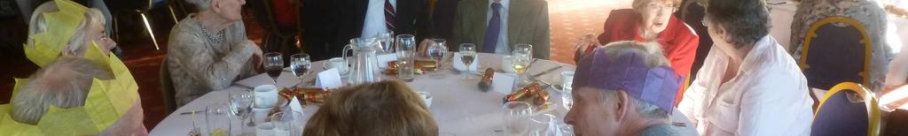
1 Sunday 25th March - Ashorne and Newbold Pacey Figure of Eight walk. Thirteen members and three guests enjoyed a sunny walk, even though we had had to set our alarms early with the start of British Summer Time! Starting from Ashorne Village Hall, we walked the first loop, taking in lovely views and fields with lambs. Then the second stage, progressing to Newbold Pacey, going through the churchyard of St George the Martyr, which was abundant with primroses. Butterflies were spotted, and it really felt like, finally, the first day of spring. The walk finished back at the village hall, where we had refreshments of hot drinks and home-made cakes, courtesy of Trish, a local resident and friend! Sunday 3 rd December 2017 Knowle Ramblers Christmas Lunch. 46 of us enjoyed an extremely the meal which was well organised, cooked and served at the Henley Golf and Country club. Thanks to them for their attention and to Elaine who organised everything for Knowle Ramblers.


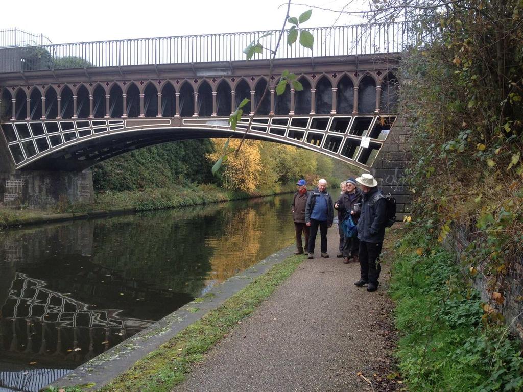
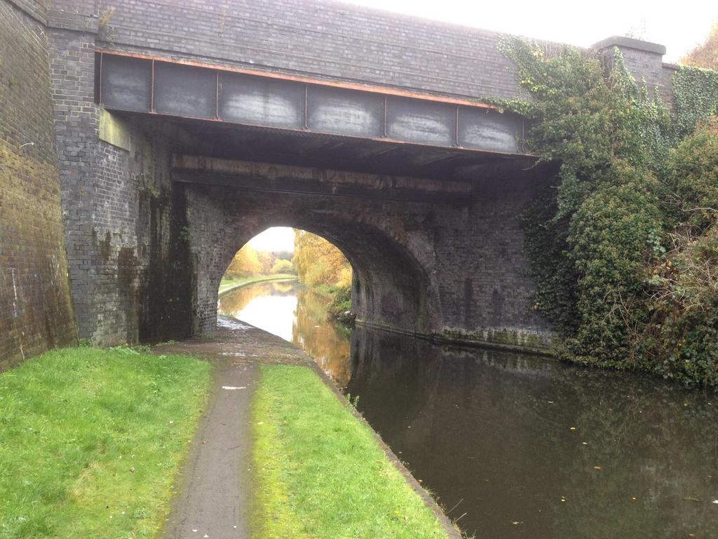
2 Saturday 2nd December Walk to Bumble Hole To see george s slideshow copy and paste this link address to your browser. Saturday 18th November Birmingham to Dudley Canalside Lovely autumnal walk along the M6 of the 19th century. Extraordinary range of bridges and aqueducts.


3 Sunday 5th November - Meriden. Our walk started from the car park of the Queen s Head pub in Meriden, with 18 happy ramblers ready to enjoy a fairly gentle 7 mile walk. The weather was cool but pleasant as we set off along the Heart of England Way towards Eaves Green. A bridle path took us towards Hollyberry Lodge Farm, from where we made our way to the outskirts of Corley Moor. Here we joined the Coventry Way to skirt Birchley Hayes Wood, briefly rejoining the Heart of England Way before crossing the Fillongley Road. We then left the main route to head south westwards and enjoyed walking through the attractive Close Wood. Our route then took us along an escarpment which offered great views of the North Birmingham conurbation before crossing over the A45 and back to our starting point, from where we drove to Berryfields Farm for a well earned cup of tea. Saturday, 21st October Cropredy On a very breezy Saturday in October 9 Knowle Ramblers set off on an eight mile Circular walk from Cropredy. Firstly we crossed the bridge near where the Battle of Cropredy Bridge was fought during the English Civil War in June 1644 between the Parliamentarians and the Royalists. We then walked along the Oxford Canal towpath until we reached the Millennium Way which we followed to the village of Chipping Warden where lunch was enjoyed in the churchyard of the ancient church of St Peter and St Paul. As we left the village a board informed us of the Battle of Edgecote which took place in Before crossing the River Cherwell we saw a silver plaque mounted on a concrete plinth which marks the site where a Wellington bomber crashed in We then followed a track between beech hedges to reach a fine view of Edgecote House and Estate which was used for the TV series Pride and Prejudice. From there it was a fine walk across open countryside to the village of Wardington and then to Cropredy. Sunday, 8th October - Priors Marston route 2. Fourteen of us started our walk from the car park of the Holly Bush Inn in the village of Priors Marston in east Warwickshire, walking along Shuckborough Lane towards Napton Hill till we reached a bridlepath that took us through woodland for a mile or more. Emerging into open country we could see wide horizons over Potash Farm along the line of the Cotswold Edge towards the Dassett Hills. Following an ancient byway we arrived at Marston Doles and the top lock of the Oxford Canal. We took lunch here watching the work of the bargees manipulated their boats through the lock. We climbed back onto the high ground of Jurassic limestone to cross fields to the ancient settlement of Priors Hardwick and then through more fields of ploughed land and sheep pastures to return to our starting point The Holly Bush Inn provided us with a place of refreshment and relaxation before returning home.
4 Sunday, 10th September - Priors Marston The village of Priors Marston lies in east Warwickshire, close to the Northants border. Our group of 8, undaunted by the threatening weather, set out from the car park of the Holly Bush Inn and climbed Marston Hill through lush vegetation. Superb views made it worthwhile. Still on a high level, we crossed the county boundary (ignoring a large bull) and took to a bridle way that curved around the fairways of Hellidon Lakes golf course. Back in Warwickshire, we followed a footpath across fields to an old byway that led us for a mile in the direction of the Shuckbough Hills. The two mile return route to Priors Marston was not signed as expected but a thoughtful farmer had marked the path with his tractor wheels across ploughed land. We were then able to pick up signs of the footpath and crossed a number of footbridges and pastures to reach the outskirts of the village. The delightful and welcoming Holly Bush Inn provided us with refreshment before our return to Knowle. Saturday 28th August Calke Abbey Limeyards. 20 members and visitors enjoyed a glorious sunny day around Calke Abbey park, the Limeyards (now a SSSI as recolonised by nature), and some of the Horse Tramway tunnels. We finished for lunch at the Staff of Life Country Inn in Ticknall Village, good food and service on the Patio. Saturday 29th July The Lenches Our group of 12, led by George and Margaret, started our walk in the car park at The Dolphin public house in Bishampton in north Worcestershire, about 30 miles drive from Knowle. We made our way through the local churchyard and then across fields towards Abberton Hall. From here we turned eastwards towards Rous Lench for an early lunch in the sunshine on the village green. After a short section along the road we walked through the lovely Old Yew Hill Wood before tackling the short uphill section to the village of Church Lench. A stop for the remainder of our lunch was interrupted by a rain shower so we headed off again towards Bishampton across fields and through part of the grounds of The Vale Golf and Country Club. During the walk we enjoyed attractive views to the Malverns, Bredon Hill and the Vale of Evesham. The walk took about 3.5 hours for the 6.5 mile circuit and we enjoyed a convivial hour in the Dolphin at the end. Sunday 16th July Pershore 15 of us enjoyed a 6 mile walk, starting along the River Avon from Pershore Bridge. This was an easy walk along the river, over fields, through woods full of wild flowers and through orchards with plums and apples beginning to ripen. We had a fine view of Pershore Abbey as we descended in to the town. A welcome cup of tea (and cake for some of us) was enjoyed in the garden of a café before we walked through this lovely Georgian town back to the bridge. Friday 5th May Evening Walk Clifford Chambers Eleven members enjoyed a fine sunny evening for a 5 mile walk from Clifford Chambers through Atherstone and attractive Preston on Stour, returning via a lane with sweeping views across to the Severn Valley including The Dumbletons, Bredon Hill, and distant Malverns. The walk finished with a red sunset followed by a pleasant meal together at The New Inn Hotel. Saturday April 29th Around Brails Hill Once again we used the George Inn at Lower Brailes for a walk around the hilly country of South Warwickshire. Our party of 17 set out across fields of medieval ridge and furrow to climb the earthen ramparts of Castle Hill. We descended through allotments into Upper Brailes village before climbing through woods over Gillett s Hill. Once again we surrendered the height gained and dropped down through Ashen Coppice onto open countryside that overlooked a patchwork of green and yellow fields, pastures and distant farms stretching out beyond Shipston towards the hills at Ilmington. After taking a break for lunch at the deserted North Farm, we climbed up steep Cherington Hill into sheep pastures and made our way along the flanks of Brailes Hill with views eastwards to Mine Hill and the borders of Oxfordshire. We made for Brailes with the tower of St. George s as our landmark and retired to the George Inn for welcome refreshment. Saturday 4 th March - Stanton A pre walk description by Robert, which exactly matched what it said on the tin. A super walk with views all round especially on the second half. It is a bit more challenging than some as it goes up onto the Cotswold escarpment above Stanton; there is a steady uphill but not especially steep stretch of


5 about a mile. There are some further undulations and a downhill stretch at the end. The walk starts at the typical Cotswold chocolate box village of Stanton and passes through two other similar villages. My recce indicated that there was some surface, but not clingy, mud near the start and just after the half way point, but most of the walk was along well frequented and dry paths. I was a bit concerned that the final downhill stretch might be a bit slippery immediately after rain; poles, if you have them, would be advised. The toilets in Stanton Village Hall were locked unfortunately and there were no obvious alternatives on the route. Should the weather be very poor, there is a good short cut that knocks about 3 miles off the walk. PS There are a few stiles, all in good condition. One is at the top of some steps. Photos taken on the walk.
WALKING GROUP 9 th JANUARY 2013
 WALKING GROUP 9 th JANUARY 2013 For our first walk of 2013 we were fortunate to have a dry, sunny day. Val hand Fred had planned a walk around Stratford on hard footpaths as the fields were still very
Walk 7: Watchet to washford
 Walk 7: Watchet to washford Length: Moderate - 7.5 miles / 12 km Good For: Theme: History Duration: 2-3 hours depending on speed of walking Notes: This is a moderate to difficult walk in places, with steps,
Atherstone and return from Rugby
 UK Canal Boating UK Canal Boating Escape with a canal boating holiday! Telephone : 01395 443545 Email : contact@ukcanalboating.com Booking Office : PO Box 57, Budleigh Salterton. Devon. EX9 7ZN. England.
Follow the Lantern Way clockwise from Dursley Town Hall through Cam & Coaley to Uley and back to Dursley (about 14 miles)
") According to the Rev Kilvert's diary of 1873, couples on their way to evening services in winter followed a practical though unusual local tradition: "My Mother says that at Dursley, when ladies and gentlemen
According to the Rev Kilvert's diary of 1873, couples on their way to evening services in winter followed a practical though unusual local tradition: "My Mother says that at Dursley, when ladies and gentlemen
Bakewell Club Site - Robin Hood's Stride
 Bakewell Club Site - Robin Hood's Stride Camping and Caravanning Route Summary A circular walk with fabulous views winding it's way through the beautiful White Peak scenery. Points of interest include
Hammer Vale and Linchmere Common
 point your feet on a new path Hammer Vale and Linchmere Common Distance: 9 km=5½ miles or 6 km=3¾ miles easy walking with one steep section Region: Hampshire, West Sussex Author: Botafuego Refreshments:
There are toilets at Manningtree Station, Flatford (close to the hump back bridge) and in Dedham.
 and in Dedham.") Arriving by Train Main Features of the Walk Outline Route Employs particularly attractive paths, many of which offer impressive views across Dedham Vale. Includes a section along the tidal section of the
Arriving by Train Main Features of the Walk Outline Route Employs particularly attractive paths, many of which offer impressive views across Dedham Vale. Includes a section along the tidal section of the
Redesdale Arms. A Trio of Walks
 Redesdale Arms A Trio of Walks Welcome to The Redesdale Arms Hotel The award winning 34 bedroom Redesdale Arms Hotel sits at the gateway to the Cotswolds in the High Street of the historic town of Moreton-in-Marsh.
WALKS PROGRAMME: January April 2018
 RAMBLERS ASSOCIATION VALE OF EVESHAM GROUP Chairperson and Secretary Sheila 07759168224 Treasurer Claire 07749754428 Walks Secretary & Newsletter Editor Frank 01386 40082 Footpath Secretary Hugh 01386
Christchurch to Hengistbury Head
 Last checked 6 June 2018 Document last updated: 13 July 2018 This document and information herein are copyrighted to Saturday Walkers Club. If you are interested in printing or displaying any of this material,
Dorridge & District Residents Association A Walk Along The Green Belt From Dorridge to Catherine-de-Barnes
 Dorridge & District Residents Association A Walk Along The Green Belt From Dorridge to Carine-de-Barnes The starting section of this walk through open fields would be destroyed by building of motorway
Fertile farms in the heart of Kent
 55 55 Fertile farms in the heart of Kent A bright sunny day is perfect for enjoying the rich and fertile Kent countryside and outstanding views across the valley of the Great Stour to the North Downs.
Countryside Walks. 1) Highclere Park Public Walk.
 Highclere Park Public Walk.") 1) Highclere Park Public Walk. Access: From Highclere Estate Main Entrance at Whitway, please note there is no parking on site or access for vehicles. Open: Throughout the year. Description: This footpath
1) Highclere Park Public Walk. Access: From Highclere Estate Main Entrance at Whitway, please note there is no parking on site or access for vehicles. Open: Throughout the year. Description: This footpath
Husthwaite to Byland Abbey
 Husthwaite to Byland Abbey This walk begins with a loop round the village of Husthwaite and continues towards Coxwold along a disused railway line, which is now a right of way. It passes through Coxwold
LDWA SOUTH DOWNS MARATHON
 AHD ahead SDW South Downs Way BL/BR bear left/bear right TL/TR turn left/turn right SP signpost/fingerpost X cross LEG 1 - EAST DEAN to WP1 NORTON GR 470019. Open 1030 to 1300. 9.6 miles. 1.1 From village
Approximate distance: 5.5 miles For this walk we ve included OS grid references should you wish to use them. Start. End
 Approximate distance: 5.5 miles For this walk we ve included OS grid references should you wish to use them. End 4 1 Start 3 2 N W E S Reproduced by permission of Ordnance Survey on behalf of HMSO. Crown
Thornton le Dale Walks
 Thornton le Dale Walks A collection of walks in and around the village Thornton le Dale Traders Forum www.visitthorntonledale.co.uk Thornton le Dale Walks Walk 1: Beck Isle Cottage and All Saints Church
NEWLANDS CORNER AND ST MARTHAS
 NEWLANDS CORNER AND ST MARTHAS 10k CIRCULAR ROUTE 2½-3HRS GU4 8SE From Newlands Corner on the North Downs just outside Guildford, you can enjoy one of the most beautiful panoramas of quintessential English
Walks Around Bishopstone & Hinton Parva
 The Walks: From ½ mile ambles to 8 mile scenic loops Hinton Parva Walks H1 H2 H3 Bishopstone Walks B1 B2 B3 B4 B5 Walk B1: Bishopstone Village, The Dingle (stream) & Pond A short circular village amble
Oldbury & Littleton, South Gloucestershire
 Oldbury & Littleton, South Gloucestershire Starts at Church Lane, Oldbury. BS35 1QF 2 hours 0 minutes 5.2miles 8.4km Easy ID: 0.2468 Developed by: GEOFF MULLETT Checked by: Marion Stone www.ramblersroutes.org
RILLINGTON TO MALTON by Tania Dickinson
 RILLINGTON TO MALTON by Tania Dickinson This walk takes you from the Vale of Pickering up on to the Wold scarp, before dropping down again through the pretty village of Settrington and joining the Centenary
Beautiful Walks from the Blue Ball Inn
 Walk No. 7 COAST AND VALLEY WALK Countisbury, Glenthorne, County Gate, Brendon, Rockford and Wilsham 10 MILES APPROX. Walking time 5 hours approx. (not including breaks)> OS Sheet 64/74 Lynton and Lynmouth.
The Hundred Parishes
 The Hundred Parishes Walks from railway stations number 9 6.4 miles (10kms) from Bishop s Stortford to Stansted Mountfitchet Start: Bishop s Stortford station (Grid Reference TL492209) (ample parking and
Walk 2: Beamsley Beacon and Bolton Abbey
 Walk 2: Beamsley Beacon and Bolton Abbey Start and Finish: The Memorial Hall, Main Street, Addingham, LS29 0LZ, SE 079 497 The shortest walk is about 5½ miles (8.8km) The medium Walk is about 8¼ miles
Welsh Newton and Woodland
 Welsh Newton and Woodland This is a 8.2km miles (approx) walk which will take about 2.5 hours at a relaxed and leisurely pace. There are a few hills but no steep inclines. Start at Llangrove bus stop and
Cleeve Common Self-Guided Walk 1 Family Circular
 Cleeve Common Self-Guided Walk 1 Family Circular Start point: Quarry Car Park Nearest postcode: GL52 3PW please note this is for the golf club. To find the quarry car park drive past the golf club car
The main feature of this tranquil walk is a visit to the source of the Thames (the Thames head) which is in a field just 3 km from Kemble station
 which is in a field just 3 km from Kemble station") SWC Walk DRAFT Kemble circular: the source of the River Thames. The main feature of this tranquil walk is a visit to the source of the Thames (the Thames head) which is in a field just 3 km from Kemble
SWC Walk DRAFT Kemble circular: the source of the River Thames. The main feature of this tranquil walk is a visit to the source of the Thames (the Thames head) which is in a field just 3 km from Kemble
How to get there. Respect - Protect - Enjoy
 How to get there Driving: Postcode is OX49 5HL with a car park for customers Nearest station: Henley on Thames station is 9.5 miles away. We re delighted to present three circular walks all starting and
9.5 km Circular 3 hours
 MEDIEVAL WAVERLEY Challenging Terrain A 6 mile (9.5km) undulating circular walk from Tilford village passing close to The Sands village and the historic ruins of Waverley Abbey. From the top of Crooksbury
THE WELLDIGGERS ARMS, HESWORTH AND FITTLEWORTH TRAIL
 THE WELLDIGGERS ARMS, HESWORTH AND FITTLEWORTH TRAIL 5.5 miles Circular 3 hours 041017 Challenging Terrain A 300-year-old pub turned country-inn on the edge of the South Downs National Park, The Welldiggers
This walk description is from happyhiker.co.uk
 This walk description is from happyhiker.co.uk Pendle Hill Walk From Barley Starting point and OS Grid reference Ordnance Survey map Distance Traffic light rating Barley village honesty box car park OS
Thornton le Dale Walks
 Thornton le Dale Walks A collection of circular walks in, and around, the village www.visitthorntonledale.co.uk Thornton-le-Dale Traders Forum and Thornton le Dale Parish Council 1 Thornton le Dale Circular
Bonnie Prince Charlie Walk
 Bonnie Prince Charlie Walk A waymarked route from Ashbourne to Derby to celebrate the 60th anniversary (1995) of the formation of the Ramblers' Association. This route follows the general direction of
Banstead: Village and Woods
 point your feet on a new path : Village and s Distance: 10 km=6 miles Region: Surrey Author: Fusszweig Refreshments:, The Ramblers Rest easy walking Date written: 2-apr-2014 Last update: 11-apr-2017 Map:
Saltash, Cornwall - Railways, Rivers & Castles
 Saltash, Cornwall - Railways, Rivers & Castles Starts at St Stephen's Church, Saltash, Cornwall 2 hours 45 minutes 5.5miles 8.9km Easy ID: 0.2532 Developed by: Peter Clements Checked by: Kevin Connor www.ramblersroutes.org
Birmingham and return from Worcester
 UK Canal Boating UK Canal Boating Escape with a canal boating holiday! Telephone : 01395 443545 Email : contact@ukcanalboating.com Booking Office : PO Box 57, Budleigh Salterton. Devon. EX9 7ZN. England.
To Happy Valley and Farthing Downs
 1 To Happy Valley and Farthing Downs Woldingham Station - Marden Park - Willey Park - Chaldon Church - Farthing Downs - Coulsdon South/Town Station Length: 10 ½ miles (16.8km) Underfoot: Mainly quiet roads
CHILTERN RAMBLING TRAIL
 CHILTERN RAMBLING TRAIL This route, including a section of the Ridgeway Long Distance Path, offers breathtaking views from the Chiltern ridge. It starts in the Ashridge Estate and returns to Tring via
Dyrham and Hinton Parish Walks
 Dyrham and Hinton Parish Walks A series of five walks in the parish, exploring most of the public footpaths. By John Miller Each walk is described in detail, with a complete map, to provide a handy guide
STRIDERS WALKING 2018
 STRIDERS WALKING 2018 January 2018: WORKSOP Fourteen of us enjoyed another beautiful winter day with blue skies and plenty of sunshine. The walk, on the outskirts of Worksop, took us through some open
Cycle routes from Guildford
 Cycle routes from Guildford The following five pages give practical information about following the main cycle routes from Guildford. There are now several good trafficfree routes in the area, and Guildford
EAST GRINSTEAD AND THE HIGH WEALD, WEST SUSSEX
 EAST GRINSTEAD AND THE HIGH WEALD, WEST SUSSEX 7 miles Circular 3.5 hours 301015 Challenging Terrain Hi, I'm Tom and this is my West Sussex Weekends walk. I live and work in London but often head out of
THE PONTON PLOD - 27 MILE ROUTE
 THE PONTON PLOD - 27 MILE ROUTE Emergency Phone Number 07771 813514 Abbreviations: BW Bridleway X Cross immd immediately FP Footpath TL Turn left L Left thro through KG Kissing Gate TR Turn right R Right
LDWA SOUTH DOWNS MARATHON 13 th MAY 2018
 AHD ahead SDW South Downs Way BL/BR bear left/bear right TL/TR turn left/turn right X cross LEG 1 - EAST DEAN to WP1 NORTON GR 470019. Open 1030 to 1300. 9.7 miles. 1.1 From village hall TL and walk to
Hawkesbury Canal Junction. (Sutton Stop) Near Coventry.
 Near Coventry.") Hawkesbury Canal Junction. (Sutton Stop) Near Coventry. Starts at Hawkesbury Canal Junction,Blackhorse Road,Bedworth 1 hours 49 minutes 5.5miles 8.9km Leisurely ID: 0.1798 Developed by: Peter Hopewell
Hawkesbury Canal Junction. (Sutton Stop) Near Coventry. Starts at Hawkesbury Canal Junction,Blackhorse Road,Bedworth 1 hours 49 minutes 5.5miles 8.9km Leisurely ID: 0.1798 Developed by: Peter Hopewell
Walk Description. Directions
 Title: Saffron Trail: Battlesbridge to Chelmsford Distance: 14¾ miles Time taken: 6 hours Start Point: Outside the Barge Inn, Battlesbridge OS Explorer Map: 175 & 183 Grid Ref.: TQ 780 947 Transport: Rail:-
Jubilee Way. 20 miles (32 ¾ km) walk
 walk") Jubilee Way 20 miles (32 ¾ km) walk Burrough on the Hill Parking and toilets at Burrough Hill Country Park Stag and Hound public house, Burrough on the Hill, (01664 454 181) Public telephone, Burrough
Jubilee Way 20 miles (32 ¾ km) walk Burrough on the Hill Parking and toilets at Burrough Hill Country Park Stag and Hound public house, Burrough on the Hill, (01664 454 181) Public telephone, Burrough
Lincolnshire Limewoods Walks. Woodhall Spa. A circular walk of 13km (8 miles)
") Lincolnshire Limewoods Walks Woodhall Spa A circular walk of 13km (8 miles) Introduction The Lincolnshire Limewoods is an area between Wragby, Bardney and Woodhall Spa. It is a fantastic place to explore
Lincolnshire Limewoods Walks Woodhall Spa A circular walk of 13km (8 miles) Introduction The Lincolnshire Limewoods is an area between Wragby, Bardney and Woodhall Spa. It is a fantastic place to explore
Sutton Valence or Harrietsham to Pluckley
 Sutton Valence start last checked Harrietsham start last checked Rest of walk last checked 22 April 2018 30 March 2017 3 June 2017 Document last updated: 2 May 2018 This document and information herein
A circular walk of or km (2 1 4 or miles)
") Grantham A circular walk of 3 3 4 or 5 3 4 km (2 1 4 or 3 1 2 miles) Introduction This relatively short circular walk, which starts in the middle of Grantham, offers plenty of variety. The route takes
Grantham A circular walk of 3 3 4 or 5 3 4 km (2 1 4 or 3 1 2 miles) Introduction This relatively short circular walk, which starts in the middle of Grantham, offers plenty of variety. The route takes
Hexham Abbey to the Racecourse Road
 Hexham Abbey to the Racecourse Road The Yarridge Road, or Racecourse Road as it is often known, runs along the ridge line to the south of Hexham and provides wonderful views of the river valley and fells
t ie s Wal k A circular walk of 7 or 91 2 km (41 2 or 6 miles)
") ford Fou m a t S r Co un t ie s Wal k A circular walk of 7 or 91 2 km (41 2 or 6 miles) Introduction This walk is set in attractive countryside on the edge of Stamford in the south-west corner of Lincolnshire.
ford Fou m a t S r Co un t ie s Wal k A circular walk of 7 or 91 2 km (41 2 or 6 miles) Introduction This walk is set in attractive countryside on the edge of Stamford in the south-west corner of Lincolnshire.
Guildford Circular via Chantries Hill
 Main walk and option b) last checked Chilworth options last checked Shalford options last checked 28 October 2017 16 January 2018 28 October 2017 Document last updated: 15 March 2018 This document and
Chipstead to Kingswood walk
 Saturday Walkers Club www.walkingclub.org.uk Chipstead to Kingswood walk Ancient woodland, open downs and farmland in London's Green Belt Length OS Map Toughness Features Main Walk: 15½ km (9.6 miles).
Walk 2 Village Hall - The Shippy - Woodhouse Farm - Village Hall
 Walk 2 Village Hall - The Shippy - Woodhouse Farm - Village Hall The walk is approximately 4km (2.5 miles) across fairly flat countryside with about a quarter on country lanes. It should take about 1 hour
Yalding to Sutton Valence via the Greensand Way
 Main walk Harrietsham extension last checked 22 April 2018 22 April 2018 Document last updated: 2 May 2018 This document and information herein are copyrighted to Saturday Walkers Club. If you are interested
Warwickshire Ring from Tamworth
 UK Canal Boating UK Canal Boating Escape with a canal boating holiday! Telephone : 01395 443545 Email : contact@ukcanalboating.com Booking Office : PO Box 57, Budleigh Salterton. Devon. EX9 7ZN. England.
HARDMOORS 26.2 WHITE HORSE HALF ROUTE DESCRIPTION - 018
 HARDMOORS 26.2 WHITE HORSE HALF ROUTE DESCRIPTION - 018 Follow Cleveland Way, keeping to the left hand path (right path is a bike trail) Ignoring any turnings to the left or right At path junction (after
Danbury Words and pictures by Laurie Page of the Public Rights of Way team at Essex County Council.
 Danbury Words and pictures by Laurie Page of the Public Rights of Way team at Essex County Council. An undulating walk from Danbury village to the bluebells at the National Trust property of Blakes Wood.
The Mendip Way. Route Directions and Maps Wells to Frome
 The Mendip Way Route Directions and Maps Wells to Frome Website: www.mendiphillsaonb.org.uk Email: mendip@mendiphillsaonb.org.uk Facebook & Twitter: @MendipHillsAONB Phone: 01761462338 1 Wells to Shepton
8 Miles Circular 4 hours
 VISIT RYEDALE HELMSLEY AND RICCAL DALE 8 Miles Circular 4 hours 090616 Challenging Terrain An 8 mile (13km) circular walk from the market town of Helmsley in Ryedale. The route heads out across sheep pastures
AMAZING WALKS RIGHT ON YOUR DOORSTEP AT WALLOPS WOOD COTTAGES!
 Wallops Wood Cottages Sheardley Lane, Droxford, Hampshire, SO32 3QY emma@wallopswoodcottages.co.uk T: 01489 878888 Sign-up to our NEWSLETTER for special offers and news. You can also follow us on social
BALCOMBE AND ARDINGLY RESERVOIR, WEST SUSSEX
 BALCOMBE AND ARDINGLY RESERVOIR, WEST SUSSEX 7 miles Circular 4 hours 080816 Challenging Terrain Hi, I'm Luke and this is my West Sussex Weekends walk It's a 7 mile loop from Balcombe rail station, taking
WETHERBY CIRCULAR by Tania Dickinson
 WETHERBY CIRCULAR by Tania Dickinson This walk in lower Wharfedale includes a disused railway line at the beginning and riverside at the end, with parkland, fields, woodland and villages in between. Distance
SIX WALKS FROM SHRIGLEY HALL HOTEL COLLECT A COPY FROM HOTEL RECEPTION (PLEASE NOTE, WALKING AROUND OR ACROSS THE GOLF COURSE IS NOT PERMITTED)
") SIX WALKS FROM SHRIGLEY HALL HOTEL COLLECT A COPY FROM HOTEL RECEPTION (PLEASE NOTE, WALKING AROUND OR ACROSS THE GOLF COURSE IS NOT PERMITTED) SH WALK 1 - SHRIGLEY HALL THE NAB LENTH: 2.5 MILES. GRADIENT:
SIX WALKS FROM SHRIGLEY HALL HOTEL COLLECT A COPY FROM HOTEL RECEPTION (PLEASE NOTE, WALKING AROUND OR ACROSS THE GOLF COURSE IS NOT PERMITTED) SH WALK 1 - SHRIGLEY HALL THE NAB LENTH: 2.5 MILES. GRADIENT:
Harlington - Sharpenhoe - Pulloxhill
 Harlington - Sharpenhoe - Pulloxhill ID: 3676, Distance: 8 miles, Height gain: 140 Metres, Map: Explorer 193 Luton & Stevenage, Contributor: Dennis Jeanes Duration: 3 Hours 27 Mins Features Church,Great
Effingham to Westhumble
 Main walk morning last checked Main walk afternoon last checked Pub diversion last checked Westhumble Circular last checked 12 December 2017 23 December 2017 19 August 2015 27 October 2017 Document last
Views! village, woodland, hills, high trails, fine houses, hidden church
 point your feet on a new path Heath Distance: 9½ km=6 miles Region: Chilterns Author: Phegophilos Refreshments: easy walking Date written: 13-oct-2017 Map: Explorer 171 (Chiltern Hills West) but this guide
Slindon Folly - South Downs, West Sussex
 Slindon Folly - South Downs, West Sussex Starts at Park road-side near entrance to Slindon College 2 hours 15 minutes 4.5miles 7.2km Easy ID: 0.1598 Developed by: Chris Mumford Checked by: Rockpit www.ramblersroutes.org
Avon Ring from Stratford upon Avon
 UK Canal Boating UK Canal Boating Escape with a canal boating holiday! Telephone : 01395 443545 Email : bookings@ukcanalboating.com Booking Office : PO Box 57, Budleigh Salterton. Devon. EX9 7ZN. England.
Guildford to Gomshall
 Morning last checked Afternoon last checked Option c) last checked Option d) last checked 9 April 2016 9 April 2016 9 April 2016 23 December 2017 Document last updated: 4 May 2018 This document and information
LOCAL CIRCUIT EM1: EAST MALLING & BARMING HEATH. N 2m ROADS: Significant roads PATHS: Starting direction Barming Longsole Mission Church
 Ditton Church Scott Close LOCAL CIRCUIT EM1: EAST MALLING & BARMING HEATH 6 Community Centre F Open fields (see 'Introductory Notes') 1m 88 Direction label (as in the walk notes) East Malling Church -
East Devon Way Circulars
 East Devon Way s A new series of circular walks developed by the East Devon Ramblers to help you explore the wildlife, heritage and places of interest just off the East Devon Way. h. i. l. g. k. b. c.
The North Pennines from near Langwathby
 3.6 Langwathby to Armathwaite Map panel?? Distance 12.7 miles (20.5 km) Terrain farm, woodland and riverside paths; some potentially muddy tracks; a few short sections of road Grade gently undulating Food
Lincolnshire Walks. Ancaster. Three cir cular walks of2 3/4,4or 6km (11/3, 21/2 or 33/4 miles)
") Lincolnshire Walks Ancaster Three cir cular walks of2 3/4,4or 6km (11/3, 21/2 or 33/4 miles) Introduction These walks are set in the attractive countryside around the historic town of Ancaster. The town
Lincolnshire Walks Ancaster Three cir cular walks of2 3/4,4or 6km (11/3, 21/2 or 33/4 miles) Introduction These walks are set in the attractive countryside around the historic town of Ancaster. The town
Green Man Ultra Route Directions 2018
 Green Man Ultra Route Directions 2018 Start-CP1 (9 miles) Community Forest Path (CFP) Frome Valley Way (FVW) From the starting line cross the playing fields diagonally to the metal gates in the hedge lined
T H E S A I N T S W A Y ST. AUSTELL RUNNING CLUB THE SAINTS WAY RELAY SUNDAY 27 TH MAY 2018
 The annual Saints Way relay will take place on Sunday 27 th of May. For those who haven t done this before, it is something different from normal training or racing. It gives a chance to run socially and
WALK 1 - SHRIGLEY HALL THE NAB LENGTH: 2.5 MILES. GRADIENT: CHALLENGING. STOUT FOOTWEAR REQUIRED
 SIX WALKS FROM SHRIGLEY HALL HOTEL COLLECT A COPY FROM HOTEL RECEPTION 1 (PLEASE NOTE, WALKING AROUND OR ACROSS THE GOLF COURSE IS NOT PERMITTED) WALK 1 - SHRIGLEY HALL THE NAB LENGTH: 2.5 MILES. GRADIENT:
Clyde Walkway Community Links: Crossford Stonebyres Nemphlar- Kirkfieldbank
 Clyde Walkway Community Links: Crossford Stonebyres Nemphlar- Kirkfieldbank Crossford Stonebyres Nemphlar - Kirkfieldbank Digital Trail Difficulty (out of 3) 2 Distance 1. Crossford to Kirkfield Bank Bridge
Masson Hill. Walk. Approximately 4 km. Moderate Walk Begins from Matlock Railway Station
 Masson Hill Walk Approximately 4 km Moderate Walk Begins from Matlock Railway Station TOWN WALKS Masson Hill walk is approx. 4 km. It can be walked in a couple of hours or so. Enjoy your walk and the beautiful
Poundgate and The Hurstwood
 point your feet on a new path Poundgate and The Hurstwood Distance: 11 km=7 miles Region: East Sussex Author: Stivaletti Refreshments: High Hurstwood easy walking Date written: 24-jul-2016 Last update:
Staffordshire and Worcestershire Canal
 UK Canal Boating UK Canal Boating Escape with a canal boating holiday! Telephone : 01395 443545 Email : bookings@ukcanalboating.com Booking Office : PO Box 57, Budleigh Salterton. Devon. EX9 7ZN. England.
Hascombe and Winkworth Arboretum Downs Link Path, Smithbrook Kilns
 point your feet on a new path Hascombe and Winkworth Arboretum Downs Link Path, Smithbrook Kilns Distance: 18 km=11 miles Region: Surrey Author: RDC easy walking Date written: 7-may-2016 Last update: 30-aug-2018
Clyde Walkway Community Links: Rosebank Circular via Ashgill and Dalserf
 Clyde Walkway Community Links: Rosebank Circular via Ashgill and Dalserf Rosebank Circular via Ashgill and Dalserf Digital Trail Difficulty (out of 3) 1 Distance 7 km / 4.35 miles. Time 2 hours Terrain
Distance: 15 km=9 miles, with 2 optional diversions 1-2 km each easy walking
 point your feet on a new path Hascombe from Afar Distance: 15 km=9 miles, with 2 optional diversions 1-2 km each easy walking Region: Surrey Author: Schwebefuss Refreshments: Hascombe Date written: 9-may-2010
Footpaths and walks in the Leckhampton Fields
 APPENDIX 5 Footpaths and walks in the Leckhampton Fields Because of its network of footpaths, the Leckhampton Fields have many different walks. The rich diversity of landscape, hedgerows, trees, streams,
Discover Shropshire. Walks and Strolls around Bridgnorth
 Discover Shropshire Walks and Strolls around Bridgnorth An Introduction to Bridgnorth Bridgnorth is made up of two towns; the High Town and the Low Town. The Low Town was once a thriving port along the
9.5 km Circular 3 hours
 RANMORE CIRCULAR A 6 mile (9.5km) circular walk from Boxhill and Westhumble Station in the village of Westhumble, passing through part of the Polesden Lacey Estate, Ranmore Common and Denbies Vineyard.
Warwickshire Ring from Coventry
 UK Canal Boating UK Canal Boating Escape with a canal boating holiday! Telephone : 01395 443545 Email : bookings@ukcanalboating.com Booking Office : PO Box 57, Budleigh Salterton. Devon. EX9 7ZN. England.
How to get there. Respect - Protect - Enjoy
 How to get there Driving: Postcode is RG9 5PF and there is a car park just across from the pub. Nearest station: Henley-on-Thames station is 5.6 miles away. We re delighted to present three circular walks
Fingest, Christmas Common, Pishill, Turville Red Kites and Red Deer
 point your feet on a new path Fingest, Christmas Common, Pishill, Turville Red Kites and Red Deer Distance: 23 km=14 miles Region: Chilterns Author: Bryntafion Refreshments: every village! Map: Explorer
Launton to Bicester nature footpath improved
 Launton to Bicester nature footpath improved Published 13 July 2012 An attractive rural footpath linking Launton to Bicester has brought back into use by the council's Countryside team. Staff have improved
10 km Circular 3 hours
 FRIMLEY AND FRIMLEY GREEN 10 km Circular 3 hours Easy Terrain 250716 A 10km (6 mile) circular walk exploring the canal towpath, riverside path, woodland, heath and small settlements around Frimley in Surrey.
Ovington and Itchen Stoke
 Trail Activity Type Terrain Author Distance Ascent Location : HAMPTR0057 : Walk : Pub : Towpaths and Cycle Tracks : Peter Carne : 1.4 miles / 2.2 kms : 62 feet / 19 metres : SU560318 / SO24 0RE Bush Inn,
CHINTHURST HILL AND THE GRANTLEY ARMS, SURREY
 CHINTHURST HILL AND THE GRANTLEY ARMS, SURREY 4 miles Circular 2 hours 110417 Challenging Terrain A 4 mile (can be shortened to 3 miles) circular pub walk near Wonersh in Surrey. The walk begins with an
9.5 km Circular 3 hours
 SILENT POOL AND ST MARTHA S HILL Challenging Terrain A 9.5km (6 mile) circular walk in the Surrey Hills, visiting a number of popular attractions including Silent Pool, a stretch of the North Downs Way,
NORTH BOVEY, DARTMOOR WALKS FROM RING OF BELLS NORTH BOVEY. By Debbie Jenkin
 NORTH BOVEY, DARTMOOR WALKS FROM RING OF BELLS NORTH BOVEY By Debbie Jenkin CONTENTS Page Introduction Walk 1 Ring of Bells - 3/4 of a mile 3 & 4 Walk 2 Ring of Bells - 3.5 miles 5 & 6 Walk 3 Ring of Bells
Stokenchurch. Bluebell Woods, Bomber Memorial, Red Kites, Getty s Cricket Ground, Nature Reserve
 Stokenchurch Bluebell Woods, Bomber Memorial, Red Kites, Getty s Cricket Ground, Nature Reserve Bomber Memorial The best time to visit Cowleaze Wood is in the spring when there is a memorable display of
How to get there. Respect - Protect - Enjoy
 How to get there Driving: Postcode is RG9 3DG and there is a carpark just across from the pub. Nearest station: Henley-on-Thames station is 5.6 miles away. We re delighted to present three circular walks
NETTLESTEAD & YALDING
 NETTLESTEAD & YALDING ULL CIRCUIT - Sheet 1 (first and last sections) Open fields (see 'Introductory Notes') 88 Direction label (as in the walk notes) ROADS: 81 10m Significant roads Redhill arm North