BUILT ENVIRONMENT AND HEALTH MODULE
|
|
|
- Loreen Rose
- 6 years ago
- Views:
Transcription
1 Interdisciplinary Program for the PhD in Urban Design and Planning BUILT ENVIRONMENT AND HEALTH MODULE 2011 Symposium April 29,
2 CONTENTS Handouts Main research question Interactions between built environment and health outcomes Examples and policy implications Pedagogy Strengths Data and projects 2
3 IN YOUR HANDOUTS Students Staff Main faculty Area of research and grants 3
4 RESEARCH QUESTION How does the built environment affect human behavior, life style/choices, and consequently health enhancing behaviors? 4
5 EXAMPLES OF HEALTH EFFECTS OF THE BUILT ENVIRONMENT Transport infrastructure/walkability/access -> physical activity; eating; obesity; CVD; diabetes; cancers; injury Air quality -> asthma, cancers Noise -> hearing loss; stress; inattention; sleep; CVD
6 BUILT ENVIRONMENT-BEHAVIOR INTERACTIONS Domains of interest Use of environment (selective, time sensitive) Exposure/access to environment (unavoidable, time and intensity sensitive) Density of environmental attributes Proximity to environmental attributes Confounders (demographic and socioeconomic factors) Access INDIVIDUAL ENVIRONMENT [social or built] Exposure 6
7 POLICY IMPLICATIONS If the use of and exposure/access to certain environmental features affects health, what are the policy changes that planners could help address? Examples Make neighborhoods more walkable (reduce distances between destinations, improve non-motorize infrastructure, mitigate vehicular traffic impacts, etc.) Incentivize certain food and physical activity establishments to locate in neighborhoods Reduce local level air and water pollution, environmental noise 7
8 PEDAGOGY Students are part of an interdisciplinary team Team consists of faculty with different areas of expertise Other consultants (including sponsoring agencies) Staff Students from other UW units (Epidemiology, Geography, Demography, etc.) Synergy between different research grants (similar data, analytic approaches, etc.) Students work at all levels of research (data development, analyses, publications, contacts with sponsors) Student dissertations are a piece of the larger team work They co-author ~2+ papers during their studies, and publish ~2 papers as first author based on their dissertation 8
9 STRENGTHS RESEARCH CONTEXT Health related behaviors Built environment 9
10 HEALTH RELATED BEHAVIORS Data sources (mostly primary) Surveys (reported) Accelerometers (objective) GPS (objective) Variable selection Measurements 10

11 Seattle Obesity Study (SOS) 2,000 surveys (30-min) 700 food frequency questionnaires Food shopping locations Food costs and expenses Diet 11
 during a 7 minute window 2,778 hours of activity")
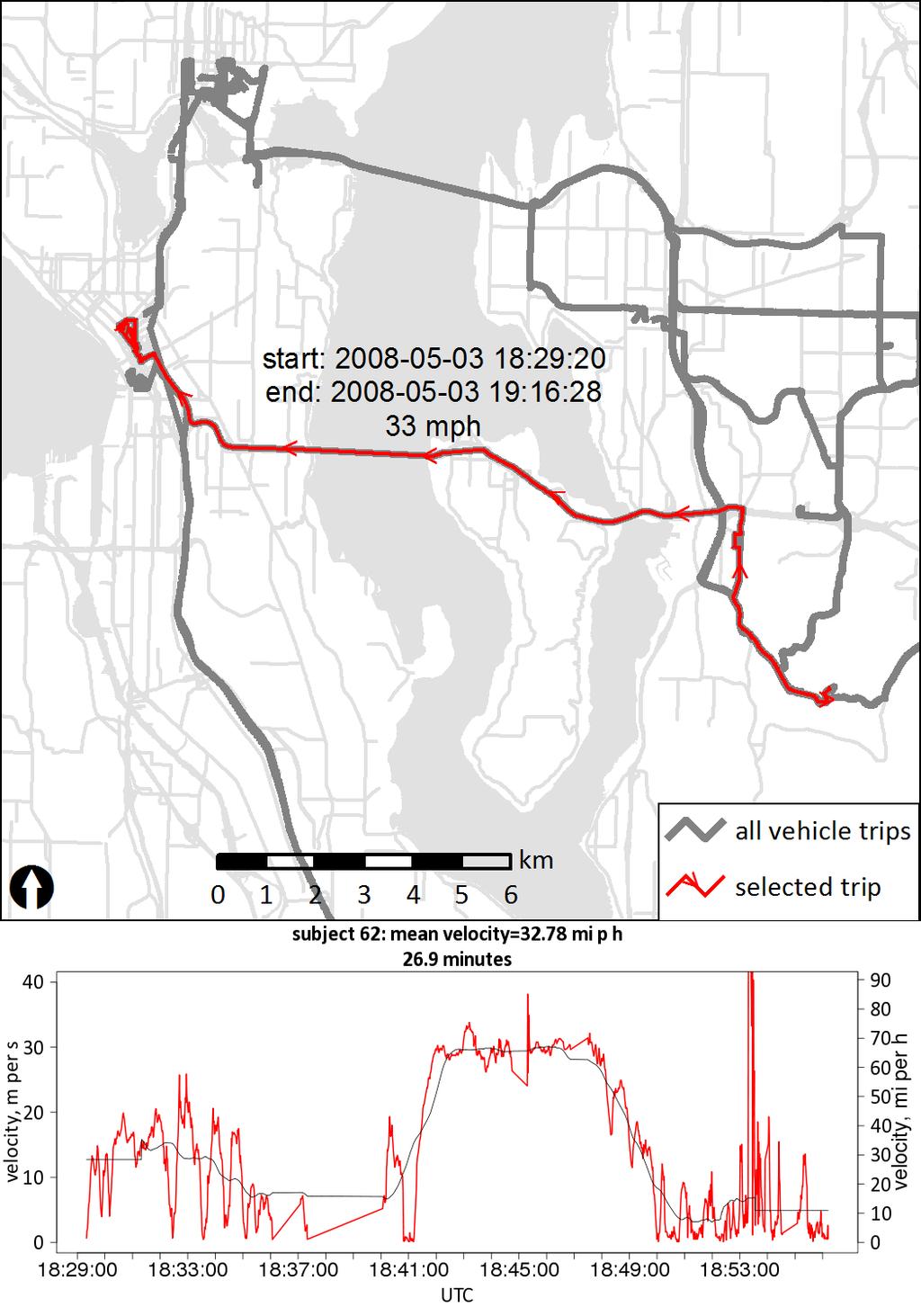
12 TRAC STUDY Home locations Accelerometer and GPS data 736 participants 5,195 days (7 days /participant) 12,598 activity bouts An activity bout contains at least 5 minutes of walk epochs (where the accelerometer count > 500 for 30 seconds) during a 7 minute window 2,778 hours of activity bouts
 Deprivation Crime")
13 ~ 2,000 pairs in WA Up to 10, 000 in US TWIN REGISTRY Locations in WA State ENVIRONMENTAL EXPOSURE MEASURES Neighborhood walkability (5) Deprivation Crime Traffic Sprawl 13


14 SAFE ROUTES TO SCHOOL (SRTS) Washington Mississippi Wisconsin Texas Florida ~890 schools funded out of 19,000 14

 and")
 as viewed on the")
15 OBJECTIVE MEASURES OF BEHAVIOR IN TIME AND SPACE Figure 7: Example of food entry program (right) and energy balance interface (left) as viewed on the phone. 15

16 GPS TRACES WITH ACCELEROMETER AND TRAVEL LOG DATA 16
17 BUILT ENVIRONMENT Conceptual models Data sources Measures typically include counts, densities, and distances between features of interest. Both airline and network measures are calculated 17

18 BUILT ENVIRONMENT SPATIAL UNITS OF DATA CAPTURE AND ANALYSIS Public parcel data are 300 to 30,000 times finer than the resolution of area-based data 18
19 BUILT ENVIRONMENT DATA King Co Domains Variables* Number of discrete observations Neighborhood environment Routine destinations residential units (houses, apartments, condos, mobile homes) employment/jobs residential wealth (property values) vacant lands food facilities (stores versus restaurants, healthy versus unhealthy) physical activity and fitness facilities retail services schools and educational facilities offices medical offices public services (libraries, etc) open space and parks facilities in parks 489k parcels 21k parcels 489k parcels 51k parcels 1,500 food stores 6,500 restaurants 880 parcels 5652 parcels 737 parcels 4393 parcels 769 parcels 1541 parks 103 types of facilities per park 19
20 BUILT ENVIRONMMENT DATA King Co Domains Variables* Number of discrete observations Transportation infrastructure street (freeways and expressways, arterials, collector and local streets) 14k linear miles intersection density trails sidewalks 64k intersections 829 linear miles 1708 linear miles Traffic conditions traffic signals parking passenger rail stations bus stops vehicular volumes bus ridership pedestrian/bike collisions 2000 signals 2.7 million stalls 17 stations 8635 stops 86 million daily vehicle-miles 364k daily trips 1150 annual collisions 20

21 SPATIAL DATA DEVELOPMENT Example: sampling for RECRUITMENT SR 520 users 21


22 KFFI - BENCHMARKING ACCESS TO FOOD AND FITNESS Transit: ENVIRONMENT VS. BEHAVIOR

23 SOS STUDY SPATIAL DISTRIBUTION OF BMI Moran s I clusters 23


24 High-cost supermarket Low-cost supermarket FOOD DESERTS IN KING CO Ten-minute walk Ten-minute bicycling Ten-minute riding transit Ten-minute driving 24
25 END 25
26 MARINA S SUGGESTIONS for questions Questions for Panels: What is unique about our program intellectual focus? What are our strengths? What potential synergies exist among the areas of specialization? How can we productively build on our strengths and emerging tensions among diverse perspectives? What are the implications for our program structure and pedagogy? Questions for panelists How do you and your students fit into the program? What are emerging research agendas and approaches? What are the cross cutting questions? What are the implications for the pedagogy? Suggestions for panel chairs: Chair the entire discussion, make sure the panel discussion stays focused on the questions. Role of discussant John Friedmann: Ask John to help us reflect on our questions, be our mirror, provide an external feedback, help us reach a synthesis of our discussion. - Ask him what kind of information he would like to have in advance to help us in the discussion. Perhaps supply with some tailored information in advance. 26
27 THIS SLIDE WILL NOT BE SHOWN this is a summary of presentation, as per my recent "Several of our doctoral students have been and are currently involved in research on the interaction between built environment and health. There are several on-going projects funded mostly by multi-year NIH grants that enable students to focus on measuring the built environment in a GIS environment and to conduct analyses on environmental influences on health. Environmental data are available at the scale of the parcel or tax lot for King County and are also being developed at the state level, which enable detailed individual-level analyses of environment and behavior. Students have the opportunity to become familiar with and to develop advanced methods in geospatial data development and spatial analyses (List students at the UFL and other collaborating entities along with their area of focus). The research seeks to untangle the effect of various environmental exposures on health outcomes. Active travel, physical activity, and walking as a popular means of being active have long been the focus of this research (List/describe projects ranging from WBC, Balance, Trac, Twins, Small towns, etc.). This research came out of past research on "non-motorized" transportation carried out with the Wash State Dept of Transportation. A somewhat newer area of research is on the food environment and specifically access to healthy and affordable foods. Work on environments that are supportive of active life styles and facilitate access to food allows us to contribute to many aspects of obesity research (List/ describe UWCOR, SOS I and II, Balance). Most exciting is our current use of accelerometers and GPS to track activity in time and space. TBD 27
28 MAIN FACULTY Bae, Christine, UDP Born, Branden, UDP Drewnowski, Adam, EPIDEMIOLOGY Duncan, Glen, EPIDEMIOLOGY Hallenbeck, Mark, TRANSPORTATION ENGINEERING Moudon, Anne Vernez, UDP Saelens, Brian, MEDICINE & CHILDREN S HOSPITAL RESEARCH 28
29 STUDENTS AND STAFF Ruizhu Huang Bumjoon Kang Jared Ulmer Jason Scully Sora Baek Phil Hurvitz, PhD (Research Associate) Junfeng Jiao, PhD (Research Associate) Lin Lin, PhD (Research Associate) Orion Stewart, MUP (Research Scientist) Melissa Munsell, MUP (Research Scientist) 29
 HURVITZ, ULMER, BUMJOO N JIAO RUIZHU. MUNSELL SCULLY,S TEWART HURVITZ.")
30 UFL PROJECTS: HEALTH Health, Physical Activity, Walking Health, Energy Balance, Obesity PROJECTS DOCTORA Geographic Extent Observations L Instruments Date Research Focus Sponsor /PI STUDENT WBC King County UGB 600 respondents Trac Twins Small Town Walkability Balance NIDDK (SOS) HURVITZ, ULMER, BUMJOO N JIAO RUIZHU. MUNSELL SCULLY,S TEWART HURVITZ. STEWART HURVITZ, ULMER, JIAO King County data collection times Washington, other states 9 towns in New England, Texas, Washington 10,000 twin pairs 1,800 respondents Surveys Surveys, Accelerometers 13, GPS, Travel Logs Surveys Surveys (subsample withh Accelerometers, GPS, Travel Logs) King County NA Multi Sensor Board Incl GPS (MSB), cell phone with dietary intake King County 2,000 respondents Surveys Probabilities of WALKING for health Effects of light rail on PHYSICAL ACTIVITY WALKABILITY and health Probabilities of WALKING for health Objective measures of ENERGY intake and expenditure Obesity and ACCESS TO FOOD Centers for Disease Control and Prevention (CDCS) (Moudon PI) , Walk and Bike Communities Project. National Institutes of Health (Saelens PI) The effect of light rail transit on physical activity: a natural experiment. National Institutes of Health (Buchwald PI) Building a Unique National Community Based Twin Registry. National Institutes of Health (Doescher PI) Rural town walkability: measuring the effect of the built environment National Institutes of Health (Duncan PI) Bioengineering Approaches to Energy Balance and Obesity. National Institutes of Health (Drewnowski PI) Food environment, diet quality, and disparities in obesity. Seattle Obesity Study (SOS) 30
31 UFL PROJECTS: Transportation Walking and Bicycling PROJECTS DOCTORAL STUDENT Geographic Extent Observations Instrumen ts Date Research Focus Sponsor /PI Land Use and Pedestrian Travel Puget Sound Four Counties NA NA A number of methodologies to identify LOCATIONS and AREAS more likely to support PEDESTRIAN TRAVEL US and Washington State Departments of Transportation, (Moudon PI). Pedestrian Location Identification Tools, Transportation-Efficient Land Use Mapping Index Pedestrian Safety LIN, JIAO King County ~14,000 pedestrian and bicyclist collisions in WA State Police records Risk of COLLISION and severe INJURY/FATALITY US and Washington State Departments of Transportation, (Moudon PI). Pedestrian Safety SRTS LIN, STEWART Florida, Mississippi, Texas, Washington, Wisconsin, ~ 900 SRTS schools (~19,000 public schools) Surveys, Case studies Children WALKING and BIKING to school US and Washington State Departments of Transportation, Transportation Pooled Funds (Moudon PI) Safe Routes to School, Statewide Mobility Assessment Study. 31
32 UFL Built environment (BE) data by domain and variable of interest (data structure and sources) Domains Variables* Data structure, and original data sources Neighborhood environment Routine destinations Transportation infrastructure Traffic conditions Number of discrete observations residential units (houses, apartments, parcels, county assessor s office 489k parcels condos, mobile homes) employment/jobs parcels, UFL 21k parcels residential wealth (property values) parcels, county assessor s office 489k parcels vacant lands parcels, county assessor s office 51k parcels food facilities (stores versus restaurants, healthy versus unhealthy) parcels, food permits from Public Health Seattle King Co 1,500 food stores 6,500 restaurants physical activity and fitness facilities parcels, InfoUSA 880 parcels retail services parcels, county assessor s office 5652 parcels schools and educational facilities 737 parcels parcels, county assessor s office, National Center for Educational Statistics offices parcels, county assessor s office 4393 parcels medical offices parcels, county assessor s office 769 parcels public services (libraries, etc) parcels, county assessor s office open space and parks parcels, UFL 1541 parks facilities in parks within each park 103 types of facilities per park street (freeways and expressways, networks, King Co GIS 14k linear miles ESRI StreetMap Premium North America NAVTEQ arterials, collector and local streets) intersection density points, UFL 64k intersections trails networks, King Co GIS 829 linear miles sidewalks networks, UFL 1708 linear miles traffic signals points, King Co GIS 2000 signals parking rasters, UFL 2.7 million stalls passenger rail stations points, UFL 17 stations bus stops King Co Metro 8635 stops vehicular volumes networks, Puget Sound Regional Council 86 million daily vehicle-miles bus ridership King Co Metro 364k daily trips pedestrian/bike collisions points, Washington State DOT 1150 annual collisions * measures typically include counts, densities, and distances between features of interest. Both airline and network measures are calculated; UFL = data already has been collected by the UW Urban Form Lab
33 Domains Variables* Data structure, and original data sources Neighborhood environment Routine destinations Transportation infrastructure Traffic conditions Number of discrete observations residential units (houses, apartments, parcels, county assessor s office 489k parcels condos, mobile homes) employment/jobs parcels, UFL 21k parcels residential wealth (property values) parcels, county assessor s office 489k parcels vacant lands parcels, county assessor s office 51k parcels food facilities (stores versus restaurants, healthy versus unhealthy) parcels, food permits from Public Health Seattle King Co 1,500 food stores 6,500 restaurants physical activity and fitness facilities parcels, InfoUSA 880 parcels retail services parcels, county assessor s office 5652 parcels schools and educational facilities 737 parcels parcels, county assessor s office, National Center for Educational Statistics offices parcels, county assessor s office 4393 parcels medical offices parcels, county assessor s office 769 parcels public services (libraries, etc) parcels, county assessor s office open space and parks parcels, UFL 1541 parks facilities in parks within each park 103 types of facilities per park street (freeways and expressways, networks, King Co GIS 14k linear miles ESRI StreetMap Premium North America NAVTEQ arterials, collector and local streets) intersection density points, UFL 64k intersections trails networks, King Co GIS 829 linear miles sidewalks networks, UFL 1708 linear miles traffic signals points, King Co GIS 2000 signals parking rasters, UFL 2.7 million stalls passenger rail stations points, UFL 17 stations bus stops King Co Metro 8635 stops vehicular volumes networks, Puget Sound Regional Council 86 million daily vehicle-miles bus ridership King Co Metro 364k daily trips pedestrian/bike collisions points, Washington State DOT 1150 annual collisions * measures typically include counts, densities, and distances between features of interest. Both airline and network measures are calculated; UFL = data already has been collected by the UW Urban Form Lab 33
34 34
Transit and Physical Activity Studies: Design and Measures Considerations From the TRAC Study
 Transit and Physical Activity Studies: Design and Measures Considerations From the TRAC Study Brian E. Saelens, Ph.D. University of Washington Seattle Children s Research Institute Objectives Rationale
Built Environment and Health in the Age of Big Data
 Built Environment and Health in the Age of Big Data Anne Vernez Moudon, Dr es Sc Urban Form Lab University of Washington, Seattle, WA, USA http://depts.washington.edu/ufl/ This material is extracted from
SAFE MAIN STREET HIGHWAYS PART I: WASHINGTON STATE COLLISION DATA AND GEOCODING
 Research Report Agreement WSDOT T1461 Task 20 SMSH PacTrans DTRT13-G-UTC40 PacTrans Budget No. 62-9153 SAFE MAIN STREET HIGHWAYS PART I: WASHINGTON STATE COLLISION DATA AND GEOCODING by Anne Vernez Moudon,
What s Health Got to Do With It? Health and Land Use Planning
 What s Health Got to Do With It? Health and Land Use Planning CANDACE RUTT, PH.D. EXECUTIVE DIRECTOR APRIL 13 TH, 2016 Planning and Public Health Planning + Public Health Healthy Communities Healthier
Focus on New Baseline Conditions, Indicators and Analytic Approaches
 Focus on New Baseline Conditions, Indicators and Analytic Approaches Lindsey Realmuto, MPH Health Program Planner San Francisco Department of Public Health Overview HIA Assessment Tools HDMT and Baseline
Peel Health Initiatives Health and Urban Form
 Region of Peel Public Health Peel Health Initiatives Health and Urban Form alpha Conference June 9, 2008 Gayle Bursey Director, Chronic Disease and Injury Prevention Declaration No part of the information
Summary Report: Built Environment, Health and Obesity
 Research and education Built Environment Edmonton Project Summary Report: Built Environment, Health and Obesity Introduction In 2007 the Canadian Institutes of Health Research and the Heart and Stroke
Active Travel and Exposure to Air Pollution: Implications for Transportation and Land Use Planning
 Active Travel and Exposure to Air Pollution: Implications for Transportation and Land Use Planning Steve Hankey School of Public and International Affairs, Virginia Tech, 140 Otey Street, Blacksburg, VA
PEDESTRIAN SAFETY AND TRANSIT CORRIDORS
 Research Report Agreement T2695, Task 10 Pedestrian Safety PEDESTRIAN SAFETY AND TRANSIT CORRIDORS by Anne Vernez Moudon, Professor and Paul M. Hess, Ph.D. Department of Urban Design and Planning University
RESOLUTION NO ?? A RESOLUTION OF THE CITY OF NEPTUNE BEACH ADOPTING A COMPLETE STREETS POLICY
 RESOLUTION NO. 2018-?? A RESOLUTION OF THE CITY OF NEPTUNE BEACH ADOPTING A COMPLETE STREETS POLICY WHEREAS, safe, convenient, and accessible transportation for all users is a priority of the City of Neptune
The best indicator of an individual s and expanding access to parks and open space.
 Health & Wellness Create a Safe and Healthy Built Environment Artist s rendering, 2014 Health is important to Loveland residents, and stakeholders see the many strong connections between quality of life,
DO OUR NEIGHBORHOODS REALLY MATTER FOR CHILDREN S HEALTH AND PHYSICAL ACTIVITY?
 DO OUR NEIGHBORHOODS REALLY MATTER FOR CHILDREN S HEALTH AND PHYSICAL ACTIVITY? Brian E. Saelens, Ph.D. Seattle Children s Research Institute, University of Washington Childhood Obesity and Public Health
BUILDING THE CASE FOR TRAVEL OPTIONS IN WASHING TON COUNTY. Image: Steve Morgan. Image: Steve Morgan
 BUILDING THE CASE FOR TRAVEL OPTIONS IN WASHING TON COUNTY Image: Steve Morgan Image: Steve Morgan Image: TriMet Image: TriMet WHAT ARE TRAVEL OPTIONS PROGRAMS? Travel options programs encourage residents,
 Time of Change We Are Growing We Are An Attractive Place To Live We Are Age Diverse + Living Longer 50000 40000 30000 20000 10000 0 2010 Census Job Density Housing Sheds Transit Sheds The Project FUNDING
INTEGRATING HEALTH INTO SCENARIO PLANNING
 INTEGRATING HEALTH INTO SCENARIO PLANNING Dr. Lawrence Frank, President UD4H, Inc. Seattle, Washington Professor in Population and Public Health and Urban Planning University of British Columbia Outline
Childhood Obesity: A Policy Perspective
 Leadership for Healthy Communities Advancing Policies to Support Healthy Eating and Active Living Childhood Obesity: A Policy Perspective Elizabeth Hinman elizabeth@leadershipforhealthycommunities.org
Performance measures for nonmotorized
 Performance measures for nonmotorized transportation May 2, 2014 Performance measures for non-motorized transportation Today s Speakers Robbie Webber State Smart Transportation Initiative Craig Williams
San Mateo County Comprehensive Bicycle and Pedestrian Plan Open House
 San Mateo County Comprehensive Bicycle and Pedestrian Plan Open House October 28, 2010 Presented to San Mateo County residents and interested parties by Lauren Ledbetter, Alta Planning + Design Matt Haynes,
DRAFT for a State Policy for Healthy Spaces and Places
 DRAFT for a State Policy for Healthy Spaces and Places 1 DRAFT State Policy for Healthy spaces and Places 1. Purpose To encourage the use and development of land that builds healthy communities through
How Policy Drives Mode Choice in Children s Transportation to School
 How Policy Drives Mode Choice in Children s Transportation to School Physical Activity through Active Transportation Ruth L. Steiner 2011 Technical Conference and Exhibit Lake Buena Vista, FL April 3-6,
Lisa Quinn Executive Director
 Transforming Injury and Violence Prevention: Innovations in Policy, Practice, and Partnerships Advocating for Prevention: Enacting and Reacting to Legislation Lisa Quinn Executive Director Feet First works
METROPOLITAN TRANSPORTATION PLAN OUTREACH: INTERACTIVE MAP SUMMARY REPORT- 10/03/14
 METROPOLITAN TRANSPORTATION PLAN OUTREACH: INTERACTIVE MAP SUMMARY REPORT- 10/03/14 INTRODUCTION This document summarizes the results of the online interactive mapping exercise implemented by MIG for the
NEWS-CFA: Confirmatory Factor Analysis Scoring for Neighborhood Environment Walkability Scale (Updated: March 15, 2011)
") NEWS-CFA: Confirmatory Factor Analysis Scoring for Neighborhood Environment Walkability Scale (Updated: March 15, 2011) The NEWS is a self-report perceived environment survey originally developed by Saelens
NEWS-CFA: Confirmatory Factor Analysis Scoring for Neighborhood Environment Walkability Scale (Updated: March 15, 2011) The NEWS is a self-report perceived environment survey originally developed by Saelens
A Framework For Integrating Pedestrians into Travel Demand Models
 A Framework For Integrating Pedestrians into Travel Demand Models Kelly J. Clifton Intersections Seminar University of Toronto September 22, 2017 Portland, Oregon, USA Region Population~ 2.4 M Urban Growth
Table A.1. Built Environment Infrastructure Domain Summary
 40 Vehicle Crosswalk AARP Livable Communities Guide and Quiz Instruments Measuring Fitness and Recreation Environments (AIMFREE) (Consumer Version) Active Community Environments (ACE) Checklist (Washington
Strategies to Promote the Availability of Affordable Healthy Food and Beverages
 Strategies to Promote the Availability of Affordable Healthy Food and Beverages CDC Recommended Strategies and Measurements Strategy #1: Communities Should Increase Availability of Healthier Food and Beverage
Walkable Communities and Adolescent Weight
 Walkable Communities and Adolescent Weight Sandy Slater, PhD Assistant Professor, University of Illinois at Chicago, School of Public Health Research Scientist, UIC Institute for Health Research and Policy
THESE DAYS IT S HARD TO MISS the story that Americans spend
 WHICH COMES FIRST: THE NEIGHBORHOOD OR THE WALKING? BY SUSAN HANDY AND PATRICIA MOKHTARIAN THESE DAYS IT S HARD TO MISS the story that Americans spend more time stuck in traffic than ever, that they re
Complete Streets 101: The Basics
 Complete Streets 101: The Basics Michigan Municipal League - Capital Conference March 21, 2017 Chip Smith, AICP - Senior Planner - Wade Trim Inc. and City Council member City of Ann Arbor 2017 MML Capital
Transportation and Health Tool
 Working together to evolve the Transportation and Health Tool APHA Webinar March 22, 2016 Ann Steedly, PE Overview THT Development Context Development of Indicators Strategies, Interventions & Policies
MEETING OF THE CITY OF CONCORD BICYCLE, PEDESTRIAN AND SAFE ROUTES TO TRANSIT PLAN ADVISORY COMMITTEE AGENDA
 MEETING OF THE CITY OF CONCORD BICYCLE, PEDESTRIAN AND SAFE ROUTES TO TRANSIT PLAN ADVISORY COMMITTEE Monday, June 22, 2015 5:30 p.m., Regular Meeting PERMIT CENTER CONFERENCE ROOM 1950 Parkside Drive,
Catalyst for Change:
 Catalyst for Change: Toronto Examples Linking Health and Transportation Presented at Walk 21 Conference Vancouver 2011 Monica Campbell, Director Healthy Public Policy Toronto Public Health 1 About Toronto
Madison Urban Area and Dane County. Bicycle Transportation Plan Summary. September Introduction. Bicycle Plan Scope and Planning Process
 Bicycle Transportation Plan Summary Madison Urban Area and Dane County Introduction September 2000 Bicycling is an important mode of transportation in the Madison urban area and countywide that is available
Identifying and Prioritizing Biking and Walking Needs
 Identifying and Prioritizing Biking and Walking Needs The 2012 Utah Bicycle and Pedestrian Barriers Survey TRB Planning Applications Conference May 6, 2013 RSG, Inc Chloe Ritter Elizabeth Greene James
Presentation Summary Why Use GIS for Ped Planning? What Tools are Most Useful? How Can They be Applied? Pedestrian GIS Tools What are they good for?
 1 2 Pedestrian GIS Tools What are they good for? Pro Walk / Pro Bike 2006 Presentation Summary Why Use GIS for Ped Planning? What Tools are Most Useful? How Can They be Applied? Matt Haynes Fehr & Peers
Sandra Nutter, MPH James Sallis, PhD Gregory J Norman, PhD Sherry Ryan, PhD Kevin Patrick, MD, MS
 Objectively Measured Environmental Correlates of Adolescent Physical Activity Sandra Nutter, MPH James Sallis, PhD Gregory J Norman, PhD Sherry Ryan, PhD Kevin Patrick, MD, MS San Diego State University
TR NEWS. Public Health and Transportation. Innovation, Intervention, and Improvements NUMBER 299 SEPTEMBER OCTOBER 2015
 TR NEWS NUMBER 299 SEPTEMBER OCTOBER 2015 Public Health and Transportation Innovation, Intervention, and Improvements Public Health and Transportation Measuring the Health Benefits of Walking and Bicycling
12/13/2018 VIA
 12/13/2018 VIA EMAIL Daniel Abbes, Assistant Planner City of Sacramento community Development Department 300 Richards Blvd., 3 rd Floor Sacramento, CA 95811 RE: Bruceville Apartments (P18-073) Dear Mr.
Built Environment and Older Adults: Supporting Smooth Transitions Across the Life- Span. Dr. Lawrence Frank, Professor and Bombardier UBC
 Built Environment and Older Adults: Supporting Smooth Transitions Across the Life- Span Dr. Lawrence Frank, Professor and Bombardier Chair @ UBC The Hidden Health Costs of Transportation - Frank et al
Complete Streets Basics and Benefits
 Complete Streets Basics and Benefits November 14, 2017 Complete Streets Workshop Ann Ogoreuc, AICP, Allegheny County Economic Development Hannah E. Hardy, Allegheny County Health Department Benefits of
Pedestrian, Bicycle and Traffic Calming Strategic Implementation Plan. January 18, 2011
 Pedestrian, Bicycle and Traffic Calming Strategic Implementation Plan January 18, 2011 Tonight s Agenda Receive update on project Provide feedback on two policy issues Complete Streets Policy Project Prioritization
Health Impact Analysis for Integrated Regional Land Use and Transportation Plan
 Health Impact Analysis for Integrated Regional Land Use and Transportation Plan Hsi-Hwa Hu, Guoxiong Huang, Frank Wen, Simon Choi (Southern California Association of Governments) Margaret Shih (Los Angeles
City of Birmingham Draft Multi-modal Transportation Plan
 City of Birmingham Draft Multi-modal Transportation Plan City Commission Public Hearing Monday, November 25, 2013 7:30 pm Norman Cox, PLA, ASLA The Greenway Collaborative, Inc. Ann Arbor, Michigan The
International Physical Activity Prevalence Study SELF-ADMINISTERED ENVIRONMENTAL MODULE
 International Physical Activity Prevalence Study SELF-ADMINISTERED ENVIRONMENTAL MODULE There is increasing interest in the contextual (environmental) barriers that prevent or limit the opportunity to
ACTIVE TRANSPORTATION
 ACTIVE TRANSPORTATION Mobility 2040 Supported Goals Improve the availability of transportation options for people and goods. Support travel efficiency measures and system enhancements targeted at congestion
Introduction Overview This document summarizes the Gateway Gold Line Bus Rapid Transit (Gold Line BRT) health impact assessment (HIA) process and reco
 health impact assessment (HIA) process and reco") Gateway Gold Line Bus Rapid Transit: A Closer Look at Health and Land Use Project Summary May 2016 Introduction Overview This document summarizes the Gateway Gold Line Bus Rapid Transit (Gold Line BRT)
Gateway Gold Line Bus Rapid Transit: A Closer Look at Health and Land Use Project Summary May 2016 Introduction Overview This document summarizes the Gateway Gold Line Bus Rapid Transit (Gold Line BRT)
 2 3 40 35 30 25 20 15 10 5 0 1986 1987 1988 1989 1990 1991 1992 1993 1994 1995 1996 1997 1998 1999 Recommended Activity Physical Inactivity 4 90 89 89.3 88 87 87.1 86 85 85 84 83.9 83 82 81 1977 1983 1990
Safe Routes to School Program in California: An Update
 Safe Routes to School Program in California: An Update Claudia Chaufan, MD, PhD Jarmin Yeh, MSSW, MPH Leslie Ross, PhD Pat Fox, PhD, MSW Institute for Health & Aging, Department of Social and Behavioral
Appendix C. Corridor Spacing Research
 Appendix C. Corridor Spacing Research Task 3 of the Twin Cities Bicycle Study called for the development of bicycle corridor spacing guidelines. This section summarizes research of the spacing of planned
o n - m o t o r i z e d transportation is an overlooked element that can greatly enhance the overall quality of life for the community s residents.
 N o n - m o t o r i z e d transportation is an overlooked element that can greatly enhance the overall quality of life for the community s residents. 84 Transportation CHAPTER 11 INTRODUCTION Transportation
Analyzing Spatial Patterns, Statistics Based on FAST Act Safety Performance Measures
 Analyzing Spatial Patterns, Statistics Based on FAST Act Safety Performance Measures Abhishek Bhargava, PhD April 13, 2017 Agenda Objective Highway Safety Improvement Program (HSIP) & FAST Act Performance
Cascade Bicycle Club Strategic Plan
 The Greater Context Bicycling has become fundamentally important as large-scale currents of change threaten the health, economy and livability of communities throughout the United States and the world
Frequently asked questions about how the Transport Walkability Index was calculated are answered below.
 Transport Walkability Index The Transport Walkability Index is a relative indicator of how well the built environment in different areas supports walking for transport. The index is frequently used in
Transit-Driven Complete Streets
 Questions: Type questions into the box at bottom of webinar panel. Panelists for today s webinar: Nimotalai Azeez, Program Associate with the National Complete Streets Coalition Rich Weaver, Director of
1. Slide Summary: This course covers methods and best practices used by professional planners, engineers, and consultants/researchers This course
 1 1. Slide Summary: This course covers methods and best practices used by professional planners, engineers, and consultants/researchers This course does not focus on advocacy; rather, it introduces current
Creating walkable, bikeable and transit-supportive communities in Halton
 Creating walkable, bikeable and transit-supportive communities in Halton By presenting current research and best practices, the information in this paper is meant to support and broaden discussion on how
GIS Based Non-Motorized Transportation Planning APA Ohio Statewide Planning Conference. GIS Assisted Non-Motorized Transportation Planning
 The Purpose of GIS Assisted Network GIS Assisted Non-Motorized Transportation 2011 APA Ohio Statewide Conference Friday, 10:45 AM to Noon Focus on near-term projects wwwgreenwaycollabcom The purpose of
9/25/2018. Multi-Modal Level of Service (MMLOS) Bianca Popescu, Transportation Planner
 Bianca Popescu, Transportation Planner") Multi-Modal Level of Service (MMLOS) Bianca Popescu, Transportation Planner 1 What is MMLOS? Is this a nice place to walk? Is this a nice place to bike? Is transit convenient? Bottom line - Are there options
Multi-Modal Level of Service (MMLOS) Bianca Popescu, Transportation Planner 1 What is MMLOS? Is this a nice place to walk? Is this a nice place to bike? Is transit convenient? Bottom line - Are there options
Walkable Communities: National Best Practices and Applications in Memphis, TN
 Walkable Communities: National Best Practices and Applications in Memphis, TN Dr. Stephanie Ivey Assistant Professor Herff College of Engineering Department of Civil Engineering Agenda Walkable communities
Governor s Transportation Vision Panel
 Office of Governor Kate Brown Governor s Transportation Vision Panel JLA Public Involvement Project Overview The is a yearlong effort to develop a series of recommendations for the Governor that address
Does It Work? THE BENCHMARKING PROJECT. State Department of Transportation Project Assessment. Bill Wilkinson and Bob Chauncey
 THE BENCHMARKING PROJECT Does It Work? State Department of Transportation Project Assessment Bill Wilkinson and Bob Chauncey National Center for Bicycling & Walking 1506 21 st Street NW, Washington, DC
The Impact of Transportation on Health: Evidence, Practice and the Case for Mode Shift
 The Impact of Transportation on Health: Evidence, Practice and the Case for Mode Shift WE BUILD A BRIGHTER FUTURE Loel Solomon, Ph.D. Vice President, Community Health Kaiser Permanente Transportation Research
Complete streets serve the 1/3 of Hoosiers who do not drive.
 Complete Streets Complete streets are safe, comfortable and convenient for all users, including pedestrians, bicyclists, motorists and public transit riders, regardless of age or ability. Complete streets
Capital and Strategic Planning Committee. Item III - B. April 12, WMATA s Transit-Oriented Development Objectives
 Capital and Strategic Planning Committee Item III - B April 12, 2018 WMATA s Transit-Oriented Development Objectives Page 24 of 76 Washington Metropolitan Area Transit Authority Board Action/Information
2010 Pedestrian and Bicyclist Special Districts Study Update
 2010 Pedestrian and Bicyclist Special Districts Study Update Pedestrian and Bicyclist Special Districts Program Overview H-GAC s Special Districts Program aims to provide strategic investments in pedestrian
VISION ZERO: ELIMINATING TRAFFIC DEATHS BY 2024 MARCH 2015
 Through Vision Zero SF we commit to working together to prioritize street safety and eliminate traffic deaths in San Francisco by 2024 VISION ZERO: ELIMINATING TRAFFIC DEATHS BY 2024 MARCH 2015 VISION
Most Important Part of any Plan
 Most Important Part of any Plan Objectives must be evaluated to determine if they have been achieved Achievement of Objectives: 10 of 13 Objectives Achieved 1 not achieved 2 not due yet Transportation
Chapter 14 PARLIER RELATIONSHIP TO CITY PLANS AND POLICIES. Recommendations to Improve Pedestrian Safety in the City of Parlier (2014)
") Chapter 14 PARLIER This chapter describes the current status and future plans for biking and walking in the City of Parlier. RELATIONSHIP TO CITY PLANS AND POLICIES The Parlier General Plan is the primary
Chapter 14 PARLIER This chapter describes the current status and future plans for biking and walking in the City of Parlier. RELATIONSHIP TO CITY PLANS AND POLICIES The Parlier General Plan is the primary
Bicycle and Pedestrian Plans and Improvements
 Bicycle and Pedestrian Plans and Improvements Presented to the City Council By Randle Harwood, Planning and Development, and Richard Zavala, Parks and Community Services September 24, 2013 Purpose Review
Eastern PA Trail Summit October 1, 2018
 Eastern PA Trail Summit October 1, 2018 WHO WE ARE + WHY + WE RE * HERE * * * * * * Session Goals: Discuss how to coordinate planning and design in small, urbanized towns Consider how to develop alternative
Safe Routes to School
 Safe Routes to School Amy Paxton-Aiken, Center TRT University of North Carolina Chapel Hill, NC and Ian Thomas, Executive Director PedNet Coalition Columbia, MO Housekeeping If you are calling in on a
May 12, 2016 Metro Potential Ballot Measure Issue Brief: Local Return
 Summary: Local return is an important revenue source for cities to maintain their local transportation infrastructure. Most cities use their local return to operate small bus systems and repave streets,
FM 1092/Murphy Road Access Management Study Pulic Meeting #1. Wednesday, August 31, :00 p.m. 8:00 p.m.
 FM 1092/Murphy Road Access Management Study Pulic Meeting #1 Wednesday, August 31, 2011 6:00 p.m. 8:00 p.m. Introductions Agency Partners H-GAC Missouri City TxDOT Introductions Consulting Team In Association
Kevin Manaugh Department of Geography McGill School of Environment
 Kevin Manaugh Department of Geography McGill School of Environment Outline Why do people use active modes? Physical (Built environment) Factors Psychological Factors Empirical Work Neighbourhood Walkability
Sedentary Behavior & Older Adults: The Role of Neighborhood Walkability
 Sedentary Behavior & Older Adults: The Role of Neighborhood Walkability Grantmakers in Aging Annual Conference 2013 "Growing Up, Growing Older: Working Together for Better Communities, Farhana Ferdous
NM-POLICY 1: Improve service levels, participation, and options for non-motorized transportation modes throughout the County.
 Transportation PRINCE WILLIAM COUNTY 2008 COMPREHENSIVE PLAN NON-MOTORIZED PLAN CONTENTS Goals, Policies, and Action Strategies Table 4 (Bike Facility Classifications and Descriptions) Table 5 (Bike Facility
2. Context. Existing framework. The context. The challenge. Transport Strategy
 Transport Strategy Providing quality connections Contents 1. Introduction 2. Context 3. Long-term direction 4. Three-year priorities 5. Strategy tree Wellington City Council July 2006 1. Introduction Wellington
Dr. Lawrence Frank, Professor, University of British Columbia & President, Urban Design 4 Health, Inc.
 Dr. Lawrence Frank, Professor, University of British Columbia & President, Urban Design 4 Health, Inc. On 350 calories one apple tart or a special slice of Ray's Pizza a cyclist can travel 10 miles, a
Introduction. Mode Choice and Urban Form. The Transportation Planner s Approach. The problem
 Introduction The table below shows transit s share in the urban US (all trip purposes) and the 10 urban areas where it is most popular (2008 data): Mode Choice and Urban Form Philip A. Viton April 4, 2014
Perceptions of the Physical Environment Surrounding Schools & Physical Activity among Low-income, Urban, African American Adolescent Girls
 Perceptions of the Physical Environment Surrounding Schools & Physical Activity among Low-income, Urban, African American Adolescent Girls Erin Hager, PhD Candice Gormley, BS Laura Latta, MHS M. Reese
JEFFERSON COUNTY BIKE PLAN 2010: EMPHASIS SUMMARY
 JEFFERSON COUNTY BIKE PLAN 2010: EMPHASIS SUMMARY Presented at Jefferson and Walworth County Bicycle Forum Series Summer 2011 By: Steve Grabow, Professor and Community Development Educator UW-Extension,
Copyright 2014 Ruizhu Huang
 Copyright 2014 Ruizhu Huang The Built Environment, Obesity and Walking Ruizhu Huang A dissertation submitted in partial fulfillment of the requirements for the degree of Doctor of Philosophy University
Sistrunk Corridor DOTMOCRACY SUMMARY
 DOTMOCRACY SUMMARY The TOUCH initiative is a true collaborative working with multi- sector community organizations and agencies to reduce tobacco use and exposure to secondhand smoke, improve access to
WALKNBIKE DRAFT PLAN NASHVILLE, TENNESSEE EXECUTIVE SUMMARY NASHVILLE, TENNESSEE
 NASHVILLE, TENNESSEE EXECUTIVE SUMMARY Executive Summary A world-class multi-modal transportation system is essential to a vibrant city and better quality of life. -Mayor Barry The WalknBike plan aims
ADOT Statewide Bicycle and Pedestrian Program Summary of Phase IV Activities APPENDIX B PEDESTRIAN DEMAND INDEX
 ADOT Statewide Bicycle and Pedestrian Program Summary of Activities APPENDIX B PEDESTRIAN DEMAND INDEX May 24, 2009 Pedestrian Demand Index for State Highway Facilities Revised: May 29, 2007 Introduction
Lane Area Transportation Safety and Security Plan Vulnerable Users Focus Group
 Lane Area Transportation Safety and Security Plan Vulnerable Users Focus Group Agenda 1. Planning Process Review 2. What are Emphasis Areas? 3. Your Role Today 4. Data Review 5. Small group discussion
Multimodal Connectivity: Walking & Wheeling to Transit
 Multimodal Connectivity: Walking & Wheeling to Transit Joanne Waszczak FTA Office of Budget & Policy APTA Sustainability & Public Transportation Workshop August 4, 2014 Walking and Wheeling to Transit
City of Novi Non-Motorized Master Plan 2011 Executive Summary
 City of Novi Non-Motorized Master Plan 2011 Executive Summary Prepared by: February 28, 2011 Why Plan? Encouraging healthy, active lifestyles through pathway and sidewalk connectivity has been a focus
Agency Advisory Group Meeting #3 and Walk Audit Anchorage Non-Motorized Plan
 Agency Advisory Group Meeting #3 and Walk Audit Anchorage Non-Motorized Plan Friday, May 18 th Walk Audit 10:00-11:30 AM Meeting 11:30 AM 1:00 PM Municipal Planning Department, 4700 Elmore Road, Training
Measuring Success: Performance Metrics and Project Selection
 Measuring Success: Performance Metrics and Project Selection Fayetteville Mobility Plan Presented by: Jeffrey Tumlin March 19, 2018 How do we use transportation performance metrics? Improving efficiency
Approaches. Livable Neighborhood Design. Examples. Traditional neighborhood development. CE 594 University of Wisconsin- Milwaukee
 Approaches Livable Neighborhood Design CE 594 University of Wisconsin- Milwaukee Traditional neighborhood design (TND), new urbanism, transit friendly design, transit oriented development and walkable
SANTA CLARA COUNTYWIDE BICYCLE PLAN August 2008
 SANTA CLARA COUNTYWIDE BICYCLE PLAN August 2008 To assist VTA and Member Agencies in the planning, development and programming of bicycle improvements in Santa Clara County. Vision Statement To establish,
Neighborhood Environment Profiles Related to Physical Activity and Weight Status among Seniors: A Latent Profile Analysis
 Neighborhood Environment Profiles Related to Physical Activity and Weight Status among Seniors: A Latent Profile Analysis Marc A. Adams, Ph.D. University of California, San Diego & Adjunct Assistant Professor
APPENDIX D. May 22, 2002 Open House Summary and Materials
 APPENDIX D May 22, 2002 Open House Summary and Materials TH 36 Partnership Study Open House May 22, 2002 Summary of Survey Responses 1. If no new crossing of the St. Croix River is built (e.g. the existing
Washington Metropolitan Area Transit Authority Board Action/Information Summary. MEAD Number:
 Washington Metropolitan Area Transit Authority Board Action/Information Summary Action Information MEAD Number: 100962 Resolution: Yes No TITLE: Bicycle and Pedestrian Access Improvements Study PURPOSE:
CONNECTING PEOPLE TO PLACES
 CONNECTING PEOPLE TO PLACES 82 EAST BENCH MASTER PLAN 07 Introduction The East Bench transportation system is a collection of slow moving, treelined residential streets and major arteries that are the
162 RESIDENTS ATTENDED 2 DAYS OF WORKSHOPS 15 TABLE DISCUSSIONS WHAT WE HEARD. Oakridge Municipal Town Centre Workshops PLANNING PROGRAM
 OAKRIDGE MTC WORKSHOP 2017 CAMBIE CORRIDOR Phase 3 STEP 3: 3: October June 2017 CAMBIE CORRIDOR PLANNING PROGRAM 2 DAYS OF WORKSHOPS 15 TABLE DISCUSSIONS 162 RESIDENTS ATTENDED WHAT WE HEARD Oakridge Municipal
Health Beyond Healthcare The Chronic Disease Impacts of Neighborhood Design. Erik J. Aulestia, AICP Principal, Torti Gallas + Partners
 Health Beyond Healthcare The Chronic Disease Impacts of Neighborhood Design Erik J. Aulestia, AICP Principal, Torti Gallas + Partners Prior to 20th Century How should a city look and function? Architects
Incorporating Health in Regional Transportation Planning
 Mayor Karl Dean, Chairman Incorporating Health in Regional Transportation Planning Leslie A. Meehan, AICP Center TRT Intervention Webinar January 29, 2013 Objectives for Today Background About the Nashville
Incorporating Health in Regional Transportation Planning
 Mayor Karl Dean, Chairman Incorporating Health in Regional Transportation Planning Leslie A. Meehan, AICP Center TRT Intervention Webinar January 29, 2013 Objectives for Today Background About the Nashville