ABOUT THIS OPEN HOUSE
|
|
|
- Mariah Francis
- 6 years ago
- Views:
Transcription


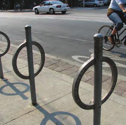
1 J O N E S TAY LO R MA S O N E LW O O D S H A N N O N ABOUT THIS OPEN HOUSE Welcome! Safer Taylor Street is a community-driven project to improve transportation safety and livability on Taylor Street from Market to Sutter streets. Tell Us About Yourself Use stickers to tell us where you: Live Work Play (fill in the blank) Frequently walk The Marker Hotel The Warwick Hotel Frequently travel Ace Parking Serrano Hotel Christian Science Church 400 Taylor Street Garage San Francisco Senior Center Tilden Hotel Tenderloin Health Services Glide Memorial Church Father Alfred E. Boeddeker Park Housing and Urban Health Clinic OFARRELL ST Hilton Hotel 210 Taylor Street Lot Vietnamese Youth Development Center MA G N IN C Y R IL San Francisco City Impact The Warfield Hotel Golden Gate Theatre The Warfield Bus Stops

2 PROJECT OVERVIEW Safer Taylor Street and Vision Zero Every year, 30 people are killed and 200 more are seriously injured in San Francisco traffic crashes. Vision Zero is a commitment by the City of San Francisco to end all traffic deaths. 118 From 2011 to 2016 injury collisions occurred on Taylor Street Taylor Street is home to one of the densest and most diverse concentrations of residents, businesses, and community organizations in San Francisco. Analysis done through Vision Zero identified Taylor Street between Market and Sutter streets as a Pedestrian High Injury Corridor, which means that it is one of only 12% of city streets that experiences 70% of the city s serious pedestrian injuries and fatalities. The City has secured $14.1 million to plan, design, and construct improvements, and hopes to build a partnership between the community, neighorhood organizations, injury collisions involved pedestrians injury collisions involved bicyclists injury collisions occurred between automobiles advocacy groups, and City agencies to create a safer and more livable Taylor Street. Vision Zero High Injury Network Map Taylor Street identified as a Pedestrian High Injury Corridor SFMTA receives Caltrans and and SFCTA Prop K funding for Safer Taylor Street Safer Taylor Project Kickoff 1st Community Workshop Safer Taylor On-Street Pilot 2nd Community Workshop 3rd Community Workshop Safer Taylor Plan Finalized Detailed Design Begins Implementation Begins APRIL 2017 JUNE 2017 AUGUST 2017 AUGUST 2017 OCTOBER 2017 SPRING


3 THE BUILT ENVIRONMENT OF TAYLOR The Experience of People Walking - High demand for groups of people walking or waiting for neighborhood services, entertainment venues, and hotels - Sidewalk width available for walking varies - Marked crosswalks have been impacted by construction - Inconsistent availability of accessible curb ramps - Concerns about visibility when vehicles are double parked The Experience of People Biking Sidewalk 9 Parking Lane 10 Travel Lane 10 Travel Lane 10 Travel Lane 9 Parking Lane TYPICAL TAYLOR STREET CROSS SECTION Sidewalk - No dedicated bike facility - Few bike amenities such as bicycle parking available - Cyclists must manuever across three lanes to make turns - Conflicts with open vehicle doors and staged buses side Uses and Parking 38% WALK TYPICAL TAYLOR STREET MODAL SPLIT Source: 2016 Intersection Counts 62% DRIVE - Active and busy commercial and passenger loading for small businesses, organizations, hotels, and entertainment venues - Mobile services including shower, toilet, and medical facilities - Frequent bus staging for major events and tours - Standard metered parking typically not used by residents 1% BIKE Traffic and Circulation - Three one-way northbound vehicle lanes - Many intersections with other one-way streets - Integrated with several corridors with other SFMTA projects - Connection from Interstate 280

4 J O N E S TAY LO R MA S O N E LW O O D S H A N N O N J J O N E S O N E S TAY LO R MA S O N TAY LO R MA S O N E LW O O D E LW O O D S H A N N O N S H A N N O N THE PEOPLE OF TAYLOR ETHNIC DIVERSITY YOUTH AGE 20 AND UNDER SENIORS AGE 65 AND OVER The Tenderloin neighborhood has the highest density of youth and seniors in San Francisco. OFARRELL ST OFARRELL ST OFARRELL ST MA G N IN MA G N IN MA G N IN C Y R IL C Y R IL C Y R IL Ethnic Diversity Index Census Block Group Building City Block Source: US Census The diversity index reports the percentage of times two randomly selected people would differ by race/ethnicity The residents on Taylor Street are 21% more ethnically diverse when compared to San Francisco as a whole. Minorities, seniors and youth are disproportionately impacted by traffic fatalities nationwide. Source: AARP Youth Age 20 & Under Density Youth per Square Mile 0-4,690 4,691-6,081 6,082-8,270 8,271-53,300 Childcare Center School Building City Block Children are especially vulnerable to traffic injuries, as they are still developing cognitively and behaviorally. Seniors Age 65 and Over Density Seniors per Square Mile 0-2,741 2,742-3,500 3,501-4,680 4,681-57,416 Senior Center Building City Block Seniors are five times more likely to die from a traffic collision than younger adults. Half of all pedestrian fatalities involve seniors.


5 HOW MIGHT WE IMPROVE TAYLOR? The following types of improvements are being considered for Taylor Street. Items labeled in purple indicate safety improvements. Green toolkit items indicate livability improvements. Advanced Limit Lines Raised Crosswalks Management Chicanes Safety Improvement Livability Improvement Advance stop lines reduce vehicle encroachment into the crosswalk and improve drivers view of pedestrians Raised crosswalks provide a level pedestrian path of travel from curb to curb. Vehicles are required to slow down before passing over the crosswalk, which is level to the sidewalk. Management of curb uses, such as parking and loading zones, can help to increase safety and improve traffic flow. A chicane consists of offset curb extensions which help to narrow the roadway and reduce traffic speeds. Speed Management Bulbouts Narrowed Lanes Lane Reduction Daylighting Turn Restrictions Driver speeds can be managed using speed radar signs, in addition to many of the other tools shown here. Bulbouts are extensions of the curb that visually and physically narrow the roadway to increase visibility of pedestrians and shorten crossing distances. Narrowing lanes reduces existing lane widths. Lane narrowing can help reduce vehicle speeds and crossing distances for pedestrians. Lane reductions reallocate space from vehicles to people walking and biking. Reducing lanes is especially useful when there is excess capacity for cars. Daylighting is a cost-effective and quick way to increase pedestrian visibility by prohibiting parking up to 20 feet from the intersection. The prohibition of right or left turning movements reduces conflicts between turning vehicles and pedestrians at intersections with unprotected turns and high pedestrian volumes. Signal Visibility Protected left-turns Signal Timing Improvements (LPI) for Pedestrians Accessible Ped Signals Signal visibility improvements include larger lenses for traffic signals, mast arms to have signals overhead, and relocated signal poles. Protected left turns allow pedestrians to cross without driver conflicts by giving turning drivers their own dedicated phase for turns. Signal timing improvements for pedestrians can include: leading pedestrian intervals (LPIs) that give pedestrians a 3 7 second head start when entering an intersection; longer pedestrian walk times to increase the amount of time alloted to people crossing; and pedestrian scrambles which stop all vehicle traffic and allow pedestrians to cross in every direction (at the expense of waiting longer to cross). Accessible pedestrian push buttons are easily located by the visually impaired and provide audible signals for pedestrians crossing an intersection.


6 HOW MIGHT WE IMPROVE TAYLOR? Protected Bikeway Protected bike lanes are physically separated from motor traffic and distinct from the sidewalk, offering greater safety and comfort than standard bike lanes. Stormwater Management Bicycle Racks Bike Share High-Visibility Crosswalk Bike racks provide secure parking. Bike share enables local residents to take short trips without having to worry about owning or securing a bike. High visibility crosswalks use ladder-like striping to increase pedestrian visibility and improve driver yielding. Pedestrian Plaza Parklets Widened Sidewalks Smooth Sidewalk Pedestrian-Scale Lighting Accessible curb ramps enhance the mobility of people who have visual or physical impairments. Smooth sidewalks provide a pleasant and accessible walking environment that is free of large cracks and breaks. Pedestrian-scale lighting is spaced closer together and lower in height than standard street lighting. Corridor Branding Public Art Alley Activation Corridor branding, such as neighborhood banners, can be used to create a unique visual identity for a neighborhood or street. Public art can help to establish community identity, provide a platform for local artists, and create visual interest for people walking. Alley activation can provide gathering spaces for community events, socializing, and civic art. Accessible Ramps pedestrians Green infrastructure areas help treat storm-water runoff and beautify the environment. Parklets are sidewalk extensions and miniature Wide sidewalks comfortably accommodate larger parks that provide public space and amenities for numbers of pedestrians of all ages and abilities. pedestrians. Parklets typically utilize existing parking spaces. Plazas and plaza-like spaces can provide gathering places for the community, often featuring seating and landscaping. Permeable Paving Street Trees Street Furniture Social Hubs Mobile Services Permeable paving uses sustainable materials to treat, detain, and filter storm water runoff. Street trees beautify the urban environment and provide shade. Street furniture enhances the pedestrian environment and can be used to express neighborhood identity. Amenities can include trash receptacles, bicycle racks, and seating. Social hubs can serve as sources of information or recreational facilities. An example of a recreational use is a mini free-to-use public library. Mobile hygiene and medical services like Lava Mae serve a critical role in supporting public health needs in the Tenderloin. Decorative Lighting Kiosks Wayfinding Decorative lighting provides illumination that is both functional and visually appealing. Wayfinding can be used to orient pedestrians and cyclists to key destinations. Decorative signage can help define the character of a neighborhood.
7 JONES ST MASON ST TAYLOR ST ELWOOD ST VISION ZERO AND SAFETY Walking Safety Key contributors to crashes on Taylor Street include: High Speed Traffic Multiple Threat Situations Protected Northbound Left Turn Red Multiple lanes enable vehicles to travel through and turn onto Taylor at high speeds. Pedestrian injuries and deaths increase exponentially as vehicle speed increases. When a pedestrian crosses the street, a car yielding to the pedestrian may actually block the ability of a car in the second lane from seeing the pedestrian in the crosswalk. Left and Right Turns Sight Lines at Intersections Red Painted Safety Zone Red Hotel Passenger Loading Zone Adjacent to Red Vehicle speeds are high along the length of roadway. Most intersections on Taylor Street have tight turns from one-way to one-way streets, meaning drivers turn close to the curb when pedestrians have a walk signal. People make hurried and poor decisions when entering the intersection if sight lines between drivers and pedestrians are blocked by parked cars, poles, or trees. O FARRELL ST Red Taxi loading zone where red curb is not enforced Faded Painted Safety Zone, Commercial Loading along Red Commercial Loading Instead of Red Taylor Street has three lanes of northbound traffic. Red Red Painted Safety Zone Painted Safety Zone Painted Safety Zones CYRIL MAGNIN ST Collision Trends Multiple Threat Collisions Sight Lines at Intersections Permitted Turns High Speed Traffic Existing Safety Measures Intersections with Good Sight Lines Intersection with Protected Turn
8 JONES ST MASON ST TAYLOR ST ELWOOD ST JONES ST MASON ST TAYLOR ST ELWOOD ST VISION ZERO AND SAFETY Biking Safety Driving Safety Key contributors to biking crashes: Key contributors to driving crashes: O FARRELL ST Vehicle speeds are high along the length of roadway. Bicyclists ride in the direction opposite of traffic Passenger Loading and parking create door zone conflict Grade increase signifcantly between Eddy and Sutter Streets High Speed Traffic Large differences in speed between vehicles and cyclists in the same lane creates stress along with a higher risk of crashes, injuries, and fatalities. Left and Right Turns Turns can cause hook crashes, which occur when a turning driver is not aware of a cyclist adjacent to them in the same lane and hits them as they turn. O FARRELL ST Vehicle speeds are high along the length of roadway. High Speed Traffic Multiple lanes create enough space to allow vehicles to travel through and turn onto Taylor at high speeds. Drivers traveling above the speed limit have a reduced margin for mistakes and higher risk of injury and death when crashes happen. CYRIL MAGNIN ST Signal Visibility Issues with signal visibility or compliance can contribute to broadside crashes at intersections, which can be severe foreople biking. CYRIL MAGNIN ST Signal Visibility Issues with signal visibility or compliance can contribute to broadside crashes between drivers at intersections. Collision Trends Broadside Right Hook No left-turns are allowed on red. High Speed Traffic Wrong-Way Riding Speed Differential No Dedicated Lanes People biking are often only comfortable using travel lanes while adjacent to parked cars, which can cause crashes when doors are suddenly opened. Collision Trends Broadside High Speed Traffic Dooring Existing Safety Measures Intersection with Turn Restrictions
9 J O N E S TAY LO R MA S O N E LW O O D S H A N N O N TELL US HOW TO MAKE TAYLOR STREET SAFER! How Can We Make Taylor Safer? Use stickers to tell us about specific safety issues and where you would like to see safety improvements for: Walking Biking Ace Parking The Warwick Hotel Driving (Fill in the blank) Serrano Hotel Christian Science Church 400 Taylor Street Garage San Francisco Senior Center Tilden Hotel Tenderloin Health Services OFARRELL ST Please add comments and sticky notes here! Glide Memorial Church Father Alfred E. Boeddeker Park Housing And Urban Health Clinic 210 Taylor Street Lot MA G N IN C Y R IL Vietnamese Youth Development Center San Francisco City Impact The Warfield Hotel Golden Gate Theatre The Warfield
10 TELL US HOW YOU WANT TO MAKE TAYLOR SAFER!
11 EVALUATING OUR IMPACT The City is committed to evaluating the effectiveness of the Safer Taylor Street project. Please vote for which performance measures matter most to you! Safety User Experience Community Engagement Innovation Neighborhood Needs Traffic speed; traffic volumes; driver, pedestrian, and bicyclist behavior; perception of safety; and reported collisions Presence of walking and biking facilities; quality of walking and biking environments, personal security, and common travel modes Level of community participation; diversity of outreach events; community satisfaction Use of latest best practices in safety, walking and biking design, and streetscape design Responsiveness of project to existing uses on the street and community vision add dots to vote add dots to vote add dots to vote add dots to vote add dots to vote


12 WHAT S WORKING ELSEWHERE? Hornby Street Road Diet - Vancouver, Canada Yellow Brick Road Iron Triangle Neighborhood Plan - Richmond, CA The City of Richmond teamed with a community-based organization to address speeding and limited walking and biking opportunities in the Iron Triangle. In addition to an extensive outreach process, they hosted a large block party with temporary versions of the proposed transportation improvements. Left Turn Pedestrian & Bicyclist Crash Study New York City, NY New York DOT completed a comprehensive study of safety treatments implemented to address the high rate of pedestrians and bicyclists killed by left turning vehicles. They found left turn restrictions and left turn-only signals to be the most effective. Source: NYDOT The Hornby Street Road Diet project replaced an existing lane of parking with a separated two-way bicycle lane and widened sidewalk. The project increased bicyclist safety and comfort. 32nd Street Sidewalk Extension New York City, NY New York DOT replaced a parking lane with a painted extension of the sidewalk to relieve crowding on a block with heavy foot traffic. They used benches and planters to provide a buffer between pedestrians and vehicle traffic. Source: 34thstreet.org Telegraph Avenue Separated Bikeway and Crosswalks -Oakland, CA Left-Turn Traffic Calming Pilot New York City, NY New York DOT developed quick-response treatments to help slow turning vehicles across crosswalks to improve pedestrian safety. They installed raised curbs, striped bulb-outs, and plastic posts to slow driver speeds and protect pedestrians. Bell Street Park, Shared Use Street Seattle, WA Seattle transformed an auto-oriented roadway into a vibrant, shared use street for pedestrians, bicyclist and buses. They reduced the roadway from two lanes to one raised, shared use street with a single travel lane. Source: 34thstreet.org Source: City of Vancouver Source: NYDOT Source: NACTO Oakland installed parking protected bicycle lanes to increase cyclist safety and comfort on Telegraph Avenue by removing one travel lane in each direction. The project also includes painted safety zones at intersections, which reduce pedestrian crossing distances.
Broad Street Bicycle Boulevard Design Guidelines
 Broad Street Bicycle Boulevard Design Guidelines Building from the strategies introduced in the 2013 Bicycle Transportation Plan and community input received thus far, City Transportation Staff have identified
Polk Streetscape Project
 What is this project? The Polk Streetscape Project is an effort to improve safety for everyone traveling on Polk Street between Union and McAllister streets. Also included in this project are paving, sewer
Replace century-old sewer & water pipes Pedestrian-scale sidewalk lighting
 PROJECT OVERVIEW The Masonic Avenue Streetscape Project is an effort to improve safety for everyone travelling on Masonic Avenue between Geary Boulevard and Fell Street. This project will bring a variety
PRINCE GEORGE S PLAZA METRO AREA PEDESTRIAN PLAN
 PRINCE GEORGE S PLAZA METRO AREA PEDESTRIAN PLAN May 28, 2008 Agenda Welcome and introductions Project overview and issue identification Planning context and strengths Design challenges and initial recommendations
CURBSIDE ACTIVITY DESIGN
 5 CURBSIDE ACTIVITY DESIGN This chapter provides design guidance for separated bike lanes adjacent to curbside activities including parking, loading and bus stops. Typical configurations are presented
FOLSOM-HOWARD STREETSCAPE OVERVIEW
 FOLSOM-HOWARD STREETSCAPE OVERVIEW SoMa residents should have the same kinds of amenities that other neighborhoods have. The Folsom- Howard Streetscape Project will make SoMa more livable by making it
SAN FRANCISCO MUNICIPAL TRANSPORTATION AGENCY
 THIS PRINT COVERS CALENDAR ITEM NO.: 13 DIVISION: Sustainable Streets BRIEF DESCRIPTION: SAN FRANCISCO MUNICIPAL TRANSPORTATION AGENCY Approving traffic and parking modifications on Taylor Street from
Agenda. Overview PRINCE GEORGE S PLAZA METRO AREA PEDESTRIAN PLAN
 PRINCE GEORGE S PLAZA METRO AREA PEDESTRIAN PLAN May 28, 2008 Agenda Welcome and introductions Project overview and issue identification Planning context and strengths Design challenges and initial recommendations
APPENDIX A: Complete Streets Checklist DRAFT NOVEMBER 2016
 APPENDIX A: Complete Streets Checklist DRAFT NOVEMBER 2016 Complete Streets Checklist MetroPlan Orlando s Complete Streets Checklist is an internal planning tool for staff to further implementation of
Design Guidelines. Overview. Design Vision for Yellow Brick Road
 Design Guidelines Overview This section presents the design vision for the Yellow Brick Road network. The Yellow Brick Road is envisioned to be an interconnected network of safe and secure roadways where
ABOUT THIS OPEN HOUSE
 ABOUT THIS OPEN HOUSE Welcome, and thanks for joining us today for the Folsom-Howard Near-Term Project! The purpose of today s open house is to: Understand how the near-term project ties into the larger
PEDALING FORWARD. A Glance at the SFMTA s Bike Program for SFMTA.COM
 PEDALING FORWARD A Glance at the SFMTA s Bike Program for 2017-2021 SFMTA.COM INTRODUCTION About This Booklet More people from all walks of life see their bicycle as a more convenient way to get where
Tonight is for you. Learn everything you can. Share all your ideas.
 Strathcona Neighbourhood Renewal Draft Concept Design Tonight is for you. Learn everything you can. Share all your ideas. What is Neighbourhood Renewal? Creating a design with you for your neighbourhood.
Data Analysis February to March Identified safety needs from reported collisions and existing travel patterns.
 Welcome! Thank you for participating in today s Valencia Bikeway Improvements workshop. Data Analysis February to March Identified safety needs from reported collisions and existing travel patterns. Initial
Mission-Geneva Transportation Study Community Workshop 2 July 8, 2006
 Community Workshop 2 July 8, 2006 Small Group Workbook 1 Basic Improvements on Mission Street Streetscape. Pedestrian-scale lighting; landscaping; community art on utility boxes; more (possibly unique)
MARTIN LUTHER KING JR. WAY
 OCTOBER 2011 40 Vision and Goals The Martin Luther King, Jr. Way Illustrative Master Plan that follows has been developed through a process of community involvement. It expresses a long term vision for
Proposed. City of Grand Junction Complete Streets Policy. Exhibit 10
 Proposed City of Grand Junction Complete Streets Policy Exhibit 10 1 City of Grand Junction Complete Streets Policy Vision: The Complete Streets Vision is to develop a safe, efficient, and reliable travel
The Wiggle Route in Context
 The Wiggle Route in Context In a city of hills, the Wiggle is an important route because it winds its way along the flattest streets from Market to the Panhandle, bringing residents to local parks and
Figure 4-10: Pedestrian Improvements Types of Potential Station Area Improvements - Place-Making Improvements
 INCORPORATE FEATURE PAVIN IN CROSSWALK AND INTERSECTION FIELDS Identifies high-priority pedestrian areas and create a station identity through colorful and interesting patterns ADD CURB EXTENSIONS Extending
REGIONAL BICYCLE AND PEDESTRIAN DESIGN GUIDELINES
 REGIONAL BICYCLE AND PEDESTRIAN DESIGN GUIDELINES November 16, 2011 Deb Humphreys North Central Texas Council of Governments Bicycle and Pedestrian Advisory Committee Snapshot of the Guide 1. Introduction
El Camino Real Specific Plan. TAC/CAC Meeting #2 Aug 1, 2018
 El Camino Real Specific Plan TAC/CAC Meeting #2 Aug 1, 2018 Land Use Alternatives Goals and Tradeoffs Parks & open space Housing Retail & services Civic spaces Parking Community gathering spaces 3 Alternatives
Protected Bike Lanes in San Francisco Mike Sallaberry SFMTA NACTO Workshop - Chicago IL
 Protected Bike Lanes in San Francisco Mike Sallaberry SFMTA 10 14 2011 NACTO Workshop - Chicago IL San Francisco 2 nd Highest Density in the U.S. 47 square miles Mild Climate Market Population ~810,000
Data Analysis February to March Identified safety needs from reported collisions and existing travel patterns.
 Welcome! Thank you for participating in today s Valencia Bikeway Improvements workshop. Data Analysis February to March Identified safety needs from reported collisions and existing travel patterns. Initial
Pedestrian and Bicycle Improvements in Balboa Park Station Area
 Pedestrian and Bicycle Improvements in Balboa Park Station Area Jamie Parks & Jen Wong, SFMTA, Livable Streets December 15, 2015 Balboa Park Station CAC Monthly Meeting Vision Zero SF Zero traffic deaths
Palou Complete Street Project Barneveld Avenue to Crisp Road Project overview and concept design Community Meeting #2 May 13, 2015
 Palou Complete Street Project Barneveld Avenue to Crisp Road Project overview and concept design Community Meeting #2 May 13, 2015 Agenda Welcome and introductions Project overview, history and goals Concept
NJDOT Complete Streets Checklist
 Background The New Jersey Department of Transportation s Complete Streets Policy promotes a comprehensive, integrated, connected multi-modal network by providing connections to bicycling and walking trip
Observations and Ideas: Toomer s Corner Streetscape Improvements
 Observations and Ideas: Toomer s Corner Streetscape Improvements AUBURN DOWNTOWN MASTER PLAN planning downtown s future August 26, 2013 Observations: Vertical Clutter at Corners 6 3 7 5 9 2 8 4 1 Excess
San Mateo County Bicycle and Pedestrian Advisory Committee
 San Mateo County Bicycle and Pedestrian Advisory Committee January 19, 2017 Emma Shlaes, Policy Manager About SVBC Mission Our purpose is to create a healthy community, environment, and economy through
FOCUS AREA 1 - Alberta Avenue Pocket Park 3 (121 Ave and 92 St)
") FOCUS AREA 1 - Alberta Avenue Pocket Park 3 (121 Ave and 92 St) New benches Plant evergreen trees Widen existing sidewalk from 1.5m to 1.8m Marked crosswalk 1.8m wide sidewalk Add pedestrian oriented lights
FOCUS AREA 1 - Alberta Avenue Pocket Park 3 (121 Ave and 92 St) New benches Plant evergreen trees Widen existing sidewalk from 1.5m to 1.8m Marked crosswalk 1.8m wide sidewalk Add pedestrian oriented lights
HARRISON STREET/OAKLAND AVENUE COMMUNITY TRANSPORTATION PLAN
 HARRISON STREET/OAKLAND AVENUE Community Workshop #4: Draft Plan Review December 3, 2009 D E S I G N, C O M M U N I T Y & E N V I R O N M E N T INTRODUCTIONS Key Project Staff: Alisa Shen, Project Manager,
PEDESTRIAN ACTION PLAN
 ATTACHMENT 2 CITY OF SANTA MONICA PEDESTRIAN ACTION PLAN CITY OF SANTA MONICA PEDESTRIAN ACTION PLAN This page intentionally left blank EXECUTIVE SUMMARY CHAPTER 1 EXECUTIVE SUMMARY Setting the Stage
Off-road Trails. Guidance
 Off-road Trails Off-road trails are shared use paths located on an independent alignment that provide two-way travel for people walking, bicycling, and other non-motorized users. Trails specifically along
Appendix C. TRAFFIC CALMING PROGRAM TOOLBOX
 Appendix C. TRAFFIC CALMING PROGRAM TOOLBOX PHASE I...2 Do Not Enter Sign...3 One-Way Sign...4 Turn Prohibition...5 Pavement Markings...6 Speed Monitoring Trailer...7 Neighborhood Speed Watch...8 Police
Bicycle and Pedestrian Advisory Committee (BPAC) November 21, 2013
 November 21, 2013") Bicycle and Pedestrian Advisory Committee (BPAC) November 21, 2013 OVERALL LAND USE CONCEPT Overall Broadway Valdez District: 95.5 acres (35.1 acres right-of ways + 60.4 acres developable land) Plan Subareas:
Bicycle and Pedestrian Advisory Committee (BPAC) November 21, 2013 OVERALL LAND USE CONCEPT Overall Broadway Valdez District: 95.5 acres (35.1 acres right-of ways + 60.4 acres developable land) Plan Subareas:
Transportation Assessment
 Transportation Assessment Midtown Open House February 10, 2018 Overview Midtown in Focus Overview & Purpose of Today Transportation Assessment overview Summary of Transportation work to date Review & Analysis
MARKET/JFK VISION ZERO PILOT PROJECT FEBRUARY 2019 EVALUATION REPORT
 MARKET/JFK VISION ZERO PILOT PROJECT FEBRUARY 2019 EVALUATION REPORT WHY IS THIS PROJECT IMPORTANT? Market Street and JFK Boulevard in Center City are key east-west corridors in the core business district.
Active Transportation Facility Glossary
 Active Transportation Facility Glossary This document defines different active transportation facilities and suggests appropriate corridor types. Click on a facility type to jump to its definition. Bike
STEERING COMMITTEE MEETING June 17, Streetscape Overview Burlington Comprehensive Master Plan
 STEERING COMMITTEE MEETING June 17, 2015 Streetscape Overview Burlington Comprehensive Master Plan 1 Introduction Slide This slide show was presented to the Burlington Steering Committee on June 17, 2015
Why Zone In on Speed Reduction?
 Learn it. Do it. Live it! SPEED REDUCTION IN THE ZONE Why Zone In on Speed Reduction? Speeding is a serious issue that plays a major role in the risk of serious injury and pedestrian fatality in a crash.
CURB EXTENSIONS BULB OUTS DPS 201 NECKDOWNS
 CURB EXTENSIONS BULB OUTS DPS 201 NECKDOWNS WHY WHEN & WHERE When Limited Sight Distance Pedestrians & Vehicles Vehicles and Signs Want to put two curb ramps in Discourage High speed turning High number
Bicycle Network. Vision Zero San Francisco The City and County of San
 PROJECT BACKGROUND Project Needs 1. 17th between Church and Sanchez is identified as a location where there is a disproportionate number of crashes involving people riding bikes. 2. There is currently
Bicycle Facilities Planning
 Bicycle Facilities Planning Overview Types of Cyclists Purpose for Riding Types of Facilities Bike Lanes Bicycle Boulevards Cycle Tracks Intersections Signals Signing and Marking Discussion Types of Bicyclists
S T A T I O N A R E A P L A N
 The Circulation and Access Plan describes vehicle, pedestrian, and transit improvements recommended within the Concept Plan. In order to create and sustain a vibrant business district that provides pedestrian-friendly
A CHANGING CITY. of Edmonton, it is essential that it reflects the long-term vision of the City.
 A CHANGING CITY By the year 2040, Edmonton will be home to more than 1 million people. To accommodate growth and support a healthy and compact city, we need a new approach to development/redevelopment
SAN FRANCISCO MUNICIPAL TRANSPORTATION AGENCY
 THIS PRINT COVERS CALENDAR ITEM NO. : 10.2 DIVISION: Sustainable Streets BRIEF DESCRIPTION: SAN FRANCISCO MUNICIPAL TRANSPORTATION AGENCY Adopting Conceptual Proposal for Streetscape Improvements to Broadway,
Welcome! San Jose Avenue Open House August 25, 2015
 Welcome! San Jose Avenue Open House August 25, 2015 Vision Zero The City and County of San Francisco adopted Vision Zero San Francisco Vision Zero High Injury Network as a policy in 2014, committing an
Better Market Street Project Update. Urban Forestry Council September 17, 2014
 Better Market Street Project Update Urban Forestry Council September 17, 2014 Project Area Limits Better Market Street Schedule Market Street City s busiest transit corridor Over 85 buses per hour 14 surface
What Is a Complete Street?
 Session 5 Charleen Zimmer, AICP, Zan Associates May 5-7, 2010 What Is a Complete Street? May 2010 5-1 Not a Complete Street More of a Complete Street May 2010 5-2 Benefits of Complete Streets Safety for
7/23/2017 VIA . Michael Hanebutt City of Sacramento Community Development Department 300 Richards Boulevard, 3 rd Floor Sacramento, CA 95811
 7/23/2017 VIA EMAIL Michael Hanebutt City of Sacramento Community Development Department 300 Richards Boulevard, 3 rd Floor Sacramento, CA 95811 RE: 65 th Street Apartments (DR17-220) Dear Mr. Hanebutt:
Neighborhood Pedestrian Safety and Traffic Calming Study
 Neighborhood Pedestrian Safety and Traffic Calming Study for the area bounded by Foster Avenue, Bedford Avenue, Farragut Road and Ocean Avenue Flatbush, Brooklyn, New York prepared by Michael King, miking@trafficcalmer.com
Vision Zero Priority Projects (March 2017)
") Key in 201 or of Key Potrero Ave., from Division to Cesar Chavez Begin Construction Spring 201 Winter 201 Achieved Safety measures include dedicated transit lane, sidewalk widening, buffers for existing
Key in 201 or of Key Potrero Ave., from Division to Cesar Chavez Begin Construction Spring 201 Winter 201 Achieved Safety measures include dedicated transit lane, sidewalk widening, buffers for existing
CONNECTING PEOPLE TO PLACES
 CONNECTING PEOPLE TO PLACES 82 EAST BENCH MASTER PLAN 07 Introduction The East Bench transportation system is a collection of slow moving, treelined residential streets and major arteries that are the
EXECUTIVE SUMMARY. Vision
 Vision Walking and bicycling in Salt Lake City will be safe, convenient, comfortable, and viable transportation options that connect people to places, foster recreational and economic development opportunities,
CHAPTER 3: Vision Statement and Goals
 Davidson Walks & Rolls: Active Transportation Master Plan CHAPTER 3 Contents: Overview Vision Statement Measurable Goals Public Outreach CHAPTER 3: Vision Statement and Goals Overview The vision statement
Southside Pilot Proposal
 To improve bicycle access and mobility to UC Berkeley, Downtown Berkeley, and the Southside area, a pilot project could include a two-way parking-protected cycle track. Turn pockets and island bus stops
5 CIRCULATION AND STREET DESIGN
 5 CIRCULATION AND STREET DESIGN This chapter describes circulation and streetscape improvements proposed for the Northwest Chico Specific Plan Area. It includes detailed design specifications for existing
The DC Pedestrian Master Plan
 The DC Pedestrian Master Plan September 28, 2010 George Branyan Pedestrian Program Coordinator District Department of Transportation Presentation Agenda Scope of the Plan Methodology Recommendations Implementation
SAN FRANCISCO MUNICIPAL TRANSPORTATION AGENCY
 THIS PRINT COVERS CALENDAR ITEM NO.: 10.3 DIVISION: Sustainable Streets BRIEF DESCRIPTION: SAN FRANCISCO MUNICIPAL TRANSPORTATION AGENCY Approving various traffic and parking modifications on Bay Street
ABOUT THIS STUDY The Tenderloin-Little Saigon Community-Based Transportation Plan
 ABOUT THIS STUDY The Tenderloin-Little Saigon Community-Based Transportation Plan The Greater Tenderloin Community Study Milestones October Community based organizations (Tenderloin Housing Clinic and
City of Wilsonville 5 th Street to Kinsman Road Extension Project
 City of Wilsonville 5 th Street to Kinsman Road Walking Tour & Neighborhood Workshop Summary Report Public Outreach Overview On July 18 th, 2017, the City of Wilsonville hosted a neighborhood walking tour
Oakland Pedestrian Master Plan Oakland Pedestrian Plan Draft Recommendations Chapter Outline
 EISEN LETUNIC T R A N S P O R T A T I O N, ENVIRO N M E N TA L A N D URBAN PLANNIN G MEMORANDUM To Oakland Pedestrian Plan Technical Advisory Committee & Pedestrian Advisory Group From Victoria Eisen Date
Telegraph Avenue Complete Streets DRAFT Recommendations. Oakland Public Works Department September 11 and 13, 2014 Open Houses
 Telegraph Avenue Complete Streets DRAFT Recommendations Oakland Public Works Department September 11 and 13, 2014 Open Houses Presentation Overview What are complete streets? What problem are we trying
BD RESOLUTION NO RESOLUTION ADOPTING THE VISION ZERO RAMP INTERSECTION STUDY PHASE 1
 BD00 RESOLUTION NO. - RESOLUTION ADOPTING THE VISION ZERO RAMP INTERSECTION STUDY PHASE [NTIP PLANNING] FINAL REPORT WHEREAS, The Vision Zero Ramp Intersection Study Phase was recommended by Commissioner
SPEED MANAGEMENT FOR VISION ZERO
 SPEED MANAGEMENT FOR VISION ZERO LUANN HAMILTON, DEPUTY COMMISSIONER FOR PROJECT DEVELOPMENT CHICAGO DEPARTMENT OF TRANSPORTATION NACTO DESIGNING CITIES 2017 Vision Zero Action Plan Speed management and
Ocean Park Boulevard Green Street Project Alternatives & Trade Offs
 Planning Commission March 4, 2009 Ocean Park Boulevard Green Street Project Alternatives & Trade Offs Purpose of Tonight s Meeting Review concept plans and options Provide input on alternatives and trade-offs
Living Streets Policy
 Living Streets Policy Introduction Living streets balance the needs of motorists, bicyclists, pedestrians and transit riders in ways that promote safety and convenience, enhance community identity, create
Pedestrian & Bicycle Safety Innovations & Applications
 Pedestrian & Bicycle Safety Innovations & Applications County Engineers Association of Maryland Spring, 2017 Conference May 25, 2017 George Branyan Pedestrian Program Coordinator District Department of
Outreach Approach RENEW SF served as the primary liaison with the North Beach community; the Chinatown. Executive Summary
 Executive Summary Executive Summary The Columbus Avenue Neighborhood Transportation Study s objective is to identify changes to transportation infrastructure and policies that could enhance the livability
Cycle Track Design Best Practices Cycle Track Sections
 Design Best Practices Sections It is along street segments where the separation and protection methods of cycle tracks offer more comfort than conventional bicycle lanes, and are more attractive to a wide
County of Greenville South Carolina. Traffic Calming Program Neighborhood Traffic Education Program and Speed Hump Program
 County of Greenville South Carolina Traffic Calming Program Neighborhood Traffic Education Program and Speed Hump Program (rev) August 2008 I. PURPOSE The potential negative impacts from vehicular traffic
PROJECT OVERVIEW. 20th Avenue Project Limits (Lincoln Way to Wawona St)
") PROJECT OVERVIEW In 2014, San Francisco adopted Vision Zero as City policy, with a commitment to eliminate all traffic deaths in the City by 2024. nue Project Limits (Lincoln Way to St) Collision data
PROJECT OVERVIEW In 2014, San Francisco adopted Vision Zero as City policy, with a commitment to eliminate all traffic deaths in the City by 2024. nue Project Limits (Lincoln Way to St) Collision data
Watertown Complete Streets Prioritization Plan. Public Meeting #1 December 14, 2017
 Watertown Complete Streets Prioritization Plan Public Meeting #1 December 14, 2017 Goals for Public Meeting Overview of MassDOT Complete Streets Funding Program Educate the community on Complete Streets
Make Lincoln Highway an economically vibrant corridor that is safe, efficient, and beautiful for local residents and visitors.
 Lincoln Highway Streetscape Plan Stakeholder Workshop #2 Handout Contents Introduction and Project Vision Planning Principles Specific Recommendations including a Proposed Typical Roadway Section Renderings
Steps to Conducting a Complete Streets Assessment
 Steps to Conducting a Complete Streets Assessment Familiarize yourself with Complete Streets Read through the Complete Streets Assessment Guidelines. This will give you an idea of what Complete Streets
Community Meeting February 27, 2007 Dorchester Avenue Transportation & Streetscape Improvements Action Plan February 27, 2007
 Community Meeting Tonight s Agenda 6:00 Introductions South Boston/Dot Ave Improvement Study Background 6:15 Consultant Introductions Review of Scope and Schedule Review of Proposed Corridor Wide Guidelines
Caltrans Sloat Boulevard Pedestrian Safety Project Response to Community Questions, Comments & Concerns
 Caltrans Sloat Boulevard Pedestrian Safety Project Response to Community Questions, Comments & Concerns Revised: May 10, 2016 The California Department of Transportation (Caltrans) is planning various
Ocean Park Boulevard Streetscape Improvement Project Alternatives & Trade Offs
 City Council Study Session January 27, 2009 Ocean Park Boulevard Streetscape Improvement Project Alternatives & Trade Offs Scope of Work Purpose of Tonight s Meeting Review work to date and direct staff
Item to be Addressed Checklist Consideration YES NO N/A Required Description Complete Streets Guidelines
 Passaic County Complete Streets Checklist - Concept Development Project Name Item to be Addressed Checklist Consideration YES NO N/A Required Description Complete Streets Guidelines Existing Plans Have
San Francisco Pedestrian Safety Capital Improvement Program: A Step Towards Vision Zero
 San Francisco Safety Capital Improvement Program: A Step Towards Vision Zero March 5, 2014 The First Steps In April 2013, Mayor Lee issued the Strategy which directed City departments to implement solutions
Better Market Street. Engineering, Maintenance & Safety Committee (EMSC) February 28, 2018
 February 28, 2018") Better Market Street Engineering, Maintenance & Safety Committee (EMSC) February 28, 2018 1 Market Street Market Street - San Francisco by rulenumberone2 2 Market Street is the... City s busiest pedestrian
Better Market Street Engineering, Maintenance & Safety Committee (EMSC) February 28, 2018 1 Market Street Market Street - San Francisco by rulenumberone2 2 Market Street is the... City s busiest pedestrian
Chapter 4 TOOLBOX AND SAMPLE BIKE BOULEVARD LAYOUT
 Chapter 4 TOOLBOX AND SAMPLE BIKE BOULEVARD LAYOUT OVERVIEW This chapter describes a cohesive set of strategies to create a bicycle boulevard, namely to make streets safer and more efficient for bicycle
Safe Routes to School: Munroe Elementary Walk Audit Report. Image: Drexel, Barrell & Co.
 Safe Routes to School: Munroe Elementary Walk Audit Report Image: Drexel, Barrell & Co. April 12, 2016 OVERVIEW As part of the 2014/2015 Denver Safe Routes to School (SRTS) Program, WalkDenver coordinated
North Avenue Corridor Study
 North Avenue Corridor Study Transportation, Energy and Utilities Committee September 10, 2014 Presentation Outline Project Initiation: Why North Avenue? Existing Conditions + Issues Vision + Goals Improvement
Designing for Pedestrian Safety in Washington, DC
 Designing for Pedestrian Safety in Washington, DC February 25, 2014 George Branyan Pedestrian Program Coordinator District Department of Transportation DC Journey to work mode split: 2012 Means of Transportation
CTDOT Pedestrian and Bicycle Safety Initiatives
 CTDOT Pedestrian and Bicycle Safety Initiatives 2017 Northeast Transportation Safety Conference Mark F. Carlino, P.E. Traffic Engineering Division Chief Bureau of Engineering and Construction Connecticut
Existing Pedestrian Conditions. PSAC February 8, 2011
 Existing Pedestrian Conditions PSAC February 8, 2011 Contents 1. Project Background & Goals 2. Pedestrian Activity: Where people walk 3. Pedestrian Safety: The conditions people face Project Background
Chapter 2. Bellingham Bicycle Master Plan Chapter 2: Policies and Actions
 Chapter 2 Bellingham Bicycle Master Plan Chapter 2: Policies and Actions Chapter 2: Policies and Actions The Bicycle Master Plan provides a road map for making bicycling in Bellingham a viable transportation
MARKET STREET STUDY TECHNICAL REPORT PEDESTRIAN CIRCULATION
 MARKET STREET STUDY TECHNICAL REPORT PEDESTRIAN CIRCULATION This technical report is one of over a dozen reports prepared to support the Market Street Study. The purpose of the technical reports was to
PEDESTRIAN CIRCULATION & STREETSCAPE DESIGN
 CHAPTER 4 Chapter 4 Pedestrian Circulation & Trails PEDESTRIAN CIRCULATION & STREETSCAPE DESIGN In recent years, the City has constructed new sidewalks and enhanced existing ones in the downtown with brick
San Jose Transportation Policy
 San Jose Transportation Policy Protected Intersections in LOS Policies to Support Smart Growth Presented by: Manuel Pineda City of San Jose Department of Transportation Bay Area Map San Francisco Oakland
C C C
 C-012-001 Thank you for your support for the creation of new public space and nonmotorized access between downtown and the waterfront through the Overlook Walk, the East-West Connections, and the Promenade.
CONNECTIVITY PLAN. Adopted December 5, 2017 City of Virginia Beach
 CONNECTIVITY PLAN Adopted December 5, 2017 City of Virginia Beach CONTENTS 1.0 Background & Purpose... 2 2.0 Existing Inventory & Analysis... 3 ViBe District Existing Walking Conditions... 4 3.0 ViBe District
SFMTA PROJECT TIMELINE
 SFMTA PROJECT TIMELIE Internal SFMTA Processes Opportunities for Public Input Data Collection and Analysis Car and bike volumes, safety (collision) data Roadway and intersection geometry June 2016 Pop
UPTOWN REGIONAL BIKE CORRIDORS PROJECT SAN DIEGO ASSOCIATION OF GOVERNMENTS
 UPTOWN REGIONAL BIKE CORRIDORS PROJECT SAN DIEGO ASSOCIATION OF GOVERNMENTS SUMMARY REPORT: COMMUNITY UPDATE MEETING February 6, 2014 6 8:30 p.m. Roosevelt Middle School Library 3366 Park Blvd, San Diego
Streets. Safe for Pedestrians 20% 2nd 5,000. Are We People-Friendly?
 Streets Safe for Pedestrians 20% Pedestrian deaths account for more than of all traffic-related fatalities in California each year. 600 More than people are killed and another 13,000 are injured every
Bikeway action plan. Bicycle Friendly Community Workshop March 5, 2007 Rochester, MN
 Bikeway action plan Summary The was held on March 5, 2007 at the Rochester Mayo Civic Center. The workshop was hosted by Rochester-Olmsted County Planning Department in collaboration with the League of
Walk Friendly Communities Engineering Strategies. Carl Sundstrom Walk Friendly Communities Workshop Grandview, MO June 2015
 Walk Friendly Communities Carl Sundstrom Walk Friendly Communities Workshop Grandview, MO June 2015 Module Overview Topics Background and purpose Sidewalks Crossings Traffic calming www.pedbikeimages.org
Ann Arbor Downtown Street Plan
 1 Ann Arbor Downtown Street Plan Public Workshop #1 We know that. 2 Public right-of-way (streets, sidewalks, and alleys) make up 30% of the total District area of downtown. Streets need to provide mobility
14 TH STREET TRANSPORTATION & STREETSCAPE DESIGN STUDY PLAN B PLAN B TRANSPORTATION & STREETSCAPE RECOMMENDATIONS
 14 TH STREET TRANSPORTATION & STREETSCAPE DESIGN STUDY PLAN B PLAN B TRANSPORTATION & STREETSCAPE RECOMMENDATIONS 141 Symbols Recommendations - Southern End of 14th Street Study Area Streetscape Each icon
Streetscape: Core Shopping District
 Streetscape: Core Shopping District DRAFT DRAFT DRAFT May 00 Core Shopping District: Phase Blue Island s Core Shopping District is located along Western Avenue, between Grove and Union Streets. Streetscape