How to get there. Respect - Protect - Enjoy
|
|
|
- Ashley Alfred McKenzie
- 6 years ago
- Views:
Transcription

1


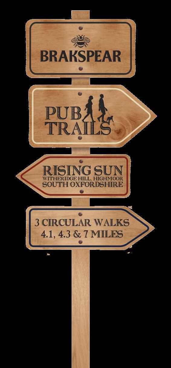
2 How to get there Driving: Postcode is RG9 5PF and there is a car park just across from the pub. Nearest station: Henley-on-Thames station is 5.6 miles away. We re delighted to present three circular walks all starting and ending at the Rising Sun. The Brakspear Pub Trails are a series of circular walks. We thought the idea of a variety of circular country walks all starting and ending at our pubs was a guaranteed winner. We have fantastic pubs nestled in the countryside, and we hope our maps are a great way for you to get out and enjoy some fresh air and a gentle walk, with a guaranteed drink at the end perfect! Our pubs have always welcomed walkers (and almost all of them welcome dogs too), so we re making it even easier with plenty of free maps. You can pick up copies in the pubs taking part or go to brakspearaletrails.co.uk to download them. We re planning to add new pubs onto them, so the best place to check for the latest maps available is always our website. We absolutely recommend you book a table so that when you finish your walk you can enjoy a much needed bite to eat too. At the weekend, please book in advance, as this is often a busier time, especially our smaller pubs. And finally, do send us your photos of you out and about on your walk. We really do love getting Local bus services: The M1 service from Whites Coaches goes to Highmoor Cross on Tuesday, Wednesday and Thursday. Brakspear would like to thank the Trust for Oxfordshire s Environment and the volunteers who helped make these walks possible. As a result of these walks, Brakspear has invested in TOE2 to help maintain and improve Oxfordshire s footpaths. Reg. charity no Respect - Protect - Enjoy Respect other people: Consider the local community and other people enjoying the outdoors Leave gates and property as you find them and follow paths unless wider access is available Protect the natural environment: Leave no trace of your visit and take your litter home Keep dogs under effective control Enjoy the outdoors: Plan ahead and be prepared Follow advice and local signs For more info visit: publications/the-countryside-code

 Time: 2-2.5 hours Route 3: Highmoor Nettlebed Estate Bix Greys Court Distance: 11.")
3 Swan Wood Highmoor Bix A4130 Route 2 Route 3 Highmoor Cross Holly Grove Witheridge Hill Bear Wood B481 Route 1 Shepherd s Green Greys Green The Rising Sun Witheridge Hill Highmoor Henley-on-Thames Oxfordshire RG9 5PF Tel: Brakspear recommends that all walkers bring a copy of the Chilterns Hills West Ordnance Survey map. You can borrow one from the pub for a refundable 10 deposit. Route 1: Shepherds Green Nettlebed estate Witheridge Hill Distance: 6.6km (4.1 miles) Time: 2.25 hours Route 2: Nettlebed estate Deadman s Lane Highmoor Distance: 6.8km (4.3 miles) Time: hours Route 3: Highmoor Nettlebed Estate Bix Greys Court Distance: 11.4km (7 miles) Time: 3-4 hours
, to another")
4 Route 1 Easy walking on fairly level terrain. 01 From the pub, walk to the path which runs just adjacent to the car park and follow this path as far as the Stoke Row road. 02 Cross the road with great care to a footpath almost directly opposite and follow this path up an incline, through a kissing gate, across a meadow, (from which there are good views), to another kissing gate. 03 Pass through this and proceed until the path splits. Take the path on the right, passing through another kissing gate, and cross another meadow where there is usually a profusion of wild flowers in the summer to a further kissing gate. 04 Pass through this and walk diagonally right across the Highmoor cricket ground, staying well clear of the actual cricket pitch, until a kissing gate is reached in the right hand corner adjacent to the Nettlebed Road (B481). 05 Cross this busy road with care to the footpath opposite and proceed through woodland, ignoring a path to the left until a path to the right is reached. Take this path and continue to the edge of the woodland and take the left-hand path which runs diagonally left across the arable field and continue until a lane is reached (Rocky Lane). 06 Cross this lane to a bridleway immediately opposite and follow this bridleway as it curves through Padnell s Wood until a four way junction of paths is reached. 07 Turn left here and walk to the edge of the wood, across a meadow, through a small wood, across another couple of meadows continuing straight ahead all the time via several kissing gates until the hamlet of Shepherd s Green is reached. 08 Walk straight ahead along the northern edge of the green until a footpath with a metal kissing gate is met on the right hand side of the track. Continue along this path, through and alongside paddocks via kissing gates, until a wood is reached and there is a split of paths. 09 Take the path on the left and follow this straight ahead ignoring a path which cuts across it. Continue along this path which curves to the left in a descent, ignoring the permissive path to the right, the descent steepens and fairly soon after this, go through a wooden kissing gate into a meadow and follow the path across this to another wooden kissing gate which leads onto Rocky Lane again. 10 Turn right and, after a short distance, take a path on the left into the National Trust woods and turn left to follow this permissive path for about 300 metres until the path splits. Des Blekinsopp Road through Nettlebed Estate Distance: 6.6km (4.1 miles) Time: 2.25 hours 11 Take the left hand path and follow this through the woods until a cross section of bridleways is reached. Continue straight ahead in the same direction on the lower bridleway heading in a northerly direction until another a four way junction of paths is reached. 12 Take the path on the left and walk though Tartary woods until at the end a stile is reached. 13 Go over the stile and turn sharp left and walk up a short incline to reach a metalled road (bridleway) which goes through the Nettlebed Estate. The Nettlebed estate is owned by the Fleming family. It is rumoured that Ian Fleming came up with idea of James Bond while living on the estate. 14 Bear left on this and walk along the road through the Estate to a cattle grid with an adjacent metal gate. Go through the gate until Rocky Lane is reached. 15 Turn right and then take a footpath almost immediately right through a bit of scrubland to an arable field. 16 Follow the path diagonally left through this field (we are now following the outward route in the reverse direction back to the pub) walk a short distance into the woods and turn left at the path junction. 17 Follow this path straight ahead to the B481, ignoring a path which leads off to the right. 18 Cross the road with care, walk across the cricket ground, follow the path straight ahead through the kissing gates and down to cross the Stoke Row road, again with great care as the visibility of oncoming traffic is very poor here. 19 Finally, walk across to the path opposite and back to The Rising Sun.
5 Route 2 Easy walking on fairly level terrain. Distance: 6.8km (4.3 miles) Time: hours 01 From the pub, walk to the path which runs just adjacent to the car park and follow this path as far as the Stoke Row road. 02 Cross the road with great care to a footpath almost directly opposite and follow this path up an incline, pass through a kissing gate, across a meadow, from which there good views, to another kissing gate. 03 Pass through this and proceed until the path splits. Take the path on the right, passing through another kissing gate, and cross another meadow where there is usually a profusion of wild flowers in the summer to a further kissing gate. 04 Pass through this and walk diagonally right across the Highmoor cricket ground, staying well clear of the actual cricket pitch, until a kissing gate is reached in the right hand corner adjacent to the Nettlebed Road (B481). 05 Cross this busy road with care to the footpath opposite and proceed through woodland, ignoring a path to the left until a path to the right is reached. Take this path and continue to the edge of the woodland and take the left-hand path which runs diagonally left across the arable field and continue until a lane is reached (Rocky Lane). 06 Turn left and then virtually immediately turn left again onto a tarmac bridleway through cattle grid and follow track. 07 Opposite Tartary Wood, before another cattle grid is reached, turn left onto a grass path to a wooden kissing gate in a wood called Scotland. Tartary Wood and much of the surrounding area are all part of the Nettlebed estate owned by the Fleming family. It is rumoured that Ian Fleming came up with idea of James Bond while living on the estate. 08 Proceed along this path bordered with rhododendrons until the junction with way mark post. 09 Turn right onto a bridleway and proceed along the bridleway past a house until a junction of paths is reached. 10 Follow the bridleway (tarmac) almost straight ahead for some way until reaching the B481. Close to this point is the Highmoor Trench. The Highmoor Trench is an ancient earthwork where the remains of many stone age tools and artefacts have been found. 11 Cross the road into Deadman s Lane. This is a bridleway which eventually reaches Swans Wood. The bridleway continues in the wood and then onto a tarmac road. 12 Continue uphill to the corner: Howberrywood Farm is to the right. Look back and admire the view towards Nettlebed. 13 Turn left at the way mark post and continue through the wood on a bridleway. 14 After a short distance, where the bridleway bends to the right, turn left onto a footpath (look for yellow arrow on a way mark post) and follow this well way marked path as it meanders through the wood (watch out for trip hazards of loose and protruding flints). 15 Continue past several fallen trees, cross a stile into a meadow from which there are fine views to the south. 16 Proceed directly ahead up a slight incline, to climb over another stile into a short section of wood, keeping straight ahead until nearly at the end of the wood a V junction is reached. 17 Bear slightly left here (look for a white arrow on a post a little way in the distance). 18 Proceed straight ahead into a field with fencing on the left of the footpath; follow the path through rhododendron and holly bushes arriving at a road. 19 Cross the road in a diagonally left direction, following the footpath. Walk across an access road noting yellow arrow disc on telegraph pole. Continue straight ahead (ignoring the path to the left) following a flint wall to the right of the path past the Old Barn and Highmoor Farm until a kissing gate is reached situated adjacent to a farm gate. Go through the kissing gate and bear right walking by the side of a horse paddock until a wooden kissing gate is reached. 20 Go through the gate and walk slightly diagonally right through an arable field. 21 Walk straight ahead, through a metal kissing gate, across a track, through another metal kissing gate, along the left side of a field, through another metal kissing gate and keeping straight ahead on the path between houses until a track is reached. 22 Turn right and follow the track down a slight incline and with a bungalow to the right, take the track to the left and follow this for about 100 yards until a road is reached. 23 Turn left and walk up the hill and the approach road to the pub is second on the right.
 Time: 3-4 hours 01 From the pub, walk out to the entrance of the car park and turn right and walk along the road until you reach a T junction, turn left and walk up the hill towards")

6 Route 3 Easy walking with one quite lengthy uphill stretch. Distance: 11.4km (7 miles) Time: 3-4 hours 01 From the pub, walk out to the entrance of the car park and turn right and walk along the road until you reach a T junction, turn left and walk up the hill towards Highmoor Village. 02 At the junction with the main road (B481), by the Highmoor Memorial Hall, cross over the main road, turn left and walk along the pavement in a northerly direction. 03 After about 250m and immediately after a derelict pub, turn right along a broad track. 04 Follow this track past Cherry Hill House and then turn right on to a bridleway. 05 Continue along the bridleway until you reach an intersection with a footpath. Turn left and follow the footpath downhill to a gate. 06 Go through the gate and bear left on to a tarmac farm road and at the cross roads turn right, following the sign to Bromsden Farm. Bromsden Farm has a beautiful tiled barn which forms an arch into the farmyard. The farm is part of Nettlebed estate owned by the Fleming family. It is rumoured that Ian Fleming came up with idea of James Bond while living on the estate. 07 Opposite Bromsden Farm is a statue of a knight on a winged horse. It is believed that the horse was a prop in the one of the James Bond movies and the wings and rider were added later. 08 Continue on in the same direction with the farm on your left and ignoring the footpath sign to the right. Turn left on to a path heading south that passes the side of the farm buildings. 09 Pass through a gate in the middle of some iron railings and cross through an orchard. In the left corner you will see a gate by a tennis court. 10 Go through this gate and immediately on the right, through another gate then follow the path downhill through the woods until you reach a broad track. 11 Turn left following the yellow arrow and after 50 metres, turn right following another yellow arrow. 12 Walk up the broad track and at the top, follow the yellow arrow to the right of a bank. Bromsden Farm 13 At the top of this path, you will see a large tranquil pond on your left. 14 Continue over a stile, bear to your left and follow the path round the edge of the field up to another stile. 15 Climb over this stile, turn left and walk along a broad fenced track. 16 At the next yellow arrow, cross the stile and walk diagonally across the field to the next stile. 17 Go over this stile and cross a track and over another stile following the yellow arrows. 18 Do the same again at the next two stiles. Walk through three fields and over the stiles towards a large white house. Winged Horse and Rider


7 Route 3 19 Go over a stile next to the white house on to a narrow footpath emerging at a busy main road (A4130). 20 Cross the dual carriageway with extreme care; cars pass here at speed. 21 On the far side of the road turn left, then at the Finger Post indicating Bix Bottom, turn right and go straight ahead on what can be a very muddy track. 22 Halfway across the field turn right on a track that leads towards some houses. Pass between the houses and turn right on to a tarmac road. 23 Walk pass the Village Hall on your left and beyond it you will see an open stretch of land known as Bix Common. Next to the Village Hall is St James Church and opposite is The Old School. Bix Common is owned by a group of nine householders by virtue of their ownership of houses in the parish. The establishment of the Commons dates back to 1300s and is not unique in England. In the 1800s a small weekly livestock market took place on the Common. During the War the scrub was cleared and the land used for cultivation. The present owners meet periodically and decide on its management. Currently it is leased for hay making according to a strict timetable. In 1875, St James Church at Bix replaced the tiny ruined Church at Bix Bottom. Michael Ford St James Church, Bix (Continued) 24 Continue along the road until your reach the A4130 once more which you need to re-cross, again, with care. 25 Take the road opposite, pass Bix Manor on the left and on the right is the Water Tank at Bix. The Water Tank at Bix was constructed in Water has always been scarce in the Chilterns but during the second half of the 19th Century it was discovered that a lack of clean drinking water was not just an inconvenience, but the cause of significant and often fatal diseases such as cholera. Consequently, efforts were made to improve the water supply. After the advent of piped water, the tank fell into disuse and became derelict but was eventually restored between 1998 and Boris Johnson MP took part in the commemoration ceremony. Deer near Highmoor Water Tank at Bix


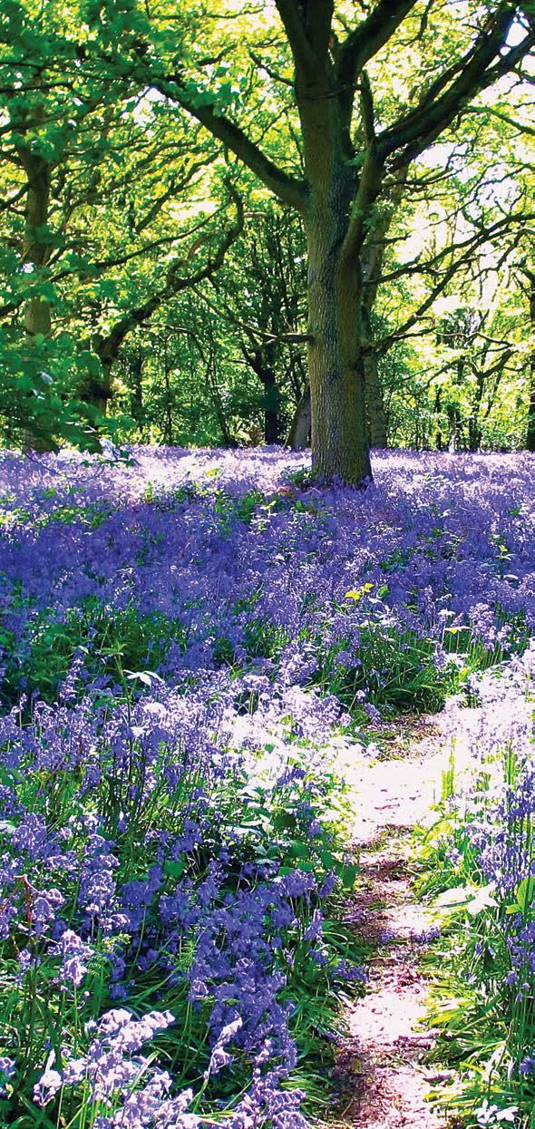
8 Route 3 (Continued) Andrew Smith Bix Common 26 Continue along the road until you reach the sign for Lawrence Farm then turn right along the track. 27 At the gate to a cream cottage with a very prominent Private sign, turn right and enter a small field through an iron gate. 28 Enter the wood through another iron gate, bear left and keep straight on through the wood, despite the mud and paths crossing, to a kissing gate. 29 Where the path forks, take the left hand fork, pass through a second kissing gate and cross the track and follow the footpath sign, taking you past some farm buildings. 30 Follow the yellow arrow through two gates and past some attractive ponds. Continue over a wooden bridge next to one of the ponds. 31 Follow the yellow arrow through three more gates, the last with a picnic table on the left. 32 Follow the path to the main drive to the wonderful Greys Court one of the many jewels in the crown of the National Trust. 34 Continue on downhill and just before the road, take the right fork on to a grass path. 35 Follow the green National Trust footpath signs (green arrows) and where the path forks, take the left fork. 36 The path runs parallel with the road (Rocky Lane) so you can use the road if you prefer. However, sticking to path is preferable especially when the bluebells flower, the woods are ablaze with colour. 37 Keep the road in view and when the path forks again go left and exit on to the road via a broken stile. 38 Continue walking uphill along Rocky Lane passing some large houses, among them Rose Farm, Rocky Lane Orchard and Rocky Lane Farm. When the lane makes a sharp left, continue straight ahead on the footpath following the yellow signs. 39 Follow the path diagonally across the field and walk a short distance into the woods. Turn left at the path junction. 40 Follow this path straight ahead to the B481, ignoring a path which leads off to the right. 41 Cross the road with care, and enter the Highmoor Cricket Ground via a kissing gate. 42 Walk across the cricket ground, follow the path straight ahead through the kissing gates and down to the road to Stoke Row. 43 Cross the road with great care as the visibility of oncoming traffic is very poor here. 44 Finally walk across to the path opposite and back to The Rising Sun on opposite site of the car from where you departed. Greys Court is a stunning Tudor country house with gardens. It is well worth taking a break from the walk to enjoy what it has to offer. 33 Follow the yellow arrows along the main drive, passing Greys Court on your right. This path affords excellent views of the house and grounds. Greys Court
9 The Rising Sun Opening Hours: Monday Thursday: 11am 3pm & 5pm onwards Friday Sunday: Open all day from 11am Food Service: Monday Saturday: 12pm 3pm & 6pm 10pm Sunday: 12pm 8pm Disabled Access Dog Friendly Family Friendly Garden/Patio Hold a Party Park the Car WiFi Access The Rising Sun Witheridge Hill, Highmoor Henley-on-Thames, Oxfordshire RG9 5PF Tel: Brakspear, The Bull Courtyard, Bell Street Henley-on-Thames, Oxfordshire RG9 2BA info@brakspear.co.uk This info was correct at the time of going to print. Printed April 2017 v1
How to get there. Respect - Protect - Enjoy
 How to get there Driving: Postcode is OX10 6AD with a car park for customers. Nearest station: Goring & Streatley station is 5.6 miles away. We re delighted to present three circular walks all starting
How to get there. Respect - Protect - Enjoy
 How to get there Driving: Postcode is RG9 3DG and there is a carpark just across from the pub. Nearest station: Henley-on-Thames station is 5.6 miles away. We re delighted to present three circular walks
How to get there. Respect - Protect - Enjoy
 How to get there Driving: Postcode is OX49 5HL with a car park for customers Nearest station: Henley on Thames station is 9.5 miles away. We re delighted to present three circular walks all starting and
How to get there. Respect - Protect - Enjoy
 How to get there Driving: Postcode is RG9 6QU and there is a car park for customers. Nearest station: Marlow train station is 7.8 miles away. We re delighted to present three circular walks all starting
The Mendip Way. Route Directions and Maps Wells to Frome
 The Mendip Way Route Directions and Maps Wells to Frome Website: www.mendiphillsaonb.org.uk Email: mendip@mendiphillsaonb.org.uk Facebook & Twitter: @MendipHillsAONB Phone: 01761462338 1 Wells to Shepton
Danbury Words and pictures by Laurie Page of the Public Rights of Way team at Essex County Council.
 Danbury Words and pictures by Laurie Page of the Public Rights of Way team at Essex County Council. An undulating walk from Danbury village to the bluebells at the National Trust property of Blakes Wood.
THE WELLDIGGERS ARMS, HESWORTH AND FITTLEWORTH TRAIL
 THE WELLDIGGERS ARMS, HESWORTH AND FITTLEWORTH TRAIL 5.5 miles Circular 3 hours 041017 Challenging Terrain A 300-year-old pub turned country-inn on the edge of the South Downs National Park, The Welldiggers
BALCOMBE AND ARDINGLY RESERVOIR, WEST SUSSEX
 BALCOMBE AND ARDINGLY RESERVOIR, WEST SUSSEX 7 miles Circular 4 hours 080816 Challenging Terrain Hi, I'm Luke and this is my West Sussex Weekends walk It's a 7 mile loop from Balcombe rail station, taking
Stokenchurch. Bluebell Woods, Bomber Memorial, Red Kites, Getty s Cricket Ground, Nature Reserve
 Stokenchurch Bluebell Woods, Bomber Memorial, Red Kites, Getty s Cricket Ground, Nature Reserve Bomber Memorial The best time to visit Cowleaze Wood is in the spring when there is a memorable display of
Hammer Vale and Linchmere Common
 point your feet on a new path Hammer Vale and Linchmere Common Distance: 9 km=5½ miles or 6 km=3¾ miles easy walking with one steep section Region: Hampshire, West Sussex Author: Botafuego Refreshments:
Slindon Folly - South Downs, West Sussex
 Slindon Folly - South Downs, West Sussex Starts at Park road-side near entrance to Slindon College 2 hours 15 minutes 4.5miles 7.2km Easy ID: 0.1598 Developed by: Chris Mumford Checked by: Rockpit www.ramblersroutes.org
LDWA SOUTH DOWNS MARATHON 13 th MAY 2018
 AHD ahead SDW South Downs Way BL/BR bear left/bear right TL/TR turn left/turn right X cross LEG 1 - EAST DEAN to WP1 NORTON GR 470019. Open 1030 to 1300. 9.7 miles. 1.1 From village hall TL and walk to
THE DOG AND DUCK HAREWOODS ESTATE TRAIL. 6 Miles Circular 3 hours. Getting there. Walk Sections
 THE DOG AND DUCK HAREWOODS ESTATE TRAIL Moderate Terrain A 6 mile circular pub walk from the Dog and Duck in Outwood, Surrey. The Dog and Duck is a delightful pub where everyone is made welcome. From walkers
Approximate distance: 10 miles For this walk we ve included OS grid references should you wish to use them. Start. End
 Approximate distance: 10 miles For this walk we ve included OS grid references should you wish to use them. 2 3 Start End 1 N W E S Reproduced by permission of Ordnance Survey on behalf of HMSO. Crown
Walk Description. Directions
 Title: Saffron Trail: Battlesbridge to Chelmsford Distance: 14¾ miles Time taken: 6 hours Start Point: Outside the Barge Inn, Battlesbridge OS Explorer Map: 175 & 183 Grid Ref.: TQ 780 947 Transport: Rail:-
8 Miles Circular 4 hours
 VISIT RYEDALE HELMSLEY AND RICCAL DALE 8 Miles Circular 4 hours 090616 Challenging Terrain An 8 mile (13km) circular walk from the market town of Helmsley in Ryedale. The route heads out across sheep pastures
HARDMOORS 26.2 WHITE HORSE HALF ROUTE DESCRIPTION - 018
 HARDMOORS 26.2 WHITE HORSE HALF ROUTE DESCRIPTION - 018 Follow Cleveland Way, keeping to the left hand path (right path is a bike trail) Ignoring any turnings to the left or right At path junction (after
LDWA SOUTH DOWNS MARATHON
 AHD ahead SDW South Downs Way BL/BR bear left/bear right TL/TR turn left/turn right SP signpost/fingerpost X cross LEG 1 - EAST DEAN to WP1 NORTON GR 470019. Open 1030 to 1300. 9.6 miles. 1.1 From village
Route: Skewsby Foulrice Stearsby
 Route: Skewsby Foulrice Stearsby Distance: 7 miles Map: Explorer: 300 Howardian Hills & Malton Start (OS ref): SE625710 Park in the village of Skewsby. Walk east out of the village to the T-Junction and
9.5 km Circular 3 hours
 RANMORE CIRCULAR A 6 mile (9.5km) circular walk from Boxhill and Westhumble Station in the village of Westhumble, passing through part of the Polesden Lacey Estate, Ranmore Common and Denbies Vineyard.
Husthwaite to Byland Abbey
 Husthwaite to Byland Abbey This walk begins with a loop round the village of Husthwaite and continues towards Coxwold along a disused railway line, which is now a right of way. It passes through Coxwold
This walk description is from happyhiker.co.uk
 This walk description is from happyhiker.co.uk Pendle Hill Walk From Barley Starting point and OS Grid reference Ordnance Survey map Distance Traffic light rating Barley village honesty box car park OS
9.5 km Circular 3 hours
 MEDIEVAL WAVERLEY Challenging Terrain A 6 mile (9.5km) undulating circular walk from Tilford village passing close to The Sands village and the historic ruins of Waverley Abbey. From the top of Crooksbury
Welsh Newton and Woodland
 Welsh Newton and Woodland This is a 8.2km miles (approx) walk which will take about 2.5 hours at a relaxed and leisurely pace. There are a few hills but no steep inclines. Start at Llangrove bus stop and
10 Miles Circular 5 hours
 VISIT RYEDALE PICKERING AND CAWTHORN CAMPS 10 Miles Circular 5 hours Moderate Terrain 120616 A 10 mile (16km) there and back walk from the market town of Pickering in Ryedale. The route heads north through
Beautiful Walks from the Blue Ball Inn
 Walk No. 7 COAST AND VALLEY WALK Countisbury, Glenthorne, County Gate, Brendon, Rockford and Wilsham 10 MILES APPROX. Walking time 5 hours approx. (not including breaks)> OS Sheet 64/74 Lynton and Lynmouth.
Although the majority of these walks are around country lanes you should still follow the Country Code:-
 With the update of the Parish Plan was a request for details of any Walks around Pillaton The following pages give several walks that I and my wife have done for many years. Please be aware that NONE OF
Bix and the Assendons
 point your feet on a new path Bix and the Assendons Distance: 8½ km=5½ miles Region: Chilterns Author: Phegophilos Refreshments: Lower and Middle Assendon Map: Explorer 171 (Chiltern Hills West) hopefully
The North Pennines from near Langwathby
 3.6 Langwathby to Armathwaite Map panel?? Distance 12.7 miles (20.5 km) Terrain farm, woodland and riverside paths; some potentially muddy tracks; a few short sections of road Grade gently undulating Food
LOCAL CIRCUIT EM1: EAST MALLING & BARMING HEATH. N 2m ROADS: Significant roads PATHS: Starting direction Barming Longsole Mission Church
 Ditton Church Scott Close LOCAL CIRCUIT EM1: EAST MALLING & BARMING HEATH 6 Community Centre F Open fields (see 'Introductory Notes') 1m 88 Direction label (as in the walk notes) East Malling Church -
Dyrham and Hinton Parish Walks
 Dyrham and Hinton Parish Walks A series of five walks in the parish, exploring most of the public footpaths. By John Miller Each walk is described in detail, with a complete map, to provide a handy guide
Heartwood Forest, in Sandridge, Hertfordshire, is a place where everyone can find space, peace, wildlife and miles of beautiful woodland to explore.
 Heartwood Forest Accessibility Statement September 2016 Purpose: This accessibility statement outlines the available facilities and access information for Heartwood Forest. Welcome We, the Woodland Trust,
Masson Hill. Walk. Approximately 4 km. Moderate Walk Begins from Matlock Railway Station
 Masson Hill Walk Approximately 4 km Moderate Walk Begins from Matlock Railway Station TOWN WALKS Masson Hill walk is approx. 4 km. It can be walked in a couple of hours or so. Enjoy your walk and the beautiful
Redesdale Arms. A Trio of Walks
 Redesdale Arms A Trio of Walks Welcome to The Redesdale Arms Hotel The award winning 34 bedroom Redesdale Arms Hotel sits at the gateway to the Cotswolds in the High Street of the historic town of Moreton-in-Marsh.
NEWLANDS CORNER AND ST MARTHAS
 NEWLANDS CORNER AND ST MARTHAS 10k CIRCULAR ROUTE 2½-3HRS GU4 8SE From Newlands Corner on the North Downs just outside Guildford, you can enjoy one of the most beautiful panoramas of quintessential English
RILLINGTON TO MALTON by Tania Dickinson
 RILLINGTON TO MALTON by Tania Dickinson This walk takes you from the Vale of Pickering up on to the Wold scarp, before dropping down again through the pretty village of Settrington and joining the Centenary
Lincolnshire Limewoods Walks. Woodhall Spa. A circular walk of 13km (8 miles)
") Lincolnshire Limewoods Walks Woodhall Spa A circular walk of 13km (8 miles) Introduction The Lincolnshire Limewoods is an area between Wragby, Bardney and Woodhall Spa. It is a fantastic place to explore
Lincolnshire Limewoods Walks Woodhall Spa A circular walk of 13km (8 miles) Introduction The Lincolnshire Limewoods is an area between Wragby, Bardney and Woodhall Spa. It is a fantastic place to explore
Walks Around Bishopstone & Hinton Parva
 The Walks: From ½ mile ambles to 8 mile scenic loops Hinton Parva Walks H1 H2 H3 Bishopstone Walks B1 B2 B3 B4 B5 Walk B1: Bishopstone Village, The Dingle (stream) & Pond A short circular village amble
9.5 km Circular 3 hours
 SILENT POOL AND ST MARTHA S HILL Challenging Terrain A 9.5km (6 mile) circular walk in the Surrey Hills, visiting a number of popular attractions including Silent Pool, a stretch of the North Downs Way,
Walk Description. Directions
 Title: East Hanningfield Distance: 8 miles / 9 miles Time taken: 3-3½ hours Location: 5 miles south east of Chelmsford Parking: Free car park off The Tye, East Hanningfield, next to the primary school
Harlington - Sharpenhoe - Pulloxhill
 Harlington - Sharpenhoe - Pulloxhill ID: 3676, Distance: 8 miles, Height gain: 140 Metres, Map: Explorer 193 Luton & Stevenage, Contributor: Dennis Jeanes Duration: 3 Hours 27 Mins Features Church,Great
Lincolnshire Walks. Grainthorpe. Three circular walks of 2 ¾, 9 and 9 ½ km (1 ¾, 5 ½ and 6 miles)
") Lincolnshire Walks Grainthorpe Three circular walks of ¾, 9 and 9 ½ km (1 ¾, ½ and 6 miles) Introduction Explore the coastal marshes, arable hinterland, Louth Navigation canal and the village of Grainthorpe
Lincolnshire Walks Grainthorpe Three circular walks of ¾, 9 and 9 ½ km (1 ¾, ½ and 6 miles) Introduction Explore the coastal marshes, arable hinterland, Louth Navigation canal and the village of Grainthorpe
The Hundred Parishes
 The Hundred Parishes Walks from railway stations number 9 6.4 miles (10kms) from Bishop s Stortford to Stansted Mountfitchet Start: Bishop s Stortford station (Grid Reference TL492209) (ample parking and
Distance: 14 km=8½ miles or 7 km=4½ miles easy-to-moderate walking
 point your feet on a new path Normandy Distance: 14 km=8½ miles or 7 km=4½ miles easy-to-moderate walking Region: Surrey Author: Botafuego Refreshments: Pirbright, Ash date written: 20-feb-2012 date revised:
Poundgate and The Hurstwood
 point your feet on a new path Poundgate and The Hurstwood Distance: 11 km=7 miles Region: East Sussex Author: Stivaletti Refreshments: High Hurstwood easy walking Date written: 24-jul-2016 Last update:
Outwood: oaks, buttercups and windmill
 point your feet on a new path Outwood: oaks, buttercups and windmill Distance: 9 km=5½ miles Region: Surrey Author: Schwebefuss Refreshments: Outwood easy walking Date written: 23-may-2014 Last update:
Bakewell Club Site - Robin Hood's Stride
 Bakewell Club Site - Robin Hood's Stride Camping and Caravanning Route Summary A circular walk with fabulous views winding it's way through the beautiful White Peak scenery. Points of interest include
NETTLESTEAD & YALDING
 NETTLESTEAD & YALDING ULL CIRCUIT - Sheet 1 (first and last sections) Open fields (see 'Introductory Notes') 88 Direction label (as in the walk notes) ROADS: 81 10m Significant roads Redhill arm North
EAST GRINSTEAD AND THE HIGH WEALD, WEST SUSSEX
 EAST GRINSTEAD AND THE HIGH WEALD, WEST SUSSEX 7 miles Circular 3.5 hours 301015 Challenging Terrain Hi, I'm Tom and this is my West Sussex Weekends walk. I live and work in London but often head out of
Aston Village: The Flowerpot (pub walk)
") point your feet on a new path Aston Village: The Flowerpot (pub walk) Distance: 10 km=6¼ miles or 8 km=5 miles (omitting the weir) Region: Berkshire, Chilterns Author: MacMeadow Refreshments: Henley, Aston
point your feet on a new path Aston Village: The Flowerpot (pub walk) Distance: 10 km=6¼ miles or 8 km=5 miles (omitting the weir) Region: Berkshire, Chilterns Author: MacMeadow Refreshments: Henley, Aston
Hascombe and Winkworth Arboretum Downs Link Path, Smithbrook Kilns
 point your feet on a new path Hascombe and Winkworth Arboretum Downs Link Path, Smithbrook Kilns Distance: 18 km=11 miles Region: Surrey Author: RDC easy walking Date written: 7-may-2016 Last update: 30-aug-2018
The main feature of this tranquil walk is a visit to the source of the Thames (the Thames head) which is in a field just 3 km from Kemble station
 which is in a field just 3 km from Kemble station") SWC Walk DRAFT Kemble circular: the source of the River Thames. The main feature of this tranquil walk is a visit to the source of the Thames (the Thames head) which is in a field just 3 km from Kemble
SWC Walk DRAFT Kemble circular: the source of the River Thames. The main feature of this tranquil walk is a visit to the source of the Thames (the Thames head) which is in a field just 3 km from Kemble
Thornton le Dale Walks
 Thornton le Dale Walks A collection of circular walks in, and around, the village www.visitthorntonledale.co.uk Thornton-le-Dale Traders Forum and Thornton le Dale Parish Council 1 Thornton le Dale Circular
Winterfold Wood. point your feet on a new path. In Brief
 point your feet on a new path Winterfold Wood Distance: 8½ km=5¼ miles Region: Surrey Author: Schwebefuss Refreshments: Windmill Inn, Peaslake after the walk moderate walking with many gradients Date written:
Follow the Lantern Way clockwise from Dursley Town Hall through Cam & Coaley to Uley and back to Dursley (about 14 miles)
") According to the Rev Kilvert's diary of 1873, couples on their way to evening services in winter followed a practical though unusual local tradition: "My Mother says that at Dursley, when ladies and gentlemen
According to the Rev Kilvert's diary of 1873, couples on their way to evening services in winter followed a practical though unusual local tradition: "My Mother says that at Dursley, when ladies and gentlemen
Tideswell to Castleton
 Tideswell to Castleton 1 Walk summary Length: 14 km, 8.5 miles Maps: OS Explorer OL1 The Peak District - Dark Peak Area, OS Explorer OL24 The Peak District - White Peak Area, OS Landranger 110 Sheffield
A circular walk of or km (2 1 4 or miles)
") Grantham A circular walk of 3 3 4 or 5 3 4 km (2 1 4 or 3 1 2 miles) Introduction This relatively short circular walk, which starts in the middle of Grantham, offers plenty of variety. The route takes
Grantham A circular walk of 3 3 4 or 5 3 4 km (2 1 4 or 3 1 2 miles) Introduction This relatively short circular walk, which starts in the middle of Grantham, offers plenty of variety. The route takes
Walk 2: Beamsley Beacon and Bolton Abbey
 Walk 2: Beamsley Beacon and Bolton Abbey Start and Finish: The Memorial Hall, Main Street, Addingham, LS29 0LZ, SE 079 497 The shortest walk is about 5½ miles (8.8km) The medium Walk is about 8¼ miles
Uif!Sfe!Mjpn-!Mpnhepn! bne!dbnnpdl!dibtf-! Tubggpsetijsf
 Uif!Sfe!Mjpn-!Mpnhepn! bne!dbnnpdl!dibtf-! Tubggpsetijsf 7/6!njmft! Djsdvmbs!!!!!!! 4!up!4/6! ipvst Strenuous Terrain Uif!Sfe!Mjpn!jt!b!dmbttjd!wjmmbhf!qvc-!b! hsfbu!qmbdf!up!tbujtgz!zpvs!ivnhfs!bgufs!b!
WETHERBY CIRCULAR by Tania Dickinson
 WETHERBY CIRCULAR by Tania Dickinson This walk in lower Wharfedale includes a disused railway line at the beginning and riverside at the end, with parkland, fields, woodland and villages in between. Distance
holly tree Wellhill Farm Woodyard Bramham House red kites Round House ha-ha
 This 6.4 mile walk around the magnificent Bramham Park Estate has been made possible with the active support of the owner of the Estate, Nick Lane Fox, with funding from Natural England, as part of Defra
10 km Circular 3 hours
 FRIMLEY AND FRIMLEY GREEN 10 km Circular 3 hours Easy Terrain 250716 A 10km (6 mile) circular walk exploring the canal towpath, riverside path, woodland, heath and small settlements around Frimley in Surrey.
There are toilets at Manningtree Station, Flatford (close to the hump back bridge) and in Dedham.
 and in Dedham.") Arriving by Train Main Features of the Walk Outline Route Employs particularly attractive paths, many of which offer impressive views across Dedham Vale. Includes a section along the tidal section of the
Arriving by Train Main Features of the Walk Outline Route Employs particularly attractive paths, many of which offer impressive views across Dedham Vale. Includes a section along the tidal section of the
Oldbury & Littleton, South Gloucestershire
 Oldbury & Littleton, South Gloucestershire Starts at Church Lane, Oldbury. BS35 1QF 2 hours 0 minutes 5.2miles 8.4km Easy ID: 0.2468 Developed by: GEOFF MULLETT Checked by: Marion Stone www.ramblersroutes.org
Thornton le Dale Walks
 Thornton le Dale Walks A collection of walks in and around the village Thornton le Dale Traders Forum www.visitthorntonledale.co.uk Thornton le Dale Walks Walk 1: Beck Isle Cottage and All Saints Church
Distance: 5 km=3 miles or 4½ km=2¾ miles or 3½ km=2 miles
 point your feet on a new path Vann Lake Distance: 5 km=3 miles or 4½ km=2¾ miles or 3½ km=2 miles Region: Surrey Author: Schwebefuss Refreshments: Ockley easy walking Date written: 12-feb-2011 Date revised:
ST. AGNES. you cannot put a time limit on beauty.
 ST. AGNES CIRCULAR WALKS AROUND There are many enjoyable and picturesque walks around St. Agnes most are signposted and are featured on the St. Agnes Mini-guide map. Because most of our footpaths are in
GENERAL INFORMATION PLEASE FOLLOW THE COUNTRYSIDE CODE:
 KNIGHTON CIRCULAR WALKS The East Radnor Group of the Ramblers Association invites you to enjoy these walks around Knighton. Knighton is an excellent centre for walks in the lovely unspoilt mid-wales countryside
Waterhead Pier to Orrest Head, Windermere and Bowness
 Waterhead Pier to Orrest Head, Windermere and Bowness A 4 1 2 hour walk through Woodlands and the Troutbeck Valley with spectacular Lake and Mountain views and a lakeshore path. Walk 10 Walk 11 Walk 12
Dorridge & District Residents Association A Walk Along The Green Belt From Dorridge to Catherine-de-Barnes
 Dorridge & District Residents Association A Walk Along The Green Belt From Dorridge to Carine-de-Barnes The starting section of this walk through open fields would be destroyed by building of motorway
Clyde Walkway Community Links: Crossford Stonebyres Nemphlar- Kirkfieldbank
 Clyde Walkway Community Links: Crossford Stonebyres Nemphlar- Kirkfieldbank Crossford Stonebyres Nemphlar - Kirkfieldbank Digital Trail Difficulty (out of 3) 2 Distance 1. Crossford to Kirkfield Bank Bridge
A Walk around Holmes Chapel starting & finishing at Holmes Chapel Railway Station. by Tony & Lindsay Wright (2016)
") A Walk around Holmes Chapel starting & finishing at Holmes Chapel Railway Station. by Tony & Lindsay Wright (2016) Introduction Holmes Chapel Railway Station is on the Crewe to Manchester line. The station
A Walk around Holmes Chapel starting & finishing at Holmes Chapel Railway Station. by Tony & Lindsay Wright (2016) Introduction Holmes Chapel Railway Station is on the Crewe to Manchester line. The station
Pull the gate towards you and ride through. The third gate takes you onto Hound House Road. Watch out for traffic. 4
 PEASLAKE TO FARLEY HEATH AND WINTERFOLD 12k CIRCULAR ROUTE 2HRS GU5 9QW This interesting trail takes you across a variety of terrain, from the sandstone of Pitch Hill, across open farmland with fabulous
SUMMER WALK 10. The Chairmakers, Worlds End
 SUMMER WALK 10 The Chairmakers, Worlds End Tuesday 10 th June 7.30pm This is a very short walk made so due to the majority of the footpaths in the area around the Chairmakers being overrun with high nettles
Views! village, woodland, hills, high trails, fine houses, hidden church
 point your feet on a new path Heath Distance: 9½ km=6 miles Region: Chilterns Author: Phegophilos Refreshments: easy walking Date written: 13-oct-2017 Map: Explorer 171 (Chiltern Hills West) but this guide
Sandilands to Huttoft Bank
 Coastal Country Park Walks Sandilands to Huttoft Bank A CIRCULAR WALK OF 11KM (7 MILES) INTRODUCTION The Lincolnshire Coastal Country Park lies between Sandilands, Chapel St Leonards and Huttoft on the
11 Miles Linear 5 to 6 hours
 11 Miles Linear 5 to 6 hours Sussex Hospices Trail Part 21: BALCOMBE TO HORSHAM Moderate Terrain 030918 An 11 mile linear walk from Balcombe rail station to Horsham rail station in West Sussex, forming
THE PONTON PLOD - 27 MILE ROUTE
 THE PONTON PLOD - 27 MILE ROUTE Emergency Phone Number 07771 813514 Abbreviations: BW Bridleway X Cross immd immediately FP Footpath TL Turn left L Left thro through KG Kissing Gate TR Turn right R Right
CHINTHURST HILL AND THE GRANTLEY ARMS, SURREY
 CHINTHURST HILL AND THE GRANTLEY ARMS, SURREY 4 miles Circular 2 hours 110417 Challenging Terrain A 4 mile (can be shortened to 3 miles) circular pub walk near Wonersh in Surrey. The walk begins with an
Lincolnshire Walks. Ancaster. Three cir cular walks of2 3/4,4or 6km (11/3, 21/2 or 33/4 miles)
") Lincolnshire Walks Ancaster Three cir cular walks of2 3/4,4or 6km (11/3, 21/2 or 33/4 miles) Introduction These walks are set in the attractive countryside around the historic town of Ancaster. The town
Lincolnshire Walks Ancaster Three cir cular walks of2 3/4,4or 6km (11/3, 21/2 or 33/4 miles) Introduction These walks are set in the attractive countryside around the historic town of Ancaster. The town
Uif!Cmbdl!Kvh!bne! Wbsnibn!Qbsl-!Ipstibn-! Wftu!Tvttfy
 Uif!Cmbdl!Kvh!bne! Wbsnibn!Qbsl-!Ipstibn-! Wftu!Tvttfy 7/6!njmft! Djsdvmbs!!!! 3/6!up!4! ipvst 200114 Moderate Terrain Uif!Cmbdl!Kvh!jt!b!hsfbu!upxn!qvc!dfnusfe! bspvne!b!mbshf!cbs!xjui!xppefn!qbnfmmjnh-!
Bonnie Prince Charlie Walk
 Bonnie Prince Charlie Walk A waymarked route from Ashbourne to Derby to celebrate the 60th anniversary (1995) of the formation of the Ramblers' Association. This route follows the general direction of
North Downs Way Monster Alternative North Downs Way Double Walk Box Hill or Dorking to Newlands Corner or Guildford
 point your feet on a new path North Downs Way Monster Alternative North Downs Way Double Walk Box Hill or Dorking to Newlands Corner or Guildford Distance: 0 or 6 km=8½ or 6 miles (by rail) or 6 km=½ miles
Fernhurst and the Temple of the Winds
 point your feet on a new path Fernhurst and the Temple of the Winds Distance: 8 km=5 miles Region: West Sussex Author: Hautboy Refreshments: Fernhurst moderate walking Date written: 12-sep-2012 Last update:
Bagshot Heath and Swinley Forest
 point your feet on a new path Bagshot Heath and Swinley Forest Distance: 13 km=8 miles Region: Berkshire, Surrey Author: Botafuego Refreshments: Forest Look Out, Bagshot easy walking Date written: 17-feb-2013
Walking Pembrokeshire.
 Walking Pembrokeshire Canaston Woods Walk It s good to walk, so why not step out and sample some of the walks your neighbourhood has to offer. This pleasant and interesting walk which starts and finishes
Walk 7: Watchet to washford
 Walk 7: Watchet to washford Length: Moderate - 7.5 miles / 12 km Good For: Theme: History Duration: 2-3 hours depending on speed of walking Notes: This is a moderate to difficult walk in places, with steps,
Goring-on-Thames Wildwood, Riverrun
 point your feet on a new path Goring-on-Thames Wildwood, Riverrun Distance: 22 km=13½ miles Region: Chilterns Author: MacMeadow Refreshments: Woodcote, Whitchurch, Goring easy-to-moderate walking Date
Distance: 9½ km=5¾ miles moderate walking or two walks of 4¼ km=2¾ miles and 6½ km=4 miles
 point your feet on a new path White Hill, Headley Distance: 9½ km=5¾ miles moderate walking or two walks of 4¼ km=2¾ miles and 6½ km=4 miles Region: Surrey Author: Fusszweig Refreshments: Headley Date
Effingham to Westhumble
 Main walk morning last checked Main walk afternoon last checked Pub diversion last checked Westhumble Circular last checked 12 December 2017 23 December 2017 19 August 2015 27 October 2017 Document last
Hindleap and Vachery Ashdown Forest, Chelwood Gate, Forest Row
 point your feet on a new path Hindleap and Vachery Ashdown Forest, Chelwood Gate, Forest Row Distance: 5 km=9½ miles Region: East Sussex Author: Stivaletti Refreshments: Chelwood Gate, Forest Row Map:
TOCKENHAM. Walks for Healthy Living. The Countryside Code (October 2016) Respect other people:
 Respect other people:") The Countryside Code (October 2016) TOCKENHAM Respect other people: consider the local community and other people enjoying the outdoors leave gates and property as you find them and follow paths unless
The Countryside Code (October 2016) TOCKENHAM Respect other people: consider the local community and other people enjoying the outdoors leave gates and property as you find them and follow paths unless
Chapel Point to Anderby Creek
 Coastal Country Park Walks Chapel Point to Anderby Creek A CIRCULAR WALK OF 8.5 OR 6 KM (5.3 OR 3.75 MILES) INTRODUCTION The Lincolnshire Coastal Country Park lies between Sandilands, Chapel St Leonards
Blackheath and Shamley Green
 point your feet on a new path and Shamley Green Distance: 14 km=9 miles Region: Surrey Author: Schwebefuss Refreshments:, Shamley Green easy walking with one climb Date written: 27-jun-2009 Date revised:
Fingest, Christmas Common, Pishill, Turville Red Kites and Red Deer
 point your feet on a new path Fingest, Christmas Common, Pishill, Turville Red Kites and Red Deer Distance: 23 km=14 miles Region: Chilterns Author: Bryntafion Refreshments: every village! Map: Explorer
Brightwalton, Chaddleworth, Leckhampstead, Peasemore: Four Downland Villages
 point your feet on a new path Brightwalton, Chaddleworth, Leckhampstead, Peasemore: Four Downland Villages Distance: 13 km=8 miles Region: Berkshire Author: MacMeadow Refreshments: Peasemore, Leckhampstead
Tinneyhall Wood, Cornwall - About 9 ½ acres, 59,000
 Tinneyhall Wood, Cornwall - About 9 ½ acres, 59,000 Tinney Hall is a hamlet close by the small hilltop village of Lewannick, which is centred around a crossroads. This is unusual for Cornwall, where the
Dragonflies and a Church-on-the-Hill Chantries, Shalford, Blackheath
 point your feet on a new path Dragonflies and a Church-on-the-Hill Chantries, Shalford, Blackheath Distance: 16 km=10 miles Region: Surrey Author: Schwebefuss Refreshments: Shalford (choice of two) easy-to-moderate
Distance: 15 km=9 miles, with 2 optional diversions 1-2 km each easy walking
 point your feet on a new path Hascombe from Afar Distance: 15 km=9 miles, with 2 optional diversions 1-2 km each easy walking Region: Surrey Author: Schwebefuss Refreshments: Hascombe Date written: 9-may-2010
Walk 3 - Woodbridge and Melton A Walk Round Waldringfield by Sue and Jim Stacey. Woodbridge. shopping centre, cafes, toilets etc. tide mill.
 Walk 3 - Woodbridge and Melton A Walk Round Waldringfield by Sue and Jim Stacey. road with roundabout church railway with station walk route showing description direction track, wide path, bridlepath footpath