Monroe Street Reconstruction Planning
|
|
|
- Nigel Evans
- 6 years ago
- Views:
Transcription


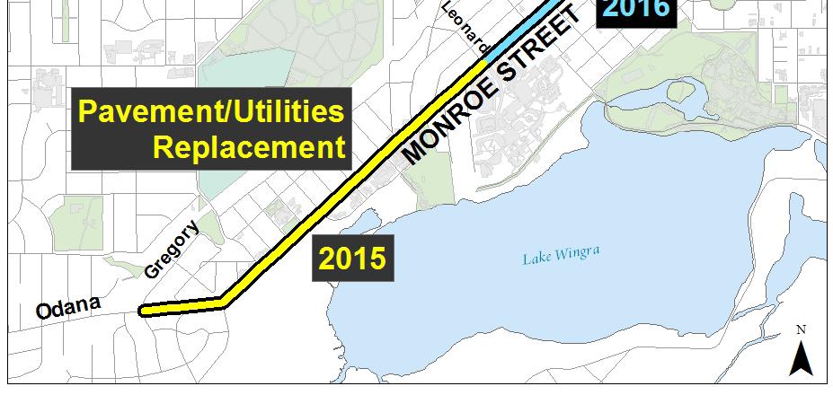
1 Monroe Street Reconstruction Planning July 2014 Monroe Street Reconstruction Project
2 What to expect this evening Introductions Project to date Project scope and summary of input from April meeting Details: p// / g/ / Table conversations on three key topics Pedestrian safety Streetscape amenities (especially lighting) Crazylegs Triangle Wrap-up, feedback forms and next steps
3 Introductions City Planning, Engineering and Economic Development staff New Alder Your turn

4 Project scope

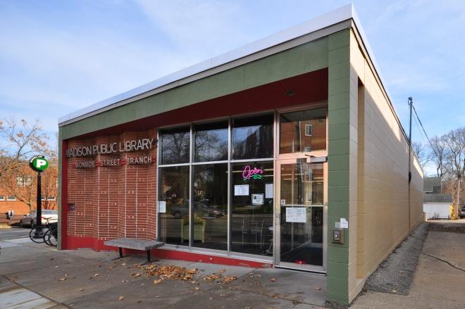
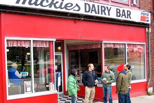
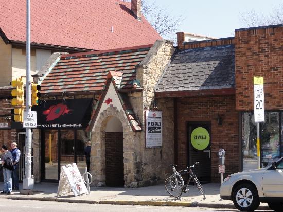
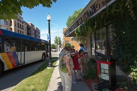
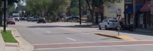
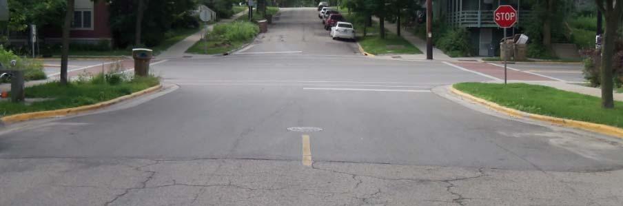
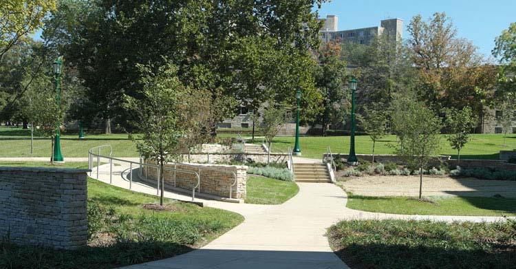
5 Monroe Street today

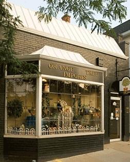
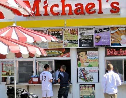
6 Monroe Street today
7 What we heard Brief summary of ideas from table conversations in April
8 Traffic and parking Improve crosswalks, reduce speed, boost enforcement Configure lanes for multi-modal friendly street Maintain i parking, especially near businesses Make better use of library parking Address parking/traffic near Glenway Consider traffic calming and modified parking on neighborhood streets
9 Pedestrians, bikes and transit Address pedestrian safety/crosswalks Reduce speed and increase enforcement Provide more space/options for bike use and additional i bike parking Offer more frequent buses, dedicated bus Put bus stops at far side of intersections Maintain parking for businesses, but discourage commuter parking
10 Stormwater and utilities Minimize run-off Increase infiltration with permeable pavement, rain gardens, etc. Strictly enforce erosion control measures during construction Install treatment devices to collect sediment Consider watershed-wide stormwater management Underground to improve diverse tree canopy
11 Business and merchants During construction, provide adequate access, parking, signage, detours Communicate with city, contractors, customers Optimize i timing/duration i i of construction Ensure pedestrian safety Maintain/improve parking Add street amenities (lights, bike racks, signage, banners, benches, etc.)
12 Placemaking Identify points of interest on kiosk/map Preserve existing amenities and character Support neighborhood placemaking initiatives Improve/maintain green space; add art and storytelling opportunities Consider unintended parking/traffic problems Include potential traffic calming and modified parking on neighborhood streets Improve Crazylegs Triangle
13 Tonight s table conversations Three rounds, one topic per round Tbl Table maps and placemats to take notes Sharing of best of between rounds (if time)
14 Conversations that matter What matters most to us as we head into the Monroe Street resurfacing/reconstruction project? One conversation, three topics Pedestrian Safety Streetscape Amenities Crazylegs Triangle
15 Round One Preview Pedestrian safety A. Which h crossings need improvement the most and why? (mark directly on the table map) B. Of the options previewed, which do you prefer? (add notes or stickies to let us know)
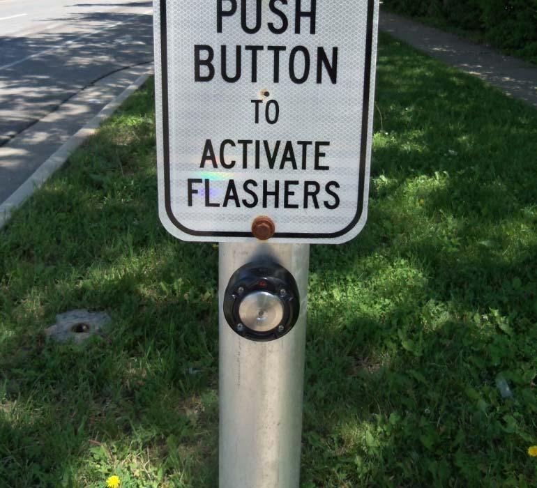
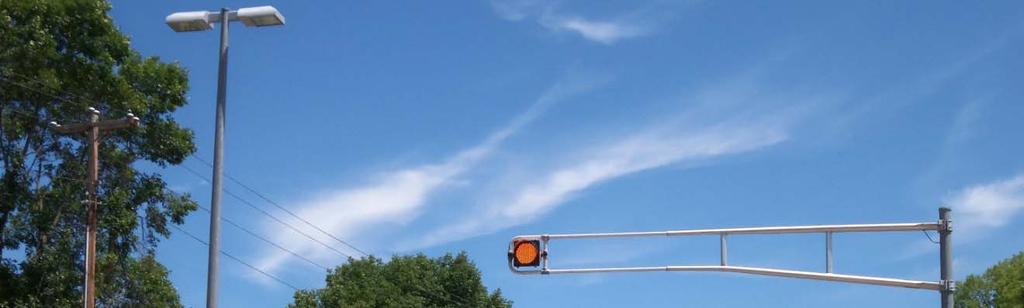
16 Pedestrian Safety/Crossings Prioritize crossings that need improvement Ideas that have been used on other projects Countdown timers at signalized intersections New traffic signal Pedestrian refuge islands Colored or Continental crosswalks (more visible) Overhead Yield to Pedestrian sign Side street bump-outs Pedestrian activated flasher

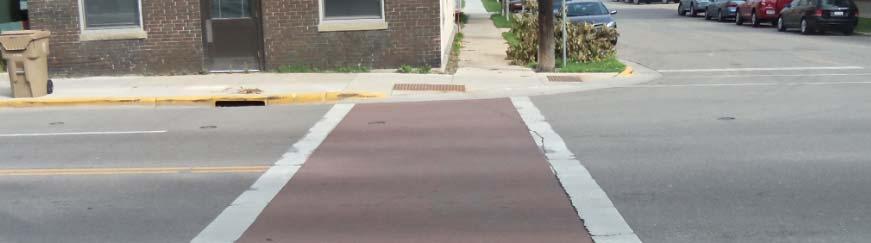
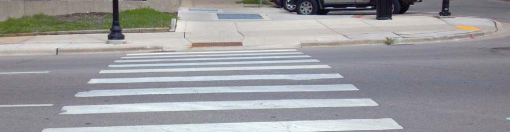


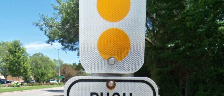
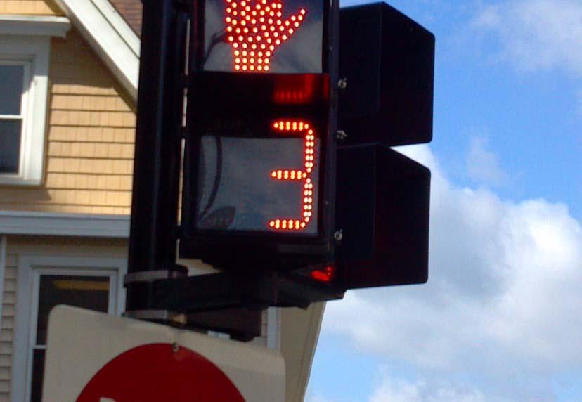


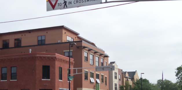
17 Pedestrian Safety/Crossings New signal Timers at signals Refuge island Colored crosswalk Continental crosswalk Overhead sign Side street bump-out Pedestrian activated flasher


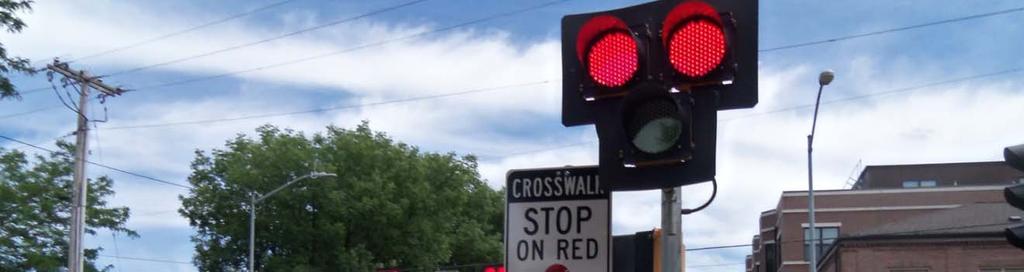
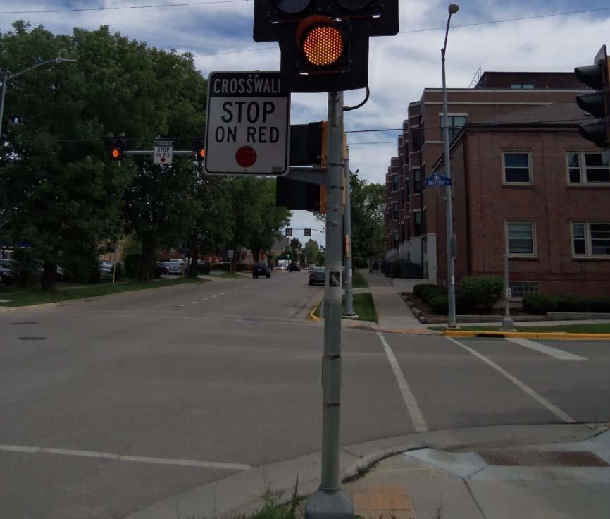

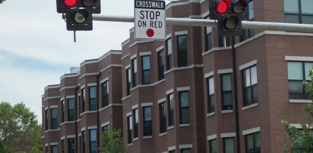
18 Pedestrian Activated Flashers
19 Round One Work Time Pedestrian safety A. Which h crossings need improvement the most and why? (mark directly on the table map) B. Of the options previewed, which do you prefer? (add notes or stickies to let us know) Timers at signals Refuge island Colored crosswalk Continental crosswalk Overhead sign Side street bump-out Pedestrian activated beacon New signals
20 Round One Wrap-up Sharing best of ideas
21 Round Two Preview Streetscape amenities A. Which h lighting i option is best for which h spot? (mark directly on the table map) B. Of the other amenities previewed, which would you like to see where? (add notes or stickies to let us know)


22 Lighting options Three lighting options Tall street lights only Pedestrian lights in business areas Tall street lights at intersections; pedestrian lights mid-block Costs vary considerably and will be distributed throughout the corridor
23 Lighting costs Tall street lights No existing underground lighting conduit/wire 100% assessable to adjacent property owners Approx $1500 for standard residential lot Pedestrian lights Existing pedestrian lights between Stockton & Prospect New lights 100% assessable to adjacent owners Replacement of existing ped. lights not assessable Approx $5000 for standard lot
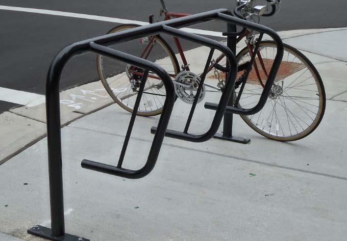
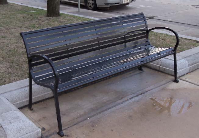
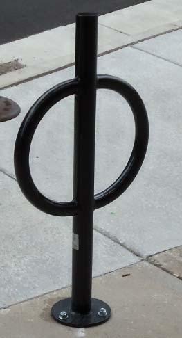
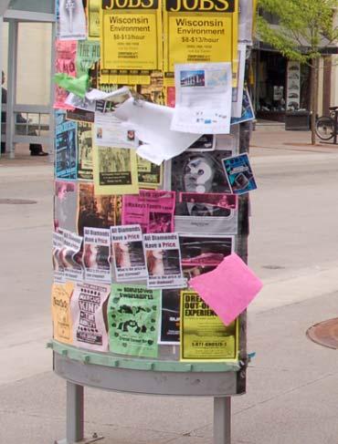
24 Additional amenities Bike racks Benches Posting kiosks
25 Round Two Work Time Streetscape amenities A. Which h lighting i options are best for which h spots? (mark directly on the table map) B. Of the other amenities previewed, which would you like to see where? (add notes or stickies to let us know) Bike racks Benches Posting kiosks
26 Round Two Wrap-up Sharing best of ideas
27 Round Three Preview Crazylegs Triangle: An opportunity to GET CREATIVE!

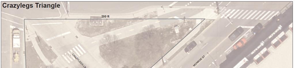
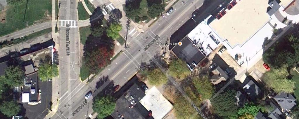
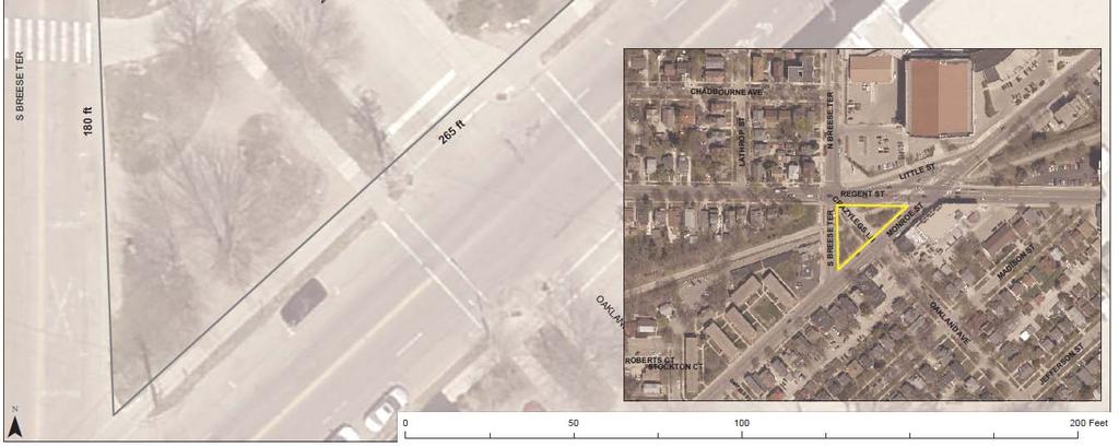
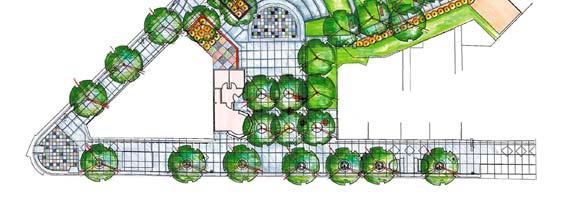
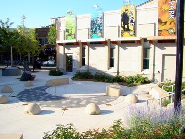
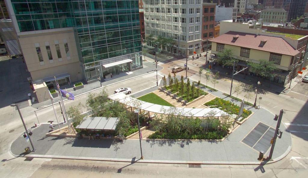
28 Crazylegs Triangle

29 Crazylegs Triangle Monroe Street Plan ideas:


30 Peace Park - Madison, WI Charlotte


31 Charlotte, NC Charlotte

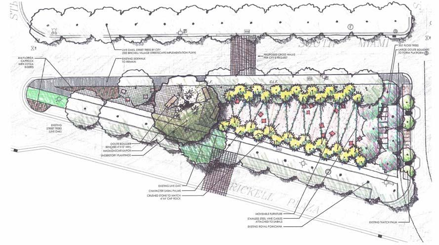
32 Miami and Seattle


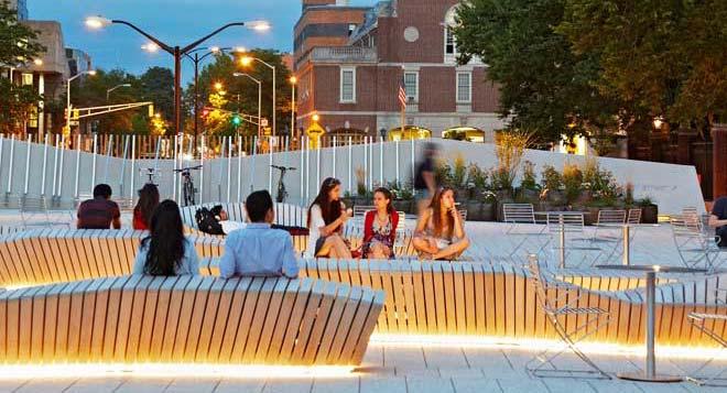
33 Pittsburgh 3 PNC Triangle Park

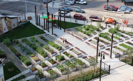

34 Detroit: Lafayette Greens

35 Other examples


36 Other examples

37 More passive design

38 More active design
39 Round Three Work Time Crazylegs Triangle: A. Wi Write, draw, doodle dl on your placemat B. We ll share best of ideas if we have time
40 Additional ideas? Please include them with your feedback form
41 For more Website: updates: d Next meeting: 6:30pm Monday, September 15, 2014 Edgewood College Anderson Auditorium Predolin 112 THANK YOU!
Monroe Street Reconstruction. Kickoff Meeting June 13, 2016
 Monroe Street Reconstruction Kickoff Meeting June 13, 2016 Wingra School Thanks to: Trader Joe s Dudgeon-Monroe Neighborhood Association Introductions Project Team: City Staff Christy Bachmann, P.E., Principal
Monroe Street Reconstruction
 Total participants: 45+ Monroe Street Reconstruction Cross Section Workshop Notes September 29, 2016, Wingra School Workshop Orientation, Technical and Functional Considerations: The workshop began with
Monroe Street Reconstruction Business Focus Group Notes July 18, 2016, HotelRED
 Monroe Street Reconstruction Business Focus Group Notes July 18, 2016, HotelRED Total participants: 31 Focus Group Conversation #1: During this exercise, participants talked in small table groups in response
Ocean Park Boulevard Green Street Project Community Workshop
 Ocean Park Boulevard Green Street Project Community Workshop 2.2.10 Project Objectives Community Priority: reclaim OPB for public open space. Build upon LUCE principles; neighborhood enhancement, connectivity,
Lawrence Avenue Streetscape Concepts August 30, 2011
 Lawrence Avenue Streetscape Concepts August 30, 2011 Neighborhood Context Phase II: River to Western Ave. Phase I: Western Ave. to Clark St. Key Map Lawrence Ave. Existing Streetscape Conditions East of
The Wiggle Route in Context
 The Wiggle Route in Context In a city of hills, the Wiggle is an important route because it winds its way along the flattest streets from Market to the Panhandle, bringing residents to local parks and
Tonight is for you. Learn everything you can. Share all your ideas.
 Strathcona Neighbourhood Renewal Draft Concept Design Tonight is for you. Learn everything you can. Share all your ideas. What is Neighbourhood Renewal? Creating a design with you for your neighbourhood.
El Camino Real Specific Plan. TAC/CAC Meeting #2 Aug 1, 2018
 El Camino Real Specific Plan TAC/CAC Meeting #2 Aug 1, 2018 Land Use Alternatives Goals and Tradeoffs Parks & open space Housing Retail & services Civic spaces Parking Community gathering spaces 3 Alternatives
Crazylegs Triangle Re:Design Workshop Discussion Notes 6:00-7:30PM, August 8, 2017
 Crazylegs Triangle Re:Design Workshop Discussion Notes 6:00-7:30PM, August 8, 2017 Total Participants: 15 plus city staff City of Madison staff and project team in attendance: Christy Bachmann (Engineering),
Omaha s Complete Streets Policy
 Omaha s Complete Streets Policy (Adopted August 2015) VISION To create great places and enhance our quality of life, the City of Omaha will provide safe, accessible streets for all users. Complete Streets
64% UNSAFE and. Where can features be added to improve the street for bicyclists?
 BICYCLING Where can features be added to improve the street for bicyclists? Due to its proximity to neighborhoods, downtown and the waterfront, many people bike Niagara Street to get to where they need
A CHANGING CITY. of Edmonton, it is essential that it reflects the long-term vision of the City.
 A CHANGING CITY By the year 2040, Edmonton will be home to more than 1 million people. To accommodate growth and support a healthy and compact city, we need a new approach to development/redevelopment
Mission-Geneva Transportation Study Community Workshop 2 July 8, 2006
 Community Workshop 2 July 8, 2006 Small Group Workbook 1 Basic Improvements on Mission Street Streetscape. Pedestrian-scale lighting; landscaping; community art on utility boxes; more (possibly unique)
West Capitol Avenue Road Rehabilitation and Safety Enhancement Project
 West Capitol Avenue Road Rehabilitation and Safety Enhancement Project Stakeholder Focus Group Meeting #2 Tuesday, August 28, 2018 7:00 8:00 a.m. West Sacramento City Hall 1110 West Capitol Avenue, West
Why invest in the 1 Street S.W. Corridor?
 Why invest in the 1 Street S.W. Corridor? This project is an investment in the Beltline Community and Calgary s economy. It is anticipated that The City s investment along this corridor will help with
In station areas, new pedestrian links can increase network connectivity and provide direct access to stations.
 The Last Mile Planning for Pedestrians Planning around stations will put pedestrians first. Making walking to stations safe and easy is important; walking will be a part of every rapid transit Accessible
Chicago Safe Routes to School Safe Routes to High School (SRTS/SRTHS)
") Chicago Safe Routes to School Safe Routes to High School (SRTS/SRTHS) Marshall Community High School and Faraday Elementary School Recommended Improvements Agenda Goals Related Programs Project Location/Area
Chicago Safe Routes to School Safe Routes to High School (SRTS/SRTHS) Marshall Community High School and Faraday Elementary School Recommended Improvements Agenda Goals Related Programs Project Location/Area
Vision: Traditional hamlet with an attractive business/pedestrian friendly main street connected to adjacent walkable neighborhoods
 N D. Focus Area II Vision: Traditional hamlet with an attractive business/pedestrian friendly main street connected to adjacent walkable neighborhoods Transit Road Focus Area II is located in the Hamlet
Bicycle + Pedestrian Connectivity Gap Analysis
 Accelerated Bridge Program Bicycle + Pedestrian Connectivity Gap Analysis Tuesday, October 11 Shriners Hospital, Boston 6:30-8:00 PM Thursday, October 13 Community Rowing, Brighton 6:30-8:00 PM Tuesday,
Active Transportation Rail to River Corridor. Community Meeting - Segment A
 Active Transportation Rail to River Corridor Community Meeting - Segment A June 29, 2017 Tonight s Agenda > Open House (30 min) > Welcome / Project Overview > Presentation of 30% Design Refinements > Next
Broad Street Bicycle Boulevard Design Guidelines
 Broad Street Bicycle Boulevard Design Guidelines Building from the strategies introduced in the 2013 Bicycle Transportation Plan and community input received thus far, City Transportation Staff have identified
WELCOME. City of Eden Prairie West 70 th Street
 WELCOME City of Eden Prairie West 70 th Street Project Schedule Sep Oct Nov Dec Jan Feb Mar Apr May Jun Jul Aug >>> May WEST SEGMENT Concept Plan Fall 2014 Plan Development Winter 2014 Summer 2015 Construction
WELCOME. Traffic & Parking Commission Special Meeting May 30, Iteris, Inc. All rights reserved.
 WELCOME Traffic & Parking Commission Special Meeting May 30, 2018 WORKSHOP #2 CONCEPTS FOR IMPROVEMENT MAY 30, 2018 Agenda 1. Welcome 10 min 2. Project Presentation 25 min 3. Roundtable Dialogue 50 min
MARTIN LUTHER KING JR. WAY
 OCTOBER 2011 40 Vision and Goals The Martin Luther King, Jr. Way Illustrative Master Plan that follows has been developed through a process of community involvement. It expresses a long term vision for
Ocean Park Boulevard Green Street Project Alternatives & Trade Offs
 Planning Commission March 4, 2009 Ocean Park Boulevard Green Street Project Alternatives & Trade Offs Purpose of Tonight s Meeting Review concept plans and options Provide input on alternatives and trade-offs
WHITE STREET/ ENGLISH PLAZA STREETSCAPE IMPROVEMENT PROJECT
 WHITE STREET/ ENGLISH PLAZA STREETSCAPE IMPROVEMENT PROJECT 1 Project Goals 1 Improved Safety: Lighting, Multi-Modal Circulation, Emergency Access, Tripping Hazards; Stormwater 4 Environmental Performance:
CLOSED. Highlights of the Final Concept Design:
 The final Concept Design is the result of many months of listening, learning, creating, balancing, and understanding different needs and viewpoints, as well as incorporating technical requirements and
Monroe Street Reconstruction Kickoff Meeting Notes Wingra School, June 13, 2016
 Monroe Street Reconstruction Kickoff Meeting Notes Wingra School, June 13, 2016 Total participants: 89 Table Conversation #1: Headlines Exercise During this 15-minute exercise, participants worked both
4 GENERIC COST ESTIMATING TOOL
 4 GENERIC COST ESTIMATING TOOL Table 4-1 presents a generic cost estimating tools that can serve as a conceptual planning tool for local jurisdictions to estimate the costs of pedestrian improvements.
Complete Streets Chicago: Data Driven Design. Luann Hamilton Deputy Commissioner
 Complete Streets Chicago: Data Driven Design Luann Hamilton Deputy Commissioner AGENDA Chicago s goals Complete Streets & Sustainable Infrastructure Guides Data-Driven Planning Setting goals Scoping/research
Item to be Addressed Checklist Consideration YES NO N/A Required Description Complete Streets Guidelines
 Passaic County Complete Streets Checklist - Concept Development Project Name Item to be Addressed Checklist Consideration YES NO N/A Required Description Complete Streets Guidelines Existing Plans Have
WELCOME. Purpose of the Open House. Update you on the project. Present a draft recommended plan. Receive your input
 WELCOME Purpose of the Open House The Town of Smiths Falls has initiated the Beckwith Street Redevelopment Plan that includes the preparation of a streetscape functional design for the renewal of Beckwith
City of Madison, East Johnson Street North Baldwin Street to First Street Local Street Dane County
 City of Madison, East Johnson Street North Baldwin Street to First Street Local Street Dane County Public Involvement Meeting Thursday, November 10, 2016 5:30 to 7 P.M. Festival Foods 810 E. Washington
Summary: Mercer County Princeton Avenue & Spruce Street Study January 2009
 Summary: Several recent studies have assessed potential development and redevelopment opportunities in the Mercer Crossing area of Trenton, Ewing, and Lawrence. This Princeton Avenue and Spruce Street
Bicycle Boulevards and Neighborhood Greenways
 Bicycle Boulevards and Neighborhood Greenways Traffic Safety is Improving for Everyone 90 80 70 60 50 40 30 20 10 0 PORTLAND: TOTAL TRAFFIC FATALITIES 1986-2008 1986 1987 1988 1989 1990 1991 1992 1993
Ocean Park Boulevard Streetscape Improvement Project Alternatives & Trade Offs
 City Council Study Session January 27, 2009 Ocean Park Boulevard Streetscape Improvement Project Alternatives & Trade Offs Scope of Work Purpose of Tonight s Meeting Review work to date and direct staff
El Centro Mobility Hub
 The El Centro drive shed comprises a major portion of the El Centro downtown area, which is well served by bus routes. The proposals intend to promote use of public transit through improvements and enhancements
Community Task Force November 15, 2017
 Community Task Force November 15, 2017 Welcome and Introductions Project Partners Regional Transportation District (RTD) Colorado Department of Transportation (CDOT) Denver Regional Council of Governments
Bicycle and Pedestrian Advisory Committee (BPAC) November 21, 2013
 November 21, 2013") Bicycle and Pedestrian Advisory Committee (BPAC) November 21, 2013 OVERALL LAND USE CONCEPT Overall Broadway Valdez District: 95.5 acres (35.1 acres right-of ways + 60.4 acres developable land) Plan Subareas:
Bicycle and Pedestrian Advisory Committee (BPAC) November 21, 2013 OVERALL LAND USE CONCEPT Overall Broadway Valdez District: 95.5 acres (35.1 acres right-of ways + 60.4 acres developable land) Plan Subareas:
CURBSIDE ACTIVITY DESIGN
 5 CURBSIDE ACTIVITY DESIGN This chapter provides design guidance for separated bike lanes adjacent to curbside activities including parking, loading and bus stops. Typical configurations are presented
Preliminary Design of Wayzata Boulevard Improvements(CSAH 112)
") Project Area Map 6 COUNTY 112 COUNTY Preliminary Design of Wayzata Boulevard Improvements(CSAH 112) Public Open House Open House To Do List: Sign in Visit with Hennepin County staff and design team Learn
Project Area Map 6 COUNTY 112 COUNTY Preliminary Design of Wayzata Boulevard Improvements(CSAH 112) Public Open House Open House To Do List: Sign in Visit with Hennepin County staff and design team Learn
Community Open House December 13, A project of the Green Infrastructure Center, supported by Skeo Solutions
 Community Open House December 13, 2011 A project of the Green Infrastructure Center, supported by Skeo Solutions Project Background The Green Infrastructure Center, Inc. (GIC) was formed in 2006 to help
UNIVERSITY AVENUE CORRIDOR REDESIGN. January 8, 2017 PUBLIC OPEN HOUSE
 January 8, 2017 PUBLIC OPEN HOUSE COLLABORATIVE COMMUNITY-BASED DESIGN IS THE FOUNDATION TO A SUCCESSFUL PROJECT AGENDA FOR TONIGHT 1 INTRODUCTIONS 2 WHY ARE WE HERE PROJECT NEED 3 SCHEDULE & GOALS 4 OPEN
Design Guidelines. Overview. Design Vision for Yellow Brick Road
 Design Guidelines Overview This section presents the design vision for the Yellow Brick Road network. The Yellow Brick Road is envisioned to be an interconnected network of safe and secure roadways where
City of Wilsonville 5 th Street to Kinsman Road Extension Project
 City of Wilsonville 5 th Street to Kinsman Road Walking Tour & Neighborhood Workshop Summary Report Public Outreach Overview On July 18 th, 2017, the City of Wilsonville hosted a neighborhood walking tour
Dowling/Beaty Cycling Route
 Public Meeting #2 Dowling/Beaty Cycling Route May 17, 2017 6:00 p.m. 8:00 p.m. Parkdale Public Library - Auditorium 1303 Queen Street West How to Participate Share your questions, ideas and concerns We
5. RUNNINGWAY GUIDELINES
 5. RUNNINGWAY GUIDELINES These guidelines should be considered collectively when making runningway decisions. A runningway is the linear component of the transit system that forms the right-of-way reserved
Eliminate on-street parking where it will allow for a dedicated bus only lane %
 Traffic Dashboard Priorities Survey Responses Introduction 1) Are you familiar with bus rapid transit (BRT)? a. No, BRT is new to me. 597 23.5% b. I ve heard of BRT, but I don t know much about it. 1,136
APPENDIX A: Complete Streets Checklist DRAFT NOVEMBER 2016
 APPENDIX A: Complete Streets Checklist DRAFT NOVEMBER 2016 Complete Streets Checklist MetroPlan Orlando s Complete Streets Checklist is an internal planning tool for staff to further implementation of
CITY OF PORTSMOUTH PLANNING DEPARTMENT
 CITY OF PORTSMOUTH PLANNING DEPARTMENT MEMORANDUM TO: JOHN P. BOHENKO, CITY MANAGER FROM: JULIET T.H. WALKER, PLANNING DIRECTOR SUBJECT: BICYCLE / PEDESTRIAN PLAN PROGRESS UPDATE DATE: 3/13/2018 Background
Active Transportation Facility Glossary
 Active Transportation Facility Glossary This document defines different active transportation facilities and suggests appropriate corridor types. Click on a facility type to jump to its definition. Bike
CONTENTS INTRODUCTION... 1 PURPOSE AND SCOPE... 1 MOBILITY ELEMENT TRANSPORTATION REPORT... 2 ROADWAY COMPONENT... 3 OPPORTUNITY AREAS...
 CONTENTS INTRODUCTION... 1 PURPOSE AND SCOPE... 1 TRANSPORTATION REPORT... 2 ROADWAY COMPONENT... 3 OPPORTUNITY AREAS... 7 OTHER TRANSPORTATION MODES... 9 GOALS, POLICIES AND IMPLEMENTING ACTIONS... 13
Balancing Operation & Safety for Motorized and Non-Motorized Traffic
 Balancing Operation & Safety for Motorized and Non-Motorized Traffic Brian Willham, PE, PTOE Iowa Director - MOVITE June 30, 2014 Learning Objectives: When & Why should we measure the performance of complete
CHAPTER 3: Vision Statement and Goals
 Davidson Walks & Rolls: Active Transportation Master Plan CHAPTER 3 Contents: Overview Vision Statement Measurable Goals Public Outreach CHAPTER 3: Vision Statement and Goals Overview The vision statement
The Leadville Bikeway Design Recommendations DRAFT January 2018
 The Leadville Bikeway Design Recommendations DRAFT January 2018 Overview The Leadville Bikeway project aims to create a bikeway that is compatible with and adds value to the neighborhood and surrounding
Executive Summary Route 30 Corridor Master Plan
 Route Corridor Master Plan Project Overview The Route Corridor Master Plan is a coordinated multimodal transportation and land use plan for the entire stretch of Route through East Whiteland Township,
MEMORANDUM. Earl Haugen and UND Transportation and Traffic Coordination Committee
 SRF No. 7766 MEMORANDUM TO: FROM: Earl Haugen and UND Transportation and Traffic Coordination Committee Rick Lane, P.E. DATE: November 26, 2013 SUBJECT: UNIVERSITY AVE REVIEW Our review of the University
Report. Typical Sections. City of Middleton, WI
 Report Typical Sections City of Middleton, WI December 2006 Report for City of Middleton, Wisconsin Typical Sections repared by: Traffic Associates LLC and STRAND ASSOCIATES, INC. 910 West Wingra Drive
Cross Street Corridor Non-Motorized Enhancement Project Project Description
 Cross Street Corridor Non-Motorized Enhancement Project Project Description A cooperative study of the Cross Street neighborhood was completed in May 2002 by the City of Ypsilanti, the Depot Town Downtown
Living Streets Policy
 Living Streets Policy Introduction Living streets balance the needs of motorists, bicyclists, pedestrians and transit riders in ways that promote safety and convenience, enhance community identity, create
Watertown Complete Streets Prioritization Plan. Public Meeting #1 December 14, 2017
 Watertown Complete Streets Prioritization Plan Public Meeting #1 December 14, 2017 Goals for Public Meeting Overview of MassDOT Complete Streets Funding Program Educate the community on Complete Streets
CLOSED. The draft concept design has been broken down into 5 categories for the purpose of this survey:
 Old Strathcona s neighbourhood renewal process is now at the draft concept design phase. Over the last several months, the city has been gathering local knowledge and resident input that has been used
Lincoln Neighborhood Corridor Plan The LiNC
 CITY OF SANTA MONICA Lincoln Neighborhood Corridor Plan The LiNC PLANNING COMMISSION September 2, 2015 COMMUNITY DESIGN + ARCHITECTURE TEAM: Community Design + Architecture Iteris Studio 111 Urban Place
Caltrans Sloat Boulevard Pedestrian Safety Project Response to Community Questions, Comments & Concerns
 Caltrans Sloat Boulevard Pedestrian Safety Project Response to Community Questions, Comments & Concerns Revised: May 10, 2016 The California Department of Transportation (Caltrans) is planning various
Lynchburg District Update
 Lynchburg District Update Virginia Statewide Bicycle and Pedestrian Advisory Committee Spring Meeting May 16 th, 2017 David Cook Transportation Planner, VDOT Lynchburg District Table of Contents Active
Monroe Street Ped Modifications
 Monroe Street Ped Modifications May 11, 2016 Hotel Red ~1.7 mile Posted Speed Limit 25 mph 30 mph Some Background Data Regent St Average Speed 7-9 am 26.8 mph 11 am-1 pm 20.2 mph 4-6 pm 22.2 mph Source:
City of Birmingham Draft Multi-modal Transportation Plan
 City of Birmingham Draft Multi-modal Transportation Plan City Commission Public Hearing Monday, November 25, 2013 7:30 pm Norman Cox, PLA, ASLA The Greenway Collaborative, Inc. Ann Arbor, Michigan The
Existing Pedestrian Conditions. PSAC February 8, 2011
 Existing Pedestrian Conditions PSAC February 8, 2011 Contents 1. Project Background & Goals 2. Pedestrian Activity: Where people walk 3. Pedestrian Safety: The conditions people face Project Background
Commerce Street Complete Street Project from Good Latimer Expressway to Exposition Avenue
 Commerce Street Complete Street Project from Good Latimer Expressway to Exposition Avenue T A N Y A B R O O K S A S S I S T A N T D I R E C T O R M O B I L I T Y P L A N N I N G M O B I L I T Y A N D S
Stakeholder Meeting Handouts. January 2013
 January 2013 Stakeholder Meeting Handouts The Case FOR Parking Minimum Requirements Reduce street congestion around the development site Avoid parking spillover Create orderly development patterns Anticipate
Healthy Corridor Audit Tool
 Healthy Corridor Audit Tool How to Use:»» Complete the first section for the entire study area. Many indicators can be collected from existing data; they do not have to be collected on site.»» To assess
MOBILITY WORKSHOP. Joint City Council and Transportation Commission May 5, 2014
 MOBILITY WORKSHOP Joint City Council and Transportation Commission May 5, 2014 Review of General Plan M-1 Develop world-class transit system M-3 Maintain/enhance pedestrian-oriented City M-4 Create comprehensive
CONTENTS EXECUTIVE SUMMARY 1
 CONTENTS CHAPTER PAGE EXECUTIVE SUMMARY 1 1 ISSUES AND PURPOSE OF THE ANALYSIS 2 1.1 Background 2 1.2 Analysis Area 2 1.3 Issues and Observations 3 1.4 Project and Public Meetings 3 2 LIST OF PREFERRED
PEDESTRIAN CROSSING SOLUTIONS ANDREA HARTH, PE, PTOE TEC ENGINEERING, INC.
 PEDESTRIAN CROSSING SOLUTIONS ANDREA HARTH, PE, PTOE TEC ENGINEERING, INC. Pedestrian Safety 2017 Pedestrian Crashes in Ohio Crash Severity Number % Fatal Crash 141 4.9% Injury Crash 2546 89.1% Property
122 Avenue: 107 Street to Fort Road
 : 107 Street to Fort Road November 24, 2015 4:30 8:00 p.m. Meeting Purpose Summarize project work completed to date Share results of public input from Phase 1 Share the draft concept plan and proposed
Ann Arbor Downtown Street Plan
 1 Ann Arbor Downtown Street Plan Public Workshop #1 We know that. 2 Public right-of-way (streets, sidewalks, and alleys) make up 30% of the total District area of downtown. Streets need to provide mobility
LANCASTER CITY BICYCLE NETWORK
 LANCASTER CITY BICYCLE NETWORK Downtown Merchants Meeting Wednesday, July 19, 2017 http://www.lancasteratp. DOWNTOWN WALKABILITY ANALYSIS What changes can be made, in the least amount of time, and for
Plant City Walk-Bike Plan
 Plant City Walk-Bike Plan Plant City Commute Mode Share 2.2% 1.4% 2.9% Drove alone 10.2% Carpooled Public transportation (0.1%) Walked Used a Bike (0.4%) 82.9% Taxicab, motorcycle, or other means Worked
HUDSON, MA PUBLIC FEEDBACK SUMMARY Second Public Meeting October 26, :30pm Welcome and Rotary Trivia - 7:00-8:30pm Event
 MAIN STREET ROTARY HUDSON, MA PUBLIC FEEDBACK SUMMARY Second Public Meeting October 26, 2016-6:30pm Welcome and Rotary Trivia - 7:00-8:30pm Event The Second Public Meeting for the redesign of the Main
Chicago Safe Routes to High School (SRHS) Kelly High School Recommended Improvements
 Kelly High School Recommended Improvements") Chicago Safe Routes to High School (SRHS) Kelly High School Recommended Improvements March 18, 2014 Presentation Outline Goals Related Programs Project Location/Area Existing Conditions Improvement Types
Chicago Safe Routes to High School (SRHS) Kelly High School Recommended Improvements March 18, 2014 Presentation Outline Goals Related Programs Project Location/Area Existing Conditions Improvement Types
Crystal City Potomac Yard Transitway. Enforcement Ordinance & Construction Update
 Enforcement Ordinance & Construction Update December 2015 Project Purpose Provide high-capacity, high-quality transit service Support redevelopment in Crystal City and in Potomac Yard in Alexandria and
Complete Streets. Designing Streets for Everyone. Sarnia
 Complete Streets Designing Streets for Everyone Sarnia Complete Streets ~ Sarnia ~ 2018 Introduction Our City is made up of a network of streets that we use to go for a walk, cycle to work, drive to the
CONNECTING PEOPLE TO PLACES
 CONNECTING PEOPLE TO PLACES 82 EAST BENCH MASTER PLAN 07 Introduction The East Bench transportation system is a collection of slow moving, treelined residential streets and major arteries that are the
Complete Streets Process and Case Study: Taft / McMillian Two-Way Street Conversion Cincinnati, Ohio. Traffic Engineering Workshop June 4, 2014
 Complete Streets Process and Case Study: Taft / McMillian Two-Way Street Conversion Cincinnati, Ohio Traffic Engineering Workshop June 4, 2014 Complete Streets Streets that enable safe access for users
Cherry Creek Transportation and Land Use Forum September 25, 2013 Meeting Summary
 Cherry Creek Transportation and Land Use Forum September 25, 2013 Meeting Summary I. LEAD-IN TO SMALL GROUP DISCUSSION, POLLING AND STEERING COMMITTEE/TECHNICAL TASK FORCE DISCUSSION The meeting began
Byron Avenue. Public Meeting. Thursday June 16, Traffic Calming Design Sherbourne Road to Island Park Drive
 Byron Avenue Traffic Calming Design Sherbourne Road to Island Park Drive Public Meeting Thursday June 16, 2016 Our Lady of Fatima Parish 153 Woodroffe Avenue 6 9pm 1 Project Summary Area Projects Background
TRAVEL PLAN: CENTRAL EUROPEAN UNIVERSITY CAMPUS REDEVELOPMENT PROJECT TRAVEL PLAN. Central European University Campus Redevelopment Project.
 TRAVEL PLAN Central European University Campus Redevelopment Project Page 1 Table of Contents Introduction... 3 Background... 7 Building Users... 7 Transportation in Community Consultation... 7 Summary
Corpus Christi Metropolitan Transportation Plan Fiscal Year Introduction:
 Introduction: The Safe, Accountable, Flexible, Efficient Transportation Equity Act: A Legacy for Users (SAFETEA-LU) has continued the efforts started through the Intermodal Surface Transportation Efficiency
Agenda. Overview PRINCE GEORGE S PLAZA METRO AREA PEDESTRIAN PLAN
 PRINCE GEORGE S PLAZA METRO AREA PEDESTRIAN PLAN May 28, 2008 Agenda Welcome and introductions Project overview and issue identification Planning context and strengths Design challenges and initial recommendations
FONTAINE AVENUE STUDY Final Report
 FONTAINE AVENUE STUDY Final Report March 28, 2005 FONTAINE AVENUE STUDY City of Charlottesville March 28, 2005 Renaissance Planning Group Kenneth Schwartz, FAIA, AICP Director of Design Leigh Wilkerson,
Sistrunk Corridor DOTMOCRACY SUMMARY
 DOTMOCRACY SUMMARY The TOUCH initiative is a true collaborative working with multi- sector community organizations and agencies to reduce tobacco use and exposure to secondhand smoke, improve access to
City of Sammamish. Welcome. Issaquah-Fall City Road Improvements Project Phase I Design: 242nd Avenue SE to Klahanie Drive SE
 Welcome Welcome to the third community meeting for the Issaquah-Fall City Road Improvements Project. AGENDA 6:00 p.m. Welcome and sign-in 6:10 p.m. Presentation 6:50 p.m. Open house Learn about the roadway
 Community and Business Outreach November 2015 Goal #1: Improve safety in the corridor Goal #2: Make a more livable corridor Goal #3: Improve mobility for all Data Collection Alternatives Recommendations
Technical Working Group November 15, 2017
 Technical Working Group November 15, 2017 Welcome and Introductions Project Partners Regional Transportation District (RTD) Colorado Department of Transportation (CDOT) Denver Regional Council of Governments
CITY OF OTTAWA ROADWAY MODIFICATION APPROVAL UNDER DELEGATED AUTHORITY
 RMA-2015-ATM-038 CITY OF OTTAWA ROADWAY MODIFICATION APPROVAL UNDER DELEGATED AUTHORITY DATE: April 22, 2015 SUBJECT Approval of Roadway Modifications Recommended through an Area Traffic Management Study
Community Workshop #1 Summary October 2017
 Community Workshop #1 Summary October 2017 1 Background Pleasure Point has a unique character and strong community identity. In 2008, the community and the County developed the Pleasure Point Community
Chapter 4 TOOLBOX AND SAMPLE BIKE BOULEVARD LAYOUT
 Chapter 4 TOOLBOX AND SAMPLE BIKE BOULEVARD LAYOUT OVERVIEW This chapter describes a cohesive set of strategies to create a bicycle boulevard, namely to make streets safer and more efficient for bicycle
PEDALING FORWARD. A Glance at the SFMTA s Bike Program for SFMTA.COM
 PEDALING FORWARD A Glance at the SFMTA s Bike Program for 2017-2021 SFMTA.COM INTRODUCTION About This Booklet More people from all walks of life see their bicycle as a more convenient way to get where
PURPOSE AND NEED SUMMARY 54% Corridor Need 1. Corridor Need 2. Corridor Need 3. Corridor Need 4. Corridor Need 5
 SUMMARY PURPOSE AND NEED Chapel Hill Transit ridership has increased Buses operate every 4 minutes and have standing room only Exceeding seated capacity by 12% Corridor Need 1 by more than 20 percent between
About the Studio. Edward J. Bloustein School of Planning and Public Policy - Rutgers University
 About the Studio Edward J. Bloustein School of Planning and Public Policy - Rutgers University Purpose of studio: Help City of Bayonne apply for Safe Routes to School (SRTS) funding by producing a School