Neighbourhood Traffic Management Guidelines and Tools
|
|
|
- Barnard Kelley
- 5 years ago
- Views:
Transcription

1 Neighbourhood Traffic Management Guidelines and Tools May 2016
2 Photograph Credit: Liz Hofmann
3 Authorization Prepared By: Shirley Matt, P.Eng., Senior Transportation Engineer Checked By: Jay Magus, P.Eng., Engineering Manager, Transportation May 2016
4 TABLE OF CONTENTS 1 INTRODUCTION... 1 BACKGROUND... 1 PURPOSE OF GUIDE... 1 GUIDING PRINCIPLES NEIGHBOURHOOD TRAFFIC MANAGEMENT GUIDELINES... 4 OVERVIEW... 4 BENEFITS OF NEIGHBOURHOOD TRAFFIC MANAGEMENT REVIEW PROCESS... 6 OVERVIEW OF STUDY PROCESS... 6 PHASE 1 - RESPONDING TO ISSUES... 6 PHASE 2 NEIGHBOURHOOD SELECTION... 7 PHASE 3 - PLAN AND DEVELOPMENT APPROVAL... 8 PHASE 4 PERMANENT IMPLEMENTATION PLAN NEIGHBOURHOOD TRAFFIC MANAGEMENT MEASURES SPEED MEASURES Speed Display Boards Education COMMUNITY BASED INITIATIVES COMMUNITY SPEED DISPLAY BOARD PROGRAM ENFORCEMENT MEASURES REGULATORY MEASURES TRAFFIC CONTROL RETROFIT PROGRAM PEDESTRIAN CROSSWALKS THE SIDEWALK RETROFIT PROGRAM THE RAMP ACCESSIBLY PROGRAM TRAFFIC CALMING OTHER PROGRAMS TRAFFIC CALMING MEASURES Horizontal Deflections Curb Extension (aka Bulb-out or bulbing) Raised Median Island Roundabout Mini-Roundabout Chokers (Pinch point) On-street Parking Curb Radius Reduction VERTICAL DEFLECTIONS Raised Crosswalks Textured Crosswalk Raised Intersection Speed Hump Speed Table Speed Kidney Speed Cushion OBSTRUCTIONS Diverter Right in/right out Directional Closure Full Closure May 2016 i
5 5.3.5 Intersection Channelization Raised Median through Intersection TRAFFIC CALMED NEIGHBOURHOOD SIGNAGE OTHER ISSUES TRAFFIC CALMING NOT USED BY THE CITY OF SASKATOON Rumble Strips Speed Bumps TRAFFIC CALMING IN NEW NEIGHBOURHOODS EFFECTS OF TRAFFIC CALMING MEASURES LIST OF TABLES Table 3-1: Neighbourhood Traffic Review Process... 9 Table 4-1: Speed Display Boards Guidelines Table 5-1: Typical City of Saskatoon Roadway Classifications and Characteristics Table 5-2: Standard Drawing for Roundabout used by the City of Saskatoon Table 5-3: Horizontal Devices Table 5-4: Vertical Devices Table 5-5: Obstruction Devices Table 6-1: Standard Drawings for New Neighbourhood Streets Table 7-1: Effectiveness of Typical Traffic Calming Measures Table 7-2 Effectiveness of Measures not used as Traffic Calming Methods LIST OF FIGURES Exhibit 3-1: Neighbourhood Traffic Review Process... 6 Exhibit 4-1: Speed Brochure Page Exhibit 5-1: 7 th Avenue and Princess Street Curb Extension (City Park) Exhibit 5-2: Saskatchewan Crescent Curb Extension (Nutana) Exhibit 5-3: Avenue P and 21 st Street Median Island (Pleasant Hill) Exhibit 5-4: 3 rd Avenue and Spadina Crescent Roundabout (River Landing) Exhibit 5-5: Stonebridge Boulevard and Cornish Road Roundabout (Stonebridge) Exhibit 5-6: 23 rd Street Temporary Mini-Roundabout (Westmount) Exhibit 5-7: Saskatchewan Crescent Pinch-Point (Nutana) Exhibit 5-8: Meilicke Road between David Knight Crescent Exhibit 5-9: Textured Crosswalk using concrete in River Landing Exhibit 5-10: Textured Crosswalk using pavers at Stonebridge Boulevard and Wellman Crescent (Stonebridge) Exhibit 5-11: Speed Hump on Hughes Avenue (Dundonald) Exhibit 5-12: Avenue C and 38 th Street Temporary Device (Mayfair) Exhibit 5-13: 51 st Street and Millar Avenue (Hudson Bay Industrial) Exhibit 5-14: Coppermine Crescent and Churchill Drive (River Heights) May 2016 ii
6 1 INTRODUCTION Background As the population of the City of Saskatoon continues to grow, residents are indicating an increasing concern regarding neighbourhood traffic issues. In particular, residents are concerned about the impacts of frequent occurrences of speeding and short-cutting traffic on the quality of life within the community. The City has developed a neighbourhood traffic management document to address neighbourhood traffic concerns. The document will provide a guideline on how to address the concerns, a list of tools recommended for different concerns (speeding, short-cutting or pedestrian safety), and it will also identify proactive treatments for newly developed neighbourhoods. The overall objectives of the City of Saskatoon Neighbourhood Traffic Management Guidelines and Tools are to maintain the livability and environmental quality of our neighbourhoods while ensuring the safe, efficient and economical movement of people and goods. Purpose of Guide The purpose of this guide is to provide the City of Saskatoon with a strategy to respond to a wide range of public concerns such as speeding, short-cutting, pedestrian safety, school safety and signage such as traffic controls, or parking restrictions and prohibitions. This guideline provides details on the following: The process for Neighbourhood Traffic Reviews Proposed measures to address traffic issues in existing neighbourhoods Tools that can be applied to the design of new neighbourhoods Guiding Principles The following guiding principles form the basis for neighbourhood traffic management and will be taken into consideration when investigating, selecting, and implementing appropriate measures. These principles provide overall direction and guidance in the application of neighbourhood traffic management measures and applying them will maximize the effectiveness of the Neighbourhood Traffic Management Plan and help build community support by ensuring their needs are met. May
7 These principles include: Identify the real problem. Often, the perceived nature of a traffic problem is substantially different than the real problem. In some cases, the difference is so great that a solution intended to eliminate the perceived problem might make the real problem worse. For example, residents often mention traffic volume and speeding as concerns on their street, but in some cases the problem is one or the other. If the real problem is speeding, for example, a measure which significantly reduces the traffic volume on a street might encourage speeding if fewer cars remain on the street to slow traffic. Therefore, it is important to identify the real problem, so as to select the appropriate measure, or to help prioritize a number of selected measures. Quantify the Problem. Some problems are more significant than others. Some are all-day problems; others occur only at certain times of day or only in one direction. To select appropriate traffic measures, it is important to quantify the extent of the problem. This means gathering data, which includes: traffic counts, speed studies, parking surveys, collision statistics, or any other data as appropriate. Involve the community. Residents, business owners, property owners, community groups, and other local stakeholders in a community should be involved in developing Neighbourhood Traffic Management Plans. Their input is essential in identifying problems and in selecting traffic solutions. Involving the community builds support, and enhances credibility of a plan. Involving a broad cross-section of the community, as well as key stakeholders, minimizes the potential of special interest groups who might otherwise unduly influence the preparation of a plan. If the community is not adequately involved in preparing a Neighbourhood Traffic Management Plan, residents and others in a community might oppose the plan, regardless of its technical merit, because they feel they were not properly consulted, listened to, or the plan does not recognize the unique circumstances of their neighbourhood. Consider improvements to the major road network first. Most motorists will not shortcut through a neighbourhood unless there is a reason to and the reason is often related to congestion on adjacent major roads. There are a wide range of low-cost options available to improve operations on major roads, including adjusting traffic signal phasing and timing, adding turn bays, implementing turn prohibitions, and establishing parking restrictions. Improvements to the major road network should be considered first, as these might prevent or reduce the need for traffic measures on the neighbourhood streets, and enhance the effectiveness of a Neighbourhood Traffic Management Plan. Access restrictions. Neighbourhood traffic management measures that restrict access or egress should be carefully considered and should be accompanied by public consultation. Do not impede non-motorized modes. Neighbourhood traffic management measures should not impede the movement of cyclists and pedestrians. May
8 Consider all services. Neighbourhood traffic management measures should not impede emergency, transit, and maintenance service access unless alternate measures are agreed upon. Implementation of Neighbourhood Traffic Management Plans. Neighbourhood Traffic Management Plans will be shared with the public and submitted to City Council for approval. All proposed measures, especially traffic calming devices, will be implemented temporary and monitored. Permanent installation of traffic calming devices will only be considered if temporary measures have proven effective. May
9 2 NEIGHBOURHOOD TRAFFIC MANAGEMENT GUIDELINES Overview Neighbourhood traffic management is considered on local and collector streets. It involves the implementation of a broad range of measures that typically falls into two categories: Isolated Studies. This is used on a single problem street where it is not likely to displace traffic onto adjacent streets. School sites can be considered for a traffic management improvement (e.g. traffic calming) without being part of a bigger plan. If there is a request for traffic control, parking restriction, signage or pedestrian device at locations that are not part of a Neighbourhood Traffic Review for that year, the City of Saskatoon will review the request as an isolated study. Area-wide issue. In other areas, there will be a range of traffic issues on many streets within an area. For example, speeding and short-cutting traffic might be an issue on several streets, and pedestrian safety might be an issue at a number of locations throughout the area. In cases like this, traffic solutions must be developed on an areawide basis, considering all issues within an area. For the purpose of neighbourhood traffic management, an area is typically defined by community boundaries. If desired, two or more adjacent areas can be combined to create a single larger area for the purposes of developing a Neighbourhood Traffic Management Plan. Neighbourhood traffic management is undertaken for two key reasons: it improves the safety and livability within neighbourhoods. It helps make the streets safer for everyone and it includes all road users (pedestrians, cyclist, and motorists). It also helps to preserve and enhance the livability of the community by minimizing the negative impacts of traffic (noise and pollution). Many neighbourhood conflicts are the result of excessive speed and motorist s inattention. Successful neighbourhood traffic management measures effectively modify driver behavior and some are self-enforcing. Examples would be speed display boards or traffic calming devices. May
10 Benefits of Neighbourhood Traffic Management The specific benefits of neighbourhood traffic management are: Minimize conflicts. Reducing conflicts between roads users reduces the likelihood of a collision occurring; therefore, improving safety, particularly for pedestrians, cyclists and other vulnerable road users. Reduce vehicular speeds. Speeds that are suitable for one type of road (such as major arterial) may be considered excessive on a residential collector or local street. Measures that decrease speeds help to reduce the likelihood of a collision occurring, as well as the severity of the collision. Reducing vehicular speeds also helps to improve the livability of a community by reducing noise and other negative impacts of traffic. Discourage through traffic on local residential streets. Local streets are primarily intended for access to properties rather than accommodating through traffic. Discouraging through traffic will improve safety by reducing potential conflicts. Establish an ongoing process to address problems. New roads, additional development and other changes may result in changes in traffic patterns and contribute to new traffic problems. Establishing proactive polices to consider neighbourhood traffic management measures in the design of new roads and neighbourhoods will help to ensure that problems are avoided in the first place. May
11 3 REVIEW PROCESS Overview of Study Process To successfully implement an effective Neighbourhood Traffic Management Plan, there must be an established procedure documenting the process and the action to be taken. The City of Saskatoon s process has been divided into four phases. Phase 1: Responding to Issues Phase 2: Neighbourhood Selection Phase 3: Plan Development and Approval (Neighbourhood Traffic Review Process) Phase 4: Permanent Implementation Plan The study process is outlined in Exhibit 3-1. Phase 1 Responding to Issues Phase 2 Neighbourhood Selection Phase 3 Plan Development Phase 4 Permanent Implementation Documenting the issue Evaluate existing traffic concerns Stage 1 Problem Identification with Community Permanent Traffic Calming Determine the approprate response Coordinate with other projects / development Stage 2 Developing the Traffic Plan Speed Display Boards Area//Ward Distribution Stage 3 Approval Sidewalks Stage 4 Implementation Ramps Stage 5 Evaluation Pedestrian Devices Exhibit 3-1: Neighbourhood Traffic Review Process Phase 1 - Responding to Issues This phase involves screening the traffic concern and determining whether the traffic concern be considered as part of Neighbourhood Traffic Management Review, or another course of action be taken. May
12 This phase involves a two-step process: Step 1 - Documenting the issue: The first activity is for residents to document their traffic issues. These issues can be documented by various methods: Council inquires, web- s, letters, telephone calls, or submitting their concern on the new web application called Report a Traffic Issue at A link to the site is provided below: Step 2 - Determine the appropriate response: The next step of this phase is for the Transportation division staff to determine which of the following responses is appropriate. In most cases, if there is neighbourhood traffic management review planned within the year, the traffic concern will be dealt with under that review. If there is no Neighbourhood Traffic Review planned for the year, the traffic issue can be reviewed under the appropriate policies and procedures. For example, Stop and Yield signs request will be reviewed under the Policy CO Traffic Control Use of Stop and Yield Signs. Phase 2 Neighbourhood Selection This phase involves prioritizing the traffic concerns to determine which neighbourhood will receive a Neighbourhood Traffic Review. A formalized process was developed to prioritize and select neighbourhoods for each year. This phase has three steps: Step 1 Evaluate existing traffic concerns: This step is based on a point system and the number of criteria listed below. 1. Number of outstanding concerns: Includes all phone calls, s, letters and additional correspondence documented since the beginning of the program in August 2013 (1 point per concern is added to the total score). 2. Councillor input: The Administration will work with each respective Councillor to select the highest priority neighbourhood in the Ward, considering all information available (3 points assigned to the highest priority neighbourhood). 3. Number of temporary traffic calming devices currently installed: There is currently a number of existing temporary traffic calming locations that must be maintained and assessed (1 point per device is added to the total score). 4. Number of collisions: Collision data provided by SGI will be reviewed each year. The criteria for collisions is as follows: Low: The number of collisions appears to be lower relative to other neighbourhoods (0 points are added to the total score). Medium: The number of collisions appears to be average relative to other neighbourhoods (1 point is added to the total score). High: The number of collisions appears to be higher relative to other neighbourhoods (2 points are added to the total score). May
13 Step 2 Coordinate with other projects/consider areas under development: This step involves coordination with other projects, such as Local Area Plans (LAP) is required to achieve efficiencies such as combining public consultation efforts. Similarly, neighbourhoods under development where roads and infrastructure are not yet constructed may be delayed as traffic patterns will evolve. Both of these factors may result in an adjustment to the timing of reviews in certain neighbourhoods. Step 3 Area/Ward Distribution: The final step of the neighbourhood selection process is to ensure reasonable distribution among the city. Since there are 10 Wards and only eight neighbourhoods reviews each year, not all Wards can be selected on an annual basis. The neighbourhoods that do not receive a review the year prior will have higher priority. Phase 3 - Plan and Development Approval This phase involves working with the community, City Council and City staff in developing a Neighbourhood Traffic Management Plan. This phase involves a five stage approach: Stage 1: Problem Identification with Community Stage 2: Developing the Traffic Plan Stage 3: Approval Stage 4: Implementation Stage 5: Evaluation Details on each stage are provided in Table 3-1. May
14 Table 3-1: Neighbourhood Traffic Review Process Stage Stage 1: Problem Identification with Community Stage 2: Developing the Traffic Plan Stage 3: Approval Stage 4: Implementation Details Host 1 st community meeting to establish study goals, objectives and identify traffic concerns and possible solutions Share results online at Collect and analyze traffic and safety data to confirm the issues Identify potential solutions Develop proposed Traffic Plan Circulate Traffic Plan to internal departments for feedback Hold 2 nd community meeting to determine the level of support for Traffic Plan Review Traffic Plan and identify changes as appropriate Determine if 3 rd community meeting is required to address outstanding issues Share community meeting results online at Present Traffic Plan to Committee and Council for approval in principle The community will be notified of the Traffic Plan by mail, the City s websites and the Community Association Implement recommendations within the plan. Timeline for implementation may be short, medium or long term depending on the specific measure Any measures that physically restrict traffic movements or significantly alter traffic patterns will be implemented temporarily to evaluate their effectiveness Approximate Duration January - April May - December January - March (2 nd year) Time Frames Short term (1-2 years) Medium (3-5 years) Stage 5: Evaluation 1 The overall plan will be evaluated and modified as required Physical traffic movement restrictions will be formally evaluated after a minimum 1-year evaluation period Traffic studies will be conducted and input sought from the impacted residents with the results shared on shapingsaskatoon.ca Final approval from City Council will be sought prior to permanent construction The community will be notified of any changes by mail, the City s websites and the Community Association If required, Public Notice and any associated bylaws will be brought forward at this time. Long Term (5 years plus Minimum 1-year period following implementation Note 1: Traffic calming measures that physically restrict traffic movements or significantly alter traffic patterns will be initially installed in a temporary manner to evaluate their effectiveness. The trial period will be a minimum of 1 year, with traffic studies being conducted to quantify the impacts. May
15 As part of the evaluation stage, if there are traffic measures that restrict traffic, further public consultation will be required. Some examples are indicated below: If a traffic restriction is being recommended that physically restricts a traffic movement, the evaluation process will include a flyer to impacted residents providing traffic data and seeking their opinion on the level of support for maintaining the traffic restriction permanently. If the majority of respondents are in support of maintaining the restriction, and it has not shifted the issue elsewhere in the area, the Administration will recommend to City Council that it be constructed permanently. The results of the trial and outcome of the community engagement will be reported to Council with the Administration s recommendation. In neighbourhoods where physical turning movement restrictions are not proposed, the Administration will monitor the effectiveness of the overall plan through discussions with the Community Association and the Councillor as well as through informal complaints from residents. Site observations will also be conducted to evaluate the design of traffic calming devices. An annual report will provide a status update on the implementation of each of the neighbourhood plans, identifying which devices will be made permanent. May
16 Phase 4 Permanent Implementation Plan Phase 4 involves the implementation of permanent measures for traffic calming, sidewalks, ramps, speed display boards and pedestrian devices. The proposed time frame for these measures will be longer as most of them will be put on lists and prioritized based on the criteria for each measure. A summary of the criteria for each is as follows: Traffic calming is installed temporary until there is funding for permanent installation. The traffic calming devices will be installed permanently based on the following criteria: Traffic calming devices temporarily installed prior to August 14, 2013 Locations adjacent to schools or parks Locations addressing speed and short-cutting issues All other locations A list will be established based on the above criteria and will be submitted to City Council in early spring for approval. Sidewalk and Ramps recommendations are funded through the programs for Sidewalk Retrofit and Accessibly Ramp programs (see Section 4.8 and Section 4.9 for how sidewalk and ramps are prioritized). Speed Display Boards when funding is available will be installed permanently. Pedestrian devices such as a pedestrian actuated signal, active pedestrian corridor or pedestrian corridor will be added to a list generated for each type of pedestrian crossing device, and is prioritized based on warrant results. May
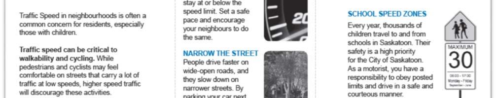
17 4 NEIGHBOURHOOD TRAFFIC MANAGEMENT MEASURES This section describes the neighbourhood traffic management measures used to address neighbourhood traffic concerns relating to speed, short-cutting, pedestrian safety, and signage. Speed Measures The intent of speed measures is to address speeding concerns in neighbourhoods by increasing driver and community awareness of the speed conditions on their streets. Tools such as speed display boards and education provides an opportunity for both the driver and community members to participate in speed reduction, creating safer and more livable streets Speed Display Boards Speed Display Boards are pole-mounted devices equipped with radar speed detectors and an LED display. The boards are capable of detecting the speed of an approaching vehicle and displaying it back to the driver. When these signs are combined with a regulatory speed limit sign, a clear message is sent to the driver displaying their speed. The objective of the speed display board is to improve road safety by making drivers aware of their speed, evoking voluntary speed compliance. Speed display boards are used as traffic calming devices in addition to or instead of physical devices such speed humps, speed cushions, or speed tables. Speed Display Board Usages Used on collector roads where there are no trees or other vegetation that will restrict the operations of the speed display board. Used in conjunction with physical traffic calming devices. Typically installed where there is already an enforcement speed sign, e.g. entrance to neighbourhoods. Advantages Provides awareness to driver. Encourages speed compliance. Portable mounting method allows for exposure at numerous locations citywide. Disadvantages Not an enforcement tool. Less effective on multi-lane, high volume roadways. May


18 4.1.2 Education Sometimes speeding is a matter of perception, and enforcement. Educating the public is an option that is relatively inexpensive and effective. For example, many residents are simply unaware of the actual speed limit in their neighbourhood. An informational brochure is available on the city website The brochure provides information on: Why we speed? A list of measure that can be used to reduce speeding in your neighbourhood. Information on school zones, back alley and constructions zones speed limits. Speeding fines. Traffic Bylaw A copy of the speed brochure is included in Exhibit 4-1. Exhibit 4-1: Speed Brochure Page 1 May

19 Exhibit 4-1 continued: Speed Brochure Page 2 May
20 Community Based Initiatives This section is intended to address numerous initiatives which individuals and community groups can undertake as a means of addressing traffic issues. The intent of these initiatives is to help communities help themselves. Together with any action undertaken by the City, these initiatives result in a balanced response to local traffic issues. Community Newsletters: Community Associations can publish information on traffic concerns in their newsletters to encourage more appropriate driving behavior among motorists or notify a neighbourhood of planned projects that will affect local traffic patterns (construction or permanent installations). Community Events: Public meetings and community open houses involving residents and stakeholders can be an effective means of identifying traffic issues and options available to deal with problems. These discussions can also bring awareness and education to help improve driver behavior. This will assist in the traffic study process. Alternative Modes of Transportation: A wide range of initiatives can be used to reduce vehicle trips and the amount of traffic on neighbourhood streets. Some examples include: o Car Pooling o Working from at home o Flex time staggering work hours to avoid peak hour traffic volumes o Public Transit o Cycling o Walking Community Speed Display Board Program The purpose of this program is to allow communities to purchase their own speed display board. The following process will be followed: 1. Community Associations will need to submit a written application to the City of Saskatoon to initiate the process. 2. The City will provide the Community Association a cost estimate of the speed reader board, along with an agreement to be signed by the Community Association. The agreement will set out the expectations on maintenance, repairs, vandalism, etc. of the board. 3. The Community Association will provide payment to the City, as well as enter into the written agreement. 4. The City of Saskatoon will proceed to acquire the speed display board. 5. The speed display board is to be installed for one-year at one location. 6. Annually, the community can submit a written request to the City to have the speed display board relocated to another location. May
21 The guidelines, and supporting reasons for developing these guidelines, that support the use of speed display boards is provided in Table 4-1. Table 4-1: Speed Display Boards Guidelines Guideline The community will only be allowed to purchase one speed display board. The speed display board can only be installed at one location per year. The speed display board cannot be used as enforcement purposes. The speed display boards are to be used only within the neighbourhood on local and collector streets. The speed display boards can be used in school zone for education purposes only. The speed display boards shall not conflict with any SGI or police education enforcement programs. The speed boards should be installed in locations with clear site visibility to the board. No vegetation should be blocking the view of the board. Comments Doesn t conflict with recommendations for permanent speed display boards from the neighbourhood review plans. More effective if they remain in one place for a longer time period. The police are the only entity that can enforce speeding. To educate the drivers within the neighborhood. The police are the only entity that can enforce speeding. These programs will take priority over the community speed display program Speed display boards are solar powered will not be effective if they do not have sufficient sunlight. Drivers need clear site visibility to see the board. Only the following type of Speed Display Boards are to be used. Radar Message signs (signs that display speed only) Radar Speed Sign The speed display board should be battery operated or solar powered. May
22 Enforcement Measures Many neighborhood traffic management issues cannot be dealt with signage or traffic calming devices and may simply require enforcement. When requested by City staff, Saskatoon Police Service will perform targeted enforcement on residential streets. The intent of the enforcement is to reduce vehicle speeds by acting as a visible deterrent. City staff may also provide the Police with speed data to assist in identifying potential locations and peak times for enforcement. In addition, any requests by City staff for parking violations will be sent to Parking Services for enforcement. Parking enforcement will target the residential area in which parking complaints are a major issue or safety concern. Regulatory Measures Stop and Yield Signs: Stop and yield signs must follow policy C Traffic Control Use of Stop and Yield Signs Maximum Speed Limit Signs: Speed limit signs will be placed according to the classification of the roadway and will follow Traffic Bylaw No Turn prohibitions, through movement prohibitions and one-way signage Used where it is not desirable to implement physical devices to restrict certain movements. Use of signage without accompanying physical devices to restrict the movements can create an enforcement problem and can be costly in terms of enforcement. Parking Restrictions and Prohibitions: Parking restrictions (parking at certain times of the day) and parking prohibitions (no parking) must meet the criteria in Policy C07-010, Parking Restrictions and Parking Prohibitions. Traffic Control Retrofit Program The primary objective of the traffic control retrofit infill system is to reduce the frequency and severity of collisions caused by confusion regarding the assignment of right-of-way. Because of the low traffic volumes and speeds, and in the absence of excessive collisions, it is the Administration s opinion that yield signs are adequate for identifying rights-of-way at the majority of currently uncontrolled intersections in neighbourhoods. Stop signs will be used at local-collector street intersections where it is required to stop minor traffic over priority traffic. Where appropriate, the proposed yield signs will be deliberately orientated in such a way as to provide alternating right-of-way priority to eastwest traffic and north-south traffic, making it more inconvenient for non-residential traffic to shortcut through the residential streets. May
23 Pedestrian Crosswalks Pedestrian crosswalk requests must adhere to the policy C Traffic Control at Pedestrian Crossing. This policy provides the following hierarchy of typical pedestrian crossing applications: Standard Crosswalk Zebra Crosswalk Pedestrian Corridor Active Pedestrian Corridor Pedestrian Actuated Signal The Sidewalk Retrofit Program The Sidewalk Retrofit Program is an inventory of all missing sidewalks in the City. The locations are prioritized based on the following criteria: Priority 1: Locations primarily include outstanding resident requests, recommendations from neighbourhood reviews, and locations where no sidewalk exists on either side of the roadway. Priority 2: Locations around high pedestrian areas such as parks, schools and public facilities. Priority 3: Locations were areas that have sidewalk along one side of the roadway and do not lead to a park, school, and senior s complex or public facility. The Ramp Accessibly program The Ramp Accessibly Program is an inventory of all missing ramps within the City. The locations are prioritized based on the following criteria: Priority 1: Resident requests including neighbourhood traffic reviews. Priority 2: Locations identified by criteria taken from the implementation of the Accessibility Action Plan, (known areas where there is high population of disabled users, e.g. senior complexes). Priority 3: Other May
24 Traffic Calming There is no perfect solution to traffic calming. Every situation is unique, and there is no single best solution to a problem. The Canadian Guide to Neighbourhood Traffic Calming provides guidelines regarding the applicability, location and design of specific traffic calming measures. Traffic calming devices are intended to slow speeding vehicles down, reduce collision frequency, enhance the safety and perception of safety for pedestrians and reduce shortcutting through residential neighbourhoods. Traffic calming as defined by the Institute of Transportation Engineers (ITE) the combination of mainly physical measures that reduce the negative effects of motor vehicles use, alter driver behavior and improve conditions for non-motorized street users. There are a number of traffic calming techniques that are used to improve concerns relating to excessive speed, excessive volume and traffic conflicts. These techniques include vertical deflections, horizontal deflections and obstructions. The different types of traffic calming devices are outlined in Chapter 5. Other Programs The intent of this section is provide information on other City programs that are not a neighbourhood traffic management measure. Intersection Improvement Program: Issues regarding arterial streets will be reviewed under the Intersection Improvement Program. This program will select and prioritize the intersections requiring reviews for improvements based on traffic safety and traffic operations. Corridor Study Program: Issues that accumulate along corridors will be reviewed under the Corridor Study Program. This program selects and prioritizes corridors requiring study based on traffic safety and traffic operations. May
25 5 TRAFFIC CALMING MEASURES This section describes the tools that will be used by the City of Saskatoon as potential traffic calming solutions within the neighbourhood. Not all tools used will be applicable to each traffic concern. For example, obstructions are often used to reduce traffic volume and should not be used to reduce speed. Each section will outline the difference between the tools and the advantages and disadvantages of each. This section will also include tools the City of Saskatoon will not consider as traffic calming solutions. Reasons are provided for each. When developing a Traffic Management Plan with the community, data and statistical analysis will still continue to be an important tool to evaluate issues. Traffic calming will be considered on streets where the following guidelines are met: Neighbourhood streets are classified as a local or collector street. Traffic volumes on streets should meet the City of Saskatoon guidelines for local and collector streets (see table below). Table 5-1: Typical City of Saskatoon Roadway Classifications and Characteristics Traffic Characteristics Traffic function Public Lanes Locals Collectors Residential Commercial Residential Commercial Residential Commercial Access function only (traffic movement not a consideration) Access primary function (traffic movement secondary consideration) Traffic movement and land access of equal importance Traffic Volume <500 <1000 <1000 <5000 <5000 8,000-10,000 Typical Speed Limits (km/h) Transit Service Not permitted Generally avoided Permitted Cyclist Pedestrians Parking No restrictions or special facilities Permitted, no special facilities Some restrictions No restrictions or special facilities Sidewalks on one or both sides Sidewalks provided where required No restrictions or restriction on one side only No restrictions or special facilities Typically, sidewalks provided both sides Sidewalks provided where required Few restrictions other than peak hour Speed on streets will be measured. If the 85 th percentile speed is 5 kph above the posted speed limit, traffic calming will be considered if supported by the community. Neighbourhood traffic calming plans and studies will be developed for areas of concern where neighbourhood areas, or residents experience unnecessary traffic. May
26 Unnecessary traffic is defined as: Traffic using a neighbourhood street as a shortcut; An excessive volume of traffic on a neighbourhood street that should normally be served by an arterial roadway; Traffic operating at excessive speed; and Vehicles with destinations outside of the neighborhood Horizontal Deflections Horizontal deflection measures are those which require a motorist to steer around them. Examples include curb extensions and raised median islands. Horizontal Deflections have the following benefits: Discourage short-cutting traffic or through traffic to a varying extent. Can achieve greater reductions in traffic volumes. May reduce vehicle speeds. Enhance pedestrian crossings and all-way stop signs locations. Relatively inexpensive. Horizontal Deflections devices used by the City of Saskatoon include: Curb Extensions Raised Median Islands Roundabouts Chokers (Pinch Point) On-Street Parking Curb Extension (aka Bulb-out or bulbing) A curb extension is a horizontal intrusion of the curb into the roadway resulting in a narrower section of roadway. The curb is extended on one or both sides of the roadway to reduce the width to as little as 6 metres for two-way traffic and thereby have the potential to moderately reduce driver speed. They also allow a pedestrian to stand further out into the driver s line of sight so they are more visible at crossing locations. May


27 Exhibit 5-1: 7 th Avenue and Princess Street Curb Extension (City Park) Curb extensions are often designed using concrete, paving stones or grass. Curb extensions can be used on all roadways which have on-street parking. They are often used at midblock crossing locations, in front of schools and at major crosswalk locations. Exhibit 5-2: Saskatchewan Crescent Curb Extension (Nutana) May

28 5.1.3 Raised Median Island A raised median island is a small-elevated median constructed on the centerline of the street, placed directly behind the crosswalk area. For example, in a marked crosswalk, it will be placed behind the standard painted markings. The purpose of the raised median island is to offer a place of refuge for pedestrian while crossing the street. It increases pedestrian visibility and may help to reduce speeds. Raised median islands are also placed to improve the visibility of four-way stop signs as well as pedestrian crosswalk signs. Typical, raised median islands are designed using concrete and often have mountable median tip. They often are 1.5 metre in width. Exhibit 5-3: Avenue P and 21 st Street Median Island (Pleasant Hill) Roundabout A roundabout is a raised island located in the centre of an intersection, which requires vehicles to travel through the intersection in a counter-clockwise direction around the island. The purpose of a roundabout is to help reduce vehicle speeds and vehicle-vehicle conflicts at intersections. The City of Saskatoon has standard drawings as listed in Table 5-2. May
29 Table 5-2: Standard Drawing for Roundabout used by the City of Saskatoon Standard Drawing Roundabout Functional Design Local Class A Roundabout Detailed Design Local Class A Roundabout Sight Lines Design Local Class A Roundabout Operating Speed Design Local Class A Roundabout Functional Collector Class A /Local Class A Roundabout Detailed Designs Collector Class A and Local Class A Roundabout Sight Lines Design Collector Class A and Local Class A Roundabout Operating Speed Design Collector Class A and Local Class A Plan No r r r r r r r r001 These drawings are found on the City of Saskatoon Web site; under Business and Development Specifications. Roundabouts reduce points of conflict between pedestrians and motor vehicles and are therefore considered to be safer. Additionally, most feature a safety island refuge where pedestrians may pause mid-crossing. Roundabouts can reduce collisions. Studies have shown that roundabouts are safer than traditional stop sign or signal-controlled intersections. There are several reasons why roundabouts help reduce the likelihood and severity of collisions: Low travel speeds: Drivers must slow down and yield to traffic before entering a roundabout. Collisions that occur in roundabouts are typically minor and cause few injuries since they occur at such low speeds. Continuous Traffic Flow: Roundabouts are designed to promote a continuous, circular flow of traffic. Drivers need only yield to traffic before entering a roundabout; if there is no traffic in the roundabout; drivers are not required to stop. Because traffic is constantly flowing through the intersection, drivers don't have the incentive to speed up to try and "beat the light," like they might at a traditional intersection. One-way travel Roads entering a roundabout are gently curved to direct drivers into the intersection and help them travel counterclockwise around the roundabout. The curved roads and one-way travel around the roundabout eliminate the possibility for T-bone and head-on collisions. In addition to the safety benefits, roundabouts can reduce overall delay and improve traffic flow. Contrary to many peoples' perceptions, roundabouts actually move traffic through an intersection more quickly, and with less congestion on approaching roads. Roundabouts promote a continuous flow of traffic. Unlike intersections with traffic signals, drivers don t have to wait for a green light at a roundabout to get through the intersection. May

30 Traffic is not required to stop, only yield, so the intersection can handle more traffic in the same amount of time. Good locations for roundabouts Roundabouts are safe and efficient, but they are not the ideal solution for every intersection. There are several factors when deciding to consider a roundabout for traffic control. Collision history: Data about the number of collisions, type of crash, speeds, and other contributing factors are analyzed. Intersection operation: The level of current and projected travel delay being experienced, and backups on each leg of the intersection. Types of vehicles using the intersection: Different kinds of vehicles that may use the intersection. This is especially important for intersections frequently used by large trucks Cost: This includes the societal cost of accidents, right-of-way (land purchase) requirements, and long-term maintenance needs. Exhibit 5-4: 3 rd Avenue and Spadina Crescent Roundabout (River Landing) For assessing the appropriateness of roundabouts; for existing or forecast traffic volumes, the HCM (Highway Capacity Manual) 2010 Roundabout methodology is used. HCM Level of Service comparisons with stop-controlled and signalized intersections demonstrating superior performance over the alternatives is required for selecting a roundabout. May


31 Exhibit 5-5: Stonebridge Boulevard and Cornish Road Roundabout (Stonebridge) Improved pedestrian crossing and cycling safety must be demonstrated, compared to the alternatives Mini-Roundabout A mini-roundabout is a raised island located in the centre of an intersection, which requires vehicles to travel through the intersection in a counter-clockwise direction around the island. It is similar to large roundabout except it does not require pedestrian islands. A mini roundabout eliminates speeding and the potential for the route to become a thoroughfare for motorists. A mini roundabout would be recommended for local streets only. It will not require the same amount of detail analysis as the roundabout indicated above. May
 A choker is a curb extension at midblock or intersection corners that narrow a street by extending the sidewalk or widening the planting strip.")
32 Exhibit 5-6: 23 rd Street Temporary Mini-Roundabout (Westmount) Chokers (Pinch point) A choker is a curb extension at midblock or intersection corners that narrow a street by extending the sidewalk or widening the planting strip. It can leave the cross section with two narrow lanes or with a single lane. Chokers are often referred to as parallel chokers, angled chokers, twisted chokers, angle points, pinch points, or midblock narrowing. When at intersections they are often referred to as neckdowns, bulbouts, knuckles, or corner bulges. If marked as a crosswalk, they are also called safe crossings. May

33 Exhibit 5-7: Saskatchewan Crescent Pinch-Point (Nutana) The exhibit above illustrates a pinch point on Saskatchewan Crescent indicating that traffic must yield to oncoming traffic On-street Parking On-Street parking is often allowed on both sides of the roadway, or parking zones can be strategically being located on alternating sides. The presence of parked vehicles may contribute to a reduction in travel speed, and potentially volume. The City of Saskatoon allows on-street parking on all local and collector streets, unless otherwise signed Curb Radius Reduction A curb radius reduction is the reconstruction of an intersection corner with a smaller radius usually in the 3.0 to 5.0 metre range. The purpose of a reduced curb radius is to: Slow right-turning vehicles; Reduce crossing distance for pedestrians; and Improve pedestrian visibility. A sample schematic drawing of curb radius reduction is included in Appendix A. Applications, advantages and disadvantages for each horizontal device is provided in Table 5-3. May
34 Table 5-3: Horizontal Devices Device Applications Advantages Disadvantages Curb Extension Raised median island Roundabout or Mini Roundabout Choker (pinch point) Local/collector streets. All traffic volumes. Use on roadways, which have on-street parking or other obstacles that cause visibility issues. Used in front of schools with school safety patrols officers. Local/collector streets. All traffic volumes. Used at intersections of two locals and local/collector streets with three or more approaches. Used on local and collector streets, pedestrian crossings. All traffic volumes. Narrows the street for pedestrians. Enhances the crosswalks. Moderately reduce speeds. No effect on snow plowing or street sweeping only if minimum width is maintained. Moderately slows down vehicles. Allows a place of refuge for pedestrians. Allows a place for additional signage to be placed. Reduces severity of collisions. Slows down vehicles. Reduce conflict between pedestrians and motor vehicles. Reduce delay and improve traffic flow. Can reduce speed and traffic volume. Can affect turning radius for large vehicles such as buses or trucks. Not compatible with bicycle lanes. May require some removal of on-street parking. Can impact driveways access. May require removal of on-street parking. May effect maintenance such as snow removal. May effect transit route (narrowing turning radius narrow passing lane near bus stops). Do not use on transit routes or primary emergency routes with high collision history. Do not use on intersections with high pedestrian volumes and high volume of left turns (particularly buses and trucks). Do not use on collector streets with significantly higher traffic volumes on the collector street than on the intersecting street. Can impact parking and driveway access. Can impact cycling abilities. May
35 Table 5-3 Continued Device Applications Advantages Disadvantages On-Street Parking Curb Radius Reduction Use on local and collector streets. All traffic volumes. Used on local and collector streets All traffic volumes. Not suitable at intersections with significant volumes of turning trucks. Avoid designated truck routes, right turn locations on bus routes with frequent service and primary emergency vehicle routes. Can reduce speed. Provide a buffer between traffic and pedestrians. Can reduce speed for right-turning vehicles. Reduce pedestrian crossing distance and improve visibility. Can reduce visibility of pedestrians crossing the roadway. Obstruct street sweeping and snow clearing operations unless parking restrictions are implemented. Can obstruct driveways and reduce visibility for motorist entering the roadway from driveways. Suddenly-opened car doors may hit or create an obstacle for cyclists. Long trucks, buses and other large vehicles may need to cross into adjacent (oncoming) travel lanes in order to negotiate turns at intersections with small curb radii. Vertical Deflections Vertical deflections measures are those which create vertical motion in a motor vehicle when it is driven over the device. Vertical deflections are not recommended on a street where there is a transit route or emergency access. Vertical deflections have the following benefits: Reduce vehicle speeds which can reduce traffic volumes. Relatively inexpensive. May

36 Vertical deflections devices used by the City of Saskatoon include: Raised crosswalk Textured Crosswalk Raised Intersection Speed Hump Speed Table Speed Kidney Speed Cushion Raised Crosswalks A raised crosswalk is a marked pedestrian crosswalk at an intersection or mid-block location constructed at a higher elevation than the adjacent roadway. Raised crosswalks may help reduce vehicle speeds and improve pedestrian visibility, thereby reducing pedestrian-vehicle conflicts. Exhibit 5-8: Meilicke Road between David Knight Crescent and Stechishin Crescent (Silverwood Heights) Textured Crosswalk A crosswalk enhanced with patterned brick or stone pavers instead of traditional paint road markings. May
 5.2.3 Raised Intersection A raised intersection includes crosswalks which are constructed at a higher elevation than the adjacent roadways.")

37 Exhibit 5-9: Textured Crosswalk using concrete in River Landing Exhibit 5-10: Textured Crosswalk using pavers at Stonebridge Boulevard and Wellman Crescent (Stonebridge) Raised Intersection A raised intersection includes crosswalks which are constructed at a higher elevation than the adjacent roadways. It consists of a flat raised area covering the entire intersection, with ramps on all approaches and often brick or other textured materials on the flat section. A raised intersection is not readily noticeable to motorists and other roadway users. The effect of a raised intersection on vehicle speed and volume is minor. May

38 The purpose of a raised intersection is to better define crosswalk areas; and the potential for reduce pedestrian-vehicle conflicts. A schematic drawing of a raised intersection is included in Appendix A Speed Hump A speed hump is a raised area of roadway that deflects both the wheels and frame of a traversing vehicle. Speed humps should only be considered if other traffic calming measures are not applicable or if there is excessive speed on a street. Exhibit 5-11: Speed Hump on Hughes Avenue (Dundonald) Speed humps are designed in series and may reduce the volume of traffic on a street by diverting traffic to other streets. Speed humps can increase safety as slower drivers and less traffic can reduce collision rates. Speed humps should be avoided on roadways that are considered an emergency route or transit route. Speed humps will only be considered if the speeds are 30% higher than the posted speed limit (e.g. on a roadway with a posted speed limit of 50 kph the 85 th percentile speed must be 66.5 kph or higher) and supported by community, City Council, Transit, emergency services (Fire, Police, and Ambulance) and Public Works. The standard drawing for speed hump Plan r001 is found on the City of Saskatoon Web site; under Business and Development Specifications. May
39 Speed humps are different than a speed bump. Speed humps are less aggressive than speed bumps at low speeds and are used on actual streets, as opposed to speed bumps which are narrow devices primarily placed in parking lots. While speed bumps generally slow cars to 15 kph, speed humps slow cars to (15 30 kph). The narrow nature of speed bumps often allows vehicles to pass over them at high speed while only perturbing the wheels and suspension, hardly affecting the vehicle cab and its occupants. The relatively long slopes of speed humps gradually accelerate the entire vehicle in the vertical direction, causing the perturbation of the cab to become progressively more severe at higher speeds Speed Table A speed table (or flat top hump) is a traffic calming device designed as a long speed hump with a flat section in the middle. Speed tables are generally long enough for the entire wheelbase of a passenger car to rest on top. The long, flat design allows cars to pass without slowing as significantly as with speed humps or cushions. Speed tables are good for locations where low speeds are desired but a somewhat smooth ride is needed for larger vehicles. Speed tables are smoother on large vehicles (such as fire trucks) than speed humps. Speed tables are effective in reducing speeds, though not to the extent of speed humps Speed tables are typically preferred by fire departments over speed humps as they are smoother to travel over. Speed tables can be designed using asphalt, paver stones or can be temporary. Speed tables will only be considered if the speeds are 30% higher than the posted speed limit and supported by community, City Council and transit, emergency services (Fire, Police, and Ambulance) and public works. A sample schematic drawing of a speed tables is included in Appendix A Speed Kidney A speed kidney is a traffic calming device composed of a main speed hump and a complementary speed hump disposed on the same cross-section. If passenger car drivers adopt a straight path they would ride the speed kidney with one or two wheels over the main speed hump, the same as a usual speed cushion or speed table. A speed kidney can reduce speed because of vertical discomfort. May
40 The shape of the main speed hump is different, it is curved. Moreover, it does not occupy the entire street cross-section because it is located on the center of the lane. Drivers could modify their path, adapting it to the curvature of the main speed hump to avoid both vertical discomfort and mechanical damage. The main speed humps effective width is narrow enough so wider vehicles, such as emergency vehicles, trucks, or buses, could follow a straight path straddling the main speed hump, as with speed cushions, but passenger cars will pass over with at least one of their wheels. Cyclists can traverse the device without deflection by driving through the gaps between either the main speed hump or the complementary speed hump. Speed kidney will only be considered if the speeds are 30% higher than the posted speed limit and supported by community, City Council, Transit, emergency services (Fire, Police, and Ambulance) and Public Works. A sample schematic drawing of a speed kidney is included in Appendix A Speed Cushion Speed cushions are traffic calming devices designed as several small speed humps installed across the width of the road with spaces between them. They are generally installed in a series across a roadway resembling a split speed hump. The design of a speed cushion forces cars to slow down as they ride with one or both wheels on the humps. However, the wider axle of emergency vehicles such as fire trucks and ambulances allows them to straddle the cushions without slowing down or increasing response times. Speed cushions will only be considered if the speeds are 30% higher than the posted speed limit and supported by community, City Council, Transit, emergency services (Fire, Police, and Ambulance) and Public Works. A sample schematic drawing of a speed cushion is included in Appendix A. Applications, advantages and disadvantages for each vertical device is provided in Table 5-4. May
41 Table 5-4: Vertical Devices Device Applications Advantages Disadvantages Raised Crosswalk Textured Crosswalk Raised Intersection Used on local and collector streets. Used at marked and unsignalized crosswalks. Used at intersections and mid-block. Avoid- designated emergency access routes, unless acceptable to emergency services. All traffic volumes. Reduce vehicle speeds and volumes. Enhance pedestrian crossing. Enhance pedestrian crossing. Reduce speed. Enhance pedestrian crossing. Traffic may be diverted to parallel streets. Unless vehicular traffic is stopped, the measure may result in a false sense of pedestrian security. Impacts and delays on emergency services. Some cyclists may experience loss of control at speeds over 40 kph. Visually-impaired pedestrians may have difficulty differentiating between the curb and travelled portion of the street. Maintenance, as catch basins will be required to provide drainage on uphill side of raised crosswalk. Snow clearing time may be increased. Maintenance issues such as repair and increase street sweeping time if texturing incorporates deep grooves. Texturing can cause traction or stability problems for seniors, disabled, wheelchairs if rough or pronounced grooves parallel to the direction of travel. Impacts and delays on emergency services. Snow clearing time may be increased. Some cyclists may experience loss of control at speeds over 40 kph. May
42 Table 5-4 Vertical Devices Continued Device Applications Advantages Disadvantages Speed Hump Speed Table Local/collector streets. Avoid emergency routes, unless acceptable to emergency services. Significant volume of Reduce speed and may reduce traffic volume. Reduce speed and may reduce traffic volume. Less delay to emergency services. Traffic may be diverted to parallel streets that do not have traffic calming measures. Some cyclists may experience loss of speeds at least 30% Reduce speed and control at speeds over greater than the posted volume. 40 kph. speed limit. Allow larger vehicles to Maintenance snow Not to be used on truck straddle the cushion clearing. or transit routes. without slowing down. Road repairs interfere Need to be at least 25 Less delay to with pavement overlays. Speed metres from emergency services. Cushion intersecting street or alley. Maximum 5 percent grade. Street must have appropriate sight distance. Speed Kidney Can be installed in local or collector streets. Can be used on bus routes and emergency response routes. Maximum 5 percent grade. Should not be installed at intersections or horizontal or vertical curves. Require sufficient stopping sight distance and should be located at a minimum distance to decision points of 20 metres. Not be used as pedestrian crossing. Spacing should be 90 to 110 metres apart. Reduce speed and may reduce volume. Allow larger vehicles to straddle the cushion without slowing down. Less delay to emergency services. Loss of parking spaces on outer sides of the road. Maintenance snow clearing. Road repairs interfere with pavement overlays. May
43 Obstructions Obstruction measures physically restrict certain vehicle movements and should only be used on local streets and on low-volume collectors where there is not a likelihood that traffic would be diverted to nearby local streets. Obstruction measures are typically deployed at intersections, but may also be applied in mid-block positions. The nature and number of movements obstructed, as well as the presence of other traffic calming measures in the neighbourhoods, combines to discourage shortcutting and through traffic to varying extents. Obstructions should be avoided and should only be used where horizontal or vertical deflection measures will not adequately address a traffic problem. Obstructions devices used by the City of Saskatoon include: Diverter Right in/right out Directional Closure or Full Closure Intersection Channelization Raised Median Through Intersection Diverter A diverter is a raised barrier placed diagonally across an intersection that forces traffic to turn and prevents traffic from proceeding straight through the intersection. Diverters can incorporate gaps for pedestrians, wheelchairs and bicycles and may allow passage of emergency vehicles in some cases. The purpose of a diverter is to obstruct shortcutting or through traffic. May
 5.3.")


44 Exhibit 5-12: Avenue C and 38 th Street Temporary Device (Mayfair) Right in/right out A right-in/right-out island is a raised triangular island at an intersection approach. A right in/right-out island restricts left turns, and through movements to and from the intersecting street or driveway. The purpose of right-in/right-out island is to restrict shortcutting or through traffic. Exhibit 5-13: 51 st Street and Millar Avenue (Hudson Bay Industrial) Directional Closure A directional closure is a curb extension or vertical barrier extending to approximately the centerline of a roadway, effectively obstructing (prohibiting) one direction of traffic. The purpose of a directional closure is to restrict shortcutting or through traffic. May

45 A sample schematic drawing of a directional closure for entrance and exits from a neighbourhood street is included in Appendix A Full Closure Full closure is a barrier extending across the entire width of a roadway that restricts all motor vehicle traffic movement from continuing along the roadway. The purpose of a full closure is to eliminate shortcutting or through traffic. It can be designed to allow pedestrian and cyclist access. Exhibit 5-14: Coppermine Crescent and Churchill Drive (River Heights) Intersection Channelization Intersection channelization is a treatment that is intended to discourage specific movements. The purpose of intersection channelization is to reduce short-cutting. A sample schematic drawing of intersection channelization is include in Appendix A Raised Median through Intersection A raised median through an intersection is an island that eliminates left turns to and from a local street and obstructs straight through movements. The median must extend a sufficient distance beyond the intersection to discourage drivers from attempting to get around it and continue through the intersection. May
46 A raised median through an intersection should be sufficiently wide to offer a pedestrian refuge area. The sidewalk crossing should include a depressed section in the median. This depressed section should be narrow enough to discourage general usage but not preclude emergency access. Separate openings may also be required for cyclists. This measure should not be used across primary emergency access routes. A sample schematic drawing of a raised median through an intersection is included in Appendix A. Applications, advantages and disadvantages for each vertical device is provided in Table 5-5. May
47 Table 5-5: Obstruction Devices Device Applications Advantages Disadvantages Diverter Directional Closure Full Closure Right in /Right out Local/collector street. All traffic volumes. Not recommended on designated emergency access routes. Aid in traffic volume reduction as a result of shortcutting. Local/collector streets. All traffic volumes. Reduce volumes. Reduce pedestrian crossing distances and may reduce vehicle and pedestrian conflicts. No effect on bicycle or pedestrian access nor on street parking. No effect on police enforcement. Reduce volumes. No effect on bicycle or pedestrian access. No effect on on-street parking. Restricts resident access. May divert significant volume of traffic to parallel streets without traffic calming measures. Maintenance such as sweeping, snow removal and garbage collection route. Some motorists may deliberately circumvent devices, by driving over it. Restricts resident access. May divert significant volume of traffic to parallel streets without traffic calming measures. Maintenance such as sweeping, snow removal and garbage collection route. Some motorist s may deliberately circumvent device by driving over it. May

48 Table 5-5 Continued Device Applications Advantages Disadvantages Raised Median Through Intersection Collector or arterial streets at intersections with local streets or residential collector streets. Avoid local street intersections with other local streets, as motorists are likely to deliberately circumvent raised median in lowvolume locations. All traffic volumes. Reduce volume. No effect on bicycle or pedestrian access. Restricts resident access. May divert significant volume of traffic to parallel streets without traffic calming measures. Maintenance such as sweeping, snow removal and garbage collection route. Some motorist s may deliberately circumvent device by driving over it. May require removal of on-street parking in order to provide sufficient lane width. May obstruct emergency vehicle in locations where median cannot be easily circumvented. Traffic Calmed Neighbourhood Signage The purpose of the Traffic-Calmed Neighbourhood sign may be used to advise drivers that traffic calming measure are in place within a neighbourhood. This sign may be installed at entrances to the neighbourhood. May
49 Other Issues Traffic calming measures will be implemented on local and collector streets only. There may be a desire to implement traffic calming measures in other areas. This section describes other approaches to implementing traffic calming measures in the City. Lanes: It is the standard policy of the Transportation division that traffic calming measures are not appropriate in lanes. Lanes are meant for backyard access for the residents living in that area or for garbage pickup, access to utilities and should not be used as a short-cut. If short-cutting is deemed an issue in lanes, other measures will be considered. Major Roads (arterials and expressways): A different approach should be used in implementing measures on major roads. It is recommended major roads encompasses a corridor study which would consider other transportation options, such as changes to traffic signals and roadway lanes, improved pedestrian facilities and crossings, space for bicycles and parking, and streetscape enhancement. Road Construction Projects: Where traffic is diverted or delayed as a result of a construction project on a major road, there is the potential for traffic to divert to adjacent neighbourhood streets. As part of construction plans, temporary traffic calming measures may be identified on adjacent local and collector roads as needed to mitigate any effects of diverted traffic. The intent would be to remove the temporary measures when the road construction project is completed. Special Events - As with road construction projects, delays and diversions to traffic as a result of special events can divert traffic to nearby neighbourhood streets and create traffic concerns on these streets. Transportation plans for special events should include temporary traffic calming measures on adjacent local/collector roads as needed to mitigate any effects of the diverted traffic. Where possible, preparation of a temporary traffic calming plan should be required as part of the planning process for a special event. In all cases, the costs of temporary traffic calming measures associated with a special event should be paid entirely by the organization hosting the event, or the Provision of Civic Services project where applicable. New Development - Traffic calming measures are now often incorporated in the design of new residential neighborhoods and are included in the initial construction. Any devices should conform to the design standards as identified in Chapter 6. May
50 Traffic Calming not used by the City of Saskatoon The City of Saskatoon currently does not use the following measures as they are not effective for traffic calming purposes Rumble Strips Rumble strips are a series of indented or raised short strips that are perpendicular to the roadway on the paved surface adjacent to the travel lane or at an important intersection. A driver, whose vehicle comes into contact with the rumble strips, generates vibration and sound cues to the alert the driver. Rumble strips are more common for highway use as a shoulder lane rumble strip or centre line rumble strips Speed Bumps Speed bumps are raised area of roadway used in areas were speed is reduced sufficiently. The City of Saskatoon will not consider using speed bumps for the following reasons: The vibrations of the vehicle when driving over the speed bump causes noise that may affect the peacefulness of the surrounding neighbourhood. Also, vehicles can be damaged if they drive too fast over the speed bumps. Speed bumps reduce speeds to 15 kph, which is too slow for collector and local streets. Difficulty in maintaining them during the winter months. Speed bumps are different than speed humps. See Section for an explanation. May
51 6 TRAFFIC CALMING IN NEW NEIGHBOURHOODS It should be noted that traffic calming measures are now often incorporated in the design of new residential neighbourhoods and included in the initial construction. Standards drawings are available to developers to incorporate into the new design. These drawings are found on the City of Saskatoon Web site; under Business and Development Specifications. The typical standard drawings are included in Table 6-1. Table 6-1: Standard Drawings for New Neighbourhood Streets Standard Drawing Plan No Intersection Highly used intersection by Pedestrians Neighbourhood Entrances Centre Median Island T-Intersection- School/Commercial Crossing Midblock crossing- Walkway to walkway Calming on a curve- center median island r r r r r001 Collector/local Collector/local Collector local Collector Collector/local May
52 7 EFFECTS OF TRAFFIC CALMING MEASURES Information on effectiveness of the traffic calming measures in addressing problems involving volume, speed, traffic conflicts, and emergency services is included in Table 7-1. The purpose of this table is to assist with screening and selecting appropriate traffic calming measures to address specific problems and conditions. Table 7-1: Effectiveness of Typical Traffic Calming Measures Traffic Calming Measures Horizontal Deflections Vertical Deflection Obstructions Volume Reductions Speed Reductions Conflict Reduction Emergency Response Curb Extension N M M N Raised Median Island N M M N Roundabout M M S S Chokers (pinch point) N M M M On-street Parking N M M M Raised Crosswalk M S M S Textured Crosswalk N N M N Raised Intersection N M M M Speed Hump M S M S Speed Table N M N M Speed Cushion N M N M Speed Kidney N M N M Diverter S M M M Right in/right Out Island M N M M Full Closure S M S S Directional Closure S N M S Intersection Channelization M N M M Raised median through island N M M M N= Minimal or no effect, M= Moderate effect, S= Significant effect May
53 The effectiveness of some of the measures that are not used as traffic calming methods is summarized in Table 7-2. Table 7-2 Effectiveness of Measures not used as Traffic Calming Methods Traffic Calming Measures Volume Reductions Speed Reductions Conflict Reduction Emergency Response Rumble Strip N M N M Speed Bump M S M S N= Minimal or no effect, M= Moderate effect, S= Significant effect May
54 Appendix A Sample Schematic Drawings May 2016
55 Curb radius extension May 2016
56 Raised Intersection May 2016
57 Speed Table May 2016


58 Speed Kidney May 2016
TRAFFIC CALMING GUIDE FOR TORONTO CITY OF TORONTO TRANSPORTATION SERVICES DIVISION
 TRAFFIC CALMING GUIDE FOR TORONTO CITY OF TORONTO TRANSPORTATION SERVICES DIVISION CITY OF TORONTO TRANSPORTATION SERVICES DIVISION 2016 TRAFFIC CALMING GUIDE FOR TORONTO TABLE OF CONTENTS Introduction
Appendix C. TRAFFIC CALMING PROGRAM TOOLBOX
 Appendix C. TRAFFIC CALMING PROGRAM TOOLBOX PHASE I...2 Do Not Enter Sign...3 One-Way Sign...4 Turn Prohibition...5 Pavement Markings...6 Speed Monitoring Trailer...7 Neighborhood Speed Watch...8 Police
CITY OF SAINT JOHN TRAFFIC CALMING POLICY
 CITY OF SAINT JOHN TRAFFIC CALMING POLICY VERSION: 1.0 April 10, 2012 Pedestrians, Cyclists and Motorists Sharing Street Spaces CONTENTS INTRODUCTION... 3 POLICY GOAL... 3 POLICY OBJECTIVES... 3 GUIDING
POLICY: TRAFFIC CALMING
 2006 MAY REFERENCE: COUNCIL APPROVED BY COUNCIL MAY 23, 2006 CITY OPERATIONS - NO. 608 POLICY: TRAFFIC CALMING A. All requests for traffic calming within the City shall be considered in accordance with
Prepared By: Town of Waxhaw Traffic Calming Policy
 Policy For Resolutions for Town Meetings Prepared By: Town Manager Michael McLaurin Director Greg Mahar CPD Waxhaw N.C. Community Planning &Development Administrative Department Department: Date Approved
CITY OF WEST KELOWNA COUNCIL POLICY MANUAL
 CITY OF WEST KELOWNA COUNCIL POLICY MANUAL Page 1 of 7 DEPARTMENT: Engineering Services SUBJECT: Traffic Calming Policy (Revised June 6, 2017) Policy Statement: The provision of traffic calming measures
City of Elizabeth City Neighborhood Traffic Calming Policy and Guidelines
 City of Elizabeth City Neighborhood Traffic Calming Policy and Guidelines I. Purpose: The City of Elizabeth City is committed to ensure the overall safety and livability of residential neighborhoods. One
Town of Mooresville, North Carolina Neighborhood Traffic Calming and Control Device Policy
 Town of Mooresville, North Carolina Neighborhood Traffic Calming and Control Device Policy Adopted January 6, 2014 Town of Mooresville Development Services Department TOWN OF MOORESVILLE NEIGHBORHOOD TRAFFIC
TRAFFIC CALMING POLICY
 TRAFFIC CALMING POLICY Introduction Each year staff and councillors receive complaints concerning traffic on residential roadways Members of the community are requesting solutions to traffic concerns in
TOWN OF HALTON HILLS TRAFFIC CALMING PROTOCOL. Page 1 of 25
 TOWN OF HALTON HILLS TRAFFIC CALMING PROTOCOL Page 1 of 25 PROCESS FOR INSTALLATION OF TRAFFIC CALMING DEVICES The Process for Installation of Traffic Calming Devices has been prepared to provide an objective
Downey Road. Transportation Improvement Study
 Downey Road Transportation Improvement Study Workshop 2 Participant Handbook Workshop 1 May 18 and 19, 2016 Workshop 2 June 23 and 28, 2016 Prepared By: City of Guelph Paradigm Transportation Solutions
City of Vallejo Traffic Calming Toolbox
 City of Vallejo Traffic Calming Toolbox June 1, 2013 Final Table of Contents Introduction... 1 Non-Physical Devices... 3 High-Visibility Crosswalk... 3 In Pavement Lighted Crosswalk... 4 Rapid Flashing
Borough of Danville, PA Traffic Calming Program Guidelines
 Borough of Danville, PA Traffic Calming Program Guidelines Adopted by Borough Council on 1 INTRODUCTION Speeding Traffic is a major concern in the Borough of Danville because of its detrimental impacts
3.1 TRAFFIC CALMING PROCESS SUMMARY
 SECTION 3 3.0 TRAFFIC CALMING 3.1 TRAFFIC CALMING PROCESS SUMMARY Traffic calming is a means in which to reduce speeds and minimize vehicular traffic on local neighborhood streets. Citizen involvement
TRAFFIC CALMING TOOLBOX
 TRAFFIC CALMING TOOLBOX Traffic control devices are those official signs and striping placed in the public right-of-way and recognized by the public such as STOP signs, curve warning signs, centerline
Massey Place Neighbourhood Traffic Review
 Massey Place Neighbourhood Traffic Review Thursday, April 12, 2018 7:00pm - 9:00pm transportation division 1 Outline Neighbourhood Traffic Review (NTR) Process Massey Place Schedule Sources of Information
Draft North Industrial Area-Wide Traffic Plan
 Summary of North Industrial and Hudson Bay Industrial Recommended Improvements Table 1. Summary of s Item Location 1 2 3 4 5 6 7 8 9 10 11 12 Millar Ave north of 51st St Super 8 Motel back lane 400 Block
RESIDENTIAL TRAFFIC CALMING PROGRAM
 RESIDENTIAL TRAFFIC CALMING PROGRAM CITY OF ALEXANDRIA, KENTUCKY Prepared For: Safety & Public Works Departments 1 Table of Contents CITY OF ALEXANDRIA... 3 RESIDENTIAL TRAFFIC CALMING PROGRAM... 3 INTRODUCTION...
TOWN OF PAYSON TRAFFIC CALMING MANUAL
 TOWN OF PAYSON TRAFFIC CALMING MANUAL APPROVED BY THE PAYSON TOWN COUNCIL SEPTEMBER 6, 2007 TOWN OF PAYSON TRAFFIC CALMING POLICY 1.0 Introduction Traffic Calming involves retrofitting physical devices
Tonight is for you. Learn everything you can. Share all your ideas.
 Strathcona Neighbourhood Renewal Draft Concept Design Tonight is for you. Learn everything you can. Share all your ideas. What is Neighbourhood Renewal? Creating a design with you for your neighbourhood.
Brief Outline of the Neighborhood Traffic Management Program (NTMP)
") Brief Outline of the Neighborhood Traffic Management Program (NTMP) Typically, this is the process after Department of Public Works (DPW) receives a request for speed humps, complaints about speeding,
Brief Outline of the Neighborhood Traffic Management Program (NTMP) Typically, this is the process after Department of Public Works (DPW) receives a request for speed humps, complaints about speeding,
CORPORATE. Transportation Department Traffic Services Division Neighbourhood Traffic Management Policy. Revision Date January 24, 2006
 CORPORATE POLICY NO. POLICY AND PAGE 1 of 10 PROCEDURE EFFECTIVE DATE JULY 1998 REVISION JANUARY 2006 Tab Authority Subject Approved by Transportation Department Traffic Services Division Neighbourhood
Public Information Centre
 WELCOME Public Information Centre Father Tobin Road Lougheed Middle School - Library Wednesday November 7, 2012 7:00 p.m.to 9:00 p.m. Please sign in Neighbourhood Traffic Calming Guide Background The City
TRAFFIC CALMING POLICY NEWTOWN TOWNSHIP DELAWARE COUNTY, PA
 TRAFFIC CALMING POLICY NEWTOWN TOWNSHIP DELAWARE COUNTY, PA September 2014 1 TABLE OF CONTENTS INTRODUCTION... 3 PURPOSE AND GOALS... 3 DEFINITIONS... 4 APPLICABILITY... 5 ELIGIBLE STREETS... 5 LOCATION
TRAFFIC CALMING TOOLBOX. For the residents of the City of Decatur, Georgia
 TRAFFIC CALMING TOOLBOX For the residents of the City of Decatur, Georgia 2 City of Decatur Traffic Calming Toolbox Public Works Department 2635 Talley Street Decatur, GA 30030 404.377.5571 3 Welcome to
Traffic Calming SECTION 1, CHAPTER Introduction What is Traffic Calming?
 SECTION 1, CHAPTER 6 Traffic Calming 6.1 Introduction 6.1.1 What is Traffic Calming? Traffic calming deals with neighborhood traffic issues comprehensively using the three E s, Education, Enforcement,
Neighborhood Traffic Calming Guidelines
 Neighborhood Traffic Calming Guidelines ADOPTED BY THE CITY COUNCIL OF ARROYO GRANDE BY RESOLUTION NO. 2016-4718 ON APRIL 12, 2016 COMMUNITY DEVELOPMENT DEPARTMENT ENGINEERING DIVISION 300 East Branch
WELCOME Public Information Centre
 WELCOME Public Information Centre Fernforest Drive Brampton Soccer Centre Community Room #2 Tuesday January 19, 2016 6:30 p.m.to 9:00 p.m. Please sign in Neighbourhood Traffic Calming Guide Background
SAGINAW CHARTER TOWNSHIP - NEIGHBORHOOD TRAFFIC CALMING PROGRAM
 SAGINAW CHARTER TOWNSHIP - NEIGHBORHOOD TRAFFIC CALMING PROGRAM Section 1.0 Statement of Purpose Traffic conditions on residential streets can greatly affect neighborhood livability. When streets are safe
Traffic Calming Policy
 Article I. Purpose and Goal. The purpose of this policy is to establish criteria and procedures the City will use to evaluate requests for, and if appropriate, implement traffic calming measures. Neighborhood
Neighborhood Traffic Calming Policy & Guidelines
 Policy & Guidelines Town of Lantana 500 Greynolds Circle Lantana, FL 33462-4594 Index Topic Page Introduction 3 Definitions 4 Objectives 5 Policies 5 Process 6 Phases of Traffic Calming Study 7 Rating
Broad Street Bicycle Boulevard Design Guidelines
 Broad Street Bicycle Boulevard Design Guidelines Building from the strategies introduced in the 2013 Bicycle Transportation Plan and community input received thus far, City Transportation Staff have identified
Southside Road. Prepared for: City of St. John s Police & Traffic Committee. Prepared by: City of St. John s Traffic Division
 Southside Road Prepared for: City of St. John s Police & Traffic Committee Prepared by: City of St. John s Traffic Division January 2007 Southside Road - Traffic Report Page 1 of 9 BACKGROUND: th At the
Gateway Signs. Description: Sign reminding drivers of the need to drive slowly Issues addressed: speeding Cautions/Limitations: Application:
 Level 1 Limited Application Gateway Signs Description: Sign reminding drivers of the need to drive slowly Issues addressed: speeding Increased motorist awareness of the neighborhood character Provides
Residential Traffic Calming Program Guide. Town of Ashland, Virginia
 Residential Traffic Calming Program Guide Town of Ashland, Virginia August 1, 2006 TABLE OF CONTENTS A. INTRODUCTION... 1 B. GOALS... 1 C. CRITERIA... 1 D. IDENTIFYING NEIGHBORHOOD TRAFFIC CONCERNS...
CITY OF COCONUT CREEK IMPLEMENTATION GUIDELINES FOR TRAFFIC CALMING
 CITY OF COCONUT CREEK IMPLEMENTATION GUIDELINES FOR TRAFFIC CALMING I. Introduction: The City of Coconut Creek recognizes that the conditions of residential streets can greatly affect neighborhood livability;
City of Port St. Lucie Neighborhood Traffic Calming Policy City of Port St. Lucie Neighborhood Traffic Calming Policy Adopted June 26, 2017
 City of Port St. Lucie Neighborhood Traffic Calming Policy Adopted June 26, 2017 INTRODUCTION The City of Port St. Lucie is committed to ensuring the overall safety and livability of residential neighborhoods.
Traffic Calming Policy Manual
 Traffic Calming Policy Manual What is Traffic Calming? Speeding and unsafe driving habits are a major concern throughout communities in the United States. The Town of Summerville is no exception with neighborhoods
City of Wayzata Comprehensive Plan 2030 Transportation Chapter: Appendix A
 A1. Functional Classification Table A-1 illustrates the Metropolitan Council s detailed criteria established for the functional classification of roadways within the Twin Cities Metropolitan Area. Table
City of Cape Coral Traffic Calming. City Council May 16,
 City of Cape Coral Traffic Calming City Council May 16, 2016 1 In This Presentation Why Traffic Calming? What is Traffic Calming? Examples Traffic Calming in the City of Cape Coral How to develop a Traffic
County of Greenville South Carolina. Traffic Calming Program Neighborhood Traffic Education Program and Speed Hump Program
 County of Greenville South Carolina Traffic Calming Program Neighborhood Traffic Education Program and Speed Hump Program (rev) August 2008 I. PURPOSE The potential negative impacts from vehicular traffic
City of Turlock Traffic Calming Program
 Table of Contents Introduction... 3 Definitions... 3 Purpose... 3 Goals and Objectives... 3 Policy Statements... 4 Minimum Qualifying Criteria... 6 Traffic Calming Request Process... 7 Step No. 1: Complete
TRAFFIC CALMING POLICY & PROCEDURES
 TRAFFIC CALMING POLICY & PROCEDURES AS ADOPTED BY MONTCLAIR TOWNSHIP COUNCIL AUGUST 4, 2009 TABLE OF CONTENTS 1. INTRODUCTION... 2 Purpose... 2 Traffic Calming Definition... 2 Statement Of Township Council
REPORT District of Maple Ridge
 REPORT District of Maple Ridge Traffic Calming Policy This report is prepared for the sole use of the District of Maple Ridge. No representations of any kind are made by Urban Systems Ltd. or its employees
Table of Contents Introduction...1. A. Background B. Introduction to Traffic Calming Devices Purpose Statement...
 Borough of Brentwood February 23, 2010 Neighborhood Traffic Calming FINAL Program Table of Contents Neighborhood Traffic Calming Program 192-01 Introduction...1 A. Background... 1 B. Introduction to Traffic
CITY OF OTTAWA ROADWAY MODIFICATION APPROVAL UNDER DELEGATED AUTHORITY
 RMA-2015-ATM-038 CITY OF OTTAWA ROADWAY MODIFICATION APPROVAL UNDER DELEGATED AUTHORITY DATE: April 22, 2015 SUBJECT Approval of Roadway Modifications Recommended through an Area Traffic Management Study
CITY OF ORILLIA POLICY MANUAL
 Page 1 of 34 1 INTRODUCTION 1.1 Background The Public Works Department receives numerous concerns, both real and perceived, from residents regarding high traffic volumes, short-cutting, speeding and overall
The Corporation of the City of Sarnia. School Crossing Guard Warrant Policy
 The Corporation of the City of Sarnia School Crossing Guard Warrant Policy Table of Contents Overview And Description... 2 Role of the School Crossing Guard... 2 Definition of a Designated School Crossing...
Active Transportation Facility Glossary
 Active Transportation Facility Glossary This document defines different active transportation facilities and suggests appropriate corridor types. Click on a facility type to jump to its definition. Bike
Draft Traffic Calming Policy Paper
 Draft Traffic Calming Policy Paper What is Traffic Calming The term traffic calming is defined differently throughout the United States. The Institute of Transportation Engineers, an international educational
City of Margate, Florida. Neighborhood Traffic Management Manual
 City of Margate, Florida Neighborhood Traffic Management Manual Table of Contents Page No. I. INTRODUCTION... 1 II. TRAFFIC CALMING REQUEST AND PROCESSING PROCEDURES... 2 1. COMPLETE AND SUBMIT PROJECT
VILLAGE OF NILES TRAFFIC CALMING POLICY
 INTRODUCTION There is increasing interest across the country in developing new strategies to reduce the speed and amount of traffic in residential neighborhoods. Measurement of speeds, traffic volumes,
TOWN OF CHAPEL HILL POLICY AND PROCEDURES FOR TRAFFIC CALMING MEASURES
 TOWN OF CHAPEL HILL POLICY AND PROCEDURES FOR TRAFFIC CALMING MEASURES (Adopted by the Town Council on June 30, 2004) (Revised December 6, 2010) (Revised February 8, 2016) POLICY AND PROCEDURES FOR TRAFFIC
122 Avenue: 107 Street to Fort Road
 : 107 Street to Fort Road November 24, 2015 4:30 8:00 p.m. Meeting Purpose Summarize project work completed to date Share results of public input from Phase 1 Share the draft concept plan and proposed
City of Vestavia Hills Traffic Calming Policy for Residential Streets
 City of Vestavia Hills Traffic Calming Policy for Residential Streets PURPOSE: The purpose of the Traffic Calming Policy for Residential Streets is to address safety concerns related to vehicular traffic
Edenbrook Hill Drive Traffic Calming Study
 WELCOME Public Information Centre Edenbrook Hill Drive Traffic Calming Study Fletchers Meadow Secondary School Wednesday January 20, 2016 6:30 p.m.to 9:00 p.m. Please sign in Neighbourhood Traffic Calming
Chapter 4 TOOLBOX AND SAMPLE BIKE BOULEVARD LAYOUT
 Chapter 4 TOOLBOX AND SAMPLE BIKE BOULEVARD LAYOUT OVERVIEW This chapter describes a cohesive set of strategies to create a bicycle boulevard, namely to make streets safer and more efficient for bicycle
Appendix A: Crosswalk Policy
 Appendix A: Crosswalk Policy Appendix A: Crosswalk Policy Introduction This citywide Crosswalk Policy is aimed at improving pedestrian safety and enhancing pedestrian mobility by providing a framework
NEIGHBORHOOD TRAFFIC CALMING POLICY
 NEIGHBORHOOD TRAFFIC CALMING POLICY I. PURPOSE The City of Kent continually strives to strengthen and protect its neighborhoods by improving the quality of life in residential areas. Traffic conditions
NEIGHBORHOOD TRAFFIC CALMING POLICY
 NEIGHBORHOOD TRAFFIC CALMING POLICY Traffic Calming is the combination of physical measures that reduce the negative effects of motor vehicle use, alter driver behavior and improve conditions for both
5 Transit & Traffic. Overview
 5 Transit & Traffic Overview Montgomery Place s roadways and overall traffic circulation are unique in the city due to the narrow streets and avenues with boulevards; however, no sidewalks or curbs in
POLICY FOR NEIGHBORHOOD TRAFFIC CALMING
 POLICY FOR NEIGHBORHOOD TRAFFIC CALMING I. STATEMENT OF PURPOSE This policy provides a procedure for the consideration, evaluation and implementation of requests for traffic calming measures. II. DEFINITIONS
Corporate Report. Recommendation
 Deferred by General Committee, August 25, 2014, Item 3.4 Corporate Report Report from Transportation and Environmental Services, Operations Date of Report: August 7, 2014 Date of Meeting: September 8,
A Residential Guide to Neighborhood Speed Enforcement
 A Residential Guide to Neighborhood Speed Enforcement City of Delaware, Ohio A Residential Guide to Neighborhood Speed Enforcement Introduction: The perception of speeding on local streets is probably
Why Zone In on Speed Reduction?
 Learn it. Do it. Live it! SPEED REDUCTION IN THE ZONE Why Zone In on Speed Reduction? Speeding is a serious issue that plays a major role in the risk of serious injury and pedestrian fatality in a crash.
CITY OF ROCK HILL, SOUTH CAROLINA. Neighborhood Traffic Calming Program A Policy for Use of Traffic Calming on Local (Residential) Streets
 Streets") CITY OF ROCK HILL, SOUTH CAROLINA Neighborhood Traffic Calming Program A Policy for Use of Traffic Calming on Local (Residential) Streets I. Statement of Purpose: This program provides a process and a
CITY OF ROCK HILL, SOUTH CAROLINA Neighborhood Traffic Calming Program A Policy for Use of Traffic Calming on Local (Residential) Streets I. Statement of Purpose: This program provides a process and a
Community Transportation Plan
 Community Transportation Plan Appendix A: Traffic Calming CITY OF DECATUR COMMUNITY TRANSPORTATION PLAN Appendix A: City of Decatur City-wide Residential Traffic Calming Program Process & Procedures The
Caltrans Sloat Boulevard Pedestrian Safety Project Response to Community Questions, Comments & Concerns
 Caltrans Sloat Boulevard Pedestrian Safety Project Response to Community Questions, Comments & Concerns Revised: May 10, 2016 The California Department of Transportation (Caltrans) is planning various
Alternative Traffic Calming Methods
 Alternative Traffic Calming Methods In-street Pedestrian Crossing Sign Cost: approximately $300 per sign not including the installation cost Advantages of in-street pedestrian crossing signs 1. Typically
DEPARTMENT OF PUBLIC WORKS Carroll County, Maryland
 DEPARTMENT OF PUBLIC WORKS Carroll County, Maryland Prepared by the Bureau of Engineering 225 North Center Street, Room 221, Westminster, MD 21157 (410) 386-2157 e-mail: trafficcalming@ccg.carr.org http://ccgovernment.carr.org/trafficcalming
Traffic Calming Policy
 City of Friendswood Traffic Calming Policy May 2012 Community Development Department Table of Contents Title Page Table of contents... 1 Background and History... 2 Purpose and Goals... 2 City Procedure
Please see the attached Policy document: Traffic Calming Policy. Please see the attached Policy document: Traffic Calming Policy
 COUNCIL POLICY Policy Title: Traffic Calming Policy Policy Number: TP002 Report Number: TTP2002-65, C2003-01 Approved by: City Council Effective Date: 2003 January 20 & 21 Business Unit: Transportation
NEIGHBOURHOOD TRAFFIC COMMITTEE POLICY AND PROCEDURE
 The City of Vaughan 2141 Major Mackenzie Drive Vaughan, Ontario Canada L6A 1T1 Tel (905) 832-2281 NEIGHBOURHOOD TRAFFIC COMMITTEE POLICY AND PROCEDURE REVISED JUNE 2010 APPLICABILITY The Neighbourhood
3.1 TRAFFIC CALMING PROCESS SUMMARY
 SECTION 3 3.0 TRAFFIC CALMING 3.1 TRAFFIC CALMING PROCESS SUMMARY Traffic calming is a means in which to reduce speeds and minimize vehicular traffic on local neighborhood streets. Citizen involvement
MEMORANDUM TERESA MCCLISH, COMMUNITY DEVELOPMENT DIRECTOR SUBJECT: CONSIDERATION OF DRAFT NEIGHBORHOOD TRAFFIC CALMING GUIDELINES
 MEMORANDUM TO: FROM: BY: TRAFFIC COMMISSION TERESA MCCLISH, COMMUNITY DEVELOPMENT DIRECTOR MATT HORN, CITY ENGINEER SUBJECT: CONSIDERATION OF DRAFT NEIGHBORHOOD TRAFFIC CALMING GUIDELINES DATE: MARCH 28,
NEIGHBOURHOOD TRAFFIC MANAGEMENT GUIDE
 NEIGHBOURHOOD TRAFFIC MANAGEMENT GUIDE March 2007 Neighbourhood Traffic Management Guide Page i EXECUTIVE SUMMARY Like most municipalities, Brampton is faced with issues of neighbourhood safety caused
WELCOME PETTIT AVENUE SPEED CONTROL REVIEW NIEGHBOURHOOD OPEN HOUSE. City of Niagara Falls Transportation Services
 WELCOME PETTIT AVENUE SPEED CONTROL REVIEW NIEGHBOURHOOD OPEN HOUSE City of Niagara Falls Transportation Services NEIGHBOURHOOD TRAFFIC REVIEW OBJECTIVES A Neighbourhood Traffic Review should be undertaken
CONTENTS EXECUTIVE SUMMARY 1
 CONTENTS CHAPTER PAGE EXECUTIVE SUMMARY 1 1 ISSUES AND PURPOSE OF THE ANALYSIS 2 1.1 Background 2 1.2 Analysis Area 2 1.3 Issues and Observations 3 1.4 Project and Public Meetings 3 2 LIST OF PREFERRED
NEIGHBOURHOOD TRAFFIC CALMING PROCESS AND GUIDELINES
 ATTACHMENT 2 NEIGHBOURHOOD TRAFFIC CALMING PROCESS AND GUIDELINES CITY OF ST. ALBERT April, 2016 Neighbourhood Traffic Calming Process and Guidelines Page 1 TABLE OF CONTENTS 1.0 Introduction... 4 1.1
REPORT. Engineering and Construction Department
 REPORT COMMUNITY SERVICES COMMITTEE MEETING DATE: JUNE 11, 2013 FROM: Engineering and Construction Department DATE: May 24, 2013 SUBJECT: Great Lakes Boulevard Mini Roundabout LOCATION: Great Lakes Boulevard
Traffic Calming Policy 2013
 Traffic Calming Policy 2013 Engineering Department Public Works Services 1.0 Purpose & Objectives The purpose of this Policy is to provide Engineering Staff with a framework to assess, design and implement
March 2011 Engineering Services
 March 2011 Engineering Services March 2011 i TABLE OF CONTENTS 1 INTRODUCTION...1 1.1 Background...1 1.2 Purpose...1 1.3 What is Traffic Calming?...1 1.3.1 Traffic Calming Advantages and Disadvantages...2
TOWN OF INNISFIL CORPORATE POLICY
 Traffic Calming TOWN OF INNISFIL 1. PURPOSE This policy is based on research of traffic calming policies utilized by other municipalities throughout Ontario, and the Canadian Guide to Neighbourhood Traffic
Complete Streets. Designing Streets for Everyone. Sarnia
 Complete Streets Designing Streets for Everyone Sarnia Complete Streets ~ Sarnia ~ 2018 Introduction Our City is made up of a network of streets that we use to go for a walk, cycle to work, drive to the
CURBSIDE ACTIVITY DESIGN
 5 CURBSIDE ACTIVITY DESIGN This chapter provides design guidance for separated bike lanes adjacent to curbside activities including parking, loading and bus stops. Typical configurations are presented
Byron Avenue. Public Meeting. Thursday June 16, Traffic Calming Design Sherbourne Road to Island Park Drive
 Byron Avenue Traffic Calming Design Sherbourne Road to Island Park Drive Public Meeting Thursday June 16, 2016 Our Lady of Fatima Parish 153 Woodroffe Avenue 6 9pm 1 Project Summary Area Projects Background
Access Location, Spacing, Turn Lanes, and Medians
 Design Manual Chapter 5 - Roadway Design 5L - Access Management 5L-3 Access Location, Spacing, Turn Lanes, and Medians This section addresses access location, spacing, turn lane and median needs, including
DEVELOPMENT OF TRAFFIC CALMING POLICY & WARRANT TASK 4 DELIVERABLE: TRAFFIC CALMING POLICY
 FINAL REPORT MAY 2011 DOCUMENT CONTROL Client: Project Name: St. John's Traffic Calming Report Title: IBI Reference: 27794 Version: 5.0 Development of Traffic Calming Policy & Warrant Task 4 Deliverable:
Citywide Sidewalk and Crosswalk Programs
 Citywide Sidewalk and Crosswalk Programs Council Meeting October 20, 2015 Presented by Rita Hu and Jamal Mahmoud Program Goals Implement the City s comprehensive plan. Provide pedestrian with safe walking
MUTCD Part 6G: Type of Temporary Traffic Control Zone Activities
 MUTCD Part 6G: Type of Temporary Traffic Control Zone Activities 6G.01 Typical Applications Each temporary traffic control (TTC) zone is different. Many variables, such as location of work, highway type,
10.0 CURB EXTENSIONS GUIDELINE
 10.0 CURB EXTENSIONS GUIDELINE Road Engineering Design Guidelines Version 1.0 March 2017 City of Toronto, Transportation Services City of Toronto Page 0 Background In early 2014, Transportation Services
Traffic Calming Program
 Traffic Calming Program Revised January 2010 Traffic Calming in Windsor Neighborhood traffic is a hot button issue in communities nationwide. Communities have struggled to find creative ways to successfully
ROUNDABOUTS/TRAFFIC CIRCLES
 GENERAL 1. Description This standard identifies minimum requirements that shall be met for Roundabouts and Neighborhood Traffic Circles in the design and construction of elements for Arlington County Horizontal
Corporate. Report COUNCIL DATE: May 25, 1998 NO: R1500 REGULAR COUNCIL. TO: Mayor & Council DATE: April 27, 1998
 R1500 : Traffic Safety at 25 Avenue and 128 Street Intersection Corporate NO: R1500 Report COUNCIL DATE: May 25, 1998 REGULAR COUNCIL TO: Mayor & Council DATE: April 27, 1998 FROM: General Manager, Engineering
Citizens Handbook for Requesting Traffic Calming Devices
 Citizens Handbook for Requesting Traffic Calming Devices January 19, 2015 Table of Contents 1. PURPOSE... - 1-2. DEFINITIONS... - 2-3. GENERAL INFORMATION... - 3-3.1. ELIGIBILITY REQUIREMENTS... - 3-3.2.
Proposed. City of Grand Junction Complete Streets Policy. Exhibit 10
 Proposed City of Grand Junction Complete Streets Policy Exhibit 10 1 City of Grand Junction Complete Streets Policy Vision: The Complete Streets Vision is to develop a safe, efficient, and reliable travel
CITY OF SASKATOON COUNCIL POLICY
 ORIGIN/AUTHORITY Clause 1, Report No. 1-1980 and Clause 4, Report No. 22-1990 of the Works and Utilities Committee; Clause 6, Report No. 17-2004 of the Planning and Operations Committee; and Clause D5,
Resident s Toolkit Traffic Control Device Local Area Traffic Management
 Resident s Toolkit Traffic Control Device Local Area Traffic Management This booklet contains information on traffic control devices commonly used in South Australia. A traffic control device is a sign,
Recommended Roadway Plan Section 2 - Land Development and Roadway Access
 Recommended Roadway Plan Section 2 - Land Development and Roadway Access SECTION 2 Land Development and Roadway Access 2.1 Land Use and Access Management The Federal Highway Administration (FHWA) defines
Implementing Complete Streets in Ottawa. Project Delivery Process and Tools Complete Streets Forum 2015 October 1, 2015
 Implementing Complete Streets in Ottawa October 1, 2015 The Essentials Complete Streets Implementation Framework will become part of the routine delivery of City transportation projects Approach uses every