Welcome to the Sellwood Bridge Project Open House!
|
|
|
- Arron Howard
- 5 years ago
- Views:
Transcription
1 Welcome to the Sellwood Bridge Project Open House! 5:30 7:30 pm Please sign in here Information stations and project staff are located throughout the room.
2 Goals for Tonight s Meeting: Learn how the Preferred Alternative has been modified since it was announced in February See what s being included in the Final Environmental Impact Statement (FEIS) Review the project schedule and next steps Get your questions answered


")
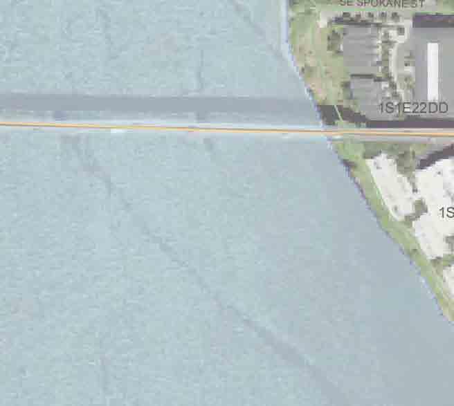
3 Sellwood Bridge S.W. Macadam Ave. Portland 26 S.E. Tacoma St. Sellwood S.E. 17th Ave. S.E. McLoughlin Blvd. SW Taylors Ferry Road Relocated Macadam Bay entrance shoulder WILLAMETTE RIVER shoulder bike/pedestrian railing shared sidewalk/ bike bike shared sidewalk/ railing 5 LEGEND Willamette River 4' 12' 12' 4' 32 feet Existing Bridge 28 feet PHASE 1: BRIDGE CROSS-SECTION LOOKING WEST 12' 6.5' 12' 12' 6.5' 12' 64 feet PHASE 2: BRIDGE CROSS-SECTION LOOKING WEST Proposed road/streets Proposed streetcar line Proposed bike/pedestrian Direction of traffic/number of s Bridges Gradeseparated, signalized interchange Bicycle/pedestrian spiral ramps replaced by ramps along side OR 43 that connect to the existing north-south trail network Replace existing bridge SE Grand Avenue SE Oaks Park Way SE 6th Avenue SE 7th Avenue Pedestrianactivated crossing signal SE 8th Avenue SE Nehalem Street SE Spokane Street INTERCHANGE LANE CONFIGURATION Access provided to River View Cemetery, Powers Marine Park, and Staff Jennings Existing alignment with widening to the south 64-foot cross-section at narrowest point SE Tacoma Street SE Tenino Street Connects to existing cemetery roads OR 43 (SW Macadam Avenue) Four west approach to interchange ft North Preferred Alternative (revised September 2009) TB PDX P2.38 9/29/09 amh
4 Preferred Alternative Refinements Based on agency and resident/ business feedback, design refinements were made to the Preferred Alternative over the spring and summer, including: Bridge cross-section has been narrowed from 5 s to 4 s at the OR 43 interchange on the west end Bicycle/pedestrian facilities on the west end have been improved Access discussions and refinements have occurred based on meetings with property owners near the west end of the bridge Measures have been explored to mitigate impacts to historic and natural resources
5 Key Features of the Preferred Alternative To be built in its current alignment and widened to the south A cross-section of 64 feet at its narrowest point: two 12 travel s, two 12 shared use sidewalks and two 6.5 bike s/emergency shoulders A grade-separated and signalized interchange at the OR 43 (SW Macadam Ave.) intersection on the west end A pedestrian-activated signal at the intersection of SE Tacoma Street and SE 6th Ave. on the east end Consistent with the Tacoma Main Street Plan Restores buses and trucks; accommodates possible future streetcar


6 Preferred Alternative (11/2008) Sellwood Bridge S.W. Macadam Ave. Portland S.E. Tacoma St. Sellwood S.E. 17th Ave. S.E. McLoughlin Blvd. SW Taylors Ferry Road Relocated Macadam Bay entrance shoulder WILLAMETTE RIVER shoulder bike/pedestrian railing shared sidewalk/ bike bike shared sidewalk/ railing LEGEND Willamette River 4' 12' 12' 4' 32 feet Existing Bridge 28 feet PHASE 1: BRIDGE CROSS-SECTION LOOKING WEST 12' 6.5' 12' 12' 6.5' 12' 64 feet PHASE 2: BRIDGE CROSS-SECTION LOOKING WEST Proposed road/streets Proposed streetcar line Proposed bike/pedestrian Direction of traffic/number of s Bridges Gradeseparated, signalized interchange Bicycle/pedestrian spiral ramps replaced by ramps along side OR 43 that connect to the existing north-south trail network Replace existing bridge SE Grand Avenue SE 6th Avenue SE 7th Avenue Pedestrianactivated crossing signal SE 8th Avenue SE Nehalem Street SE Spokane Street INTERCHANGE LANE CONFIGURATION Access provided to River View Cemetery, Powers Marine Park, and Staff Jennings Existing alignment with widening to the south 64-foot cross-section at narrowest point SE Oaks Park Way SE Tacoma Street SE Tenino Street Connects to existing cemetery roads OR 43 (SW Macadam Avenue) Four west approach to interchange ft North Revised September 2009
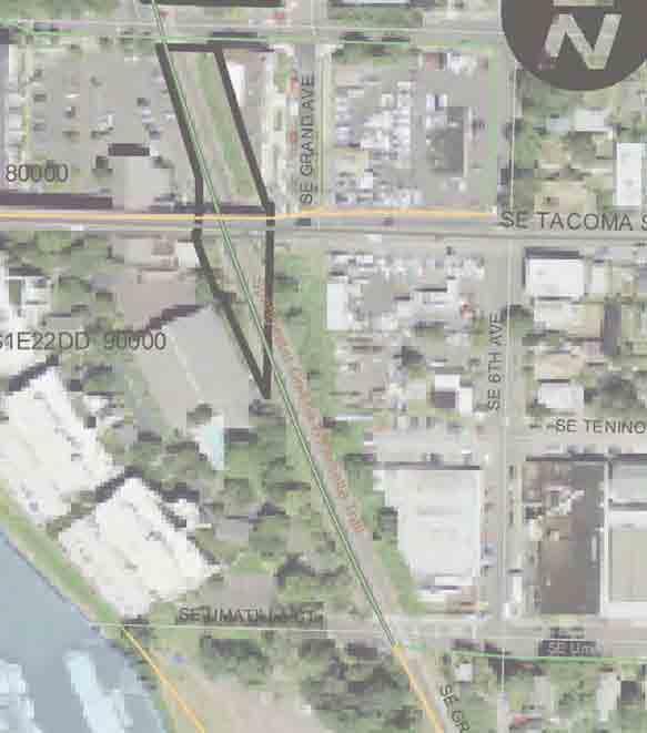
7 Bicycle and Pedestrian Refinements After considering costs and impacts to parks and natural resources, the ramps on the west end of the bridge have been changed from a spiral design on both sides of the bridge to a single, long switchback on both sides of the bridge connecting to the existing north-south trail network.

8 Bicycle/Pedestrian Facilities Current Design Trail continues to Willamette Moorage Park Cyclists crossing of proposed streetcar tracks DEIS Design (November 2008) Proposed streetcar station Route to Powers Marine Park Trail continues below Sellwood Bridge for eastbound travel Curb cut to allow cyclists onto switchback Entrance to Powers Marine Park Bikes in right turn for right turns Bike for through movement Curb cut to allow cyclists off switchback Pedestrian sidewalk to southbound OR 43 LEGEND Direction of traffic Road/street Streetcar/trail Bike/pedestrian facility Crosswalk Bus stop Traffic signal Pedestrian route Bike route Shared ped/bike route


 Road")


9 West Side Access to River View Cemetery, Staff Jennings, and Powers Marine Park Current Design DEIS (November 2008) Road to River View Cemetery, Staff Jennings, and Powers Marine Park. Access road was redesigned to accommodate possible future streetcar tracks. LEGEND Proposed road/streets Proposed streetcar line Proposed bike/pedestrian Direction of traffic/number of s Bridges Superintendent's House

10 West Hillside Profiles River View Cemetery Existing hillside Southbound exit ramp from OR 43 to Sellwood Bridge North of Sellwood Bridge OR 43 Northbound entrance ramp to OR 43 from Sellwood Bridge Shared ped/bike ramp to Sellwood Bridge Proposed streetcar tracks Rockcut wall Bike/pedestrian trail Staff Jennings ft Access road to Staff Jennings/Powers Marine Park South of Sellwood Bridge Southbound entrance ramp to OR 43 from Sellwood Bridge River View Cemetery Existing hillside OR 43 Northbound exit ramp from OR 43 to Sellwood Bridge Shared ped/bike ramp to Sellwood Bridge Superintendent's House Proposed streetcar tracks Access road to Staff Jennings/Powers Marine Park Powers Marine Park


11 OR 43 (SW Macadam Ave) Westside Access Points Taylors Ferry 26 Proposed Streetcar Line 18 Bicycle/ Pedestrian Trail Tower to remain Island Macadam Bay Legend Closed Driveway Full Access Driveway Emergency Access Only Driveway
12 Bridge Cross-Section at West End Narrower width responds to community concerns and meets ODOT and City requirements railing shared sidewalk/ right turn to OR 43 northbound bike left turn to OR 43 southbound and through to cemetery bike shared sidewalk/ railing 89.5 feet Current Design (looking east, from west end) railing shared sidewalk/ right turn to OR 43 northbound bike left turn left turn to to OR 43 OR 43 southbound southbound and through to cemetery bike shared sidewalk/ railing 100 feet DEIS Design (November 2008)


")

 River")


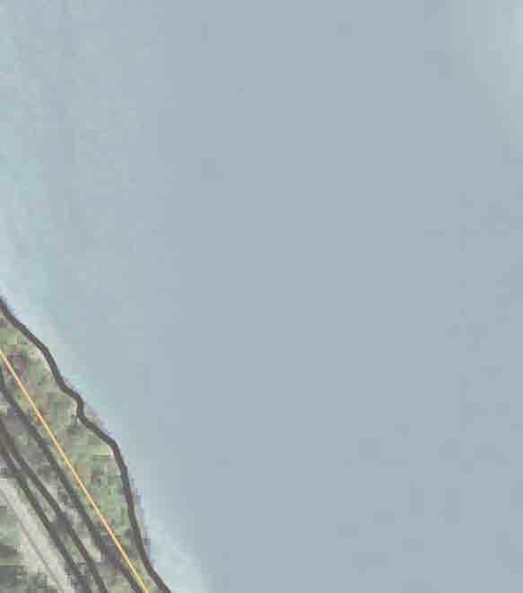
13 Natural and Historic Mitigation LEGEND # Park resources in impact area North Recreational trail resources in impact area Historical/cultural resources in impact area SW Taylors Ferry Road Willamette Greenway Trail (West Bank) Willamette Shoreline Trolley Track Sellwood Riverfront Park SE Oaks Park Way Springwater Corridor Trail Oregon Pacific Railroad Willamette Greenway Trail (East Bank) Oaks Pioneer Park Oaks Pioneer Church Willamette Greenway Trail (Spokane Street) River View Cemetery Sellwood Bridge River Park EXISTING SELLWOOD BRIDGE River View Cemetery Superintendent s House Sellwood Bridge Recreation Trail OR 43 (SW Macadam Avenue) WILLAMETTE RIVER Powers Marine Park
14 Mitigation for Historic Resources Existing Sellwood Bridge Determine if materials can be salvaged and donated to interested parties (e.g. truss spans) Support a new web site about Portland s historic bridges Create interpretive panels about the bridge and place at the east end of the new bridge Install interpretive panels about downtown County-owned bridges at select bridge heads River View Cemetery Relocate cemetery gates Record history of River View Cemetery and Superintendent s House for document libraries Install interpretive panels about River View Cemetery s history at Superintendent s House Design retaining wall behind the Superintendent s House to blend in with the existing landscape

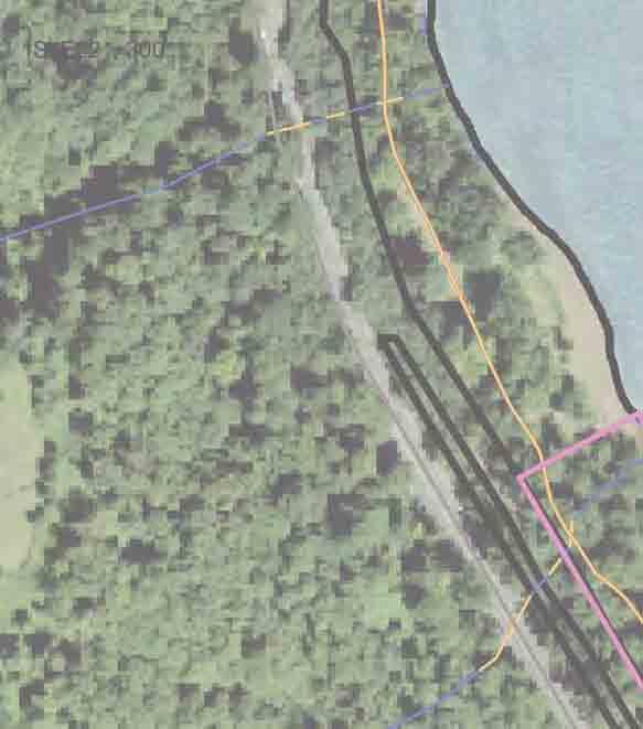


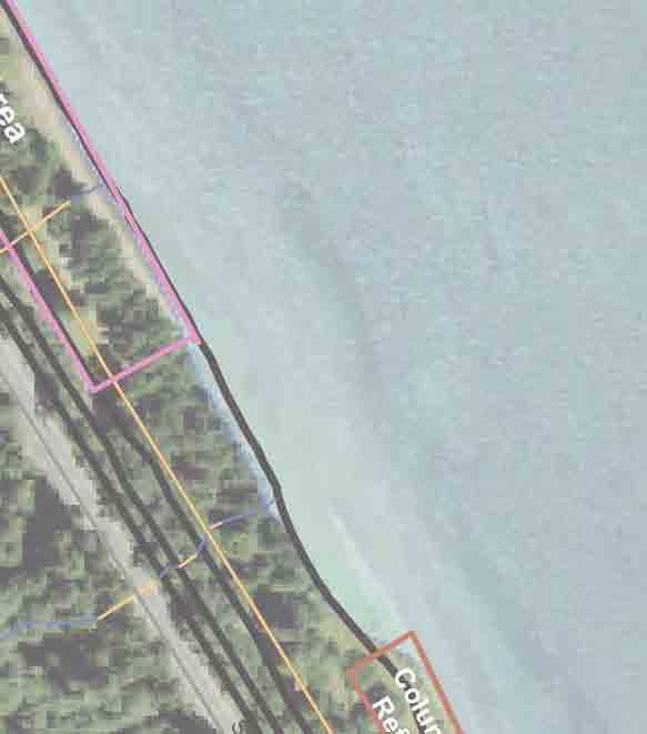
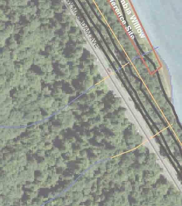


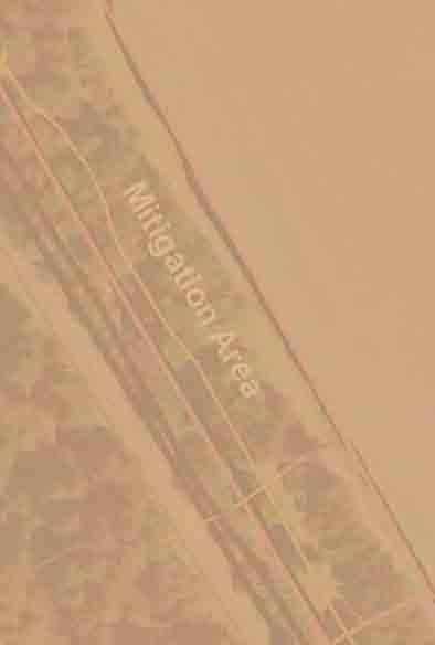


15 Natural Resource Mitigation Sellwood Bridge Stephens Creek Mitigation Area Stream restoration and enhancement To Sellwood Bridge Mitigation Area
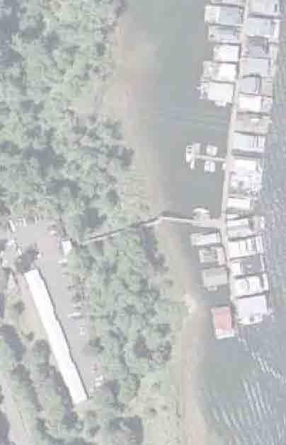
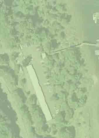
16 Mitigation for Parks & Natural Resources New bike/ped trail between Sellwood Bridge and SW Miles St. will reduce impacts to the passive trails within Willamette Moorage Park Culvert replacement on Stephens Creek will improve fish and wildlife passage Two streams within Powers Marine Park will be restored to enhance fish and wildlife habitat Removing spiral bike/ped ramp will eliminate in-water piers and reduce impacts to the riparian area Driveway refinements to Macadam Bay and Willamette Moorage Park will reduce impacts to Stephens Creek area Better stormwater treatment on-site compared to the existing condition
17 Sellwood Bridge Schedule Approve Preferred Alternative Refine Preferred Alternative to Meet Regulations Prepare Final Environmental Impact Statement Project Check-in Public Events* Federal Highway Administration s Record of Decision Purchase Right of Way Bridge Type/Final Design Construction (determined by funding availability) * Future public input opportunities will be scheduled for later phases of the project
18 Cost Estimate $321 - $330 Million 2014 dollars Includes Bridge, Interchange, Mitigation, Engineering, and Right-of-Way Funding Plan Carry over from EIS Phase* $11M 2009 Oregon Jobs and Transportation Act for Highway 43 Interchange* $30M City of Portland Agreement $100M Federal Reauthorization Request $40M Multnomah County $ M Clackamas County $22M Total Project Cost $ M *secured funding 2009 Oregon Jobs and Transportation Act Provision for Counties to enact a Vehicle Registration Fee for Willamette River (Sellwood) Bridge replacement Allocated $30M to interchange at OR 43/ Sellwood Bridge Multnomah County Strategy County Annual Vehicle Registration Fee $17-20 Elegible Vehicles 557,240 Trucks over 26,000 pounds excluded by state law 20-year Bond proceeds $ M Implementation date Fall 2010 Duration 20 years
City of Sammamish. Welcome. Issaquah-Fall City Road Improvements Project Phase I Design: 242nd Avenue SE to Klahanie Drive SE
 Welcome Welcome to the third community meeting for the Issaquah-Fall City Road Improvements Project. AGENDA 6:00 p.m. Welcome and sign-in 6:10 p.m. Presentation 6:50 p.m. Open house Learn about the roadway
DRAFT Sellwood Bridge Existing Roadway Deficiencies
 Technical Memorandum DRAFT Sellwood Bridge Existing Roadway Deficiencies Executive Summary Purpose Roadway design standards are developed to support safety and mobility goals. Roadway deficiencies have
2014/2015 BIKE ROUTE PLAN 83 AVENUE PROTECTED BIKE LANE
 About the Project The City of Edmonton is planning a major bike route on the southside of Edmonton. The Strathcona Bike Route will connect the communities of Strathcona, Garneau and the University area,
ROAD SAFETY AUDIT (RSA) Barbur Blvd: SW Capitol Hwy to SW Naito Parkway (M.P to M.P. 1.95)
 Barbur Blvd: SW Capitol Hwy to SW Naito Parkway (M.P to M.P. 1.95)") ROAD SAFETY AUDIT (RSA) Barbur Blvd: SW Capitol Hwy to SW Naito Parkway (M.P. 6.30 to M.P. 1.95) SWNI Meeting November July 18, 2016 19, 2015 Portland, Oregon BARBUR ROAD SAFETY AUDIT FHWA RSA Process
ROAD SAFETY AUDIT (RSA) Barbur Blvd: SW Capitol Hwy to SW Naito Parkway (M.P. 6.30 to M.P. 1.95) SWNI Meeting November July 18, 2016 19, 2015 Portland, Oregon BARBUR ROAD SAFETY AUDIT FHWA RSA Process
Duwamish Way-finding and CTR Report
 V. North Tukwila When the North Tukwila Manufacturing and Industrial Center was designated in 1992 as part of the region s land use and transportation plan, the plan called for the area to set a light-rail
Scarlett Road Bridge & Road Improvements Lambton Park Community School - Gymnasium Tuesday November 28 th, 2017
 Scarlett Road Bridge & Road Improvements Lambton Park Community School - Gymnasium Tuesday November 28 th, 2017 PROJECT LOCATION 2 SCARLETT ROAD BRIDGE Constructed in 1912, the bridge carries 4 active
Creating the Future Bruce B Downs Blvd
 Creating the Future Bruce B Downs Blvd How things look today May not be how things look in the future. Bruce B Downs PD&E Study 2003 Construction programmed 2009, Palm Springs to Pebble Creek Tampa Rail
Environmental Assessment Findings & Recommendations. Public Hearing November 13, 2014
 Environmental Assessment Findings & Recommendations Public Hearing November 13, 2014 Welcome! Welcome and Introductions Project and Environmental Assessment Overview Public Comments Adjourn Purpose of
Lee s Summit Road Improvement Study Public Open House June 7, 2007 Summary of Comment Card Responses
 Lee s Summit Road Improvement Study Public Open House June 7, 2007 Summary of Comment Card Responses Introduction At the Lee s Summit Road Improvement Study Public Open House held Thursday, June 7, 2007
Welcome. Thank you for your interest in the Lewis & Clark Viaduct Concept Study
 Welcome Thank you for your interest in the Lewis & Clark Viaduct Concept Study Please use the arrows in the upper left hand corner to navigate through the presentation. Use the envelope icon to ask a question
Los Altos Hills Town Council - June 18, 2015 Palo Alto City Council June 22, AGENDA ITEM #2.B Presentation
 Los Altos Hills Town Council - June 18, 2015 Palo Alto City Council June 22, 2015 AGENDA ITEM #2.B Presentation Previous Presentations Los Altos Hills Town Council in May 2014 and February 2015 Palo Alto
WELCOME. Stakeholder Involvement Group Meeting #2 Round Lake Public Works October 24, 2018
 WELCOME Stakeholder Involvement Group Meeting #2 Round Lake Public Works October 24, 2018 MEETING AGENDA 1. Welcome and Introductions 2. Study Progress Update 3. Problem Statement 4. Technical Analysis
AGENDA REPORT. Issue: Discussion of potential improvements on Barnwell Road at Niblick Drive
 AGENDA REPORT To: From: By: Honorable Mayor and City Council Members Warren Hutmacher, City Manager Tom Black, Public Works Director Date: March 23, 2016 Agenda: March 28, 2016 WORK SESSION AGENDA: Barnwell
5. RUNNINGWAY GUIDELINES
 5. RUNNINGWAY GUIDELINES These guidelines should be considered collectively when making runningway decisions. A runningway is the linear component of the transit system that forms the right-of-way reserved
City of Wilsonville 5 th Street to Kinsman Road Extension Project
 City of Wilsonville 5 th Street to Kinsman Road Walking Tour & Neighborhood Workshop Summary Report Public Outreach Overview On July 18 th, 2017, the City of Wilsonville hosted a neighborhood walking tour
Long Island Rail Road Expansion Project Floral Park to Hicksville
 Long Island Rail Road Expansion Project Floral Park to Hicksville Final Environmental Impact Statement Appendix 1-D Complete Streets Policy Checklist April 2017 0902ML PIN: Project Location: 18A-4 Floral
PROPOSED BICYCLE AND PEDESTRIAN FACILITY Vicinity of Route 123/I-495 Interchange Tysons, Fairfax County, Virginia
 PROPOSED BICYCLE AND PEDESTRIAN FACILITY Vicinity of Route 123/I-495 Interchange Tysons, Fairfax County, Virginia PRELIMINARY ENGINEERING REPORT Prepared for: Prepared by: July 2017 Table of Contents 1
Pattullo Bridge Replacement Project Community Connections Phase 2 Consultation. Appendix 3: Open House Display Boards
 Replacement Project Community Connections Phase 2 Consultation Appendix 3: Open House Display Boards November 2016 Welcome! Welcome to the Replacement Project Public Open House We Want to Hear from You
PEDESTRIAN / BIKE PROJECTS
 PEDESTRIAN / BIKE PROJECTS BP-1. SOUTH WATERFRONT WILLAMETTE GREENWAY TRAIL Need/Purpose The South Waterfront Greenway Trail will stretch from the Marquam Bridge south to the River Forum Building, providing
BETHEL ROAD AND SEDGWICK ROAD CORRIDOR STUDY
 DRAFT PLAN City Council Meeting August 14, 2017 STUDY AREA Sedgwick Corridor State Route 160, principal arterial with Class 3 access management designation, commuter and freight route, connection to SR
Summary: Mercer County Princeton Avenue & Spruce Street Study January 2009
 Summary: Several recent studies have assessed potential development and redevelopment opportunities in the Mercer Crossing area of Trenton, Ewing, and Lawrence. This Princeton Avenue and Spruce Street
2014/2015 BIKE ROUTE PLAN 83 AVENUE PROTECTED BIKE LANE
 About the Project 2014/2015 BIKE ROUTE PLAN The City of Edmonton is planning a major bike route on the south side of Edmonton. This bike route is one part of a plan to provide citizens with transportation
Terwillegar Drive Expressway Draft Concept Plan
 Terwillegar Drive Expressway Draft Concept Plan Anthony Henday Drive to Whitemud Drive November 28 5:00-8:00 p.m. December 1 10:00 a.m. - 3:00 p.m. Let s Talk Today you can: Learn about the new direction
Typical Cross Section: DOWNTOWN (Observer Highway - 8th Street)
") Typical Cross Section: DOWNTOWN (Observer Highway - 8th Street) DRAFT SEPTEMBER 23, 14 1 Washington Street Typical Block Downtown Typical Block: DOWNTOWN (Observer Highway - 8th Street) New crosswalks
Typical Cross Section: DOWNTOWN (Observer Highway - 8th Street) DRAFT SEPTEMBER 23, 14 1 Washington Street Typical Block Downtown Typical Block: DOWNTOWN (Observer Highway - 8th Street) New crosswalks
Foothill Expressway Improvements Between El Monte and San Antonio
 Foothill Expressway Improvements Between El Monte and San Antonio June 29, 2017 - Los Altos Community Meeting Introduction Project Background Agenda Visit Stations: Provide Input and Ask Questions Reconvene:
Design Criteria. Design Criteria
 F Design Criteria Design Criteria Ministry of Transportation Ministère des Transports DESIGN CRITERIA Page: 1 of 13 WORK PROJECT NO. N/A GO Bloomington Station TYPE OF PROJECT LOCATION Bloomington Road
Basalt Creek Transportation Refinement Plan Recommendations
 Basalt Creek Transportation Refinement Plan Recommendations Introduction The Basalt Creek transportation planning effort analyzed future transportation conditions and evaluated alternative strategies for
C C C
 C-012-001 Thank you for your support for the creation of new public space and nonmotorized access between downtown and the waterfront through the Overlook Walk, the East-West Connections, and the Promenade.
Stephens Creek Culvert Replacement. CAC April 28, 2010
 Stephens Creek Culvert Replacement CAC April 28, 2010 1 Top of Bank Willamette Moorage Park Existing Culverts 50 ft Greenway Setback 200 ft Greenway Setback Existing Macadam Bay Access Stephens Creek Existing
Pennsylvania Avenue (CR 484) Design Alternatives Study
 Design Alternatives Study") MEMORANDUM Pennsylvania Avenue (CR 484) Design Alternatives Study Prepared for: APRIL 2016 Prepared By TABLE OF CONTENTS Project Background... 2 Previous Concept... 2 Existing Conditions... 4 New Alternatives...
MEMORANDUM Pennsylvania Avenue (CR 484) Design Alternatives Study Prepared for: APRIL 2016 Prepared By TABLE OF CONTENTS Project Background... 2 Previous Concept... 2 Existing Conditions... 4 New Alternatives...
Welcome to the Quebec Alternatives Analysis Public Meeting
 Welcome to the Public Meeting Please sign in. Public Comment Please fill out a comment card and tell us what you think. Check back or comment any time at: www.quebecalternatives.com Project Area Technical
Improving Cyclist Safety at the Dundas Street West and Sterling Road Intersection
 STAFF REPORT ACTION REQUIRED Improving Cyclist Safety at the Dundas Street West and Sterling Road Intersection Date: August 17, 2012 To: From: Wards: Reference Number: Public Works and Infrastructure Committee
Municipal Class EA To Address Traffic Congestion On The Ontario Street Corridor (Grand Bend) Public Information Meeting June 4, 2018
 Public Information Meeting June 4, 2018") Municipal Class EA To Address Traffic Congestion On The Ontario Street Corridor (Grand Bend) Public Information Meeting June 4, 2018 Background Agenda Traffic Study Update Class EA Alternatives Bridge
Municipal Class EA To Address Traffic Congestion On The Ontario Street Corridor (Grand Bend) Public Information Meeting June 4, 2018 Background Agenda Traffic Study Update Class EA Alternatives Bridge
Merrick and Memorial Neighborhood Study 5/14/2014 Public Meeting
 Merrick and Memorial Neighborhood Study 5/14/2014 Public Meeting Study Area April 9 Public Meeting Comments Summary Pedestrian Safety - A Walking Neighborhood Pedestrian traffic is very difficult A need
If a person walks within this focus area, these are examples of the places he or she could walk to or from:
 Portland Hillsdale Hillsdale Portland The Hillsdale focus area is located in the City of Portland. It is situated approximately three miles from the City of Portland s downtown, 5.5 miles from the City
Recommendations. Central Salem Mobility Study
 Central Salem Mobility Study The Central Salem Mobility Study evaluated a range of multimodal transportation issues affecting downtown Salem, including circulation, access, and safety for people traveling
Polk Streetscape Project
 What is this project? The Polk Streetscape Project is an effort to improve safety for everyone traveling on Polk Street between Union and McAllister streets. Also included in this project are paving, sewer
Public Workshop Alternatives Development
 Meeting Summary Public Workshop Alternatives Development DATE: April 4, 2007 TIME: LOCATION: 7:00 TO 9:00 P.M. Sellwood Middle School The second public forum for the Sellwood Bridge project (a public workshop)
CAPITOL DRIVE & FOND DU LAC AVENUE INTERSECTION ANALYSIS. Urban Planning 772 SARAH BREGANT, RYAN PETERSON, & MATT WERDERITCH
 CAPITOL DRIVE & FOND DU LAC AVENUE INTERSECTION ANALYSIS Urban Planning 772 SARAH BREGANT, RYAN PETERSON, & MATT WERDERITCH OVERVIEW N 51 ST BOULEVARD N 51 ST BOULEVARD 12,100 44,700 W CAPITOL DRIVE 52,600
Chapter 5 Future Transportation
 Chapter 5 Future Transportation The Future Land Use Plan identifies the desired land use designations. The land uses desired for Crozet depend, in large part, on the success of the transportation system,
The Transformation of Portland into a Two-Wheeled Mecca. Mia Birk, Principal, Alta Planning + Design
 The Transformation of Portland into a Two-Wheeled Mecca Mia Birk, Principal, Alta Planning + Design Development of Portland s Bikeway Network 1990 Early 1990s Infrastructure Growing Public Support Growing
Appendix C. NORTH METRO STATION AREA TRAFFIC IMPACT STATEMENT 88th Avenue Station
 Appendix C NORTH METRO STATION AREA TRAFFIC IMPACT STATEMENT 88th Avenue Station Prepared for: Regional Transportation Department and URS Corporation as part of the North Metro EIS David Evans and Associates,
City of Gainesville Transportation/Roadway Needs PROJECT SUMMARY
 A1 Roadway Resurfacing $23,846,000 TYPE: Preservation of existing system Roadway resurfacing A2 Signal Replacement $6,000,000 TYPE: Preservation of existing system Replace traffic signals. B1 W 6th St
Tunnel Reconstruction Brooklyn CB 1 August 14, 2018
 Tunnel Reconstruction Brooklyn CB 1 August 14, 2018 Reconstructing the Tunnel 2 Service During Tunnel Reconstruction April 2019 through July 2020 3 Projected Cross River Travel Paths of Customers The Service
Governance and Priorities Committee Report For the July 2, 2015 Meeting
 CITY OF VICTORIA For the July 2, 2015 Meeting To: Governance and Priorities Committee Date: From: Subject: Brad Dellebuur, A/Assistant Director, Transportation and Parking Services Executive Summary The
Sellwood Bridge Project Evaluation Framework
 Sellwood Bridge Project Evaluation Framework Draft Technical Memorandum This memorandum outlines the approach for screening Sellwood Bridge Project concepts and evaluating alternatives adopted by the Policy
2012 PRIORITY TRANSPORTATION PROJECTS
 0 PRIORITY TRANSPORTATION PROJECTS The 0 Priority Transportation Projects include candidate road, congestion management, multi-use trail, transit, transportation regional incentive program (TRIP), county
WELCOME! Please complete a comment sheet as we value your feedback. 4 pm to 8 pm. September 15, Hosted by: AECOM on behalf of City of Calgary
 WELCOME! Thank you for attending our open house. There will be no formal presentation today so please take the time to read the boards. If you have any questions, please do not hesitate to approach one
Memorandum. Sunday, July 13, Saturday, July 19, 2014
 Memorandum To: David Lowin, Brooklyn Bridge Park Corporation From: Daniel Schack, AICP, PTP Date: Re: Brooklyn Bridge Park Pier 5/6 Loop Road Traffic Study Project No: 14-01-2407 At the request of Brooklyn
UNIVERSITY OF WASHINGTON TO SOUND TRANSIT U-LINK PEDESTRIAN CONNECTION PROJECT EIS ADDENDUM
 UNIVERSITY OF WASHINGTON TO SOUND TRANSIT U-LINK PEDESTRIAN CONNECTION PROJECT EIS ADDENDUM UNIVERSITY OF WASHINGTON SOUND TRANSIT January 2011 EIS Addendum for the University of Washington to Sound Transit
Overview. Illinois Bike Summit IDOT Complete Streets Policy Presentation. What is a Complete Street? And why build them? And why build them?
 Overview Illinois Bike Summit IDOT Complete Streets Policy Presentation Aren Kriks, P.E. District One Bicycle Coordinator and Bureau of Programming Project Engineer History of Complete Streets IDOT Policy
Southwest Bus Rapid Transit (SW BRT) Functional Planning Study - Executive Summary January 19 LPT ATTACHMENT 2.
 Functional Planning Study - Executive Summary January 19 LPT ATTACHMENT 2.") Southwest Bus Rapid Transit (SW BRT) Functional Planning Study - Executive Summary 2011 January 19 1 of 19 Introduction This executive summary presents the results of the Southwest Bus Rapid Transit (SW
Southwest Bus Rapid Transit (SW BRT) Functional Planning Study - Executive Summary 2011 January 19 1 of 19 Introduction This executive summary presents the results of the Southwest Bus Rapid Transit (SW
Access Routes from US 101 to the Richmond San Rafael Bridge
 Access Routes from US 101 to the Richmond San Rafael Bridge TAM Board Meeting January 28, 2016 RSRB Project Elements Eastbound Third Lane: Sir Francis Drake Blvd. to Marine Street 10 ft Barrier Separated
Pine Hills Road Pedestrian/Bicycle Safety Study Board of County Commissioners Work Session
 Pine Hills Road Pedestrian/Bicycle Safety Study Board of County Commissioners Work Session February 20, 2018 Meeting Agenda Study Overview Existing Conditions Access Management Potential Gateway Features
Tunnel Reconstruction South 5 th Street Association October 16, 2018
 Tunnel Reconstruction South 5 th Street Association October 16, 2018 Reconstructing the Tunnel 2 Service During Tunnel Reconstruction April 2019 through July 2020 3 Projected Cross River Travel Paths of
Protected Bike Lanes in San Francisco Mike Sallaberry SFMTA NACTO Workshop - Chicago IL
 Protected Bike Lanes in San Francisco Mike Sallaberry SFMTA 10 14 2011 NACTO Workshop - Chicago IL San Francisco 2 nd Highest Density in the U.S. 47 square miles Mild Climate Market Population ~810,000
West Circle Drive (CSAH 22) Traffic Operations Study
 Traffic Operations Study") West Circle Drive (CSAH 22) Traffic Operations Study May 24, 2016 Open House Harriet Bishop Elementary School 6:45 8:00 p.m. Presentation at 7:00 p.m. Purpose of Tonight s Meeting Introductions Explain
West Circle Drive (CSAH 22) Traffic Operations Study May 24, 2016 Open House Harriet Bishop Elementary School 6:45 8:00 p.m. Presentation at 7:00 p.m. Purpose of Tonight s Meeting Introductions Explain
Traffic Improvements for the Transit Oriented Development District (TODD) Meriden Public Library March 11, 2014
 Meriden Public Library March 11, 2014") Traffic Improvements for the Transit Oriented Development District (TODD) Meriden Public Library March 11, 2014 Project Overview Coordinate roadway improvements with other major projects HUB Flood Control
Traffic Improvements for the Transit Oriented Development District (TODD) Meriden Public Library March 11, 2014 Project Overview Coordinate roadway improvements with other major projects HUB Flood Control
Richmond-Adelaide Cycle Tracks
 Public Drop-In Event Richmond-Adelaide Cycle Tracks June 25, 2018 12:00 p.m. 3:00 p.m. 4:30 p.m. 7:30 p.m. Metro Hall, Rotunda 55 John Street 1 Purpose of Event In Scope Communicate an update about the
Proposed Bridge Street East Bicycle Lanes Public Open House Thursday, April 27, 2017
 WELCOME Proposed Bridge Street East Bicycle Lanes Public Open House Thursday, April 27, 2017 Purpose of the Open House The purpose of this Open House is to gain public input on the bicycle lanes proposed
HIGHBURY AVENUE/HAMILTON ROAD INTERSECTION IMPROVEMENTS PUBLIC INFORMATION CENTRE 1 MAY 14, 2015
 HIGHBURY AVENUE/HAMILTON ROAD INTERSECTION IMPROVEMENTS Municipal Class Environmental Assessment PUBLIC INFORMATION CENTRE 1 MAY 14, 2015 ACCESSIBILITY Under the Accessibility Standards 2015 for Customer
WELCOME Public Information Centre
 WELCOME Public Information Centre Fernforest Drive Brampton Soccer Centre Community Room #2 Tuesday January 19, 2016 6:30 p.m.to 9:00 p.m. Please sign in Neighbourhood Traffic Calming Guide Background
NOTICE OF PREPARATION. Environmental Programs 3331 North First Street, Building B-2 San Jose, CA
 NOTICE OF PREPARATION May 29, 2018 To: Reviewing Agencies and Organizations From: Santa Clara Valley Transportation Authority Environmental Programs 3331 North First Street, Building B-2 San Jose, CA 95134-1927
Flanders Crossing. Save Lives Save Money Saving Our Environment. Portland City Council April 30, 2008
 Flanders Crossing Save Lives Save Money Saving Our Environment Portland City Council April 30, 2008 NWSTELBRG-GLISANSTRAMP Expanding Portland s Bicycle Boulevards NW NAITO PKY Why this project? Part of
Legislative Update. Frederick County Fall Staunton District. Interstate 81 - Exit 300 at Interstate 66 Southbound Acceleration Lane Extension
 Interstate 81 - Exit 300 at Interstate 66 Southbound Acceleration Lane Extension Application ID 1643 Northern Shenandoah Valley Regional Commission (NSVRC) $3,437,423 This project extends the Interstate
Clackamas County Comprehensive Plan
 ROADWAYS The County s road system permits the movement of goods and people between communities and regions, using any of a variety of modes of travel. Roads provide access to virtually all property. They
DAFFODIL FESTIVAL 2018 STREET PARADE BANDS & LARGE MARCHING UNITS USING BUSES (SU#5)
") DAFFODIL FESTIVAL 2018 STREET PARADE BANDS & LARGE MARCHING UNITS USING BUSES (SU#5) The Parade will start at: 10:15 a.m. in Tacoma 2:30 p.m. in Sumner 12:45 p.m. in Puyallup 5:00 p.m. in Orting MARCHERS:
DAFFODIL FESTIVAL 2018 STREET PARADE BANDS & LARGE MARCHING UNITS USING BUSES (SU#5) The Parade will start at: 10:15 a.m. in Tacoma 2:30 p.m. in Sumner 12:45 p.m. in Puyallup 5:00 p.m. in Orting MARCHERS:
Saskatchewan Drive Roadway Rehabilitation and Shared-Use Path Widening
 Saskatchewan Drive Roadway Rehabilitation and Shared-Use Path Widening We are here today to present the draft plan for the Saskatchewan Drive Roadway Rehabilitation and Shared-Use Path Widening project
Main-McVay Transit Study: Phase 2 Options Definition and High Level Constraints Evaluation
 Main-McVay Transit Study: Phase 2 Options Definition and High Level Constraints Evaluation APRIL 2016 A collaborative study between: For Additional Information or to Comment If you would like additional
GEARY CORRIDOR BUS RAPID TRANSIT Environmental Analysis. Special Intersections: Preliminary Concepts
 GEARY CORRIDOR BUS RAPID TRANSIT Environmental Analysis Special Intersections: Preliminary Concepts April 2, 2009 FILLMORE: Existing Conditions 3 lanes in underpass, 2 lanes in service road (each direction)
Cascade Bicycle Club Recommendations
 Cascade Bicycle Club Recommendations The following recommendations are focused on improving bicycle commuting in the Duwamish (South Park, South Downtown, Georgetown and North Tukwila). The recommendations
Columbia Pike Implementation Team (CPIT) Meeting
 Meeting") Columbia Pike Implementation Team (CPIT) Meeting November 30, 2010 Agenda Introductions / Purpose of Meeting Review of project goals Multimodal project: 10% street design between the curbs Discussion Multimodal
Columbia Pike Implementation Team (CPIT) Meeting November 30, 2010 Agenda Introductions / Purpose of Meeting Review of project goals Multimodal project: 10% street design between the curbs Discussion Multimodal
WHEREAS delivery trucks also pass through the Narrows, into the northern parking lot, to loading docks in the back of the building.
 CEDAR-ISLES-DEAN NEIGHBORHOOD ASSOCIATION ( CIDNA ) RESOLUTION OPPOSING A DRUG STORE DRIVE THRU, AND COMMENDING DORAN COMPANIES FOR PROPOSING MITIGATING AMENITIES INCLUDING NEW LANDSCAPING AND A DEDICATED
Public Meeting #1 Comment Summary
 Public Meeting #1 Comment Summary This summary includes comments received on comment forms and during conversations between attendees and project team staff at the February 18, 2016 public open house.
City of Moorhead Committee of the Whole Meeting
 City of Moorhead Committee of the Whole Meeting Corridor Study Limits Center Avenue (Red River to 8th Street) TH 10 (Red River to TH 336) TH 75 (20th Ave S to Main Avenue) 2 Study Need: Project Overview
I-10 AT SCENIC LOOP RD. Open House
 I-10 AT SCENIC LOOP RD Open House General Information I-10 At Scenic Loop Rd KENDALL COUNTY OPEN HOUSE June 30, 2015 Currey Creek Baptist Church 35 Cascade Cavern 5:00 7:00 Boerne, TX 78015 2 Public Meeting
4. ENVIRONMENTAL IMPACT ANALYSIS 9. TRANSPORTATION AND TRAFFIC
 4. ENVIRONMENTAL IMPACT ANALYSIS 9. TRANSPORTATION AND TRAFFIC 4.9.1 INTRODUCTION The following section addresses the Proposed Project s impact on transportation and traffic based on the Traffic Study
5. MODIFICATIONS AT JEANNE D ARC BOULEVARD/REGIONAL ROAD 174 INTERCHANGE INTERSECTION - PUBLIC HEARING COMMITTEE RECOMMENDATION
 5. MODIFICATIONS AT JEANNE D ARC BOULEVARD/REGIONAL ROAD 174 INTERCHANGE INTERSECTION - PUBLIC HEARING COMMITTEE RECOMMENDATION Having held a public hearing, that Council approve the preliminary designs
section 4 Existing Conditions, Issues, and Options
 section 4 Existing Conditions, Issues, and Options 4.0 Existing Conditions, Issues, and Options This section analyzes each segment of the corridor on a street to street basis. Each segment is discussed
2016 I-30 CROSSING ARKANSAS BOULEVARD KEY IDEAS OF PLAN B:
 KEY IDEAS OF PLAN B: Transportation shall support all parts of the cities and improve the quality of life downtown. There is no need to shorten commuting time at rush hour by a few minutes at the risk
TRAFFIC ACTION PLAN. Laurie Meadows Neighborhood CITY OF SAN MATEO
 TRAFFIC ACTION PLAN Laurie Meadows Neighborhood CITY OF SAN MATEO Draft January 2017 Table of Contents Introduction... 2 The Traffic Forum Process... 5 Neighborhood Traffic Issues... 7 Neighborhood Recommendations
VDOT I-66 Inside the Beltway Eastbound Widening Environmental Assessment. Staff Recommendations
 VDOT I-66 Inside the Beltway Eastbound Widening Environmental Assessment Staff Recommendations Department of Environmental Services Transportation January 28, 2017 Timeline of Transform66 June 2012: I-66
STUDY ADVISORY COMMITTEE. October 8, 2015
 STUDY ADVISORY COMMITTEE October 8, 2015 Study Purpose evaluate the long-term transportation strategies and investments needed to sustain the county s economic health and quality of life in the coming
Transportation Planning Division
 Transportation Planning Division Presentation Outline Study Tasks Recap of Previous Meetings Data Collected Focus Areas within Study Limits Design Principles Tool Box Recommended Concepts Schedule Moving
COMMUNITY MEETING AGENDA
 COMMUNITY MEETING AGENDA Welcome and Introductions SAFE Presentation Project Presentation Priorities Feedback Next Steps Q&A Santa Cruz Avenue Corridor Study 1 Santa Cruz Avenue Corridor Study Community
122 Avenue: 107 Street to Fort Road
 : 107 Street to Fort Road November 24, 2015 4:30 8:00 p.m. Meeting Purpose Summarize project work completed to date Share results of public input from Phase 1 Share the draft concept plan and proposed
Colchester/Riverside/Barrett/ Mill Intersection Study. PAC Meeting #3 September 22, 2016
 Colchester/Riverside/Barrett/ Mill Intersection Study PAC Meeting #3 September 22, 2016 Tonight s Agenda Review Project Purpose and Need Describe short term and long improvements and changes since public
Hennepin Avenue Reconstruction Washington Avenue to 12 th Street
 CITY OF MINNEAPOLIS Hennepin Avenue Reconstruction Washington Avenue to 12 th Street April 2016 1 Upcoming Opportunities Public Meeting #2 April 25, 2016 Minneapolis Central Library Doty Board Room Repeat
Princeton Avenue and Spruce Street Transportation and Site Access Enhancements Project
 Princeton Avenue and Spruce Street Transportation and Site Access Enhancements Project Mercer County Planning Division AECOM Transportation (formerly DMJM Harris) January 29, 2009 Agenda Project Status
Non-Motorized Transportation 7-1
 Non-Motorized Transportation 7-1 Transportation facilities no longer mean just accommodating a vehicle powered by a combustion engine. Pedestrian and non-motorized facilities are important modes of travel
Station 1: Street & Sidewalk Upgrades
 Station 1: Street & Sidewalk Upgrades Existing no left turn; Potential left turn arrow, see Circulation Study boards for more information Thru-lane guidance Improved lead-in green bike lane 17TH ST CASTRO
Corpus Christi Metropolitan Transportation Plan Fiscal Year Introduction:
 Introduction: The Safe, Accountable, Flexible, Efficient Transportation Equity Act: A Legacy for Users (SAFETEA-LU) has continued the efforts started through the Intermodal Surface Transportation Efficiency
Comments EXECUTIVE SUMMARY
 Comments 1. Under any Alternatives, MCDOT should provide better at-grade pedestrian crossing of Georgia Avenue and Forest Glen Road, including improved crosswalks with wider medians and adequate signal
Poor pavement condition Substandard Intersections. / Substandard bike/pedestrian/transit accommodations. Driveway access Environmental concerns
 Public Informational Meeting University Avenue (Allen Boulevard Segoe Road) March 23, 2011 City of Madison City of Middleton Village of Shorewood Hills Dane County Existing Roadway Conditions Poor pavement
FY STATEWIDE TRANSPORTATION IMPROVEMENT PROGRAM New Jersey Department of Transportation Projects
 ROUTE/ Project ID No. TIP No. Electrical Load Center Replacement - North 04324 04324 This project will provide for the betterment of the existing highway lighting facilities located along Routes 3, 17
Dr. M.L. King, Jr. Street North Complete Streets Resurfacing Opportunities HOUSING, LAND USE, AND TRANSPORTATION COMMITTEE MARCH 22, 2018
 Dr. M.L. King, Jr. Street North Complete Streets Resurfacing Opportunities HOUSING, LAND USE, AND TRANSPORTATION COMMITTEE MARCH 22, 2018 What s Happening The City plans to mill and resurface Dr. M.L.
Riverside Drive Complete Streets Project 3 rd Community Meeting. March 26, 2015
 Riverside Drive Complete Streets Project 3 rd Community Meeting March 26, 2015 Providing Feedback Sign-In with contact information for future updates Complete questionnaire provided tonight Complete comment
Bay to Bay Boulevard Complete Streets Project
 Bay to Bay Boulevard Complete Streets Project Dale Mabry Highway to Bayshore Boulevard February 08, 2018 Photo Source: Tampa Bay Times Alessandra Da Pra Meeting Format Introduction Resurfacing Information
Tonight is for you. Learn everything you can. Share all your ideas.
 Strathcona Neighbourhood Renewal Draft Concept Design Tonight is for you. Learn everything you can. Share all your ideas. What is Neighbourhood Renewal? Creating a design with you for your neighbourhood.
Welcome. If you have any questions or comments on the project, please contact:
 Welcome This drop-in public open house is intended to provide information about the Bay Street bike lanes project. This project proposes a dedicated cycling facility along Bay Street between Aberdeen Avenue