Highway 49, Highway 351 and Highway 91 Improvements Feasibility Study Craighead County
|
|
|
- Iris Stewart
- 5 years ago
- Views:
Transcription

1 Highway 49, Highway 351 and Highway 91 Improvements Feasibility Study Craighead County Executive Summary March 2015

 complies with all civil rights provisions of")

2 Highway 49, Highway 351 and Highway 91 Improvements Feasibility Study Craighead County Executive Summary March 2015 Prepared by the Transportation Planning and Policy Division Arkansas State Highway and Transportation Department In cooperation with the Federal Highway Administration This report was funded in part by the Federal Highway Administration, U.S. Department of Transportation. The views and opinions of the authors expressed herein do not necessarily state or reflect those of the U.S. Department of Transportation. ARKANSAS STATE HIGHWAY AND TRANSPORTATION DEPARTMENT NOTICE OF NONDISCRIMINATION The Arkansas State Highway and Transportation Department (Department) complies with all civil rights provisions of federal statutes and related authorities that prohibited discrimination in programs and activities receiving federal financial assistance. Therefore, the Department does not discriminate on the basis of race, sex, color, age, national origin, religion or disability, in the admission, access to and treatment in Department s programs and activities, as well as the Department s hiring or employment practices. Complaints of alleged discrimination and inquiries regarding the Department s nondiscrimination policies may be directed to Joanna P. McFadden Section Head- EEO/DBE (ADA/504/Title VI Coordinator), P. O. Box 2261, Little Rock, AR 72203, (501) , (Voice/TTY 711), or the following address: joanna.mcfadden@ahtd.ar.gov Free language assistance for Limited English Proficient individuals is available upon request. This notice is available from the ADA/504/Title VI Coordinator in large print, on audiotape and in Braille. AHTD:TPP:MPP:JHS/ASB:sag:1/21/15
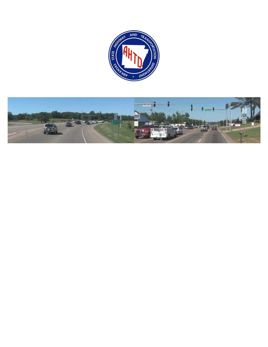
3 Introduction Highway 49, a principal arterial, is part of the Arkansas Primary Highway Network (APHN) and the National Highway System (NHS). Highway 351, a minor arterial, is also part of the APHN; however, it is not an NHS route. Significant development has occurred in northeast Jonesboro, leading to increased traffic growth and congestion on Highways 49 and 351. The City of Jonesboro has expressed concerns regarding congestion and safety on these routes. At the request of the City, the Arkansas State Highway Commission approved Minute Order , which authorized a study of Highway 49 from Highway 91 to Highway 351 and of Highway 351 from Highway 49 to the north. The study area is shown in Figure ES-1. Purpose and Need The City of Jonesboro, located in Craighead County in northeast Arkansas, is the regional employment, medical and commercial center. The population of Jonesboro grew from 55,515 in 2000 to 67,263 in 2010, an increase of approximately 21 percent. The Craighead County population grew from 82,148 in 2000 to 96,443 in 2010, an increase of approximately 17 percent. Arkansas State University (ASU), the State s second largest university, is located along Highway 49 adjacent to a portion of the study area. The purpose of this study is to determine the need for and feasibility of improvements to facilitate current and future traffic flow and enhance safety along Highway 49 and Highway 351 in northeast Jonesboro. 1

4 Figure ES-1 Study Area 2
5 Existing Conditions West of the signalized intersection of Highway 49 and Highway 351, Highway 49 (Red Wolf Boulevard and Johnson Avenue) consists of four 12-foot travel lanes, a continuous, two-way, left-turn lane, and six-foot paved shoulders. The land use near Highway 49 consists of commercial, industrial, and residential use. Within the study area, Highway 351 (Old Greensboro Road) consists of two 11-foot travel lanes with three-foot paved shoulders, and is signalized at its intersection with Highway 49. The land use near Highway 351 consists of commercial and single family residential use. Highway 91 (Johnson Avenue) is functionally classified as a principal arterial and is part of the APHN and the NHS. Near the intersection with Highway 49, Highway 91 consists of four 12-foot travel lanes with eight-foot paved shoulders. The existing land use along Highway 91 is a combination of mixed-use and single family use. Traffic Analysis As shown in Figure ES-2, the 2014 average daily traffic (ADT) on Highway 49 ranges from 27,000 vehicles per day (vpd) to 33,000 vpd, while the 2014 ADT on Highway 91 is 18,000 vpd and the 2014 ADT on Highway 351 north is 10,000 vpd. The 2034 ADT is forecasted to be as high as 50,000 vpd along Highway 49, 27,000 vpd along Highway 91, and 15,000 vpd along Highway 351. The traffic forecasts considered the nearby proposed development. Based on field observations, approximately 83 percent of the southbound Highway 351 traffic turning right onto Highway 49 is destined to Highway 49 south during the AM peak periods. About 65 percent of the westbound Highway 49 traffic east of Highway 351 continues south on Highway 49, while the remaining 35 percent continues west onto Highway 91. 3
6 Figure ES-2 Average Daily Traffic Operations 4
7 Traffic congestion is currently experienced primarily at the Highway 49 intersection with Highway 351. The volume to capacity ratio is greater than one on Highway 49 in this area, resulting in an unacceptable level of service (LOS). Level of service (LOS) is a quality measure describing conditions within a traffic stream, generally in terms of such service measures as speed, travel time, freedom to maneuver, traffic interruptions, and comfort and convenience. Traffic queues in the AM peak often extend about 2,500 feet on Highway 49 from Highway 351 (Old Greensboro Road) to Highway 351 (Airport Road). Traffic queues also extend about 2,500 feet on Highway 351 from Highway 49 to Greensboro Road. While the current congestion within the study area on Highway 49 is primarily focused around the Highway 351 (Old Greensboro Road) intersection, the LOS at the Highway 91 intersection is currently C, and is projected to decrease to an unacceptable LOS F within the study period. Safety Analysis A crash analysis for Highway 49, Highway 91, and Highway 351 was conducted using crash data from 2010, 2011, and 2012 (the three most recent years for which data are available). As shown in Table ES-1, crash rates were generally near the statewide averages for similar roadway types. The crash analysis revealed that the majority of crashes in the study area (Figure ES-3) are rear-end crashes. Approximately 60 percent of the crashes reported on Highway 49 (Johnson Avenue) from Highway 351 to Highway 49 (Red Wolf Boulevard), 77 percent on Highway 91, and 54 percent on Highway 351, were rear-end crashes. 5

8 Figure ES-3 Crash Location Map 6
9 Route Roadway Type (Length) urban, four-lane undivided (1.33 miles) urban, four-lane undivided (0.50 mile) Table ES-1 Crash Rates Year ADT Crashes Crash Rate 1 (per MVM) Statewide Average Crash Rate , , , year Average Crash Rate , , , year Average Crash Rate , urban, two-lane, , undivided (2.66 miles) , year Average Crash Rate Crash rates are based on the number of crashes per million vehicle miles (mvm) traveled. 2 Comparing the crash rate to a statewide average for similar facilities is one factor in reviewing safety. Other Considerations Metropolitan Transportation Plan The study area is located in the Jonesboro Area Metropolitan Planning Organization s (MPO s) planning area. The Jonesboro Area MPO 2035 Metropolitan Transportation Plan (MTP), adopted in 2011, identified the need for improvements to the Highway 49/Highway 91 intersection, widening Highway 49 (Johnson Avenue) from Highway 91 to Highway 351 (Airport Road), and widening of Highway 351 (Old Greensboro Road) to a four-lane facility from Highway 49 to Macedonia Road. The proposed trail system shown in the MTP includes a trail that would parallel Highway 49 (Red Wolf Boulevard), cross Highway 49 (Johnson Avenue), and follow Highway 351 to the north (Old Greensboro Road). Due to the potential developments in the study area, bicycle and pedestrian activities may become more prevalent, which could result in modifications to the plan. If an improvement project is identified, any need for bicycle and pedestrian accommodations should be coordinated with the City s 7
10 and the MPO s plans in accordance with the Arkansas State Highway and Transportation Department s policies. Land Use and Transportation Local land use and access management policies have a significant impact on sustainability and reliability of the transportation system. An efficient local roadway network that provides an adequate system of minor arterial and connector streets would relieve traffic demands on the State Highway System. This type of local connectivity mostly benefits the local population by allowing them to avoid congestion as well as accommodating other road users. 8
11 Discussion of Alternatives Based on an evaluation of the existing conditions and traffic and safety analyses, a no-action alternative and two improvement alternatives were developed. The total estimated costs for the improvement alternatives, in 2014 dollars, include preliminary engineering, right of way acquisition, utility relocation, construction, and construction engineering. No-Action Alternative The No-Action Alternative includes no capacity or geometric improvements on the existing highways. Adverse impacts will occur due to increased traffic demand on the system resulting in more congestion, increased travels times, reduced speeds and increased safety concerns. Improvement Alternatives Each alternative assumes that no additional traffic signals will be added to Highway 49 in the study area, and that access management strategies such as adequate driveway spacing, a raised median, and deceleration lanes would be applied. These are necessary to maximize operations and safety through this corridor. Alternative 1 Improve Existing Roadway Network Under this alternative, a series of improvements would be made to the existing roadway network to achieve adequate levels of service as shown in Figure ES-4. It is also assumed that a city street located west of the Highway 91 intersection would be constructed to connect Highway 91 and Greensboro Road. The following improvements are included in this alternative to achieve adequate levels of service. Highway 49 would be widened to six through lanes with a raised median from approximately 1,000 feet south of the Highway 91 intersection to the Highway 351 South (Airport Road) intersection, a distance of approximately 9

12 Figure ES-4 Alternative 1 - Improve Existing Network 10
13 1.3 miles. Widening to six lanes east of Highway 351 to Highway 351 South (Airport Road) is necessary to provide adequate capacity for the Highway 351 intersection. Highway 351 would be widened to four through lanes from Highway 49 to Macedonia Road, a distance of approximately 2.7 miles. For eastbound traffic on Highway 49 turning north on Highway 351, dual left-turn lanes would be constructed on Highway 49 at the Highway 351 North intersection. Due to the low volumes on the south leg (bank entrance) of the intersection, eliminating the dedicated protected signal phase should be considered to improve intersection operations. Additional turn lanes would be constructed on Highway 49 at the Highway 91 intersection. Dual northbound (NB) left-turn lanes, dual westbound (WB) right-turn lanes, and triple EB left-turn lanes would be provided. Dual EB left-turn lanes would be constructed at the Highway 91 and Pierce Drive intersection. The total estimated cost for this alternative is $26.6 million. The estimated construction cost is $18.3 million. 11
14 Alternative 2 Highway 351 Relocation Alternative 2 includes relocation of Highway 351 to the Highway 49/Highway 91 intersection to separate north-south from east-west traffic as shown in Figure ES-5. The following improvements are included in this alternative. Highway 49 would be widened to six through lanes with a raised median from approximately 1,000 feet south of the Highway 91 intersection to the Highway 351 South (Airport Road) intersection, a distance of approximately 1.3 miles. Highway 351 would be widened to four through lanes from Macedonia Road to approximately 2,000 feet north of Highway 49, a distance of approximately 2.3 miles. Highway 351 would be relocated from this point to the Highway 49/ Highway 91 intersection as a four through lane facility, a distance of approximately 0.8 mile. The bypassed portion of Old Greensboro Road would be removed from the State Highway System. Improvements to the intersection at Highway 91, Highway 49, and relocated Highway 351 would be made to handle current and future traffic. Four improvement options were evaluated, which are described in the following sections. The total estimated cost for this alternative without the intersection improvements is $28.1 million. The estimated construction cost without the intersection improvements is $19.4 million. 12

15 Figure ES-5 Alternative 2 - Highway 351 Relocation 13
16 Intersection Option 2A Conventional 4-Legged Intersection This option would turn the existing Highway 91 intersection into a conventional 4-legged intersection, as shown in Figure ES-6. The following improvements are included in this option. Dual left-turn lanes would be provided for all legs of the intersection. Right-turn channelization would be provided for all legs of the intersection. Dual right-turn lanes and channelization would be provided for traffic continuing north on Highway 49. Traffic would merge into one lane before continuing freely onto Highway 49 where it will be required to make another lane change to continue north on Highway 49 prior to the Highway 351 South (Airport Road) intersection, where the outside third lane on Highway 49 would be dropped. The total estimated cost for this option is an additional $1.5 million. The estimated construction cost is $1.1 million. Although the Old Greensboro Road intersection (currently Highway 351) would operate at an acceptable LOS during the study time period, the traffic analysis shows that the Highway 91 intersection would not operate at an acceptable LOS. Therefore, this option is not considered feasible. 14

17 Figure ES-6 Intersection Option 2A - Conventional Intersection 15
18 Intersection Option 2B - Two-Legged Continuous Flow Intersection (CFI) This option would construct a continuous flow intersection (CFI) at the existing Highway 91 intersection, as shown in Figure ES-7. The benefit of a CFI is realized by removing left-turn lanes from an intersection and placing them upstream. This results in reduced delays and improved green times over conventional intersections. Dual left-turn lanes would be provided for all legs of the intersection. Right turn channelization would be provided for all legs of the intersection. Dual NB right-turn lanes and channelization would be provided for traffic continuing north on Highway 49. Traffic would merge into one lane before continuing freely on Highway 49 where it will be required to make another lane change to continue north on Highway 49 prior to the Highway 351 South (Airport Road) intersection, where the outside third lane on Highway 49 would be dropped. The total estimated cost for this option is an additional $1.8 million. The estimated construction cost is $1.2 million. Although the traffic analysis indicates that this option would result in an overall acceptable LOS for the intersection, it would likely result in unacceptable LOS for one or more individual movements. This is because the predominant traffic movement is on Highway 49, requiring Highway 49 traffic continuing south to turn left at a signal and thus resulting in unacceptable LOS in the study period. Therefore, this option is not considered feasible. 16

19 Figure ES-7 Intersection Option 2B - Continuous Flow Intersection 17
20 Intersection Option 2C - Highway 49 Flyover This option would construct a flyover ramp for Highway 49 traffic continuing south, as shown in Figure ES-8. The following improvements are included in this option. A two-lane flyover ramp would be constructed for traffic continuing south on Highway 49. This would remove the need for a WB left turning movement at the Highway 91 intersection. Dual left-turn lanes would be provided for the north, south and east legs of the intersection. Dual right-turn lanes and channelization would be provided for the NB traffic movement. Traffic would merge into one lane before continuing freely on Highway 49 where it will be required to make another lane change to continue north on Highway 49 prior to the Highway 351 South (Airport Road) intersection, where the outside third lane on Highway 49 would be dropped. Right turn channelization would also be provided for the east leg of the intersection. The traffic analysis indicates that this option would result in an acceptable LOS in the study period. All Highway 49 through traffic would bypass the intersection, experiencing minimal delay. The total estimated cost for this option is an additional $7.5 million. The estimated construction cost is $5.2 million. 18

21 Figure ES-8 Intersection Option 2C - Highway 49 Flyover 19
22 Intersection Option 2D - Trumpet Interchange This option involves the construction of a trumpet interchange to allow Highway 49 traffic to continue north and south around the Highway 91 intersection, as shown in Figure ES-9. The following improvements are included in this option. Three lanes would be provided for the north leg of the intersection on the relocated Highway 351. The rightmost lane would provide access to Highway 49 southbound, the left lane would be located on the Highway 49 grade separation to access Highway 49 EB, and the center lane would be a decision lane accommodating both movements. Two left-turn lanes and two right-turn lanes would be provided for the west leg of the intersection on Highway 91. Two through lanes and a left-turn lane would be provided on the NB Highway 351 approach from the trumpet interchange. NB right lane exit to the new Highway 351 would be provided on Highway 49. WB right turn lane would be provided on Highway 49. The traffic analysis indicates that this option would result in an acceptable LOS in the study period. All Highway 49 through traffic would bypass the intersection, experiencing minimal delay. Unlike Intersection Options 2A, 2B and 2C, this option would not require a lane change for traffic continuing north on Highway 49. The total estimated cost for this option is an additional $12.7 million. The estimated construction cost is $8.2 million. 20

23 Figure ES-9 Intersection Option 2D - Trumpet Interchange 21
24 Environmental Considerations A preliminary environmental review was conducted in the study area. The evaluation consisted of preliminary geographic information systems (GIS) constraints mapping and research that included checking the national registry for historic sites and a preliminary field survey. A review of the State Historic Preservation Officer s files indicated no known historic properties in the study area. There are no recorded or identified cemeteries, municipal parks, or municipal/county resource agencies in the study area. Two fuel stations, one church, and one university are located within the study area. These properties are not considered constraints; however, there is a possibility of hazardous waste associated with underground storage tanks at the fuel stations. 22
25 Conclusion This study considered traffic operations along a portion of Highway 49 in northeastern Jonesboro. Portions of Highways 49 and 351 were identified as congested, and congestion levels are expected to increase in the future. Much of this is due to northsouth traffic on Highway 351 (Old Greensboro Road) continuing onto Highway 49 (Red Wolf Boulevard) and mixing in with east-west traffic on Highway 49 (Johnson Avenue). Anticipated development in this area is expected to further increase congestion levels. In order to provide acceptable traffic operations in the future, various improvement alternatives were evaluated. All alternatives evaluated are summarized in Table ES-2. Table ES-2 Summary of Alternatives Improvement Construction Costs (million 1 ) Total Costs 2 (million 1 ) Alternative 1: Improve Existing Network Highway 49 Widen to 6 Through Lanes $7.7 Highway 351 Widen to 4 Through Lanes $9.0 Highway 91 Intersection Improvements $1.6 TOTAL $18.3 $26.6 Alternative 2: Highway 351 Relocation Highway 49 Widen to 6 Through Lanes $7.2 Highway 351 Widen to 4 Through Lanes $7.7 Highway 351 New Location $4.5 SUB-TOTAL $19.4 $28.1 Highway 91 Intersection Improvements (see below) $1.1 - $8.2 $1.5 - $12.7 Intersection Option 2A Conventional Intersection 3 $1.1 $1.5 Intersection Option 2B Continuous Flow Intersection 3 $1.2 $1.8 Intersection Option 2C Highway 49 Flyover 4 $5.2 $7.5 Intersection Option 2D Trumpet Interchange 4 $8.2 $ TOTAL $ $27.6 $ $ Costs are in 2014 dollars. 2 Total cost includes PE, ROW, Construction and CENG. 3 Intersection Options 2A and 2B are not considered feasible. 4 Although Intersection Options 2C and 2D provide adequate operations, Option 2D is considered to be more superior option from traffic operation and safety standpoint.
26 If improvements are made to the highways in the study area, proper land use policies should be followed to maximize connectivity and minimize traffic conflicts. Access management policies along Highway 49 will also be necessary to minimize access points and control left-turn movements through the use of a divided median. These policies, if properly executed, will protect any transportation investments by creating a safe and efficient highway corridor. Due to the high cost of the improvements, cost sharing through a partnering arrangement with local jurisdictions should be explored. At a minimum, possible removal of existing highways from the State Highway System should be considered. Furthermore, removal of the bypassed portion of Old Greensboro Road from the State Highway System would be required if Alternative 2 is selected. Once funding is identified, all involved jurisdictions should work cooperatively to identify a preferred alternative for implementation. 24
27
Executive Summary June 2015
 Executive Summary June 2015 Highway 112 Corridor Study Benton and Washington Counties Executive Summary June 2015 Prepared by Transportation Planning and Policy Division Arkansas State Highway and Transportation
JONESBORO HIGHWAY 63 HIGHWAY 18 CONNECTOR STUDY
 JONESBORO HIGHWAY 63 HIGHWAY 18 CONNECTOR STUDY Craighead County May 2007 JONESBORO HIGHWAY 63 HIGHWAY 18 CONNECTOR STUDY Craighead County May 2007 Prepared by Planning and Research Division Arkansas State
Chapter 4 Traffic Analysis
 Chapter 4 Traffic Analysis PURPOSE The traffic analysis component of the K-68 Corridor Management Plan incorporates information on the existing transportation network, such as traffic volumes and intersection
APPENDIX G: INTERSECTION NEEDS AT OKEECHOBEE BOULEVARD
 APPENDIX G: INTERSECTION NEEDS AT OKEECHOBEE BOULEVARD INTERSECTION NEEDS AT SR 7 and OKEECHOBEE BOULEVARD SR 7 Extension Project Development and Environment (PD&E) Study From Okeechobee Boulevard (SR
Way. Roundabout (FUNCTIONING AS A ROUNDABOUT) Driving the
 Driving the") (FUNCTIONING AS A ROUNDABOUT) Roundabouts are becoming more common across the U.S. as a way to improve traffic flow and reduce serious accidents. But for drivers who have never used a roundabout, it can
(FUNCTIONING AS A ROUNDABOUT) Roundabouts are becoming more common across the U.S. as a way to improve traffic flow and reduce serious accidents. But for drivers who have never used a roundabout, it can
Route 7 Corridor Study
 Route 7 Corridor Study Executive Summary Study Area The following report analyzes a segment of the Virginia State Route 7 corridor. The corridor study area, spanning over 5 miles in length, is a multi
Transportation Improvement Study
 Transportation Improvement Study City of Searcy White County November 2008 Transportation Improvement Study City of Searcy White County November 2008 Prepared by: Planning and Research Division Arkansas
Glenn Avenue Corridor Traffic Operational Evaluation
 Glenn Avenue Corridor Traffic Operational Evaluation PREPARED FOR: THE CITY OF AUBURN PREPARED BY: DECEMBER 2007 Glenn Avenue Corridor Study--Auburn, Alabama TABLE OF CONTENTS Introduction... 1 Background
TRANSPORTATION ANALYSIS REPORT US Route 6 Huron, Erie County, Ohio
 TRANSPORTATION ANALYSIS REPORT US Route 6 Huron, Erie County, Ohio December 12, 2012 Prepared for: The City of Huron 417 Main Huron, OH 44839 Providing Practical Experience Technical Excellence and Client
METHODOLOGY. Signalized Intersection Average Control Delay (sec/veh)
") Chapter 5 Traffic Analysis 5.1 SUMMARY US /West 6 th Street assumes a unique role in the Lawrence Douglas County transportation system. This principal arterial street currently conveys commuter traffic
Chapter 5 Traffic Analysis 5.1 SUMMARY US /West 6 th Street assumes a unique role in the Lawrence Douglas County transportation system. This principal arterial street currently conveys commuter traffic
DUNBOW ROAD FUNCTIONAL PLANNING
 DUNBOW ROAD FUNCTIONAL PLANNING Final Report August 3, 216 #31, 316 5th Avenue NE Calgary, AB T2A 6K4 Phone: 43.273.91 Fax: 43.273.344 wattconsultinggroup.com Dunbow Road Functional Planning Final Report
4. ENVIRONMENTAL IMPACT ANALYSIS 9. TRANSPORTATION AND TRAFFIC
 4. ENVIRONMENTAL IMPACT ANALYSIS 9. TRANSPORTATION AND TRAFFIC 4.9.1 INTRODUCTION The following section addresses the Proposed Project s impact on transportation and traffic based on the Traffic Study
RM 620/RM 2222 CONNECTOR (BYPASS) STATUS REPORT RM 620/2222 STATUS
 STATUS REPORT RM 620/2222 STATUS") RM 620/RM 2222 CONNECTOR (BYPASS) STATUS REPORT January 25, 2017 RM 620/2222 BYPASS - INTRODUCTION Because of the enormous traffic demand at the RM 620/2222 intersection, TxDOT searched for a way to relieve
RM 620/RM 2222 CONNECTOR (BYPASS) STATUS REPORT January 25, 2017 RM 620/2222 BYPASS - INTRODUCTION Because of the enormous traffic demand at the RM 620/2222 intersection, TxDOT searched for a way to relieve
Route 29 Solutions Projects
 Route 29 Solutions Route 29 Solutions Projects www.route29solutions.org October 10, 2014 Route 29 Widening to Six Lanes Albemarle County This project will widen a 1.8-mile segment of Route 29 from four
Subject: Solberg Avenue / I-229 Grade Separation: Traffic Analysis
 MEMORANDUM Transportation Bill Troe, AICP Jason Carbee, AICP 12120 Shamrock Plaza Suite 300 Omaha, NE 68154 (402) 334-8181 (402) 334-1984 (Fax) To: Project File Date: Subject: Solberg Avenue / I-229 Grade
INNOVATIVE INTERSECTION DESIGN
 INNOVATIVE INTERSECTION DESIGN J. Eddie Valtier, P.E. ELP TP&D Director Introduction Why Do We Need To Start Looking For Innovative Intersection Designs? Congestion is worsening and traffic volumes and
Highway 111 Corridor Study
 Highway 111 Corridor Study June, 2009 LINCOLN CO. HWY 111 CORRIDOR STUDY Draft Study Tea, South Dakota Prepared for City of Tea Sioux Falls Metropolitan Planning Organization Prepared by HDR Engineering,
ENHANCED PARKWAY STUDY: PHASE 2 CONTINUOUS FLOW INTERSECTIONS. Final Report
 Preparedby: ENHANCED PARKWAY STUDY: PHASE 2 CONTINUOUS FLOW INTERSECTIONS Final Report Prepared for Maricopa County Department of Transportation Prepared by TABLE OF CONTENTS Page EXECUTIVE SUMMARY ES-1
3.0 PROJECT DESCRIPTION
 The following section of the Draft EIR contains a description of the proposed Elk Grove Boulevard/SR 99 Interchange Modification project, consistent with the requirements of CEQA Guidelines Section 15124.
WELCOME TO OPEN HOUSE # 1 June 14, 2017
 Langstaff Road Weston Road to Highway 7 Class Environmental Assessment Study WELCOME TO OPEN HOUSE # 1 June 14, 2017 Please sign in and join our mailing list Purpose of Open House #1 & Study Area York
Route 28 (South Orleans Road)/Route 39 (Harwich Road)/Quanset Road Intersection
/Route 39 (Harwich Road)/Quanset Road Intersection") TRAFFIC FEASIBILITY STUDY Route 28 (South Orleans Road)/Route 39 (Harwich Road)/Quanset Road Intersection Orleans, Massachusetts Prepared for: Town of Orleans Prepared by: Fay, Spofford & Thorndike, LLC
TRAFFIC FEASIBILITY STUDY Route 28 (South Orleans Road)/Route 39 (Harwich Road)/Quanset Road Intersection Orleans, Massachusetts Prepared for: Town of Orleans Prepared by: Fay, Spofford & Thorndike, LLC
APPENDIXB. Traffic Operations Technical Memorandum
 APPENDIXB Traffic Operations Technical Memorandum Environmental Assessment - Lincoln County, SD 85 th Street: Sundowner Avenue to Louise Avenue November 2017 MEMORANDUM Transportation Jim Kollbaum, PE
Los Altos Hills Town Council - June 18, 2015 Palo Alto City Council June 22, AGENDA ITEM #2.B Presentation
 Los Altos Hills Town Council - June 18, 2015 Palo Alto City Council June 22, 2015 AGENDA ITEM #2.B Presentation Previous Presentations Los Altos Hills Town Council in May 2014 and February 2015 Palo Alto
Intersection Traffic Control Feasibility Study
 Intersection Traffic Control Feasibility Study CSAH 9 at CSAH 60 (185th Avenue) Prepared For: Dakota County Transportation Department Western Service Center 14955 Galaxie Avenue, 3rd Floor Apple Valley,
M-58 HIGHWAY ACCESS MANAGEMENT STUDY Mullen Road to Bel-Ray Boulevard. Prepared for CITY OF BELTON. May 2016
 M-58 HIGHWAY ACCESS MANAGEMENT STUDY Prepared for CITY OF BELTON By May 2016 Introduction Missouri State Highway 58 (M-58 Highway) is a major commercial corridor in the City of Belton. As development has
#!! "$% ##! &! # '#! % $ #!
 Executive Summary US Highway 16 (US 16) is the primary corridor connecting Rapid City to the Black Hills region. It serves a growing population of commercial and residential traffic, as well as seasonal
Traffic Impact Study Little Egypt Road Development Denver, North Carolina June 2017
 Traffic Impact Study Little Egypt Road Development Denver, North arolina June 2017 N. Little Egypt Road DQ\ QDQFLQJ VDOHV RU RWKHU SHUIRUPDQFH EDVHG FULWHULD Proposed Site Driveways Site Driveway 1 TRAFFI
Walmart (Store # ) 60 th Street North and Marion Road Sioux Falls, South Dakota
 60 th Street North and Marion Road Sioux Falls, South Dakota") Walmart (Store #4865-00) 60 th Street North and Marion Road Sioux Falls, South Dakota Prepared for: Wal-Mart Stores, Inc. Bentonville, Arkansas Prepared by: Kimley-Horn and Associates, Inc. ã2013 Kimley-Horn
Walmart (Store #4865-00) 60 th Street North and Marion Road Sioux Falls, South Dakota Prepared for: Wal-Mart Stores, Inc. Bentonville, Arkansas Prepared by: Kimley-Horn and Associates, Inc. ã2013 Kimley-Horn
MoPac South: Impact on Cesar Chavez Street and the Downtown Network
 MoPac South: Impact on Cesar Chavez Street and the Downtown Network Prepared by: The University of Texas at Austin Center for Transportation Research Prepared for: Central Texas Regional Mobility Authority
Harrah s Station Square Casino
 Transportation Analysis Harrah s Station Square Casino Pittsburgh, Pennsylvania Submitted To: City of Pittsburgh and Pennsylvania Gaming Control Board Prepared By: DKS Associates GAI Consultants December
Appendix C. NORTH METRO STATION AREA TRAFFIC IMPACT STATEMENT 88th Avenue Station
 Appendix C NORTH METRO STATION AREA TRAFFIC IMPACT STATEMENT 88th Avenue Station Prepared for: Regional Transportation Department and URS Corporation as part of the North Metro EIS David Evans and Associates,
ARTINSVILLE ENRY OUNTY REA RANSPORTATION TUDY
 ARTINSVILLE ENRY OUNTY REA RANSPORTATION TUDY DEVELOPED BY THE TRANSPORTATION AND MOBILITY PLANNING DIVISION OF THE VIRGINIA DEPARTMENT OF TRANSPORTATION IN COOPERATION WITH THE U.S. DEPARTMENT OF TRANSPORTATION,
EXISTING (2006) CONDITIONS
 CONDITIONS") Section 2 EXISTING (2006) CONDITIONS This section provides a description of the existing transportation system in the study area and a comprehensive analysis of existing traffic operations and crash history.
Section 2 EXISTING (2006) CONDITIONS This section provides a description of the existing transportation system in the study area and a comprehensive analysis of existing traffic operations and crash history.
PRELIMINARY DRAFT WADDLE ROAD / I-99 INTERCHANGE PROJECT ALTERNATIVE ANALYSIS FINAL TRAFFIC SUMMARY REPORT
 PRELIMINARY DRAFT WADDLE ROAD / I-99 INTERCHANGE PROJECT ALTERNATIVE ANALYSIS FINAL TRAFFIC SUMMARY REPORT Prepared by: In Association with: November 2013 EXECUTIVE SUMMARY Patton Township, in partnership
7.0 FREEWAYS CONGESTION HOT SPOT PROBLEM & IMPROVEMENT PROJECT ANALYSIS & DEFINITION
 7.0 FREEWAYS CONGESTION HOT SPOT PROBLEM & IMPROVEMENT PROJECT ANALYSIS & DEFINITION 7.1 INTRODUCTION & METHODOLOGY FEASIBILITY REPORT Congestion hot spot problem locations have been assessed using the
DRAFT. Corridor study. Honeysuckle Road. October Prepared for the City of Dothan, AL. Prepared by Gresham, Smith and Partners
 DRAFT Corridor study Honeysuckle Road October 2017 Prepared for the City of Dothan, AL Prepared by TABLE OF CONTENTS SECTION I... 1 STUDY SUMMARY... 1 INTRODUCTION... 1 CONCLUSIONS... 5 SECTION II... 7
Recommended Roadway Plan Section 2 - Land Development and Roadway Access
 Recommended Roadway Plan Section 2 - Land Development and Roadway Access SECTION 2 Land Development and Roadway Access 2.1 Land Use and Access Management The Federal Highway Administration (FHWA) defines
City of Homewood Transportation Plan
 City of Homewood Transportation Plan Prepared for: City of Homewood, Alabama Prepared by: Skipper Consulting, Inc. May 2007 TABLE OF CONTENTS INTRODUCTION... 1 BACKGROUND INFORMATION... 1 EXISTING TRANSPORTATION
Clackamas County Comprehensive Plan
 ROADWAYS The County s road system permits the movement of goods and people between communities and regions, using any of a variety of modes of travel. Roads provide access to virtually all property. They
City of Wayzata Comprehensive Plan 2030 Transportation Chapter: Appendix A
 A1. Functional Classification Table A-1 illustrates the Metropolitan Council s detailed criteria established for the functional classification of roadways within the Twin Cities Metropolitan Area. Table
FINAL DESIGN TRAFFIC TECHNICAL MEMORANDUM
 FINAL DESIGN TRAFFIC TECHNICAL MEMORANDUM July 2014 FINAL (SR 43) Project Development and Environment Study From State Road 60 (Adamo Drive) to I-4 (SR 400) Hillsborough County, Florida Work Program Item
Arterial Management Plan for US Route 250 and State Route 623
 Arterial Management Plan for US Route 250 and State Route 623 June 25, 2014 Brad Shelton, AICP Access Management and Traffic Impact Analysis Programs Manager Transportation and Mobility Planning Division
Access Location, Spacing, Turn Lanes, and Medians
 Design Manual Chapter 5 - Roadway Design 5L - Access Management 5L-3 Access Location, Spacing, Turn Lanes, and Medians This section addresses access location, spacing, turn lane and median needs, including
1. Provide a dedicated westbound approach bus lane at the intersection;
 3. MODIFICATIONS AT HIGHWAY 417 WESTBOUND OFF-RAMP/PINCREST ROAD - PUBLIC HEARING COMMITTEE RECOMMENDATIONS Having held a public hearing, that Council approve the preliminary design for the proposed modifications
Capital Region Council of Governments
 March 23, 2018 Capital Region Council of Governments PROJECT CONCEPT REPORT Realignment of Swamp and Northfield Road s approaches to Route 44 (Boston Turnpike) Town of Coventry SUMMARY: The Town of Coventry
Traffic Impact Analysis Walton Acres at Riverwood Athletic Club Clayton, NC
 Traffic Impact Analysis Walton Acres at Riverwood Athletic Club Clayton, NC 1. TABLE OF CONTENTS INTRODUCTION...1 1.1. Site Location and Study Area...1 1.2. Proposed Land Use and Site Access...2 1.3.
I-264 CORRIDOR EVALUATION STUDY. September 7, 2016 Eric Stringfield VDOT Planning Director Chris Lawrence AECOM Senior Transportation Engineer
 I-264 CORRIDOR EVALUATION STUDY September 7, 2016 Eric Stringfield VDOT Planning Director Chris Lawrence AECOM Senior Transportation Engineer Study Overview Interchange Locations Study Context Follow-up
3.9 - Transportation and Traffic
 Transportation and Traffic 3.9 - Transportation and Traffic This section describes the potential transportation and traffic effects of project implementation on the project site and its surrounding area.
Traffic Circulation Study for Neighborhood Southwest of Mockingbird Lane and Airline Road, Highland Park, Texas
 ARIZONA TEXAS NEW MEXICO OKLAHOMA February 13, 2015 Mr. Meran Dadgostar P.E., R.S. Town of Highland Park 4700 Drexel Dr. Highland Park, Texas 75205 Re: Traffic Circulation Study for Neighborhood Southwest
Figure 1: Vicinity Map of the Study Area
 ARIZONA TEXAS NEW MEXICO OKLAHOMA May 5, 2016 Mr. Anthony Beach, P.E. BSP Engineers 4800 Lakewood Drive, Suite 4 Waco, Texas 76710 Re: Intersection and Access Analysis along Business 190 in Copperas Cove
Traffic Impact Study. Roderick Place Columbia Pike Thompson s Station, TN. Transportation Group, LLC Traffic Engineering and Planning
 F i s c h b a c h Transportation Group, LLC Traffic Engineering and Planning Traffic Impact Study Roderick Place Columbia Pike Thompson s Station, TN Prepared March 2016 Ms. Gillian L. Fischbach, P.E.,
Proposed Action, Purpose and Need Technical Memorandum
 Proposed Action, Purpose and Need Technical Memorandum MoPac (State Loop 1) Intersections, Austin District From North of Slaughter Lane to South of La Crosse Avenue CSJ: 3136-01-015 Travis County, Texas
Donahue Drive Corridor Traffic Operational Evaluation
 Donahue Drive Corridor Traffic Operational Evaluation PREPARED FOR: THE CITY OF AUBURN PREPARED BY: JANUARY 2007 Donahue Drive Corridor Study--Auburn, Alabama TABLE OF CONTENTS Introduction... 1 Background
Northwest Corridor Project Interchange Modification, Interchange Justification and System Analysis Report Reassessment (Phase I)
") Northwest Corridor Project Interchange Modification, Interchange Justification and System Analysis Report Reassessment (Phase I) Introduction The Georgia Department of Transportation (GDOT) prepared a
Northwest Corridor Project Interchange Modification, Interchange Justification and System Analysis Report Reassessment (Phase I) Introduction The Georgia Department of Transportation (GDOT) prepared a
Traffic Impact Analysis Chatham County Grocery Chatham County, NC
 Chatham County Grocery Chatham County, NC TABLE OF CONTENTS 1. INTRODUCTION... 1 1.1. Location and Study Area... 1 1.2. Proposed Land Use and Access... 2 1.3. Adjacent Land Uses... 2 1.4. Existing ways...
Summary: Mercer County Princeton Avenue & Spruce Street Study January 2009
 Summary: Several recent studies have assessed potential development and redevelopment opportunities in the Mercer Crossing area of Trenton, Ewing, and Lawrence. This Princeton Avenue and Spruce Street
Interstate Route 77 / US Route 62 / State Route 687 (Fulton Road) Transportation Improvement Project. Prepared September 6, 2017
 Transportation Improvement Project. Prepared September 6, 2017") EODOT Project: ODOT Project: STA-IR 77-.50; PID 00290 Interstate Route 77 / US Route 62 / State Route 687 (Fulton Road) Transportation Improvement Project Summary of Public Comments Received and Responses
EODOT Project: ODOT Project: STA-IR 77-.50; PID 00290 Interstate Route 77 / US Route 62 / State Route 687 (Fulton Road) Transportation Improvement Project Summary of Public Comments Received and Responses
5858 N COLLEGE, LLC N College Avenue Traffic Impact Study
 5858 N COLLEGE, LLC nue Traffic Impact Study August 22, 2016 Contents Traffic Impact Study Page Preparer Qualifications... 1 Introduction... 2 Existing Roadway Conditions... 5 Existing Traffic Conditions...
QUICKIE C STORE AND GAS BAR 1780 HERON ROAD OTTAWA, ONTARIO TRANSPORTATION BRIEF. Prepared for:
 QUICKIE C STORE AND GAS BAR 1780 HERON ROAD OTTAWA, ONTARIO TRANSPORTATION BRIEF Prepared for: Quickie Convenience Stores Larny Holdings Ltd. c/o PBC Group April 15, 2015 115-615 Report_1.doc D. J. Halpenny
Southwest Bus Rapid Transit (SW BRT) Functional Planning Study - Executive Summary January 19 LPT ATTACHMENT 2.
 Functional Planning Study - Executive Summary January 19 LPT ATTACHMENT 2.") Southwest Bus Rapid Transit (SW BRT) Functional Planning Study - Executive Summary 2011 January 19 1 of 19 Introduction This executive summary presents the results of the Southwest Bus Rapid Transit (SW
Southwest Bus Rapid Transit (SW BRT) Functional Planning Study - Executive Summary 2011 January 19 1 of 19 Introduction This executive summary presents the results of the Southwest Bus Rapid Transit (SW
CITY OF FRANKLIN, TENNESSEE. Columbia Avenue. Widening & Improvements Project. Public Meeting May 16, 2017
 CITY OF FRANKLIN, TENNESSEE Columbia Avenue Widening & Improvements Project Public Meeting May 16, 2017 Agenda 6:00 6:30 Formal Presentation 6:30 8:00 Town Hall Forum City of Franklin Columbia Avenue Alternatives
OFFICE/RETAIL DEVELOPMENT 1625 BANK STREET OTTAWA, ONTARIO TRANSPORTATION BRIEF. Prepared for: Canada Inc.
 OFFICE/RETAIL DEVELOPMENT 1625 BANK STREET OTTAWA, ONTARIO TRANSPORTATION BRIEF Prepared for: 9402209 Canada Inc. December 15, 2015 115-625 Report_2.doc D. J. Halpenny & Associates Ltd. Consulting Transportation
INTERSTATE 540 IMPROVEMENT STUDY
 INTERSTATE 540 IMPROVEMENT STUDY WASHINGTON COUNTY AND BENTON COUNTY APRIL, 2006 INTERSTATE 540 IMPROVEMENT STUDY WASHINGTON COUNTY AND BENTON COUNTY April, 2006 Prepared by Parsons Transportation Group
3.0 Future Conditions
 3.0 Future Conditions In order to be able to recommend appropriate improvements to the transportation system of the Town, it is important to first understand the nature and volume of traffic that is expected
MEDICAL/OFFICE BUILDING 1637 BANK STREET OTTAWA, ONTARIO TRANSPORTATION OVERVIEW. Prepared for:
 MEDICAL/OFFICE BUILDING 1637 BANK STREET OTTAWA, ONTARIO TRANSPORTATION OVERVIEW Prepared for: 2434984 Ontario Inc. 13-5510 Canotek Road Ottawa, Ontario K1J 9J5 June 4, 2015 115-613 Report_2.doc D. J.
Truck Climbing Lane Traffic Justification Report
 ROUTE 7 (HARRY BYRD HIGHWAY) WESTBOUND FROM WEST MARKET STREET TO ROUTE 9 (CHARLES TOWN PIKE) Truck Climbing Lane Traffic Justification Report Project No. 6007-053-133, P 101 Ι UPC No. 58599 Prepared by:
2045 Long Range Transportation Plan. Summary of Draft
 2045 Long Range Transportation Plan Summary of Draft Fredericksburg Area Metropolitan Planning Organization The George Washington Region includes the City of Fredericksburg and the counties of Caroline,
Traffic Impact Study. Westlake Elementary School Westlake, Ohio. TMS Engineers, Inc. June 5, 2017
 TMS Engineers, Inc. Traffic Impact Study Westlake Elementary School Westlake, Ohio June 5, 2017 Prepared for: Westlake City Schools - Board of Education 27200 Hilliard Boulevard Westlake, OH 44145 TRAFFIC
TRASBURG RANSPORTATION
 TRASBURG RANSPORTATION LAN DEVELOPED BY THE TRANSPORTATION PLANNING DIVISION OF THE VIRGINIA DEPARTMENT OF TRANSPORTATION IN COOPERATION WITH THE U.S. DEPARTMENT OF TRANSPORTATION, FEDERAL HIGHWAY ADMINISTRATION
INNOVATIVE INTERSECTION SOLUTIONS. Jay Bockisch, PE, PTOE Senior Associate
 INNOVATIVE INTERSECTION SOLUTIONS Jay Bockisch, PE, PTOE Senior Associate INNOVATIVE INTERSECTION SOLUTIONS Innovative intersection overview Case studies Continuous flow intersection Modern roundabouts
INDUSTRIAL BUILDING 3009 HAWTHORNE ROAD CITY OF OTTAWA TRANSPORTATION OVERVIEW REVISED. Prepared for: Canada Inc.
 INDUSTRIAL BUILDING 3009 HAWTHORNE ROAD CITY OF OTTAWA TRANSPORTATION OVERVIEW REVISED Prepared for: 7849648 Canada Inc. Octiober 1, 2015 114-598 Overview_2.doc D. J. Halpenny & Associates Ltd. Consulting
WASHINGTON CITY TELEGRAPH ROAD & GREEN SPRINGS DRIVE INTERSECTION STUDY
 WASHINGTON CITY TELEGRAPH ROAD & GREEN SPRINGS DRIVE INTERSECTION STUDY February 6, 2014 PREPARED BY: 11 North 300 West Washington, UT 84780 (435) 652-8450 phone (435) 652-8416 fax WASHINGTON CITY TELEGRAPH
Traffic Impact Study WestBranch Residential Development Davidson, NC March 2016
 Traffic Impact Study WestBranch Residential Development Davidson, NC March 216 TRAFFIC IMPACT STUDY FOR THE WestBranch Residential Development LOCATED IN DAVIDSON, NC Prepared For: Lennar Carolinas, LLC
Project Update May 2018
 Project Update May 2018 Dakota County, in cooperation with the City of Lakeville, is planning to reconstruct 202 nd Street West (County Road 50) from Holyoke Avenue to Cedar Avenue (County Road 23). 202
REVIEW OF LOCAL TRAFFIC FLOW / LONG RANGE PLANNING SOLUTIONS STUDY
 ITEM Town of Atherton TRANSPORTATION COMMITTEE STAFF REPORT TO: FROM: MEMBERS OF THE COMMITTEE ROBERT OVADIA, PUBLIC WORKS DIRECTOR DATE: FEBRUARY 12, 2019 SUBJECT: REVIEW OF LOCAL TRAFFIC FLOW / LONG
Comments EXECUTIVE SUMMARY
 Comments 1. Under any Alternatives, MCDOT should provide better at-grade pedestrian crossing of Georgia Avenue and Forest Glen Road, including improved crosswalks with wider medians and adequate signal
City of Gainesville Transportation/Roadway Needs PROJECT SUMMARY
 A1 Roadway Resurfacing $23,846,000 TYPE: Preservation of existing system Roadway resurfacing A2 Signal Replacement $6,000,000 TYPE: Preservation of existing system Replace traffic signals. B1 W 6th St
Blair/Williamson Intersection Expressed Needs
 Blair/Williamson Intersection Expressed Needs NORTH Blair Street is a barrier for pedestrians and bicycles Relocate Capitol City Trail crossing from Blair Street and John Nolen Drive intersection to Williamson
Gwinnett County Department of Transportation SR 324 / Gravel Springs Road at I-85 / SR 403 Interchange Project Number F , PI No.
 June 4, 2015 Dear Resident: Thank you for attending this public information meeting for the proposed SR 324 / Gravel Springs Road at I-85 Interchange. The purpose of this meeting is two-fold: to provide
US-6 Spanish Fork Fact Finding Study. December 2017
 US-6 Spanish Fork Fact Finding Study December 2017 US-6 Spanish Fork Fact Finding Study Avenue Consultants December 2017 US-6 Spanish Fork Fact Finding Study December 2017 Table of Contents 1 Introduction...
DRAFT. Memo. Range of the Alternatives Considered in the EIS
 Memo Date: Friday, December 09, 2016 Project: To: From: Subject: State Route 30 EIS UDOT Vince Izzo This memorandum summarizes the draft State Route (S.R.) 30 Level 1 screening results. A more detailed
Feasibility Study of Pedestrian Crossings Along Route 7, East of Cascades Parkway and West of Dranesville Road. October 3, 2017
 Feasibility Study of Pedestrian Crossings Along Route 7, East of Cascades Parkway and West of Dranesville Road October 3, 2017 Study Area (area within a ¼-mile radius of the study intersections) Route
5. MODIFICATIONS AT JEANNE D ARC BOULEVARD/REGIONAL ROAD 174 INTERCHANGE INTERSECTION - PUBLIC HEARING COMMITTEE RECOMMENDATION
 5. MODIFICATIONS AT JEANNE D ARC BOULEVARD/REGIONAL ROAD 174 INTERCHANGE INTERSECTION - PUBLIC HEARING COMMITTEE RECOMMENDATION Having held a public hearing, that Council approve the preliminary designs
Chapter 6: Transportation
 Chapter 6: Transportation I. INTRODUCTION The purpose of the Transportation Plan element of the Comprehensive Plan is to provide guidance to the City of North Mankato, as well as existing and future landowners
Design Traffic Technical Memorandum
 State Road 7 Extension PD&E Study Design Traffic Technical Memorandum Palm Beach County, FL October 2010 State Road 7 Extension PD&E Study Design Traffic Technical Memorandum Palm Beach County, FL Prepared
INTRODUCTION THOROUGHFARE SYSTEM CLASSIFICATIONS
 INTRODUCTION The thoroughfare plan will assist public officials in the development of a specialized system for efficient and safe movement of vehicular traffic while minimizing potential conflicts with
Evaluation of M-99 (Broad Street) Road Diet and Intersection Operational Investigation
 Road Diet and Intersection Operational Investigation") Evaluation of M-99 (Broad Street) Road Diet and Intersection Operational Investigation City of Hillsdale, Hillsdale County, Michigan June 16, 2016 Final Report Prepared for City of Hillsdale 97 North Broad
Evaluation of M-99 (Broad Street) Road Diet and Intersection Operational Investigation City of Hillsdale, Hillsdale County, Michigan June 16, 2016 Final Report Prepared for City of Hillsdale 97 North Broad
CIRCLE DRIVE TRAFFIC AND ACCESS MANAGEMENT POLICY GUIDE. Management Principles and Implementation Concepts
 CIRCLE DRIVE TRAFFIC AND ACCESS MANAGEMENT POLICY GUIDE A. PREFACE Management Principles and Implementation Concepts The intent of this policy guide is to provide interim guidance on the implementation
Project Description Form 8EE
 Project Description Form 8EE Basic Project Information Submitting Jurisdiction/Agency: Town of Dumfries Project Title: Route 1 (Fraley Blvd) Widening: Brady's Hill Road to Dumfries Road Project Location:
HIGHBURY AVENUE/HAMILTON ROAD INTERSECTION IMPROVEMENTS PUBLIC INFORMATION CENTRE 1 MAY 14, 2015
 HIGHBURY AVENUE/HAMILTON ROAD INTERSECTION IMPROVEMENTS Municipal Class Environmental Assessment PUBLIC INFORMATION CENTRE 1 MAY 14, 2015 ACCESSIBILITY Under the Accessibility Standards 2015 for Customer
Existing Conditions. Date: April 16 th, Dan Holderness; Coralville City Engineer Scott Larson; Coralville Assistant City Engineer
 Date: April 16 th, 2015 To: From: Re: Dan Holderness; Coralville City Engineer Scott Larson; Coralville Assistant City Engineer Darian Nagle-Gamm, Traffic Engineering Planner Highway 6 (2 nd Street) /
Toronto and East York Community Council. Director, Transportation Services, Toronto and East York District
 No Turn on Red Regulations STAFF REPORT ACTION REQUIRED Date: June 1, 2010 To: From: Toronto and East York Community Council Director, Transportation Services, Toronto and East York District Wards: Trinity
Shockoe Bottom Preliminary Traffic and Parking Analysis
 Shockoe Bottom Preliminary Traffic and Parking Analysis Richmond, Virginia August 14, 2013 Prepared For City of Richmond Department of Public Works Prepared By 1001 Boulders Pkwy Suite 300, Richmond, VA
5.0 Roadway System Plan
 Southwest Boise Transportation Study Page 16 5.0 Roadway System Plan The Roadway System Plan outlines roadway improvements in the Initial Study Area. It forecasts future deficiencies on the arterial system,
Public Information Meeting. Orange Camp Road. Dr. Martin Luther King Jr. Beltway to I-4. Presented by: Volusia County August 2, 2018
 Public Information Meeting Orange Camp Road Dr. Martin Luther King Jr. Beltway to I-4 Presented by: Volusia County August 2, 2018 1 Project Goals To improve the operations and safety for Orange Camp Road
HOLIDAY INN HOTEL 235 KING EDWARD AVENUE CITY OF OTTAWA TRANSPORTATION BRIEF. Prepared for:
 HOLIDAY INN HOTEL 235 KING EDWARD AVENUE CITY OF OTTAWA TRANSPORTATION BRIEF Prepared for: Momentum Planning & Communications 1165 Greenlawn Crescent Ottawa, ON K1L 6C2 June 29, 2015 115-618 Brief_1.doc
FAIRFIELD INN & SUITES HOTEL 135 THAD JOHNSON PRIVATE OTTAWA TRANSPORTATION BRIEF. Prepared for:
 FAIRFIELD INN & SUITES HOTEL 135 THAD JOHNSON PRIVATE OTTAWA TRANSPORTATION BRIEF Prepared for: Bona Building & Management Co. Ltd. Place Vanier, 333 North River Road Vanier, Ontario K1L 8B9 August 12,
Access Routes from US 101 to the Richmond San Rafael Bridge
 Access Routes from US 101 to the Richmond San Rafael Bridge TAM Board Meeting January 28, 2016 RSRB Project Elements Eastbound Third Lane: Sir Francis Drake Blvd. to Marine Street 10 ft Barrier Separated
THIS PAGE LEFT BLANK INTENTIONALLY
 GA SR 25 Spur at Canal Road Transportation Impact Analysis PREPARED FOR GLYNN COUNTY, GEORGIA 1725 Reynolds Street, Suite 300 Brunswick, Georgia 31520 PREPARED BY 217 Arrowhead Boulevard Suite 26 Jonesboro,
Basalt Creek Transportation Refinement Plan Recommendations
 Basalt Creek Transportation Refinement Plan Recommendations Introduction The Basalt Creek transportation planning effort analyzed future transportation conditions and evaluated alternative strategies for