Bardney and Fiskerton
|
|
|
- Bryce Sparks
- 5 years ago
- Views:
Transcription

1 Lincolnshire Limewoods ycle Routes ardney and iskerton circular route of 38½ km (24 miles)


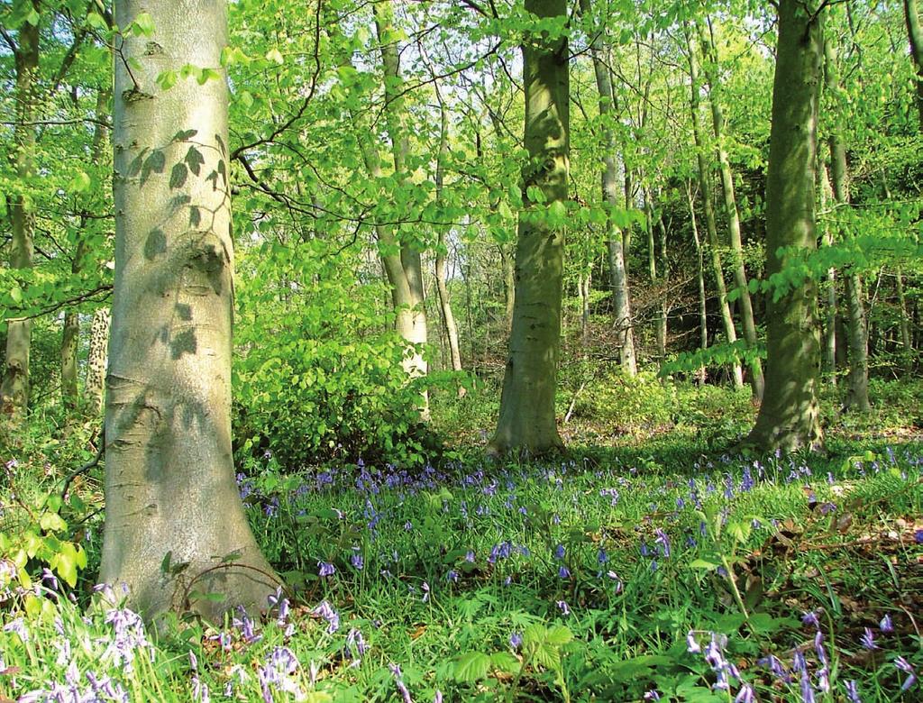
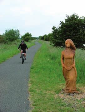
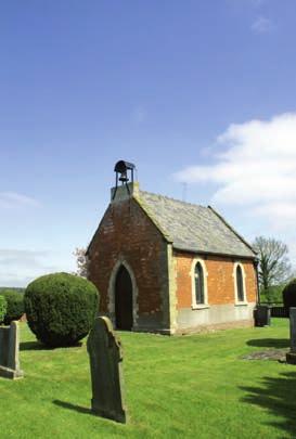
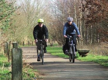
2 Places to look out for e a responsible cyclist The letters used here correspond to those shown on the map. Snakeholme Pit Nature Reserve This reserve is managed by the Lincolnshire ranch of utterfly onservation. It is a former clay pit that was used by nglian Water as a fish nursery before becoming a nature reserve. With meadows, trees and a pond there is a wealth of wildlife to be seen. In particular look out for the following butterflies: ommon lue, Meadow rown and Small opper. Please do not cycle around the reserve but enjoy it on foot. Stainfield Stainfield is a pretty hamlet full of history. settlement was recorded in the omesday ook and earthworks in the parkland relate to several periods in history including a premonastic village, a monastery, medieval village and a grand country house. The brick church was built in1711 on a north-south orientation. Kingthorpe Holt This former agricultural land was bought by the Woodland Trust in 2006 and planted with native tree species to extend the woodland cover in the area. The Holt is adjacent to ollege Wood. ollege Wood Part of the ardney Limewoods National Nature Reserve (NNR) and a Site of Special Scientific Interest (SSSI). The Limewoods are a group of woods which are the most important examples of small-leaved lime woodland in ritain. The woodland is owned and managed by the orestry ommission. Hardy ang Wood, Newball Wood and Woodside alconry entre Sections of both these woods are part of the ardney Limewoods NNR. The alconry entre is open to the public, for details call arlings bbey ll that remains of the bbey today are earthworks and a single standing wall, the eastern arch of the north arcade of the church nave and part of the west pillar of the tower base. The bbey was founded by the Premonstratensian Order in 1154 and dissolved in River Witham and the Water Rail Way The Witham flows from south of rantham, through Lincoln to oston and The Wash. The Water Rail Way is a multi-user path beside the river between Lincoln and oston. long the route is a variety of artwork including metal sheep and cows and wooden pigs and fish. Watch out for a large pike near ardney Lock ycling quietly by the river is a great way to see river wildlife. Look out for great crested grebes, goosander and of course the elusive water rail. You may also be lucky enough to see a barn owl out during the day. lways follow the highway code lways follow the countryside code e courteous to other users and vehicles Use a bell to let people know you are there e seen wear high visibility clothing and use lights in poor visibility Wear a helmet Keep your bike roadworthy Please do not cycle around nature reserves or woodlands - take time to enjoy them on foot This route has been produced to enable cyclists to explore the Lincolnshire countryside. lthough the route is generally quiet please note that all roads have periods when they are busier and attract faster vehicles so please take care. This is just one in a series of cycle routes produced by Lincolnshire ounty ouncil. or others please contact us or visit the website. We would welcome your comments and suggestions on this route and leaflet to help us improve future editions. If you would like to request a copy of this leaflet in an alternative format or different language please contact us. Lincolnshire ounty ouncil ountryside ccess Team Tel: Minicom: mail: countryside_access@lincolnshire.gov.uk Web: River Witham

 rown")

3 Map North Map Scale: 1km 1mile 10 1: Water Rail Way iskerton en Nature Reserve 4 3 ollege Wood 15 River Witham Reproduced from OS mapping with permission of the controller of HMSO (c) rown opyright. Unauthorised reproduction infringes rown opyright and may lead to civil proceedings. OS licence

 over the old railway bridge. Snakeholme Pit Nature Reserve t the sharp left hand bend turn right (signed Stainfield). In Stainfield turn right (signed Kingthorpe).")
4 irections irections xplore the fascinating Limewoods area on two wheels and you will experience the true nature of the area. With a landscape of woods, arable fields and tiny rural villages it is a great place to discover. Views of the cathedral along the route remind you how close this quiet rural area is to Lincoln. irections =Pub/Refreshments =Shops Z =Places to look out for =Take care W =Toilets rom the Heritage entre turn right and cycle into the village. Turn left (signed Stainfield). Turn left (signed Stainfield) over the old railway bridge. Snakeholme Pit Nature Reserve t the sharp left hand bend turn right (signed Stainfield). In Stainfield turn right (signed Kingthorpe). Stainfield 6 7 t T-junction with busy road turn left (signed Wragby). Turn left again almost immediately (signed pley). Kingthorpe Holt ollege wood ycle through pley. t the T-junction turn right (signed Langworth). Hardy ang Wood & Newball Wood & Woodside alconry entre t T-junction with a busy road turn left (signed Lincoln) and then right (signed Stainton). lternatively, dismount and use the central refuge to cross the road. In Stainton turn left (signed Scothern). t T-junction turn left (signed the Langworth). Level crossing t the busy crossroads in Langworth carry straight on (signed Reepham). lternatively, dismount and use the pedestrian crossing further along the road to your right. ollow the road into Reepham. (To visit arlings bbey turn left at the junction signed to Low arlings). arlings bbey t the T-junction in Reepham turn left (signed iskerton). t the T-junction in iskerton turn left (signed Short erry). Towards the end of the village turn right (signed National ycle Network (NN) route 1). ross the river and turn left to join the Water Rail Way to ardney. River Witham and the Water Rail Way t the junction with the road in ardney turn left to return to the starting point. Limewoods landscape St ndrew s hurch, pley
 on the surfaced Water Rail Way (NN 1). The route crosses the busy 158 twice at Langworth.")
5 Useful Information Route summary: ardney, Stainfield, Kingthorpe, pley, Langworth, Stainton by Langworth, Langworth, arlings, Reepham, iskerton, ardney. Route length: 38½ km (24 miles). Route description: ircular, mostly on quiet roads with an off road section (8 km/5 miles) on the surfaced Water Rail Way (NN 1). The route crosses the busy 158 twice at Langworth. The route is mostly level. Starting and finishing point: ardney Heritage entre, Station Road. rid Ref: T Post code: LN3 5U. Parking: Please park responsibly in the village. Shops: ardney, Reepham and iskerton. Pubs and refreshments: Selection in ardney; New Station Inn and The eorge at Langworth; ox & Hounds, Reepham; arpenters rms, iskerton. ycle hire: ardney Heritage entre, Station Road. Opening times: Thursday, riday & Saturday 9.30am to 4pm, Sunday 10am to 4pm. Plus all ank Holidays and every day during the summer holidays. To check opening times and bike availability call or bardneyheritage@btinternet.com. The centre also has a tea room and information on local history. Ordnance survey maps: Landranger 121 Lincoln & Newark. xplorer 272 Lincoln and 273 Lincolnshire Wolds South. More information: South Wolds ycling Map ( Water Rail Way rtworks and The Water Rail Way: Lincoln to ardney leaflets( The Limewoods Project aims to protect, enhance and promote the Lincolnshire Limewoods area through the Limewoods Partnership. mail: limewoods@lincolnshire.gov.uk The Limewoods Project is funded by: The Limewoods Project acknowledges the financial support of the nvironment gency in producing this leaflet. Published October 2009
Sandilands to Huttoft Bank
 Coastal Country Park Walks Sandilands to Huttoft Bank A CIRCULAR WALK OF 11KM (7 MILES) INTRODUCTION The Lincolnshire Coastal Country Park lies between Sandilands, Chapel St Leonards and Huttoft on the
Lincolnshire Limewoods Walks. Woodhall Spa. A circular walk of 13km (8 miles)
") Lincolnshire Limewoods Walks Woodhall Spa A circular walk of 13km (8 miles) Introduction The Lincolnshire Limewoods is an area between Wragby, Bardney and Woodhall Spa. It is a fantastic place to explore
Lincolnshire Limewoods Walks Woodhall Spa A circular walk of 13km (8 miles) Introduction The Lincolnshire Limewoods is an area between Wragby, Bardney and Woodhall Spa. It is a fantastic place to explore
Lincolnshire Walks. Grainthorpe. Three circular walks of 2 ¾, 9 and 9 ½ km (1 ¾, 5 ½ and 6 miles)
") Lincolnshire Walks Grainthorpe Three circular walks of ¾, 9 and 9 ½ km (1 ¾, ½ and 6 miles) Introduction Explore the coastal marshes, arable hinterland, Louth Navigation canal and the village of Grainthorpe
Lincolnshire Walks Grainthorpe Three circular walks of ¾, 9 and 9 ½ km (1 ¾, ½ and 6 miles) Introduction Explore the coastal marshes, arable hinterland, Louth Navigation canal and the village of Grainthorpe
Lincolnshire Walks. Ancaster. Three cir cular walks of2 3/4,4or 6km (11/3, 21/2 or 33/4 miles)
") Lincolnshire Walks Ancaster Three cir cular walks of2 3/4,4or 6km (11/3, 21/2 or 33/4 miles) Introduction These walks are set in the attractive countryside around the historic town of Ancaster. The town
Lincolnshire Walks Ancaster Three cir cular walks of2 3/4,4or 6km (11/3, 21/2 or 33/4 miles) Introduction These walks are set in the attractive countryside around the historic town of Ancaster. The town
Chapel Point to Anderby Creek
 Coastal Country Park Walks Chapel Point to Anderby Creek A CIRCULAR WALK OF 8.5 OR 6 KM (5.3 OR 3.75 MILES) INTRODUCTION The Lincolnshire Coastal Country Park lies between Sandilands, Chapel St Leonards
East Lulworth Ride Route 5
 East Lulworth Ride Route 5 Out of ar Experience - ycling in Purbeck ircular route from Wareham to Lulworth - 18 miles + Lulworth ove oombe Keynes River Frome Time needed: 3-4 hours + Grading: Moderate
Circular route from Wareham to Moreton - 22 miles
 Lawrence Ride Route 4 Out of ar Experience - ycling in Purbeck ircular route from Wareham to Moreton - 22 miles ottages at Throop hurch at Moreton Ford at Turnerspuddle Time needed: 4-5 hours Grading:
A circular walk of or km (2 1 4 or miles)
") Grantham A circular walk of 3 3 4 or 5 3 4 km (2 1 4 or 3 1 2 miles) Introduction This relatively short circular walk, which starts in the middle of Grantham, offers plenty of variety. The route takes
Grantham A circular walk of 3 3 4 or 5 3 4 km (2 1 4 or 3 1 2 miles) Introduction This relatively short circular walk, which starts in the middle of Grantham, offers plenty of variety. The route takes
Cilgerran Wildlife Park Circular Walk
 Walking embrokeshire Cilgerran Wildlife ark Circular Walk It s good to walk, so why not step out and sample some of the walks your neighbourhood has to offer. This pleasant and interesting walk which starts
& r al. Two circular walks of 8 km (5 miles) wal k
 wal k") & Ru r al Two circular walks of 8 km (5 miles) s ford Riv m a t S er wal k Introduction Stamford is noted as being one of the finest stone towns in the country. The stone being local limestone and Collyweston
& Ru r al Two circular walks of 8 km (5 miles) s ford Riv m a t S er wal k Introduction Stamford is noted as being one of the finest stone towns in the country. The stone being local limestone and Collyweston
t ie s Wal k A circular walk of 7 or 91 2 km (41 2 or 6 miles)
") ford Fou m a t S r Co un t ie s Wal k A circular walk of 7 or 91 2 km (41 2 or 6 miles) Introduction This walk is set in attractive countryside on the edge of Stamford in the south-west corner of Lincolnshire.
ford Fou m a t S r Co un t ie s Wal k A circular walk of 7 or 91 2 km (41 2 or 6 miles) Introduction This walk is set in attractive countryside on the edge of Stamford in the south-west corner of Lincolnshire.
Chichester Harbour. A Walker s Guide
 A Walker s Guide - Chichester Harbour Chichester Harbour A Walker s Guide Chichester Harbour is an Area of Outstanding Natural Beauty on the south coast of Britain. Virtually flat with far reaching sea
Walk Description. Directions
 Title: Saffron Trail: Battlesbridge to Chelmsford Distance: 14¾ miles Time taken: 6 hours Start Point: Outside the Barge Inn, Battlesbridge OS Explorer Map: 175 & 183 Grid Ref.: TQ 780 947 Transport: Rail:-
WETHERBY CIRCULAR by Tania Dickinson
 WETHERBY CIRCULAR by Tania Dickinson This walk in lower Wharfedale includes a disused railway line at the beginning and riverside at the end, with parkland, fields, woodland and villages in between. Distance
Danbury Words and pictures by Laurie Page of the Public Rights of Way team at Essex County Council.
 Danbury Words and pictures by Laurie Page of the Public Rights of Way team at Essex County Council. An undulating walk from Danbury village to the bluebells at the National Trust property of Blakes Wood.
Husthwaite to Byland Abbey
 Husthwaite to Byland Abbey This walk begins with a loop round the village of Husthwaite and continues towards Coxwold along a disused railway line, which is now a right of way. It passes through Coxwold
Heartwood Forest, in Sandridge, Hertfordshire, is a place where everyone can find space, peace, wildlife and miles of beautiful woodland to explore.
 Heartwood Forest Accessibility Statement September 2016 Purpose: This accessibility statement outlines the available facilities and access information for Heartwood Forest. Welcome We, the Woodland Trust,
Walking Pembrokeshire.
 Walking Pembrokeshire Canaston Woods Walk It s good to walk, so why not step out and sample some of the walks your neighbourhood has to offer. This pleasant and interesting walk which starts and finishes
Key Information. Self-Guided Walk Exploring Sedbergh
 Self-Guided Walk Exploring Sedbergh A great short walk - ideal for an early evening in summer. This is a lovely circuit of Sedbergh visiting some of the historic buildings as well as ambling by the river
Approximate distance: 10 miles For this walk we ve included OS grid references should you wish to use them. Start. End
 Approximate distance: 10 miles For this walk we ve included OS grid references should you wish to use them. 2 3 Start End 1 N W E S Reproduced by permission of Ordnance Survey on behalf of HMSO. Crown
The Mendip Way. Route Directions and Maps Wells to Frome
 The Mendip Way Route Directions and Maps Wells to Frome Website: www.mendiphillsaonb.org.uk Email: mendip@mendiphillsaonb.org.uk Facebook & Twitter: @MendipHillsAONB Phone: 01761462338 1 Wells to Shepton
Maps The maps provided are a guide and are not to scale. Please use OS Explorer Map 120 (Chichester).
.") A Walker s Guide - Chichester Harbour Useful Information Directions All the walks were tested in 2013. Please note, however, that some footpaths may be diverted and buildings such as pubs may have changed
A Walker s Guide - Chichester Harbour Useful Information Directions All the walks were tested in 2013. Please note, however, that some footpaths may be diverted and buildings such as pubs may have changed
RILLINGTON TO MALTON by Tania Dickinson
 RILLINGTON TO MALTON by Tania Dickinson This walk takes you from the Vale of Pickering up on to the Wold scarp, before dropping down again through the pretty village of Settrington and joining the Centenary
The Hundred Parishes
 The Hundred Parishes Walks from railway stations number 9 6.4 miles (10kms) from Bishop s Stortford to Stansted Mountfitchet Start: Bishop s Stortford station (Grid Reference TL492209) (ample parking and
10 Miles Circular 5 hours
 VISIT RYEDALE PICKERING AND CAWTHORN CAMPS 10 Miles Circular 5 hours Moderate Terrain 120616 A 10 mile (16km) there and back walk from the market town of Pickering in Ryedale. The route heads north through
Maps The maps provided are a guide and are not to scale. Please use OS Explorer Map 120 (Chichester).
.") A Walker s Guide - Chichester Harbour Useful Information Directions All the walks were tested in 201. Please note, however, that some footpaths may be diverted and buildings such as pubs may have changed
A Walker s Guide - Chichester Harbour Useful Information Directions All the walks were tested in 201. Please note, however, that some footpaths may be diverted and buildings such as pubs may have changed
9.5 km Circular 3 hours
 RANMORE CIRCULAR A 6 mile (9.5km) circular walk from Boxhill and Westhumble Station in the village of Westhumble, passing through part of the Polesden Lacey Estate, Ranmore Common and Denbies Vineyard.
Greenwood. Walks. Cossall Canal Walk. Cossall Canal Walk
 Cossall Canal Walk C5 Cossall Canal Walk C5 Features: Cossall is a picturesque, relatively unspoiled village on the Nottingham canal, four miles south-east of Eastwood. Architecturally interesting. See
Approximate distance: 5.5 miles For this walk we ve included OS grid references should you wish to use them. Start. End
 Approximate distance: 5.5 miles For this walk we ve included OS grid references should you wish to use them. End 4 1 Start 3 2 N W E S Reproduced by permission of Ordnance Survey on behalf of HMSO. Crown
Broom Hill/Blackberry Hill Walking and Cycling Improvements
 Broom Hill/Blackberry Hill Walking and Cycling Improvements Introduction Bristol has been awarded additional funding from the UK government to upgrade and extend walking and cycling routes across the city.
The Griffon Guide The North Walsham and Dilham Canal Trail
 The Griffon Guide The North Walsham and Dilham Canal Trail This trail explores some of the most accessible and interesting parts of the North Walsham and Dilham Canal. The canal was built in 1825 to allow
Marriott s Way Walking and Cycling Guide
 Marriott s Way Walking and Cycling Guide 1 Introduction The routes in this guide are designed to make the most of the natural beauty and cultural heritage of Marriott s Way, which follows two disused train
Route: Skewsby Foulrice Stearsby
 Route: Skewsby Foulrice Stearsby Distance: 7 miles Map: Explorer: 300 Howardian Hills & Malton Start (OS ref): SE625710 Park in the village of Skewsby. Walk east out of the village to the T-Junction and
Walk Description. Directions
 Title: East Hanningfield Distance: 8 miles / 9 miles Time taken: 3-3½ hours Location: 5 miles south east of Chelmsford Parking: Free car park off The Tye, East Hanningfield, next to the primary school
Countryside Walks. 1) Highclere Park Public Walk.
 Highclere Park Public Walk.") 1) Highclere Park Public Walk. Access: From Highclere Estate Main Entrance at Whitway, please note there is no parking on site or access for vehicles. Open: Throughout the year. Description: This footpath
1) Highclere Park Public Walk. Access: From Highclere Estate Main Entrance at Whitway, please note there is no parking on site or access for vehicles. Open: Throughout the year. Description: This footpath
Hammer Vale and Linchmere Common
 point your feet on a new path Hammer Vale and Linchmere Common Distance: 9 km=5½ miles or 6 km=3¾ miles easy walking with one steep section Region: Hampshire, West Sussex Author: Botafuego Refreshments:
Harlington - Sharpenhoe - Pulloxhill
 Harlington - Sharpenhoe - Pulloxhill ID: 3676, Distance: 8 miles, Height gain: 140 Metres, Map: Explorer 193 Luton & Stevenage, Contributor: Dennis Jeanes Duration: 3 Hours 27 Mins Features Church,Great
9. Marbury Country Park
 9. Marbury Country Park Marbury has seen many dramatic changes, particularly within living memory. After Leslie Fink and Company demolished Marbury Hall in 1968, they tried several times to get planning
Gainsborough and Fledborough Circular
 Trent Vale Cycle Route TVCR18 Gainsborough and Fledborough Circular Gainsborough Old Hall. One of the biggest and best preserved Medieval Manor Houses in England. Start Point: Gainsborough Marshall s Yard
Closing statement. I have chosen not to object in principle to the proposal to close S08.
 Closing statement In drafting the order being considered by this Inquiry Network Rail have set out plans to close many at grade pedestrian crossings in Suffolk and have been quite open that they will seek
6 Miles Linear 3 hours
 SPIRES AND STEEPLES Part 2: BRANSTON TO METHERINGHAM 6 Miles Linear 3 hours 160818 Moderate Terrain A 6 mile (10km) linear walk from Branston to Metheringham, forming the second part of the Spires and
For more information and to buy this book click here ISBN: CICERONE. Guides for walkers, trekkers, mountaineers, climbers and cyclists
 For more information and to buy this book click here ISBN: 9781852845377 CICERONE Guides for walkers, trekkers, mountaineers, climbers and cyclists www.cicerone.co.uk WALK 5 Ouston and Urpeth Distance
PAGHAM NEIGHBOURHOOD PLAN INFRASTRUCTURE GROUP
 PAGHAM NEIGHBOURHOOD PLAN INFRASTRUCTURE GROUP SUMMARY OF FINDINGS AND PRIORITIES PARKING There was a high level of response to this topic which included many aspirations to provide car parking near to
Fertile farms in the heart of Kent
 55 55 Fertile farms in the heart of Kent A bright sunny day is perfect for enjoying the rich and fertile Kent countryside and outstanding views across the valley of the Great Stour to the North Downs.
Oldbury & Littleton, South Gloucestershire
 Oldbury & Littleton, South Gloucestershire Starts at Church Lane, Oldbury. BS35 1QF 2 hours 0 minutes 5.2miles 8.4km Easy ID: 0.2468 Developed by: GEOFF MULLETT Checked by: Marion Stone www.ramblersroutes.org
THE DOG AND DUCK HAREWOODS ESTATE TRAIL. 6 Miles Circular 3 hours. Getting there. Walk Sections
 THE DOG AND DUCK HAREWOODS ESTATE TRAIL Moderate Terrain A 6 mile circular pub walk from the Dog and Duck in Outwood, Surrey. The Dog and Duck is a delightful pub where everyone is made welcome. From walkers
How to get there. Respect - Protect - Enjoy
 How to get there Driving: Postcode is RG9 5PF and there is a car park just across from the pub. Nearest station: Henley-on-Thames station is 5.6 miles away. We re delighted to present three circular walks
INTrepid Orienteering Weekend
 INTrepid Orienteering Weekend DECHMONT LAW South of Scotland Orienteering League (SoSOL) 7 Local Event & East of Scotland Orienteering Association (ESOA) Championships Sunday 4 th November 2018 Directions:
Didcot Urban Race 2014
 Thames Valley Orienteering Club Didcot Urban Race 2014 UK Urban League, Southern England Urban League & British Orienteering Rankings Monday 25 th August 2014 Key Points Race HQ at Willowbrook Leisure
BALCOMBE AND ARDINGLY RESERVOIR, WEST SUSSEX
 BALCOMBE AND ARDINGLY RESERVOIR, WEST SUSSEX 7 miles Circular 4 hours 080816 Challenging Terrain Hi, I'm Luke and this is my West Sussex Weekends walk It's a 7 mile loop from Balcombe rail station, taking
Saltash, Cornwall - Railways, Rivers & Castles
 Saltash, Cornwall - Railways, Rivers & Castles Starts at St Stephen's Church, Saltash, Cornwall 2 hours 45 minutes 5.5miles 8.9km Easy ID: 0.2532 Developed by: Peter Clements Checked by: Kevin Connor www.ramblersroutes.org
Walk 3 - Woodbridge and Melton A Walk Round Waldringfield by Sue and Jim Stacey. Woodbridge. shopping centre, cafes, toilets etc. tide mill.
 Walk 3 - Woodbridge and Melton A Walk Round Waldringfield by Sue and Jim Stacey. road with roundabout church railway with station walk route showing description direction track, wide path, bridlepath footpath
The North Pennines from near Langwathby
 3.6 Langwathby to Armathwaite Map panel?? Distance 12.7 miles (20.5 km) Terrain farm, woodland and riverside paths; some potentially muddy tracks; a few short sections of road Grade gently undulating Food
Llanrwst Triathlon Sunday 20 th of August Race Pack. GOG Triathlon Welsh Aquathlon Championships 2017 Event Manual V1.1
 Llanrwst Triathlon Sunday 20 th of August 2017 Race Pack Llanrwst Trithlon 2017 Welcome Gog Triathlon would like to extend a warm welcome to everyone participating or spectating at the Llanrwst Triathlon
Bakewell Club Site - Robin Hood's Stride
 Bakewell Club Site - Robin Hood's Stride Camping and Caravanning Route Summary A circular walk with fabulous views winding it's way through the beautiful White Peak scenery. Points of interest include
LDWA SOUTH DOWNS MARATHON
 AHD ahead SDW South Downs Way BL/BR bear left/bear right TL/TR turn left/turn right SP signpost/fingerpost X cross LEG 1 - EAST DEAN to WP1 NORTON GR 470019. Open 1030 to 1300. 9.6 miles. 1.1 From village
There are toilets at Manningtree Station, Flatford (close to the hump back bridge) and in Dedham.
 and in Dedham.") Arriving by Train Main Features of the Walk Outline Route Employs particularly attractive paths, many of which offer impressive views across Dedham Vale. Includes a section along the tidal section of the
Arriving by Train Main Features of the Walk Outline Route Employs particularly attractive paths, many of which offer impressive views across Dedham Vale. Includes a section along the tidal section of the
SHIPTON BELLINGER Hampshire
 SHIPTON BELLINGER Hampshire from www.discoverbutterflies.com the website for the book Discover Butterflies in Britain D E Newland Stonehenge from the north Shipton Bellinger is a small village on the edge
CHILTERN RAMBLING TRAIL
 CHILTERN RAMBLING TRAIL This route, including a section of the Ridgeway Long Distance Path, offers breathtaking views from the Chiltern ridge. It starts in the Ashridge Estate and returns to Tring via
NCN 78 Benderloch to Ledaig Summary
 NCN 78 Benderloch to Ledaig Summary Traffic-free Route Options Appraisal Summary Report Final Draft August 2016 About Sustrans Sustrans Scotland makes smarter travel choices possible, desirable and inevitable.
Bagshot Heath and Swinley Forest
 point your feet on a new path Bagshot Heath and Swinley Forest Distance: 13 km=8 miles Region: Berkshire, Surrey Author: Botafuego Refreshments: Forest Look Out, Bagshot easy walking Date written: 17-feb-2013
How to get there. Respect - Protect - Enjoy
 How to get there Driving: Postcode is OX49 5HL with a car park for customers Nearest station: Henley on Thames station is 9.5 miles away. We re delighted to present three circular walks all starting and
Slindon Folly - South Downs, West Sussex
 Slindon Folly - South Downs, West Sussex Starts at Park road-side near entrance to Slindon College 2 hours 15 minutes 4.5miles 7.2km Easy ID: 0.1598 Developed by: Chris Mumford Checked by: Rockpit www.ramblersroutes.org
10 km Circular 3 hours
 FRIMLEY AND FRIMLEY GREEN 10 km Circular 3 hours Easy Terrain 250716 A 10km (6 mile) circular walk exploring the canal towpath, riverside path, woodland, heath and small settlements around Frimley in Surrey.
YHA RAVENSTOR Ideas for walks in the local area
 YHA RAVENSTOR Ideas for walks in the local area How to use this book This book contains some suggestions for enjoyable walks in the countryside immediately surrounding YHA Ravenstor. We hope that our guests
DEFRA RIGHTS OF WAY IMPROVEMENT PLANS OF THE FUTURE
 DEFRA RIGHTS OF WAY IMPROVEMENT PLANS OF THE FUTURE Defra team update. The Review of ROWIPs. Areas of work for the LAF review of ROWIPS to consider. Commons and Access Implementation Team Head of Team
Tinneyhall Wood, Cornwall - About 9 ½ acres, 59,000
 Tinneyhall Wood, Cornwall - About 9 ½ acres, 59,000 Tinney Hall is a hamlet close by the small hilltop village of Lewannick, which is centred around a crossroads. This is unusual for Cornwall, where the
Margam Country Park. Saturday 10 September, 10am 5pm Margam Country Park, Neath Port Talbot SA13 2TJ. Enjoy a great day out!
 Margam ountry Park Saturday 10 September, 10am 5pm Margam ountry Park, S13 2TJ Enjoy a great day out! #boutg www.ramblers.org.uk/walkabout From 10am 5pm, there s plenty on offer for everyone Throughout
Walk 2: Beamsley Beacon and Bolton Abbey
 Walk 2: Beamsley Beacon and Bolton Abbey Start and Finish: The Memorial Hall, Main Street, Addingham, LS29 0LZ, SE 079 497 The shortest walk is about 5½ miles (8.8km) The medium Walk is about 8¼ miles
Bonnie Prince Charlie Walk
 Bonnie Prince Charlie Walk A waymarked route from Ashbourne to Derby to celebrate the 60th anniversary (1995) of the formation of the Ramblers' Association. This route follows the general direction of
Weatherman Walking. Approximate distance: 5.5 miles For this walk we ve included OS grid references should you wish to use them. Start.
 Approximate distance: 5.5 miles For this walk we ve included OS grid references should you wish to use them. 4 1 Start End 3 2 N W E S Reproduced by permission of Ordnance Survey on behalf of HMSO. Crown
Aston Village: The Flowerpot (pub walk)
") point your feet on a new path Aston Village: The Flowerpot (pub walk) Distance: 10 km=6¼ miles or 8 km=5 miles (omitting the weir) Region: Berkshire, Chilterns Author: MacMeadow Refreshments: Henley, Aston
point your feet on a new path Aston Village: The Flowerpot (pub walk) Distance: 10 km=6¼ miles or 8 km=5 miles (omitting the weir) Region: Berkshire, Chilterns Author: MacMeadow Refreshments: Henley, Aston
HISTON ROAD Have your say on better public transport, cycling and walking journeys
 HISTON ROAD Have your say on better public transport, cycling and walking journeys Have your say: Please complete the survey inside this leaflet or online at www.greatercambridge.org.uk/histonconsultation
TRAVEL PLAN ANNUAL MONITORING REPORT
 Sustainability Services - Maintenance Services TRAVEL PLAN ANNUAL MONITORING REPORT 2017-18 Contents 1. Updated Travel Plan Action PLan...2 2. Completed Travel Plan Projects 2017-18...2 3. Planned Projects
LOCAL CIRCUIT EM1: EAST MALLING & BARMING HEATH. N 2m ROADS: Significant roads PATHS: Starting direction Barming Longsole Mission Church
 Ditton Church Scott Close LOCAL CIRCUIT EM1: EAST MALLING & BARMING HEATH 6 Community Centre F Open fields (see 'Introductory Notes') 1m 88 Direction label (as in the walk notes) East Malling Church -
Coast Survey Stretch 03 Seaview High Street to Sandown Zoo
 Coast Survey Stretch 03 Seaview High Street to Sandown Zoo Overview map of the stretch Introduction The route starts at the attractive village of Seaview, through the wooded Priory Bay, passing the remains
TRAVEL PLAN ANNUAL MONITORING REPORT
 Sustainability Services - Maintenance Services TRAVEL PLAN ANNUAL MONITORING REPORT 2017-18 Contents 1. Updated Travel Plan Action Plan...2 2. Travel Survey Results 2018...2 3. Usage Data For Travel Initiatives...2
HERITAGE, LEGEND and NATURE in the VALLEYS WALK ND6 SARN HELEN, ST PATRICK & HENRHYD FALLS The Romans, Saint Patrick and a Waterfall
 HERITAGE, LEGEND and NATURE in the VALLEYS WALK ND6 SARN HELEN, ST PATRICK & HENRHYD FALLS The Romans, Saint Patrick and a Waterfall Historic & Geographic Background Banwen is best known as a former mining
Redesdale Arms. A Trio of Walks
 Redesdale Arms A Trio of Walks Welcome to The Redesdale Arms Hotel The award winning 34 bedroom Redesdale Arms Hotel sits at the gateway to the Cotswolds in the High Street of the historic town of Moreton-in-Marsh.
Lea Bridge Road A street for everyone Tell us
 Lea Bridge Road A street for everyone Tell us Public consultation document Section H your views 1 Lea Bridge Road: a street for everyone Introduction Mni-Holland is an exciting programme to improve walking
2-3 miles - up to 90 minutes walks
 SHIREHAMPTON COMMUNITY ACTION FORUM Walkie-Talkies Issue 17 Free Walks Programme From January 2017, due to changes in the way that LinkAge operates, there will no longer be a Health Walks Coordinator in
Greenway. Great Western A USER S GUIDE. Ireland s Longest Off-Road Walking And Cycling Route.
 Great Western Greenway www.greenway.ie A USER S GUIDE Ireland s Longest Off-Road Walking And Cycling Route EUROPEAN DESTINATION OF EXCELLENCE AWARD WINNER t o Escape the bustle of urban life on the 42km
Do more cycling. EIGHT CYCLE ROUTES AROUND dornoch
 Do more cycling EIGHT CYCLE ROUTES AROUND dornoch cycle routes Around dornoch route 1 Loch Fleet 12.5 miles Easy Description: Route 1 takes you past the fishing village of Embo and to Loch Fleet, an internationally-renowned
FB01 - THE VIA FRANCIGENA ROAD BY BIKE - LEG I
 FB01 - THE VIA FRANCIGENA ROAD BY BIKE - LEG I Start node info End node info Total length Category Suggested type of bycicle Cycle time Uphill Downhill Max height Difficulty by cycle Coated Offroad Mountain
Guildford Borough (Draft)
") ITEM Annex Page 7 Guildford Borough (Draft) Forward Programme Part A This is a work in progress and its completion is subject to the adoption of the Local Plan and Infrastructure Delivery Schedule November
ITEM Annex Page 7 Guildford Borough (Draft) Forward Programme Part A This is a work in progress and its completion is subject to the adoption of the Local Plan and Infrastructure Delivery Schedule November
Great Barford and The River Great Ouse
 Great Barford and The River Great Ouse A riverside route which follows the River Great Ouse, with historic sites at Barford Bridge, Danish Camp and Willington Dovecote Essential Facts Route distance: Approximate
THE WELLDIGGERS ARMS, HESWORTH AND FITTLEWORTH TRAIL
 THE WELLDIGGERS ARMS, HESWORTH AND FITTLEWORTH TRAIL 5.5 miles Circular 3 hours 041017 Challenging Terrain A 300-year-old pub turned country-inn on the edge of the South Downs National Park, The Welldiggers
CUERDEN TRANSPORT PROPOSALS
 1 CUERDEN TRANSPORT PROPOSALS The transport assessment, submitted with the Cuerden development planning application, looks at access to the site and the impact on the local road network in detail. This
This walk description is from happyhiker.co.uk
 This walk description is from happyhiker.co.uk Pendle Hill Walk From Barley Starting point and OS Grid reference Ordnance Survey map Distance Traffic light rating Barley village honesty box car park OS
Easton Safer Streets - Final Project Report BRISTOL
 - Final Project Report BRISTOL A Sustrans Community Street Design Project in partnership with Bristol City Council February 07 About Sustrans Sustrans makes smarter travel choices possible, desirable and
London Cycle Network Annual Report 2000
 London Cycle Network Annual Report 2000 A cycle network for London by 2005 A cycle network for London by 2005 The London Cycle Network will: provide local links between residential neighbourhoods, railway
East Devon Way Circulars
 East Devon Way s A new series of circular walks developed by the East Devon Ramblers to help you explore the wildlife, heritage and places of interest just off the East Devon Way. h. i. l. g. k. b. c.
Bulwell Cycling Consultation
 Bulwell Cycling Consultation Image 1 Bulwell Bogs (Sutton, 2015) As part of a final year research project, I am seeking feedback on proposals for cycling improvements in Bulwell. This consultation is not
Scottish Schools' Orienteering Festival. Dechmont Law and Deans Community High School
 Scottish Schools' Orienteering Festival Dechmont Law and Deans Community High School Date/Time: Friday 5 June 2015 (c.1000 1400 hours). Directions: Leave the M8 at J3 and head south on the dual carriageway
9.5 km Circular 3 hours
 MEDIEVAL WAVERLEY Challenging Terrain A 6 mile (9.5km) undulating circular walk from Tilford village passing close to The Sands village and the historic ruins of Waverley Abbey. From the top of Crooksbury
SWC Bedfordshire walks Sandy and Biggleswade
 SWC Bedfordshire walks Sandy and Biggleswade Main Walk: Sandy to Biggleswade via Northill and Old Warden 19.5km (12.2m), toughness 4/10. Long Walk: Sandy Circular - Main Walk plus route from Biggleswade
A127/A130 Fairglen Interchange Improvement Schemes. Information Leaflet February 2017
 A127/A130 Fairglen Interchange Improvement Schemes Information Leaflet February 2017 1 2 Foreword By Councillor Kevin Bentley Essex is continuing to grow as a vibrant economic hub and as a fantastic place
MARKHOUSE ROAD IMPROVEMENTS
 MARKHOUSE ROAD IMPROVEMENTS www.enjoywalthamforest.co.uk Waltham Forest is changing and we want you to be part of it. Thanks to a funding pot of 27million from Transport for London, we re delivering the
Walks in Lenham. Three delightful walks in and around Lenham from 30 minutes to 90 minutes with map and photographic guides. l l l ABOUT LENHAM
 Walks in Lenham Three delightful walks in and around Lenham from 0 minutes to 90 minutes with map and photographic guides l l l ABOUT LENHAM The medieval village of Lenham, in the Borough of Maidstone,
NETTLESTEAD & YALDING
 NETTLESTEAD & YALDING ULL CIRCUIT - Sheet 1 (first and last sections) Open fields (see 'Introductory Notes') 88 Direction label (as in the walk notes) ROADS: 81 10m Significant roads Redhill arm North