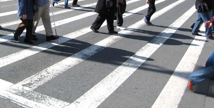
City of San Francisco 2009 Pedestrian Count Report. April 2010
|
|
|
- Linda Cross
- 5 years ago
- Views:
Transcription

1 April 2010
2 TABLE OF CONTENTS Introduction... 3 Background... 3 Methodology:... 4 Results... 4 Recommendations... 6 Conclusion... 7 APPENDIX A: CENSUS DATA... 8 APPENDIX B: COUNT LOCATIONS... 8 APPENDIX B: COUNT LOCATIONS... 8 APPENDIX C: WEATHER... 9 APPENDIX D: COLLISIONS APPENDIX E: IS SAN FRANCISCO AN UNSAFE CITY FOR PEDESTRIANS? 12 2
3 Introduction Starting in September 2009, the San Francisco Municipal Transportation Agency (SFMTA) Pedestrian Program conducted its first annual Citywide Pedestrian Count. As awareness and concern about the relationship between transportation choices, global warming and public health grows, transportation agencies are finding an increasing need for pedestrian mobility data. In San Francisco, data about the number of people walking could be used to measure the progress of City policies and sustainability goals, determine the effect of pedestrian infrastructure improvements, measure the mode split between the City s transportation options, forecast future pedestrian demand, and determine pedestrian collision exposure rates. The exposure rate is the number of vehiclepedestrian collisions at a specific location over a given period of time, divided by the actual or estimated total pedestrian volume over that same period. Exposure rate is a better indicator of pedestrian safety than simple collision history because it takes into account pedestrian volumes when comparing intersection safety. The pedestrian counts in this report are the first step in calculating exposure rates. Background According to the San Francisco 2008 Collision Report 1, about a fourth of San Francisco s 3,010 injury collisions (799) and half of the 27 fatal collisions (13) involved pedestrians. The 2008 total of 799 injury collisions involving a pedestrian as a party is almost the same as the figure of 796 injury collisions reported in In the first half of the decade pedestrian collisions came down from the over 1,000 incidents recorded annually in the 1990 s. Further declines have unfortunately not been reported in 2007 or The number of fatal collisions involving a pedestrian decreased to 13 in 2008, the lowest total of the decade. This constitutes a reversal from the rise noted in With 824 pedestrians killed or injured in 2007, San Francisco is ranked by the state Office of Traffic Safety 2 as the county having the highest total rates of fatalities and injuries to pedestrians by both vehicle miles and by population, especially for those over 65 years of age. (See Appendix D for Collision Data and Appendix E for a discussion of statewide pedestrian safety rankings). Because this is the first Citywide Pedestrian Count, we must look to other data sources for historical trends. The US Census Journey to Work data shows that for workers aged sixteen years or older, about ten percent walk to work in San Francisco. This figure has held steady in the years for which we have data: 2000 and San Francisco s walking mode share for commute trips is high 1 SFMTA San Francisco 2008 Collision Report, 2 California Office of Traffic Safety. Differences in collision totals are due to the various ways collisions can occur and be classified by the SFPD using the State collision form. 3
4 compared to the averages for California and the US, both of which have held steady around three percent (See Appendix A). Methodology: 2009 marks the first year of SFMTA s Citywide Pedestrian Count, which will continue with annual updates. The counts will take place every year in the first two full weeks of September, so as to comply with the suggested timeline for the Alta/ITE National Documentation Project, which would allow counts to be compared with nationwide data. Counts will take place annually at the same twenty-five locations throughout the city. Count locations were chosen based on known pedestrian volumes, land use, proximity to transit, and previous pedestrian and bicycle count locations. Additionally, the four highest injury vehicle-pedestrian collision locations during were all included in the 2009 count locations. Counts are taken by SFMTA staff at intersections in order to measure the number of pedestrian crossings, which is the metric needed for exposure calculations. The number of pedestrians crossing at each crosswalk is recorded in fifteen minute increments for two hours. The counts are taken during the expected weekday morning or afternoon peak: Tuesday, Wednesday or Thursday from 7:00-9:00am or 4:00-6:00pm. See Appendix B for the twenty-five count locations, the nearby land use, and the reasoning for choosing each location. In addition to manual counts, the SFMTA will collect volume data using automatic counters. The SFMTA has purchased several automatic counters that will be rotated throughout the twenty-five locations. Initially, two weeks of data will be collected at each location. These data, combined with those from the manual counts, will be used to create an exposure model. Results Since this is the first year of pedestrian counts, there aren t previous years of data with which to compare. The following table shows both the two-hour volume, and using the fifteen-minute increments to calculate the peak hour, the peak hour volume. 4
5 Table 1: 2009 Pedestrian Volumes Street Cross Street Date AM/PM 2 HR Volume Peak Hour Peak Hr Volume 3rd Street Howard 9/8/ PM pm th Street Market 9/17/ PM pm th Street Market 9/16/ PM :30-5:30pm th Street Mission 9/16/ PM :15-5: th Street Folsom 9/17/ AM am 820 8th Street Market 9/17/ PM pm th Ave Irving 9/15/ AM am th Street Mission 9/15/ AM am th Street Castro 9/10/ PM pm th Ave Taraval 9/9/ PM pm th Street Castro 9/15/ PM :15-5:15pm th Ave Geary 9/9/ AM 765 7:45-8:45am th Ave Ulloa 9/9/ AM 44 7:15-8:15am 24 Bayshore Cortland 9/16/ AM 114 7:30-8:30am 70 Beach Hyde 9/16/ PM :15-5:15pm 2226 Chestnut Steiner 9/15/ PM pm 745 Divisadero Geary 9/10/ AM am 993 Embarcadero Washington 9/10/ PM pm 570 Geary Laguna 9/16/ AM 487 7:30-8:30am 294 Geneva Ocean 9/10/ PM 808 4:15-5:15pm 414 Golden Gate Jones 9/17/ AM am 650 Ingalls Palou 9/17/ PM pm 33 JFK Stanyan 9/17/ PM pm 438 Mission Silver 9/17/ PM :15-5:15pm 730 Randall San Jose 9/16/ AM am 429 5


6 Figure 1: 2009 Pedestrian Volumes Recommendations While the 2009 counts went smoothly, a few general observations and comments are worth noting. First, the required person-power is difficult to obtain, especially since most summer interns do not work through September. It is recommended to solicit help from staff and interns up to three weeks in advance. Some summer interns continue to work part-time during the school year, so if given advance notice, many could incorporate these pedestrian counts into their schedules. It is foreseen that the automatic counters will be used in future years to supplement manual counts. While most of the intersections were straightforward and routine to count, a few of them warrant comment. The Market Street intersections where counts were 6
7 conducted have multiple legs and require three counters because of both the high volumes of pedestrians and the distance between crosswalks. Downtown intersections such as Third and Howard Streets may experience fluctuations in the number of pedestrians crossing depending on whether a SF Giants home game is scheduled or not. This was not anticipated for the 2009 counts; the count at Third and Howard Streets took place from 4-6pm and a home game was scheduled for 7pm. In future years, care should be taken to avoid counts on ballgame days. Recording weather conditions will help ensure that counts from year to year are directly comparable (See Appendix C for Weather Conditions). Future organizers of the Citywide Pedestrian Count can use past volumes to determine which intersections might warrant more than one person counting and the use of one of our limited supply of click-counters. Conclusion The 2009 Citywide Pedestrian Count was successful in its goal of capturing a sample of pedestrian activity across the City. Combined with data that will be collected by automated counters, we will be able to extrapolate exposure rates at these locations. The Citywide Pedestrian Count is an evolving project, one with a core foundation of established techniques and consistent methodology. However, new lessons will continue to be learned. It is important to make changes and improvements in the counts when circumstances warrant. In the future, new locations may be added, and the methodology may be further refined. As long as a careful eye is directed towards consistency, the goal of capturing walking trends in San Francisco will be met. 7
8 APPENDIX A: CENSUS DATA Table A-1: Journey to Work Data- Walking Mode Share San Francisco California US % 2.9% 2.9% % 2.8% 3.0% % 3.0% 3.0% % 2.9% 2.9% Source: 2000 U.S. Census, SF3, P30; American Community Survey, B08301 APPENDIX B: COUNT LOCATIONS Table B-1: 2009 Count Locations Street Cross Street Nearby Land Use Reasoning 3rd Street Howard Commercial MTC Regional Count Site 4th Street Market Commercial, Transit Connection Top 5 High Incidence 4/28/09 6th Street Market Mixed Use Residential-Commercial Top 5 High Incidence 4/28/09 6th Street Mission Mixed Use Residential-Commercial Top 5 High Incidence 4/28/09 7th Street Folsom Commercial, School, Bike Lanes MTC Regional Count Site 8th Street Market Commercial, Transit Connection Top 5 High Incidence 4/28/09, Market St 9th Ave Irving Mixed Use Residential-Commercial Signal Changes/Spatial Distribution 16th Street Mission Mixed Use Residential-Commercial, School High Incidence 4/20/09 - not SOMA 18th Street Castro Mixed Use Residential-Commercial High Incidence 4/20/09 - not SOMA 19th Ave Taraval Mixed Use Residential-Commercial, Transit Connection High Incidence 4/20/09 - not SOMA 24th Street Castro Mixed Use Residential-Commercial Duratherm Installation Counts 25th Ave Geary Mixed Use Residential-Commercial Spatial Distribution 34th Ave Ulloa Spatial Distribution/Residential/Future Signal on Residential Sunset Bayshore Cortland Mixed Use Residential-Commercial PMP Counts/Spatial Distribution Beach Hyde Mixed Use Residential-Comercial, Open Space City Planning's Fisherman's Wharf Counts Chestnut Steiner Mixed Use Residential-Commercial Suspected High Volume Not Near Transit Divisadero Geary Mixed Use Residential-Commercial MTC Regional Count Site Embarcadero Washington Open Space, Commercial MTC Regional Count Site Geary Laguna Residential High Incidence 4/20/09 - not SOMA, Geary BRT Geneva Ocean SF State, Residential MTC Regional Count Site Golden Gate Jones Mixed Use Residential-Commercial, school Top 5 High Incidence 4/28/09 Ingalls Palou Residential Spatial Distribution, future redevelopment JFK Stanyan Open Space, Residential PMP Counts/GG Park Mission Silver Mixed Use Residential-Commercial High Incidence 4/20/09 - not SOMA Randall San Jose Residential, School Bike Counts 8
9 APPENDIX C: WEATHER Table C-1: Weather Conditions at 2009 Count Locations Street Cross Street Weather 3rd Street Howard 66, sunny, windy 4th Street Market 75, sunny 6th Street Market 71, sunny 6th Street Mission 71, clear 7th Street Folsom 62, overcast 8th Street Market 75, sunny 9th Ave Irving 60, sunny 16th Street Mission 60, sunny 18th Street Castro 80, clear 19th Ave Taraval 64, foggy, cool 24th Street Castro 67, sunny, then foggy 25th Ave Geary 57, gloomy overcast 34th Ave Ulloa 57, overcast Bayshore Cortland 60, overcast Beach Hyde 71, sunny, then foggy Chestnut Steiner 67, sunny Divisadero Geary 70, clear Embarcadero Washington 80, sunny, warm Geary Laguna 60, overcast Geneva Ocean 80, sunny, warm Golden Gate Jones 62, sunny Ingalls Palou 75, sunny, clear JFK Stanyan 75, sunny, clear Mission Silver 68, clear, dry Randall San Jose 60, foggy, chilly Source: The Weather Underground, Inc., 9
10 APPENDIX D: COLLISIONS Table D-1: 2007 Non-Fatal Injury and Fatal Collisions Involving Pedestrians 3 Injury Collisions Fatal Collisions Number Percent 27% 48% Figure D-1: San Francisco Injury Collisions Involving Pedestrians ( ) 4 San Francisco Injury Collisions Involving Pedestrians ( ) Pedestrian Collisions Year Year Total SFMTA San Francisco 2008 Collision Report, 4 SFMTA San Francisco 2008 Collision Report, 10
11 Figure D-2: San Francisco Pedestrian Fatal Collision Totals ( ) 5 35 San Francisco Pedestrian Fatal Collision Totals ( ) 30 Fatal Collisions Year Year Total Table D-2: Three Year Highest Injury Vehicle-Pedestrian Collision Intersections- Intersections with 7 or more collisions resulting in injury, Injury Collisions Injury Collisions Three year change Street A Street B 6 th Street / Market Street Golden Gate / Taylor th Street Howard Street Jones Street Golden Gate Ave th Street Mission Street SFMTA San Francisco 2008 Collision Report, 6 SFMTA San Francisco 2008 Collision Report, 11
12 APPENDIX E: IS SAN FRANCISCO AN UNSAFE CITY FOR PEDESTRIANS? (Excerpted from the 2008 Collision Report) It is natural to want to compare safety statistics across cities in an effort to put collision numbers in a broader perspective. When such comparisons have been attempted, the headlines have usually been that San Francisco is one of the least safe or most dangerous cities for pedestrians in the country. These types of assessments are usually based on per capita rates that simply divide the annual number of pedestrian fatalities by a city s population total. For example, in 2003 the National Highway Traffic Safety Administration (NHTSA) released a ranking in which San Francisco had the fourth highest per capita pedestrian fatality rate in the United States, ahead of Phoenix, Arizona but worse than Dallas, Texas. 7 In 2007 San Francisco had the highest pedestrian injury collision per capita rate among the largest cities in California (Figure E-1). However, there are significant problems with comparing collision totals using per capita rates. Even after population size is accounted for, cities can have vastly different vehicular miles traveled, daytime populations, transportation networks, built densities, and walking rates. The Metropolitan Transportation Commission, when looking at similar per capita rates for the Bay Area, recognized that San Franciscans likely make more trips by walking than residents of other, less dense cities, which may account for the higher number of pedestrian fatalities and injuries in San Francisco County. 8 To address these methodological issues, researchers from the Surface Transportation Policy Partnership (STPP) in the 1990 s developed the Pedestrian Danger Index (PDI). The PDI computes the rate of pedestrian deaths relative to the amount of walking work trips according to the Census. This measure of actual walking activity, imperfect as it is acknowledged to be, results in a more balanced comparison among urban areas. In a 2009 follow up report by STPP and Transportation for America, 39 other metro areas in the U.S. had a higher pedestrian fatal collision rate than the San Francisco-Oakland-Fremont metro area. 9 Using a similar approach but focusing on all pedestrian injury collisions, SFMTA staff prepared Figure E-2 for the thirteen largest cities in California. Figures E-1 and E-2 show how simply adding walk trips to work results in a different perspective about the relationship between collision and population totals. Comparisons such as these are not meant to minimize the importance of lowering the high number of pedestrian collisions in San Francisco and continuing to improve conditions for walking. Rather, an understanding of pedestrian statistics can serve to ease public fears that could discourage 7 NHTSA Releases Major Research Report On Crashes Involving Pedestrians in U.S., NHTSA Press Release, Tuesday, April 22, Overview: Pedestrian Collisions, Metropolitan Transportation Commission, from 9 Dangerous by Design, page 19, Transportation for America,
13 walking. Although further improvements are needed, walking in San Francisco today is a healthy, sustainable, and safe form of transportation. Collisions per 100,000 Residents Anaheim Riverside FIGURE E Pedestrian Injury Collisions Per Capita California Cities with more than 250,000 Population Bakersfield Fresno San Jose Santa Ana San Diego Stockton Sacramento Long Beach Oakland Los Angeles San Francisco Figure E-1: 2007 Pedestrian Injury Collisions Per Capita California Cities with more than 250,000 Population City 2007 Population 2007 Pedestrian Injury Collisions Pedestrian Injury Collisions per 100,000 residents Anaheim 342, Riverside 316, Bakersfield 324, Fresno 476, San Jose 922, Santa Ana 327, San Diego 1,276, Stockton 295, Sacramento 451, Long Beach 458, Oakland 358, Los Angeles 3,806,003 2, San Francisco 764, Sources: U.S. Census Bureau, 2007 American Community Survey; California Office of Traffic Safety, 2007 OTS Collision Rankings 13
14 Collisions per 100,000 Walk Trips FIGURE E Pedestrian Injury Collisions Per Walk Trips to Work California Cities with more than 250,000 Population Anaheim San Francisco Oakland Sacramento San Diego Fresno San Jose Riverside Long Beach Los Angeles Stockton Santa Ana Bakersfield Figure E-2: 2007 Pedestrian Injury Collisions per Walk Trips to Work California Cities with more than 250,000 Population City Walking work mode split Estimated annual work walk trips Pedestrian Injury Collisions per 100,000 work walking trips Anaheim 2.56% 1,047, San Francisco 9.66% 10,491, Oakland 5.18% 2,184, Sacramento 3.43% 1,795, San Diego 2.65% 4,292, Fresno 2.03% 1,030, San Jose 1.96% 2,253, Riverside 1.72% 621, Long Beach 3.64% 1,947, Los Angeles 3.68% 16,720, Stockton 2.01% 588, Santa Ana 1.37% 537, Bakersfield 1.01% 349, Sources: U.S. Census Bureau, 2007 American Community Survey; California Office of Traffic Safety, 2007 OTS Collision Rankings 14
City of San Francisco Pedestrian Count Report
 June 2011 Preparation of this report was made possible entirely by the San Francisco County Transportation Authority through a grant of Proposition K Local Transportation Sales Tax Funds Introduction In
San Francisco 2008 Collisions Report December 18, 2009
 San Francisco 2008 Report December 18, 2009 City and County of San Francisco San Francisco Municipal Transportation Agency 1 South Van Ness Avenue, 7 th Floor San Francisco CA 94103 CONTENTS Safer Streets
Extending Parking Meter Hours SAN FRANCISCO, CALIFORNIA
 Extending Parking Meter Hours 10 13 2009 SAN FRANCISCO, CALIFORNIA Background Purpose of study To assess where and when extended parking meter hours make sense Why meter parking? Meters: Create parking
Identifying High Injury Density Corridors and Areas for Targeted Safety Improvements to Reduce Severe and Fatal Pedestrian Injuries: A Methodology
 Background The December 2010 Executive Directive 10-03: Pedestrian Safety In San Francisco established targets for the reduction of serious and fatal pedestrian injuries in San Francisco of 25% by 2016
FALL 2014 WORKSHOPS TAKEAWAYS
 SFMTA WORKSHOP FEEDBACK The SFMTA and partner agencies are continuing to utilize feedback from the Fall 2014 workshops to inform priorities and next steps for the Embarcadero Enhancement Project. Throughout
San Francisco 2009 Collisions Report April 21, 2011
 San Francisco 29 Collisions Report April 21, 211 City and County of San Francisco San Francisco Municipal Transportation Agency 1 South Van Ness Avenue, 7 th Floor San Francisco CA 9413 CONTENTS About
Purpose and Need. Chapter Introduction. 2.2 Project Purpose and Need Project Purpose Project Need
 Chapter 2 Purpose and Need 2.1 Introduction The El Camino Real Bus Rapid Transit (BRT) Project (Project) would make transit and other transportation improvements along a 17.6-mile segment of the El Camino
BICYCLE STRATEGY UPDATE
 SFMTA Municipal Transportation Agency Image: Bike locks in front of San Francisco main library BICYCLE STRATEGY UPDATE 2015 SAN FRANCISCO, CALIFORNIA Bicycle Strategy Overview Four Goals: 1. Improve safety
Vision Zero Traffic Fatalities: 2017 End of Year Report
 Vision Zero Traffic Fatalities: End of Year Report April, updated July Produced by the San Francisco Department of Public Health, in collaboration with the San Francisco Municipal Transportation Agency
San Francisco Pedestrian Safety Capital Improvement Program: A Step Towards Vision Zero
 San Francisco Safety Capital Improvement Program: A Step Towards Vision Zero March 5, 2014 The First Steps In April 2013, Mayor Lee issued the Strategy which directed City departments to implement solutions
2017 Annual Traffic Safety Report
 2017 Annual Traffic Safety Report City of Santa Cruz Public Works Department I. Introduction The purpose of the 2017 City of Santa Cruz Traffic Safety Report is to provide an overview of traffic safety
modes, the increased roadway capacity is the implied solution, which, in turn, has been shown to lead to more driving (induced demand).
.") CONGESTION MANAGEMEN T PROGRAM DECEMBER, 201 7 EXECUTIVE SUMMARY A. Introduction Every two years, the San Francisco County Transportation Authority (SFCTA) prepares the San Francisco Congestion Management
CONGESTION MANAGEMEN T PROGRAM DECEMBER, 201 7 EXECUTIVE SUMMARY A. Introduction Every two years, the San Francisco County Transportation Authority (SFCTA) prepares the San Francisco Congestion Management
Northbound San Jose Avenue & I-280 Off-Ramp Road Diet Pilot Project
 Project Overview Fed by a two-lane Interstate-280 (I-280) off-ramp, high vehicular volumes and speeds are longstanding issues along San Jose Avenue. Residents in the surrounding neighborhoods have expressed
ADOT Statewide Bicycle and Pedestrian Program Summary of Phase IV Activities APPENDIX B PEDESTRIAN DEMAND INDEX
 ADOT Statewide Bicycle and Pedestrian Program Summary of Activities APPENDIX B PEDESTRIAN DEMAND INDEX May 24, 2009 Pedestrian Demand Index for State Highway Facilities Revised: May 29, 2007 Introduction
TRANSPORTATION & MOBILITY
 TRANSPORTATION & MOBILITY ROADWAY SYSTEM There are approximately 40 miles of roadways in Manitou Springs. For planning purposes, roadways are typically assigned a functional classification which defines
City of San Francisco 2010 Bicycle Count Report
 City of San Francisco 2010 Bicycle Count Report November 2010 0 Table of Contents Page No. List of Tables & Figures 2 Report Highlights 3 Introduction 4 Methodology 6 Results 6 Recommendations 12 Conclusions
Pedestrian injuries in San Francisco: distribution, causes, and solutions
 Pedestrian injuries in San Francisco: distribution, causes, and solutions Presentation to the San Francisco Health Commission RAJIV BHATIA, MD, MPH DIRECTOR OF OCCUPATIONAL AND ENVIRONMENTAL HEALTH, SAN
MEMORANDUM. City Constituents. Leilani Schwarcz, Vision Zero Surveillance Epidemiologist, SFDPH
 MEMORANDUM TO: FROM: CC: City Constituents Leilani Schwarcz, Vision Zero Surveillance Epidemiologist, SFDPH Megan Wier, Co-Chair, San Francisco Vision Zero Task Force, SFDPH Commander Ann Mannix, Traffic
San Francisco Mobility Trends Report 2018
 San Francisco Mobility Trends Report 2018 San Francisco Municipal Transportation Agency Jan 28, 2019 San Francisco, California 2 Table of Contents 2 5 6 7 9 11 12 13 Executive Summary Transit Bicycling
modes, the increased roadway capacity is the implied solution, which, in turn, has been shown to lead to more driving (induced demand).
.") EXECUTIVE SUMMARY A. Introduction The San Francisco Congestion Management Program (CMP) is a biennial program conducted in accordance with state law to monitor congestion and adopt plans for mitigating
EXECUTIVE SUMMARY A. Introduction The San Francisco Congestion Management Program (CMP) is a biennial program conducted in accordance with state law to monitor congestion and adopt plans for mitigating
Focus on Enforcement. 7/21/2017 Presentation to SFMTA Policy & Governance Committee. Joe Lapka Corina Monzón
 Focus on Enforcement Insights from research and analysis in support of San Francisco s Vision Zero plan to eliminate traffic deaths Joe Lapka Corina Monzón 7/21/2017 Presentation to SFMTA Policy & Governance
SF Transportation Plan Update
 SF Transportation Plan Update CAC Meeting #11 Existing Conditions and Future Baseline Needs Revised, Part I www.sfcta.org/movesmartsf twitter.com/sanfranciscota www.facebook.com/movesmartsf January 30,
Project Goal and Description. Why Broadway? Broadway SFMTA.COM/BROADWAY. The goal of the Broadway Safety Improvement
 PROJECT OVERVIEW Project Goal and Description The goal of the Broadway Safety Improvement d St Van Ness Ave Project is to improve safety and comfort for all who Franklin St Hyde St Octavia St Gough St
Summary of NWA Trail Usage Report November 2, 2015
 Summary of NWA Trail Usage Report November 2, 2015 Summary Findings: The study showed that Northwest Arkansas (NWA) had relatively high cyclist user counts per capita aggregated across the top three usage
Appendix E: Bike Crash Analysis ( )
") Appendix E: Bike Crash Analysis (2009-2012) Davis Bicycle Crashes Analysis 2009-2012 December 2013 Ride Walk Davis Active Transportation Program City of Davis December 2013 Prepared by: Jimmy Fong Active
Appendix E: Bike Crash Analysis (2009-2012) Davis Bicycle Crashes Analysis 2009-2012 December 2013 Ride Walk Davis Active Transportation Program City of Davis December 2013 Prepared by: Jimmy Fong Active
2019 Prop K 5-Year Prioritization Program Update Prop K Project Ideas - Public Survey Results
 Prop K Project Ideas - Public Survey Results As part of the 5YPP update outreach strategy, the Transportation Authority conducted a survey to gather input from the public about what projects people would
PRELIMINARY DRAFT FIRST AMENDMENT TO VISION 2050: A REGIONAL LAND USE AND TRANSPORTATION PLAN FOR SOUTHEASTERN WISCONSIN
 PRELIMINARY DRAFT FIRST AMENDMENT TO VISION 2050: A REGIONAL LAND USE AND TRANSPORTATION PLAN FOR SOUTHEASTERN WISCONSIN ESTABLISHING TARGETS FOR FEDERAL PERFORMANCE MEASURES: HIGHWAY SAFETY SOUTHEASTERN
ORDER NUMBER SPECIAL EVENTS REMEMBER: SERVICE IS OUR ONLY BUSINESS
 TO MUNI OPERATIONS PROFESSIONALS ORDER BULLETIN ORDER NUMBER SPECIAL EVENTS 2017-788 SF Pride Parade Service Order Sun, June 25, 2017 REMEMBER: SERVICE IS OUR ONLY BUSINESS Caution: 3 s: 2, 5, 6, 7, 8,
Magnolia Place. Traffic Impact Analysis. Prepared for: City of San Mateo. Prepared by: Hexagon Transportation Consultants, Inc.
 Magnolia Place Traffic Impact Analysis Prepared for: City of San Mateo Prepared by: Hexagon Transportation Consultants, Inc. Updated January 4, 2010 Table of Contents 1. Introduction...1 2. Existing Conditions...6
Guidelines for Providing Access to Public Transportation Stations APPENDIX C TRANSIT STATION ACCESS PLANNING TOOL INSTRUCTIONS
 APPENDIX C TRANSIT STATION ACCESS PLANNING TOOL INSTRUCTIONS Transit Station Access Planning Tool Instructions Page C-1 Revised Final Report September 2011 TRANSIT STATION ACCESS PLANNING TOOL INSTRUCTIONS
2010 Pedestrian and Bicyclist Special Districts Study Update
 2010 Pedestrian and Bicyclist Special Districts Study Update Pedestrian and Bicyclist Special Districts Program Overview H-GAC s Special Districts Program aims to provide strategic investments in pedestrian
FINAL PLAN APPENDIX D CITY OF BERKELEY BIKE PLAN D-1
 CITY OF BERKELEY BIKE PLAN D-1 . Proposed Programs D.1. EDUCATION This appendix presents the recommended bicycle-related programs for the City of Berkeley. The recommendations are organized in four E s:
CITY AND COUNTY OF SAN FRANCISCO BOARD OF SUPERVISORS. Policy Analysis Report
 CITY AND COUNTY OF SAN FRANCISCO BOARD OF SUPERVISORS BUDGET AND LEGISLATIVE ANALYST 1390 Market Street, Suite 1150, San Francisco, CA 94102 (415) 552-9292 FAX (415) 252-0461 Policy Analysis Report To:
DANGEROUS BY DESIGN MARYLAND. Solving the Epidemic of Preventable Pedestrian Deaths (And Making Great Neighborhoods)
") DANGEROUS BY DESIGN 2011 MARYLAND Solving the Epidemic of Preventable Pedestrian Deaths (And Making Great Neighborhoods) DANGEROUS BY DESIGN 2011 Maryland T4AMERICA.ORG Between 2000 and 2009, 1,057 people
DANGEROUS BY DESIGN 2011 MARYLAND Solving the Epidemic of Preventable Pedestrian Deaths (And Making Great Neighborhoods) DANGEROUS BY DESIGN 2011 Maryland T4AMERICA.ORG Between 2000 and 2009, 1,057 people
SAN FRANCISCO MUNICIPAL TRANSPORTATION AGENCY Order # 5068 FOR PUBLIC HEARING
 The Sustainable Streets Division of the San Francisco Municipal Transportation Agency will hold a public hearing on Friday, March 8, 2013, at 10:00 AM, in Room 416 (Hearing Room 4), City Hall, 1 Dr. Carlton
Vision Zero Traffic Fatalities: 2017 End of Year Report
 Vision Zero Traffic Fatalities: 07 End of Year Report April 0 Produced by the San Francisco Department of Public Health, in collaboration with the San Francisco Municipal Transportation Agency and the
Focus on New Baseline Conditions, Indicators and Analytic Approaches
 Focus on New Baseline Conditions, Indicators and Analytic Approaches Lindsey Realmuto, MPH Health Program Planner San Francisco Department of Public Health Overview HIA Assessment Tools HDMT and Baseline
San Mateo County Comprehensive Bicycle and Pedestrian Plan
 San Mateo County Comprehensive Bicycle and Pedestrian Plan August 26, 2010 Presented to the San Mateo County BPAC by Lauren Ledbetter, Alta Planning + Design in association with: Fehr & Peers Eisen Letunic
FACTS AND FIGURES: MAKING THE CASE FOR COMPLETE STREETS IN LEE COUNTY
 FACTS AND FIGURES: MAKING THE CASE FOR COMPLETE STREETS IN LEE COUNTY Safety: Close to 5,000 pedestrians and bicyclists die each year on U.S. roads, and more than 70,000 are injured. [Mean Streets, Surface
2017 Northwest Arkansas Trail Usage Monitoring Report
 2017 Northwest Arkansas Trail Usage Monitoring Report Summary Findings: The study showed that average daily weekday bicycle volumes per study site increased by about 32% between 2015 and 2017, from 142
VISIONZEROPHL.COM #VISIONZEROPHL
 What is Vision Zero? What is Vision Zero? A policy that states clearly that traffic deaths are preventable and unacceptable. CORE PRINCIPLES: Human life takes priority over mobility; Human error is inevitable
Protected Bike Lanes in San Francisco Mike Sallaberry SFMTA NACTO Workshop - Chicago IL
 Protected Bike Lanes in San Francisco Mike Sallaberry SFMTA 10 14 2011 NACTO Workshop - Chicago IL San Francisco 2 nd Highest Density in the U.S. 47 square miles Mild Climate Market Population ~810,000
VISION ZERO: What will it take?
 1 Through Vision Zero SF we commit to working together to prioritize street safety and eliminate traffic deaths in San Francisco. VISION ZERO: What will it take? Tom Maguire, Director, Sustainable Streets
Vision Zero Task Force February 28, Collision Landscape Analysis
 Vision Zero Task Force February 28, 2017 Collision Landscape Analysis Welcome! What happened since our last Task Force meeting: City Council adopted the Vision Zero Resolution Applied for an OTS grant
Welcome! San Jose Avenue Open House August 25, 2015
 Welcome! San Jose Avenue Open House August 25, 2015 Vision Zero The City and County of San Francisco adopted Vision Zero San Francisco Vision Zero High Injury Network as a policy in 2014, committing an
APPENDIX H EXISTING TRAFFIC CONDITIONS ANALYSIS
 APPENDIX H EXISTING TRAFFIC CONDITIONS ANALYSIS MEMO : Peter Steacy, P.Eng. Date: December 3, 2014 : Ian Borsuk, P.Eng. Job No.: 3414015-000 Subject: City of Ottawa O-Train Extension Planning & EA Study
PEDESTRIAN COLLISIONS IN LOS ANGELES 1994 through 2000
 PEDESTRIAN COLLISIONS IN LOS ANGELES 1994 through 2000 City of Los Angeles Department of Transportation Gloria Jeff, General Manager March, 2006 This document printed with grant funds from the California
DANGEROUS BY DESIGN WISCONSIN. Solving the Epidemic of Preventable Pedestrian Deaths (And Making Great Neighborhoods)
") DANGEROUS BY DESIGN 2011 WISCONSIN Solving the Epidemic of Preventable Pedestrian Deaths (And Making Great Neighborhoods) DANGEROUS BY DESIGN 2011 Wisconsin T4AMERICA.ORG Dangerous by Design 2011: Wisconsin
DANGEROUS BY DESIGN 2011 WISCONSIN Solving the Epidemic of Preventable Pedestrian Deaths (And Making Great Neighborhoods) DANGEROUS BY DESIGN 2011 Wisconsin T4AMERICA.ORG Dangerous by Design 2011: Wisconsin
Connecting Sacramento: A Trip-Making and Accessibility Study
 Connecting Sacramento: A Trip-Making and Accessibility Study Study Overview and Highlights July 2017 Purpose of this study Local governments and transportation agencies often make challenging decisions
Final Report. Siim Sööt, Ph.D. Lu Gan Piyushimita (Vonu) Thakuriah, Ph.D. - Project Lead University of Illinois at Chicago
 Thakuriah, Ph.D. - Project Lead University of Illinois at Chicago") Bicycle Crash Analysis and Review of Trends City of Chicago, 2005 to 2010 Final Report Siim Sööt, Ph.D. Lu Gan Piyushimita (Vonu) Thakuriah, Ph.D. - Project Lead University of Illinois at Chicago Melody
Bicycle Crash Analysis and Review of Trends City of Chicago, 2005 to 2010 Final Report Siim Sööt, Ph.D. Lu Gan Piyushimita (Vonu) Thakuriah, Ph.D. - Project Lead University of Illinois at Chicago Melody
Preview. Tables in your paper Mass Transit as alternative to auto California s problems in urban transportation
 Preview Tables in your paper Mass Transit as alternative to auto California s problems in urban transportation Integrating tables in your writing Commuting in Urban Areas Last time auto and congestion
SFMTA SAN FRANCISCO MUNICIPAL TRANSPORTATION AGENCY
 SFMTA SAN FRANCISCO MUNICIPAL TRANSPORTATION AGENCY VAN NESS BUS RAPID TRANSIT PROJECT UPDATE PRESENTATION TO SFMTA BOARD OF DIRECTORS RELEASE OF DRAFT ENVIRONMENTAL IMPACT STATEMENT / REPORT 10 18 2011
Dear Mr. Tweed: Sincerely, Min Zhou, P.E. Vice President
 December 17, 2012 Mr. Steve Tweed City of Long Beach, Department of Public Works Traffic & Transportation Bureau, 10 th Floor City Hall 333 West Ocean Boulevard Long Beach, CA 90802 Subject: Broadway and
NACTO Designing Cities 2014 Dongho Chang, City Traffic Engineer October 23, 2014
 NACTO Designing Cities 2014 Dongho Chang, City Traffic Engineer October 23, 2014 Presentation overview Perspective on Safety Changing needs of our cities How Seattle is meeting those needs Challenge for
RED COLORED TRANSIT-ONLY LANES REQUEST TO EXPERIMENT
 RED COLORED TRANSIT-ONLY LANES REQUEST TO EXPERIMENT Submitted to: California Traffic Control Devices Committee Federal Highway Administration, Office of Traffic Operations Submitted by: San Francisco
Central Freeway and Octavia Circulation Study
 Central Freeway and Octavia Circulation Study Final Report Plans and Programs Committee San Francisco County Transportation Authority September 18, 2012 Presentation Outline Background and Study Purpose
Thank you for this opportunity to discuss with you how we can work together to make our streets more complete.
 Thank you for this opportunity to discuss with you how we can work together to make our streets more complete. 1 2 3 Thank you for this opportunity to discuss with you how we can work together to make
Data Analysis February to March Identified safety needs from reported collisions and existing travel patterns.
 Welcome! Thank you for participating in today s Valencia Bikeway Improvements workshop. Data Analysis February to March Identified safety needs from reported collisions and existing travel patterns. Initial
PEDALING FORWARD. A Glance at the SFMTA s Bike Program for SFMTA.COM
 PEDALING FORWARD A Glance at the SFMTA s Bike Program for 2017-2021 SFMTA.COM INTRODUCTION About This Booklet More people from all walks of life see their bicycle as a more convenient way to get where
Vision Zero San Jose. Moving toward zero traffic deaths and providing safe streets for all
 Vision Zero San Jose Moving toward zero traffic deaths and providing safe streets for all SPUR San Jose April 4, 2017 Source: Vision Zero Network Vision Zero Core Principles 1. Traffic deaths are preventable
Vision Zero Priority Projects (March 2017)
") Key in 201 or of Key Potrero Ave., from Division to Cesar Chavez Begin Construction Spring 201 Winter 201 Achieved Safety measures include dedicated transit lane, sidewalk widening, buffers for existing
Key in 201 or of Key Potrero Ave., from Division to Cesar Chavez Begin Construction Spring 201 Winter 201 Achieved Safety measures include dedicated transit lane, sidewalk widening, buffers for existing
Access BART: TOD and Improved Connections. October 29, 2008
 Access BART: TOD and Improved Connections October 29, 2008 1 Access BART Study Goals Evaluate at the system-level land use and access scenarios to optimize ridership Identify station clusters that provide
How Policy Drives Mode Choice in Children s Transportation to School
 How Policy Drives Mode Choice in Children s Transportation to School Physical Activity through Active Transportation Ruth L. Steiner 2011 Technical Conference and Exhibit Lake Buena Vista, FL April 3-6,
25th Avenue Road Diet Project A One Year Evaluation. Transportation Fund for Clean Air Project #05R07
 25th Avenue Road Diet Project A One Year Evaluation Transportation Fund for Clean Air Project #05R07 Submitted by: The San Francisco Municipal Transportation Agency Dan Provence May 22, 2009 EXECUTIVE
TABLE OF CONTENTS. Executive Summary
 Executive Summary Background... ES-1 Pedestrian Network... ES-2 Bikeway Network... ES-2 Collision History... ES-2 Public Input... ES-4 Conclusions and Recommendations... ES-4 1. Introduction and Setting
Appendix T 1: Additional Supporting Data
 Appendix T 1: Additional Supporting Data Project Delivery Delays with the implementation of the 2000 TIP became apparent early in the decade. In response to direction among policy officials, ARC began
San Mateo County Comprehensive Bicycle and Pedestrian Plan Open House
 San Mateo County Comprehensive Bicycle and Pedestrian Plan Open House October 28, 2010 Presented to San Mateo County residents and interested parties by Lauren Ledbetter, Alta Planning + Design Matt Haynes,
Pedestrian Safety Workshop SAN FRANCISCO, CALIFORNIA
 Pedestrian Safety Workshop 02 15 2011 SAN FRANCISCO, CALIFORNIA 1 Agenda Walking in San Francisco Accomplishments and Current Pedestrian Activities Mayor s Pedestrian Safety Executive Directive Next Steps
8. Collisions INTRODUCTION
 8. Collisions INTRODUCTION While traffic collisions can affect anyone, they have a disproportionate impact on bicyclists, who along with pedestrians are the most vulnerable users of the transportation
National Bicycle and Pedestrian Documentation Project INSTRUCTIONS
 National Bicycle and Pedestrian Documentation Project INSTRUCTIONS The National Documentation Project (NBPD) is an annual bicycle and pedestrian count and survey effort sponsored by the Institute of Transportation
Replace century-old sewer & water pipes Pedestrian-scale sidewalk lighting
 PROJECT OVERVIEW The Masonic Avenue Streetscape Project is an effort to improve safety for everyone travelling on Masonic Avenue between Geary Boulevard and Fell Street. This project will bring a variety
Cultivating Senior Advocacy for Healthy & Walkable Neighborhoods. Jaime Fearer, AICP Planning & Policy Manager
 Cultivating Senior Advocacy for Healthy & Walkable Neighborhoods Jaime Fearer, AICP Planning & Policy Manager www.californiawalks.org @CaliforniaWalks Presenter Disclosures Jaime Fearer The following personal
About the Active Transportation Alliance
 About the Active Transportation Alliance Chicagoland s voice for better biking, walking and transit Founded 1985 7,000 members, ~33 full time staff Serve Chicago metro region 1 More Cars, More Driving
METHODOLOGY. Signalized Intersection Average Control Delay (sec/veh)
") Chapter 5 Traffic Analysis 5.1 SUMMARY US /West 6 th Street assumes a unique role in the Lawrence Douglas County transportation system. This principal arterial street currently conveys commuter traffic
Chapter 5 Traffic Analysis 5.1 SUMMARY US /West 6 th Street assumes a unique role in the Lawrence Douglas County transportation system. This principal arterial street currently conveys commuter traffic
Chapter 14 PARLIER RELATIONSHIP TO CITY PLANS AND POLICIES. Recommendations to Improve Pedestrian Safety in the City of Parlier (2014)
") Chapter 14 PARLIER This chapter describes the current status and future plans for biking and walking in the City of Parlier. RELATIONSHIP TO CITY PLANS AND POLICIES The Parlier General Plan is the primary
Chapter 14 PARLIER This chapter describes the current status and future plans for biking and walking in the City of Parlier. RELATIONSHIP TO CITY PLANS AND POLICIES The Parlier General Plan is the primary
ABOUT THIS OPEN HOUSE
 ABOUT THIS OPEN HOUSE Welcome, and thanks for joining us today for the Folsom-Howard Near-Term Project! The purpose of today s open house is to: Understand how the near-term project ties into the larger
BALBOA AREA: TRANSPORTATION PROJECTS & PLANNING
 BALBOA AREA: TRANSPORTATION PROJECTS & PLANNING TRANSPORTATION FOR ALL AGES, ABILITIES & MEANS CHANGING PATTERNS: TRENDING TO WALKING, BIKING, TRANSIT San Francisco s Change in Number of Commuters by Mode
Active Transportation on the Rise
 Integrated Approaches to Shared-Use Paths Doug Sarkkinen, PE Windi Shapley, PE Mandi Roberts, AICP, PLA Why? Biking and walking are important active transportation options. Shared-use paths are critical
HENDERSON DEVELOPMENT 213, 217, 221, 221 ½, 223 HENDERSON AVENUE and 65 TEMPLETON STREET OTTAWA, ONTARIO TRANSPORTATION OVERVIEW.
 HENDERSON DEVELOPMENT 213, 217, 221, 221 ½, 223 HENDERSON AVENUE and 65 TEMPLETON STREET OTTAWA, ONTARIO TRANSPORTATION OVERVIEW Prepared for: 2294170 Ontario Inc. February 2, 2017 117-652 Report_1.doc
In 2014, the number of traffic fatalities in the United States reached its lowest level at. Bicycle Collisions. Effective in Reducing
 CASE STUDY Pierre Aden/shutterstock.com Countermeasures Prove Effective in Reducing Bicycle Collisions By Nazir Lalani, P.E. and Kristopher Gunterson In 2014, the number of traffic fatalities in the United
VISION ZERO UPDATE JUNE 2, 2016
 Through Vision Zero SF we commit to working together to prioritize street safety and eliminate traffic deaths in San Francisco by 2024 VISION ZERO UPDATE JUNE 2, 2016 1 TRAFFIC FATALITIES - 2015 31 people
SUSTAINABILITY, TRANSPORT, & HEALTH. Ralph Buehler, Virginia Tech
 SUSTAINABILITY, TRANSPORT, & HEALTH Ralph Buehler, Virginia Tech Prepared for National Academies Roundtable on Science and Technology for Sustainability 6 December 2013 Overview Trends in Motorization
MEMORANDUM. Sutter Street Bicycle Lanes, Stockton, CA SF
 MEMORANDUM Date: To: From: Subject: PURPOSE Anthony J. Lopes, Siegfried Engineering Christine Carey & Matthew Ridgway, Fehr & Peers Sutter Street Bicycle Lanes, Stockton, CA SF09-0468 The City of Stockton
PEDESTRIAN ACTION PLAN
 ATTACHMENT 2 CITY OF SANTA MONICA PEDESTRIAN ACTION PLAN CITY OF SANTA MONICA PEDESTRIAN ACTION PLAN This page intentionally left blank EXECUTIVE SUMMARY CHAPTER 1 EXECUTIVE SUMMARY Setting the Stage
COLUMBUS AVENUE NEIGHBORHOOD TRANSPORTATION STUDY
 COLUMBUS AVENUE NEIGHBORHOOD TRANSPORTATION STUDY Pedestrian Survey Findings Survey Main Findings: Transit and walking are the main two modes used by both visitors and residents of the area, regardless
CITY OF COCOA BEACH 2025 COMPREHENSIVE PLAN. Section VIII Mobility Element Goals, Objectives, and Policies
 CITY OF COCOA BEACH 2025 COMPREHENSIVE PLAN Section VIII Mobility Element Goals, Objectives, and Policies Adopted August 6, 2015 by Ordinance No. 1591 VIII MOBILITY ELEMENT Table of Contents Page Number
Sustainable Transportation Planning in the Portland Region
 Sustainable Transportation Planning in the Portland Region Jennifer Dill, Ph.D. Associate Professor School of Urban Studies & Planning jdill@pdx.edu http://web.pdx.edu/~jdill/ Outline Elements of a sustainable
Welcome! Thank you for joining us today for a Geary Rapid project open house. Geary Rapid Project. SFMTA.com/GearyRapid
 Welcome! Thank you for joining us today for a Geary Rapid project open house. Get the most out of this event: 1. Sign in and get your feedback sheet 2. Visit project information stations hosted by project
OLDER PEDESTRIANS AT RISK
 OLDER PEDESTRIANS AT RISK A TEN-YEAR SURVEY AND A LOOK AHEAD August 0 The population of older adults is growing in the U.S. and in the tri-state region. According to AARP, one in three Americans is now
Evaluation of M-99 (Broad Street) Road Diet and Intersection Operational Investigation
 Road Diet and Intersection Operational Investigation") Evaluation of M-99 (Broad Street) Road Diet and Intersection Operational Investigation City of Hillsdale, Hillsdale County, Michigan June 16, 2016 Final Report Prepared for City of Hillsdale 97 North Broad
Evaluation of M-99 (Broad Street) Road Diet and Intersection Operational Investigation City of Hillsdale, Hillsdale County, Michigan June 16, 2016 Final Report Prepared for City of Hillsdale 97 North Broad
The Role of MPOs in Advancing Safe Routes to School through the Transportation Alternatives Program
 The Role of MPOs in Advancing Safe Routes to School through the Transportation Alternatives Program In 2012, Congress made changes to Federal funding for Safe Routes to School that gave some metropolitan
VISION ZERO: ELIMINATING TRAFFIC DEATHS BY 2024 MARCH 2015
 Through Vision Zero SF we commit to working together to prioritize street safety and eliminate traffic deaths in San Francisco by 2024 VISION ZERO: ELIMINATING TRAFFIC DEATHS BY 2024 MARCH 2015 VISION
SAN FRANCISCO MUNICIPAL TRANSPORTATION AGENCY
 THIS PRINT COVERS CALENDAR ITEM NO: 10.2 DIVISION: Sustainable Streets BRIEF DESCRIPTION: SAN FRANCISCO MUNICIPAL TRANSPORTATION AGENCY Approving various routine parking and traffic modifications. SUMMARY:
Preview. Second midterm Tables in your paper Mass Transit as alternative to auto California s problems in urban transportation
 Preview Second midterm Tables in your paper Mass Transit as alternative to auto California s problems in urban transportation Score Distribution 1 st Midterm 2 nd Midterm 3.5-4.0 8% 21% 3.0-3.5 23% 34%
City of Decatur, GA. Speed Limits Study and Proposal
 City of Decatur, GA Speed Limits Study and Proposal Table of Contents SUMMARY 2 HEALTH IMPACTS 5 EXAMPLES 6 ASSESSMENT 7 Current Speed Limits 7 Safe Routes To School 9 Speed Limit Enforcement 11 Accidents
TRANSIT PLANNING for LARGE EVENT VENUES
 SFMTA Municipal Transportation Agency Image: Crosswalk of California Street and Grant Avenue 06 19 2014 SAN FRANCISCO, CALIFORNIA OVERVIEW Differences from conventional transit planning Unique opportunities
Golden Gate Park. Project Goal and Description. Lower Great Highway Facts
 PROJECT OVERVIEW Project Goal and Description The goal of the is to increase pedestrian safety and comfort along Lower Great Highway by evaluating and implementing near- and medium-term pedestrian improvements
Gerald Ollivier Lead Transport Specialist World Bank, New Delhi. Transforming Cities through Integrated Planning Corridor Scale
 Gerald Ollivier Lead Transport Specialist World Bank, New Delhi Transforming Cities through Integrated Planning Corridor Scale JOB ACCESSIBILITY: ZHENGZHOU A: LINE 1, 2, AND 3 AND WALKING: 12% B. SCENARIO
International Trade Economic Forecasts An Overview of Orange County and Southern California Exports
 International Trade Economic Forecasts An Overview of Orange County and Southern California Exports Mira Farka Adrian R. Fleissig Institute for Economic and Environmental Studies Orange County / Inland
Chapter PERFORMANCE MEASURES AND ACCOUNTABILITY. Introduction
 PERFORMANCE MEASURES AND ACCOUNTABILITY Introduction Performance measures are helpful in evaluating the progress being made toward achieving the goals and objectives of the Gateway Bicycle Plan. The Plan