Chapter 3.9 Timbercrest Elementary School. Volusia County MPO. November 2008
|
|
|
- Alison Young
- 5 years ago
- Views:
Transcription


1 Chapter 3.9 Timbercrest Elementary School Deltona, FL Volusia County MPO November 2008

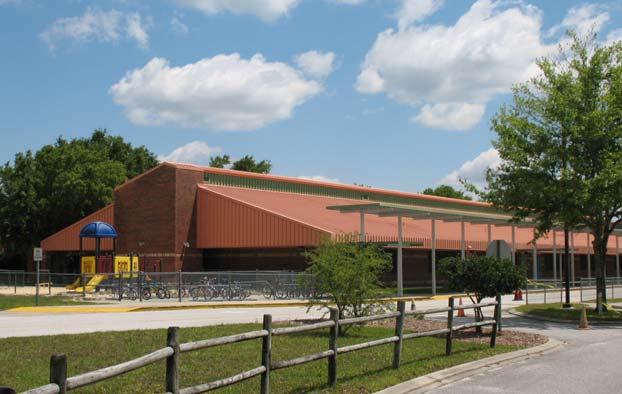
2 Volusia County MPO School Bicycle and Pedestrian Review Study, Phase 3B School Summary Timbercrest Elementary School is located on Eustace Avenue across from Galaxy Middle School, in a densely populated area in the City of Deltona. Of the 925 students attending this school, 423 live within the designated walk zone area. During the 2007/2008 school year approximately 100 of these students walked or rode bicycles to school. According to the crossing guards, the number of students walking and bicycling to school has recently increased. This may be due to increased difficulty for motorists who drop off or pick up students because U-turns are no longer permitted near school property or possibly higher gas prices may be a factor. The safety of the existing crosswalk/crossing guard location is affected by many factors, including: reduced horizontal and vertical visibility on Eustace Avenue, the intersection of Seagate Drive and the location of Galaxy Middle School. At the time of this Study, there were three crossing guard locations serving Timbercrest Elementary School students. The crossing guard location at Seagate Drive and Placid Avenue was closed for the 2007/2008 school year. There was one reported pedestrian crash during estimated school travel times involving an elementary school age child within the walk zone during the last three years. This Study recommends the construction of a sidewalk along the east side of Eustace Avenue from the school entrance road to Catalina Boulevard. Timbercrest Elementary School Eustace Avenue Galaxy Middle School Figure Chapter 3.9 Page 1
3 Timbercrest Elementary School Timbercrest Elementary School Summary Sheet School Address: School Principal: Volusia County School District Representative: Volusia County Public Works Traffic Engineering: Crossing Guard Supervisor: City Representative: 2401 Eustace Avenue Deltona, FL Dr. Mary Cool Phone: Saralee Morrissey, AICP Phone: , ext Jon Cheney, P.E., Director Phone: ext Julyann Rivera Phone: Tom Burbank, Acting Planning and Development Services Director (Previous representative, Becky Mendez is no longer with the City) Phone: Scott McGrath, Principal Planner Phone: Volusia County MPO: Stephan Harris, Bicycle and Pedestrian Coordinator Phone: ext Site Visit Observation Date: April 10, 2008 (weather: cool, clear, and seasonal) Meeting Attendees: Dr. Mary Cool, School Principal Julyann Rivera, Crossing Guard Supervisor Becky Mendez, Deltona Planning Manager Scott McGrath, Deltona Principal Planner Stephan Harris, MPO Bicycle and Pedestrian Coordinator Ginger Hoke, Hoke Design, Inc. Number of Enrolled Students (2008 data): 925 Estimated Number of Students Living in Walk Zone: 423 Chapter 3.9 Page 2
4 Volusia County MPO School Bicycle and Pedestrian Review Study, Phase 3B Number of School Buses: 6 Number of Aftercare Buses/Vans: 5 Estimated Number of Walkers/Bicycle Riders: Number of Bicycles on Site: 27 Number of Bicycle Helmets (stored with bicycle): 12 Staggered Student Dismissal: Unknown Estimated Number of Students Attending Breakfast: 300 (starts prior to 7:30am and a before-school program begins at 6:15am) Number of Students for School Site Aftercare: 140 Teachers Assisting in Arrival and Dismissal Safety: Arrival: 9 Dismissal: 10 Title One School: No (47%) Backpack Policy: no wheeled backpacks permitted Summary of Principal Comments: Traffic pattern and unsafe U-turns on Eustace Avenue Does not want to switch bus area with student drop-off and pick-up loop Feels that a community meeting should be held because she has had 7 letters from concerned parents when the crossing guard program was downsized Crossing Guard Locations: Seagate Drive and Placid Avenue (will be eliminated 08/09) Providence Boulevard and Joyner Drive Seagate Drive and Eustace Avenue (2 guards) Summary of Crossing Guard Supervisor Comments: U-turns are a problem Traffic in front of school is a problem Number of Bicycle and Pedestrian Crash Events within the Existing Walk Zone (elementary age, during estimated school travel times, ): 1 pedestrian (afternoon) Planned Road, Sidewalk, or other Improvements: City has an ongoing sidewalk construction plan and budget Planned Development in Walk Zone: The library and the Lyonia Preserve are undergoing expansion and will include an environmental studies center Number of Students Transported (Designated as Hazardous): None Votran Route in Walk Zone: Yes, Votran typically stops at the library but now turns around at City Hall until library construction is completed Chapter 3.9 Page 3


5 Timbercrest Elementary School Findings and Recommendations Site Description: Timbercrest Elementary School is located on the north side of Eustace Avenue across from Galaxy Middle School. The student drop-off and pick-up area is located on the inside curve of Eustace Avenue. Seagate Drive is located across Eustace Avenue and is generally aligned with the student drop-off access drive. The east side parking lot is used for staff parking and bus loading and unloading. Finding: The visitor parking lot includes a sidewalk along the north side of the parking area that collects students and leads them to openings in a fence where they cross with staff. Recommendation: The combination of a sidewalk along the edge of the parking area and a fence function well together to direct pedestrians to the proper crossing location. This type of design should be considered for use at other schools. A sidewalk and fence direct pedestrians to a designated crossing location Finding: The accessible route for the parking spaces for persons with disabilities could potentially be blocked by the adjacent vehicle. Recommendation: Consider relocating the accessible parking space to the edge of the parking area. Add bollards or a fence to prevent vehicles from encroaching into the sidewalk zone. The use of wheel stops may prevent vehicle encroachments, but may also pose a trip hazard. The parking location of the white truck allows a clear path for motorists with disabilities Finding: An overhead canopy support pole obstructs full access to the curb ramp. Recommendations: Shift either the curb ramp or the pole to allow full clearance at the top of the ramp. Accessible routes should be reviewed for obstacles when designing or modifying campus improvements. A pole obstructs full curb ramp access Chapter 3.9 Page 4

 of the twenty-seven (27) student bicyclists wore helmets.")

6 Volusia County MPO School Bicycle and Pedestrian Review Study, Phase 3B Findings: Vehicular access to the internal campus has created a ramp in the sidewalk in front of the school. This change in elevation has been painted yellow to warn the sidewalk user. Recommendation: If concrete work is planned for this school, reconstruct the sidewalk further from the edge of pavement to allow a separate curb ramp and sidewalk. Service access creates a grade change in the sidewalk Finding: Twelve (12) of the twenty-seven (27) student bicyclists wore helmets. The student in the photograph to the right carries his helmet instead of wearing it. Recommendation: Continue efforts to encourage helmet use. For additional recommendations, refer to the Best Practices section of the Bicycle and Pedestrian School Safety Study Phase 2. A student carries his helmet instead of wearing it Finding: Crossing guards are posted at their locations from 7:15 am to 8:15 am. However, breakfast starts prior to 7:30 am. Students may reach the crossing locations before the guards and cross unaided. Recommendation: The crossing guard supervisor should coordinate with school staff to adjust the crossing guard schedule to serve students arriving early for breakfast. School breakfast may start before the guards are at their post Chapter 3.9 Page 5


7 Timbercrest Elementary School Timbercrest Elem. Existing Crossing Guard Crossing Existing Crosswalks Eustace Ave Galaxy Middle Figure Findings: The access drive for the student drop-off and pick-up area is located along a curve in Eustace Avenue, and the crosswalk is located on the north side of this intersection. The curve in the road and a change in elevation reduce the visibility of the crosswalk for motorists. There are two crossing guards at this location, and they cross students primarily over Eustace Avenue. The placement of safety cones prevents motorists on Seagate Drive from turning left onto Eustace Avenue or going straight into the school access drive. The student drop-off and pick-up access road is located south of the main crosswalk Additionally, cones prevent eastbound motorists on Eustace Avenue from turning left into the student drop-off and pick-up access road. Eastbound motorists on Eustace Avenue wishing to drop off and pick up students must travel beyond the access drive and make a U- turn further east on Eustace Avenue. Recommendations: This Study recommends further review of the possibility of relocating the main crosswalk to the east side of the bus/staff parking entrance. Shifting the crosswalk will result in the need to construct a A curve along Eustace Avenue reduces motorist visibility Chapter 3.9 Page 6

8 Volusia County MPO School Bicycle and Pedestrian Review Study, Phase 3B sidewalk along the west side of the bus/staff entrance and modifications to the existing fence. Shifting the crosswalk to the bus/staff access drive area would also benefit middle school students who frequently volunteer at Timbercrest Elementary School and cross Eustace Avenue unaided. Most of the vehicles traveling to and from the school will use the student drop-off and pick-up access road. Moving the crosswalk to the bus/staff access road area may reduce the pedestrian conflict with motorists. Finally, the existing crosswalk located directly east of the bus/staff access drive and the mid-block crossing located east of the school site should be eliminated. This Study recommends the consolidation of three crosswalks into one crosswalk to increase safety for students crossing Eustace Avenue (See Figure 3.9.2). Finding: A pedestrian crash occurred at the crosswalk over Eustace Avenue, east of the Timbercrest Elementary school site. According to the crash report, student visibility was blocked by parked vehicles along the right of way and the student ran into a moving vehicle. Recommendation: As discussed earlier, this crosswalk should be reviewed for elimination. As an interim measure, post no parking or stopping signs along the right of way near the crosswalk and increase enforcement and student education measures. A motorist parks along Eustace Avenue right of way near the crosswalk, reducing visibility for motorists and crosswalk users Findings: Students walk or ride bicycles in groups, especially in the afternoon when they are released at the same time. Some sidewalks within the walk zone are too narrow to accommodate groups of students. Recommendations: Walking in groups should be encouraged to increase visibility of students and to provide safety in numbers. Sidewalks along major travel routes should be constructed eight to ten feet wide to accommodate groups of students and multiple user groups. Wide sidewalks accommodate groups of users Narrow sidewalks discourage walking in groups Chapter 3.9 Page 7


9 Timbercrest Elementary School Finding: Eustace Avenue does not have a sidewalk on the east side of the road north of the school site. Students living east of Eustace Avenue may cross the road at random locations to reach the wide sidewalk on the west side. Recommendation: Construct a minimum five foot wide sidewalk along the east side of Eustace Avenue between the school site and Catalina Boulevard. A short section of retaining wall may be needed near the school. This sidewalk is recommended as a Priority Project and is further described at the end of this chapter. Eustace Avenue looking south toward Timbercrest Elementary School Findings: A crossing guard location was closed in the 2007/08 school year at the intersection of Old Mills Road and Placid Avenue. A guard location at Seagate Drive and Placid Avenue will also close for the 08/09 school year. Currently, the crosswalk over Old Mills Road aligns with the sidewalk on the east side of Placid Avenue and crosses into a private driveway where it connects with the wide sidewalk on the south side of Old Mills Road. Recommendations: Relocate the crosswalk east of its current location to avoid termination into the driveway. Construct a short extension of the sidewalk along the south side of Old Mills Road to connect to the crosswalk. Old Mills Road The crosswalk over Old Mills Road at Placid Avenue terminates into a private driveway Findings: Portions of Providence Boulevard include a narrow sidewalk that is flush and adjacent to the roadway. A painted shoulder has been added to provide some separation between the travel area and the sidewalk. Recommendations: Future modifications should include sidewalks separated from the roadway. The sidewalk on the west side should continue and connect to the sidewalk south of the Deltona Lakes Elementary School access road. The construction of sidewalk along the east side of Providence Boulevard from Auburndale Street to the intersection of Eustace Avenue would provide sidewalk facilities for students attending Timbercrest Portions of Providence Boulevard have narrow sidewalks adjacent to the roadway Chapter 3.9 Page 8
10 Volusia County MPO School Bicycle and Pedestrian Review Study, Phase 3B Elementary and Galaxy Middle School. The construction of a sidewalk along the east side of Providence Boulevard would also serve library patrons, Lyonia Preserve visitors, Votran users, and students attending Daytona State College and Deltona Lakes Elementary Schools. If this sidewalk is constructed, the crossing guard location at Joyner Drive and Providence Boulevard should be evaluated for relocation to the intersection of Eustace Avenue and Providence Boulevard. A guard at this location would serve students living east of Providence Boulevard and Galaxy Middle students. This intersection should be evaluated for a signal with enhanced pedestrian features. Chapter 3.9 Page 9
11 Timbercrest Elementary School Master Plan The following Bicycle and Pedestrian Master Plan specifies a network of sidewalks and trails that, if implemented, will greatly increase the convenience and safety of travel for pedestrians and bicyclists. A 24 x36 fold-out map is included as a deliverable with this Study. The Bicycle and Pedestrian Master Plan includes the following information: Existing Conditions: Existing Walk Zone area from School District GIS (shaded tan) Courtesy Transportation Zone from School District, if applicable (shaded blue) Hazardous Transportation Zone from School District, if applicable (shaded yellow) Student Home Location from School District (dark blue dot) Existing Trails from County GIS and field review (solid green line) Existing Wide Sidewalk 6-8 from field review (solid blue line) Existing Sidewalks 3-5 from field review (solid red line) Existing Crossing Guard Locations from County GIS and field observations (green cross for existing to remain and yellow cross for existing to be closed) Bicycle or Pedestrian Crash Event Locations from from County GIS data, during estimated school travel times and involving an elementary age bicyclist or pedestrian (pink star) Existing Votran Routes and stops from Volusia County MPO (yellow lines along roadway centerline with yellow squares at bus stops) Planned Conditions: Planned trail (long dashed dark green line) Planned wide sidewalk (long dashed blue line) Planned sidewalk (long dashed red line) Recommendations of this Study: Proposed Trails (dashed dark green line) Proposed Sidewalks 6-8 wide (dashed blue line) Proposed Sidewalks 5 (dashed red line) This Master Plan and supplemental information supplied within the Implementation Report are meant as a guideline for sidewalk and trail planning. The Master Plan is not an engineering document. Chapter 3.9 Page 10


12 Volusia County MPO School Bicycle and Pedestrian Review Study, Phase 3B Chapter 3.9 Page 11

13 Timbercrest Elementary School Recommended Priority Project Eustace Avenue Sidewalk (east side) School Served: Timbercrest Elementary School and Galaxy Middle School Project Location: East side of Eustace Avenue from Catalina Boulevard to the school entrance across from Seagate Drive. Project Description: A.65 mile minimum 5 foot wide sidewalk with up to 200 linear feet of retaining wall Maintaining Agency: City of Deltona Finding: Eustace Avenue does not have a sidewalk on the east side of the road north of the school site. Students living east of Eustace Avenue may cross the road at random locations to reach the wide sidewalk on the west side. Recommendation: Construct a minimum five foot wide sidewalk along the east side of Eustace Avenue between the school site and Catalina Boulevard. A 200 linear foot section of retaining wall may be needed near the school. Eustace Avenue looking south toward Timbercrest Elementary School Potential Constraints: Grading issues are substantial near the school entrance drive and a retaining wall and coordination with adjacent property owners will most likely be necessary. Shade trees should be avoided and protected, possibly increasing project cost. Potential Opportunities: The construction of this sidewalk would serve Timbercrest Elementary and Galaxy Middle School students. Additionally, the City of Deltona has an annual budget of $350,000 for new sidewalk construction. Estimated Cost (Not including right of way acquisition, if needed): $400,000 Eustace Avenue looking west Note: This project is highlighted blue on the corresponding Bicycle and Pedestrian Master Plan. Chapter 3.9 Page 12
Chapter 4.3 Enterprise Elementary. Volusia County MPO. March Page 7.0
 Chapter 4.3 Enterprise Elementary Enterprise, FL Volusia County MPO March 2008 Page 7.0 Volusia County MPO Bicycle and Pedestrian School Safety Review Study Introduction Enterprise Elementary School is
Chapter 3.5 Osteen Elementary School. Volusia County MPO. November 2008
 Chapter 3.5 Osteen Elementary School Osteen, FL Volusia County MPO November 2008 Volusia County MPO School Bicycle and Pedestrian Review Study, Phase 3B School Summary Osteen Elementary School is located
Chapter 3.3 Horizon Elementary School. Volusia County MPO. June 2009
 Chapter 3.3 Horizon Elementary School Port Orange, FL Volusia County MPO June 2009 Volusia County MPO School Bicycle and Pedestrian Review Study, Phase 3C School Summary Horizon Elementary School is located
Chapter 3.6 Elementary School Z. Volusia County MPO. March Page 13.0
 Chapter 3.6 Elementary School Z DeLand, FL Volusia County MPO March 2008 Page 13.0 Volusia County MPO Bicycle and Pedestrian School Safety Review Study Introduction Elementary School Z is a planned elementary
Final Sidewalk Feasibility Study
 Garfield Drive From Anastasia Drive to Elizabeth Place City of South Daytona July 23, 2009 Final Sidewalk Feasibility Study Prepared for: Prepared by: Final Sidewalk Feasibility Study Garfield Drive 2
C/CAG. Sunnybrae Elementary School Walking and Bicycling Audit. San Mateo-Foster City School District JUNE 2013
 Sunnybrae Elementary School Walking and Bicycling Audit JUNE 2013 San Mateo-Foster City School District C/CAG City/County Association of Governments of San Mateo County SUNNYBRAE ELEMENTARY SCHOOL WALKING
Bicycle and Pedestrian Safety Review Study Assessment Report
 Bicycle and Pedestrian Safety Review Study Assessment Report Turie T. Small Elementary school Daytona Beach, Florida March 2007 Hoke Design, Inc. Turie T. Small Elementary School March 2007 Hoke Design,
Orange Center Elementary School
 Drag and drop pic and stretch/crop to the limits of the blue rectangle (delete this text box) Orange Center Elementary School Drag and drop pic and stretch/crop to the limits of the blue rectangle (delete
Hidden Oaks Elementary School
 Hidden Oaks Elementary School SCHOOL ROUTE PLAN For HIDDEN OAKS ELEMENTARY SCHOOL LOCATION 13 ORANGE COUNTY Prepared for: ORANGE COUNTY SCHOOL ASSESSMENT PROGRAM ORANGE COUNTY PUBLIC WORKS Traffic Engineering
CHAPTER 16 PEDESTRIAN FACILITIES DESIGN AND TECHNICAL CRITERIA TABLE OF CONTENTS
 CHAPTER 16 PEDESTRIAN FACILITIES DESIGN AND TECHNICAL CRITERIA TABLE OF CONTENTS Section Title Page 16.1 General... 16-1 16.1.1 AASHTO Reference... 16-1 16.1.2 ADA Requirements... 16-1 16.2 Sidewalks...
Drag and drop pic and stretch/crop to the limits of the blue rectangle (delete this text box) Maxey Elementary School
 Maxey Elementary School") Drag and drop pic and stretch/crop to the limits of the blue rectangle (delete this text box) Maxey Elementary School SCHOOL ROUTE PLAN For MAXEY ELEMENTARY SCHOOL LOCATION 33 ORANGE COUNTY Prepared for:
Drag and drop pic and stretch/crop to the limits of the blue rectangle (delete this text box) Maxey Elementary School SCHOOL ROUTE PLAN For MAXEY ELEMENTARY SCHOOL LOCATION 33 ORANGE COUNTY Prepared for:
APPENDIX A: Complete Streets Checklist DRAFT NOVEMBER 2016
 APPENDIX A: Complete Streets Checklist DRAFT NOVEMBER 2016 Complete Streets Checklist MetroPlan Orlando s Complete Streets Checklist is an internal planning tool for staff to further implementation of
Traffic Circulation & Pedestrian Safety Study
 Lyons Township High School North Campus La Grange, Illinois Parking Lot Vaughan Building N Main Building Prepared for: Prepared by: July 23, 2015 Contents List of Figures, iii 1. Introduction...1 2. Existing
Meadow Woods Elementary School
 Drag and drop pic and stretch/crop to the limits of the blue rectangle (delete this text box) Meadow Woods Elementary School Drag and drop pic and stretch/crop to the limits of the blue rectangle (delete
LTAC: Katie Mencarini, Central & Hampton Roads streets and a fifteen minute debrief to discuss the findings. Participants walked along Mill Road
 Walkabout Summary On June 3, 2013, five participants met at Glen Allen Elementary School in Glen Allen, Virginia to take a closer look at the walking and biking network around the school. In addition to
Chapter 2: Standards for Access, Non-Motorized, and Transit
 Standards for Access, Non-Motorized, and Transit Chapter 2: Standards for Access, Non-Motorized, and Transit The Washtenaw County Access Management Plan was developed based on the analysis of existing
CURBSIDE ACTIVITY DESIGN
 5 CURBSIDE ACTIVITY DESIGN This chapter provides design guidance for separated bike lanes adjacent to curbside activities including parking, loading and bus stops. Typical configurations are presented
Windy Ridge Elementary School
 Windy Ridge Elementary School SCHOOL ROUTE PLAN For WINDY RIDGE ELEMENTARY SCHOOL LOCATION 54 ORANGE COUNTY Prepared for: ORANGE COUNTY SCHOOL ASSESSMENT PROGRAM ORANGE COUNTY PUBLIC WORKS Traffic Engineering
NJDOT Complete Streets Checklist
 Background The New Jersey Department of Transportation s Complete Streets Policy promotes a comprehensive, integrated, connected multi-modal network by providing connections to bicycling and walking trip
5. RUNNINGWAY GUIDELINES
 5. RUNNINGWAY GUIDELINES These guidelines should be considered collectively when making runningway decisions. A runningway is the linear component of the transit system that forms the right-of-way reserved
Memorandum. Sunday, July 13, Saturday, July 19, 2014
 Memorandum To: David Lowin, Brooklyn Bridge Park Corporation From: Daniel Schack, AICP, PTP Date: Re: Brooklyn Bridge Park Pier 5/6 Loop Road Traffic Study Project No: 14-01-2407 At the request of Brooklyn
July 5, Arthur R. Ware, Jr. Elementary School 2017 Safe Routes to School Walkabout Report
 July 5, 2017 Arthur R. Ware, Jr. Elementary School 2017 Safe Routes to School Walkabout Report 1 Walkabout Report Introduction On April 28, 2017, City, School, and SAWMPO staff met to conduct a Safe Routes
ATTACHMENT NO. 11. RRLRT No. 2. Railroad / Light Rail Transit Technical Committee TECHNICAL COMMITTEE: Busway Grade Crossings STATUS/DATE OF ACTION
 ATTACHMENT NO. 11 RRLRT No. 2 TECHNICAL COMMITTEE: TOPIC: Railroad / Light Rail Transit Technical Committee Busway Grade Crossings STATUS/DATE OF ACTION RRLRT TC Draft: 06/23/2011 RRLRT TC Approval: 06/27/2014
SCHOOL ROUTE PLAN. For HUNTER S CREEK ELEMENTARY SCHOOL LOCATION 14 ORANGE COUNTY. Prepared for:
 SCHOOL ROUTE PLAN For HUNTER S CREEK ELEMENTARY SCHOOL LOCATION 14 ORANGE COUNTY Prepared for: ORANGE COUNTY SCHOOL ASSESSMENT PROGRAM ORANGE COUNTY PUBLIC WORKS Traffic Engineering Division 42 South John
Woodward Hill Elementary School School Safety and Operation Review
 Address: 6082-142 nd Street Surrey, BC, V3X 1C1 Site Visit: March 7, 2011 Principal Anne Mackie Report Date: November 25, 2011 Phone: (604) 594-2408 Email: Mackie_A@sd36.bc.ca The following report is one
Feasibility Study of Pedestrian Crossings Along Route 7, East of Cascades Parkway and West of Dranesville Road. October 3, 2017
 Feasibility Study of Pedestrian Crossings Along Route 7, East of Cascades Parkway and West of Dranesville Road October 3, 2017 Study Area (area within a ¼-mile radius of the study intersections) Route
Durrance Elementary School
 Durrance Elementary School SCHOOL ROUTE PLAN For DURRANCE ELEMENTARY SCHOOL LOCATION 9 ORANGE COUNTY Prepared for: ORANGE COUNTY SCHOOL ASSESSMENT PROGRAM ORANGE COUNTY PUBLIC WORKS Traffic Engineering
Lake Whitney Elementary School
 Lake Whitney Elementary School SCHOOL ROUTE PLAN For LAKE WHITNEY ELEMENTARY SCHOOL LOCATION 18 ORANGE COUNTY Prepared for: ORANGE COUNTY SCHOOL ASSESSMENT PROGRAM ORANGE COUNTY PUBLIC WORKS Traffic Engineering
section 4 Existing Conditions, Issues, and Options
 section 4 Existing Conditions, Issues, and Options 4.0 Existing Conditions, Issues, and Options This section analyzes each segment of the corridor on a street to street basis. Each segment is discussed
SAFE ROUTES TO SCHOOL
 SAFE ROUTES TO SCHOOL Forest Ridge Elementary School Existing Conditions and ACTION PLAN > Oak Creek - Franklin Joint School District Table of Contents CONTEXT Enrollment Boundaries
Multi-Modal Traffic Analysis. Parisi and Associates
 Mill Valley to Corte Madera Bicycle and Pedestrian Corridor Study Appendix D: Multi-Modal Traffic Analysis Prepared by Parisi and Associates August 2009 Appendix D - Multi-Modal Traffic Analysis Table
City of Madison, East Johnson Street North Baldwin Street to First Street Local Street Dane County
 City of Madison, East Johnson Street North Baldwin Street to First Street Local Street Dane County Public Involvement Meeting Thursday, April 28, 2016 6 to 8 P.M. Lapham Elementary School 1045 E. Dayton
Chapter 4 TOOLBOX AND SAMPLE BIKE BOULEVARD LAYOUT
 Chapter 4 TOOLBOX AND SAMPLE BIKE BOULEVARD LAYOUT OVERVIEW This chapter describes a cohesive set of strategies to create a bicycle boulevard, namely to make streets safer and more efficient for bicycle
Improvements Infrastructure Gap Assessment and Improvements Street Striping
 Infrastructure Project Proposal The federal-aid Safe Routes to School program funds infrastructure/engineering projects that fall into two categories: Design (available only to School Development Authority
Sebastopol Charter School Traffic Management Plan
 Sebastopol Charter School The serves as the working document in support of these essential goals: to ensure the safety and efficiency of student arrival to and departure from school to ensure the safety
Bicycle and Pedestrian Safety Review Study Implementation Report
 Bicycle and Pedestrian Safety Review Study Implementation Report Indian River Elementary school Edgewater, Florida March 2007 Hoke Design, Inc. Indian River Elementary School March 07 Hoke Design 1 Bicycle
Complete Streets. Designing Streets for Everyone. Sarnia
 Complete Streets Designing Streets for Everyone Sarnia Complete Streets ~ Sarnia ~ 2018 Introduction Our City is made up of a network of streets that we use to go for a walk, cycle to work, drive to the
Active Transportation Facility Glossary
 Active Transportation Facility Glossary This document defines different active transportation facilities and suggests appropriate corridor types. Click on a facility type to jump to its definition. Bike
10.0 CURB EXTENSIONS GUIDELINE
 10.0 CURB EXTENSIONS GUIDELINE Road Engineering Design Guidelines Version 1.0 March 2017 City of Toronto, Transportation Services City of Toronto Page 0 Background In early 2014, Transportation Services
Broad Street Bicycle Boulevard Design Guidelines
 Broad Street Bicycle Boulevard Design Guidelines Building from the strategies introduced in the 2013 Bicycle Transportation Plan and community input received thus far, City Transportation Staff have identified
Bicycle and Pedestrian Facilities Toolbox (Excerpt from Figure 3.1)
") Appendix B Neighborhood Connections Summaries This Appendix is a supplement to the information presented in Chapter 3 Connect People. The Appendix includes a summary or profile for each of the proposed
Appendix B Neighborhood Connections Summaries This Appendix is a supplement to the information presented in Chapter 3 Connect People. The Appendix includes a summary or profile for each of the proposed
What Is a Complete Street?
 Session 5 Charleen Zimmer, AICP, Zan Associates May 5-7, 2010 What Is a Complete Street? May 2010 5-1 Not a Complete Street More of a Complete Street May 2010 5-2 Benefits of Complete Streets Safety for
West Dimond Blvd Upgrade Jodhpur Street to Sand Lake Road
 West Dimond Blvd Jodhpur St to Sand Lake CSS Transportation Project Summary Municipality of Anchorage Project # 05 005 Project Manager: John Smith, P.E. (MOA PM&E) Project Administrator: Julie Makela,
Cycle Track Design Best Practices Cycle Track Sections
 Design Best Practices Sections It is along street segments where the separation and protection methods of cycle tracks offer more comfort than conventional bicycle lanes, and are more attractive to a wide
School Zone Traffic Control Policy
 School Zone Traffic Control Policy I. GE ERAL CITY OF BILLINGS SCHOOL ZONE TRAFFIC CONTROL POLICY (Approved by Traffic Control Board 10/27/99) (Approved by Billings City Council on 6/25/01) This policy
Trail Feasibility. 1. Introduction FINAL. October What s inside?
 VOLUSIA COUNTY MPO CITY OF PORT ORANGE FINAL Trail Feasibility October 2006 What s inside? 1 Introduction 2 Project Purpose & Scope 3 Physical Inventory & Assessment of Right-of- Way 4 Trail Concept Plan
San Rafael School District. Task Force Meeting Notes. November 5, 2012
 San Rafael School District Task Force Meeting Notes November 5, 2012 Attendees (8) Wendi Kallins Program Director for Safe Routes to Schools; Laura Kelly Volunteer Liaison for Safe Routes to Schools; Leslie
Community Bicycle Planning
 Community Bicycle Planning City of Mentor s Bicycle Facility Plan Allen E. Pennington, P.E. Civil Engineer - Traffic Office of the Mentor City Engineer Why has Mentor participated in bicycle planning?
Regional School District #19 Transportation Policy
 Regional School District #19 Transportation Policy I. Scope of Policy Many students attending E.O. Smith High School are transported by local boards of education, through written agreements with those
Recommended Roadway Plan Section 2 - Land Development and Roadway Access
 Recommended Roadway Plan Section 2 - Land Development and Roadway Access SECTION 2 Land Development and Roadway Access 2.1 Land Use and Access Management The Federal Highway Administration (FHWA) defines
Accommodating Pedestrians in the Work Zone
 Accommodating Pedestrians in the Work Zone Guidance for Section C Plan Preparers Some impacts cannot be avoided and those impacts apply to residents, businesses, motorists, and pedestrians alike. However,
Item No. 14 Town of Atherton
 Item No. 14 Town of Atherton CITY COUNCIL STAFF REPORT CONSENT AGENDA TO: THROUGH: FROM: HONORABLE MAYOR AND CITY COUNCIL GEORGE RODERICKS, CITY MANAGER MICHAEL KASHIWAGI, COMMUNITY SERVICES DIRECTOR MARTY
Duwamish Way-finding and CTR Report
 V. North Tukwila When the North Tukwila Manufacturing and Industrial Center was designated in 1992 as part of the region s land use and transportation plan, the plan called for the area to set a light-rail
Implementing the Three Es of School Zone Traffic Calming
 Implementing the Three Es of School Zone Traffic Calming Use this evaluation tool as a guide to analyze the specific safety needs of your school. SCHOOL PROFILE School Name: School District: Address: Phone
City of Albert Lea Policy and Procedure Manual 4.10 ALBERT LEA CROSSWALK POLICY
 4.10 ALBERT LEA CROSSWALK POLICY PURPOSE: Pedestrian crosswalks are an integral part of our transportation infrastructure. To be effective and promote safety, marked crosswalks must be installed after
TRAFFIC CALMING GUIDE FOR TORONTO CITY OF TORONTO TRANSPORTATION SERVICES DIVISION
 TRAFFIC CALMING GUIDE FOR TORONTO CITY OF TORONTO TRANSPORTATION SERVICES DIVISION CITY OF TORONTO TRANSPORTATION SERVICES DIVISION 2016 TRAFFIC CALMING GUIDE FOR TORONTO TABLE OF CONTENTS Introduction
2.0 LANE WIDTHS GUIDELINE
 2.0 LANE WIDTHS GUIDELINE Road Engineering Design Guidelines Version 2.0.1 May 2018 City of Toronto, Transportation Services City of Toronto Page 0 Background In early 2014, Transportation Services initiated
7/23/2017 VIA . Michael Hanebutt City of Sacramento Community Development Department 300 Richards Boulevard, 3 rd Floor Sacramento, CA 95811
 7/23/2017 VIA EMAIL Michael Hanebutt City of Sacramento Community Development Department 300 Richards Boulevard, 3 rd Floor Sacramento, CA 95811 RE: 65 th Street Apartments (DR17-220) Dear Mr. Hanebutt:
ADA Transition Plan. City of Gainesville FY19-FY28. Date: November 5, Prepared by: City Of Gainesville Department of Mobility
 ADA Transition Plan FY19-FY28 Date: November 5, 2018 Prepared by: City Of Gainesville Department of Mobility 1.0 INTRODUCTION 1.1 BACKGROUND The federal statute known as the Americans with Disabilities
Zlatko Krstulich, P.Eng. City of O9awa
 Zlatko Krstulich, P.Eng. City of O9awa 1. Introduction to the Ontario Traffic Manual Series 2. What is OTM Book 18: Bicycle Facilities? 3. Study / Committee Team Members 4. Brief overview of the content
Figure 4-10: Pedestrian Improvements Types of Potential Station Area Improvements - Place-Making Improvements
 INCORPORATE FEATURE PAVIN IN CROSSWALK AND INTERSECTION FIELDS Identifies high-priority pedestrian areas and create a station identity through colorful and interesting patterns ADD CURB EXTENSIONS Extending
Table of Contents. Introduction. Prompt List Arterials and Streets. Prompt List Interchange. Prompt List Intersections. Prompt List Limited Access
 Table of Contents Introduction Prompt List Arterials and Streets Prompt List Interchange Prompt List Intersections Prompt List Limited Access Prompt List MOT Prompt List Pedestrian Bicyclist Prompt List
Hedgepeth Williams Middle School and Paul Robeson Elementary School Trenton, NJ. School Travel Plan
 Hedgepeth Williams Middle School and Paul Robeson Elementary School Trenton, NJ School Travel Plan Hedgepeth Williams Middle School Description: Hedgepeth-Williams Middle School is located at 301 Gladstone
Lee s Summit Road Improvement Study Public Open House June 7, 2007 Summary of Comment Card Responses
 Lee s Summit Road Improvement Study Public Open House June 7, 2007 Summary of Comment Card Responses Introduction At the Lee s Summit Road Improvement Study Public Open House held Thursday, June 7, 2007
City of Margate, Florida. Neighborhood Traffic Management Manual
 City of Margate, Florida Neighborhood Traffic Management Manual Table of Contents Page No. I. INTRODUCTION... 1 II. TRAFFIC CALMING REQUEST AND PROCESSING PROCEDURES... 2 1. COMPLETE AND SUBMIT PROJECT
Roadways. Roadways III.
 Introduction 97 Roadway Design Principles 98 Safe Speeds 99 Optimizing of Street Space 00 Minimum Lane Widths in the City of Boston 02 Design Features that Reduce Operating Speeds 05 Travel Lanes Transit
HALFF TRAFFIC MANAGEMENT PLAN. Richardson ISD Northwood Hills Elementary School Dallas, Texas. /? /4O/2o16
 30279 161966 TRAFFIC MANAGEMENT PLAN Richardson ISD Northwood Hills Elementary School August 30 2016 Exhibit 976B Planned Development District No. 976 Z156-311(OTH) Approved City Plan Commission October
Lynchburg District Update
 Lynchburg District Update Virginia Statewide Bicycle and Pedestrian Advisory Committee Spring Meeting May 16 th, 2017 David Cook Transportation Planner, VDOT Lynchburg District Table of Contents Active
City of Gainesville Transportation/Roadway Needs PROJECT SUMMARY
 A1 Roadway Resurfacing $23,846,000 TYPE: Preservation of existing system Roadway resurfacing A2 Signal Replacement $6,000,000 TYPE: Preservation of existing system Replace traffic signals. B1 W 6th St
Transportation Policy Manual
 March 4, 2013 EXHIBIT 2 Metropolitan Transportation Planning Organization for the Gainesville Urbanized Area A Comprehensive Guide to Adopted Metropolitan Transportation Planning Organization for the
City of Moorhead Committee of the Whole Meeting
 City of Moorhead Committee of the Whole Meeting Corridor Study Limits Center Avenue (Red River to 8th Street) TH 10 (Red River to TH 336) TH 75 (20th Ave S to Main Avenue) 2 Study Need: Project Overview
Appendix C. TRAFFIC CALMING PROGRAM TOOLBOX
 Appendix C. TRAFFIC CALMING PROGRAM TOOLBOX PHASE I...2 Do Not Enter Sign...3 One-Way Sign...4 Turn Prohibition...5 Pavement Markings...6 Speed Monitoring Trailer...7 Neighborhood Speed Watch...8 Police
Borough of Danville, PA Traffic Calming Program Guidelines
 Borough of Danville, PA Traffic Calming Program Guidelines Adopted by Borough Council on 1 INTRODUCTION Speeding Traffic is a major concern in the Borough of Danville because of its detrimental impacts
ADA on Construction. Guidance for Section C Plan Preparers
 ADA on Construction Guidance for Section C Plan Preparers Some impacts cannot be avoided and those impacts apply to residents, businesses, motorists, and pedestrians alike. However, good planning can minimize
Roadway Classification Design Standards and Policies. Pueblo, Colorado November, 2004
 Roadway Classification Design Standards and Policies Pueblo, Colorado November, 2004 Table of Contents Page Chapter 1. General Provisions 1.1 Jurisdiction 3 1.2 Purpose and Intent 3 1.3 Modification 3
FINAL MCDONALD ROAD SIDEWALK FEASIBILITY STUDY
 FINAL MCDONALD ROAD SIDEWALK FEASIBILITY STUDY APRIL 2015 Prepared For: Prepared By: CONTENTS 1 EXECUTIVE SUMMARY... 4 2 INTRODUCTION... 5 PURPOSE AND OBJECTIVES... 5 CITY OF PORT ORANGE... 7 PROJECT HISTORY...
2014/2015 BIKE ROUTE PLAN 83 AVENUE PROTECTED BIKE LANE
 About the Project The City of Edmonton is planning a major bike route on the southside of Edmonton. The Strathcona Bike Route will connect the communities of Strathcona, Garneau and the University area,
Memorandum. Exhibit 60 SSDP To: Jenny Bailey, Senior Planner. From: Bill Schultheiss, P.E. (WA. P.E. #46108) Date: June 20, 2017
 Date: June 20, 2017") Memorandum To: Jenny Bailey, Senior Planner From: Bill Schultheiss, P.E. (WA. P.E. #46108) Date: June 20, 2017 Re: East Lake Sammamish Trail, Segment 2B Review King County has asked Toole Design Group
Memorandum To: Jenny Bailey, Senior Planner From: Bill Schultheiss, P.E. (WA. P.E. #46108) Date: June 20, 2017 Re: East Lake Sammamish Trail, Segment 2B Review King County has asked Toole Design Group
Pedestrian Safety Guide for Transit Agencies
 Pedestrian Safety Guide for Transit Agencies FDOT/FTPA/CUTR Professional Development Workshop June 15, 2010 1 Purpose Presentation Overview Bus Stop Location and Design Process/Partnership 2 Purpose Every
CHAPTER 1 STANDARD PRACTICES
 CHAPTER 1 STANDARD PRACTICES OBJECTIVES 1) Functions and Limitations 2) Standardization of Application 3) Materials 4) Colors 5) Widths and Patterns of Longitudinal Pavement Marking Lines 6) General Principles
Washington St. Corridor Study
 FIGURE 7.17 Bridge Alternatives - Cross Sections 86 Discarded Alternative: Short-Term Bridge Repair Short-term repairs and west bridge span replacement were considered during analysis. Short-term repairs
AGENDA ITEM 6 D THOMASVILLE ROAD (HERMITAGE BOULEVARD TO LIVE OAK PLANTATION ROAD) ROADWAY SAFETY AUDIT
 ROADWAY SAFETY AUDIT") May 15, 2018 AGENDA ITEM 6 D THOMASVILLE ROAD (HERMITAGE BOULEVARD TO LIVE OAK PLANTATION ROAD) ROADWAY SAFETY AUDIT TYPE OF ITEM: Discussion STATEMENT OF ISSUE The Florida Department of Transportation
May 15, 2018 AGENDA ITEM 6 D THOMASVILLE ROAD (HERMITAGE BOULEVARD TO LIVE OAK PLANTATION ROAD) ROADWAY SAFETY AUDIT TYPE OF ITEM: Discussion STATEMENT OF ISSUE The Florida Department of Transportation
General Design Factors
 Chapter 3: 3-1.0 Introduction General Design Factors Mn/DOT s goals include encouraging and accommodating safe bicycling. From a design perspective, these goals are achieved by first having an understanding
Chapter V TRAFFIC CONTROLS. Tewodros N.
 Chapter V TRAFFIC CONTROLS www.tnigatu.wordpress.com tedynihe@gmail.com Lecture Overview Traffic markings Longitudinal markings Transverse markings Object markers and delineator Traffic signs Regulatory
About the Studio. Edward J. Bloustein School of Planning and Public Policy - Rutgers University
 About the Studio Edward J. Bloustein School of Planning and Public Policy - Rutgers University Purpose of studio: Help City of Bayonne apply for Safe Routes to School (SRTS) funding by producing a School
Forest Hills Improvement Initiative
 Forest Hills Improvement Initiative Transportation Action Plan Short Term Recommendations ONLY Final Draft as of April 30, 2008 For Community Review and Feedback Prepared for: The City of Boston Boston
REGIONAL BICYCLE AND PEDESTRIAN DESIGN GUIDELINES
 REGIONAL BICYCLE AND PEDESTRIAN DESIGN GUIDELINES November 16, 2011 Deb Humphreys North Central Texas Council of Governments Bicycle and Pedestrian Advisory Committee Snapshot of the Guide 1. Introduction
Clybourn Ave. Protected Bike Lane Study Halsted St. to Division St.
 Clybourn Ave. Protected Bike Lane Study Halsted St. to Division St. Nathan Roseberry, Senior Engineer Pam Broviak, Project Manager July 24, 2014 Agenda Project Goals Existing Roadway Conditions Traffic
Arlington Public Schools Thomas Jefferson Site Evaluation Transportation Networks. Thomas Jefferson Working Group Meeting #6 November 10, 2014
 Arlington Public Schools Thomas Jefferson Site Evaluation Transportation Networks Thomas Jefferson Working Group Meeting #6 November 10, 2014 2 3 INTRODUCTION 4 Goal of our work: Identify and assess multi-modal
SAN FRANCISCO MUNICIPAL TRANSPORTATION AGENCY BOARD OF DIRECTORS. RESOLUTION No
 SAN FRANCISCO MUNICIPAL TRANSPORTATION AGENCY BOARD OF DIRECTORS RESOLUTION No. 15-031 WHEREAS, Transportation Code Division II, Section 909 authorizes the Director of Transportation to install and permit
COMPLETE STREETS DURING CONSTRUCTION
 COMPLETE STREETS DURING CONSTRUCTION MAINTAINING ACCESSIBILITY FOR ALL Presented by Robbie Burgess, P.E., PTOE Associate Principal Construction Services Manager Howard Stein Hudson rburgess@hshassoc.com
Complete Streets Policy DAVID CRONIN, P.E., CITY ENGINEER
 Complete Streets Policy DAVID CRONIN, P.E., CITY ENGINEER Complete Streets City Commission adopted a Complete Streets policy in 2012 Complete Streets are road networks that are designed for all users:
WHEREAS delivery trucks also pass through the Narrows, into the northern parking lot, to loading docks in the back of the building.
 CEDAR-ISLES-DEAN NEIGHBORHOOD ASSOCIATION ( CIDNA ) RESOLUTION OPPOSING A DRUG STORE DRIVE THRU, AND COMMENDING DORAN COMPANIES FOR PROPOSING MITIGATING AMENITIES INCLUDING NEW LANDSCAPING AND A DEDICATED
Walkabout Summary Report
 Walkabout Summary Report Introduction On September 3, 2014, stakeholders at Bessie Weller Elementary School (Bessie Weller ES) in Staunton, Virginia met to examine the walking and bicycling network around
Americans with Disabilities Act Transition Plan for Public Right-of-Way Improvements
 Americans with Disabilities Act Transition Plan for Public Right-of-Way Improvements Prepared by: Public Works Department Engineering Division October 2015 Table of Contents Section I Introduction.. 3
CITY OF OAK CREEK SAFE ROUTES TO SCHOOL ACTION PLAN. East Middle School
 CITY OF OAK CREEK SAFE ROUTES TO SCHOOL ACTION PLAN East Middle School CITY OF OAK CREEK SAFE ROUTES TO SCHOOL ACTION PLAN East Middle School Why Safe Routes to School? Safe Routes to School ( SRTS ) is
SAFE ROUTES TO SCHOOL
 SAFE ROUTES TO SCHOOL Edgewood Elementary School Existing Conditions and ACTION PLAN > Oak Creek - Franklin Joint School District Table of Contents CONTEXT Enrollment Boundaries Enrollment
Table 1.0 Grade Crossing Enhancements PVL San Jacinto Branch Line
 Grade Crossing Enhancements CPUC 1 2 3 4 5 Citrus Avenue, Riverside County Palmyrita Ave., Columbia Avenue, Marlborough Ave., Spruce St., MP 0.57 002X-0.6 027301Y MP 1.00 002X-1.0 027302F MP 1.24 002X-1.3
San Ramon Elementary School. Travel Plan
 San Ramon Elementary School Travel Plan TABLE OF CONTENTS 1. PURPOSE... 1 1.1. SR2S PLANNING, IMPLEMENTATION AND MONITORING... 1 1.2. MARIN COUNTY MEASURE A... 1 2. SAN RAMON ELEMENTARY SCHOOL PROFILE...
On-Street Bicycle Facilities
 On-Street Bicycle Facilities A. General 12B-3 Design Manual Chapter 12 - Sidewalks and Bicycle Facilities 12B - Bicycle Facilities Cyclists have similar access and mobility needs as other transportation