SAN FRANCISCO MUNICIPAL TRANSPORTATION AGENCY
|
|
|
- Katherine Shepherd
- 5 years ago
- Views:
Transcription
1 THIS PRINT COVERS CALENDAR ITEM NO. : SAN FRANCISCO MUNICIPAL TRANSPORTATION AGENCY DIVISION: Sustainable Streets Transportation Engineering BRIEF DESCRIPTION: Requesting that the San Francisco Municipal Transportation Agency (SFMTA) Board of Directors approve traffic regulations related to allowing Muni to operate two-way, both eastbound and westbound, on Haight Street between Laguna and Market streets. SUMMARY: The proposed traffic modifications will facilitate the two-way operation of the 6, 71, and 71L buses on Haight Street, which will reduce transit travel times by one to three minutes and improve transit reliability while increasing transit legibility, safety and comfort. This project implements the Market Octavia plan's transit improvements and does not conflict with the recommendations of the Transit Effectiveness Project. The proposed legislation will benefit the nearly 20,000 customers of these routes and result in an increase of four parking spaces in the project area. This project also includes pedestrian and streetscape improvements that will benefit all modes at the intersection of Market, Haight and Gough streets. The Planning Department reviewed this project and prepared an Addendum to the Market and Octavia Neighborhood Plan Environmental Impact Report on March 28, ENCLOSURES: 1. SFMTAB Resolution 2. Addendum APPROVALS: DIRECTOR OF DIVISION PREPARING ITEM DATE FINANCE DIRECTOR SECRETARY ADOPTED RESOLUTION BE RETURNED TO Britt Tanner ASSIGNED SFMTAB CALENDAR DATE: PURPOSE
2 PAGE 2. Requesting approval by the SFMTA Board of Directors for traffic regulations related to allowing Muni to operate two-way, both eastbound and westbound, on Haight Street between Laguna and Market streets. GOAL This action is consistent with the SFMTA Strategic Plan. Goal 1: Customer Focus To provide safe, accessible, reliable, clean and environmentally sustainable service and encourage the use of auto-alternative modes through the Transit First Policy. Objective 1.1: Improve safety and security across all modes of transportation. Objective 1.4: Improve accessibility across transit service. Goal 2: Customer Focus To get customers where they want to go, when they want to be there. Objective 2.1: Improve transit reliability to meet 85% on-time performance standard. Objective 2.2: Ensure efficient transit connectivity and span of service. DESCRIPTION This calendar item is in response to the SFMTA s vision to provide two-way Muni service on Haight Street between Laguna and Market streets. The project also includes extensive and pedestrian and streetscape improvements at the intersection of Market, Haight and Gough streets. The project will reduce transit travel times by one to three minutes, and improve transit reliability, while increasing transit legibility, safety and comfort. This project is a multi-agency collaboration including the SFMTA, the Department of Public Works, the Planning Department and the San Francisco County Transportation Authority. This project implements the Market Octavia plan's transit improvements and does not conflict with the recommendations of the Transit Effectiveness Project. The current routing of the Haight street buses, as shown in Figure 1, requires inbound buses to take indirect paths to Market Street because the unit block of Haight Street is one-way away from Market Street. Inbound 6 Parnassus and 71 Haight-Noriega buses turn left on Laguna, right on Page, then left on Market to access Market Street, while the 71L Haight-Noriega Limited buses take a right on Laguna then a left onto Market. These indirect routes add additional turns and mileage, making trips longer for Muni customers.


3 PAGE 3. Figure 1. Route Map In addition, this area is subject to congestion due to cars queuing to access Octavia Boulevard and US 101, as shown in Figure 2. The travel time from Laguna Street to Van Ness Avenue is highly variable with travel times varying from one to eight minutes, as shown in Figure 3. The average travel time from Laguna and Haight to Market and Van Ness increases from four minutes in the early morning and evenings to five minutes most of the day and six minutes during the AM peak. The unpredictable travel times makes it more difficult to provide reliable transit service for the 20,000 weekday customers of these routes. Figure 2. Existing Conditions Westbound Haight Street at Octavia Boulevard Buses in traffic queues on Page Street at Octavia


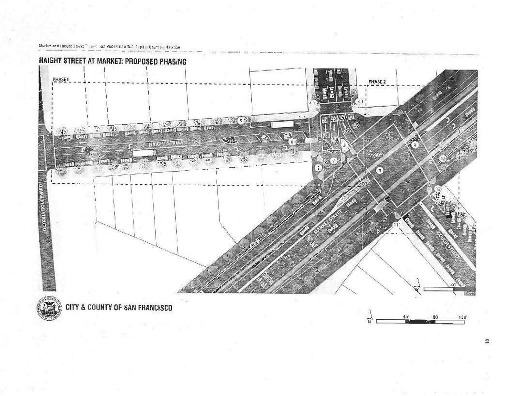
4 PAGE 4. Figure 3. Distribution of Existing Muni Travel Times The Haight Street Transit and Pedestrian Improvement Project aims to address the issues described above through the creation of an east-bound transit-only lane between Laguna and Market streets. This project would give Muni a more direct route in a dedicated transit lane through this congested area, reducing average travel times by one to three minutes and improving reliability. Figure 4 shows the existing configuration of Haight Street, which has one lane in each direction between Laguna Street and Octavia Boulevard, and two westbound lanes between Octavia Boulevard and Gough/Market streets (one left-turn lane and one through lane). Figure 4. Plan View of Existing Lane Configuration of Haight Street

5 PAGE 5. Figure 5 shows the proposed configuration on the block between Laguna Street and Octavia Boulevard, where the project proposes to add the east-bound transit-only lane in the center of the street and restrict left turns from eastbound Haight Street onto northbound Octavia Boulevard. Originally, staff proposed allowing left turns from the transit-only lane, but the proposal was modified to restrict left turns based on community concerns that left-turning vehicles would add congestion and delays for Muni. Figure 5. Plan View of Proposed Improvements between Laguna and Octavia

6 PAGE 6. The proposed configuration between Octavia Boulevard and Gough/Market Street is shown in Figure 6. The project proposed to add a contraflow transit only-lane on the south side of the street. A four-foot wide median island would be built at the western entry to the block to allow for clear DO NOT ENTER EXCEPT MUNI signage to discourage non-muni vehicles from traveling eastbound on this block. The proposal also removes seven metered and seven unregulated parking spaces from the south side of the block. To mitigate the impact of this parking removal, the project will allow residents and business owners on this block face to purchase Area S Residential Parking Permits (RPP), as all the adjacent blocks are currently part of RPP Area S. The original staff proposal for this block retained the parking on the southern block face, which required allowing general traffic to travel eastbound on this block. Community members expressed concerns regarding the potential for vehicles from northbound Octavia to use Haight Street as a clover-leaf to access westbound Market Street. Removing parking on this block was in direct response to the community concerns expressed. The net impact of the parking changes as part of this proposal will be discussed further below. Figure 6. Proposed Improvements between Octavia and Gough

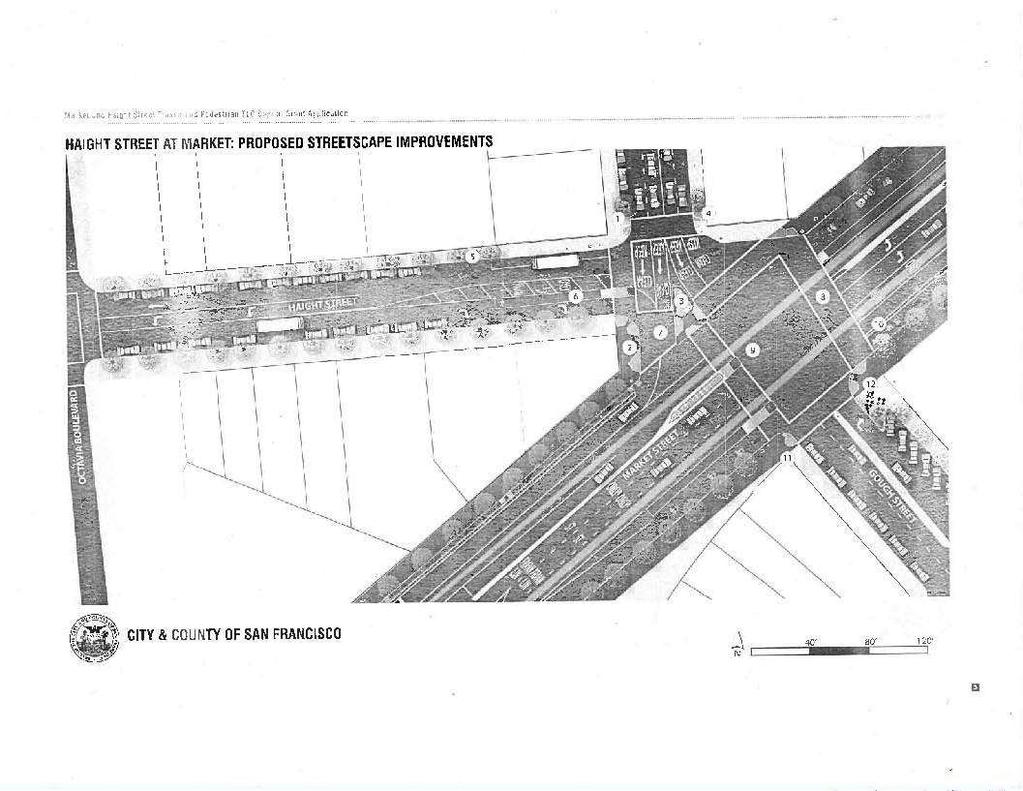
7 PAGE 7. This is a Complete Streets project, meaning it is designed to address the needs of all users: pedestrians, bicyclists, motorists and transit riders. It includes many pedestrian and streetscape improvements, especially at the intersection of Haight, Gough and Market Streets, as shown in Figure 7. The project will include: Pedestrian bulb-outs and widened sidewalks to shorten crossing distances. New countdown pedestrian signals for two crosswalks currently with no pedestrian signals. Realignment of the eastern crosswalk across Market Street to follow the path of travel on Gough Street. Upgraded curb ramps and additional pedestrian refuges for improved pedestrian safety. Improved signal visibility for southbound Gough Street. Converting angled parking on Gough Street between Market Street and Colton Street to back-in angled parking. Figure 7. Proposed Improvements at the Haight/Gough/Market Intersection Red dotted lines indicate relocated curbs. Blue dotted lines indicate relocated crosswalks.

8 PAGE 8. Because Haight Street buses would no longer be traveling on Laguna or Page streets, the existing bus zones would be rescinded on those streets. In addition, the project recommends rescinding the outbound bus zone at Octavia Boulevard due to its close spacing and relatively low ridership compared to the adjacent stops. The current stops are approximately 450 feet and 500 feet apart; removing the stop at Octavia Boulevard would result in a 950-foot stop spacing, which is within the 800 to 1,000 foot spacing recommended in SFMTA s current stop spacing guidelines. These changes are illustrated in Figure 8. Figure 8. Bus Stop Changes

9 PAGE 9. As shown in Figure 9, rescinding the bus zones as well as the red zones installed to allow the 6 and 71 buses to make the turns required under their current, indirect routing will create 20 parking spaces. As described above, the project would remove fourteen parking spaces on the south side of Haight between Gough/Market and Octavia. The two proposed sidewalk bulbs at the Haight/Gough/Market intersection also remove one parking space each. Thus, the net parking change with this project is an increase of four parking spaces within the project area. Figure 9. Parking Impacts This project implements the Market Octavia plan's transit improvements and does not conflict with the recommendations of the Transit Effectiveness Project. The proposal to reroute the inbound 6, 71 and 71L buses to Haight Street was vetted with the community through extensive community meetings held in 2007 and 2008, and public feedback generally supported providing two-way Muni service on Haight Street at that time. In July 2010, the project was awarded a $2.8M Transportation for Livable Communities Grant. Once grant funding was awarded, additional outreach was conducted with the Hayes Valley Neighborhood Association (HVNA) to gather support for the project. In April 2011, the legislation related to the original proposal was continued at a public hearing due to new concerns heard from residents on the block, including the clover leaf concern and the potential for eastbound left-turns adding congestion at Octavia Boulevard as referenced earlier. Community meetings were held in May and June 2011 to develop a refined proposal that addresses their concerns while meeting the goals of the project. Additional outreach was conducted with the HVNA and the Lower Haight Merchants and Neighbors Association (LoHaMNA) in
10 PAGE 10. September 2011, which both supported the refined proposal. An SFMTA public hearing on these changes was held on September 16, The SFMTA mailed 336 public hearing notices, ed 60 addresses on the project list, and posted notices on the affected blocks. The Planning Department also sent notices to their Market-Octavia list. There were a total of 12 speakers in support of the project, including the HVNA, LoHaMNA, Walk SF, the San Francisco Bicycle Coalition, Livable City, and 8 speakers opposed. Prior to the public meeting we had received 4 s in support (including the Transit Riders Union) and 4 s opposed. The supporters were generally in favor of the transit benefits, improved pedestrian safety, and the inclusive community process that was conducted to refine the proposal. The opposition was primarily focused in four areas: Opponents were concerned that the project does not address the chronic congestion caused by traffic accessing Octavia Boulevard and US101. This project is not intended to address that issue; this project aims to reduce Muni travel times and improve pedestrian safety while improving the streetscape. The SFCTA s Central Freeway and Octavia Boulevard Circulation Study is currently studying the congestion issue and developing recommendations. Residents were concerned about the loss of parking on the south side of the Unit Block. However, the project results in a net gain of four parking spaces within the project area. Many of the opponents did not believe that the project would improve transit travel time and reliability. SFMTA s past experience has shown that dedicated travel lanes and more direct routing will reduce transit travel times and improve transit reliability. Opponents were also concerned that the project would decrease safety at the intersection with Market Street due to the addition of the eastbound bus across the intersection, adding a fifth direction of traffic into the intersection. However, there are many intersections along Market Street with five legs of traffic that operate safely. Further, the project improves safety at this intersection through the many pedestrian and streetscaping improvements, as well as the improved signal visibility for southbound Gough Street traffic. If approved, this project would complete conceptual engineering in spring 2012, detailed design in summer 2013 and complete construction in Due to community concerns, staff have committed to conducting a Before and After evaluation and make any necessary adjustments upon completion of the project, as is part of our normal practice. ALTERNATIVES CONSIDERED This alternative was developed through an extensive community process. The original proposal that was taken to Engineering Public Hearing in April 2011 was modified in direct response to community concerns. Alternatives considered but eliminated include: Maintaining current route of 6/71/71L buses this option was eliminated as it does not address the variable travel times and indirect routing of the current routes. Rerouting the 6/71/71L buses to a different street, such as Buchanan this option was eliminated as it would be more indirect than the current route.
11 PAGE 11. Retaining parking on south side of the unit block Haight Street this option was eliminated due to community concerns about potential increased traffic on the Unit block Converting parking to angled parking to create more parking spaces this option was eliminated as there is not adequate roadway width. Modifying access to southbound Octavia Boulevard (e.g. adding turn restrictions) this option was eliminated as it would shift traffic to adjacent streets and would require an extensive area-wide study; the SFCTA s Central Freeway and Octavia Boulevard Circulation Study currently underway is the more appropriate venue for evaluating such options. FUNDING IMPACT This project has already obtained a $2.8M grant from Transportation for Livable Cities (managed by FTA), and has been allocated matching funds from Prop K. The current rough cost estimate for the project is approximately $5.3M. Staff is in the process of developing more refined cost estimates for the project and will pursue additional funding opportunities once the funding gap is determined. The approval of these traffic modifications will allow the conceptual engineering phase to begin, but does not commit the SFMTA to the construction of this project. Staff will return to the SFMTA Board for approval of the construction contract when funds have been identified for the entire project. OTHER APPROVALS RECEIVED OR STILL REQUIRED The Planning Department has reviewed the environmental impacts of this project and prepared an Addendum to the Market and Octavia Neighborhood Plan Environmental Impact Report on March 28, A copy of this Addendum is attached to this Report and is also available in the SFMTA Board Secretary s office. A copy of the Market and Octavia Area Neighborhood Plan EIR is on file with the SFMTA s Board Secretary and is available online at There are no other approvals required. The City Attorney has reviewed this report. RECOMMENDATION That the San Francisco Municipal Transportation Agency Board of Directors approve traffic regulations related to allowing Muni to operate two-way, both eastbound and westbound, on Haight Street between Laguna and Market streets.
12 SAN FRANCISCO MUNICIPAL TRANSPORTATION AGENCY BOARD OF DIRECTORS RESOLUTION No. WHEREAS, The San Francisco Municipal Transportation Agency has received a request, or identified a need for traffic modifications as follows: A. ESTABLISH MUNI ONLY LANE Haight Street, eastbound, from Octavia Boulevard to Gough Street. B. ESTABLISH TOW-AWAY, NO STOPPING ANYTIME Haight Street, south side, from Octavia Boulevard to Gough Street. C. ESTABLISH RESIDENTIAL PERMIT PARKING AREA S - ELIGIBILITY ONLY Unit block of Haight Street, south side. D. ESTABLISH BUS ZONE Haight Street, south side, from 20 feet west of Gough Street to 165 feet west of Gough Street. E. ESTABLISH LEFT LANE MUNI ONLY and ESTABLISH RIGHT LANE MUST TURN RIGHT Haight Street, eastbound, from Laguna Street to Octavia Boulevard. F. ESTABLISH NO LEFT TURN Haight Street, eastbound, at Octavia Boulevard. G. ESTABLISH LEFT LANE MUST TURN LEFT EXCEPT MUNI Haight Street, eastbound, at Laguna Street. H. RESCIND BUS ZONE Laguna Street, east side, from Haight Street to 97 feet northerly; Page Street, south side, from Octavia Boulevard to 80 feet easterly; Page Street, south side, from Franklin Street to 95 feet westerly; Haight Street, north side, from Octavia Boulevard to 80 feet westerly. I. RESCIND METERED PARKING SPACE Gough Street, west side, from Haight Street to 20 feet northerly. J. ESTABLISH BACK-IN ANGLED PARKING, 45 DEGREES Gough Street, east side, between Market Street and Colton Street. K. ESTABLISH CORNER BULB (SIDEWALK EXTENSION) Gough Street, east side, from Market Street to 30 feet southerly, 14-foot sidewalk widening; Gough Street, west side, from Market Street to 20 feet northerly, 6-foot sidewalk widening; Gough Street, west side, between Haight and Market, 6-foot sidewalk widening. L. RESCIND TOW-AWAY, NO STOPPING ANYTIME Laguna Street, east side, from Page Street to 21 feet southerly; Page Street, south side, from Laguna Street to 20 feet easterly.
13 M. RESCIND TOW-AWAY, NO STOPPING 7AM-9AM, MONDAY THROUGH FRIDAY Laguna Street, east side, from Haight Street to 20 feet southerly; Laguna Street, west side, from Haight Street to 20 feet southerly. WHEREAS, SFMTA staff has worked with the San Francisco Planning Department, Department of Public Works and County Transportation Authority on the design and review of these parking and traffic changes; and, WHEREAS, The San Francisco Planning Department has reviewed the project and issued an Addendum to the Final Environmental Impact Report (FEIR) dated March 28, 2011, for Project Title E Market and Octavia Neighborhood Plan; Haight Street Conversion Two-Way; and, and, WHEREAS, A copy of this Addendum is on file with the SFMTA's Board Secretary; WHEREAS, On April 5, 2007, by Motion No the Planning Commission certified the FEIR for the Plan as prepared by the Planning Department in compliance with the California Environmental Quality Act (CEQA), the State CEQA Guidelines and Chapter 31. The FEIR was upheld on appeal by the Board of Supervisors on June 19, On April 5, 2007 by Motion No , the Planning Commission made CEQA findings, including the Statement of Overriding Considerations and the Mitigation Monitoring and Reporting Program and, in separate motions, recommended approval of the Market and Octavia Area Plan to the Board of Supervisors. The Board of Supervisors adopted the CEQA Findings in Planning Commission Motion No and adopted the Market and Octavia Plan in Ordinances Nos , and 72-08; and, WHEREAS, A copy of the FEIR and Planning Commission Motion No is on file with the SFMTA's Board Secretary. The FEIR is available on-line at: and, WHEREAS, Any and all documents referenced in this Resolution may be found in the files of the San Francisco Planning Department, as the custodian of records, at 1650 Mission Street in San Francisco or on file with the SFMTA's Board Secretary at 1 South Van Ness Avenue, 7 th Floor, in San Francisco; and, WHEREAS, The public has been notified about the proposed modifications and has been given the opportunity to comment on those modifications through the public hearing process; now, therefore, be it RESOLVED, In accordance with the provisions of CEQA, the State CEQA Guidelines and Chapter 31, the SFMTA Board has reviewed and considered the information contained in the FEIR as relevant to this approval and the CEQA Findings contained in Planning Commission Motion No as relevant to this approval and finds that the FEIR is adequate for its use as the decision-making body for this Project and hereby adopts and incorporates by reference as though fully set forth herein Motion No , including a statement of overriding
14 considerations and a mitigation monitoring and reporting program; and therefore, be it further RESOLVED, The proposed project as described in the case report and Addendum is consistent with the project as described in the FEIR and approved by the Board of Supervisors and would not result in any significant impacts not identified in the FEIR nor cause significant effects identified in the FEIR to be substantially more severe; and therefore, be it further RESOLVED, The SFMTA Board further finds that since the FEIR was finalized, there have been no substantial project changes and no substantial changes in project circumstances that would require major revisions to the FEIR due to the involvement of new significant environmental effects or an increase in the severity of previously identified significant impacts, and there is no new information of substantial importance that would change the conclusions set forth in the FEIR; and be it further RESOLVED, That the San Francisco Municipal Transportation Agency Board of Directors does hereby approve establishing the traffic modifications set forth in items A-M above to allow Muni to operate two-way, both eastbound and westbound, on Haight Street between Laguna and Market streets; and be it further RESOLVED, That the Sustainable Streets Division shall conduct a Before and After study to monitor the implementation of the project as part of its normal traffic engineering practice. I certify that the foregoing resolution was adopted by the San Francisco Municipal Transportation Agency Board of Directors at its meeting of. Secretary to the Board of Directors San Francisco Municipal Transportation Agency
15 Currently, inbound 6 Parnassus and 71 Haight/Noriega buses operate eastbound on Haight up to Laguna ADDENDUM TO ENVIRONMENTAL IMPACT REPORT Date of Publication of Addendum: March 28, 2011 Date of Certification of Final Environmental Impact Report: April 5, 2007 Lead Agency: Planning Department, City and County of San Francisco 1650 Mission Street, Suite 400, San Francisco, CA Agency Contact Person: Paul Maltzer Telephone: (415) Project Title: E - Market and Octavia Neighborhood Plan; Haight Street Conversion Two-Way Project Sponsor/Contact: Javad Mirabdal, SFMTA Telephone: (415) Project Address: City and County: The project area is located in the central city neighborhoods along Market Street from about 10 th Street on the east to Noe Street on the west, north along the former Central Freeway alignment at Turk Street, and south along Howard and Sixteenth Streets. The project site encompasses about 85 city blocks. San Francisco Remarks: Background A final environmental impact report (EIR) for the Market and Octavia Neighborhood Plan (hereinafter referred to as Plan), file number E, was certified by the Planning Commission on April 5, 2007 and upheld on appeal by the Board of Supervisors on June 19, 2Q07. The project analyzed in the EIR consisted of amendments to the San Francisco Planning Code and Zoning Maps, General Plan, and Western Addition A-2 Redevelopment Plan to establish a new policy framework and new Planning Code and zoning controls for the Market/Octavia area, generally west of the downtown, and including portions of Civic Center, Hayes Valley, Western Addition, South of Market, Inner Mission, the Castro, Duboce Triangle, Eureka Valley and Upper Market Neighborhoods. The Plan proposed a set of land use controls, urban design guidelines, public street and open space improvements, some site specific development proposals, mitigation measures, conditions of approval and community improvement fees and funds for the project area. Subsequent to certification of the EIR, the Market and Octavia Neighborhood Plan was adopted by the Planning Commission on April 5, 2007 and by the Board of Supervisors on October 23, Proposed Revisions to Project The Municipal Transportation Agency is currently proposing revisions to the public Street improvements in the previously adopted Market and Octavia Neighborhood Plan. Specifically, the original Plan analyzed in the EIR did not change existing Muni bus operation for the 6 Parnassus and 71 Haight/Noriega lines on the segments between Laguna Street and Market Street. MTA is now proposing to improve operation of the inbound (eastbound) 6 Parnassus and 71 Haight/Noriega transit routes for the segments between Laguna Street and Market Street, as described more fully below.
16 Street and then make a left turn onto northbound Laguna Street and then a right turn onto eastbound Page Street in order to reach Market Street. Buses then turn left on Market Street and continue towards downtown. The 71L Haight/Noriega buses operate eastbound on Haight up to Laguna Street and then make a right turn onto southbound Laguna to reach Market Street. Buses then turn left on Market Street and continue towards downtown. The eastbound buses on Haight Street are required to turn onto Laguna because Haight Street at Octavia (between Laguna and Market Streets) becomes one-way westbound. The current proposal is to allow Haight Street eastbound buses and bicycles only to continue eastbound across Octavia Street all the way to Market Street. Buses would then turn left onto Market Street and continue towards downtown. All other eastbound traffic on Haight Street, west of Octavia Street, would remain restricted (as at present) to right -or left turns onto Octavia. Local traffic would be allowed to make a right turn from northbound Octavia onto eastbound Haight Street. However, such local traffic on eastbound Haight Street would only be allowed to make a right turn onto Market Street. Only buses and bicycles would be allowed to make the left turn from eastbound Haight Street onto eastbound Market Street. The traffic signal at Gough/Haight/Market Streets would be modified to add a signal phase for eastbound buses and bicyclists on Haight Street. Existing and proposed lane configurations on Haight Street, between Laguna and Gough, are shown in Attachment A. Between Laguna and Octavia, Haight Street would be restriped with one lane westbound and two lanes (right-turn lane and left-turn lane) eastbound. Between Octavia and Gough, Haight Street would be restriped to provide for two-way traffic. There would effectively be three travel lanes on this segment of Haight Street. Both eastbound and westbound traffic would begin the leg with one lane, which would then widen to include a second left-turn only lane as Haight approaches the opposite end of the leg (see Attachment A.) The left-turn only lane on eastbound Haight would only be available for buses and bicycles. In order to accommodate the revised bus routing, existing bus stops would be eliminated on the northeast corner of Laguna/Haight, the southeast corner of Page/Octavia and the southwest corner of Page/Franklin Streets. A new bus boarding island would be built on the southwest corner of Haight/Gough Streets. The bus boarding island would be built between the two eastbound travel lanes, so that bus boarding could occur within a more protected area outside of the right-turn travel lane. As a part of the project proposal, the City is also proposing twelve specific streetscape improvements related to the proposed change in operations along Haight Street and at the intersection of Haight/Gough/Market Streets. Those streetscape improvements, described and diagramed in Attachment B, would include items such as re-striping crosswalks, widening sidewalks, creating a MINI boarding platform, enlarging traffic islands, installation of bike lane separation poles (vertical poles approximately three feet tall inserted along the edge of the bike lane to provide physical separation from the vehicular travel lane) and planting of street trees within the sidewalk. Regarding the streetscape improvements, there would be no change in the number of traffic lanes or vehicle turning movements or operations, beyond those described above related to the conversion to two-way traffic on Haight Street for Muni operations. Section 31.19(c) (1) of the San Francisco Administrative Code states that a modified project must be reevaluated and that, "If, on the basis of such reevaluation, the Environmental Review Officer determines, based on the requirements of CEQA, that no additional environmental review is necessary, this determination and the reasons therefor shall be noted in writing in the case record, and no further evaluation shall be required by this Chapter." Analysis of Potential Environmental Effects The Final EIR completed for the Plan in 2007 included analysis of potential traffic and transit impacts of development and buildout pursuant to the Market/Octavia Plan. Analysis of the current proposal, relative
17 to the environmental impact analysis and conclusions contained in the Final EIR is presented below. Traffic Impacts Potential traffic impact analysis of the current proposal has been completed by the City (Memorandum from Javad Mirabdal, SFMTA, to Bill Wycko, Environmental Review Officer at Planning Department, dated March 2, 2011; on file and available for review at Planning Department.) The March 2, 2011 Memorandum analyzed the current proposal for conversion of a portion of Haight Street from one-way to two-way by re-distributing traffic and buses through the project area intersections as a result of the proposed conversion, and calculating the resulting Level of Service impacts to the existing street intersections for both existing and future (year 2025) traffic and transit levels. The results and conclusions from that analysis are presented below. The analysis determined that the only intersection that would experience a potential change in traffic impacts as a result of the proposed project would be the intersection of Haight/Gough/Market Streets. The analysis first calculated existing conditions [intersection delay and traffic levels of service (LOS)] for that intersection for both the AM Peak and PM Peak hours. The analysis then calculated intersection delay and LOS impacts of the proposed project relative to existing conditions. Lastly, the analysis calculated future (year 2025) intersection delay and PM Peak LOS, both with and without the proposed project. Results of that analysis are presented in the Table below. Traffic Impacts - Intersection of Haight/Gough/Market Scenario Intersection LOS Intersection Delay Existing AM B 18.3 Seconds Existing PM B 19.6 Seconds Proposed Project AM C 23.7 Seconds Proposed Project PM C 24.3 Seconds 2025 PM Without Project C 25.7 Seconds 2025 PM With Project C 26.8 Seconds Hence, the analysis indicates that if the proposed project is implemented, the intersection of Haight/Gough/Market Street would operate at LOS C, both at present and in the future.
18 The same intersection was also analyzed for potential traffic impacts within the Market & Octavia Neighborhood Plan EIR. The EIR looked at potential traffic conditions for Year 2025, both with and without Plan buildout, and determined that the intersection of Haight/Gough/Market would operate at LOS D under either scenario. A separate proposal for conversion of Hayes and Fell Streets from one-way to two-way operation between Franklin and Van Ness is several blocks away from the Haight Street proposal analyzed in this document and is expected to have little or no effect on traffic in the area of Haight/Gough/Market Streets. Additionally, the proposed conversion from one-way to two-way at Hayes and Fell Streets was generally found to have beneficial traffic impacts in the project vicinity. ( E - Market and Octavia Neighborhood Plan; Hayes & Fell Two-Way Addendum, December 16, 2010; on file and available for review at Planning Department.) Hence, the potential traffic impacts of the proposed conversion of Haight Street to two-way operation for MLTNI between Octavia and Market Streets would be within the scope of traffic impacts and conclusions previously disclosed in the EIR. The proposed project would result in no new significant impacts, nor would it substantially increase any traffic impacts previously disclosed in the EIR. Transit Impacts Transit impact analysis in the March 2, 2011 Memorandum concluded that transit operation between Haight/Laguna and Haight/Gough/Market is expected to improve by three to five minutes due to shortening of routes, elimination of turns and reduction in the number of stops. However, given the additional traffic signal turning movement to allow eastbound buses from Haight Street onto Market Street, there would be some adverse impact to transit operation on Market Street. In order to determine the extent of impact on transit operation along Market Street, eastbound (EB) and westbound (WB), the Memorandum analyzed existing conditions as well as project impacts and future conditions with and without the project, for both AM and PM Peak hours. The results of that analysis are presented in the Table below. Transit Operation on Market Street -Existing, Proposed and Future (Year 2025) [Level of Service (LOS) and Delay (in seconds, Market Street Approach) EB Market AM EB Market PM WB Market AM WB Market PM Existing B (16.1 see) C (18.1 see) B (12.6 see) B (19.9 see) Existing plus project B (26.4 see) C (24.3 see) B (19,3 see) C (27.3 see) Future w/o project Not analyzed C (24.7 see) Not analyzed C (31.1 see) Future w/ project Not analyzed C (25.2 see) Not analyzed C (32.7 see) Hence, the conclusion of the Memorandum was that there would be a slight adverse impact (from LOS B to LOS C) to existing westbound transit operation on Market. This impact would be minimized to the extent possible by making the left turn traffic signal for buses from eastbound Haight Street onto eastbound Market actuated (i.e., signal would not turn green unless a bus was present to activate the turn signal.) The overall conclusion of the Memorandum was that, given the great reduction in transit operation time along Haight Street, relative to the slight degradation in transit operation on westbound Market Street at this intersection approach, the net transit impact would be positive. The Market and Octavia Neighborhood Plan EIR analysis of transit impacts from the proposed plan included Muni Screenline analysis, Muni Corridor analysis and peak hour capacity utilization. The EIR concluded that development and buildout pursuant to the Plan would not have a significant adverse impact on Muni operations with respect to any of these parameters. Given that the proposed project is expected to have a net positive impact on Muni operation and is not expected to otherwise affect development in the
19 Plan area, there would be no new significant impacts from the proposed project. Similarly, the proposed project would not substantially increase any impacts previously disclosed in the EIR. Parking, Pedestrian and Bicycle Impacts Regarding parking impacts, the project would result in the loss of four spaces on the south side of Haight Street just west of Gough, due to the construction of a bus boarding island. The project would also result in the loss of one parking space on Gough at Haight and one space on Gough at Market due to sidewalk bulbouts as part of the streetscape improvements. Conversely, the elimination of three existing bus stops at Laguna/Haight, Page/Octavia and Page/Franklin would result in an increase of 12 on-street parking spaces. Hence, the project would result in a net increase of six parking spaces in the project vicinity. Regarding pedestrian and bicycle impacts, the streetscape improvements component of the proposed project is expected to improve pedestrian and bicycle circulation and safety. As there would be no resulting loss of traffic capacity or change in traffic circulation (beyond that already described and analyzed above as part of the Haight two-way conversion component) the overall effect of the proposed project would be a beneficial impact with respect to parking supply, as well as existing pedestrian and bicycle conditions. Other Impacts While the proposed project modification would result in changed traffic and transit movement within the project area, and some change to sidewalk widths, pedestrian islands, crosswalk locations and Muni boarding locations, relative to the original Plan proposal, the modification would cause no other physical change in the environment. As such, the current proposal has the potential to change traffic and transit impacts within the project area, as described above. To the extent that traffic conditions would remain unchanged from those forecast in the EIR, no change is anticipated in terms of air quality impacts from the currently proposed modifications, relative to the impacts described in the Final EIR. While eight new historic districts (analyzed in Addendum, dated August 12, 2009) and new Upper Market Design Guidelines (analyzed in Memorandum to File, dated October 16, 2008) have been recognized within the project area, the proposed modification to transit operation on this short segment of Haight Street is expected to have no influence on demolition or new development potential in the project area, and therefore no potential adverse effect on historic resources or urban design. The proposed modification is expected to result in no change in population, visual quality, shadow and wind, noise, hazardous materials, geology, public facilities or any other environmental impact topics, relative to the discussion and analysis in the Final EIR. Conclusion Based on the foregoing, it is concluded that the analyses conducted and the conclusions reached in the final EIR certified on April 5, 2007, remain valid. The proposed revisions to the project would cause no new significant impacts beyond those previously identified in the EIR, would not increase the severity of significant impacts previously identified in the EIR, and no new mitigation measures would be necessary to reduce significant impacts. The EIR for the Plan was certified in 2007 and little new development has occurred in the project area subsequent to said EIR certification. Development that has occurred since EIR certification has been consistent with the Plan. While eight new historic districts and new Upper Market Design Guidelines have been recognized within the project area subsequent to completion of the Final EIR, the proposed modification to transit operation on this short segment of Haight Street would have no impact on historic resources or the Upper Market Design Guidelines. As such, no changes have occurred with respect to circumstances surrounding the proposed project that would cause significant environmental impacts to which the project would contribute considerably, and no new information has become available that shows that the project would cause significant environmental impacts. Therefore, no supplemental
20 environmental review is required beyond this Addendum. Date of Determination: I do hereby certify that the above determination has been made pursuant to State and Local requirements. March 28, 2011 BILL WYCKO Environmental Review Officer cc: Distribution List Vima Byrd, Master Decision File/Bulletin Board
21 ATTACHMENT A Existing and Proposed Traffic Circulation - Haight Street Between Laguna and Gough
22 Existing Traffic Circulation between Laguna Street and Octavia Boulevard
23 Proposed Traffic Circulation between Laguna Street and Octavia Boulevard
24 Existing Traffic Circulation between Octavia Boulevard and Gough/Market Streets
25 Proposed Traffic Circulation between Octavia Boulevard and Gough/Market Streets
26 ATTACHMENT B STREETSCAPE IMPROVEMENTS DIAGRAM AND KEY 1. Gough & Haight: Northwest corner Improvement: Bulb-out into parking lane, approximately 6 Design Intent: Make pedestrians waiting to cross more visible to traffic in Gough St. Allow more room for those waiting for bus. 2. Gough between Haight and Market Improvement: Widen sidewalk approximately 6 Design Intent: Reduce crossing distance for pedestrians. Reclaim excess roadway width on Gough St. 3. Gough & Market: Traffic Island Improvement: Expand traffic island approximately 6 to the west into Gough St. and 5 to the north on Haight St. Design Intent: Reduce crossing distance and create larger refuge for pedestrians. 4. Haight Street between Gough and Market Improvement: Redesign existing curb ramp for ADA compatibility Design Intent: Improve access to crosswalk. 5. Haight Street between Gough and Octavia Improvement: In-fill street tree planting Design Intent: Greening and beautification 6. Haight Street Boarding Island (new) Improvement: 8 wide and 80 long boarding island on Haight St. at Market St. Intent: Create a boarding area for Haight St. bus at Market St. 7. Market Street & Haight Street: Crosswalk to traffic island Improvement: Restripe crosswalk with funnel shape toward traffic island Design Intent: Accommodate desired paths of travel for pedestrians crossing Market Street from the southwest corner of Haight/Gough 8. Market Street: Crosswalk from southeast corner of Gough to northeast corner Improvement: Move crosswalk approximately 30 west to align with sidewalk on Gough St. south of Market St. Remove existing curb cuts and restore sidewalk. Expand Muni boarding island and median to meet the realigned crosswalk. Design Intent: Physically reduce size of intersection Make pedestrians crossing Market more visible to vehicles turning from Gough St. Align crosswalk with pedestrian path of travel along Gough St. 9. Market Street: Medians/Boarding Islands: Improvement: Where it does not impede turn movements, extend all medians/boarding islands into the cross-walk with pedestrian refuges. Design Intent: Increase pedestrian safety and visually reduce size of intersection
27 10. Market Street: Bike Lanes Improvement: Add safe hit poles to bike lanes Design Intent: Increased safety for bicyclists 11. Gough & Market: Southwest corner Improvement: Redesign existing curb ramp for ADA compatibility Design Intent: Improve access to crosswalk 12. Gough & Market: Southeast corner Improvement: Sidewalk bulb-out into Gough St. the length of one diagonal parking space Design Intent: Reduce crossing distance for pedestrians; utilize excess traffic lane width for pedestrian/café seating and amenities
28
29
30
SAN FRANCISCO MUNICIPAL TRANSPORTATION AGENCY
 THIS PRINT COVERS CALENDAR ITEM NO.: 10.2 DIVISION: Sustainable Streets BRIEF DESCRIPTION: SAN FRANCISCO MUNICIPAL TRANSPORTATION AGENCY Approving various routine parking and traffic modifications. SUMMARY:
SAN FRANCISCO MUNICIPAL TRANSPORTATION AGENCY
 THIS PRINT COVERS CALENDAR ITEM NO. : 10.5 DIVISION: Sustainable Streets BRIEF DESCRIPTION: SAN FRANCISCO MUNICIPAL TRANSPORTATION AGENCY SUMMARY: The South Van Ness and Mission Intersection Improvements
SAN FRANCISCO MUNICIPAL TRANSPORTATION AGENCY
 THIS PRINT COVERS CALENDAR ITEM NO.: 10.3 DIVISION: Sustainable Streets BRIEF DESCRIPTION: SAN FRANCISCO MUNICIPAL TRANSPORTATION AGENCY Approving various traffic and parking modifications on Bay Street
SAN FRANCISCO MUNICIPAL TRANSPORTATION AGENCY
 THIS PRINT COVERS CALENDAR ITEM NO: 10.2 DIVISION: Sustainable Streets BRIEF DESCRIPTION: SAN FRANCISCO MUNICIPAL TRANSPORTATION AGENCY Approving various routine parking and traffic modifications. SUMMARY:
SAN FRANCISCO MUNICIPAL TRANSPORTATION AGENCY
 THIS PRINT COVERS CALENDAR ITEM NO.: 11 DIVISION: Transit Services BRIEF DESCRIPTION: SAN FRANCISCO MUNICIPAL TRANSPORTATION AGENCY Approving the installation of traffic and parking modifications along
SAN FRANCISCO MUNICIPAL TRANSPORTATION AGENCY
 THIS PRINT COVERS CALENDAR ITEM NO. : 10.3 DIVISION: Sustainable Streets Division BRIEF DESCRIPTION: SAN FRANCISCO MUNICIPAL TRANSPORTATION AGENCY Approving traffic and parking modifications to install
Addendum to Mitigated Negative Declaration
 Addendum Date: Case No.: 2014.1499E Project Title: (MDSP) - Mission Valencia Green Gateway Streetscape Project Original: 2008.1075, MDSP Mitigated Negative Declaration Project Sponsor: Charlie Ream, San
SAN FRANCISCO MUNICIPAL TRANSPORTATION AGENCY
 THIS PRINT COVERS CALENDAR ITEM NO. : 10.2 DIVISION: Sustainable Streets BRIEF DESCRIPTION: SAN FRANCISCO MUNICIPAL TRANSPORTATION AGENCY Approving various parking and traffic modifications on Herbst Road
SAN FRANCISCO MUNICIPAL TRANSPORTATION AGENCY
 THIS PRINT COVERS CALENDAR ITEM NO. : 11 DIVISION: Sustainable Streets BRIEF DESCRIPTION: SAN FRANCISCO MUNICIPAL TRANSPORTATION AGENCY Approving traffic modifications on Twin Peaks Boulevard between Christmas
SAN FRANCISCO MUNICIPAL TRANSPORTATION AGENCY
 THIS PRINT COVERS CALENDAR ITEM NO. : 11 DIVISION: Transit BRIEF DESCRIPTION: SAN FRANCISCO MUNICIPAL TRANSPORTATION AGENCY Approving parking and traffic modifications on San Bruno Avenue included in the
SAN FRANCISCO MUNICIPAL TRANSPORTATION AGENCY
 THIS PRINT COVERS CALENDAR ITEM NO.: 10.2 SAN FRANCISCO MUNICIPAL TRANSPORTATION AGENCY DIVISION: Sustainable Streets BRIEF DESCRIPTION: Approving various routine parking and traffic modifications. SUMMARY:
SAN FRANCISCO MUNICIPAL TRANSPORTATION AGENCY
 THIS PRINT COVERS CALENDAR ITEM NO. : 10.2 DIVISION: Sustainable Streets BRIEF DESCRIPTION: SAN FRANCISCO MUNICIPAL TRANSPORTATION AGENCY Adopting Conceptual Proposal for Streetscape Improvements to Broadway,
SAN FRANCISCO MUNICIPAL TRANSPORTATION AGENCY
 THIS PRINT COVERS CALENDAR ITEM NO.: 12 DIVISION: Transit BRIEF DESCRIPTION: SAN FRANCISCO MUNICIPAL TRANSPORTATION AGENCY Approving parking and traffic modifications along the 30 Stockton Muni transit
SAN FRANCISCO MUNICIPAL TRANSPORTATION AGENCY
 THIS PRINT COVERS CALENDAR ITEM NO. : 12 DIVISION: Sustainable Streets BRIEF DESCRIPTION: SAN FRANCISCO MUNICIPAL TRANSPORTATION AGENCY Approving various bicycle improvements and traffic modifications
Project Goal and Description. Why Broadway? Broadway SFMTA.COM/BROADWAY. The goal of the Broadway Safety Improvement
 PROJECT OVERVIEW Project Goal and Description The goal of the Broadway Safety Improvement d St Van Ness Ave Project is to improve safety and comfort for all who Franklin St Hyde St Octavia St Gough St
BD RESOLUTION NO RESOLUTION ADOPTING THE VISION ZERO RAMP INTERSECTION STUDY PHASE 1
 BD00 RESOLUTION NO. - RESOLUTION ADOPTING THE VISION ZERO RAMP INTERSECTION STUDY PHASE [NTIP PLANNING] FINAL REPORT WHEREAS, The Vision Zero Ramp Intersection Study Phase was recommended by Commissioner
Station 1: Street & Sidewalk Upgrades
 Station 1: Street & Sidewalk Upgrades Existing no left turn; Potential left turn arrow, see Circulation Study boards for more information Thru-lane guidance Improved lead-in green bike lane 17TH ST CASTRO
Upper Market Street Bike Lane Project
 Upper Market Street Bike Lane Project 17th Street to Octavia Boulevard 6 30 2010 SAN FRANCISCO, CALIFORNIA Agenda San Francisco & Sustainable Transportation Project Goals Outreach & Coordination Project
SAN FRANCISCO MUNICIPAL TRANSPORTATION AGENCY
 THIS PRINT COVERS CALENDAR ITEM NO.: 13 DIVISION: Sustainable Streets BRIEF DESCRIPTION: SAN FRANCISCO MUNICIPAL TRANSPORTATION AGENCY Endorsing the Planning Department s 2014 Update to the conceptual
SAN FRANCISCO MUNICIPAL TRANSPORTATION AGENCY
 THIS PRINT COVERS CALENDAR ITEM NO. : 12 DIVISION: Sustainable Streets BRIEF DESCRIPTION: SAN FRANCISCO MUNICIPAL TRANSPORTATION AGENCY Approving the traffic modifications associated with the Dolores Street
SAN FRANCISCO MUNICIPAL TRANSPORTATION AGENCY BOARD OF DIRECTORS. RESOLUTION No
 SAN FRANCISCO MUNICIPAL TRANSPORTATION AGENCY BOARD OF DIRECTORS RESOLUTION No. 15-031 WHEREAS, Transportation Code Division II, Section 909 authorizes the Director of Transportation to install and permit
Mission Bay Loop (MBL) Public Meeting
 Public Meeting") Mission Bay Loop (MBL) Public Meeting La Scuola Internazionale di San Francisco, November 18, 2014 Frequently Asked Questions 1. When would construction have to start before the SFMTA loses TIGER funds?
Mission Bay Loop (MBL) Public Meeting La Scuola Internazionale di San Francisco, November 18, 2014 Frequently Asked Questions 1. When would construction have to start before the SFMTA loses TIGER funds?
Community Advisory Committee of Market and Octavia Area Plan City and County of San Francisco. Meeting Minutes
 Community Advisory Committee of Market and Octavia Area Plan City and County of San Francisco Meeting Minutes Monday, November 17, 7:00 PM Regular Meeting Committee Members Present: Jason Henderson, Robin
Caltrans Sloat Boulevard Pedestrian Safety Project Response to Community Questions, Comments & Concerns
 Caltrans Sloat Boulevard Pedestrian Safety Project Response to Community Questions, Comments & Concerns Revised: May 10, 2016 The California Department of Transportation (Caltrans) is planning various
May 20, 2016 PUBLIC HEARING RESULTS
 The Sustainable Streets Division of the San Francisco Municipal Transportation Agency held a public hearing on Friday,, at 10:00 AM, in Room 416 (Hearing Room 4), City Hall, 1 Dr. Carlton B. Goodlett Place,
SAN FRANCISCO MUNICIPAL TRANSPORTATION AGENCY Order # 5194 FOR PUBLIC HEARING
 The Sustainable Streets Division of the San Francisco Municipal Transportation Agency will hold a public hearing on Friday, December 6, 2013, at 10:00 AM, in Room 416 (Hearing Room 4), City Hall, 1 Dr.
4. ENVIRONMENTAL IMPACT ANALYSIS 9. TRANSPORTATION AND TRAFFIC
 4. ENVIRONMENTAL IMPACT ANALYSIS 9. TRANSPORTATION AND TRAFFIC 4.9.1 INTRODUCTION The following section addresses the Proposed Project s impact on transportation and traffic based on the Traffic Study
Central Freeway and Octavia Circulation Study
 Central Freeway and Octavia Circulation Study Final Report Plans and Programs Committee San Francisco County Transportation Authority September 18, 2012 Presentation Outline Background and Study Purpose
Freeway ramp intersection study
 Freeway ramp intersection study Supporting Vision Zero: Zero traffic deaths in San Francisco by 2024 Study Goals: Primary Improve Safety Improve Accessibility Secondary Provide Efficient Circulation Accommodate
TRAFFIC IMPACT ANALYSIS
 TRAFFIC IMPACT ANALYSIS FOR THE CHAMPAIGN UNIT#4 SCHOOL DISTRICT PROPOSED HIGH SCHOOL (SPALDING PARK SITE) IN THE CITY OF CHAMPAIGN Final Report Champaign Urbana Urbanized Area Transportation Study 6/24/2014
Summary: Mercer County Princeton Avenue & Spruce Street Study January 2009
 Summary: Several recent studies have assessed potential development and redevelopment opportunities in the Mercer Crossing area of Trenton, Ewing, and Lawrence. This Princeton Avenue and Spruce Street
SAN FRANCISCO MUNICIPAL TRANSPORTATION AGENCY
 THIS PRINT COVERS CALENDAR ITEM NO. : 8 DIVISION: Sustainable Streets BRIEF DESCRIPTION: SAN FRANCISCO MUNICIPAL TRANSPORTATION AGENCY Approving traffic and parking modifications to implement seven projects
Shockoe Bottom Preliminary Traffic and Parking Analysis
 Shockoe Bottom Preliminary Traffic and Parking Analysis Richmond, Virginia August 14, 2013 Prepared For City of Richmond Department of Public Works Prepared By 1001 Boulders Pkwy Suite 300, Richmond, VA
Welcome! Thank you for joining us today for a Geary Rapid project open house. Geary Rapid Project. SFMTA.com/GearyRapid
 Welcome! Thank you for joining us today for a Geary Rapid project open house. Get the most out of this event: 1. Sign in and get your feedback sheet 2. Visit project information stations hosted by project
MEMORANDUM. Charlotte Fleetwood, Transportation Planner
 MEMORANDUM Date: Updated August 22, 2017 To: Organization: Charlotte Fleetwood, Transportation Planner Boston Transportation Department From: Jason DeGray, P.E., PTOE, Regional Director of Engineering
SAN FRANCISCO MUNICIPAL TRANSPORTATION AGENCY Order # 5883 FOR PUBLIC HEARING
 The Sustainable Streets Division of the San Francisco Municipal Transportation Agency will hold a public hearing on Friday, March 2, 2018, at 10:00 AM, in Room 416 (Hearing Room 4), City Hall, 1 Dr. Carlton
3.0 PROJECT DESCRIPTION
 The following section of the Draft EIR contains a description of the proposed Elk Grove Boulevard/SR 99 Interchange Modification project, consistent with the requirements of CEQA Guidelines Section 15124.
Mission-Geneva Transportation Study Community Workshop 2 July 8, 2006
 Community Workshop 2 July 8, 2006 Small Group Workbook 1 Basic Improvements on Mission Street Streetscape. Pedestrian-scale lighting; landscaping; community art on utility boxes; more (possibly unique)
SAN FRANCISCO MUNICIPAL TRANSPORTATION AGENCY
 THIS PRINT COVERS CALENDAR ITEM NO.: 13 DIVISION: Sustainable Streets BRIEF DESCRIPTION: SAN FRANCISCO MUNICIPAL TRANSPORTATION AGENCY Approving traffic and parking modifications on Taylor Street from
C C C
 C-012-001 Thank you for your support for the creation of new public space and nonmotorized access between downtown and the waterfront through the Overlook Walk, the East-West Connections, and the Promenade.
Polk Streetscape Project
 What is this project? The Polk Streetscape Project is an effort to improve safety for everyone traveling on Polk Street between Union and McAllister streets. Also included in this project are paving, sewer
Outreach Approach RENEW SF served as the primary liaison with the North Beach community; the Chinatown. Executive Summary
 Executive Summary Executive Summary The Columbus Avenue Neighborhood Transportation Study s objective is to identify changes to transportation infrastructure and policies that could enhance the livability
Better Market Street Project Update. Urban Forestry Council September 17, 2014
 Better Market Street Project Update Urban Forestry Council September 17, 2014 Project Area Limits Better Market Street Schedule Market Street City s busiest transit corridor Over 85 buses per hour 14 surface
Geary Corridor Bus Rapid Transit SFMTA Citizens Advisory Committee
 Geary Corridor Bus Rapid Transit SFMTA Citizens Advisory Committee Project Update SAN FRANCISCO COUNTY TRANSPORTATION AUTHORITY SAN FRANCISCO MUNICIPAL TRANSPORTATION AGENCY August 6, 2015 Project Overview
Complete Street Analysis of a Road Diet: Orange Grove Boulevard, Pasadena, CA
 Complete Street Analysis of a Road Diet: Orange Grove Boulevard, Pasadena, CA Aaron Elias, Bill Cisco Abstract As part of evaluating the feasibility of a road diet on Orange Grove Boulevard in Pasadena,
Exhibit 1 PLANNING COMMISSION AGENDA ITEM
 Exhibit 1 PLANNING COMMISSION AGENDA ITEM Project Name: Grand Junction Circulation Plan Grand Junction Complete Streets Policy Applicant: City of Grand Junction Representative: David Thornton Address:
TRAFFIC IMPACT STUDY CRITERIA
 Chapter 6 - TRAFFIC IMPACT STUDY CRITERIA 6.1 GENERAL PROVISIONS 6.1.1. Purpose: The purpose of this document is to outline a standard format for preparing a traffic impact study in the City of Steamboat
FOLSOM-HOWARD STREETSCAPE OVERVIEW
 FOLSOM-HOWARD STREETSCAPE OVERVIEW SoMa residents should have the same kinds of amenities that other neighborhoods have. The Folsom- Howard Streetscape Project will make SoMa more livable by making it
Geary Corridor Bus Rapid Transit
 Geary Corridor Bus Rapid Transit Near-term Improvements Update SAN FRANCISCO COUNTY TRANSPORTATION AUTHORITY SAN FRANCISCO MUNICIPAL TRANSPORTATION AGENCY Phasing Packages Phase 1 Near-term: Delivers project
Memorandum. Fund Allocation Fund Programming Policy/Legislation Plan/Study Capital Project Oversight/Delivery Budget/Finance Contract/Agreement Other:
 Memorandum Date: November 20, 2017 To: Transportation Authority Board From: Eric Cordoba Deputy Director Capital Projects Subject: 12/5/17 Board Meeting: San Francisco Freeway Corridor Management Study
East 12 th Street Bikeway Feasibility Study
 Final Report East 12 th Street Bikeway Feasibility Study Prepared for: City of Oakland Public Works Agency Submitted by: 180 Grand Avenue, Suite 250 Oakland, CA 94612 Phone: (510) 839-1742; Fax: (510)
ALLEY 24 TRAFFIC STUDY
 ALLEY 24 TRAFFIC STUDY in City of Frostburg, Maryland January 2013 3566 Teays Valley Road Hurricane, WV Office: (304) 397-5508 www.denniscorporation.com Alley 24 Traffic Study January 2013 Frostburg, Maryland
25th Avenue Road Diet Project A One Year Evaluation. Transportation Fund for Clean Air Project #05R07
 25th Avenue Road Diet Project A One Year Evaluation Transportation Fund for Clean Air Project #05R07 Submitted by: The San Francisco Municipal Transportation Agency Dan Provence May 22, 2009 EXECUTIVE
San Francisco County Transportation Authority Proposition K Sales Tax Program Allocation Request Form
 FY of Allocation Action: 2006/07 Project Name: Implementing Agency: Market Street Bike Lane, Octavia Boulevard to 17th Street Department of Parking and Traffic Category: Subcategory: EXPENDITURE PLAN INFORMATION
1.0 INTRODUCTION 1.1 PURPOSE OF THIS REPORT
 1.0 INTRODUCTION This chapter provides an overview of the purpose, authorization and focus of this Recirculated Draft Environmental Impact Report (EIR), an identification of the Lead Agency, an outline
Chapter 3: Multi-Modal Circulation and Streetscapes
 CHAPTER 3: MULTI-MODAL CIRCULATION AND STREETSCAPES Chapter 3: Multi-Modal Circulation and Streetscapes Overview Streetscape improvements have already been completed for Depot Street between Main Avenue
CITY OF LOS ANGELES INTER-DEPARTMENTAL MEMORANDUM
 CITY OF LOS ANGELES INTER-DEPARTMENTAL MEMORANDUM Date: April 1, 219 To: Honorable City Council c/o City Clerk, Room 395, City Hall Attention: Honorable Mike Bonin, Chair, Transportation Committee From:
Item Description: Presentation and Discussion: Berkeley Rapid Transit Locally Preferred Alternative
 Office of the City Manager Meeting Date: April 29, 2010 Item Number: 1 Item Description: Presentation and Discussion: Berkeley Rapid Transit Locally Preferred Alternative Staff report, resolution, and
Road Alterations - Wellington Street East, Church Street, and Front Street Intersection
 REPORT FOR ACTION Road Alterations - Wellington Street, Church Street, and Front Street Intersection Date: November 1, 2016 To: Toronto and York Community Council From: Director, Public Realm Section,
Princeton Avenue and Spruce Street Transportation and Site Access Enhancements Project
 Princeton Avenue and Spruce Street Transportation and Site Access Enhancements Project Mercer County Planning Division AECOM Transportation (formerly DMJM Harris) January 29, 2009 Agenda Project Status
Memorandum. Sunday, July 13, Saturday, July 19, 2014
 Memorandum To: David Lowin, Brooklyn Bridge Park Corporation From: Daniel Schack, AICP, PTP Date: Re: Brooklyn Bridge Park Pier 5/6 Loop Road Traffic Study Project No: 14-01-2407 At the request of Brooklyn
Pedestrian and Bicycle Conditions
 Pedestrian and Bicycle Conditions Geary Citizens Advisory Committee May 8, 2014 SAN FRANCISCO COUNTY TRANSPORTATION AUTHORITY SAN FRANCISCO MUNICIPAL TRANSPORTATION AGENCY Topics Pedestrian Conditions
San Jose Transportation Policy
 San Jose Transportation Policy Protected Intersections in LOS Policies to Support Smart Growth Presented by: Manuel Pineda City of San Jose Department of Transportation Bay Area Map San Francisco Oakland
2. NORTEL CARLING CAMPUS EXPANSION - PROPOSED MODIFICATIONS TO MOODIE DRIVE (REGIONAL ROAD 59) AND HIGHWAY 417 INTERCHANGE
 AND HIGHWAY 417 INTERCHANGE") 2. NORTEL CARLING CAMPUS EXPANSION - PROPOSED MODIFICATIONS TO MOODIE DRIVE (REGIONAL ROAD 59) AND HIGHWAY 417 INTERCHANGE COMMITTEE RECOMMENDATIONS AS AMENDED That Council approve: 1. The endorsement
2. NORTEL CARLING CAMPUS EXPANSION - PROPOSED MODIFICATIONS TO MOODIE DRIVE (REGIONAL ROAD 59) AND HIGHWAY 417 INTERCHANGE COMMITTEE RECOMMENDATIONS AS AMENDED That Council approve: 1. The endorsement
MARKET STREET STUDY TECHNICAL REPORT
 MARKET STREET STUDY TECHNICAL REPORT BICYCLE LANES BETWEEN EIGHTH and OCTAVIA STREETS This technical report is one of over a dozen reports prepared to support the Market Street Study. The purpose of the
David DiPierro, John Amberson. Steering Committee Meeting #4 Overview
 IBI GROUP 18401 Von Karman Avenue Suite 110 Irvine CA 92612 USA tel 949 833 5588 fax 949 833 5511 ibigroup.com Memorandum To/Attention Steering Committee Members Date February 17, 2016 From IBI Group Project
Welcome. If you have any questions or comments on the project, please contact:
 Welcome This drop-in public open house is intended to provide information about the Bay Street bike lanes project. This project proposes a dedicated cycling facility along Bay Street between Aberdeen Avenue
June 29, Dear Mr. Walter:
 From: CountyBoard@arlingtonva.us To: chickandsandy@msn.com Subject: County Board Response Regarding the Arlington Ridge Road Improvement Project (Intranet Quorum IMA00252707) Date: Wed, 29 Jun 2011 08:09:53-0400
Draft Planning Commission
 Exhibit E Draft Planning Commission Resolution No. General Plan Amendment HEARING DATE: MAY 16, 2013 Date: May 9, 2013 Case No.: 2011.0397 M Project Address: General Plan Amendments to Bicycle Policies
Corpus Christi Metropolitan Transportation Plan Fiscal Year Introduction:
 Introduction: The Safe, Accountable, Flexible, Efficient Transportation Equity Act: A Legacy for Users (SAFETEA-LU) has continued the efforts started through the Intermodal Surface Transportation Efficiency
SAN FRANCISCO MUNICIPAL TRANSPORTATION AGENCY Order # 5068 FOR PUBLIC HEARING
 The Sustainable Streets Division of the San Francisco Municipal Transportation Agency will hold a public hearing on Friday, March 8, 2013, at 10:00 AM, in Room 416 (Hearing Room 4), City Hall, 1 Dr. Carlton
Co-ordinator Transportation Committee. Director, Mobility Services and Corporate Fleet Services Environment and Transportation Department
 28 REGIONAL MUNICIPALITY OF OTTAWA-CARLETON MUNICIPALITÉ RÉGIONALE D OTTAWA-CARLETON REPORT RAPPORT Our File/N/Réf. Your File/V/Réf. 25 23-97-R016 DATE 15 April 1997 TO/DEST. FROM/EXP. SUBJECT/OBJET Co-ordinator
ALTERNATIVES SCREENING REPORT
 VAN NESS AVENUE BUS RAPID TRANSIT (BRT) ALTERNATIVES SCREENING REPORT Revised Draft, 3/28/08 San Francisco County Transportation Authority 1 Introduction The San Francisco County Transportation Authority
CITY OF OTTAWA ROADWAY MODIFICATION APPROVAL UNDER DELEGATED AUTHORITY
 RMA-2015-ATM-038 CITY OF OTTAWA ROADWAY MODIFICATION APPROVAL UNDER DELEGATED AUTHORITY DATE: April 22, 2015 SUBJECT Approval of Roadway Modifications Recommended through an Area Traffic Management Study
CITY OF OAKLAND. 27th Street Bikeway Feasibility and Design. Final Report (v3) March 23, Kimley-Horn and Associates, Inc.
 March 23, Kimley-Horn and Associates, Inc.") CITY OF OAKLAND 27th Street Bikeway Feasibility and Design Final Report (v3) March 23, 2007 PREPARED BY: Kimley-Horn and Associates, Inc. Table of Contents 1. Introduction 3 2. 27 th Street/Bay Place Corridor
CITY OF OAKLAND 27th Street Bikeway Feasibility and Design Final Report (v3) March 23, 2007 PREPARED BY: Kimley-Horn and Associates, Inc. Table of Contents 1. Introduction 3 2. 27 th Street/Bay Place Corridor
CURBSIDE ACTIVITY DESIGN
 5 CURBSIDE ACTIVITY DESIGN This chapter provides design guidance for separated bike lanes adjacent to curbside activities including parking, loading and bus stops. Typical configurations are presented
Better Market Street. Engineering, Maintenance & Safety Committee (EMSC) February 28, 2018
 February 28, 2018") Better Market Street Engineering, Maintenance & Safety Committee (EMSC) February 28, 2018 1 Market Street Market Street - San Francisco by rulenumberone2 2 Market Street is the... City s busiest pedestrian
Better Market Street Engineering, Maintenance & Safety Committee (EMSC) February 28, 2018 1 Market Street Market Street - San Francisco by rulenumberone2 2 Market Street is the... City s busiest pedestrian
THIS PRINT COVERS CALENDAR ITEM NO. : 12 SAN FRANCISCO MUNICIPAL TRANSPORTATION AGENCY. DIVISION: Sustainable Streets BRIEF DESCRIPTION:
 THIS PRINT COVERS CALENDAR ITEM NO. : 12 DIVISION: Sustainable Streets BRIEF DESCRIPTION: SAN FRANCISCO MUNICIPAL TRANSPORTATION AGENCY Approving a parking protected bikeway and parking and traffic modifications
Recommendations. Central Salem Mobility Study
 Central Salem Mobility Study The Central Salem Mobility Study evaluated a range of multimodal transportation issues affecting downtown Salem, including circulation, access, and safety for people traveling
Traffic Circulation Study for Neighborhood Southwest of Mockingbird Lane and Airline Road, Highland Park, Texas
 ARIZONA TEXAS NEW MEXICO OKLAHOMA February 13, 2015 Mr. Meran Dadgostar P.E., R.S. Town of Highland Park 4700 Drexel Dr. Highland Park, Texas 75205 Re: Traffic Circulation Study for Neighborhood Southwest
California Department of Transportation, District 4. Sloat Boulevard Project Skyline Blvd. to 19 th Ave. Community Update January 13, 2016
 California Department of Transportation, District 4 Sloat Boulevard Project Skyline Blvd. to 19 th Ave. Community Update January 13, 2016 Agenda Welcome and introductions Project overview, history and
5. MODIFICATIONS AT JEANNE D ARC BOULEVARD/REGIONAL ROAD 174 INTERCHANGE INTERSECTION - PUBLIC HEARING COMMITTEE RECOMMENDATION
 5. MODIFICATIONS AT JEANNE D ARC BOULEVARD/REGIONAL ROAD 174 INTERCHANGE INTERSECTION - PUBLIC HEARING COMMITTEE RECOMMENDATION Having held a public hearing, that Council approve the preliminary designs
Display Boards Including Five Refined Design Concepts
 APPENDIX D Workshop Session 3 Sign-in sheets Agenda Booklet Display Boards Including Five Refined Design Concepts PowerPoint Presentation Questions Recorded Discussion of Preference Exercise AGENDA
Executive Summary Route 30 Corridor Master Plan
 Route Corridor Master Plan Project Overview The Route Corridor Master Plan is a coordinated multimodal transportation and land use plan for the entire stretch of Route through East Whiteland Township,
HARRISON STREET/OAKLAND AVENUE COMMUNITY TRANSPORTATION PLAN
 HARRISON STREET/OAKLAND AVENUE Community Workshop #4: Draft Plan Review December 3, 2009 D E S I G N, C O M M U N I T Y & E N V I R O N M E N T INTRODUCTIONS Key Project Staff: Alisa Shen, Project Manager,
Active Transportation Facility Glossary
 Active Transportation Facility Glossary This document defines different active transportation facilities and suggests appropriate corridor types. Click on a facility type to jump to its definition. Bike
Main-McVay Transit Study: Phase 2 Options Definition and High Level Constraints Evaluation
 Main-McVay Transit Study: Phase 2 Options Definition and High Level Constraints Evaluation APRIL 2016 A collaborative study between: For Additional Information or to Comment If you would like additional
TRAFFIC ACTION PLAN. Laurie Meadows Neighborhood CITY OF SAN MATEO
 TRAFFIC ACTION PLAN Laurie Meadows Neighborhood CITY OF SAN MATEO Draft January 2017 Table of Contents Introduction... 2 The Traffic Forum Process... 5 Neighborhood Traffic Issues... 7 Neighborhood Recommendations
SAN FRANCISCO MUNICIPAL TRANSPORTATION AGENCY Order # 5221 FOR PUBLIC HEARING
 The Sustainable Streets Division of the San Francisco Municipal Transportation Agency will hold a public hearing on Friday, FEBRUARY 14, 2014, at 10:00 AM, in Room 416 (Hearing Room 4), City Hall, 1 Dr.
Reference number /VP. Lafayette Downtown Congestion Study - Additional Traffic Analysis
 To James Hinkamp and Tony Coe, City of Lafayette Date January 19, 2017 Copies Reference number 243381/VP From Michael Iswalt and Vanessa Peers File reference 4-05 Subject Lafayette Downtown Congestion
Giles Run Connector Road
 Giles Run Connector Road Laurel Hill Adaptive Reuse Area to Laurel Crest Drive South County Federation Meeting June 14, 2016 History Connector road included in the Laurel Hill Comprehensive Plan amendment
Environmental Assessment Findings & Recommendations. Public Hearing November 13, 2014
 Environmental Assessment Findings & Recommendations Public Hearing November 13, 2014 Welcome! Welcome and Introductions Project and Environmental Assessment Overview Public Comments Adjourn Purpose of
Tonight is for you. Learn everything you can. Share all your ideas.
 Strathcona Neighbourhood Renewal Draft Concept Design Tonight is for you. Learn everything you can. Share all your ideas. What is Neighbourhood Renewal? Creating a design with you for your neighbourhood.
Windy Ridge Elementary School
 Windy Ridge Elementary School SCHOOL ROUTE PLAN For WINDY RIDGE ELEMENTARY SCHOOL LOCATION 54 ORANGE COUNTY Prepared for: ORANGE COUNTY SCHOOL ASSESSMENT PROGRAM ORANGE COUNTY PUBLIC WORKS Traffic Engineering
APPROVE A RESOLUTION ADOPTING A COMPLETE STREETS POLICY
 STAFF REPORT MEETING DATE: September 13, 2016 TO: FROM: City Council Bob Brown, Community Development Director Russ Thompson, Public Works Director Patrick Filipelli, Management Analyst 922 Machin Avenue
MASONIC AVENUE STREET DESIGN STUDY Community Workshop 2. Masonic Ave Street Design Study Community Workshop 2 August 10, 2010
 Masonic Ave Street Design Study Community Workshop 2 August 10, 2010 Introduction MASONIC AVENUE STREET DESIGN STUDY Community Workshop 2 SF Municipal Transportation Agency Javad Mirabdal, Project Manager
DEPARTMENT OF ENVIRONMENTAL SERVICES. North Harrison Street (Lee Highway to Little Falls Road) Comparative Analysis. Prepared for:
 Comparative Analysis. Prepared for:") DEPARTMENT OF ENVIRONMENTAL SERVICES North Harrison Street (Lee Highway to Little Falls Road) Comparative Analysis Prepared for: Arlington County Department of Environmental Services 2100 Clarendon Boulevard,
DEPARTMENT OF ENVIRONMENTAL SERVICES North Harrison Street (Lee Highway to Little Falls Road) Comparative Analysis Prepared for: Arlington County Department of Environmental Services 2100 Clarendon Boulevard,
TRAFFIC ACTION PLAN. North Central Neighborhood CITY OF SAN MATEO
 TRAFFIC ACTION PLAN North Central Neighborhood CITY OF SAN MATEO Draft February 2017 Table of Contents Introduction... 1 The Traffic Forum Process... 4 Neighborhood Traffic Issues... 6 Neighborhood Recommendations
5 Transit & Traffic. Overview
 5 Transit & Traffic Overview Montgomery Place s roadways and overall traffic circulation are unique in the city due to the narrow streets and avenues with boulevards; however, no sidewalks or curbs in
New Planning Code Summary: Better Streets Plan and Curb Cut Restrictions
 New ning Code Summary: Better Streets and Curb Cut Restrictions Amended Sections: 138.1, 155(r) and 303(y) Case Number: 2018-008862PCA Board File/Enactment #: 180914/277-18 Initiated by: Supervisors Kim