City of St. Louis Calm Streets Pilot Plan. DRAFT Louisiana Avenue Calm Streets Project
|
|
|
- Kimberly Freeman
- 5 years ago
- Views:
Transcription


1 City of St. Louis Calm Streets Pilot Plan


2 CONTENTS Executive Summary (1) (1) Project Background & History Calm Streets 1.1 What is a Calm Street Neighborhood Greenways in the United States About the St. Louis Calm Streets Project 5 (2) Neighborhood Greenway Design Standards 2.1 Speed vs. Volume Management Strategies Design Toolkit 8 14 Bumpouts 8 9 Traffic circles 10 Speed humps 11 Intersection pavement markings Stop sign removal 14 Speed limit signs 14 (3) Sustainable Project Components 3.1 Green design standards St. Louis maintenance ideas 17 Louisiana Pilot Plan 4.1 About the route: selection and general information Data collection & pop-up demonstration Louisiana Avenue Calm Streets Project concept plans Cost Estimate 27 Plans Sheets 28 33
3 Executive Summary Calm Streets are streets with low motorized traffic volumes and speed, that create safe and accessible routes for walking and biking. These routes are important to the City of St. Louis as we continue to promote active transportation for both mode of commute, as well as for recreation. To ensure we are actively promoting walking and biking, the City works every day to plan, design and implement facilities that provide safe and accessible travel for users of all abilities and ages. As such, implementing a Calm Streets Network in the City promotes our vision for encouraging walking and biking. After securing funding in 2014 from the Environmental Protection Agency (EPA), Trailnet, together with the City of St. Louis, formed a working group of partners to evaluate a Calm Streets network within the City. This working group worked together to assess streets where these facilities may be feasible, as well as identifying routes for network buildout, as well as potential pilot routes. Based on many factors (proximity to community goods and services, location relative to existing bicycle facilities, community buy-in, etc.), Louisiana Street was selected as the Pilot Calm Street route for the City of St. Louis. In 2016, multiple City of St. Louis Aldermen, along with the Missouri Department of Conservation, partnered with Trailnet and the City of St. Louis to engage a consultant (CBB Transportation Engineers + Planners) to further the Calm Streets Plan by developing a toolbox of national best practices, as well as a concept plan of the Louisiana Street Corridor. CBB began the process by engaging with the Calm Streets working group, as well as the City of St. Louis Board of Public Service and Street Department to identify goals and vision for the corridor, as well as output for the study process. The ultimate goal was to develop a concept plan, complete with a best practice toolbox, that can be used for further implementation of the Calm Streets network. Additionally, the goal of the concept plan is to develop a Transportation Alternatives Program (TAP) Application for project funding when funds become available from the East West Gateway Council of Governments) in The team analyzed the full Louisiana corridor, and selected the initial Pilot Route for design and funding application. While the team was working to make this decision, many national resources and guides were researched and reviewed for development of the best practices to be used as guidelines when 1 developing the Louisiana Concept plan. CBB collected data and inventoried the existing infrastructure on the Louisiana corridor, and combined this information with research to develop a conceptual design. The design was thoroughly reviewed and revised the Calm Streets core working team (City of St. Louis, CBB and Trailnet) and distributed to the wider group of stakeholders. A public engagement process about the plan took place in the spring 2017 for input and feedback on the plan. Included in this report you will find information about the project background and history, including information about Calm Streets, a look at these types of projects all over the United States, and how the project evolved in St. Louis. Next, you will find our toolbox of design standards featuring specific tools we are looking at implementing in St. Louis such as bumpouts, traffic circles, speed humps, intersection pavement markings, stop sign removal and speed limit reduction. We also include information about green design elements that may be included in this project, as well as future projects. Finally, we finish the report with specific information about the Louisiana corridor including detailed costs and conceptual plans sheets. It is the intent of this report to be used as blueprint for the future buildout of the Calm Streets network within the City of St. Louis. Using these design standards will help create a uniform design that offers high level facilities for pedestrians and bicyclists throughout the City. Moving forward, city and elected officials, as well as neighborhood organizations may use this document to understand the vision of Calm Streets, as well as how they may be implemented throughout the City.
, Bicycle Boulevards (referred to as many other names such as Neighborhood Greenways, Neighborways, Neighborhood Bikeways, and in")
4 Project Background & History 1.1 What is a Neighborhood Greenway (Calm Street)? According the National Association of Transportation Officials (NACTO), Bicycle Boulevards (referred to as many other names such as Neighborhood Greenways, Neighborways, Neighborhood Bikeways, and in St. Louis Calm Streets ) are streets NACTO Bicycle Boulevards Design Elements 1. Route Planning Direct access to destinations 2. Signs & Pavement Markings Easy to find and to follow 3. Speed Management Slow motor vehicle speeds 4. Volume Management Low or reduced motor vehicle volumes 5. Minor Street Crossings Minimal bicyclist delay 6. Major Street Crossings Safe and convenient crossings 7. Offset Crossings Clear and safe navigation 8. Green Infrastructure Enhancing environments Branding in Berkeley, CA 2 with low motorized traffic volumes and speeds. Bicycle boulevards (hereby referred to as Calm Streets ) use signs, pavement markings and various speed and volume management strategies to create safe and accessible routes for walking and biking. The goal of combining these various traffic calming techniques is to minimize motor vehicle traffic on the route, and thereby to enhance the atmosphere for pedestrians and bicyclists. Ideal routes for these networks are on local streets and on streets where there is the opportunity to use calming techniques to get the 85 th percentile speed as 25mph (ideally 20 mph) which have volumes less than 1,500 vehicles per day (VPD), but up to 3,000 VPD. Local streets offer convenient routes for walking and biking because of low existing speeds and volumes and are enhanced using various design treatments to create a calm street. NACTO groups design treatments into eight categories based on the various benefits they provide. These design elements use different tools to create a safe and inviting atmosphere. The eight elements are (1) route planning, (2) signs and pavement markings, (3) speed management, (4) volume management, (5) minor street crossings, (6) major street crossings, (7) offset crossings, and (8) green infrastructure. While these treatments have benefits to bicyclists, it is important to remember these treatments also help maintain quiet streets, which benefits residents and improves safety for all road users. When looking at implementing a calm street, or network of such streets, it is important to identify where the routes may best be utilized, the problems existing on the routes currently, and how to brand the route so it is easy to find and use. Route Planning Route selection for a useful calm streets network is a crucial component of a successful project. Calm streets will not work if the route is not intuitive, is not easy to navigate, or is illogical. It is also important that these routes do not require frequent/unnecessary stopping and that they avoid higher speed and volume roadways, including crossings. Calm streets can play a key role in providing a low stress bike network within a city, as well as serve to complement nearby facilities such as bike lanes and off-street paths. Calm streets should be considered only for local streets with direct route access and connections to nearby pedestrian and bicycle amenities. Connectivity in route planning plays a key role in having a successful route. Looking at connections that parallel major roadways and connect to community amenities, such as parks, community centers, schools, business districts and commercial nodes, and entertainment venues, as well as access to jobs and public transportation, are good strategies for planning a calm street. Speed Management Techniques In addition to route planning and understanding where your calm street fits in the context of the transportation system, it is critical to understand where issues currently exist. In effectively planning a facility for a high level of use, it is important to understand the documented issues, address how implementing a calm street can mitigate those issues and enhance user experience, and follow up with documentation after implementation of the route success. As cities work to promote these types of facilities, as well as other high-level bicycle and pedestrian facilities, it is important for future project funding and stakeholder support to demonstrate an understanding of issues, and how the project addresses those issues. Speed management techniques include a toolkit of various design elements that help to slow motor vehicle speeds, creating a safer atmosphere for walking and biking. As noted previously, bicycle boulevards should have an 85 th percentile speed of 25 mph or less, but 20 mph is preferred. Motor vehicles travelling at slower speeds have the opportunity to react with more time to incidents and reduce the severity of crashes if they occur. These techniques should be utilized where speeding is a documented problem. These speed management techniques are grouped into three general categories: (1) speed limit reduction, (2) vertical deflection (3) horizontal deflection. Examples of vertical deflection and horizontal deflection are documented on the next page and are more thoroughly discussed in section two (Neighborhood Greenway Design Standards).


 is pictured on this page.")


5 SPEED MANAGEMENT VOLUME MANAGEMENT Example Speed and Volume Management Design Strategies (NACTO, Urban Bikeway Design Guide) Horizontal Deflection Traffic Circle Vertical Deflection Speed Hump Volume Management, Full Closure Volume Management Techniques Similar to speed management techniques, volume management techniques should be utilized on routes where there is a documented issue or concern. Calm streets routes should be planned on corridors where the volume is 1,500 vehicles per day (vpd), but can be up to 3,000 vpd. Therefore, when developing the route, volume management techniques should be utilized in areas where the volumes exceed those guidelines. Volume management seeks to reduce traffic volumes or to keep volumes low on a selected route by physically or operationally reconfiguring select intersections or corridors. One example of volume management (full closure) is pictured on this page. However, volume management techniques are not comprehensively discussed in this document, as our Louisiana Avenue Pilot Calm Streets Project will not be utilizing these techniques. corridor, especially when the route jogs. Wayfinding signs can also be used to give users an idea of how far nearby amenities are by showing both mileage and estimated time on a bicycle. These signs can direct users to nearby facilities including trails and bike lanes, as well as other community resources and amenities. Modified street signs can be used on calm streets to enhance branding and promote interest within the community. These modified signs help enhance the sense of place on the corridor. Examples of wayfinding signs and modified street signs are included here. Example Wayfinding and Modified Street Signs Signage, Pavement Markings, and Branding Signs and pavement markings are key elements of calm streets and indicate that a roadway is intended to be a slow, shared street. In addition to serving as wayfinding for bicyclists and pedestrians, signage and pavement markings reinforce to motorists on the corridor the need to drive slowly and to be cautious and aware for active modes of transportation. Enhanced signage and gateway treatments can help to enhance the sense of place on the corridor, and increase community involvement and engagement within the project. It is important to remember, that signage alone is not sufficient as a lone treatment on a calm street, but that when used in conjunction with other design elements, serve to reinforce the priority to bicycles and pedestrians. Pavement markings and wayfinding signs serve to help the user navigate their way through the Wilson Bike Boulevard, Madison, WI Remingotn Bikeway, Fort Collins, CO 3

 adopted the Complete Streets Policy at the federal level, although communities all over the United States have worked toward promoting, planning, and implementing")

6 1.2 Calm Streets in the United States The U.S. Department of Transportation (USDOT) adopted the Complete Streets Policy at the federal level, although communities all over the United States have worked toward promoting, planning, and implementing projects on a local level that better accommodate all modes of transportation since well before that Cities are starting to understand the direct benefits experienced by a community that has a robust transportation network and offers options for all users: bicyclists, pedestrians, mass transit users, and motorists. For much of the last century of our transportation history, projects were developed and designed to move the most cars quickly from one point to another, minimizing congestion, and focusing on travel times. However, with the increase in environmental and health concerns within our cities, walking and bicycling have become increasingly important modes of transportation. These trends are continuing because of the multiple direct benefits that have been documented as a result of these projects. Example Calm Streets Seattle, WA Trends have continued to promote active transportation, and the networks within each community continue to grow. Streets that are safer for pedestrians and bicyclists, are safer for all road users. High-level facilities such as bicycle boulevards, protected bike lanes, off-street paths, are popping up all over the United States, and communities are realizing the benefits of these projects include everything from economic benefits to public health benefits. Bicycle boulevards have continued to grow within communities all over the nation because of these benefit are not only for the cycling community, but for the entire community. These benefits are elaborated on in a few different categories: safety, efficiency, and other. Safety Benefits Low volume traffic reduces the potential for conflicts between motorists Slower traffic helps avoid collisions and reduce the severity if they occur Enhanced wayfinding, pavement markings, and traffic control conveys to all users (bicyclists, pedestrians and motorists) that the corridor is a slow, shared street Portland, OR Efficiency Benefits Direct route connections to community amenities Minimal stops to limit trip time Other Benefits Sustainable traffic calming components Green Design Enhanced sense of place on the corridor Greater visibility and promoting of walking and biking in a community 4 Berkeley, CA


7 1.3 About the St. Louis Calm Streets Project After securing funding in 2014 from the Environmental Protection Agency (EPA), Trailnet, together with the City of St. Louis, formed a working group of partners to evaluate a Calm Streets network within the City. The team worked toward assessing where these streets may be feasible, and identifying potential routes for network buildout, as well as routes for pilot planning and implementation. Together, this working group came together to identify opportunities for calm streets in St. Louis. While the team encouraged participation by the entire community in their process, three opportunity areas were identified and further analyzed for potential options. The areas looked at neighborhoods that are included in North St. Louis City, as well as South St. Louis City. The goal of the group was to develop an option for a pilot route in both North and South City that will be part of the initial planning and implementation phases. These opportunity areas are: Opportunity Area #1 The Ville, Greater Ville, JeffVanderLou, Carr Square Opportunity Area #2 Forest Park Southeast Opportunity Area #3 Dutchtown In 2014, the partner team educated more than 1,200 residents about calm streets, their benefits, and the program in St. Louis, through various community meetings, walks and outreach. In 2015, grant funding was used to take members of the partnering team study tours. City of St. Louis elected and agency officials, along with partnering members participated in these study tours. The team travelled to Portland, Oregon, and Kansas City, Missouri. On these tours, team members were able to see what types of treatments were used in both of these cities to learn about successfully creating lowstress infrastructure and calm streets. The team toured the cities looking at protected bike lanes, as well as calm streets. Additionally, the team learned about stormwater management practices that can be incorporated into traffic calming design and other best practices and new strategies for the calm streets network in St. Louis. The trip worked to strengthen partner relationships, and the working group was able to come away with strategies to make the project in St. Louis a success. Each tour was a successful experience of collaboration and brainstorming to understand how to implement a high level calm streets network in the City of St. Louis. P P roject artners 5 Boys & Girls Clubs of Greater St. Louis, City of St. Louis Health Department, City of St. Louis Sustainability Initiative, Creative Exchange Lab, Dutchtown South Community Corporation, Greater Ville Preservation Commission, Harris Stowe State University Center for Neighborhood Affairs, Metropolitan Sewer District, St. Louis Association of Community Organizations, Northside Community Housing, Inc., Park Central Development, Urban Strategies, Community Renewal and Development Inc., Revitalization 2000, Inc., Ward 20 Alderman Craig Schmid, Ward 25 Alderman Shane Cohn

8

 speed management and (2) volume management.")

9 Calm Streets Design Standards 2.1 Speed vs. Volume Management Strategies Calm Streets are streets with low motorized traffic volumes and speeds, designed to be a shared street that gives equal priority to bicyclists, pedestrians and motorists. Because not all streets of a roadway network are designed to give this equal priority, various traffic calming strategies are used from a toolbox of options to create this environment. The design elements can be categorized in two types of management strategies to make the calm street a successful environment: (1) speed management and (2) volume management. While these were discussed in section 1, a brief recap is included here, followed by a toolbox of design components and guidelines, which will be incorporated in the Louisiana Avenue Calm Streets Project. Speed vs. Volume Management, NACTO Speed management techniques for calm streets slow down motor vehicles and bring speeds closer to those of bicyclists. A reduction in speed along the calm street improves the walking and biking environment, enhances the drivers ability to react to an incident, and diminishes the severity of crashes if they occur. The ideal speed for a calm street is 20mph but can be up to 25mph. Speed management techniques are divided into three categories: (1) horizontal deflection, (2) vertical deflection and (3) reduced speed limits. Volume management reduces or discourage thru traffic on the designated calm street route. This excess motor vehicle traffic is discouraged by physically or operationally reconfiguring the corridor or intersections on the corridor. Because high volumes can make pedestrians and bicyclists feel unsafe, limiting this is important. Calm streets should be designed for volumes under 1,500 VPD, but can be up to 3,000 VPD. Speed Management Speed management techniques are divided into three sub-categories: (1) horizontal deflection and (2) vertical deflection and (3) reduced speed limits. For the Louisiana Avenue Calm Streets Project, both types of speed management categories will be utilized. Brief detail is provided on this page, and more design guidelines continue for the elements to be used in the St. Louis Calm Streets network. Horizontal Deflection These speed control measures visually narrow the roadway and as a response, cause motorists to slow down. In addition to slowing motor vehicle speed, when these horizontal measures shorten pedestrian crossing distance, and improve sight distance for bicyclists, as well as for motorists. Horizontal deflection techniques are: (1) Bumpouts (Louisiana Avenue element elaborated in next section) (2) Traffic circles (Louisiana Avenue element elaborated in next section) (3) Chicanes (4) Chokers (5) Center islands (6) Skinny streets Vertical Deflection These speed control measures include wide slight pavement elevations that self-enforce slower speed. Narrow and abrupt speed bumps that are typically used in parking lots are not included in this category and are a hazard to bicyclists. Vertical deflection techniques are: (1) Speed humps (Louisiana Avenue element elaborated in next section) (2) Speed cushions (3) Speed tables (4) Raised crosswalk Speed Management Speed management lowers the speed limit in the corridor and can assist with slower motor vehicles. Volume Management As indicated previously volume management reduces or discourages thru traffic using design techniques to physically or operationally reconfigure roadways. These strategies are not elaborate further, as there is no plan to use these components in the St. Louis Calm Streets Network. Included in the next segment of this section is a design toolkit for the various calm streets elements to be included in the Louisiana Avenue Calm Streets project. 7

![Guide and Manual Uniform Traffic Control Device [MUTCD]). In additional to the best practices and standard guidelines, reference images are included.](/docs-images/87/95752131/images/10-1.jpg "This section contains guidelines for the design elements planned for the St.")
 Intersection and pavement markings signs and pavement markings (5) Stop sign removal signs and pavement markings (6) Speed limit signs speed management //")
10 2.2 Design Toolkit In this section you will find design guidelines for implementing various elements of the calm streets network. These guidelines are a result of research on these types of projects nationwide, as well as information on best practices and standards from various roadway design guides (NACTO Urban Bikeway Design Guide and Manual Uniform Traffic Control Device [MUTCD]). In additional to the best practices and standard guidelines, reference images are included. This section contains guidelines for the design elements planned for the St. Louis Calm Streets Network and includes information on: (1) Bumpouts speed management // horizontal deflection (2) Traffic circles speed management // horizontal deflection (3) Speed humps speed management // horizontal deflection (4) Intersection and pavement markings signs and pavement markings (5) Stop sign removal signs and pavement markings (6) Speed limit signs speed management // reduced speed limits Bumpouts Bumpouts are an expansion of the sidewalk and curb into the roadway in order to reduce the width of the roadway between curbs. Bumpouts at an intersection, usually built at all corners of the intersection, are referred to as intersection bumpouts, neckdowns, or gateways. Bumpouts may also be built mid-block. Two extensions opposite each other on either side of the street are known as chokers or pinch points. Bumpouts that are on both sides of the street, but offset from each other form a chicane. 8 NACTO Bumpouts increase pedestrian comfort and safety, due to the shortened crossing distance and by drawing attention to the pedestrians in the peninsula area. This is especially important on streets that are heavily parked. In this case, the peninsula allows the pedestrians to approach the driving lanes at a marked spot, where they are visible to drivers. This prevents them from being hidden by parked cars. Also, because curb extensions are often designed in conjunction with marked crosswalks, it creates a visual cue to drivers that there will be pedestrians crossing the street, and drivers are able to expect pedestrian crossings at this location. The narrower roadway width also reduces drivers speeds. Furthermore, intersection bumpouts reduce speeds of turning vehicles because they tighten the curb radii at the corners. Landscaping and green elements are included in the next section, but it is important to remember that before it is planned in installed you should consider sightlines, and have a maintenance plan in place. Initially, curb extensions may be installed using low-cost, interim materials such as planters and bollards. These should either have reflective surfaces or be used with a reflective measure. An alternative to planters and bollards is the use of paint or textured pavement for the curb extension. These temporary treatments can be beneficial to install bumpouts for a test period. Before deciding to build, the full bumpouts, you can test community receptiveness to the bumpouts, as well as effectiveness. While you test temporary options there is also the opportunity for decorative treatments that add a sense of place and increased beautification in the neighborhood. St. Louis, MO St. Louis, MO Bumpouts that are not completely connected to the curb are an option as well to help. These bumpouts leave a drainage slot in between the curb of the sidewalk and the start of the bumpout. These bumpouts are considered medium cost bumpouts as you do not have to fully reconstruct the curb. However, you have to take into consideration maintenance and clearance of the drainage slot, as well as ADA compliance if located where a crossing exists. Bumpout guidelines are included on the next page, as well as multiple reference images of various types of design.


11 Bumpout Design Considerations, NACTO Urban Street Design Guide Critical Recommended Length of the bumpout should at least be equal to the width of the crosswalk & is recommended to advance the stop bar Should be 1 2 feet narrower than parking lane, except where parking lane is treated with materials that integrate it into sidewalk Installed when on-street parking is present to increase visibility, reduce crossing distance Combine stormwater management features and reduce impervious surface on the street, however you must consider sight distance. Optional Enhanced signage or striping (continental crosswalks and stop bars) Potential to include street furniture given context of bumpout Indianapolis, IN St. Louis, MO 9 St. Louis, MO Alexandria, VA


 Typically, circular in shape, though not always (2) Usually landscaped in their center islands, though not always (3) Often")
12 Traffic Circles A neighborhood traffic circle is a horizontal deflection traffic calming technique that is used on calm streets throughout the nation. These have become popular options because of the useful nature in slowing down traffic, but also because of the opportunity for landscaping and beautification features in the middle of the circle that help enhance the neighborhood. Neighborhood traffic circles are raised islands, at the center of an intersection, which allows traffic to circulate. Motorists yield to other motorists in the circle. The design of the neighborhood traffic circle requires drivers to slow to a speed that is comfortable to maneuver around the circle. These are different from roundabouts. Traffic Circle Roundabout Traffic Circle Design Considerations, ITE (1) Typically, circular in shape, though not always (2) Usually landscaped in their center islands, though not always (3) Often controlled by YIELD signs on all approaches (4) Key design features are the offset distance (distance between projection of street curb and center island), lane width for circling the circle, the circle diameter, and height of mountable outer ring for large vehicles such as school buses and trash trucks (5) Emergency response vehicle routes should be considered (6) Quality of landscaping and maintenance is a key issue and should be addressed prior to planning and implementing (7) Landscaping needs to allow adequate site distance Institute of Transportation Engineers Traffic Circle vs. Roundabout There are various things to consider when looking at installing a traffic circle. Typically, these are only effective when used in a series. They should not be placed randomly out of context of other circles, or without any other traffic calming features on the corridor. Additionally, crashes, speeds, and volumes must be considered when looking at implementing a traffic circle. Traffic circles are useful in preventing collisions, and therefore the number of crashes at an intersection in the last three years can be a good metric to use when determining placement. Traffic circles are popular in Seattle, WA, and before the local agency will consider installation, the intersection has to be identified as a crash problem with over five crashes in the past three years. Finally, these are good features to use as gateway treatments near neighborhood entrances, parks, or community amenities, thus the location of the intersection must be considered. Gateway treatments are effective as visual cues to motorists to slow down, and serve as enhanced wayfinding for bicyclists and pedestrians on the corridor. The Louisiana Avenue Calm Streets project recommends traffic circles at all four intersections adjacent to a park. 10 Seattle, WA


13 Speed Humps Speed humps, speed cushions, and speed tables are vertical deflection measures that encourage motorists to slow down. Speed humps extend across the street, with a gap between the speed hump and curve to allow for drainage. Speed cushions are similar to speed humps, but they have wheel cutouts to allow large vehicles, such as buses and emergency vehicles, to pass through unaffected. Speed tables are flat-topped speed humps that are long enough to raise the entire wheel base of a car. Speed humps are ideal for clam streets because they have a minimal impact to cyclists and no impact to on street parking. They are relatively inexpensive and easy to maintain. Speed humps should not be installed on snow plow routes, and are only meant to be used on local streets. The hump sign should be installed prior to the hump to allow for plenty of warning, especially to large vehicles travelling on the route. Speed Hump Design Considerations (Institute of Transportation Engineers) feet in the direction of travel feet apart (no more than 500 feet apart) 3-4 inches high, usually inches Grades not greater than 8 percent Include pavement markings Speed Hump Design Considerations (Seattle Traffic Calming Toolkit) Used where speeds shown to be over 5mph the posted limit (need to confirm speeding problem*) 400 feet apart Always use on neighborhood greenway routes *City of St. Louis adopted a traffic calming ordinance in 2016 that clearly identifies the process that must be completed within a neighborhood if a speed hump is requested on a local street. Note: It was discussed in many best practice findi0ngs that widely spaced humps are ineffective, and actually may increase motorist speed as they feel the need to make up time. Humps should be no more than 500 feet apart. Both pictured from San Francisco, CA 11


14 Intersection and Pavement markings Intersection and pavement markings are critical components to a well-designed calm street. At the intersection, these elements are key because when designed correctly, they help provide a clear indication of what path they should follow, as well as constriction of movements, and who has the right of way. For the Louisiana Avenue Calm Streets Pilot Project, these markings include sharrows, continental crosswalks, and stop bars. Sharrows Shared lane markings, also known as sharrows, are pavement markings that indicate that both automobile and bicycle traffic use the marked lane or roadway. The sharrows reinforce the legitimacy to bicycle traffic as well as recommending proper bicycle positioning. Sharrows should be position in the center of the travel lane so as to indicate the lane may be fully shared by bicyclists. Redlands, CA Benefits of Shared Lane Markings, NACTO 1. Encourages bicyclists to position themselves safely in lanes too narrow for a motor vehicle and a bicycle to comfortably travel side by side within the same traffic lane. 2. Alerts motor vehicle drivers to the potential presence of bicyclists. 3. Alerts road users of the lateral position bicyclists are expected to occupy within the travel lane. 4. Indicates a proper path for bicyclists through difficult or potentially hazardous situations, such as railroad tracks. 5. Advertises the presence of bikeway routes to all users. 6. Provides a wayfinding element along bike routes. 7. Demonstrated to increase the distance between bicyclists and parked cars, keeping bicyclists out of the door zone. 8. Encourages safe passing by motorists. 9. Requires no additional street space. 10. Reduces the incidence of sidewalk riding. 11. Reduces the incidence of wrong-way bicycling. Continental crosswalks Continental crosswalks are used to mark the route for pedestrians crossing the street and to call attention to pedestrians. Continental crosswalks are the suggested striping pattern as they have a higher visibility and allow for pedestrians to be seen more clearly against the striping. Wherever possible, they should line up with sidewalks and curb ramps. Stop bars Stop bars, or stop lines, are used to indicate where motorists should stop at an intersection. They must be places to allow maximum visibility of pedestrians and cyclists at an intersection. Advanced stop bars can be placed feet ahead of the crosswalk (usually about 30 feet), and are used to reduce the multi-threat situation of a motor vehicle blocking the visibility between a second motorist and a pedestrian. Parking should be prohibited between a stop bar and an intersection in order to keep lines of sight clear. They are more effective with a Stop Here for Pedestrians sign. 12 MUTCD Design Specifications *As indicated by NACTO, must be placed in the center of the travel lane
 Stripe the crosswalk as wide as or wider than the walkway it connects to. This will ensure that when two groups of people meet in the crosswalk, they can comfortably pass one another.")
15 CRITICAL RECOMMENDED Crosswalk Design Considerations, NACTO (1) Stripe all signalized crossings to reinforce yielding of vehicles turning during a green signal phase. (2) Stripe the crosswalk as wide as or wider than the walkway it connects to. This will ensure that when two groups of people meet in the crosswalk, they can comfortably pass one another. Crosswalks should be aligned as closely as possible with the pedestrian through zone. (3) High -visibility ladder, zebra, and continental crosswalk markings are preferable to standard parallel or dashed pavement markings. (4) Street lighting should be provided at all intersections, with additional care and emphasis taken at and near crosswalks (5) Accessible curb ramps are required by the Americans with Disabilities Act (ADA) at all crosswalks. (1) Keep crossing distances as short as possible using tight corner radii, curb extensions, and medians. Interim curb extensions may be incorporated using flexible posts and epoxied gravel. (2) An advanced stop bar should be located at least 8 feet in advance of the crosswalk to reinforce yielding to pedestrians. In cases where bicycles frequently queue in the crosswalk or may benefit from an advanced queue, a bike box should be utilized in place of or in addition to an advanced stop bar. (3) Stop bars should be perpendicular to the travel lane, not parallel to the adjacent street or crosswalk Stop Bar Design Guidelines, MUTCD If used, stop lines shall consist of solid white lines extending across approach lanes to indicate the point at which the stop is intended or required to be made. Stop lines should be 300 to 600 mm (12 to 24 in) wide. Stop lines should be used to indicate the point behind which vehicles are required to stop, in compliance with a STOP (R1-1) sign (see Figure 2B-1), traffic control signal, or some other traffic control device. If used, stop and yield lines should be placed a minimum of 1.2 m (4ft) in advance of and parallel to the nearest crosswalk line at controlled intersections, except for yield lines at roundabout intersections as provided for in Section 3B.24 and at midblock crosswalks. In the absence of a marked crosswalk, the stop line or yield line should be placed at the desired stopping or yielding point, but should be placed no more than 9 m (30ft) nor less than 1.2 m (4ft) from the nearest edge of the intersecting traveled way. Stop lines should be placed to allow sufficient sight distance to all other approaches to an intersection. Stop lines at midblock signalized locations should be placed at least 12 m (40ft) in advance of the nearest signal indication. Drivers who yield too close to crosswalks on multi-lane approaches place pedestrians at risk by blocking other drivers' views of pedestrians, and pedestrians' views of other vehicles. NACTO, Continental crosswalks & Stop bars 13
16 Stop Sign Removal Wherever possible, stop signs should not be installed or should be removed along bike trails and greenways whenever they cross another street. There is little trust between motorists and cyclists that either one will appropriately follow the rules of a stop sign, leading to conflict between road users. Because motorists will often unnecessarily yield to cyclists, cyclist become accustomed to not stopping at these stop signs, especially since it saves them energy. This perpetuates the cycle. Removal of stop signs gives pedestrians and bicyclists similar treatments at intersections. For the City of St. Louis Calm Streets networks, stop signs should be removed in the direction on the calm street route. For this project, all stop signs on Louisiana should be removed for the limits of the bicycle boulevard (Cherokee to Meramec), with the exception of three streets: (1) Cherokee, (2) Chippewa and (3) Meramec, where fourway stops should be utilized. These locations should utilize four-way stops because the cross traffic is higher on these roads as they are minor arterials, and move more motor vehicles because of their higher functional classification rating. Currently, fourway stops exist at Cherokee and Louisiana, and Chippewa and Louisiana. The intersection at Meramec and Louisiana and is a two-way stop on Louisiana, but should be converted to a four way stop. The City has the goal to have net-zero new stop signs when adding a new stop sign. Given that we are removing from the corridor, and adding this one here, the City is still a minus three stop signs for this neighborhood. This has proven to be an effective measure for many other calm streets networks. As a rule of planning moving forward with this program, stop sign removal should be considered an element of the design, unless significant concern is warranted at a specific intersection, and indicates otherwise. Speed Limit Signs Another element of pavement markings and signage is to reduce the posted speed limit. In the City of St. Louis, unless otherwise posted, local roads speed is 25mph. Because the ideal speed for calm streets is 20mph, there is the possibility of posting signs with lower limits, and other cities have used this signage technique. The advantage to this is that it is low cost, may discourage additional traffic, and cyclists feel more comfortable on the road. The disadvantage is enforcement issues. At this time, unless the City of St. Louis has a policy in place for posting lower speed limit signs (only on calm streets for example), these are not being recommended for the Louisiana Avenue Calm Streets Project. 14

17


18 Sustainable Project Components 3.1 Green Design Incorporating green infrastructure in the Calm Streets projects is an important component not only to enhance placemaking within the corridor and the public realm, but also to help promote a number of positive factors associated with environmentally friendly design. Green infrastructure assists with managing stormwater, reducing the urban heat island effect, promoting better public health, and enhancing air quality within a community. Using green elements in the Calm Streets projects demonstrates an understanding of the interconnected nature of our natural environment and our built environment, as well Benefits of Green Design as a commitment to promoting healthier and Ecological and aesthetic enhancement of sustainable communities. traffic calming Friendly and pleasant environment for biking, walking, or enjoying the public space (park visitors, residents, etc.) Improves drainage, reduces sewer costs and reduces risk of flooding When used in bumpouts, reduces crossing distances for pedestrians and improves street crossings Improves air quality Can make use of non-transportation funding sources for project completion Bioswale, Portland, OR 16 Calm streets present an opportunity to use many elements from our green design toolkit including stormwater treatment facilities, street trees, as well as sustainable elements incorporated in various speed and volume management strategies. Examples of treatments that may be incorporated include: bioswales; infiltration basins; permeable pavement; and plantings and street trees in curb extensions, pedestrian refuge islands, and chicanes. In the Louisiana Avenue Calm Streets Pilot Project, we plan to use bumpouts with infiltration basins, bumpouts with plantings, and tree infill where applicable, using a species that fits both the climate and aesthetically, and can survive in the amount of space allotted for the tree planting. Further elaboration on the green design techniques to be used in the Louisiana Avenue Calm Streets Plan is later in this section. Any green design elements on St. Louis Calm Streets will be coordinated with the Metropolitan Sewer District (MSD) standards. Green Bumpouts For the Louisiana Calm Streets project, the concept plan includes two different types of bumpouts using different green elements. Planned for the bumpouts in this project are both infiltration basins, as well as bumpouts with plantings. As you will note in the concept plan at the end of this document, infiltration basins are planned for multiple corner bumpouts throughout the corridor, and plantings are proposed for bumpouts located at T- intersections and within the four traffic circles proposed for the corridor. Infiltration basins allow stormwater runoff from the street to flow into the bumpout, as well as allowing runoff from the adjacent sidewalk. These systems are designed to capture, slow and infiltrate the Philadelphia, PA water. Bumpouts with landscape plantings use their root systems to take up some of the stormwater. In addition to the water quality and air quality benefits of this component of calm streets, these elements shorten crossing distance and slow vehicular speed. Philadelphia, PA Street Trees Street trees are planted in the tree-lawn area between the back of the curb to the edge of the sidewalk. These trees help manage stormwater runoff, enhance air quality, and add beautification to the corridor. To allow enough room for successful growth, you need to have at least five feet of space within the tree-lawn. Throughout the Louisiana Avenue corridor, the tree-lawn is very narrow, and may not be sufficient for tree plantings. The recommendation for this plan is to complete selective removal of current vegetation where applicable, and infill with ornamental trees that are conducive (odd word choice?) to the local environment. In addition to a narrow tree-lawn, overhead powerlines must be


 Incorporating green design in the Louisiana Avenue Calm Streets Project will require maintenance agreements with local groups or")


19 considered when deciding the appropriate tree species for the corridor. The plan proposes trees where they are applicable and fit within the environment, and also recommends to work with property owners to establish if any trees may be planted on their property, behind the sidewalk. There is opportunity to include trees in this calm streets plan, but it is critical to carefully analyze the amount of space available, the type of tree species, and potential for any tree plantings on private properties. Example Green Design Elements 3.2 St. Louis Maintenance Strategy and Partners (Louisiana Pilot Specific) Incorporating green design in the Louisiana Avenue Calm Streets Project will require maintenance agreements with local groups or individuals that are willing to take on responsibility for maintenance and upkeep these components. This can include individuals taking ownership of locations in front of their property, or neighborhood associations and business groups willing to take on the upkeep of an entire segment or certain location of the project. Green techniques require frequent care, such as inlet clearing, trash removal, and proper plant care. It is imperative that maintenance agreements be signed prior to the design and implementation of these techniques on the corridor to keep the elements functioning, as well as keep the neighborhood beautiful. If not properly cared for, the green elements can become functionally obsolete. In addition to the functionality, the aesthetic benefits are lost if these are not properly cared for, as they can become eyesores and in the neighborhood. Portland, OR Philadelphia, PA For the Louisiana Avenue Calm Streets Project, there are multiple groups to begin to contact to work on maintenance agreements. These groups are listed below. In addition to potentially signing a maintenance agreement, these entities may be able to point the project team to others that are willing to assist with maintenance Potential Maintenance Partners Dutchtown South Community Corporation Cherokee Street Business District Chippewa-Broadway Business District Dutchtown Downtown Business District International Institute Gravois Park Neighborhood Association Gateway Greening Marine Villa Neighborhood Association Mt. Pleasant Neighborhood Association St. Louis Open Space Council Art Saint Louis Terrain Magazine Local Bike Shops (Big Shark Bicycle, South Side Cyclery, etc.) Philadelphia, PA Aurora, IL Aurora, IL Portland, OR Portland, OR St. Louis, MO 17
20

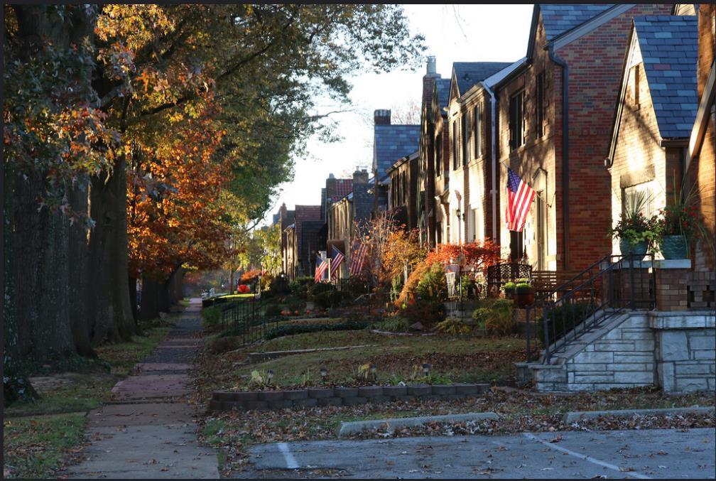
21 Louisiana Pilot Plan 4.1 About the Route Selection & General Information north. Maps outlining this network in relation to the St. Louis roadway system are on the next page. Louisiana Avenue Calm Streets Project: Route Limits As mentioned in Section 1.3 About the Louisiana Calm Streets Project, the Louisiana Avenue pilot route was selected by the working group. Through a series of public engagement, as well as analysis to where the route may be feasible, including the potential to leverage current funding for federal funding, the Louisiana Avenue route was selected. The full length of the Louisiana Avenue route is 3.6 miles spanning from Carondelet Park on the south (Holly Hills Avenue) to Shenandoah Avenue on the north. As discussed previously, route planning is an important element to planning a calm streets network, and this route was selected because of its connectivity to nearby amenities. Situated in South City St. Louis, this portion of Louisiana Avenue connects multiple parks, cultural institutions, business districts, schools, existing and planned bicycle facilities on the Gateway Bike Plan network, and many other local amenities. Included on this page are the full limits of the project as selected by the working group, including the different wards this route passes thru. The City of St. Louis was able to secure funding from multiple city aldermen, as well as the Missouri Department of Natural Resources to progress the Louisiana Avenue Calm Streets Project. Money was used to procure a consultant (CBB Transportation Engineers + Planners) to complete the Calm Streets Concept Plan and Report, and assist with an application for Transportation Alternative Program (TAP) funding when money became available in When the concept plan process started, the team quickly identified that acquiring federal funds for the implementation of the entire 3.6-mile route would not be feasible, due to funding constraints. We made a high level estimate of the cost to implement multiple traffic calming features (speed humps, bumpouts, pavement markings and signage, etc.) per mile. Based on this, and the length of the corridor, we decided to develop a concept for roughly a mile stretch of the corridor. Similar to selecting the initial location on Louisiana, route planning remained an important component to selecting what portion of the Louisiana corridor we wanted to focus efforts. We collected an initial set of data (volumes and speeds elaborated more in the data collection section next) to identify where we had problems and how we may solve those problems. We also looked at the Gateway Bike Plan to map proximity to the Bike St. Louis Network and future planned routes, as well as community destinations and amenities. Based on all of this information, coupled with the location being the middle of the entire length of the route. The team selected to focus our concept plan on the section from Meramec on the south to Cherokee on the 19


22 Louisiana Avenue Pilot Route Community Connectivity Louisiana Avenue Pilot Route Location within Roadway Functional Classification Network 20

23 4.2 Data Collection & Pop-up Demonstration Louisiana Avenue Initial Route Counts (4 locations) In addition to analyzing connections for our proposed segment for the concept plan, we collected data to better understand where we had room for improvement on the corridor. The team wanted to understand volumes and speeds to see where we may want to implement various volume or speed management strategies. As discussed previously, once we determined where there were issues, as well as what neighborhood amenities we could connect, CBB, together with the project team decided on the segment of Louisiana Avenue where we would develop the concept plan, and apply for TAP money for implementation. The data collection was broken into three segments based on phases of the project, as we further developed our concept and location. These three segments include: Initial Route Counts Pilot Route Counts (TAP Boundaries Meramec to Cherokee) Pop-up Demonstration Counts (comparison with pilot route counts) Initial Route Counts The full length of the entire Louisiana route is 3.6 miles, with Carondelet Park as the boundary to the south, and Shenandoah Avenue as the north boundary. Because the project team knew funding would not be feasible to fully design and construct the entire route, CBB collected data to understand where issues exist on the corridor. Hoses were placed at four segments on the corridor for 24 hours a day for a full week (7 days). We analyzed the volumes and speeds to identify where certain strategies may be implemented to reduce those volumes and speeds. The exhibit on this page identifies the initial counts. Based on this information, the project team established there is a concern for speeding on the corridor (the speed limit for the local route is 25), but that volumes are within the recommended volumes for neighborhood greenways. We determined that implementing speed management strategies will be an important component of the calm streets network. Based on this information, as well as connections, we decided our pilot route (because of costs should be around one mile) to be on Louisiana from Meramec at the south to Cherokee at the north. This connects two parks (Marquette and Gravois), as well as three business districts. Additionally, focusing on the middle segment leaves opportunity for implementation on either end as the network continues to grow. Osage & Keokuk 28.4 mph (ADT: 900 1,200) Delor & Walsh 35.5 mph (ADT: ) Iron & Fillmore 25.8 mph (ADT: ) Arsenal & Pestalozzi 27.5 mph (ADT: 900 1,200) 21

24 Pilot Route Counts (TAP Boundaries Meramec to Cherokee) With the pilot segment selected, CBB collected data throughout the segment on Louisiana, and adjoining streets. The team wanted to more thoroughly analyze traffic patterns and speeds not only on Louisiana, but also on the cross streets. This was to ensure we can plan the best, direct route, with safe crossings, when designing the concept plan. The exhibit to the right shows the full data collection completed on the entire Louisiana corridor, and the inset shows the locations were we collected more data. This was used in conjunction with crashes to understand where issues exist on the corridor. Full tables of the speeds and volumes on the selected pilot route (Meramec to Cherokee), and the crashes are located on the following page. Louisiana Avenue Initial & Pilot Route Counts While we developed our pilot route plan, Trailnet worked to host a pop-up demonstration on the Louisiana corridor. This was to showcase the types of treatments (in a temporary fashion) that may be considered in the future design, and raise awareness of the project. We planned the pop-up demonstration near Marquette Park, and arranged to collect data the day of the demonstration to compare numbers with and without the traffic calming devices. 22
25 Louisiana Avenue Speeds and Volumes (Pilot Route) Louisiana Avenue Speeds and Volumes (Pilot Route) Location Posted Speed 85th Percentile Average ADT 1. Meremac between S. Grand & Louisiana ,700-4, Louisiana between Gasconade & Osage ,100 Louisiana between Osage & Keokuk* , Chippewa between Arkansas & Louisiana ,600-3, Louisiana between Chippewa & Winnebago Winnebago between Louisiana & Virginia , Louisiana between Winnebago & Miami Louisiana between Cherokee & Potomac Louisiana between Virginia & Compton ,800-2,300 *collected during initial counts 85th percentile in excess of 5mph over posted speed Louisiana and Louisiana Avenue Crash Data (Pilot Route) Project Limits Crash History ( ) Cherokee P otomac Miami Winnebago Chippewa K eokuk O sage Gasc onade Meramec Traffic Control AWSC AWSC AWSC AWSC AWSC AWSC AWSC AWSC 2-way Stop Bike Ped 1 Other Total Bike Ped Other Total Bike Ped Other Total TOTAL ALL YEARS


26 Louisiana Avenue Pop-up Demonstration Pop Up Traffic Calming Counts To gain initial feedback on the traffic calming concept, Trailnet worked with the City of St. Louis Street Department and Board of Public Service to set up a pop-up traffic calming demonstration. The pop-up layout closely replicated the initial concept for the Louisiana Avenue Calm Streets project, incorporating a traffic circle, a temporary speed hump, bumpouts, and continental crosswalks. In addition to gathering information from the public at the demonstration, CBB collected data using hoses during the day of the demonstration to understand the impact these traffic calming devices had on Louisiana. We placed hoses in two locations, where we had previously collected data: (1) Louisiana between Osage and Keokuk and (2) Louisiana between Osage and Gasconade. While it is not perfect because of the different sights, and additional activity on and near the roadway, it is a good indicator of how these traffic calming installments may slow down speeds and make the corridor safer for walking and biking. The demonstration was conducted near Marquette Park, on Louisiana from Gasconade to Osage. The demonstration was conducted on Thursday, November 17th from 8am 5pm. Information on the data collected with no traffic calming (typical conditions) and data collected with traffic calming (pop-up event) is shown on this page. Louisiana Avenue Data Comparison (no calming vs. calming) Osage & Keokuk 28.4mph (900 1,200 ADT) Osage & Gasconade 31.9mph (900 1,100 ADT) Osage & Keokuk 24 mph Osage & Gasconade 20.7 mph Pictured from top: speed hump, bumpouts with continental crosswalk, traffic circle with continental crosswalk 24 As indicated in the figures above, the speed data (85 th percentile) collected during the pop-up calm streets event was lower than when the calming measures were not in place. Additionally, the 85 th percentile at both points collected is within the ideal realm of 20 mph 25mph. This information was used in designing our concept plan.
27 4.3 Louisiana Avenue Calm Streets Project Concept Plans After compiling all of this information, including best practices on calm streets, and analysis of our Louisiana Avenue corridor, we have provided a conceptual plan for the segment from Meramec to Cherokee. This concept includes a preliminary cost estimate and plans sheets which outline placement for features outlined in this document, a wayfinding and signage plan, and design details for the different features utilized throughout the corridor. Included in the following pages you will find: (1) Cost Estimate (2) Louisiana Avenue Calm Streets Projects plans sheets The information outlined in this document, coupled with the concept plan for Louisiana Avenue, is intended to be used as a toolkit for the City of St. Louis moving forward. Upon completion of the Louisiana Avenue Calm Streets Project, this work can assist you with planning, designing and implementing the calm streets network in the City of St. Louis. City of St. Louis Calm Streets Pilot Plan 25

28
29 Louisiana Avenue Calm Streets Project DRAFT Conceptual Cost Estimate 27
 =")
 12400 OLIVE BLVD, SUITE 430 450")
 878-6644")
")
30 LEGEND = DOWELLED-ON BUMP OUT = BUMP OUT W/ PLANTINGS = BUMP OUT W/ INFILTRATION BASIN (PER MSD STANDARDS) = RESURFACING = BIKE ST. LOUIS ROUTE (SHARED) OLIVE BLVD, SUITE COTTONWOOD RD, SUITE B ST. LOUIS, MO GLEN CARBON, IL (314) (618) LEGEND = DOWELLED-ON BUMP OUT = BUMP OUT W/ PLANTINGS = BUMP OUT W/ INFILTRATION BASIN (PER MSD STANDARDS) = RESURFACING = BIKE ST. LOUIS ROUTE (SHARED)


")


 878-6644 (618)")


31 LEGEND = DOWELLED-ON BUMP OUT = BUMP OUT W/ PLANTINGS = BUMP OUT W/ INFILTRATION BASIN (PER MSD STANDARDS) = RESURFACING = BIKE ST. LOUIS ROUTE (SHARED) LEGEND = DOWELLED-ON BUMP OUT = BUMP OUT W/ PLANTINGS = BUMP OUT W/ INFILTRATION BASIN (PER MSD STANDARDS) = RESURFACING = BIKE ST. LOUIS ROUTE (SHARED) OLIVE BLVD, SUITE COTTONWOOD RD, SUITE B ST. LOUIS, MO GLEN CARBON, IL (314) (618)

 =")
")


 656-2612 www.")

32 LEGEND = DOWELLED-ON BUMP OUT = BUMP OUT W/ PLANTINGS = BUMP OUT W/ INFILTRATION BASIN (PER MSD STANDARDS) = RESURFACING = BIKE ST. LOUIS ROUTE (SHARED) LEGEND = DOWELLED-ON BUMP OUT = BUMP OUT W/ PLANTINGS = BUMP OUT W/ INFILTRATION BASIN (PER MSD STANDARDS) = RESURFACING = BIKE ST. LOUIS ROUTE (SHARED) OLIVE BLVD, SUITE COTTONWOOD RD, SUITE B ST. LOUIS, MO GLEN CARBON, IL (314) (618)
 12400 OLIVE BLVD, SUITE 430 ST. LOUIS, MO 63141 (314) 878-6644 www.cbbtraffic.")
33 LEGEND = DOWELLED-ON BUMP OUT = BUMP OUT W/ PLANTINGS = BUMP OUT W/ INFILTRATION BASIN (PER MSD STANDARDS) = RESURFACING = BIKE ST. LOUIS ROUTE (SHARED) OLIVE BLVD, SUITE 430 ST. LOUIS, MO (314) COTTONWOOD RD, SUITE B GLEN CARBON, IL (618)


")
34 12400 OLIVE BLVD, SUITE COTTONWOOD RD, SUITE B ST. LOUIS, MO GLEN CARBON, IL (314) (618)
Broad Street Bicycle Boulevard Design Guidelines
 Broad Street Bicycle Boulevard Design Guidelines Building from the strategies introduced in the 2013 Bicycle Transportation Plan and community input received thus far, City Transportation Staff have identified
Proposed. City of Grand Junction Complete Streets Policy. Exhibit 10
 Proposed City of Grand Junction Complete Streets Policy Exhibit 10 1 City of Grand Junction Complete Streets Policy Vision: The Complete Streets Vision is to develop a safe, efficient, and reliable travel
Off-road Trails. Guidance
 Off-road Trails Off-road trails are shared use paths located on an independent alignment that provide two-way travel for people walking, bicycling, and other non-motorized users. Trails specifically along
TRAFFIC CALMING GUIDE FOR TORONTO CITY OF TORONTO TRANSPORTATION SERVICES DIVISION
 TRAFFIC CALMING GUIDE FOR TORONTO CITY OF TORONTO TRANSPORTATION SERVICES DIVISION CITY OF TORONTO TRANSPORTATION SERVICES DIVISION 2016 TRAFFIC CALMING GUIDE FOR TORONTO TABLE OF CONTENTS Introduction
Appendix C. TRAFFIC CALMING PROGRAM TOOLBOX
 Appendix C. TRAFFIC CALMING PROGRAM TOOLBOX PHASE I...2 Do Not Enter Sign...3 One-Way Sign...4 Turn Prohibition...5 Pavement Markings...6 Speed Monitoring Trailer...7 Neighborhood Speed Watch...8 Police
City of Vallejo Traffic Calming Toolbox
 City of Vallejo Traffic Calming Toolbox June 1, 2013 Final Table of Contents Introduction... 1 Non-Physical Devices... 3 High-Visibility Crosswalk... 3 In Pavement Lighted Crosswalk... 4 Rapid Flashing
Tonight is for you. Learn everything you can. Share all your ideas.
 Strathcona Neighbourhood Renewal Draft Concept Design Tonight is for you. Learn everything you can. Share all your ideas. What is Neighbourhood Renewal? Creating a design with you for your neighbourhood.
Active Transportation Facility Glossary
 Active Transportation Facility Glossary This document defines different active transportation facilities and suggests appropriate corridor types. Click on a facility type to jump to its definition. Bike
Agenda. Overview PRINCE GEORGE S PLAZA METRO AREA PEDESTRIAN PLAN
 PRINCE GEORGE S PLAZA METRO AREA PEDESTRIAN PLAN May 28, 2008 Agenda Welcome and introductions Project overview and issue identification Planning context and strengths Design challenges and initial recommendations
Exhibit 1 PLANNING COMMISSION AGENDA ITEM
 Exhibit 1 PLANNING COMMISSION AGENDA ITEM Project Name: Grand Junction Circulation Plan Grand Junction Complete Streets Policy Applicant: City of Grand Junction Representative: David Thornton Address:
Town of Mooresville, North Carolina Neighborhood Traffic Calming and Control Device Policy
 Town of Mooresville, North Carolina Neighborhood Traffic Calming and Control Device Policy Adopted January 6, 2014 Town of Mooresville Development Services Department TOWN OF MOORESVILLE NEIGHBORHOOD TRAFFIC
REGIONAL BICYCLE AND PEDESTRIAN DESIGN GUIDELINES
 REGIONAL BICYCLE AND PEDESTRIAN DESIGN GUIDELINES November 16, 2011 Deb Humphreys North Central Texas Council of Governments Bicycle and Pedestrian Advisory Committee Snapshot of the Guide 1. Introduction
City of Elizabeth City Neighborhood Traffic Calming Policy and Guidelines
 City of Elizabeth City Neighborhood Traffic Calming Policy and Guidelines I. Purpose: The City of Elizabeth City is committed to ensure the overall safety and livability of residential neighborhoods. One
CURBSIDE ACTIVITY DESIGN
 5 CURBSIDE ACTIVITY DESIGN This chapter provides design guidance for separated bike lanes adjacent to curbside activities including parking, loading and bus stops. Typical configurations are presented
Living Streets Policy
 Living Streets Policy Introduction Living streets balance the needs of motorists, bicyclists, pedestrians and transit riders in ways that promote safety and convenience, enhance community identity, create
Bicycle Boulevards and Neighborhood Greenways
 Bicycle Boulevards and Neighborhood Greenways Traffic Safety is Improving for Everyone 90 80 70 60 50 40 30 20 10 0 PORTLAND: TOTAL TRAFFIC FATALITIES 1986-2008 1986 1987 1988 1989 1990 1991 1992 1993
City of Wayzata Comprehensive Plan 2030 Transportation Chapter: Appendix A
 A1. Functional Classification Table A-1 illustrates the Metropolitan Council s detailed criteria established for the functional classification of roadways within the Twin Cities Metropolitan Area. Table
ROUNDABOUTS/TRAFFIC CIRCLES
 GENERAL 1. Description This standard identifies minimum requirements that shall be met for Roundabouts and Neighborhood Traffic Circles in the design and construction of elements for Arlington County Horizontal
County of Greenville South Carolina. Traffic Calming Program Neighborhood Traffic Education Program and Speed Hump Program
 County of Greenville South Carolina Traffic Calming Program Neighborhood Traffic Education Program and Speed Hump Program (rev) August 2008 I. PURPOSE The potential negative impacts from vehicular traffic
Item to be Addressed Checklist Consideration YES NO N/A Required Description Complete Streets Guidelines
 Passaic County Complete Streets Checklist - Concept Development Project Name Item to be Addressed Checklist Consideration YES NO N/A Required Description Complete Streets Guidelines Existing Plans Have
Complete Streets. Designing Streets for Everyone. Sarnia
 Complete Streets Designing Streets for Everyone Sarnia Complete Streets ~ Sarnia ~ 2018 Introduction Our City is made up of a network of streets that we use to go for a walk, cycle to work, drive to the
DRAFT Montgomery County Bicycle Master Plan Design Toolkit
 DRAFT Montgomery County Bicycle Master Plan Design Toolkit Fall 2016 Sidepaths Sidepaths are shared use paths located parallel to and within the road right-of-way providing twoway travel for walking, bicycling,
Appendix A: Crosswalk Policy
 Appendix A: Crosswalk Policy Appendix A: Crosswalk Policy Introduction This citywide Crosswalk Policy is aimed at improving pedestrian safety and enhancing pedestrian mobility by providing a framework
CITY OF SARATOGA SPRINGS PEDESTRIAN CROSSING TOOLBOX
 CITY OF SARATOGA SPRINGS PEDESTRIAN CROSSING TOOLBOX This toolbox is to be used to guide pedestrian crossing improvements within the City of Saratoga Springs. Details for each crossing type are provided.
Safe Routes to School Action Plan Aberdeen, Idaho
 Background Aberdeen, Idaho is a largely agricultural community of nearly 2,000 people and is located in the southeast portion of the state on the western edge of American Falls Reservoir. The community
APPENDIX A: Complete Streets Checklist DRAFT NOVEMBER 2016
 APPENDIX A: Complete Streets Checklist DRAFT NOVEMBER 2016 Complete Streets Checklist MetroPlan Orlando s Complete Streets Checklist is an internal planning tool for staff to further implementation of
EXECUTIVE SUMMARY. Vision
 Vision Walking and bicycling in Salt Lake City will be safe, convenient, comfortable, and viable transportation options that connect people to places, foster recreational and economic development opportunities,
CITY OF SAINT JOHN TRAFFIC CALMING POLICY
 CITY OF SAINT JOHN TRAFFIC CALMING POLICY VERSION: 1.0 April 10, 2012 Pedestrians, Cyclists and Motorists Sharing Street Spaces CONTENTS INTRODUCTION... 3 POLICY GOAL... 3 POLICY OBJECTIVES... 3 GUIDING
Chapter 4 TOOLBOX AND SAMPLE BIKE BOULEVARD LAYOUT
 Chapter 4 TOOLBOX AND SAMPLE BIKE BOULEVARD LAYOUT OVERVIEW This chapter describes a cohesive set of strategies to create a bicycle boulevard, namely to make streets safer and more efficient for bicycle
Residential Traffic Calming Program Guide. Town of Ashland, Virginia
 Residential Traffic Calming Program Guide Town of Ashland, Virginia August 1, 2006 TABLE OF CONTENTS A. INTRODUCTION... 1 B. GOALS... 1 C. CRITERIA... 1 D. IDENTIFYING NEIGHBORHOOD TRAFFIC CONCERNS...
Report. Typical Sections. City of Middleton, WI
 Report Typical Sections City of Middleton, WI December 2006 Report for City of Middleton, Wisconsin Typical Sections repared by: Traffic Associates LLC and STRAND ASSOCIATES, INC. 910 West Wingra Drive
PRINCE GEORGE S PLAZA METRO AREA PEDESTRIAN PLAN
 PRINCE GEORGE S PLAZA METRO AREA PEDESTRIAN PLAN May 28, 2008 Agenda Welcome and introductions Project overview and issue identification Planning context and strengths Design challenges and initial recommendations
TRAFFIC CALMING TOOLBOX
 TRAFFIC CALMING TOOLBOX Traffic control devices are those official signs and striping placed in the public right-of-way and recognized by the public such as STOP signs, curve warning signs, centerline
FEDERAL HIGHWAY ADMINISTRATION APPLICATION
 FEDERAL HIGHWAY ADMINISTRATION APPLICATION REQUEST FOR PERMISSION TO EXPERIMENT WITH A BICYCLE BOX INTERSECTION TREATMENT Submitted by: City of Columbus Department of Public Service Date: June 26, 2009
Chapter 2: Standards for Access, Non-Motorized, and Transit
 Standards for Access, Non-Motorized, and Transit Chapter 2: Standards for Access, Non-Motorized, and Transit The Washtenaw County Access Management Plan was developed based on the analysis of existing
TRAFFIC CALMING TOOLBOX. For the residents of the City of Decatur, Georgia
 TRAFFIC CALMING TOOLBOX For the residents of the City of Decatur, Georgia 2 City of Decatur Traffic Calming Toolbox Public Works Department 2635 Talley Street Decatur, GA 30030 404.377.5571 3 Welcome to
BETHEL ROAD AND SEDGWICK ROAD CORRIDOR STUDY
 DRAFT PLAN City Council Meeting August 14, 2017 STUDY AREA Sedgwick Corridor State Route 160, principal arterial with Class 3 access management designation, commuter and freight route, connection to SR
TOWN OF HALTON HILLS TRAFFIC CALMING PROTOCOL. Page 1 of 25
 TOWN OF HALTON HILLS TRAFFIC CALMING PROTOCOL Page 1 of 25 PROCESS FOR INSTALLATION OF TRAFFIC CALMING DEVICES The Process for Installation of Traffic Calming Devices has been prepared to provide an objective
G AT E WAY PLAN. Community BRIEFING KIT GATEWAY BIKE
 G AT E WAY PLAN GATEWAY BIKE Community BRIEFING KIT PLAN August 2016 TABLE OF CONTENTS INTRODUCTION... 1 THE BENEFITS OF A BIKEABLE COMMUNITY... 2 ECONOMY...2 SAFETY...3 HEALTH...3 HOUSEHOLD SPENDING...3
The Wiggle Route in Context
 The Wiggle Route in Context In a city of hills, the Wiggle is an important route because it winds its way along the flattest streets from Market to the Panhandle, bringing residents to local parks and
Brief Outline of the Neighborhood Traffic Management Program (NTMP)
") Brief Outline of the Neighborhood Traffic Management Program (NTMP) Typically, this is the process after Department of Public Works (DPW) receives a request for speed humps, complaints about speeding,
Brief Outline of the Neighborhood Traffic Management Program (NTMP) Typically, this is the process after Department of Public Works (DPW) receives a request for speed humps, complaints about speeding,
Cycle Track Design Best Practices Cycle Track Sections
 Design Best Practices Sections It is along street segments where the separation and protection methods of cycle tracks offer more comfort than conventional bicycle lanes, and are more attractive to a wide
Bicycle and Pedestrian Advisory Committee (BPAC) November 21, 2013
 November 21, 2013") Bicycle and Pedestrian Advisory Committee (BPAC) November 21, 2013 OVERALL LAND USE CONCEPT Overall Broadway Valdez District: 95.5 acres (35.1 acres right-of ways + 60.4 acres developable land) Plan Subareas:
Bicycle and Pedestrian Advisory Committee (BPAC) November 21, 2013 OVERALL LAND USE CONCEPT Overall Broadway Valdez District: 95.5 acres (35.1 acres right-of ways + 60.4 acres developable land) Plan Subareas:
Appendix T CCMP TRAIL TRAFFIC & TRANSPORTATION DESIGN STANDARD
 Appendix T CCMP 3.3.4 TRAIL TRAFFIC & TRANSPORTATION DESIGN STANDARD 3.3.4 Trail Traffic and Transportation Design Multi-use trails have certain design standards, which vary depending on the agency that
Corpus Christi Metropolitan Transportation Plan Fiscal Year Introduction:
 Introduction: The Safe, Accountable, Flexible, Efficient Transportation Equity Act: A Legacy for Users (SAFETEA-LU) has continued the efforts started through the Intermodal Surface Transportation Efficiency
City of Albert Lea Policy and Procedure Manual 4.10 ALBERT LEA CROSSWALK POLICY
 4.10 ALBERT LEA CROSSWALK POLICY PURPOSE: Pedestrian crosswalks are an integral part of our transportation infrastructure. To be effective and promote safety, marked crosswalks must be installed after
Why Zone In on Speed Reduction?
 Learn it. Do it. Live it! SPEED REDUCTION IN THE ZONE Why Zone In on Speed Reduction? Speeding is a serious issue that plays a major role in the risk of serious injury and pedestrian fatality in a crash.
TOWN OF PORTLAND, CONNECTICUT COMPLETE STREETS POLICY
 TOWN OF PORTLAND, CONNECTICUT COMPLETE STREETS POLICY I. VISION, GOALS & PRINCIPLES VISION To improve the streets of Portland making them safer and more accessible for all users including pedestrians,
Neighborhood Traffic Calming Guidelines
 Neighborhood Traffic Calming Guidelines ADOPTED BY THE CITY COUNCIL OF ARROYO GRANDE BY RESOLUTION NO. 2016-4718 ON APRIL 12, 2016 COMMUNITY DEVELOPMENT DEPARTMENT ENGINEERING DIVISION 300 East Branch
CONNECTING PEOPLE TO PLACES
 CONNECTING PEOPLE TO PLACES 82 EAST BENCH MASTER PLAN 07 Introduction The East Bench transportation system is a collection of slow moving, treelined residential streets and major arteries that are the
CITY OF COCOA BEACH 2025 COMPREHENSIVE PLAN. Section VIII Mobility Element Goals, Objectives, and Policies
 CITY OF COCOA BEACH 2025 COMPREHENSIVE PLAN Section VIII Mobility Element Goals, Objectives, and Policies Adopted August 6, 2015 by Ordinance No. 1591 VIII MOBILITY ELEMENT Table of Contents Page Number
SAN FRANCISCO MUNICIPAL TRANSPORTATION AGENCY
 THIS PRINT COVERS CALENDAR ITEM NO. : 10.2 DIVISION: Sustainable Streets BRIEF DESCRIPTION: SAN FRANCISCO MUNICIPAL TRANSPORTATION AGENCY Adopting Conceptual Proposal for Streetscape Improvements to Broadway,
TOWN OF PAYSON TRAFFIC CALMING MANUAL
 TOWN OF PAYSON TRAFFIC CALMING MANUAL APPROVED BY THE PAYSON TOWN COUNCIL SEPTEMBER 6, 2007 TOWN OF PAYSON TRAFFIC CALMING POLICY 1.0 Introduction Traffic Calming involves retrofitting physical devices
CONNECTIVITY PLAN. Adopted December 5, 2017 City of Virginia Beach
 CONNECTIVITY PLAN Adopted December 5, 2017 City of Virginia Beach CONTENTS 1.0 Background & Purpose... 2 2.0 Existing Inventory & Analysis... 3 ViBe District Existing Walking Conditions... 4 3.0 ViBe District
ACTIVE TRANSPORTATION
 ACTIVE TRANSPORTATION Mobility 2040 Supported Goals Improve the availability of transportation options for people and goods. Support travel efficiency measures and system enhancements targeted at congestion
County of Spartanburg South Carolina
 County of Spartanburg South Carolina Traffic Calming Program June 2012 (Revised/Program on Hold) PURPOSE The potential negative impacts from vehicular traffic on residential roads have been a longstanding
5. RUNNINGWAY GUIDELINES
 5. RUNNINGWAY GUIDELINES These guidelines should be considered collectively when making runningway decisions. A runningway is the linear component of the transit system that forms the right-of-way reserved
CITY OF BLOOMINGTON COMPLETE STREETS POLICY
 CITY OF BLOOMINGTON COMPLETE STREETS POLICY POLICY OBJECTIVE: The City of Bloomington will enhance safety, mobility, accessibility and convenience for transportation network users of all ages and abilities,
Overview. Illinois Bike Summit IDOT Complete Streets Policy Presentation. What is a Complete Street? And why build them? And why build them?
 Overview Illinois Bike Summit IDOT Complete Streets Policy Presentation Aren Kriks, P.E. District One Bicycle Coordinator and Bureau of Programming Project Engineer History of Complete Streets IDOT Policy
DRAFT FOR DISCUSSION PURPOSED ONLY, 10/26/13 MOBILITY PLAN UPDATE DESIGN TOOLBOX
 DRAFT FOR DISCUSSION PURPOSED ONLY, 10/26/13 MOBILITY PLAN UPDATE DESIGN TOOLBOX Tool #1: Bike Lane Portion of the roadway designated for preferential use by bicyclists. One-way facilities that typically
Traffic Calming SECTION 1, CHAPTER Introduction What is Traffic Calming?
 SECTION 1, CHAPTER 6 Traffic Calming 6.1 Introduction 6.1.1 What is Traffic Calming? Traffic calming deals with neighborhood traffic issues comprehensively using the three E s, Education, Enforcement,
INTRODUCTION TO BICYCLE BOULEVARDS
 ROCHESTER, NY Chapter Contents: Introduction Benefits of Bicycle Boulevards Routing Selection Process Design Strategy Tools Marketing + Branding INTRODUCTION TO BICYCLE BOULEVARDS In an effort to appeal
RESOLUTION NO ?? A RESOLUTION OF THE CITY OF NEPTUNE BEACH ADOPTING A COMPLETE STREETS POLICY
 RESOLUTION NO. 2018-?? A RESOLUTION OF THE CITY OF NEPTUNE BEACH ADOPTING A COMPLETE STREETS POLICY WHEREAS, safe, convenient, and accessible transportation for all users is a priority of the City of Neptune
Bikeway action plan. Bicycle Friendly Community Workshop March 5, 2007 Rochester, MN
 Bikeway action plan Summary The was held on March 5, 2007 at the Rochester Mayo Civic Center. The workshop was hosted by Rochester-Olmsted County Planning Department in collaboration with the League of
Coquitlam Cross-town Bike Route Improving Bicycle Facilities in a Mature Suburban Environment
 Coquitlam Cross-town Bike Route Improving Bicycle Facilities in a Mature Suburban Environment Sarah Rocchi, Vice-President, Projects, Opus International Consultants (Main Presenter) Catherine Mohoruk,
INDOT Complete Streets Guideline & Policy
 INDOT Complete Streets Guideline & Policy INTRODUCTION The Complete Streets guidelines build upon multiple efforts and promote a multimodal transportation system that is integrated and sustains land use
o n - m o t o r i z e d transportation is an overlooked element that can greatly enhance the overall quality of life for the community s residents.
 N o n - m o t o r i z e d transportation is an overlooked element that can greatly enhance the overall quality of life for the community s residents. 84 Transportation CHAPTER 11 INTRODUCTION Transportation
MAG Town of Cave Creek Bike Study Task 6 Executive Summary and Regional Significance Report
 Page 1 MAG Town of Cave Creek Bike Study Task 6 Executive Summary and Regional Significance Report August 1, 2012 MAG Project #481 Page 2 Task 6 Executive Summary and Regional Significance Report Introduction
Ocean Park Boulevard Green Street Project Alternatives & Trade Offs
 Planning Commission March 4, 2009 Ocean Park Boulevard Green Street Project Alternatives & Trade Offs Purpose of Tonight s Meeting Review concept plans and options Provide input on alternatives and trade-offs
Walk Friendly Communities Engineering Strategies. Carl Sundstrom Walk Friendly Communities Workshop Grandview, MO June 2015
 Walk Friendly Communities Carl Sundstrom Walk Friendly Communities Workshop Grandview, MO June 2015 Module Overview Topics Background and purpose Sidewalks Crossings Traffic calming www.pedbikeimages.org
Transportation Planning Division
 Transportation Planning Division Presentation Outline Study Tasks Recap of Previous Meetings Data Collected Focus Areas within Study Limits Design Principles Tool Box Recommended Concepts Schedule Moving
NEIGHBORHOOD TRAFFIC CALMING POLICY
 NEIGHBORHOOD TRAFFIC CALMING POLICY Traffic Calming is the combination of physical measures that reduce the negative effects of motor vehicle use, alter driver behavior and improve conditions for both
Bicycle Facilities Planning
 Bicycle Facilities Planning Overview Types of Cyclists Purpose for Riding Types of Facilities Bike Lanes Bicycle Boulevards Cycle Tracks Intersections Signals Signing and Marking Discussion Types of Bicyclists
10.0 CURB EXTENSIONS GUIDELINE
 10.0 CURB EXTENSIONS GUIDELINE Road Engineering Design Guidelines Version 1.0 March 2017 City of Toronto, Transportation Services City of Toronto Page 0 Background In early 2014, Transportation Services
City of Novi Non-Motorized Master Plan 2011 Executive Summary
 City of Novi Non-Motorized Master Plan 2011 Executive Summary Prepared by: February 28, 2011 Why Plan? Encouraging healthy, active lifestyles through pathway and sidewalk connectivity has been a focus
CURB EXTENSIONS BULB OUTS DPS 201 NECKDOWNS
 CURB EXTENSIONS BULB OUTS DPS 201 NECKDOWNS WHY WHEN & WHERE When Limited Sight Distance Pedestrians & Vehicles Vehicles and Signs Want to put two curb ramps in Discourage High speed turning High number
Appendix 3 Roadway and Bike/Ped Design Standards
 Appendix 3 Roadway and Bike/Ped Design Standards OTO Transportation Plan 2040 4/20/2017 Page A3-1 Adopted Standards The adopted OTO Design Standards and Major Thoroughfare Plan are contained herein.
Safe Streets. City of Lake Forest Park. March 21, 2017
 Safe Streets City of Lake Forest Park March 21, 2017 1 01 WELCOME 2 Agenda WELCOME WHAT IS THIS PROJECT? CONTEXT DRAFT CITYWIDE PROJECTS EXERCISE INTRODUCTION 3 02 WHAT IS THIS PROJECT? 4 WHAT IS THIS
3.1 TRAFFIC CALMING PROCESS SUMMARY
 SECTION 3 3.0 TRAFFIC CALMING 3.1 TRAFFIC CALMING PROCESS SUMMARY Traffic calming is a means in which to reduce speeds and minimize vehicular traffic on local neighborhood streets. Citizen involvement
Duwamish Way-finding and CTR Report
 V. North Tukwila When the North Tukwila Manufacturing and Industrial Center was designated in 1992 as part of the region s land use and transportation plan, the plan called for the area to set a light-rail
PEDALING FORWARD. A Glance at the SFMTA s Bike Program for SFMTA.COM
 PEDALING FORWARD A Glance at the SFMTA s Bike Program for 2017-2021 SFMTA.COM INTRODUCTION About This Booklet More people from all walks of life see their bicycle as a more convenient way to get where
CHAPTER 16 PEDESTRIAN FACILITIES DESIGN AND TECHNICAL CRITERIA TABLE OF CONTENTS
 CHAPTER 16 PEDESTRIAN FACILITIES DESIGN AND TECHNICAL CRITERIA TABLE OF CONTENTS Section Title Page 16.1 General... 16-1 16.1.1 AASHTO Reference... 16-1 16.1.2 ADA Requirements... 16-1 16.2 Sidewalks...
Physical Implications of Complete Streets Policies
 Presentation Overview Physical Implications of Complete Norm Cox, ASLA, LLA Landscape Architect Ann Arbor, Michigan, 10:45 to Noon What Are Complete Streets? What Matters to Bicyclists and Pedestrians
MEMORANDUM. Date: 9/13/2016. Citywide Crosswalk Policy
 MEMORANDUM Date: 9/13/2016 Re: Citywide Crosswalk Policy Foreword Through the s Circulation Element and Complete Streets Policy, it is the City s goal to promote walking trips and provide safe facilities
Watertown Complete Streets Prioritization Plan. Public Meeting #1 December 14, 2017
 Watertown Complete Streets Prioritization Plan Public Meeting #1 December 14, 2017 Goals for Public Meeting Overview of MassDOT Complete Streets Funding Program Educate the community on Complete Streets
TOWN OF CHAPEL HILL POLICY AND PROCEDURES FOR TRAFFIC CALMING MEASURES
 TOWN OF CHAPEL HILL POLICY AND PROCEDURES FOR TRAFFIC CALMING MEASURES (Adopted by the Town Council on June 30, 2004) (Revised December 6, 2010) (Revised February 8, 2016) POLICY AND PROCEDURES FOR TRAFFIC
AMATS Complete Streets Policy
 AMATS Complete Streets Policy Table of Contents: Section 1. Definition of Complete Streets Section 2. Principles of Complete Streets Section 3. Complete Streets Policy Section 4. Consistency Section 5.
On-Street Bicycle Facilities
 On-Street Bicycle Facilities A. General 12B-3 Design Manual Chapter 12 - Sidewalks and Bicycle Facilities 12B - Bicycle Facilities Cyclists have similar access and mobility needs as other transportation
East Burke Transportation, Safety and Capacity Improvements
 East Burke Transportation, Safety and Capacity Improvements The purpose of this project is to increase mobility and improve safety for pedestrians, cyclists, and motor vehicles along VT Route 114 in the
Solana Beach Comprehensive Active Transportation Strategy (CATS)
") Solana Beach Comprehensive Active Transportation Strategy (CATS) 3.0 Goals & Policies The Solana Beach CATS goals and objectives outlined below were largely drawn from the Solana Beach Circulation Element
Solana Beach Comprehensive Active Transportation Strategy (CATS) 3.0 Goals & Policies The Solana Beach CATS goals and objectives outlined below were largely drawn from the Solana Beach Circulation Element
Prepared By: Town of Waxhaw Traffic Calming Policy
 Policy For Resolutions for Town Meetings Prepared By: Town Manager Michael McLaurin Director Greg Mahar CPD Waxhaw N.C. Community Planning &Development Administrative Department Department: Date Approved
PEDESTRIAN ACTION PLAN
 ATTACHMENT 2 CITY OF SANTA MONICA PEDESTRIAN ACTION PLAN CITY OF SANTA MONICA PEDESTRIAN ACTION PLAN This page intentionally left blank EXECUTIVE SUMMARY CHAPTER 1 EXECUTIVE SUMMARY Setting the Stage
General Design Factors
 Chapter 3: 3-1.0 Introduction General Design Factors Mn/DOT s goals include encouraging and accommodating safe bicycling. From a design perspective, these goals are achieved by first having an understanding
Caltrans Sloat Boulevard Pedestrian Safety Project Response to Community Questions, Comments & Concerns
 Caltrans Sloat Boulevard Pedestrian Safety Project Response to Community Questions, Comments & Concerns Revised: May 10, 2016 The California Department of Transportation (Caltrans) is planning various
WELCOME. Purpose of the Open House. Update you on the project. Present a draft recommended plan. Receive your input
 WELCOME Purpose of the Open House The Town of Smiths Falls has initiated the Beckwith Street Redevelopment Plan that includes the preparation of a streetscape functional design for the renewal of Beckwith
Make Lincoln Highway an economically vibrant corridor that is safe, efficient, and beautiful for local residents and visitors.
 Lincoln Highway Streetscape Plan Stakeholder Workshop #2 Handout Contents Introduction and Project Vision Planning Principles Specific Recommendations including a Proposed Typical Roadway Section Renderings
Chapter 3: Multi-Modal Circulation and Streetscapes
 CHAPTER 3: MULTI-MODAL CIRCULATION AND STREETSCAPES Chapter 3: Multi-Modal Circulation and Streetscapes Overview Streetscape improvements have already been completed for Depot Street between Main Avenue
CITY OF SLO SEEKS INPUT ON PREFERRED ALTERNATIVE FOR BROAD STREET BICYCLE BOULEVARD PROJECT
 City of San Luis Obispo, News Release DATE: August 1, 2017 RELEASE: Immediate CONTACT: Luke Schwartz (805) 781-7190 Transportation Planner-Engineer, Public Works CITY OF SLO SEEKS INPUT ON PREFERRED ALTERNATIVE
COMPLETE STREETS PLANNER S PORTFOLIO
 COMPLETE STREETS PLANNER S PORTFOLIO ISSUE 3 APRIL 2016 PLANNER S PORTFOLIO COMPLETE STREETS 1 2 6 10 14 OVERVIEW MATURE NEIGHBORHOODS GROWING SUBURBS CENTRAL PLACES ACTIVITY CORRIDORS Planner s Portfolio
Bicycle Network. Vision Zero San Francisco The City and County of San
 PROJECT BACKGROUND Project Needs 1. 17th between Church and Sanchez is identified as a location where there is a disproportionate number of crashes involving people riding bikes. 2. There is currently