RM 620 FEASIBILITY STUDY
|
|
|
- Lenard Foster
- 5 years ago
- Views:
Transcription
1 RM 620 FEASIBILITY STUDY Sections 5 & 6 December 7, 2015
2 STUDY PROCESS
3 Study Purpose and Goals The RM 620 Feasibility Study was launched by the Texas Department of Transportation (TxDOT) to analyze transportation issues along RM 620 from SH 71 to US 183. The 12 to 18-month study is a stakeholder-focused process incorporating input from neighborhoods, businesses, property owners, commuters, bicyclists, pedestrians, and others who use RM 620. This information will help TxDOT identify needs and gather feedback and ideas on potential short- and long-term mobility and safety improvements for the corridor. The goal of the study is to identify potential improvements that will maximize safety and mobility while balancing competing stakeholder interests. Currently, there is no funding available for any improvements. TxDOT will be working with local communities and residents to determine the need and feasibility for Potential improvements to serve existing and future growth. The information gathered from the community will help shape proposals for appropriate improvements. 3

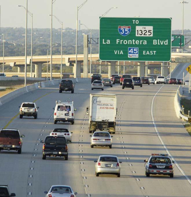
4 Study Background RM 620 serves a wide range of users: Residents Businesses Bicyclists Commuters Segment of RM 620 under study: Between US 183 and SH 71 Approximately 18 miles long Located mostly within Travis County except small northern portion located in Williamson County Connects Cedar Park, Austin, Lakeway, and Bee Cave RM 620 segment divided into 6 sections for study purposes 4
5 What is a Feasibility Study? A feasibility study is used to determine critical elements of engineering and the economic feasibility of a proposed facility or corridor. Feasibility studies establish design concepts, general right-of-way requirements, and potential project impacts. They are not intended to result in detailed design, environmental analysis, or thorough cost estimates. Generalized cost estimates are developed and help determine the project s overall financial feasibility in terms of a benefit and cost ratio. Feasibility studies consider various alternatives, analyze current and future traffic, analyze potential environmental problems, develop cost estimates, and determine feasibility. Once a feasibility study warrants further consideration and development, comprehensive environmental studies and construction documents may be completed. 5

6 RM 620 Feasibility Study Map Showing Study Sections 6

7 Existing Signalized Intersections within Section 5 (Lakeway) Debba Dr. Kollmeyer Dr. Lakeway Blvd. Lohmans Crossing Lohmans Spur Flint Rock Rd. Spillman Lp./Honey Creek Ct. Cavalier Dr./Aria Dr. (Google Maps, 2015) 4

8 Existing Signalized Intersections within Section 6 (Bee Cave) Falcon Head Blvd. Ladera Blvd. Bee Cave Pkwy. SH 71 (Google Maps, 2015) 8
9 NEED FOR IMPROVEMENTS

10 Existing Conditions 24-hour traffic counts are occasionally collected along a roadway to provide context regarding local and regional travel patterns and roadway usage. For a road similar to RM 620, City of Austin lists the typical daily traffic as 5,000 to 35,500 vehicles per day. This range does not explicitly consider the number of signals, driveways, etc., that can impede traffic along a major arterial, however. The daily traffic volumes show that RM 620 is over capacity north of Bee Cave Pkwy. 14,800 24,400 36,700 25,300 10,500 29,400 41,266 37,200 36,000 44,200 49,600 20,000 40,400 (Google Maps, 2015) (counts in vehicles per day) LEGEND March 2015 HDR 24-hour vehicle count November 2013 HDR 24-hour vehicle count May 2012 HDR 24-hour vehicle count 2013 AADT TxDOT (traffic volumes based on average of daily volumes collected over an entire year) 10
. A B C D LOS Free Flow.")


11 Existing Traffic Conditions Level of service (LOS) is the most commonly used metric to describe traffic conditions. It provides a way to quantify traffic congestion and present the results in a way that is easy to comprehend (i.e., on a scale similar to a school grading scale). A B C D LOS Free Flow. Traffic flows at or above the posted speed limit and motorists have complete mobility between lanes. Reasonably Free Flow: LOS A speeds are maintained, maneuverability within the traffic stream is slightly restricted. Stable Flow, at or near free flow. Ability to maneuver through lanes is noticeably restricted and lane changes require more driver awareness. Approaching Unstable Flow. Speeds slightly decrease as traffic volume slightly increase. Freedom to maneuver within the traffic stream is much more limited and driver comfort levels decrease. Example E Unstable Flow, operating at capacity. Flow becomes irregular and speed varies rapidly because there are virtually no usable gaps to maneuver in the traffic stream and speeds rarely reach the posted speed limit. F Forced or breakdown flow. Every vehicle moves in lockstep with the vehicle in front of it, with frequent slowing required. Travel time cannot be predicted, with generally more demand than capacity. 11
12 AM Peak LOS: Sections 5 & 6 This table shows how major intersections along RM 620 are currently functioning and how they would function in 2035 with projected growth of traffic. Intersection Existing 2035 No-Build RM 620 / Debba Drive F F RM 620 / Kollmeyer Drive B E RM 620 / Lakeway Boulevard C E RM 620 / Lohmans Crossing Drive/Ameno Drive E F RM 620 / Lohmans Spur Road B D RM 620 / Flint Rock Road B F RM 620 / Spillman Loop/Honey Creek Court D F RM 620 / Cavalier Drive/Aria Drive F F RM 620 / Falcon Head Boulevard C D RM 620 / Ladera Boulevard B D RM 620 / Bee Cave Parkway E F RM 620 / SH 71 C D 12
13 PM Peak LOS: Sections 5 & 6 Intersection Existing 2035 No-Build RM 620 / Debba Drive E F RM 620 / Kollmeyer Drive B E RM 620 / Lakeway Boulevard C F RM 620 / Lohmans Crossing Drive/Ameno Drive F F RM 620 / Lohmans Spur Road B E RM 620 / Flint Rock Road B F RM 620 / Spillman Loop/Honey Creek Court A E RM 620 / Cavalier Drive/Aria Drive C F RM 620 / Falcon Head Boulevard C E RM 620 / Ladera Boulevard C F RM 620 / Bee Cave Parkway E F RM 620 / SH 71 D F 13
14 Crash Data Crash data provided by TxDOT was summarized for the period between January 2010 and March Many of the crashes did not occur at the major signalized intersections, rather at driveways and other locations. RM 620 currently has a center left-turn lane along most of its length. A Transportation Research Board study shows that raised medians, compared with center left-turn lanes, are associated with fewer crashes on roads that carry more than 20,000 vehicles per day. 14

15 Total Crashes ( ) 747 crashes have occurred throughout Sections 5 and 6 Data from TxDOT; map from Google Earth Pro Each white dot represents a single crash 15
16 RM 620 SURVEY RESULTS


17 Who is Responding to the RM 620 Feasibility Study Survey? As of September 18, 2015, 2,131 survey responses have been received Approximately 70% of the survey respondents say they live along the RM 620 corridor Survey responses have come from 69 unique zip codes Roughly 57% of respondents say they travel along RM 620 several times a day About 19% of respondents say they have been involved in a traffic crash on RM 620 Map shows the number of respondents from each zip code 17

18 RM 620 Intersections The top ten intersections most often identified by survey respondents as having significant mobility problems include: 70% 60% 50% 40% 30% 20% 10% 0% Bullick Hollow Rd/RM 2222 Anderson Mill Rd Lohmans Crossing Rd/Ameno Dr Bee Cave Pkwy Lakeway Blvd Four Points Dr Lohmans Spur Falcon Head Blvd Quinlan Park Rd HEB/Plaza Volente 18
19 For what purpose do you use RM 620? Run daily errands/shopping Access other roadways Visit family/friends Access recreational activities Travel to/from a work location outside the RM 620 corridor Travel to/from a work location located along the RM 620 corridor Travel to/from school I avoid RM 620 as much as possible Recreational bicycling/jogging/walking Job-related travel requirements Other (please specify) 0% 10% 20% 30% 40% 50% 60% 70% 80% 90% 19
")
20 When do you experience significant traffic congestion problems on RM 620? Weekday evening rush hour Weekday morning rush hour Unpredictable Weekday lunch time Weekends Other (please specify) 0% 10% 20% 30% 40% 50% 60% 70% 80% 90% 100% 20
21 How does the traffic on RM 620 impact you? Longer travel times along RM 620 Longer wait time to enter/exit my community Difficulty crossing RM 620 to get to schools or other destinations within my community Notice cars cutting through neighborhood streets to avoid traffic Increase in traffic violations due to traffic congestion (i.e. running red lights, illegal turns, running on shoulders, etc.) Other Difficulty walking or biking to and from my neighborhood RM 620 traffic does not affect my neighborhood directly 0% 10% 20% 30% 40% 50% 60% 70% 80% 90% 100% 21
22 What are the most significant problems along RM 620? Rank the order of each of the problems from 1 (most significant) to 10 (least significant) Average Ranking Percentage Who Ranked this #1 1 Overall traffic congestion along the corridor MORE SIGNIFICANT % 2 Traffic backups at specific intersections on RM % 3 Congestion during accidents % 4 Overall safety along the corridor % 5 Traffic backups at schools and churches % 6 Difficulty turning/merging onto RM 620 from cross streets % 7 Difficulty/delay turning onto cross streets from RM % 8 Difficulty accessing businesses or residences from RM % 9 Difficulty crossing RM % 10 Conflicts between auto and bicycle/pedestrian traffic using the corridor LESS SIGNIFICANT % 22
23 How can these problems be addressed? Rank the order of each of the problems from 1 (most effective) to 5 (least effective) Average Ranking Percentage Who Ranked this #1 1 Intersection improvements that reduce travel time along RM Eliminate traffic signals on through traffic by building over/under passes at intersections MORE EFFECTIVE % % 3 Add more lanes to RM % 4 5 Intersection improvements that improve access to and from cross streets Add a separate bicycle/pedestrian path along the entire RM 620 corridor LESS EFFECTIVE % % 23

24 Suggestions from the public* Synchronize traffic signals Restrict development Improve safety Create a new alignment Make intersection improvements Add lanes Add overpasses Improve access Add turn lanes Lower the speed limit Create a divide highway Implement public transportation Remove traffic lights Create a toll road Extend SH 45 Improve travel time Pedestrian improvements Add frontage roads Bicycle improvements Increase police presence Elevate roadway 3% 3% 3% 3% 3% 2% 1% 1% 1% 1% 1% 4% 4% 5% 6% 8% 7% 9% 10% 11% 16% 0% 2% 4% 6% 8% 10% 12% 14% 16% 18% *Suggestion responses were grouped into themes. Percentages were calculated by dividing the number of responses per theme by the total number of responses. 24
25 Common Themes from Open-ended Comments congestion toll road elevated development RM 620 alternate routes school difficult traffic lights improve turn lanes problem speed limit Anderson Mill Four Points work from home entrance considering moving far Steiner Ranch public transportation Question 19 asked the survey participants for open-ended feedback on how to improve the RM 620 corridor. This word cloud shows the most common words and phrases the respondents used. The larger the font size, the more significant the word. 25
26 SCENARIO DEVELOPMENT AND ANALYSIS

27 Potential Cross Sections Lakeway Boulevard to Mansfield Dam Bridge SH 71 to Lakeway Boulevard 27
28 Potential Intersection Improvements Intersection Potential Improvement RM 620 / Debba Drive - Westbound right-turn bay - Northbound right-turn bay - Remove Eastbound/Westbound split-phasing RM 620 / Lakeway Boulevard - Additional Northbound left-turn lane RM 620 / Lohmans Crossing Drive/Ameno Drive - Additional Eastbound right-turn lane - Additional Northbound left-turn lane - Additional Northbound and Southbound right-turn lanes RM 620 / Lohmans Spur Road - Remove Eastbound/Westbound split-phasing RM 620 / Flint Rock Road - Remove Eastbound/Westbound split-phasing - Eastbound right-turn overlap RM 620 / Spillman Loop/Honey Creek Court - Free Southbound right-turn movement RM 620 / Cavalier Drive/Aria Drive - Additional Southbound left-turn lane - Additional Northbound right-turn lane - Additional Eastbound right-turn lane - Conversion of Westbound approach to LT-LT/T-T-RT lane configuration - Extended Northbound left-turn lane striping RM 620 / Falcon Head Boulevard - Dual Northbound left-turn - Dual Eastbound left-turn - Southbound right-turn lane - Remove Eastbound/Westbound split-phasing RM 620 / Ladera Boulevard - Dual Eastbound left-turn - Southbound right-turn lane - Remove Eastbound/Westbound split-phasing RM 620 / Bee Cave Parkway - Exclusive dual Westbound right-turn lanes - Exclusive dual Eastbound left-turn lanes RM 620 / SH 71 - Triple Southbound left-turn 28

29 Potential Improvements at RM 620 & Lakeway Boulevard 29


30 Potential Improvements at RM 620 & Lohmans Crossing Road/Ameno Drive 30

31 Potential Improvements at RM 620 & Cavalier Drive/Aria Drive 31

32 Potential Improvements at RM 620 & Bee Cave Parkway 32
33 Year 2035 AM Peak Level of Service: Sections 5 & 6 Intersection No-Build Build RM 620 / Debba Drive F F RM 620 / Kollmeyer Drive E E RM 620 / Lakeway Boulevard E C RM 620 / Lohmans Crossing Drive/Ameno Drive F C RM 620 / Lohmans Spur Road D B RM 620 / Flint Rock Road F B RM 620 / Spillman Loop/Honey Creek Court F C RM 620 / Cavalier Drive/Aria Drive F E RM 620 / Falcon Head Boulevard D B RM 620 / Ladera Boulevard D A RM 620 / Bee Cave Parkway F F RM 620 / SH 71 D D 33
34 Year 2035 PM Peak LOS: Sections 5 & 6 Intersection No-Build Build RM 620 / Debba Drive F D RM 620 / Kollmeyer Drive E E RM 620 / Lakeway Boulevard F C RM 620 / Lohmans Crossing Drive/Ameno Drive F D RM 620 / Lohmans Spur Road E B RM 620 / Flint Rock Road F B RM 620 / Spillman Loop/Honey Creek Court E A RM 620 / Cavalier Drive/Aria Drive F C RM 620 / Falcon Head Boulevard E B RM 620 / Ladera Boulevard F B RM 620 / Bee Cave Parkway F E RM 620 / SH 71 F F 34
35 Cost Estimates Limits Cost (Y2015 $) Between Colorado River Bridge and Lakeway Boulevard $21,797,700 Between Lakeway Boulevard and SH 71 $51,039,100 Total $72,836,800 DISCLAIMER: Cost estimates are for planning purposes only, and actual construction costs may differ. 35
36 Costs vs. Benefits Estimated costs of improvements: $73 million (subject to change after construction plans are finalized) Benefits calculated using Year 2035 AM peak and PM peak hour traffic models and the differences in intersection delay between the No-Build and the Build scenarios The following assumptions were made as part of the benefits analysis Value of time = $17.67 (based on value used by Texas Transportation Institute) AM peak and PM peak hour delay savings each realized over 3 hours per day for 250 days per year Estimated benefits realized in Year 2035 alone: $36 million 36
37 EXAMPLES OF DIVIDED ROADWAYS
")
38 Example Six-Lane Divided Major Arterial (RM 1431, Cedar Park) 38
 39")
39 Example Left-In/Right-In/Right-Out Driveways (RM 1431, Cedar Park) 39
")
40 Example Opposing Hooded Left Turns (RM 1431, Cedar Park) 40

41 Example Full-Purpose Driveway Intersection (RM 1431, Cedar Park) 41
")
42 Example Median U-Turn (US 281, San Antonio) 42

43 Bruce Byron Project Manager TxDOT Austin District QUESTIONS? BRUCE BYRON
RM 620 FEASIBILITY STUDY SURVEY RESPONSES
 RM 620 FEASIBILITY STUDY SURVEY RESPONSES as of January 11, 2016 1/11/16 Who is Responding to the RM 620 Feasibility Study Survey? As of January 11, 2016, 2,835 survey responses have been received Approximately
LOOP 360 IMPROVEMENT STUDY
 LOOP 360 IMPROVEMENT STUDY Overview and Preliminary Analysis August 2015 1 STUDY PROCESS 2 Study Background Loop 360 serves a wide range of users, including residents, businesses, bicyclists, and commuters
RM 620 Corridor Improvement Study. US 183 North to SH 71 West in Travis and Williamson Counties
 RM 620 Corridor Improvement Study US 183 North to SH 71 West in Travis and Williamson Counties February 2017 Executive Summary Background Ranch-to-Market 620 from State Highway 71 to United States Highway
RM 620/RM 2222 CONNECTOR (BYPASS) STATUS REPORT RM 620/2222 STATUS
 STATUS REPORT RM 620/2222 STATUS") RM 620/RM 2222 CONNECTOR (BYPASS) STATUS REPORT January 25, 2017 RM 620/2222 BYPASS - INTRODUCTION Because of the enormous traffic demand at the RM 620/2222 intersection, TxDOT searched for a way to relieve
RM 620/RM 2222 CONNECTOR (BYPASS) STATUS REPORT January 25, 2017 RM 620/2222 BYPASS - INTRODUCTION Because of the enormous traffic demand at the RM 620/2222 intersection, TxDOT searched for a way to relieve
Reference number /VP. Lafayette Downtown Congestion Study - Additional Traffic Analysis
 To James Hinkamp and Tony Coe, City of Lafayette Date January 19, 2017 Copies Reference number 243381/VP From Michael Iswalt and Vanessa Peers File reference 4-05 Subject Lafayette Downtown Congestion
Proposed Action, Purpose and Need Technical Memorandum
 Proposed Action, Purpose and Need Technical Memorandum MoPac (State Loop 1) Intersections, Austin District From North of Slaughter Lane to South of La Crosse Avenue CSJ: 3136-01-015 Travis County, Texas
Preliminary Transportation Analysis
 Preliminary Transportation Analysis Goals of a Robust, Multimodal Transportation Network Safe Accessible/Connected Efficient Comfortable Context-Sensitive Motor Vehicle: Continue to analyze the data to
WELCOME. Stakeholder Involvement Group Meeting #2 Round Lake Public Works October 24, 2018
 WELCOME Stakeholder Involvement Group Meeting #2 Round Lake Public Works October 24, 2018 MEETING AGENDA 1. Welcome and Introductions 2. Study Progress Update 3. Problem Statement 4. Technical Analysis
TRAFFIC IMPACT ANALYSIS
 TRAFFIC IMPACT ANALYSIS FOR THE CHAMPAIGN UNIT#4 SCHOOL DISTRICT PROPOSED HIGH SCHOOL (SPALDING PARK SITE) IN THE CITY OF CHAMPAIGN Final Report Champaign Urbana Urbanized Area Transportation Study 6/24/2014
Traffic Circulation Study for Neighborhood Southwest of Mockingbird Lane and Airline Road, Highland Park, Texas
 ARIZONA TEXAS NEW MEXICO OKLAHOMA February 13, 2015 Mr. Meran Dadgostar P.E., R.S. Town of Highland Park 4700 Drexel Dr. Highland Park, Texas 75205 Re: Traffic Circulation Study for Neighborhood Southwest
Traffic Impact Study. Westlake Elementary School Westlake, Ohio. TMS Engineers, Inc. June 5, 2017
 TMS Engineers, Inc. Traffic Impact Study Westlake Elementary School Westlake, Ohio June 5, 2017 Prepared for: Westlake City Schools - Board of Education 27200 Hilliard Boulevard Westlake, OH 44145 TRAFFIC
Bay to Bay Boulevard Complete Streets Project
 Bay to Bay Boulevard Complete Streets Project Dale Mabry Highway to Bayshore Boulevard February 08, 2018 Photo Source: Tampa Bay Times Alessandra Da Pra Meeting Format Introduction Resurfacing Information
Blair/Williamson Intersection Expressed Needs
 Blair/Williamson Intersection Expressed Needs NORTH Blair Street is a barrier for pedestrians and bicycles Relocate Capitol City Trail crossing from Blair Street and John Nolen Drive intersection to Williamson
Chapter 4 Traffic Analysis
 Chapter 4 Traffic Analysis PURPOSE The traffic analysis component of the K-68 Corridor Management Plan incorporates information on the existing transportation network, such as traffic volumes and intersection
Arlington Public Schools Thomas Jefferson Site Evaluation Transportation Networks. Thomas Jefferson Working Group Meeting #6 November 10, 2014
 Arlington Public Schools Thomas Jefferson Site Evaluation Transportation Networks Thomas Jefferson Working Group Meeting #6 November 10, 2014 2 3 INTRODUCTION 4 Goal of our work: Identify and assess multi-modal
THIS PAGE LEFT BLANK INTENTIONALLY
 GA SR 25 Spur at Canal Road Transportation Impact Analysis PREPARED FOR GLYNN COUNTY, GEORGIA 1725 Reynolds Street, Suite 300 Brunswick, Georgia 31520 PREPARED BY 217 Arrowhead Boulevard Suite 26 Jonesboro,
Los Altos Hills Town Council - June 18, 2015 Palo Alto City Council June 22, AGENDA ITEM #2.B Presentation
 Los Altos Hills Town Council - June 18, 2015 Palo Alto City Council June 22, 2015 AGENDA ITEM #2.B Presentation Previous Presentations Los Altos Hills Town Council in May 2014 and February 2015 Palo Alto
AGENDA REPORT. Issue: Discussion of potential improvements on Barnwell Road at Niblick Drive
 AGENDA REPORT To: From: By: Honorable Mayor and City Council Members Warren Hutmacher, City Manager Tom Black, Public Works Director Date: March 23, 2016 Agenda: March 28, 2016 WORK SESSION AGENDA: Barnwell
180 Grand Avenue, Suite x117 Dowling Associates, Inc.
 180 Grand Avenue, Suite 250 510.839.1742 x117 Oakland, CA 94612 510.839.0871 fax www.dowlinginc.com mbowman@dowlinginc.com Dowling Associates, Inc. Date: Memorandum To: CC: From: Ms. Leah Greenblat City
I-35 COMAL COUNTY OPERATIONAL IMPROVEMENTS
 I- COMAL COUNTY OPERATIONAL IMPROVEMENTS OPEN HOUSE The environmental review, consultation, and other actions required by applicable Federal environmental laws for this project are being, or have been,
APPENDIX G: INTERSECTION NEEDS AT OKEECHOBEE BOULEVARD
 APPENDIX G: INTERSECTION NEEDS AT OKEECHOBEE BOULEVARD INTERSECTION NEEDS AT SR 7 and OKEECHOBEE BOULEVARD SR 7 Extension Project Development and Environment (PD&E) Study From Okeechobee Boulevard (SR
Highway 217 Corridor Study. Phase I Overview Report
 Highway 217 Corridor Study Phase I Overview Report November 3, 24 BACKGROUND AND OVERVIEW Study purpose The Highway 217 Corridor Study is developing multi-modal transportation solutions for traffic problems
Complete Street Analysis of a Road Diet: Orange Grove Boulevard, Pasadena, CA
 Complete Street Analysis of a Road Diet: Orange Grove Boulevard, Pasadena, CA Aaron Elias, Bill Cisco Abstract As part of evaluating the feasibility of a road diet on Orange Grove Boulevard in Pasadena,
Giles Run Connector Road
 Giles Run Connector Road Laurel Hill Adaptive Reuse Area to Laurel Crest Drive South County Federation Meeting June 14, 2016 History Connector road included in the Laurel Hill Comprehensive Plan amendment
METHODOLOGY. Signalized Intersection Average Control Delay (sec/veh)
") Chapter 5 Traffic Analysis 5.1 SUMMARY US /West 6 th Street assumes a unique role in the Lawrence Douglas County transportation system. This principal arterial street currently conveys commuter traffic
Chapter 5 Traffic Analysis 5.1 SUMMARY US /West 6 th Street assumes a unique role in the Lawrence Douglas County transportation system. This principal arterial street currently conveys commuter traffic
Traffic Impact Analysis Walton Acres at Riverwood Athletic Club Clayton, NC
 Traffic Impact Analysis Walton Acres at Riverwood Athletic Club Clayton, NC 1. TABLE OF CONTENTS INTRODUCTION...1 1.1. Site Location and Study Area...1 1.2. Proposed Land Use and Site Access...2 1.3.
SUPERSTREETS IN TEXAS. ITS Texas Annual Meeting San Marcos, Texas Session 6A - Operations November 11, 2011
 SUPERSTREETS IN TEXAS ITS Texas Annual Meeting San Marcos, Texas Session 6A - Operations November 11, 2011 1 Superstreet Corridor Location 2 3 US Highway 281 2007 Looking south above Evans Road, pm peak
Project Report. South Kirkwood Road Traffic Study. Meadows Place, TX October 9, 2015
 Meadows Place, TX October 9, 2015 Contents 1 Introduction... 1 2 Data Collection... 1 3 Existing Roadway Network... 2 4 Traffic Volume Development... 2 5 Warrant Analysis... 3 6 Traffic Control Alternative
Highway 49, Highway 351 and Highway 91 Improvements Feasibility Study Craighead County
 Highway 49, Highway 351 and Highway 91 Improvements Feasibility Study Craighead County Executive Summary March 2015 Highway 49, Highway 351 and Highway 91 Improvements Feasibility Study Craighead County
CITY OF WEST LAKE HILLS. Forest View Neighborhood Traffic Calming Study
 CITY OF WEST LAKE HILLS 901 South Mopac Expressway Building V, Suite 220 Austin, Texas 78746 Texas P.E. Firm Registration No. F-929 Klotz Associates Final Report Submittal: March 20, 2015 Revised Final
Lee s Summit Road Improvement Study Public Open House June 7, 2007 Summary of Comment Card Responses
 Lee s Summit Road Improvement Study Public Open House June 7, 2007 Summary of Comment Card Responses Introduction At the Lee s Summit Road Improvement Study Public Open House held Thursday, June 7, 2007
Lincoln Avenue Road Diet Trial
 Lincoln Avenue Road Diet Trial Data Collection Report June 1, 2015 Department of Transportation Table of Contents I. Introduction...... 3 II. Data Collection Methodology & Results...... 5 A. Traffic Volume
M-58 HIGHWAY ACCESS MANAGEMENT STUDY Mullen Road to Bel-Ray Boulevard. Prepared for CITY OF BELTON. May 2016
 M-58 HIGHWAY ACCESS MANAGEMENT STUDY Prepared for CITY OF BELTON By May 2016 Introduction Missouri State Highway 58 (M-58 Highway) is a major commercial corridor in the City of Belton. As development has
State Road 54/56 Tampa Bay s Northern Loop. The Managed Lane Solution Linking I-75 to the Suncoast Parkway
 State Road 54/56 Tampa Bay s Northern Loop The Managed Lane Solution Linking I-75 to the Suncoast Parkway SUNCOAST PARKWAY Both I 75 and the Suncoast Parkway are planning, or in the process of constructing,
HIGHBURY AVENUE/HAMILTON ROAD INTERSECTION IMPROVEMENTS PUBLIC INFORMATION CENTRE 1 MAY 14, 2015
 HIGHBURY AVENUE/HAMILTON ROAD INTERSECTION IMPROVEMENTS Municipal Class Environmental Assessment PUBLIC INFORMATION CENTRE 1 MAY 14, 2015 ACCESSIBILITY Under the Accessibility Standards 2015 for Customer
FINAL DESIGN TRAFFIC TECHNICAL MEMORANDUM
 FINAL DESIGN TRAFFIC TECHNICAL MEMORANDUM July 2014 FINAL (SR 43) Project Development and Environment Study From State Road 60 (Adamo Drive) to I-4 (SR 400) Hillsborough County, Florida Work Program Item
US 41 COMPLETE STREETS CORRIDOR PLANNING STUDY from University Parkway to Whitfield Avenue
 41 US 41 COMPLETE STREETS CORRIDOR PLANNING STUDY from University Parkway to Whitfield Avenue EXECUTIVE SUMMARY DRAFT FEBRUARY 2019 Project Overview The US 41 Complete Streets Corridor Planning Study,
INNOVATIVE INTERSECTION DESIGN
 INNOVATIVE INTERSECTION DESIGN J. Eddie Valtier, P.E. ELP TP&D Director Introduction Why Do We Need To Start Looking For Innovative Intersection Designs? Congestion is worsening and traffic volumes and
Boston Post Road Design Feasibility Study
 Boston Post Road Design Feasibility Study Prepared for the City of Rye Final Report July 18, 2007 Prepared by: Buckhurst Fish & Jacquemart (BFJ) 115 Fifth Avenue New York, NY 10003 www.bfjplanning.com
Intersection Traffic Control Feasibility Study
 Intersection Traffic Control Feasibility Study CSAH 9 at CSAH 60 (185th Avenue) Prepared For: Dakota County Transportation Department Western Service Center 14955 Galaxie Avenue, 3rd Floor Apple Valley,
2014/2015 BIKE ROUTE PLAN 83 AVENUE PROTECTED BIKE LANE
 About the Project 2014/2015 BIKE ROUTE PLAN The City of Edmonton is planning a major bike route on the south side of Edmonton. This bike route is one part of a plan to provide citizens with transportation
J Street and Folsom Boulevard Lane Conversion Project (T ) Before and After Traffic Evaluation
 Before and After Traffic Evaluation") J Street and Folsom Boulevard Lane Conversion Project (T15125400) Before and After Traffic Evaluation Prepared by Transportation Division June 2014 Executive Summary On February 12, 2013, the City of Sacramento
J Street and Folsom Boulevard Lane Conversion Project (T15125400) Before and After Traffic Evaluation Prepared by Transportation Division June 2014 Executive Summary On February 12, 2013, the City of Sacramento
Traffic Impact Analysis Chatham County Grocery Chatham County, NC
 Chatham County Grocery Chatham County, NC TABLE OF CONTENTS 1. INTRODUCTION... 1 1.1. Location and Study Area... 1 1.2. Proposed Land Use and Access... 2 1.3. Adjacent Land Uses... 2 1.4. Existing ways...
David Agacinski FDOT District One Bicycle & Pedestrian Coordinator Daniels Parkway Ft. Myers, Florida 33913
 Meeting Notes Date: December 20, 2018 Project #: 20166 To: David Agacinski FDOT District One Bicycle & Pedestrian Coordinator 10041 Daniels Parkway Ft. Myers, Florida 33913 From: Project: Subject: Patty
Northbound San Jose Avenue & I-280 Off-Ramp Road Diet Pilot Project
 Project Overview Fed by a two-lane Interstate-280 (I-280) off-ramp, high vehicular volumes and speeds are longstanding issues along San Jose Avenue. Residents in the surrounding neighborhoods have expressed
Traffic Impact Study WestBranch Residential Development Davidson, NC March 2016
 Traffic Impact Study WestBranch Residential Development Davidson, NC March 216 TRAFFIC IMPACT STUDY FOR THE WestBranch Residential Development LOCATED IN DAVIDSON, NC Prepared For: Lennar Carolinas, LLC
JONESBORO HIGHWAY 63 HIGHWAY 18 CONNECTOR STUDY
 JONESBORO HIGHWAY 63 HIGHWAY 18 CONNECTOR STUDY Craighead County May 2007 JONESBORO HIGHWAY 63 HIGHWAY 18 CONNECTOR STUDY Craighead County May 2007 Prepared by Planning and Research Division Arkansas State
Monterey Road Complete Streets
 Monterey Road Complete Streets Complete Street Objectives Improve livability and economic vitality Enhance pedestrian environment Accommodate bicyclists safely Reduce noise and air pollution Create attractive,
3.9 - Transportation and Traffic
 Transportation and Traffic 3.9 - Transportation and Traffic This section describes the potential transportation and traffic effects of project implementation on the project site and its surrounding area.
Comments EXECUTIVE SUMMARY
 Comments 1. Under any Alternatives, MCDOT should provide better at-grade pedestrian crossing of Georgia Avenue and Forest Glen Road, including improved crosswalks with wider medians and adequate signal
TRANSPORTATION FACILITY PLANNING Waugh Chapel Road Maytime Drive to New Market Lane
 July 24, 2018 TRANSPORTATION FACILITY PLANNING Waugh Chapel Road Maytime Drive to New Market Lane DPWandYOU.com Making a difference, together Meeting Agenda Purpose of the project Overview of work conducted
New Seward and 36 th Avenue Intersection Conceptual Design
 University of Alaska Anchorage New Seward and 36 th Avenue Intersection Conceptual Design Prepared By: Zaid S. Hussein Dana Menendez Galen Jones Civil Engineering Department Prof. Osama Abaza CE A404 Highway
MOUNTAIN HOUSE SPECIFIC PLAN I 9.1 INTRODUCTION ASSUMPTIONS TRANSPORTATION FACILITIES TRANSPORTATION IMPROVEMENTS PHASING 9.
 CHAPTER NINE: TRANSPORTATION AND CIRCULATION 9.1 INTRODUCTION 9.1 9.2 ASSUMPTIONS 9.1 9.3 TRANSPORTATION FACILITIES 9.1 9.4 TRANSPORTATION IMPROVEMENTS PHASING 9.3 LIST OF FIGURES LIST OF TABLES Figure
MEMORANDUM INTRODUCTION/PURPOSE/OVERALL FINDINGS
 MEMORANDUM Date: To: From: Subject: Steve, City of Tacoma Dan Grayuski and Will Lisska, Fehr & Peers Schuster Corridor Trail Project SE12-0265.00 INTRODUCTION/PURPOSE/OVERALL FINDINGS The City of Tacoma
Access Management Regulations and Standards
 Access Management Regulations and Standards Efficient highway operation Reasonable property access Concept of Access Management The way to manage access to land development while simultaneously preserving
Route 29 Corridor Assessment Update. Development of Possible Solutions
 Route 29 Corridor Assessment Update Development of Possible Solutions Public Workshop #3 October 27, 2016 Purpose of Developing Possible Solutions Recap of where we ve been and timeline for moving forward
Carmel, Indiana Illinois Street and 126th Street Westfield Boulevard and 96th Street Arts and Design District RAB
 Sustainability Benefits Of Network Wide Roundabout Use Case Study of Carmel, Indiana Presented By: Michael McBride PE Carmel City Engineer Carmel, Indiana Carmel, Indiana 1996 Carmel, Indiana Population
Pattullo Bridge Replacement Project Community Connections Phase 2 Consultation. Appendix 3: Open House Display Boards
 Replacement Project Community Connections Phase 2 Consultation Appendix 3: Open House Display Boards November 2016 Welcome! Welcome to the Replacement Project Public Open House We Want to Hear from You
Foothill Expressway Improvements Between El Monte and San Antonio
 Foothill Expressway Improvements Between El Monte and San Antonio June 29, 2017 - Los Altos Community Meeting Introduction Project Background Agenda Visit Stations: Provide Input and Ask Questions Reconvene:
NORTHERN VIRGINIA HIGHLIGHTS for the Dulles Area Transportation Association
 NORTHERN VIRGINIA HIGHLIGHTS for the Dulles Area Transportation Association June 20, 2012 Garrett Moore VDOT District Administrator, Northern Virginia Paving Program 2012 This season's paving program will
REVIEW OF LOCAL TRAFFIC FLOW / LONG RANGE PLANNING SOLUTIONS STUDY
 ITEM Town of Atherton TRANSPORTATION COMMITTEE STAFF REPORT TO: FROM: MEMBERS OF THE COMMITTEE ROBERT OVADIA, PUBLIC WORKS DIRECTOR DATE: FEBRUARY 12, 2019 SUBJECT: REVIEW OF LOCAL TRAFFIC FLOW / LONG
Highway 111 Corridor Study
 Highway 111 Corridor Study June, 2009 LINCOLN CO. HWY 111 CORRIDOR STUDY Draft Study Tea, South Dakota Prepared for City of Tea Sioux Falls Metropolitan Planning Organization Prepared by HDR Engineering,
Short and Long Term Needs
 Short and Long Term Needs The short- and long-term programs of proposed projects listed below have been designed to address the mobility issues in South Montgomery County. These improvements to the transportation
DEPARTMENT OF ENVIRONMENTAL SERVICES. North Harrison Street (Lee Highway to Little Falls Road) Comparative Analysis. Prepared for:
 Comparative Analysis. Prepared for:") DEPARTMENT OF ENVIRONMENTAL SERVICES North Harrison Street (Lee Highway to Little Falls Road) Comparative Analysis Prepared for: Arlington County Department of Environmental Services 2100 Clarendon Boulevard,
DEPARTMENT OF ENVIRONMENTAL SERVICES North Harrison Street (Lee Highway to Little Falls Road) Comparative Analysis Prepared for: Arlington County Department of Environmental Services 2100 Clarendon Boulevard,
US 81 CORRIDOR STUDY FROM NORTH OF UNION CITY SOUTH TO SH 19 SOUTH OF CHICKASHA CANADIAN AND GRADY COUNTIES, OKLAHOMA JULY 2007
 US 81 CORRIDOR STUDY FROM NORTH OF UNION CITY SOUTH TO SH 19 SOUTH OF CHICKASHA CANADIAN AND GRADY COUNTIES, OKLAHOMA JULY 2007 PREPARED BY THE RESEARCH AND PLANNING DIVISION OKLAHOMA DEPARTMENT OF TRANSPORTATION
Figure 1: East West Connector Alignment Alternatives Concept Drawing
 Page 2 of 9 Figure 1: East West Connector Alignment Alternatives Concept Drawing The Montebello Drive extension will run north south and connect Wilsonville Road to the Boones Ferry Road to Brown Road
4. ENVIRONMENTAL IMPACT ANALYSIS 9. TRANSPORTATION AND TRAFFIC
 4. ENVIRONMENTAL IMPACT ANALYSIS 9. TRANSPORTATION AND TRAFFIC 4.9.1 INTRODUCTION The following section addresses the Proposed Project s impact on transportation and traffic based on the Traffic Study
8 PROPOSED ROUNDABOUT DUFFERIN STREET AND KING VAUGHAN ROAD INTERSECTION CITY OF VAUGHAN
 8 PROPOSED ROUNDABOUT DUFFERIN STREET AND KING VAUGHAN ROAD INTERSECTION CITY OF VAUGHAN The Transportation Services Committee recommends the adoption of the recommendation contained in the following report
Recommended Roadway Plan Section 2 - Land Development and Roadway Access
 Recommended Roadway Plan Section 2 - Land Development and Roadway Access SECTION 2 Land Development and Roadway Access 2.1 Land Use and Access Management The Federal Highway Administration (FHWA) defines
DIMARCO CANANDAIGUA PROPERTIES HOUSING PROJECT CANANDAIGUA, ONTARIO COUNTY, NEW YORK
 TRAFFIC IMPACT STUDY FOR THE DIMARCO CANANDAIGUA PROPERTIES HOUSING PROJECT CANANDAIGUA, ONTARIO COUNTY, NEW YORK MARCH 14, 2017 PREPARED FOR: 1950 Brighton Henrietta Town Line Rd Rochester, NY 14623 PREPARED
List of Attachments. Location Map... Site Plan... City of Lake Elsinore Circulation Element... City of Lake Elsinore Roadway Cross-Sections...
 List of Attachments Exhibits Location Map... Site Plan... City of Lake Elsinore Circulation Element... City of Lake Elsinore Roadway Cross-Sections... Existing Lane Geometry and Traffic Controls... Existing
FRONT RANGE CROSSINGS TRAFFIC IMPACT STUDY
 FRONT RANGE CROSSINGS TRAFFIC IMPACT STUDY Prepared for: City of Thornton And Colorado Department of Transportation Prepared by: 11 Blake Street, Suite 2 Denver, Colorado 822 Contact: Brian Bern, PE, PTOE
ENHANCED PARKWAY STUDY: PHASE 2 CONTINUOUS FLOW INTERSECTIONS. Final Report
 Preparedby: ENHANCED PARKWAY STUDY: PHASE 2 CONTINUOUS FLOW INTERSECTIONS Final Report Prepared for Maricopa County Department of Transportation Prepared by TABLE OF CONTENTS Page EXECUTIVE SUMMARY ES-1
I-10 AT SCENIC LOOP RD. Open House
 I-10 AT SCENIC LOOP RD Open House General Information I-10 At Scenic Loop Rd KENDALL COUNTY OPEN HOUSE June 30, 2015 Currey Creek Baptist Church 35 Cascade Cavern 5:00 7:00 Boerne, TX 78015 2 Public Meeting
Parks Highway: MP Lucus Road to Big Lake Road
 2 Purpose and Need 2.1 Corridor History The Parks Highway is a 324-mile long Rural Interstate Highway that extends from its intersection with the Glenn Highway north to Fairbanks, Alaska. The Parks Highway
APPENDIX F SUPPLEMENTAL TRAFFIC DATA
 APPENDIX F SUPPLEMENTAL TRAFFIC DATA Environmental and Planning Consultants 440 Park Avenue South 7th Floor New York, NY 10016 tel: 212 696-0670 fax: 212 213-3191 www.akrf.com Draft Memorandum To: Michael
Chapter 6 Transportation Plan
 Chapter 6 Transportation Plan Transportation Plan Introduction Chapter 6 Transportation Plan Transportation Plan Introduction This chapter describes the components of Arvada s transportation system, comprised
Transportation Advisory Board
 C I T Y O F WEATHERFORD Transportation Advisory Board AGENDA REPORT Meeting Date: October 15,2015 Staff Contact: Manny Palacios Jr. Phone: E-mail: 817-598-4296 mpalacios@weatherfordtx.gov SUBJECT: Discuss
Appendix B: Forecasting and Traffic Operations Analysis Framework Document
 Existing Conditions Report - Appendix Appendix B: Forecasting and Traffic Operations Analysis Framework Document This document defines the methodology and assumptions that will be used in the traffic forecasting
CHIEF PEGUIS TRAIL EXTENSION WEST
 1 PRELIMINARY DESIGN OF THE CHIEF PEGUIS TRAIL EXTENSION WEST Public Information Session June 6, 2017 Welcome 1 Thank you for attending today s public information session. The following boards provide
TRANSPORTATION ANALYSIS REPORT US Route 6 Huron, Erie County, Ohio
 TRANSPORTATION ANALYSIS REPORT US Route 6 Huron, Erie County, Ohio December 12, 2012 Prepared for: The City of Huron 417 Main Huron, OH 44839 Providing Practical Experience Technical Excellence and Client
TRANSPORTATION & MOBILITY
 TRANSPORTATION & MOBILITY ROADWAY SYSTEM There are approximately 40 miles of roadways in Manitou Springs. For planning purposes, roadways are typically assigned a functional classification which defines
Fairfax County Parkway Widening Fairfax County
 Get Involved VDOT representatives will review and evaluate information received as a result of this meeting. Please fill out the comment sheet provided in this brochure if you have any comments or questions.
Traffic Study of Fuller Street, Cady Street, West Street and West Avenue. Final Report
 Traffic Study of Fuller Street, Cady Street, West Street and West Avenue Final Report July 2005 Prepared for: Town of Ludlow Prepared by: Pioneer Valley Planning Commission 26 Central Street West Springfield,
Waterford Lakes Small Area Study
 Waterford Lakes Small Area Study Existing Traffic Conditions PREPARED FOR: ORANGE COUNTY PUBLIC WORKS DEPARTMENT TRAFFIC ENGINEERING DIVISION ORLANDO, FLORIDA PREPARED WITH: INWOOD CONSULTING ENGINEERS
LSC TRANSPORTATION CONSULTANTS, INC. 516 North Tejon Street Colorado Springs, CO (719) FAX (719)
 FAX (719)") LSC TRANSPORTATION CONSULTANTS, INC. 516 North Tejon Street Colorado Springs, CO 80903 (719) 633-2868 FAX (719) 633-5430 E-mail: lsc@lsccs.com May 15, 2009 Mr. Davis Farrar Western Slope Consulting, LLC
LSC TRANSPORTATION CONSULTANTS, INC. 516 North Tejon Street Colorado Springs, CO 80903 (719) 633-2868 FAX (719) 633-5430 E-mail: lsc@lsccs.com May 15, 2009 Mr. Davis Farrar Western Slope Consulting, LLC
Appendix D: Concept Screening
 Concept Description Concept #1 Route 288 Roadway Widening This concept consists of constructing a third lane on northbound and southbound Route 288 between Powhite Parkway and US 360. This improvement
Multi-Modal Traffic Analysis. Parisi and Associates
 Mill Valley to Corte Madera Bicycle and Pedestrian Corridor Study Appendix D: Multi-Modal Traffic Analysis Prepared by Parisi and Associates August 2009 Appendix D - Multi-Modal Traffic Analysis Table
122 Avenue: 107 Street to Fort Road
 : 107 Street to Fort Road November 24, 2015 4:30 8:00 p.m. Meeting Purpose Summarize project work completed to date Share results of public input from Phase 1 Share the draft concept plan and proposed
Data Analysis February to March Identified safety needs from reported collisions and existing travel patterns.
 Welcome! Thank you for participating in today s Valencia Bikeway Improvements workshop. Data Analysis February to March Identified safety needs from reported collisions and existing travel patterns. Initial
2014/2015 BIKE ROUTE PLAN 83 AVENUE PROTECTED BIKE LANE
 About the Project The City of Edmonton is planning a major bike route on the southside of Edmonton. The Strathcona Bike Route will connect the communities of Strathcona, Garneau and the University area,
FY STIP. Austin District. November Quarterly Revisions HIGHWAY STATEWIDE TRANSPORTATION IMPROVEMENT PROGRAM
 FY 2011-2014 STIP STATEWIDE TRANSPORTATION IMPROVEMENT PROGRAM HIGHWAY Austin District November Quarterly Revisions November 2011 FY 2011-2014 Transportation Improvement Program Amendments October 10,
Figure 1: Vicinity Map of the Study Area
 ARIZONA TEXAS NEW MEXICO OKLAHOMA May 5, 2016 Mr. Anthony Beach, P.E. BSP Engineers 4800 Lakewood Drive, Suite 4 Waco, Texas 76710 Re: Intersection and Access Analysis along Business 190 in Copperas Cove
Citizen Advisory Group Meeting #8 May 5, Welcome. Today s meeting will focus on: Land Use & Transportation CHARLOTTEPLANNING.
 Citizen Advisory Group Meeting #8 May 5, 2010 Welcome. Today s meeting will focus on: Land Use & Transportation CHARLOTTEPLANNING.ORG Meeting Agenda Handouts: o Meeting Agenda o Summary of East Seventh
MoPac South: Impact on Cesar Chavez Street and the Downtown Network
 MoPac South: Impact on Cesar Chavez Street and the Downtown Network Prepared by: The University of Texas at Austin Center for Transportation Research Prepared for: Central Texas Regional Mobility Authority
CHAPTER 3 STUDY AREA OPERATIONAL OVERVIEW
 HPTER 3 STUY RE OPERTIONL OVERVIEW This chapter describes the overall traffic operations within the study area under existing and future conditions and focuses on individual intersections not directly
Access Management Regulations and Standards
 Access Management Regulations and Standards January 2014 Efficient highway operation Reasonable property access Concept of Access Management The way to manage access to land development while preserving
WASHINGTON CITY TELEGRAPH ROAD & GREEN SPRINGS DRIVE INTERSECTION STUDY
 WASHINGTON CITY TELEGRAPH ROAD & GREEN SPRINGS DRIVE INTERSECTION STUDY February 6, 2014 PREPARED BY: 11 North 300 West Washington, UT 84780 (435) 652-8450 phone (435) 652-8416 fax WASHINGTON CITY TELEGRAPH
Committed to Service
 Committed to Service Paul Woods, President Rebecca W. Arnold, Vice President Sara M. Baker, Commissioner Jim D. Hansen, Commissioner Kent Goldthorpe, Commissioner March 14, 2017 Planning and Programming
Basalt Creek Transportation Refinement Plan Recommendations
 Basalt Creek Transportation Refinement Plan Recommendations Introduction The Basalt Creek transportation planning effort analyzed future transportation conditions and evaluated alternative strategies for