WELCOME WIGGLE NEIGHBORHOOD GREEN CORRIDOR COMMUNITY OPEN HOUSE
|
|
|
- Lorena Edwina Ross
- 5 years ago
- Views:
Transcription

1 WELCOME WIGGLE NEIGHBORHOOD GREEN CORRIDOR COMMUNITY OPEN HOUSE Meeting Objectives: Provide results of feedback submitted during the June 11, 2013 Open House Display preliminary locations and features for green infrastructure, pedestrian Help to rate features to be considered for inclusion in the Wiggle Neighborhood Green Corridor project
, the San Francisco Municipal Transportation Agency (SFMTA) and")


2 Project Goals and Timeline The San Francisco Public Utilities Commission (SFPUC), the San Francisco Municipal Transportation Agency (SFMTA) and the San Francisco Department of Public Works (SFDPW) are working to improve stormwater management and walking and biking conditions along the iconic Wiggle route and Duboce Park. STORMWATER MANAGEMENT Improvements developed for this project will manage stormwater, and may include rain gardens, tree wells, and permeable pavement. TRAFFIC CALMING Improvements will create more comfortable streets for people who walk, bike and live in the area improving intersections. PROJECT TIMELINE DEC - DEC Planning DEC - OCT Design NOV - NOV Construction Existing conditions
![Public Input Community Open House [June 11, 2013] In-person](/docs-images/89/97689266/images/3-0.jpg "attendance: 90 members of the public Community Priorities Open")


 250 200 150 100 50 What is")


3 Public Input Community Open House [June 11, 2013] In-person attendance: 90 members of the public Community Priorities Open House/Online Activity Interactive online survey [June 10 to September 10, 2013] Online participation: 929 people visited site 470 people provided input Public Feedback Results What is Driving This Project? 300 STORMWATER MANAGEMENT & TRAFFIC CALMING number of votes (in-person + online results) What is Important to You on This Street? A total of 560 people provided input in-person or on-line for green infrastructure improvements. Here are the top three priorities participants selected from six options. 0 BICYCLE IMPROVEMENTS PEDESTRIAN IMPROVEMENTS NATURE SPACE COMMUNITY SPACES ROUTE IDENTITY ON-STREET PARKING OTHER BICYCLE IMPROVEMENTS Manage vehicle volumes and speeds to create streets that are more comfortable for biking. PEDESTRIAN IMPROVEMENTS Enhance visibility of pedestrians at intersections and calm bicycle and vehicle Secondary Priorities NATURE SPACE Provide planted areas on the street. TOP THREE Community Priorities BICYCLE IMPROVEMENTS PEDESTRIAN IMPROVEMENTS NATURE SPACE COMMUNITY SPACES Create areas on the street for small gatherings, seating, and public art. ROUTE IDENTITY Incorporate distinctive physical features that create a sense of place, including branding and ON-STREET PARKING Preserve as much on-street parking as possible in the project area.


4 Public Input Look and Feel Preferences The June 11, 2013, open house and the on-line survey provided responses from hundreds of people to Green Infrastructure approaches that could be introduced to the neighborhood. Participants were presented with four images in six categories (see below left) and asked to identify the MOST AND LEAST APPROPRIATE image for that category. Below/right is the vote tally and a sample of comments received. Open House/Online Activity Public Feedback Results MOST appropriate 221 votes Open sidewalk spaces Big, shady trees Lovely Pedestrian safety Bulb-out with nature 202 votes Community spaces Integrated infrastructure Lots of plants Inspiring look Water control Visually attractive Wild looking greens 185 votes 169 votes Good bike storage Mixed use of bikes, pedestrians and landscaping 184 votes 166 votes More interesting than plain concrete Balanced LEAST appropriate Barren All pavement Too much hardscape Unused space 247 votes Ugly bulb-out Too big Too much concrete 169 votes Looks drab Too cold 148 votes Too harsh Walls too high Industrial 147 votes Potential trip hazard 134 votes 129 votes

5 WIGGLE NEIGHBORHOOD GREEN CORRIDOR Public Input Traffic Calming Issues We received a lot of great feedback at our June 11th meeting and through our online survey about where Traffic Calming measures are needed. Here are some of the most commonly noted opportunities proposals. Hot Topics Many of the comments we received that relate to the entire project route: Residents, pedestrians, drivers, and many bicyclists noted that bicycle behavior can be an issue, particularly at intersections. Our designs include features that enhance safety at intersections, and we are working with our partners on opportunities to promote good behavior through outreach, education and enforcement. We have heard from many folks that parking loss is a concern from them; however, survey-takers ranked pedestrian and bicycle improvements and nature space more highly than preserving parking. We look forward to hearing your We know that folks are excited to provide input as long as they are aware of opportunities and have the information they need to make decisions. We are working hard to let people know about the ongoing community process you can help us spread the word! Hot Spots Here are the most common location-specific concerns and opportunities, that we are working to address through the design alternatives presented today. Heavy vehicle congestion from drivers using Scott as a cut-through to Fell and Oak Left turning motorist (Fell to Scott) make bicyclists and pedestrians feel unsafe, while left turning cyclists (Scott to Fell) often turn against the light. Right turning bicyclists and motorists coming off of Oak take the corner too quickly and cut too close to the curb. Many bicycle riders told us they prefer to use Page and Pierce, to avoid Haight Street. With intersecting bike routes and heavy vehicle volumes, this intersection needs to be addressed. Poor visibility of pedestrians contributes to lack of yielding by bicycle riders. Need better wayfinding to guide bicycle riders to the Wiggle Bicycle right turn is dangerous when a bus is loading passengers at Haight and Pierce. This wide, offset intersection can be unpredictable and difficult to navigate.


6 Green Infrastructure Improvements Green solutions, also called green infrastructure projects, are a stormwater management tool that reduce the burden on the City s grey infrastructure. Green infrastructure can help manage and treat stormwater on-site before it enters the combined sewer system. Examples of GREEN infrastructure improvements include: Permeable Pavement Permeable paving allows stormwater to soak into the ground in contrast to hard surfaces (concrete or system. Planning Tip: Best used in alleyways, parking spaces, and sidewalks. Rain Gardens Rain Gardens capture stormwater that runs off streets, roofs, and parking lots. Plants and soil absorb that water, reducing the amount of runoff entering our sewer system. Planning Tip: Best along sidewalks (by streets) or bulb outs. You can also disconnect your downspout, and run your rainwater to a rain garden in your backyard! Bulb Outs sidewalk, reducing the distance to cross the street and increasing pedestrian visibility and safety. These can also include various green technologies to capture and treat stormwater. Planning Tip: Implement along streets and at intersections. Rainwater Harvesting Rainwater harvesting collects and diverts stormwater from hard surfaces such as roofs that would otherwise be going into the combined sewer system, making it available for use. Planning Tip: Best for buildings and other structures with large, relatively clean, rainwater space for above or below ground cisterns.


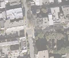
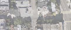
7 Carmelia St Water Movement Diagram The Wiggle is a favored route by bicyclists due to its gentle slope. This diagram illustrates the movement of stormwater in the project it can drain naturally without entering the sewer system. Water from surrounding streets is directed to these areas as well. Project Area Hayes St Wiggle Route Alternatives Direction of Flow General Direction of Drainage Flow Fell St Fillmore St Oak St Steiner Steiner St St Pierce Pierce St St Divisadero Divisadero St St Page St Haight St Laussat St Waller St Germania St Scott St Hermann St Duboce Park Castro St Duboce Ave


8 WIGGLE NEIGHBORHOOD GREEN CORRIDOR Streets for People a route that is comfortable and safe for all who walk, bike, and live along the Wiggle. Whether taking your dog to the park, biking with your children, or chatting with a neighbor outside your home, there are a few key roadway characteristics that the SFMTA can address to preserve the residential nature of the Wiggle streets: Ensure that pedestrians feel safe crossing the street Minimize congestion from motor vehicles Encourage slow, safe speeds from all roadway users Traffic Calming Toolbox they should go slowly and expect pedestrians and bicyclists of all abilities. Read on to learn how these features can address specific issues in this neighborhood! Portland 17 th and Shotwell, San Francisco Hayes Valley, San Francisco Education and Enforcement Through this project, the SFMTA will be able to make physical changes to the roadway. However, there are other ways to improve behavior that are not part of the built environment, such as police enforcement of thoughts and ideas that pertain to education and enforcement as well.


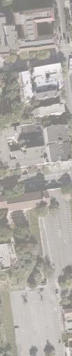

9 Van Ness Av Laguna St Fillmore St Laguna St Core Project Improvements Buchanan St Webster St Fillmore St Fell St Oak Oak St St Steiner St Pierce St Page Page St St Divisadero St Haight Haight St St Laussat Laussat St St Steiner St Waller Waller St St Germania Germania St St Hermann St Scott St Waller Waller St St Carmelia St Lloyd St Duboce Park Duboce Ave Castro St Project Site Market St Waller St Project Area Wiggle Route Alternatives Bulb-outs Permeable Pavement in Parking Lane Raised Crosswalk Location Speed Reduction Bars Divisadero St


10 WIGGLE NEIGHBORHOOD GREEN CORRIDOR Raised Crosswalks and Speed Reduction Pedestrians want to feel confident that drivers and bicyclists will yield to them when crossing the street especially with children and puppies in tow! Raised Crosswalks and Speed Reduction Bars highlight an upcoming crosswalk, encouraging roadway users to slow as they approach and turn through an intersection. Continuous Sidewalk 17 th and Shotwell, San Francisco This raised crosswalk is designed to provide a level pedestrian path and to match the materials of the sidewalk, accentuating the feeling of entering pedestrian space. Nancy Pelosi Drive, San Francisco Marked Speed Table This raised crosswalk maintains existing drainage flow along the curb, and uses asphalt to create a flatter version of a speed hump, known as a speed table, to create the raised crosswalk area. Santa Cruz Boardwalk In-Pavement Speed Reduction Bars Speed Reduction Bars are used to signal a change in the roadway, such as an approaching pedestrian crossing. The SFMTA proposes adding these at the downhill approaches to intersections along the Wiggle as an added reminder to roadway users to stop. These stripes would be narrower and spaced more closely than the dashed green markings seen in some SF bike lanes. West Palm Beachh Raised Intersections The SFMTA is also considering raised intersections, which are similar to raised crosswalks but cover the entire intersection and all four crosswalks. Haight and Pierce


 Castro St")

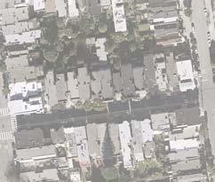
11 Permeable Paving Waller Street is very typical of city streets within the project area. Here is a potential before and after view of how permeable paving in vehicle parking areas can be incorporated for narrowing the roadway. Pierce St Bioretention in Bulb-out Fell St Buchanan St Webster Webster St St Fillmore St Proposed Bulb-out Oak St Pierce Pierce Pierce St St St Steiner Steiner St St Waller St Page St Haight St Pavement Rendering Steiner St Laussat St Scott St Waller St Waller St Germania St Permeable Pavement (Parking lane only) Castro St Lloyd St Carmelia St Duboce Park Duboce Ave Hermann St Existing Conditions on Waller Street Permeable Pavers Pervious Concrete Porous Asphalt


")


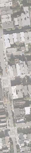
12 Castro St Carmelia St Pierce Pierce Pierce St St St Bulb-outs and Rain Gardens The corner of Waller and Pierce Streets is very typical of city streets and in the project area. Here is a potential before and after view of how a vegetated bulb-out can be incorporated at a street corner to capture stormwater runoff and improve pedestrian visibility at corners. Bulb-outs (also called Curb Extensions) extend the sidewalk into the parking lane to narrow the roadway, increasing visibility between people in the roadway (including drivers and bicycle riders) and those crossing the street. They also shorten crossing distances for pedestrians and can slow turns by drivers and bicycle riders. Pierce St Proposed Bulb-out Perspective View Permeable Pavement (Parking lane only) Bioretention in Bulb-out Waller St Fell St Buchanan St Webster Webster St St Fillmore St Oak St Steiner Steiner St St Page St Haight St Steiner St Laussat St Scott St Waller St Waller St Germania St Hermann St Lloyd St Duboce Park Duboce Ave Existing Proposed Improvements


13 WIGGLE NEIGHBORHOOD GREEN CORRIDOR Green Corridor Route Alternatives The green infrastructure and traffic calming improvements proposed in this project would create visual continuity along the corridor where they are placed. We would like to know if you have a preference for where traditional Wiggle bicycle route is on Haight and Scott. Haight/Scott (Traditional Wiggle) Placing these improvements on Haight and However, this block of Haight Street has a different character from the other streets along the proposed route, due to the buses and businesses on Haight, and some green infrastructure features may not be feasible. Pierce/Page (Alternative Route) Placing these improvements on Pierce and Page would provide increased opportunities for stormwater management and would be more cohesive terms of following primarily residential streets. However, these improvements would bypass a portion of the bicycle route. Note that Page street is also part of both the bicycle network and the proposed Green Connections network: Comparative Slopes of Route Alternatives Fell Fell & Divisadero Elevation (feet) Church & Duboce Distance from Church & Duboce (feet)


14 WIGGLE NEIGHBORHOOD GREEN CORRIDOR Concepts for Scott Street Motorists who drive through the neighborhood rather than to a local destination can cause congestion on residential streets. The treatments presented below would reduce automobile traffic, making Scott Street more comfortable for residents, bicycle riders and pedestrians, but could potentially increase automobile traffic on adjacent streets. Do you like these treatments for Scott? Should we continue to study what the effects would be? Northbound and Southbound Diverters A paired set of traffic diverters could drastically reduce traffic on Scott Street by restricting auto access in both directions, either at one intersection or spaced a few blocks apart. Southbound Diverter at Oak or Fell A partial diverter that restricts southbound motor vehicle access could be placed at either Oak Street or Fell Street with similar effects on traffic circulation in the neighborhood. While this option would improve conditions for people who walk, bicycle and live on these blocks of Scott Street, this treatment would also have the greatest effect on traffic circulation in the neighborhood. Vancouver Photo by Payton Chung Diverters reduce traffic volumes by limiting through-traffic on neighborhood streets while maintaining pedestrian and bicycle access, as well as access to residential addresses and driveways. A Partial Diverter, shown above, blocks the entrance to a block at one end to limit one direction of traffic. Use your questionnaire to let us know how much you like the idea of restricting traffic on Scott either southbound only, or in both directions and whether you have a preferred location along Scott for these types of treatments.
 would have a traffic circulation effect similar to adding a southbound-only traffic diverter, but")


15 WIGGLE NEIGHBORHOOD GREEN CORRIDOR One-Way Street One Block of Scott Turning one block of Scott into a one-way northbound street (with a southbound bicycle lane) would have a traffic circulation effect similar to adding a southbound-only traffic diverter, but would provide additional space in the roadway for greening or angled parking. Similar to the block of Pierce Street between Fell and Oak, all addresses and driveways would be accessible from one direction. Page and Scott Traffic Circle A traffic circle at Page and Scott would help pedestrians, drivers, and bicycle riders negotiate the intersection, reducing the conflicts normally created by left turns. Traffic circles do not restrict auto access, but could be used in conjunction with traffic diverters to enhance the traffic calming benefits of each. N Vancouver Photo by Payton Chung 23 rd and Anza, San Francisco Photo by Aaron Bialick Traffic Circles Then & Now In 2003, the SFMTA experimented with removing stop signs and installing traffic circles at several locations along Page Street. Many residents complained that the circles were unsightly and deprioritized pedestrians, and they were removed. However, in recent years the SFMTA has installed traffic circles with success and community support, using improved outreach, design, and signage. We would not remove stop signs at Page and Pierce. Bulb-outs and Raised Crosswalks Please also rate the option of continuing the traffic calming treatments used throughout the rest of the project area instead of having special improvements on Scott. This option would use raised crosswalks, bulb-outs, and speed humps to achieve traffic calming and pedestrian visibility improvements. Divisadero Street Improvements Crosstown traffic passing through this neighborhood is most appropriate on Divisadero, but when Divisadero gets backed up, drivers often use Scott Street to avoid the congestion. In addition to Scott Street changes, the SFMTA is exploring improvements to Divisadero that would make traffic flow more smoothly to make it more attractive to crosstown drivers.

16 WIGGLE NEIGHBORHOOD GREEN CORRIDOR Haight Street Transit Improvements The Transit Effectiveness Project (TEP) is an on-going program of the SFMTA that aims to improve service reliability, reduce travel time on transit, and improve customer experiences and service efficiency. Haight Street is one of the key transit corridors in San Francisco and the TEP is investigating opportunities to make improvements along Haight Street, including in the Wiggle Neighborhood Green Corridor project area. Traffic Signals at Scott Street and Pierce Street The TEP proposes converting the all-way stop signs along the Wiggle route into traffic signals equipped with transit signal priority. Traffic signals can clarify the right-of-way for pedestrians while minimizing travel time delays for buses. This would make these intersections (Haight and Scott and Haight and Pierce) consistent with other intersections in this part of Haight Street, such as at Haight and Steiner. Signals could add delay to pedestrians, drivers and bicyclists but would help establish right of way. Moving the Pierce Street Bus Stops The existing bus stop at the southwest corner of Pierce and Page creates a dangerous situation where bicycle riders pass a bus to the left (while it is picking up passengers), and then make a right turn in front of the bus. The SFMTA will be moving both bus stops to the far side of the intersection to remove this obstacle. Combined with the new traffic signal, this would ensure that buses do not stop twice at intersections. New Bus Bulb-outs at Divisadero and Fillmore Transit bulbs can reduce transit travel times on bus routes by eliminating the need for buses to pull out of and back into traffic to access curbside transit stops and improves boarding by allowing buses to align directly with the curb. They also increase passenger comfort while waiting and provide more sidewalk space for transit shelters and streetscape improvements. Pedestrian safety is also improved through reduced street crossing distance, improved visibility and reduced speed of turning traffic More Frequent Limited-Stop Service The 71L currently only runs during the morning and afternoon commute hours. The service hours would be extended to provide all-day limited service along the Haight Street corridor. The extended hours would be combined with increased frequency to reduce crowding on Haight Street buses. For more information about the TEP, please visit


17 Get Involved! There are things you can do to help reduce the amount of stormwater going into the combined sewer system. Help Build Green Infrastructure Projects Near You! Join the SFPUC as we plan, design and build Green Infrastructure projects in the city: Get a Sidewalk Garden on Your Block! Gather your neighbors and get a free Sidewalk Garden. Apply with our partners at Friends of the Urban Forest: Use Green Technologies at Home Learn how to capture and reuse your rainwater at home for irrigation and help keep stormwater out of the combined sewer system: Laundry to Landscape Subsidy Program Don t let good water go to waste. Irrigate your backyard with graywater from your laundry machine: Protect Our Grey Infrastructure Keep fats, oils, and grease out of your sinks and drains, and recycle at convenient drop off points: Make a Lasting Impact! Be a part of San Francisco s longterm planning process of sewer system improvements for the next twenty years. To get involved, visit: sfwater.org/urbanwatersheds. Connect with the SFPUC to help improve local stormwater management and assist the SSIP. ssip@sfwater.org
The Wiggle Route in Context
 The Wiggle Route in Context In a city of hills, the Wiggle is an important route because it winds its way along the flattest streets from Market to the Panhandle, bringing residents to local parks and
Broad Street Bicycle Boulevard Design Guidelines
 Broad Street Bicycle Boulevard Design Guidelines Building from the strategies introduced in the 2013 Bicycle Transportation Plan and community input received thus far, City Transportation Staff have identified
Tonight is for you. Learn everything you can. Share all your ideas.
 Strathcona Neighbourhood Renewal Draft Concept Design Tonight is for you. Learn everything you can. Share all your ideas. What is Neighbourhood Renewal? Creating a design with you for your neighbourhood.
WELCOME Mission-Geneva Transportation Study
 WELCOME Mission-Geneva Transportation Study Study Process and Schedule 2005 2006 Oct Nov Dec Jan Feb Mar Apr May Jun Jul Aug Sept Oct Task 2 Develop Outreach Plan Task 3 Document Existing Conditions/ Prioritize
Appendix C. TRAFFIC CALMING PROGRAM TOOLBOX
 Appendix C. TRAFFIC CALMING PROGRAM TOOLBOX PHASE I...2 Do Not Enter Sign...3 One-Way Sign...4 Turn Prohibition...5 Pavement Markings...6 Speed Monitoring Trailer...7 Neighborhood Speed Watch...8 Police
Project Goal and Description. Why Broadway? Broadway SFMTA.COM/BROADWAY. The goal of the Broadway Safety Improvement
 PROJECT OVERVIEW Project Goal and Description The goal of the Broadway Safety Improvement d St Van Ness Ave Project is to improve safety and comfort for all who Franklin St Hyde St Octavia St Gough St
Geary Corridor Bus Rapid Transit: Staff-Recommended Alternative
 Geary Corridor Bus Rapid Transit: Staff-Recommended Alternative Urban Forestry Council January 24, 2014 SAN FRANCISCO COUNTY TRANSPORTATION AUTHORITY SAN FRANCISCO MUNICIPAL TRANSPORTATION AGENCY Today
WORKSHOP 2 SUMMARY OVERVIEW GENERAL COMMENTS. Walking and Biking. Greening & Stormwater. Transportation & Parking. Lighting, Art and Identity
 WORKSHOP 2 SUMMARY OVERVIEW On May 9, 2016, 55 people came to the second public meeting for the Lower Haight Public Realm Plan. Roughly 34 of attendees were neighborhood residents. The open house was a
Welcome! Thank you for joining us today for a Geary Rapid project open house. Geary Rapid Project. SFMTA.com/GearyRapid
 Welcome! Thank you for joining us today for a Geary Rapid project open house. Get the most out of this event: 1. Sign in and get your feedback sheet 2. Visit project information stations hosted by project
Caltrans Sloat Boulevard Pedestrian Safety Project Response to Community Questions, Comments & Concerns
 Caltrans Sloat Boulevard Pedestrian Safety Project Response to Community Questions, Comments & Concerns Revised: May 10, 2016 The California Department of Transportation (Caltrans) is planning various
Mission-Geneva Transportation Study Community Workshop 2 July 8, 2006
 Community Workshop 2 July 8, 2006 Small Group Workbook 1 Basic Improvements on Mission Street Streetscape. Pedestrian-scale lighting; landscaping; community art on utility boxes; more (possibly unique)
PEDALING FORWARD. A Glance at the SFMTA s Bike Program for SFMTA.COM
 PEDALING FORWARD A Glance at the SFMTA s Bike Program for 2017-2021 SFMTA.COM INTRODUCTION About This Booklet More people from all walks of life see their bicycle as a more convenient way to get where
PROJECT OVERVIEW. 20th Avenue Project Limits (Lincoln Way to Wawona St)
") PROJECT OVERVIEW In 2014, San Francisco adopted Vision Zero as City policy, with a commitment to eliminate all traffic deaths in the City by 2024. nue Project Limits (Lincoln Way to St) Collision data
PROJECT OVERVIEW In 2014, San Francisco adopted Vision Zero as City policy, with a commitment to eliminate all traffic deaths in the City by 2024. nue Project Limits (Lincoln Way to St) Collision data
SFMTA PROJECT TIMELINE
 SFMTA PROJECT TIMELIE Internal SFMTA Processes Opportunities for Public Input Data Collection and Analysis Car and bike volumes, safety (collision) data Roadway and intersection geometry June 2016 Pop
City of Wilsonville 5 th Street to Kinsman Road Extension Project
 City of Wilsonville 5 th Street to Kinsman Road Walking Tour & Neighborhood Workshop Summary Report Public Outreach Overview On July 18 th, 2017, the City of Wilsonville hosted a neighborhood walking tour
MASONIC AVENUE STREET DESIGN STUDY Community Workshop 2. Masonic Ave Street Design Study Community Workshop 2 August 10, 2010
 Masonic Ave Street Design Study Community Workshop 2 August 10, 2010 Introduction MASONIC AVENUE STREET DESIGN STUDY Community Workshop 2 SF Municipal Transportation Agency Javad Mirabdal, Project Manager
SAN FRANCISCO MUNICIPAL TRANSPORTATION AGENCY
 THIS PRINT COVERS CALENDAR ITEM NO.: 10.3 DIVISION: Sustainable Streets BRIEF DESCRIPTION: SAN FRANCISCO MUNICIPAL TRANSPORTATION AGENCY Approving various traffic and parking modifications on Bay Street
Active Transportation Facility Glossary
 Active Transportation Facility Glossary This document defines different active transportation facilities and suggests appropriate corridor types. Click on a facility type to jump to its definition. Bike
City of Vallejo Traffic Calming Toolbox
 City of Vallejo Traffic Calming Toolbox June 1, 2013 Final Table of Contents Introduction... 1 Non-Physical Devices... 3 High-Visibility Crosswalk... 3 In Pavement Lighted Crosswalk... 4 Rapid Flashing
Item to be Addressed Checklist Consideration YES NO N/A Required Description Complete Streets Guidelines
 Passaic County Complete Streets Checklist - Concept Development Project Name Item to be Addressed Checklist Consideration YES NO N/A Required Description Complete Streets Guidelines Existing Plans Have
Protected Bike Lanes in San Francisco Mike Sallaberry SFMTA NACTO Workshop - Chicago IL
 Protected Bike Lanes in San Francisco Mike Sallaberry SFMTA 10 14 2011 NACTO Workshop - Chicago IL San Francisco 2 nd Highest Density in the U.S. 47 square miles Mild Climate Market Population ~810,000
Bicycle Facilities Planning
 Bicycle Facilities Planning Overview Types of Cyclists Purpose for Riding Types of Facilities Bike Lanes Bicycle Boulevards Cycle Tracks Intersections Signals Signing and Marking Discussion Types of Bicyclists
25th Avenue Road Diet Project A One Year Evaluation. Transportation Fund for Clean Air Project #05R07
 25th Avenue Road Diet Project A One Year Evaluation Transportation Fund for Clean Air Project #05R07 Submitted by: The San Francisco Municipal Transportation Agency Dan Provence May 22, 2009 EXECUTIVE
Polk Streetscape Project
 What is this project? The Polk Streetscape Project is an effort to improve safety for everyone traveling on Polk Street between Union and McAllister streets. Also included in this project are paving, sewer
Living Streets Policy
 Living Streets Policy Introduction Living streets balance the needs of motorists, bicyclists, pedestrians and transit riders in ways that promote safety and convenience, enhance community identity, create
Pedestrian and Bicycle Improvements in Balboa Park Station Area
 Pedestrian and Bicycle Improvements in Balboa Park Station Area Jamie Parks & Jen Wong, SFMTA, Livable Streets December 15, 2015 Balboa Park Station CAC Monthly Meeting Vision Zero SF Zero traffic deaths
CONNECTIVITY PLAN. Adopted December 5, 2017 City of Virginia Beach
 CONNECTIVITY PLAN Adopted December 5, 2017 City of Virginia Beach CONTENTS 1.0 Background & Purpose... 2 2.0 Existing Inventory & Analysis... 3 ViBe District Existing Walking Conditions... 4 3.0 ViBe District
Geary Bus Rapid Transit Project
 Geary Bus Rapid Transit Project Outreach Update SAN FRANCISCO COUNTY TRANSPORTATION AUTHORITY SAN FRANCISCO MUNICIPAL TRANSPORTATION AGENCY April 28, 2016 Project Activities Since January Meeting Continued
THE ALAMEDA CONCEPT DESIGN COMMUNITY MEETING 3. A Plan for The Beautiful Way JANUARY 28, 2010
 CONCEPT DESIGN COMMUNITY MEETING 3 JANUARY 28, 2010 AGENDA INTRODUCTION COMMUNITY INPUT ROADWAY STUDIES STREETSCAPE DESIGN STATIONS DISCUSSION SUMMARY AND DISCUSSION NEXT STEPS CLOSE INTRODUCTION SCHEDULE
Bicycle and Pedestrian Advisory Committee (BPAC) November 21, 2013
 November 21, 2013") Bicycle and Pedestrian Advisory Committee (BPAC) November 21, 2013 OVERALL LAND USE CONCEPT Overall Broadway Valdez District: 95.5 acres (35.1 acres right-of ways + 60.4 acres developable land) Plan Subareas:
Bicycle and Pedestrian Advisory Committee (BPAC) November 21, 2013 OVERALL LAND USE CONCEPT Overall Broadway Valdez District: 95.5 acres (35.1 acres right-of ways + 60.4 acres developable land) Plan Subareas:
Crystal City Potomac Yard Transitway. Enforcement Ordinance & Construction Update
 Enforcement Ordinance & Construction Update December 2015 Project Purpose Provide high-capacity, high-quality transit service Support redevelopment in Crystal City and in Potomac Yard in Alexandria and
MARTIN LUTHER KING JR. WAY
 OCTOBER 2011 40 Vision and Goals The Martin Luther King, Jr. Way Illustrative Master Plan that follows has been developed through a process of community involvement. It expresses a long term vision for
SAN FRANCISCO MUNICIPAL TRANSPORTATION AGENCY
 THIS PRINT COVERS CALENDAR ITEM NO. : 10.2 DIVISION: Sustainable Streets BRIEF DESCRIPTION: SAN FRANCISCO MUNICIPAL TRANSPORTATION AGENCY Adopting Conceptual Proposal for Streetscape Improvements to Broadway,
Safe Routes to School Action Plan Aberdeen, Idaho
 Background Aberdeen, Idaho is a largely agricultural community of nearly 2,000 people and is located in the southeast portion of the state on the western edge of American Falls Reservoir. The community
BETHEL ROAD AND SEDGWICK ROAD CORRIDOR STUDY
 DRAFT PLAN City Council Meeting August 14, 2017 STUDY AREA Sedgwick Corridor State Route 160, principal arterial with Class 3 access management designation, commuter and freight route, connection to SR
Mission Bay Loop (MBL) Public Meeting
 Public Meeting") Mission Bay Loop (MBL) Public Meeting La Scuola Internazionale di San Francisco, November 18, 2014 Frequently Asked Questions 1. When would construction have to start before the SFMTA loses TIGER funds?
Mission Bay Loop (MBL) Public Meeting La Scuola Internazionale di San Francisco, November 18, 2014 Frequently Asked Questions 1. When would construction have to start before the SFMTA loses TIGER funds?
Upper Market Street Bike Lane Project
 Upper Market Street Bike Lane Project 17th Street to Octavia Boulevard 6 30 2010 SAN FRANCISCO, CALIFORNIA Agenda San Francisco & Sustainable Transportation Project Goals Outreach & Coordination Project
MASONIC AVENUE STREET DESIGN STUDY Community Workshop 3. Masonic Ave Street Design Study Community Workshop 3 September 30, 2010
 Masonic Ave Street Design Study Community Workshop 3 September 30, 2010 Introduction MASONIC AVENUE STREET DESIGN STUDY Community Workshop 3 SF Municipal Transportation Agency Javad Mirabdal, Project Manager
TRAFFIC CALMING PLANNER S PORTFOLIO
 TRAFFIC CALMING PLANNER S PORTFOLIO ISSUE 8 January 2017 PLANNER S PORTFOLIO TRAFFIC CALMING 1 OVERVIEW 2 3 4 ENGINEERED TRAFFIC CALMING MEASURES SIGNS AND PAVEMENT MARKINGS EMERGENCY RESPONSE DELAYS 5
Public Information Centre
 WELCOME Public Information Centre Father Tobin Road Lougheed Middle School - Library Wednesday November 7, 2012 7:00 p.m.to 9:00 p.m. Please sign in Neighbourhood Traffic Calming Guide Background The City
Providence Downtown Transit Connector STAKEHOLDER MEETING #2. Stakeholder Meeting #1 October 24, 2016
 Providence Downtown Transit Connector STAKEHOLDER MEETING #2 Stakeholder Meeting #1 October 24, 2016 February 2017 1 AGENDA 1 DTC Goals and Expectations 2 Street Design Concepts 3 Potential Benefits and
CONNECTING PEOPLE TO PLACES
 CONNECTING PEOPLE TO PLACES 82 EAST BENCH MASTER PLAN 07 Introduction The East Bench transportation system is a collection of slow moving, treelined residential streets and major arteries that are the
CITY OF SLO SEEKS INPUT ON PREFERRED ALTERNATIVE FOR BROAD STREET BICYCLE BOULEVARD PROJECT
 City of San Luis Obispo, News Release DATE: August 1, 2017 RELEASE: Immediate CONTACT: Luke Schwartz (805) 781-7190 Transportation Planner-Engineer, Public Works CITY OF SLO SEEKS INPUT ON PREFERRED ALTERNATIVE
Watertown Complete Streets Prioritization Plan. Public Meeting #1 December 14, 2017
 Watertown Complete Streets Prioritization Plan Public Meeting #1 December 14, 2017 Goals for Public Meeting Overview of MassDOT Complete Streets Funding Program Educate the community on Complete Streets
Data Analysis February to March Identified safety needs from reported collisions and existing travel patterns.
 Welcome! Thank you for participating in today s Valencia Bikeway Improvements workshop. Data Analysis February to March Identified safety needs from reported collisions and existing travel patterns. Initial
ABOUT THIS OPEN HOUSE
 ABOUT THIS OPEN HOUSE Welcome, and thanks for joining us today for the Folsom-Howard Near-Term Project! The purpose of today s open house is to: Understand how the near-term project ties into the larger
WELCOME Public Information Centre
 WELCOME Public Information Centre Fernforest Drive Brampton Soccer Centre Community Room #2 Tuesday January 19, 2016 6:30 p.m.to 9:00 p.m. Please sign in Neighbourhood Traffic Calming Guide Background
2014/2015 BIKE ROUTE PLAN 83 AVENUE PROTECTED BIKE LANE
 About the Project 2014/2015 BIKE ROUTE PLAN The City of Edmonton is planning a major bike route on the south side of Edmonton. This bike route is one part of a plan to provide citizens with transportation
City of Elizabeth City Neighborhood Traffic Calming Policy and Guidelines
 City of Elizabeth City Neighborhood Traffic Calming Policy and Guidelines I. Purpose: The City of Elizabeth City is committed to ensure the overall safety and livability of residential neighborhoods. One
Data Analysis February to March Identified safety needs from reported collisions and existing travel patterns.
 Welcome! Thank you for participating in today s Valencia Bikeway Improvements workshop. Data Analysis February to March Identified safety needs from reported collisions and existing travel patterns. Initial
CURBSIDE ACTIVITY DESIGN
 5 CURBSIDE ACTIVITY DESIGN This chapter provides design guidance for separated bike lanes adjacent to curbside activities including parking, loading and bus stops. Typical configurations are presented
Fifth & Kirkham Traffic-Calming Project. 5 th Avenue and Kirkham Street Presented at the UCSF Quarterly Parnassus Community Meeting May 3, 2018
 Fifth & Kirkham Traffic-Calming Project 5 th Avenue and Kirkham Street Presented at the UCSF Quarterly Parnassus Community Meeting May 3, 2018 1 Agenda Welcome and introductions Project history, goals,
TRAFFIC CALMING TOOLBOX. For the residents of the City of Decatur, Georgia
 TRAFFIC CALMING TOOLBOX For the residents of the City of Decatur, Georgia 2 City of Decatur Traffic Calming Toolbox Public Works Department 2635 Talley Street Decatur, GA 30030 404.377.5571 3 Welcome to
Freeway ramp intersection study
 Freeway ramp intersection study Supporting Vision Zero: Zero traffic deaths in San Francisco by 2024 Study Goals: Primary Improve Safety Improve Accessibility Secondary Provide Efficient Circulation Accommodate
By: Bill Baranowski, PE TRAFFIC CALMING EXAMPLES IN SUGARHOUSE, DAYBREAK, AND WEST JORDAN CITY
 By: Bill Baranowski, PE TRAFFIC CALMING EXAMPLES IN SUGARHOUSE, DAYBREAK, AND WEST JORDAN CITY 1977 HIGHLAND RUGBY TOUR 1945 WHERE??? What is more contentious than traffic calming? 1951 LOOKING SOUTHEAST
FOCUS AREA 1 - Alberta Avenue Pocket Park 3 (121 Ave and 92 St)
") FOCUS AREA 1 - Alberta Avenue Pocket Park 3 (121 Ave and 92 St) New benches Plant evergreen trees Widen existing sidewalk from 1.5m to 1.8m Marked crosswalk 1.8m wide sidewalk Add pedestrian oriented lights
FOCUS AREA 1 - Alberta Avenue Pocket Park 3 (121 Ave and 92 St) New benches Plant evergreen trees Widen existing sidewalk from 1.5m to 1.8m Marked crosswalk 1.8m wide sidewalk Add pedestrian oriented lights
2014/2015 BIKE ROUTE PLAN 83 AVENUE PROTECTED BIKE LANE
 About the Project The City of Edmonton is planning a major bike route on the southside of Edmonton. The Strathcona Bike Route will connect the communities of Strathcona, Garneau and the University area,
Central Freeway and Octavia Circulation Study
 Central Freeway and Octavia Circulation Study Final Report Plans and Programs Committee San Francisco County Transportation Authority September 18, 2012 Presentation Outline Background and Study Purpose
Agenda. Overview PRINCE GEORGE S PLAZA METRO AREA PEDESTRIAN PLAN
 PRINCE GEORGE S PLAZA METRO AREA PEDESTRIAN PLAN May 28, 2008 Agenda Welcome and introductions Project overview and issue identification Planning context and strengths Design challenges and initial recommendations
Bellevue Downtown Association Downtown Bike Series
 Bellevue Downtown Association Downtown Bike Series Meeting 2 Franz Loewenherz Andreas Piller Kyle Potuzak Chris Long October 26, 2017 Today s Agenda: 1) Meeting Purpose 2) 9/28 Meeting Recap 3) Candidate
CITY OF OTTAWA ROADWAY MODIFICATION APPROVAL UNDER DELEGATED AUTHORITY
 RMA-2015-ATM-038 CITY OF OTTAWA ROADWAY MODIFICATION APPROVAL UNDER DELEGATED AUTHORITY DATE: April 22, 2015 SUBJECT Approval of Roadway Modifications Recommended through an Area Traffic Management Study
Executive Summary Route 30 Corridor Master Plan
 Route Corridor Master Plan Project Overview The Route Corridor Master Plan is a coordinated multimodal transportation and land use plan for the entire stretch of Route through East Whiteland Township,
Ocean Park Boulevard Green Street Project Alternatives & Trade Offs
 Planning Commission March 4, 2009 Ocean Park Boulevard Green Street Project Alternatives & Trade Offs Purpose of Tonight s Meeting Review concept plans and options Provide input on alternatives and trade-offs
El Centro Mobility Hub
 The El Centro drive shed comprises a major portion of the El Centro downtown area, which is well served by bus routes. The proposals intend to promote use of public transit through improvements and enhancements
PRINCE GEORGE S PLAZA METRO AREA PEDESTRIAN PLAN
 PRINCE GEORGE S PLAZA METRO AREA PEDESTRIAN PLAN May 28, 2008 Agenda Welcome and introductions Project overview and issue identification Planning context and strengths Design challenges and initial recommendations
Southside Pilot Proposal
 To improve bicycle access and mobility to UC Berkeley, Downtown Berkeley, and the Southside area, a pilot project could include a two-way parking-protected cycle track. Turn pockets and island bus stops
20 th Avenue Neighborway Project August 2, Second Open House
 20 th Avenue Neighborway Project August 2, 2018 - Second Open House General Comments We love the plan in general and appreciate the SFMTA looking out for walkers and bikers. Can we get better traffic enforcement
FOLSOM-HOWARD STREETSCAPE OVERVIEW
 FOLSOM-HOWARD STREETSCAPE OVERVIEW SoMa residents should have the same kinds of amenities that other neighborhoods have. The Folsom- Howard Streetscape Project will make SoMa more livable by making it
5 Transit & Traffic. Overview
 5 Transit & Traffic Overview Montgomery Place s roadways and overall traffic circulation are unique in the city due to the narrow streets and avenues with boulevards; however, no sidewalks or curbs in
o n - m o t o r i z e d transportation is an overlooked element that can greatly enhance the overall quality of life for the community s residents.
 N o n - m o t o r i z e d transportation is an overlooked element that can greatly enhance the overall quality of life for the community s residents. 84 Transportation CHAPTER 11 INTRODUCTION Transportation
Sandwich Pedestrian/Bicycle Planning
 Sandwich Pedestrian/Bicycle Planning Improved Pedestrian and Bicycle Connections with the Cape Cod Canal Multi-use Path February 2014 Table of Contents Introduction... 1 Background... 1 Study Goals...
SAFE ROUTES TO SCHOOL (SR2S)
") SAFE ROUTES TO SCHOOL (SR2S) In partnership with Burbank Unified School District (BUSD) & City of Burbank George Washington Elementary School Thomas Jefferson Elementary School John Muir Middle School
SAFE ROUTES TO SCHOOL (SR2S) In partnership with Burbank Unified School District (BUSD) & City of Burbank George Washington Elementary School Thomas Jefferson Elementary School John Muir Middle School
California Department of Transportation, District 4. Sloat Boulevard Project Skyline Blvd. to 19 th Ave. Community Update January 13, 2016
 California Department of Transportation, District 4 Sloat Boulevard Project Skyline Blvd. to 19 th Ave. Community Update January 13, 2016 Agenda Welcome and introductions Project overview, history and
Make Lincoln Highway an economically vibrant corridor that is safe, efficient, and beautiful for local residents and visitors.
 Lincoln Highway Streetscape Plan Stakeholder Workshop #2 Handout Contents Introduction and Project Vision Planning Principles Specific Recommendations including a Proposed Typical Roadway Section Renderings
East Burke Transportation, Safety and Capacity Improvements
 East Burke Transportation, Safety and Capacity Improvements The purpose of this project is to increase mobility and improve safety for pedestrians, cyclists, and motor vehicles along VT Route 114 in the
Saskatchewan Drive Roadway Rehabilitation and Shared-Use Path Widening
 Saskatchewan Drive Roadway Rehabilitation and Shared-Use Path Widening We are here today to present the draft plan for the Saskatchewan Drive Roadway Rehabilitation and Shared-Use Path Widening project
About the Studio. Edward J. Bloustein School of Planning and Public Policy - Rutgers University
 About the Studio Edward J. Bloustein School of Planning and Public Policy - Rutgers University Purpose of studio: Help City of Bayonne apply for Safe Routes to School (SRTS) funding by producing a School
5. Automobile Circulation, Wayfinding and Signage
 5. Automobile Circulation, Wayfinding and Signage Policy: The City Center should have a balanced, safe, and interconnected circulation system that provides expanded travel opportunities for transit, pedestrian,
Environment and Public Works Committee Presentation
 Mixed Use Centers Complete Streets Guidelines Project Environment and Public Works Committee Presentation December 10, 2008 Project Objectives: Conduct an inter-departmental and agency process to study
Outreach Approach RENEW SF served as the primary liaison with the North Beach community; the Chinatown. Executive Summary
 Executive Summary Executive Summary The Columbus Avenue Neighborhood Transportation Study s objective is to identify changes to transportation infrastructure and policies that could enhance the livability
City of Novi Non-Motorized Master Plan 2011 Executive Summary
 City of Novi Non-Motorized Master Plan 2011 Executive Summary Prepared by: February 28, 2011 Why Plan? Encouraging healthy, active lifestyles through pathway and sidewalk connectivity has been a focus
Design Guidelines. Overview. Design Vision for Yellow Brick Road
 Design Guidelines Overview This section presents the design vision for the Yellow Brick Road network. The Yellow Brick Road is envisioned to be an interconnected network of safe and secure roadways where
Memorandum. Sunday, July 13, Saturday, July 19, 2014
 Memorandum To: David Lowin, Brooklyn Bridge Park Corporation From: Daniel Schack, AICP, PTP Date: Re: Brooklyn Bridge Park Pier 5/6 Loop Road Traffic Study Project No: 14-01-2407 At the request of Brooklyn
RZC Appendix 8A Marymoor Subarea Street Requirements
 RZC Appendix 8A Marymoor Subarea Street Requirements For additional design details for Marymoor Subarea infrastructure, refer to the 2017 Marymoor Subarea Infrastructure Planning Report. STREET REQUIREMENTS
El Camino Real Specific Plan. TAC/CAC Meeting #2 Aug 1, 2018
 El Camino Real Specific Plan TAC/CAC Meeting #2 Aug 1, 2018 Land Use Alternatives Goals and Tradeoffs Parks & open space Housing Retail & services Civic spaces Parking Community gathering spaces 3 Alternatives
Bicycle Network. Vision Zero San Francisco The City and County of San
 PROJECT BACKGROUND Project Needs 1. 17th between Church and Sanchez is identified as a location where there is a disproportionate number of crashes involving people riding bikes. 2. There is currently
COWETA HIGH SCHOOL AND EAST HIGHWAY 51
 COWETA HIGH SCHOOL AND EAST HIGHWAY 51 Lack of sidewalks along Ben Lumpkin Rd. Lack of crosswalks and ramps at intersection. Hwy 51 is wide to cross as a pedestrian. No ADA compliance or connection to
Community Task Force November 15, 2017
 Community Task Force November 15, 2017 Welcome and Introductions Project Partners Regional Transportation District (RTD) Colorado Department of Transportation (CDOT) Denver Regional Council of Governments
Geary Corridor Bus Rapid Transit SFMTA Citizens Advisory Committee
 Geary Corridor Bus Rapid Transit SFMTA Citizens Advisory Committee Project Update SAN FRANCISCO COUNTY TRANSPORTATION AUTHORITY SAN FRANCISCO MUNICIPAL TRANSPORTATION AGENCY August 6, 2015 Project Overview
Omaha s Complete Streets Policy
 Omaha s Complete Streets Policy (Adopted August 2015) VISION To create great places and enhance our quality of life, the City of Omaha will provide safe, accessible streets for all users. Complete Streets
September 20, 2016 L Taraval Rapid Project SFMTA Board of Directors Meeting
 September 20, 2016 L Taraval Rapid Project SFMTA Board of Directors Meeting WHY TARAVAL STREET L TARAVAL PROJECT GOALS 1. Improve state of good repair of our transit system Track and overhead replacement
Traffic Calming SECTION 1, CHAPTER Introduction What is Traffic Calming?
 SECTION 1, CHAPTER 6 Traffic Calming 6.1 Introduction 6.1.1 What is Traffic Calming? Traffic calming deals with neighborhood traffic issues comprehensively using the three E s, Education, Enforcement,
City of Sammamish. Welcome. Issaquah-Fall City Road Improvements Project Phase I Design: 242nd Avenue SE to Klahanie Drive SE
 Welcome Welcome to the third community meeting for the Issaquah-Fall City Road Improvements Project. AGENDA 6:00 p.m. Welcome and sign-in 6:10 p.m. Presentation 6:50 p.m. Open house Learn about the roadway
SFMTA SAN FRANCISCO MUNICIPAL TRANSPORTATION AGENCY
 SFMTA SAN FRANCISCO MUNICIPAL TRANSPORTATION AGENCY VAN NESS BUS RAPID TRANSIT PROJECT UPDATE PRESENTATION TO SFMTA BOARD OF DIRECTORS RELEASE OF DRAFT ENVIRONMENTAL IMPACT STATEMENT / REPORT 10 18 2011
4 GENERIC COST ESTIMATING TOOL
 4 GENERIC COST ESTIMATING TOOL Table 4-1 presents a generic cost estimating tools that can serve as a conceptual planning tool for local jurisdictions to estimate the costs of pedestrian improvements.
Options. Agenda. Program
 July 2013 Workshops Agenda Parc 55 Main Library Open house 6-6:15pm 10-10:15am Presentation 6:15-7:00pm 10:15-11am Exhibit stations review & comments 7-8:20pm 11am - 12:20pm Meeting close 8:20-8:30pm 12:20-12:30pm
Complete Streets. Designing Streets for Everyone. Sarnia
 Complete Streets Designing Streets for Everyone Sarnia Complete Streets ~ Sarnia ~ 2018 Introduction Our City is made up of a network of streets that we use to go for a walk, cycle to work, drive to the
Memo. Ocean Avenue Corridor Design Project Public Workshop #2 Summary
 Ocean Avenue Corridor Design Project Public Workshop #2 Summary The second public workshop for the Ocean Avenue Corridor Design Project was held on Wednesday, May 14, 2014 from, 6 to 8 pm at Lick Wilmerding
MINERAL AVENUE CORRIDOR ASSESSMENT STUDY IMPLEMENTATION STRATEGY
 MINERAL AVENUE CORRIDOR ASSESSMENT STUDY IMPLEMENTATION STRATEGY INTRODUCTION City Personnel Sign-in Sheet Comment Forms Please Write Down Any Feedback INTRODUCTION List of Topics for Presentation Study
Lincoln Neighborhood Corridor Plan The LiNC
 CITY OF SANTA MONICA Lincoln Neighborhood Corridor Plan The LiNC PLANNING COMMISSION September 2, 2015 COMMUNITY DESIGN + ARCHITECTURE TEAM: Community Design + Architecture Iteris Studio 111 Urban Place