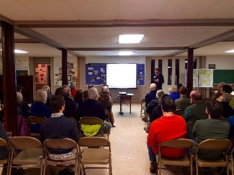
Leveraging Active Transportation & Recreation for Economic Development in Rural VT Vermont Bike Walk Summit
|
|
|
- Roy Morris
- 5 years ago
- Views:
Transcription
1 Leveraging Active Transportation & Recreation for Economic Development in Rural VT 2018 Vermont Bike Walk Summit

2
3

4

5

6

7

8


9


10
11 MRV Moves Active Transportation Plan Scope & Purpose Watershed-wide long-range vision for active transportation Cohesive & collaborative framework for realizing the vision Communicates the importance of a connected network of active transportation & recreation facilities Future Opportunities Map for the MRV Guidance for: Trail and facility design & management Implementation Funding


12
13 DO YOU RIDE A BIKE FOR RECREATION OR TRANSPORTATION IN THE MRV? No, I don't ride a bike 37% Yes, for recreation 41% Yes, for both 21% Yes, for transportation 1%

14 Destinations you bike or walk to The most common destinations included the village centers, trailheads and recreation areas, work and school.
15 WHAT ACTIVITIES DO YOU ENGAGE IN ON TRAILS IN THE MRV? WALKING 88% JOGGING 36% HIKING 75% WALKING PETS BICYCLING 45% 50% HORSEBACK SNOWMOBILING 5% 4% SKIING 58% SNOWSHOEING 64% HUNTING OTHER 7% 6% 0% 10% 20% 30% 40% 50% 60% 70% 80% 90% 100%
16 MRV Commuting Barriers to walk/bike: Hills, Hills, Hills Dangerous traffic/unsafe roads Too many "close calls" on Rt. 100 Need to bring the dog Difficult to carry gear Commuting with young children Destinations too far apart WHAT MODE DO YOU MOST FREQUENTLY USE TO COMMUTE TO WORK WHEN IN THE MRV? Foot 1% HOW DO YOU TYPICALLY GET TO THE TRAILHEAD? Walk 18% Not applicab le 14% I don't commute 21% Bike 3% Car 61% Other - Write In 5% I would have to walk on Route 100 to get there! Bike 13% Car/Van/ Truck
17 How can we improve conditions for bicyclists and pedestrians? A dd a tr ail, b i k e way o r s i dewalk t o c lose a c r i t i cal gap E ducation for m otorists, b i c yclis t s and p e des t r ians I m p rov e s afety E ncour agem ent e f for t s t o increase walking and b i k i ng A dd a tr ail, b i k e way o r s i dewalk t o directly access a des t i nation I ns tall way f inding s i g nage O t h e r P rov ide b e t t e r e nforcement for m o t o r i s ts, b i c yclis t s and pedes t r ians I ns tall b i k e p arking ( i. e. b i k e r acks and b i k e s t or age) and/or r es t rooms and B e t t er m aintain t r a i l, b i k e way o r s i dewalk R e m ov e or m anage t h e s now f rom b i k e p at h s o r tr ails for w i nt e r u s e

18 Existing Conditions Points of Interest Conservation Lands Sidewalks/crosswalks Trails Alpine skiing Nordic skiing Backcountry skiing Mountain biking Hiking/snowshoeing Snowmobiling Multi-use
19 Future Opportunities What are nodes? Village Centers Schools Trailheads Recreation Areas What are connections? On-road Major Minor Off-road Major Minor
20 Connection Typology MRV MOVES ACTIVE TRANSPORTATION FOR THE MAD RIVER VALLEY Future Opportunities Connection Typologies Bike Lane Bike lanes are a portion of the roadway designated for preferential use by bicyclists. One-way facilities striped on streets that carry bicycle traf c in the same direction as motor vehicles Terrain Suitability MINOR CONNECTIONS ON ROAD CONNECTIONS OFF ROAD CONNECTIONS Major Paved Road Connections Minor Paved Road Connections Minor Unpaved Connections Major Of Road Connections Most appropriate and needed on arterial and collector streets Require proper roadway placement through intersections to minimize conficts with motor vehicles May include NACTO treatments such as bike boxes, colored pavements, bike lane pockets, and innovative intersection design Paved Shoulder Paved shoulders are used on rural roads to extend roadway maintenance life, provide space for temporary storage of disabled vehicles, and improve bicyclist accommodation. May use Share-the-Road warning signs Should not use longitudinal rumble strips; may use bicycle-tolerable rumble strips (with periodic gaps) if 4 min. width between rumble strip and pavement edge Paved shoulders may also be used to accommodate pedestrian use in rural and less developed areas Shared Lane All streets and roadways, unless specif cally prohibited by law, shall permit use by both bicycles and motor vehicles. No designation is needed for bicycle use unless street is a key corridor in bicycle system May be identif ed by Bike Route signing and/or use of shared pavement marking symbols (sharrows) Most cyclists will prefer to ride on lower volume streets and corridors with traf c calming measures Higher speed roadways may use Share-the-Road warning signs instead of Bike Route wayf nding signs Sidewalk Sidewalks are separated from the motor vehicle travelway by a landscape planting strip or buf er zone. Sidewalks that are 8-10 wide are typically considered sidepaths (multi-use paths parallel to and within street rights-of-way) and may be used by cyclists and other non-motorized users in addition to pedestrians Signed Route Signed routs are found along paved or unpaved roadways most often on lower volume roads. A bicycle and walking wayf nding system consists of comprehensive signing and/or pavement markings to guide users to their destinations along the route. Signs are typically placed at decision points along the routes typically at the intersections of two or more routes and at other key locations leading to and along the routes. Natural Surface Trails In general, natural surface trails are characterized as: Narrow mountain trails designed as sustainable, rolling contour trails that have minimal impact on natural systems Trail treads should include benching, outsloping, grade reversals, armoring, switchbacks, and other techniques to minimize erosion and wear by trail users Frequently smooth and f owing, with features like banked turns, rolling terrain, and consistent and predictable surfaces Tend to wind around obstacles such as trees, large rocks and bushes If intended for singletrack mountain biking, may also exhibit technical sections with features such as roots, logs and rocks, or man-made technical features such as elevated bridges, jumps, teetertotters, and drop-of s Mowed Path Mountain Biking Tread Width narrow trail tread for singletrack experience Corridor Width 5-7 Average Grade <10% grade desired for sustainable trails Hiking Tread Width Corridor Width 4-6 Average Grade <10% grade desired for sustainable trails Equestrian Tread Width Corridor Width 8-12 Average Grade <10% grade desired for sustainable trails A mowed path is a soft surface trail that is light on the land and can accommodate a limited number uses. These paths typically serve as a recreation oriented facilities and are generally suitable for providing access to natural areas and some rural connections. Unpaved Graded Path Multi-use or shared use paths are physically separated from motor vehicle traf c. They have a graded gravel f nes treadway and provide accessible outdoor recreation and transportation opportunities for many user groups. adult bicyclists child bicyclists horseback riding walking jogging/running wheelchair use baby strollers dog walking snowshoeing cross country skiing Local facilities connect local destinations such as: schools shopping employment Paved Path Regional facilities are longer distance, multi-jurisdictional paths that may be used for a variety of recreation and non-motorized transportation needs. Similar to the list above. Are often located in the vicinity of linear features such as: river and stream corridors roads railroad grades utility corridors irrigation canals CONSULTING TEAM:


 if 4 min.")
21 IONS ON ROAD CONNECTIONS MRV MOVES Major Paved Road Connections Minor Paved Road Connections ACTIVE TRANSPORTATION FOR THE MAD RIVER VALLEY Future Opportunities Connection Typologies Bike Lane Bike lanes are a portion of the roadway designated for preferential use by bicyclists. One-way facilities striped on streets that carry bicycle traf c in the same direction as motor vehicles Most appropriate and needed on arterial and collector streets Require proper roadway placement through intersections to minimize conficts with motor vehicles May include NACTO treatments such as bike boxes, colored pavements, bike lane pockets, and innovative intersection design Paved Shoulder Paved shoulders are used on rural roads to extend roadway maintenance life, provide space for temporary storage of disabled vehicles, and improve bicyclist accommodation. May use Share-the-Road warning signs Should not use longitudinal rumble strips; may use bicycle-tolerable rumble strips (with periodic gaps) if 4 min. width between rumble strip and pavement edge Paved shoulders may also be used to accommodate pedestrian use in rural and less developed areas Shared Lane All streets and roadways, unless specif cally prohibited by law, shall permit use by both bicycles and motor vehicles. No designation is needed for bicycle use unless street is a key corridor in bicycle system May be identif ed by Bike Route signing and/or use of shared pavement marking symbols (sharrows) Most cyclists will prefer to ride on lower volume streets and corridors with traf c calming measures Higher speed roadways may use Share-the-Road warning signs instead of Bike Route wayf nding signs Sidewalk Sidewalks are separated from the motor vehicle travelway by a landscape planting strip or buf er zone. Sidewalks that are 8-10 wide are typically considered sidepaths (multi-use paths parallel to and within street rights-of-way) and may be used by cyclists and other non-motorized users in addition to pedestrians Signed Route Signed routs are found along paved or unpaved roadways most often on lower volume roads. A bicycle and walking wayf nding system consists of comprehensive signing and/or pavement markings to guide users to their destinations along the route. Signs are typically placed at decision points along the routes typically at the intersections of two or more routes and at other key locations leading to and along the routes. Terrain Suitability

22 MINOR CONNECT Minor Unpaved Connections Natural Surface Trails In general, natural surface trails are characterized as: Narrow mountain trails designed as sustainable, rolling contour trails that have minimal impact on natural systems Trail treads should include benching, outsloping, grade reversals, armoring, switchbacks, and other techniques to minimize erosion and wear by trail users Frequently smooth and f owing, with features like banked turns, rolling terrain, and consistent and predictable surfaces Tend to wind around obstacles such as trees, large rocks and bushes If intended for singletrack mountain biking, may also exhibit technical sections with features such as roots, logs and rocks, or man-made technical features such as elevated bridges, jumps, teetertotters, and drop-of s Mountain Biking Tread Width narrow trail tread for singletrack experience Corridor Width 5-7 Average Grade <10% grade desired for sustainable trails Hiking Tread Width Corridor Width 4-6 Average Grade <10% grade desired for sustainable trails Equestrian Tread Width Corridor Width 8-12 Average Grade <10% grade desired for sustainable trails OFF ROAD CONNECTIONS Major Of Road Connections Mowed Path A mowed path is a soft surface trail that is light on the land and can accommodate a limited number uses. These paths typically serve as a recreation oriented facilities and are generally suitable for providing access to natural areas and some rural connections. Unpaved Graded Path Multi-use or shared use paths are physically separated from motor vehicle traf c. They have a graded gravel f nes treadway and provide accessible outdoor recreation and transportation opportunities for many user groups. adult bicyclists child bicyclists horseback riding walking jogging/running wheelchair use baby strollers dog walking snowshoeing cross country skiing Local facilities connect local destinations such as: schools shopping employment Paved Path Regional facilities are longer distance, multi-jurisdictional paths that may be used for a variety of recreation and non-motorized transportation needs. Similar to the list above. Are often located in the vicinity of linear features such as: river and stream corridors roads railroad grades utility corridors irrigation canals

23 Photo Credit: VMBA

24
25

26 Plan Recommendations VILLAGE CENTERS Streetscape Improvements Complete Streets Active Transportation Tourism and Bike/Ped Friendly Communities Local Control of State Highways in Village Centers EDUCATION AND OUTREACH OPPORTUNITIES Pedestrians Bicyclists Motorists Dogs DESIGNATION OF THE ACTIVE TRANSPORTATION SYSTEM Unified Signage and Wayfinding System Consistent Mapping Branding

27 Where are we today? Identified Needs 1. Signage 2. Mapping 3. Funding 4. Construction/main tenance
28 MRV Branding Effort

29 Unified Trailhead Kiosk & Mapping Project
30 Kristine Keeney mrvpd.org mrvmoves.org
Appendix 3 Roadway and Bike/Ped Design Standards
 Appendix 3 Roadway and Bike/Ped Design Standards OTO Transportation Plan 2040 4/20/2017 Page A3-1 Adopted Standards The adopted OTO Design Standards and Major Thoroughfare Plan are contained herein.
2.0 Existing Conditions
 20 2.0 Existing Conditions 2.1 Land Use, Future Growth Patterns, Physical Barriers Geographic Overview Sutter County s land use pattern is characterized by extensive agricultural areas, significant natural
Why plan for bicycles?
 Local Bike Planning Basics: Products and Process Topics Ed Barsotti 630-978-0583 ed@rideillinois.org Why plan for bicycles? Why plan for bicycles? - Quality of life, popular - Economic development - Recreation
Perryville TOD and Greenway Plan
 Perryville TOD and Greenway Plan Greenway Glossary Pathway: A bicycle and pedestrian path separated from motorized vehicular traffic by an open space, barrier or curb. Multi-use paths may be within the
General Design Factors
 Chapter 3: 3-1.0 Introduction General Design Factors Mn/DOT s goals include encouraging and accommodating safe bicycling. From a design perspective, these goals are achieved by first having an understanding
South Carolina Department of Transportation. Engineering Directive
 South Carolina Department of Transportation Engineering Directive Directive Number: ED-22 Effective: December 16, 2009 Subject: References: Purpose: This Directive Applies to: Considerations for Bicycle
Off-Road Facilities Part 1: Shared Use Path Design
 Off-Road Facilities Part 1: Shared Use Path Design Presentation by: Eric Mongelli, P.E. Tom Huber October 9, 2012 FOLLOW THE CONVERSATION ON TWITTER Toole Design Group is live tweeting this webinar @tooledesign
ACTIVE TRANSPORTATION
 ACTIVE TRANSPORTATION Mobility 2040 Supported Goals Improve the availability of transportation options for people and goods. Support travel efficiency measures and system enhancements targeted at congestion
MAG Town of Cave Creek Bike Study Task 6 Executive Summary and Regional Significance Report
 Page 1 MAG Town of Cave Creek Bike Study Task 6 Executive Summary and Regional Significance Report August 1, 2012 MAG Project #481 Page 2 Task 6 Executive Summary and Regional Significance Report Introduction
Solana Beach Comprehensive Active Transportation Strategy (CATS)
") Solana Beach Comprehensive Active Transportation Strategy (CATS) 3.0 Goals & Policies The Solana Beach CATS goals and objectives outlined below were largely drawn from the Solana Beach Circulation Element
Solana Beach Comprehensive Active Transportation Strategy (CATS) 3.0 Goals & Policies The Solana Beach CATS goals and objectives outlined below were largely drawn from the Solana Beach Circulation Element
Active Transportation Facility Glossary
 Active Transportation Facility Glossary This document defines different active transportation facilities and suggests appropriate corridor types. Click on a facility type to jump to its definition. Bike
APPENDIX A: Complete Streets Checklist DRAFT NOVEMBER 2016
 APPENDIX A: Complete Streets Checklist DRAFT NOVEMBER 2016 Complete Streets Checklist MetroPlan Orlando s Complete Streets Checklist is an internal planning tool for staff to further implementation of
Cyclists and Bikeways: What s your match? A guide to bikeway options for a variety of cyclists
 Cyclists and Bikeways: What s your match? guide to bikeway options for a variety of cyclists The workshop and this resource were made possible by funding from the Province of Ontario via the Ministry of
Parks, Open Space, Trails and Recreation Master Plan
 5.3 DEFINITIONS AND VOCABULARY In order to fully understand the range of trails that have been developed, and should be developed, throughout the community, a vocabulary needs to be established for the
Small Town & Rural Multimodal Networks
 Small Town & Rural Multimodal Networks Fred Young, PLA Andrea Clinkscales, AICP, PMP Alta Planning + Design Funding Partners Project Team Existing Design Guidance AASHTO Flexibility Guide 2004 AASHTO Bike
Off-road Trails. Guidance
 Off-road Trails Off-road trails are shared use paths located on an independent alignment that provide two-way travel for people walking, bicycling, and other non-motorized users. Trails specifically along
REGIONAL BICYCLE AND PEDESTRIAN DESIGN GUIDELINES
 REGIONAL BICYCLE AND PEDESTRIAN DESIGN GUIDELINES November 16, 2011 Deb Humphreys North Central Texas Council of Governments Bicycle and Pedestrian Advisory Committee Snapshot of the Guide 1. Introduction
Construction Specifications Manual
 Isle of Wight County Pedestrian and Bicycle Master Plan Construction Specifications Manual Adopted August 20, 2009 Introduction The Isle of Wight County Pedestrian and Bicycle Facilities Master Plan was
Goal 3: Foster an environment of partnerships and collaboration to connect our communities and regions to one another.
 Non-Motorized Transportation Plan (NMTP) Draft Vision, Goal and,, Tri-County Regional Planning Commission (TCRPC) Purpose The purpose of the Tri-County Regional Planning Commission (TCRPC) Non-Motorized
Living Streets Policy
 Living Streets Policy Introduction Living streets balance the needs of motorists, bicyclists, pedestrians and transit riders in ways that promote safety and convenience, enhance community identity, create
Emergency Response Support Signage on Multi-Use Trails Plan
 DRAFT ( ) Emergency Response Support Signage on Multi-Use Trails Plan Prepared for: SATS Multi-Use Trails Jurisdictions Committee Table of Contents Introduction... 3 Mileage Markers... 4 Rest Stop Identifiers...
Connecting cyclists to work. Syracuse Metropolitan Transportation Council
 Connecting cyclists to work Syracuse Metropolitan Transportation Council Overview Prepared at request: NYS Department of Transportation (NYSDOT) Project Achievements Target group Purpose Process Recommendations
City of Charlottesville Bicycle and Pedestrian Master Plan Update
 City of Charlottesville Bicycle and Pedestrian Master Plan Update September 17, 2014 I. Welcome and meeting overview II. Project status update III. Network overview IV. Break-out groups Pedestrian Network
Hennepin County Bicycle and Pedestrian Planning
 Hennepin County Bicycle and Pedestrian Planning 1 Value of bicycle and sidewalk systems Safety Livability Mobility Health Personal Finances Economic Sustainability Clean Air Recreation Parking and congestion
Chapter 7. Transportation. Transportation Road Network Plan Transit Cyclists Pedestrians Multi-Use and Equestrian Trails
 Chapter 7 Transportation Transportation Road Network Plan Transit Cyclists Pedestrians Multi-Use and Equestrian Trails 7.1 TRANSPORTATION BACKGROUND The District of Maple Ridge faces a number of unique
Bicycle and Pedestrian Connectivity Study. Old Colony Planning Council
 Bicycle and Pedestrian Connectivity Study Old Colony Planning Council Outline Why consider bike/peds in road designs? Why are measures needed? Connecting Land Use with Transportation Evaluation Tools:
TOWN OF WILLIAMSTON, SC BICYCLE AND PEDESTRIAN MASTER PLAN TOWN OF WILLIAMSTON, SC BICYCLE AND PEDESTRIAN MASTER PLAN
 TOWN OF WILLIAMSTON, SC BICYCLE AND PEDESTRIAN MASTER PLAN Americans Want Choices 55% of Americans would rather drive less & walk more. Transit use is growing faster than population or highway travel.
Does It Work? THE BENCHMARKING PROJECT. State Department of Transportation Project Assessment. Bill Wilkinson and Bob Chauncey
 THE BENCHMARKING PROJECT Does It Work? State Department of Transportation Project Assessment Bill Wilkinson and Bob Chauncey National Center for Bicycling & Walking 1506 21 st Street NW, Washington, DC
Physical Implications of Complete Streets Policies
 Presentation Overview Physical Implications of Complete Norm Cox, ASLA, LLA Landscape Architect Ann Arbor, Michigan, 10:45 to Noon What Are Complete Streets? What Matters to Bicyclists and Pedestrians
Non-Motorized Transportation 7-1
 Non-Motorized Transportation 7-1 Transportation facilities no longer mean just accommodating a vehicle powered by a combustion engine. Pedestrian and non-motorized facilities are important modes of travel
EXECUTIVE SUMMARY. Vision
 Vision Walking and bicycling in Salt Lake City will be safe, convenient, comfortable, and viable transportation options that connect people to places, foster recreational and economic development opportunities,
INDOT Complete Streets Guideline & Policy
 INDOT Complete Streets Guideline & Policy INTRODUCTION The Complete Streets guidelines build upon multiple efforts and promote a multimodal transportation system that is integrated and sustains land use
5 CIRCULATION AND STREET DESIGN
 5 CIRCULATION AND STREET DESIGN This chapter describes circulation and streetscape improvements proposed for the Northwest Chico Specific Plan Area. It includes detailed design specifications for existing
Chapter 3 DESIGN SPECIFICATIONS
 Brampton PathWays Planning and Design Guidelines 27 Chapter 3 DESIGN SPECIFICATIONS 3.1 CLASS 1 MULTI-USE PATH Off-road multi-use trails are the backbone of the Brampton PathWays Network. They are typically
Proposed. City of Grand Junction Complete Streets Policy. Exhibit 10
 Proposed City of Grand Junction Complete Streets Policy Exhibit 10 1 City of Grand Junction Complete Streets Policy Vision: The Complete Streets Vision is to develop a safe, efficient, and reliable travel
NJDOT Complete Streets Checklist
 Background The New Jersey Department of Transportation s Complete Streets Policy promotes a comprehensive, integrated, connected multi-modal network by providing connections to bicycling and walking trip
DRAFT. System Components. Greenway Trails. Introduction. Trail Types. Zebulon Greenway Master Plan
 5 System Components Wakefield Street Photo Simulation showing Sharrows Introduction The Master Plan identifies various system components that, together, create a comprehensive greenway system. These components
Cycle Track Design Best Practices Cycle Track Sections
 Design Best Practices Sections It is along street segments where the separation and protection methods of cycle tracks offer more comfort than conventional bicycle lanes, and are more attractive to a wide
Who is Toole Design Group?
 2018 AASHTO Bike Guide Status Update NCHRP 15 60 Amalia Leighton Cody, PE, AICP & Kenneth Loen, PE Washington APWA October 4, 2018 Who is Toole Design Group? TDG is a full service engineering, planning
Steps to Conducting a Complete Streets Assessment
 Steps to Conducting a Complete Streets Assessment Familiarize yourself with Complete Streets Read through the Complete Streets Assessment Guidelines. This will give you an idea of what Complete Streets
4 Goals, Objectives & Actions
 Chapter4 4 This chapter presents goals, objectives, and recommended actions to support the vision of making Overland Park a safer and easier place to ride a bicycle. 35 4.1 Recommendations Structure The
o n - m o t o r i z e d transportation is an overlooked element that can greatly enhance the overall quality of life for the community s residents.
 N o n - m o t o r i z e d transportation is an overlooked element that can greatly enhance the overall quality of life for the community s residents. 84 Transportation CHAPTER 11 INTRODUCTION Transportation
Madison Urban Area and Dane County. Bicycle Transportation Plan Summary. September Introduction. Bicycle Plan Scope and Planning Process
 Bicycle Transportation Plan Summary Madison Urban Area and Dane County Introduction September 2000 Bicycling is an important mode of transportation in the Madison urban area and countywide that is available
El Paso County 2040 Major Transportation Corridors Plan
 El Paso County 2040 Major Transportation Corridors Plan Connect-our-County Online Transportation User Survey Preliminary Results June 24, 2010 Years of Residence 2. How many years have you LIVED HERE?
Dan Andrews. Expert Advisor to the Ontario Ministry of Tourism, Culture & Sport OPA Ed Conference, Burlington, ON March 1, 2018
 Dan Andrews Expert Advisor to the Ontario Ministry of Tourism, Culture & Sport OPA Ed Conference, Burlington, ON March 1, 2018 I Will Share With You Typical New User Experience Leading Towards Classification:
Chapter 9: Pedestrians and Bicyclists
 Chapter 9: Pedestrians and Bicyclists Walking and bicycling are essential modes of transportation. These modes allow people to travel without contributing to congestion and air pollution, to access other
Watertown Complete Streets Prioritization Plan. Public Meeting #1 December 14, 2017
 Watertown Complete Streets Prioritization Plan Public Meeting #1 December 14, 2017 Goals for Public Meeting Overview of MassDOT Complete Streets Funding Program Educate the community on Complete Streets
Prince George s County plans, policies, and projects
 Prince George s County plans, policies, and projects Over 250 projects for trails, bikeways, designated bike lanes and sidewalk construction Trail projects that improve access to Metro Sidewalk and trail
Bicycle Facilities Planning
 Bicycle Facilities Planning Overview Types of Cyclists Purpose for Riding Types of Facilities Bike Lanes Bicycle Boulevards Cycle Tracks Intersections Signals Signing and Marking Discussion Types of Bicyclists
What Is a Complete Street?
 Session 5 Charleen Zimmer, AICP, Zan Associates May 5-7, 2010 What Is a Complete Street? May 2010 5-1 Not a Complete Street More of a Complete Street May 2010 5-2 Benefits of Complete Streets Safety for
March 2008 FINAL DRAFT. Supplemental Bikeway Design Guidelines
 March 2008 FINAL DRAFT Supplemental Bikeway Design Guidelines Prepared for: Marin County Department of Public Works Marin County Unincorporated Area Bicycle and Pedestrian Master Plan Prepared by: Alta
Complete Streets Policy DAVID CRONIN, P.E., CITY ENGINEER
 Complete Streets Policy DAVID CRONIN, P.E., CITY ENGINEER Complete Streets City Commission adopted a Complete Streets policy in 2012 Complete Streets are road networks that are designed for all users:
CONNECTING PEOPLE TO PLACES
 CONNECTING PEOPLE TO PLACES 82 EAST BENCH MASTER PLAN 07 Introduction The East Bench transportation system is a collection of slow moving, treelined residential streets and major arteries that are the
City Snapshot September 27, 2018
 1 City Snapshot September 27, 2018 Respondent Introduction Thank you for providing data for the PlacesForBikes City Rating program! The information you provide will be used to understand the progress your
TABLE OF CONTENTS. Executive Summary
 Executive Summary Background... ES-1 Pedestrian Network... ES-2 Bikeway Network... ES-2 Collision History... ES-2 Public Input... ES-4 Conclusions and Recommendations... ES-4 1. Introduction and Setting
Safe Streets. City of Lake Forest Park. March 21, 2017
 Safe Streets City of Lake Forest Park March 21, 2017 1 01 WELCOME 2 Agenda WELCOME WHAT IS THIS PROJECT? CONTEXT DRAFT CITYWIDE PROJECTS EXERCISE INTRODUCTION 3 02 WHAT IS THIS PROJECT? 4 WHAT IS THIS
CITY OF ELKO BICYCLE AND PATHWAY PLAN
 CITY OF ELKO BICYCLE AND PATHWAY PLAN INTRODUCTION: The City of Elko is intended to provide the basic framework for the development of a functional bicycle and pathway system for the community with connections
2014 Wisconsin Tribal Transportation Conference. Matt Halada Transportation Planner NE Region
 2014 Wisconsin Tribal Transportation Conference Matt Halada Transportation Planner NE Region Implementing Wisconsin s Pedestrian and Bicycle Accommodations Law (Complete Streets) Tools and methods for
Duwamish Way-finding and CTR Report
 V. North Tukwila When the North Tukwila Manufacturing and Industrial Center was designated in 1992 as part of the region s land use and transportation plan, the plan called for the area to set a light-rail
Chapter 6: Along the Street
 Chapter 6: Along the Street This section describes the types of infrastructure that should be in place along school routes to make walking and bicycling to school safer. Sidewalks In communities with sidewalks,
The study area for this project is the entire County of Oxford including both the urban centres and rural areas.
 INTRODUCTION In July 2013 Oxford County initiated a study to develop a long term Trails Master Plan. The study is now being undertaken collaboratively with the County, the consultant team from MMM Group
Color your stress away
 Color your stress away Learn about the Bicycle Master Plan s comfortable, low-stress bicycling network in Montgomery County. Unwind as you color the bicycling scenes. Check out montgomeryplanning.org/bikeplan
Overview. Illinois Bike Summit IDOT Complete Streets Policy Presentation. What is a Complete Street? And why build them? And why build them?
 Overview Illinois Bike Summit IDOT Complete Streets Policy Presentation Aren Kriks, P.E. District One Bicycle Coordinator and Bureau of Programming Project Engineer History of Complete Streets IDOT Policy
Agency Advisory Group Meeting #3 and Walk Audit Anchorage Non-Motorized Plan
 Agency Advisory Group Meeting #3 and Walk Audit Anchorage Non-Motorized Plan Friday, May 18 th Walk Audit 10:00-11:30 AM Meeting 11:30 AM 1:00 PM Municipal Planning Department, 4700 Elmore Road, Training
MASTER BICYCLE AND PEDESTRIAN PLAN
 VILLAGE OF NORTHBROOK MASTER BICYCLE AND PEDESTRIAN PLAN DRAFT PLAN OPEN HOUSE May 2, 2018 AGENDA 1. Community Engagement 2. Vision and Goals 3. General Structure of Plan 4. Recommendations Overview 5.
Chapter 2. Bellingham Bicycle Master Plan Chapter 2: Policies and Actions
 Chapter 2 Bellingham Bicycle Master Plan Chapter 2: Policies and Actions Chapter 2: Policies and Actions The Bicycle Master Plan provides a road map for making bicycling in Bellingham a viable transportation
TxDOT Bicycle Tourism Trails Study Update. April 2017 BAC Meeting April 10, 2017
 AGENDA ITEM 6 TxDOT Bicycle Tourism Trails Study Update April 2017 BAC Meeting April 10, 2017 Agenda Approval of interim products o Present study vision statement, goals, and study objectives o Present
DRAFT - CITY OF MEDFORD TRANSPORTATION SYSTEM PLAN Roadway Cross-Sections
 Roadway Cross-Sections Medford s roadway cross-section standards apply to new and reconstructed roads. The crosssections take into consideration roadway function and operational characteristics, including
Exhibit 1 PLANNING COMMISSION AGENDA ITEM
 Exhibit 1 PLANNING COMMISSION AGENDA ITEM Project Name: Grand Junction Circulation Plan Grand Junction Complete Streets Policy Applicant: City of Grand Junction Representative: David Thornton Address:
Proposed Bridge Street East Bicycle Lanes Public Open House Thursday, April 27, 2017
 WELCOME Proposed Bridge Street East Bicycle Lanes Public Open House Thursday, April 27, 2017 Purpose of the Open House The purpose of this Open House is to gain public input on the bicycle lanes proposed
TOWN OF PORTLAND, CONNECTICUT COMPLETE STREETS POLICY
 TOWN OF PORTLAND, CONNECTICUT COMPLETE STREETS POLICY I. VISION, GOALS & PRINCIPLES VISION To improve the streets of Portland making them safer and more accessible for all users including pedestrians,
Gordon Proctor Director Policy on Accommodating Bicycle and Pedestrian Travel on ODOT Owned or Maintained Facilities
 Approved: Policy: 20-004(P) Responsible Office: Planning Gordon Proctor Director Policy on Accommodating Bicycle and Pedestrian Travel on ODOT Owned or Maintained Facilities I. POLICY STATEMENT: This policy
Classification Criteria
 SCHEDULE D TO RECOMMENDED OFFICIAL PLAN AMENDMENT NO. 40 SCHEDULE C-4 Road Criteria Criteria Traffic Service Objective Land Service/Access Typical Daily Traffic Volume Flow characteristics Travel Speed
INDEX. Geometric Design Guide for Canadian Roads INDEX
 Acceleration lane, see Lanes, Acceleration Access, 8.1 Access Management and Functional Classification 8.2 Access Management by Design Classification 8.3 Access Configuration 8.4 Building Set-Back Guidelines
Obey Creek PEDESTRIAN CIRCULATION EAST WEST PARTNERS PEDESTRIAN CIRCULATION CREEK SIDE LANE SLIP STREET SCOTT MURRAY MAIN STREETS EAST/WEST
 THE VILLAGE AT PEDESTRIAN CIRCULATION MAIN STREETS NORTH/SOUTH MAIN STREETS EAST/WEST SLIP STREET CREEK SIDE LANE PEDESTRIAN CIRCULATION DESCRIPTION: Circulation through the downtown of is organized by
Ajax: The Road to Complete Streets
 Ajax: The Road to Complete Streets Hubert Ng, Senior Transportation Planner Elysia Leung, Transportation Demand Management Coordinator Complete Streets Forum October 1, 2015 Overview 1 2 Introduction to
15 April CAMPUS MASTER PLAN UPATE F o c us G r o up M o b ility
 15 April 2016 CAMPUS MASTER PLAN UPATE F o c us G r o up M o b ility AGENDA What We Heard Campus Framework & Open Space Network Mobility Approach Supporting the Pedestrian Environment Mobility & Sustainability
3.9 Recreational Trails and Natural Areas
 3.9 Recreational Trails and Natural Areas 3.9.1 Introduction Parks and other recreational facilities such as trails, bicycle routes, and open space are important community resources. This section discusses
FHWA Bikeway Selection Guide
 FHWA Bikeway Selection Guide Tamara Redmon Federal Highway Administration Bill Schultheiss Toole Design Lauren Blackburn VHB March 26, 2019 PBIC Webinar pedbikeinfo.org @pedbikeinfo Housekeeping Problems
East Burke Transportation, Safety and Capacity Improvements
 East Burke Transportation, Safety and Capacity Improvements The purpose of this project is to increase mobility and improve safety for pedestrians, cyclists, and motor vehicles along VT Route 114 in the
Broad Street Bicycle Boulevard Design Guidelines
 Broad Street Bicycle Boulevard Design Guidelines Building from the strategies introduced in the 2013 Bicycle Transportation Plan and community input received thus far, City Transportation Staff have identified
and older adults and people with disabilities still face barriers when using the pedestrian network and public transportation.
 Background Afterthe1980Olympics,theLakePlacid/NorthElbacommunityadoptedaneconomicstrategy ofdevelopingandmarketingeventstoincreaseareatourism.thisstrategyhasbeenvery successful.overrecentyearsthevolumeofvisitorshasincreased,andthelengthofthe
Bikeability Checklist
 Bikeability Checklist How bikeable is your community? Riding a bike is fun! Bicycling is a great way to get around and to get your daily dose of physical activity. It's good for the environment, and it
Outer Cape Bicycle & Pedestrian Master Plan. PUBLIC WORKSHOP #2 March 26, 2015
 Outer Cape Bicycle & Pedestrian Master Plan PUBLIC WORKSHOP #2 March 26, 2015 Introductions TODAY S DISCUSSION PRESENTATION: Project Background : Where have we been? Where are we now? Steering Committee
CITY OF BLOOMINGTON COMPLETE STREETS POLICY
 CITY OF BLOOMINGTON COMPLETE STREETS POLICY POLICY OBJECTIVE: The City of Bloomington will enhance safety, mobility, accessibility and convenience for transportation network users of all ages and abilities,
Bicycle Boulevards and Neighborhood Greenways
 Bicycle Boulevards and Neighborhood Greenways Traffic Safety is Improving for Everyone 90 80 70 60 50 40 30 20 10 0 PORTLAND: TOTAL TRAFFIC FATALITIES 1986-2008 1986 1987 1988 1989 1990 1991 1992 1993
Mainstreet Master Plan Land Use
 Mainstreet Master Plan 04 Land Use Top Recommendations Active Uses: Promote active ground-floor uses such as retail, restaurants, galleries and personal services with interactive storefronts for Mainstreet
Bicycle and Pedestrian Facilities Toolbox (Excerpt from Figure 3.1)
") Appendix B Neighborhood Connections Summaries This Appendix is a supplement to the information presented in Chapter 3 Connect People. The Appendix includes a summary or profile for each of the proposed
Appendix B Neighborhood Connections Summaries This Appendix is a supplement to the information presented in Chapter 3 Connect People. The Appendix includes a summary or profile for each of the proposed
STEERING COMMITTEE MEETING June 17, Streetscape Overview Burlington Comprehensive Master Plan
 STEERING COMMITTEE MEETING June 17, 2015 Streetscape Overview Burlington Comprehensive Master Plan 1 Introduction Slide This slide show was presented to the Burlington Steering Committee on June 17, 2015
Planning Guidance in the 2012 AASHTO Bike Guide
 Planning Guidance in the 2012 AASHTO Bike Guide Presentation by: RJ Eldridge Peter Lagerwey August 22, 2012 WEBINAR 2: PLANNING GUIDANCE IN THE 2012 AASHTO BIKE GUIDE Today s Webinar Significant Updates
Houma-Thibodaux Metropolitan Planning Organization STP<200K Funding Application APPLICATION
 APPLICATION HOUMA-THIBODAUX METROPOLITAN PLANNING ORGANIZATION (HTMPO) FOR SURFACE TRANSPORTATION PROGRAM (STP
Multimodal Through Corridors and Placemaking Corridors
 68 Multimodal Through Corridors and Placemaking Corridors Corridors have different functions in a region. Some corridors are used to get smoothly and rapidly through a region or to get quickly to major
5. RUNNINGWAY GUIDELINES
 5. RUNNINGWAY GUIDELINES These guidelines should be considered collectively when making runningway decisions. A runningway is the linear component of the transit system that forms the right-of-way reserved
RESOLUTION NO ?? A RESOLUTION OF THE CITY OF NEPTUNE BEACH ADOPTING A COMPLETE STREETS POLICY
 RESOLUTION NO. 2018-?? A RESOLUTION OF THE CITY OF NEPTUNE BEACH ADOPTING A COMPLETE STREETS POLICY WHEREAS, safe, convenient, and accessible transportation for all users is a priority of the City of Neptune
Bicycle-Pedestrian Master Plan Update
 Bicycle-Pedestrian Master Plan Update Planning & Zoning Commission November 29, 2017 Overview Project Purpose & Scope Project History Plan Vision & Goals Chapter 5: Making Connections-Beyond the Path Next
Castro Valley Municipal Advisory Council March 19, 2018
 Castro Valley Municipal Advisory Council March 19, 2018 1 Background 2 Draft Bicycle Vision and Pedestrian Networks 3 Next Steps 4 Updates Agenda 2 PROJECT AREA: Unincorporated Areas of Alameda County
TRANSPORTATION TRAINING TOPICS. April 6, 2010
 TRANSPORTATION TRAINING TOPICS April 6, 2010 Roles of Transportation Providers Context and Policy Makers Division of Transportation and Traffic Other City Operations Other Transportation Operators CMA
City of Hamilton s Transportation Master Plan (TMP) Public Consultation 3 December 2015
 Public Consultation 3 December 2015") City of Hamilton s Transportation Master Plan (TMP) Public Consultation 3 December 2015 McPhail Transportation Planning Services Ltd. AGENDA 6:00 7:00 pm Viewing Boards / Q & A with the Team 7:00 7:50
City of Hamilton s Transportation Master Plan (TMP) Public Consultation 3 December 2015 McPhail Transportation Planning Services Ltd. AGENDA 6:00 7:00 pm Viewing Boards / Q & A with the Team 7:00 7:50
El Centro Mobility Hub
 The El Centro drive shed comprises a major portion of the El Centro downtown area, which is well served by bus routes. The proposals intend to promote use of public transit through improvements and enhancements
CHAPTER 3: Vision Statement and Goals
 Davidson Walks & Rolls: Active Transportation Master Plan CHAPTER 3 Contents: Overview Vision Statement Measurable Goals Public Outreach CHAPTER 3: Vision Statement and Goals Overview The vision statement