Board of Supervisors February 27, 2017
|
|
|
- Dylan Stephens
- 5 years ago
- Views:
Transcription


1 : Traffic Analysis Results & Draft Conceptual Plan Board of Supervisors February 27, 2017 Transportation Solutions Building Better Communities
2 Presentation Overview Background Summary of Traffic Analysis Results Draft Conceptual Plan Next Steps Page 2

3 : Today Page 3


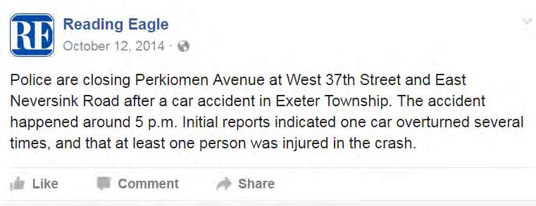
4 Crash History Source: Reading Eagle ( Page 4

5 PennDOT Resurfacing Project Construction Anticipated Spring 2018 Page 5
6 Goals Improve safety Reduce travel speeds Promote Main Street Bicycle and pedestrian connections Landscaping and corridor greening Support local businesses and redevelopment opportunities Minimize impacts to residents Maintain traffic flow Road Diet Evaluation DRAFT Conceptual Plan of Improvements Page 6

7 What is a Road Diet? Reduction in travel lanes and reallocating the space for other uses Source: Road Diet Informational Guide, FHWA, November Page 7

8 Road Diet Evaluation Page 8
9 Traffic Capacity Analysis Level-of-Service Definition Signalized Intersections Page 9
10 Existing Peak Hour Traffic Volumes 560 (925) [920] 50% (47%) [48%] 585 (825) [1020] 53% (45%) [50%] 1100 (945) [1250] 59% (40%) [53%] 1025 (960) [1100] 61% (41%) [51%] 1055 (1010) [1075] 57% (43%) [51%] 630 (815) [810] 52% (50%) [54%] PERKIOMEN AVENUE (S.R. 2021) 570 (1035) [1090] 50% (53%) [52%] BOSCOV S DRIVEWAY 525 (995) [1000] 47% (55%) [50%] E. NEVERSINK ROAD (S.R. 2039) 780 (1440) [1090] 41% (60%) [47%] 37 TH STREET 650 (1355) [1045] 39% (59%) [49%] 36 TH STREET 785 (1320) [1025] 43% (57%) [49%] OLEY TURNPIKE (S.R. 2034) 575 (830) [695] 48% (50%) [46%] # WEEKDAY AM PEAK HOUR TRAFFIC VOLUME (#) WEEKDAY PM PEAK HOUR TRAFFIC VOLUME [#] SATURDAY MIDDAY PEAK HOUR TRAFFIC VOLUME #% DIRECTIONAL SPLITS Source: Traffic counts from Traffic Signal Design Report for SR 2021, Section 03M Pavement Rehabilitation Project, prepared by JMT, March Page 10
11 Future (2037) Peak Hour Traffic Volumes 660 (1080) [1070] 50% (47%) [48%] 685 (960) [1190] 52% (45%) [51%] 1280 (1400) [1455] 58% (46%) [53%] 1195 (1120) [1285] 61% (41%) [51%] 1230 (1130) [1255] 57% (42%) [51%] 735 (950) [945] 52% (50%) [54%] PERKIOMEN AVENUE (S.R. 2021) 670 (1210) [1270] 50% (53%) [52%] BOSCOV S DRIVEWAY 620 (1155) [1165] 48% (55%) [49%] E. NEVERSINK ROAD (S.R. 2039) 910 (1670) [1270] 42% (54%) [47%] 37 TH STREET 760 (1580) [1220] 39% (59%) [49%] 36 TH STREET 915 (1535) [1195] 43% (58%) [49%] OLEY TURNPIKE (S.R. 2034) 670 (965) [810] 48% (50%) [46%] # WEEKDAY AM PEAK HOUR TRAFFIC VOLUME (#) WEEKDAY PM PEAK HOUR TRAFFIC VOLUME [#] SATURDAY MIDDAY PEAK HOUR TRAFFIC VOLUME #% DIRECTIONAL SPLITS Source: Traffic counts from Traffic Signal Design Report for SR 2021, Section 03M Pavement Rehabilitation Project, prepared by JMT, March Page 11
12 Existing Conditions Four Travel Lanes On-street Parking (in select locations) P P Page 12
13 Existing Peak Hour Levels-of-Service
14 Full Road Diet Two Travel Lanes Center Turn Lane Opportunities for: On-street Parking (both sides) Bicycle/Pedestrian Facilities Sidewalks Multi-use Trail Bicycle Lanes P P Page 14
15 Existing Peak Hour Levels-of-Service with Full Road Diet
16 Modified Road Diet Three Travel Lanes Two Northbound One Southbound Center Turn Lane Opportunities for: On-street Parking (both sides) Bicycle/Pedestrian Facilities Sidewalks Multi-use Trail Bicycle Lanes P P Page 16
17 Existing Peak Hour Levels-of-Service with Modified Road Diet
18 PennDOT s Plan (Center Left Turn Lane) Four Travel Lanes Center Turn Lane On-street Parking East Side (in select locations) Opportunities for: On-street Parking (one side) Bicycle/Pedestrian Facilities Sidewalks Bicycle Lanes P Page 18
19 Existing Peak Hour Levels-of-Service with PennDOT s Plan (Center Left Turn Lane)

20 40 th Street Connector Page 20

21 40 th Street Connector Page 21
 Mix of land uses, including single family residential homes and retail establishments Wide and undefined commercial driveways")
22 Existing Conditions E. NEVERSINK TO 37TH STREET (Southern Section) Mix of land uses, including single family residential homes and retail establishments Wide and undefined commercial driveways (east side) Steep slopes adjacent to the roadway (west side) Utility poles (west side) Limited sidewalks Limited on-street parking (near 37 th ) Page 22
23 E. Neversink To 37th Street EXISTING Looking North Shoulder Shoulder 66 DRAFT PROPOSED Looking North 58 Page 23
 Existing continuous sidewalks Established street trees On-street parking utilized (particularly on east side) Page")
24 Existing Conditions 37TH STREET TO BEECHWOOD DRIVE (Central Section) Mix of land uses, including single family homes and professional offices Frontage road (west side) Existing continuous sidewalks Established street trees On-street parking utilized (particularly on east side) Page 24


25 37th Street to Beechwood Drive EXISTING Looking North Varies Varies DRAFT PROPOSED 66 Looking North 66 Page 25
 Frontage road(west side) Limited sidewalks Limited on-street parking Page")
26 Existing Conditions Oley Turnpike BEECHWOOD DRIVE TO OLEY TURNPIKE (Northern Section) Mix of land uses, including single family residential homes and retail establishments Wide and undefined commercial driveways and parking areas (east side) Frontage road(west side) Limited sidewalks Limited on-street parking Page 26


27 Beechwood Drive To Oley Turnpike EXISTING Looking North Shoulder Shoulder 66 DRAFT PROPOSED Looking North 58 Page 27

 Continuous sidewalk (east side) Grass")
 Street trees (within buffer area) Ornamental")
 Potential 37")
28 Key Elements of DRAFT Conceptual Plan Center left turn lane On-street parking (east side between 37 th and Beechwood) Curb extensions (between 37 th and Beechwood) Continuous sidewalk (east side) Grass buffer area (between curb and sidewalk on the east side) Street trees (within buffer area) Ornamental pedestrian-scale lighting (east side) Access management: Defined driveways (east side) Potential 37 th Street left turn lane Page 28
29 DRAFT Conceptual Plan Overview Depicts improvement concepts and evaluates feasibility Based on PennDOT s plans, aerial imagery, GIS data, and field inventory Not based on topographic survey Does not include potential impacts to right-of-way, utilities, etc. Further engineering necessary to implement improvements Page 30
30 See DRAFT Conceptual Plan Exhibits Page 31
31 Next Steps Public Input Draft Conceptual Plans available on the Township s website Future Board of Supervisors Meeting Coordination with PennDOT Finalize Report Page 32
Plant City Walk-Bike Plan
 Plant City Walk-Bike Plan Plant City Commute Mode Share 2.2% 1.4% 2.9% Drove alone 10.2% Carpooled Public transportation (0.1%) Walked Used a Bike (0.4%) 82.9% Taxicab, motorcycle, or other means Worked
Thank you for attending
 Improving mobility safety comfort WELCOME Thank you for attending The purpose of this meeting is to: Learn about the project Prioritize potential walking and biking improvements on Snelling Ave Gather
Brian McHugh, Buckhead Community Improvement District. SUBJECT: Wieuca Road at Phipps Boulevard Intersection Improvements Project
 MEMO TO: FROM: Brian McHugh, Buckhead Community Improvement District Jagan Kaja, AICP, WSP Parsons Brinckerhoff SUBJECT: Wieuca Road at Phipps Boulevard Intersection Improvements Project DATE: October
Giles Run Connector Road
 Giles Run Connector Road Laurel Hill Adaptive Reuse Area to Laurel Crest Drive South County Federation Meeting June 14, 2016 History Connector road included in the Laurel Hill Comprehensive Plan amendment
Atwood Avenue Fair Oaks Avenue Cottage Grove Road
 Atwood Avenue Fair Oaks Avenue Cottage Grove Road Agenda Purpose Review project scope & goals Present design alternatives Gather feedback Answer Questions Format Open House Presentation Q&A Open House
Water Street Promenade. Engineering and Design Services. Public Information Meeting No. 2. Education / Infrastructure / Innovation. Maplewood Avenue &
 Public Information Meeting No. 2 Water Street Promenade Maplewood Avenue & Engineering and Design Services Adjacent Areas July 16,2014Portsmouth, NH May 10, 2016 Education / Infrastructure / Innovation
FLORIDA DEPARTMENT OF TRANSPORTATION DISTRICT 7 DISTRICT WIDE BICYCLE/PEDESTRIAN ACCESS TO TRANSIT SAFETY ASSESSMENT AND IMPROVEMENT PLAN
 FLORIDA DEPARTMENT OF TRANSPORTATION DISTRICT 7 DISTRICT WIDE BICYCLE/PEDESTRIAN ACCESS TO TRANSIT SAFETY ASSESSMENT AND IMPROVEMENT PLAN TRANSIT SAFETY ASSESSMENT SR 55/US 19 AT 80 TH AVE N DRAFT JUNE
Washington St. Corridor Study
 FIGURE 7.17 Bridge Alternatives - Cross Sections 86 Discarded Alternative: Short-Term Bridge Repair Short-term repairs and west bridge span replacement were considered during analysis. Short-term repairs
Tonight is for you. Learn everything you can. Share all your ideas.
 Strathcona Neighbourhood Renewal Draft Concept Design Tonight is for you. Learn everything you can. Share all your ideas. What is Neighbourhood Renewal? Creating a design with you for your neighbourhood.
Pennsylvania Avenue (CR 484) Design Alternatives Study
 Design Alternatives Study") MEMORANDUM Pennsylvania Avenue (CR 484) Design Alternatives Study Prepared for: APRIL 2016 Prepared By TABLE OF CONTENTS Project Background... 2 Previous Concept... 2 Existing Conditions... 4 New Alternatives...
MEMORANDUM Pennsylvania Avenue (CR 484) Design Alternatives Study Prepared for: APRIL 2016 Prepared By TABLE OF CONTENTS Project Background... 2 Previous Concept... 2 Existing Conditions... 4 New Alternatives...
Route 47 (North Main Street) Reconstruction
 Reconstruction") TOWN OF SUNDERLAND Route 47 (North Main Street) Reconstruction Presented by Lou Rabito, P.E. Presented to Town of Sunderland June 11, 2018 Project Overview MassDOT Project No. 607245 Resurfacing and Related
TOWN OF SUNDERLAND Route 47 (North Main Street) Reconstruction Presented by Lou Rabito, P.E. Presented to Town of Sunderland June 11, 2018 Project Overview MassDOT Project No. 607245 Resurfacing and Related
Municipal Class EA To Address Traffic Congestion On The Ontario Street Corridor (Grand Bend) Public Information Meeting June 4, 2018
 Public Information Meeting June 4, 2018") Municipal Class EA To Address Traffic Congestion On The Ontario Street Corridor (Grand Bend) Public Information Meeting June 4, 2018 Background Agenda Traffic Study Update Class EA Alternatives Bridge
Municipal Class EA To Address Traffic Congestion On The Ontario Street Corridor (Grand Bend) Public Information Meeting June 4, 2018 Background Agenda Traffic Study Update Class EA Alternatives Bridge
US 41 COMPLETE STREETS CORRIDOR PLANNING STUDY from University Parkway to Whitfield Avenue
 41 US 41 COMPLETE STREETS CORRIDOR PLANNING STUDY from University Parkway to Whitfield Avenue EXECUTIVE SUMMARY DRAFT FEBRUARY 2019 Project Overview The US 41 Complete Streets Corridor Planning Study,
Executive Summary Route 30 Corridor Master Plan
 Route Corridor Master Plan Project Overview The Route Corridor Master Plan is a coordinated multimodal transportation and land use plan for the entire stretch of Route through East Whiteland Township,
Chapter 2: Standards for Access, Non-Motorized, and Transit
 Standards for Access, Non-Motorized, and Transit Chapter 2: Standards for Access, Non-Motorized, and Transit The Washtenaw County Access Management Plan was developed based on the analysis of existing
Downtown Naples Mobility and Connectivity Study. Naples City Council Presentation January 2017
 Downtown Naples Mobility and Connectivity Study Naples City Council Presentation January 2017 Agenda 1. Introduction 2. Scope Review 3. Project Schedule 4. Existing Conditions 5. Public Charrette 6. Mobility
Building Great Neighbourhoods BELLEVUE AND VIRGINIA PARK
 Building Great Neighbourhoods BELLEVUE AND VIRGINIA PARK This is Meeting 2 Unfortunately, some residents in Bellevue and Virginia Park received the wrong information for this public open house (Meeting
PROJECT OBJECTIVES. Improve vehicle capacity for the intersection. Improve pedestrian and bicycle access
 COMMUNITY MEETING Project Update March 15, 2010 Purcellville, Virginia OVERVIEW Project need / objectives Project recap Design elements Proposed improvements Summary of project benefits / next steps PROJECT
122 Avenue: 107 Street to Fort Road
 : 107 Street to Fort Road November 24, 2015 4:30 8:00 p.m. Meeting Purpose Summarize project work completed to date Share results of public input from Phase 1 Share the draft concept plan and proposed
Bay to Bay Boulevard Complete Streets Project
 Bay to Bay Boulevard Complete Streets Project Dale Mabry Highway to Bayshore Boulevard February 08, 2018 Photo Source: Tampa Bay Times Alessandra Da Pra Meeting Format Introduction Resurfacing Information
Bicycle and Pedestrian Facilities Toolbox (Excerpt from Figure 3.1)
") Appendix B Neighborhood Connections Summaries This Appendix is a supplement to the information presented in Chapter 3 Connect People. The Appendix includes a summary or profile for each of the proposed
Appendix B Neighborhood Connections Summaries This Appendix is a supplement to the information presented in Chapter 3 Connect People. The Appendix includes a summary or profile for each of the proposed
Intersection Traffic Control Feasibility Study
 Intersection Traffic Control Feasibility Study CSAH 9 at CSAH 60 (185th Avenue) Prepared For: Dakota County Transportation Department Western Service Center 14955 Galaxie Avenue, 3rd Floor Apple Valley,
Bridges and Arizona Crossings
 Circulation and Transportation 5-11 Discovery Street/Barham Drive. Discovery Street is planned 5.4.3 Specific Plan Circulation Improvements to be extended eastward from its terminus at Craven Road Circulation
State Road 54/56 Tampa Bay s Northern Loop. The Managed Lane Solution Linking I-75 to the Suncoast Parkway
 State Road 54/56 Tampa Bay s Northern Loop The Managed Lane Solution Linking I-75 to the Suncoast Parkway SUNCOAST PARKWAY Both I 75 and the Suncoast Parkway are planning, or in the process of constructing,
2014/2015 BIKE ROUTE PLAN 83 AVENUE PROTECTED BIKE LANE
 About the Project 2014/2015 BIKE ROUTE PLAN The City of Edmonton is planning a major bike route on the south side of Edmonton. This bike route is one part of a plan to provide citizens with transportation
Public Works Committee Meeting Richard E. Mastrangelo Council Chamber November 20, 2017
 Public Works Committee Meeting Richard E. Mastrangelo Council Chamber November 20, 2017 Purpose of Meeting Why are we here? Project Recap/Updates Project Limits/Segments Road Diet Concept Lessons Learned
NORTH DOWNTOWN N EAST WEST
 ORTH DOWTOW CHURCH STREET ALTERATE o. 1 BIKE LAES, O-STREET PARKIG, SIDEWALK AD MULTI-USE PATH This alternate incorporates a 5-foot sidewalk along the eastern side of Church Street, a 10-foot Multi-Use
CDOT s Transportation Plan for the Obama Presidential Center in Jackson Park
 CDOT s Transportation lan for the Obama residential Center in Jackson ark May 10, 2018 repared for Jackson ark Watch JacksonarkWatch.org repared by at Hawley,.E. TOE rasmith 16745 West Bluemound Road Brookfield,
Clackamas County Comprehensive Plan
 ROADWAYS The County s road system permits the movement of goods and people between communities and regions, using any of a variety of modes of travel. Roads provide access to virtually all property. They
Paoli Road Improvement Feasibility Study
 Paoli Road Improvement Feasibility Study & Public Participation Project March 24, 2015 Prepared for: Tredyffrin Township Prepared by: McMahon Associates, Inc. with Town Planning Partnership, LLC Glackin
2014/2015 BIKE ROUTE PLAN 83 AVENUE PROTECTED BIKE LANE
 About the Project The City of Edmonton is planning a major bike route on the southside of Edmonton. The Strathcona Bike Route will connect the communities of Strathcona, Garneau and the University area,
CITY OF OTTAWA ROADWAY MODIFICATION APPROVAL UNDER DELEGATED AUTHORITY
 RMA-2015-ATM-038 CITY OF OTTAWA ROADWAY MODIFICATION APPROVAL UNDER DELEGATED AUTHORITY DATE: April 22, 2015 SUBJECT Approval of Roadway Modifications Recommended through an Area Traffic Management Study
Traffic Assessment for Woodhaven Redevelopment. City of Rome Oneida County, New York. March 2, 2018
 March 2, 2018 Traffic Assessment for Woodhaven Redevelopment City of Rome Oneida County, New York Prepared for: City of Rome 198 N. Washington Street Rome, NY 13440 Prepared by: C.T. MALE ASSOCIATES 50
PROPOSED BICYCLE AND PEDESTRIAN FACILITY Vicinity of Route 123/I-495 Interchange Tysons, Fairfax County, Virginia
 PROPOSED BICYCLE AND PEDESTRIAN FACILITY Vicinity of Route 123/I-495 Interchange Tysons, Fairfax County, Virginia PRELIMINARY ENGINEERING REPORT Prepared for: Prepared by: July 2017 Table of Contents 1
Public Open House #2. THE CITY OF NORTH VANCOUVER CHESTERFIELD AVENUE CYCLING IMPROVEMENTS (4th - 13th STREET) JULY 2013
 JULY 2013") CHESTERFIELD AVENUE CYCLING IMPROVEMENTS (4th - 13th Street) Public Open House #2 1 Chesterfield Avenue provides an important north/south connection between Lonsdale Quay and West 23rd Street Purpose of
CHESTERFIELD AVENUE CYCLING IMPROVEMENTS (4th - 13th Street) Public Open House #2 1 Chesterfield Avenue provides an important north/south connection between Lonsdale Quay and West 23rd Street Purpose of
Dr. M.L. King, Jr. Street North Complete Streets Resurfacing Opportunities HOUSING, LAND USE, AND TRANSPORTATION COMMITTEE MARCH 22, 2018
 Dr. M.L. King, Jr. Street North Complete Streets Resurfacing Opportunities HOUSING, LAND USE, AND TRANSPORTATION COMMITTEE MARCH 22, 2018 What s Happening The City plans to mill and resurface Dr. M.L.
CONNECTIVITY PLAN. Adopted December 5, 2017 City of Virginia Beach
 CONNECTIVITY PLAN Adopted December 5, 2017 City of Virginia Beach CONTENTS 1.0 Background & Purpose... 2 2.0 Existing Inventory & Analysis... 3 ViBe District Existing Walking Conditions... 4 3.0 ViBe District
Southwest Bus Rapid Transit (SW BRT) Functional Planning Study - Executive Summary January 19 LPT ATTACHMENT 2.
 Functional Planning Study - Executive Summary January 19 LPT ATTACHMENT 2.") Southwest Bus Rapid Transit (SW BRT) Functional Planning Study - Executive Summary 2011 January 19 1 of 19 Introduction This executive summary presents the results of the Southwest Bus Rapid Transit (SW
Southwest Bus Rapid Transit (SW BRT) Functional Planning Study - Executive Summary 2011 January 19 1 of 19 Introduction This executive summary presents the results of the Southwest Bus Rapid Transit (SW
Complete Streets Policy DAVID CRONIN, P.E., CITY ENGINEER
 Complete Streets Policy DAVID CRONIN, P.E., CITY ENGINEER Complete Streets City Commission adopted a Complete Streets policy in 2012 Complete Streets are road networks that are designed for all users:
EXECUTIVE SUMMARY... vii 1 STUDY OVERVIEW Study Scope Study Area Study Objectives
 Contents EXECUTIVE SUMMARY... vii 1 STUDY OVERVIEW... 1-1 1.1 Study Scope... 1-1 1.2 Study Area... 1-1 1.3 Study Objectives... 1-3 2 EXISTING CONDITIONS... 2-1 2.1 Existing Freeway Conditions... 2-4 2.1.1
01. VICINITY OF GREENBRAE POC: EXISTING CONDITIONS
 01. VICINITY OF GREENBRAE POC: EXISTING CONDITIONS Existing Bus Stop Existing US101 On-ramp Existing POC Old Redwood Highway Rich Street City ROW Environmental Study Limit Industrial Way NO DESIGNATED
Public Works and Infrastructure Committee. General Manager, Transportation Services
 STAFF REPORT ACTION REQUIRED Extending the Bay Street Bicycle Lanes Date: May 16, 2013 To: From: Public Works and Infrastructure Committee General Manager, Transportation Services Wards: Toronto Centre
5. RUNNINGWAY GUIDELINES
 5. RUNNINGWAY GUIDELINES These guidelines should be considered collectively when making runningway decisions. A runningway is the linear component of the transit system that forms the right-of-way reserved
US Route 4 Traffic and Pedestrian Improvement Project
 Welcome to the public meeting for US Route 4 Traffic and Pedestrian Improvement Project June 5, 2018 Introduction Project Team Town of North Greenbush, Tony Germano, Town Comptroller Lou Desso, Town Supervisor
Hidden Oaks Elementary School
 Hidden Oaks Elementary School SCHOOL ROUTE PLAN For HIDDEN OAKS ELEMENTARY SCHOOL LOCATION 13 ORANGE COUNTY Prepared for: ORANGE COUNTY SCHOOL ASSESSMENT PROGRAM ORANGE COUNTY PUBLIC WORKS Traffic Engineering
RZC Appendix 8A Marymoor Subarea Street Requirements
 RZC Appendix 8A Marymoor Subarea Street Requirements For additional design details for Marymoor Subarea infrastructure, refer to the 2017 Marymoor Subarea Infrastructure Planning Report. STREET REQUIREMENTS
TRANSPORTATION FACILITY PLANNING Waugh Chapel Road Maytime Drive to New Market Lane
 July 24, 2018 TRANSPORTATION FACILITY PLANNING Waugh Chapel Road Maytime Drive to New Market Lane DPWandYOU.com Making a difference, together Meeting Agenda Purpose of the project Overview of work conducted
North Shore Transportation Improvement Strategy
 North Shore Transportation Improvement Strategy Preliminary, Near-term Recommendation 2016 April Transportation Improvement Strategy (TIS) Comprehensive and Analytical A multi-modal transportation strategy
Terwillegar Drive Expressway Draft Concept Plan
 Terwillegar Drive Expressway Draft Concept Plan Anthony Henday Drive to Whitemud Drive November 28 5:00-8:00 p.m. December 1 10:00 a.m. - 3:00 p.m. Let s Talk Today you can: Learn about the new direction
Fleur Drive Reconstruction
 Fleur Drive Reconstruction October 29, 2018 1 Agenda: Fleur Drive Reconstruction Project Scope & Cost Overview Fleur Drive Cross Section Elements - Travel Lane Widths - Sidewalk Widths - Parkway Widths
Building Great Neighbourhoods BONNIE DOON
 Building Great Neighbourhoods BONNIE DOON We Are Here Today To Explain the Neighbourhood Renewal Process Show you the Westwood Preliminary Design Ask for local knowledge Highlight the Local Improvement
City of Birmingham Draft Multi-modal Transportation Plan
 City of Birmingham Draft Multi-modal Transportation Plan City Commission Public Hearing Monday, November 25, 2013 7:30 pm Norman Cox, PLA, ASLA The Greenway Collaborative, Inc. Ann Arbor, Michigan The
Lee s Summit Road Improvement Study Public Open House June 7, 2007 Summary of Comment Card Responses
 Lee s Summit Road Improvement Study Public Open House June 7, 2007 Summary of Comment Card Responses Introduction At the Lee s Summit Road Improvement Study Public Open House held Thursday, June 7, 2007
4. ENVIRONMENTAL IMPACT ANALYSIS 9. TRANSPORTATION AND TRAFFIC
 4. ENVIRONMENTAL IMPACT ANALYSIS 9. TRANSPORTATION AND TRAFFIC 4.9.1 INTRODUCTION The following section addresses the Proposed Project s impact on transportation and traffic based on the Traffic Study
Transportation Impact Study for Abington Terrace
 Transportation Impact Study for Abington Terrace Abington Township, Montgomery County, PA Sandy A. Koza, P.E., PTOE PA PE License Number PE059911 Prepared by McMahon Associates, Inc. 425 Commerce Drive,
WELCOME Public Information Centre
 WELCOME Public Information Centre Fernforest Drive Brampton Soccer Centre Community Room #2 Tuesday January 19, 2016 6:30 p.m.to 9:00 p.m. Please sign in Neighbourhood Traffic Calming Guide Background
DOWNTOWN TUPELO MAIN STREET: ROAD DIET STUDY
 DOWNTOWN TUPELO MAIN STREET: ROAD DIET STUDY Since mid-2009, RPM Transportation Consultants (RPM) has worked with the Downtown Tupelo Main Street Association to evaluate traffic conditions and potential
GARLAND ROAD/GASTON AVENUE/ GRAND AVENUE INTERSECTION IMPROVEMENT STUDY
 MEETING OF AFFECTED PROPERTY OWNERS AND STAKEHOLDERS GARLAND ROAD/GASTON AVENUE/ GRAND AVENUE INTERSECTION IMPROVEMENT STUDY CSJ 0009-02-067 Meeting Agenda 1 2 3 4 5 6 7 8 9 10 Opening Remarks State Representative
Project Overview. Rolling Road Widening Fairfax County. Get Involved. Design Public Hearing. Contact Information
 Get Involved VDOT representatives will review and evaluate information received as a result of this meeting. Please fill out the comment sheet provided in this brochure if you have any comments or questions.
City of Gainesville Transportation/Roadway Needs PROJECT SUMMARY
 A1 Roadway Resurfacing $23,846,000 TYPE: Preservation of existing system Roadway resurfacing A2 Signal Replacement $6,000,000 TYPE: Preservation of existing system Replace traffic signals. B1 W 6th St
Item to be Addressed Checklist Consideration YES NO N/A Required Description Complete Streets Guidelines
 Passaic County Complete Streets Checklist - Concept Development Project Name Item to be Addressed Checklist Consideration YES NO N/A Required Description Complete Streets Guidelines Existing Plans Have
Public Information Meeting. Orange Camp Road. Dr. Martin Luther King Jr. Beltway to I-4. Presented by: Volusia County August 2, 2018
 Public Information Meeting Orange Camp Road Dr. Martin Luther King Jr. Beltway to I-4 Presented by: Volusia County August 2, 2018 1 Project Goals To improve the operations and safety for Orange Camp Road
APPENDIX 2 LAKESHORE ROAD TRANSPORTATION REVIEW STUDY EXECUTIVE SUMMARY
 APPENDIX 2 LAKESHORE ROAD TRANSPORTATION REVIEW STUDY EXECUTIVE SUMMARY Appendix 2 City of Mississauga Lakeshore Road FINAL REPORT Transportation Review Study December 2010 EXECUTIVE SUMMARY Study Purpose
Foothill Expressway Improvements Between El Monte and San Antonio
 Foothill Expressway Improvements Between El Monte and San Antonio June 29, 2017 - Los Altos Community Meeting Introduction Project Background Agenda Visit Stations: Provide Input and Ask Questions Reconvene:
Preliminary Engineering Study
 Preliminary Engineering Study Open House # 2 June 6, 2018 PREPARED FOR: PREPARED BY: Agenda Background and status of preliminary engineering study County Road 26 design summary County Road 63 design summary
RIVERSIDE, Newton MA BH NORMANDY RIVERSIDE LLC. Riverside Station. A green, transit-oriented community
 Riverside Station A green, transit-oriented community October 6, 2011 TONIGHT S AGENDA: 1. Project Update (5 min.) 2. Master Plan Update (10 min.) 3.Traffic Plan Update (10 min.) Questions & Answers MASTER
City of Wilsonville 5 th Street to Kinsman Road Extension Project
 City of Wilsonville 5 th Street to Kinsman Road Walking Tour & Neighborhood Workshop Summary Report Public Outreach Overview On July 18 th, 2017, the City of Wilsonville hosted a neighborhood walking tour
Windy Ridge Elementary School
 Windy Ridge Elementary School SCHOOL ROUTE PLAN For WINDY RIDGE ELEMENTARY SCHOOL LOCATION 54 ORANGE COUNTY Prepared for: ORANGE COUNTY SCHOOL ASSESSMENT PROGRAM ORANGE COUNTY PUBLIC WORKS Traffic Engineering
Oakland Pedestrian Master Plan Oakland Pedestrian Plan Draft Recommendations Chapter Outline
 EISEN LETUNIC T R A N S P O R T A T I O N, ENVIRO N M E N TA L A N D URBAN PLANNIN G MEMORANDUM To Oakland Pedestrian Plan Technical Advisory Committee & Pedestrian Advisory Group From Victoria Eisen Date
CITY OF LOMITA CITY COUNCIL REPORT
 CITY OF LOMITA CITY COUNCIL REPORT TO: FROM: City Council Ryan Smoot, City Manager Item No. SCH 12 PREPARED BY: Mark A. McAvoy, P.E., Public Works Director/City Engineer MEETING DATE: August 1, 2017 SUBJECT:
Reference number /VP. Lafayette Downtown Congestion Study - Additional Traffic Analysis
 To James Hinkamp and Tony Coe, City of Lafayette Date January 19, 2017 Copies Reference number 243381/VP From Michael Iswalt and Vanessa Peers File reference 4-05 Subject Lafayette Downtown Congestion
Feasibility Study of Pedestrian Crossings Along Route 7, East of Cascades Parkway and West of Dranesville Road. October 3, 2017
 Feasibility Study of Pedestrian Crossings Along Route 7, East of Cascades Parkway and West of Dranesville Road October 3, 2017 Study Area (area within a ¼-mile radius of the study intersections) Route
GIS Based Data Collection / Network Planning On a City Scale. Healthy Communities Active Transportation Workshop, Cleveland, Ohio May 10, 2011
 The Purpose of GIS Based Network Planning GIS Based Data Collection / Network Planning Healthy Communities Active Transportation Conference Tuesday, May 10, 2011 10:00 AM Norman Cox, LLA, ASLA. Ann Arbor,
Los Altos Hills Town Council - June 18, 2015 Palo Alto City Council June 22, AGENDA ITEM #2.B Presentation
 Los Altos Hills Town Council - June 18, 2015 Palo Alto City Council June 22, 2015 AGENDA ITEM #2.B Presentation Previous Presentations Los Altos Hills Town Council in May 2014 and February 2015 Palo Alto
Water Street Promenade Engineering and Design Services
 Preliminary Design Presentation Parking & Traffic Safety Committee Water Street Promenade Engineering and Design Services July 16,2014 November 3, 2016 Education / Infrastructure / Innovation 1 Project
DRAFT - CITY OF MEDFORD TRANSPORTATION SYSTEM PLAN Roadway Cross-Sections
 Roadway Cross-Sections Medford s roadway cross-section standards apply to new and reconstructed roads. The crosssections take into consideration roadway function and operational characteristics, including
Welcome to the Public Meeting. Red Hill Business Park South Transportation Master Plan Addendum. December 4, :00 p.m. to 8:00 p.m.
 Welcome Welcome to the Transportation Master Plan Addendum December 4, 2012 6:00 p.m. to 8:00 p.m. Please sign-in Background PIC#1 Public Information Centre #1 (PIC#1) was held on June 25, 2012. Feedback
GIS Based Non-Motorized Transportation Planning APA Ohio Statewide Planning Conference. GIS Assisted Non-Motorized Transportation Planning
 The Purpose of GIS Assisted Network GIS Assisted Non-Motorized Transportation 2011 APA Ohio Statewide Conference Friday, 10:45 AM to Noon Focus on near-term projects wwwgreenwaycollabcom The purpose of
Building Great Neighbourhoods QUEEN ALEXANDRA
 Building Great Neighbourhoods QUEEN ALEXANDRA We are here today to Explain how the City is investing in improving your neighbourhood and how your neighbourhood will be improved to meet current City standards.
TRAFFIC IMPACT STUDY And A TRAFFIC SIGNAL WARRANT ANALYSIS FOR A SENIOR LIVING AND APARTMENT DEVELOPMENT
 TRAFFIC IMPACT STUDY And A TRAFFIC SIGNAL WARRANT ANALYSIS FOR A SENIOR LIVING AND APARTMENT DEVELOPMENT DEERFIELD TOWNSHIP, WARREN COUNTY, OHIO Nantucket Circle and Montgomery Road () Prepared for: ODLE
COMMUNITY MEETING AGENDA
 COMMUNITY MEETING AGENDA Welcome and Introductions SAFE Presentation Project Presentation Priorities Feedback Next Steps Q&A Santa Cruz Avenue Corridor Study 1 Santa Cruz Avenue Corridor Study Community
This page intentionally left blank.
 This page intentionally left blank. COMMUNITY Coweta Community Overview Coweta Coweta, a residential community located in Wagoner County, is a suburb of Tulsa situated southeast of the metropolitan area
Station Plan: Penn & 43rd Avenue
 Station Plan: Penn & 43rd Avenue This station will serve the northern portion of the Penn Avenue corridor, including the commercial node at 44th Avenue. Ridership and roadway geometry support station siting
TRANSPORTATION COMMISSION Agenda Staff Report
 TRANSPORTATION COMMISSION Agenda Staff Report Agenda Item No. 5.a DATE: JULY 31, 2014 TO: FROM: SUBJECT: TRANSPORTATION COMMISSION COMMUNITY DEVELOPMENT DEPARTMENT - PLANNING DRAFT OLYMPIC CORRIDOR PREFERRED
Living Streets Policy
 Living Streets Policy Introduction Living streets balance the needs of motorists, bicyclists, pedestrians and transit riders in ways that promote safety and convenience, enhance community identity, create
3.0 ACCESS CONTROL PLAN - HARMONY ROAD (SH68)
") 3.0 ACCESS CONTROL PLAN - HARMONY ROAD (SH68) 3.1 Existing Conditions Roadway Physical Characteristics Typical Section The existing typical cross-section for SH68 is shown on Figure 3-1 and is comprised
3.0 ACCESS CONTROL PLAN - HARMONY ROAD (SH68) 3.1 Existing Conditions Roadway Physical Characteristics Typical Section The existing typical cross-section for SH68 is shown on Figure 3-1 and is comprised
Readington Road (C.R. 637) Construction
 Construction") Public Information Meeting Thursday, August 2, 2012 Readington Road (C.R. 637) Construction from Dreahook Road to Harlan School Road Branchburg Township, Somerset County Readington Township, Hunterdon
Public Information Meeting Thursday, August 2, 2012 Readington Road (C.R. 637) Construction from Dreahook Road to Harlan School Road Branchburg Township, Somerset County Readington Township, Hunterdon
Colerain Avenue Roadway Improvements. Sponsored by Hamilton County Engineer
 Colerain Avenue Roadway Improvements Sponsored by Hamilton County Engineer Participants Lead Agency: Hamilton County Engineer Review and Approval: Ohio Department of Transportation Design Engineer: Edwards
Complete Streets Process and Case Study: Taft / McMillian Two-Way Street Conversion Cincinnati, Ohio. Traffic Engineering Workshop June 4, 2014
 Complete Streets Process and Case Study: Taft / McMillian Two-Way Street Conversion Cincinnati, Ohio Traffic Engineering Workshop June 4, 2014 Complete Streets Streets that enable safe access for users
Presentation Outline. Project/Study Purpose. Existing Conditions. Future Conditions. Understanding the Streetside. Similar Walkable Environments
 Presentation Outline Project/Study Purpose Study Area Map Existing Conditions Future Conditions Understanding the Streetside Similar Walkable Environments Conceptual Alternatives Magnolia/NE 1st Ave Block
Poor pavement condition Substandard Intersections. / Substandard bike/pedestrian/transit accommodations. Driveway access Environmental concerns
 Public Informational Meeting University Avenue (Allen Boulevard Segoe Road) March 23, 2011 City of Madison City of Middleton Village of Shorewood Hills Dane County Existing Roadway Conditions Poor pavement
INNER LOOP EAST. AIA Rochester Annual Meeting November 13, 2013 TRANSFORMATION PROJECT. Bret Garwood, NBD Erik Frisch, DES
 INNER LOOP EAST TRANSFORMATION PROJECT AIA Rochester Annual Meeting November 13, 2013 Bret Garwood, NBD Erik Frisch, DES Why? We are building a city that encourages walking, biking and enjoying the outdoor
City of Memphis On-Street Parking Modification Guidelines
 City of Memphis Effective Date: December 1, 2013 Bicycle/Pedestrian Program 125 N. Main Street Memphis, TN 38103 (901) 576-6710 www.bikepedmemphis.com City of Memphis Executive Summary It is current practice
Clybourn Ave. Protected Bike Lane Study Halsted St. to Division St.
 Clybourn Ave. Protected Bike Lane Study Halsted St. to Division St. Nathan Roseberry, Senior Engineer Pam Broviak, Project Manager July 24, 2014 Agenda Project Goals Existing Roadway Conditions Traffic
Northbound San Jose Avenue & I-280 Off-Ramp Road Diet Pilot Project
 Project Overview Fed by a two-lane Interstate-280 (I-280) off-ramp, high vehicular volumes and speeds are longstanding issues along San Jose Avenue. Residents in the surrounding neighborhoods have expressed
Transportation Corridor Studies: Summary of Recommendations
 Transportation Corridor Studies: Summary of Recommendations Route 4 Corridor Study: Route 10 Corridor Study: Route 44 Corridor Study: Route 175 Corridor Study: Route 5/15 Corridor Study: Rentschler Field
NJDOT Complete Streets Checklist
 Background The New Jersey Department of Transportation s Complete Streets Policy promotes a comprehensive, integrated, connected multi-modal network by providing connections to bicycling and walking trip
TRAFFIC STUDY. Birch Bluff Road / Pleasant Avenue 01/15/2018. City of Tonka Bay 4901 Manitou Road Tonka Bay, MN WSB PROJECT NO.
 TRAFFIC STUDY Birch Bluff Road / Pleasant Avenue 01/15/2018 City of Tonka Bay 4901 Manitou Road Tonka Bay, MN 55331 WSB PROJECT NO. 10805-000 Birch Bluff Road/ Pleasant Avenue Traffic Study For: City of
AGENDA REPORT. Issue: Discussion of potential improvements on Barnwell Road at Niblick Drive
 AGENDA REPORT To: From: By: Honorable Mayor and City Council Members Warren Hutmacher, City Manager Tom Black, Public Works Director Date: March 23, 2016 Agenda: March 28, 2016 WORK SESSION AGENDA: Barnwell
DRAFT. A fifth objective, other considerations, has been added to capture considerations not captured by the four primary objectives.
 TECHNICAL MEMORANDUM Albany - Washington Avenue Traffic Calming Evaluation Matrix of Conceptual Alternatives Date: May 17, 2017 Project #: 17356 To: Aleida Andrino-Chavez From: Laurence Lewis, Sara Muse,